Ute Bill Thompson
Ute Bill Thompson

Places

Places Articles

100 Years of Location, Location, Location

Real Estate and land ownership have always been important to the Granby area. With the passage of the 1862 Homestead Act by Congress, the West, including the area around the current town of Granby, began to be settled with hardy, ranching pioneers. The opportunity to own land was often made possible by homesteading.   This lured many settlers to the area.

As Congress adjusted the homesteading rules over the years to allow for larger acreages which would support ranching in the Middle Park, towns began to grow. Ranching, mining and especially the railroad fueled the growth. In 1902, railroad visionary, David Moffat, set events into motion in Denver to build a steam railroad from Denver to Salt Lake City which would be built over Rollins Pass.   This was a monumental task which led to the founding of the town of Granby.

Mary Lyons Cairns observed in her book, “Grand Lake in the Olden Days,” “Granby came into being with the Moffat Railroad, which reached that point in September, 1905. The town site was laid out on a piece of land which was part of a homestead and part of a pre-emption taken up by James Snyder from the government. Mr. Snyder sold this land to David Moffat who had the town site surveyed and platted in 1904, and a man named Hunter auctioned off the lots.”  

The lots on the town plat were 12 blocks and a Block “A.” Each block, except Block 12 and “A,” would have 32 lots. Each lot would be 25 feet by 125 feet. Block 12 only had 20 lots. Block “A” only had four smaller lots. David Moffat and the railroad in the form of the Frontier Land and Investment Company designed the town streets so that the southern boundary of the town was Agate Avenue, the western was First Street, and the northern boundary was Garnet Avenue. A variation in terrain in between Block 12 and Block “A” created Opal Avenue that would lead down Fifth Street which would be the eastern boundary of the new town of Granby.    

The new town streets were named Agate, Jasper, Topaz, Garnet and Opal, all precious gems which might reflect the mining heritage. But, in the King James version of the Bible in the Book of Revelation, Chapter 21, Verse 19, heaven is described as, “And the foundations of the wall of the city were garnished with all manner of precious stones. The first foundation was jasper…” Other streets and foundations are described as being made of precious gems such as topaz and chalcedony. Agate is described in the dictionary as a variegated variety of quartz or chalcedony.   Maybe the founders thought Granby was “heaven on earth.” Or, at least the real estate marketers wanted buyers to think that.

The real estate advertising in the December 16, 1905, Grand County Advocate showed V.S. Wilson as the local real estate agent for Granby. He also was the newspaper editor and became Granby’s first mayor on December 11, 1905. With that background, hyperbole and adjectives must have been in his blood.   “Now is the time to buy property at Granby-The newest and best town on the ‘Moffat Road.’…It would be a Happy Christmas investment. Do it now,” was part of the ad copy.  Mr. Wilson became one of the first land owners in Granby buying lots 18 and 19, Block 7 on Topaz from Frontier Land & Investment in November, 1905.  

When the railroad’s real estate company founded Granby in 1905, local historian, Betty Jo Woods, said the new town location was chosen because it had great connections with the stage route to Grand Lake, was mostly dry ground, and had pleasant views. As they say in real estate, the three keys to successful land investing are “Location, location, location!”   The locations of many of the historic buildings were on the north side of Agate Avenue. According to photographs and written explanations by the late Vera Snider, in 1920, on “main” street, one of the only buildings on the south side of the street was the firehouse which protected the fire pumper and hoses. The post office was also on the south side.   Vera Snider later arranged for the preservation of this historic structure built in 1910 by moving the first post office building in the 1960s from 458 East Agate where it had stood for over 50 years to its present location at 170 2nd Street.

According to the current owner of this historic structure, Deb Brynoff, “When Ron, my husband, was remodeling he found old letters in the wall from when it was the post office building.” It was not unusual during the early years of construction for letters and newspapers to be “stuffed” into the walls to help increase what little “R-factor insulation” existed.    Other early buildings which still exist in Granby are a home at 127 4th Street which was built in 1909. The current Re/Max Granby office at 247 Agate was a home originally built in 1909. Other early Agate Avenue buildings still thriving are Crafter’s Corner at 295 East Agate built in 1913 for the Granby Mercantile. Local lore says the basement was used as a temporary morgue during the 1918 flu pandemic. However, no historic research has yet been found to document this information.  

Research on High Country Motors at 277 East Agate reveal it was originally Middle Park Auto which grew up with the town of Granby. The tax rolls indicate 1913 for the birth of this building. The business was “born” in 1915 when Jack Schliz founded Middle Park Auto. During Granby’s early years this was a hub for locals. It even included a small medical-first aid station inside it before Granby had any local medical services. In 1938, the business was sold to Glenn Pharo and Morris Long. Later, Jack Shield was associated with the business. The authorized Ford dealership was later purchased by Fred Garrett, who later sold it to Mike and Kimberly Garrett.   The only constant on Agate Avenue is change. Many of the buildings have a colorful past. For example, the current location of Brown & Company at 315 East Agate was a Texaco Service Station built in the 1930s.

The Long Branch at 185 East Agate is in a building that was Granby’s first strip mall. That accounts for the many doors fronting on to Agate. Built around 1938 for the Craig’s Café, it has housed Olson’s Café, a Laundromat, a barber shop, The Carpet Wagon rug store and Maureen’s Clothing Store to name a few.   The Silver Spur Saloon & Steakhouse at 15 East Agate used to be the Grand Bar and Café run by Dick and Beulah Samuelson from 1944 to 1964. The original business at this location was the lettuce shed where the famous Granby Iceberg Lettuce was delivered by local growers for shipping to the Broadmoor Hotel in Colorado Springs. Some of the original lettuce shed has been incorporated into this building.  

The Dick Samuelson family also has a history with the Granby Mart at 62 East Agate. This building at one time was the home of Bud and Ken Chalmers’ Auto Repair Shop. In the early 1940s, it had a dirt floor when Sonny Samuelson and his Dad bought it. Clyde Redburn had a bowling alley on one side. The Samuelsons later put in more bowling lanes. Upstairs they had a club called “3.2.” At the time, those 18 and older could sip the 3.2 beer served there and dance. At one time Wayne Snyder’s Saddlery shared half of the store.   Sharing a location was the thinking behind the former Minnie Mall located at 480 East Age. Named by local businessman, Jack Applebee, for his mother, Minnie, in the 1980s, many businesses enjoyed the convenient location, The Furniture Store, Hobby Shop, Montgomery Wards, Honey Bear Children’s Clothing, Fabric Nook, Greg Henry’s Get-N-Pack, Radio Shack, Julie Sneddon’s Cards and Gifts, Patti Applebee’s Nimble Needle, Ben’s Aspen Leaf Café and the Shaft Shop which specialized in darts and dart supplies. Today, Granby Medical Center-Centura Health is at this historic downtown location.  

Granby’s historic story from 1905 to 2005 is one of building dreams, homes and businesses to create a community. Chinese Proverb says, “One generation plants the trees; another gets the shade.” How true.
2005


1873 directions to Hot Sulphur Springs

Hot Sulphur Springs (First published in 1873)

Location.—Middle Park, Summit County, Colorado  (now Grand County)

Access. – Go to Denver, via Kansas Pacific Railroad; thence, seventeen miles west, via Colorado Central Railroad, to Golden City; thence, thirty-two miles by stage, to Georgetown or Empire; thence, fifty miles horseback over Berthoud Pass. Or, from Denver, thirty-four miles west, via Colorado Central Railroad, to Central City; thence, fifty-five miles horseback over the James Peak route. Or, from Central City by wagon or carriage, fifty-five miles, over the South Boulder route.  Camp out on the way

Hotel.—One in contemplation.

Analysis.—None has been made. They are, however, said to be of the Sulphur class, and range in temperature from 111 to 116 degrees Fahr. Flow, two hundred gallons per minute.

Remarks.—These springs are no doubt destined to be a very popular resort. Situated as they are, on a mountain-bound plateau eight thousand feet above the level of the sea, under a cloudless sky, and surrounded by the attractions of mountain scenery and the chase, they cannot fail to receive visitors.

With all the inconvenience that attends a journey thither, and the necessity of camping out, over five hundred persons were there during the month of July, 1871.

The favorite route to the springs is by the way of Berthoud Pass. Having arrived at Georgetown, the tourist procures saddle and pack horses, and guides. The first day‘s journey will be over the summit of the range, eleven thousand feet above the sea, and through a dense forest of timber for fourteen miles beyond, to the “head of the park.” Here camp is usually made. The next day’s ride is down an open valley or arm of the park, following for some miles the course of Fraser’s River. The route by South Boulder Pass is tedious and difficult, the road passing over the extreme summit of the range, more than 12,000 feet above the sea, where snow-storms are not unusual in July and August. The James Peak route is one of the most interesting, the road winding around the mountain, one of the highest points in the range; and the ascent easily made. All the roads, however, after crossing the mountains, meet together in the valley of the Fraser River. Thence the road is a pleasant carriage-drive along meadow-like valleys, with timbered ridges or table-lands, to the right and left. The grass is of luxuriant growth, and great variety. Clover of several kinds, and the blue flowering flax, are seen everywhere. All through late spring and early summer the prairies are bright with flowers, and the air laden with their fragrance. Days or weeks can be whiled away in Arcadian simplicity and enjoyment. 

Arrived at the springs…...what a joy!


A Dream Smashed in Gore Canyon

The idea of a water passage from the Atlantic to the Pacific Ocean had long captivated the imagination of early explorers.  Soon after the Territory of Colorado was established, the United States government made a standing offer of $3,750 to anyone who could demonstrate such a route.

In 1869 a dreamer named Sam Adams convinced some people in the town of Breckenridge that goods could be sent upriver via the Mississippi, Missouri, Platte and South Platte Rivers to South Park.  Then, with a short portage over Boreas pass, they could continue down the Blue River to the Grand (Colorado) River and then through Gore Canyon the Sea of Cortez.

Volunteers were told they would share in the prize, and they built four boats of green lumber for the voyage.  The flotilla was launched with great celebration, the lead boat bearing a banner proclaiming "Western Colorado to California ? Greetings!"  A little dog was given to the crew to keep up morale.

As the boats went down the Blue River, the waters were a bit rougher than expected. When the men arrived at the Grand (Colorado) River, the crew set up camp. However several of the "sailors" declared they had had enough and began a trek, via dry land back home to Breckenridge.

When the boats reached Gore Canyon, they encountered violent upsurges and dramatic drops.  The wild waters smashed all four of the vessels on dangerous rocks.  Fortunately, all members made it to dry land, even the little dog.  No reward was ever given for the attempt.

Berthoud Pass
Berthoud Pass

Berthoud Pass was named for Captain Edward L. Berthoud, who completed the first survey of  this saddle in the main Divide in the spring of 1861.

Berthoud’s expedition of eight people, including Jim Bridger, crossed the Continental Divide at the 11,315 foot summit and established a relatively easy way to get into Middle Park from the east. Berthoud also served as chief engineer on the Colorado Central Railroad.

It is surprising that this famous pass had played no previous role in the history of the region. Even Jim Bridger, who knew the country well, did not learn of its existence until the survey. For reasons of their own, Indians had chosen to go over the divide at higher levels further to the north. One explanation may be that the pass is not evident from most locations on either side of the Continental Divide.

Church Park
Church Park

George Henry Church and his brother John had a substantial ranch in Jefferson Country, prior to Colorado Statehood.  When the Timber and Stone Act of 1878 was passed, it permitted the purchase of land unfit for agriculture for $2.50 an acre.  Thus the Church brothers obtained land in Middle Park for summer grazing.  They would move their cattle into the Park by driving them over the Rollins Pass.   The area they used is just west of the town of Fraser and became known as Church Park.

In 1910, the Church Ditch was created to divert water across the Continental Divide for irrigation.  The remains of this early trans-mountain project can still be seen today at mile marker 241.5 on U.S. Highway 40.

Colorado-Big Thompson Project

The idea of diverting water from the Colorado River on the Western Slope of the Continental Divide to the productive farmlands of the eastern plains had been a dream of planners as early as 1929.  Subsequently,  a long period of drought and the sagging economy of the “Great Depression” whetted demands for what became the largest trans-mountain diversion project ever built.

The Colorado-Big Thompson Project takes water from Grand Lake on the western side of the Continental Divide to the Big Thompson River on the east.  The water flows through a 13 mile tunnel beneath Rocky Mountain National Park.  In order to supply the residential and farming needs of Northeastern Colorado, the project was begun in 1938 and continued through the years of World War II.  The first water flowed though the tunnel, named for Senator Alva B. Adams, on June 23, 1947.

In order to assure an adequate supply from Grand Lake, a dam was built creating Shadow Mountain Reservoir.  A larger lake, Granby Reservoir was then built below, with a unique pumping plant that forces water into Shadow Mountain.  The Farr Pumping Plant cost over $9 million and provides an additional 700,000 of irrigated land to northeastern Colorado.  Further reservoirs were added, both to supplement the diversion and to compensate the water needs of Western Colorado.  These include Willow Creek and Windy Gap Reservoirs in Grand County.

While most legislators were enthusiastic about the project, U.S. Representative Edward Taylor was vehemently opposed to the reduction of water flowing down the Colorado River.  A compromise was reached in the creation of Green Mountain Reservoir (on the Blue River), which reserves water to replenish the Colorado River.   The city of Denver later claimed upstream water on the Blue River for the massive diversion project of Dillon Reservoir

Claims on the water of the Colorado River range from the fruit and wine regions of the Grand Valley in Colorado all the way to Los Angeles and Mexico.  It can be said that every snowflake which falls in Western Colorado had already been over-appropriated, especially during drought periods in the arid West.

Early Water Disagreements

As fast as settlers arrived in the county, conflicts arose over water use.  George T. Bell, an early rancher on the Blue River in the 1890's, had water rights coming out of Deep Creek, Spring Creek, and Soda and Iron Springs.  Daughter Maud Bell had married James Mugrage and when her father died in 1925, she and James stayed on the ranch of about 800 acres, to operate it.  She reported years later that when Noonen, a large rancher also on the Blue, built his ditch, he took much of the Bell water and used it for his own benefit.  Many years later, Maud discovered that although her father was long dead, those early water rights still belonged to the Bells, not the Noonens. 

Another family, that of George Henricks, settled far up the Troublesome Valley, about 1900, in what was truly an inaccessible spot.  What possessed him to pick such a remote area for his ranch?  Because when he and his wife Aurille lived in Nebraska and tried to make a living on their farm, farmers upstream stole their water to the point that they couldn't keep their crops alive.  Aurille actually had to use the same batch of water for two or three purposes!  As water fights escalated, George vowed to find a place where nobody could be above him and his water source. Rancher Will Call took him far up the Troublesome valley to a large meadow, reachable only by foot or horseback.  Life wasn't easy, for George and Aurille had to do everything from scratch, and they lived in a cabin with a dirt floor for many years.  But nobody took his water! 

Even more recently there was a case on Crooked Creek, where a ranching family that owned quite a good spring and used it to water their hay, discovered that a new neighbor was diverting the water from the spring over onto his own land, to water his own hay!  The rancher protested and diverted the water back where it belonged.  The newcomer turned around and stole it again.  This situation went on for many years without good satisfaction.

The Kirtz Ditch development on the Troublesome began about 1890.  In 1911, an Elias T. Copelin homesteaded land, later adjacent to the Alexander and George Murray Baker ranches.  One day Copelin and Murray Baker, one of the brothers, got into an argument over water rights in the Kirtz Ditch, each accusing the other of stealing his water.  Murray, who was a little guy with a fierce temper, picked up a shovel and gave Copelin a mighty whack with it.  Copelin fell to the ground but after a bit picked himself up, climbed on his horse, and headed toward his home.  However, the blow must have damaged his brain because he was found the next day, dead on the ground at his own gate

High on Meadow Creek, in the early 1900's, lumber activity began in the area later known as Sawmill Meadow.  About 1910, the Western Land and Flume Co. put in a little dam near what is now the trailhead to Columbine Lake.  The resulting lake, today filled with water lilies, was used as a holding pond for logs that would be moved by flume to the main mill downstream in Tabernash.  This lumber company sold to Western Box & Lumber Company in 1912.  Business flourished.  There was even a short railroad going into the woods, with the tracks made of logs about 6" to 8" in diameter.  Prospects looked good.  However, from the beginning water rights were an issue. Some people say it was Nathan Hurd who broke the company.  Western Box had lost some of its water to the Strawberry Ditch (going to Granby) in 1914.  More trouble was looming.  Hurd wanted to keep the water from the little reservoir for the ranchers and lettuce farmers below.  The timber folks wanted to use the water during the summer months to keep the flume going.  Nobody was willing to give up anything, so in 1915, the big mill closed.   Still, efforts continued.

Then in 1919, the planing mill at Tabernash burned.  In the early twenties, further contention led to the withholding of more water from the lumber companies who wanted permission to ditch Trail Creek water across into Meadow Creek, replacing water taken higher up for the flume and Strawberry Ditch.  This would have been quite easy because, about seven miles out of Tabernash is a nearly flat saddle that exists between the two creeks.   Nevertheless the Hurds wouldn't hear of it.

Then one Henry Jarvis showed up on the scene.  He was known to all the timber men.  In 1923, Jarvis, using a box of TNT, "blew the dam" of the irrigation reservoir at Western Box.  People suspected that he did it for T.S. Huston, one of the big lumber powers of the area.  The feeling was that "if the lumbermen couldn't have the water, neither could the ranchers and the Granby farmers."  In any case, that basically was the end of Western Box Company. 

Five Middle Park Veterans - Members of the Powell Expedition

On May 24, 1869, Major John W. Powell embarked on an expedition to fill in the final unknowns on the map of the American West. Among his nine-man crew were five veterans of the Civil War from Middle Park, unaware that by joining Powell’s discovery expedition they would find their own immortality.  

Corporal John "Jack" C. Sumner served in Company E, 32nd Iowa Volunteer Infantry in the Civil War. His sister Elizabeth Byers brought him to Colorado in 1866.  W.N. Byers, editor of the Rocky Mountain News, employed Jack as caretaker of the Middle Park Hot Springs. Sumner set up a trading post for hunters and trappers. Bill Dunn, Billy Hawkins, Oramel Howland, and Seneca Howland were all customers. 

Major and Mrs. John Wesley Powell visited the springs in 1867. Nearby, the headwaters of the Grand River flowed. Powell and Sumner planned to navigate the Grand, Green, and Colorado Rivers to the Gulf of California. Sumner convinced his colleagues to join the Colorado River Exploring Expedition. Only Sumner made it to the Gulf. He died July 5, 1907, leaving a widow and three sons.

page6image62730048

Private William H. “Bill” Dunn served with Co. K, 15th Ohio Vol. Inf. After service, he came to Colorado. Powell said of Dunn, “He dresses in buckskin with dark luster, and has a contempt for razors and shears.” Dunn left the expedition at Separation Rapid, Arizona, and was subsequently killed.  No photos of Dunn exist today. Artist’s interpretation courtesy of Hannah George.

Oramel G. Howland was a printer at the Rocky Mountain News, and VP of the Typographical Union. He was associated with the Methodist publication The Sunday School Casket. Powell said Oramel had a “King Lear” look. At age 36, he was the expedition’s mapmaker. His fate was the same as Dunn’s.

page6image62718736 

Pvt. William R.W. “Billy” Hawkins enlisted with Company D, 15th Missouri Vol. Cavalry. Hawkins came to Colorado as a bullwhacker. He was the expedition’s cook and last survivor, passing away in Arizona at age 70, on June 7, 1919.

page6image62718624

 A half-brother of Oramel, Seneca B. Howland was a member of Co. G, Vermont Vol. Inf. Brigade. At age 26, he shared the same demise as Oramel and Bill Dunn.

page6image62727472

2019 marked the 150th Anniversary of the Powell Expedition.  

Fraser
Fraser

The origin of Fraser was in 1905 and it was incorporated in 1953. It was formerly known as Eastom, for George Eastom, who laid out the town site in 1871. The spelling of Fraser was originally Frazier, after Reuben Frazier. The town came into being because it was the site of a large sawmill and was a railroad terminus for the lumbering operation.

While Fraser was generally considered to be an isolated mountain outpost, at one point there was enough cultural interest to support a local opera house.  Fraser was the location of a weather station for several years and during that time it was not uncommon for the winter temperatures to be 45 to 50 degrees below zero; one Fraserite remembers a morning when it was 60 degrees BELOW zero. Thus the town earned the nickname “Icebox of the Nation.” After a legal battle, that offical title went to a town in Minnesota.

A transcontinental motor route dubbed the Midland Trail came through Grand County and by 1913 a Ford sales agency was located outside of Fraser on the 4 Bar 4 Ranch. Avid fly fisherman President Eisenhower was a frequent visitor between 1948 and 1955.

Fraser Valley
Fraser Valley

The principal population centers in the Fraser River Valley are Winter Park, Fraser and Tabernash.  When the early stage coaches came over Berthoud pass into the Fraser Valley, the most popular stop was at the Cozens Ranch, which now houses a historical museum in Winter Park. The valley is now bisected by U.S. Highway 40, which was designated the "Victory Highway" in 1931.  The new route of the highway leads through the main streets in both Fraser and Tabernash and the backdoors of some business became front doors because of the new highway alignment.   

Tabernash was the name given to a railroad siding, named for the Ute leader who was killed during a confrontation with local ranchers.  The town became a key station on the railroad line, and included a roundhouse, and a supply of helper engines for the steep climb over Rollins Pass.  When the Moffatt Tunnel was opened in 1928, the railroad no longer needed service there and the town lost its' main economic support.

George Easton founded the town site of Fraser in 1905.  The rest of the country became familiar with Fraser when the winter temperatures were often the lowest recorded in the U.S. and Fraser was know by the nickname "Icebox of the Nation".   Lumbering was one of the prime industries in the region until World War II.  During the war, the military built a Prisoner of War camp at Fraser to help lumber for the mills in the area.

The current area of Winter Park has had many names over the years.  First it was called simply "Old Town" or "Vasquez", named after the fur trader Louis Vasquez.  "Woodspur" or "Woodstock" referred to Billy Wood's lumber mill in the area, which furnished ties for the railroad while it was being built over Rollins Pass. During the construction of the Moffatt Tunnel, the name "West Portal" came into usage.  Rail workers also called the community "Little Chicago" as it was as it was a favorite gambling, saloon, and brothel site.  As tourists began to arrive it was known as "Idlewild" and also "Hideaway Park".  Finally, the name "Winter Park" was settled upon to correspond with the adjacent ski area of the same name.

The area population declined from 1232 people in the 1920's to only 373 people by 1930.  The Great Depression ended the construction boom and the price of beef became too low for ranches to turn a profit.  However, since that time, the area has thrived, mostly based on a tourism economy.  The valley's main source of income is now recreation and second home construction. 

Articles to Browse

Topic: Mining

Dutch Town

When two Germans, having imbibed too liberally shot up the mining town of Lulu City, they were run out of town.  They went higher and established camp, on the side of Red Mountain near timberline.  There they found a lode of low grade gold, silver and lead.

While it lasted only two years, this encampment came to be called "Dutch Town".  Gradually the fierce winters and lower quality of ore drove the settlers out, leaving only a few empty cabins about a mile west of Lulu City. 


Topic: Biographies

Howard Henry Yust

Howard Henry Yust was the sixth child of Charley and Mary Yust, born April 18, 1891 on their homestead by the Blue River six miles south of Kremmling. At age eleven, Henry worked as a teamster. He and his brother Bill rode broncs at early Middle Park Fairs. He homesteaded part of the ranch then grew potatoes Wynn Howe sold at his Troublesome store. Henry and his brother Ed raised lettuce in 1924-5 where Mesa, Arizona is now.

Winters, Henry and Ed broke horses. Daily they rode five miles through deep snow. The first day one brother led the unbroken horse ridden by the other brother. The next day, the two rode their two horses together, but separately to feed the Yust family cow herd at the mouth of Gore Canyon. Loose hay pitched onto team pulled sleds was pitched off in meadows.

In the summer of 1931 Jack Shiltz approached Henry while he and Ed were building the first water carrying flume/suspension bridge over the Blue River and asked if he would work for Middle Park Auto in Granby as a mechanic. Henry asked Ed if he wanted the ranch. Ed said yes, so Henry left. Later, Henry operated Standard stations in Kremmling, first the current Kremmling town hall, second now O'Aces Liquor. After he leased the second station to Dolye Likely, Henry operated a rock shop where he sold jewelry he made.

July 7, 1943 Henry married Mary Anna Ostergaard. They raised Mary's nieces Willa Jo and Donna Dee Ostergaard. On his last visit to Kremmling August 30, 1980 Henry showed Jim Yust the location of Elliott's cabin on Elliott Creek three miles south of Kremmling. Elliott squatted on land now owned by Blue Valley Ranch when he was killed by Indians taking revenge for the killing of Chief Tabernash. This band went on west to participate in the Meeker Massacre (1879). Henry died Election Day November 4, 1980 in Northglenn, Colorado.

Topic: Towns

Tabernash

The town of Tabernash was established in 1905 on the location of the old Junction Ranch. The name came from the Ute Indian, Tabernash, who was killed here in 1878 during a confrontation with a posse sent to stop the Indians from tearing down fences and racing their horses on the white mans newly "private" property.

In 1913 the locomotive terminal was relocated from Fraser to Tabernash by the Denver and Salt Lake railroad. When the Moffat Tunnel was completed, the need for the terminal diminished, but the community persisted with a ranching economy.


Topic:

Mountain Men and Trappers

Article contributed by Abbott Fay

Many noted fur trappers and traders are reported to have been familiar with the headwaters of the Grand (Colorado) River as early as the 1820s.  Among them were Thomas Fitzpatrick, Jim Beckwurth, Christopher “Kit “Carson, Henry Fraeb and Peter Sarpy.

Louis Vasquez built a trading fort on the South Platte River and ventured into what is now Grand County to trade with the Utes.  A pass east of Berthoud Pass is named for him and his trading post was located at the site of modern Winter Park.  His partner, Andrew Sublette, also came across the Divide to trade in Grand County, as well as Ceran St. Vrain, whose fort was near modern Platteville.

26 year old Tom Smith was with a group of trappers who entered the northern part of Grand County in 1827, where they were attacked by either Ute or Arapahoe Indians.  Tom was hit in the leg by an arrow, splitting the bone and creating a life threatening infection.  Amputation was needed but none of the party had the nerve to perform the operation.  So Tom took a butcher knife and amputated his own leg.  As “Pegleg Smith” Tom later became noted as one of the greatest horse thieves in the West, but was never prosecuted.

The beaver trade was essentially over by the 1840s as silk replaced beaver pelt as the stylish material for top hats.  In 1842, famed traveler Rufus Sage came over Muddy Pass into Middle Park, but recorded almost no hunting activity there.  On the other hand …fishing was great!  His party caught over 50 pounds of trout in one morning.

Noted mountain man Jim Bridger and another guide, Joseph Chatillon, let the infamous Sir George Gore on an extravagant hunting expedition in Middle Park.  Despite the senseless slaughter of thousands of game animals, Gore has been immortalized with a mountain range, canyon and pass named for him.

One of the earliest of the mountain men to discover what was to become Grand County arrived in the Fraser Valley as early as 1860, soon after gold was discovered in Colorado.  Charley Utter, known as “Colorado Charley”, was considered the prototype of rough trappers and traders.  He was unique, though, in that he insisted on taking a bath every day, whether in the hot springs or beneath frigid waterfalls.  In 1864, Charley was one of the first to make use of Berthoud Pass driving cattle that he raised at Troublesome Creek. His home was host to various adventurers who came to explore the prospects of Middle Park. He would eventually work with the famous Buffalo Bill Cody, appearing in “Wild West” shows.

When Kentuckian Beverly D. William spent some time in Grand County, he realized the Grand River was originally named the Colorado.  As a Washington delegate from the newly organized “Jefferson Territory” (as this area was known at the time), he was instrumental in getting the named changed to the “Colorado Territory”, although the river was called Grand River until 1921.      

Sources:
Carl Ubbulode, Maxine Benson & Duane Smith, A Colorado History, Pruett Press, 1972
Agnes Spring Wright, Colorado Charlie, Wild Bill's Partner, Pruett Press, 1968
Hazel Gresham, North Park, Self Published, 1975
R.C. Black, Island in the Rockies, Pruett Publishing Co., 1969
Abbott Fay, To Think That This Happened In Grand County, Grand County Historical Association, 1999


Topic:

Irving Hale's Adventures in Grand County

Article contributed by Abbott Fay

At the age of 17, Irving Hale was the first graduate of the Denver Hugh School in 1878. That summer, he and his younger brother decided to go to Grand Lake to catch trout with the plan to sell the fish in Central City and make a tidy profit.


On July 5th, they camped atop of Berthoud Pass, building a "roaring fire to keep mosquitoes away".  The next day, they reached Cozens Ranch (stage stop in what is now Winter Park) but their jackass, carrying much of their supplies, had wandered off.  They feared that he had returned to Georgetown, where they had purchased him earlier in the week, but they found him grazing in a nearby pasture.


They almost drowned attempting to cross the Fraser River but finally found their way to Grand Lake on July 9th.  There, they camped and fished and collected enough trout for their return trip to Central City.  On the way back, the fish started to smell so they found some ice and started over the Continental Divide.  They realized they wouldn't make much money so were happy to sell their rotting trout for 25 cents per 10 pounds.  On July 25th they shot a deer and had a terrible time trying to skin it and cut up the meat.  Discouraged, they finally returned home to Central City.


Irving Hale was given an appointment to West Point and during his career he rose to the rank of Brigadier General. He was given command of troops in combat in the Philippines following the Spanish-American War. As Colorado's first combat general, he retired to Denver in 1906, and published his experiences as a youth in  "A Tramp Through Middle Park".


When the World War II cold weather camp was established near Leadville Colorado, it was named after Irving Hale. Many of the ski and mountaineering troops, the Tenth Mountain Division, became the founders of many of the modern ski areas of Colorado.  


Sources:

Rocky Mountain News, April 15, 1888

Sons of Colorado, Vol. I, 3&, 1906

Fay, Abbott; A History of Skiing in Colorado; Ouray, CO; 2002


Topic: Mountains

Mountains

The mountains of Grand County may not boast any of the famous “fourteeners“ (14,000 feet and above), but Middle Park is defined by some of the most majestic ranges in the state. These include parts of the Front Range, Gore Range, Rabbit Ears Range, and the Williams Fork Mountains.  

The only range Grand County can call entirely it's own is The Never Summer Range.  It's highest point is Mount Richthofen (12,940 feet).  Other major peaks include: Mount Howard (12,810 feet), Mount Cirrus (12,797 feet), Mount Nimbus (12,706 feet), and Nokhu Crags (12,485 feet). The name Never Summer is translated from the Arapahoe name, Ni-chebe-chii, which means “the place of No Never Summer“.  The cloud names of Cirrus and Nimbus, and Stratus and Cumulus were the idea of James Grafton Rogers, a founder of the Colorado Mountain Club.  

The Never Summer Range stretches for ten miles from Cameron Pass to Bowen Mountain.  This range is darker and harder due the tremendous heat produced when the peaks were a localized center of volcanic activity.

Ute Legend of the Quaking Aspen

It is amazing to behold the continuous quivering of aspen leaves in groves around Grand County, even when there is no apparent breeze.

According to Ute legend, the reason for this unique aspect of the aspen tree happened during a visit to Erath from the Great Spirit during a special full moon.  All of nature anticipated the Spirit's arrival and trembled to pay homage.  All except the proud and beautiful aspen. The aspens stood still, refusing to pay proper respect. The Great Spirit was furious and decreed that, from that time on, the aspen leaves would tremble whenever anyone looked upon them.

Origins of the Ute People

Before there were any people anywhere, the Creator, "Sinawaf", cut sticks and placed them in a large sack.  After many days, this aroused the curiosity of the coyote.  When Sinewaf was away, the coyote could no longer control himself and opened the sack.

Out came many people who scattered in all directions.  Each spoke a difference language from the others.  When Sinewaf returned, there were only a few people remaining in the sack.  He was furious with the coyote, as he had planned to distribute the people equally in various parts of the land.  As there could now be no such equity, there would be wars among the different people, who would fight for the best locations.

Of the small group left in the sack, Sinawaf called them Ute or Nuche, which meant "the people".  They would be a very brave and strong tribe.

McQueary Family of Middle Park

It has been said that if you walk down the streets of Hot Sulphur Springs and call out "Hello McQueary" at any given time, someone will respond.  Certainly one of the most prolific families to pioneer the Middle Park, the McQueary clan consisted of Scotch-Irish descendents of the immigrants who had settled in the mountainous regions of the Ozarks and the Blue Ridge Mountains.

Henry McQueary and his brother Humphrey, visited the Middle Park area in 1866 while prospecting for gold on Troublesome Creek.  Henry built a cabin on the creek in 1875 and other relatives came to settle including Walker, James, John and George, along with their families.  The families settled near Hot Sulphur Springs and as far west as Muddy Creek and the Gore Canyon.

In 1875, Henry found a Ute Indian with a broken leg near the Troublesome Creek.  He took the man to his cabin and splinted the leg.  After three weeks, the injury healed enough that the Ute could return to his family and that created a friendship that outlasted the Ute uprisings of 1878-1879.

In 1888, Fount McQuearly established a hotel in Hot Sulphur Springs which included a 45 foot ballroom in the Antlers Saloon.  In his later life, he served as County Commissioner (1924).  Many other McQuearys also went into politics, so much so that they were sometimes referred to as the "McQueary Gang".     

"Uncle Walk" McQueary once said that if Andy Eairheart "ever fell into the river and drowned, we'd have to look for his body upstream 'cause he's too stubborn to float downstream!".

Dick McQueary was quite enterprising, establishing a store in Hot Sulphur Springs (1904) and helping newcomers to the area locate homestead sites.  He once was paid with a barrel of china for his services.  Dick also was a contractor for building and maintenance for Grand County and he led the effort to build a road through Rocky Mountain National Park.  This road was eventually finished in 1920 and is known as the Fall River Road.

At least three McQuearys served their country in World War I and fifteen in World War II.  They were also noted athletes; at the 1924 Hot Sulphur Springs Winter Carnival, Margaret McQueary won first place in girls jumping and ski-joring while Milton won first in boys cross country.  

Eventually the McQuearys had over a dozen ranches in Middle Park.


Rundell & French - Two families of the Sheephorn

October 2009

Here we have a story of two families, who became intertwined in a far away place where there weren't too many people. In fact, there was only a handful.  Three young fellows, the Rundell boys, came from Wisconsin about 1880, to settle on the Sheephorn, an area in the very southwest corner of Grand County.

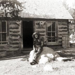
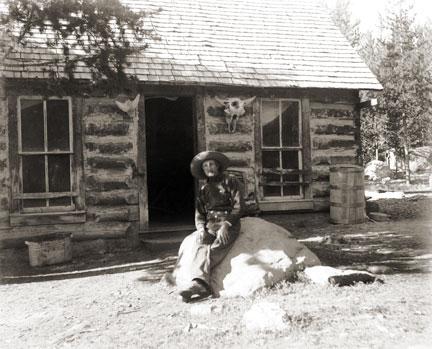
Al, the oldest brother, chose land on the Upper Sheephorn.  While he was at it, he established a much-needed ferry across the Grand River at today's Rancho Del Rio.  His brother Clarence homesteaded land on the same stream some two miles above the Midland Trail, known to us as the Trough Road. The only home he could afford for a couple of years was a dugout under the creek bank.  That tended to be damp and dingy, but Clarence hung in.  Finally he was able to build a cabin uphill from the stream. Newspapers used as insulation on his cabin walls show the year to be 1882.  Clarence was pleased with his house.  "Now I feel I've really put down roots and am here to stay!" he exclaimed.

Their young brother, Ernest, was frail, for he had suffered all his life from lung trouble.   Still, he loved working with Clarence.  One summer, they were digging a water ditch near Azure, on the Grand, above Radium; Ernest caught pneumonia and died. The poor boy was only about sixteen. Clarence never got over his brother's death and he gave land for a cemetery, where he buried Ernest, the first person there.

The second family were the Rundell boys' neighbors, Charlie French and his older brother, Harry, Jr. who had "hit town" from Iowa just about the same time.  Harry homesteaded upstream from Clarence and anticipated ranching.  By and by, though, Harry remarked to Charlie, "I've discovered I'm not much of a hand at ranching and besides, my land isn't very fertile.  I think I'll sell it and become a U.S. Forest Ranger instead.  If they'll have me." He easily passed the test and soon transferred to the little community of Azure.

Now, Charlie French was a wonderful musician, a whiz at playing the fiddle.  He missed making music with their sister Phoebe.  "You know, Harry," he said one day.  "I'd really like Phoebe to come out and see this country. I'm sure she'd like it.  And besides, we could play together again."

He urged her several times to come visit.  At last she agreed, traveling by train to Leadville, then to Wolcott.  About then, Charlie started to worry.   "Phoebe's only 18," he thought, "and she's such a lady. Is it proper to expect her to ride sidesaddle all the way in from Wolcott?"  He stopped by to see Clarence Rundell.  "Clarence, do you suppose you could take your buggy to Wolcott and pick up our Phoebe?"  He explained the circumstances. "Why, I'd be delighted," answered his friend.

It was a happy development.  At the station Clarence saw a lovely young woman, tall and slender, obviously well-educated.  He soon found she had a beautiful soprano voice and was an accomplished musician who could play both piano and organ.  He took to Phoebe right away, and she, to him.  It wasn't long before the two decided to marry.

Now the French boys' parents, Harry, Sr. and Mary, sold their Iowa farm about now and homesteaded at Azure, to be near their boys, even though Charlie left the country soon after.  Here the old folks remained for many years.  They also had some land up the Little Sheephorn, which they gave Phoebe as a dowry, when Clarence and Phoebe decided to wed.  Shortly after, the happy young couple married and made the little cabin their home.

Their three children were born here, Ernest, named after the brother who died, Marie, and Helen.  Clarence worked very hard, ranching in the summer and cutting logs in the winter.  The young folks were thrifty.  In 1908, Clarence sold his homestead to a Swiss newcomer and bought land above his original site. By 1912, Clarence and Phoebe built a fine three-story house, complete with beautiful hardwood floors.  It was wonderful place to raise the children.  "This will surely be our home forever!"

Harry French, Sr., died in 1924.   "Mother," invited Phoebe, "move in with us, since you're alone now." Mary did this, but then she returned to Iowa to stay with her sister, until her death.  The French name continues on, however, for there are two French Creeks in the Sheephorn area.

Finally, the Rundells decided to buy a home in north Denver and to invest in an apartment house.  All went well until 1928, when everything fell apart at the beginning of the Depression.   Clarence lost nearly everything. "Let's go back to the ranch, Phoebe," he said.  "I still have my 300-400 head of cattle; I know ranching and love it.  Let's go."  Thus they left city life and returned to their ranching roots.

Error message

  • Notice: Undefined index: quantity in omega_views_mini_pager() (line 234 of /var/www/html/docroot/sites/all/themes/omega/omega/inc/theme.inc).
  • Notice: Undefined index: quantity in omega_views_mini_pager() (line 234 of /var/www/html/docroot/sites/all/themes/omega/omega/inc/theme.inc).

Places