Mining

Mining Articles

Dutch Town
Dutch Town

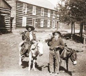
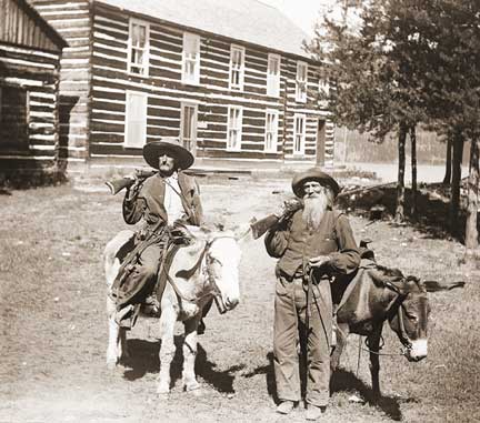
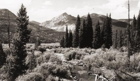
When two Germans, having imbibed too liberally shot up the mining town of Lulu City, they were run out of town.  They went higher and established camp, on the side of Red Mountain near timberline.  There they found a lode of low grade gold, silver and lead.

While it lasted only two years, this encampment came to be called "Dutch Town".  Gradually the fierce winters and lower quality of ore drove the settlers out, leaving only a few empty cabins about a mile west of Lulu City. 


Gaskill and the Wolverine and Ruby Mines
Mount Baker

The Wolverine Mine was discovered in 1875 by James Bourn and Alexander Campbell. Bourn was the brother-in-law of James Crawford, the founder of Steamboat Springs. James Bourn was the twin brother of Crawford's wife, Maggie.  A Grand County recording error forever changed the name of Bourn in the area to "Bowen".  The mine was located in the Rabbit Ears Range on Bowen Mountain, up Bowen Gulch, approximately 10 miles northwest of Grand Lake.  This discovery sparked additional exploration in the area that lead to a number of new mines. Within a week of the original discovery,  interested parties formed the Campbell Mining District which included Bowen Mountain, Bowen and Baker gulches.  Some of the Middle Park residents who participated in the mining exploration  were John Baker, Charles Royer, Charles Hook, John Stokes and the Redman brothers, William and Mann. The Redman's  eventually  discovered the Sedalia mine. Bourn and Campbell  in less than a year lost the Wolverine mine by not fulfilling a grubstake agreement with the Georgetown grocers, Spruance and Hutchinson.

John Stokes leased the Wolverine Mine from the grocers until Edward Phillip Weber, an agent representing a group of Illinois investors, purchased the Wolverine Mine in the Summer of 1879.  Weber continued purchasing other Campbell Mining District claims which created a great deal of local excitement.  Weber hired Stokes  to assist him and also hired Lewis Dewitt Clinton Gaskill to act as the first foreman for the Wolverine mine.  Gaskill had mine operation experience, having successfully operated the Saco Mine, on Leavenworth Mountain, above Georgetown for several years.  A mining camp was built  below the Wolverine Mine that contained a large bunk house building and a more substantial mine office building.

Gaskill, a Civil War veteran of the 28th  Regiment of the New York Volunteer Infantry,  had come to Colorado in 1868 as a representative of a group of Auburn, New York bankers to invest in mining properties.  He eventually successfully operated the Saco mine in 1873 and 1874.  He invested in the Georgetown, Empire and Middle Park Wagon Road in 1874, which was a toll road that finally made the Berthoud Pass road passable for wagon traffic.  Gaskill also acted as the foreman during the construction of the road. The principal investor in the road was William Cushman of the First National Bank of Georgetown. The bank had a financial collapse in 1877.  At that time, Gaskill was the secretary of the road company and lived with his family in the company house just below the summit of Berthoud Pass on the west side.  William Hamill, a wealthy Georgetown businessman, bought the wagon road in a foreclosure auction in 1881 for $7,000.  Gaskill continued to live with his family in the Berthoud Pass summit house until 1885, when he moved his family into the Fraser Valley and homesteaded 160 acres along Elk Creek.

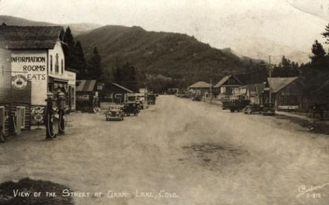
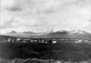
The settlement of Gaskill began when  in August of 1880,  Al J. Warner built a log cabin store in a meadow below Bowen Gulch on the trail/road that lead to both Bowen Gulch and Baker Gulch.  The settlement was also strategically well placed midway on the trail/road between Grand Lake and Lulu City and the Lead Mountain Mining District.  Another store was built in September by  John K. Mowery.  By that October, Mowery was appointed as the first postmaster of Gaskill.  The following spring E. Snell, opened a large general merchandise store that prompted the original store keeper, Al Warner, to relocate to Grand Lake as Al's Place. The town was named to honor L.D.C. Gaskill, the greatly respected foreman of the Wolverine Mine, the road builder/operator and the Civil War veteran.  By 1882, the town covered 60 acres.  E.P. Weber of the Grand Lake Mining and Smelting Company got involved in the town real estate development by laying out a city grid and offering lots for sale.  Weber's plat renamed the town Auburn after L. D. C. Gaskill's home town of Auburn, New York, but the Gaskill name stuck.  By the close of 1882, there were over 100 residents living in Gaskill.  The most substantial building was the Rogerson House, a well appointed two  story, squared log hostelry, Horatio Bailey Rogerson, proprietor.  Rogerson, would be elected County Commissioner in November of 1882, but would not serve because of a sudden discovery of ineligibility.  Instead, lame duck Colorado Governor Pitkin, appointed E. P. Weber to the post.  Weber was killed in the infamous July 4, 1883 shoot-out at Grand Lake.   

The Bowen Gulch trail lead to many of the  most productive and worked mines in the Campbell Mining District which included the Wolverine, now owned by the Grand Lake Mining and Smelting Company, E. P. Weber superintendent and the Ruby and Cross mines owned by Kentucky and Colorado Mining and Smelting  Company, John Barbee superintendent. Barbee, who lived in Grand Lake,  would go on to serve as superintendent of schools, Justice of the Peace and briefly the editor of the Grand Lake Prospector.  Barbee's partner in many endeavors was Antelope Jack Warren. Warren was as rough as Barbee was refined.  He acted as a foreman and, by one account, a bodyguard for Barbee.  The Bowen Gulch trail continued up the mountain to Bowen Pass and then descended into North Park and the Jack and Park mining districts which were organized by the end of 1880, to the settlement of Teller City.  Passable roads that could handle wagon traffic were needed and often planned but rarely built.  The high cost of building and maintaining  wagon capable roads in Middle Park was a difficult proposition for local governments and private entrepreneurs.  

The Grand County Commissioners in July of 1877 had declared the trail from Grand Lake to the mining gulches of the Rabbit Ears  Range to be a county road.  However there was little county money to pay for improvements to make the trail a road.  Private investors were reluctant to invest in wagon roads when there was the persistent  rumor that railroads were coming spawned by the numerous railroad surveys that were performed in the area.   Albert Selak, a Georgetown brewer, in August of 1878, organized a toll road that would branch off of the Georgetown, Empire, and Middle Park Wagon Road at the Ostrander Ranch on Red Dirt Hill, and proceed to Grand Lake and continue on to the Rabbit Ears Range mines and continue on into North Park and on to the Wyoming territory line.  John Barbee invested in the Middle Park Toll Bridge Company, a toll bridge company that intended  to build a bridge across the Grand River  above the confluence of Willow Creek and the Grand River.  However, this project languished, and was taken over by the county with an expenditure of $150.  

If ore wagons would need to haul ore to the nearest reduction mill which was over 60 miles in Georgetown, the toll road might have been a financial success. However, the lower grade ore from these Rabbit Ears Range mines would not yield a sufficient profit to cover the transportation and processing costs in a market where the market value of silver annually declined.  So the ore piles grew.  What was needed was a nearby reduction mill or cheaper transportation, like a railroad or a higher price for silver.  Weber had  repeatedly promised that a reduction mill was coming, but nothing was ever built.  By April of 1883 with tons of ore piled up and waiting for transport to be processed,  Weber temporarily closed the Wolverine Mine and laid off his miners.  He admitted  in June of 1883 that the ore from the Wolverine was “rather refractory” and that it would not justify shipment without local reduction.  Some hoped the closing was a strategic move by Weber to trigger a sell off of area mining properties  so that he could acquire additional mines before he built the reduction mill, but it was not to be. Weber would soon be shot dead by his political rival, John Gillis Mills.

The favorable newspaper stories of Rabbit Ears Range mining would continue, but for the informed, it had become  clear that without a major investment in improved transportation including a railroad or a major investment in a reduction mill in the area, the mining concerns were doomed to fail.  Mining claims had to be worked in order to be kept.   A minimum of $100 of labor or $500 in improvements had to be expended each year to maintain the claim or else the claim would be deemed abandoned.  Many claim holders leased their claims to miners to work for a percentage of the return.  Without the ability to sell and process the ore for a profit, there was no return.  The speculative mining investment money began to dry up and the miners and their supporting merchants began to leave.  By the end of 1886, the Middle Park mining boom had  ended. To further add to the decline,  a border dispute that arose between Larimer County and Grand County over the taxation and mineral wealth of North Park was finally decided in 1886 by the Colorado Supreme Court in favor of Larimer County.  North Park was part of Larimer County, not part of Grand County.  A lawsuit would follow so that Larimer County could recover the wrongly collected taxes of $20,000 from Grand County.  Grand County's total tax income at the time was less than $3,500 a year.

Lulu City
Lulu City

A popular hiking trail in Rocky Mountain National Park leads to the site of the historic mining town of Lulu City.  When precious metals were discovered there in 1879, as many as 500 prospectors showed up.  When the mines played out four years later, they departed in haste for other promising boom towns.

Lulu City was named for the daughter of Benjamin Franklin Burnett, one of the town founders. At its height, the town had a hotel, post office, and a justice of the peace.  It was served three times a week by a state coach from Fort Collins, on the other side of the Continental Divide.

There were probably ten saloons which drew customers from various mines in the area, such as the Rustic, Friday Nite, Tiger, Carbonate and Southern Cross.  These yielded low grade gold, silver and lead but the remote location of the Lulu made the cost to process the metals so high that efforts were soon abandoned.  The closest smelters were probably well over 100 wagon miles away.

One of the more remarkable characters of Lulu was "Squeaky Bob" Wheeler.  His high pitched voice was unique.  He was subject to drinking bouts, but was usually a likeable, well-behaved citizen.

After working in the mines, Squeaky Bob saved enough money to purchase a ranch south of Lulu. There he established a guest house and became famous for his cooking skills and colorful hospitality.  The current Lulu City trail runs through the site of his property, which was named the Phantom Valley Ranch.  He sold the ranch in 1926, but it continued to be a popular tourist stop until it was included in the National Park boundaries. 

Mining
Mining

Ghost towns and broken dreams are legacies left by the early miners and prospectors of Grand County. Ever since 1879 when the first mines were staked out and claimed on Bowen Mountain near Grand Lake, “gold and silver fever” grew like an epidemic. Men blinded by greed and prospects of a better tomorrow scrambled to the Kawuneeche Valley with picks and shovels to unearth their fortunes. Women worked just as feverishly along side their men and encampments gave way to mining towns almost overnight. Land offices, eateries, and boarding houses sprouted like wild flowers.

Claim jumping became a common practice, resulting in fights and even murders. Most of these injustices would go unpunished, for no one wanted to risk losing their chance of riches. In Grand County the mother load was a false prophecy, as only small quantities of low grade gold, silver, and lead ore were found. In a few short years, Gaskill, Teller City, and Lulu City, three of the more noted settlements, suffered the same fate as the other boom towns. By 1885 the mining boom had ended in Grand County and ranching had taken it’s place as a sustaining industry.

Mining in Grand County

Ghost towns and broken dreams are legacies left by the early miners and prospectors of Grand County.  

Ever since 1879 when the first mines were staked out and claimed on Bowen Mountain near Grand Lake, “gold and silver fever” grew like an epidemic.  Men blinded by greed and prospects of a better tomorrow scrambled to the Kawuneeche Valley with picks and shovels to unearth their fortunes.  

Women worked just as feverishly along side their men and encampments gave way to mining towns almost overnight.  Land offices, eateries, and boarding houses sprouted like wild flowers. Claim jumping became a common practice, resulting in fights and even murders.  Most of these injustices would go unpunished, for no one wanted to risk losing their chance of riches.  

In Grand County the mother load was a false prophecy, as only small quantities of low grade gold, silver, and lead ore were found.  In a few short years, Gaskill, Teller City, and Lulu City, three of the more noted settlements, suffered the same fate as the other boom towns.  By 1885 the mining boom had ended in Grand County and ranching had taken it’s place as a sustaining industry.

Teller City, Crescent City and Tyner

The original Grand County contained North Park as well as Middle Park, and during the mining boom of the early 1880's there were several mining camps east of the modern town of Rand. It was several years after the mining boom northern area of Jackson County was created.

Teller City was founded in 1879 and named for Colorado's famous Senator Henry M. Teller, who later became U.S. Secretary of the Interior.  By 1882, the population of Teller City was about 1200.  It had a fine hotel with 40 rooms, a newspaper and two steam saw mills.  It was a lively Old West town with twenty seven saloons and a number of "houses of ill repute".

Some high quality ore assayed at Teller City was as much as $3000 a ton, but most of that soon ran out and by 1884, the high shipping costs to far away smelters dropped the price per ton dropped to $20. The best mine, Endomile, was three miles from town.

Crescent City, southwest of Teller City had an even more brief existence, but there was population enough for a U.S. Post Office in 1880. 

Rumors of valuable silver three miles sough of Teller City drew a number of prospectors to found the camp known as Tyner.  John Noble Tyner was the First Assistant Postmaster General of the United States and visited the mining camp so named in 1879.  He promised the miners a weekly mail delivery if at least 2 miners mined through the winter.  Tyner had been a special agent for the Post Office from 1861 thru 1868, at which time he was appointed to serve in an open seat in the U.S. House of Representatives for Indiana.  He ran for election win the appointed term ended and was elected and continued to be reelected and serve as a Representative until 1875 when President Grant appointed him Second Assistant Postmaster General.  Grant would later appoint him to the "big job" of Postmaster General in 1876. 

Tyner worked to elect Rutherford B. Hayes in 1876 and after Hayes was elected and took office in March of 1877, Hayes appointed a new Postmaster General, but gave the second spot, First Assistant to the Postmaster General to Tyner.  Historians suggest that Tyner's demotion angered him to the point that he allowed wide spread corruption in the day to day operation of the Postal Service which was his responsibility to over see. He resigned in 1881 under great public pressure from what became known as the "Star Route Fraud scandal".  He would remain a political figure  being appointed  various positions  with the U. S. Postal Service until shortly before his death in 1904.  Although indited three times for corruption in his Post Office management, he was never convicted.  The "Star Route Fraud scandal", may have local implications.  It had to do with over charging and providing needless postal routes, roads and post offices and kick backs to politicians from contractors .

Articles to Browse

Topic: Water

Water from the Mountains - The Grand Ditch

 Though few, high altitude water ditches have had a major impact on Grand County's history and economy, there were many early valley ditches transporting this precious commodity from water-right sources to the owner's ranch. However, the threat of transporting great volumes of water from our county to Boulder County via high altitude ditches appeared back in 1889.  Certain interests east of the Divide talked the Legislature into appropriating $25,000, for surveying and developing a 20-mile-long canal over South Boulder Pass to South Boulder Creek.  Amazingly, neither Grand County residents nor very many others opposed this notion.  Luckily the state engineer found the terrain so difficult that not even $2000 was ever spent on the project.


The next effort occurred also in 1889.  This privately financed plan was to develop a two-branched canal system that would move 700 second feet of water to a half-mile tunnel just beneath Berthoud Pass at over 11,000 feet, thence down to Clear Creek and on to the Golden area.  Initial surveys were begun that fall and roads laid out the following year.  The effort bogged down but was resurrected in 1900 under the Agricultural Ditch Co., supplemented in 1902 with the Berthoud Canal Co.  The canal was partially completed by the Frank Church family ranching interests of Jefferson County by 1906.  The ditch, which can be walked today, runs from Second Creek to Berthoud Pass, though it no longer carries much water.  However, the Church Ditch water rights coming from Clear Creek still exist and today are owned by Northglenn.

Proposed in 1890 by the Water Supply and Storage Company of Fort Collins, a greater canal was to be built 1000 feet above the Kawuneeche Valley, that would tap the high tributaries of the North Fork of the Grand River, sending the water over Poudre Pass to a reservoir and then into the Cache La Poudre River and on to agricultural areas east of the Front Range.  The water company, later known as the Grand River Ditch Company, appropriated 525 second feet at the time of the initial diversion in 1892.  (When the Grand River was renamed the Colorado River in 1921, the company was changed to the Grand Valley Irrigation Company.)  The ditch was dug by hand, primarily by Japanese and Mexican laborers.  By 1900, water was flowing eastward.  

By 1906, this major canal, known as the Grand Ditch, and draining water from the Never Summer Range, had a capacity of nearly 358 second feet with 12 headgates within 8 miles, running from Baker Creek to the pass at 10,179 feet, plus a smaller canal carrying 183 second feet within 11 miles, coming from Specimen Mountain.  In 1936, using machinery, the ditch was lengthened to 14 miles.  The Grand Ditch is about 20 feet wide and 6 feet deep, though the water is rarely more than 3 feet deep, and this water irrigates some 40,000 acres in Weld and Larimer counties.

The National Park Service has argued against the allocation of all this water to the canal as it is needed to support plant life and animal habitat.  Becuase river water flow was cut in half, the immediate effect was a reduction in the fish population in the Colorado River.  More recently, a major washout in the ditch caused devastating damage to the slopes below the ditch and to the Colorado River itself.  Hikers climbing up from the valley use the Grand Ditch as a route to the high peaks and lake.  But as viewed from below, the Grand Ditch is often considered an ugly scar on the landscape.

Colorado Mountain Wild Flowers

A sight to behold
Not just a story to be told
A beauty of our own Grand County things
of the past of here and now

A sight that will forever last
Field, and fields everywhere down low
More growing the higher we go

Our beautiful Colorado mountain flowers
The prettiest of anywhere
All of those colors

Scattered among the trees
Swaying in the breeze
Yellow, purple, blue, pink and red

Tiny little heads
Names of them all I do not know
Just that here they grow
Making a wonderful show!

Oct 2006

Topic: Places

Place Names

Article contributed by Kathy Zeigler

The County of Grand was established in 1874, taking its name from the Grand River which has its headwaters in the county, and from Grand Lake, the largest natural body of water in the state of Colorado.  The county seat is Hot Sulphur Springs.  The area of the county is 1854 sq. mi., making it larger than the state of Rhode Island.

Fraser was established in 1871 as the town of Eastom.  Its name changed to Fraser, after the river that flows through the town, though it was originally spelled Frazier, for Reuben Frazier. The Post Office adopted the simpler spelling at the establishment of the Post Office.  The town bore the distinction of being the "icebox of the nation" for many years, losing that title in a legal battle with a town in Minnesota.

Granby was established in 1904, taking its name from Granby Hillyer, a Denver attorney who may have been associated with the founding of the town.

Grand Lake was established in 1881 as a mining settlement by the Grand Lake Town and Improvement Company, taking its name from Grand Lake.

Hideaway Park was established approximately 1905, and named for its hidden location with the trees screening it from the road. It may have been earlier known as Woodstock, Vasquez and Little Chicago. Max Kortz, owner of a dance hall in the village is said to have provided the moniker. 

Hot Sulphur Springs was established in 1860 and named for the hot springs.  It may have been refered to as Sulphur Springs in its earliest days, and as Sulphur by the workers and management of the Denver and Salt Lake Railroad when it came through in 1904.

Kremmling was established in 1881 as a general merchandise store, owned by Kare Kremmling on the ranch of Dr. Harris, located on the north bank of the Muddy River. In 1888 John and Aaron Kinsey had part of their ranch platted, calling the site Kinsey City. Kremmling moved his store across the river to the new site; eventually the town came to be known as Kremmling.  (Note the two different first names-Reuben Kremmling and Kare Kremmling.  I'll keep working on that discrepancy.)

Radium's name was suggested by Harry S. Porter, prospector and miner, in reference to the radium content in one of his mines.

Winter Park was first known as West Portal, a settlement that grew up during the construction of the Moffat Tunnel in the 1920s.  Postal authorities agreed to the name change to Winter Park, after a request was made by Denver mayor Benjamin F. Stapleton and many sport enthusiasts to publicize the establishment of a top winter sports area.

Berthoud Pass, el. 11314, was named for Capt. Edward L. Berthoud. Berthoud discovered the pass in 1861. He was also chief engineer on the Colorado Central Railroad.

Gore Pass, el. 9524, was named for Sir Charles Gore, who mounted a monumental "hunt" to the American West during the 1850s. Gore spent considerable time in the area, and gave his name to the Pass, a mountain range, and a canyon.

Milner Pass, el. 10759, was named for T.J. Milner, and accomplished civil engineer for railroads and street car lines.

Muddy Pass, el. 8772, bears the name of Big Muddy Creek, a tributary of the Colorado River, with reference to the muddy appearance of the waters during the spring runoff and storms.

Rabbit Ears Pass, el. 9426, refers to Rabbit Ears Peak, whose outcroppings somewhat resemble a rabbit's ears.

Willow Creek Pass, el 10850, is named for the stream, and almost certainly for the willow bushes that line the banks of the stream. The pass was a well known Indian trail, and became a road in the early 1900s.

Source: Eichler, George R. Colorado Place Names. Boulder: Johnson Publishing, 1977.

Topic: Places

Grand County

Grand County was established in 1874 by the Territory of Colorado, thus becoming a county two years before Colorado became a state. It was named for the Grand River, the name by which the Colorado River was known at that time. The headwaters of the today’s Colorado River are in Grand County. The county was formed from a portion of Summit County but acquired its current boundaries in 1877, when part of the Grand County was used to create Routt County. The county seat is Hot Sulphur Springs. The area of 1,854 square miles (larger than Rhode Island) consists of meadows, river valleys and mountains.
 

Topic:

Dude Ranches

Article contributed by Gretchen Bergen


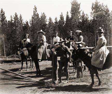
Starting in the late 1870s, ranchers took in guests to supplement their income during hard times. Early adventure-seekers from the East made the long rail journey to the wilds of Middle Park in search of big game and unspoiled mountain scenery.


With few accommodations available, travelers looked to frontier families for room and board. Ranchers soon discovered guests,
or "dudes" as they came to be known, would pay to fix fences, ride horses, work cattle and sleep in tents....sometimes for an entire summer! 
Entertainment was eventually incorporated into the guest experience.


Located on the stage stop between Georgetown and Hot Sulphur Springs, William Z. Cozens was the first rancher in Grand County to provide room and board to travelers starting as early as 1874. The Lehman and Sheriff families also ran well-known turn of the century dude ranches.


The years following World War I were the height of the dude ranch era. By the late 1950s, Granby had as many as ten guest ranches between Granby and Grand Lake with others scattered throughout the county. Today Grand County is still home to six dude ranches,
which attract visitors from all over the world for their western charm, high-quality accommodations, horseback riding programs and superb fly fishing.

Sources:
A Dude Ranch Is... 1874-1986.
Grand County Historical Association Journal, Volume VI, Number 1. June 1986. Grand County Historical Association

Christmas in the Mountains 1951

It was my first Christmas in the mountains. Not only that, but it was my first time to be part of a vacation in a cozy ski inn.  This was at Millers Idlewild Inn in Hideaway Park (now the town of Winter Park). I had been married only eight months. Dwight and I had worked hard, getting everything in order: ­clean beds, fresh spreads and curtains, floors shining and bathrooms sparkling.  The woodpile was full and food supplies ready.  Our plans for evenings were laid out too. Dwight would do movies. His brother Woodie would call square dances, with former Moffat Road engineer George Shryer accompanying on the fiddle and his wife, Grace, chording on the piano.  Tom Smith would bring his sled and team of horses, to take happy folks along snow-packed roads for sleigh rides, to the tune of jingling bells. Games were at hand, along with a fine supply of books on the shelves. We expected a wonderfully busy two weeks, which was a good thing, because it had been a long time since our last income, before Labor Day.

Family and friends were coming tomorrow to give a hand over the holiday, and then the fun would begin. As the first guests arrived, I stepped outside, and lifting my nose, I thought, "I smell snow!"  Great!  The area already had a pretty good covering, so that when people called and asked, "Is there snow yet?  Should we come on ahead?" we could gladly say, "Come." That night it snowed,­ 12" of beautiful soft flakes.  Skiers were overjoyed. Dwight got out early to shovel, plow, pull people out of drifts, take others to Winter Park Ski Area, three miles away. That evening we heard that almost no stumps or rocks were evident on the slopes; all had been buried. The next night it snowed again ­ 12" of beautiful white stuff.  We were amazed.  But Dwight got out early to shovel, plow, pull people out if drifts, and take others to the area.  The following night it snowed again, and every night for a week, it snowed, dumping heaps of snow on the whole valley.

Winter Park Ski Area, in those days, wasn't open on Christmas Day; the management wanted to let its employees have the day at home with their families.  So we took our guests to the top of Berthoud Pass; from there they could ski down Seven Mile Trail and we met them at the bottom.  The day after Christmas began the busiest days of all. Back then, many families didn't leave home until the 26th. This was fine, until the passes closed from heavy snows and avalanches. Then visitors, who had to leave, couldn't drive out, but people who were coming by train could still get in!  We had a problem.  The parking lot was jammed with rental cars.  Although some folks went ahead and left by train, many families stayed on.  The rooms were completely full and after all, newcomers were entitled to their reserved space. We had guests stashed all over the lounge, extras in the dorms, and extras in the cabins.  What a crowd it was. I hardly had time to think. 

I cleaned all morning, helped set tables and serve, did dishes, sometimes hauled skiers to or from the area, kept up with the office work, and joined in entertaining folks in the evenings. Thank heaven for family and friends!  There never was such a hectic week. But the Miller hospitality at Idlewild kept our visitors relaxed and happy. Truly, it was a jolly time, with tired skiers loafing in front of the fire, doing puzzles or playing games.  There was always a group playing canasta after dinner, in the dining room, and peals of laughter would pour forth when somebody won a great hand. At last New Year's Eve came and went. The rental cars had gone back to Denver.  The rooms were empty.  We were alone except for a couple of guests.  Making our path through the deep drifts, Dwight and I went home and flopped down on our own sofa.  I heaved a sigh, saying, "Well!  So that's what Christmas in the mountains is like.  I had o idea there would be so much snow."  Little did I know that for Christmas, 1952, we would still have the crowd of guests, but there would be hardly any snow until January!

Topic: Mining

Lulu City

A popular hiking trail in Rocky Mountain National Park leads to the site of the historic mining town of Lulu City.  When precious metals were discovered there in 1879, as many as 500 prospectors showed up.  When the mines played out four years later, they departed in haste for other promising boom towns.

Lulu City was named for the daughter of Benjamin Franklin Burnett, one of the town founders. At its height, the town had a hotel, post office, and a justice of the peace.  It was served three times a week by a state coach from Fort Collins, on the other side of the Continental Divide.

There were probably ten saloons which drew customers from various mines in the area, such as the Rustic, Friday Nite, Tiger, Carbonate and Southern Cross.  These yielded low grade gold, silver and lead but the remote location of the Lulu made the cost to process the metals so high that efforts were soon abandoned.  The closest smelters were probably well over 100 wagon miles away.

One of the more remarkable characters of Lulu was "Squeaky Bob" Wheeler.  His high pitched voice was unique.  He was subject to drinking bouts, but was usually a likeable, well-behaved citizen.

After working in the mines, Squeaky Bob saved enough money to purchase a ranch south of Lulu. There he established a guest house and became famous for his cooking skills and colorful hospitality.  The current Lulu City trail runs through the site of his property, which was named the Phantom Valley Ranch.  He sold the ranch in 1926, but it continued to be a popular tourist stop until it was included in the National Park boundaries. 

Topic: Biographies

R.W. "Dick" McQueary

R.W. (Dick) McQueary was born May 9, 1868, in the San Luis Valley near what is now Del Norte. Dick moved to Grand County in 1876. In 1892, Dick, newly married, began freighting between Hot Sulphur Springs and George Town's railroad terminal.

He moved boxes of merchandise for the general store, barrels of whiskey for saloons and machinery for sawmills. On one of these trips he decided to build cabins closer to Berthoud Pass. His crew built several log buildings 6 miles from the top of the pass and named it "Spruce Lodge".

In the spring of 1893, Dick contracted to open snowbound Berthoud Pass by middle June. He moved his wife Jessie and three-months old son to Spruce Lodge. Snow was shoveled from the roofs and trails to the buildings. Heat from stoves thawed the frozen dirt roofs and water entered the cabins. Pans were placed under the leaks to catch snow water. Work was completed 2 weeks later. On June 14, snow began to fall and canvas was placed over stove pipes to keep water from putting out the fires. Four feet of snow fell and the only dry place in the cabins was the pallet with the baby on it under the table.

1895 saw Dick Mcqueary homestead 320 acres between Pole and Crooked Creeks The ranch was named "Four-Bar-Four" after Dick's cattle brand. It became a well-known travel stop and is a point of interest to this day. By 1909 R.W. was freighting the Grand Lake area and became involved with building a road between the foot of Milner Pass to Pouder Lake at the summit. Dick bid $49,000 to build the road. Three years later, completion of a rough outline of the entire road through Rocky Mtn.National Park. M cqueary completed the west side and Jacobson the east side. Dick prepared festival grounds west of Grand Lake and a large crowd enjoyed the road opening celebration.

Rundell & French - Two families of the Sheephorn

October 2009

Here we have a story of two families, who became intertwined in a far away place where there weren't too many people. In fact, there was only a handful.  Three young fellows, the Rundell boys, came from Wisconsin about 1880, to settle on the Sheephorn, an area in the very southwest corner of Grand County.

Al, the oldest brother, chose land on the Upper Sheephorn.  While he was at it, he established a much-needed ferry across the Grand River at today's Rancho Del Rio.  His brother Clarence homesteaded land on the same stream some two miles above the Midland Trail, known to us as the Trough Road. The only home he could afford for a couple of years was a dugout under the creek bank.  That tended to be damp and dingy, but Clarence hung in.  Finally he was able to build a cabin uphill from the stream. Newspapers used as insulation on his cabin walls show the year to be 1882.  Clarence was pleased with his house.  "Now I feel I've really put down roots and am here to stay!" he exclaimed.

Their young brother, Ernest, was frail, for he had suffered all his life from lung trouble.   Still, he loved working with Clarence.  One summer, they were digging a water ditch near Azure, on the Grand, above Radium; Ernest caught pneumonia and died. The poor boy was only about sixteen. Clarence never got over his brother's death and he gave land for a cemetery, where he buried Ernest, the first person there.

The second family were the Rundell boys' neighbors, Charlie French and his older brother, Harry, Jr. who had "hit town" from Iowa just about the same time.  Harry homesteaded upstream from Clarence and anticipated ranching.  By and by, though, Harry remarked to Charlie, "I've discovered I'm not much of a hand at ranching and besides, my land isn't very fertile.  I think I'll sell it and become a U.S. Forest Ranger instead.  If they'll have me." He easily passed the test and soon transferred to the little community of Azure.

Now, Charlie French was a wonderful musician, a whiz at playing the fiddle.  He missed making music with their sister Phoebe.  "You know, Harry," he said one day.  "I'd really like Phoebe to come out and see this country. I'm sure she'd like it.  And besides, we could play together again."

He urged her several times to come visit.  At last she agreed, traveling by train to Leadville, then to Wolcott.  About then, Charlie started to worry.   "Phoebe's only 18," he thought, "and she's such a lady. Is it proper to expect her to ride sidesaddle all the way in from Wolcott?"  He stopped by to see Clarence Rundell.  "Clarence, do you suppose you could take your buggy to Wolcott and pick up our Phoebe?"  He explained the circumstances. "Why, I'd be delighted," answered his friend.

It was a happy development.  At the station Clarence saw a lovely young woman, tall and slender, obviously well-educated.  He soon found she had a beautiful soprano voice and was an accomplished musician who could play both piano and organ.  He took to Phoebe right away, and she, to him.  It wasn't long before the two decided to marry.

Now the French boys' parents, Harry, Sr. and Mary, sold their Iowa farm about now and homesteaded at Azure, to be near their boys, even though Charlie left the country soon after.  Here the old folks remained for many years.  They also had some land up the Little Sheephorn, which they gave Phoebe as a dowry, when Clarence and Phoebe decided to wed.  Shortly after, the happy young couple married and made the little cabin their home.

Their three children were born here, Ernest, named after the brother who died, Marie, and Helen.  Clarence worked very hard, ranching in the summer and cutting logs in the winter.  The young folks were thrifty.  In 1908, Clarence sold his homestead to a Swiss newcomer and bought land above his original site. By 1912, Clarence and Phoebe built a fine three-story house, complete with beautiful hardwood floors.  It was wonderful place to raise the children.  "This will surely be our home forever!"

Harry French, Sr., died in 1924.   "Mother," invited Phoebe, "move in with us, since you're alone now." Mary did this, but then she returned to Iowa to stay with her sister, until her death.  The French name continues on, however, for there are two French Creeks in the Sheephorn area.

Finally, the Rundells decided to buy a home in north Denver and to invest in an apartment house.  All went well until 1928, when everything fell apart at the beginning of the Depression.   Clarence lost nearly everything. "Let's go back to the ranch, Phoebe," he said.  "I still have my 300-400 head of cattle; I know ranching and love it.  Let's go."  Thus they left city life and returned to their ranching roots.

Topic: Mountains

Mount Craig

The rounded mountain at the head of the East Inlet to Grand Lake has born many names-from Middle Mountain, to Mount Baldy, to Mount Westcott. It's official title, however, is Mount Craig. It's namesake is The Reverend William Bayard Craig, who came to the area in 1882, to be pastor of the Central Christian Church in Denver. He visited Grand Lake occasionally, and completed some real estate dealings there. The town of Craig also bears his name, due to the influence of his friend, David Moffat, of the Denver and Salt Lake Railroad.

Error message

  • Notice: Undefined index: quantity in omega_views_mini_pager() (line 234 of /var/www/html/docroot/sites/all/themes/omega/omega/inc/theme.inc).
  • Notice: Undefined index: quantity in omega_views_mini_pager() (line 234 of /var/www/html/docroot/sites/all/themes/omega/omega/inc/theme.inc).

Mining