In 1947 my family moved to Granby, Colorado; I was 5 years old. My Mom (Eloise) and Dad (Howard, “RED”) Beakey, ran the Texaco gas station where the Chamber of Commerce parking lot now sits. I have a sister named Sandra Sue, who was 3 at the time.
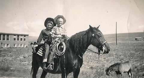
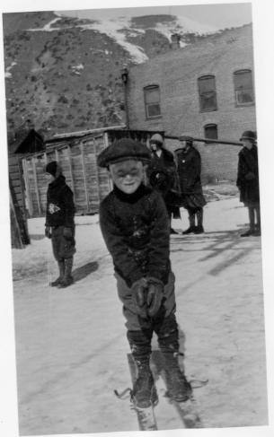
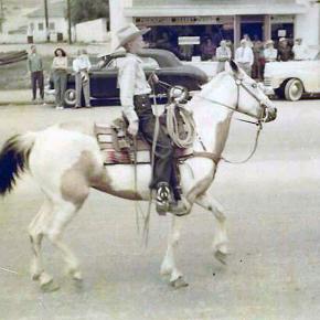
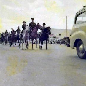
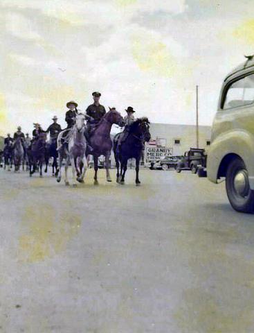
In 1948 Mom and Dad bought me a mare named Midge, and that is the beginning of my joy of growing up in Granby. I rode Midge all over Granby and surrounding area. In the winter I would pull kids on their sleds and skis with a rope tied to the saddle horn. In the spring of 1949 Midge produced a filly foal that we named “Lady Blaze.” The following 4th of July Rodeo Parade, 1949, I rode on Midge and my friend, Howard Ferguson, rode behind me and led Lady Blaze in the parade. A local farrier had made lace up booties with metal bottoms for Lady Blaze so she wouldn’t damage her hooves while being led in the parade. You can imagine the sound of those booties hitting the pavement as we rode down Agate Ave., and the enjoyment of the crowd lining the parade route. At that time the rodeo grounds were in the area of N Ranch Road. The Granby Fire Department awarded me with a $3.00 check for being “The Most Typical Cowboy Under 12.” I was totally amazed and still, at the age of 79, have that check! I did give Howard $1.50 in cash, though, that day for his part.
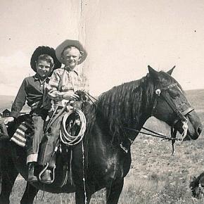
The following year, 1950, Mom and Dad bought a Pinto filly from Tex Hill, the Foreman of the Little HO Ranch east of Granby. Tex rode the Pinto into the gas station office one day and asked my Dad if she was gentle enough for me. Dad said yes, and I became the proud owner of my second horse, which I named Melody. That year (1950) my sister, Sandra, rode Midge and my Dad rode his hunting horse, Spike, and I rode Melody in the Rodeo Parade. Prior to the rodeo Dad (who hadn’t ridden Spike in a long time) got bucked off into a pile of rocks and got pretty banged up. Sis rode up and asked Dad (who was laying on the rocks) “are you dead Daddy”?
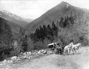
Sis and I rode all over Grand County, riding along US 40 to 10 Mile Creek to fish the beaver ponds; we would be stopped several times to have our photos taken by the tourists. Tourists always seemed amazed to see little kids riding on horseback way out in the country. We always brought home from our outings some nice Brookie trout. Sometimes we would ride out to The Little HO Ranch and spend a few days there with playing real live cowboys with Tex, while Sis would help his wife around the house.
In 1951 Tex Hill brought a full sister to Melody, named Patches, for Sis to ride in the parade, so, we rode side by side. That same year Eddie Linke Jr. asked me to ride his racehorse in the rodeo race. We went to the rodeo grounds several days for me to get used to the horse. Of course, the horse was not as gentle as Melody, so I fell off several times before getting use to him. The best part is that I did win the race, and was happy and proud riding Eddie’s horse.
In 1952 I once again rode Melody in the Rodeo Parade, which was sad for me as it was the last one, I attended before we moved away from Granby to Arvada. Mom and Dad sold both the horses. I guarantee several tears flowed because of that.
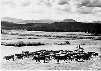
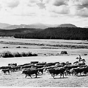
One of the other great things I enjoyed was going to a cow camp in the summer. A friend of my parents, Rocky Garber took me to cow camp that was behind Trails End Ranch on Willow Creek Pass. We packed our supplies in on pack horses to a small log cabin. I was so excited to be a cowboy, moving cattle from one grazing spot to another, even getting covered with mud pulling a heifer out of a mud bog. The second time I went to cow camp was with my Dad’s cousin Louis “Newt” Culver, who in my mind was the greatest cowboy ever. The cow camp was below “Devils Thumb” east of Tabernash. It was a log cabin next to a creek and had corrals to keep horses. Once again, I loved the excitement of being a cowboy. We would go to the high meadows checking on the cattle and occasionally have to chase an ornery bull back to the herd. In the evenings Newt would train horses to be good cow ponies. When they were gentle enough, he would let me ride one while he rode another that he was training.
So, some of my greatest memories of my life are the years I spent in Granby and Grand County, not a better place for a kid to grow up! I graduated from Salida High School in 1961 and our family moved back to Granby. Mom and Dad had the Texaco Station in Fraser. I joined the Air Force in 1962 and retired after serving 26 Years.
By Joe Beakey - Poncha Springs April 2022


 ,
,  ,
,