Time Line

Get an idea of how historical events fit together in Grand County.

Browse Subtopics

Time Line Articles

Statehood
Statehood

Colorado was the 38th state admitted to the Union, and is known as the “Centennial State” because of its entrance into the union in 1876, one hundred years after the signing of the Declaration of Independence. The Colorado River was named earlier, and is Spanish for “red“, the color of the water that the Spanish explorers observed.

People have been living in Colorado at least 9,000 years. Spanish explorers were here in 1540, but the discovery of gold caused a major population explosion in 1859.

The state consists of 3 topographic zones: plains, mountains, and plateaus. The Continental Divide bisects the state, north to south and there are 54 peaks above 14,000 feet.

Denver is the State Capitol at 5,280 feet, one mile above sea level. Colorado is noted for its waterways and is the only state in the U.S. from which all water courses flow out of the state. Rivers that have their origins in Colorado include the North Platte, South Platte, Arkansas, Rio Grande, and the Colorado with its headwaters in Grand County.

Articles to Browse

Topic: Granby

The Naming of Granby

Granby Hillyer was born in Cartersville, Georgia on July 7, 1874. The third of six children, born of Shaler Granby Jr. and Lelia (Holloway) Hillyer, and the grandson of the Rev. Shaler Granby Hillyer, Sr. who was born in Granby, Hartford County, Connecticut. When Granby was 13 years old the Hillyer family moved to Washington, D.C. where Granby graduated from public high school. He then entered government service and at the same time studied at George Washington University, receiving a Bachelors of Law Degree. A postgraduate law degree was awarded in 1896 from Columbia University School of Law. He moved to Colorado in 1898 settling at Lamar (Prowers  County) launching a 40+ year legal career. On June 16, 1900 he married Miss Annie Creaghe, from a prominent southern Colorado pioneer family, and a daughter of an Apache County, Arizona sheriff. To this union were born 3 children St. George Creaghe, Granby Francis Ridgeway Jr., and Helen Edna Dolorine (Jane) later Mrs. Albert Hunt of Boston, Massachusetts.

Granby Hillyer was a member of the Republican Party. He served as Lamar City Attorney, Prowers County Attorney, and Deputy District Attorney. He was also affiliated with the Elks, Masons, Sons of the American Revolution, and Woodmen of the World fraternal organizations.

At 28 years of age, the citizens of Prowers, Baca and Las Animas Counties, elected Granby Hillyer to serve in the 14th Colorado General Assembly, House of Representatives, making him one of the youngest elected officials in state legislature history. He served one term from 1903-1905. During this tenure he plotted the streets at no cost for the Frontier Land and Investment Companies newest town on the Denver, Northwestern & Pacific Railroad (The Moffat Road). In doing so, Mr. Hillyer was honored by having the Town of Granby, Grand County, Colorado named for him.

Governor Carlson appointed Mr. Hillyer as the Third Judicial District Court Judge, at Trinidad, Colorado from 1914-1916. Her served as the United States Attorney for Colorado from 1922-1925. Afterwards he enjoyed a large private law practice in Lamar and Denver.

In 1928 at Lamar, Granby Hillyer was a speical prosecutor in the "Fleagle Gang Case".  On May 23rd, the First National Bank was robbed, resulting in the loss of four lives.  The case has been credited by the F.B.I. as the first robbery solved from a single fingerprint.

The Denver Post on July 21, 1931 page 9, reported "Granby Hillyer Is Disbarred By Federal Courts." In a decision reached by the United States Circuit Court of Appeals, predicated by a Colorado Supreme Court tribunal, of neglecting the interests of his clients in a number of cases.

Tragedy then struck the Hillyer family twice with the loss of St. George Creaghe in June 1932 and October 1933, Granby Jr. was killed in an automobile accident near Lamar. They both were attorneys. St. George and Granby Jr. were born 16 months apart and passed away 17 months apart. Both funeral services were held at the Immaculate Conception Cathedral in Denver, with the same set of pallbearers for both young men. They were laid to rest at Denver's Fairmount Cemetery. Their father Granby Hillyer, joined his sons on January 2, 1942, passing away at Denver Mercy Hospital, after suffering a heart attack at age 68.

The name Granby also comes from Great Britain, one of the original references was for the "Marquis of Granby," John Manners. A Member of Parliament from 1754 until his death in 1770, he also was a popular army officer and hero of the Seven-Year War 1756-1763, obtaining the rank of Lieutenant General. In 1766, he was named British Commander-in-Chief of the Army. John Manners once had his hat and wig shot off during a cavalry charge, thus leading to the British expression, "to go baldheaded at something." He had his office attacked by the pseudonymous political writer "Junius." The Marquis of Granby resigned most of his offices and died in debt.

Curiously, Granby Hillyer had an uncle and a brother named Junius.

Topic: Mining
Mount Baker

Gaskill and the Wolverine and Ruby Mines

Mount Baker

The Wolverine Mine was discovered in 1875 by James Bourn and Alexander Campbell. Bourn was the brother-in-law of James Crawford, the founder of Steamboat Springs. James Bourn was the twin brother of Crawford's wife, Maggie.  A Grand County recording error forever changed the name of Bourn in the area to "Bowen".  The mine was located in the Rabbit Ears Range on Bowen Mountain, up Bowen Gulch, approximately 10 miles northwest of Grand Lake.  This discovery sparked additional exploration in the area that lead to a number of new mines. Within a week of the original discovery,  interested parties formed the Campbell Mining District which included Bowen Mountain, Bowen and Baker gulches.  Some of the Middle Park residents who participated in the mining exploration  were John Baker, Charles Royer, Charles Hook, John Stokes and the Redman brothers, William and Mann. The Redman's  eventually  discovered the Sedalia mine. Bourn and Campbell  in less than a year lost the Wolverine mine by not fulfilling a grubstake agreement with the Georgetown grocers, Spruance and Hutchinson.

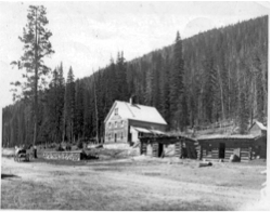
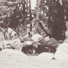
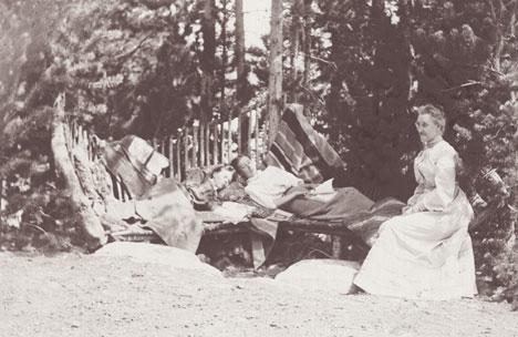
John Stokes leased the Wolverine Mine from the grocers until Edward Phillip Weber, an agent representing a group of Illinois investors, purchased the Wolverine Mine in the Summer of 1879.  Weber continued purchasing other Campbell Mining District claims which created a great deal of local excitement.  Weber hired Stokes  to assist him and also hired Lewis Dewitt Clinton Gaskill to act as the first foreman for the Wolverine mine.  Gaskill had mine operation experience, having successfully operated the Saco Mine, on Leavenworth Mountain, above Georgetown for several years.  A mining camp was built  below the Wolverine Mine that contained a large bunk house building and a more substantial mine office building.

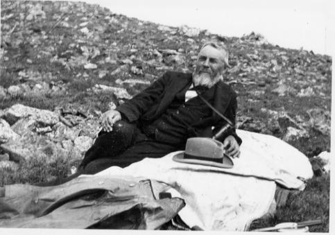
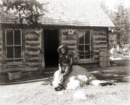
Gaskill, a Civil War veteran of the 28th  Regiment of the New York Volunteer Infantry,  had come to Colorado in 1868 as a representative of a group of Auburn, New York bankers to invest in mining properties.  He eventually successfully operated the Saco mine in 1873 and 1874.  He invested in the Georgetown, Empire and Middle Park Wagon Road in 1874, which was a toll road that finally made the Berthoud Pass road passable for wagon traffic.  Gaskill also acted as the foreman during the construction of the road. The principal investor in the road was William Cushman of the First National Bank of Georgetown. The bank had a financial collapse in 1877.  At that time, Gaskill was the secretary of the road company and lived with his family in the company house just below the summit of Berthoud Pass on the west side.  William Hamill, a wealthy Georgetown businessman, bought the wagon road in a foreclosure auction in 1881 for $7,000.  Gaskill continued to live with his family in the Berthoud Pass summit house until 1885, when he moved his family into the Fraser Valley and homesteaded 160 acres along Elk Creek.

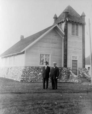
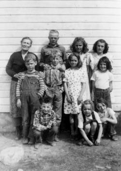
The settlement of Gaskill began when  in August of 1880,  Al J. Warner built a log cabin store in a meadow below Bowen Gulch on the trail/road that lead to both Bowen Gulch and Baker Gulch.  The settlement was also strategically well placed midway on the trail/road between Grand Lake and Lulu City and the Lead Mountain Mining District.  Another store was built in September by  John K. Mowery.  By that October, Mowery was appointed as the first postmaster of Gaskill.  The following spring E. Snell, opened a large general merchandise store that prompted the original store keeper, Al Warner, to relocate to Grand Lake as Al's Place. The town was named to honor L.D.C. Gaskill, the greatly respected foreman of the Wolverine Mine, the road builder/operator and the Civil War veteran.  By 1882, the town covered 60 acres.  E.P. Weber of the Grand Lake Mining and Smelting Company got involved in the town real estate development by laying out a city grid and offering lots for sale.  Weber's plat renamed the town Auburn after L. D. C. Gaskill's home town of Auburn, New York, but the Gaskill name stuck.  By the close of 1882, there were over 100 residents living in Gaskill.  The most substantial building was the Rogerson House, a well appointed two  story, squared log hostelry, Horatio Bailey Rogerson, proprietor.  Rogerson, would be elected County Commissioner in November of 1882, but would not serve because of a sudden discovery of ineligibility.  Instead, lame duck Colorado Governor Pitkin, appointed E. P. Weber to the post.  Weber was killed in the infamous July 4, 1883 shoot-out at Grand Lake.   

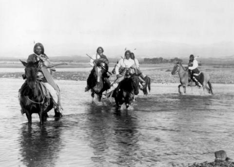
The Bowen Gulch trail lead to many of the  most productive and worked mines in the Campbell Mining District which included the Wolverine, now owned by the Grand Lake Mining and Smelting Company, E. P. Weber superintendent and the Ruby and Cross mines owned by Kentucky and Colorado Mining and Smelting  Company, John Barbee superintendent. Barbee, who lived in Grand Lake,  would go on to serve as superintendent of schools, Justice of the Peace and briefly the editor of the Grand Lake Prospector.  Barbee's partner in many endeavors was Antelope Jack Warren. Warren was as rough as Barbee was refined.  He acted as a foreman and, by one account, a bodyguard for Barbee.  The Bowen Gulch trail continued up the mountain to Bowen Pass and then descended into North Park and the Jack and Park mining districts which were organized by the end of 1880, to the settlement of Teller City.  Passable roads that could handle wagon traffic were needed and often planned but rarely built.  The high cost of building and maintaining  wagon capable roads in Middle Park was a difficult proposition for local governments and private entrepreneurs.  

The Grand County Commissioners in July of 1877 had declared the trail from Grand Lake to the mining gulches of the Rabbit Ears  Range to be a county road.  However there was little county money to pay for improvements to make the trail a road.  Private investors were reluctant to invest in wagon roads when there was the persistent  rumor that railroads were coming spawned by the numerous railroad surveys that were performed in the area.   Albert Selak, a Georgetown brewer, in August of 1878, organized a toll road that would branch off of the Georgetown, Empire, and Middle Park Wagon Road at the Ostrander Ranch on Red Dirt Hill, and proceed to Grand Lake and continue on to the Rabbit Ears Range mines and continue on into North Park and on to the Wyoming territory line.  John Barbee invested in the Middle Park Toll Bridge Company, a toll bridge company that intended  to build a bridge across the Grand River  above the confluence of Willow Creek and the Grand River.  However, this project languished, and was taken over by the county with an expenditure of $150.  

If ore wagons would need to haul ore to the nearest reduction mill which was over 60 miles in Georgetown, the toll road might have been a financial success. However, the lower grade ore from these Rabbit Ears Range mines would not yield a sufficient profit to cover the transportation and processing costs in a market where the market value of silver annually declined.  So the ore piles grew.  What was needed was a nearby reduction mill or cheaper transportation, like a railroad or a higher price for silver.  Weber had  repeatedly promised that a reduction mill was coming, but nothing was ever built.  By April of 1883 with tons of ore piled up and waiting for transport to be processed,  Weber temporarily closed the Wolverine Mine and laid off his miners.  He admitted  in June of 1883 that the ore from the Wolverine was “rather refractory” and that it would not justify shipment without local reduction.  Some hoped the closing was a strategic move by Weber to trigger a sell off of area mining properties  so that he could acquire additional mines before he built the reduction mill, but it was not to be. Weber would soon be shot dead by his political rival, John Gillis Mills.

The favorable newspaper stories of Rabbit Ears Range mining would continue, but for the informed, it had become  clear that without a major investment in improved transportation including a railroad or a major investment in a reduction mill in the area, the mining concerns were doomed to fail.  Mining claims had to be worked in order to be kept.   A minimum of $100 of labor or $500 in improvements had to be expended each year to maintain the claim or else the claim would be deemed abandoned.  Many claim holders leased their claims to miners to work for a percentage of the return.  Without the ability to sell and process the ore for a profit, there was no return.  The speculative mining investment money began to dry up and the miners and their supporting merchants began to leave.  By the end of 1886, the Middle Park mining boom had  ended. To further add to the decline,  a border dispute that arose between Larimer County and Grand County over the taxation and mineral wealth of North Park was finally decided in 1886 by the Colorado Supreme Court in favor of Larimer County.  North Park was part of Larimer County, not part of Grand County.  A lawsuit would follow so that Larimer County could recover the wrongly collected taxes of $20,000 from Grand County.  Grand County's total tax income at the time was less than $3,500 a year.

Topic: Towns

Kremmling

Kremmling started as a general mechandise store, owned by Rudolph (or Kare) Kremmling, on the ranch of Dr. Harris, located on the north bank of the Muddy River. In 1888, John and Aaron Kinsey had part of their ranch platted, calling the site Kinsey City. Kremmling moved his store across the river from the new site and the town that subsequently developed became known as Kremmling. There was a post office established at Kremmling as early as 1885 and the town was incorporated in 1904. 

The Middle Park Fair was established here in 1912. Famous Western Novelist Zane Grey spent time in Kremmling and, as a result, wrote "Mysterious Rider" in which the area is shown as a classic Western setting.

During World War II the town was the location of a prisoner of war camp where German prisoners cut ice that was shipped by rail to other locations.

The local ranching industry, the presence of the railroad and its strategic location at the confluence of the Colorado River, the Blue River, and Muddy Creek made Kremmling a natural location for a town, which still retains the “Old West“ atmosphere.

Topic: Biographies
Ute Bill Thompson, Ute Chief Piah

Ute Bill Thompson

Ute Bill Thompson, Ute Chief Piah

William Jefferson (Wm./W.J./Bill) Thompson was born on March 26, 1849 in Aurora Township, Preston County, Virginia (1863-West Virginia). The 8th child of 9 children of Wm. & Mary Anne (Wotring) Thompson. His father was a shoemaker at the Wotring Tannery and died in 1853. Mrs. Thompson left Preston County in September 1859 with her children on a covered wagon for Oregon. They arrived at St. Charles, Iowa around Christmas, settling at New Virginia, joining other relatives.

Wm. may have been taken captive by Native Americans prior to entering Colorado Territory. Via ox cart he came to Central City to start mining in 1865. He ventured into adjacent Middle Park, seeking gold in the Troublesome Valley, supplied with 1 ton of flour. He spent four years as a postal carrier from Hot Sulphur Springs to Steamboat Springs, using the Gore Pass route.

Once, the Ute Indians saw him baking biscuits and they enjoyed the “beescuts” until the flour ran out. An altercation left Wm. severely beaten. He made his way to Georgetown and the miners denied him entry, thinking he was a crazy man. One kind miner gave Wm. canvas for clothing, and took him to Idaho Springs. He recovered and was employed as a shoemaker.

Wm. re-entered Middle Park, built a hunting cabin on Muddy Creek ready for the 1867 winter. Chief Yarmonite led 40 Ute men, women and children to Wm’s cabin explaining to him that the Gore Range was covered with snow, and they were in need of food. This time Wm. refused. A rifle match was agreed upon with the loser put to death. Wm. threw his sombrero to the ground as his hair fell to his shoulders. A cry of the Ute went up as they recognized Wm. from the Troublesome. Sub-chief Piah told Wm. they could not fight a Ute brother, and braided Wm’s hair and applied face paint as they were at war with the Arapahoes. A hunt for bison began. Shooting was heard with the thought the Arapahoes arrived. Len Pollard & Sandy Mellon were chasing buffalo, which Wm. shot and killed. Len & Sandy confronted the supposed Ute with Len asking, “Where did you get Bill Thompson’s Winchester rifle?” Wm. played along until Sandy aimed his rifle on Wm. who wisely said, “Don’t over reach yourself, Sandy.” Sandy demanded, “Who in the hell are you!” Bill laughed and told them he was Bill Thompson. The sobriquet of “Ute Bill” was given. Wm. preferred his nick name over his legal name.

Ute Bill carried on as a mountaineer. Hunting and trapping, taking wild game to the Georgetown & Denver markets selling the meat, until laws prohibited the practice. A new career began of driving stagecoaches and freight wagons for the Colorado Stage Company on the Georgetown, Empire & Middle Park Wagon Road, over Berthoud Pass to Grand Lake, Hot Sulphur Springs, Gore Pass, and occasionally Steamboat Springs. One day on Cottonwood Pass, Ute Bill stopped and hiked over a ridge to find 400 Ute tipis on a meadow, imaging this could be a ranch. He homesteaded acreage, bought the home ranch from Al Honscome, and through marriage owned 4000 acres.

The T Lazy S brand was patented. The Thompson Ranch was the 1st in Middle Park allowed to receive water from the Grand (Colorado) River for irrigation. Ute Bill Creek and Ute Bill Ditch 1 & 2 were also patented. Middle Park became Grand County of February 2, 1874. Ute Bill was on the first jury, appointed Road Supervisor, and a delegate to the state Democrat Party Convention. In 1879 he owned Thompson’s Billiard Hall, bought a store from John Kinsey and expanded it into Ute Bill’s Saloon in Hot Sulphur Springs. He also had a game park of tame antelope, deer, and elk.

The “Texas Charley” incident of December 5, 1884 began at the saloon when Texas Charley forced Ute Bill to hand over his prized Winchester rifle. His future father in law played a role in the coroner’s inquest. January 30, 1889 The Middle Park Times listed the sale of the saloon to Billy Pharo with the quote of, “We don’t reach Denver yet but were getting there you see.” An ad in Hot Sulphur Springs complemented the sale.

On December 25, 1893 Ute Bill Tompson was united in marriage to Mabel Smith. The first recorded marriage in the Hot Sulphur Springs Congregational Community Church. Mabel was the eldest daughter of Preston Henry & the late Mary Smith. Ute Bill & Mabel had 6 children Fred Charles, William Preston, John Henry, Otto Woodring, Marion Loman, and Mary Ellen. W.J. Thompson advertised in the Grand County News, January 8, 1904 Sulphur Springs and Kremmling Stage Carries Mail & Express Stage Fare, One Way $1.50 Round Trip, $2.75 In 1903-1904 The Denver, Northwestern & Pacific Railroad (D.N.P.R.R.) was buying ranchers land. Ute Bill refused to sell his for $500 and lost on appeal in District Court receiving $300. However, it was “matter of principal” that he won on, as E.A. Meredith the railroad surveyor diverted the rail bed to be placed on the other side of the Colorado River below the cliffs.

As the excursion trains were passing by the Thompson Ranch on their way to the Railroad Days celebration in Hot Sulphur Springs on September 15, 1905 Ute Bill danced with joy knowing that the “Iron Horse” was NOT allowed to disturb the sacred tipi grounds of the Utes! Ute Bill forgot his grievances and presided over a vast fish fry and barbeque of elk on July 4, 1906. The last cattle trail drive out of Grand County was conducted by 2 aged pioneers, Sam Martin of Muddy Creek, and Ute Bill in 1923. Another matter of principal to avoid paying railroad costs, but of great sentimental value of all the past cattle trail drives. Ute Bill & Mabel both entered St. Luke’s Hospital in Denver for surgery in late February 1926. Ute Bill’s first surgery went well, the second did not. Mabel was not able to be with him as she was recovering from her own.

Many Middle Park pioneers visited them to wish them well. Old friend Charles Nines Sr. who retired in Denver from Pine Ridge Agency, South Dakota a Sioux language interpreter and Trading Post owner was with Ute Bill when he passed away on March 19, 1926, one week shy of his 77th birthday. William Jefferson “Ute Bill” Thompson is buried in the Hot Sulphur Springs Cemetery off of Cottonwood Pass, Looking at Elk Mountain and the original homestead.

This article is dedicated to Lorna Marie Gowen; September 6, 1954-April 14, 2006

Topic: Libraries

Libraries

In 1938, Grand County decided to establish a library to act as a central reservoir of knowledge for its citizens. The community realized that few people can purchase all of the books and other materials which they may need, and so they agreed to pool their money in the library to build its central collection. At the same time they wanted to be sure that their interests would always be represented in the operations of the library, and so they formed a board of trustees from among themselves.

At about the same time, the federated women's clubs in Granby and Grand Lake, for the same reasons, set up lending libraries in those two communities. Run by the clubs for many years, both were eventually incorporated into the County Library. In 1994, the Committee to Protect the Library was established to petition the Board of Commissioners to increase funding for the library to set aside a completely separate library fund, which would be administered as a Library District. The voters approved the move on November 8, 1994, and Grand County Library District was formed on January 1, 1995. Today, the library still serves that same basic function for the community as well as new roles acquired in the intervening years.

My Granby, Little Old Log Church

Contributed by Vera "Stathos" Shay, Kremmling...Granby resident 1930-1945

From what I hear

It is very near

To be torn away

The little church of my childhood day

The most beautiful to see

That can ever be

Inside and out

Without a doubt

Built of log so fine

In the style of old time

In my own little chair

Every Sunday I was there

The chime of its bell

For miles around

Heard its wonderful sound

For a while our school

We didn't fit

So in our church were classes

For a bit

Beside our church on the hill

We sledded for a thrill

That poor little church

They moved it around

All over town

Proudly it's hung together

In all kinds of weather

Every time I go to Granby town

I look around to find

And have a look

At my log church for my eyes'

Memory book

Now they say it's got to go

Pray it won't be so

All of you Granby folk

Louder you should have spoke

To save that church with its

Memories and history

For there could never be

Anything that would compare

Built or put there

With my magnificent, beautiful

Childhood Granby log church

Find it in your hearts

To never let it be torn apart.


April 2005


Barger Gulch - Archaelogical site

The prospect of discovering a remnant from a 10,000-year-old stone age society that inhabited Colorado's Middle Park so long ago seemed remote at best - while the suggestion that a prized Folsom point could somehow materialize before our very eyes appeared all but impossible.  For one thing, it was the last day of excavating for the summer at the Barger Gulch archaeological site and the ten member scientific team would soon be packing up and heading back to their ivory towers at the University of Wyoming and the University of Arizona.

Barger Gulch is a desolate spot that the federal Bureau of Land Management (BLM) oversees. It is hard, parched dirt dabbled with sagebrush as far as your eyes can see across the flat valley - a haven for all manner of bugs and other forms of native wildlife. In winter, the place turns to the opposite extreme as temperatures plunge to minus 40-degrees and howling winds whip up ghostly images of snow that swirl eerily across the land. This is Middle Park, a high mountain basin with roughly the same geo-political boundaries as Grand County. It encompasses some 1,100 square miles of unforgiving territory flanked on three sides by the formidable wall of the Continental Divide and its terrain soars high over the Great Plains into the thin, alpine air up to altitudes of 13,000 feet above sea level. What would induce these primitive Americans to trek all the way up here without so much as horses for transportation? How would they have survived the brutal winters with only primitive tools and clothing?  And why in the world would they ever want to settle in such a barren, god-forsaken place as Barger Gulch? 

This site could well prove to be one of the most significant archaeological discoveries of its kind in North America, according to BLM officials who oversee the project here. In just three years of work in a relatively small excavation area, investigators unearthed more than 18,000 artifacts - a staggering number ten times that discovered at typical Folsom sites. And this is only one of four sites in the same vicinity.  In addition to Barger Gulch and Upper Twin Mountain, discoveries include the Jerry Craig and Yarmony Pit House sites. Most of these were occupied by peoples described by archaeologists as Paleo-Indians, a catchall term for ancient humans that inhabited North America; Yarmony Pit House post dated Paleo-Indians by about 3,000 years.

But long before Paleo-Indians ever set foot on the Continent, Middle Park was a prehistoric menagerie; 20-million years ago, it was the stomping grounds for prehistoric rhinoceros, three-toed horses, camels, giant beavers, and even small horses. Creatures known as oreodonts also romped across the mountainous terrain. These vegetarians, ranging in size from small dogs to large pigs, fed on grasses and green, leafy plants. In fact, the skull of one of these animals was discovered recently in the vicinity of Barger Gulch. These long extinct, hoofed animals resembled sheep, but were actually closer to camels, and were common in the western U.S. This latest discovery is remarkably well preserved; while the bones have turned to stone, the smooth, hard enamel that encased the animal's teeth is still intact. 

Humans arrived in North America much later - about 12,000 years ago - as the last Ice Age of the Pleistocene Epoch made its exit. These first Americans crossed a land bridge from Siberia to Alaska and began populating the entire Continent; experts believe it is possible they also arrived on boats following the Continental Shelf into North America. Folsom people are best known as nomadic, big game hunters who chiseled out their spear points and finished them off with a distinctive, artistic flourish - a unique groove, or flute, that runs lengthwise along the face that has become the symbol of this Paleo-Indian culture. They honed the tips of these primitive weapons surprisingly sharp for killing frenzies that were necessarily up close and personal: they herded their prey into traps before launching their spears - and archaeologists suspect there was just such a bison ambush site near Barger Gulch. The quarry just over the rise is a gold mine of raw materials, including fine-grained Kremmling chert and abundant Windy Ridge quartzite, which provided a never-ending supply of top grade stone. "It makes sense," explains Todd Surovell. "You would want to camp where you could get as many raw materials as possible within a short distance. That's where you're going to park yourself for awhile."

The bulk of these tools originated with local material, but investigators have found some 200  "exotic" items noticeably out of place at Barger Gulch. One is a distinctive piece of yellow, petrified wood that came from 93 miles away as the crow flies, near the town of Castle Rock on the Colorado plains. Another is a large biface that was brought up from the Arkansas Valley, some 60 miles south. "They worked on it up here in one place and turned it into two, maybe three projectile points," notes Surovell. "One of them broke during manufacture and we have two pieces that fit exactly together."

Fitting these and thousands of other pieces together is what archaeologists do when they get back to the lab. The process begins on site where investigators photograph each find and record its exact location within the excavation block. This gives the team a visual reference to help recognize activity patterns - a way to connect the dots of Folsom society.  But the specks come to an abrupt stop, as if they suddenly run into a solid wall. "If we could figure out that this represented the wall of a structure, that would be really special," he explains. "Nobody's even been able to do that before in a site of this age in North America." Just then, a graduate student pops his head inside the door. "You want to be a camera man?" he asks Surrovell. "What do you got?" "A Folsom point," he replies with a broad grin. We rush over to the site where Waguespack has dug a narrow shaft down the north wall of the excavation pit and hit pay dirt - a Folsom point that remains half buried in the stratum of rich soil.

Grand Lake's First Fireboat

During the summer of 1960, Jeff E. Fuller and Don Drake formed Mountain Services Inc. to offer Grand Lake shore owners protection by patrolling the properties.  In May of 1961, Don Drake promoted the idea of a fireboat and with donations, a 1960 18 foot Buehler Turbocraft Jet 56 was purchased and equipped to fight fires. Don tested the water jet and found that it would pump enough water to reach the fourth story of the five story-14 bedroom Oscar Malo home. 

Ironically, on September 10, 1961, that very home caught on fire.  The home was completely engulfed by the time Don got the fireboat to the location but, with the help of Elmer Badger and Jerry Gruber, they concentrated on the 4-slip boathouse.  The heat was so intense it melted the plastic trim on the fireboat but the boathouse was saved and still stands today.


Topic: Leisure Time

Leisure Time

Of all the leisure time activities available to the pioneers, dancing was the favorite. Dances were held in grand hotels that remained from the mining boom, such as the Fairview House and The Garrison House in Grand Lake. Quadrilles, a type of square dance, were popular at the time. A fiddler would provide the music and serve as the caller. These parties would start in the evening and last all night.

The formidable temperatures and great traveling distances were incentive for getting the most out of every gathering. Winter Sports have also always been a popular pastime. Skiing was introduced to the region during the winter of 1883. Snowshoeing and sleigh rides were also enjoyed. 1882 officially brought the arts to the Grand Lake area when the Dramatic Society was organized. A production of the well-known comedy "Our Boys" was the premiere performance.

Topic: Railroads

Railroads

Construction on the railroad line from Denver to Grand County began in July 1902.

The project, called the Moffat road (officially the Denver, Northwestern & Pacific), was the seemingly impossible dream of David H. Moffat, who spent much of his personal fortune building the tracks over the Continental Divide.

The rails pushed higher and higher up the mountains until they reached a station named Corona, meaning the crown of the continent.

Corona was the highest point in the world with a standard gauge railroad and the journey from Denver in the winter was perilous at best.

Huge snowplows were required on either side of the Divide to keep the tracks clear.

Eventually, in the late 1920s, a tunnel was dug through the range, eliminating 22.84 miles of track and the breathtaking journey over Rollins Pass.

The railroad reached Granby and Hot Sulphur Springs in 1905 and Kremmling in 1906, and played a significant role in building the population of Grand County.

In 1900 the total resident population of Grand County was only 741, but grew to 1,862 in 1910.

Time Line