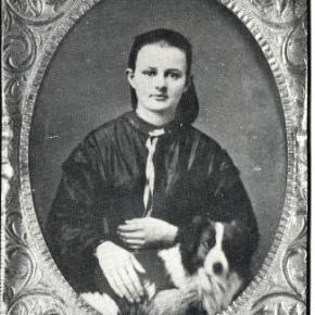
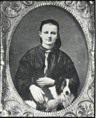
January, 1911. Five years ago they were teenagers in Torsby, Sweden, oblivious to the sweeping changes that history and hope would bring to their lives. Now they’re in a mountain valley halfway around the world from their Scandinavian homeland, marveling at the tiny bundle of flesh and spirit who has just joined their family. It’s the coldest week of the year in one of the coldest spots in America, but there’s a fire crackling in the woodstove, and their hearts are warm with love for each other and their firstborn child. For the next few days, a parade of fellow Swedes stop by to pay their respects to the newest resident of the town of Fraser: Elsie Josephine Goranson.
February, 1918. It’s barely dawn, and a blizzard is howling across the valley, piling snow against the sturdy wooden house. George Goranson puts on his boots and woolen overcoat and trudges towards the barn. There are cows to milk and horses to feed. There are no days off. Meanwhile, in the house, 7-year old Elsie stokes the perpetual fire in the cook stove, while her mother grinds the beans for a second pot of strong coffee. Later they will make sour cream cookies. Her younger brother Hill is sick in bed with influenza. He will survive. Many others will not.
March, 1925. The logging camps are humming, the Moffat Tunnel is under construction, and the valley is brimming with workers and their hard earned pay. Fraser merchants and boarding houses are doing a brisk business, as are the local bootleggers. Elsie is waiting tables at the “Victory Café”, named for its proximity to the new coast-to-coast “Victory Highway” that passes through town, and each morning she serves breakfast to the nice looking (if scantily clad) girls from the corner house of ill repute. Soon the local vigilante committee will force these ladies of the night to leave town, but for now it’s business as usual, and Fraser is hopping. In fact, “Russell’s Riot Squad” is playing at a dance tonight at the Thomas Hotel.
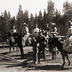
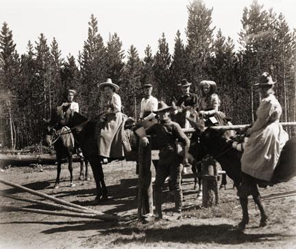
April, 1927. Sleigh bells jangle as a team of horses pulls four young couples down valley to a dance in Tabernash, the most happening town in the county. The roundhouse is there, as are the wages of engineers and brakemen who guide the trains over Rollins Pass. There is even a movie house, where Elsie saw her first moving picture, “Jackie Coogan”. As the sleigh glides across the moonlit snow, Elsie feels a mix of excitement and nervousness. This is her first date with Chuck Clayton, a hardworking man from Oklahoma. Chuck is handsome as he steals glances through the cold night air, but her Dad doesn’t approve of his drinking and gambling. Other dates will follow: motor trips in a Model A Roadster to Garden of the Gods, picnics in Rocky Mountain National Park, and plenty of dancing. “I’ll never marry you,” she tells him everyday. “Yes you will,” he insists.
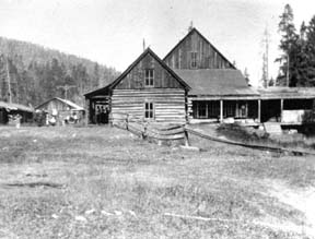
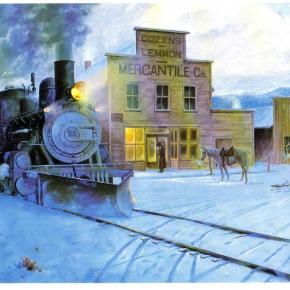
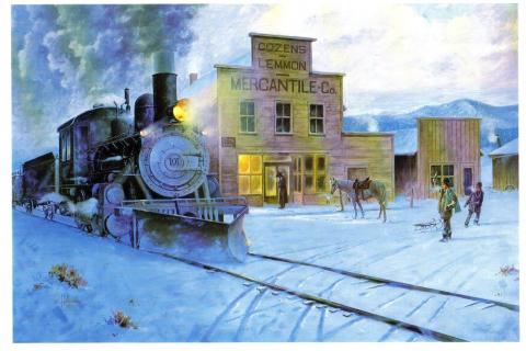
May, 1933. One child underfoot and another in the belly, and Elsie Clayton is tired. Chuck bought a house for 20 dollars and used the lumber to build a hamburger stand (soon café and bar) right along the newly paved Highway 40, the main route from Denver to San Francisco. For the next 38 years, their lives will be a blur of ham and eggs, New Year’s Eve parties, and a long medley of songs on the jukebox. The school bus will stop there, as will the “Steamboat Stagecoach” bus line, and three generations of folks looking for a home cooked meal or glass of beer. There will be marathon cribbage games, war stories, and “Friday Night Fights” watched live on the first television in town. Despite the booze and boxing, Clayton’s Café and Bar will be known as a family establishment, especially compared to the “Fraser Bar”, a.k.a. the “Bloody Bucket”, where a love triangle will one day lead to murder.
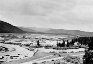
June, 1945. It’s 4:30 a.m. Elsie tiptoes downstairs and into the café. She brews coffee, warms up the grill, then sits and enjoys a rare moment of relaxation before her workday begins. In the distance, a steam locomotive blows its whistle as it chugs towards town. Before her life is over, nearly a half million trains will pass through Fraser, an endless stream of rumbling horsepower that conjures up different images as the years pass by: trains bringing home soldiers from the Great War; trains loading up ranchers’ fattened cattle in the fall; trains delivering newspapers and mail; trains colliding head on in the Fraser flats; a train’s whistle frantically blowing to alert sleeping townspeople to a midnight fire; streamlined diesel trains ushering in a new era, and countless coal trains, hauling the carbon wealth of Western Colorado to the factories and power plants of far off cities.
July, 1950. Summer’s here, and all are invited to the town picnic down by the Fraser River. Aging Swedish bachelors will be there, sipping steel cans of Coors and swapping stories of crosscut saws and the rowdy “Lapland” logging camps up St. Louis Creek. Young men will dance with young women. Young men will start fistfights with other young men. Navajo railroad workers will perform a rain dance. Children will play Audie Murphy in the riverside willows and drink Coca Cola from thick glass bottles. Meanwhile, the deluxe brick barbecue will sizzle as Elsie spreads mayonnaise on buns and Chuck flips burgers and jokes with friends.
August, 1953. President Dwight D. Eisenhower is coming to town to fish and relax. “We come Ike” banners wave in the breeze as the motorcade turns off Highway 40 and onto the dusty gravel of Main Street. Cheers erupt and flashbulbs pop as a smiling Ike emerges from his limo and waves to the crowd of 300. It is the biggest day in Fraser history, but Elsie sees none of it, for even as her husband, the Mayor of Fraser, is welcoming the leader of the free world to town, she’s in the cafe tending to the crush of reporters and tourists who’ve come to see an American hero. Tomorrow, after the excitement dies down, she’ll personally deliver two of her homemade pies to the President, who will rave about the perfect crust.
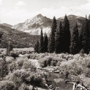
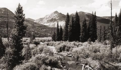
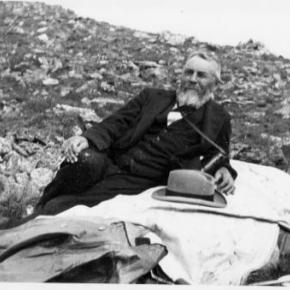
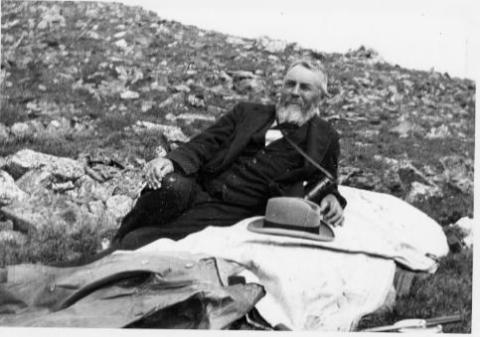
September, 1971. Retired. Chuck and Elsie sit on the porch of their new home on the edge of town, watching cows graze just beyond the fence, and taking in the unobstructed view of Byers Peak. Labor Day has come and gone, and now town is peaceful, the highway quiet. Freed from the busy schedule she’s kept for decades, Elsie will soon embark on a reading frenzy and will begin to keep a modest journal of the days’ events: A Grandchild born, an illness in the family, an exceptionally cold morning. Chuck busies himself planting trees, tending a garden, and mowing his spacious lawn. Tomorrow they will pack a picnic lunch and drive the Denver Water Board roads in search of raspberry bushes.
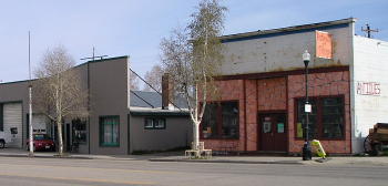
October, 1978. Today is Chuck and Elsie’s 50th wedding anniversary. It’s a perfect day, sunny and warm, Indian summer if there ever was such a thing. The mountains shimmer beneath a blanket of fresh snow. Hay meadows glow golden beneath the cloudless sky. Family and friends gather in the yard for photos before heading to the Crooked Creek Saloon, formerly Clayton’s Cafe and Bar, for a long afternoon of celebration and reminiscing.
November, 1999. After 71 years of marriage, Chuck has passed on, and Elsie is suddenly alone. She sits at her dining room table, peering out the frost fringed window at the town she was born in, the town she has lived in her whole life. The ridge she once sledded down is covered with condominiums. The willowed wetland where her brother trapped muskrats has become a large parking lot. Her father’s horse pasture is now a shopping center. Everything has changed, yet memories remain, taking on a life of their own. Horses still pull wagonloads of hay up the highway. Loggers come in from the woods every Saturday night for revelry and roulette. A young couple poses for a photo in front of their new cafe. A sharp axe splits a chunk of pine. Life goes on.
December, 2004. Christmas Eve. There is plenty of food, including the homemade potato sausage that’s been served at every family Christmas for centuries, and plenty of gifts stacked beneath the brightly lit tree. Elsie sits at the head of the table, quietly marveling at this clan she has wrought. Her surviving children are here, as are her grandchildren, some of who have grandchildren of their own. Five generations of family pour gravy on potatoes and crack jokes. As she looks at their faces, she remembers her own parents, her grandparents, and her husband. Everyone is here. In a few minutes, in a ritual as old as Elsie can remember, her great-great grandkids will hand out presents, and the house will resound with laughter.
Winner of the “One Grand Essay” contest 2005