Transcribed by Dan Nolan
In 1880, Jacob Pettingell moved to Grand County at the age of 20. He spent the rest of his life here serving as postmaster, notary public, insurance agent, abstracter, legal counsel, justice of the peace and county clerk. The following is part of an interview conducted by his son-in-law Victor Frey in 1931.
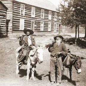
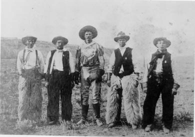
Company of soldiers
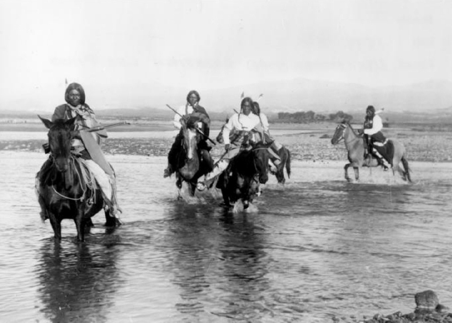
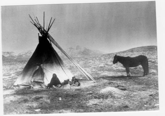
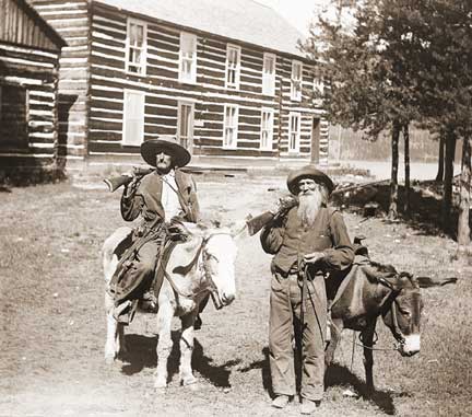
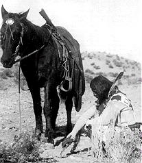
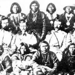
"When I came here, there was a company of U.S. soldiers camped at the old Barney Day ranch; this ranch is a few miles below Parshall, Colo. I think they left that fall. The Meeker Indian Massacre was in ‘79 and these soldiers were sent here in anticipation of further trouble. In addition, the government sent Springfield rifles to all settlers with ammunition. We were curious about these new guns and went up on the hill to try them out; before we realized it, we had used up about all the ammunition. At this time some of the Utes came to Sulphur and vicinity to hunt and fish, and to trade.
Fish & game
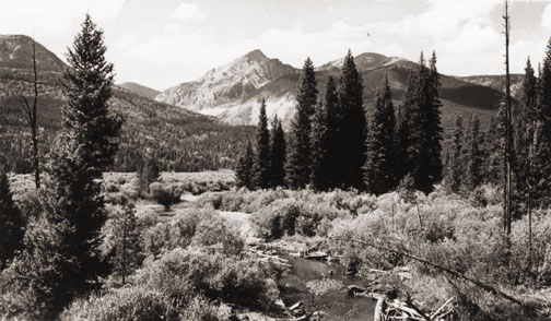
Both fish and game were very plentiful in the early ‘80s. On account of severe weather, the settlers usually laid in their winter’s supply of grub early in the fall. At this time they would take several loads of game out to Empire and Georgetown, trading same for grub and provisions. C. H. Hook, who ran the stage, would pay 25 cents per pound for fish, taking it out to market and selling it for 50 cents per pound. Some persons made as high as $15 per day by fishing. There were no state game laws then.
Town of Kremmling
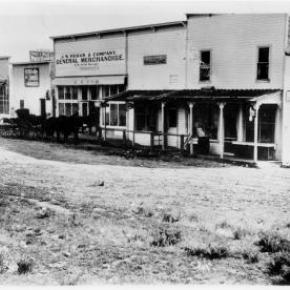
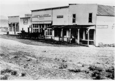
Around 1880 or 1881, there was one little store and a building or two, located across the River (Muddy Cr.). This store belonged to a man named Kremmling. About 1891, John Kinsey laid out the town of Kinsey City. Later, Kremmling moved his store and post office across the river to this townsite and the name was changed to Kremmling, Colo. There were some ranches in this locality and some of the ranchers names were Bill Kindell, Tracey Tyler, Jim Hetherley, and Dr. Hillery Harris.
Williams Fork
There was only about one ranch here owned by Joe Coberley. There was, of course, no town of Parshall.
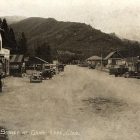
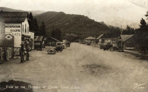
Town of Grand Lake
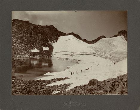
Old man Wescott lived here; a family by name of John Shafer and Ike Burton. Hot Sulphur Springs had been the county seat and headquarters for supplies for all the mines up Bowen Gulch. Grand County included all of Jackson County at that time. About 1881, when the mining boom commenced up Bowen Gulch where the towns of Lulu, Gaskill and Teller City sprang up, they decided to move the county seat to Grand Lake since this was much closer. The county seat remained there until 1888 when it was moved back to Hot Sulphur Springs. The old town of Gaskill was located at the mouth of Bowen Gulch; Lulu was about three miles above Squeaky Bob’s ranch, now the Phantom Valley Ranch; while Teller City was on the other side of the ridge in North Park.
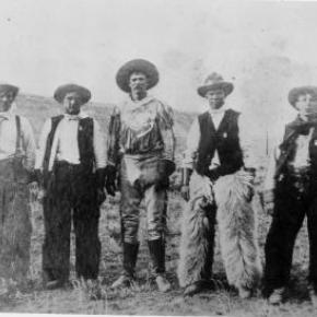
Sandy Campbell and Jim Bowen were the first prospectors. The price of silver was high, and most of these mines were for silver. These mining towns sprang up around 1880-81. I originally came west to spend about three months in Middle Park, hunting and fishing, but when the mining boom struck this locality, I became interested. I grubstaked two men; later I took up a claim above the old Wolverine mine for silver and mined for 7 or 8 years. It was a paying proposition while silver was up in price but on account of the long freight haul and drop in price, the mine was later abandoned. Estimated population during boom days: Gaskill 150; Lulu 200; Teller City from 1,200 to 1,500. It was claimed that Teller City had 27 saloons. My personal recollections are that they might have had as many as 20 at one time.
The Famous Foot Race
About once a month, the miners would all come down to Grand Lake for celebrations. There is no use to say that considerable liquor was disposed of. During the winter of 1882 a man named Sharp had been working at the Wolverine mine; he had beat them all at foot racing early that spring when the snow went off; these miners thought they had a world beater at foot racing. While down at Grand Lake on a monthly celebration, they were all bragging about this man Sharp. At this time Harley McCoy was living at Grand Lake and he spoke up and said he had a man named Montgomery who could beat Sharp in a foot race. Sharp went into training at Gaskill; Montgomery at Grand Lake. Bets were originally around $100 and increased to nearly $8,000 on this proposed foot race. The race was pulled off July 4 on the main street of Teller City. Montgomery won the race by about 7 feet and Sharp kept right on running to the end of Main Street, then out into the timber. There was a horse tied there for him and a man waiting to divide up the swag—Sharp was never seen again. The gang at the Wolverine mine took their defeat like good sports, the other bunch paying for all they could eat and drink for a number of days.
The Mock Trial
Usually there was quite a bit of fun and excitement during the mining boom, but once in a while the boys would get a little lonesome on Sundays. This was one of those particular Sundays when they craved a little excitement. There was a tourist and his party who had come in from around Boulder to fish and hunt. The boys confided in the judge and they arrested this man by an old location certificate and he was charged with horse stealing (a pretty serious offense in those days).
They held open court and the house was packed, not only with local people, but about 20 tourists were present. The defense attorney spent much of his time describing the wonderful scenery around Grand Lake and Colorado in general. The prosecuting attorney prosecuted hard and produced a witness who claimed he actually recognized the accused man and stated there was no doubt but what he was the guilty party. About the time the jury was to have the case, it was framed that I should commence a heated argument across the room with Gil Martin. When I jumped up and called Martin a liar, he opened fire with blank cartridges across the room: I commenced returning the fire. There was a great commotion, people actually jumping out thru the windows and a wild scramble thru the doors. The frightened defendant escaped into the timber. It rained all that afternoon. We later succeeded in convincing his partner that it was a joke, so he finally brought the defendant in that night, dripping wet and still badly frightened. They all pulled out of Grand Lake before morning.
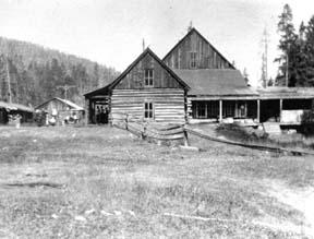
First Courthouse
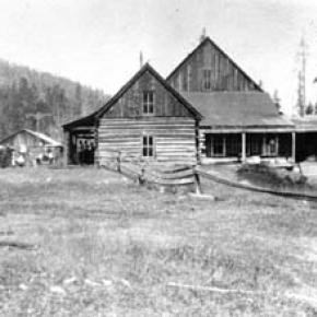
This was a small frame building about 12’ x 14’, one room. It has been moved and is now one of the cabins belonging to the Corner Cupboard. The Commissioners then let a contract to Tom Johnston to build a new court house with jail behind, as quickly as possible. There was a sawmill at Grand Lake and plenty of lumber. Johnston put on a large crew; they started in one morning; the next day they moved into the new court house building. Johnston put up this building in a little over one day, sufficiently for them to move in and use it. This building is now John Zick’s restaurant building.
The Duel
The commissioners were Barney Day, Webber and Mills, an attorney from Teller City. The sheriff was Chas. Royer and under-sheriff Bill Redman. Cap Dean was the clerk pro-tem. Mills and Webber had been close friends but had a falling out over the Republican State Convention the year before and since then had become bitter enemies. It is reported that there had been differences between Barney Day and the sheriff and under-sheriff.
The commissioners met at Grand Lake on July 3, 1883; they all agreed to adjourn until July 4 because Mills had an important case in court that day. Mills went to court but Day and Webber went to the Nickerson House and held a commissioners meeting there. At this meeting they raised the amount of bonds for county officers, making same so high they knew none could comply. As I recall, the sheriff’s bond was around $50,000. This caused the sheriff and under-sheriff to throw in with Mills. The next day was Fourth of July and many people were shooting out into the lake, there being considerable noise. Cap Dean, Barney Day and Webber left the Young Hotel (where I was also stopping) and started down town. No one knew just what did happen or who fired the first shot. There were some extra shots in that direction: someone thought they saw a man fall to the ground; we all ran down to the spot which was about 500 yards from the Young Hotel.
Mills was lying in the road; Barney Day part way in the water; both Dean and Webber had been carried into the hotel. Day and Mills died instantly, while Webber lived until around 2 A.M. the next morning. I sat by his bedside. Cap Dean lived 4 or 5 days although he was shot to pieces. I sat beside Dean’s bed and asked him who did the shooting and he replied that he did not care to say. Later, he described one tall man with a handkerchief over his face who attacked him and it fit the description of Bill Redman. It was thought that Mills opened up the attack by firing his rifle. The sheriff and undersheriff both escaped. They first came to Sulphur and tried to organize a posse but the people seemed to mistrust them and they left the country. Later, Chas. Royer, the sheriff, committed suicide. Bill Redman had been a great pal of Royer’s and when he picked up a paper reading about Royer, he also committed suicide. Therefore, this cost the lives of 6 men.
Firsts in Grand County:
The First Newspaper
The Middle Park Times was founded in 1881 at Grand Lake by John Smart and George Bailey. They called it the Grand Lake Prospector. It was moved to Sulphur in 1889 and called the Grand County Prospector. One day, in 1890, I walked into the newspaper office and was talking to Willard Minor, then running the paper. I told him that I thought Grand County Prospector was a h-l of a name for a county newspaper and suggested they change this name to “Middle Park Times.” They took this action and the paper has been known by this name from then on. About 1897, I bought out this paper and edited it for three years.
The First Auto
It was a Thomas Flyer driven from Denver to the Grand Hotel at Sulphur by Harold Brinker, who later on became a famous race driver. This was in 1905. It caused no end of excitement in our small town. Brinker kindly took several of the young people for a ride out to the old horse race track. My daughter, now Mrs. V. H. Frey, was one of the persons and she often mentions the thrill that first auto ride gave her. The car was driven in over the old Berthoud Pass road.
The First Train
In the fall of 1905 the tracks were laid as far as Hot Sulphur Springs and at this time the first train came in two sections; there were about 1,000 people with a band. The community gave a barbecue and fish fry.
The Grand Hotel
This was contracted for by my friend Mr. Chapin and myself, and finished in the year 1905. I ran same for a number of years. The first Forest Service office was located in this building and J. C. Stahl was the Supervisor. Later the forest office was moved to Fraser; it was there a short time, then moved back to Hot Sulphur Springs.
Conclusion
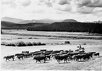
From May 10, 1880 to the present time, February 7, 1931 I have watched the following towns spring up in Grand County: West Portal, Fraser, Tabernash, Granby, Grand Lake, Parshall, and Kremmling. The Williams Fork locality has also settled up. The old mining towns of Gaskill, Lulu and Teller City came, and then died away. Ranches have developed over most of the county. Stock raising, both sheep and cattle, has become a fixed industry. The county, during this time, has shipped out an enormous amount of timber. Like elsewhere, the auto has developed rapidly and we have many miles of splendid mountain pass roads. There is an abundance of fish and game, although not so plentiful as the early days. Every town in Grand County is growing slowly but surely, with the possible exception of one railroad town. Grand County is well off financially and it has the very brightest prospects for future prosperity.