"One Grand Essay" contest 2005
It is a strange feeling one gets as you realize you are breathing your last breaths. You start to remember some of the wonderful and not so wonderful things that have happened in your life. As I am lying on this cold ground in Phoenix, Arizona instead of my beloved land in Dexter Colorado, I start to think of my family. I miss my sweet and beautiful wife Anna whom I have had to live without for so long and realize suddenly that is has been 20 lonely years. We had an interesting life together: she and I and our 10 children.
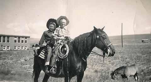
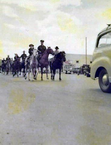
I remember many years ago before I met Anna, when I was only 11 on the day of April 27, 1873. My family had decided to head out of Missouri with our covered wagon. It was pulled by mules and oxen and filled with all of our precious possessions, along with boxes of shot and black powder for muzzle-loading guns. Potatoes, flour, beans, coffee, salt pork, fish hooks, and of course my dog Ranger accompanied us. My father and mother, Walker Barron and Mary, my younger brothers John H., Walker Emery and my little sister Maud who was only 3 at the time were all ready as we started out early in the morning with my Uncle James Allen "Polk" and his family. We traveled until we met up with a train of about 100 other wagons heading west in search of a new home, and possibly some gold.
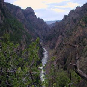
We had traversed across the country over the plains, streams and mountain ranges from Johnson Country Missouri to Denver, Colorado arriving on June 5th where we made camp the first night near Sloan's Lake. Then we continued moving west until my father and uncle found work at a sawmill between Golden and Idaho Springs in the town of Beaverbrook.
With the completion of the Berthoud Pass stagecoach road in 1874, my father and some friends went over the Gore Range to explore Middle Park. Then two years later on July 9, 1876, our family moved to Middle Park just two weeks after General Custer's defeat on the Little Bighorn River in Montana.
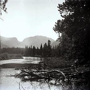
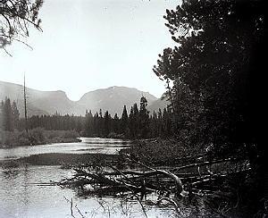
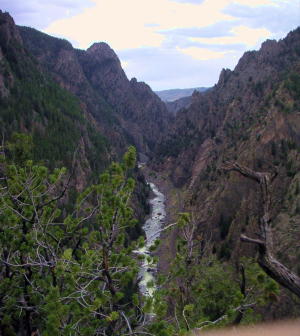
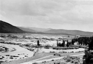
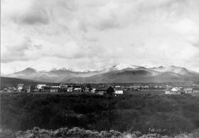
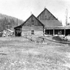
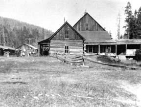
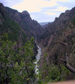
My father decided to claim squatter's rights by building a one room cabin on the bank of the Grand River near Kremmling a mere two years before we had the Ute Indian scare. After the scare my mother wanted to move to Hot Sulphur Springs where there was and established school and more people. It was there that my father purchased the Springs Hotel renaming it the McQueary House. Shortly after some success with the hotel, my father purchased a home along the Willow Creek near Windy Gap.
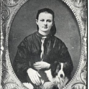
I remember the day I had met my love, Anna Rebecca Kemmerer. She was so sweet that we married quickly on May 6 1884. In February of 1885 my first son Frederick was born followed by Clayton Henry two year later, and Harry Senator two years after that. However, Harry was not to be with us long and we lost him in August of 1892. Nevertheless, life goes on we were blessed with another son Ralph Grant who was born in August of 1892, followed by Myrtle Grace in 1894 and Chester William in 1896.
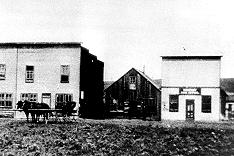
With our ever-increasing family, Anna and I purchased the 160-acre Frank Adam's homestead adjoining my father's home on Willow Creek where we would have room to grow and my children could enjoy the company of my parents. Just before Chester was born, I applied for a coveted appointment as postmaster and wanted to locate a post office on Gold Run, naming it the "Willows Post Office." On September 25, 1896, the US postal department did let us open a post but decided but renamed it Dexter instead. We had expected a mining boom along the Willow Creek and thought a town would be built around our post office and homes.
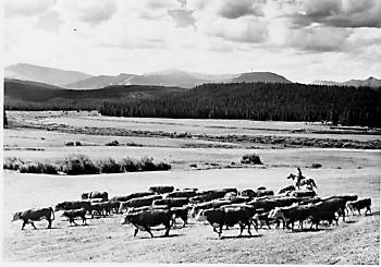
I remember when Ike Alden had found gold along the creek and sent it down to Georgetown to have it assayed. He found out that it was estimated to be worth about $1,700.00 to the ton, which is where the name Gold Run came from. But our peaceful valley did not prosper as we had hoped and the town was never built so we turned to ranching instead. We had four more children Gertrude Mildred, Robert Melvin, Mary Frances and lastly Ada Rebecca who was born in 1904.
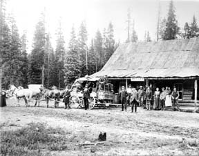
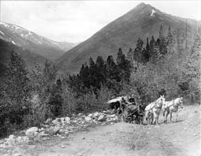
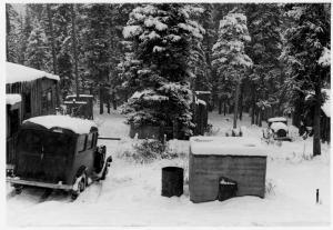
During those years in my blacksmiths shop, I made wagons, repaired some of my neighbor's equipment and farm machinery. We had thought that a stagecoach line would bring the mail on a regular basis but it was really just a freight line. Anyone who wanted to could ride it and some of the passengers who used it were welcome to stay for a meal at the Dexter Ranch. There were two cabins across the road, which used for guest or tourists, mostly fisherman, but a place for anyone to sleep.
In 1905, the first train reached Granby and many of the ranchers of North Park would travel to the depot via Dexter and stay, purchase hay and join us for some meals. I was somewhat handy with carpentry and had built a large round table, which was a little unusual but very practical. I had fashioned it with pegs around a lazy Susan. I remember now at supper one time a guest of ours was helping himself to some food from a dish when someone asked him what the matter was. He was holding the dish in his hand and looked befuddled. He answered, "I forgot where I got this," We all laughed at his little dilemma. It makes me smile now thinking how wonderful the food was and how lovely my Anna looked when she laughed.
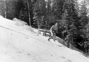
We built a schoolhouse made out of log in Dexter. Using our horses we created a log skid trail, dragging log after log until we had enough for a 16, or was it 18 by 20 foot building. Years later the children would still climb the skid trail with their skis and ski down during their recess.
Sometimes we would have dances at the schoolhouse and we would push all of the desks back against the wall and play old-time pieces. I liked to play my fiddle with a few of my other friends. Roy Curtis, and Andy Eairheart and sometimes my cousin Dick would call out square dances.
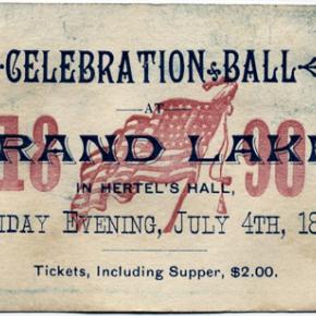
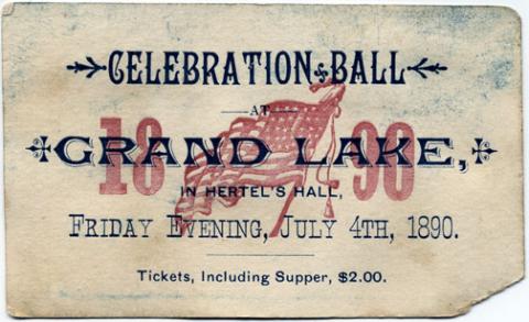
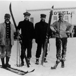
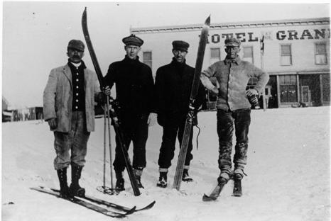
I also remember what a great time everyone would have as they danced when we played at the Grand County Winter Sports Carnival Grand Ball. Although the Carnival was held in Hot Sulphur Springs the last two days of December, we all headed over to participate and watch the skating, tobogganing and skiing. One year my son Robert who was a member of the Commercial Club went to Denver to represent us in the National Ski Association meet there and the following year he went to Steamboat.
As time went, on my daughter, Myrtle Grace met and married Charles Everhart and I had my first granddaughter Violet. I remember that as Violet became older she loved to play in my Blacksmith shop. I told her "If you play with my tools put them back where you got them". She was an obedient child and did as I asked so I never minded her coming in and playing with the bellows. She would get some scrap iron and place it in the fire until it was red-hot and then put it into the tempering barrel. She just loved to hear that sizzling sound. It makes me smile to think about that now as I start to shiver in this darkness and evening begins to approach.
I am struggling to stay awake hoping someone will help me get out of this place as memories of my other granddaughter Gertrude Jane come to my mind. She did not like the name Gertrude Jane because her mothers name was Gertrude Mildred, and everyone called her mother Gertie. She did not want to be called Gertie too; she preferred to be called by her middle name Jane instead. She would tell me what an interesting man I was and that she loved my blue eyes.
My little Jane is 17 years old already. But I guess I won't be celebrating her eighteenth birthday or the birthdays of any of other grandchildren now. I feel myself falling deeper and deeper into darkness and know that my Anna is waiting for me. I see a light now and my blue eyes are starting to tear. As I walk towards the light I see my Anna is holding out her had for me to grasp. How wonderful my life has been and how I have enjoyed my journey. Now it is time for us to go home.


 ,
,  ,
,