
| Eduard Berthoud |
Eduard Berthoud
Born in Geneva, Switzerland, Eduard Louis Berthoud (pronounced "Bare-too") came to the United States with his parents in 1830. His childhood was spent in New York State along the Mohawk River. After completing a degree in engineering at Union College in Schenectady, he spent a lifetime supporting the great western movement. In 1860, Berthoud came to the Rocky Mountains with the Gold Rush. During the 40 years between 1850-1890, Berthoud contributed greatly to the expanding west through his experiences as a young surveyor on the Panama Railroad, the linking of Leavenworth, KS to the Rocky Mountains, and his survey and exploration of a transcontinental road through Colorado's Middle Park.
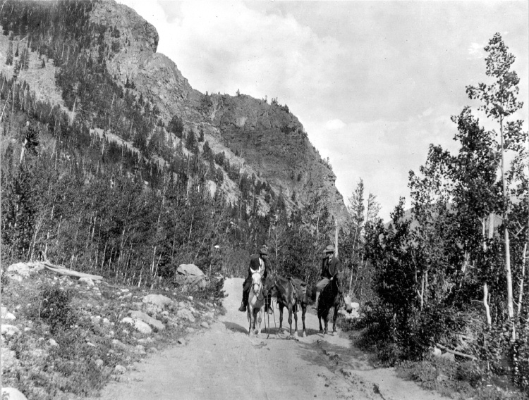
As a Coloradoan, Edward Berthoud (his name now "Americanized) also lead surveys for railroads to booming mining camps in Gilpin County, Georgetown, Leadville and San Juan County. Berthoud's legacy includes his pioneer survey of Berthoud Pass and wagon road through Middle Park into Utah. In addition to his work as a surveyor, Berthoud also helped create the School of Mines and often taught there. He also was involved in various political positions from territorial legislator to Golden's Mayor. He collected natural history specimens for eastern museums that even today are considered extremely valuable. |
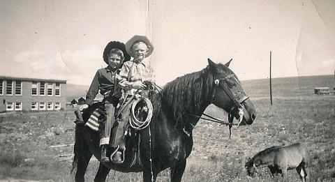
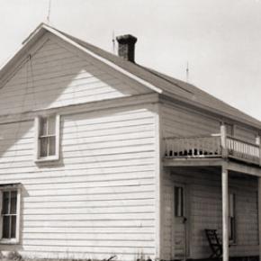
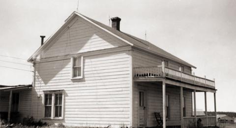
| Elenor and George Smith |
Elenor and George Smith
"You have tuberculosis." Frightening words to be sure, especially in times when the life expectancy rate for such a disease was slim. Tuberculosis, or consumption as it was commonly called, is a disease that primarily affects the lungs. Something as simple as the common cold quickly develops until the patient is suffering from severe chest pain. Soon they are coughing up blood. For most diagnosed, the result was eventual death. As a last hope, many people fled westward, desperately seeking the arid climate that would dry up the fluid in their lungs. Little did they know that while the west would cure them, it would by no means make their lives easier. Elenor Smith, a woman in her early thirties living in Wisconsin, was one of the many so diagnosed. The doctor who examined her did not have much hope for her survival. He ominously predicted she would live no more that a few years longer and she would be unable to bear any more children. With this devastating prognosis ringing in her ears, Elenor, along with her husband George and their five children, packed up and headed west. Their long journey brought them to Fraser, Colorado, where they ended up settling in 1910. The Smiths soon became an important part of the community. They built a log cabin in what is now "Olde Town Fraser' and, like everyone else, allowed their cattle to roam freely. George, affectionately called "Whispering George" by those who knew him well, owned the only livery stable in town. He could regularly be found escorting "Doc Susie" to her patients, be they man or beast. The climate seemed to have been the perfect cure for Elenor. She lived a hardy and wholesome life, and went on to have four more children. Being the hard worker she was, she would often cook for the men working in the nearby logging camps. When she wasn't cooking, she was washing laundry. She was known by many and loved by all. However, things were rough all over and all too soon the Smith family learned how harsh life could be. In 1921, their second eldest son, Oliver, at the age of twenty, was killed while working at Virgil Linnegar's sawmill. Then in 1944, things again took a turn for the worst. Her youngest daughter's (Georgene) two children contracted polio, a contagious disease that causes muscle paralysis and stunted limb growth, while their father was away in World War II. As the story goes, the eldest of the two children, Sherry, showed signs of polio first, so she was rushed to the hospital in Denver. Not thinking George, the youngest at the time, had also contracted it, his mother left him with his Grandma Elenor, so that she could be with her ailing daughter. However, one day Elenor found him hiding under the table crying. Knowing immediately the two-year-old wasn't just throwing a fit, she scooped him up in her arms and rushed to get help. Polio had been going around for a few years now, leaving a swath of deaths in its wake. People were doing everything they could to prevent bringing the disease upon themselves and their families, which was why the woman working in the telephone office locked the door when she saw them coming. Not knowing what else to do, Elenor searched frantically for someone, anyone, to help her. She even began knocking on house doors. Finally one brave man offered to help. He took her and little George to Denver in his car. Luckily, both children survived, though they would carry the repercussions of the disease for the rest of their lives. Having conquered tuberculosis, polio, and everyday hardships, Elenor Smith died in 1974 at the ripe age of 93. |
| Ellen E. Crabb, Parshall Postmaster |
Ellen E. Crabb, Parshall Postmaster

Ellen Elaine Engelhaupt was the first of nine children and was born in Chambers, Neb., on July 13, 1912, to Michael and Ollie Engelhaupt. She attended schools in Sterling and Crook, Colo., driving a pony trap to school when the distance was too far to walk. She graduated from Sterling High School at age 20, as one high school year was spent recovering at home from rheumatic fever. In 1919, she also missed her first grade year recovering from the Spanish Flu. |
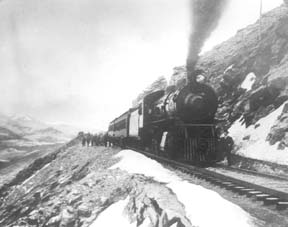
| Emile and Sohie and the Linke Legacy |
Emile and Sohie and the Linke Legacy
Emile Linke and his wife Sophie were both immigrants from Germany. They were living in Denver in 1883 when a friend from the Turnverien (German Athletic Club) persuaded them to homestead in Grand County. They settled along Eight Mile Creek, south of what would later be the town of Granby and had nine children. When the railroad was being built over Rollins Pass in 1904-1905, the Linkes were given the contract to furnish meat to the construction crew. Sophie would take a two-wheeled cart to Grand Lake to sell dairy products at the tourist resorts. |
| George & Joyce Engel |
George & Joyce Engel
 , , 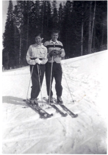
Here is the story of how Joyce and George Engel became legends in Winter Park and Fraser. In 1945, Winter Park Resort hired George Engel as their very first paid ski patroller. Little could George have known that this job would lead him to his wife, Joyce Hanna, disembarking from a ski train, and together they would call Winter Park and the Fraser Valley their home for life. Along with Joyce and their daughters, the Engel Family would have a lasting influence not only on Winter Park Resort but on the Fraser Valley community as well. In the year following his hiring as Winter Park’s ski patroller, George Engel took on different responsibilities at the ski area, such as plowing the parking lot and collecting rental fees in the bunkhouse. Gordy Wren and Frank Bulkley formed Colorado Outings in 1946 and started the ski school at Winter Park. As director of the ski school, Gordy Wren hired George Engel as a ski instructor. That same year George passed one of the first ski instructor certification exams ever held. By 1949, the Professional Ski Instructors of America was formed and Engel held pin # 12. Gordy Wren was busy practicing for the 1948 Olympics and consequently sold his share in Colorado Outings. This gave George Engel the opportunity to buy into the company and he became director and eventually sole owner of the ski school. George added the Winter Park Ski Shop onto the ski school. George met the love of his life, Joyce Hanna in 1951 as she disembarked from the Winter Park Ski Train. Joyce, with two BA degrees from the University of Colorado, was ready to ski and work. After dating for three weeks, George proposed to his future bride and business partner. The Winter Park Ski School under George’s leadership, and the Winter Park Ski Shop with Joyce at the helm, became fixtures of the ski area. George and Joyce’s two daughters grew up on the slopes. Daughters Wendy and Janet tell wonderful stories from when the family lived in an apartment above the Winter Park Ski Shop. After Winter Park Resort bought the ski school in 1982, they demolished the shop and apartment to make way for the West Portal Station. Along with skiing, another Engel passion was horses which led to their acquiring 40 acres along County Road 5 where they built Casa de Engel. From their ranch, the Engels helped to establish the Winter Park Horseman’s Association and the High Country Stampede Rodeo at John Work Arena in Fraser. Naturally, Janet Engel became a rodeo star. The Engels were also involved with the Middle Park Fair and Rodeo for decades. As community leaders, the Engels transformed Winter Park Resort and the Fraser Valley. They helped start the Fraser Valley Metropolitan Recreation District, the Winter Park Chamber of Commerce and the Winter Park Sanitation District. Joyce Engel was a founder of the Grand County Concert Series bringing live classical music to this rural community. In 1968, George Engel was instrumental in bringing the National Sports Center for the Disabled to Winter Park. The family’s wide-ranging passions enrich all our lives then, now and into the future.
|
| Harry Knight |
Harry Knight
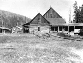
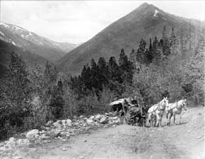
The early emphasis north of Granby was tourism and mining. When the mines were exhausted in the early eighties, some of the locals turned to ranching. Henry Lehman was one of these ranchers on the upper Grand (Colorado). He homesteaded and built a ranch on the South Fork of the river where the family took in guests, travelers and fishermen. Henry died in 1919 and the ranch was purchased by the Knight family of St. Louis. The first historical reference of Harry Knight was the gift to the Grand Lake Yacht Club of a cup for racing competition known as the Knight Cup. It was one of many coveted trophies sought after the winning of the famous Lipton Cup. Knight's most important place in local history was his friendship with Charles Lindbergh. When Harry Knight was president of the St. Louis Flying Club he developed great respect for the "ace pilot". Lindbergh had pioneered the airmail route between St Louis and Chicago. Because of his skills Knight chose Lindbergh as his personal flight instructor. Harry convinced the head of the St Louis Chamber of Commerce to have them help Charles by sponsoring his famous flight with a check for $15,000. Upon completion of the New York to Paris flight in 1927, Knight built an airport on the ranch. Writings of the period indicate that Harry built the airport just for Lindbergh. However, Harry also was a pilot in his own right. Lindbergh would fly over the divide and onto the ranch mostly for weekend visits. Years passed and Lindbergh became involved with other activities that did not involve the Knights. Water storage became the most important problem facing them. The Granby dam was proposed for construction. After completion of the dam the Knight family auctioned off their house, bunkhouse and ranch equipment on July 27, 1946. The ranch house was dismantled and moved to a lot overlooking Lake Granby where it is still used as a private residence. |
| Helen Catharine Linke |
Helen Catharine Linke
Helen Catharine Linke, 90, of Granby, Colo., passed away quietly at the Cliffview Assisted Living Center in Kremmling, Colo., on Oct. 13, 2009. She was born March 13, 1919, in Hillrose, Colo., to Raymond and Malva (Wise) Odell. When she was a toddler, her family moved to Denver where Helen attended Skinner Elementary School and graduated from North High School in 1937. |
| Henry "Rooster" Wilson |
Henry "Rooster" Wilson
One of the most colorful characters of early Grand County history was Henry "Rooster" Wilson. He was born in Ft. Sill, Oklahoma in 1881 of part Cherokee ancestry. Shortly thereafter the family moved to Ft. Steele, Wyoming. During his younger years he worked as a cowpuncher in Wyoming and Colorado and claimed to be one of Teddy Roosevelt's packers when he hunted out of Glenwood Springs. After moving to Middle Park he became one of the early game wardens for the area. He always rode a white horse and most people thought he chose the color to be conspicuous so he didn't embarrass the local ranchers or his friends by catching them with illegal meat. All his horses and dogs were named "Major". Rooster was one of the best ropers in the area and always helped folks when it was roundup time. He told a story about catching a bear with another fellow. They had two ropes on the bear to keep it away from the horses, but then they couldn't turn loose of the bear, so had to shoot it. He never mastered the operation of automobiles and misjudged one of the turns on the Hot Sulphur Springs/Parshall divide and put his Dodge touring car over the bank. The locals named the place "Dodge Turn" because of so many Dodge cars that seemed to find there way over the bank at that spot. One day Rooster was driving from the Post Office into the yard at the Parshall Hotel for lunch. As he drove into the yard there was a post in his way, so he reared back on the steering wheel and yelled "Whoa". As you might guess the car didn't "whoa" and it ran into the post without much damage. One time he rode into the yard at the McMillan ranch (a.k.a. the Barney Day ranch about 4 miles west of Parshall on the Colorado River) just at supper time. The women had venison frying on the stove. My mother quickly stuck the meat into the oven and brought out some ham to cook. Rooster had supper (in those days visitors were always fed), gossiped awhile and started to leave. As he went out the door, he turned and said, “You can take that meat out of the oven now”, and rode away. His one big fault was alcohol. This was during prohibition, but there was always some available. When my mother knew Rooster was going to be around she had to hide the vanilla and lemon extract because he would sneak into the cupboard and drink them for the alcohol content. Rooster couldn’t talk without swearing, but he was a gentle man and, although he never married, he loved kids. At the local dances he was often put in charge of the babies and younger kids while the parents danced.Rooster liked kids and was often put in charge of the babies and younger children while their parents danced at local parties. How did "Rooster" get his nickname? There are two theories. When he was ready to retire to bed after a full day's work and conversation around the pot-bellied stove, he usually remarked, "Well, I guess I'll go to roost." The other theory was that while he worked as a wrangler, he was the first to get out of bed so he could round up the horses for the other cowpunchers. Then he would roust everybody out of bed at that early hour. Rooster died in 1934 of natural causes and is buried in the Hot Sulphur Springs Cemetery.
|
| Howard Henry Yust |
Howard Henry Yust

Howard Henry Yust was the sixth child of Charley and Mary Yust, born April 18, 1891 on their homestead by the Blue River six miles south of Kremmling. At age eleven, Henry worked as a teamster. He and his brother Bill rode broncs at early Middle Park Fairs. He homesteaded part of the ranch then grew potatoes Wynn Howe sold at his Troublesome store. Henry and his brother Ed raised lettuce in 1924-5 where Mesa, Arizona is now. Winters, Henry and Ed broke horses. Daily they rode five miles through deep snow. The first day one brother led the unbroken horse ridden by the other brother. The next day, the two rode their two horses together, but separately to feed the Yust family cow herd at the mouth of Gore Canyon. Loose hay pitched onto team pulled sleds was pitched off in meadows. In the summer of 1931 Jack Shiltz approached Henry while he and Ed were building the first water carrying flume/suspension bridge over the Blue River and asked if he would work for Middle Park Auto in Granby as a mechanic. Henry asked Ed if he wanted the ranch. Ed said yes, so Henry left. Later, Henry operated Standard stations in Kremmling, first the current Kremmling town hall, second now O'Aces Liquor. After he leased the second station to Dolye Likely, Henry operated a rock shop where he sold jewelry he made. July 7, 1943 Henry married Mary Anna Ostergaard. They raised Mary's nieces Willa Jo and Donna Dee Ostergaard. On his last visit to Kremmling August 30, 1980 Henry showed Jim Yust the location of Elliott's cabin on Elliott Creek three miles south of Kremmling. Elliott squatted on land now owned by Blue Valley Ranch when he was killed by Indians taking revenge for the killing of Chief Tabernash. This band went on west to participate in the Meeker Massacre (1879). Henry died Election Day November 4, 1980 in Northglenn, Colorado. |
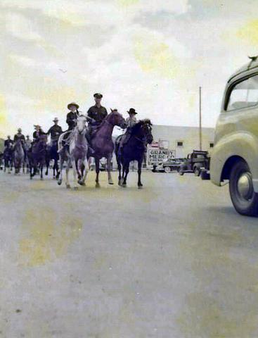
| Indians |
Indians
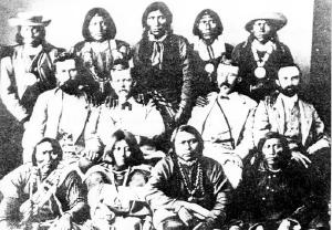
There is a great deal of evidence of primitive cultures in what is now Grand County, but all seems to have been transient until the modern tribes arrived, probably around 1450. The Arapaho Tribe claimed the northern part of this region and were in frequent territorial dispute with the Ute Tribe, who were dominate in the Colorado Rockies. The Utes did not have “chiefs” in the sense of the organized Plains Indians. |
 ,
,  ,
,