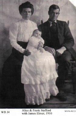
Chauncey Thomas memorial
Doc Susie

People Articles

Inell Harvey
Inell Harvey

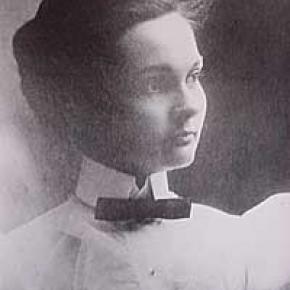
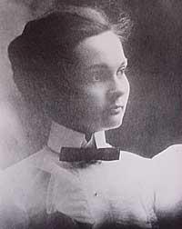
Born in 1916 in Springfield, Mo., and raised in Kansas, Inell came to Colorado to study at the Greeley State Teachers College, which later became the University of Northern Colorado. At the age of 22, she taught eight grades in Pratt, KS, in a one-room school to which she rode a horse every day and where stoked a potbelly stove for heat. Later, she taught on a Ute Indian reservation in Ignacio before going on to teach drama for several years.

Inell Harvey was locally famous for being a newspaper columnist, full-time volunteer, exercise fanatic, teacher, poet and former Heeney Tick Queen. She was a regular columnist for the Middle Park Times and the Sky-Hi Daily News for 22 years, writing close to 1,600 of her weekly "Heeney Hearsay" columns.

Harvey also worked at the Cliffview Assisted Living Center in Kremmling, where she organized holiday parties, called Bingo, and helped keep the limbs and minds of local seniors active by teaching chair aerobics.  Harvey also volunteered five times per week to help children with their reading. Harvey's work for the public good included being a member of both the Grand County Council on Aging and the regional Council on Aging. Both organizations have recognized her as Senior of the Year.

Always generous, Harvey crocheted hundreds of afghans for Kremmling-area babies over the years. Harvey's good deeds were recognized by the public as well. In 2006, she was honored by West Grand Educational Foundation as its Citizen of the Year. In 2000, she was named a "9News Who Care" Citizen of the Year and was featured on Channel 9 for her many contributions to the community.

Inell and her husband Bill had two children, Rick and Janifer.  After retiring, she and Bill moved to Heeney where they loved to fish in Green Mountain Reservoir. After Bill's death in 2000, she moved to Kremmling and lived in her own house.

An avid writer, Inell was a freelance writer for both the Denver Post and Rocky Mountain News. For more than 30 years, her poems, columns and essays appeared in the Middle Park Times and Sky-Hi Daily News.

Harvey died on June 4, 2008 at the age of 92, after a car accident on the Trough road west of Kremmling.

Isabella Bird
Isabella Bird

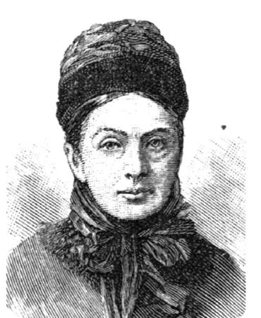
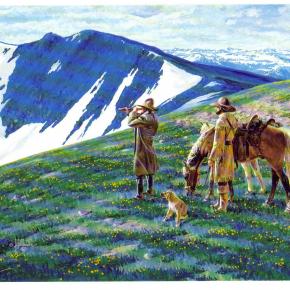
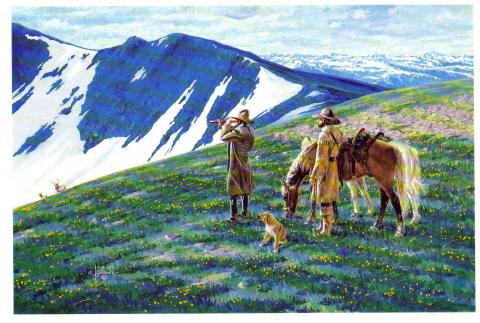
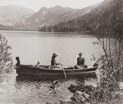
In Yorkshire, England on October 15th 1831, a clergyman and the daughter of a clergyman gave birth to small, sickly girl who would grow up to be one of the most well known travel writers of her time, an exceptional accomplishment in an era when women rarely ventured far from home unescorted. In 1850, after a childhood full of ailments, Isabella had an only partially successful operation to remove a tumor from her spine. Following the surgery, Isabella suffered greatly from depression and insomnia; it was then that her doctor recommended that she travel.  Isabella's father, becoming increasingly worried about his daughter, gave her a hundred pounds and sent her off to see the world.

Ms. Bird traveled throughout the world including Canada, Hawaii, Australia, China, Tibet and Morocco.  She came to Colorado right after the territory had officially been become a state. Isabella loved it in the mountains, so much so that she wrote many letters home to her sister which eventually came to become her third and most famous book, A Lady's Life in the Rocky Mountains. In this document, Isabella wrote of her adoration of the area saying, "I have found a dream of beauty at which one might look all one's life and sigh."

Upon her arrival to Colorado, she traveled into the mountains west of Estes Park. She wrote about adventures and challenges and of her romance with Jim Nugent, or "Rocky Mountain Jim" a one eyed outlaw with an attraction to violence and poetry. He was shot and killed a year after Isabella left Colorado.

Throughout the letters, Isabella mentions the wonderful sights of the lands she explored near current day Grand County.  In one of her letters, Isabella wrote of the time she rode a horse through a blizzard with her eyes frozen shut.  She found herself in another adventure when she was snowed in a cabin with two young men for several months.

Isabella grew eventually grew homesick and headed back to Edinburgh Scotland where she married a doctor. After five years of marriage, her husband died and Isabella returned to travelling. When Isabella returned to Edinburgh in 1904, she grew very ill and died while planning another trip to China.

Jacob Pettingell - An interview from 1931

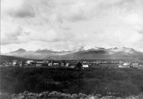
Transcribed by Dan Nolan

In 1880, Jacob Pettingell moved to Grand County at the age of 20. He spent the rest of his life here serving as postmaster, notary public, insurance agent, abstracter, legal counsel, justice of the peace and county clerk. The following is part of an interview conducted by his son-in-law Victor Frey in 1931.

Company of soldiers 
"When I came here, there was a company of U.S. soldiers camped at the old Barney Day ranch; this ranch is a few miles below Parshall, Colo. I think they left that fall. The Meeker Indian Massacre was in ‘79 and these soldiers were sent here in anticipation of further trouble. In addition, the govern­ment sent Springfield rifles to all settlers with ammunition.  We were curious about these new guns and went up on the hill to try them out; before we realized it, we had used up about all the ammunition. At this time some of the Utes came to Sulphur and vicinity to hunt and fish, and to trade. 

Fish & game 
Both fish and game were very plenti­ful in the early ‘80s. On account of severe weather, the settlers usually laid in their winter’s supply of grub early in the fall. At this time they would take several loads of game out to Empire and Georgetown, trading same for grub and provisions.  C. H. Hook, who ran the stage, would pay 25 cents per pound for fish, taking it out to market and selling it for 50 cents per pound. Some persons made as high as $15 per day by fishing. There were no state game laws then. 

Town of Kremmling 
Around 1880 or 1881, there was one little store and a building or two, located across the River (Muddy Cr.). This store belonged to a man named Kremmling.  About 1891, John Kinsey laid out the town of Kinsey City. Later, Kremmling moved his store and post office across the river to this townsite and the name was changed to Kremmling, Colo. There were some ranches in this locality and some of the ranchers names were Bill Kindell, Tracey Tyler, Jim Hetherley, and Dr. Hillery Harris.

Williams Fork
There was only about one ranch here owned by Joe Coberley. There was, of course, no town of Parshall. 

Town of Grand Lake
Old man Wescott lived here; a family by name of John Shafer and Ike Burton. Hot Sulphur Springs had been the county seat and headquarters for supplies for all the mines up Bowen Gulch. Grand County included all of Jackson County at that time.  About 1881, when the mining boom commenced up Bowen Gulch where the towns of Lulu, Gaskill and Teller City sprang up, they decided to move the county seat to Grand Lake since this was much closer. The county seat remained there until 1888 when it was moved back to Hot Sulphur Springs. The old town of Gaskill was located at the mouth of Bowen Gulch; Lulu was about three miles above Squeaky Bob’s ranch, now the Phantom Valley Ranch; while Teller City was on the other side of the ridge in North Park. 

Sandy Campbell and Jim Bowen were the first prospectors. The price of silver was high, and most of these mines were for silver. These mining towns sprang up around 1880-81. I originally came west to spend about three months in Middle Park, hunting and fishing, but when the mining boom struck this locality, I became interested. I grubstaked two men; later I took up a claim above the old Wolverine mine for silver and mined for 7 or 8 years. It was a paying proposition while silver was up in price but on account of the long freight haul and drop in price, the mine was later abandoned. Estimated population dur­ing boom days: Gaskill 150; Lulu 200; Teller City from 1,200 to 1,500. It was claimed that Teller City had 27 saloons. My personal recollections are that they might have had as many as 20 at one time.

The Famous Foot Race 
About once a month, the miners would all come down to Grand Lake for celebra­tions. There is no use to say that considerable liquor was disposed of. During the winter of 1882 a man named Sharp had been working at the Wolverine mine; he had beat them all at foot racing early that spring when the snow went off; these miners thought they had a world beater at foot racing.  While down at Grand Lake on a monthly celebration, they were all bragging about this man Sharp. At this time Harley McCoy was living at Grand Lake and he spoke up and said he had a man named Montgomery who could beat Sharp in a foot race. Sharp went into training at Gaskill; Montgomery at Grand Lake. Bets were originally around $100 and increased to nearly $8,000 on this proposed foot race. The race was pulled off July 4 on the main street of Teller City. Montgomery won the race by about 7 feet and Sharp kept right on running to the end of Main Street, then out into the timber. There was a horse tied there for him and a man waiting to divide up the swag—Sharp was never seen again. The gang at the Wolverine mine took their defeat like good sports, the other bunch paying for all they could eat and drink for a number of days.

The Mock Trial
Usually there was quite a bit of fun and excitement during the mining boom, but once in a while the boys would get a little lonesome on Sundays. This was one of those particu­lar Sundays when they craved a little excitement. There was a tourist and his party who had come in from around Boulder to fish and hunt. The boys confided in the judge and they arrested this man by an old location certificate and he was charged with horse steal­ing (a pretty serious offense in those days).

They held open court and the house was packed, not only with local people, but about 20 tourists were present. The defense attorney spent much of his time describing the wonderful scenery around Grand Lake and Colorado in general. The prosecut­ing attorney prosecuted hard and produced a witness who claimed he actually recognized the accused man and stated there was no doubt but what he was the guilty party. About the time the jury was to have the case, it was framed that I should commence a heated argument across the room with Gil Martin. When I jumped up and called Martin a liar, he opened fire with blank cartridges across the room: I commenced returning the fire. There was a great commo­tion, people actually jumping out thru the windows and a wild scramble thru the doors. The frightened defendant escaped into the timber. It rained all that afternoon. We later succeeded in convincing his partner that it was a joke, so he finally brought the de­fendant in that night, dripping wet and still badly frightened. They all pulled out of Grand Lake before morning.

First Courthouse
This was a small frame building about 12’ x 14’, one room. It has been moved and is now one of the cab­ins belonging to the Corner Cupboard. The Commission­ers then let a contract to Tom Johnston to build a new court house with jail behind, as quickly as possible. There was a sawmill at Grand Lake and plenty of lumber. Johnston put on a large crew; they start­ed in one morning; the next day they moved into the new court house building. John­ston put up this building in a little over one day, sufficiently for them to move in and use it. This building is now John Zick’s restaurant building. 

The Duel 
The commissioners were Barney Day, Webber and Mills, an attorney from Teller City. The sheriff was Chas. Royer and under-sheriff Bill Red­man. Cap Dean was the clerk pro-tem. Mills and Webber had been close friends but had a falling out over the Repub­lican State Convention the year before and since then had become bitter enemies. It is reported that there had been differences between Bar­ney Day and the sheriff and under-sheriff. 

The commissioners met at Grand Lake on July 3, 1883; they all agreed to adjourn un­til July 4 because Mills had an important case in court that day. Mills went to court but Day and Webber went to the Nickerson House and held a commissioners meeting there. At this meeting they raised the amount of bonds for county officers, making same so high they knew none could comply. As I recall, the sheriff’s bond was around $50,000. This caused the sheriff and under-sheriff to throw in with Mills. The next day was Fourth of July and many people were shooting out into the lake, there being considerable noise. Cap Dean, Barney Day and Webber left the Young Hotel (where I was also stopping) and started down town. No one knew just what did happen or who fired the first shot. There were some extra shots in that direction: someone thought they saw a man fall to the ground; we all ran down to the spot which was about 500 yards from the Young Hotel. 

Mills was lying in the road; Barney Day part way in the water; both Dean and Web­ber had been carried into the hotel. Day and Mills died instantly, while Webber lived until around 2 A.M. the next morning. I sat by his bedside. Cap Dean lived 4 or 5 days although he was shot to pieces. I sat beside Dean’s bed and asked him who did the shoot­ing and he replied that he did not care to say. Later, he described one tall man with a handkerchief over his face who attacked him and it fit the description of Bill Redman. It was thought that Mills opened up the attack by firing his rifle. The sheriff and undersheriff both es­caped. They first came to Sulphur and tried to organize a posse but the people seemed to mistrust them and they left the country. Later, Chas. Royer, the sheriff, committed suicide. Bill Redman had been a great pal of Royer’s and when he picked up a paper reading about Royer, he also com­mitted suicide. Therefore, this cost the lives of 6 men.

Firsts in Grand County:

The First Newspaper
The Middle Park Times was founded in 1881 at Grand Lake by John Smart and George Bailey. They called it the Grand Lake Prospector. It was moved to Sulphur in 1889 and called the Grand County Prospector. One day, in 1890, I walked into the newspaper office and was talking to Willard Minor, then running the paper. I told him that I thought Grand County Prospector was a h-l of a name for a county newspaper and sug­gested they change this name to “Middle Park Times.” They took this action and the paper has been known by this name from then on. About 1897, I bought out this paper and edited it for three years.

The First Auto
It was a Thomas Flyer driven from Denver to the Grand Hotel at Sulphur by Harold Brinker, who later on became a famous race driver. This was in 1905. It caused no end of excitement in our small town. Brinker kindly took several of the young people for a ride out to the old horse race track. My daughter, now Mrs. V. H. Frey, was one of the persons and she often mentions the thrill that first auto ride gave her. The car was driven in over the old Berthoud Pass road. 

The First Train
In the fall of 1905 the tracks were laid as far as Hot Sulphur Springs and at this time the first train came in two sections; there were about 1,000 people with a band. The community gave a barbecue and fish fry.

The Grand Hotel 
This was contracted for by my friend Mr. Chapin and myself, and finished in the year 1905. I ran same for a number of years. The first Forest Service office was located in this building and J. C. Stahl was the Supervisor. Later the forest office was moved to Fraser; it was there a short time, then moved back to Hot Sulphur Springs. 

Conclusion
From May 10, 1880 to the present time, February 7, 1931 I have watched the following towns spring up in Grand County: West Portal, Fraser, Tabernash, Granby, Grand Lake, Parshall, and Krem­mling. The Williams Fork locality has also settled up. The old mining towns of Gaskill, Lulu and Teller City came, and then died away. Ranches have developed over most of the county. Stock raising, both sheep and cattle, has become a fixed indus­try. The county, during this time, has shipped out an enormous amount of timber. Like else­where, the auto has developed rapidly and we have many miles of splendid mountain pass roads. There is an abundance of fish and game, although not so plenti­ful as the early days. Every town in Grand County is growing slowly but surely, with the possible exception of one railroad town. Grand County is well off financially and it has the very brightest prospects for future prosperity.


Jim Bridger
Jim Bridger

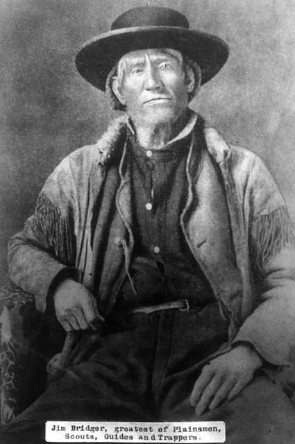
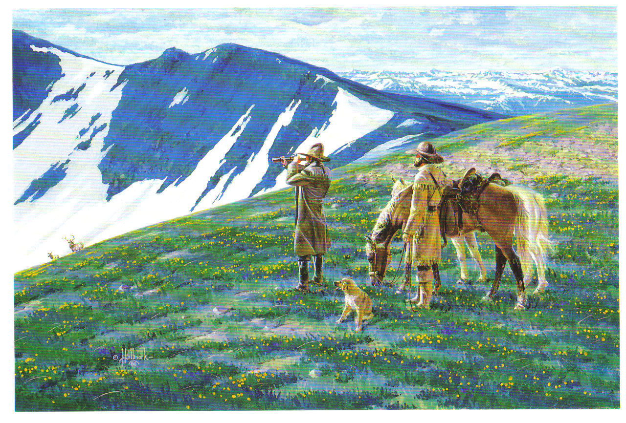
Jim Bridger spent quite a bit of time in Grand County and has been cited as "one of the three or four most able, influential, and best known mountain men' according to historian Dan Thrapp.  Born in Virginia in 1804, he was apprenticed to a blacksmith in St Louis at the age of fourteen, and in 1822, left to join Ashley's fur trading operation in the Yellowstone area of Wyoming. He claimed to have discovered the Great Salt Lake in 1824, believing it to be an arm of the Pacific Ocean.  He was a co-founder of the Rocky Mountain Fur Company, along with Tom Fitzpatrick and Milton Sublette. 

While Bridger was illiterate, he was noted for both his intimate knowledge of the Rocky Mountains and his prevarications to impress newcomers.  He was engaged in some battles with Indians, but was married to two Indian women; a Ute woman who died in childbirth, and then Shoshone women who bore him two children.

Jim's friendship with Louis Vasquez led to construction of a fort named Fort. Bridger on the Green River in Wyoming.  As a guide, he led the infamous expedition of Sir George Gore through Grand County in 1855, in which Gore killed many thousands of animals and birds.  During the excursion, he would join Gore for luxurious dinners with fine table service and discussions of Shakespeare.  Bridger hired a teenaged boy to read him some of Shakespeare's plays but thought that many of the story lines were just "too vicious or ridiculous". 

He was one of the most sought after guides of the West during his lifetime and guided American troops in the so called Mormon War of 1857-8.  In his later years, Bridger acquired a farm near Westport Missouri, gradually became blind and died in 1873.  His two sons buried him in the present Kansas City, but in 1904, his remains were moved to Mountain Washington Cemetery in Independence Missouri.    Jim Bridger is immortalized with his name being given to many places in the West.

John & Ida and the Sheriff Ranch

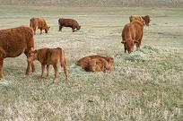
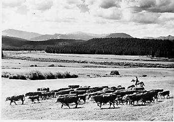
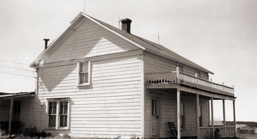
Sheriff Ranch lies in a valley just below Highway 40, 2 miles east of the Town of Hot Sulphur Springs. It's the serene world of John & Ida Sheriff. Old cabins with outhouses align themselves against the riverbank of the Colorado River. They tell a story of the fishermen who once rented the cabins for just a dollar a day-a long time ago.

It's a quiet Sunday morning and only the sound of geese flying overhead can be heard. The cattle are quiet in the meadow as the sun begins to rise and feeding time comes close. They sense the presence of this stranger. The air is cool and damp as Ida comes to greet me. John is not far behind. Looking across the meadow, a calf seems to have caught herself in a fence and to my surprise, the entire herd rushed off to help her. Suddenly she's free and the cattle slow to a stop. The cows quiet down as John throws hay from the pickup. The calves are more curious and come right up to us. One mother cow took off with her young one and Ida called her by name, "Oh, Spook, why are you running off?-she's always taking off! She's afraid you're here to brand her!"

John & Ida begin this morning just as they have for the past 57 years, checking on momma cows ready to give birth and carefully watching the newborn calves. They all have a name, just like children. Two calves, not quite awake, lie together on the hay while chewing on the tender hay. The sound of the cows chewing is soothing to the ear.

A story of the ranch heritage unfolds while we sit at the kitchen table enjoying a cup of tea and fresh baked date-nut bread.

Marietta Sumner Sheriff and her sons came to Leadville, Colorado from a farm in Keithsburg, Illinois, in search of mining claims recorded by her deceased husband, Matthew. (Many farmers and ranchers moved to Colorado ? the promise land of gold). Some years later, Marietta and her sons moved to Hot Sulphur Springs where her sister, Mrs. William Byers lived (1859 Rocky Mountain News founder, William F. Byers).

The ranch has been passed down from generation to generation since then. John Sheriff was the eldest son of Glenn and Adaline Sheriff (Glenn Sheriff was County Commissioner for 21 years, County Assessor, Director of the State Welfare Board for 13 years, and President of the Board of the Middle Park Union High School). He attended the Hot Sulphur Springs Public School through the 12 th grade. Everyone had to share in working the ranch and John was no stranger to peddling milk door to door for 10 cents a quart before he went to school.

Harsh winters closed off travel over Corona Pass (Top of the World) and the only way into the County was on snowshoes. Middle Park was a tough place to live with 50 degrees below freezing for weeks on end. Many people stocked up on flour and sugar and other supplies for the winter because they couldn't get into town for supplies. The Sheriffs were more fortunate and would use a horse and sled and follow the river into the town of Hot Sulphur for supplies.

Ranch life was not a wealthy profession as many may have thought. The Sheriffs know how hard it was to keep the family ranch. In the 1930's, Roosevelt's New Deal (Agriculture Adjustment Administration-AAA) forced ranchers and farmers to kill off half of their herd to level out the economy. Cow hides were sold for 5 cents a hide. Ida recalls, "Everyone in agriculture had to start over. Everyone was in the same boat. Some people couldn't take the stress and just moved off their ranches-- just leaving them!" The Sheriff ranch was in debt following the depression era. Ranches were up for foreclosure everywhere; banks didn't want them. The family just hung in there until they could get a herd of cattle going again.

Joining the Navy, John served in the South Pacific during World War II, and returned home to attend Colorado State University where he studied general agriculture. He met and married Ida Marte in 1949, daughter to early Grand County pioneers, Liberat and Bertha Marte. Ida is known over the years for her involvement with historical societies, documenting the history of the County, and maintaining original cemetery plots for the Hot Sulphur Springs Cemetery.

The years after the war were a struggle. With not enough hay to put up and only a handful of cattle, ranchers turned to raising sheep and harvesting crops of lettuce. Japanese prisoners of war were sent here from California to work on ranches.

"We always had to have an outside income ?cabin rentals, John's dad, Glenn was commissioner, and Mom worked at the library to help pay expenses. Once in a while we would have enough cows or lambs to go to market. The Federal Land Bank saved a lot of ranches allowing us to borrow money to get going. We were all afraid of another recession after the war," Ida said.

In the first 30 years of their marriage, John & Ida did not see much of each other. John traveled back and forth taking cattle to auction. When they got married, the ranch was so much in debt that they were "darn lucky that we didn't loose it".

The Sheriff homestead was registered in 1881 with 1350 acres and had as many as 250 head of high grade Herefords by 1975. Pure-bred bulls were purchased from neighboring ranches (Taussig Brothers, Hermosa Ranch, and Lawson Ranch) improving the quality of the herd. Sheriff ranch's registered brand-Bar Double S---is still known to be the oldest registered brand in the County.

In 1984 a large portion of ranch acreage was sold to Chimney Rock Ranch Company and the remaining acreage is where Ida and John live today, raising a small herd of cattle. They no longer make trips to auction. Today, a buyer comes to the ranch.

With no electricity in the early years, trudging through deep snow to the barn's generator was a morning ritual to power the lights in the house. In later years, electricity allowed the Sheriffs to start the generator with a flick of the switch from within the main residence.

The years of struggle and hardship, hard work and the desire to keep the family ranch has been a great sense of pride for the Sheriff family today. John and Ida, their ancestors and their family are a living example of family ranches surviving today. Not many remain, but this ranch, with a great family history, has a river of life flowing through it.

John Charles Fremont

Captain John Charles Fremont was born in 1813 and at the age of 31, in June 1844, was exploring the northern reaches of the Republic of Texas when he passed through Grand County.  This marked the first appearance of official government enterprise in Grand County.

His expedition included some 40 explorers, including people of Creole, French, and Black descent. The guides were Thomas Fitzpatrick and Kit Carson. This expedition entered Grand County via Muddy Pass and exited via the Blue River, never traveling into the eastern part of the County. 

They met with some 200 Arapahoe Indians, who were traditionally suspicious of the intruders, but through the giving of trade gifts, overt conflicts were avoided. The cartographer for that expedition was Charles Preuss, who provided the first map on which all of the central Rocky Mountain Parks were named and mapped accurately.

John Peyer - Winter Carnival Founder

John Peyer was born in Zurich Switzerland on March 26, 1880 and emigrated to the United States in 1902, settling in Ionia (Jewell County) Kansas.  John eventually found his way to Hot Sulphur Springs on June 1, 1911 as the sales manager of the Hot Sulphur Springs Townsite Company.  John drove a luxury 7-passenger Martini automobile, which was used for transporting prospective land buyers  from the Moffat Railroad train depot. 

In October of 1911, the Moffat Railroad announced that freight operations would be moved from Hot Sulphur Springs to Fraser.  The Middle Park Times published an editorial concerned about the future of Hot Sulphur Springs.  John Peyer responded with a letter that suggested that the town could be a winter  sports tourist attraction. One week later John ran a notice in the paper for all interested parties to meet to plan a winter carnival.  John Peyer was elected Carnival Committee Chairman and the Carnival Day was set for December 30, 1911.

A Denver Post article the day before the carnival quoted “Hot Sulphur Springs Winter Sports Club hopes to make winter sports as popular in Colorado as they are in Switzerland and Norway”. 

The carnival had a great turnout and John Peyer showed he also had athletic skill, placing first in the Fancy Skating Contest and first in the Couples Fancy Skating Contest, along with Mrs. Fuller.  At 9pm at the highlight of the Grand Ball, two strangers appeared on skies, with 35 pound backpacks and rifles.  Carl Howelsen and Angell Schmidt, who had heard about the carnival, boarded the train in Denver at 8 am and detrained at the Corona Station atop of Rollins Pass to ski down the mountains.  They completed this feat of 44 miles on skis in 9 hours.  

The Norwegians set out the next day to build a crude ski jump and by shortly after noon, they gave a jumping exhibition that amazed the spectators.  John  Peyer and the Winter Carnival committee were inspired to plan yet another event in six weeks time to include the spectacular ski jumping.  The second carnival was planned for February 10-12, 1912.

Ski events of cross country, downhill and jumping were added to the skate and sled competitions.  This became the first winter ski carnival west of the Mississippi River.  Entrants came to compete from all over the United States and the Moffat Railroad ran special trains, bringing hundreds of spectators from the Denver area.  John Peyer’s dreams became a reality! The winter carnival was declared a great success and plans were made for the second annual event in 1913.

John Peyer headed up the planning for the Second Annual Winter Carnival and attracted skiers and athletes from all over including the National Ski Association’s professional circuit. The Middle Park Times had ads for the upcoming 2nd Annual Winter Sports Carnival on January 31, February 1 & 2, 1913.

Skis for sale $2.50 and up. See John Peyer.

Mr. John Peyer has received a consignment of skis from a ski factory in Ashland, Wisconsin and is selling them for Mr. C. Howelsen, our professional ski jumper.

If you don’t believe that Hot Sulphur Springs is the best place in the world for ski jumping, just ask John Peyer. He knows.

The  January 19th 1913 Denver Post, published a half page with photos and headlined “Skijoring, with Horses Hitched to Men on Skis to be seen at Sulphur Springs Winter Carnival.” “Novel Sport will be Witnessed in U.S. for First Time”.  The article explained skijoring.  The January 31st 1913 Rocky Mountain News headline was, “Ski Jumpers Are Ready For Great Midwinter Sport Carnival”. “Crack Flyers East and West will meet in Program of Daring Feats”.  Five photos appeared with two ski jumpers, persons on a sled, and a toboggan.  In the center photo was John Peyer and a lady demonstrating skijoring  with the caption, “Never before in America, so far as we can learn, has skijoring been attempted”.

The second carnival made history by being recorded in moving pictures which were shown across America. 

John Peyer pursued his real estate career with the Hot Sulphur Springs Company and in July 1913 became Automobile Park Superintendent for the Lincoln Highway Association.  The association was in charge of "The Main Street Across America Campaign".  John later made a living by repairing cars and went on to be a travelling salesman for the Hupp Motor Car Company. Around 1920, John Peyer settled in Brooklyn New York where he married and fathered two children. He continued to visit his bungalow in Hot Sulphur Springs. John became the proprietor of a hotel in DeSoto City Florida and then moved on to Sebring Florida where he opened a machine shop business.  At the outbreak of World War II, John Peyer helped organize and became an instructor at the Sebring Defense School at Hendricks Airfield. 

John Peyer passed away on November 5, 1941 at age 61 years.  He was survived by his wife Elsa, daughter Helen and son Herbert. His obituary said that he was considered to be one of the ablest machinists and manufacturers machinists in the nation.

John Wesley Powell
John Wesley Powell

John Wesley Powell was a Civil War veteran who had lost part of one arm as a result of combat.  He was a professor of natural history at Illinois Wesleyan Collage, who took field trips with his students to the Rockies.

He came to the Grand County region looking for a vantage point to conduct an exploration of the Colorado (the Grand) River. With six local men he made the first recorded ascent of Long's Peak, the 14,255 foot landmark of the Front Range, on August 23, 1868.  From that summit he could view much of the headwaters area of the river.

Descending back into Middle Park, he ventured to Gore Canyon where he decided the turbulent rapids were too dangerous for his boats.  He decided to take an exploratory  party of students to the Green River in Wyoming, a tributary of the Colorado.  Losing one boat in that expedition, the party made the first known trip through the Grand Canyon in 1869.

He later became leader of the first U.S. Geological Survey, and because of his study of Indian tribes, the first head of the U.S. Bureau of Ethnology.

Joseph Wescott
Joseph Wescott

Joseph Wescott was born in 1838 in Nova Scotia and reared in Iowa.  By 1865, he was in Middle Park, squatting, half-blind and semi-alcoholic, in Hot Sulphur Springs with his friend Charlie Utter.  

Having come to Colorado to get relief from rheumatism, he passed his time in creative writing, fishing, drinking, and shooting his revolver.  In 1868, after being induced to sell all of his claims of 160 acres around the hot springs, he left Hot Sulphur Springs to go to Grand Lake.

In 1870, a group of Arapahoe Indians arrived in the area and there is an unverified report that Wescott, Jack Sumner, and three fishermen killed “not less than five” of the Indians.  Soon after this incident, Wescott settled into developing a rustic resort with cabins, rafts, canoes, and skiffs on Grand Lake.

By 1879, he had three buildings on the West Shore. In July 1880, disaster struck when Edward Phillips Weber, an attorney, took over Wescott’s original filing as his own.  Weber claimed that there were “flaws in the filing” and forced Wescott out.

Nevertheless, on June 26, 1888, Wescott filed a plat for “Grand Lake City,” on the lake shore south from the inlet.  He designed the area for summer visitors rather than as a residential community. 

Wescott later wrote a famous poem about the legend of Grand Lake, and how the spirits of the lost Ute women and children can still be heard wailing on foggy mornings at the lake shore.
 

Lewis D.C. Gaskill
Lewis D.C. Gaskill

Lewis DeWitt Clinton Gaskill came to Colorado as a polished young mining promoter from upstate New York, where he was born in 1840. He married Miss Nellie C. Rogers in 1865, and raised three daughters born to the marriage.

By 1874 he partnered with William Cushman to build the Georgetown, Empire and Middle Park Wagon Road, which opened in November of that year, to the great surprise of locals and professionals alike.  He and his family lived at the summit of Berthoud Pass into the mid-1880s, when they built the Gaskill House in what became Fraser, CO.   For a short time he was employed as mine foreman at the Wolverine Mine in Bowen Gulch, outside of Grand Lake.  One of the mining camps, in fact, came to be known as Gaskill. Over the years there was significant competition between the different camps, and mercantiles associated with them.  Gaskill's was one of the biggest and best.  Gaskill, the camp, survived for about six years, before falling victim to the end of the mining boom.  In 1896, a county-wide passion for William Jennings Bryan and his Democratic-Populist party, helped to seat Gaskill as democratic chairman of the Board of County Commissioners for Grand County. By 1903, Gaskill came into conflict with D.H. Moffat and the Denver, Northwestern, and Pacific Railway, over property and right-of-way purchases. He, along with Nathan S. Hurd, ended up settling their dispute over property values in County Court. In 1904, upon the death of Fraser postmaster, William Z. Cozens, the Fraser post office was moved to the Gaskill House in Fraser, and L.D.C. Gaskill was appointed postmaster.  Soon after, the townsite was platted and development undertaken under the name of Eastom, but that name was soon forgotten and the area continued to be known as Fraser.

"[Gaskill] was one of those quiet, easy-tempered, efficient persons who can always be depended upon.'" Captain Gaskill (his rank came from service in the Civil War) became "a major Grand County personality."

Articles to Browse

Topic: Biographies
Winter Park Ski Shop, Joyce and George Engel

George & Joyce Engel

Winter Park Ski Shop, Joyce and George Engel

Here is the story of how Joyce and George Engel became legends in Winter Park and Fraser. In 1945, Winter Park Resort hired George Engel as their very first paid ski patroller.  Little could George have known that this job would lead him to his wife, Joyce Hanna, disembarking from a ski train, and together they would call Winter Park and the Fraser Valley their home for life. Along with Joyce and their daughters, the Engel Family would have a lasting influence not only on Winter Park Resort but on the Fraser Valley community as well.

In the year following his hiring as Winter Park’s ski patroller, George Engel took on different responsibilities at the ski area, such as plowing the parking lot and collecting rental fees in the bunkhouse.  Gordy Wren and Frank Bulkley formed Colorado Outings in 1946 and started the ski school at Winter Park.  As director of the ski school, Gordy Wren hired George Engel as a ski instructor. That same year George passed one of the first ski instructor certification exams ever held.  By 1949, the Professional Ski Instructors of America was formed and Engel held pin # 12.

Gordy Wren was busy practicing for the 1948 Olympics and consequently sold his share in Colorado Outings.  This gave George Engel the opportunity to buy into the company and he became director and eventually sole owner of the ski school. George added the Winter Park Ski Shop onto the ski school.  

George met the love of his life, Joyce Hanna in 1951 as she disembarked from the Winter Park Ski Train.  Joyce, with two BA degrees from the University of Colorado, was ready to ski and work.  After dating for three weeks, George proposed to his future bride and business partner. The Winter Park Ski School under George’s leadership, and the Winter Park Ski Shop with Joyce at the helm, became fixtures of the ski area. George and Joyce’s two daughters grew up on the slopes.

Daughters Wendy and Janet tell wonderful stories from when the family lived in an apartment above the Winter Park Ski Shop.  After Winter Park Resort bought the ski school in 1982, they demolished the shop and apartment to make way for the West Portal Station.

Along with skiing, another Engel passion was horses which led to their acquiring 40 acres along County Road 5 where they built Casa de Engel.  From their ranch, the Engels helped to establish the Winter Park Horseman’s Association and the High Country Stampede Rodeo at John Work Arena in Fraser.    Naturally, Janet Engel became a rodeo star. The Engels were also involved with the Middle Park Fair and Rodeo for decades.

As community leaders, the Engels transformed Winter Park Resort and the Fraser Valley. They helped start the Fraser Valley Metropolitan Recreation District, the Winter Park Chamber of Commerce and the Winter Park Sanitation District.  Joyce Engel was a founder of the Grand County Concert Series bringing live classical music to this rural community.  In 1968, George Engel was instrumental in bringing the National Sports Center for the Disabled to Winter Park. The family’s wide-ranging passions enrich all our lives then, now and into the future.   


Topic: Water

Water

Grand County is home to the headwaters of the famed Colorado River — the river that brings water to five other arid Western states. Water is the lifeblood of semi-arid Colorado and Grand County is one of the most water-rich areas of Colorado, and yet faces a shortage due to historical water agreements, written long before population pressures and the environmental awareness of the current age.

On average, the water diversion projects in the county move a whopping 305,000 acre-feet per year from the Fraser, Colorado and Williams Fork rivers — all headwaters of the Colorado's main stem. 60 percent of the water in Grand County is diverted elsewhere and there are plans underway, mostly from Front Range communities, to divert as much as 80 percent of the county's headwaters by the year 2010.

Two of the main water utilities, Denver Water and the Northern Colorado Water Conservancy District face a quandary: how to take the water from Grand County without further damaging the delicate environment and the region's economy, which is fueled by tourists who expect to play in the very water the Front Range wants to take.

Crawford

Maggie and Jimmy Crawford came to Middle Park in the summer of 1874 with their three children. They were given a piece of property and built a one room sod roofed cabin in Hot Sulphur Springs. They were probably the first family to stay the winter in Middle Park.

As they settled in for a long hard winter, Jimmy continued exploring lands to the west. He found prime land near a spring that made a unique chugging noise. That sound reminded him of the steamboats on the Missouri River back home. After that winter, Maggie returned to Missouri with her family, while Jimmy built a cabin on the new filing, which would later become known as Steamboat Springs, Colorado.

By 1876, Maggie and the children were back in Colorado, and the family became founding members of that new community.
 

Topic: Places

Place Names of Grand County

Because Grand County has such a rich history, many names reflect that important heritage. Traveling East to West from town-to-town, here are a few historical tidbits to think about.  

Winter Park came into being around 1923. Several names to identify the place were used over the years, including West Portal, Hideaway Park, Vasquez, Woodstock, and even "Little Chicago" because of gambling and other activities. The City of Denver bought land in 1939. Winter Park officially opened in 1940. According to "Colorado Place Names" by George R. Eichler, with the assistance of Denver Mayor, Benjamin F. Stapleton, the town changed its name to "Winter Park" to publicize the establishment of the city's winter sports centers.

Iron Horse Resort and Zephyr Mountain Lodge reflect the importance of the railroad in the development of Grand County. Newer condominiums also reflect the heritage of the area. Sawmill Station, Teller City and more recently, Telemark, are a few examples. "Telemark is named after the traditional method of skiing," said a Telemark Townhomes representative. Red Quill townhomes, according to broker and owner Mike Ray of Century 21 Real Estate in Winter Park, are named after President Eisenhower's favorite fishing fly lure. "He found the Red Quill pattern particularly effective on St. Louis Creek while visiting and fishing with Axel Neilsen at the Byers Peak Ranch." Van Anderson Drive, according to Jan Smith, a Realtor at Century 21 of Winter Park and longtime local, is named after the first mayor of Winter Park. He developed the Hideaway Village, including the condos, Filings 1 and 2 and Hideaway Village South.  


Vasquez Road, according to well-known historian, Abbott Fay, is named after Louis Vasquez, an early fur trader. Woodspur and even Woodstock, one of the early names attributed to the town of Winter Park, referred to Billy Wood's lumber mill which furnished Rollins Pass railroad ties.

Fraser was originally spelled "Frazier" for Reuben Frazier, an early Grand County Settler. Postal authorities adopted the simpler spelling when the post office was established. Doc Susie Avenue is named for Susan Anderson, M.D. "Doc Susie," a pioneer physician who came to the area in 1907. She served the citizens of Grand County faithfully until she died in Fraser at the age of 90. Fraser's Eastom Avenue is named after George Eastom, who founded the town. The Eastom family from Ohio built an important lumber mill. Mill Avenue also reflects those early lumber days. Eisenhower Drive is named after President Dwight D. Eisenhower, who enjoyed visiting the area especially for fishing. Ptarmigan is a grouse with feathered feet particularly found in the cold, mountainous regions. And, for Wapiti Drive/Lane, Wapiti is an elk. Zerex Street, according to Susan Stone of the Fraser Visitor Center, is named after the antifreeze product which was tested at "the Icebox of the Nation."

Tabernash is on the homestead of 1882 pioneer Edward J. Vulgamott. By 1905, the enclave came into existence because of its location during the building of the Denver & Salt Lake Railroad. E.A. Meredith, chief engineer, named the town after the Ute Native American called Tabernash who was killed earlier by a white man named "Big Frank." Junction Ranch, built by Quincy Adams Rollins, according to noted historian Abbott Fay, was an important stop on the Idlewild Stage line which could accommodate up to 50 travelers.

Granby was founded in 1905, named after attorney Granby Hillyer, who assisted David Moffat and Frontier Land and Investment Company with the incorporation. Granby landmark, Kaibab Park was donated by the Kaibab Company. According to former local postmistress Carole Clark, during the 1940s, Broderick Wood Products Company had a large sawmill with housing for their workers where the current ball fields are now located. Selak Drive is named after the Selak family, who ran a large Granby Merchantile. Before Granby, the Selak post office and general store provided service from June 1883 to September 1893 on the nearby Selak Ranch.
Ouray Ranch, a residential community located off US. Highway 34, was the original home of the YMCA Camp Chief Ouray until the early 1980s when the YMCA sold the land and relocated to Snow Mountain Ranch outside of Granby on US Highway 40. Chief of the Ute Indians, Ouray was born in Colorado in 1820. He was noted for his friendship with the white settlers.

Grand Lake was established by hardy pioneers in 1879. Joseph L. Wescott, was the first white settler-prospector. Grand Lake was founded as a mining settlement by the Grand Lake Town & Improvement Company. As the mines played out, tourism and focus on Grand Lake, Colorado's largest natural body of water, took center stage. Cairns Avenue, according to Jane Kemp, granddaughter of James Cairns, is named for him. In 1881, he ran a general store. He extended credit for supplies to many of the miners who left town without paying him. With unpaid bills and depleted stock, Cairns then homesteaded a ranch to sell hay to freighters for their horses. He trapped bears for their shaggy skins to sell. All the while he kept his store open. A mountain peak bears his name, also.  

Columbine Lake is named after the Colorado State Flower. Kinnikinnick is a Native American term used to describe mixtures of Indian tobacco.  West Portal Road leads to the west portal of the Alva B. Adams Tunnel, which since 1947 delivers Grand County-Western Slope water to farmers on the Front Range as part of the Colorado-Big Thompson Project.

Hot Sulphur Springs, established in 1860 is named for the famous hot springs in the area. (Colorado Place Names) Ute and Arapaho tribes used the hot springs for their "healing waters." Byers Avenue is named after William N. Byers, founder of the Denver Rocky Mountain News. He wanted to create a spa resort modeled after Saratoga in New York.

Moffat Avenue-Several streets in Grand County are named after David Moffat, the pioneer railroading legend, who started the Moffat tunnel and brought predictable rail service to Grand County with his "true-grit" determination.

Parshall, according to Colorado Place Names, was established in 1907 when a Mr. Dow set up a small store and circulated a petition for a post office. The name "Parshall" honored a local pioneer. Postal authorities accepted it as no other post office had that name in the entire county.

Kremmling established in 1881 according to Colorado Place Names, the town's beginning was a general merchandise store run by Kare Kremmling, (The Chamber of Commerce web site says Mr. Kremmling was named Rudolph and the town was established in 1884) located on a ranch on the north bank of the Muddy River. When Aaron and John Kinsey platted their ranch and called the site Kinsey City, Kremmling moved his store across the river to a new site which soon became known as "Kremmling."

Radium had a post office as early as 1906. Harry S. Porter, a prospector and miner, suggested the name because of the radium content in a mine he owned near the town. The community was settled by Tim Mugrage and his family.

Topic: Biographies

Nathaniel "Nathan" Shore

Nathaniel "Nathan" Shore was born in Cottonwood Harbor Canada in 1856. When he was about 16 years old he had visited and then worked as a freighter hauling groceries to different towns in western Colorado. He saved enough money to purchase his own wagons and 2 yoke of oxen for each wagon to continue freighting.

Nathan became famous as a man who carried his Bible in one hand and a gun in the other. Nathan returned to visit his family and met Sarah Jones in Springfield Missouri. They were married in 1885. Their trip to Colorado and the Williams Fork was undertaken with Sarah driving a team of horses pulling a covered wagon and Nathan herding their few cows.

The cows helped start a homestead ranch east of the Williams Fork river. In 1907 they sold the homestead ranch to the Curtis Family. They had purchased the Anders Anderson ranch close to Williams Peak and the Joseph Jackson ranch on Bull Run Creek.

They lived on the Anderson place until the forest fire that burned along the Williams Fork Mountains. Nathan told Sarah to hitch the horses to the hay rack, load the furniture that it would carry, take all the children and move to the Jackson place while he helped fight the fire. Nathan's team of horses were stolen so he broke 3 heifers and a steer to work in the yoke.

He still did a lot of freighting to make a living for his family. He freighted to Hot Sulphur Springs and also from Georgetown. He returned home to the ranch about once a week. He sold butter, that Sarah had made and hung down in the well to keep cold, in the mining town of Breckenridge.

Nathan Shore died June, 1928 when his pickup stalled on a railroad crossing in Utah. He was trying to find the trouble under the hood and didn't hear the train as it whistled and whistled. He was headed for a trip to Hawaii.

Topic: Mountains

Rollins or Corona - What shall it be called?

Travel across various passes of the Continental Divide occurred long before white men showed up. Indeed, as anthropologist James Benedict wrote c. 1975, some 10,000 years ago, prehistoric Indians camped, hunted, and built hunting walls on the upper reaches of Rollins Pass, as well as moving in and out of Middle Park for the warm summer months.

Historic Indians followed the same paths. In the earliest days of non-Indian access, a particular pass at the head of Boulder Creek was dubbed Boulder Pass. Capt. Jacob Bonesteel, including wagons, made the first recorded crossing by a white man at this point in April 1862. Three years later, a group of Mormons brought wagons over this route and a year later, promoters of new roads into Middle Park brought in many wagons and livestock.

In fact, tourists were starting to enter the park by a number of routes, and one of them, Samuel Bowles, who wrote a fascinating account of his trip, including his return to Denver via Boulder Pass. Interest was growing rapidly for a road over the Divide, into Hot Sulphur Springs, and on into Utah. One promoter, John Quincy Adams Rollins, from New Hampshire, teamed up with William N. Byers and Porter M. Smart to carry this project through. Rollins was interested in crossing the Divide; Byers was promoting the Springs; Porter wanted to develop the valley of the Middle Yampa. All three were pushing to have Middle Park officially named as Grand County, a challenge finally accomplished in 1874. So Rollins and associates started his road, reaching the top in 1873.

That next winter, they publicized this access and in June, Jimmy Crawford brought his family and wagons to Rollinsville and thence to Yankee Doodle Lake, ready to cross the pass now named Rollins Pass by the developer. But the road ended, and they found Rollins' men still hacking the road out of the granite! Jimmy and his crew found it necessary to leave their wagons and help. Finally, on June 10th, the family was able to head for the top. Jimmy borrowed two yokes of oxen, hitching them to mules, and then to his horse. The road was so rough that the procession could proceed but a few feet before having to rest. The family itself climbed on foot. At the summit, they discovered only a rough swath cut down through the trees on the western side. The "road" dropped down between the lakes and followed Ranch Creek to its junction with the Fraser River.

Rollins quickly realized that Berthoud Pass, which also opened in 1874, was superior to his own pass for wheeled vehicles, so he determined to hedge his bets. He initiated the first mail service into the county in 1873. He also built a commodious hotel where his road joined the Berthoud Pass road at the confluence of Crooked Creek and the Fraser. He called it the Junction House. Next, he proposed to the builders of Berthoud Pass that they form a joint ownership of the two roads between Junction Ranch and the Springs. Tickets would be issued for both routes and revenues would be shared. The two companies would build a bridge over the Grand at Hot Sulphur Springs. He even buttered up his rivals by complementing their work. All this was accomplished, although the mail route soon moved to Berthoud Pass, because of the severe winters on Rollins Pass.

The bridge was started in November 1874. From the beginning, Rollins' road was preferred for trailing livestock, because there were fewer problems with heavy timber and bogs. For years, the Church brothers, George and John, who introduced the Hereford breed into the county, trailed their cattle for summering in what became known as Church Park. However, tourists such as Irving Hale still drove wagons over Rollins Pass in 1878. About 1880, interest burgeoned for bringing a railroad up South Boulder Canyon and through a tunnel near Rollins Pass. Numerous surveys were completed all along the area. David Moffat settled on Rollins Pass for the tunnel site but decided first to put a temporary line over the top.

Thus, in the summer of 1903, a formal contract was let for work up and over the Pass itself. By 1904, the workers reached Arrowhead and they also built a work station on top, called Corona Station, or "crown of the mountain." This railroad construction town of Corona, located at over 11,600 feet at the top of Rollins Pass (first called Boulder Pass) along the Continental Divide was the highest railroad station in the world. It became obvious by 1905 that the Corona area would require snowsheds if trains were to travel, even irregularly, during the winter. Still, word got out of the spectacular splendor of Rollins Pass and tourists flocked in on summer train excursions, sometimes stopping on top, sometimes going as far as Arrow.

In 1913, a fine hotel was built next to the rail facilities. Because Rollins Pass was right in the middle of severe weather patterns, a weather station was built on top, as well as one down at Sunnyside. In 1915, Rollins Pass was actually proposed to be the south boundary of a proposed "Estes National Park." Later, on the National Historic Register, the district was listed in 1997 as the Denver, Northwestern and Pacific Railway Historic District--Rollinsville & Middle Park Wagon Road. It was also identified as the Rollinsville and Middle Park Wagon Road; Boulder Wagon Road, Rollins Pass, and Rollinsville area. In 1956, Governor Steve McNichols had presided at the official re-opening of the four percent grade to vehicle traffic over Corona Pass, expressing the hope that the route would someday be paved. The Colorado Game and Fish Department and the U.S. Forest Service made additional improvements, and the Arapaho and Roosevelt National Forests put out a 24-page booklet titled "The Moffat Road: A Self-Guiding Auto Tour."

The road crossed two of the original railroad trestles near Corona but those trestles, even if reached by 4-wheel vehicles, were crumbling and could no longer even be crossed safely on foot. The current self-guided auto tour refers to Rollins Pass, as well as the Moffat Road and the Boulder Wagon Road. Corona Station and Hotel are discussed. In 1979, a portion of the auto road over Corona Pass was permanently closed because of a cave-in of the "Needle's Eye," a tunnel located before the trestles heading west from the Moffat Tunnel's East Portal. The tunnel reopened on July 3, 1988, thanks to efforts of the Rollins Pass Restoration Association on both sides of the Divide, with the cooperation of the U.S. Forest Service, Colorado History Society, and Boulder, Grand, and Gilpin Counties. It then closed once more when another rockfall hit the tunnel on July 15, 1990. The RPRA is continuing its efforts for re-opening. The noted photographer, Charles McClure, took many outstanding photos of the Rollins Pass road.

One, titled "Group on Rollins Pass, shows well-dressed men and women stand on a snowfield making snowballs on Rollins Pass, Moffat Road, Boulder or Grand County, Colorado; probably on Denver, Northwestern and Pacific excursion train. Date: between 1904 and 1913 near Corona Station." Another photo shows a "30 ft. snowcut on Rollins Pass, Moffat Road photo. Denver and Salt Lake Arrow passenger car is parked east of Corona snowshed by the thirty foot snowbank cut, Rollins Pass, Colorado; it shows men, women and railroad employees posed behind train, on the roof and on the snowbank and a standard gauge track. Date: between 1904 and 1915." A sign at the highway turn onto the Moffat roadbed says: The Moffat Road "Hill Route" Also called "Corona Pass Road", this road over the Continental Divide was the original "Hill Route" of the Denver, Northwestern & Pacific Railway built by David H. Moffat in 1903. It crosses Rollins Pass at 11,666 feet elevation. On top of Rollins Pass, a sign says: Elevation 11, 660 feet, John Quincy Adams Rollins established a toll wagon road through this pass in the mid 1870's. David H. Moffat's Denver, Northwestern & Pacific Railway crossed the Continental Divide at this point in 1903.

First known as Boulder Pass, then Rollins Pass, the railroad workers dubbed it "Corona", the crown of the "Top of the world." A railroad station, hotel, restaurant and workers' quarters existed here until 1928 when the railroad was abandoned due to the building of the Moffat Tunnel. Identifications in various trail and geographical guides say: Rollins Pass (el. 11,680 ft) is a high mountain pass in the Rocky Mountains of north-central Colorado in the United States. The pass is located on the continental divide at the crest of the Front Range southwest of Boulder, at the boundary of Grand County, Colorado and Boulder County, Colorado. Rollins Pass (a.k.a. Corona Pass) sits approximately 5 miles east and above the popular ski areas around Winter Park, between Winter Park and Rollinsville. The pass is traversed by an unpaved road, mostly the former roadbed of the Denver and Salt Lake Railway which abandoned the route in 1928 when the Moffat Tunnel opened to replace it. Railroad advertising called this the "Top O' the World" and it referred to the Moffat Route over the continental divide and the Rocky Mountains. Rollins Pass was the primary travel route west from Denver until an easier road over Berthoud Pass was constructed. The Denver, Northwestern and Pacific railroad laid its tracks across the pass in 1903-1904 and established a Depot at Corona on the crest. It can be noted that in R.C. Black's Island in the Rockies, the term "Corona Pass" was mentioned one time, on p. 351; the terms "Corona Station" or "Corona Snowsheds were used. In Dismantling the Rails That Climbed, Rollins Pass was used, the Corona hotel, and just once, Corona Pass; 1936.

In Maggie By My Side, it was Boulder Pass and Rollins Pass. In Rails that Climbed, Rollins Pass, the Corona shed, weather at Corona, Rollins Pass Snow Shed, other references to Corona as a site. In Guide to the Colorado Mountains (Orme) , they speak of the Corona Trail to Rollins Pass. High Country Names (Ward) used Rollins Pass entirely. Only Hiking Grand County, Colorado, published 2002 by Carr speaks of Corona Pass, with reference to Rollins Pass (near the town of Corona), Moffat Road. The term "town" might be questionable; there was only a small restaurant, workers quarters, railroad offices, and in 1913, the hotel. Current maps, USFS and the Grand County Trail Map, show Rollins Pass, with Corona at the side as being a site. The use of "Corona Pass' seems to be a rather recent innovation that has come into being with tourism efforts in the upper Fraser Valley. Rollins Pass From Island in the Rockies p. 45 Rollins Pass was originally known as Boulder Pass, first recorded being crossed by whites, by Capt. Jacob Bonesteel in April 1862. Their supplies were carried in wagons. A second organized party went over the same pass in 1865. In 1866, promoters of access into Grand County brought many wagons and livestock over Boulder Pass.In 1867, Samuel Bowles and a group returned home to Denver via Boulder Pass. In 1873-74, two roads were proposed into the county, one of Berthouds pass and one over Boulder Pass. This was the same time that the county was named "Grand". J..A Rollins and his associates started the road and reached the top of the pass in 1873, at which time they envisaged a road from HSS into Utah. The first wagons went over in June 1874. The western descent was so bad that it never was much patronized by wheeled vehicles, instead becoming primarily used for trailing of cattle. At this time the name Boulder Pass disappeared from maps and Rollins Pass became the official name. p. 85. p. 80 Lots of schemes to build roads into GC, but of all the schemes for transport, only one, the Rollinsville and Middle Park Wagon Road showed any promise. T

hat was designed by John Quincy Adams Rollins, from NH, a gifted promoter, a son of a clergyman, second of 19 children. He was a farmer, miner, freighter, road bulder, and platter of towns. He was perhaps the most accomplished billiard player west of the Mississippi. He was a Colorado resident at least by 1866. His finances were up and down, but he was tremendously strong. In December 1884, when he was 68, he thought nothing of a 3-day snow-clogged crossing of the Continental Divide. p. 85 Rollins was interested in MP as an investor and he was interested in extending his road into Utah.. At the same time, a Porter M. Smart was likewise excited about speculating in frontier projects and was working at developing the valley of the Middle Yampa. William N. Byers was busy planning for HSS. These three men launched at least two petitions, with more than 80 "residents" for creating GC. Grand County was created that year, 1874. p. 89 With the creation of GC, people began to consider the area more seriously. p. 92 There was no official mail into the county until 1873 when Rollins brought in the first US pouch over his pass. In May 1874, he built a commodious hotel at the confluence of Crooked Creek and the Fraser, known as the Junction House. p. 94 Rollins knew that the road over Berthoud Pass was superior to Rollins Pass; his main advantage was the railhead at Blackhawk.

So Rollins proposed a joint ownership and operation of the two roads for the line between Junction Ranch and HSS. Tickets would be issued for both routes and revenues would be shared. The two companies would build a bridge across the Grand at HSS. Rollins even complimented the Berthoud work. This merger was completed soon. p. 104 This bridge was started in November 1874. p. 108 A mail contract was made in July 1875 for once a week delivery over Rollins Pass, but conditions were so severe that the route was changed to Berthoud Pass. p. 110 From the beginning, Rollins Pass was used in preference to Berthoud Pass for trailing livestock, because there were fewer problems with timber and bogs. However, late spring snowdrifts were a problem, so 20-30 horses were often brought along to break trail. The Church brothers, ?George and John, summered their cattle in what became known as Church Park and dug the Church Ditch. They also introduced the celebrated Hereford breed into GC. p. 170-171 As interest in bringing a railroad into and through GC developed, about 1880, various stockholders proposed to build up South Boulder Canyon to Yankee Doodle Lake and start a tunnel near Rollins Pass. Nothing came of the first attempts but by the end of July 1881, numerous surveys had been made for that tunnel. p. 238 Cattle was still being trailed out via Rollins Pass up to the turn of the century. p. 258 David Moffat and Horace Sumner, his chief engineer, in the fall of 1903, were planning the tunnel for future excavation; but in the meantime a temporary line was planned for crissing Rollins Pass, at 11,640 feet. p. 264 A formal contract was let for the work over Rollins Pass in August 1903. The loftiest sections were started first, and the first cuts at the top were nearly finished by the 26th of October and tunneling started at Riflesight Notch. As snow came, work slowed to a standstill. p. 265 Work in 1904 was extremely slow until the end of August.

An encampment was built at Arrowhead and a station at the crest of the Divide was named Corona Station, where long snow sheds were built almost immediately. p. 267 Arrowhead was soon shortened to Arrow, when a post office was opened there in 1905. Travel on the grades, at 4-5% grades up over Rollins Pass was exceedingly difficult. p. 270 In 1908, word of the scenic splendor of Rollins Pass was becoming known world wide. Also, Rollins Pass and its "Corona station" were attracting the attention fo the US Weather Bureau, for the pass lay squarely in the center of the region of heaviest snowfall on the entire Colorado Continental Divide. p. 344 A terrible winter in 1909 made people think that Rollins Pass was never going to be practical for the long term. Time and again freight and passengers were stuck on top at the Corona facility. In 1913, a $10,000 hotel was built at Corona next to the rail facilities. From Dismantling the Rails That Climbed p. 6 The railroad went from Denver to the top of Rollins Pass. p. 8 Snowsheds were built over the tracks at Corona and other strategic places in 1905. p. 12 The top was referred to as "Corona Pass" 1936. p. 16 Crews who were to removed tails and ties reached Corona at the top of Rollins Pass 1936. p. 20 Reference to the Corona hotel From Maggie By My Side p. 1 Jimmy Crawford heard that a man named John Quincy Adams Rollins was building a road over the range at a place called Boulder Pass. 1873 p. 9-14 June 1874 The Crawford family traveled to Rollinsville and then to Yankee Doodle Lake, where the road ended. Rollins' men were still hacking the road out of the granite. Jimmy and his crew helped. On the morning of June 10, the family started out to go over the rocks and up the mountain. Then he borrowed two yokes of oxen to his wagon, then mules, then his horse. The animals had to rest every few feet; the family climbed on foot. There was no shelter at the top. Rollins' men had done no work yet on the west side of the pass except to cut a rough swath down through the trees. The road dropped down along Ranch Creek. From Rails That Climb published 1950 p. 43 Leyden Junction to Tolland to Rollins Pass. P. 63-64 Many references to Tunnels as identifiers of location. p. 76-77, 78 reference to the old Rollins Pass toll road; first mention of the place called Corona- crown of the mountain. Most references are to Rollins Pass. The Corona shed is mentioned, p. 82. p. 83 Sunnyside water stop, Loop Trestle and Tunnel, Ranch Creek Trestle and water stop, Arrow. p. 95, 100- 101 It is eleven miles from Arrowhead to Rollins Pass. Rollins Pass-Boulder wagon road; other references p. 107 - 112 reference to Corona shed. Reference to pipe line to Corona; a number of comments to Rollins Pass p. 119 weather at Corona p. 120-121 Rollins Pass p. 151 Rollins Pass p. 182 photo of "Rollins Pass Snow Shed" "This Corona station burned one night." p. 188 photo of June at Rollins Pass p. 192-194 photos of Corona shed and other buildings; Rollins Pass p. 252 walking on top of snow shed at Corona p. 271- 272. 1910 Snowshed at Corona p. 312-314 Rollins Pass; Rollins Pass snowshed; Corona; Corona siding p. 324 Corona; Sunnyside weather report station p. 326 Corona sheds p. 333-335 Corona shed; references to "Corona" as a place From Guide to the Colorado Mountains published 1974 p. 54-55 Corona Trail, going from East Portal to Rollins Pass From High Country Names published 1972 p. 105 Irving Hale in 1878 drove his wagon over Rollins Pass, now nearly abandoned as a wagon road. p. 131 David Moffat decides to build a temporary line over Rollins Pass. p. 165 In 1915, Rollins Pass was proposed to be the south boundary of a proposed "Estes National Park". From Hiking Grand County, Colorado published 2002 p. 52 Trailhead on the "Moffat Road to Corona Pass". In same paragraph, it becomes Rollins Pass (near the town of Corona). On p. 54, reference to the Corona Road. On p. 57, map shows Rollins Pass with Corona marked as a "site." p. 56, reference to the old railroad bed used crossing the Divide at Rollins Pass, near the town of Corona.

Sometimes called Corona Pass. p. 60-61 Rollins Pass Wagon Road historical notes on JQA Rollins and how to find his wagon road over Rollins Pass, following Ranch Creek to Tabernash. p. 66 Rollins Pass (Corona) to Devil's Thumb From GCHA Journal The Journey p. 6 Rollins Pass used by Indians; comment in 1981 From GCHA Journal Middle Park Indians to 1881 p. 8 Archaic hunters camped in the Rollins Pass area; written mid-1970's The current maps, USFS and Grand County Trail Map, show Rollins Pass with Corona at the side as being a site. The Rollins Pass Restoration Association for many years, and currently, has been trying to open the road and Needles Eye Tunnel. The self-guided auto tour refers to Rollins Pass, as well as the Moffat Road and the Boulder Wagon Road. Corona Station and Hotel are discussed. On the National Historic Register Denver, Northwestern and Pacific Railway Historic District--Rollinsville & Middle Park Wagon Road (Boundary Increase) ** (added 1997 - District - #97001114) Also known as Rollinsville and Middle Park Wagon Road;Boulder Wagon Road;R Rollins Pass, Rollinsville Corona Station and Hotel The railroad construction town of Corona, Colorado, located at over 11,600 feet at the top Corona Pass (first called Boulder Pass) along the Continental Divide was the highest railroad station in the world. It was situated on an old Native American trail, the same trail it is believed the Mormons traveled on their way to Utah. The road was improved by the U.S. Army, then further improved in 1866 by General John Q. Rollins, for whom the pass and the town of Rollinsville were officially named. Because of the high drifts of snow, the pass was only open from around July to the first big snowstorm two or three months later. In 1956, Governor Steve McNichols presided at the official re-opening of the four percent grade to vehicle traffic over Corona Pass, expressing the hope that the route would someday be paved. The Colorado Game and Fish Department and the U.S. Forest Service made additional improvements, and the Arapaho and Roosevelt National Forests put out a 24-page booklet titled "The Moffat Road: A Self-Guiding Auto Tour."

The road crossed two of the original railroad trestles near Corona but those trestles, even if reached by 4-wheel vehicles, are crumbling and can no longer even be crossed safely on foot. In 1979, a portion of the auto road over Corona Pass was permanently closed because of a cave-in of the "Needle's Eye," a tunnel that came before the trestles on a westward drive from the Moffat Tunnel's East Portal area. The tunnel reopened on July 3, 1988, thanks to the efforts of the Rollins Pass Restoration Association with the cooperation of the U.S. Forest Service, Colorado History Society, and Boulder, Grand, and Gilpin Counties. It was then closed once more when another rockfall hit the tunnel on July 15, 1990. John K. Aldrich is a geologist, lecturer, and author whose "Ghosts of . . . " books and accompanying topo maps are a boon to hobbyists, explorers, and those interested in Colorado mining history. Date: 02/04/08 05:13 Rollins Pass Milepost 16 Corona Station. Picture 6 below, is DPL photo X-7388. "Title: Corona, Colorado, interior of snowshed. Summary: Passengers stand next to the covered train depot at Rollins Pass, in Corona (Grand County), Colorado. The tracks of the Denver, Northwestern & Pacific Railway are in the foreground. The depot is constructed of logs, and the roof of the snowshed is upheld by timbers. Sunlight streams through the opening at the end of the snowshed. Date: (between 1904 and 1913). Source: E. T. Bollinger from W. I. Hoklas." Picture 7 below, is DPL photo MCC-454A. "Title: Group on Rollins Pass. Summary: Well dressed men and women stand on a snowfield making snowballs, Rollins Pass, Moffat Road, Boulder or Grand County, Colorado; probably on Denver, Northwestern and Pacific excursion train. Date: (between 1904 and 1913). Creator: Louis Charles McClure 1867-1957. Picture 8 below, is DPL photo MCC-624. "Title: 30 ft. snowcut, Rollins Pass, Moffat Road photo. Summary: Denver and Salt Lake Arrow Turn (passenger car) parked east of Corona snowshed by thirty foot snowbank cut, Rollins Pass, Colorado; shows men, women and railroad employees posed behind train, on roof and on snowbank and standard gauge track. Date: (between 1904 and 1915 The highway sign says The Moffat Road "Hill Route" Also called "Corona Pass Road", this road over the Continental Divide was the original "Hill Route" of the Denver, Northwestern & Pacific Railway built by David H. Moffat in 1903. It crosses Rollins Pass at 11,666 feet elevation. On top of Rollins Pass, a sign says: Rollins Pass Elevation 11, 660 feet John Quincy Adams Rollins established a toll wagon road through this pass in the mid 1860-s. David H. Moffat's Denver, Northwestern & Pacific Railway crossed the Continental Divide at this point in 1903. First known as Boulder Pass, then Rollins Pass, the railroad workers dubbed it "Corona", the crown of the "Top of the world." A railroad station, hotel, restaurant and workers' quarters existed here until 1928 when the railroad was abandoned due to the building of the Moffat Tunnel. Rollins Pass Elevation 11,680 ft (3,560.1 m) Traversed by Unpaved road Location Boulder_County,_Colorado / Grand,Colorado Rollins Pass (el. 11,680 ft) is a high mountain pass in the Rocky Mountains of north-central Colorado in the United States. The pass is located on the continental divide at the crest of the Front Range southwest of Boulder at the boundary of Grand_County,_Colorado and Boulder County. Sign that sits on top of Rollins Pass Rollins Pass (a.k.a. Corona Pass) sits approximately 5 miles east and above the popular ski areas around Winter Park, between Winter Park and Rollinsville. The pass is traversed by an unpaved road, mostly the former roadbed of the Denver and Salt Lake RailwayDenver_and_Salt_Lake_Railway which abandoned the route in 1928 when the Moffat Tunnel opened to replace it. Rollins Pass Railroad advertising called this the "Top 'O the World" and it referred to the Moffat Route over the continental divide and the Rocky Mountains. Rollins Pass was the primary travel route west from Denver until an easier road over Berthoud Pass was constructed. The Denver, Northwestern and Pacific railroad laid its tracks across the pass in 1903-1904 and established a Depot at Corona on the crest. David Moffat planned to replace the "Hill Line" with a tunnel through James Peak within a few years of the railroad construction. However, he never could obtain financing for the tunnel due to the inability of the railroad to make a profit and opposition from competing railroads such as the Denver and Rio Grande. The D&RG saw the line as a threat. But, in the far future the construction of Moffat Tunnel would turn out to be the D&RG's saving grace.

The trip up Rollins Pass was a favorite of summer tourists looking to enjoy the mountain scenery. It was heavily promoted by the railroad with picnic and wildflower picking excursions. Sights along the line were made famous by postcards containing the photos of L. C. McClure. At last the route surmounts the crest of the Continental Divide and takes quick refuge on the top at Corona. At elevation 11, 660 this is truly the famous Top O' the World and one of the highest railroad passes in the world. Due to the great height and nature of the Rocky Mountains, the entire railroad complex was completely enclosed in giant covered snow sheds.

Topic: Granby

100 Years of Location, Location, Location

Real Estate and land ownership have always been important to the Granby area. With the passage of the 1862 Homestead Act by Congress, the West, including the area around the current town of Granby, began to be settled with hardy, ranching pioneers. The opportunity to own land was often made possible by homesteading.   This lured many settlers to the area.

As Congress adjusted the homesteading rules over the years to allow for larger acreages which would support ranching in the Middle Park, towns began to grow. Ranching, mining and especially the railroad fueled the growth. In 1902, railroad visionary, David Moffat, set events into motion in Denver to build a steam railroad from Denver to Salt Lake City which would be built over Rollins Pass.   This was a monumental task which led to the founding of the town of Granby.

Mary Lyons Cairns observed in her book, “Grand Lake in the Olden Days,” “Granby came into being with the Moffat Railroad, which reached that point in September, 1905. The town site was laid out on a piece of land which was part of a homestead and part of a pre-emption taken up by James Snyder from the government. Mr. Snyder sold this land to David Moffat who had the town site surveyed and platted in 1904, and a man named Hunter auctioned off the lots.”  

The lots on the town plat were 12 blocks and a Block “A.” Each block, except Block 12 and “A,” would have 32 lots. Each lot would be 25 feet by 125 feet. Block 12 only had 20 lots. Block “A” only had four smaller lots. David Moffat and the railroad in the form of the Frontier Land and Investment Company designed the town streets so that the southern boundary of the town was Agate Avenue, the western was First Street, and the northern boundary was Garnet Avenue. A variation in terrain in between Block 12 and Block “A” created Opal Avenue that would lead down Fifth Street which would be the eastern boundary of the new town of Granby.    

The new town streets were named Agate, Jasper, Topaz, Garnet and Opal, all precious gems which might reflect the mining heritage. But, in the King James version of the Bible in the Book of Revelation, Chapter 21, Verse 19, heaven is described as, “And the foundations of the wall of the city were garnished with all manner of precious stones. The first foundation was jasper…” Other streets and foundations are described as being made of precious gems such as topaz and chalcedony. Agate is described in the dictionary as a variegated variety of quartz or chalcedony.   Maybe the founders thought Granby was “heaven on earth.” Or, at least the real estate marketers wanted buyers to think that.

The real estate advertising in the December 16, 1905, Grand County Advocate showed V.S. Wilson as the local real estate agent for Granby. He also was the newspaper editor and became Granby’s first mayor on December 11, 1905. With that background, hyperbole and adjectives must have been in his blood.   “Now is the time to buy property at Granby-The newest and best town on the ‘Moffat Road.’…It would be a Happy Christmas investment. Do it now,” was part of the ad copy.  Mr. Wilson became one of the first land owners in Granby buying lots 18 and 19, Block 7 on Topaz from Frontier Land & Investment in November, 1905.  

When the railroad’s real estate company founded Granby in 1905, local historian, Betty Jo Woods, said the new town location was chosen because it had great connections with the stage route to Grand Lake, was mostly dry ground, and had pleasant views. As they say in real estate, the three keys to successful land investing are “Location, location, location!”   The locations of many of the historic buildings were on the north side of Agate Avenue. According to photographs and written explanations by the late Vera Snider, in 1920, on “main” street, one of the only buildings on the south side of the street was the firehouse which protected the fire pumper and hoses. The post office was also on the south side.   Vera Snider later arranged for the preservation of this historic structure built in 1910 by moving the first post office building in the 1960s from 458 East Agate where it had stood for over 50 years to its present location at 170 2nd Street.

According to the current owner of this historic structure, Deb Brynoff, “When Ron, my husband, was remodeling he found old letters in the wall from when it was the post office building.” It was not unusual during the early years of construction for letters and newspapers to be “stuffed” into the walls to help increase what little “R-factor insulation” existed.    Other early buildings which still exist in Granby are a home at 127 4th Street which was built in 1909. The current Re/Max Granby office at 247 Agate was a home originally built in 1909. Other early Agate Avenue buildings still thriving are Crafter’s Corner at 295 East Agate built in 1913 for the Granby Mercantile. Local lore says the basement was used as a temporary morgue during the 1918 flu pandemic. However, no historic research has yet been found to document this information.  

Research on High Country Motors at 277 East Agate reveal it was originally Middle Park Auto which grew up with the town of Granby. The tax rolls indicate 1913 for the birth of this building. The business was “born” in 1915 when Jack Schliz founded Middle Park Auto. During Granby’s early years this was a hub for locals. It even included a small medical-first aid station inside it before Granby had any local medical services. In 1938, the business was sold to Glenn Pharo and Morris Long. Later, Jack Shield was associated with the business. The authorized Ford dealership was later purchased by Fred Garrett, who later sold it to Mike and Kimberly Garrett.   The only constant on Agate Avenue is change. Many of the buildings have a colorful past. For example, the current location of Brown & Company at 315 East Agate was a Texaco Service Station built in the 1930s.

The Long Branch at 185 East Agate is in a building that was Granby’s first strip mall. That accounts for the many doors fronting on to Agate. Built around 1938 for the Craig’s Café, it has housed Olson’s Café, a Laundromat, a barber shop, The Carpet Wagon rug store and Maureen’s Clothing Store to name a few.   The Silver Spur Saloon & Steakhouse at 15 East Agate used to be the Grand Bar and Café run by Dick and Beulah Samuelson from 1944 to 1964. The original business at this location was the lettuce shed where the famous Granby Iceberg Lettuce was delivered by local growers for shipping to the Broadmoor Hotel in Colorado Springs. Some of the original lettuce shed has been incorporated into this building.  

The Dick Samuelson family also has a history with the Granby Mart at 62 East Agate. This building at one time was the home of Bud and Ken Chalmers’ Auto Repair Shop. In the early 1940s, it had a dirt floor when Sonny Samuelson and his Dad bought it. Clyde Redburn had a bowling alley on one side. The Samuelsons later put in more bowling lanes. Upstairs they had a club called “3.2.” At the time, those 18 and older could sip the 3.2 beer served there and dance. At one time Wayne Snyder’s Saddlery shared half of the store.   Sharing a location was the thinking behind the former Minnie Mall located at 480 East Age. Named by local businessman, Jack Applebee, for his mother, Minnie, in the 1980s, many businesses enjoyed the convenient location, The Furniture Store, Hobby Shop, Montgomery Wards, Honey Bear Children’s Clothing, Fabric Nook, Greg Henry’s Get-N-Pack, Radio Shack, Julie Sneddon’s Cards and Gifts, Patti Applebee’s Nimble Needle, Ben’s Aspen Leaf Café and the Shaft Shop which specialized in darts and dart supplies. Today, Granby Medical Center-Centura Health is at this historic downtown location.  

Granby’s historic story from 1905 to 2005 is one of building dreams, homes and businesses to create a community. Chinese Proverb says, “One generation plants the trees; another gets the shade.” How true.
2005


Topic:

Abbott Fay

History and Philosophy Professor Abbott Eastman Fay was born in Scottsbluff, Nebraska on July 19, 1926. He married Joan D. Richardson November 26, 1953 near the beginning of his teaching career. They had three children: Rand, Diana, and Collin. He obtained his BA at Colorado State College (now the University of Northern Colorado) in Greeley, Colorado.

He taught and was a principal in the  Leadville, Colorado Public Schools  from 1952-54, then moved to Mesa College in Grand Junction, where he taught until 1964.

From 1964-1982 he taught at Western State College in Gunnison, Colorado, retiring as Associate Professor Emeritus and has since taught extensively for Western State and other regional colleges as adjunct professor.

His published works are extensive and include Ski Tracks in the Rockies, Famous Coloradans, I Never Knew That About Colorado, More That I Never Knew About Colorado , Beyond the Great Divide, To Think that This Happened In Grand County!, A History of Skiing in Colorado, The Story of Colorado Wines, and many other books and articles.

Abbott Fay died March 12, 2009 after a brief illness. His biographical website is abbottfay.com.

Topic:

Places in Grand County

Click on the drop-down menus and discover the history behind some of the everyday places you visit in Grand County.

Grand County was established in 1874 by the Territory of Colorado, thus becoming a county two years before Colorado became a state. It was named for the Grand River, the name by which the Colorado River was known at that time. 

The headwaters of the today's
Colorado River are in Grand County. The county was formed from a portion of Summit County but acquired its current boundaries in 1877, when part of the Grand County was used to create Routt County.

The county seat is Hot Sulphur Springs. The area of 1,854 square miles (larger than Rhode Island) consists of meadows, river valleys and mountains.

Sources:
R.C. Black,
Island in the Rockies. Pruett Publishing Company, 1969
William Bright,

Colorado Place
Names. Johnson Publishing Company, 1993
Hafen and Hafen, Our State:
Colorado. Old West Publishing Company, 1971

Topic: Mountains

Mount Craig

The rounded mountain at the head of the East Inlet to Grand Lake has born many names-from Middle Mountain, to Mount Baldy, to Mount Westcott. It's official title, however, is Mount Craig. It's namesake is The Reverend William Bayard Craig, who came to the area in 1882, to be pastor of the Central Christian Church in Denver. He visited Grand Lake occasionally, and completed some real estate dealings there. The town of Craig also bears his name, due to the influence of his friend, David Moffat, of the Denver and Salt Lake Railroad.

People