Doc Susie

Places Articles

Moving Water from Point A to Point B

Most serious ranchers had more than one ditch and most built one or more reservoirs. Hilry Harris, Munroe C. Wythe, Samuel H. Burghard, and John A. Coulter entered the first water claim in the county on September 20, 1874. This came out of Sheep Creek above the head of Gore Canyon.

There usually was some natural irrigation; but the challenge of getting the water from the creek required laborious construction of diversion dams, headgates, and ditches, the earliest ditches being dug by hand and often taking up to four years to complete. Later, ditches were dug using teams and scrapers. The grade was figured out initially by simple gravity flow, letting a trickle of water move down the ditch. Soon ranchers refined the process, using a 16’ long board placed with a 1/8" slope, determined by a carpenter’s level. A.F. and Roy Polhamus surveyed a great many of the water ditches, especially those impressive ones in West Grand County, some of which even had tunnels involved. Most small ditches supplied just one ranch, but if a ditch had to cross another ranch, that rancher usually got a share. And some of these ditches were long!

For instance, Dr. Henry Hoagland, on the Blue River, anticipated getting water close at hand from Spruce Creek. Instead, he discovered an old timer had previous rights that forced him to go back into the mountains and build a 13-mile long ditch. Hoagland had figured on spending about $7000; in the end, the actual cost was $26,000! His crew dug the ditch around side hills and across valleys using flumes and siphons. Then his real troubles began. Terrible leaks and washouts occurred everywhere. Finally he hauled in adobe and put this in the bottom of the ditch, rented sheep, and drove them day after day up and down the ditch to pack it. After a couple of years of using this tamping process, the ditch held. Other ditches were even longer. The Church Ditch at Willow Creek and the Wheatley Ditch on the back Troublesome were both 16 miles long.

The Company Ditch (aka the Williams Fork Ditch), eight feet wide on the bottom, was another long one. Built between 1903 and 1907, it cost $44,000 and had a decree for 150 cubic feet / second. The ditch went uphill and down, requiring many flumes and bridges. One flume was actually 1200 feet long! Subsequent breakdowns, leaks, and slides were so frequent and repairs so extremely costly that old-timers have said the reason the Company Ranch went broke about 1920 was the expense of The Ditch. The Lyman Ditch (or the Curtis), started about 1891, was just as complicated as the Company Ditch. Crossing high above the Williams Fork River, the ditch eventually needed cement piers to carry the pipe (1928). This ditch had so many slides, leaks, and washouts, that it had to be inspected once or twice daily! Siphons were required over draws. Flumes, sometimes ¼ mile long, might be 25-30 feet high, and one flume was actually 177 feet high; but these heights were necessary to maintain the elevation.

Flumes, being of wood, rotted and were guaranteed to leak. Sometimes wind blew a portion of the flume down. Finally the county put in big pipes to help the ditches across the Williams Fork. It might be noted that, when water leaked out of ditches, a side benefit was that ranchers along the way could use the "lost" water. Along with the ditches came reservoirs.

Fred DeBerard had four reservoirs on the Muddy: the Albert, the Binco, Milk Creek, and a low one that flooded the Jones place near Kremmling. All were dirt, of course. The Hermosa Ranch on the Little Muddy had water rights through the Sylvan Ditch and Reservoir Company and they built the Sylvan Reservoir dam and the Hermosa Ditch starting in 1911 and completing it by the spring of 1916. The Stein Ditch, started in 1897, was another large ditch, this one later purchased by the Taussig family. These ditches were all built originally to provide water to meadows and fields for ranching purposes. For years, people hauled in water for baths and household use, but that gradually changed. Leon Almirall, near the Horseshoe Ranger Station on the Williams Fork, decided that he wanted water for his home, so he built a 1700’ pipeline to his house, added an inside bathroom, and was shocked when the line froze the first winter – it was only three feet deep. He called in workers who dug down and insulated the line with manure and straw. It froze again. Finally, Almirall gave up and buried the line six feet deep. Now he had his water!

On Ranch Creek in the east end of the county, E.D. Shew cut a ditch upstream from his house, placing it along the edge of the creek, but directing the water back into the main channel near his house. At that point, he put a little water wheel that pushed the water up the hill to his cabins -- and furnished electricity besides. Eventually he replaced the water wheel with a gas engine. There was a similar water wheel, used for the same purpose, up in Hideaway Park.

Water was used to transport lumber as well. A flume ran down the mountain into Monarch Lake, in the days when the Monarch Company was timbering there. There was a flume along St. Louis Creek, carrying lumber from the camps upstream. Perhaps the most ambitious flume ran from Western Box Sawmill. This area is now under Meadow Creek Reservoir. In 1906, the Deisher Lumber Company paid Nathan Hurd for a right of way through his land and built a flume with a 2% grade down Hurd Creek. Logs were placed in the flume and a horse harnessed to the last log. The horse then pushed the logs down the flume with the help of the water. Three years later, the mill was moved to "Sawmill Meadow" on Meadow Creek.

In 1911 construction on the seven-mile-long Vaver Flume began, with 117 cubic inches of water allotment. This flume ran down Meadow Creek and over to Tabernash, carrying partially processed logs for further manufacture. A flume rider checked along the way, making sure there were no jams, and phone line allowed the rider to report troubles. Hikers can see remnants of both the St. Louis Creek flume and that one coming down Meadow Creek today.

North Park & Middle Park - Politics and Whiskey

The Territorial legislature defined the boundaries and county seats for the West Slope in 1861.  Geographic knowledge of the Colorado mountains was somewhat limited at that time.  North Park (a name now synonymous with Jackson County) was an Indian hunting ground and little was known about it.

A boom started with the discovery of gold and silver at Teller City in 1879.  North Park was considered to be part of Grand County, and now there was property to assess and tax.  The Grand County road tax in North Park for 1881 applied only to males between the ages of 21 and 45.  They had to either pay $3 in cash or do two day's work on the roads. John Mills, a Teller City resident who acted as an attorney for mine owners, served as a Grand County commissioner and was one of the commissioners killed in the July 4, 1883 gun battle at Grand Lake.

As ranches became established and more mineral deposits were discovered, the Larimer County commissioners began to speculate that the "Snowy Range" that defined the western boundary of Larimer County was the Park Range on the west side of North Park rather than the Medicine Bow Range.  This opinion soon degenerated into a dispute between Grand and Larimer counties, ultimately ending up in court. In 1886 the Colorado Supreme Court ruled that North Park was part of Larimer County.

A trip to the county seat in Fort Collins was a considerable undertaking.  If everything ran on schedule it was possible for travelers to leave Walden on the morning stage, catch a train from Laramie to Cheyenne, another train from Cheyenne to Greeley, still another from Greeley to Fort Collins, and arrive at the county seat before closing hours the following day.  The fares amounted to a significant expense.  It was probably more common for a North Parker to travel to Fort Collins in his wagon, take care of business, and come home with a wagonload of provisions.  The trip by wagon took three to four days each way.

As the population of North Park grew, so did the desire to split from Larimer County.  In 1908 the Loveland newspaper stated that Larimer County was too big and advocated a new county with Loveland as the county seat.  The Walden newspaper agreed that the county was too big but felt the wrong division line had been picked, pointing out that "A Loveland man can get to the county seat in three hours anytime, but it takes a North Park man three days most of the time."

Ranchers resisted early efforts to set off the area west of the Medicine Bow Range into a county of its own as they carried the largest part of the tax burden and felt their taxes would increase if a new county was established.  But by 1908 there was general agreement within the Park that it was time for court and administrative offices to be more conveniently located.

The total valuation assessed in 1908 of North Park property by Larimer County was $771,776, which generated $16,979 of revenue.  The salaries of some of the paid officers of the new county was estimated as follows:

     Assessor                                                    $800

     County School Superintendent                   $800

     Water Commissioner, 2 districts                $1000

     County Commissioners                             $1000

Even adding in salaries for the sheriff and county clerk it appeared quite likely that the new county could be operated efficiently without a tax increase and the proposal to create "North Park County" had nearly unanimous support from North Parkers.  The bill passed the legislature easily in April 1909, with a name change to Jackson, and was quickly signed into law on May 5 by Governor Shafroth.

While North Parkers were eager to sever their legal ties to Larimer County in 1909, they clearly weren't ready to give up the pleasures of offered by a nip of the bottle.  Like most frontier areas, North Park had a significant number of single men who liked to occasionally get together and enjoy a few drinks with their friends.  Walden was the center of socialization.  According to an 1899 newspaper article, Walden residents worried about the "toughs" who came to town to "drink barbed-wire bitters and then shoot up the place."

In addition, local married men sometimes frequented the bars when they could have been spending more time at home helping out with domestic chores.  As a result, a strong temperance movement soon divided the community.  One of the two local newspapers, the North Park Union, endorsed the temperance movement in early 1902 and soon found itself the target of a boycott by both advertisers and subscribers.  Although the editor declared it a "boycott of no great magnitude", the paper had a new owner/editor within a month.  The issue of whether Walden should be wet or dry was on the 1902 ballot.  By a very decisive majority, voters decided Walden would continue to be wet.

Just before the 1906 election, the Walden newspaper criticized the local Republican Party bosses for providing a lot of free whiskey in every North Park precinct on election day, and urged North Parkers not to sell their vote for a drink.  The temperance movement enjoyed its first victory when it combined forces with the local church and convinced the businessmen of Walden to close their stores on Sundays.  The closing did not stand in high favor with ranchers.  "When a man can't buy axle grease for his wagon when it runs dry and something else for himself when he runs dry, it is time to call a halt," they declared.  Quite a number of the ranchers started going through to Laramie for their provisions, and the Sunday closing rule was abandoned six weeks after it was implemented.

When news reached Walden in early 1909 that the bill creating Jackson County had cleared the legislature, the newspaper reported that the town was moved to the point of a merry celebration.  The brass band marched, guns were fired, and at daybreak "the women, as becomes their sex, were among the few who were sober."  A few weeks later news that the Governor had signed the bill was cause for another celebration.  The newspaper reported that, "the air about town clouded up and filled with burnt powder and raucous vocalizations.  The festivities continued in the evening with flying anvils propelled by stick powder . . ." The first hundred years of Jackson County had commenced.

Onahu Creek
Onahu Creek

Onahu Creek was called Fish Creek and is a tributary of the North Fork of the Colorado River. The name refers to one of the Indian race horses who came up to a campfire to warm himself, and the name means “warms himself“.  The horse ultimately died on Fish Creek and gave his name to the waterway.

Parshall
Parshall

The town-site of Parshall was part of the ranch homesteaded by Fred Dean in the 1880s. Before 1900 the ranch belonged to William Byers, founder of the Rocky Mountain News and town of Hot Sulphur Springs. In 1902 Frank Byers, son of William Byers, sold the ranch of 480 acres to Cordelia and Simon Parshall.   

Cordelia Parshall died on March 30, 1904, leaving the ranch to her son Clyde. In 1907 Clyde sold 60.6 acres of the northeast corner of the ranch to Alonzo F. Polhamus, a civil engineer. Polhamus dedicated the town plat to Grand County on July 26, 1907 and named it for his friend and the Parshall homestead. The original primitive store operated by Walter Dow was the drawing card for visitors. Parshall was the headquarters of the “Williams Fork Telephone Company,” a highly informal operation that is said to have transmitted its subscribers’ voices along barbed wire fences.

The town was never incorporated and today still has a bar and restaurant, a post office and a chapel, plus the Grand County Road and Bridge Dept. District 3 maintenance shops. Population varies seasonally between 75 and 90 people.

Edits and corrections to original posting by Don Dailey, 10-2021.


Place Names
Place Names

Article contributed by Kathy Zeigler

The County of Grand was established in 1874, taking its name from the Grand River which has its headwaters in the county, and from Grand Lake, the largest natural body of water in the state of Colorado.  The county seat is Hot Sulphur Springs.  The area of the county is 1854 sq. mi., making it larger than the state of Rhode Island.

Fraser was established in 1871 as the town of Eastom.  Its name changed to Fraser, after the river that flows through the town, though it was originally spelled Frazier, for Reuben Frazier. The Post Office adopted the simpler spelling at the establishment of the Post Office.  The town bore the distinction of being the "icebox of the nation" for many years, losing that title in a legal battle with a town in Minnesota.

Granby was established in 1904, taking its name from Granby Hillyer, a Denver attorney who may have been associated with the founding of the town.

Grand Lake was established in 1881 as a mining settlement by the Grand Lake Town and Improvement Company, taking its name from Grand Lake.

Hideaway Park was established approximately 1905, and named for its hidden location with the trees screening it from the road. It may have been earlier known as Woodstock, Vasquez and Little Chicago. Max Kortz, owner of a dance hall in the village is said to have provided the moniker. 

Hot Sulphur Springs was established in 1860 and named for the hot springs.  It may have been refered to as Sulphur Springs in its earliest days, and as Sulphur by the workers and management of the Denver and Salt Lake Railroad when it came through in 1904.

Kremmling was established in 1881 as a general merchandise store, owned by Kare Kremmling on the ranch of Dr. Harris, located on the north bank of the Muddy River. In 1888 John and Aaron Kinsey had part of their ranch platted, calling the site Kinsey City. Kremmling moved his store across the river to the new site; eventually the town came to be known as Kremmling.  (Note the two different first names-Reuben Kremmling and Kare Kremmling.  I'll keep working on that discrepancy.)

Radium's name was suggested by Harry S. Porter, prospector and miner, in reference to the radium content in one of his mines.

Winter Park was first known as West Portal, a settlement that grew up during the construction of the Moffat Tunnel in the 1920s.  Postal authorities agreed to the name change to Winter Park, after a request was made by Denver mayor Benjamin F. Stapleton and many sport enthusiasts to publicize the establishment of a top winter sports area.

Berthoud Pass, el. 11314, was named for Capt. Edward L. Berthoud. Berthoud discovered the pass in 1861. He was also chief engineer on the Colorado Central Railroad.

Gore Pass, el. 9524, was named for Sir Charles Gore, who mounted a monumental "hunt" to the American West during the 1850s. Gore spent considerable time in the area, and gave his name to the Pass, a mountain range, and a canyon.

Milner Pass, el. 10759, was named for T.J. Milner, and accomplished civil engineer for railroads and street car lines.

Muddy Pass, el. 8772, bears the name of Big Muddy Creek, a tributary of the Colorado River, with reference to the muddy appearance of the waters during the spring runoff and storms.

Rabbit Ears Pass, el. 9426, refers to Rabbit Ears Peak, whose outcroppings somewhat resemble a rabbit's ears.

Willow Creek Pass, el 10850, is named for the stream, and almost certainly for the willow bushes that line the banks of the stream. The pass was a well known Indian trail, and became a road in the early 1900s.

Source: Eichler, George R. Colorado Place Names. Boulder: Johnson Publishing, 1977.

Place Names of Grand County

Because Grand County has such a rich history, many names reflect that important heritage. Traveling East to West from town-to-town, here are a few historical tidbits to think about.  

Winter Park came into being around 1923. Several names to identify the place were used over the years, including West Portal, Hideaway Park, Vasquez, Woodstock, and even "Little Chicago" because of gambling and other activities. The City of Denver bought land in 1939. Winter Park officially opened in 1940. According to "Colorado Place Names" by George R. Eichler, with the assistance of Denver Mayor, Benjamin F. Stapleton, the town changed its name to "Winter Park" to publicize the establishment of the city's winter sports centers.

Iron Horse Resort and Zephyr Mountain Lodge reflect the importance of the railroad in the development of Grand County. Newer condominiums also reflect the heritage of the area. Sawmill Station, Teller City and more recently, Telemark, are a few examples. "Telemark is named after the traditional method of skiing," said a Telemark Townhomes representative. Red Quill townhomes, according to broker and owner Mike Ray of Century 21 Real Estate in Winter Park, are named after President Eisenhower's favorite fishing fly lure. "He found the Red Quill pattern particularly effective on St. Louis Creek while visiting and fishing with Axel Neilsen at the Byers Peak Ranch." Van Anderson Drive, according to Jan Smith, a Realtor at Century 21 of Winter Park and longtime local, is named after the first mayor of Winter Park. He developed the Hideaway Village, including the condos, Filings 1 and 2 and Hideaway Village South.  


Vasquez Road, according to well-known historian, Abbott Fay, is named after Louis Vasquez, an early fur trader. Woodspur and even Woodstock, one of the early names attributed to the town of Winter Park, referred to Billy Wood's lumber mill which furnished Rollins Pass railroad ties.

Fraser was originally spelled "Frazier" for Reuben Frazier, an early Grand County Settler. Postal authorities adopted the simpler spelling when the post office was established. Doc Susie Avenue is named for Susan Anderson, M.D. "Doc Susie," a pioneer physician who came to the area in 1907. She served the citizens of Grand County faithfully until she died in Fraser at the age of 90. Fraser's Eastom Avenue is named after George Eastom, who founded the town. The Eastom family from Ohio built an important lumber mill. Mill Avenue also reflects those early lumber days. Eisenhower Drive is named after President Dwight D. Eisenhower, who enjoyed visiting the area especially for fishing. Ptarmigan is a grouse with feathered feet particularly found in the cold, mountainous regions. And, for Wapiti Drive/Lane, Wapiti is an elk. Zerex Street, according to Susan Stone of the Fraser Visitor Center, is named after the antifreeze product which was tested at "the Icebox of the Nation."

Tabernash is on the homestead of 1882 pioneer Edward J. Vulgamott. By 1905, the enclave came into existence because of its location during the building of the Denver & Salt Lake Railroad. E.A. Meredith, chief engineer, named the town after the Ute Native American called Tabernash who was killed earlier by a white man named "Big Frank." Junction Ranch, built by Quincy Adams Rollins, according to noted historian Abbott Fay, was an important stop on the Idlewild Stage line which could accommodate up to 50 travelers.

Granby was founded in 1905, named after attorney Granby Hillyer, who assisted David Moffat and Frontier Land and Investment Company with the incorporation. Granby landmark, Kaibab Park was donated by the Kaibab Company. According to former local postmistress Carole Clark, during the 1940s, Broderick Wood Products Company had a large sawmill with housing for their workers where the current ball fields are now located. Selak Drive is named after the Selak family, who ran a large Granby Merchantile. Before Granby, the Selak post office and general store provided service from June 1883 to September 1893 on the nearby Selak Ranch.
Ouray Ranch, a residential community located off US. Highway 34, was the original home of the YMCA Camp Chief Ouray until the early 1980s when the YMCA sold the land and relocated to Snow Mountain Ranch outside of Granby on US Highway 40. Chief of the Ute Indians, Ouray was born in Colorado in 1820. He was noted for his friendship with the white settlers.

Grand Lake was established by hardy pioneers in 1879. Joseph L. Wescott, was the first white settler-prospector. Grand Lake was founded as a mining settlement by the Grand Lake Town & Improvement Company. As the mines played out, tourism and focus on Grand Lake, Colorado's largest natural body of water, took center stage. Cairns Avenue, according to Jane Kemp, granddaughter of James Cairns, is named for him. In 1881, he ran a general store. He extended credit for supplies to many of the miners who left town without paying him. With unpaid bills and depleted stock, Cairns then homesteaded a ranch to sell hay to freighters for their horses. He trapped bears for their shaggy skins to sell. All the while he kept his store open. A mountain peak bears his name, also.  

Columbine Lake is named after the Colorado State Flower. Kinnikinnick is a Native American term used to describe mixtures of Indian tobacco.  West Portal Road leads to the west portal of the Alva B. Adams Tunnel, which since 1947 delivers Grand County-Western Slope water to farmers on the Front Range as part of the Colorado-Big Thompson Project.

Hot Sulphur Springs, established in 1860 is named for the famous hot springs in the area. (Colorado Place Names) Ute and Arapaho tribes used the hot springs for their "healing waters." Byers Avenue is named after William N. Byers, founder of the Denver Rocky Mountain News. He wanted to create a spa resort modeled after Saratoga in New York.

Moffat Avenue-Several streets in Grand County are named after David Moffat, the pioneer railroading legend, who started the Moffat tunnel and brought predictable rail service to Grand County with his "true-grit" determination.

Parshall, according to Colorado Place Names, was established in 1907 when a Mr. Dow set up a small store and circulated a petition for a post office. The name "Parshall" honored a local pioneer. Postal authorities accepted it as no other post office had that name in the entire county.

Kremmling established in 1881 according to Colorado Place Names, the town's beginning was a general merchandise store run by Kare Kremmling, (The Chamber of Commerce web site says Mr. Kremmling was named Rudolph and the town was established in 1884) located on a ranch on the north bank of the Muddy River. When Aaron and John Kinsey platted their ranch and called the site Kinsey City, Kremmling moved his store across the river to a new site which soon became known as "Kremmling."

Radium had a post office as early as 1906. Harry S. Porter, a prospector and miner, suggested the name because of the radium content in a mine he owned near the town. The community was settled by Tim Mugrage and his family.

Radium
Radium

The settlement of Radium, on the north bank of the Colorado River in Gore Canyon, was established in 1906, when railroad construction of the Denver and Salt Lake Railroad brought in foreign workers, typically Swedes, Greeks, and Italians. After the rail lines were built, livestock was shipped out and vegetables such as potatoes, peas, and lettuce were grown and picked at the last minute so they could be shipped while still fresh.

Originally the land was homesteaded by the Murgrage and Hoyt ranch families. Railroad passenger service during the winter months was scheduled only three times a week each way but even then, couldn’t always get through. Nonetheless, the “Try Weakly Railroad” service was better transportation than anything residents had ever had before.

The name of Radium was suggested by Harry S. Porter because of the radioactivity found in his mine. The nearby Radium Copper Mine was a large copper producer at one time.

Maintainance workers for Union Pacific, current owners of the railroad, are still based at Radium.

Rocky Mountain National Park

In 1915, thanks to the efforts of visionary Enos Mills, Rocky Mountain National Park became the 10th national park. The concept was then, and still is, conservation of natural lands and wildlife. No commercial enterprises which consume resources operate within its boundaries--no logging, grazing, farming, mining, hunting or trapping.

Almost all private property in-holdings have been bought by the National Park Service and the buildings destroyed. Located within park boundaries, Longs Peak, at an altitude of 14,256 feet, named for explorer Stephen Long, is visible from both sides of the Continental Divide. Indeed, one can look northwest along 17th Street in Denver, to see one of the area’s best known peaks.

Trail Ridge Road, which runs through the park, was completed in 1932 and is the highest continuous highway in the United States. It is open only in the summer. Dignitaries from the towns of Estes Park and Grand Lake celebrate the opening each year, often but not always by Memorial Day, with a ceremony at the top called “Hands Across the Nation.”

Rollins or Corona - What shall it be called?

Travel across various passes of the Continental Divide occurred long before white men showed up. Indeed, as anthropologist James Benedict wrote c. 1975, some 10,000 years ago, prehistoric Indians camped, hunted, and built hunting walls on the upper reaches of Rollins Pass, as well as moving in and out of Middle Park for the warm summer months. Historic Indians followed the same paths. In the earliest days of non-Indian access, a particular pass at the head of Boulder Creek was dubbed Boulder Pass.

Capt. Jacob Bonesteel, including wagons, made the first recorded crossing by a white man at this point in April 1862. Three years later, a group of Mormons brought wagons over this route and a year later, promoters of new roads into Middle Park brought in many wagons and livestock. In fact, tourists were starting to enter the park by a number of routes, and one of them, Samuel Bowles, who wrote a fascinating account of his trip, including his return to Denver via Boulder Pass.

Interest was growing rapidly for a road over the Divide, into Hot Sulphur Springs, and on into Utah. One promoter, John Quincy Adams Rollins, from New Hampshire, teamed up with William N. Byers and Porter M. Smart to carry this project through. Rollins was interested in crossing the Divide; Byers was promoting the Springs; Porter wanted to develop the valley of the Middle Yampa. All three were pushing to have Middle Park officially named as Grand County, a challenge finally accomplished in 1874.

So Rollins and associates started his road, reaching the top in 1873. That next winter, they publicized this access and in June, Jimmy Crawford brought his family and wagons to Rollinsville and thence to Yankee Doodle Lake, ready to cross the pass now named Rollins Pass by the developer. But the road ended, and they found Rollins' men still hacking the road out of the granite! Jimmy and his crew found it necessary to leave their wagons and help.

Finally, on June 10th, the family was able to head for the top. Jimmy borrowed two yokes of oxen, hitching them to mules, and then to his horse. The road was so rough that the procession could proceed but a few feet before having to rest. The family itself climbed on foot. At the summit, they discovered only a rough swath cut down through the trees on the western side. The "road" dropped down between the lakes and followed Ranch Creek to its junction with the Fraser River. Rollins quickly realized that Berthoud Pass, which also opened in 1874, was superior to his own pass for wheeled vehicles, so he determined to hedge his bets. He initiated the first mail service into the county in 1873. He also built a commodious hotel where his road joined the Berthoud Pass road at the confluence of Crooked Creek and the Fraser. He called it the Junction House. Next, he proposed to the builders of Berthoud Pass that they form a joint ownership of the two roads between Junction Ranch and the Springs. Tickets would be issued for both routes and revenues would be shared. The two companies would build a bridge over the Grand at Hot Sulphur Springs. He even buttered up his rivals by complementing their work.

All this was accomplished, although the mail route soon moved to Berthoud Pass, because of the severe winters on Rollins Pass. The bridge was started in November 1874. From the beginning, Rollins' road was preferred for trailing livestock, because there were fewer problems with heavy timber and bogs. For years, the Church brothers, George and John, who introduced the Hereford breed into the county, trailed their cattle for summering in what became known as Church Park. However, tourists such as Irving Hale still drove wagons over Rollins Pass in 1878.

About 1880, interest burgeoned for bringing a railroad up South Boulder Canyon and through a tunnel near Rollins Pass. Numerous surveys were completed all along the area. David Moffat settled on Rollins Pass for the tunnel site but decided first to put a temporary line over the top. Thus, in the summer of 1903, a formal contract was let for work up and over the Pass itself. By 1904, the workers reached Arrowhead and they also built a work station on top, called Corona Station, or "crown of the mountain." This railroad construction town of Corona, located at over 11,600 feet at the top of Rollins Pass (first called Boulder Pass) along the Continental Divide was the highest railroad station in the world.

It became obvious by 1905 that the Corona area would require snowsheds if trains were to travel, even irregularly, during the winter. Still, word got out of the spectacular splendor of Rollins Pass and tourists flocked in on summer train excursions, sometimes stopping on top, sometimes going as far as Arrow. In 1913, a fine hotel was built next to the rail facilities. Because Rollins Pass was right in the middle of severe weather patterns, a weather station was built on top, as well as one down at Sunnyside. In 1915, Rollins Pass was actually proposed to be the south boundary of a proposed "Estes National Park."

Later, on the National Historic Register, the district was listed in 1997 as the Denver, Northwestern and Pacific Railway Historic District--Rollinsville & Middle Park Wagon Road. It was also identified as the Rollinsville and Middle Park Wagon Road; Boulder Wagon Road, Rollins Pass, and Rollinsville area. In 1956, Governor Steve McNichols had presided at the official re-opening of the four percent grade to vehicle traffic over Corona Pass, expressing the hope that the route would someday be paved. The Colorado Game and Fish Department and the U.S. Forest Service made additional improvements, and the Arapaho and Roosevelt National Forests put out a 24-page booklet titled "The Moffat Road: A Self-Guiding Auto Tour." The road crossed two of the original railroad trestles near Corona but those trestles, even if reached by 4-wheel vehicles, were crumbling and could no longer even be crossed safely on foot. The current self-guided auto tour refers to Rollins Pass, as well as the Moffat Road and the Boulder Wagon Road. Corona Station and Hotel are discussed. In 1979, a portion of the auto road over Corona Pass was permanently closed because of a cave-in of the "Needle's Eye," a tunnel located before the trestles heading west from the Moffat Tunnel's East Portal.

The tunnel reopened on July 3, 1988, thanks to efforts of the Rollins Pass Restoration Association on both sides of the Divide, with the cooperation of the U.S. Forest Service, Colorado History Society, and Boulder, Grand, and Gilpin Counties. It then closed once more when another rockfall hit the tunnel on July 15, 1990. The RPRA is continuing its efforts for re-opening. The noted photographer, Charles McClure, took many outstanding photos of the Rollins Pass road. One, titled"Group on Rollins Pass, shows well-dressed men and women stand on a snowfield making snowballs on Rollins Pass, Moffat Road, Boulder or Grand County, Colorado; probably on Denver, Northwestern and Pacific excursion train. Date: between 1904 and 1913 near Corona Station." Another photo shows a "30 ft. snowcut on Rollins Pass, Moffat Road photo. Denver and Salt Lake Arrow passenger car is parked east of Corona snowshed by the thirty foot snowbank cut, Rollins Pass, Colorado; it shows men, women and railroad employees posed behind train, on the roof and on the snowbank and a standard gauge track. Date: between 1904 and 1915."

A sign at the highway turn onto the Moffat roadbed says: The Moffat Road "Hill Route" Also called "Corona Pass Road", this road over the Continental Divide was the original "Hill Route" of the Denver, Northwestern & Pacific Railway built by David H. Moffat in 1903. It crosses Rollins Pass at 11,666 feet elevation. On top of Rollins Pass, a sign says: Elevation 11, 660 feet, John Quincy Adams Rollins established a toll wagon road through this pass in the mid 1870's. David H. Moffat's Denver, Northwestern & Pacific Railway crossed the Continental Divide at this point in 1903. First known as Boulder Pass, then Rollins Pass, the railroad workers dubbed it "Corona", the crown of the "Top of the world." A railroad station, hotel, restaurant and workers' quarters existed here until 1928 when the railroad was abandoned due to the building of the Moffat Tunnel. Identifications in various trail and geographical guides say: Rollins Pass (el. 11,680 ft) is a high mountain pass in the Rocky Mountains of north-central Colorado in the United States. The pass is located on the continental divide at the crest of the Front Range southwest of Boulder, at the boundary of Grand County,Colorado and Boulder County, Colorado. Rollins Pass (a.k.a. Corona Pass) sits approximately 5 miles east and above the popular ski areas around Winter Park, between Winter Park and Rollinsville. The pass is traversed by an unpaved road, mostly the former roadbed of the Denver and Salt Lake Railway which abandoned the route in 1928 when the Moffat Tunnel opened to replace it. Railroad advertising called this the "Top O' the World" and it referred to the Moffat Route over the continental divide and the Rocky Mountains.

Rollins Pass was the primary travel route west from Denver until an easier road over Berthoud Pass was constructed. The Denver, Northwestern and Pacific railroad laid its tracks across the pass in 1903-1904 and established a Depot at Corona on the crest. It can be noted that in R.C. Black's Island in the Rockies, the term "Corona Pass" was mentioned one time, on p. 351; the terms "Corona Station" or "Corona Snowsheds were used. In Dismantling the Rails That Climbed, Rollins Pass was used, the Corona hotel, and just once, Corona Pass; 1936. In Maggie By My Side, it was Boulder Pass and Rollins Pass. In Rails that Climbed, Rollins Pass, the Corona shed, weather at Corona, Rollins Pass Snow Shed, other references to Corona as a site. In Guide to the Colorado Mountains (Orme) , they speak of the Corona Trail to Rollins Pass. High Country Names (Ward) used Rollins Pass entirely. Only Hiking Grand County, Colorado, published 2002 by Carr speaks of Corona Pass, with reference to Rollins Pass (near the town of Corona), Moffat Road. The term "town" might be questionable; there was only a small restaurant, workers quarters, railroad offices, and in 1913, the hotel. Current maps, USFS and the Grand County Trail Map, show Rollins Pass, with Corona at the side as being a site.

The use of "Corona Pass' seems to be a rather recent innovation that has come into being with tourism efforts in the upper Fraser Valley. Rollins Pass From Island in the Rockies p. 45 Rollins Pass was originally known as Boulder Pass, first recorded being crossed by whites, by Capt. Jacob Bonesteel in April 1862. Their supplies were carried in wagons. A second organized party went over the same pass in 1865. In 1866, promoters of access into Grand County brought many wagons and livestock over Boulder Pass.In 1867, Samuel Bowles and a group returned home to Denver via Boulder Pass. In 1873-74, two roads were proposed into the county, one of Berthouds pass and one over Boulder Pass. This was the same time that the county was named "Grand". J..A Rollins and his associates started the road and reached the top of the pass in 1873, at which time they envisaged a road from HSS into Utah. The first wagons went over in June 1874. The western descent was so bad that it never was much patronized by wheeled vehicles, instead becoming primarily used for trailing of cattle. At this time the name Boulder Pass disappeared from maps and Rollins Pass became the official name. p. 85. p. 80 Lots of schemes to build roads into GC, but of all the schemes for transport, only one, the Rollinsville and Middle Park Wagon Road showed any promise. That was designed by John Quincy Adams Rollins, from NH, a gifted promoter, a son of a clergyman, second of 19 children. He was a farmer, miner, freighter, road bulder, and platter of towns. He was perhaps the most accomplished billiard player west of the Mississippi. He was a Colorado resident at least by 1866. His finances were up and down, but he was tremendously strong. In December 1884, when he was 68, he thought nothing of a 3-day snow-clogged crossing of the Continental Divide. p. 85 Rollins was interested in MP as an investor and he was interested in extending his road into Utah.

At the same time, a Porter M. Smart was likewise excited about speculating in frontier projects and was working at developing the valley of the Middle Yampa. William N. Byers was busy planning for HSS. These three men launched at least two petitions, with more than 80 "residents" for creating GC. Grand County was created that year, 1874. p. 89 With the creation of GC, people began to consider the area more seriously. p. 92 There was no official mail into the county until 1873 when Rollins brought in the first US pouch over his pass. In May 1874, he built a commodious hotel at the confluence of Crooked Creek and the Fraser, known as the Junction House. p. 94 Rollins knew that the road over Berthoud Pass was superior to Rollins Pass; his main advantage was the railhead at Blackhawk. So Rollins proposed a joint ownership and operation of the two roads for the line between Junction Ranch and HSS. Tickets would be issued for both routes and revenues would be shared. The two companies would build a bridge across the Grand at HSS. Rollins even complimented the Berthoud work. This merger was completed soon. p. 104 This bridge was started in November 1874. p. 108

A mail contract was made in July 1875 for once a week delivery over Rollins Pass, but conditions were so severe that the route was changed to Berthoud Pass. p. 110 From the beginning, Rollins Pass was used in preference to Berthoud Pass for trailing livestock, because there were fewer problems with timber and bogs. However, late spring snowdrifts were a problem, so 20-30 horses were often brought along to break trail. The Church brothers, George and John, summered their cattle in what became known as Church Park and dug the Church Ditch. They also introduced the celebrated Hereford breed into GC. p. 170-171 As interest in bringing a railroad into and through GC developed, about 1880, various stockholders proposed to build up South Boulder Canyon to Yankee Doodle Lake and start a tunnel near Rollins Pass. Nothing came of the first attempts but by the end of July 1881, numerous surveys had been made for that tunnel. p. 238 Cattle was still being trailed out via Rollins Pass up to the turn of the century. p. 258

David Moffat and Horace Sumner, his chief engineer, in the fall of 1903, were planning the tunnel for future excavation; but in the meantime a temporary line was planned for crissing Rollins Pass, at 11,640 feet. p. 264 A formal contract was let for the work over Rollins Pass in August 1903. The loftiest sections were started first, and the first cuts at the top were nearly finished by the 26th of October and tunneling started at Riflesight Notch. As snow came, work slowed to a standstill. p. 265 Work in 1904 was extremely slow until the end of August. An encampment was built at Arrowhead and a station at the crest of the Divide was named Corona Station, where long snow sheds were built almost immediately. p. 267 Arrowhead was soon shortened to Arrow, when a post office was opened there in 1905. Travel on the grades, at 4-5% grades up over Rollins Pass was exceedingly difficult. p. 270 In 1908, word of the scenic splendor of Rollins Pass was becoming known world wide.

Also, Rollins Pass and its "Corona station" were attracting the attention fo the US Weather Bureau, for the pass lay squarely in the center of the region of heaviest snowfall on the entire Colorado Continental Divide p. 344 A terrible winter in 1909 made people think that Rollins Pass was never going to be practical for the long term. Time and again freight and passengers were stuck on top at the Corona facility. In 1913, a $10,000 hotel was built at Corona next to the rail facilities. From Dismantling the Rails That Climbed p. 6 The railroad went from Denver to the top of Rollins Pass. p. 8 Snowsheds were built over the tracks at Corona and other strategic places in 1905. p. 12 The top was referred to as "Corona Pass" 1936. p. 16 Crews who were to removed tails and ties reached Corona at the top of Rollins Pass 1936. p. 20 Reference to the Corona hotel From Maggie By My Side p. 1 Jimmy Crawford heard that a man named John Quincy Adams Rollins was building a road over the range at a place called Boulder Pass. 1873 p. 9-14 June 1874

The Crawford family traveled to Rollinsville and then to Yankee Doodle Lake, where the road ended. Rollins' men were still hacking the road out of the granite. Jimmy and his crew helped. On the morning of June 10, the family started out to go over the rocks and up the mountain. Then he borrowed two yokes of oxen to his wagon, then mules, then his horse. The animals had to rest every few feet; the family climbed on foot. There was no shelter at the top. Rollins' men had done no work yet on the west side of the pass except to cut a rough swath down through the trees. The road dropped down along Ranch Creek. From Rails That Climb published 1950 p. 43 Leyden Junction to Tolland to Rollins Pass. P. 63-64 Many references to Tunnels as identifiers of location. p. 76-77, 78 reference to the old Rollins Pass toll road; first mention of the place called Corona- crown of the mountain. Most references are to Rollins Pass. The Corona shed is mentioned, p. 82. p. 83 Sunnyside water stop, Loop Trestle and Tunnel, Ranch Creek Trestle and water stop, Arrow. p. 95, 100- 101 It is eleven miles from Arrowhead to Rollins Pass. Rollins Pass-Boulder wagon road; other references p. 107 - 112 reference to Corona shed. Reference to pipe line to Corona; a number of comments to Rollins Pass p. 119 weather at Corona p. 120-121 Rollins Pass p. 151 Rollins Pass p. 182 photo of "Rollins Pass Snow Shed" "This Corona station burned one night." p. 188 photo of June at Rollins Pass p. 192-194 photos of Corona shed and other buildings; Rollins Pass p. 252 walking on top of snow shed at Corona p. 271- 272. 1910 Snowshed at Corona p. 312-314 Rollins Pass; Rollins Pass snowshed; Corona; Corona siding p. 324 Corona; Sunnyside weather report station p. 326 Corona sheds p. 333-335 Corona shed; references to "Corona" as a place From Guide to the Colorado Mountains published 1974 p. 54-55 Corona Trail, going from East Portal to Rollins Pass From High Country Names published 1972 p. 105 Irving Hale in 1878 drove his wagon over Rollins Pass, now nearly abandoned as a wagon road. p. 131

David Moffat decides to build a temporary line over Rollins Pass. p. 165 In 1915, Rollins Pass was proposed to be the south boundary of a proposed "Estes National Park". From Hiking Grand County, Colorado published 2002 p. 52 Trailhead on the "Moffat Road to Corona Pass". In same paragraph, it becomes Rollins Pass (near the town of Corona). On p. 54, reference to the Corona Road. On p. 57, map shows Rollins Pass with Corona marked as a "site." p. 56, reference to the old railroad bed used crossing the Divide at Rollins Pass, near the town of Corona. Sometimes called Corona Pass. p. 60-61 Rollins Pass Wagon Road historical notes on JQA Rollins and how to find his wagon road over Rollins Pass, following Ranch Creek to Tabernash. p. 66 Rollins Pass (Corona) to Devil's Thumb From GCHA Journal The Journey p. 6 Rollins Pass used by Indians; comment in 1981 From GCHA Journal Middle Park Indians to 1881 p. 8 Archaic hunters camped in the Rollins Pass area; written mid-1970's The current maps, USFS and Grand County Trail Map, show Rollins Pass with Corona at the side as being a site. The Rollins Pass Restoration Association for many years, and currently, has been trying to open the road and Needles Eye Tunnel. The self-guided auto tour refers to Rollins Pass, as well as the Moffat Road and the Boulder Wagon Road. Corona Station and Hotel are discussed. On the National Historic Register Denver, Northwestern and Pacific Railway Historic District--Rollinsville & Middle Park Wagon Road (Boundary Increase) ** (added 1997 - District - #97001114)

Also known as Rollinsville and Middle Park Wagon Road;Boulder Wagon Road;R Rollins Pass, Rollinsville Corona Station and Hotel The railroad construction town of Corona, Colorado, located at over 11,600 feet at the top Corona Pass (first called Boulder Pass) along the Continental Divide was the highest railroad station in the world. It was situated on an old Native American trail, the same trail it is believed the Mormons traveled on their way to Utah. The road was improved by the U.S. Army, then further improved in 1866 by General John Q. Rollins, for whom the pass and the town of Rollinsville were officially named. Because of the high drifts of snow, the pass was only open from around July to the first big snowstorm two or three months later. In 1956, Governor Steve McNichols presided at the official re-opening of the four percent grade to vehicle traffic over Corona Pass, expressing the hope that the route would someday be paved. The Colorado Game and Fish Department and the U.S. Forest Service made additional improvements, and the Arapaho and Roosevelt National Forests put out a 24-page booklet titled "The Moffat Road: A Self-Guiding Auto Tour."

The road crossed two of the original railroad trestles near Corona but those trestles, even if reached by 4-wheel vehicles, are crumbling and can no longer even be crossed safely on foot. In 1979, a portion of the auto road over Corona Pass was permanently closed because of a cave-in of the "Needle's Eye," a tunnel that came before the trestles on a westward drive from the Moffat Tunnel's East Portal area. The tunnel reopened on July 3, 1988, thanks to the efforts of the Rollins Pass Restoration Association with the cooperation of the U.S. Forest Service, Colorado History Society, and Boulder, Grand, and Gilpin Counties. It was then closed once more when another rockfall hit the tunnel on July 15, 1990. John K. Aldrich is a geologist, lecturer, and author whose "Ghosts of . . . " books and accompanying topo maps are a boon to hobbyists, explorers, and those interested in Colorado mining history. Date: 02/04/08 05:13 Rollins Pass Milepost 16 Corona Station. Picture 6 below, is DPL photo X-7388. "Title: Corona, Colorado, interior of snowshed. Summary: Passengers stand next to the covered train depot at Rollins Pass, in Corona (Grand County), Colorado. The tracks of the Denver, Northwestern & Pacific Railway are in the foreground. The depot is constructed of logs, and the roof of the snowshed is upheld by timbers. Sunlight streams through the opening at the end of the snowshed. Date: (between 1904 and 1913). Source: E. T. Bollinger from W. I. Hoklas." Picture 7 below, is DPL photo MCC-454A. "Title: Group on Rollins Pass. Summary: Well dressed men and women stand on a snowfield making snowballs, Rollins Pass, Moffat Road, Boulder or Grand County, Colorado; probably on Denver, Northwestern and Pacific excursion train. Date: (between 1904 and 1913). Creator: Louis Charles McClure 1867-1957. Picture 8 below, is DPL photo MCC-624. "Title: 30 ft. snowcut, Rollins Pass, Moffat Road photo. Summary: Denver and Salt Lake Arrow Turn (passenger car) parked east of Corona snowshed by thirty foot snowbank cut, Rollins Pass, Colorado; shows men, women and railroad employees posed behind train, on roof and on snowbank and standard gauge track. Date: (between 1904 and 1915 The highway sign says The Moffat Road "Hill Route" Also called "Corona Pass Road", this road over the Continental Divide was the original "Hill Route" of the Denver, Northwestern & Pacific Railway built by David H. Moffat in 1903. It crosses Rollins Pass at 11,666 feet elevation. On top of Rollins Pass, a sign says: Rollins Pass Elevation 11, 660 feet John Quincy Adams Rollins established a toll wagon road through this pass in the mid 1860-s. David H. Moffat's Denver, Northwestern & Pacific Railway crossed the Continental Divide at this point in 1903. First known as Boulder Pass, then Rollins Pass, the railroad workers dubbed it "Corona", the crown of the "Top of the world." A railroad station, hotel, restaurant and workers' quarters existed here until 1928 when the railroad was abandoned due to the building of the Moffat Tunnel. Rollins Pass Elevation 11,680 ft (3,560.1 m) Traversed by Unpaved road Location Boulder_County,_Colorado / Grand,Colorado Rollins Pass (el. 11,680 ft) is a high mountain pass in the Rocky Mountains of north-central Colorado in the United States. The pass is located on the continental divide at the crest of the Front Range southwest of Boulder at the boundary of Grand_County,_Colorado and Boulder County. Sign that sits on top of Rollins Pass Rollins Pass (a.k.a. Corona Pass) sits approximately 5 miles east and above the popular ski areas around Winter Park, between Winter Park and Rollinsville. The pass is traversed by an unpaved road, mostly the former roadbed of the Denver and Salt Lake RailwayDenver_and_Salt_Lake_Railway which abandoned the route in 1928 when the Moffat Tunnel opened to replace it. Rollins Pass Railroad advertising called this the "Top 'O the World" and it referred to the Moffat Route over the continental divide and the Rocky Mountains.

Rollins Pass was the primary travel route west from Denver until an easier road over Berthoud Pass was constructed. The Denver, Northwestern and Pacific railroad laid its tracks across the pass in 1903-1904 and established a Depot at Corona on the crest. David Moffat planned to replace the "Hill Line" with a tunnel through James Peak within a few years of the railroad construction. However, he never could obtain financing for the tunnel due to the inability of the railroad to make a profit and opposition from competing railroads such as the Denver and Rio Grande. The D&RG saw the line as a threat. But, in the far future the construction of Moffat Tunnel would turn out to be the D&RG's saving grace. The trip up Rollins Pass was a favorite of summer tourists looking to enjoy the mountain scenery. It was heavily promoted by the railroad with picnic and wildflower picking excursions. Sights along the line were made famous by postcards containing the photos of L. C. McClure. At last the route surmounts the crest of the Continental Divide and takes quick refuge on the top at Corona. At elevation 11, 660 this is truly the famous Top O' the World and one of the highest railroad passes in the world. Due to the great height and nature of the Rocky Mountains, the entire railroad complex was completely enclosed in giant covered snow sheds.

Rollins or Corona - What shall it be called?

Travel across various passes of the Continental Divide occurred long before white men showed up. Indeed, as anthropologist James Benedict wrote c. 1975, some 10,000 years ago, prehistoric Indians camped, hunted, and built hunting walls on the upper reaches of Rollins Pass, as well as moving in and out of Middle Park for the warm summer months.

Historic Indians followed the same paths. In the earliest days of non-Indian access, a particular pass at the head of Boulder Creek was dubbed Boulder Pass. Capt. Jacob Bonesteel, including wagons, made the first recorded crossing by a white man at this point in April 1862. Three years later, a group of Mormons brought wagons over this route and a year later, promoters of new roads into Middle Park brought in many wagons and livestock.

In fact, tourists were starting to enter the park by a number of routes, and one of them, Samuel Bowles, who wrote a fascinating account of his trip, including his return to Denver via Boulder Pass. Interest was growing rapidly for a road over the Divide, into Hot Sulphur Springs, and on into Utah. One promoter, John Quincy Adams Rollins, from New Hampshire, teamed up with William N. Byers and Porter M. Smart to carry this project through. Rollins was interested in crossing the Divide; Byers was promoting the Springs; Porter wanted to develop the valley of the Middle Yampa. All three were pushing to have Middle Park officially named as Grand County, a challenge finally accomplished in 1874. So Rollins and associates started his road, reaching the top in 1873.

That next winter, they publicized this access and in June, Jimmy Crawford brought his family and wagons to Rollinsville and thence to Yankee Doodle Lake, ready to cross the pass now named Rollins Pass by the developer. But the road ended, and they found Rollins' men still hacking the road out of the granite! Jimmy and his crew found it necessary to leave their wagons and help. Finally, on June 10th, the family was able to head for the top. Jimmy borrowed two yokes of oxen, hitching them to mules, and then to his horse. The road was so rough that the procession could proceed but a few feet before having to rest. The family itself climbed on foot. At the summit, they discovered only a rough swath cut down through the trees on the western side. The "road" dropped down between the lakes and followed Ranch Creek to its junction with the Fraser River.

Rollins quickly realized that Berthoud Pass, which also opened in 1874, was superior to his own pass for wheeled vehicles, so he determined to hedge his bets. He initiated the first mail service into the county in 1873. He also built a commodious hotel where his road joined the Berthoud Pass road at the confluence of Crooked Creek and the Fraser. He called it the Junction House. Next, he proposed to the builders of Berthoud Pass that they form a joint ownership of the two roads between Junction Ranch and the Springs. Tickets would be issued for both routes and revenues would be shared. The two companies would build a bridge over the Grand at Hot Sulphur Springs. He even buttered up his rivals by complementing their work. All this was accomplished, although the mail route soon moved to Berthoud Pass, because of the severe winters on Rollins Pass.

The bridge was started in November 1874. From the beginning, Rollins' road was preferred for trailing livestock, because there were fewer problems with heavy timber and bogs. For years, the Church brothers, George and John, who introduced the Hereford breed into the county, trailed their cattle for summering in what became known as Church Park. However, tourists such as Irving Hale still drove wagons over Rollins Pass in 1878. About 1880, interest burgeoned for bringing a railroad up South Boulder Canyon and through a tunnel near Rollins Pass. Numerous surveys were completed all along the area. David Moffat settled on Rollins Pass for the tunnel site but decided first to put a temporary line over the top.

Thus, in the summer of 1903, a formal contract was let for work up and over the Pass itself. By 1904, the workers reached Arrowhead and they also built a work station on top, called Corona Station, or "crown of the mountain." This railroad construction town of Corona, located at over 11,600 feet at the top of Rollins Pass (first called Boulder Pass) along the Continental Divide was the highest railroad station in the world. It became obvious by 1905 that the Corona area would require snowsheds if trains were to travel, even irregularly, during the winter. Still, word got out of the spectacular splendor of Rollins Pass and tourists flocked in on summer train excursions, sometimes stopping on top, sometimes going as far as Arrow.

In 1913, a fine hotel was built next to the rail facilities. Because Rollins Pass was right in the middle of severe weather patterns, a weather station was built on top, as well as one down at Sunnyside. In 1915, Rollins Pass was actually proposed to be the south boundary of a proposed "Estes National Park." Later, on the National Historic Register, the district was listed in 1997 as the Denver, Northwestern and Pacific Railway Historic District--Rollinsville & Middle Park Wagon Road. It was also identified as the Rollinsville and Middle Park Wagon Road; Boulder Wagon Road, Rollins Pass, and Rollinsville area. In 1956, Governor Steve McNichols had presided at the official re-opening of the four percent grade to vehicle traffic over Corona Pass, expressing the hope that the route would someday be paved. The Colorado Game and Fish Department and the U.S. Forest Service made additional improvements, and the Arapaho and Roosevelt National Forests put out a 24-page booklet titled "The Moffat Road: A Self-Guiding Auto Tour."

The road crossed two of the original railroad trestles near Corona but those trestles, even if reached by 4-wheel vehicles, were crumbling and could no longer even be crossed safely on foot. The current self-guided auto tour refers to Rollins Pass, as well as the Moffat Road and the Boulder Wagon Road. Corona Station and Hotel are discussed. In 1979, a portion of the auto road over Corona Pass was permanently closed because of a cave-in of the "Needle's Eye," a tunnel located before the trestles heading west from the Moffat Tunnel's East Portal. The tunnel reopened on July 3, 1988, thanks to efforts of the Rollins Pass Restoration Association on both sides of the Divide, with the cooperation of the U.S. Forest Service, Colorado History Society, and Boulder, Grand, and Gilpin Counties. It then closed once more when another rockfall hit the tunnel on July 15, 1990. The RPRA is continuing its efforts for re-opening. The noted photographer, Charles McClure, took many outstanding photos of the Rollins Pass road.

One, titled "Group on Rollins Pass, shows well-dressed men and women stand on a snowfield making snowballs on Rollins Pass, Moffat Road, Boulder or Grand County, Colorado; probably on Denver, Northwestern and Pacific excursion train. Date: between 1904 and 1913 near Corona Station." Another photo shows a "30 ft. snowcut on Rollins Pass, Moffat Road photo. Denver and Salt Lake Arrow passenger car is parked east of Corona snowshed by the thirty foot snowbank cut, Rollins Pass, Colorado; it shows men, women and railroad employees posed behind train, on the roof and on the snowbank and a standard gauge track. Date: between 1904 and 1915." A sign at the highway turn onto the Moffat roadbed says: The Moffat Road "Hill Route" Also called "Corona Pass Road", this road over the Continental Divide was the original "Hill Route" of the Denver, Northwestern & Pacific Railway built by David H. Moffat in 1903. It crosses Rollins Pass at 11,666 feet elevation. On top of Rollins Pass, a sign says: Elevation 11, 660 feet, John Quincy Adams Rollins established a toll wagon road through this pass in the mid 1870's. David H. Moffat's Denver, Northwestern & Pacific Railway crossed the Continental Divide at this point in 1903.

First known as Boulder Pass, then Rollins Pass, the railroad workers dubbed it "Corona", the crown of the "Top of the world." A railroad station, hotel, restaurant and workers' quarters existed here until 1928 when the railroad was abandoned due to the building of the Moffat Tunnel. Identifications in various trail and geographical guides say: Rollins Pass (el. 11,680 ft) is a high mountain pass in the Rocky Mountains of north-central Colorado in the United States. The pass is located on the continental divide at the crest of the Front Range southwest of Boulder, at the boundary of Grand County, Colorado and Boulder County, Colorado. Rollins Pass (a.k.a. Corona Pass) sits approximately 5 miles east and above the popular ski areas around Winter Park, between Winter Park and Rollinsville. The pass is traversed by an unpaved road, mostly the former roadbed of the Denver and Salt Lake Railway which abandoned the route in 1928 when the Moffat Tunnel opened to replace it. Railroad advertising called this the "Top O' the World" and it referred to the Moffat Route over the continental divide and the Rocky Mountains. Rollins Pass was the primary travel route west from Denver until an easier road over Berthoud Pass was constructed. The Denver, Northwestern and Pacific railroad laid its tracks across the pass in 1903-1904 and established a Depot at Corona on the crest. It can be noted that in R.C. Black's Island in the Rockies, the term "Corona Pass" was mentioned one time, on p. 351; the terms "Corona Station" or "Corona Snowsheds were used. In Dismantling the Rails That Climbed, Rollins Pass was used, the Corona hotel, and just once, Corona Pass; 1936.

In Maggie By My Side, it was Boulder Pass and Rollins Pass. In Rails that Climbed, Rollins Pass, the Corona shed, weather at Corona, Rollins Pass Snow Shed, other references to Corona as a site. In Guide to the Colorado Mountains (Orme) , they speak of the Corona Trail to Rollins Pass. High Country Names (Ward) used Rollins Pass entirely. Only Hiking Grand County, Colorado, published 2002 by Carr speaks of Corona Pass, with reference to Rollins Pass (near the town of Corona), Moffat Road. The term "town" might be questionable; there was only a small restaurant, workers quarters, railroad offices, and in 1913, the hotel. Current maps, USFS and the Grand County Trail Map, show Rollins Pass, with Corona at the side as being a site. The use of "Corona Pass' seems to be a rather recent innovation that has come into being with tourism efforts in the upper Fraser Valley. Rollins Pass From Island in the Rockies p. 45 Rollins Pass was originally known as Boulder Pass, first recorded being crossed by whites, by Capt. Jacob Bonesteel in April 1862. Their supplies were carried in wagons. A second organized party went over the same pass in 1865. In 1866, promoters of access into Grand County brought many wagons and livestock over Boulder Pass.In 1867, Samuel Bowles and a group returned home to Denver via Boulder Pass. In 1873-74, two roads were proposed into the county, one of Berthouds pass and one over Boulder Pass. This was the same time that the county was named "Grand". J..A Rollins and his associates started the road and reached the top of the pass in 1873, at which time they envisaged a road from HSS into Utah. The first wagons went over in June 1874. The western descent was so bad that it never was much patronized by wheeled vehicles, instead becoming primarily used for trailing of cattle. At this time the name Boulder Pass disappeared from maps and Rollins Pass became the official name. p. 85. p. 80 Lots of schemes to build roads into GC, but of all the schemes for transport, only one, the Rollinsville and Middle Park Wagon Road showed any promise. T

hat was designed by John Quincy Adams Rollins, from NH, a gifted promoter, a son of a clergyman, second of 19 children. He was a farmer, miner, freighter, road bulder, and platter of towns. He was perhaps the most accomplished billiard player west of the Mississippi. He was a Colorado resident at least by 1866. His finances were up and down, but he was tremendously strong. In December 1884, when he was 68, he thought nothing of a 3-day snow-clogged crossing of the Continental Divide. p. 85 Rollins was interested in MP as an investor and he was interested in extending his road into Utah.. At the same time, a Porter M. Smart was likewise excited about speculating in frontier projects and was working at developing the valley of the Middle Yampa. William N. Byers was busy planning for HSS. These three men launched at least two petitions, with more than 80 "residents" for creating GC. Grand County was created that year, 1874. p. 89 With the creation of GC, people began to consider the area more seriously. p. 92 There was no official mail into the county until 1873 when Rollins brought in the first US pouch over his pass. In May 1874, he built a commodious hotel at the confluence of Crooked Creek and the Fraser, known as the Junction House. p. 94 Rollins knew that the road over Berthoud Pass was superior to Rollins Pass; his main advantage was the railhead at Blackhawk.

So Rollins proposed a joint ownership and operation of the two roads for the line between Junction Ranch and HSS. Tickets would be issued for both routes and revenues would be shared. The two companies would build a bridge across the Grand at HSS. Rollins even complimented the Berthoud work. This merger was completed soon. p. 104 This bridge was started in November 1874. p. 108 A mail contract was made in July 1875 for once a week delivery over Rollins Pass, but conditions were so severe that the route was changed to Berthoud Pass. p. 110 From the beginning, Rollins Pass was used in preference to Berthoud Pass for trailing livestock, because there were fewer problems with timber and bogs. However, late spring snowdrifts were a problem, so 20-30 horses were often brought along to break trail. The Church brothers, ?George and John, summered their cattle in what became known as Church Park and dug the Church Ditch. They also introduced the celebrated Hereford breed into GC. p. 170-171 As interest in bringing a railroad into and through GC developed, about 1880, various stockholders proposed to build up South Boulder Canyon to Yankee Doodle Lake and start a tunnel near Rollins Pass. Nothing came of the first attempts but by the end of July 1881, numerous surveys had been made for that tunnel. p. 238 Cattle was still being trailed out via Rollins Pass up to the turn of the century. p. 258 David Moffat and Horace Sumner, his chief engineer, in the fall of 1903, were planning the tunnel for future excavation; but in the meantime a temporary line was planned for crissing Rollins Pass, at 11,640 feet. p. 264 A formal contract was let for the work over Rollins Pass in August 1903. The loftiest sections were started first, and the first cuts at the top were nearly finished by the 26th of October and tunneling started at Riflesight Notch. As snow came, work slowed to a standstill. p. 265 Work in 1904 was extremely slow until the end of August.

An encampment was built at Arrowhead and a station at the crest of the Divide was named Corona Station, where long snow sheds were built almost immediately. p. 267 Arrowhead was soon shortened to Arrow, when a post office was opened there in 1905. Travel on the grades, at 4-5% grades up over Rollins Pass was exceedingly difficult. p. 270 In 1908, word of the scenic splendor of Rollins Pass was becoming known world wide. Also, Rollins Pass and its "Corona station" were attracting the attention fo the US Weather Bureau, for the pass lay squarely in the center of the region of heaviest snowfall on the entire Colorado Continental Divide. p. 344 A terrible winter in 1909 made people think that Rollins Pass was never going to be practical for the long term. Time and again freight and passengers were stuck on top at the Corona facility. In 1913, a $10,000 hotel was built at Corona next to the rail facilities. From Dismantling the Rails That Climbed p. 6 The railroad went from Denver to the top of Rollins Pass. p. 8 Snowsheds were built over the tracks at Corona and other strategic places in 1905. p. 12 The top was referred to as "Corona Pass" 1936. p. 16 Crews who were to removed tails and ties reached Corona at the top of Rollins Pass 1936. p. 20 Reference to the Corona hotel From Maggie By My Side p. 1 Jimmy Crawford heard that a man named John Quincy Adams Rollins was building a road over the range at a place called Boulder Pass. 1873 p. 9-14 June 1874 The Crawford family traveled to Rollinsville and then to Yankee Doodle Lake, where the road ended. Rollins' men were still hacking the road out of the granite. Jimmy and his crew helped. On the morning of June 10, the family started out to go over the rocks and up the mountain. Then he borrowed two yokes of oxen to his wagon, then mules, then his horse. The animals had to rest every few feet; the family climbed on foot. There was no shelter at the top. Rollins' men had done no work yet on the west side of the pass except to cut a rough swath down through the trees. The road dropped down along Ranch Creek. From Rails That Climb published 1950 p. 43 Leyden Junction to Tolland to Rollins Pass. P. 63-64 Many references to Tunnels as identifiers of location. p. 76-77, 78 reference to the old Rollins Pass toll road; first mention of the place called Corona- crown of the mountain. Most references are to Rollins Pass. The Corona shed is mentioned, p. 82. p. 83 Sunnyside water stop, Loop Trestle and Tunnel, Ranch Creek Trestle and water stop, Arrow. p. 95, 100- 101 It is eleven miles from Arrowhead to Rollins Pass. Rollins Pass-Boulder wagon road; other references p. 107 - 112 reference to Corona shed. Reference to pipe line to Corona; a number of comments to Rollins Pass p. 119 weather at Corona p. 120-121 Rollins Pass p. 151 Rollins Pass p. 182 photo of "Rollins Pass Snow Shed" "This Corona station burned one night." p. 188 photo of June at Rollins Pass p. 192-194 photos of Corona shed and other buildings; Rollins Pass p. 252 walking on top of snow shed at Corona p. 271- 272. 1910 Snowshed at Corona p. 312-314 Rollins Pass; Rollins Pass snowshed; Corona; Corona siding p. 324 Corona; Sunnyside weather report station p. 326 Corona sheds p. 333-335 Corona shed; references to "Corona" as a place From Guide to the Colorado Mountains published 1974 p. 54-55 Corona Trail, going from East Portal to Rollins Pass From High Country Names published 1972 p. 105 Irving Hale in 1878 drove his wagon over Rollins Pass, now nearly abandoned as a wagon road. p. 131 David Moffat decides to build a temporary line over Rollins Pass. p. 165 In 1915, Rollins Pass was proposed to be the south boundary of a proposed "Estes National Park". From Hiking Grand County, Colorado published 2002 p. 52 Trailhead on the "Moffat Road to Corona Pass". In same paragraph, it becomes Rollins Pass (near the town of Corona). On p. 54, reference to the Corona Road. On p. 57, map shows Rollins Pass with Corona marked as a "site." p. 56, reference to the old railroad bed used crossing the Divide at Rollins Pass, near the town of Corona.

Sometimes called Corona Pass. p. 60-61 Rollins Pass Wagon Road historical notes on JQA Rollins and how to find his wagon road over Rollins Pass, following Ranch Creek to Tabernash. p. 66 Rollins Pass (Corona) to Devil's Thumb From GCHA Journal The Journey p. 6 Rollins Pass used by Indians; comment in 1981 From GCHA Journal Middle Park Indians to 1881 p. 8 Archaic hunters camped in the Rollins Pass area; written mid-1970's The current maps, USFS and Grand County Trail Map, show Rollins Pass with Corona at the side as being a site. The Rollins Pass Restoration Association for many years, and currently, has been trying to open the road and Needles Eye Tunnel. The self-guided auto tour refers to Rollins Pass, as well as the Moffat Road and the Boulder Wagon Road. Corona Station and Hotel are discussed. On the National Historic Register Denver, Northwestern and Pacific Railway Historic District--Rollinsville & Middle Park Wagon Road (Boundary Increase) ** (added 1997 - District - #97001114) Also known as Rollinsville and Middle Park Wagon Road;Boulder Wagon Road;R Rollins Pass, Rollinsville Corona Station and Hotel The railroad construction town of Corona, Colorado, located at over 11,600 feet at the top Corona Pass (first called Boulder Pass) along the Continental Divide was the highest railroad station in the world. It was situated on an old Native American trail, the same trail it is believed the Mormons traveled on their way to Utah. The road was improved by the U.S. Army, then further improved in 1866 by General John Q. Rollins, for whom the pass and the town of Rollinsville were officially named. Because of the high drifts of snow, the pass was only open from around July to the first big snowstorm two or three months later. In 1956, Governor Steve McNichols presided at the official re-opening of the four percent grade to vehicle traffic over Corona Pass, expressing the hope that the route would someday be paved. The Colorado Game and Fish Department and the U.S. Forest Service made additional improvements, and the Arapaho and Roosevelt National Forests put out a 24-page booklet titled "The Moffat Road: A Self-Guiding Auto Tour."

The road crossed two of the original railroad trestles near Corona but those trestles, even if reached by 4-wheel vehicles, are crumbling and can no longer even be crossed safely on foot. In 1979, a portion of the auto road over Corona Pass was permanently closed because of a cave-in of the "Needle's Eye," a tunnel that came before the trestles on a westward drive from the Moffat Tunnel's East Portal area. The tunnel reopened on July 3, 1988, thanks to the efforts of the Rollins Pass Restoration Association with the cooperation of the U.S. Forest Service, Colorado History Society, and Boulder, Grand, and Gilpin Counties. It was then closed once more when another rockfall hit the tunnel on July 15, 1990. John K. Aldrich is a geologist, lecturer, and author whose "Ghosts of . . . " books and accompanying topo maps are a boon to hobbyists, explorers, and those interested in Colorado mining history. Date: 02/04/08 05:13 Rollins Pass Milepost 16 Corona Station. Picture 6 below, is DPL photo X-7388. "Title: Corona, Colorado, interior of snowshed. Summary: Passengers stand next to the covered train depot at Rollins Pass, in Corona (Grand County), Colorado. The tracks of the Denver, Northwestern & Pacific Railway are in the foreground. The depot is constructed of logs, and the roof of the snowshed is upheld by timbers. Sunlight streams through the opening at the end of the snowshed. Date: (between 1904 and 1913). Source: E. T. Bollinger from W. I. Hoklas." Picture 7 below, is DPL photo MCC-454A. "Title: Group on Rollins Pass. Summary: Well dressed men and women stand on a snowfield making snowballs, Rollins Pass, Moffat Road, Boulder or Grand County, Colorado; probably on Denver, Northwestern and Pacific excursion train. Date: (between 1904 and 1913). Creator: Louis Charles McClure 1867-1957. Picture 8 below, is DPL photo MCC-624. "Title: 30 ft. snowcut, Rollins Pass, Moffat Road photo. Summary: Denver and Salt Lake Arrow Turn (passenger car) parked east of Corona snowshed by thirty foot snowbank cut, Rollins Pass, Colorado; shows men, women and railroad employees posed behind train, on roof and on snowbank and standard gauge track. Date: (between 1904 and 1915 The highway sign says The Moffat Road "Hill Route" Also called "Corona Pass Road", this road over the Continental Divide was the original "Hill Route" of the Denver, Northwestern & Pacific Railway built by David H. Moffat in 1903. It crosses Rollins Pass at 11,666 feet elevation. On top of Rollins Pass, a sign says: Rollins Pass Elevation 11, 660 feet John Quincy Adams Rollins established a toll wagon road through this pass in the mid 1860-s. David H. Moffat's Denver, Northwestern & Pacific Railway crossed the Continental Divide at this point in 1903. First known as Boulder Pass, then Rollins Pass, the railroad workers dubbed it "Corona", the crown of the "Top of the world." A railroad station, hotel, restaurant and workers' quarters existed here until 1928 when the railroad was abandoned due to the building of the Moffat Tunnel. Rollins Pass Elevation 11,680 ft (3,560.1 m) Traversed by Unpaved road Location Boulder_County,_Colorado / Grand,Colorado Rollins Pass (el. 11,680 ft) is a high mountain pass in the Rocky Mountains of north-central Colorado in the United States. The pass is located on the continental divide at the crest of the Front Range southwest of Boulder at the boundary of Grand_County,_Colorado and Boulder County. Sign that sits on top of Rollins Pass Rollins Pass (a.k.a. Corona Pass) sits approximately 5 miles east and above the popular ski areas around Winter Park, between Winter Park and Rollinsville. The pass is traversed by an unpaved road, mostly the former roadbed of the Denver and Salt Lake RailwayDenver_and_Salt_Lake_Railway which abandoned the route in 1928 when the Moffat Tunnel opened to replace it. Rollins Pass Railroad advertising called this the "Top 'O the World" and it referred to the Moffat Route over the continental divide and the Rocky Mountains. Rollins Pass was the primary travel route west from Denver until an easier road over Berthoud Pass was constructed. The Denver, Northwestern and Pacific railroad laid its tracks across the pass in 1903-1904 and established a Depot at Corona on the crest. David Moffat planned to replace the "Hill Line" with a tunnel through James Peak within a few years of the railroad construction. However, he never could obtain financing for the tunnel due to the inability of the railroad to make a profit and opposition from competing railroads such as the Denver and Rio Grande. The D&RG saw the line as a threat. But, in the far future the construction of Moffat Tunnel would turn out to be the D&RG's saving grace.

The trip up Rollins Pass was a favorite of summer tourists looking to enjoy the mountain scenery. It was heavily promoted by the railroad with picnic and wildflower picking excursions. Sights along the line were made famous by postcards containing the photos of L. C. McClure. At last the route surmounts the crest of the Continental Divide and takes quick refuge on the top at Corona. At elevation 11, 660 this is truly the famous Top O' the World and one of the highest railroad passes in the world. Due to the great height and nature of the Rocky Mountains, the entire railroad complex was completely enclosed in giant covered snow sheds.

Articles to Browse

Topic: Mountains

Mountains of Grand County

The mountains of Grand County may not boast any of the famous “fourteeners“ (14,000 feet and above), but Middle Park is defined by some of the most majestic ranges in the state. These include parts of the Front Range, Gore Range, Rabbit Ears Range, and the Williams Fork Mountains.

The only range Grand County can call entirely it's own is the Never Summer Range. It's highest point is Mount Richthofen (12,940 feet). Other major peaks include: Mount Howard (12,810 feet), Mount Cirrus (12,797 feet), Mount Nimbus (12,706 feet), and Nokhu Crags (12,485 feet). The name Never Summer is translated from the Arapahoe name, Ni-chebe-chii, which means “the place of No Never Summer“. The cloud names of Cirrus and Nimbus, and Stratus and Cumulus were the idea of James Grafton Rogers, a founder of the Colorado Mountain Club.

The Never Summer Range stretches for ten miles from Cameron Pass to Bowen Mountain. This range is darker and harder due the tremendous heat produced when the peaks were a localized center of volcanic activity.

Topic: Biographies

Lewis D.C. Gaskill

Lewis DeWitt Clinton Gaskill came to Colorado as a polished young mining promoter from upstate New York, where he was born in 1840. He married Miss Nellie C. Rogers in 1865, and raised three daughters born to the marriage.

By 1874 he partnered with William Cushman to build the Georgetown, Empire and Middle Park Wagon Road, which opened in November of that year, to the great surprise of locals and professionals alike.  He and his family lived at the summit of Berthoud Pass into the mid-1880s, when they built the Gaskill House in what became Fraser, CO.   For a short time he was employed as mine foreman at the Wolverine Mine in Bowen Gulch, outside of Grand Lake.  One of the mining camps, in fact, came to be known as Gaskill. Over the years there was significant competition between the different camps, and mercantiles associated with them.  Gaskill's was one of the biggest and best.  Gaskill, the camp, survived for about six years, before falling victim to the end of the mining boom.  In 1896, a county-wide passion for William Jennings Bryan and his Democratic-Populist party, helped to seat Gaskill as democratic chairman of the Board of County Commissioners for Grand County. By 1903, Gaskill came into conflict with D.H. Moffat and the Denver, Northwestern, and Pacific Railway, over property and right-of-way purchases. He, along with Nathan S. Hurd, ended up settling their dispute over property values in County Court. In 1904, upon the death of Fraser postmaster, William Z. Cozens, the Fraser post office was moved to the Gaskill House in Fraser, and L.D.C. Gaskill was appointed postmaster.  Soon after, the townsite was platted and development undertaken under the name of Eastom, but that name was soon forgotten and the area continued to be known as Fraser.

"[Gaskill] was one of those quiet, easy-tempered, efficient persons who can always be depended upon.'" Captain Gaskill (his rank came from service in the Civil War) became "a major Grand County personality."

Topic: Libraries

Juniper Library at Grand Lake

The Grand Lake Library was originally sponsored by the Women's Club of Grand Lake.  In January of 1933, the club voted to sponsor a town library to collect sufficient number of books may be obtained to open the in October.  A newspaper article from December 13, 1933 stated:

"The Grand Lake Woman's Club is glad to announce that its free public library is now open to the public at the home of Mrs. Goldie Hawkins. Books may be exchanged every Thursday from 10 am to 5 pm. There are over 300 volumes of fiction and non-fiction for both adults and children. The Club is grateful to many of our citizens as well as to summer residents who have donated these books. It is by means of their generosity that our library is made possible at this time. Lumber for the shelves was donated by Henry Schnoor, and Preston Hawkins built the shelves without charge." Mary L. Cairns, Chairman Library Board.

The Juniper Women's Club, a junior club of the Grand Lake Women's Club first opened a library in January 1945. It started in a small room in the Community house used for town council meetings. The library was allowed to use the room rent free; however, the library was soon bursting out at the seams and unable to take book donations due to lack of space. When the town council and the firemen decided to build an addition on the firehouse in the winter of 1947, the Juniper Club sought and received permission to have an upstairs room of 16 ft. by 18 ft. for the library. There was a condition; the room was to be finished by the club. A contract was let for the complete finishing of the room with built in shelves on the east and west walls and a sub floor. A wiring contract was also let. To earn the money for the payment the club had bingo, potluck suppers, card parties and food in a basket.

Since January of 1945 836 books were added to the 900 books of the former library. In February of 1948 the books were all moved to the new library, by hand and through the snow, with the assistance of the club members' husbands. In the summer of 1948 these books were all classified according to the Dewey Decimal System by the club members. From the May 1948-May 1949 Juniper Club President's report:

  • Our main project has been and will be our public library. We have approximately 2000 books which are mostly fiction. The first year fifty new books were purchased for $134. There were approximately 200 library cards purchased by our patrons.
  • In May a benefit card party was held and $34 was cleared for the library. Two baskets of food were sent from member to member and $26.25 was raised this way.
  • In July a silver teas was given at the library room. A lovely program of music, pictures of Hawaii, etc. was given. $50.75 was cleared from this tea for the library.
  • During August the club women sold chances on a service for six, sterling silverware set. 330 chances were sold earning $229.73 for the running of the library.
  • New Year's Eve, a dance was given and $29.83 was cleared for the library project.
  • In addition to the 50 books purchased, an oil stove was purchased, curtains were made and the floors were refinished for the library by club members.

 From newspaper articles of 1949:
"The library boasts 1650 volumes, most of them good recent books, and it is open two afternoons a week in winter but three in summer with Mrs. Agnes Gingery as librarian. This year's project for the Juniper Club under the direction of Mrs. Grace Eslick, president, will be the landscaping of the area within the circle drive around the fire house in the Community House block. Last Sunday the first of a series of square dances was held at the Southway Lodge, with a good crowd attending. These dances are put on by the Juniper club and will be for the benefit of the Grand Lake library. They will be held every Sunday night and refreshments are served free. If you do not know how to square dance and would like to learn, we will be glad to teach you. The square dances at Southway's on Sunday evenings are proving very popular as well as lucrative for the library fund."

During the Christmas holidays the new floor was laid and new shelves were built. Materials and labor cost $150 of the club's square dance money. The club spent $650 on the library room. 116 books were added, 75 by donation and 41 were purchased.

The Juniper Club then started a beautification program in the area of the town square and around the fire house and library.

The Juniper Library at Grand Lake became a branch of the Grand County Library System in 1988. In May of 1995 the Juniper Library moved from the Fire Station to a location just off the town square.

With increased library use and development of computer information systems the need for a larger space was recognized and a new library was built adjacent to the Town Hall and dedicated in June of 2006. Serving local residents as well as guests to the community, Juniper Library’s diverse collection, beautiful space, and helpful librarians make it a center of the community.

Mountain Men / Trappers

Many noted fur trappers and traders are reported to have been familiar with the headwaters of the Grand (Colorado) River as early as the 1820s. Among them were Thomas Fitzpatrick, Jim Beckwurth, Christopher “Kit “Carson, Henry Fraeb and Peter Sarpy. Louis Vasquez built a trading fort on the South Platte River and ventured into what is now Grand County, where a pass east of Berthoud Pass is named for him.

His partner, Andrew Sublette, also came across the Divide to trade in Grand County, as well as Ceran St. Vrain, whose fort was near modern Platteville. 26 year old Tom Smith was with a group of trappers who entered the northern part of Grand County in 1827, where they were attacked by either Ute or Arapahoe Indians. Tom was hit in the leg by an arrow, splitting the bone and creating a life threatening infection. Amputation was needed but none of the party had the nerve to perform the operation. So Tom took a butcher knife and amputated his own leg. As “Pegleg Smith” Tom later became noted as one of the greatest horse thieves in the West, but was never prosecuted.

The beaver trade was essentially over by the 1840s as silk replaced beaver pelt as the stylish material for top hats. In 1842, famed traveler Rufus Sage came over Muddy Pass into Middle Park, but recorded almost no hunting activity there. On the other hand …fishing was great! His party caught over 50 pounds of trout in one morning. Noted mountain man Jim Bridger and another guide, Joseph Chatillon, let the infamous Sir George Gore on an extravagant hunting expedition in Middle Park. Despite the senseless slaughter of thousands of game animals, Gore has been immortalized with a mountain range, canyon and pass named for him.

One of the earliest of the mountain men to discover what was to become Grand County arrived in the Fraser Valley as early as 1860, soon after gold was discovered in Colorado. Charley Utter, known as “Colorado Charley”, was considered the prototype of rough trappers and traders. He was unique, though, in that he insisted on taking a bath every day, whether in the hot springs or beneath frigid waterfalls. In 1864, Charley was one of the first to make use of Berthoud Pass driving cattle that he raised at Troublesome Creek. His home was host to various adventurers who came to explore the prospects of Middle Park. He would eventually work with the famous Buffalo Bill Cody, appearing in “Wild West” shows.

When Kentuckian Beverly D. William spent some time in Grand County, he realized the Grand River was originally named the Colorado. As a Washington delegate from the newly organized “Jefferson Territory” (as this area was known at the time), he was instrumental in getting the named changed to the “Colorado Territory”, although the river was called Grand River until 1921.

Topic: Regions

Church Park

George Henry Church and his brother John had a substantial ranch in Jefferson Country, prior to Colorado Statehood.  When the Timber and Stone Act of 1878 was passed, it permitted the purchase of land unfit for agriculture for $2.50 an acre.  Thus the Church brothers obtained land in Middle Park for summer grazing.  They would move their cattle into the Park by driving them over the Rollins Pass.   The area they used is just west of the town of Fraser and became known as Church Park.

In 1910, the Church Ditch was created to divert water across the Continental Divide for irrigation.  The remains of this early trans-mountain project can still be seen today at mile marker 241.5 on U.S. Highway 40.

Topic: Dude Ranches

Squeaky Bob's Hotel de Hardscrabble

Robert L. "Squeaky Bob" Wheeler homesteaded the northern end of the Kawuneeche Valley in 1907, setting up his tent camp at the base of Shipler Mountain.  He called his accommodations Squeaky Bob's Hotel de Hardscrabble.  He was one of many guest lodge operators who catered to the leisure traveler seeking relaxation through recreation.  These vacations were quite rustic, especially by today's standards. At least two guests at a time were asked to share lumpy beds. The sheets were said to be "refreshed" with talcum powder rather than changed and laundered.  The outhouses were stocked with mail order catalogs rather than toilet paper.

Despite these conditions, Squeaky Bob was very successful and his hotel hosted famous travelers from all over, including President Theodore Roosevelt. Squeaky Bob was known for entertaining his visitors with amazing tales and witty yarns.

Murphy Family

October 2009

As late as this summer, John Murphy, 94, mowed ditches on his ranch land and built a new fence. "You got to keep busy doing something," he said. His longevity, he said smiling at wife Carolyn across the table, is owed to "having a good wife to keep you healthy."

And then he added, "and being stubborn and contrary, I guess." But, Carolyn believes John's secret to healthy aging is due to "hard physical labor from an early age," plus the privilege of being raised where there is good air, little junk food, fresh vegetables, fresh milk daily and ranch-harvested meat. Dancing and regular rodeo jaunts also don't hurt.

This week, the Murphys are pausing to acknowledge a 100-year milestone, when John's parents first bought the ranch in greater Granby. John Murphy was born in the family's white two-story ranch house, which still stands on the property, six years after his parents Anna (Rohracher) and James Murphy bought 160 acres from Leopold Mueller in 1909. He had purchased the land from the widow of Edward Weber, who was one of the Grand County commissioners shot in the Grand Lake shoot-out of 1883. Weber's grave is still surrounded by a white-picket fence, located just northwest from the Murphys' newer home.

Mother Anna had crossed the ocean from Austria in 1882 with her family, then in the spring of 1884, they walked over Rollins Pass from Ward to homestead at Eight-Mile Creek south of Granby. The town of Granby didn't sprout until the railroad came through in the early 1900s, so twice a year, the family would travel over Berthoud to Georgetown to buy groceries - a testament to the fortitude people had back then. "How often do you go for groceries now?" John asked. "Twice a day?"

Anna and James married in March of 1907 and had three children: Margaret, James and John. When John was just two years old, his father died and his mother was left to care for the ranch and the three young children. She later married Joseph Reinhardt who had the ranch above theirs.

Upon her death in 1952 at the age of 75, "The Middle Park Times" saluted Anna for having been "a hardy pioneer woman" who prided herself for her ability to horseback ride and milk cows, and called the latter a "fine art rather than a chore."

"It was a pleasure for her to sit down and milk cows," John said. "That's when she could rest. She would milk half of the cows while me and my step-dad milked the other half."

The ranch had about 35 cows, and the cream and milk they produced was shipped to Denver where it was sold. When the lettuce colonies came to the Granby area around the early 1920s, the Murphy ranch prospered selling milk and butter to local settlers.  "Where the airport is now, there was a shack or tent on every 10 acres over there," he said, "and five packing warehouses along the railroad." Even a section of Murphy land was leased to grow lettuce and spinach.

When young boys, John and his brother would sometimes find entertainment riding on the backs of calves in the barn - always out of sight from their mother who would have disapproved, he said. And the younger John would horseback to the Granby schoolhouse located across from the present day Granby Community Center.

Back then, Granby was barely a settlement, and the Murphys' closest neighbor was farther than a mile away. Granby, especially, has grown in the past 20 years, threatening the lifestyle he has known all his life. In the past, ranching families made up the community, and neighbors looked out for one another, he said. "There was kind of a togetherness," he said. "Now we don't have that."

Nodding to the golf courses and newer homes surrounding Granby proper, "We're losing it, losing all the ranchers," he said. "Like any piece of property, I hate to see it change hands, but progress happens and there's nothing you can do about it."

John Murphy began running the ranch in 1934 and his older brother James ran another ranch near Fraser, land the brothers originally had purchased together.
John's first wife Edith died during childbirth, and John became a single dad to a daughter and son who were 2 and 4 years old at the time, running the ranch and raising his children like his own mother did when he was a toddler.

At its height, John Murphy's commercial cattle operation had about 2,000 acres and about 120 pair of cows and calves, with the calves selling at the top of the market in Omaha. John said from working his land for hay through the years, he has found buffalo horns. "There must have been quite a few buffalo here in the 1800s," he said. The land has since been leased, split, and some shared with John's family, including daughter Jennifer Baker and son Steve Murphy.

Although the winters are no longer as harsh as he remembers them - "It would get 30 to 40 below for the whole month," he said - he and wife Carolyn now winter in Arizona. John met Carolyn in the 1970s, and the couple would dance at haunts such as the Circle H and Hazel Mosle's (now Johnson's Landing). "I just held the girls, and they did the dancing," John said. "She complained I held her too tight," he said, of Carolyn. "And she's been suffering every since."

Topic: Agriculture

Worm Farms and Other Gardens

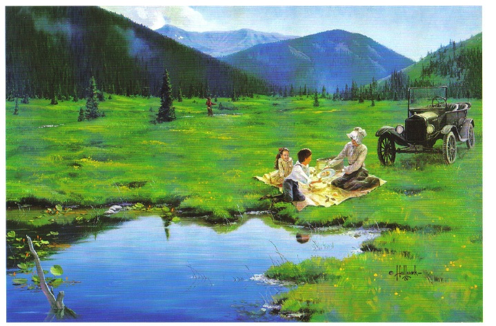
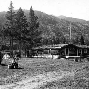
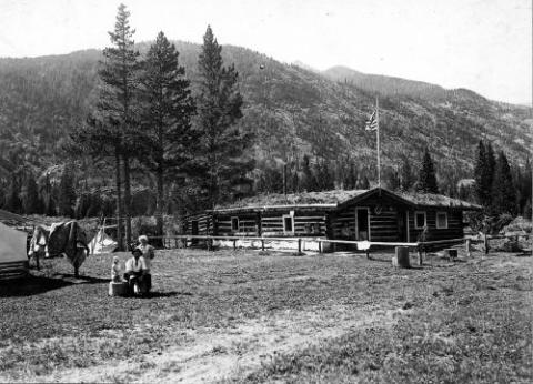
Have you ever heard of a worm farm? Harry French Sr., who lived for many years at Azure, on the Colorado River, loved to fish, anywhere and anytime.  He had brought the first angleworms into the valley from Iowa.  At his Azure homestead, he made a worm bed and got his worms established. Pretty soon, everybody came by to get some worms for their own needs.  

Worms can’t be found just anywhere in these high mountain valleys. However, at the Arkell place (Diamond Bar T) on Ranch Creek in the east end of the county, luckily someone had planted worms in a corner of the garden plot and this was the only place the Arkells could find worms.  At one point, Gertrude Arkell’s cousin Rose started a small business, digging worms from the garden and selling them to fishermen who happened by.  She even charged the rest of the family if they wanted worms!  

Gertrude described planting their own garden in 1916 after they moved to the ranch.  Papa spread several loads of well-decayed fertilizer from an old corral onto the garden and plowed it, creating a fine base for his vegetables.  Of necessity, pioneers coming into Grand County started immediately to see what would grow here.  They had to eat, and gardens were one of the first items on anyone’s agenda.  Coming over Dice Hill from the Blue and into the Sheephorn area about 1880, Joseph McPhee, a Scot, homesteaded the grass-covered McPhee Flats in Garden Gulch, site of the first garden in the area.  There were only two other homesteads on the Sheephorn at that time.  

Possibly Nancy Veatch Schissler, (Mrs. Henry Roric) planted the first garden on the Williams Fork in 1883.  She asked the men to plow her a bed, but they were positive nothing would grow.  So, undaunted, she planted lettuce, onions, and radishes on her dirt roof and potato peelings along the ditch bank, all of which grew!  Her little daughters fetched pails of water to hand to her up on the roof for irrigation.  

George Henricks, on the farthest reaches of the Troublesome, rarely had access to stores.  His wife, Aurella, bravely started radishes on her sod roof before the ground thawed, later transplanting them to a sheltered spot along with other vegetables.   What were the usual high altitude crops?  Lettuce, green onions, peas, root vegetables, and beans generally grew well.  Willis Call near Kremmling brought the first white potatoes to Grand County. 

Now, the Arkells on Ranch Creek had been told that at 8900 feet altitude, beans would freeze, and they did.  So did the potatoes, except those planted high up the hill in a spot where the soil was deep and black.  An aspen grove had grown there once, maybe for hundreds of years.   The family anticipated a good crop, but in early September or even in late August, a heavy frost completely melted the patch down.  That crop yielded bushels of small potatoes, few larger than golf balls.  Still, the Arkells stored them in their so-called ice-house, because until Papa got a cellar dug, there was nothing else.  They hoped the ice-house would keep the cold out, as it did heat, but the potatoes froze as hard as rocks.  Mama would bring in enough for a meal and immediately put them into a kettle of boiling water.  When done, they tasted like fresh potatoes! 

Before July, the family had early green onions, lettuce, and radishes, since these didn¹t mind the frost.  They froze every night but still lived, grew, and were good.  The white radishes grew long, slender, and crisp.  Head lettuce could be eaten early as leaf lettuce, or later as a fine firm head.  Peas didn’t mind the cold either but grew fast and tall. The package advertised them as “Telephone Pole Peas.”  They bloomed, set on peas ready to pick, and kept right on blooming and growing more peas, producing right up till early frost.  By late July, the Arkells had small rutabagas to eat, a crop new to them.  Turnips in late July were already large, and by fall they were gigantic but still sweet and good to eat raw. Turnips were pulled in the fall and stored in a great pile. Rabbits chewed off the outer skin and ate it but left the rest.  The remaining skinless turnips soon froze and made good cow feed.

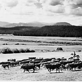
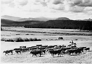
Actually, a number of ranchers grew turnips for cattle food, particularly for show cattle.   Over on the Sheephorn, Helen Anghern Curry related that families shipped plenty of potatoes and peas out of Radium to Denver.  Farmers had to get up very early to pick the vegetables in order to get them on the train. That was almost fresh!  

Grain was grown more commonly than one might expect, especially on the west end.  For instance, a young English chap on the Blue River, Tom Pharo, experimented with growing vegetables and grain as early as 1877.  The Company Ranch on the Williams Fork planted many acres in grain.  And Dr. Hoagland, on the Blue, regularly put in oats and barley for two years, before planting seed for hay crops, in order to break up the soil and gradually level the rough ground.  Others raised many grains such as wheat, rye, oats, and barley, as well as hay.   High altitude lettuce became a main crop to be shipped out of Grand County about 1920.  Before this decade, lettuce sent by train was grown, especially on the upper Sheephorn and on the Blacktail. 

Later, centered around Granby, farms spread to the Williams Fork and the Troublesome, as well as Ranch Creek.  Japanese laborers harvested much of the crop.  In 1919, there had not been a single truck farm in the county; in 1929, there were 34.   On the Troublesome, Roy Polhamus was famous for his lettuce.  His daughter, Catherine, lined the crates with heavy paper in the packing shed. After being cut in the fields, trimmed of bad outer leaves and packed, the crop was shipped to Denver by truck. It depended on how big the lettuce was as to how many dozen would fit into the crate.  Roy also grew enough potatoes that he could spare many for Granby stores in the winter.  

Encouraged by Nathan Hurd, a Mr. Henderson, on a little ranch straddling the shoulder between Hamilton Creek and Ranch Creek, tried growing lettuce long before the lettuce craze the west end of the county. Nobody had thought of growing it before and people were quite sure he was crazy.  His lettuce was as sweet as any ever tasted, but when the big craze hit, for some reason he gave it up.  Before he quit, he had some 2000 crates of Los Angeles Head Lettuce to sell and planned for 40 acres the following year.  Everyone laughed at him two years before when he started, but the laugh was on them now.  His 2 1/2 acres of jackpine paid him over $750/acre.   The lettuce was grown on new ground and no water; ­dry land farmed.  He called his place “The Happy Lettuce Farm”. 

In the same area, a group of Basques did all the work.  They irrigated at night, little lights at hand to show them the way.  This local lettuce was stored in Tabernash in a shed, before being put on the train.  This shed was later hauled to Granby and became the Grand Old Inn.   Other crops were raised, too. 

At Radium, sweet corn and strawberries were grown for sale.  Harry French’s wife, Mary, had a very green thumb, and at the 1914 County Fair, special mention was given to “Mrs. French of the Sheephorn area, then age 77, for her splendid display of Brown Australian onions, raised from seed.”  In addition, “she had a very handsome display of crabapples and tomatoes.”  Mike Leroux, also in the Sheephorn area, said that his family almost always won a prize at the county fair in Kremmling, because they had one of the few spots in the county where one could grow apples!   Women and children gathered wild berries for jams and pies.  Wild strawberries, raspberries, and gooseberries went into these treats.  The residents on the Troublesome picked chokecherries, and service berries, currants, in addition.  

Marie Craven George remembers growing rhubarb at their cabin.  Some of it still grows there.  Many years later, after Marie married, she and her husband dug up some of that rhubarb and took it to their own garden in Kremmling.  Marie remembers that, as a little girl, she stuck a gooseberry up her nose once and they had to hang her upside-down and spank her, until she sneezed the berry out.  She decided gooseberries were for pies and jams, not noses!  

Getting off the train, the Arkells often walked from Arrow, to check on the raspberry crop, for great quantities of bushes grew along the tracks.  The wild strawberries, though very small, were so full of unexcelled taste that one cup would be enough to flavor a shortcake for all of them, with whipped cream on top.  Using a kind of rake, they also gathered gooseberries, wild currants, and wild blueberries, which grew everywhere.  Bob Peterson maintains the best berry patch for blackberries or red and black currants was on Cabin Creek a mile of so above Devils Thumb Park.

Topic: Grand County

Grand County Trivia

After 1879 there were no Native Americans in Grand County.

In the 1800, the leading cause of death in Grand County was accidents followed by pneumonia.

Between 1887 and 1902, Grand County had no divorces.

The total resident population of Grand County in 1900 was 741.  The average life expectancy was 47 years.

Winters in Grand County often were severe, but nothing as terrible as the winter of 1898-1899.  Warm weather preceded the storm which began on February 2nd.  Four feet of snow fell by that first evening and the residents did not see the sun for the rest of the month as the snow continued to fall.  The snow continued into March and April and while few residents died, but the loss of livestock was tremendous.

Topic: Mining

Lulu City

A popular hiking trail in Rocky Mountain National Park leads to the site of the historic mining town of Lulu City.  When precious metals were discovered there in 1879, as many as 500 prospectors showed up.  When the mines played out four years later, they departed in haste for other promising boom towns.

Lulu City was named for the daughter of Benjamin Franklin Burnett, one of the town founders. At its height, the town had a hotel, post office, and a justice of the peace.  It was served three times a week by a state coach from Fort Collins, on the other side of the Continental Divide.

There were probably ten saloons which drew customers from various mines in the area, such as the Rustic, Friday Nite, Tiger, Carbonate and Southern Cross.  These yielded low grade gold, silver and lead but the remote location of the Lulu made the cost to process the metals so high that efforts were soon abandoned.  The closest smelters were probably well over 100 wagon miles away.

One of the more remarkable characters of Lulu was "Squeaky Bob" Wheeler.  His high pitched voice was unique.  He was subject to drinking bouts, but was usually a likeable, well-behaved citizen.

After working in the mines, Squeaky Bob saved enough money to purchase a ranch south of Lulu. There he established a guest house and became famous for his cooking skills and colorful hospitality.  The current Lulu City trail runs through the site of his property, which was named the Phantom Valley Ranch.  He sold the ranch in 1926, but it continued to be a popular tourist stop until it was included in the National Park boundaries. 

Error message

  • Notice: Undefined index: quantity in omega_views_mini_pager() (line 234 of /var/www/html/docroot/sites/all/themes/omega/omega/inc/theme.inc).
  • Notice: Undefined index: quantity in omega_views_mini_pager() (line 234 of /var/www/html/docroot/sites/all/themes/omega/omega/inc/theme.inc).

Places