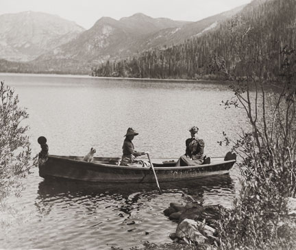

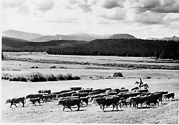

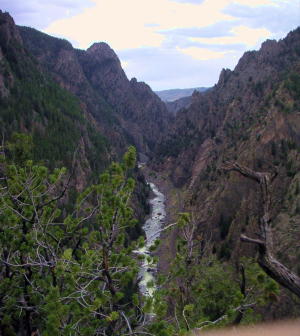
Story Contributed by Jean Miller Sam Conger worked long and hard in 1861, panning for gold along Coon Track Creek east of Colorado¹s Continental Divide; his findings encouraged him to follow the creek on up to 9800’. Arapahoe Indians of that area told him about their “Treasure Mountain” and when the government moved the Indians out, Sam resolved to explore. By the summer of 1869, he and five partners had found silver, enough to stake out the Caribou and Conger mines. A year later, the little town of Caribou was established to house miners that flocked in. Hopes were high and Caribou City soon had a church, three saloons, a brewery, and a newspaper to provide for the 400 people who lived there. Eventually, this district produced an estimated $8 million before closing in 1884, enough to give rise to Colorado’s being dubbed the “Silver State.” The area also became known as “The Place where Winds were Born,” for it was always windy, with plenty of snow to go with it. In September 1879, nearly the entire town went up in flames. Among those who lost their homes and belongings were Ben and Laura Simpson. The couple and their children found a place in the budding town of Nederland, where they stayed for six months while they decided what to do. Although the town was soon rebuilt for a population of 549, the Simpsons weren’t sure they even wanted to remain. Ben told his wife, “I’m thinking I’m not really cut out to be a miner. I reckon I’d like farming or ranching better.” Word was that Middle Park, west of the Divide, had fine open meadows, ranch land, and plenty of water. “That sounds hopeful,” commented Laura. But how to get there was another question. To the north no roads existed, all the way to Wyoming. Indians sometimes entered the Park by way of the Milner Pass area or over Flattop Mountain, but that was a long way from Caribou. To the south, the Crawford family, in 1874, had used a road of sorts, built by J.Q.A. Rollins; but that too was a long way from Caribou. Berthoud Pass also had been opened in 1874, but that was even farther to travel, and walking was the only choice the Simpsons had. As it was, several trips would be necessary to get their meager possessions all moved. However, Ben had heard of a closer Indian trail that led over Buckhannon Pass (sic). Simpson knew that there was fairly flat country between Caribou and a branch of St. Vrain Creek, which drained from Buchanan Pass and was closer at hand. “We’ll go that way,” said Ben. “I figure we can make it one way in a week or so, at least, if we don’t get lost.” Now, what we call “Buchanan” Pass and Creek today is supposedly named for James Buchanan, the pre-Civil War president, who was also president when Colorado Territory was created. Be that as it may, early maps of Colorado, including Hayden’s 1877 Atlas, don’t name the pass at all and it’s uncertain if, in fact, this is so. July was well along when the family packed the first load of their belongings, along with food that wouldn’t spoil. They headed out, the children driving or leading their stock. Chickens were confined in coops, lashed to horses’ backs and the pigs in crates, to mules. Progress was not difficult to start with, though it was slow, for Ben often had to scout on ahead. He had only a very sketchy map and there were no roads to follow. Still, the family was glad to stop a bit and rest and to let the animals graze. It took most of three days to reach the St. Vrain and locate the rumored Indian trail. Tall aspens and pines crowded the forest here and the ground vegetation was thick, with large boulders scattered everywhere. “Keep those critters moving,” Simpson told the children. “Don’t let them wander. I want to get to the top of the pass today, if we can.” Pines gradually gave way to moss-festooned spruce, but finally, the faint trail left the forest and opened onto bare, glacially-carved terrain with spectacular views of what today we call Indian Peaks, rugged, with sheer cliffs, surrounded by huge boulders. Even though t was mid-summer, they met drifts of deep snow as they climbed higher and they had to pick their path through the wet and slop. The horses and mules plunged and pawed their way through, chickens squawking frantically and pigs grunting uneasily. The final stretch of the narrow path was steep enough that they had to make several switchbacks up the rock face to the tundra on top, almost 12,000’ high. A chill wind quickly dried their sweaty faces, and everyone was happy to stop for a breather. The view was stunning; Sawtooth Mountain towered to the southeast, with its flat summit and sharp drop-offs on three sides. Alpine grasses and flowers of the most brilliant colors grew between flat lichen-covered boulders atop the crest. The animals fell to grazing eagerly while the Simpsons looked west towards what would be their new home. Soon, though, Laura said, “Let’s move on down, Ben. I¹m getting chilled, and I see a thunderstorm building over that way. I don’t want that to catch us on top here. They scare me.” So the little group moved down the easy tundra slope leading northwest, until they spotted the descending trail. This soon dropped steeply to a bench. Here and there the spruce forest opened to meadows, soggy with melting snow and filled with little creeks, tarns, and abundant flowers. Parallel to their route, Buchanan Creek gained momentum as it plunged downward, and whenever the canyon narrowed, the immense amount of water crashed and tumbled over the large boulders, creating a tremendous and frightening roar. “Don’t anybody get near that creek,” cried Ben. “If you fall in, we’d never get you out!” When the Simpsons saw that the trail, such as it was, seemed to split, they chose to go right, which seemed more moderate. “That creek spooks me, with all its noise,” said Laura. The forest was lodgepoles and aspens now and everyone was pleased when they came to a large, deep lake with boulders surrounding the water’s edge; they heard later this was Gourd Lake. “Shall we camp here,” suggested Ben? “No,” said the children. “It’s too wet!” On they trudged then, down another very steep drop, switchbacking through the trees as well as they were able. At last, scrambling over unstable, loose rock, they reached the valley where another large stream cascaded down on the left, to join Buchanan Creek. The way eased and the valley gradually opened until finally, to everyone¹s delight, a huge park appeared, with meadows filled with grass turning golden in the summer sun, sparkling streams, and kindly hills surrounding all. The end of their trek was at hand. Just then Laura spotted a rider on the far side of the meadow. The man turned out to be Henry Lehman, a recent homesteader and rancher, one of only three in the area. “Welcome to Middle Park and to Grand County,” he cried. When he heard who they were and where they had come from, he said, “Stay the night with us. My wife will be delighted to have company; she sees so few people.” The Simpsons were overjoyed at such a welcome. Then Henry added, “You can rest with us a few days and leave your things here until you have fetched your other belongings. We can talk about where you might settle and even help you build a cabin before winter.” Thus it was that Ben and Laura Simpson found a new home in this green oasis of Middle Park. Sources: Louisa Ward Arps: High Country Names,GCHA Journals:1982 The Journey 1987 Indians of Middle Park, 1985 Ranching and Ranchers Henry Lehman, Deborah Carr, Hiking Grand CountyTrails and other hiking experts, Robert C. Black III, Island in the Rockies &l ;/P> <
Category: