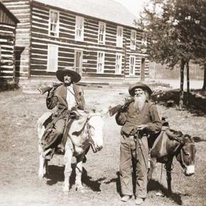
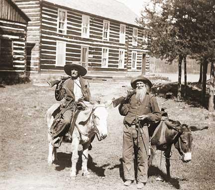
John Wesley Powell about the time of his Longs Peak ascent
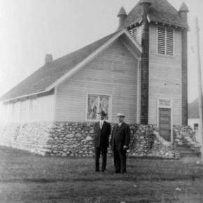
Spruce Lodge

Transportation

How did people travel to Grand County? How did they get around? Click on the drop-down menus and take a little trip through history.

Browse Subtopics

Transportation Articles

Getting Around in North Park

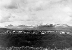
United States Geologist F.V. Hayden visited North Park briefly in August, 1868 in company of a small party of Army officers from Fort Saunders.  The campsite he described on the Big Laramie River is where the Boswell Ranch was later established.  They crossed the river at that point and entered North Park after following the Cherokee Trail twenty-five miles.  The trail from Boswell angled across Beaver Creek and Bear Creek to Chimney Park and then turned southwest to the neck of the Park.  It became North Park's main connection to the outside world.

In 1879, the year of the great fires, naturalist George Grinnell hired a teamster with a stout team and a Studebaker wagon to take him to North Park from Laramie.  By then wagon trails were numerous in the Park, probably created by market hunters who, in turn, likely followed travois-trails made by Indians.

Stagecoach service between Laramie and North Park started in May, 1881 with tri-weekly trips by Concord coach to mining community of Teller City.  The scheduled time for the trip was fifteen hours without any stoppage except for meals and to change horses.

After the mining activity at Teller slowed down the stages ran from Laramie to Walden.  Travel time was about twelve hours with three drivers on the route and five changes of horses, coming and going.

The Laramie-Walden stage had the best record for continuous service of any in the west in 1907.  At that time the mail had been carried six days each week for more than six years without missing a trip, although weather and roads had sometimes delayed the arrival of the stage until 2 or 3 in the morning.

That is a remarkable record considering the weather conditions the stage traveled in.  The editor of the Walden newspaper once described the Laramie Plains as a place "where the wind blows 400 days out of the year--sometimes with a speed and force that turns over wagons and miles of barbed wire fence."  During the winter months the stage would typically start from Laramie with a coach with wheels, transfer to a coach with sled runners at a point above Boswell when the snow got deep, and then transfer back to a coach with wheels when the snow ran out in North Park.

North Park had a public transportation system a century ago.  From Walden local stages carried the mail to the various post offices scattered around the Park.  Passengers could ride on the mail stages, so a traveler could get off the train in Laramie or Granby, take the stage to Walden and the next day catch a ride with the local mail stage to any place in the Park mail was delivered.

During the winter months local travel was by team and sled, skis or snowshoes. Willow Creek Pass became an important travel route for North Park after the Moffat Railroad reached Hot Sulphur Springs in the fall of 1905.  Dave Gresham established a road ranch for travelers near the top of the Pass.  J.W. Welch, the Rand merchant, soon had two freight outfits running between Rand and Granby and tri-weekly stagecoach service between Walden and Granby started in the spring of 1908.  Passengers left Walden at 6 a.m., spent the night at the Nixon cabins on Willow Creek Pass, and arrived in Granby at 11 a.m. the next morning.

Wagon loads of oats from the Yampa Valley were freighted into the Park over Buffalo Pass.  Construction of a road over Rabbit Ears Pass was still several years away.  Cameron Pass was a major transportation route in the days when Teller City was booming.  By 1879 it was obvious that the Park would soon be settled and Fort Collins businessmen were urging that a road to North Park be built to secure the travel and trade of the region before a trade route developed through Laramie.  A toll road was completed over Cameron Pass by 1881.  There was a charge of $2 for each vehicle drawn by one horse, ox or mule passing through the toll gate at Rustic.  A single span was $3 and any additional horses $1 each.  Business was brisk for only a few years and the road was opened to free public travel in 1902, but by then the public was using the road over Ute Pass and the road over Cameron Pass soon fell into a state of disrepair.

While a few automobiles ventured into North Park each summer, there is no mention in the early newspapers of anyone in North Park owning one of the contraptions by the spring of 1909.  There was one steam tractor in the Park and bicycles were popular.

Moffat Road
Moffat Road


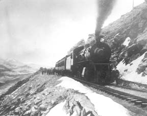
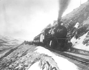
"I shall never forget it as long as I live. Nor do I ever expect to experience anything comparable to it again. Civilization had found its way across the mountains into Middle Park," reflected Mrs. Josephine Button in 1955 on her 91st birthday, as she recalled seeing smoke from the first Denver Northwestern and Pacific work-train on Rollins Pass, high above the Fraser Valley and Middle Park. Once those rails made it over the Continental Divide all the way to Hot Sulphur Springs, "changes came thick and fast." Many men, many dollars, many routes and many dreams tried to bring a railroad over the Continental Divide into Northwest Colorado, and the "Hill Route" over Rollins Pass that finally accomplished it a century ago has retained its allure ever since.

The Moffat Railroad built a cafeteria, telegraph station, living quarters for Moffat's "Hill Men" (as the railroad crews up there were known) and a fine hotel - all collectively called Corona Station. Soot-filled snow sheds protected over a mile of this windblown section of track. And where today silence is the most powerful sense, colorful locomotives pulled passenger and freight cars, filling the rare atmosphere with black smoke and mechanical clatter.

Decades of men's dreams lay behind the once massive snow shed that cut the bitter winds from the north and west, behind that fine hotel that offered some of the most spectacular scenery in America, behind the hopeful Town of Arrow nestled below tree-line ten or twelve miles west of Rollins Pass, and behind that first work-train that Josephine Button watched from her hay ranch along the Cottonwood Pass Wagon Road to Hot Sulphur Springs. Competent, often powerful, men in the 1860's through the 1890's filed surveys, graded road beds, and even began drilling before being stopped by severe storms that foiled the best laid plans or their inability to fund the ambitious projects.

Dreams to penetrate the high mountains along the Divide in central Colorado began when the Front Range was flooded with miners during the Gold Rush of 1859. Even before Colorado became a territory in 1861, Golden City, just west of Denver along Clear Creek, recognized its potential as a gateway to the rich mineral resources of mountain towns like Central City, Black Hawk, and Georgetown. Golden City's ambitions went beyond becoming a mountain transportation hub, believing that with the right incentives, enthusiasms, and leadership, its location supported a future as a national commerce center. 

Golden City certainly had men of vision, ambition, and wealth among its ranks. William Loveland and George Vest, both young and feverishly ambitious to see Golden City reach its potential, vigorously pursued their dreams for a powerful commercial center in Golden City. From Missouri River towns like Leavenworth in Eastern Kansas, leading town founders also recognized the benefits of linking their water and rail routes to the east with the resources of the west. Finally, as if destiny had demanded it, Edward L. Berthoud, a young civil engineer and surveyor with energy and ability, arrived in Golden City from Leavenworth in April of 1860 to unite the similar passions of leading citizens from both locations.

From 1861 until 1866, Berthoud, Loveland and Vest focused on bringing a direct transcontinental railroad route through Golden City. First, Edward Berthoud, along with Jim Bridger and a capable young cartographer named Redwood Fisher, blazed a trail across Berthoud Pass through Middle Park all the way to Salt Lake City. Returning to Golden City on May 28, 1861, Berthoud reported "a good wagon road could be ?quickly' built" from Denver to Salt Lake City over Berthoud Pass for about $100,000.00. According to the local hyperbole, a railroad would surely follow.

In spite of considerable enthusiasm, disappointment plagued early efforts to put a rail line over the mountains in Colorado Territory. In 1862, Territorial Governor John Evans sent the Surveyor General for Colorado and Territories along Berthoud's route and others to confirm or deny the potential of a railroad line. About the same time, the Union Pacific Railroad Company sent an independent reconnaissance to examine potential routes over the divide that included Berthoud and Boulder Passes (Boulder Pass became Rollins Pass in the early 1870's, when John Quincy Adams Rollins built a toll road over it, and then Corona Pass when the Railroad crossed it). Surveyor General Case and the UP agreed that neither route offered much hope for a standard gauge railroad. The dream of a transcontinental line over the Continental Divide through central Colorado seemed to die with the UP surveyor's words, "I learned enough to satisfy myself that no railroad would - at least in our day - cross the mountains south of the Cache la Poudre..." 

Multiple failed attempts to bring a rail line over the Divide through Middle Park during the following decades strengthened the UP's "death sentence." Against the odds, Berthoud and Loveland continued to solicit support for a railroad west over or through the Continental Divide, using improved surveys and maps to support their requests. In the 1880's, survey crews from a variety of railway incorporations were scattered over the high country on or near Rollins Pass. Over Berthoud, Rollins and other passes, they marked potential railroad lines with their wooden stakes. It was during this stretch of strenuous surveying activity that David Moffat, a highly successful Denver capitalist, got involved with an unsuccessful effort to bring through the mountains instead of over the top. 

 In the early 1880's, Mr. Moffat invested in the Denver, Utah and Pacific Railroad, which intended to tunnel through the mountains near Rollins Pass. Like the other efforts, though, the Denver, Utah and Pacific vanished in a few short years. Unlike many other lines that accomplished little more than surveys and maps, the DU&PRR completed significant grading and began tunneling before reaching the "end of its resources."

Money, power and success supported Moffat's dream to put Denver on a direct transcontinental railroad line. Doctor Robert C. Black, III, wrote that David Moffat's failed efforts in the early 1880's converted him to the idea that Denver needed to be on a direct transcontinental rail line. Moffat considered the route over Rollins Pass valuable enough to have surveying and grading crews working on it throughout the winter in 1902. The Denver Rocky Mountain News claimed that Moffat's route through Northwestern Colorado included "the largest strip of fertile land as yet undeveloped in the United States..." With his Denver, Northwestern and Pacific Railroad, David Moffat planned to make good his intentions to put Denver on direct transcontinental railroad line.

Moffat's original plan called for the "Hill Route" over Corona Pass ? the name changed from Rollins Pass in honor of Corona Station at the top ? to last for only a few short years. While the "temporary" route over the top generated resources by extracting the resources of Northwestern Colorado, a tunnel was to be bored through the Continental Divide. Even the wealth and power of Moffat, though, failed to adequately finance the tunnel before he died in 1911. The temporary line, therefore, lasted for nearly of a quarter century, from 1904 until 1928.

Its obstacles proved as enormous as the mountains it crossed. Work crews had to cease operations because of snow for most of April in 1920. The road was closed from late January until May in 1921. In December of 1924, engine number 210 busted "a main reservoir pipe," causing the train to fly down the hill out of control until it jumped the tracks and crashed into the valley below. Clearly, the Denver and Salt Lake Railroad, which took over Moffat's DNW&P after his death, needed a tunnel to replace the expensive effort over the "Devil's Backbone."

 As Denver and Salt Lake Locomotive Number 120 came through the tunnel in early 1928, it represented the culmination of a massive undertaking through wet, unstable rocks which required considerable engineering ingenuity and caused six deaths in a 1926 cave-in. It also took an enormous amount of coordination and effort to secure the necessary funding. Through local bond issues, private investors and other means, the project was completed. And through a connection at Dotsero, a railroad station less than 30 minutes west of Vail on I-70, freight and passengers could make a direct Pacific connection from Denver. Posthumously, David Moffat's dream became a reality.

For significant periods of time since the trains stopped operations over Rollins Pass in the late 1920's with the opening of the Moffat Tunnel, on-road vehicles crept along its relatively easy grades and wide curves from Rollinsville on the east slope to Winter Park on the west side of the Divide. Like now, the road ran through an area attractive to backcountry campers and sport enthusiasts. On September 1, 1956, local officials and private citizens met on Rollins Pass to celebrate a "joint state-federal-county project to convert the old D. & S. L. railroad right of way over Corona Pass into an access road for sportsmen." According to the Denver Post, the game and fish department's construction division reconstructed the road during the summer of 1955 for about $20,000. The following year, the road became a scenic route over the Continental Divide for family cars and jeep caravans alike. And after it was built, or at least reconstructed, they did come. Intrepid tourists into Middle Park.

Railroads
Railroads

Construction on the railroad line from Denver to Grand County began in July 1902.

The project, called the Moffat road (officially the Denver, Northwestern & Pacific), was the seemingly impossible dream of David H. Moffat, who spent much of his personal fortune building the tracks over the Continental Divide.

The rails pushed higher and higher up the mountains until they reached a station named Corona, meaning the crown of the continent.

Corona was the highest point in the world with a standard gauge railroad and the journey from Denver in the winter was perilous at best.

Huge snowplows were required on either side of the Divide to keep the tracks clear.

Eventually, in the late 1920s, a tunnel was dug through the range, eliminating 22.84 miles of track and the breathtaking journey over Rollins Pass.

The railroad reached Granby and Hot Sulphur Springs in 1905 and Kremmling in 1906, and played a significant role in building the population of Grand County.

In 1900 the total resident population of Grand County was only 741, but grew to 1,862 in 1910.

Stage and Freight Lines

Berthoud Pass Stage Road was built by the extreme efforts of Captain Lewis Gaskill.  It came from the top of the Pass through Spruce Lodge, Idlewild (now Winter Park), the Cozens Ranch (near Fraser) Junction Ranch (Tabernash) and Coulter.  From there once branch lead over Cottonwood Divide to Hot Sulphur Springs (and points west) while the other went to Selak’s and over Coffey Divide to the Lehman Post Office and on to Grand Lake.  

At the summit of Berthoud Pass there was a large house of hewn logs, occupied by Lewis Gaskill and his family.  They collected the tolls for the road and gave welcome shelter to those weathering the variable passage.  The house was located on the West side of current Hwy. 40 but no trace of the building remains.  

At the steepest portion of the west side of Berthoud Pass was the Spruce House rest stop, which by 1900 was a sold structure of two and a half stories.  There the traveler could find a warm meal and corral for livestock.  No trace of it remains today.  

The Idlewild Stage Stop was located in present day Winter Park and was a popular place to change horses before the steep assent up the pass.  Mrs. Ed Evans served a hearty noonday meal there for only 35 cents.

Cozens Ranch was also one of the more popular stops and Fraser Post Office until 1904. Built around 1874 by William Zane Cozens, it remains today, outfitted in period décor and is the home of the Cozens Ranch History Museum.  

The Gaskill House, in Fraser was built by Lewis De Witt Clinton Gaskill, one of the original investors in the road and a prominent Grand County citizen. The house now houses the Hungry Bear Restaurant.

Junction House at Junction Ranch (Tabernash) could accommodate up to fifty travelers and was built by Quincy Adams Rollins, and subsequently leased to Johnson Turner.   

The Coulter Stage Stop was built by John Coulter, an attorney from George town and shareholder in the stage road.  It also served as a Post Office from 1884 to 1905. 

Frank and Fred Selak, sons of a pioneer Georgetown brewer ran the Selak stop which was north of Granby and east of current Hwy. 34.           

Cottonwood Divide (Pass), at 8904 feet above sea level, was laid out by Edward Berthoud and Redwood Fisher in 1861.  The route was used by stagecoaches from 1874 until the railroad arrived at Hot Sulphur Springs in 1905.  The last driver on the route was Charlie Purcell.  Summer travel time between Hot Sulphur Springs and Georgetown was typically twelve hours. Travelers between Hot Sulphur Springs and Kremmling could stop at the Barney Day or King Ranches, both near current Hwy. 40.   The Pinney Ranch House, used by the firm of Whipple and Metcalf for the connecting service to Steamboat Springs, is still standing on Hwy. 134 on the east slope of Gore Pass. There a traveler could pay 50 cents for a meal, 50 cents for a bed and expect a change of horses every ten miles.  It ceased operation in 1908 when the railroad reached Toponas.  

The flood that built the Moffat Tunnel

Article contributed by Tim Nicklas


For many years Denver longed for its own direct line through the continental divide, linking the city to the west coast.  In the 1860s, Denver was slighted by the Union Pacific(UP), when the company chose Cheyenne as the major hub for the prized Transcontinental Railroad, before it snaked through the Rockies.  Fortunately, the city fathers of Denver did not give up on making their city the center of the Rocky Mountain Empire, as they risked financial disaster by bankrolling a spur line to the main route in Cheyenne.  Denver may not have had their direct route to the west and the fortunes that lay on the other side of the divide, but the city was not dead. 


For Grand County, the U.P.'s decision not to penetrate the formidable barrier of Colorado's mountains had a much greater impact.  As it stood Grand County had no for seeable future of gaining a rail line.  This meant that the only means of transportation into or out of the county was by pack animal or foot.  Furthermore, without a line to Denver, there was virtually no practical way for industry to develop in Grand County.


In 1904, Denver and Grand County's long awaited dream of a direct line through the mountains and on to Salt Lake City began to materialize.  The Moffat Railroad had risen over Corona Pass and descended into the Fraser Valley.  At the time Corona Pass was the highest rail pass in the world.  Along with this fact came the troubles of maintaining such a wonder.  The route was challenging to keep open in the summer with the violent storms that are prone at such a location.  In the winter the line would close all together.  Adding to the trouble of the unpredictable route was the fact that Colorado's economy of the 1870s was not the same in the early 20th century.


In the 1870s, much of Colorado's mineral wealth was centered directly west of Denver in Central City and Georgetown.  By 1880 many of those mines began to play out.  Furthermore, production shifted to the silver mines of Leadville and the Arkansas Valley.  As a result, rail traffic favored Pueblo over Denver.  Pueblo was situated on the plains as the Arkansas River exits from the mountains, eliminating the need for boring tunnels or climbing over arduous mountain passes.  In addition, Pueblo was close to the coalfields that were essential to power the locomotives.  Also, the city was the site of the largest steel mill west of the Mississippi, which supplied rails for the sprawling network.  Finally, Pueblo's smelters boomed when many others withered after the "Silver Panic" of 1893.  At the same time that depression gripped Colorado and silver was devalued, gold was discovered in Cripple Creek.  Within a few short years the new gold camp would become the world's largest producer.  As a result, nearby Pueblo would reap the benefits by converting from silver to gold, to become the smelting capitol of the nation.


By the early 20th century, Pueblo's status as an industrial powerhouse and rail center threatened Denver's status as Colorado's "first city."  This was even further evidenced by the "powers-that-be" in the northern part of the state being unable to convince the rest of Colorado to finance a tunnel under the continental divide west of Denver.  Time and again legislation that would fund the missing link between Denver and the western slope was defeated in the statehouse by those in southern Colorado who were content with their established web-link.  Barring a miracle, it looked as if Denver and Grand County would have to settle for the unreliable Moffat line over Corona Pass.  In 1921 that miracle would rush in, due to un-for-seen misfortune upon Colorado's "second city" in the south of the state. 


The spring of 1921 started as many do in Colorado, with a drought.  By June 1st the many farmers downstream in the Arkansas Valley feared disaster as crops withered with thirst.  On the 2nd day of June, the farmers got the relief of rain they eagerly wanted.  Unfortunately, the downpour continued until the formerly parched earth became like a sponge and the Arkansas River swelled.  The streets of Pueblo were ankle deep with water by nighttime.  Suddenly, with little warning, a torrent of water rushed from the upper Arkansas Valley toward the helpless "Steel City."  Pueblo's streets filled with water up to rooftops.  The unified rail-yard was ripped instantly.   Unfortunate train passengers were tossed unaware into the maddening grip of the Arkansas, unable to escape the iron coffins in which they were riding.  Families were stranded on roofs as row boats desperately searched for stranded victims.  As pungent water filled the business area with filth and debris, fires broke out.  Unable to do anything, citizens watched helplessly as fire and water consumed their city.  As the flood receded the Rocky Mountain News headline proclaimed "201 Bodies Found, Scores Lost, Pueblo Death Total, 500 To 1,500."  The Rocky Mountain News goes on to describe the scene from June 4th:

"All day long refugees, dazed, not knowing what to do, straggled

about the streets.  Mothers with babes in their arms, mothers

whose arms were empty, old men and women and people of every

description wandered about until gathered up and taken to Red

 Cross headquarters, where they were fed and allowed to rest."

The scene in Pueblo was like those witnessed in New Orleans after Hurricane Katrina or the notorious San Francisco Earthquake in 1906.


As Pueblo dried out in the days that followed, plans were immediately being drafted in the statehouse to assure that the devastated city would not befall a future wrath from the Arkansas River.  Seizing upon the opportunity presented by Pueblo's misery, interests in Denver, Grand County, and others in northern Colorado saw fit to take advantage.  As the discussion of flood control in the south dominated state legislation the notion of a tunnel under the continental divide west of Denver resurfaced.  According to Ubbelohde, Benson, and Smith's book, A Colorado History 8th Ed., a "special legislative session made history."  Attached to the act that created the Pueblo Conservancy District, northern lawmakers added the Moffat Tunnel Improvement District.  As a result of the passage of these two distinctly different special tax districts in a single signing by Governor Shoup, the long sought after western passage would be built.  With the tunnel Grand County would finally be open to the outside world by a year round and reliable link.


The building of the Moffat Tunnel was an enormous undertaking that cost several lives and injured even more workers.  Nonetheless, the tunnel from its inception has remained of vital importance to the Fraser Va

The Train Comes to Fraser

Article contributed by Tim Nicklas
 

A little over a hundred years ago the few residents of Fraser were awakened by a sound new to their town.  The railroad had finally arrived in 1904, just over 30 years after it had first debuted in Denver.  That same blaring horn, followed by the rumble of iron wheels on rails is waking up the good town-folk of the Fraser Valley today.  As the local Manifest has documented recently, many residents have long been annoyed by the noisy disruption the train makes as it announces its passing through town.  Additionally, parents of school children rushing to Fraser Elementary School in the morning can attest to the intrusive obstacle the slow moving behemoth becomes at in the morning.

A hundred years ago, residents of the Fraser Valley complained loudly of the intrusion of the iron horse on the tranquil lifestyle.  It has long been rumored that the course of the railroad was determined by an angry old timer by the name of Billy Cozens.  Cozens was a pioneer of the valley having homesteaded his ranch in the area in the early 1870s.  According to legend, when the engineers were surveying the route of the future Denver, Northwestern, and Pacific Railroad through the valley, Billy Cozens bullied the crewmen into the woods.  As the railmen would lay their flags for the roadbed, Cozens, an expert marksman, would shoot the markers out of the ground.  As the story goes, this was the reason the tracks were laid through the forest, rather than the meadow.

The reality of the chosen route for the D.N.&P. was due to grade and not fear of the rifle.  Whether Cozens despised the railroad is anyone's guess.  According to Robert Black's book, Island in the Rockies, the railroads designing engineers actually consulted Cozens concerning the lack of snow on the continental divide.  Regardless, the rumors have persisted over the years about the "Old Sheriff's" contempt for the railroad.  It has even divulged to me that the ghost of Billy Cozens will not allow anything concerning the railroad in his former home, the Cozens Ranch Museum.  Whenever railroad exhibits have been attempted they have mysteriously vanished and were never seen again.

As far as the townfolk of Fraser were concerned, many of them regarded the railroad as an opportunity that had eluded the region for years.  Unfortunately for Fraserites, their town was to be bypassed as the major hub for the area.  Further down the valley Tabernash was chosen as the location for the workshops and roundhouse for the forthcoming trains.  As a result, the trains would move through Fraser without their engineers paying the town much notice outside of their blowing whistles.  Nonetheless, the people of the valley would embrace the iron horse.  Economic potential in Grand County would erupt due to the advent of relatively efficient transportation.  Specifically, the lumber industry would boom with the outlet that the railroad would provide.  Additionally, people could move between Denver and Grand County easily compared to the wagon roads that formerly provided the only passage to the outside world.  As timber and cattle traveled to the Front Range, mail and hard goods traveled back to the Fraser Valley.

In years past, just like today, it has been easy to forget the benefits that the railroad has brought to our lives.  Certainly, when the train moved into the valley, the people that day realized that their life could slow down a bit.  The reality was that the short inconvenience that the passing train brought with its blaring horn, bringing traffic to a momentary standstill enhanced the life and character of the Fraser Valley.  It provided power, people, and materials in a unique way that simplified life here.  This is as true today as it was in 1905.      


Train Legends of the Moffat Road

Article contributed by Abbott Fay

The railroaders graded and bridged the trails originally made by the Indians and expanded by the trappers, prospector and stage road builders that following in rapid succession. The

Moffat Road
train track has an almost endless series of wreck stories and legends.  In one, a "green clerk" was said to have piled all the mail order catalogs on the same side of a car, causing the train to leave the tracks and roll down the mountainside into Yankee Doodle Lake.


In another lost train story, the No. 3 westbound was seven hours late out of Denver because of a severe winter blizzard.  It crept out of the Fraser Canyon and whistled for the Granby Crossing.  The engineer parked the train intending to wait till daylight to continue on.  In the meantime, the No. 2 eastbound, 2 days late out of Craig reached Corona without passing the No. 3. In the morning, all were amazed to find the train parked "plumb center" of Granby's main street. Later investigation showed that the No. 3 train left the train tracks just east of Granby and traveled almost a mile over frozen highway.  The next day a Chinook wind came up and melted the frozen soil, sinking the train to it's axles in mud. It required the building of 1500 feet of special track to salvage the train. However, some longtime Granby residents say the locale of this incident was the Kremmling flats.


Sources: Roland L. Ives, Folklore of Middle Park Colorado,Journal of American Folklore, Vol. XXXIV, Nos. 211, 212, 1941; Levette J. Davidson & Forrester Blake, Rocky Mountain Tales, University of Oklahoma Press, 1947


Wagons of the West
Wagons of the West

Transportation into Grand County in the late 1800's was one of the more difficult tasks. Stage coaches were used to carry the many people to and from the county.

The first stagecoach into Grand County was a Concord. The Concord stagecoach was a luxury wagon weighing around 2,200 lbs. It cost around $1,050 and was beautifully painted. No two Concord luxury coach paint jobs were the same. The wheels were made of white oak and would not shrink in the cold or expand in hot weather, and made very reliable, durable wheels. The body was iron barred and was easier for the horses to pull than some of the other standard stagecoaches of its time. The mountain conditions caused different rules and a different coach then the stereotypical Concord.

The inside of a Concord was four feet wide, and four and one half feet tall. The coach had leather curtains, but they did little to keep the dust, wind, snow, and rain out. Three benches lined the inside, and held nine passengers. The coach was often known to hold up to six people on the roof as well. Luggage was held in the "boot", a metal box on the back of the coach. Mail was often put in the "boot" for transportation, or kept right behind the driver.

The average speed for the Concord was around fifteen miles an hour. The braking system was sand bags placed over the brake pads, so that sand could be released on rugged hills. The Concord was only used for one year because of its weight and bulkiness it did not make for a good coach in the mountains. The weight, price, and bulkiness caused this stagecoach to be produced for one year before another one came into play.

At one third of the cost, the Dearborn took over after the Concord. These were known as Mud Wagons because of their easy travel in the mud and tricky terrain. The Mud Wagon weighed around 1,600 lbs. and was much more efficient. It had the standard four wheels, but was only pulled by one to two horses, and could hold around one to three people. However it was not as luxurious as the Concord. They often  did not have side curtains, and the seats were not as nice. The cabin sat on wooden springs. The Mud Wagon was used by farmers, peddlers, emigrants, and pleasure travelers as it was affordable and decent in appearance.

The weary traveler who took the stagecoaches soon learned the rules of the road. The best seat was next to the driver where there were less bumps. Never ride in cold weather with tight boots or shoes, or tight gloves. If one is asked to walk, do so without grumbling as the driver would not ask unless truly necessary. Don't jump from the moving wagon, as nine out of ten times you will get badly hurt. Do not drink alcohol in cold weather as it can cause hypothermia. In warm weather it is okay to drink as long as you are willing to share. Eat what is available, no one wants to hear you whine. Do not smoke, or spit on the leeward side. Never swear, and don't fall asleep on your neighbor. Do not ask how much longer, you will get there when you get there. Never fire a gun as it will scare the horses. Never grease your hair because of dust and most important - remember mountain traveling is hard.The first stagecoach into Grand County was a Concord. The Concord stagecoach was a luxury wagon weighing around 2,200 lbs. It cost around $1,050 and was beautifully painted. No two Concord luxury coach paint jobs were the same. The wheels were made of white oak and would not shrink in the cold or expand in hot weather, and made very reliable, durable wheels. The body was iron barred and was easier for the horses to pull than some of the other standard stagecoaches of its time. The mountain conditions caused different rules and a different coach then the stereotypical Concord.

The inside of a Concord was four feet wide, and four and one half feet tall. The coach had leather curtains, but they did little to keep the dust, wind, snow, and rain out. Three benches lined the inside, and held nine passengers. The coach was often known to hold up to six people on the roof as well. Luggage was held in the "boot", a metal box on the back of the coach. Mail was often put in the "boot" for transportation, or kept right behind the driver.

The average speed for the Concord was around fifteen miles an hour. The braking system was sand bags placed over the brake pads, so that sand could be released on rugged hills. The Concord was only used for one year because of its weight and bulkiness it did not make for a good coach in the mountains. The weight, price, and bulkiness caused this stagecoach to be produced for one year before another one came into play.

At one third of the cost, the Dearborn took over after the Concord. These were known as Mud Wagons because of their easy travel in the mud and tricky terrain. The Mud Wagon weighed around 1,600 lbs. and was much more efficient. It had the standard four wheels, but was only pulled by one to two horses, and could hold around one to three people. However it was not as luxurious as the Concord. They often  did not have side curtains, and the seats were not as nice. The cabin sat on wooden springs. The Mud Wagon was used by farmers, peddlers, emigrants, and pleasure travelers as it was affordable and decent in appearance.

The weary traveler who took the stagecoaches soon learned the rules of the road. The best seat was next to the driver where there were less bumps. Never ride in cold weather with tight boots or shoes, or tight gloves. If one is asked to walk, do so without grumbling as the driver would not ask unless truly necessary. Don't jump from the moving wagon, as nine out of ten times you will get badly hurt. Do not drink alcohol in cold weather as it can cause hypothermia. In warm weather it is okay to drink as long as you are willing to share. Eat what is available, no one wants to hear you whine. Do not smoke, or spit on the leeward side. Never swear, and don't fall asleep on your neighbor. Do not ask how much longer, you will get there when you get there. Never fire a gun as it will scare the horses. Never grease your hair because of dust and most important - remember mountain traveling is hard.

Articles to Browse

Topic: Biographies

Stephen Bradley


Article contributed by Karen Wischnack


Born to a Wisconsin doctor in Chicago November 12, 1916 was one of seven skiing sons by the name of Stephen J. Bradley.  His talents in skiing showed up at a very early age.  By the time he was attending Dartmouth College his talents were apparent and was a top competitive skier.  He skied in the slalom, downhill, jumping and langlauf while on the college's team.  Steve then was called to serve his country during the World War II Army service.  After his discharge he then attended and coached skiing at Colorado University. 


In 1950 Steve became Winter Park's executive director.  During his employment at Winter Park he guided it from a four rope tow/three T-bar local ski area to a major resort of 770 acres with 13 chair lifts.  His brilliance in design led to the Balcony House, the Base Lodge which was one of the first ski area structures to utilize solar heating, the restaurant in the midway proved to be a model for the "scramble" system of food service and then there's the Mary Jane section of Winter Park which was another one of his talents.


Stephen was given the name "Father of Slope Grooming" in 1952 when he then invented the famous Bradley Packer-Grader when experimenting with slope grooming.  The invention was a one man gravity-powered slope grooming device which revolutionized the ski maintenance industry.  Nick-named "the Purple People Eater".  This machine was a mogul-cutting snow groomer that was 5-foot-wide corrugated culvert that a skier would drag down hill or as they said " A hardy mountain crewman" who risked his life by being devoured by the spinning rotor.  As skiing became more popular, skiers started demanding that the slopes be groomed.  Nature was no problem but not everyone wanted to ski moguls.  This Bradley Packer was a way to reduce the mogul's and keep snow on the trails by flattening the snow.  "It was a pretty scary thing" supervisors claimed.  Grooming was soon transferred to a line of tracked vehicles now known a "Snowcats". 


Stephen served as President of the NSAA (National Ski Areas Association) and helped organize Colorado Ski Country USA and the Colorado Passenger Tramway Safety Board before his death in Longmont November 13, 2002.  You can find him as an honored member of the Colorado Ski Hall of Fame and in the National Ski Hall of Fame.


Topic: Indians

Indians

There is a great deal of evidence of primitive cultures in what is now Grand County, but all seems to have been transient until the modern tribes arrived, probably around 1450. The Arapaho Tribe claimed the northern part of this region and were in frequent territorial dispute with the Ute Tribe, who were dominate in the Colorado Rockies. The Utes did not have “chiefs” in the sense of the organized Plains Indians.

There were five different tribal groupings in Colorado, and those in the Grand County area were known as the “White River Utes”. The Uncompahgre Utes lived in the southern area of the state, near the San Juan Mountains. Their spokesman to the white man was Ouray, and because of his knowledge of Spanish and some English, the federal negotiators designated him “Chief of All Utes”. Thus it was he, who in 1868 agreed that most of the land west of the 107th degree longitude (about one third of Colorado) would be a Ute Reservation “for all time”.

Ouray probably never knew the Utes of the northern region and they were never notified officially of this treaty. Suddenly, their favored hunting grounds of Middle Park, the healing waters of Hot Sulphur Springs, and much of the Front Range and Gore Range were opened to white settlement. Naturally there were tensions between the Utes and the white settlers and there are several well documented accounts of disputes in the area, including the killing of Tabernash, retaliatory strikes by the Utes, and the supposedly intentional burning of Middle Park by Colorow. Finally, there was an uprising in 1879, known as the Thornburg and White River Massacres, and the result was that the Utes were evacuated from almost all of their former reservation and driven to the Utah area in 1882.

Though much of the culture, knowledge and influence of the original Indian people has been lost to time, Ute and Arapaho names still grace many landmarks in Grand County.
 

Topic: Mining

Lulu City

A popular hiking trail in Rocky Mountain National Park leads to the site of the historic mining town of Lulu City.  When precious metals were discovered there in 1879, as many as 500 prospectors showed up.  When the mines played out four years later, they departed in haste for other promising boom towns.

Lulu City was named for the daughter of Benjamin Franklin Burnett, one of the town founders. At its height, the town had a hotel, post office, and a justice of the peace.  It was served three times a week by a state coach from Fort Collins, on the other side of the Continental Divide.

There were probably ten saloons which drew customers from various mines in the area, such as the Rustic, Friday Nite, Tiger, Carbonate and Southern Cross.  These yielded low grade gold, silver and lead but the remote location of the Lulu made the cost to process the metals so high that efforts were soon abandoned.  The closest smelters were probably well over 100 wagon miles away.

One of the more remarkable characters of Lulu was "Squeaky Bob" Wheeler.  His high pitched voice was unique.  He was subject to drinking bouts, but was usually a likeable, well-behaved citizen.

After working in the mines, Squeaky Bob saved enough money to purchase a ranch south of Lulu. There he established a guest house and became famous for his cooking skills and colorful hospitality.  The current Lulu City trail runs through the site of his property, which was named the Phantom Valley Ranch.  He sold the ranch in 1926, but it continued to be a popular tourist stop until it was included in the National Park boundaries. 

Topic: Biographies

Joseph Wescott

Joseph Wescott was born in 1838 in Nova Scotia and reared in Iowa.  By 1865, he was in Middle Park, squatting, half-blind and semi-alcoholic, in Hot Sulphur Springs with his friend Charlie Utter.  

Having come to Colorado to get relief from rheumatism, he passed his time in creative writing, fishing, drinking, and shooting his revolver.  In 1868, after being induced to sell all of his claims of 160 acres around the hot springs, he left Hot Sulphur Springs to go to Grand Lake.

In 1870, a group of Arapahoe Indians arrived in the area and there is an unverified report that Wescott, Jack Sumner, and three fishermen killed “not less than five” of the Indians.  Soon after this incident, Wescott settled into developing a rustic resort with cabins, rafts, canoes, and skiffs on Grand Lake.

By 1879, he had three buildings on the West Shore. In July 1880, disaster struck when Edward Phillips Weber, an attorney, took over Wescott’s original filing as his own.  Weber claimed that there were “flaws in the filing” and forced Wescott out.

Nevertheless, on June 26, 1888, Wescott filed a plat for “Grand Lake City,” on the lake shore south from the inlet.  He designed the area for summer visitors rather than as a residential community. 

Wescott later wrote a famous poem about the legend of Grand Lake, and how the spirits of the lost Ute women and children can still be heard wailing on foggy mornings at the lake shore.
 

Ute Legends of Hot Sulphur Springs

Ages ago, there were many Ute Indians who enjoyed life in Middle Park with its plentiful game and lush meadows.  They lived in peace and harmony for "as many years as there are hairs on the head."

In spite of this idyllic life, there was one young brave who yearned for more adventure and material goods.  He proposed that the Utes attack the Sioux, who lived beyond the mountains on the plains of the rising sun.  As victors, they would return in glory with much wealth and many captives.

Spiquet Pah (Smoking Water) was an elderly medicine man who foresaw only grief in the prospect of such a war.  He spoke before a council meeting, warning of the devastation that such an action would bring upon the tribe.  He foretold " As the North Wind soon brings the snows and death of winter, so will he bring sorrow and death to our own people.....if you do this, strength and peace and plenty will be but for a few; joy will be seen no more."

Disregarding his warning, most of the young men were tantalized with the temptation of the grand adventure of such a conquest.  In the autumn of the year, when they usually did their hunting, the young men rallied behind the young brave and followed him over the Great Divide into combat with the plains people.  As the fighters departed, a saddened Spiquet Pah went into the heart of the mountain "and pulled the hole in after him."

The young Ute men found the enemy better armed and organized than they expected. Many Ute braves were killed and others were taken as slaves. The prophecy had come true as starvation and disease plagued the tribe as there were too few men to hunt for food. The old man sat on his haunches beside his subterranean fire which he heated water from an underground stream.  From the mountain at Hot Sulphur Springs, water flows even today as a reminder of the rash behavior of so long ago.

Another legend holds simply that the Hot Sulphur Springs water acquired medicinal qualities in answer to the prayers of an old chief who has be left by his tribe to die.  The old man built fires within the mountain, and after drinking the water and bathing in them, we was restored to health and rejoined his people.

Christmas at the Crawfords

Jimmy and Maggie Crawford settled in Hot Sulphur Springs in June of 1874.  They left their farm in Missouri with their three children, John not yet two, Logan 4 and Lulie 7 years old to begin a new life in Colorado. The one room cabin was built of round logs and had a sod roof.  In several places outside light could be seen between the logs. The floor was packed earth covered with elk skins which had a tendency to smell while drying out after a rain or melting snow.  The sod roof was far from water proof.  When the children came down with scarlet fever Jimmy promised to cover the roof with wood shingles and had gone to Billy Cozens' sawmill to make them.  Mr. Cozens was very helpful and even gave Jimmy a rusty iron stove to take back home.  Rusty or not, to Maggie it was like new.  She was most appreciative.  The shingles were carefully stacked by the cabin but never made it to the roof.

Jimmy carefully explored the area for suitable pasture land for his small cattle herd.  His explorations took him further and further to the west of Hot Sulphur Springs and as fall approached he became desperate to locate suitable grazing pasture before the snows.  Although Jimmy would return home every few weeks, the time in between his visits became longer and longer as he moved his cows to the west.  Maggie was faced with many hardships in his absence.  Ute Indians would quietly appear, seemingly from nowhere, and ask for food or as in one instance, ask to trade a pony for the little boy John which she of course adamantly refused.  Maggie was able to keep friendly relations with the Utes but never comfortable when they appeared.  The conversations were limited to jesters, hand language and a variety of facial expressions.

But this is a Christmas Story. To begin with, mountain men, prospectors and just plain loafers from Georgetown would stop by the Crawford's for a meal when they were in the area.  Maggie would never refuse them.  A few weeks before Christmas four prospectors enjoyed a well prepared venison stew with Maggie and the three children.  Lulie, the seven year old told the visitors how she was going to hang a stocking at the foot of the bed for Santa Claus to fill with toys and candy.  Her two brothers shook their heads in agreement.  Maggie said, "Lulie, I really don't think Santa Claus could find us way out here in Colorado!"  She knew there was nothing she had to fill the stockings except maybe some sugar candy which would likely be a disappointment for each of them.  Their Christmases in Missouri were memorable with presents, candies and fruit.   One of the four prospectors listened intently to Lulie as she described the Crawford's last Christmas in Missouri.  He had introduced himself as Charley Royer.  Charley was a 22 year old, recently from Kentucky now working in the silver mines near Georgetown. After a very satisfying lunch the men left and a heavy snow began to fall.

By Christmas Eve the snow was deep and drifts were high. The temperature dropped  below zero.  Although Jimmy had promised to be back for Christmas, Maggie thought the snow too deep for him to travel.  He had located what he called the perfect pasture far to the west and had made a land claim close to a bubbling sulphur spring.  He told Maggie it reminded him of the sounds steamboats made on the Missouri River and named his land claim, "Steamboat Springs."   Alone with the children, Maggie read the bible story of Christmas.  Before dropping off to sleep, Lulie said, "I know Santa Claus will find us, I just know he will!"  Maggie sadly shook her head.  Hours later, close to midnight, there was a gentle knock on the door.  Maggie cautiously opened the door hoping it would not invite trouble.  To her surprise it was the young Charley Royer.  He held out a gunny sack and said, "Mam, I've brought some oranges, hope they haven't froze, some candy and a few toys for the children.  Please tell them Santa Claus did know where they lived.  I remember how important Christmas was for me and I wish you and your family a Happy Christmas."  He turned and walked back into the darkness.  Charley Royer had come 60 miles from Georgetown in the bitter cold and heavy snow to make three little children happy on Christmas morning with oranges no less, in the middle of winter, toys and candy, a Christmas they would never forget. Jimmy made it home on Christmas day to add to the joy.  The following year and many years after the Crawfords had Christmas in a comfortable ranch house in a place called "Steamboat Springs."  As for what the future held for Charley Royer, well that's a story for another time.

Topic: Water

Water from the Mountains - The Grand Ditch

 Though few, high altitude water ditches have had a major impact on Grand County's history and economy, there were many early valley ditches transporting this precious commodity from water-right sources to the owner's ranch. However, the threat of transporting great volumes of water from our county to Boulder County via high altitude ditches appeared back in 1889.  Certain interests east of the Divide talked the Legislature into appropriating $25,000, for surveying and developing a 20-mile-long canal over South Boulder Pass to South Boulder Creek.  Amazingly, neither Grand County residents nor very many others opposed this notion.  Luckily the state engineer found the terrain so difficult that not even $2000 was ever spent on the project.


The next effort occurred also in 1889.  This privately financed plan was to develop a two-branched canal system that would move 700 second feet of water to a half-mile tunnel just beneath Berthoud Pass at over 11,000 feet, thence down to Clear Creek and on to the Golden area.  Initial surveys were begun that fall and roads laid out the following year.  The effort bogged down but was resurrected in 1900 under the Agricultural Ditch Co., supplemented in 1902 with the Berthoud Canal Co.  The canal was partially completed by the Frank Church family ranching interests of Jefferson County by 1906.  The ditch, which can be walked today, runs from Second Creek to Berthoud Pass, though it no longer carries much water.  However, the Church Ditch water rights coming from Clear Creek still exist and today are owned by Northglenn.

Proposed in 1890 by the Water Supply and Storage Company of Fort Collins, a greater canal was to be built 1000 feet above the Kawuneeche Valley, that would tap the high tributaries of the North Fork of the Grand River, sending the water over Poudre Pass to a reservoir and then into the Cache La Poudre River and on to agricultural areas east of the Front Range.  The water company, later known as the Grand River Ditch Company, appropriated 525 second feet at the time of the initial diversion in 1892.  (When the Grand River was renamed the Colorado River in 1921, the company was changed to the Grand Valley Irrigation Company.)  The ditch was dug by hand, primarily by Japanese and Mexican laborers.  By 1900, water was flowing eastward.  

By 1906, this major canal, known as the Grand Ditch, and draining water from the Never Summer Range, had a capacity of nearly 358 second feet with 12 headgates within 8 miles, running from Baker Creek to the pass at 10,179 feet, plus a smaller canal carrying 183 second feet within 11 miles, coming from Specimen Mountain.  In 1936, using machinery, the ditch was lengthened to 14 miles.  The Grand Ditch is about 20 feet wide and 6 feet deep, though the water is rarely more than 3 feet deep, and this water irrigates some 40,000 acres in Weld and Larimer counties.

The National Park Service has argued against the allocation of all this water to the canal as it is needed to support plant life and animal habitat.  Becuase river water flow was cut in half, the immediate effect was a reduction in the fish population in the Colorado River.  More recently, a major washout in the ditch caused devastating damage to the slopes below the ditch and to the Colorado River itself.  Hikers climbing up from the valley use the Grand Ditch as a route to the high peaks and lake.  But as viewed from below, the Grand Ditch is often considered an ugly scar on the landscape.

Topic: Dude Ranches

Dwight D. Eisenhower and the Western White House

Dwight D. Eisenhower met and married Mamie Geneva Doud of Denver on July 1, 1916. Carl Norgren, a Doud family friend, had started spending time in the Fraser area and was enchanted by the beauty of the area and especially the Byers Peak Ranch for Boys.

By the late 1930s, Norgren partnered with Aksel Nielsen to purchase the Byers Peak Ranch.  During Eisenhower's presidency, the Brown Palace Hotel in Denver, the Byers Peak Ranch, and Lowry AFB were all known as "Western White Houses" or "Summer White Houses." There is a well known photo published in Life Magazine of Eisenhower fishing in the Fraser River with his grandson, David.

Eisenhower used his time at the Byers Peak Ranch to rest and recompose himself in the face of difficult political times. As President, Eisenhower dealt with the threats of the Cold War, a truce in Korea, the desegregation of public schools (Little Rock, Arkansas), and the development of the "Eisenhower Doctrine" to bolster the Middle East against the threat of communism. On the domestic front, he was faced with the difficulties of dealing with the Republican Old Guard, including Senator Joseph McCarthy, who headed a subcommittee charged with the finding of communists within the government.  

Eisenhower enjoyed cooking for guests at the Ranch, fishing St. Louis Creek and having "brookies" (brook trout) for breakfast, painting, and playing golf.  On September 24, 1955 while at the Ranch, Eisenhower suffered a coronary thrombosis (heart attack) and was hospitalized at Fitzsimmons Army Hospital in Denver until November 11, 1955.  His hospital suite has now been restored and is open for limited tours.

The bulk of information about Eisenhower and the Byers Peak Ranch comes from the personal papers of Carl Norgren, which are housed at the Eisenhower Museum and Library in Abilene, KS.  The collection of correspondence from 1948-1964 covered a broad variety of topics: fishing, recreation, taxes, health matters, food, communism, reorganization of the Department of Defense, federal spending, etc. The Norgren collection valued for the details it provides concerning the hobbies and recreational pursuits of the President during his visits to Grand County between 1952 and 1957.

Ninety Four Winters So Far

January, 1911.  Five years ago they were teenagers in Torsby, Sweden, oblivious to the sweeping changes that history and hope would bring to their lives.   Now they’re in a mountain valley halfway around the world from their Scandinavian homeland, marveling at the tiny bundle of flesh and spirit who has just joined their family. It’s the coldest week of the year in one of the coldest spots in America, but there’s a fire crackling in the woodstove, and their hearts are warm with love for each other and their firstborn child.   For the next few days, a parade of fellow Swedes stop by to pay their respects to the newest resident of the town of Fraser: Elsie Josephine Goranson.  

February, 1918.  It’s barely dawn, and a blizzard is howling across the valley, piling snow against the sturdy wooden house.  George Goranson puts on his boots and woolen overcoat and trudges towards the barn.  There are cows to milk and horses to feed.  There are no days off.  Meanwhile, in the house, 7-year old Elsie stokes the perpetual fire in the cook stove, while her mother grinds the beans for a second pot of strong coffee.  Later they will make sour cream cookies.   Her younger brother Hill is sick in bed with influenza.  He will survive.  Many others will not.   

March, 1925.  The logging camps are humming, the Moffat Tunnel is under construction, and the valley is brimming with workers and their hard earned pay.  Fraser merchants and boarding houses are doing a brisk business, as are the local bootleggers.  Elsie is waiting tables at the “Victory Café”, named for its proximity to the new coast-to-coast “Victory Highway” that passes through town, and each morning she serves breakfast to the nice looking (if scantily clad) girls from the corner house of ill repute.  Soon the local vigilante committee will force these ladies of the night to leave town, but for now it’s business as usual, and Fraser is hopping.   In fact, “Russell’s Riot Squad” is playing at a dance tonight at the Thomas Hotel.  

April, 1927.  Sleigh bells jangle as a team of horses pulls four young couples down valley to a dance in Tabernash, the most happening town in the county.  The roundhouse is there, as are the wages of engineers and brakemen who guide the trains over Rollins Pass.  There is even a movie house, where Elsie saw her first moving picture, “Jackie Coogan”. As the sleigh glides across the moonlit snow, Elsie feels a mix of excitement and nervousness.  This is her first date with Chuck Clayton, a hardworking man from Oklahoma. Chuck is handsome as he steals glances through the cold night air, but her Dad doesn’t approve of his drinking and gambling.  Other dates will follow: motor trips in a Model A Roadster to Garden of the Gods, picnics in Rocky Mountain National Park, and plenty of dancing.  “I’ll never marry you,” she tells him everyday.  “Yes you will,” he insists.  

May, 1933.  One child underfoot and another in the belly, and Elsie Clayton is tired.  Chuck bought a house for 20 dollars and used the lumber to build a hamburger stand (soon café and bar) right along the newly paved Highway 40, the main route from Denver to San Francisco.  For the next 38 years, their lives will be a blur of ham and eggs, New Year’s Eve parties, and a long medley of songs on the jukebox.  The school bus will stop there, as will the “Steamboat Stagecoach” bus line, and three generations of folks looking for a home cooked meal or glass of beer.  There will be marathon cribbage games, war stories, and “Friday Night Fights” watched live on the first television in town.  Despite the booze and boxing, Clayton’s Café and Bar will be known as a family establishment, especially compared to the “Fraser Bar”, a.k.a. the “Bloody Bucket”, where a love triangle will one day lead to murder.  

June, 1945.  It’s 4:30 a.m.  Elsie tiptoes downstairs and into the café.  She brews coffee, warms up the grill, then sits and enjoys a rare moment of relaxation before her workday begins.  In the distance, a steam locomotive blows its whistle as it chugs towards town.  Before her life is over, nearly a half million trains will pass through Fraser, an endless stream of rumbling horsepower that conjures up different images as the years pass by: trains bringing home soldiers from the Great War; trains loading up ranchers’ fattened cattle in the fall; trains delivering newspapers and mail; trains colliding head on in the Fraser flats; a train’s whistle frantically blowing to alert sleeping townspeople to a midnight fire; streamlined diesel trains ushering in a new era, and countless coal trains, hauling the carbon wealth of Western Colorado to the factories and power plants of far off cities.  

July, 1950.  Summer’s here, and all are invited to the town picnic down by the Fraser River.  Aging Swedish bachelors will be there, sipping steel cans of Coors and swapping stories of crosscut saws and the rowdy “Lapland” logging camps up St. Louis Creek.  Young men will dance with young women.  Young men will start fistfights with other young men.  Navajo railroad workers will perform a rain dance. Children will play Audie Murphy in the riverside willows and drink Coca Cola from thick glass bottles.  Meanwhile, the deluxe brick barbecue will sizzle as Elsie spreads mayonnaise on buns and Chuck flips burgers and jokes with friends.      

August, 1953.  President Dwight D. Eisenhower is coming to town to fish and relax.  “We come Ike” banners wave in the breeze as the motorcade turns off Highway 40 and onto the dusty gravel of Main Street.  Cheers erupt and flashbulbs pop as a smiling Ike emerges from his limo and waves to the crowd of 300.  It is the biggest day in Fraser history, but Elsie sees none of it, for even as her husband, the Mayor of Fraser, is welcoming the leader of the free world to town, she’s in the cafe tending to the crush of reporters and tourists who’ve come to see an American hero.   Tomorrow, after the excitement dies down, she’ll personally deliver two of her homemade pies to the President, who will rave about the perfect crust.   

September, 1971.  Retired.  Chuck and Elsie sit on the porch of their new home on the edge of town, watching cows graze just beyond the fence, and taking in the unobstructed view of Byers Peak.  Labor Day has come and gone, and now town is peaceful, the highway quiet.  Freed from the busy schedule she’s kept for decades, Elsie will soon embark on a reading frenzy and will begin to keep a modest journal of the days’ events:  A Grandchild born, an illness in the family, an exceptionally cold morning.  Chuck busies himself planting trees, tending a garden, and mowing his spacious lawn.  Tomorrow they will pack a picnic lunch and drive the Denver Water Board roads in search of raspberry bushes.   

October, 1978.  Today is Chuck and Elsie’s 50th wedding anniversary.  It’s a perfect day, sunny and warm, Indian summer if there ever was such a thing.  The mountains shimmer beneath a blanket of fresh snow.  Hay meadows glow golden beneath the cloudless sky.  Family and friends gather in the yard for photos before heading to the Crooked Creek Saloon, formerly Clayton’s Cafe and Bar, for a long afternoon of celebration and reminiscing.   

November, 1999.  After 71 years of marriage, Chuck has passed on, and Elsie is suddenly alone.  She sits at her dining room table, peering out the frost fringed window at the town she was born in, the town she has lived in her whole life.  The ridge she once sledded down is covered with condominiums.  The willowed wetland where her brother trapped muskrats has become a large parking lot.  Her father’s horse pasture is now a shopping center.  Everything has changed, yet memories remain, taking on a life of their own.  Horses still pull wagonloads of hay up the highway.  Loggers come in from the woods every Saturday night for revelry and roulette.  A young couple poses for a photo in front of their new cafe.  A sharp axe splits a chunk of pine.  Life goes on.   

December, 2004.  Christmas Eve.  There is plenty of food, including the homemade potato sausage that’s been served at every family Christmas for centuries, and plenty of gifts stacked beneath the brightly lit tree.  Elsie sits at the head of the table, quietly marveling at this clan she has wrought.  Her surviving children are here, as are her grandchildren, some of who have grandchildren of their own.  Five generations of family pour gravy on potatoes and crack jokes.  As she looks at their faces, she remembers her own parents, her grandparents, and her husband.  Everyone is here.   In a few minutes, in a ritual as old as Elsie can remember, her great-great grandkids will hand out presents, and the house will resound with laughter.  

Winner of  the “One Grand Essay” contest 2005

Topic:

Places in Grand County

Click on the drop-down menus and discover the history behind some of the everyday places you visit in Grand County.

Grand County was established in 1874 by the Territory of Colorado, thus becoming a county two years before Colorado became a state. It was named for the Grand River, the name by which the Colorado River was known at that time. 

The headwaters of the today's
Colorado River are in Grand County. The county was formed from a portion of Summit County but acquired its current boundaries in 1877, when part of the Grand County was used to create Routt County.

The county seat is Hot Sulphur Springs. The area of 1,854 square miles (larger than Rhode Island) consists of meadows, river valleys and mountains.

Sources:
R.C. Black,
Island in the Rockies. Pruett Publishing Company, 1969
William Bright,

Colorado Place
Names. Johnson Publishing Company, 1993
Hafen and Hafen, Our State:
Colorado. Old West Publishing Company, 1971

Transportation