Joe on Melody
Barney McLean

Community Life Articles

Ida Laverne
Ida Laverne

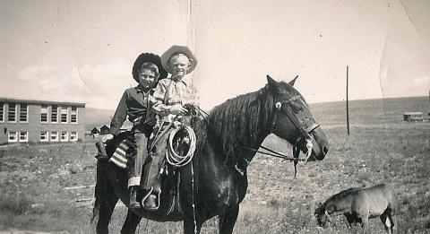
"Ida Laverne: My Baby Sister" contributed by Vera Shay

One Grand Essay Contest, 2005


I didn't remember it at all

I was pretty small

It was the sixth of November

this I do remember

Daddy went a-far

traveling on his railroad motor-car

all the way to Fraser

and in good measure

Dr. Susie he brought back

riding down the railroad track

I think with them, that maybe

they brought us our baby

And that was you Ida LaVerne

now it's my turn

to say

Happy Birthday


John the Cat Man
John the Cat Man

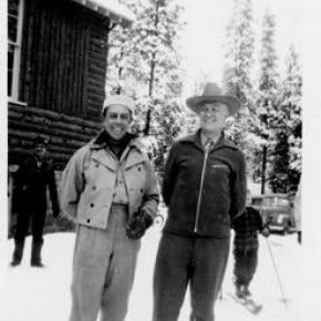
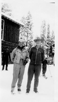
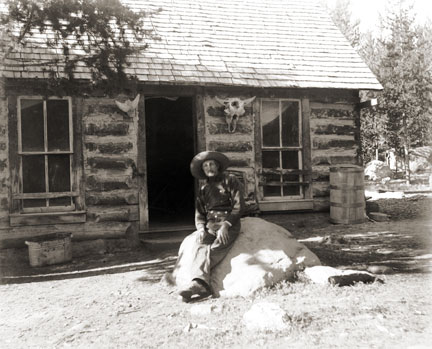
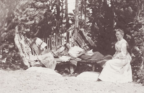
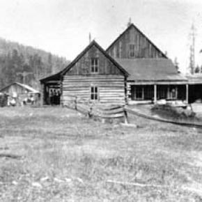
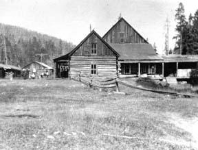
Old John, the Cat Man, lived just below the red brick railroad station at Winter Park, in a small log cabin, perhaps 10’ x 12’.  He was Swedish, or maybe Norwegian.  His last name might have been Peterson or Pederson, Swenson or Svenson or Swanson, Larson, Olson, Wilson, or Erickson; all that is lost to history. John surely came into the country first, to work on the Moffat Tunnel.  Now, two decades later after the opening of the tunnel, he was mostly retired.  However, he was the official deliverer of the U.S. Mail to the Winter Park Post Office.  This was in the years between 1945 and 1949 or 1950.  

Each day, after the Yampa Valley Mail went through, John would trudge slowly up to the depot, pulling his toboggan behind him.  Entering the bare waiting room, he¹d stick his grey head and long grizzled beard in at the office window to say hello to Mr. Schaeffer, known as “Schaef” to everyone.

Sometimes Schaef was too busy to talk as he tap tap tapped out a message on the telegraph key.  Or he might be expecting one in; when he was ready to receive, he’d cry into the radio to the man on the other end, “Fire, Gridley!”  But if all was quiet, John and Schaef would talk about “³way back when,” their favorite subject. Soon the two of them would be laughing and cackling at incidents long gone.  Schaef was considered by many residents to be grouchy, but he wasn’t really; he was just old and tired.  He and his wife lived in a little apartment at the back of the station.  In the fall he put his car up on blocks and didn¹t take it down until spring. 

If they needed to go any place, they rode the train. The station was bare; only benches lined around the edges of the room, a schedule nailed to the wall, but it was warm, for there was a coal furnace in the basement below.  John liked to feel that nice heat coming out of the vent while he visited.   After loading the sacks of mail, John hauled the sled down the road, past the Ranger Station, to the Post Office, a small building placed between Adolph¹s Bar and the Idlewild Stage Stop.  Now came the opportunity for another visit, this time with the postmaster, Gertrude Allison, aka “Allie”. Allie ran the post office for years, long before and after there was a post office in Hideaway Park.  She knew everything that went on, and what she didn’t know, she made up. It was considered something of a sport by the locals to start a rumor at her post office one day and see how it had developed a few days later.  

John then moved slowly home, his body bent over with the weight of his years and hard work, to greet his cats.  Long ago, John had gotten a cat; well, two cats.  Then he had four, five, seven, ten.  His tiny home was chock full of cats!  And oh, did it stink.  The place reeked, inside and out.  Dwight asked him one time, “John, why do you have so many cats?”  And John answered, “Well, I yust don’t have the heart to kill them, and they yust keep coming!”    And that’s how John came to be known as “The Cat Man.”

Juniper Library at Grand Lake

The Grand Lake Library was originally sponsored by the Women's Club of Grand Lake.  In January of 1933, the club voted to sponsor a town library to collect sufficient number of books may be obtained to open the in October.  A newspaper article from December 13, 1933 stated:

"The Grand Lake Woman's Club is glad to announce that its free public library is now open to the public at the home of Mrs. Goldie Hawkins. Books may be exchanged every Thursday from 10 am to 5 pm. There are over 300 volumes of fiction and non-fiction for both adults and children. The Club is grateful to many of our citizens as well as to summer residents who have donated these books. It is by means of their generosity that our library is made possible at this time. Lumber for the shelves was donated by Henry Schnoor, and Preston Hawkins built the shelves without charge." Mary L. Cairns, Chairman Library Board.

The Juniper Women's Club, a junior club of the Grand Lake Women's Club first opened a library in January 1945. It started in a small room in the Community house used for town council meetings. The library was allowed to use the room rent free; however, the library was soon bursting out at the seams and unable to take book donations due to lack of space. When the town council and the firemen decided to build an addition on the firehouse in the winter of 1947, the Juniper Club sought and received permission to have an upstairs room of 16 ft. by 18 ft. for the library. There was a condition; the room was to be finished by the club. A contract was let for the complete finishing of the room with built in shelves on the east and west walls and a sub floor. A wiring contract was also let. To earn the money for the payment the club had bingo, potluck suppers, card parties and food in a basket.

Since January of 1945 836 books were added to the 900 books of the former library. In February of 1948 the books were all moved to the new library, by hand and through the snow, with the assistance of the club members' husbands. In the summer of 1948 these books were all classified according to the Dewey Decimal System by the club members. From the May 1948-May 1949 Juniper Club President's report:

  • Our main project has been and will be our public library. We have approximately 2000 books which are mostly fiction. The first year fifty new books were purchased for $134. There were approximately 200 library cards purchased by our patrons.
  • In May a benefit card party was held and $34 was cleared for the library. Two baskets of food were sent from member to member and $26.25 was raised this way.
  • In July a silver teas was given at the library room. A lovely program of music, pictures of Hawaii, etc. was given. $50.75 was cleared from this tea for the library.
  • During August the club women sold chances on a service for six, sterling silverware set. 330 chances were sold earning $229.73 for the running of the library.
  • New Year's Eve, a dance was given and $29.83 was cleared for the library project.
  • In addition to the 50 books purchased, an oil stove was purchased, curtains were made and the floors were refinished for the library by club members.

 From newspaper articles of 1949:
"The library boasts 1650 volumes, most of them good recent books, and it is open two afternoons a week in winter but three in summer with Mrs. Agnes Gingery as librarian. This year's project for the Juniper Club under the direction of Mrs. Grace Eslick, president, will be the landscaping of the area within the circle drive around the fire house in the Community House block. Last Sunday the first of a series of square dances was held at the Southway Lodge, with a good crowd attending. These dances are put on by the Juniper club and will be for the benefit of the Grand Lake library. They will be held every Sunday night and refreshments are served free. If you do not know how to square dance and would like to learn, we will be glad to teach you. The square dances at Southway's on Sunday evenings are proving very popular as well as lucrative for the library fund."

During the Christmas holidays the new floor was laid and new shelves were built. Materials and labor cost $150 of the club's square dance money. The club spent $650 on the library room. 116 books were added, 75 by donation and 41 were purchased.

The Juniper Club then started a beautification program in the area of the town square and around the fire house and library.

The Juniper Library at Grand Lake became a branch of the Grand County Library System in 1988. In May of 1995 the Juniper Library moved from the Fire Station to a location just off the town square.

With increased library use and development of computer information systems the need for a larger space was recognized and a new library was built adjacent to the Town Hall and dedicated in June of 2006. Serving local residents as well as guests to the community, Juniper Library’s diverse collection, beautiful space, and helpful librarians make it a center of the community.

Kremmling Bank Robbery

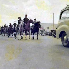
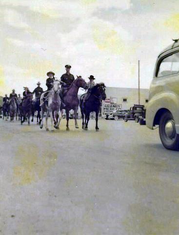
Article contributed by Robert Peterson and Elsie Fletcher Ruske


The summer of 1933 offered more excitement than usual. First there was a lost child who kept most of the Fraser Valley busy searching for several days. Just two days later, the town of Kremmling was visited by two criminals who came to rob the local bank.

Bank heists at gunpoint were becoming a popular form of crime thanks to men like John Dillinger and Baby Face Nelson. This particular hold-up would be Grand County's first experience with the phenomenon.

A short time before noon on August 29, two men came into the Bank of Kremmling, with pistols drawn. On entering, they walked to the cashier's office, which was separated from the lobby by a waist high wall. Three men, bank president F. C. Jones, cashier Carl G. Breeze and a customer, were in the office at the time. They were held at gunpoint by one robber while the other went to the teller's cage, which was occupied by Mrs. Ethel Hackwith, assistant cashier. The robber forced Mrs. Hackwith to turn over all the money in the cage and then demanded that she open the bank vault.

"I can't," she said. "The door is on a time lock and won't open until an hour from now." Discouraged, the two men decided to leave. They forced the teller to accompany them and commandeered her car for use in their getaway. They had collected only $1770.74.

In fact, the vault had not been locked and the door could have been opened with a simple push. Ethel Hackwith's quick thinking had saved the bank some $5,000, and she became an instant heroine with her picture on the front page of the Denver Post.

The robbers had overlooked a second source of loot when a second customer had entered the bank with a handful of cash that he was expecting to deposit. He was not robbed but was simply forced to stand quietly until the culprits left. He was reported to have said: "I was never so insulted in my life. You'd think my money was no good."

The president of the bank notified Sheriff Fletcher as soon as the robbers and Hackwith were gone. Several carloads of Kremmling citizens along with the town deputy set out in pursuit of the crooks within 15 minutes. The trail led south over the river toward Dillon. The pursuers almost immediately found Mrs. Hackwith where the robbers had dropped her off and then proceeded on with her car.

Information from a passing motorist led the pursuit southwest onto the Trough Road, and all roads in the region were under surveillance. The newspapers had a good time writing about what might happen. One Denver paper wrote:
"POSSE CLOSE ON BANK GANG
Kremmling Bandits Trapped High in Hills and Gun Battle Imminent"

A ridiculous article followed that described the posse as being composed of pioneers of the region, all of whom were "used to the two-gun method of gun-fighting" and were "dead shots with a rifle."

The car was found and later one robber was apprehended by Sheriff Mark Fletcher, tried, convicted and sentenced to 12 to 20 years in the penitentiary. The second robber was picked up in Wyoming on suspicion of robbing a post office in Verse, Wyo., a month or so before the Kremmling job. He was sentenced to a three-year term in a federal prison.

- The above is a short version of the Kremmling Bank robbery in 1933. For the entire story and other accounts of the tenure of Mark Fletcher as Sheriff of Grand County from 1924 to 1944, read "A Western Sheriff, The Biography of Mark Fletcher" by Robert Peterson & Elsie Fletcher Ruske, available at the Grand County/Pioneer Village Museum.


Kremmling Library
Kremmling Library

A public library was first located in Kremmling, in 1967. Vi Johnson and Virginia Taussig researched and then established a library in the elementary school basement.  The basement of the school was no longer used for classes because it did not meet the Kremmling fire codes.  Prior to the opening of the Kremmling Library, residents traveled to Hot Sulphur Springs to visit a library.

The library staff consisted of volunteers and was open on Wednesday and Saturday afternoons.  Shelving was built from cinder blocks and varnished boards.  The sparse collection began with books borrowed from the library in Hot Sulphur Springs and donations. 

As the community whole-heartedly embraced the new library, hours were added and the county employed Betty Nunn, as librarian, and Virginia Taussig to work with her. 

In 1977 the library moved into what is now the community room of the Kremmling Library. The building is owned by the Town of Kremmling and had previously been owned by the government and housed the BLM.  When the building was given to the town it was stipulated that it could be used for recreational purposes only, so the library was called the "Reading Room".

As more and more books were added to the library collection construction began to enlarge the "Reading Room" into what is now the children's library.  The main and larger portion of the building was still being used as a garage to store the Town of Kremmling's fleet of trucks. Growth and interest soon made it necessary to remodel and take down walls for the expansion into the whole building. Betty Nunn retired in 1988 shortly after the remodeling and expansion project was completed. 

Today, the Kremmling Library houses a diverse collection of books, magazines, newspapers, DVDs, sports equipment, games, activity passes, digital resources, and all sorts.  Public computers and wifi are available for use as well as a meeting and study room. A multitude of programs for all members of the community are offered. Thanks to the dedication and hard work of its founders, Kremmling now boasts a very modern and well used library.

Leisure Time
Leisure Time

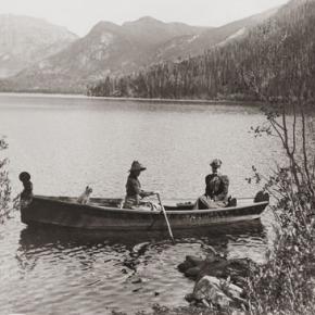
Of all the leisure time activities available to the pioneers, dancing was the favorite. Dances were held in grand hotels that remained from the mining boom, such as the Fairview House and The Garrison House in Grand Lake. Quadrilles, a type of square dance, were popular at the time. A fiddler would provide the music and serve as the caller. These parties would start in the evening and last all night.

The formidable temperatures and great traveling distances were incentive for getting the most out of every gathering. Winter Sports have also always been a popular pastime. Skiing was introduced to the region during the winter of 1883. Snowshoeing and sleigh rides were also enjoyed. 1882 officially brought the arts to the Grand Lake area when the Dramatic Society was organized. A production of the well-known comedy "Our Boys" was the premiere performance.

Libraries
Libraries

In 1938, Grand County decided to establish a library to act as a central reservoir of knowledge for its citizens. The community realized that few people can purchase all of the books and other materials which they may need, and so they agreed to pool their money in the library to build its central collection. At the same time they wanted to be sure that their interests would always be represented in the operations of the library, and so they formed a board of trustees from among themselves.

At about the same time, the federated women's clubs in Granby and Grand Lake, for the same reasons, set up lending libraries in those two communities. Run by the clubs for many years, both were eventually incorporated into the County Library. In 1994, the Committee to Protect the Library was established to petition the Board of Commissioners to increase funding for the library to set aside a completely separate library fund, which would be administered as a Library District. The voters approved the move on November 8, 1994, and Grand County Library District was formed on January 1, 1995. Today, the library still serves that same basic function for the community as well as new roles acquired in the intervening years.

Like Father Like Son

The Wichita Millers lived in one of those lovely old homes, blessed with fine trees lining the streets, large shady yards, and an easy arrangement within, that made family or visitors feel welcome. Three stories and a basement allowed plenty of space for a family of six.  The roomy dining area looked out onto the grassy backyard and flower garden, but the windows were rather small.

About this time, the notion of picture windows came into being. C.D. thought about this for a spell; good idea!  I want more light and a view.  Following through on the idea, he fetched his sledge hammer one afternoon and with a mighty wallop, he broke through the dining room wall! Presto....a larger scene. It took a while to trim out the whole, but the end result was totally satisfying.

This "grab the bull by the horns" attitude was passed through to Dwight.  We had moved into a nice modular home in December 1979.  A few years later, we decided we needed a garage; the solution was to lift the house and build a lower floor beneath it.

Dwight, his Uncle Ed, and I drove to the ski area where some used oak railroad ties had been cast aside.  We gathered a large number of these (Have you ever tried hefting a tie?) and we hauled them home.  Dwight had four extra-powerful jacks that he'd used previously to lift houseboats down at Lake Powell.  After undoing all the foundation bolts, we started lifting, first one end, then another, building increasingly high cross-hatch type supports near each corner as we raised the house higher and higher.

We lived there the entire time this was going on and the house shook with our every step. By the grace of God, no huge winds came up during the whole process.  Each morning, Dwight disconnected the water and the sewer lines. Each evening, he reconnected everything.

When we were up about eight feet, Dwight and his uncle built stud walls and stood the first wall beneath one side of the house.  Would you believe that, thanks to the irregular ties, the house was skewed about six inches out of alignment?  Troubles.  Now what?

Dwight decided that he would take his CAT and carefully push the house back into line, readjusting the braces as he went.  That was the day I chose to go to Denver for supplies, knowing full well that when I returned, my piano and good china would be sitting in Ranch Creek.  But no.  When I got back, all four stud walls were securely in place and the upper floor was resting safely on top.  Was it the luck of dumb dumbs? Brilliance?  Who knows?

Well, in order to go downstairs, we had a fairly steep stairway.  We had looked at our various options for less steep stairs, but one would have ended up in the middle of the garage and the other would have had to start in our bedroom.  Not good choices.  Thus it was steep.  Somebody accused us of having the only carpeted ladder in the county.  It was also rather dark.

One Thanksgiving Day when the family was gathered round, Dwight got the brilliant idea to cut an opening in the upper section of the wall at the top of the stairs, to make it lighter.  The family agreed that this was a great idea and they were excited to see how this was accomplished.

Out came the skill saw, bursts of sawdust flew into my nice clean living room and onto my counters where I was trying to prepare a festive dinner.  I tried to shield the food from sawdust.  I tripped over the cord while setting the table. I scrambled over scrap wood trying to reach pans and dishes.

But the family loved it.  By supper time, a rough hole definitely brought more light, and amazingly, we were still married!

My Granby, Little Old Log Church

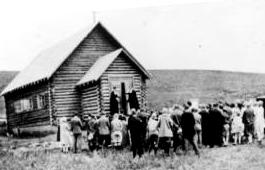
Contributed by Vera "Stathos" Shay, Kremmling...Granby resident 1930-1945

From what I hear

It is very near

To be torn away

The little church of my childhood day

The most beautiful to see

That can ever be

Inside and out

Without a doubt

Built of log so fine

In the style of old time

In my own little chair

Every Sunday I was there

The chime of its bell

For miles around

Heard its wonderful sound

For a while our school

We didn't fit

So in our church were classes

For a bit

Beside our church on the hill

We sledded for a thrill

That poor little church

They moved it around

All over town

Proudly it's hung together

In all kinds of weather

Every time I go to Granby town

I look around to find

And have a look

At my log church for my eyes'

Memory book

Now they say it's got to go

Pray it won't be so

All of you Granby folk

Louder you should have spoke

To save that church with its

Memories and history

For there could never be

Anything that would compare

Built or put there

With my magnificent, beautiful

Childhood Granby log church

Find it in your hearts

To never let it be torn apart.


April 2005


National Sports Center for the Disabled

May 8, 2010 Sky-Hi News

In January 1970, Gerald Groswold, then chairman of the board of Winter Park Ski Area, received a call from the Children's Hospital of Denver about program they'd been running at Arapahoe Basin for amputee children. A-Basin wasn't going to continue the program, and the hospital wanted to bring it to Winter Park.

In his morning meeting a few days later, George Engel, who ran Winter Park Ski School at the time, announced that this group was coming up in a week's time and asked for volunteers. Of the 40 or so ski instructors standing there that day, only one raised his hand to volunteer. Later, at lunch, Engel walked by the lone volunteer and threw a note in front of him. "Call this number. You're in charge," Engel said.

The 32-year-old Montreal-born ski instructor stared at the note while he finished eating his lunch. He had no way of knowing that by raising his hand he had just shifted the entire course his life as well as the lives of tens of thousands of others. That ski patroller was Hal O'Leary.

O'Leary went on to found the National Sports Center for the Disabled. Today, the NSCD is one of the largest outdoor therapeutic recreation agencies in the world. Each year, thousands of children and adults with disabilities take to the ski slopes, mountain trails and golf courses to learn more about sports, and themselves.

From the get-go, O'Leary had obstacles to overcome, starting with the fact that he'd never even known an amputee, not to mention seeing one ski. The day after he raised his hand, O'Leary got himself a set of outriggers and went about teaching himself to ski on one leg. Being schooled in the Professional Ski Instructions of America technique, he used all the same concepts as he would use for a conventional skier, sliding between turns.

On Jan. 22, 1970, 23 amputee children arrived at Winter Park with equipment borrowed from Children's Hospital. It was a cold day, as O'Leary recalls, and he pushed the kids hard, making them climb up the bunny slope to turn around and practice making runs back down. Some of the kids who had participated in the program at A-Basin had been taught to jump turn the ski rather than sliding it. So they were hopping around like kangaroos, hopping three times to make each turn, O'Leary said. By 11 a.m., kids were collapsed on slope, crying. One screamed: "I hate your guts," O'Leary recalled.

Feeling that he had failed them, he took them over to the lift on Practice Slope after lunch and put them on the chairlift. A few bailed out, and O'Leary thought: ?Oh my God, I'm going to kill them,' he said: "I worried they'd end up in the tunnel." By the end of the day, however, the kids were flying down the hill, coats flapping in the wind and smiles on their faces. O'Leary was hooked.

For eight weeks the program continued. Before long, the television stations caught wind of what was going on at Winter Park. One day O'Leary got a call from the Today Show, which wanted to feature his program. No sooner had he hung up the phone then it rang again, and Good Morning America was on the line wanting an interview. "It really put Winter Park on the map in those days," he said.  As word got out, people with different disabilities started calling O'Leary to set up lessons, from the visually impaired to the paraplegic.

For each new challenge a skier presented, O'Leary needed a new adaptation to the traditional ski equipment. He spent nights at the ski shop working on modifications and pouring over medical books. Improving the design of the outrigger was O'Leary's first challenge. O'Leary made a lot of phone calls back and forth with George Engel (who also owned Winter Park Ski Shop) and other product manufactures, explaining the design he needed, then they would build it.

Another early invention was the "ski bra." Originally made of metal, the contraption slid over the tip of the skis, holding them in place and preventing them from crossing. "The ski still had freedom, but it helped people that lack lateral control of their bodies," O'Leary said. Sit skis hadn't been invented either. So when a paraplegic wanted to ski, O'Leary modified a cross-country ski item out of Norway. "It reminded me of a little bathtub," he said. "It didn't have any runners. It made me nervous. But, people could use it in a seated position, and it got people who couldn't stand out on the hill."

One of the more peculiar adaptive designs that O'Leary saw over the years was a space suit worn by a paraplegic man. The man filled the suit with enough air that he could stand upright, which worked well, O'Leary said, until he sprang a leak and had to be rushed back down the hill. "In 40 years, it's amazing what has happened to the gear," O'Leary said.

If equipment is the backbone of the program, volunteers are its heart. "We couldn't do this without our volunteers," O'Leary said. More than 800 people volunteer every year with the NSCD. It's a dedicated group of people - the average volunteer has been involved with the program for more than eight years, O'Leary said. Just about anyone who can ski can volunteer. NSCD provides the training and, soon, the volunteers are teaching the lessons. Thanks to the volunteer program, a NSCD participant in 2010 can get a full day lesson with a private instructor, plus a lift ticket and adaptive equipment for $100. Scholarships help people who can't afford the price tag. Raising money to help offset costs and provide these scholarships is key for the program's success. The NSCD holds more than a dozen fund raisers each year, although the Wells Fargo Cup and the Hal O'Leary Golf Classic are two of the biggest and most well-known.

O'Leary built the adaptive skiing program for 10 years before it began to develop into something permanent. In the early years, he was challenged a lot by the ski area, he said. Lift ops had concern about people riding the chairs with different apparatus. The ski patrol was concerned about people with various abilities getting on slope. "There was opposition from different parts of the mountain," O'Leary said. But the program's champion - Gerry Groswold, who served as the ski area's president for 22 years, from 1974 to 1996 - held strong to his conviction that the mountain should make room for skiers of all abilities, O'Leary said.

While the majority of those other ski instructors - the ones that didn't raise their hands that day - moved on to other pursuits, O'Leary had found his life's purpose. "It was seeing smiles on people's faces," he said. "I never realized what it would mean, giving these people movement they did not have in a wheelchair or walking. It changed their life. It helped them in many ways with their challenges. They did better in school. They started focusing more. After several years, wanting to give back what they took, many of them became instructors themselves."

For the first four years, O'Leary still had to wait tables in the summer to survive. Finally, in 1974, O'Leary parted ways from Winter Park Ski School, and Winter Park Ski Area brought the disabled skier program under its wings with O'Leary at its helm. That year, O'Leary introduced summer activities to the program, including whitewater rafting and horseback riding. "That first summer went extremely well," he said. "The turnout was huge."

Today, the summer program has expanded to include almost any recreational activity imaginable, including rock climbing, biking, hiking, canoeing, kayaking, camping and fishing. Programs are designed for individuals, families and groups and are available for all levels of ability, from beginner to advanced. "What we offer now parallels what any tourist would want to do on a vacation in Colorado," O'Leary said.

O'Leary has spent the past 14 years traveling to other countries, lecturing, writing books and working with ski areas to set up programs and introduce adaptive equipment. "It's not easy to create a program at a ski area," he said. "Space is limited. You have to raise money to finance it. But the point is to create choices for people who have disabilities, choices like everyone else has."

In the United States, the sporting opportunities for disabled people have exploded in the past few decades, thanks, in large part to the early efforts of folks like O'Leary. Disabled Sports USA now recognizes 13 disabled sports programs in Colorado, far more than any other state. Although O'Leary, now 72, handed over the day-to-day operations of NSCD more than eight years ago, he still works daily. He's traveled to 13 different countries helping to create NSCD-style program. He's written the book, literally, on adaptive skiing techniques (Bold Tracks: Skiing for the Disabled).

Looking back on that January day 40 years ago when he innocently raised his hand, O'Leary said he'd do it all again: "I've gotten more out of it than I put into it," he said. "I've worked with fabulous people. I've had great opportunities. It's been a good life. It really has."

Articles to Browse

Topic: Mountains
John Wesley Powell about the time of his Longs Peak ascent

The First Recorded Ascent of Long’s Peak

John Wesley Powell about the time of his Longs Peak ascent

After his discharge from the Union Army in 1865, a veteran who lost his right arm at the Battle of Shiloh, Tennessee as a commander of a field artillery battery, John Wesley Powell was appointed curator of the Illinois Natural History Society’s Museum located at Illinois State University-Normal. Later, he was a Professor of Natural Science at Illinois Wesleyan University-Bloomington. 

In the summer of 1867, Professor Powell and his wife Emma, brought five students of the two university’s and six educators at other Illinois schools to Colorado Territory. Two peaks over 14,000 feet were climbed. Pike’s Peak (Emma was the 4thwoman to do so), and Mt. Lincoln. The expedition combined exploration and higher education of large scale student field trips was the first of its kind in American college history. 

In the autumn, the Powell’s visited the natural Middle Park hot springs (the heart of Hot Sulphur Springs) owned by William N. Byers editor of the Rocky Mountain News. The caretaker of the springs introduced himself as Jack Sumner, also a Union Army veteran, and Byers’ brother-in-law. Near the springs was the Grand River as the headwaters of the Colorado River were called. Around a campfire Powell and Sumner made plans for a Colorado River Exploring Expedition. Looming over this decision on the eastern horizon was Long’s Peak.  In November, Wes and Emma Powell departed for Illinois filled with fortitude to return to Colorado. 

John Wesley Powell sought financing for an 1868 expedition from the museum and university’s boards of education, being happy to oblige. However, his request to draw supplies from U.S. Army western warehouses took an Act of Congress to approve. The Smithsonian Institute donated scientific materials. The expeditions purpose was to stock the natural history museum with large collections of specimens representing different sciences and illustrating the resources of the country. Before leaving Illinois for Colorado, it was understood that the ascent of Long’s Peak would be attempted. 

At Chicago on June 29th, a special Pullman car of the Chicago & Northwestern Railroad arrived with a banner lettered “Colorado Scientific Exploring Expedition”. At 3 p.m. Professor and Mrs. Powell, with 19 others were taken to Omaha, Nebraska traveling all night. In the morning they rode a Union Pacific train to Cheyenne, Wyoming. They were organized into messes of four and drew supplies from the army warehouse. Each man had to break his own bronco for the pack train ride to Denver. One man was bucked into a cactus. A Reverend was thrown with his foot hung in a stirrup. While being dragged he said, “take hold of her boy’s. Whoa!  Sweet little angel you.” They arrived and camped at Denver on July 14th. Then proceeded to Empire where they were greeted by mountain man and guide Jack Sumner,  William Byers, and Ned Farrell.  

So much was untouched to be plucked in the names of anthropology to zoology. A week was spent on Berthoud Pass. One young scientist shot a jack rabbit thinking it an antelope. Jack Sumner was used to dudes. Finally, the expedition arrived at Mr. Byers’ resort where headquarters and the Reverend’s “Preaching Tent” was set up. Rest and relaxation were enjoyed by soaking in the hot springs. 

Professor Powell used his military rank Major. He never let the loss of his right arm hinder him. The Major took a trip to the Rabbit Ears and Gore Range where the highest peak is named Mt. Powell. When he returned the Major selected his student squad for the ascent of Long’s Peak. Chosen were L.W. Keplinger, and Sam Garman. One old mountaineer told the two that nothing could get them there that didn’t have wings. The idea of tenderfeet trying the ascent was ridiculous!

August 20th-22nd -The Major, his brother Walter Powell, Jack Sumner, William Byers, Ned Farrell, and the squad, departed headquarters mounted on horses, and one pack mule with 10 days rations. Each carried a pistol or rifle. The squad had weather equipment. They camped at Grand Lake. In the morning the party of seven rode up a steep rock ridge almost impassable by fallen timber. They corralled the equines at Mt. McHenry elevation 13,327 feet and camped for the night. At 7 a.m. the Major made bacon and biscuits. The men stuffed their pockets with a two day’s allotment. Leaving their firearms behind Sumner and Keplinger led the way to Wild Basin over tortuous terrain. All arrived exhausted at 2 p.m. except for Keplinger who volunteered to find a route to Long’s Peak. Keplinger went through the notch and was within 200 feet of the crown. Turning to enjoy the view he almost became an eternal resident of Estes Park. Nightfall was setting in and he had to return to Wild Basin. To his amazement Sumner was hollering and had lit beacon fires. At 10 p.m. Keplinger and Sumner were in camp. 

At 6 a.m. on August 23rd, Keplinger led the way. Required of each was caution, coolness, and intense labor; life depending on the grasp of fingers in a crevice that would hardly admit them. Moving up in order were Keplinger, the Major, Sumner, Byers, and the others. Before 10 a.m. the entire party stood on Long’s Peak summit, elevation 14,255 feet. “Glory to God!” shouted the Major. For three hours they remained enjoying the spectacular views. North, south, east, and west. They counted 32 alpine lakes. An American flag was flown and left. A monument was built, and a baking soda can was used as a time capsule. Placed in the capsule were each member’s names, and the temperature. A biscuit was going into the capsule but the Major objected as he wanted fame as a mountain climber and not a biscuit maker. The capsule was sealed for the next climbers to find. Wine was sprinkled on the monument and disposed of in the usual manner. Two members abstained. 

The descent route went towards the branches of the St. Vrain River. Noticed on the snowbanks were two bears feasting on grasshoppers numbed by the cold. On the western branch of the St. Vrain the party was out of grub and they rested for the night. The men hiked to Mt. McHenry where a hearty breakfast was made. The two Powell’s, Sumner, Byers, and Farrell, returned to the springs on August 25th. Keplinger and Garman remained to record high altitude weather. Submitting the first mountain climate observations to the Smithsonian Institute. 

The First Recorded Ascent of Long’s Peak (with a lengthy caption) was published in the Rocky Mountain News by William N. Byers on September 1, 1868. Proud of the fact, “that all were eminently successful and satisfied; the more so because the mountain had always before been pronounced inaccessible, and ours was the first party that had set foot on its summit.” 


Topic: Water

Water from the Mountains - The Grand Ditch

 Though few, high altitude water ditches have had a major impact on Grand County's history and economy, there were many early valley ditches transporting this precious commodity from water-right sources to the owner's ranch. However, the threat of transporting great volumes of water from our county to Boulder County via high altitude ditches appeared back in 1889.  Certain interests east of the Divide talked the Legislature into appropriating $25,000, for surveying and developing a 20-mile-long canal over South Boulder Pass to South Boulder Creek.  Amazingly, neither Grand County residents nor very many others opposed this notion.  Luckily the state engineer found the terrain so difficult that not even $2000 was ever spent on the project.


The next effort occurred also in 1889.  This privately financed plan was to develop a two-branched canal system that would move 700 second feet of water to a half-mile tunnel just beneath Berthoud Pass at over 11,000 feet, thence down to Clear Creek and on to the Golden area.  Initial surveys were begun that fall and roads laid out the following year.  The effort bogged down but was resurrected in 1900 under the Agricultural Ditch Co., supplemented in 1902 with the Berthoud Canal Co.  The canal was partially completed by the Frank Church family ranching interests of Jefferson County by 1906.  The ditch, which can be walked today, runs from Second Creek to Berthoud Pass, though it no longer carries much water.  However, the Church Ditch water rights coming from Clear Creek still exist and today are owned by Northglenn.

Proposed in 1890 by the Water Supply and Storage Company of Fort Collins, a greater canal was to be built 1000 feet above the Kawuneeche Valley, that would tap the high tributaries of the North Fork of the Grand River, sending the water over Poudre Pass to a reservoir and then into the Cache La Poudre River and on to agricultural areas east of the Front Range.  The water company, later known as the Grand River Ditch Company, appropriated 525 second feet at the time of the initial diversion in 1892.  (When the Grand River was renamed the Colorado River in 1921, the company was changed to the Grand Valley Irrigation Company.)  The ditch was dug by hand, primarily by Japanese and Mexican laborers.  By 1900, water was flowing eastward.  

By 1906, this major canal, known as the Grand Ditch, and draining water from the Never Summer Range, had a capacity of nearly 358 second feet with 12 headgates within 8 miles, running from Baker Creek to the pass at 10,179 feet, plus a smaller canal carrying 183 second feet within 11 miles, coming from Specimen Mountain.  In 1936, using machinery, the ditch was lengthened to 14 miles.  The Grand Ditch is about 20 feet wide and 6 feet deep, though the water is rarely more than 3 feet deep, and this water irrigates some 40,000 acres in Weld and Larimer counties.

The National Park Service has argued against the allocation of all this water to the canal as it is needed to support plant life and animal habitat.  Becuase river water flow was cut in half, the immediate effect was a reduction in the fish population in the Colorado River.  More recently, a major washout in the ditch caused devastating damage to the slopes below the ditch and to the Colorado River itself.  Hikers climbing up from the valley use the Grand Ditch as a route to the high peaks and lake.  But as viewed from below, the Grand Ditch is often considered an ugly scar on the landscape.

Logging

In the early decades of Grand County, lumbering was a key contributor to the local economy.  Logging was necessary as the principal source of building construction and also as the only available fuel.  When the railroad first made its way over Rollins Pass, the production of railroad ties became an important industry.  In the Grand Lake area, the brief mining boom of the 1880s created a steady demand for timber.

Some remains of log structures from abandoned logging camps were still evident late in to the 20th century. These include the Middle Park Lumber Company on St. Louis Creek (southwest of Fraser), an operation that had it's own railroad line into town.  In the same area, the independent logging settlements of Lapland and Stockholm date back to 1915. 

Above Tabernash was located the Deiler Mill, ten miles up Hurd Creek.  In 1910, the Western Box Company bought the mill and moved it to the head of Meadow Creek.  A box factory was located in Tabernash and the logs were floated down in a flume, thirteen miles long.  Mrs. Braddock was the "flume lady" at one time and would balance on a log while breaking up log jams on the trip downstream.....a task that required "great skill and derring-do". 

Other operations included Koppers Camp up Pole Creek (above Tabernash), Mr. Daves Mill at Hideaway Park and Bob Morrow's camp on Byers Peak.  Broderick Wood Products Company of Denver was a major purchaser of Grand County timber starting in 1930.  In 1939, Smokey Harrison founded the Timberline Sawmill at Kremmling.

A huge box making plant was built on a site now covered by Granby reservoir.  Its main supply point was a logging camp at southwest corner of Monarch Lake.  You can still see remnants of the logging machinery along the shore of the lake.  For a short time there was a branch railroad from Granby to the box factory, which later burned to the ground, In 1949, American Timber built a sawmill and log pond at Granby, west of the Highway 40 overpass.  The west end of the county was logged by the Kremmling Division of the Edward Hines Lumber Company.  Later, Louisiana Pacific built a wafer board plant in Kremmling but it closed in the 1980's.

The short growing and harvesting season created many challenges for the loggers.  According to Ed. "Jr." O'Neil, it takes over 100 years in Grand County to grow a tree big enough got a 35 foot telephone pole.  In contrast, it would only take 30 years to grow a similar tree in warmer climes.  There is still private logging activity in Grand County, most of it for the construction of luxury log homes.

Wheatley Family of the Troublesome

Forrest Wheatley was born in Chicago in 1875 and his brother George R. was born 6 years later.  Their parents were English immigrants, William and Mary.  The family moved to Denver in 1887 where William pursued his trade of upholstering carriages.

 After Forrest returned from service in the Spanish American War in 1900, he and George decided to establish homesteads of 160 acres each on the East Fork of Troublesome Creek. When the expansion of the National Forest land limited the growth of their holdings, they moved to Muddy Creek to the west and ran their operation there until 1929.  They continued to purchase additional homesteads on the Troublesome.

 The brothers had a disagreement so Forrest and his wife Ida remained on the Muddy while George moved back to the Troublesome.  He sold the original claims high on the East Fork.  Later he married his neighbor, Bessie Sampson, and they moved back to the Muddy Creek basin and had five children; George, Douglass, Kenneth, Maidie and Gene.  Gene drowned in an irrigation ditch while still a young child.

Through purchases and marriages, the Wheatley descendents eventually owned property throughout western Grand County and as far north as the Yampa River Valley.
 

Christmas in the Mountains 1951

It was my first Christmas in the mountains. Not only that, but it was my first time to be part of a vacation in a cozy ski inn.  This was at Millers Idlewild Inn in Hideaway Park (now the town of Winter Park). I had been married only eight months. Dwight and I had worked hard, getting everything in order: ­clean beds, fresh spreads and curtains, floors shining and bathrooms sparkling.  The woodpile was full and food supplies ready.  Our plans for evenings were laid out too. Dwight would do movies. His brother Woodie would call square dances, with former Moffat Road engineer George Shryer accompanying on the fiddle and his wife, Grace, chording on the piano.  Tom Smith would bring his sled and team of horses, to take happy folks along snow-packed roads for sleigh rides, to the tune of jingling bells. Games were at hand, along with a fine supply of books on the shelves. We expected a wonderfully busy two weeks, which was a good thing, because it had been a long time since our last income, before Labor Day.

Family and friends were coming tomorrow to give a hand over the holiday, and then the fun would begin. As the first guests arrived, I stepped outside, and lifting my nose, I thought, "I smell snow!"  Great!  The area already had a pretty good covering, so that when people called and asked, "Is there snow yet?  Should we come on ahead?" we could gladly say, "Come." That night it snowed,­ 12" of beautiful soft flakes.  Skiers were overjoyed. Dwight got out early to shovel, plow, pull people out of drifts, take others to Winter Park Ski Area, three miles away. That evening we heard that almost no stumps or rocks were evident on the slopes; all had been buried. The next night it snowed again ­ 12" of beautiful white stuff.  We were amazed.  But Dwight got out early to shovel, plow, pull people out if drifts, and take others to the area.  The following night it snowed again, and every night for a week, it snowed, dumping heaps of snow on the whole valley.

Winter Park Ski Area, in those days, wasn't open on Christmas Day; the management wanted to let its employees have the day at home with their families.  So we took our guests to the top of Berthoud Pass; from there they could ski down Seven Mile Trail and we met them at the bottom.  The day after Christmas began the busiest days of all. Back then, many families didn't leave home until the 26th. This was fine, until the passes closed from heavy snows and avalanches. Then visitors, who had to leave, couldn't drive out, but people who were coming by train could still get in!  We had a problem.  The parking lot was jammed with rental cars.  Although some folks went ahead and left by train, many families stayed on.  The rooms were completely full and after all, newcomers were entitled to their reserved space. We had guests stashed all over the lounge, extras in the dorms, and extras in the cabins.  What a crowd it was. I hardly had time to think. 

I cleaned all morning, helped set tables and serve, did dishes, sometimes hauled skiers to or from the area, kept up with the office work, and joined in entertaining folks in the evenings. Thank heaven for family and friends!  There never was such a hectic week. But the Miller hospitality at Idlewild kept our visitors relaxed and happy. Truly, it was a jolly time, with tired skiers loafing in front of the fire, doing puzzles or playing games.  There was always a group playing canasta after dinner, in the dining room, and peals of laughter would pour forth when somebody won a great hand. At last New Year's Eve came and went. The rental cars had gone back to Denver.  The rooms were empty.  We were alone except for a couple of guests.  Making our path through the deep drifts, Dwight and I went home and flopped down on our own sofa.  I heaved a sigh, saying, "Well!  So that's what Christmas in the mountains is like.  I had o idea there would be so much snow."  Little did I know that for Christmas, 1952, we would still have the crowd of guests, but there would be hardly any snow until January!

Topic: Grand County

Grand County

Grand County was established in 1874 by the Territory of Colorado, thus becoming a county two years before Colorado became a state. It was named for the Grand River, the name by which the Colorado River was known at that time. The headwaters of the today’s Colorado River are in Grand County. The county was formed from a portion of Summit County but acquired its current boundaries in 1877, when part of the Grand County was used to create Routt County. The county seat is Hot Sulphur Springs. The area of 1,854 square miles consists of meadows, river valleys and mountains.

Topic: Skiing

Winter Carnivals

Carl Howelsen, a ski jumping champion in his native Norway, came to Denver to pursue a career as a stonemason in the early years of the 20th Century.  He amused himself and others by demonstrating ski-jumping in the foothills of Denver. 

In 1911, Howelson went to Hot Sulphur Springs, where he taught locals such as Horace Button the art of jumping.  Under Howelson's leadership, the first winter carnival west of the Mississippi Rover was held there on February 10-12.  According to the Middle Park Times, "Never before in the history of the Territory and State of Colorado has such an event even been contemplated, much less held!".

Norwegian immigrants Howelson, Angell Schmidt of Denver and Gunnar Dahles of Williams Fork (Grand County) all staged jumping competitions during the carnival.  There were also skating and tobogganing events and a Grand Ball.  Hot Sulphur Springs continued holding Winter Carnivals annually until World War II, when they were discontinued until the 100th anniversary celebration, called the Grand Winter Sports Carnival scheduled for December 30, 2011-February 11, 2012.

Topic: Places

Place Names of Grand County

Because Grand County has such a rich history, many names reflect that important heritage. Traveling East to West from town-to-town, here are a few historical tidbits to think about.  

Winter Park came into being around 1923. Several names to identify the place were used over the years, including West Portal, Hideaway Park, Vasquez, Woodstock, and even "Little Chicago" because of gambling and other activities. The City of Denver bought land in 1939. Winter Park officially opened in 1940. According to "Colorado Place Names" by George R. Eichler, with the assistance of Denver Mayor, Benjamin F. Stapleton, the town changed its name to "Winter Park" to publicize the establishment of the city's winter sports centers.

Iron Horse Resort and Zephyr Mountain Lodge reflect the importance of the railroad in the development of Grand County. Newer condominiums also reflect the heritage of the area. Sawmill Station, Teller City and more recently, Telemark, are a few examples. "Telemark is named after the traditional method of skiing," said a Telemark Townhomes representative. Red Quill townhomes, according to broker and owner Mike Ray of Century 21 Real Estate in Winter Park, are named after President Eisenhower's favorite fishing fly lure. "He found the Red Quill pattern particularly effective on St. Louis Creek while visiting and fishing with Axel Neilsen at the Byers Peak Ranch." Van Anderson Drive, according to Jan Smith, a Realtor at Century 21 of Winter Park and longtime local, is named after the first mayor of Winter Park. He developed the Hideaway Village, including the condos, Filings 1 and 2 and Hideaway Village South.  


Vasquez Road, according to well-known historian, Abbott Fay, is named after Louis Vasquez, an early fur trader. Woodspur and even Woodstock, one of the early names attributed to the town of Winter Park, referred to Billy Wood's lumber mill which furnished Rollins Pass railroad ties.

Fraser was originally spelled "Frazier" for Reuben Frazier, an early Grand County Settler. Postal authorities adopted the simpler spelling when the post office was established. Doc Susie Avenue is named for Susan Anderson, M.D. "Doc Susie," a pioneer physician who came to the area in 1907. She served the citizens of Grand County faithfully until she died in Fraser at the age of 90. Fraser's Eastom Avenue is named after George Eastom, who founded the town. The Eastom family from Ohio built an important lumber mill. Mill Avenue also reflects those early lumber days. Eisenhower Drive is named after President Dwight D. Eisenhower, who enjoyed visiting the area especially for fishing. Ptarmigan is a grouse with feathered feet particularly found in the cold, mountainous regions. And, for Wapiti Drive/Lane, Wapiti is an elk. Zerex Street, according to Susan Stone of the Fraser Visitor Center, is named after the antifreeze product which was tested at "the Icebox of the Nation."

Tabernash is on the homestead of 1882 pioneer Edward J. Vulgamott. By 1905, the enclave came into existence because of its location during the building of the Denver & Salt Lake Railroad. E.A. Meredith, chief engineer, named the town after the Ute Native American called Tabernash who was killed earlier by a white man named "Big Frank." Junction Ranch, built by Quincy Adams Rollins, according to noted historian Abbott Fay, was an important stop on the Idlewild Stage line which could accommodate up to 50 travelers.

Granby was founded in 1905, named after attorney Granby Hillyer, who assisted David Moffat and Frontier Land and Investment Company with the incorporation. Granby landmark, Kaibab Park was donated by the Kaibab Company. According to former local postmistress Carole Clark, during the 1940s, Broderick Wood Products Company had a large sawmill with housing for their workers where the current ball fields are now located. Selak Drive is named after the Selak family, who ran a large Granby Merchantile. Before Granby, the Selak post office and general store provided service from June 1883 to September 1893 on the nearby Selak Ranch.
Ouray Ranch, a residential community located off US. Highway 34, was the original home of the YMCA Camp Chief Ouray until the early 1980s when the YMCA sold the land and relocated to Snow Mountain Ranch outside of Granby on US Highway 40. Chief of the Ute Indians, Ouray was born in Colorado in 1820. He was noted for his friendship with the white settlers.

Grand Lake was established by hardy pioneers in 1879. Joseph L. Wescott, was the first white settler-prospector. Grand Lake was founded as a mining settlement by the Grand Lake Town & Improvement Company. As the mines played out, tourism and focus on Grand Lake, Colorado's largest natural body of water, took center stage. Cairns Avenue, according to Jane Kemp, granddaughter of James Cairns, is named for him. In 1881, he ran a general store. He extended credit for supplies to many of the miners who left town without paying him. With unpaid bills and depleted stock, Cairns then homesteaded a ranch to sell hay to freighters for their horses. He trapped bears for their shaggy skins to sell. All the while he kept his store open. A mountain peak bears his name, also.  

Columbine Lake is named after the Colorado State Flower. Kinnikinnick is a Native American term used to describe mixtures of Indian tobacco.  West Portal Road leads to the west portal of the Alva B. Adams Tunnel, which since 1947 delivers Grand County-Western Slope water to farmers on the Front Range as part of the Colorado-Big Thompson Project.

Hot Sulphur Springs, established in 1860 is named for the famous hot springs in the area. (Colorado Place Names) Ute and Arapaho tribes used the hot springs for their "healing waters." Byers Avenue is named after William N. Byers, founder of the Denver Rocky Mountain News. He wanted to create a spa resort modeled after Saratoga in New York.

Moffat Avenue-Several streets in Grand County are named after David Moffat, the pioneer railroading legend, who started the Moffat tunnel and brought predictable rail service to Grand County with his "true-grit" determination.

Parshall, according to Colorado Place Names, was established in 1907 when a Mr. Dow set up a small store and circulated a petition for a post office. The name "Parshall" honored a local pioneer. Postal authorities accepted it as no other post office had that name in the entire county.

Kremmling established in 1881 according to Colorado Place Names, the town's beginning was a general merchandise store run by Kare Kremmling, (The Chamber of Commerce web site says Mr. Kremmling was named Rudolph and the town was established in 1884) located on a ranch on the north bank of the Muddy River. When Aaron and John Kinsey platted their ranch and called the site Kinsey City, Kremmling moved his store across the river to a new site which soon became known as "Kremmling."

Radium had a post office as early as 1906. Harry S. Porter, a prospector and miner, suggested the name because of the radium content in a mine he owned near the town. The community was settled by Tim Mugrage and his family.

Post Offices

Article contributed by Abbott Fay

Postal routes into Middle Park were first offered for contract to the lowest bidders in 1875.  A once a week route over Rollins Pass was bid at $693 per year but winter was so severe that the service stopped.  The route from Georgetown to Hot Sulphur Springs over Berthoud Pass from July through October was more enduring. 

Later, postmaster appointments were recommended by congressmen, thereby making the the system more variable as political party power shifted at election time.  The great advantage to having a post office was the opportunity to include a retail goods for sale, often in the living room of the postmaster's home.

Post offices were located within 10 miles of the addresses they served.  In those days, a 10 mile round trip would often take a full day of travel by horse or wagon.  Many post offices were simply ranch homes, and there were frequent changes in location due to disabilities or political party changes.

Post offices were closed when there were too few recipients to justify the cost, often caused by consolidation of ranches or mine closures.  As transportation became mechanized, there was no longer the need for a 10 mile radius maximum.     


PO                            Opening Date             First Postmaster

Hot Sulphur Springs     Sept. 10, 1874            Thomas N. Francie

Fraser                        July 20, 1876              William Z. Cozens

Troublesome               March 15, 1878            Henry King

(When Henry King died in 1879, his wife Albina replaced him. The Troublesome office was discontinued on April 19, 1935)                               

Red Mountain             April 8, 1878               William D. Coberly

(Discontinued in September 1878)

Hermitage                  May 17, 1878              George Rand

(Intermittent service.  Discontinued Jan. 10, 1884)

Grand Lake                 Jan. 10, 1879              John Baker

Twelve Mile                 June 1879         Daniel N. Ostrander

(Discontinued Aug. 5, 1880)

Lulu City                    July 20, 1880              D.W. Hassix

(Discontinued Nov. 26, 1883)

Gaskill                       Oct. 22, 1880             John K. Mowrey

(Discontinued Nov. 11, 1886) 

Colorow                     May 24, 1882              Thomas E. Pharo

(Discontinued May 16, 1903)

Selak                         June 11, 1883             Frank J. Selak

(Discontinued Sept. 29, 1893)

Fairfax                       Jan. 14, 1884              John Barber

(Discontinued July 9, 1885) 

Coulter                      Aug. 14, 1884             Fred Halkowiez

(Discontinued Sept. 20, 1905)

Kremmling                 Feb. 12, 1885             Rudolph Kremmling

Kinsey                       Oct. 24, 1891             Rudolph Kremmling

Crescent                    Feb. 14, 1887             Tracy C. Tyler

(Discontinued April 16, 1894) 

Clarkson                    July 28, 1892              William M. Clark

(Discontinued Dec. 8, 1898)

Dexter                       Sept. 21, 1896            Milton G. McQueary

(Discontinued May 20, 1911) 

Martin                        Aug. 24, 1898             Samuel Martin

Discontinued Nov. 3, 1934)

Scholl                        Nov. 27, 1901             Ole Langholm

(Discontinued Jan. 21, 1930)

Lohman                     March 31, 1903           Clyde N. King

(Name changed to Stillwater on Oct. 4, 1911.  Discontinued Oct. 29, 1930) 

Leal                          Sept. 17, 1904            Charles F. Barker

(Discontinued April 30, 1930) 

Arrow                        March 21, 1905           William L. York

(Discontinued March 15, 1915) 

Tabernash                  Sept. 30. 1905            Mary Knight

Granby                       Oct. 26, 1905             Agnes Whited

Radium                      Feb. 9, 1906               O.C. Mugrage

(Discontinued Dec. 6, 1963)

Parshall                     Nov. 17, 1906             G. Walter Dow

<

Topic: Mountains

Rollins or Corona - What shall it be called?

Travel across various passes of the Continental Divide occurred long before white men showed up. Indeed, as anthropologist James Benedict wrote c. 1975, some 10,000 years ago, prehistoric Indians camped, hunted, and built hunting walls on the upper reaches of Rollins Pass, as well as moving in and out of Middle Park for the warm summer months. Historic Indians followed the same paths. In the earliest days of non-Indian access, a particular pass at the head of Boulder Creek was dubbed Boulder Pass.

Capt. Jacob Bonesteel, including wagons, made the first recorded crossing by a white man at this point in April 1862. Three years later, a group of Mormons brought wagons over this route and a year later, promoters of new roads into Middle Park brought in many wagons and livestock. In fact, tourists were starting to enter the park by a number of routes, and one of them, Samuel Bowles, who wrote a fascinating account of his trip, including his return to Denver via Boulder Pass.

Interest was growing rapidly for a road over the Divide, into Hot Sulphur Springs, and on into Utah. One promoter, John Quincy Adams Rollins, from New Hampshire, teamed up with William N. Byers and Porter M. Smart to carry this project through. Rollins was interested in crossing the Divide; Byers was promoting the Springs; Porter wanted to develop the valley of the Middle Yampa. All three were pushing to have Middle Park officially named as Grand County, a challenge finally accomplished in 1874.

So Rollins and associates started his road, reaching the top in 1873. That next winter, they publicized this access and in June, Jimmy Crawford brought his family and wagons to Rollinsville and thence to Yankee Doodle Lake, ready to cross the pass now named Rollins Pass by the developer. But the road ended, and they found Rollins' men still hacking the road out of the granite! Jimmy and his crew found it necessary to leave their wagons and help.

Finally, on June 10th, the family was able to head for the top. Jimmy borrowed two yokes of oxen, hitching them to mules, and then to his horse. The road was so rough that the procession could proceed but a few feet before having to rest. The family itself climbed on foot. At the summit, they discovered only a rough swath cut down through the trees on the western side. The "road" dropped down between the lakes and followed Ranch Creek to its junction with the Fraser River. Rollins quickly realized that Berthoud Pass, which also opened in 1874, was superior to his own pass for wheeled vehicles, so he determined to hedge his bets. He initiated the first mail service into the county in 1873. He also built a commodious hotel where his road joined the Berthoud Pass road at the confluence of Crooked Creek and the Fraser. He called it the Junction House. Next, he proposed to the builders of Berthoud Pass that they form a joint ownership of the two roads between Junction Ranch and the Springs. Tickets would be issued for both routes and revenues would be shared. The two companies would build a bridge over the Grand at Hot Sulphur Springs. He even buttered up his rivals by complementing their work.

All this was accomplished, although the mail route soon moved to Berthoud Pass, because of the severe winters on Rollins Pass. The bridge was started in November 1874. From the beginning, Rollins' road was preferred for trailing livestock, because there were fewer problems with heavy timber and bogs. For years, the Church brothers, George and John, who introduced the Hereford breed into the county, trailed their cattle for summering in what became known as Church Park. However, tourists such as Irving Hale still drove wagons over Rollins Pass in 1878.

About 1880, interest burgeoned for bringing a railroad up South Boulder Canyon and through a tunnel near Rollins Pass. Numerous surveys were completed all along the area. David Moffat settled on Rollins Pass for the tunnel site but decided first to put a temporary line over the top. Thus, in the summer of 1903, a formal contract was let for work up and over the Pass itself. By 1904, the workers reached Arrowhead and they also built a work station on top, called Corona Station, or "crown of the mountain." This railroad construction town of Corona, located at over 11,600 feet at the top of Rollins Pass (first called Boulder Pass) along the Continental Divide was the highest railroad station in the world.

It became obvious by 1905 that the Corona area would require snowsheds if trains were to travel, even irregularly, during the winter. Still, word got out of the spectacular splendor of Rollins Pass and tourists flocked in on summer train excursions, sometimes stopping on top, sometimes going as far as Arrow. In 1913, a fine hotel was built next to the rail facilities. Because Rollins Pass was right in the middle of severe weather patterns, a weather station was built on top, as well as one down at Sunnyside. In 1915, Rollins Pass was actually proposed to be the south boundary of a proposed "Estes National Park."

Later, on the National Historic Register, the district was listed in 1997 as the Denver, Northwestern and Pacific Railway Historic District--Rollinsville & Middle Park Wagon Road. It was also identified as the Rollinsville and Middle Park Wagon Road; Boulder Wagon Road, Rollins Pass, and Rollinsville area. In 1956, Governor Steve McNichols had presided at the official re-opening of the four percent grade to vehicle traffic over Corona Pass, expressing the hope that the route would someday be paved. The Colorado Game and Fish Department and the U.S. Forest Service made additional improvements, and the Arapaho and Roosevelt National Forests put out a 24-page booklet titled "The Moffat Road: A Self-Guiding Auto Tour." The road crossed two of the original railroad trestles near Corona but those trestles, even if reached by 4-wheel vehicles, were crumbling and could no longer even be crossed safely on foot. The current self-guided auto tour refers to Rollins Pass, as well as the Moffat Road and the Boulder Wagon Road. Corona Station and Hotel are discussed. In 1979, a portion of the auto road over Corona Pass was permanently closed because of a cave-in of the "Needle's Eye," a tunnel located before the trestles heading west from the Moffat Tunnel's East Portal.

The tunnel reopened on July 3, 1988, thanks to efforts of the Rollins Pass Restoration Association on both sides of the Divide, with the cooperation of the U.S. Forest Service, Colorado History Society, and Boulder, Grand, and Gilpin Counties. It then closed once more when another rockfall hit the tunnel on July 15, 1990. The RPRA is continuing its efforts for re-opening. The noted photographer, Charles McClure, took many outstanding photos of the Rollins Pass road. One, titled"Group on Rollins Pass, shows well-dressed men and women stand on a snowfield making snowballs on Rollins Pass, Moffat Road, Boulder or Grand County, Colorado; probably on Denver, Northwestern and Pacific excursion train. Date: between 1904 and 1913 near Corona Station." Another photo shows a "30 ft. snowcut on Rollins Pass, Moffat Road photo. Denver and Salt Lake Arrow passenger car is parked east of Corona snowshed by the thirty foot snowbank cut, Rollins Pass, Colorado; it shows men, women and railroad employees posed behind train, on the roof and on the snowbank and a standard gauge track. Date: between 1904 and 1915."

A sign at the highway turn onto the Moffat roadbed says: The Moffat Road "Hill Route" Also called "Corona Pass Road", this road over the Continental Divide was the original "Hill Route" of the Denver, Northwestern & Pacific Railway built by David H. Moffat in 1903. It crosses Rollins Pass at 11,666 feet elevation. On top of Rollins Pass, a sign says: Elevation 11, 660 feet, John Quincy Adams Rollins established a toll wagon road through this pass in the mid 1870's. David H. Moffat's Denver, Northwestern & Pacific Railway crossed the Continental Divide at this point in 1903. First known as Boulder Pass, then Rollins Pass, the railroad workers dubbed it "Corona", the crown of the "Top of the world." A railroad station, hotel, restaurant and workers' quarters existed here until 1928 when the railroad was abandoned due to the building of the Moffat Tunnel. Identifications in various trail and geographical guides say: Rollins Pass (el. 11,680 ft) is a high mountain pass in the Rocky Mountains of north-central Colorado in the United States. The pass is located on the continental divide at the crest of the Front Range southwest of Boulder, at the boundary of Grand County,Colorado and Boulder County, Colorado. Rollins Pass (a.k.a. Corona Pass) sits approximately 5 miles east and above the popular ski areas around Winter Park, between Winter Park and Rollinsville. The pass is traversed by an unpaved road, mostly the former roadbed of the Denver and Salt Lake Railway which abandoned the route in 1928 when the Moffat Tunnel opened to replace it. Railroad advertising called this the "Top O' the World" and it referred to the Moffat Route over the continental divide and the Rocky Mountains.

Rollins Pass was the primary travel route west from Denver until an easier road over Berthoud Pass was constructed. The Denver, Northwestern and Pacific railroad laid its tracks across the pass in 1903-1904 and established a Depot at Corona on the crest. It can be noted that in R.C. Black's Island in the Rockies, the term "Corona Pass" was mentioned one time, on p. 351; the terms "Corona Station" or "Corona Snowsheds were used. In Dismantling the Rails That Climbed, Rollins Pass was used, the Corona hotel, and just once, Corona Pass; 1936. In Maggie By My Side, it was Boulder Pass and Rollins Pass. In Rails that Climbed, Rollins Pass, the Corona shed, weather at Corona, Rollins Pass Snow Shed, other references to Corona as a site. In Guide to the Colorado Mountains (Orme) , they speak of the Corona Trail to Rollins Pass. High Country Names (Ward) used Rollins Pass entirely. Only Hiking Grand County, Colorado, published 2002 by Carr speaks of Corona Pass, with reference to Rollins Pass (near the town of Corona), Moffat Road. The term "town" might be questionable; there was only a small restaurant, workers quarters, railroad offices, and in 1913, the hotel. Current maps, USFS and the Grand County Trail Map, show Rollins Pass, with Corona at the side as being a site.

The use of "Corona Pass' seems to be a rather recent innovation that has come into being with tourism efforts in the upper Fraser Valley. Rollins Pass From Island in the Rockies p. 45 Rollins Pass was originally known as Boulder Pass, first recorded being crossed by whites, by Capt. Jacob Bonesteel in April 1862. Their supplies were carried in wagons. A second organized party went over the same pass in 1865. In 1866, promoters of access into Grand County brought many wagons and livestock over Boulder Pass.In 1867, Samuel Bowles and a group returned home to Denver via Boulder Pass. In 1873-74, two roads were proposed into the county, one of Berthouds pass and one over Boulder Pass. This was the same time that the county was named "Grand". J..A Rollins and his associates started the road and reached the top of the pass in 1873, at which time they envisaged a road from HSS into Utah. The first wagons went over in June 1874. The western descent was so bad that it never was much patronized by wheeled vehicles, instead becoming primarily used for trailing of cattle. At this time the name Boulder Pass disappeared from maps and Rollins Pass became the official name. p. 85. p. 80 Lots of schemes to build roads into GC, but of all the schemes for transport, only one, the Rollinsville and Middle Park Wagon Road showed any promise. That was designed by John Quincy Adams Rollins, from NH, a gifted promoter, a son of a clergyman, second of 19 children. He was a farmer, miner, freighter, road bulder, and platter of towns. He was perhaps the most accomplished billiard player west of the Mississippi. He was a Colorado resident at least by 1866. His finances were up and down, but he was tremendously strong. In December 1884, when he was 68, he thought nothing of a 3-day snow-clogged crossing of the Continental Divide. p. 85 Rollins was interested in MP as an investor and he was interested in extending his road into Utah.

At the same time, a Porter M. Smart was likewise excited about speculating in frontier projects and was working at developing the valley of the Middle Yampa. William N. Byers was busy planning for HSS. These three men launched at least two petitions, with more than 80 "residents" for creating GC. Grand County was created that year, 1874. p. 89 With the creation of GC, people began to consider the area more seriously. p. 92 There was no official mail into the county until 1873 when Rollins brought in the first US pouch over his pass. In May 1874, he built a commodious hotel at the confluence of Crooked Creek and the Fraser, known as the Junction House. p. 94 Rollins knew that the road over Berthoud Pass was superior to Rollins Pass; his main advantage was the railhead at Blackhawk. So Rollins proposed a joint ownership and operation of the two roads for the line between Junction Ranch and HSS. Tickets would be issued for both routes and revenues would be shared. The two companies would build a bridge across the Grand at HSS. Rollins even complimented the Berthoud work. This merger was completed soon. p. 104 This bridge was started in November 1874. p. 108

A mail contract was made in July 1875 for once a week delivery over Rollins Pass, but conditions were so severe that the route was changed to Berthoud Pass. p. 110 From the beginning, Rollins Pass was used in preference to Berthoud Pass for trailing livestock, because there were fewer problems with timber and bogs. However, late spring snowdrifts were a problem, so 20-30 horses were often brought along to break trail. The Church brothers, George and John, summered their cattle in what became known as Church Park and dug the Church Ditch. They also introduced the celebrated Hereford breed into GC. p. 170-171 As interest in bringing a railroad into and through GC developed, about 1880, various stockholders proposed to build up South Boulder Canyon to Yankee Doodle Lake and start a tunnel near Rollins Pass. Nothing came of the first attempts but by the end of July 1881, numerous surveys had been made for that tunnel. p. 238 Cattle was still being trailed out via Rollins Pass up to the turn of the century. p. 258

David Moffat and Horace Sumner, his chief engineer, in the fall of 1903, were planning the tunnel for future excavation; but in the meantime a temporary line was planned for crissing Rollins Pass, at 11,640 feet. p. 264 A formal contract was let for the work over Rollins Pass in August 1903. The loftiest sections were started first, and the first cuts at the top were nearly finished by the 26th of October and tunneling started at Riflesight Notch. As snow came, work slowed to a standstill. p. 265 Work in 1904 was extremely slow until the end of August. An encampment was built at Arrowhead and a station at the crest of the Divide was named Corona Station, where long snow sheds were built almost immediately. p. 267 Arrowhead was soon shortened to Arrow, when a post office was opened there in 1905. Travel on the grades, at 4-5% grades up over Rollins Pass was exceedingly difficult. p. 270 In 1908, word of the scenic splendor of Rollins Pass was becoming known world wide.

Also, Rollins Pass and its "Corona station" were attracting the attention fo the US Weather Bureau, for the pass lay squarely in the center of the region of heaviest snowfall on the entire Colorado Continental Divide p. 344 A terrible winter in 1909 made people think that Rollins Pass was never going to be practical for the long term. Time and again freight and passengers were stuck on top at the Corona facility. In 1913, a $10,000 hotel was built at Corona next to the rail facilities. From Dismantling the Rails That Climbed p. 6 The railroad went from Denver to the top of Rollins Pass. p. 8 Snowsheds were built over the tracks at Corona and other strategic places in 1905. p. 12 The top was referred to as "Corona Pass" 1936. p. 16 Crews who were to removed tails and ties reached Corona at the top of Rollins Pass 1936. p. 20 Reference to the Corona hotel From Maggie By My Side p. 1 Jimmy Crawford heard that a man named John Quincy Adams Rollins was building a road over the range at a place called Boulder Pass. 1873 p. 9-14 June 1874

The Crawford family traveled to Rollinsville and then to Yankee Doodle Lake, where the road ended. Rollins' men were still hacking the road out of the granite. Jimmy and his crew helped. On the morning of June 10, the family started out to go over the rocks and up the mountain. Then he borrowed two yokes of oxen to his wagon, then mules, then his horse. The animals had to rest every few feet; the family climbed on foot. There was no shelter at the top. Rollins' men had done no work yet on the west side of the pass except to cut a rough swath down through the trees. The road dropped down along Ranch Creek. From Rails That Climb published 1950 p. 43 Leyden Junction to Tolland to Rollins Pass. P. 63-64 Many references to Tunnels as identifiers of location. p. 76-77, 78 reference to the old Rollins Pass toll road; first mention of the place called Corona- crown of the mountain. Most references are to Rollins Pass. The Corona shed is mentioned, p. 82. p. 83 Sunnyside water stop, Loop Trestle and Tunnel, Ranch Creek Trestle and water stop, Arrow. p. 95, 100- 101 It is eleven miles from Arrowhead to Rollins Pass. Rollins Pass-Boulder wagon road; other references p. 107 - 112 reference to Corona shed. Reference to pipe line to Corona; a number of comments to Rollins Pass p. 119 weather at Corona p. 120-121 Rollins Pass p. 151 Rollins Pass p. 182 photo of "Rollins Pass Snow Shed" "This Corona station burned one night." p. 188 photo of June at Rollins Pass p. 192-194 photos of Corona shed and other buildings; Rollins Pass p. 252 walking on top of snow shed at Corona p. 271- 272. 1910 Snowshed at Corona p. 312-314 Rollins Pass; Rollins Pass snowshed; Corona; Corona siding p. 324 Corona; Sunnyside weather report station p. 326 Corona sheds p. 333-335 Corona shed; references to "Corona" as a place From Guide to the Colorado Mountains published 1974 p. 54-55 Corona Trail, going from East Portal to Rollins Pass From High Country Names published 1972 p. 105 Irving Hale in 1878 drove his wagon over Rollins Pass, now nearly abandoned as a wagon road. p. 131

David Moffat decides to build a temporary line over Rollins Pass. p. 165 In 1915, Rollins Pass was proposed to be the south boundary of a proposed "Estes National Park". From Hiking Grand County, Colorado published 2002 p. 52 Trailhead on the "Moffat Road to Corona Pass". In same paragraph, it becomes Rollins Pass (near the town of Corona). On p. 54, reference to the Corona Road. On p. 57, map shows Rollins Pass with Corona marked as a "site." p. 56, reference to the old railroad bed used crossing the Divide at Rollins Pass, near the town of Corona. Sometimes called Corona Pass. p. 60-61 Rollins Pass Wagon Road historical notes on JQA Rollins and how to find his wagon road over Rollins Pass, following Ranch Creek to Tabernash. p. 66 Rollins Pass (Corona) to Devil's Thumb From GCHA Journal The Journey p. 6 Rollins Pass used by Indians; comment in 1981 From GCHA Journal Middle Park Indians to 1881 p. 8 Archaic hunters camped in the Rollins Pass area; written mid-1970's The current maps, USFS and Grand County Trail Map, show Rollins Pass with Corona at the side as being a site. The Rollins Pass Restoration Association for many years, and currently, has been trying to open the road and Needles Eye Tunnel. The self-guided auto tour refers to Rollins Pass, as well as the Moffat Road and the Boulder Wagon Road. Corona Station and Hotel are discussed. On the National Historic Register Denver, Northwestern and Pacific Railway Historic District--Rollinsville & Middle Park Wagon Road (Boundary Increase) ** (added 1997 - District - #97001114)

Also known as Rollinsville and Middle Park Wagon Road;Boulder Wagon Road;R Rollins Pass, Rollinsville Corona Station and Hotel The railroad construction town of Corona, Colorado, located at over 11,600 feet at the top Corona Pass (first called Boulder Pass) along the Continental Divide was the highest railroad station in the world. It was situated on an old Native American trail, the same trail it is believed the Mormons traveled on their way to Utah. The road was improved by the U.S. Army, then further improved in 1866 by General John Q. Rollins, for whom the pass and the town of Rollinsville were officially named. Because of the high drifts of snow, the pass was only open from around July to the first big snowstorm two or three months later. In 1956, Governor Steve McNichols presided at the official re-opening of the four percent grade to vehicle traffic over Corona Pass, expressing the hope that the route would someday be paved. The Colorado Game and Fish Department and the U.S. Forest Service made additional improvements, and the Arapaho and Roosevelt National Forests put out a 24-page booklet titled "The Moffat Road: A Self-Guiding Auto Tour."

The road crossed two of the original railroad trestles near Corona but those trestles, even if reached by 4-wheel vehicles, are crumbling and can no longer even be crossed safely on foot. In 1979, a portion of the auto road over Corona Pass was permanently closed because of a cave-in of the "Needle's Eye," a tunnel that came before the trestles on a westward drive from the Moffat Tunnel's East Portal area. The tunnel reopened on July 3, 1988, thanks to the efforts of the Rollins Pass Restoration Association with the cooperation of the U.S. Forest Service, Colorado History Society, and Boulder, Grand, and Gilpin Counties. It was then closed once more when another rockfall hit the tunnel on July 15, 1990. John K. Aldrich is a geologist, lecturer, and author whose "Ghosts of . . . " books and accompanying topo maps are a boon to hobbyists, explorers, and those interested in Colorado mining history. Date: 02/04/08 05:13 Rollins Pass Milepost 16 Corona Station. Picture 6 below, is DPL photo X-7388. "Title: Corona, Colorado, interior of snowshed. Summary: Passengers stand next to the covered train depot at Rollins Pass, in Corona (Grand County), Colorado. The tracks of the Denver, Northwestern & Pacific Railway are in the foreground. The depot is constructed of logs, and the roof of the snowshed is upheld by timbers. Sunlight streams through the opening at the end of the snowshed. Date: (between 1904 and 1913). Source: E. T. Bollinger from W. I. Hoklas." Picture 7 below, is DPL photo MCC-454A. "Title: Group on Rollins Pass. Summary: Well dressed men and women stand on a snowfield making snowballs, Rollins Pass, Moffat Road, Boulder or Grand County, Colorado; probably on Denver, Northwestern and Pacific excursion train. Date: (between 1904 and 1913). Creator: Louis Charles McClure 1867-1957. Picture 8 below, is DPL photo MCC-624. "Title: 30 ft. snowcut, Rollins Pass, Moffat Road photo. Summary: Denver and Salt Lake Arrow Turn (passenger car) parked east of Corona snowshed by thirty foot snowbank cut, Rollins Pass, Colorado; shows men, women and railroad employees posed behind train, on roof and on snowbank and standard gauge track. Date: (between 1904 and 1915 The highway sign says The Moffat Road "Hill Route" Also called "Corona Pass Road", this road over the Continental Divide was the original "Hill Route" of the Denver, Northwestern & Pacific Railway built by David H. Moffat in 1903. It crosses Rollins Pass at 11,666 feet elevation. On top of Rollins Pass, a sign says: Rollins Pass Elevation 11, 660 feet John Quincy Adams Rollins established a toll wagon road through this pass in the mid 1860-s. David H. Moffat's Denver, Northwestern & Pacific Railway crossed the Continental Divide at this point in 1903. First known as Boulder Pass, then Rollins Pass, the railroad workers dubbed it "Corona", the crown of the "Top of the world." A railroad station, hotel, restaurant and workers' quarters existed here until 1928 when the railroad was abandoned due to the building of the Moffat Tunnel. Rollins Pass Elevation 11,680 ft (3,560.1 m) Traversed by Unpaved road Location Boulder_County,_Colorado / Grand,Colorado Rollins Pass (el. 11,680 ft) is a high mountain pass in the Rocky Mountains of north-central Colorado in the United States. The pass is located on the continental divide at the crest of the Front Range southwest of Boulder at the boundary of Grand_County,_Colorado and Boulder County. Sign that sits on top of Rollins Pass Rollins Pass (a.k.a. Corona Pass) sits approximately 5 miles east and above the popular ski areas around Winter Park, between Winter Park and Rollinsville. The pass is traversed by an unpaved road, mostly the former roadbed of the Denver and Salt Lake RailwayDenver_and_Salt_Lake_Railway which abandoned the route in 1928 when the Moffat Tunnel opened to replace it. Rollins Pass Railroad advertising called this the "Top 'O the World" and it referred to the Moffat Route over the continental divide and the Rocky Mountains.

Rollins Pass was the primary travel route west from Denver until an easier road over Berthoud Pass was constructed. The Denver, Northwestern and Pacific railroad laid its tracks across the pass in 1903-1904 and established a Depot at Corona on the crest. David Moffat planned to replace the "Hill Line" with a tunnel through James Peak within a few years of the railroad construction. However, he never could obtain financing for the tunnel due to the inability of the railroad to make a profit and opposition from competing railroads such as the Denver and Rio Grande. The D&RG saw the line as a threat. But, in the far future the construction of Moffat Tunnel would turn out to be the D&RG's saving grace. The trip up Rollins Pass was a favorite of summer tourists looking to enjoy the mountain scenery. It was heavily promoted by the railroad with picnic and wildflower picking excursions. Sights along the line were made famous by postcards containing the photos of L. C. McClure. At last the route surmounts the crest of the Continental Divide and takes quick refuge on the top at Corona. At elevation 11, 660 this is truly the famous Top O' the World and one of the highest railroad passes in the world. Due to the great height and nature of the Rocky Mountains, the entire railroad complex was completely enclosed in giant covered snow sheds.

Community Life