Time Line

Get an idea of how historical events fit together in Grand County.

Browse Subtopics

Time Line Articles

Statehood
Statehood

Colorado was the 38th state admitted to the Union, and is known as the “Centennial State” because of its entrance into the union in 1876, one hundred years after the signing of the Declaration of Independence. The Colorado River was named earlier, and is Spanish for “red“, the color of the water that the Spanish explorers observed.

People have been living in Colorado at least 9,000 years. Spanish explorers were here in 1540, but the discovery of gold caused a major population explosion in 1859.

The state consists of 3 topographic zones: plains, mountains, and plateaus. The Continental Divide bisects the state, north to south and there are 54 peaks above 14,000 feet.

Denver is the State Capitol at 5,280 feet, one mile above sea level. Colorado is noted for its waterways and is the only state in the U.S. from which all water courses flow out of the state. Rivers that have their origins in Colorado include the North Platte, South Platte, Arkansas, Rio Grande, and the Colorado with its headwaters in Grand County.

Articles to Browse

Topic: Towns

Winter Park

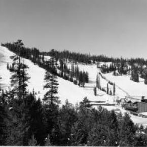
The town of Winter Park was first settled in 1923 and incorporated in 1978. It came into existence as a construction camp during the building of the Moffat Tunnel. The west portal is located here, hence the original name of West Portal.

As early as 1929 hearty winter sports enthusiasts were getting off the regularly scheduled trains there to ski the trails that were being developed. Regular weekend service on a special ski train began in January 1938. That same year, the U.S. Forest Service gave permission to the City and County of Denver to develop land near West Portal for winter sports, constructing ski-tows and trails. Winter Park ski area was formally opened in 1940.

With the consent of postal authorities, West Portal’s name was changed to Winter Park to publicize the ski area.  Benjamin F. Stapleton, the mayor of Denver at the time, championed the cause of the name change to help publicize the winter sports of the area. The town has now grown into a classic resort town and the ski area management has been recently turned over to the Intrawest Corporation by the City and County of Denver.

The Daily Life of Mountain Men

Washington Irving wrote "There is, perhaps, no class of men on the face of the Earth who lead a life of more continued exertion, peril and excitement, and who are more enamored of their occupations, than the free trappers of the West".

The diet of the mountain men at times consisted of nothing more than meat. When possible. wild plants and berries supplemented needed vitamins.  Pemmican, a meat pounded with fruits and dried in flakes, was convenient to carry and lasted a long time. Mountain men made boudins, sausage made from the intestines of newly killed animals.  These sausages were packed full of undigested grasses which probably protected the mountain men from the illness of scurvy.  The mountain men also chewed on leaves and wild grasses to supplement their vitamin needs.  Potatoes soaked in vinegar supplied further balance to the diet.  Jams and orange marmalade were highly valued whenever they could be obtained. Bread consisted almost entirely of hardtack, a touch cracker usually unsalted, which would not spoil and sturdy enough not to crumble.

Beaver tail soup was considered a delicacy by most mountain men.  Another treat was called "French dumplings", made by mincing buffalo hump with marrow, rolling it into balls, and covering with flour dough and boiled.  Coffee was popular, but limited for transport.  Tea from China came in solid blocks which could be shaved off as needed. 

Normally, mountain men could not carry whiskey on the move but at rendezvous or during visits to forts, they were known as fabulous drinkers.  The most common intoxicant in those days was "Taos Lightening", a strong whiskey manufactured by Simeon Truly of Taos New Mexico.  Various writers have portrayed these men as brutes who lived from one drunken episode to the next, but the facts, and common sense contradict that image.  They could not achieve much in either trapping or trading if they did not stay focused on their outdoor skills and survival. 

Smoking pipes was a luxury, mostly at nights as only a limited amount of tobacco could be obtained.  The mountain men would stretch their tobacco supplies by mixing it with kinnick-kinnick and other plants.

While many traders and trappers dressed in buckskin shirts and trousers, wool garments were even more common and needed to be shrunk to fit.  Probably every mountain man carried what was called a "possibilities bag" that contained personal items such as a pipe, tobacco, soap, needles, and small keepsakes such as mouth-harps.

Before the Sharps "Big 50" rifle was invented, it was necessary to carry a waterproof powder horn and a bag of rifle balls weighing fifty to a pound.  A good knife was essential.  The most sought after of these was the Bowie Knife, invented by Rezin Bowie, but made famous by his brother Jim, who was adept at its use.  Jim was one of the heros killed at the Battle of the Alamo in Texas.

Some mountain men simply loved the lifestyle and had no reason to return to their original homes.  Some had wives back in St. Louis and made an annual trek there every year.  Others had Indian wives or female companions.  Some men claimed to have a wife in every tribe they visited.  Divorce within many tribes was often simple, a matter of putting one's belongings outside the lodge.

As journeys by foot or horse were lonely, mountain men were known to play their mouth harps or sing songs along the trail.  The use of profanity was common, except in the presence of white ladies.  One writer claimed the Indians called white men "Godams" because that swear word was used so frequently by the mountain men, ranch hands and mule skinners.     

Topic:

Water/Lakes/Reservoirs

Grand County is home to the headwaters of the famed Colorado River - the river that brings water to five other arid Western states.  Water is the lifeblood of semi-arid Colorado and Grand County is one of the most water-rich areas of Colorado, and yet faces a shortage due to historical water agreements, written long before population pressures and the environmental awareness of the current age.  On average, the water diversion projects in the county move a whopping 305,000 acre-feet per year from the Fraser, Colorado and Williams Fork rivers - all headwaters of the Colorado's main stem.

60 percent of the water in Grand County is diverted elsewhere and there are plans underway, mostly from Front Range communities, to divert as much as 80 percent of the county's headwaters by the year 2010.  Two of the main water utilities, Denver Water and the Northern Colorado Water Conservancy District face a quandary: how to take the water from Grand County without further damaging the delicate environment and the region's economy, which is fueled by tourists who expect to play in the very water the Front Range wants to take.


More on water issues in Grand County

Jacob Pettingell - An interview from 1931

Transcribed by Dan Nolan

In 1880, Jacob Pettingell moved to Grand County at the age of 20. He spent the rest of his life here serving as postmaster, notary public, insurance agent, abstracter, legal counsel, justice of the peace and county clerk. The following is part of an interview conducted by his son-in-law Victor Frey in 1931.

Company of soldiers 
"When I came here, there was a company of U.S. soldiers camped at the old Barney Day ranch; this ranch is a few miles below Parshall, Colo. I think they left that fall. The Meeker Indian Massacre was in ‘79 and these soldiers were sent here in anticipation of further trouble. In addition, the govern­ment sent Springfield rifles to all settlers with ammunition.  We were curious about these new guns and went up on the hill to try them out; before we realized it, we had used up about all the ammunition. At this time some of the Utes came to Sulphur and vicinity to hunt and fish, and to trade. 

Fish & game 
Both fish and game were very plenti­ful in the early ‘80s. On account of severe weather, the settlers usually laid in their winter’s supply of grub early in the fall. At this time they would take several loads of game out to Empire and Georgetown, trading same for grub and provisions.  C. H. Hook, who ran the stage, would pay 25 cents per pound for fish, taking it out to market and selling it for 50 cents per pound. Some persons made as high as $15 per day by fishing. There were no state game laws then. 

Town of Kremmling 
Around 1880 or 1881, there was one little store and a building or two, located across the River (Muddy Cr.). This store belonged to a man named Kremmling.  About 1891, John Kinsey laid out the town of Kinsey City. Later, Kremmling moved his store and post office across the river to this townsite and the name was changed to Kremmling, Colo. There were some ranches in this locality and some of the ranchers names were Bill Kindell, Tracey Tyler, Jim Hetherley, and Dr. Hillery Harris.

Williams Fork
There was only about one ranch here owned by Joe Coberley. There was, of course, no town of Parshall. 

Town of Grand Lake
Old man Wescott lived here; a family by name of John Shafer and Ike Burton. Hot Sulphur Springs had been the county seat and headquarters for supplies for all the mines up Bowen Gulch. Grand County included all of Jackson County at that time.  About 1881, when the mining boom commenced up Bowen Gulch where the towns of Lulu, Gaskill and Teller City sprang up, they decided to move the county seat to Grand Lake since this was much closer. The county seat remained there until 1888 when it was moved back to Hot Sulphur Springs. The old town of Gaskill was located at the mouth of Bowen Gulch; Lulu was about three miles above Squeaky Bob’s ranch, now the Phantom Valley Ranch; while Teller City was on the other side of the ridge in North Park. 

Sandy Campbell and Jim Bowen were the first prospectors. The price of silver was high, and most of these mines were for silver. These mining towns sprang up around 1880-81. I originally came west to spend about three months in Middle Park, hunting and fishing, but when the mining boom struck this locality, I became interested. I grubstaked two men; later I took up a claim above the old Wolverine mine for silver and mined for 7 or 8 years. It was a paying proposition while silver was up in price but on account of the long freight haul and drop in price, the mine was later abandoned. Estimated population dur­ing boom days: Gaskill 150; Lulu 200; Teller City from 1,200 to 1,500. It was claimed that Teller City had 27 saloons. My personal recollections are that they might have had as many as 20 at one time.

The Famous Foot Race 
About once a month, the miners would all come down to Grand Lake for celebra­tions. There is no use to say that considerable liquor was disposed of. During the winter of 1882 a man named Sharp had been working at the Wolverine mine; he had beat them all at foot racing early that spring when the snow went off; these miners thought they had a world beater at foot racing.  While down at Grand Lake on a monthly celebration, they were all bragging about this man Sharp. At this time Harley McCoy was living at Grand Lake and he spoke up and said he had a man named Montgomery who could beat Sharp in a foot race. Sharp went into training at Gaskill; Montgomery at Grand Lake. Bets were originally around $100 and increased to nearly $8,000 on this proposed foot race. The race was pulled off July 4 on the main street of Teller City. Montgomery won the race by about 7 feet and Sharp kept right on running to the end of Main Street, then out into the timber. There was a horse tied there for him and a man waiting to divide up the swag—Sharp was never seen again. The gang at the Wolverine mine took their defeat like good sports, the other bunch paying for all they could eat and drink for a number of days.

The Mock Trial
Usually there was quite a bit of fun and excitement during the mining boom, but once in a while the boys would get a little lonesome on Sundays. This was one of those particu­lar Sundays when they craved a little excitement. There was a tourist and his party who had come in from around Boulder to fish and hunt. The boys confided in the judge and they arrested this man by an old location certificate and he was charged with horse steal­ing (a pretty serious offense in those days).

They held open court and the house was packed, not only with local people, but about 20 tourists were present. The defense attorney spent much of his time describing the wonderful scenery around Grand Lake and Colorado in general. The prosecut­ing attorney prosecuted hard and produced a witness who claimed he actually recognized the accused man and stated there was no doubt but what he was the guilty party. About the time the jury was to have the case, it was framed that I should commence a heated argument across the room with Gil Martin. When I jumped up and called Martin a liar, he opened fire with blank cartridges across the room: I commenced returning the fire. There was a great commo­tion, people actually jumping out thru the windows and a wild scramble thru the doors. The frightened defendant escaped into the timber. It rained all that afternoon. We later succeeded in convincing his partner that it was a joke, so he finally brought the de­fendant in that night, dripping wet and still badly frightened. They all pulled out of Grand Lake before morning.

First Courthouse
This was a small frame building about 12’ x 14’, one room. It has been moved and is now one of the cab­ins belonging to the Corner Cupboard. The Commission­ers then let a contract to Tom Johnston to build a new court house with jail behind, as quickly as possible. There was a sawmill at Grand Lake and plenty of lumber. Johnston put on a large crew; they start­ed in one morning; the next day they moved into the new court house building. John­ston put up this building in a little over one day, sufficiently for them to move in and use it. This building is now John Zick’s restaurant building. 

The Duel 
The commissioners were Barney Day, Webber and Mills, an attorney from Teller City. The sheriff was Chas. Royer and under-sheriff Bill Red­man. Cap Dean was the clerk pro-tem. Mills and Webber had been close friends but had a falling out over the Repub­lican State Convention the year before and since then had become bitter enemies. It is reported that there had been differences between Bar­ney Day and the sheriff and under-sheriff. 

The commissioners met at Grand Lake on July 3, 1883; they all agreed to adjourn un­til July 4 because Mills had an important case in court that day. Mills went to court but Day and Webber went to the Nickerson House and held a commissioners meeting there. At this meeting they raised the amount of bonds for county officers, making same so high they knew none could comply. As I recall, the sheriff’s bond was around $50,000. This caused the sheriff and under-sheriff to throw in with Mills. The next day was Fourth of July and many people were shooting out into the lake, there being considerable noise. Cap Dean, Barney Day and Webber left the Young Hotel (where I was also stopping) and started down town. No one knew just what did happen or who fired the first shot. There were some extra shots in that direction: someone thought they saw a man fall to the ground; we all ran down to the spot which was about 500 yards from the Young Hotel. 

Mills was lying in the road; Barney Day part way in the water; both Dean and Web­ber had been carried into the hotel. Day and Mills died instantly, while Webber lived until around 2 A.M. the next morning. I sat by his bedside. Cap Dean lived 4 or 5 days although he was shot to pieces. I sat beside Dean’s bed and asked him who did the shoot­ing and he replied that he did not care to say. Later, he described one tall man with a handkerchief over his face who attacked him and it fit the description of Bill Redman. It was thought that Mills opened up the attack by firing his rifle. The sheriff and undersheriff both es­caped. They first came to Sulphur and tried to organize a posse but the people seemed to mistrust them and they left the country. Later, Chas. Royer, the sheriff, committed suicide. Bill Redman had been a great pal of Royer’s and when he picked up a paper reading about Royer, he also com­mitted suicide. Therefore, this cost the lives of 6 men.

Firsts in Grand County:

The First Newspaper
The Middle Park Times was founded in 1881 at Grand Lake by John Smart and George Bailey. They called it the Grand Lake Prospector. It was moved to Sulphur in 1889 and called the Grand County Prospector. One day, in 1890, I walked into the newspaper office and was talking to Willard Minor, then running the paper. I told him that I thought Grand County Prospector was a h-l of a name for a county newspaper and sug­gested they change this name to “Middle Park Times.” They took this action and the paper has been known by this name from then on. About 1897, I bought out this paper and edited it for three years.

The First Auto
It was a Thomas Flyer driven from Denver to the Grand Hotel at Sulphur by Harold Brinker, who later on became a famous race driver. This was in 1905. It caused no end of excitement in our small town. Brinker kindly took several of the young people for a ride out to the old horse race track. My daughter, now Mrs. V. H. Frey, was one of the persons and she often mentions the thrill that first auto ride gave her. The car was driven in over the old Berthoud Pass road. 

The First Train
In the fall of 1905 the tracks were laid as far as Hot Sulphur Springs and at this time the first train came in two sections; there were about 1,000 people with a band. The community gave a barbecue and fish fry.

The Grand Hotel 
This was contracted for by my friend Mr. Chapin and myself, and finished in the year 1905. I ran same for a number of years. The first Forest Service office was located in this building and J. C. Stahl was the Supervisor. Later the forest office was moved to Fraser; it was there a short time, then moved back to Hot Sulphur Springs. 

Conclusion
From May 10, 1880 to the present time, February 7, 1931 I have watched the following towns spring up in Grand County: West Portal, Fraser, Tabernash, Granby, Grand Lake, Parshall, and Krem­mling. The Williams Fork locality has also settled up. The old mining towns of Gaskill, Lulu and Teller City came, and then died away. Ranches have developed over most of the county. Stock raising, both sheep and cattle, has become a fixed indus­try. The county, during this time, has shipped out an enormous amount of timber. Like else­where, the auto has developed rapidly and we have many miles of splendid mountain pass roads. There is an abundance of fish and game, although not so plenti­ful as the early days. Every town in Grand County is growing slowly but surely, with the possible exception of one railroad town. Grand County is well off financially and it has the very brightest prospects for future prosperity.


Topic: Places
Spruce Lodge

The search for Spruce Lodge

Spruce Lodge

 You gotta love a mystery! My curiosity rose, my anticipation of being the one with the real story was more than my appetite could stand. I looked at pictures, figured angles, mused at what other people said, reviewed topographic maps and finally said to myself “it just can’t be.” The terrain doesn’t look like that. It isn’t two miles from the last switchback on Hwy 40. I don’t care what the writing on the back of the pictures say. 

I want to know once and for all, where is the real location of Spruce Lodge? How can it be located so everyone will agree. I’ve got it, find an expert wilderness person with my same curiosity. As fate would have it, entered Debora Carr, author of Hiking Grand County Colorado, complete with pictures, maps, GPS coordinates and trail narratives. Her coauthor Lou Ladrigan also caught the bug. “We can find it.” 

Exploration began early in the spring but the snow was just a little too deep to find any artifacts. Failed attempt, but the appetite was there. Wait till the snow melts in the trees. Again, as fate would have it, entered Carol Hunter. Carol has been instrumental in the efforts to resore the Berthoud Pass wagon road. Carol has lots of maps and pictures of the development of the wagon road and just happened to have an original U.S. Bureau of Public Roads 1920 survey map for the construction of Hwy 40 from Empire to Fraser. I loaded it into the computer, expanded the image and found lots of strange numbers. Almost like mile markers. Carol said they were numbers used by the work parties. They seemed evenly spaced and the map had a distance legend. It even had a marked location for Spruce Lodge. I couldn’t wait to add this map to Deborah and Lou’s reference material.

Armed with new references, Debora and Lou hiked both sides of Hwy 40 from the switchback to the entrance to Mary Jane. Looking for artifacts, existence of remnants of the old wagon road, foundations and terrain that matched the photos in the GCHA collection. A couple places looked promising, but not quite. Finally, a white station post number 390 was found lying on the ground on the west side of today’s Hwy 40. Then another white station post was found to the south, number 380. That was a match! Just what we needed. That confirmed the surveyor L.J. Young’s map. To the south of 390 a flat part of ground revealed what looked like part of a foundation and surrounding the location were remnants of discarded cans and possible buildings. A two holer! Now check the terrain with the pictures. Well maybe. Don’t forget that Hwy 40 didn’t exist. Step back and look from the east side of the existing Hwy. A great match with the slope and tree line. This was it! Just .9 miles North of the last switchback.


Topic: Mining
Mount Baker

Gaskill and the Wolverine and Ruby Mines

Mount Baker

The Wolverine Mine was discovered in 1875 by James Bourn and Alexander Campbell. Bourn was the brother-in-law of James Crawford, the founder of Steamboat Springs. James Bourn was the twin brother of Crawford's wife, Maggie.  A Grand County recording error forever changed the name of Bourn in the area to "Bowen".  The mine was located in the Rabbit Ears Range on Bowen Mountain, up Bowen Gulch, approximately 10 miles northwest of Grand Lake.  This discovery sparked additional exploration in the area that lead to a number of new mines. Within a week of the original discovery,  interested parties formed the Campbell Mining District which included Bowen Mountain, Bowen and Baker gulches.  Some of the Middle Park residents who participated in the mining exploration  were John Baker, Charles Royer, Charles Hook, John Stokes and the Redman brothers, William and Mann. The Redman's  eventually  discovered the Sedalia mine. Bourn and Campbell  in less than a year lost the Wolverine mine by not fulfilling a grubstake agreement with the Georgetown grocers, Spruance and Hutchinson.

John Stokes leased the Wolverine Mine from the grocers until Edward Phillip Weber, an agent representing a group of Illinois investors, purchased the Wolverine Mine in the Summer of 1879.  Weber continued purchasing other Campbell Mining District claims which created a great deal of local excitement.  Weber hired Stokes  to assist him and also hired Lewis Dewitt Clinton Gaskill to act as the first foreman for the Wolverine mine.  Gaskill had mine operation experience, having successfully operated the Saco Mine, on Leavenworth Mountain, above Georgetown for several years.  A mining camp was built  below the Wolverine Mine that contained a large bunk house building and a more substantial mine office building.

Gaskill, a Civil War veteran of the 28th  Regiment of the New York Volunteer Infantry,  had come to Colorado in 1868 as a representative of a group of Auburn, New York bankers to invest in mining properties.  He eventually successfully operated the Saco mine in 1873 and 1874.  He invested in the Georgetown, Empire and Middle Park Wagon Road in 1874, which was a toll road that finally made the Berthoud Pass road passable for wagon traffic.  Gaskill also acted as the foreman during the construction of the road. The principal investor in the road was William Cushman of the First National Bank of Georgetown. The bank had a financial collapse in 1877.  At that time, Gaskill was the secretary of the road company and lived with his family in the company house just below the summit of Berthoud Pass on the west side.  William Hamill, a wealthy Georgetown businessman, bought the wagon road in a foreclosure auction in 1881 for $7,000.  Gaskill continued to live with his family in the Berthoud Pass summit house until 1885, when he moved his family into the Fraser Valley and homesteaded 160 acres along Elk Creek.

The settlement of Gaskill began when  in August of 1880,  Al J. Warner built a log cabin store in a meadow below Bowen Gulch on the trail/road that lead to both Bowen Gulch and Baker Gulch.  The settlement was also strategically well placed midway on the trail/road between Grand Lake and Lulu City and the Lead Mountain Mining District.  Another store was built in September by  John K. Mowery.  By that October, Mowery was appointed as the first postmaster of Gaskill.  The following spring E. Snell, opened a large general merchandise store that prompted the original store keeper, Al Warner, to relocate to Grand Lake as Al's Place. The town was named to honor L.D.C. Gaskill, the greatly respected foreman of the Wolverine Mine, the road builder/operator and the Civil War veteran.  By 1882, the town covered 60 acres.  E.P. Weber of the Grand Lake Mining and Smelting Company got involved in the town real estate development by laying out a city grid and offering lots for sale.  Weber's plat renamed the town Auburn after L. D. C. Gaskill's home town of Auburn, New York, but the Gaskill name stuck.  By the close of 1882, there were over 100 residents living in Gaskill.  The most substantial building was the Rogerson House, a well appointed two  story, squared log hostelry, Horatio Bailey Rogerson, proprietor.  Rogerson, would be elected County Commissioner in November of 1882, but would not serve because of a sudden discovery of ineligibility.  Instead, lame duck Colorado Governor Pitkin, appointed E. P. Weber to the post.  Weber was killed in the infamous July 4, 1883 shoot-out at Grand Lake.   

The Bowen Gulch trail lead to many of the  most productive and worked mines in the Campbell Mining District which included the Wolverine, now owned by the Grand Lake Mining and Smelting Company, E. P. Weber superintendent and the Ruby and Cross mines owned by Kentucky and Colorado Mining and Smelting  Company, John Barbee superintendent. Barbee, who lived in Grand Lake,  would go on to serve as superintendent of schools, Justice of the Peace and briefly the editor of the Grand Lake Prospector.  Barbee's partner in many endeavors was Antelope Jack Warren. Warren was as rough as Barbee was refined.  He acted as a foreman and, by one account, a bodyguard for Barbee.  The Bowen Gulch trail continued up the mountain to Bowen Pass and then descended into North Park and the Jack and Park mining districts which were organized by the end of 1880, to the settlement of Teller City.  Passable roads that could handle wagon traffic were needed and often planned but rarely built.  The high cost of building and maintaining  wagon capable roads in Middle Park was a difficult proposition for local governments and private entrepreneurs.  

The Grand County Commissioners in July of 1877 had declared the trail from Grand Lake to the mining gulches of the Rabbit Ears  Range to be a county road.  However there was little county money to pay for improvements to make the trail a road.  Private investors were reluctant to invest in wagon roads when there was the persistent  rumor that railroads were coming spawned by the numerous railroad surveys that were performed in the area.   Albert Selak, a Georgetown brewer, in August of 1878, organized a toll road that would branch off of the Georgetown, Empire, and Middle Park Wagon Road at the Ostrander Ranch on Red Dirt Hill, and proceed to Grand Lake and continue on to the Rabbit Ears Range mines and continue on into North Park and on to the Wyoming territory line.  John Barbee invested in the Middle Park Toll Bridge Company, a toll bridge company that intended  to build a bridge across the Grand River  above the confluence of Willow Creek and the Grand River.  However, this project languished, and was taken over by the county with an expenditure of $150.  

If ore wagons would need to haul ore to the nearest reduction mill which was over 60 miles in Georgetown, the toll road might have been a financial success. However, the lower grade ore from these Rabbit Ears Range mines would not yield a sufficient profit to cover the transportation and processing costs in a market where the market value of silver annually declined.  So the ore piles grew.  What was needed was a nearby reduction mill or cheaper transportation, like a railroad or a higher price for silver.  Weber had  repeatedly promised that a reduction mill was coming, but nothing was ever built.  By April of 1883 with tons of ore piled up and waiting for transport to be processed,  Weber temporarily closed the Wolverine Mine and laid off his miners.  He admitted  in June of 1883 that the ore from the Wolverine was “rather refractory” and that it would not justify shipment without local reduction.  Some hoped the closing was a strategic move by Weber to trigger a sell off of area mining properties  so that he could acquire additional mines before he built the reduction mill, but it was not to be. Weber would soon be shot dead by his political rival, John Gillis Mills.

The favorable newspaper stories of Rabbit Ears Range mining would continue, but for the informed, it had become  clear that without a major investment in improved transportation including a railroad or a major investment in a reduction mill in the area, the mining concerns were doomed to fail.  Mining claims had to be worked in order to be kept.   A minimum of $100 of labor or $500 in improvements had to be expended each year to maintain the claim or else the claim would be deemed abandoned.  Many claim holders leased their claims to miners to work for a percentage of the return.  Without the ability to sell and process the ore for a profit, there was no return.  The speculative mining investment money began to dry up and the miners and their supporting merchants began to leave.  By the end of 1886, the Middle Park mining boom had  ended. To further add to the decline,  a border dispute that arose between Larimer County and Grand County over the taxation and mineral wealth of North Park was finally decided in 1886 by the Colorado Supreme Court in favor of Larimer County.  North Park was part of Larimer County, not part of Grand County.  A lawsuit would follow so that Larimer County could recover the wrongly collected taxes of $20,000 from Grand County.  Grand County's total tax income at the time was less than $3,500 a year.

Topic: Railroads

Moffat Road


"I shall never forget it as long as I live. Nor do I ever expect to experience anything comparable to it again. Civilization had found its way across the mountains into Middle Park," reflected Mrs. Josephine Button in 1955 on her 91st birthday, as she recalled seeing smoke from the first Denver Northwestern and Pacific work-train on Rollins Pass, high above the Fraser Valley and Middle Park. Once those rails made it over the Continental Divide all the way to Hot Sulphur Springs, "changes came thick and fast." Many men, many dollars, many routes and many dreams tried to bring a railroad over the Continental Divide into Northwest Colorado, and the "Hill Route" over Rollins Pass that finally accomplished it a century ago has retained its allure ever since.

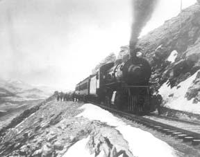
The Moffat Railroad built a cafeteria, telegraph station, living quarters for Moffat's "Hill Men" (as the railroad crews up there were known) and a fine hotel - all collectively called Corona Station. Soot-filled snow sheds protected over a mile of this windblown section of track. And where today silence is the most powerful sense, colorful locomotives pulled passenger and freight cars, filling the rare atmosphere with black smoke and mechanical clatter.

Decades of men's dreams lay behind the once massive snow shed that cut the bitter winds from the north and west, behind that fine hotel that offered some of the most spectacular scenery in America, behind the hopeful Town of Arrow nestled below tree-line ten or twelve miles west of Rollins Pass, and behind that first work-train that Josephine Button watched from her hay ranch along the Cottonwood Pass Wagon Road to Hot Sulphur Springs. Competent, often powerful, men in the 1860's through the 1890's filed surveys, graded road beds, and even began drilling before being stopped by severe storms that foiled the best laid plans or their inability to fund the ambitious projects.

Dreams to penetrate the high mountains along the Divide in central Colorado began when the Front Range was flooded with miners during the Gold Rush of 1859. Even before Colorado became a territory in 1861, Golden City, just west of Denver along Clear Creek, recognized its potential as a gateway to the rich mineral resources of mountain towns like Central City, Black Hawk, and Georgetown. Golden City's ambitions went beyond becoming a mountain transportation hub, believing that with the right incentives, enthusiasms, and leadership, its location supported a future as a national commerce center. 

Golden City certainly had men of vision, ambition, and wealth among its ranks. William Loveland and George Vest, both young and feverishly ambitious to see Golden City reach its potential, vigorously pursued their dreams for a powerful commercial center in Golden City. From Missouri River towns like Leavenworth in Eastern Kansas, leading town founders also recognized the benefits of linking their water and rail routes to the east with the resources of the west. Finally, as if destiny had demanded it, Edward L. Berthoud, a young civil engineer and surveyor with energy and ability, arrived in Golden City from Leavenworth in April of 1860 to unite the similar passions of leading citizens from both locations.

From 1861 until 1866, Berthoud, Loveland and Vest focused on bringing a direct transcontinental railroad route through Golden City. First, Edward Berthoud, along with Jim Bridger and a capable young cartographer named Redwood Fisher, blazed a trail across Berthoud Pass through Middle Park all the way to Salt Lake City. Returning to Golden City on May 28, 1861, Berthoud reported "a good wagon road could be ?quickly' built" from Denver to Salt Lake City over Berthoud Pass for about $100,000.00. According to the local hyperbole, a railroad would surely follow.

In spite of considerable enthusiasm, disappointment plagued early efforts to put a rail line over the mountains in Colorado Territory. In 1862, Territorial Governor John Evans sent the Surveyor General for Colorado and Territories along Berthoud's route and others to confirm or deny the potential of a railroad line. About the same time, the Union Pacific Railroad Company sent an independent reconnaissance to examine potential routes over the divide that included Berthoud and Boulder Passes (Boulder Pass became Rollins Pass in the early 1870's, when John Quincy Adams Rollins built a toll road over it, and then Corona Pass when the Railroad crossed it). Surveyor General Case and the UP agreed that neither route offered much hope for a standard gauge railroad. The dream of a transcontinental line over the Continental Divide through central Colorado seemed to die with the UP surveyor's words, "I learned enough to satisfy myself that no railroad would - at least in our day - cross the mountains south of the Cache la Poudre..." 

Multiple failed attempts to bring a rail line over the Divide through Middle Park during the following decades strengthened the UP's "death sentence." Against the odds, Berthoud and Loveland continued to solicit support for a railroad west over or through the Continental Divide, using improved surveys and maps to support their requests. In the 1880's, survey crews from a variety of railway incorporations were scattered over the high country on or near Rollins Pass. Over Berthoud, Rollins and other passes, they marked potential railroad lines with their wooden stakes. It was during this stretch of strenuous surveying activity that David Moffat, a highly successful Denver capitalist, got involved with an unsuccessful effort to bring through the mountains instead of over the top. 

 In the early 1880's, Mr. Moffat invested in the Denver, Utah and Pacific Railroad, which intended to tunnel through the mountains near Rollins Pass. Like the other efforts, though, the Denver, Utah and Pacific vanished in a few short years. Unlike many other lines that accomplished little more than surveys and maps, the DU&PRR completed significant grading and began tunneling before reaching the "end of its resources."

Money, power and success supported Moffat's dream to put Denver on a direct transcontinental railroad line. Doctor Robert C. Black, III, wrote that David Moffat's failed efforts in the early 1880's converted him to the idea that Denver needed to be on a direct transcontinental rail line. Moffat considered the route over Rollins Pass valuable enough to have surveying and grading crews working on it throughout the winter in 1902. The Denver Rocky Mountain News claimed that Moffat's route through Northwestern Colorado included "the largest strip of fertile land as yet undeveloped in the United States..." With his Denver, Northwestern and Pacific Railroad, David Moffat planned to make good his intentions to put Denver on direct transcontinental railroad line.

Moffat's original plan called for the "Hill Route" over Corona Pass ? the name changed from Rollins Pass in honor of Corona Station at the top ? to last for only a few short years. While the "temporary" route over the top generated resources by extracting the resources of Northwestern Colorado, a tunnel was to be bored through the Continental Divide. Even the wealth and power of Moffat, though, failed to adequately finance the tunnel before he died in 1911. The temporary line, therefore, lasted for nearly of a quarter century, from 1904 until 1928.

Its obstacles proved as enormous as the mountains it crossed. Work crews had to cease operations because of snow for most of April in 1920. The road was closed from late January until May in 1921. In December of 1924, engine number 210 busted "a main reservoir pipe," causing the train to fly down the hill out of control until it jumped the tracks and crashed into the valley below. Clearly, the Denver and Salt Lake Railroad, which took over Moffat's DNW&P after his death, needed a tunnel to replace the expensive effort over the "Devil's Backbone."

 As Denver and Salt Lake Locomotive Number 120 came through the tunnel in early 1928, it represented the culmination of a massive undertaking through wet, unstable rocks which required considerable engineering ingenuity and caused six deaths in a 1926 cave-in. It also took an enormous amount of coordination and effort to secure the necessary funding. Through local bond issues, private investors and other means, the project was completed. And through a connection at Dotsero, a railroad station less than 30 minutes west of Vail on I-70, freight and passengers could make a direct Pacific connection from Denver. Posthumously, David Moffat's dream became a reality.

For significant periods of time since the trains stopped operations over Rollins Pass in the late 1920's with the opening of the Moffat Tunnel, on-road vehicles crept along its relatively easy grades and wide curves from Rollinsville on the east slope to Winter Park on the west side of the Divide. Like now, the road ran through an area attractive to backcountry campers and sport enthusiasts. On September 1, 1956, local officials and private citizens met on Rollins Pass to celebrate a "joint state-federal-county project to convert the old D. & S. L. railroad right of way over Corona Pass into an access road for sportsmen." According to the Denver Post, the game and fish department's construction division reconstructed the road during the summer of 1955 for about $20,000. The following year, the road became a scenic route over the Continental Divide for family cars and jeep caravans alike. And after it was built, or at least reconstructed, they did come. Intrepid tourists into Middle Park.

Topic: Biographies

Elenor and George Smith

"You have tuberculosis." Frightening words to be sure, especially in times when the life expectancy rate for such a disease was slim. Tuberculosis, or consumption as it was commonly called, is a disease that primarily affects the lungs. Something as simple as the common cold quickly develops until the patient is suffering from severe chest pain. Soon they are coughing up blood. For most diagnosed, the result was eventual death. As a last hope, many people fled westward, desperately seeking the arid climate that would dry up the fluid in their lungs. Little did they know that while the west would cure them, it would by no means make their lives easier.

Elenor Smith, a woman in her early thirties living in Wisconsin, was one of the many so diagnosed. The doctor who examined her did not have much hope for her survival. He ominously predicted she would live no more that a few years longer and she would be unable to bear any more children. With this devastating prognosis ringing in her ears, Elenor, along with her husband George and their five children, packed up and headed west. Their long journey brought them to Fraser, Colorado, where they ended up settling in 1910.

The Smiths soon became an important part of the community. They built a log cabin in what is now "Olde Town Fraser' and, like everyone else, allowed their cattle to roam freely. George, affectionately called "Whispering George" by those who knew him well, owned the only livery stable in town. He could regularly be found escorting "Doc Susie" to her patients, be they man or beast.


The climate seemed to have been the perfect cure for Elenor. She lived a hardy and wholesome life, and went on to have four more children. Being the hard worker she was, she would often cook for the men working in the nearby logging camps. When she wasn't cooking, she was washing laundry. She was known by many and loved by all.


However, things were rough all over and all too soon the Smith family learned how harsh life could be. In 1921, their second eldest son, Oliver, at the age of twenty, was killed while working at Virgil Linnegar's sawmill. Then in 1944, things again took a turn for the worst. Her youngest daughter's (Georgene) two children contracted polio, a contagious disease that causes muscle paralysis and stunted limb growth, while their father was away in World War II.


As the story goes, the eldest of the two children, Sherry, showed signs of polio first, so she was rushed to the hospital in Denver. Not thinking George, the youngest at the time, had also contracted it, his mother left him with his Grandma Elenor, so that she could be with her ailing daughter. However, one day Elenor found him hiding under the table crying. Knowing immediately the two-year-old wasn't just throwing a fit, she scooped him up in her arms and rushed to get help.


Polio had been going around for a few years now, leaving a swath of deaths in its wake. People were doing everything they could to prevent bringing the disease upon themselves and their families, which was why the woman working in the telephone office locked the door when she saw them coming. Not knowing what else to do, Elenor searched frantically for someone, anyone, to help her. She even began knocking on house doors. Finally one brave man offered to help. He took her and little George to Denver in his car. Luckily, both children survived, though they would carry the repercussions of the disease for the rest of their lives.


Having conquered tuberculosis, polio, and everyday hardships, Elenor Smith died in 1974 at the ripe age of 93.

Stage and Freight Lines

Berthoud Pass Stage Road was built by the extreme efforts of Captain Lewis Gaskill.  It came from the top of the Pass through Spruce Lodge, Idlewild (now Winter Park), the Cozens Ranch (near Fraser) Junction Ranch (Tabernash) and Coulter.  From there once branch lead over Cottonwood Divide to Hot Sulphur Springs (and points west) while the other went to Selak’s and over Coffey Divide to the Lehman Post Office and on to Grand Lake.  

At the summit of Berthoud Pass there was a large house of hewn logs, occupied by Lewis Gaskill and his family.  They collected the tolls for the road and gave welcome shelter to those weathering the variable passage.  The house was located on the West side of current Hwy. 40 but no trace of the building remains.  

At the steepest portion of the west side of Berthoud Pass was the Spruce House rest stop, which by 1900 was a sold structure of two and a half stories.  There the traveler could find a warm meal and corral for livestock.  No trace of it remains today.  

The Idlewild Stage Stop was located in present day Winter Park and was a popular place to change horses before the steep assent up the pass.  Mrs. Ed Evans served a hearty noonday meal there for only 35 cents.

Cozens Ranch was also one of the more popular stops and Fraser Post Office until 1904. Built around 1874 by William Zane Cozens, it remains today, outfitted in period décor and is the home of the Cozens Ranch History Museum.  

The Gaskill House, in Fraser was built by Lewis De Witt Clinton Gaskill, one of the original investors in the road and a prominent Grand County citizen. The house now houses the Hungry Bear Restaurant.

Junction House at Junction Ranch (Tabernash) could accommodate up to fifty travelers and was built by Quincy Adams Rollins, and subsequently leased to Johnson Turner.   

The Coulter Stage Stop was built by John Coulter, an attorney from George town and shareholder in the stage road.  It also served as a Post Office from 1884 to 1905. 

Frank and Fred Selak, sons of a pioneer Georgetown brewer ran the Selak stop which was north of Granby and east of current Hwy. 34.           

Cottonwood Divide (Pass), at 8904 feet above sea level, was laid out by Edward Berthoud and Redwood Fisher in 1861.  The route was used by stagecoaches from 1874 until the railroad arrived at Hot Sulphur Springs in 1905.  The last driver on the route was Charlie Purcell.  Summer travel time between Hot Sulphur Springs and Georgetown was typically twelve hours. Travelers between Hot Sulphur Springs and Kremmling could stop at the Barney Day or King Ranches, both near current Hwy. 40.   The Pinney Ranch House, used by the firm of Whipple and Metcalf for the connecting service to Steamboat Springs, is still standing on Hwy. 134 on the east slope of Gore Pass. There a traveler could pay 50 cents for a meal, 50 cents for a bed and expect a change of horses every ten miles.  It ceased operation in 1908 when the railroad reached Toponas.  

Topic: Towns

Grand Lake

Grand Lake was established in 1879 and incorporated in 1944. It is named for the largest natural body of water in Colorado. In 1867, when only a few people resided near the lake, Major John Wesley Powell (the man whose group first rafted the Grand Canyon) came to explore the possibility of floating down the Grand (now Colorado) River. That summer, Powell, local resident Jack Sumner, and William Byers, founder of the Rocky Mountain News, made the first recorded ascent of Longs Peak from Grand Lake. In the early 1900’s a Yacht Club was formed by enthusiasts who were attracted by the demands of attentive seamanship the lake demanded.

In 1912, Sir Thomas Lipton contributed an impressive cup to be presented annually to the winner of the annual August Regatta. This event still draws skilled sailors to the challenging competition. The town was founded during a very brief mining boom, but because of it's natural beauty, tourism has long been the sustaining feature of it's economy.

Time Line