Volunteer Fire Departments

.

Volunteer Fire Departments Articles

Fire Engine No 1 - Hideaway Park Fire Department

"What Hideaway Park needs is a fire engine!  No way can we fight fires without more water; all we can do is watch some building burn!"  The half dozen volunteer firefighters were seated around the table in Hildebrand's little grocery store on Highway 40. "I agree," said Ray.  "We've talked long enough!  Who's got the want ads?"

Claude pulled out the latest Denver Post want ads.   "I don't see any fire engines.  I looked up fire fighting equipment too.  Nothing there.  But here's a 1940 Chevy truck for $400.00.  That's just eight years old; maybe it would do."

"We could mount a tank and a pump on the back," said Dwight.  "Do we have enough money to pay for it?" Claude pulled out their account book.  " We've $550.00.  That would pay for the truck and we volunteers could use the rest to put up a shed.  We can always have more Bingo nights.

"Dwight, you're the Fire Chief.  Why don't you and Ray go down and look at it.  We'll give you a blank check so you can bring it home if it looks good." The men agreed.  At last they were getting started.

The following week Dwight and Ray drove to Denver to the car lot and took a look.  The truck wasn't much, but the engine worked and the tires weren't too bad.  Ray commented, "I know a fellow who has a galvanized tank.  We can buy some 2" hose and a pump from American LaFrance.

"Okay," said Dwight.  "Let's take it."   He brought out the check Claude had sent along and signed it.  The used truck salesman looked at it and looked at Dwight.    "How old are you, Mr. Miller?"

"I'm 20 years old," he answered.  "What's the problem?  I'm Fire Chief."

"Hmph, you look more like sixteen!  We're not supposed to take checks from anybody younger than 21.  Let me go talk to the bookkeeper."   It took a long time and Dwight and Ray were getting nervous.  At last the salesman returned.  They'd accept the check.

And so Hideaway Park got its very first fire truck.  The men in town finally got the tank and pump put together and started in on a wooden building, along the main road off Highway 40 where Cooper Creek is now.  Winter came early that year, and the fellows didn't have time to get the roof completed.  The rafters and sheeting were up, but the 90# roofing material had to wait; so snow drifted in with every storm, and ice built up, to melt and leak later onto the truck.  But the men knew they could finish up the following year.   Periodically they got together to try out the pump and drive up and down through town, with their new siren wailing.  Everything seemed to work.

A few years passed.  When fires occurred, however, the buildings still usually burned to the ground. One winter in 1952, Dwight was wakened before midnight.  "The Spot is burning.  Let's go!  Let's go!"  Ray's voice broke with excitement.  Dwight jumped from bed and threw on his clothes.  He could see the flames down on the highway leaping above the trees.

Men were gathering at the firehouse. Dwight ran through the door and clambered up on the fire truck.   He tried to start the engine.  R-r-r-r --.  Nothing happened.  R-r-r-r.   "The battery is dead," he cried. 

Ray and Wally were struggling to get the overhead door open and the miserable thing was frozen shut!  They took a hammer to the base, but the frost wasn't about to give way and let door move.  Finally Dwight cried, "Let's slip a cable under the door and hook it to the truck.  We can pull the truck out and on down to Vasquez, to fill the tank." 

The cable was soon in place and Claude jumped into his truck and started pulling.  With the fire truck in gear, it moved forward, hit the double garage door, and continued on.  With a groan and a jerk, the engine and siren  finally started.  Dwight guided the rig onto the road with the door riding on top of it, blinding him.  At last, the door fell to the ground.

At the creek, the fellows pulled the hose down to the water and chopped a hole in the ice.  Another started to hook the hose onto the pump.  "The hose has shrunk!  It won't fit!"

 "What?  It did the last time we practiced!"  The volunteers looked at each other and threw up their hands in disgust. The Spot to Stop was burning fiercely by this time, but Ray said, "Let me string my garden hose across the highway.  I think it's long enough, and maybe it will do some good."  This is what he did, but it was too late.  That building was a goner. 

The townspeople stood around until there was nothing left but ashes; then they went home to bed.  The firemen met the next morning to decide what to do about the truck.  They eventually chose just to leave it there all winter.  It sure wasn't going to do anybody any good.  The next winter, that fire truck had a new hose!

Some years later, Dwight and Jean Miller gave land for a volunteer fire building, which was made of metal and which had a heater.  And over the years, better trucks were purchased and the men received some proper training.  The early volunteers had a perfect record ? they never saved a building.

Some of the volunteers in 1947-48; there may be others.  
Dwight Miller
Ray Hildebrand
Claude Brock
Bill Polk
Jim Quinn
Wally Tunstead
Easy Butler
Leroy Hauptman
Dick Mulligan, Jr.

Grand Lake's First Fireboat

During the summer of 1960, Jeff E. Fuller and Don Drake formed Mountain Services Inc. to offer Grand Lake shore owners protection by patrolling the properties.  In May of 1961, Don Drake promoted the idea of a fireboat and with donations, a 1960 18 foot Buehler Turbocraft Jet 56 was purchased and equipped to fight fires. Don tested the water jet and found that it would pump enough water to reach the fourth story of the five story-14 bedroom Oscar Malo home. 

Ironically, on September 10, 1961, that very home caught on fire.  The home was completely engulfed by the time Don got the fireboat to the location but, with the help of Elmer Badger and Jerry Gruber, they concentrated on the 4-slip boathouse.  The heat was so intense it melted the plastic trim on the fireboat but the boathouse was saved and still stands today.


Articles to Browse

Topic: Biographies

David Moffat and the Railroad Dream

David Moffat was a wealthy Denver businessman who saw the need for a rail link between Denver and Salt Lake City. His vision, a 6.2 mile long tunnel beneath the Continental Divide, made this link possible.

He was born in 1839, the youngest of 8 children. He ran away from home at age of 12, went to New York City and found work as a bank messenger.  He was an assistant teller by the age of 16 and  became a millionaire through real estate by the age of 21. 

Moffat was admired for his qualities of courage, adaptation to the “barbaric” West and his goodness of heart. He married his childhood sweetheart, Francis Buckhout, moved to Denver, and in 1860 opened a bookstore/stationary/drug store with C.C. & S.W. Woolworth on the corner of 11th and Larimer.  

Moffat and others formed the Denver Pacific Railroad to reach Cheyenne. The rail line to the Moffat Tunnel was the highest standard railroad ever built in the U.S. (11,660 ft). It went over the Continental Divide at Rollins Pass and came into the Fraser Valley in 1904. At the time, it was the most difficult railroad engineering and construction project ever undertaken. It involved boring numerous tunnels through solid granite, as well as constructing precarious timbered trestles that bridged deep mountain gorges. 

David Moffat was a multi-millionaire when he started the Moffat Line and was nearly broke when he died in 1911 trying to raise money for the tunnel that would eventually be built and bear his name. It was finally completed in 1928. The west portal of the Moffat Tunnel can be seen from the Winter Park Resort.


National Sports Center for the Disabled

May 8, 2010 Sky-Hi News

In January 1970, Gerald Groswold, then chairman of the board of Winter Park Ski Area, received a call from the Children's Hospital of Denver about program they'd been running at Arapahoe Basin for amputee children. A-Basin wasn't going to continue the program, and the hospital wanted to bring it to Winter Park.

In his morning meeting a few days later, George Engel, who ran Winter Park Ski School at the time, announced that this group was coming up in a week's time and asked for volunteers. Of the 40 or so ski instructors standing there that day, only one raised his hand to volunteer. Later, at lunch, Engel walked by the lone volunteer and threw a note in front of him. "Call this number. You're in charge," Engel said.

The 32-year-old Montreal-born ski instructor stared at the note while he finished eating his lunch. He had no way of knowing that by raising his hand he had just shifted the entire course his life as well as the lives of tens of thousands of others. That ski patroller was Hal O'Leary.

O'Leary went on to found the National Sports Center for the Disabled. Today, the NSCD is one of the largest outdoor therapeutic recreation agencies in the world. Each year, thousands of children and adults with disabilities take to the ski slopes, mountain trails and golf courses to learn more about sports, and themselves.

From the get-go, O'Leary had obstacles to overcome, starting with the fact that he'd never even known an amputee, not to mention seeing one ski. The day after he raised his hand, O'Leary got himself a set of outriggers and went about teaching himself to ski on one leg. Being schooled in the Professional Ski Instructions of America technique, he used all the same concepts as he would use for a conventional skier, sliding between turns.

On Jan. 22, 1970, 23 amputee children arrived at Winter Park with equipment borrowed from Children's Hospital. It was a cold day, as O'Leary recalls, and he pushed the kids hard, making them climb up the bunny slope to turn around and practice making runs back down. Some of the kids who had participated in the program at A-Basin had been taught to jump turn the ski rather than sliding it. So they were hopping around like kangaroos, hopping three times to make each turn, O'Leary said. By 11 a.m., kids were collapsed on slope, crying. One screamed: "I hate your guts," O'Leary recalled.

Feeling that he had failed them, he took them over to the lift on Practice Slope after lunch and put them on the chairlift. A few bailed out, and O'Leary thought: ?Oh my God, I'm going to kill them,' he said: "I worried they'd end up in the tunnel." By the end of the day, however, the kids were flying down the hill, coats flapping in the wind and smiles on their faces. O'Leary was hooked.

For eight weeks the program continued. Before long, the television stations caught wind of what was going on at Winter Park. One day O'Leary got a call from the Today Show, which wanted to feature his program. No sooner had he hung up the phone then it rang again, and Good Morning America was on the line wanting an interview. "It really put Winter Park on the map in those days," he said.  As word got out, people with different disabilities started calling O'Leary to set up lessons, from the visually impaired to the paraplegic.

For each new challenge a skier presented, O'Leary needed a new adaptation to the traditional ski equipment. He spent nights at the ski shop working on modifications and pouring over medical books. Improving the design of the outrigger was O'Leary's first challenge. O'Leary made a lot of phone calls back and forth with George Engel (who also owned Winter Park Ski Shop) and other product manufactures, explaining the design he needed, then they would build it.

Another early invention was the "ski bra." Originally made of metal, the contraption slid over the tip of the skis, holding them in place and preventing them from crossing. "The ski still had freedom, but it helped people that lack lateral control of their bodies," O'Leary said. Sit skis hadn't been invented either. So when a paraplegic wanted to ski, O'Leary modified a cross-country ski item out of Norway. "It reminded me of a little bathtub," he said. "It didn't have any runners. It made me nervous. But, people could use it in a seated position, and it got people who couldn't stand out on the hill."

One of the more peculiar adaptive designs that O'Leary saw over the years was a space suit worn by a paraplegic man. The man filled the suit with enough air that he could stand upright, which worked well, O'Leary said, until he sprang a leak and had to be rushed back down the hill. "In 40 years, it's amazing what has happened to the gear," O'Leary said.

If equipment is the backbone of the program, volunteers are its heart. "We couldn't do this without our volunteers," O'Leary said. More than 800 people volunteer every year with the NSCD. It's a dedicated group of people - the average volunteer has been involved with the program for more than eight years, O'Leary said. Just about anyone who can ski can volunteer. NSCD provides the training and, soon, the volunteers are teaching the lessons. Thanks to the volunteer program, a NSCD participant in 2010 can get a full day lesson with a private instructor, plus a lift ticket and adaptive equipment for $100. Scholarships help people who can't afford the price tag. Raising money to help offset costs and provide these scholarships is key for the program's success. The NSCD holds more than a dozen fund raisers each year, although the Wells Fargo Cup and the Hal O'Leary Golf Classic are two of the biggest and most well-known.

O'Leary built the adaptive skiing program for 10 years before it began to develop into something permanent. In the early years, he was challenged a lot by the ski area, he said. Lift ops had concern about people riding the chairs with different apparatus. The ski patrol was concerned about people with various abilities getting on slope. "There was opposition from different parts of the mountain," O'Leary said. But the program's champion - Gerry Groswold, who served as the ski area's president for 22 years, from 1974 to 1996 - held strong to his conviction that the mountain should make room for skiers of all abilities, O'Leary said.

While the majority of those other ski instructors - the ones that didn't raise their hands that day - moved on to other pursuits, O'Leary had found his life's purpose. "It was seeing smiles on people's faces," he said. "I never realized what it would mean, giving these people movement they did not have in a wheelchair or walking. It changed their life. It helped them in many ways with their challenges. They did better in school. They started focusing more. After several years, wanting to give back what they took, many of them became instructors themselves."

For the first four years, O'Leary still had to wait tables in the summer to survive. Finally, in 1974, O'Leary parted ways from Winter Park Ski School, and Winter Park Ski Area brought the disabled skier program under its wings with O'Leary at its helm. That year, O'Leary introduced summer activities to the program, including whitewater rafting and horseback riding. "That first summer went extremely well," he said. "The turnout was huge."

Today, the summer program has expanded to include almost any recreational activity imaginable, including rock climbing, biking, hiking, canoeing, kayaking, camping and fishing. Programs are designed for individuals, families and groups and are available for all levels of ability, from beginner to advanced. "What we offer now parallels what any tourist would want to do on a vacation in Colorado," O'Leary said.

O'Leary has spent the past 14 years traveling to other countries, lecturing, writing books and working with ski areas to set up programs and introduce adaptive equipment. "It's not easy to create a program at a ski area," he said. "Space is limited. You have to raise money to finance it. But the point is to create choices for people who have disabilities, choices like everyone else has."

In the United States, the sporting opportunities for disabled people have exploded in the past few decades, thanks, in large part to the early efforts of folks like O'Leary. Disabled Sports USA now recognizes 13 disabled sports programs in Colorado, far more than any other state. Although O'Leary, now 72, handed over the day-to-day operations of NSCD more than eight years ago, he still works daily. He's traveled to 13 different countries helping to create NSCD-style program. He's written the book, literally, on adaptive skiing techniques (Bold Tracks: Skiing for the Disabled).

Looking back on that January day 40 years ago when he innocently raised his hand, O'Leary said he'd do it all again: "I've gotten more out of it than I put into it," he said. "I've worked with fabulous people. I've had great opportunities. It's been a good life. It really has."

Topic: Granby

100 Years of Location, Location, Location

Real Estate and land ownership have always been important to the Granby area. With the passage of the 1862 Homestead Act by Congress, the West, including the area around the current town of Granby, began to be settled with hardy, ranching pioneers. The opportunity to own land was often made possible by homesteading.   This lured many settlers to the area.

As Congress adjusted the homesteading rules over the years to allow for larger acreages which would support ranching in the Middle Park, towns began to grow. Ranching, mining and especially the railroad fueled the growth. In 1902, railroad visionary, David Moffat, set events into motion in Denver to build a steam railroad from Denver to Salt Lake City which would be built over Rollins Pass.   This was a monumental task which led to the founding of the town of Granby.

Mary Lyons Cairns observed in her book, “Grand Lake in the Olden Days,” “Granby came into being with the Moffat Railroad, which reached that point in September, 1905. The town site was laid out on a piece of land which was part of a homestead and part of a pre-emption taken up by James Snyder from the government. Mr. Snyder sold this land to David Moffat who had the town site surveyed and platted in 1904, and a man named Hunter auctioned off the lots.”  

The lots on the town plat were 12 blocks and a Block “A.” Each block, except Block 12 and “A,” would have 32 lots. Each lot would be 25 feet by 125 feet. Block 12 only had 20 lots. Block “A” only had four smaller lots. David Moffat and the railroad in the form of the Frontier Land and Investment Company designed the town streets so that the southern boundary of the town was Agate Avenue, the western was First Street, and the northern boundary was Garnet Avenue. A variation in terrain in between Block 12 and Block “A” created Opal Avenue that would lead down Fifth Street which would be the eastern boundary of the new town of Granby.    

The new town streets were named Agate, Jasper, Topaz, Garnet and Opal, all precious gems which might reflect the mining heritage. But, in the King James version of the Bible in the Book of Revelation, Chapter 21, Verse 19, heaven is described as, “And the foundations of the wall of the city were garnished with all manner of precious stones. The first foundation was jasper…” Other streets and foundations are described as being made of precious gems such as topaz and chalcedony. Agate is described in the dictionary as a variegated variety of quartz or chalcedony.   Maybe the founders thought Granby was “heaven on earth.” Or, at least the real estate marketers wanted buyers to think that.

The real estate advertising in the December 16, 1905, Grand County Advocate showed V.S. Wilson as the local real estate agent for Granby. He also was the newspaper editor and became Granby’s first mayor on December 11, 1905. With that background, hyperbole and adjectives must have been in his blood.   “Now is the time to buy property at Granby-The newest and best town on the ‘Moffat Road.’…It would be a Happy Christmas investment. Do it now,” was part of the ad copy.  Mr. Wilson became one of the first land owners in Granby buying lots 18 and 19, Block 7 on Topaz from Frontier Land & Investment in November, 1905.  

When the railroad’s real estate company founded Granby in 1905, local historian, Betty Jo Woods, said the new town location was chosen because it had great connections with the stage route to Grand Lake, was mostly dry ground, and had pleasant views. As they say in real estate, the three keys to successful land investing are “Location, location, location!”   The locations of many of the historic buildings were on the north side of Agate Avenue. According to photographs and written explanations by the late Vera Snider, in 1920, on “main” street, one of the only buildings on the south side of the street was the firehouse which protected the fire pumper and hoses. The post office was also on the south side.   Vera Snider later arranged for the preservation of this historic structure built in 1910 by moving the first post office building in the 1960s from 458 East Agate where it had stood for over 50 years to its present location at 170 2nd Street.

According to the current owner of this historic structure, Deb Brynoff, “When Ron, my husband, was remodeling he found old letters in the wall from when it was the post office building.” It was not unusual during the early years of construction for letters and newspapers to be “stuffed” into the walls to help increase what little “R-factor insulation” existed.    Other early buildings which still exist in Granby are a home at 127 4th Street which was built in 1909. The current Re/Max Granby office at 247 Agate was a home originally built in 1909. Other early Agate Avenue buildings still thriving are Crafter’s Corner at 295 East Agate built in 1913 for the Granby Mercantile. Local lore says the basement was used as a temporary morgue during the 1918 flu pandemic. However, no historic research has yet been found to document this information.  

Research on High Country Motors at 277 East Agate reveal it was originally Middle Park Auto which grew up with the town of Granby. The tax rolls indicate 1913 for the birth of this building. The business was “born” in 1915 when Jack Schliz founded Middle Park Auto. During Granby’s early years this was a hub for locals. It even included a small medical-first aid station inside it before Granby had any local medical services. In 1938, the business was sold to Glenn Pharo and Morris Long. Later, Jack Shield was associated with the business. The authorized Ford dealership was later purchased by Fred Garrett, who later sold it to Mike and Kimberly Garrett.   The only constant on Agate Avenue is change. Many of the buildings have a colorful past. For example, the current location of Brown & Company at 315 East Agate was a Texaco Service Station built in the 1930s.

The Long Branch at 185 East Agate is in a building that was Granby’s first strip mall. That accounts for the many doors fronting on to Agate. Built around 1938 for the Craig’s Café, it has housed Olson’s Café, a Laundromat, a barber shop, The Carpet Wagon rug store and Maureen’s Clothing Store to name a few.   The Silver Spur Saloon & Steakhouse at 15 East Agate used to be the Grand Bar and Café run by Dick and Beulah Samuelson from 1944 to 1964. The original business at this location was the lettuce shed where the famous Granby Iceberg Lettuce was delivered by local growers for shipping to the Broadmoor Hotel in Colorado Springs. Some of the original lettuce shed has been incorporated into this building.  

The Dick Samuelson family also has a history with the Granby Mart at 62 East Agate. This building at one time was the home of Bud and Ken Chalmers’ Auto Repair Shop. In the early 1940s, it had a dirt floor when Sonny Samuelson and his Dad bought it. Clyde Redburn had a bowling alley on one side. The Samuelsons later put in more bowling lanes. Upstairs they had a club called “3.2.” At the time, those 18 and older could sip the 3.2 beer served there and dance. At one time Wayne Snyder’s Saddlery shared half of the store.   Sharing a location was the thinking behind the former Minnie Mall located at 480 East Age. Named by local businessman, Jack Applebee, for his mother, Minnie, in the 1980s, many businesses enjoyed the convenient location, The Furniture Store, Hobby Shop, Montgomery Wards, Honey Bear Children’s Clothing, Fabric Nook, Greg Henry’s Get-N-Pack, Radio Shack, Julie Sneddon’s Cards and Gifts, Patti Applebee’s Nimble Needle, Ben’s Aspen Leaf Café and the Shaft Shop which specialized in darts and dart supplies. Today, Granby Medical Center-Centura Health is at this historic downtown location.  

Granby’s historic story from 1905 to 2005 is one of building dreams, homes and businesses to create a community. Chinese Proverb says, “One generation plants the trees; another gets the shade.” How true.
2005


Maggie and Jimmy Crawford

Maggie and Jimmy Crawford came to Middle Park in the summer of 1874 with their three children. They were given a piece of property and built a one room sod roofed cabin in Hot Sulphur Springs. They were probably the first family to stay the winter in Middle Park.

As they settled in for a long hard winter, Jimmy continued exploring lands to the west.  He found prime land near a spring that made a unique chugging noise.  That sound reminded him of the steamboats on the Missouri River back home.

After that winter, Maggie returned to Missouri with her family, while Jimmy built a cabin on the new filing, which would later become known as Steamboat Springs, Colorado.

By 1876, Maggie and the children were back in Colorado, and the family became founding members of that new community.
 

Topic: Mountains

Mountain Names

While the origin of the names of many mountains in Grand County has been lost to history, we do know the source of many of the more notable mountains.  The name originations of some mountains of Grand County are as follows:   Adams Peak – Named for either Jay E. Adams who owned a cottage in Grand Lake or Alexander and Louise Adams, original owners of the Grand Lake Lodge.  

Mount Alice – 13,110 ft. – Named in 1911 by request of geologist Dr. William S. Cooper.  Who “Alice” was, was not explained.   Arapaho Peak – Named for the Arapaho Indian tribe who frequented Grand County during hunting season.   Arikaree Peak – Named for the Arikaree Indian tribe by James Grafton Rogers in 1955.   Baker Mountain – Named for John Baker from Indiana, a well known prospector and hunter of the 1850’s and 1860’s.  

Bills Peak – Named after an early settler in the area whose last name was not known.   Bottle Mountain – Named for the bottle shape of the mountain, three miles north of Byers Peak.   Byers Peak – 12,790 ft. – Named for William N. Byers, publisher and editor of the Rocky Mountain News and early promoter of Hot Sulphur Springs.   Mountain Cairns – 10,800 ft. – Named for James Cairns, first storekeeper at Grand Lake.   West Carter Peak and North Carter Peak– Believed to have been named for a member of the original U.S. Geological Survey team.   Cascade Mountain – Also known as Loder Mountain, popularly named for cascading stream.  

The Cleaver – Believed named by early settlers for location between two other peaks.   Coal Mountain – Named for visible coal seam.   Mount Cumulus – 12,725 ft. – Named for cloud formation resemblance.  One of three “cloud” peaks.   Diamond Mountain – Named for rumors of diamonds found there or its shape.  Located four miles East of Muddy Pass.   Mount Epworth – Believed named for a Methodist youth group founded in 1889.  Located east of Rollins Pass.  

Fairview Mountain – Named for scenic view.  Located ½ mile south of Parika Peak.   Mount Flora – Named for fields of flowers on mountain.   Mount George – 12,876 – Named for Dr. R.D. George, a geologist.  Its north spur is Lone Eagle Peak.   Green Mountain – Named for the green trees covering the mountain.   Grouse Mountain – Named for the grouse that inhabit the area.   Hallett Park – 12,713 – Named for William H. Hallett who lived from 1851 to 1947.  The mountain was named in 1887.  

Howard Mountain – Named for John Howard, a prospector.  The mountain was named in 1880.   Mount Irving Hale – Named for Brigadier General Hale who lead Colorado troops in the Philippines during the Spanish American War.  Hale was a member of the first graduating class at Denver High School and won an appointment to West Point.  Camp Hale, near Leadville, was a training site for World War II ski troops and was also named for him.

Topic: Places
Spruce Lodge

The search for Spruce Lodge

Spruce Lodge

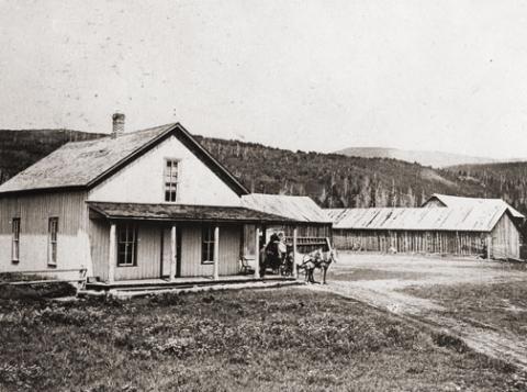
 You gotta love a mystery! My curiosity rose, my anticipation of being the one with the real story was more than my appetite could stand. I looked at pictures, figured angles, mused at what other people said, reviewed topographic maps and finally said to myself “it just can’t be.” The terrain doesn’t look like that. It isn’t two miles from the last switchback on Hwy 40. I don’t care what the writing on the back of the pictures say. 

I want to know once and for all, where is the real location of Spruce Lodge? How can it be located so everyone will agree. I’ve got it, find an expert wilderness person with my same curiosity. As fate would have it, entered Debora Carr, author of Hiking Grand County Colorado, complete with pictures, maps, GPS coordinates and trail narratives. Her coauthor Lou Ladrigan also caught the bug. “We can find it.” 

Exploration began early in the spring but the snow was just a little too deep to find any artifacts. Failed attempt, but the appetite was there. Wait till the snow melts in the trees. Again, as fate would have it, entered Carol Hunter. Carol has been instrumental in the efforts to resore the Berthoud Pass wagon road. Carol has lots of maps and pictures of the development of the wagon road and just happened to have an original U.S. Bureau of Public Roads 1920 survey map for the construction of Hwy 40 from Empire to Fraser. I loaded it into the computer, expanded the image and found lots of strange numbers. Almost like mile markers. Carol said they were numbers used by the work parties. They seemed evenly spaced and the map had a distance legend. It even had a marked location for Spruce Lodge. I couldn’t wait to add this map to Deborah and Lou’s reference material.

Armed with new references, Debora and Lou hiked both sides of Hwy 40 from the switchback to the entrance to Mary Jane. Looking for artifacts, existence of remnants of the old wagon road, foundations and terrain that matched the photos in the GCHA collection. A couple places looked promising, but not quite. Finally, a white station post number 390 was found lying on the ground on the west side of today’s Hwy 40. Then another white station post was found to the south, number 380. That was a match! Just what we needed. That confirmed the surveyor L.J. Young’s map. To the south of 390 a flat part of ground revealed what looked like part of a foundation and surrounding the location were remnants of discarded cans and possible buildings. A two holer! Now check the terrain with the pictures. Well maybe. Don’t forget that Hwy 40 didn’t exist. Step back and look from the east side of the existing Hwy. A great match with the slope and tree line. This was it! Just .9 miles North of the last switchback.


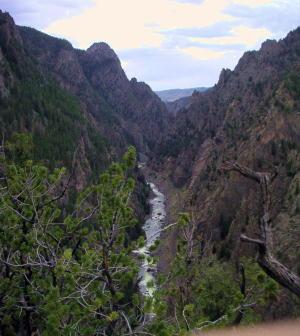
Ute Legend of Canyons

Major John Wesley Powell was in the first party to make a recorded climb of Pikes Peak in 1868.  Later, he would lead the first expedition of the Green and Colorado (Grand) Rivers. He was very interested in the Indian tribes that he encountered and later became head of the new U.S. Bureau of Ethnology.  He recorded this legend as told by the Utes on his first visit to the Colorado mountains, during his Pikes Peak climb.

A chief of the Utes mourned the death of his beloved wife, and his grief was so deep, that no one could console him.  Then the Great Spirit, Ta-Vwoats, appeared to him and promised to take him southwest to where he could see where his wife had gone, if he would promise to grieve no more.

Ta-Vwoats rolled a magical ball before him and it crushed mountains, earth and rocks, making a trail to the land of the afterlife.  Following the ball was a rolling globe of fire which the Great Spirit and the chief followed.  At last they were in the happy land where all was blessed with plenty and joy.  This was where the chief's wife had gone and he was glad to see it.

When they returned, Ta-Vwoats told the chief that he must never travel that trail again during life and warned all the people against it.  Knowing that those who had lost their loved ones would be tempted to make the journey, Ta-Vwoats rolled a river into the canyons so that no one could enter.

Topic: Towns

Fraser

The origin of Fraser was in 1905 and it was incorporated in 1953. It was formerly known as Eastom, for George Eastom, who laid out the town site in 1871. The spelling of Fraser was originally Frazier, after Reuben Frazier. The town came into being because it was the site of a large sawmill and was a railroad terminus for the lumbering operation.

While Fraser was generally considered to be an isolated mountain outpost, at one point there was enough cultural interest to support a local opera house.  Fraser was the location of a weather station for several years and during that time it was not uncommon for the winter temperatures to be 45 to 50 degrees below zero; one Fraserite remembers a morning when it was 60 degrees BELOW zero. Thus the town earned the nickname “Icebox of the Nation.” After a legal battle, that offical title went to a town in Minnesota.

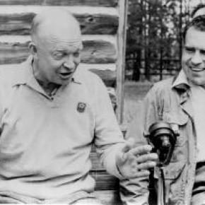
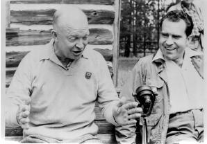
A transcontinental motor route dubbed the Midland Trail came through Grand County and by 1913 a Ford sales agency was located outside of Fraser on the 4 Bar 4 Ranch. Avid fly fisherman President Eisenhower was a frequent visitor between 1948 and 1955.

Topic: Biographies
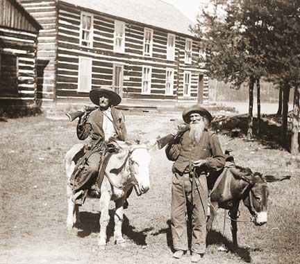
Ute Bill Thompson, Ute Chief Piah

Ute Bill Thompson

Ute Bill Thompson, Ute Chief Piah

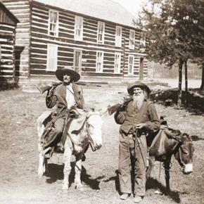
William Jefferson (Wm./W.J./Bill) Thompson was born on March 26, 1849 in Aurora Township, Preston County, Virginia (1863-West Virginia). The 8th child of 9 children of Wm. & Mary Anne (Wotring) Thompson. His father was a shoemaker at the Wotring Tannery and died in 1853. Mrs. Thompson left Preston County in September 1859 with her children on a covered wagon for Oregon. They arrived at St. Charles, Iowa around Christmas, settling at New Virginia, joining other relatives.

Wm. may have been taken captive by Native Americans prior to entering Colorado Territory. Via ox cart he came to Central City to start mining in 1865. He ventured into adjacent Middle Park, seeking gold in the Troublesome Valley, supplied with 1 ton of flour. He spent four years as a postal carrier from Hot Sulphur Springs to Steamboat Springs, using the Gore Pass route.

Once, the Ute Indians saw him baking biscuits and they enjoyed the “beescuts” until the flour ran out. An altercation left Wm. severely beaten. He made his way to Georgetown and the miners denied him entry, thinking he was a crazy man. One kind miner gave Wm. canvas for clothing, and took him to Idaho Springs. He recovered and was employed as a shoemaker.

Wm. re-entered Middle Park, built a hunting cabin on Muddy Creek ready for the 1867 winter. Chief Yarmonite led 40 Ute men, women and children to Wm’s cabin explaining to him that the Gore Range was covered with snow, and they were in need of food. This time Wm. refused. A rifle match was agreed upon with the loser put to death. Wm. threw his sombrero to the ground as his hair fell to his shoulders. A cry of the Ute went up as they recognized Wm. from the Troublesome. Sub-chief Piah told Wm. they could not fight a Ute brother, and braided Wm’s hair and applied face paint as they were at war with the Arapahoes. A hunt for bison began. Shooting was heard with the thought the Arapahoes arrived. Len Pollard & Sandy Mellon were chasing buffalo, which Wm. shot and killed. Len & Sandy confronted the supposed Ute with Len asking, “Where did you get Bill Thompson’s Winchester rifle?” Wm. played along until Sandy aimed his rifle on Wm. who wisely said, “Don’t over reach yourself, Sandy.” Sandy demanded, “Who in the hell are you!” Bill laughed and told them he was Bill Thompson. The sobriquet of “Ute Bill” was given. Wm. preferred his nick name over his legal name.

Ute Bill carried on as a mountaineer. Hunting and trapping, taking wild game to the Georgetown & Denver markets selling the meat, until laws prohibited the practice. A new career began of driving stagecoaches and freight wagons for the Colorado Stage Company on the Georgetown, Empire & Middle Park Wagon Road, over Berthoud Pass to Grand Lake, Hot Sulphur Springs, Gore Pass, and occasionally Steamboat Springs. One day on Cottonwood Pass, Ute Bill stopped and hiked over a ridge to find 400 Ute tipis on a meadow, imaging this could be a ranch. He homesteaded acreage, bought the home ranch from Al Honscome, and through marriage owned 4000 acres.

The T Lazy S brand was patented. The Thompson Ranch was the 1st in Middle Park allowed to receive water from the Grand (Colorado) River for irrigation. Ute Bill Creek and Ute Bill Ditch 1 & 2 were also patented. Middle Park became Grand County of February 2, 1874. Ute Bill was on the first jury, appointed Road Supervisor, and a delegate to the state Democrat Party Convention. In 1879 he owned Thompson’s Billiard Hall, bought a store from John Kinsey and expanded it into Ute Bill’s Saloon in Hot Sulphur Springs. He also had a game park of tame antelope, deer, and elk.

The “Texas Charley” incident of December 5, 1884 began at the saloon when Texas Charley forced Ute Bill to hand over his prized Winchester rifle. His future father in law played a role in the coroner’s inquest. January 30, 1889 The Middle Park Times listed the sale of the saloon to Billy Pharo with the quote of, “We don’t reach Denver yet but were getting there you see.” An ad in Hot Sulphur Springs complemented the sale.

On December 25, 1893 Ute Bill Tompson was united in marriage to Mabel Smith. The first recorded marriage in the Hot Sulphur Springs Congregational Community Church. Mabel was the eldest daughter of Preston Henry & the late Mary Smith. Ute Bill & Mabel had 6 children Fred Charles, William Preston, John Henry, Otto Woodring, Marion Loman, and Mary Ellen. W.J. Thompson advertised in the Grand County News, January 8, 1904 Sulphur Springs and Kremmling Stage Carries Mail & Express Stage Fare, One Way $1.50 Round Trip, $2.75 In 1903-1904 The Denver, Northwestern & Pacific Railroad (D.N.P.R.R.) was buying ranchers land. Ute Bill refused to sell his for $500 and lost on appeal in District Court receiving $300. However, it was “matter of principal” that he won on, as E.A. Meredith the railroad surveyor diverted the rail bed to be placed on the other side of the Colorado River below the cliffs.

As the excursion trains were passing by the Thompson Ranch on their way to the Railroad Days celebration in Hot Sulphur Springs on September 15, 1905 Ute Bill danced with joy knowing that the “Iron Horse” was NOT allowed to disturb the sacred tipi grounds of the Utes! Ute Bill forgot his grievances and presided over a vast fish fry and barbeque of elk on July 4, 1906. The last cattle trail drive out of Grand County was conducted by 2 aged pioneers, Sam Martin of Muddy Creek, and Ute Bill in 1923. Another matter of principal to avoid paying railroad costs, but of great sentimental value of all the past cattle trail drives. Ute Bill & Mabel both entered St. Luke’s Hospital in Denver for surgery in late February 1926. Ute Bill’s first surgery went well, the second did not. Mabel was not able to be with him as she was recovering from her own.

Many Middle Park pioneers visited them to wish them well. Old friend Charles Nines Sr. who retired in Denver from Pine Ridge Agency, South Dakota a Sioux language interpreter and Trading Post owner was with Ute Bill when he passed away on March 19, 1926, one week shy of his 77th birthday. William Jefferson “Ute Bill” Thompson is buried in the Hot Sulphur Springs Cemetery off of Cottonwood Pass, Looking at Elk Mountain and the original homestead.

This article is dedicated to Lorna Marie Gowen; September 6, 1954-April 14, 2006

Topic: Railroads

Moffat Road


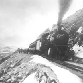
"I shall never forget it as long as I live. Nor do I ever expect to experience anything comparable to it again. Civilization had found its way across the mountains into Middle Park," reflected Mrs. Josephine Button in 1955 on her 91st birthday, as she recalled seeing smoke from the first Denver Northwestern and Pacific work-train on Rollins Pass, high above the Fraser Valley and Middle Park. Once those rails made it over the Continental Divide all the way to Hot Sulphur Springs, "changes came thick and fast." Many men, many dollars, many routes and many dreams tried to bring a railroad over the Continental Divide into Northwest Colorado, and the "Hill Route" over Rollins Pass that finally accomplished it a century ago has retained its allure ever since.

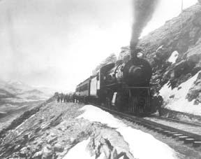
The Moffat Railroad built a cafeteria, telegraph station, living quarters for Moffat's "Hill Men" (as the railroad crews up there were known) and a fine hotel - all collectively called Corona Station. Soot-filled snow sheds protected over a mile of this windblown section of track. And where today silence is the most powerful sense, colorful locomotives pulled passenger and freight cars, filling the rare atmosphere with black smoke and mechanical clatter.

Decades of men's dreams lay behind the once massive snow shed that cut the bitter winds from the north and west, behind that fine hotel that offered some of the most spectacular scenery in America, behind the hopeful Town of Arrow nestled below tree-line ten or twelve miles west of Rollins Pass, and behind that first work-train that Josephine Button watched from her hay ranch along the Cottonwood Pass Wagon Road to Hot Sulphur Springs. Competent, often powerful, men in the 1860's through the 1890's filed surveys, graded road beds, and even began drilling before being stopped by severe storms that foiled the best laid plans or their inability to fund the ambitious projects.

Dreams to penetrate the high mountains along the Divide in central Colorado began when the Front Range was flooded with miners during the Gold Rush of 1859. Even before Colorado became a territory in 1861, Golden City, just west of Denver along Clear Creek, recognized its potential as a gateway to the rich mineral resources of mountain towns like Central City, Black Hawk, and Georgetown. Golden City's ambitions went beyond becoming a mountain transportation hub, believing that with the right incentives, enthusiasms, and leadership, its location supported a future as a national commerce center. 

Golden City certainly had men of vision, ambition, and wealth among its ranks. William Loveland and George Vest, both young and feverishly ambitious to see Golden City reach its potential, vigorously pursued their dreams for a powerful commercial center in Golden City. From Missouri River towns like Leavenworth in Eastern Kansas, leading town founders also recognized the benefits of linking their water and rail routes to the east with the resources of the west. Finally, as if destiny had demanded it, Edward L. Berthoud, a young civil engineer and surveyor with energy and ability, arrived in Golden City from Leavenworth in April of 1860 to unite the similar passions of leading citizens from both locations.

From 1861 until 1866, Berthoud, Loveland and Vest focused on bringing a direct transcontinental railroad route through Golden City. First, Edward Berthoud, along with Jim Bridger and a capable young cartographer named Redwood Fisher, blazed a trail across Berthoud Pass through Middle Park all the way to Salt Lake City. Returning to Golden City on May 28, 1861, Berthoud reported "a good wagon road could be ?quickly' built" from Denver to Salt Lake City over Berthoud Pass for about $100,000.00. According to the local hyperbole, a railroad would surely follow.

In spite of considerable enthusiasm, disappointment plagued early efforts to put a rail line over the mountains in Colorado Territory. In 1862, Territorial Governor John Evans sent the Surveyor General for Colorado and Territories along Berthoud's route and others to confirm or deny the potential of a railroad line. About the same time, the Union Pacific Railroad Company sent an independent reconnaissance to examine potential routes over the divide that included Berthoud and Boulder Passes (Boulder Pass became Rollins Pass in the early 1870's, when John Quincy Adams Rollins built a toll road over it, and then Corona Pass when the Railroad crossed it). Surveyor General Case and the UP agreed that neither route offered much hope for a standard gauge railroad. The dream of a transcontinental line over the Continental Divide through central Colorado seemed to die with the UP surveyor's words, "I learned enough to satisfy myself that no railroad would - at least in our day - cross the mountains south of the Cache la Poudre..." 

Multiple failed attempts to bring a rail line over the Divide through Middle Park during the following decades strengthened the UP's "death sentence." Against the odds, Berthoud and Loveland continued to solicit support for a railroad west over or through the Continental Divide, using improved surveys and maps to support their requests. In the 1880's, survey crews from a variety of railway incorporations were scattered over the high country on or near Rollins Pass. Over Berthoud, Rollins and other passes, they marked potential railroad lines with their wooden stakes. It was during this stretch of strenuous surveying activity that David Moffat, a highly successful Denver capitalist, got involved with an unsuccessful effort to bring through the mountains instead of over the top. 

 In the early 1880's, Mr. Moffat invested in the Denver, Utah and Pacific Railroad, which intended to tunnel through the mountains near Rollins Pass. Like the other efforts, though, the Denver, Utah and Pacific vanished in a few short years. Unlike many other lines that accomplished little more than surveys and maps, the DU&PRR completed significant grading and began tunneling before reaching the "end of its resources."

Money, power and success supported Moffat's dream to put Denver on a direct transcontinental railroad line. Doctor Robert C. Black, III, wrote that David Moffat's failed efforts in the early 1880's converted him to the idea that Denver needed to be on a direct transcontinental rail line. Moffat considered the route over Rollins Pass valuable enough to have surveying and grading crews working on it throughout the winter in 1902. The Denver Rocky Mountain News claimed that Moffat's route through Northwestern Colorado included "the largest strip of fertile land as yet undeveloped in the United States..." With his Denver, Northwestern and Pacific Railroad, David Moffat planned to make good his intentions to put Denver on direct transcontinental railroad line.

Moffat's original plan called for the "Hill Route" over Corona Pass ? the name changed from Rollins Pass in honor of Corona Station at the top ? to last for only a few short years. While the "temporary" route over the top generated resources by extracting the resources of Northwestern Colorado, a tunnel was to be bored through the Continental Divide. Even the wealth and power of Moffat, though, failed to adequately finance the tunnel before he died in 1911. The temporary line, therefore, lasted for nearly of a quarter century, from 1904 until 1928.

Its obstacles proved as enormous as the mountains it crossed. Work crews had to cease operations because of snow for most of April in 1920. The road was closed from late January until May in 1921. In December of 1924, engine number 210 busted "a main reservoir pipe," causing the train to fly down the hill out of control until it jumped the tracks and crashed into the valley below. Clearly, the Denver and Salt Lake Railroad, which took over Moffat's DNW&P after his death, needed a tunnel to replace the expensive effort over the "Devil's Backbone."

 As Denver and Salt Lake Locomotive Number 120 came through the tunnel in early 1928, it represented the culmination of a massive undertaking through wet, unstable rocks which required considerable engineering ingenuity and caused six deaths in a 1926 cave-in. It also took an enormous amount of coordination and effort to secure the necessary funding. Through local bond issues, private investors and other means, the project was completed. And through a connection at Dotsero, a railroad station less than 30 minutes west of Vail on I-70, freight and passengers could make a direct Pacific connection from Denver. Posthumously, David Moffat's dream became a reality.

For significant periods of time since the trains stopped operations over Rollins Pass in the late 1920's with the opening of the Moffat Tunnel, on-road vehicles crept along its relatively easy grades and wide curves from Rollinsville on the east slope to Winter Park on the west side of the Divide. Like now, the road ran through an area attractive to backcountry campers and sport enthusiasts. On September 1, 1956, local officials and private citizens met on Rollins Pass to celebrate a "joint state-federal-county project to convert the old D. & S. L. railroad right of way over Corona Pass into an access road for sportsmen." According to the Denver Post, the game and fish department's construction division reconstructed the road during the summer of 1955 for about $20,000. The following year, the road became a scenic route over the Continental Divide for family cars and jeep caravans alike. And after it was built, or at least reconstructed, they did come. Intrepid tourists into Middle Park.

Volunteer Fire Departments