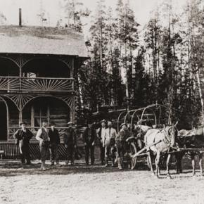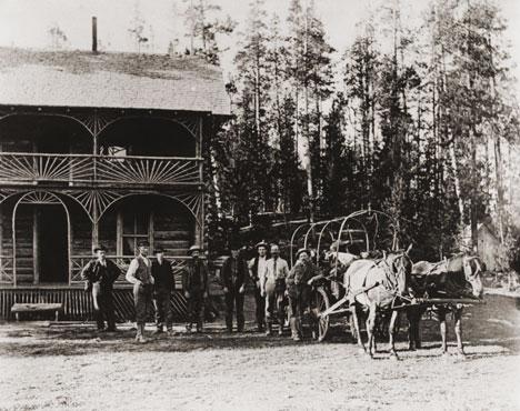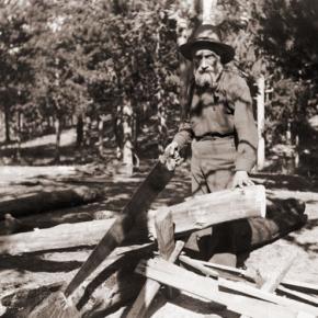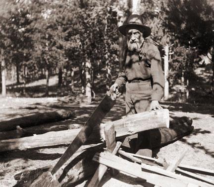
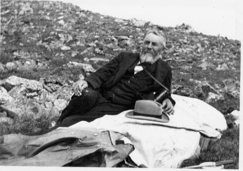


Berthoud Pass Stage Road was built by the extreme efforts of Captain Lewis Gaskill.
| Stage and Freight Lines |
Stage and Freight Lines
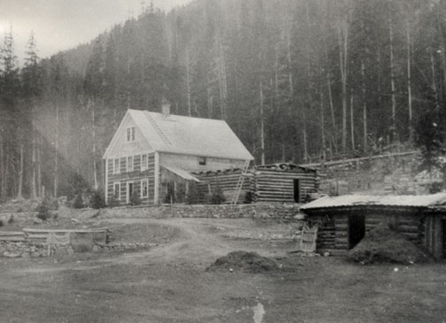
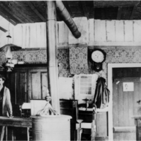
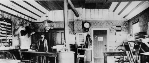
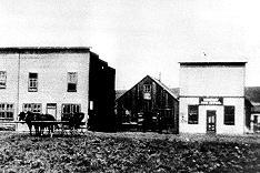
Berthoud Pass Stage Road was built by the extreme efforts of Captain Lewis Gaskill. It came from the top of the Pass through Spruce Lodge, Idlewild (now Winter Park), the Cozens Ranch (near Fraser) Junction Ranch (Tabernash) and Coulter. From there once branch lead over Cottonwood Divide to Hot Sulphur Springs (and points west) while the other went to Selak’s and over Coffey Divide to the Lehman Post Office and on to Grand Lake. At the summit of Berthoud Pass there was a large house of hewn logs, occupied by Lewis Gaskill and his family. They collected the tolls for the road and gave welcome shelter to those weathering the variable passage. The house was located on the West side of current Hwy. 40 but no trace of the building remains. At the steepest portion of the west side of Berthoud Pass was the Spruce House rest stop, which by 1900 was a sold structure of two and a half stories. There the traveler could find a warm meal and corral for livestock. No trace of it remains today. The Idlewild Stage Stop was located in present day Winter Park and was a popular place to change horses before the steep assent up the pass. Mrs. Ed Evans served a hearty noonday meal there for only 35 cents. Cozens Ranch was also one of the more popular stops and Fraser Post Office until 1904. Built around 1874 by William Zane Cozens, it remains today, outfitted in period décor and is the home of the Cozens Ranch History Museum. The Gaskill House, in Fraser was built by Lewis De Witt Clinton Gaskill, one of the original investors in the road and a prominent Grand County citizen. The house now houses the Hungry Bear Restaurant. Junction House at Junction Ranch (Tabernash) could accommodate up to fifty travelers and was built by Quincy Adams Rollins, and subsequently leased to Johnson Turner. The Coulter Stage Stop was built by John Coulter, an attorney from George town and shareholder in the stage road. It also served as a Post Office from 1884 to 1905. Frank and Fred Selak, sons of a pioneer Georgetown brewer ran the Selak stop which was north of Granby and east of current Hwy. 34. Cottonwood Divide (Pass), at 8904 feet above sea level, was laid out by Edward Berthoud and Redwood Fisher in 1861. The route was used by stagecoaches from 1874 until the railroad arrived at Hot Sulphur Springs in 1905. The last driver on the route was Charlie Purcell. Summer travel time between Hot Sulphur Springs and Georgetown was typically twelve hours. Travelers between Hot Sulphur Springs and Kremmling could stop at the Barney Day or King Ranches, both near current Hwy. 40. The Pinney Ranch House, used by the firm of Whipple and Metcalf for the connecting service to Steamboat Springs, is still standing on Hwy. 134 on the east slope of Gore Pass. There a traveler could pay 50 cents for a meal, 50 cents for a bed and expect a change of horses every ten miles. It ceased operation in 1908 when the railroad reached Toponas. |
| Wagons of the West |
Wagons of the West
Transportation into Grand County in the late 1800's was one of the more difficult tasks. Stage coaches were used to carry the many people to and from the county. The first stagecoach into Grand County was a Concord. The Concord stagecoach was a luxury wagon weighing around 2,200 lbs. It cost around $1,050 and was beautifully painted. No two Concord luxury coach paint jobs were the same. The wheels were made of white oak and would not shrink in the cold or expand in hot weather, and made very reliable, durable wheels. The body was iron barred and was easier for the horses to pull than some of the other standard stagecoaches of its time. The mountain conditions caused different rules and a different coach then the stereotypical Concord. The inside of a Concord was four feet wide, and four and one half feet tall. The coach had leather curtains, but they did little to keep the dust, wind, snow, and rain out. Three benches lined the inside, and held nine passengers. The coach was often known to hold up to six people on the roof as well. Luggage was held in the "boot", a metal box on the back of the coach. Mail was often put in the "boot" for transportation, or kept right behind the driver. The average speed for the Concord was around fifteen miles an hour. The braking system was sand bags placed over the brake pads, so that sand could be released on rugged hills. The Concord was only used for one year because of its weight and bulkiness it did not make for a good coach in the mountains. The weight, price, and bulkiness caused this stagecoach to be produced for one year before another one came into play. At one third of the cost, the Dearborn took over after the Concord. These were known as Mud Wagons because of their easy travel in the mud and tricky terrain. The Mud Wagon weighed around 1,600 lbs. and was much more efficient. It had the standard four wheels, but was only pulled by one to two horses, and could hold around one to three people. However it was not as luxurious as the Concord. They often did not have side curtains, and the seats were not as nice. The cabin sat on wooden springs. The Mud Wagon was used by farmers, peddlers, emigrants, and pleasure travelers as it was affordable and decent in appearance. The weary traveler who took the stagecoaches soon learned the rules of the road. The best seat was next to the driver where there were less bumps. Never ride in cold weather with tight boots or shoes, or tight gloves. If one is asked to walk, do so without grumbling as the driver would not ask unless truly necessary. Don't jump from the moving wagon, as nine out of ten times you will get badly hurt. Do not drink alcohol in cold weather as it can cause hypothermia. In warm weather it is okay to drink as long as you are willing to share. Eat what is available, no one wants to hear you whine. Do not smoke, or spit on the leeward side. Never swear, and don't fall asleep on your neighbor. Do not ask how much longer, you will get there when you get there. Never fire a gun as it will scare the horses. Never grease your hair because of dust and most important - remember mountain traveling is hard.The first stagecoach into Grand County was a Concord. The Concord stagecoach was a luxury wagon weighing around 2,200 lbs. It cost around $1,050 and was beautifully painted. No two Concord luxury coach paint jobs were the same. The wheels were made of white oak and would not shrink in the cold or expand in hot weather, and made very reliable, durable wheels. The body was iron barred and was easier for the horses to pull than some of the other standard stagecoaches of its time. The mountain conditions caused different rules and a different coach then the stereotypical Concord. The inside of a Concord was four feet wide, and four and one half feet tall. The coach had leather curtains, but they did little to keep the dust, wind, snow, and rain out. Three benches lined the inside, and held nine passengers. The coach was often known to hold up to six people on the roof as well. Luggage was held in the "boot", a metal box on the back of the coach. Mail was often put in the "boot" for transportation, or kept right behind the driver. The average speed for the Concord was around fifteen miles an hour. The braking system was sand bags placed over the brake pads, so that sand could be released on rugged hills. The Concord was only used for one year because of its weight and bulkiness it did not make for a good coach in the mountains. The weight, price, and bulkiness caused this stagecoach to be produced for one year before another one came into play. At one third of the cost, the Dearborn took over after the Concord. These were known as Mud Wagons because of their easy travel in the mud and tricky terrain. The Mud Wagon weighed around 1,600 lbs. and was much more efficient. It had the standard four wheels, but was only pulled by one to two horses, and could hold around one to three people. However it was not as luxurious as the Concord. They often did not have side curtains, and the seats were not as nice. The cabin sat on wooden springs. The Mud Wagon was used by farmers, peddlers, emigrants, and pleasure travelers as it was affordable and decent in appearance. The weary traveler who took the stagecoaches soon learned the rules of the road. The best seat was next to the driver where there were less bumps. Never ride in cold weather with tight boots or shoes, or tight gloves. If one is asked to walk, do so without grumbling as the driver would not ask unless truly necessary. Don't jump from the moving wagon, as nine out of ten times you will get badly hurt. Do not drink alcohol in cold weather as it can cause hypothermia. In warm weather it is okay to drink as long as you are willing to share. Eat what is available, no one wants to hear you whine. Do not smoke, or spit on the leeward side. Never swear, and don't fall asleep on your neighbor. Do not ask how much longer, you will get there when you get there. Never fire a gun as it will scare the horses. Never grease your hair because of dust and most important - remember mountain traveling is hard. |