Doc Susie

Water

Water Articles

A Dream Smashed in Gore Canyon

The idea of a water passage from the Atlantic to the Pacific Ocean had long captivated the imagination of early explorers.  Soon after the Territory of Colorado was established, the United States government made a standing offer of $3,750 to anyone who could demonstrate such a route.

In 1869 a dreamer named Sam Adams convinced some people in the town of Breckenridge that goods could be sent upriver via the Mississippi, Missouri, Platte and South Platte Rivers to South Park.  Then, with a short portage over Boreas pass, they could continue down the Blue River to the Grand (Colorado) River and then through Gore Canyon the Sea of Cortez.

Volunteers were told they would share in the prize, and they built four boats of green lumber for the voyage.  The flotilla was launched with great celebration, the lead boat bearing a banner proclaiming "Western Colorado to California ? Greetings!"  A little dog was given to the crew to keep up morale.

As the boats went down the Blue River, the waters were a bit rougher than expected. When the men arrived at the Grand (Colorado) River, the crew set up camp. However several of the "sailors" declared they had had enough and began a trek, via dry land back home to Breckenridge.

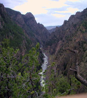
When the boats reached Gore Canyon, they encountered violent upsurges and dramatic drops.  The wild waters smashed all four of the vessels on dangerous rocks.  Fortunately, all members made it to dry land, even the little dog.  No reward was ever given for the attempt.

Colorado-Big Thompson Project

The idea of diverting water from the Colorado River on the Western Slope of the Continental Divide to the productive farmlands of the eastern plains had been a dream of planners as early as 1929.  Subsequently,  a long period of drought and the sagging economy of the “Great Depression” whetted demands for what became the largest trans-mountain diversion project ever built.

The Colorado-Big Thompson Project takes water from Grand Lake on the western side of the Continental Divide to the Big Thompson River on the east.  The water flows through a 13 mile tunnel beneath Rocky Mountain National Park.  In order to supply the residential and farming needs of Northeastern Colorado, the project was begun in 1938 and continued through the years of World War II.  The first water flowed though the tunnel, named for Senator Alva B. Adams, on June 23, 1947.

In order to assure an adequate supply from Grand Lake, a dam was built creating Shadow Mountain Reservoir.  A larger lake, Granby Reservoir was then built below, with a unique pumping plant that forces water into Shadow Mountain.  The Farr Pumping Plant cost over $9 million and provides an additional 700,000 of irrigated land to northeastern Colorado.  Further reservoirs were added, both to supplement the diversion and to compensate the water needs of Western Colorado.  These include Willow Creek and Windy Gap Reservoirs in Grand County.

While most legislators were enthusiastic about the project, U.S. Representative Edward Taylor was vehemently opposed to the reduction of water flowing down the Colorado River.  A compromise was reached in the creation of Green Mountain Reservoir (on the Blue River), which reserves water to replenish the Colorado River.   The city of Denver later claimed upstream water on the Blue River for the massive diversion project of Dillon Reservoir

Claims on the water of the Colorado River range from the fruit and wine regions of the Grand Valley in Colorado all the way to Los Angeles and Mexico.  It can be said that every snowflake which falls in Western Colorado had already been over-appropriated, especially during drought periods in the arid West.

Early Water Disagreements

As fast as settlers arrived in the county, conflicts arose over water use.  George T. Bell, an early rancher on the Blue River in the 1890's, had water rights coming out of Deep Creek, Spring Creek, and Soda and Iron Springs.  Daughter Maud Bell had married James Mugrage and when her father died in 1925, she and James stayed on the ranch of about 800 acres, to operate it.  She reported years later that when Noonen, a large rancher also on the Blue, built his ditch, he took much of the Bell water and used it for his own benefit.  Many years later, Maud discovered that although her father was long dead, those early water rights still belonged to the Bells, not the Noonens. 

Another family, that of George Henricks, settled far up the Troublesome Valley, about 1900, in what was truly an inaccessible spot.  What possessed him to pick such a remote area for his ranch?  Because when he and his wife Aurille lived in Nebraska and tried to make a living on their farm, farmers upstream stole their water to the point that they couldn't keep their crops alive.  Aurille actually had to use the same batch of water for two or three purposes!  As water fights escalated, George vowed to find a place where nobody could be above him and his water source. Rancher Will Call took him far up the Troublesome valley to a large meadow, reachable only by foot or horseback.  Life wasn't easy, for George and Aurille had to do everything from scratch, and they lived in a cabin with a dirt floor for many years.  But nobody took his water! 

Even more recently there was a case on Crooked Creek, where a ranching family that owned quite a good spring and used it to water their hay, discovered that a new neighbor was diverting the water from the spring over onto his own land, to water his own hay!  The rancher protested and diverted the water back where it belonged.  The newcomer turned around and stole it again.  This situation went on for many years without good satisfaction.

The Kirtz Ditch development on the Troublesome began about 1890.  In 1911, an Elias T. Copelin homesteaded land, later adjacent to the Alexander and George Murray Baker ranches.  One day Copelin and Murray Baker, one of the brothers, got into an argument over water rights in the Kirtz Ditch, each accusing the other of stealing his water.  Murray, who was a little guy with a fierce temper, picked up a shovel and gave Copelin a mighty whack with it.  Copelin fell to the ground but after a bit picked himself up, climbed on his horse, and headed toward his home.  However, the blow must have damaged his brain because he was found the next day, dead on the ground at his own gate

High on Meadow Creek, in the early 1900's, lumber activity began in the area later known as Sawmill Meadow.  About 1910, the Western Land and Flume Co. put in a little dam near what is now the trailhead to Columbine Lake.  The resulting lake, today filled with water lilies, was used as a holding pond for logs that would be moved by flume to the main mill downstream in Tabernash.  This lumber company sold to Western Box & Lumber Company in 1912.  Business flourished.  There was even a short railroad going into the woods, with the tracks made of logs about 6" to 8" in diameter.  Prospects looked good.  However, from the beginning water rights were an issue. Some people say it was Nathan Hurd who broke the company.  Western Box had lost some of its water to the Strawberry Ditch (going to Granby) in 1914.  More trouble was looming.  Hurd wanted to keep the water from the little reservoir for the ranchers and lettuce farmers below.  The timber folks wanted to use the water during the summer months to keep the flume going.  Nobody was willing to give up anything, so in 1915, the big mill closed.   Still, efforts continued.

Then in 1919, the planing mill at Tabernash burned.  In the early twenties, further contention led to the withholding of more water from the lumber companies who wanted permission to ditch Trail Creek water across into Meadow Creek, replacing water taken higher up for the flume and Strawberry Ditch.  This would have been quite easy because, about seven miles out of Tabernash is a nearly flat saddle that exists between the two creeks.   Nevertheless the Hurds wouldn't hear of it.

Then one Henry Jarvis showed up on the scene.  He was known to all the timber men.  In 1923, Jarvis, using a box of TNT, "blew the dam" of the irrigation reservoir at Western Box.  People suspected that he did it for T.S. Huston, one of the big lumber powers of the area.  The feeling was that "if the lumbermen couldn't have the water, neither could the ranchers and the Granby farmers."  In any case, that basically was the end of Western Box Company. 

Grand Lake
Grand Lake

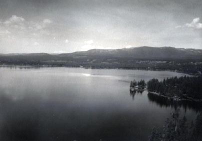
Grand Lake is Colorado's largest natural lake.  The clear blue waters are surrounded by magnificent mountain scenery and a haunting Indian legend.  

Judge Joseph L. Wescott, an early white settler, wrote a poem about a Ute story he heard from an Indian camping at the lake in 1867.  One summer Utes were camping on the shores of Grand Lake when they were suddenly attacked by an enemy tribe of the Arapahoe.  As the brave Ute warriors began fighting, the squaws and papooses hurried onto a raft for safety, pushing the raft to the middle of the lake. As the battle continued, a treacherous wind overturned the raft and all the women and children drowned.  

It is said that you can see ghostly forms in the morning mist rising from the lake and hear the wailing of the women and children beneath the winter ice.

Moving Water from Point A to Point B

Most serious ranchers had more than one ditch and most built one or more reservoirs. Hilry Harris, Munroe C. Wythe, Samuel H. Burghard, and John A. Coulter entered the first water claim in the county on September 20, 1874. This came out of Sheep Creek above the head of Gore Canyon.

There usually was some natural irrigation; but the challenge of getting the water from the creek required laborious construction of diversion dams, headgates, and ditches, the earliest ditches being dug by hand and often taking up to four years to complete. Later, ditches were dug using teams and scrapers. The grade was figured out initially by simple gravity flow, letting a trickle of water move down the ditch. Soon ranchers refined the process, using a 16’ long board placed with a 1/8" slope, determined by a carpenter’s level. A.F. and Roy Polhamus surveyed a great many of the water ditches, especially those impressive ones in West Grand County, some of which even had tunnels involved. Most small ditches supplied just one ranch, but if a ditch had to cross another ranch, that rancher usually got a share. And some of these ditches were long!

For instance, Dr. Henry Hoagland, on the Blue River, anticipated getting water close at hand from Spruce Creek. Instead, he discovered an old timer had previous rights that forced him to go back into the mountains and build a 13-mile long ditch. Hoagland had figured on spending about $7000; in the end, the actual cost was $26,000! His crew dug the ditch around side hills and across valleys using flumes and siphons. Then his real troubles began. Terrible leaks and washouts occurred everywhere. Finally he hauled in adobe and put this in the bottom of the ditch, rented sheep, and drove them day after day up and down the ditch to pack it. After a couple of years of using this tamping process, the ditch held. Other ditches were even longer. The Church Ditch at Willow Creek and the Wheatley Ditch on the back Troublesome were both 16 miles long.

The Company Ditch (aka the Williams Fork Ditch), eight feet wide on the bottom, was another long one. Built between 1903 and 1907, it cost $44,000 and had a decree for 150 cubic feet / second. The ditch went uphill and down, requiring many flumes and bridges. One flume was actually 1200 feet long! Subsequent breakdowns, leaks, and slides were so frequent and repairs so extremely costly that old-timers have said the reason the Company Ranch went broke about 1920 was the expense of The Ditch. The Lyman Ditch (or the Curtis), started about 1891, was just as complicated as the Company Ditch. Crossing high above the Williams Fork River, the ditch eventually needed cement piers to carry the pipe (1928). This ditch had so many slides, leaks, and washouts, that it had to be inspected once or twice daily! Siphons were required over draws. Flumes, sometimes ¼ mile long, might be 25-30 feet high, and one flume was actually 177 feet high; but these heights were necessary to maintain the elevation.

Flumes, being of wood, rotted and were guaranteed to leak. Sometimes wind blew a portion of the flume down. Finally the county put in big pipes to help the ditches across the Williams Fork. It might be noted that, when water leaked out of ditches, a side benefit was that ranchers along the way could use the "lost" water. Along with the ditches came reservoirs.

Fred DeBerard had four reservoirs on the Muddy: the Albert, the Binco, Milk Creek, and a low one that flooded the Jones place near Kremmling. All were dirt, of course. The Hermosa Ranch on the Little Muddy had water rights through the Sylvan Ditch and Reservoir Company and they built the Sylvan Reservoir dam and the Hermosa Ditch starting in 1911 and completing it by the spring of 1916. The Stein Ditch, started in 1897, was another large ditch, this one later purchased by the Taussig family. These ditches were all built originally to provide water to meadows and fields for ranching purposes. For years, people hauled in water for baths and household use, but that gradually changed. Leon Almirall, near the Horseshoe Ranger Station on the Williams Fork, decided that he wanted water for his home, so he built a 1700’ pipeline to his house, added an inside bathroom, and was shocked when the line froze the first winter – it was only three feet deep. He called in workers who dug down and insulated the line with manure and straw. It froze again. Finally, Almirall gave up and buried the line six feet deep. Now he had his water!

On Ranch Creek in the east end of the county, E.D. Shew cut a ditch upstream from his house, placing it along the edge of the creek, but directing the water back into the main channel near his house. At that point, he put a little water wheel that pushed the water up the hill to his cabins -- and furnished electricity besides. Eventually he replaced the water wheel with a gas engine. There was a similar water wheel, used for the same purpose, up in Hideaway Park.

Water was used to transport lumber as well. A flume ran down the mountain into Monarch Lake, in the days when the Monarch Company was timbering there. There was a flume along St. Louis Creek, carrying lumber from the camps upstream. Perhaps the most ambitious flume ran from Western Box Sawmill. This area is now under Meadow Creek Reservoir. In 1906, the Deisher Lumber Company paid Nathan Hurd for a right of way through his land and built a flume with a 2% grade down Hurd Creek. Logs were placed in the flume and a horse harnessed to the last log. The horse then pushed the logs down the flume with the help of the water. Three years later, the mill was moved to "Sawmill Meadow" on Meadow Creek.

In 1911 construction on the seven-mile-long Vaver Flume began, with 117 cubic inches of water allotment. This flume ran down Meadow Creek and over to Tabernash, carrying partially processed logs for further manufacture. A flume rider checked along the way, making sure there were no jams, and phone line allowed the rider to report troubles. Hikers can see remnants of both the St. Louis Creek flume and that one coming down Meadow Creek today.

Onahu Creek
Onahu Creek

Onahu Creek was called Fish Creek and is a tributary of the North Fork of the Colorado River. The name refers to one of the Indian race horses who came up to a campfire to warm himself, and the name means “warms himself“.  The horse ultimately died on Fish Creek and gave his name to the waterway.

Water
Water

Grand County is home to the headwaters of the famed Colorado River — the river that brings water to five other arid Western states. Water is the lifeblood of semi-arid Colorado and Grand County is one of the most water-rich areas of Colorado, and yet faces a shortage due to historical water agreements, written long before population pressures and the environmental awareness of the current age.

On average, the water diversion projects in the county move a whopping 305,000 acre-feet per year from the Fraser, Colorado and Williams Fork rivers — all headwaters of the Colorado's main stem. 60 percent of the water in Grand County is diverted elsewhere and there are plans underway, mostly from Front Range communities, to divert as much as 80 percent of the county's headwaters by the year 2010.

Two of the main water utilities, Denver Water and the Northern Colorado Water Conservancy District face a quandary: how to take the water from Grand County without further damaging the delicate environment and the region's economy, which is fueled by tourists who expect to play in the very water the Front Range wants to take.

Water from the Mountains - The Grand Ditch

 Though few, high altitude water ditches have had a major impact on Grand County's history and economy, there were many early valley ditches transporting this precious commodity from water-right sources to the owner's ranch. However, the threat of transporting great volumes of water from our county to Boulder County via high altitude ditches appeared back in 1889.  Certain interests east of the Divide talked the Legislature into appropriating $25,000, for surveying and developing a 20-mile-long canal over South Boulder Pass to South Boulder Creek.  Amazingly, neither Grand County residents nor very many others opposed this notion.  Luckily the state engineer found the terrain so difficult that not even $2000 was ever spent on the project.


The next effort occurred also in 1889.  This privately financed plan was to develop a two-branched canal system that would move 700 second feet of water to a half-mile tunnel just beneath Berthoud Pass at over 11,000 feet, thence down to Clear Creek and on to the Golden area.  Initial surveys were begun that fall and roads laid out the following year.  The effort bogged down but was resurrected in 1900 under the Agricultural Ditch Co., supplemented in 1902 with the Berthoud Canal Co.  The canal was partially completed by the Frank Church family ranching interests of Jefferson County by 1906.  The ditch, which can be walked today, runs from Second Creek to Berthoud Pass, though it no longer carries much water.  However, the Church Ditch water rights coming from Clear Creek still exist and today are owned by Northglenn.

Proposed in 1890 by the Water Supply and Storage Company of Fort Collins, a greater canal was to be built 1000 feet above the Kawuneeche Valley, that would tap the high tributaries of the North Fork of the Grand River, sending the water over Poudre Pass to a reservoir and then into the Cache La Poudre River and on to agricultural areas east of the Front Range.  The water company, later known as the Grand River Ditch Company, appropriated 525 second feet at the time of the initial diversion in 1892.  (When the Grand River was renamed the Colorado River in 1921, the company was changed to the Grand Valley Irrigation Company.)  The ditch was dug by hand, primarily by Japanese and Mexican laborers.  By 1900, water was flowing eastward.  

By 1906, this major canal, known as the Grand Ditch, and draining water from the Never Summer Range, had a capacity of nearly 358 second feet with 12 headgates within 8 miles, running from Baker Creek to the pass at 10,179 feet, plus a smaller canal carrying 183 second feet within 11 miles, coming from Specimen Mountain.  In 1936, using machinery, the ditch was lengthened to 14 miles.  The Grand Ditch is about 20 feet wide and 6 feet deep, though the water is rarely more than 3 feet deep, and this water irrigates some 40,000 acres in Weld and Larimer counties.

The National Park Service has argued against the allocation of all this water to the canal as it is needed to support plant life and animal habitat.  Becuase river water flow was cut in half, the immediate effect was a reduction in the fish population in the Colorado River.  More recently, a major washout in the ditch caused devastating damage to the slopes below the ditch and to the Colorado River itself.  Hikers climbing up from the valley use the Grand Ditch as a route to the high peaks and lake.  But as viewed from below, the Grand Ditch is often considered an ugly scar on the landscape.

Williams Fork Reservoir

Article contributed by Liz Church


Williams Fork Reservoir plays an important role in water conservation, while being an asset in revealing archaeological data of earlier existent peoples in the region. The reservoir is located about 12 miles southeast of Kremmling at an elevation of 7874 ft. in Grand County, Colorado, near the center of Middle Park. Williams Fork is a tributary of the Colorado River, extending from Clear Creek to Vasquez Creek, with the Vasquez Tunnel running through and its completion in 1959.


Williams Fork is a water source to the Denver Metro Area, with diverted water from high elevation tributaries of the Williams Fork River to the Gumlick Tunnel for departure to the Moffat Tunnel system. Standing 217 feet above the Williams Fork River streambed, the dam backs up a reservoir of 97,000 acre feet of water.


Williams Fork is also a Paleo-Indian site.  Archaeologists believe that 12,000 years ago, during the last Ice Age, people migrated from Asia into North America. Most Paleo-Indian sites are identified by an existence of projectile points. The Williams Fork Reservoir was dominated by James Allen projectile points, a categorized set of points, or better known as a categorized set of stone tools. The reservoir allows archaeologists to access the extent in which the James Allen points and perhaps earlier existent groups were bestowing the mountains during the Holocene period, the name given to the last 10,000 years of the Earth's history.


Source: http://en.wikipedia.org/wiki/Phillips-Williams_Fork_Reservoir _Site


Articles to Browse

Joe on Melody, Joe and Dad in 4th of July Parade, Joe and Howard 4th of July Parade

4th of July Parades in Granby

Joe on Melody, Joe and Dad in 4th of July Parade, Joe and Howard 4th of July Parade

In 1947 my family moved to Granby, Colorado; I was 5 years old. My Mom (Eloise) and Dad (Howard, “RED”) Beakey, ran the Texaco gas station where the Chamber of Commerce parking lot now sits. I have a sister named Sandra Sue, who was 3 at the time.

In 1948 Mom and Dad bought me a mare named Midge, and that is the beginning of my joy of growing up in Granby. I rode Midge all over Granby and surrounding area. In the winter I would pull kids on their sleds and skis with a rope tied to the saddle horn. In the spring of 1949 Midge produced a filly foal that we named “Lady Blaze.” The following 4th of July Rodeo Parade, 1949, I rode on Midge and my friend, Howard Ferguson, rode behind me and led Lady Blaze in the parade. A local farrier had made lace up booties with metal bottoms for Lady Blaze so she wouldn’t damage her hooves while being led in the parade. You can imagine the sound of those booties hitting the pavement as we rode down Agate Ave., and the enjoyment of the crowd lining the parade route. At that time the rodeo grounds were in the area of N Ranch Road. The Granby Fire Department awarded me with a $3.00 check for being “The Most Typical Cowboy Under 12.”  I was totally amazed and still, at the age of 79, have that check!  I did give Howard $1.50 in cash, though, that day for his part.

The following year, 1950, Mom and Dad bought a Pinto filly from Tex Hill, the Foreman of the Little HO Ranch east of Granby. Tex rode the Pinto into the gas station office one day and asked my Dad if she was gentle enough for me. Dad said yes, and I became the proud owner of my second horse, which I named Melody. That year (1950) my sister, Sandra, rode Midge and my Dad rode his hunting horse, Spike, and I rode Melody in the Rodeo Parade. Prior to the rodeo Dad (who hadn’t ridden Spike in a long time) got bucked off into a pile of rocks and got pretty banged up. Sis rode up and asked Dad (who was laying on the rocks) “are you dead Daddy”?

Sis and I rode all over Grand County, riding along US 40 to 10 Mile Creek to fish the beaver ponds; we would be stopped several times to have our photos taken by the tourists. Tourists always seemed amazed to see little kids riding on horseback way out in the country.  We always brought home from our outings some nice Brookie trout. Sometimes we would ride out to The Little HO Ranch and spend a few days there with playing real live cowboys with Tex, while Sis would help his wife around the house.

In 1951 Tex Hill brought a full sister to Melody, named Patches, for Sis to ride in the parade, so, we rode side by side. That same year Eddie Linke Jr. asked me to ride his racehorse in the rodeo race. We went to the rodeo grounds several days for me to get used to the horse. Of course, the horse was not as gentle as Melody, so I fell off several times before getting use to him. The best part is that I did win the race, and was happy and proud riding Eddie’s horse.

In 1952 I once again rode Melody in the Rodeo Parade, which was sad for me as it was the last one, I attended before we moved away from Granby to Arvada.  Mom and Dad sold both the horses. I guarantee several tears flowed because of that.

One of the other great things I enjoyed was going to a cow camp in the summer. A friend of my parents, Rocky Garber took me to cow camp that was behind Trails End Ranch on Willow Creek Pass. We packed our supplies in on pack horses to a small log cabin. I was so excited to be a cowboy, moving cattle from one grazing spot to another, even getting covered with mud pulling a heifer out of a mud bog. The second time I went to cow camp was with my Dad’s cousin Louis “Newt” Culver, who in my mind was the greatest cowboy ever. The cow camp was below “Devils Thumb” east of Tabernash. It was a log cabin next to a creek and had corrals to keep horses. Once again, I loved the excitement of being a cowboy. We would go to the high meadows checking on the cattle and occasionally have to chase an ornery bull back to the herd. In the evenings Newt would train horses to be good cow ponies. When they were gentle enough, he would let me ride one while he rode another that he was training.

So, some of my greatest memories of my life are the years I spent in Granby and Grand County, not a better place for a kid to grow up! I graduated from Salida High School in 1961 and our family moved back to Granby. Mom and Dad had the Texaco Station in Fraser. I joined the Air Force in 1962 and retired after serving 26 Years.

By Joe Beakey - Poncha Springs April 2022

Topic: Ranching

Murphy Family Ranch

Article contributed by Tonya Bina of Sky Hi Daily News, October 2009


As late as this summer, John Murphy, 94, mowed ditches on his ranch land and built a new fence. "You got to keep busy doing something," he said.
His longevity, he said smiling at wife Carolyn across the table, is owed to "having a good wife to keep you healthy."

And then he added, "and being stubborn and contrary, I guess." But, Carolyn believes John's secret to healthy aging is due to "hard physical labor from an early age," plus the privilege of being raised where there is good air, little junk food, fresh vegetables, fresh milk daily and ranch-harvested meat. Dancing and regular rodeo jaunts also don't hurt.

This week, the Murphys are pausing to acknowledge a 100-year milestone, when John's parents first bought the ranch in greater Granby. John Murphy was born in the family's white two-story ranch house, which still stands on the property, six years after his parents Anna (Rohracher) and James Murphy bought 160 acres from Leopold Mueller in 1909. He had purchased the land from the widow of Edward Weber, who was one of the Grand County commissioners shot in the Grand Lake shoot-out of 1883. Weber's grave is still surrounded by a white-picket fence, located just northwest from the Murphys' newer home.

Mother Anna had crossed the ocean from Austria in 1882 with her family, then in the spring of 1884, they walked over Rollins Pass from Ward to homestead at Eight-Mile Creek south of Granby. The town of Granby didn't sprout until the railroad came through in the early 1900s, so twice a year, the family would travel over Berthoud to Georgetown to buy groceries - a testament to the fortitude people had back then. "How often do you go for groceries now?" John asked. "Twice a day?"

Anna and James married in March of 1907 and had three children: Margaret, James and John. When John was just two years old, his father died and his mother was left to care for the ranch and the three young children. She later married Joseph Reinhardt who had the ranch above theirs.

Upon her death in 1952 at the age of 75, "The Middle Park Times" saluted Anna for having been "a hardy pioneer woman" who prided herself for her ability to horseback ride and milk cows, and called the latter a "fine art rather than a chore."

"It was a pleasure for her to sit down and milk cows," John said. "That's when she could rest. She would milk half of the cows while me and my step-dad milked the other half."

The ranch had about 35 cows, and the cream and milk they produced was shipped to Denver where it was sold. When the lettuce colonies came to the Granby area around the early 1920s, the Murphy ranch prospered selling milk and butter to local settlers.  "Where the airport is now, there was a shack or tent on every 10 acres over there," he said, "and five packing warehouses along the railroad." Even a section of Murphy land was leased to grow lettuce and spinach.

When young boys, John and his brother would sometimes find entertainment riding on the backs of calves in the barn - always out of sight from their mother who would have disapproved, he said. And the younger John would horseback to the Granby schoolhouse located across from the present day Granby Community Center.

Back then, Granby was barely a settlement, and the Murphys' closest neighbor was farther than a mile away. Granby, especially, has grown in the past 20 years, threatening the lifestyle he has known all his life. In the past, ranching families made up the community, and neighbors looked out for one another, he said. "There was kind of a togetherness," he said. "Now we don't have that."

Nodding to the golf courses and newer homes surrounding Granby proper, "We're losing it, losing all the ranchers," he said. "Like any piece of property, I hate to see it change hands, but progress happens and there's nothing you can do about it."

John Murphy began running the ranch in 1934 and his older brother James ran another ranch near Fraser, land the brothers originally had purchased together.
John's first wife Edith died during childbirth, and John became a single dad to a daughter and son who were 2 and 4 years old at the time, running the ranch and raising his children like his own mother did when he was a toddler.

At its height, John Murphy's commercial cattle operation had about 2,000 acres and about 120 pair of cows and calves, with the calves selling at the top of the market in Omaha. John said from working his land for hay through the years, he has found buffalo horns. "There must have been quite a few buffalo here in the 1800s," he said. The land has since been leased, split, and some shared with John's family, including daughter Jennifer Baker and son Steve Murphy.

Although the winters are no longer as harsh as he remembers them - "It would get 30 to 40 below for the whole month," he said - he and wife Carolyn now winter in Arizona. John met Carolyn in the 1970s, and the couple would dance at haunts such as the Circle H and Hazel Mosle's (now Johnson's Landing). "I just held the girls, and they did the dancing," John said. "She complained I held her too tight," he said, of Carolyn. "And she's been suffering every since."


Topic: Railroads

The Train Comes to Fraser

Article contributed by Tim Nicklas
 

A little over a hundred years ago the few residents of Fraser were awakened by a sound new to their town.  The railroad had finally arrived in 1904, just over 30 years after it had first debuted in Denver.  That same blaring horn, followed by the rumble of iron wheels on rails is waking up the good town-folk of the Fraser Valley today.  As the local Manifest has documented recently, many residents have long been annoyed by the noisy disruption the train makes as it announces its passing through town.  Additionally, parents of school children rushing to Fraser Elementary School in the morning can attest to the intrusive obstacle the slow moving behemoth becomes at in the morning.

A hundred years ago, residents of the Fraser Valley complained loudly of the intrusion of the iron horse on the tranquil lifestyle.  It has long been rumored that the course of the railroad was determined by an angry old timer by the name of Billy Cozens.  Cozens was a pioneer of the valley having homesteaded his ranch in the area in the early 1870s.  According to legend, when the engineers were surveying the route of the future Denver, Northwestern, and Pacific Railroad through the valley, Billy Cozens bullied the crewmen into the woods.  As the railmen would lay their flags for the roadbed, Cozens, an expert marksman, would shoot the markers out of the ground.  As the story goes, this was the reason the tracks were laid through the forest, rather than the meadow.

The reality of the chosen route for the D.N.&P. was due to grade and not fear of the rifle.  Whether Cozens despised the railroad is anyone's guess.  According to Robert Black's book, Island in the Rockies, the railroads designing engineers actually consulted Cozens concerning the lack of snow on the continental divide.  Regardless, the rumors have persisted over the years about the "Old Sheriff's" contempt for the railroad.  It has even divulged to me that the ghost of Billy Cozens will not allow anything concerning the railroad in his former home, the Cozens Ranch Museum.  Whenever railroad exhibits have been attempted they have mysteriously vanished and were never seen again.

As far as the townfolk of Fraser were concerned, many of them regarded the railroad as an opportunity that had eluded the region for years.  Unfortunately for Fraserites, their town was to be bypassed as the major hub for the area.  Further down the valley Tabernash was chosen as the location for the workshops and roundhouse for the forthcoming trains.  As a result, the trains would move through Fraser without their engineers paying the town much notice outside of their blowing whistles.  Nonetheless, the people of the valley would embrace the iron horse.  Economic potential in Grand County would erupt due to the advent of relatively efficient transportation.  Specifically, the lumber industry would boom with the outlet that the railroad would provide.  Additionally, people could move between Denver and Grand County easily compared to the wagon roads that formerly provided the only passage to the outside world.  As timber and cattle traveled to the Front Range, mail and hard goods traveled back to the Fraser Valley.

In years past, just like today, it has been easy to forget the benefits that the railroad has brought to our lives.  Certainly, when the train moved into the valley, the people that day realized that their life could slow down a bit.  The reality was that the short inconvenience that the passing train brought with its blaring horn, bringing traffic to a momentary standstill enhanced the life and character of the Fraser Valley.  It provided power, people, and materials in a unique way that simplified life here.  This is as true today as it was in 1905.      


Topic: Biographies

Billy Cozens - First Settler in the Fraser Valley

William Zane Cozens was born in Canada on July 2, 1830. After spending some time in New York, he moved to Central City Colorado in 1859, lured by the rumor of gold in the mountains. There, he became well known as a steady and trusted lawman.

In December 1860 he married Mary York, who had been born in England in 1830.  Mary was a devout Roman Catholic and was not happy with the uproarious mining camp of Central City and the constant threat to her husband in his role as Sheriff. So by the mid-1870's, they decided to relocate over the Continental Divide and established a hay ranch and stage stop in Middle Park (north of the present town of Winter Park). They had seven children, although only three ? Mary Elizabeth, Sarah Agnes and Willie ? survived infancy.

Mr. Cozens became the Fraser postmaster in 1876, holding the position until his death in 1904. On July 29, 1878, there was a total eclipse of the sun over Colorado.  The Ute leader Tabernash took that as a divine omen to take action against the increasing encroachment of white settlers, miners and hunters into Ute hunting grounds. Tabernash gathered 40 armed warriors and set out to attack the Cozens Ranch. Billy Cozens negotiated with the group, offered food and finally persuaded them to move on.  The group ended up confronting another rancher and the face off resulted in the death of Tabernash (more details under Tabernash page). 

Mary worked very hard to make their isolated home a pleasant place.  She even ordered dandelion seeds from a seed catalog in order to add color and zest to her garden.  One can speculate that the source the abundant dandelions in the Valley are the result of Mary's original plants.

The Cozens Families' stage stop became a well-known stopping place for summer tourists, who often enjoyed Mary's fine meals and "Uncle Billy's" (Mr. Cozens' nickname) tales from his days as a Gilpin County lawman. When Billy dies in 1904, none of his children had any offspring so Mary left the ranch to the Catholic Church and Regis University, which built a retreat on the property.  In 1987 the ranch house was given to the Grand County Historical Association and now houses a museum.   

Source:


Topic: Regions

Middle Park

Middle Park is one of three big parks in the Colorado Rockies and covers a large portion of Grand County. Like North Park and South Park on either side, Middle Park is a large open area of  meadows, river valleys, woodlands, surrounded by mountains. It is also the headwaters of the mighty Colorado River.

The first printed account of Middle Park was written in 1839 describing abundant antelope, deer, big horn sheep, bears, buffalo and elk. The word “parc” is of French origin and so it is logical to assume that French trappers named this location.

In 1819 the Adams-Onis Treaty partitioned Middle Park so that Fraser, Granby and Hot Sulphur Springs, had they existed, would become part of the United States; however, Kremmling would have belonged to Spain! Later, Kremmling would have been part of Texas.

While political boundaries have changed, the beauty of the park remains the same. As Middle Park is entirely surrounded by mountains, Robert C. Black, who wrote the area’s definitive history, chose to call his book, Island in the Rockies.

Rundell & French - Two families of the Sheephorn

October 2009

Here we have a story of two families, who became intertwined in a far away place where there weren't too many people. In fact, there was only a handful.  Three young fellows, the Rundell boys, came from Wisconsin about 1880, to settle on the Sheephorn, an area in the very southwest corner of Grand County.

Al, the oldest brother, chose land on the Upper Sheephorn.  While he was at it, he established a much-needed ferry across the Grand River at today's Rancho Del Rio.  His brother Clarence homesteaded land on the same stream some two miles above the Midland Trail, known to us as the Trough Road. The only home he could afford for a couple of years was a dugout under the creek bank.  That tended to be damp and dingy, but Clarence hung in.  Finally he was able to build a cabin uphill from the stream. Newspapers used as insulation on his cabin walls show the year to be 1882.  Clarence was pleased with his house.  "Now I feel I've really put down roots and am here to stay!" he exclaimed.

Their young brother, Ernest, was frail, for he had suffered all his life from lung trouble.   Still, he loved working with Clarence.  One summer, they were digging a water ditch near Azure, on the Grand, above Radium; Ernest caught pneumonia and died. The poor boy was only about sixteen. Clarence never got over his brother's death and he gave land for a cemetery, where he buried Ernest, the first person there.

The second family were the Rundell boys' neighbors, Charlie French and his older brother, Harry, Jr. who had "hit town" from Iowa just about the same time.  Harry homesteaded upstream from Clarence and anticipated ranching.  By and by, though, Harry remarked to Charlie, "I've discovered I'm not much of a hand at ranching and besides, my land isn't very fertile.  I think I'll sell it and become a U.S. Forest Ranger instead.  If they'll have me." He easily passed the test and soon transferred to the little community of Azure.

Now, Charlie French was a wonderful musician, a whiz at playing the fiddle.  He missed making music with their sister Phoebe.  "You know, Harry," he said one day.  "I'd really like Phoebe to come out and see this country. I'm sure she'd like it.  And besides, we could play together again."

He urged her several times to come visit.  At last she agreed, traveling by train to Leadville, then to Wolcott.  About then, Charlie started to worry.   "Phoebe's only 18," he thought, "and she's such a lady. Is it proper to expect her to ride sidesaddle all the way in from Wolcott?"  He stopped by to see Clarence Rundell.  "Clarence, do you suppose you could take your buggy to Wolcott and pick up our Phoebe?"  He explained the circumstances. "Why, I'd be delighted," answered his friend.

It was a happy development.  At the station Clarence saw a lovely young woman, tall and slender, obviously well-educated.  He soon found she had a beautiful soprano voice and was an accomplished musician who could play both piano and organ.  He took to Phoebe right away, and she, to him.  It wasn't long before the two decided to marry.

Now the French boys' parents, Harry, Sr. and Mary, sold their Iowa farm about now and homesteaded at Azure, to be near their boys, even though Charlie left the country soon after.  Here the old folks remained for many years.  They also had some land up the Little Sheephorn, which they gave Phoebe as a dowry, when Clarence and Phoebe decided to wed.  Shortly after, the happy young couple married and made the little cabin their home.

Their three children were born here, Ernest, named after the brother who died, Marie, and Helen.  Clarence worked very hard, ranching in the summer and cutting logs in the winter.  The young folks were thrifty.  In 1908, Clarence sold his homestead to a Swiss newcomer and bought land above his original site. By 1912, Clarence and Phoebe built a fine three-story house, complete with beautiful hardwood floors.  It was wonderful place to raise the children.  "This will surely be our home forever!"

Harry French, Sr., died in 1924.   "Mother," invited Phoebe, "move in with us, since you're alone now." Mary did this, but then she returned to Iowa to stay with her sister, until her death.  The French name continues on, however, for there are two French Creeks in the Sheephorn area.

Finally, the Rundells decided to buy a home in north Denver and to invest in an apartment house.  All went well until 1928, when everything fell apart at the beginning of the Depression.   Clarence lost nearly everything. "Let's go back to the ranch, Phoebe," he said.  "I still have my 300-400 head of cattle; I know ranching and love it.  Let's go."  Thus they left city life and returned to their ranching roots.

Topic: Mining

Dutch Town

When two Germans, having imbibed too liberally shot up the mining town of Lulu City, they were run out of town.  They went higher and established camp, on the side of Red Mountain near timberline.  There they found a lode of low grade gold, silver and lead.

While it lasted only two years, this encampment came to be called "Dutch Town".  Gradually the fierce winters and lower quality of ore drove the settlers out, leaving only a few empty cabins about a mile west of Lulu City. 


Topic: Regions

Three Lakes

The Three Lakes area encompasses the north-east corner of Grand County and is so named because of the three connected lakes of Grand Lake, Shadow Mountain Reservoir and Granby Reservoir. 

The two reservoirs were formed as a part of the Colorado-Big Thompson Project, which takes water from Grand Lake on the western side of the Continental Divide to the Big Thompson River on the east.  Shadow Mountain Reservoir and Granby Reservoir. connected by a   unique pumping plant, assure that the Grand Lake water level remains consistent. Further reservoirs were added in the Three Lakes area, including the Willow Creek and Windy Gap Reservoirs.
Topic: Towns

Grand Lake

Grand Lake was established in 1879 and incorporated in 1944. It is named for the largest natural body of water in Colorado.

In 1867, when only a few people resided near the lake, Major John Wesley Powell (the man whose group first rafted the Grand Canyon) came to explore the possibility of floating down the Grand (now Colorado) River. That summer, Powell, local resident Jack Sumner, and William Byers, founder of the Rocky Mountain News, made the first recorded ascent of Longs Peak from Grand Lake.

In the early 1900’s a Yacht Club was formed by enthusiasts who were attracted by the demands of attentive seamanship the lake demanded. In 1912, Sir Thomas Lipton contributed an impressive cup to be presented annually to the winner of the annual August Regatta. This event still draws skilled sailors to the challenging competition. 

The town was founded during a very brief mining boom, but because of it's natural beauty, tourism has long been the sustaining feature of it's economy.

Topic:

Sheriff

Article contributed by Abbott Fay


One of the oldest brands in Colorado still in use by the same family is the Bar Double S brand of the Sheriff Ranch near Hot Sulphur Springs.  The current owners of the ranch are John Brice and Ida Sheriff.


In 1863, Matthew Sheriff of Keithsburg, Illinois came to Colorado to search for gold in the California Gulch, near where Leadville would be established.  Mathew was dismayed by the gray mineral which consistently clogged the gold sluice, and gave up on his dreams of instant wealth to return to Illinois.  Many other miners also gave up mining for this reason, never realizing that the gray mineral was carbonite of lead, which was rich in silver.  Mathew died in 1863 at the age of 40, leaving behind his wife Marietta and their 3 surviving sons, Burt, Glenn and Mark.


In 1878, Marietta was inspired to return to Colorado in search of security and stability for her family.  She spent some time in Leadville running a boarding house.  Her sister was the wife of William Byers who was developing the Hot Sulphur Springs area so Marietta moved to the area to settle with her sons.  In 1882 the family homesteaded three ranches of 160 acres each, proving them up and added a preemption right to another 160 acres.


Bert later moved to Denver and established a livery stable and Mark and his mother moved into Hot Sulphur Springs, while Glenn continued to work the ranch.  Glenn married Alice Cleora Smith in 1886 and they had two surviving sons, Brice and Glenn Jr.  Glenn Jr. was only 6 weeks old when his father died at the age of 33 of "brain fever" or diphtheria.  Alice took the children back to her family in Iowa to raise them, but the boys returned to their Colorado ranch in 1910. 


Brice, who suffered from a back injury as a child, bought an abstract business in Hot Sulphur Springs and lived there with his mother for the rest of their lives.  Glenn Jr. continued to expand and develop the ranch and married Adaline Morgan in 1923.  They had four children; Nona, John, Robert and Catherine.   Glenn Jr. served Grand County as a Commissioner for 24 years and also as the County Assessor for 4 years.


Glenn Jr.s, son John, took over the ranch and married Ida Marte in 1949.  Ida's family had homesteaded their own ranch near Cottonwood Pass.  They have two children and continue to work the ranch to this day.        


Source:

Interview with John and Ida Sheriff, at the Sheriff Ranch, July 14, 2004

Water