Winter Park Ski Shop
Barney McLean

Business/Industry

How did people make a living? What were some of the businesses and industries that brought people to Grand County?

Business/Industry Articles

Agriculture of Grand County

The first settlers in Granby realized the sunny days and cool nights were perfect for growing one crop in particular, lettuce. Lettuce farming boomed in the 1920's and a new industry was born. Granby had become an important railway center as tracks were laid over the Divide at Rollins Pass,giving the Moffat Railroad access to Salt Lake City.

Granby produced some of the best-known lettuce in America. There are even tales that New York's Waldorf-Astoria Hotel bragged of their “Granby Lettuce” on the menu. Then a blight settled into the soil, probably brought in by the wooden crates used for shipping, and the lettuce business was ruined. Since then, ranching has replaced agriculture as Granby's major industry.

Devil's Thumb Ranch
Devil's Thumb Ranch

According to local lore, Native Americans named Devil's Thumb, a rocky outcropping that towers high above the Ranch. As legend goes, after the warring Ute and Arapahoe tribes settled their differences in the
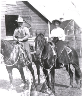
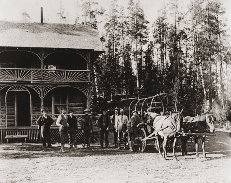
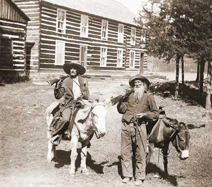
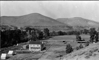
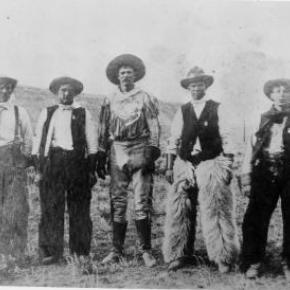
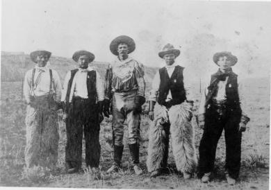
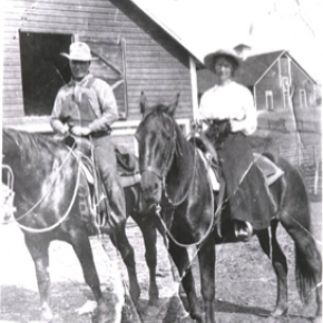
 Ranch Creek Valley, they buried the devil, but left his thumb exposed to remind them of the evils of war.

Before the Trans-Continental Railroad opened up the area in 1904, a stagecoach route from Idlewild (now
Winter Park) joined the Rollins Pass route. A state station was situated east of what is now our Ranch. The road extended transversely over the Ranch where it followed the course of the existing County Road 83. The land was rich agriculturally, and was used for cattle grazing in the early 1900s.

After the railroad was introduced, settlers began moving west in search of wealth and opportunity. Many ended their journeys in the
Rocky Mountains. During this time, there were more people living in the Fraser Valley than there are today. One favorite hangout of the railroad workers was a dance hall on Black Ranch, located immediately north of Devil's Thumb Ranch.

In the 1930s, Margaret Radcliff built the original Ranch homestead and operated it as a dairy. However, it was brothers Dan, Louis, and George Yager who started Devil's Thumb Ranch as a vacation property in 1946. The Yagers incorporated the Radcliff homestead in to the Ranch facilities and the original building exists today as the Ranch House Saloon.

The Yagers operated Devil's Thumb Ranch as both a working ranch and dude ranch until 1972. They introduced cross-country skiing in the winter of 1975-1976. Dick Taylor, a 1964 Olympic cross-country team member, designed 35 kilometers of the area's Nordic trails.

The Ranch was well known as a Nordic destination, but one without many amenities or niceties. The current owners purchased it in 2001, saving it from a group of developers who planned to fill the valley with residences and a golf course. They immediately began making improvements to the facilities, all the while impacting the land as little as possible.

Dude Ranches
Dude Ranches

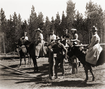
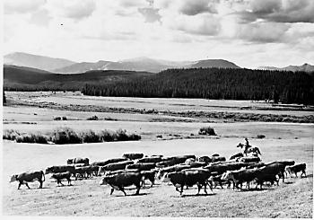
Starting in the late 1870s, ranchers took in guests to supplement their income during hard times. Early adventure-seekers from the East made the long rail journey to the wilds of Middle Park in search of big game and unspoiled mountain scenery. With few accommodations available, travelers looked to frontier families for room and board. Ranchers soon discovered guests, or “dudes” as they came to be known, would pay to fix fences, ride horses, work cattle and sleep in tents....sometimes for an entire summer! Entertainment was eventually incorporated into the guest experience.

Located on the stage stop between Georgetown and Hot Sulphur Springs, William Z. Cozens was the first rancher in Grand County to provide room and board to travelers starting as early as 1874. The Lehman and Sheriff families also ran well-known turn of the century dude ranches. The years following World War I were the height of the dude ranch era. By the late 1950s, Granby had as many as ten guest ranches between Granby and Grand Lake with others scattered throughout the county. Today Grand County is still home to six dude ranches, which attract visitors from all over the world for their western charm, high-quality accommodations, horseback riding programs and superb fly fishing.

Dutch Town
Dutch Town

When two Germans, having imbibed too liberally shot up the mining town of Lulu City, they were run out of town.  They went higher and established camp, on the side of Red Mountain near timberline.  There they found a lode of low grade gold, silver and lead.

While it lasted only two years, this encampment came to be called "Dutch Town".  Gradually the fierce winters and lower quality of ore drove the settlers out, leaving only a few empty cabins about a mile west of Lulu City. 


Dwight D. Eisenhower and the Western White House

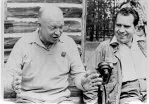
Dwight D. Eisenhower met and married Mamie Geneva Doud of Denver on July 1, 1916. Carl Norgren, a Doud family friend, had started spending time in the Fraser area and was enchanted by the beauty of the area and especially the Byers Peak Ranch for Boys.

By the late 1930s, Norgren partnered with Aksel Nielsen to purchase the Byers Peak Ranch.  During Eisenhower's presidency, the Brown Palace Hotel in Denver, the Byers Peak Ranch, and Lowry AFB were all known as "Western White Houses" or "Summer White Houses." There is a well known photo published in Life Magazine of Eisenhower fishing in the Fraser River with his grandson, David.

Eisenhower used his time at the Byers Peak Ranch to rest and recompose himself in the face of difficult political times. As President, Eisenhower dealt with the threats of the Cold War, a truce in Korea, the desegregation of public schools (Little Rock, Arkansas), and the development of the "Eisenhower Doctrine" to bolster the Middle East against the threat of communism. On the domestic front, he was faced with the difficulties of dealing with the Republican Old Guard, including Senator Joseph McCarthy, who headed a subcommittee charged with the finding of communists within the government.  

Eisenhower enjoyed cooking for guests at the Ranch, fishing St. Louis Creek and having "brookies" (brook trout) for breakfast, painting, and playing golf.  On September 24, 1955 while at the Ranch, Eisenhower suffered a coronary thrombosis (heart attack) and was hospitalized at Fitzsimmons Army Hospital in Denver until November 11, 1955.  His hospital suite has now been restored and is open for limited tours.

The bulk of information about Eisenhower and the Byers Peak Ranch comes from the personal papers of Carl Norgren, which are housed at the Eisenhower Museum and Library in Abilene, KS.  The collection of correspondence from 1948-1964 covered a broad variety of topics: fishing, recreation, taxes, health matters, food, communism, reorganization of the Department of Defense, federal spending, etc. The Norgren collection valued for the details it provides concerning the hobbies and recreational pursuits of the President during his visits to Grand County between 1952 and 1957.

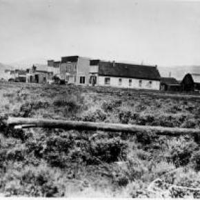
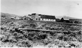
Gaskill and the Wolverine and Ruby Mines
Mount Baker

The Wolverine Mine was discovered in 1875 by James Bourn and Alexander Campbell. Bourn was the brother-in-law of James Crawford, the founder of Steamboat Springs. James Bourn was the twin brother of Crawford's wife, Maggie.  A Grand County recording error forever changed the name of Bourn in the area to "Bowen".  The mine was located in the Rabbit Ears Range on Bowen Mountain, up Bowen Gulch, approximately 10 miles northwest of Grand Lake.  This discovery sparked additional exploration in the area that lead to a number of new mines. Within a week of the original discovery,  interested parties formed the Campbell Mining District which included Bowen Mountain, Bowen and Baker gulches.  Some of the Middle Park residents who participated in the mining exploration  were John Baker, Charles Royer, Charles Hook, John Stokes and the Redman brothers, William and Mann. The Redman's  eventually  discovered the Sedalia mine. Bourn and Campbell  in less than a year lost the Wolverine mine by not fulfilling a grubstake agreement with the Georgetown grocers, Spruance and Hutchinson.

John Stokes leased the Wolverine Mine from the grocers until Edward Phillip Weber, an agent representing a group of Illinois investors, purchased the Wolverine Mine in the Summer of 1879.  Weber continued purchasing other Campbell Mining District claims which created a great deal of local excitement.  Weber hired Stokes  to assist him and also hired Lewis Dewitt Clinton Gaskill to act as the first foreman for the Wolverine mine.  Gaskill had mine operation experience, having successfully operated the Saco Mine, on Leavenworth Mountain, above Georgetown for several years.  A mining camp was built  below the Wolverine Mine that contained a large bunk house building and a more substantial mine office building.

Gaskill, a Civil War veteran of the 28th  Regiment of the New York Volunteer Infantry,  had come to Colorado in 1868 as a representative of a group of Auburn, New York bankers to invest in mining properties.  He eventually successfully operated the Saco mine in 1873 and 1874.  He invested in the Georgetown, Empire and Middle Park Wagon Road in 1874, which was a toll road that finally made the Berthoud Pass road passable for wagon traffic.  Gaskill also acted as the foreman during the construction of the road. The principal investor in the road was William Cushman of the First National Bank of Georgetown. The bank had a financial collapse in 1877.  At that time, Gaskill was the secretary of the road company and lived with his family in the company house just below the summit of Berthoud Pass on the west side.  William Hamill, a wealthy Georgetown businessman, bought the wagon road in a foreclosure auction in 1881 for $7,000.  Gaskill continued to live with his family in the Berthoud Pass summit house until 1885, when he moved his family into the Fraser Valley and homesteaded 160 acres along Elk Creek.

The settlement of Gaskill began when  in August of 1880,  Al J. Warner built a log cabin store in a meadow below Bowen Gulch on the trail/road that lead to both Bowen Gulch and Baker Gulch.  The settlement was also strategically well placed midway on the trail/road between Grand Lake and Lulu City and the Lead Mountain Mining District.  Another store was built in September by  John K. Mowery.  By that October, Mowery was appointed as the first postmaster of Gaskill.  The following spring E. Snell, opened a large general merchandise store that prompted the original store keeper, Al Warner, to relocate to Grand Lake as Al's Place. The town was named to honor L.D.C. Gaskill, the greatly respected foreman of the Wolverine Mine, the road builder/operator and the Civil War veteran.  By 1882, the town covered 60 acres.  E.P. Weber of the Grand Lake Mining and Smelting Company got involved in the town real estate development by laying out a city grid and offering lots for sale.  Weber's plat renamed the town Auburn after L. D. C. Gaskill's home town of Auburn, New York, but the Gaskill name stuck.  By the close of 1882, there were over 100 residents living in Gaskill.  The most substantial building was the Rogerson House, a well appointed two  story, squared log hostelry, Horatio Bailey Rogerson, proprietor.  Rogerson, would be elected County Commissioner in November of 1882, but would not serve because of a sudden discovery of ineligibility.  Instead, lame duck Colorado Governor Pitkin, appointed E. P. Weber to the post.  Weber was killed in the infamous July 4, 1883 shoot-out at Grand Lake.   

The Bowen Gulch trail lead to many of the  most productive and worked mines in the Campbell Mining District which included the Wolverine, now owned by the Grand Lake Mining and Smelting Company, E. P. Weber superintendent and the Ruby and Cross mines owned by Kentucky and Colorado Mining and Smelting  Company, John Barbee superintendent. Barbee, who lived in Grand Lake,  would go on to serve as superintendent of schools, Justice of the Peace and briefly the editor of the Grand Lake Prospector.  Barbee's partner in many endeavors was Antelope Jack Warren. Warren was as rough as Barbee was refined.  He acted as a foreman and, by one account, a bodyguard for Barbee.  The Bowen Gulch trail continued up the mountain to Bowen Pass and then descended into North Park and the Jack and Park mining districts which were organized by the end of 1880, to the settlement of Teller City.  Passable roads that could handle wagon traffic were needed and often planned but rarely built.  The high cost of building and maintaining  wagon capable roads in Middle Park was a difficult proposition for local governments and private entrepreneurs.  

The Grand County Commissioners in July of 1877 had declared the trail from Grand Lake to the mining gulches of the Rabbit Ears  Range to be a county road.  However there was little county money to pay for improvements to make the trail a road.  Private investors were reluctant to invest in wagon roads when there was the persistent  rumor that railroads were coming spawned by the numerous railroad surveys that were performed in the area.   Albert Selak, a Georgetown brewer, in August of 1878, organized a toll road that would branch off of the Georgetown, Empire, and Middle Park Wagon Road at the Ostrander Ranch on Red Dirt Hill, and proceed to Grand Lake and continue on to the Rabbit Ears Range mines and continue on into North Park and on to the Wyoming territory line.  John Barbee invested in the Middle Park Toll Bridge Company, a toll bridge company that intended  to build a bridge across the Grand River  above the confluence of Willow Creek and the Grand River.  However, this project languished, and was taken over by the county with an expenditure of $150.  

If ore wagons would need to haul ore to the nearest reduction mill which was over 60 miles in Georgetown, the toll road might have been a financial success. However, the lower grade ore from these Rabbit Ears Range mines would not yield a sufficient profit to cover the transportation and processing costs in a market where the market value of silver annually declined.  So the ore piles grew.  What was needed was a nearby reduction mill or cheaper transportation, like a railroad or a higher price for silver.  Weber had  repeatedly promised that a reduction mill was coming, but nothing was ever built.  By April of 1883 with tons of ore piled up and waiting for transport to be processed,  Weber temporarily closed the Wolverine Mine and laid off his miners.  He admitted  in June of 1883 that the ore from the Wolverine was “rather refractory” and that it would not justify shipment without local reduction.  Some hoped the closing was a strategic move by Weber to trigger a sell off of area mining properties  so that he could acquire additional mines before he built the reduction mill, but it was not to be. Weber would soon be shot dead by his political rival, John Gillis Mills.

The favorable newspaper stories of Rabbit Ears Range mining would continue, but for the informed, it had become  clear that without a major investment in improved transportation including a railroad or a major investment in a reduction mill in the area, the mining concerns were doomed to fail.  Mining claims had to be worked in order to be kept.   A minimum of $100 of labor or $500 in improvements had to be expended each year to maintain the claim or else the claim would be deemed abandoned.  Many claim holders leased their claims to miners to work for a percentage of the return.  Without the ability to sell and process the ore for a profit, there was no return.  The speculative mining investment money began to dry up and the miners and their supporting merchants began to leave.  By the end of 1886, the Middle Park mining boom had  ended. To further add to the decline,  a border dispute that arose between Larimer County and Grand County over the taxation and mineral wealth of North Park was finally decided in 1886 by the Colorado Supreme Court in favor of Larimer County.  North Park was part of Larimer County, not part of Grand County.  A lawsuit would follow so that Larimer County could recover the wrongly collected taxes of $20,000 from Grand County.  Grand County's total tax income at the time was less than $3,500 a year.
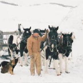
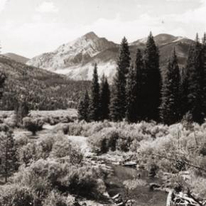
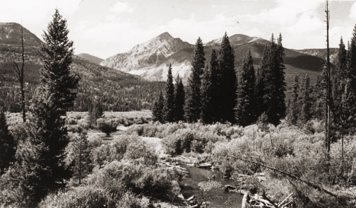
Logging
Logging

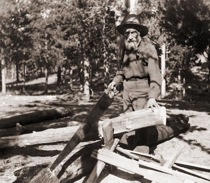
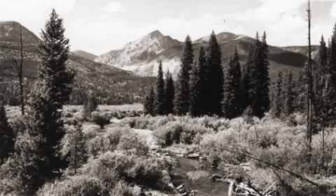
In the early decades of Grand County, lumbering was a key contributor to the local economy.  Logging was necessary as the principal source of building construction and also as the only available fuel.  When the railroad first made its way over Rollins Pass, the production of railroad ties became an important industry.  In the Grand Lake area, the brief mining boom of the 1880s created a steady demand for timber.

Some remains of log structures from abandoned logging camps were still evident late in to the 20th century. These include the Middle Park Lumber Company on St. Louis Creek (southwest of Fraser), an operation that had it's own railroad line into town.  In the same area, the independent logging settlements of Lapland and Stockholm date back to 1915. 

Above Tabernash was located the Deiler Mill, ten miles up Hurd Creek.  In 1910, the Western Box Company bought the mill and moved it to the head of Meadow Creek.  A box factory was located in Tabernash and the logs were floated down in a flume, thirteen miles long.  Mrs. Braddock was the "flume lady" at one time and would balance on a log while breaking up log jams on the trip downstream.....a task that required "great skill and derring-do". 

Other operations included Koppers Camp up Pole Creek (above Tabernash), Mr. Daves Mill at Hideaway Park and Bob Morrow's camp on Byers Peak.  Broderick Wood Products Company of Denver was a major purchaser of Grand County timber starting in 1930.  In 1939, Smokey Harrison founded the Timberline Sawmill at Kremmling.

A huge box making plant was built on a site now covered by Granby reservoir.  Its main supply point was a logging camp at southwest corner of Monarch Lake.  You can still see remnants of the logging machinery along the shore of the lake.  For a short time there was a branch railroad from Granby to the box factory, which later burned to the ground, In 1949, American Timber built a sawmill and log pond at Granby, west of the Highway 40 overpass.  The west end of the county was logged by the Kremmling Division of the Edward Hines Lumber Company.  Later, Louisiana Pacific built a wafer board plant in Kremmling but it closed in the 1980's.

The short growing and harvesting season created many challenges for the loggers.  According to Ed. "Jr." O'Neil, it takes over 100 years in Grand County to grow a tree big enough got a 35 foot telephone pole.  In contrast, it would only take 30 years to grow a similar tree in warmer climes.  There is still private logging activity in Grand County, most of it for the construction of luxury log homes.
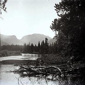
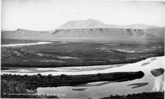
Lulu City
Lulu City

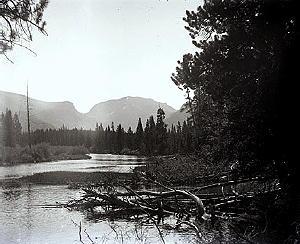
A popular hiking trail in Rocky Mountain National Park leads to the site of the historic mining town of Lulu City.  When precious metals were discovered there in 1879, as many as 500 prospectors showed up.  When the mines played out four years later, they departed in haste for other promising boom towns.

Lulu City was named for the daughter of Benjamin Franklin Burnett, one of the town founders. At its height, the town had a hotel, post office, and a justice of the peace.  It was served three times a week by a state coach from Fort Collins, on the other side of the Continental Divide.

There were probably ten saloons which drew customers from various mines in the area, such as the Rustic, Friday Nite, Tiger, Carbonate and Southern Cross.  These yielded low grade gold, silver and lead but the remote location of the Lulu made the cost to process the metals so high that efforts were soon abandoned.  The closest smelters were probably well over 100 wagon miles away.

One of the more remarkable characters of Lulu was "Squeaky Bob" Wheeler.  His high pitched voice was unique.  He was subject to drinking bouts, but was usually a likeable, well-behaved citizen.

After working in the mines, Squeaky Bob saved enough money to purchase a ranch south of Lulu. There he established a guest house and became famous for his cooking skills and colorful hospitality.  The current Lulu City trail runs through the site of his property, which was named the Phantom Valley Ranch.  He sold the ranch in 1926, but it continued to be a popular tourist stop until it was included in the National Park boundaries. 
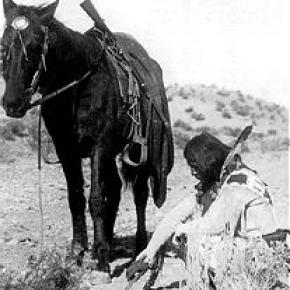
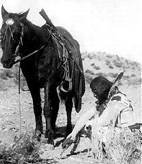
Mining
Mining

Ghost towns and broken dreams are legacies left by the early miners and prospectors of Grand County. Ever since 1879 when the first mines were staked out and claimed on Bowen Mountain near Grand Lake, “gold and silver fever” grew like an epidemic. Men blinded by greed and prospects of a better tomorrow scrambled to the Kawuneeche Valley with picks and shovels to unearth their fortunes. Women worked just as feverishly along side their men and encampments gave way to mining towns almost overnight. Land offices, eateries, and boarding houses sprouted like wild flowers.

Claim jumping became a common practice, resulting in fights and even murders. Most of these injustices would go unpunished, for no one wanted to risk losing their chance of riches. In Grand County the mother load was a false prophecy, as only small quantities of low grade gold, silver, and lead ore were found. In a few short years, Gaskill, Teller City, and Lulu City, three of the more noted settlements, suffered the same fate as the other boom towns. By 1885 the mining boom had ended in Grand County and ranching had taken it’s place as a sustaining industry.

Mining in Grand County

Ghost towns and broken dreams are legacies left by the early miners and prospectors of Grand County.  

Ever since 1879 when the first mines were staked out and claimed on Bowen Mountain near Grand Lake, “gold and silver fever” grew like an epidemic.  Men blinded by greed and prospects of a better tomorrow scrambled to the Kawuneeche Valley with picks and shovels to unearth their fortunes.  

Women worked just as feverishly along side their men and encampments gave way to mining towns almost overnight.  Land offices, eateries, and boarding houses sprouted like wild flowers. Claim jumping became a common practice, resulting in fights and even murders.  Most of these injustices would go unpunished, for no one wanted to risk losing their chance of riches.  

In Grand County the mother load was a false prophecy, as only small quantities of low grade gold, silver, and lead ore were found.  In a few short years, Gaskill, Teller City, and Lulu City, three of the more noted settlements, suffered the same fate as the other boom towns.  By 1885 the mining boom had ended in Grand County and ranching had taken it’s place as a sustaining industry.

Articles to Browse

Topic:

Business and Industry

How did people make a living? What were some of the businesses and industries that brought people to Grand County?  Jut click on the drop-down menus and find out more about it!

Ute Legends of Hot Sulphur Springs

Ages ago, there were many Ute Indians who enjoyed life in Middle Park with its plentiful game and lush meadows.  They lived in peace and harmony for "as many years as there are hairs on the head."

In spite of this idyllic life, there was one young brave who yearned for more adventure and material goods.  He proposed that the Utes attack the Sioux, who lived beyond the mountains on the plains of the rising sun.  As victors, they would return in glory with much wealth and many captives.

Spiquet Pah (Smoking Water) was an elderly medicine man who foresaw only grief in the prospect of such a war.  He spoke before a council meeting, warning of the devastation that such an action would bring upon the tribe.  He foretold " As the North Wind soon brings the snows and death of winter, so will he bring sorrow and death to our own people.....if you do this, strength and peace and plenty will be but for a few; joy will be seen no more."

Disregarding his warning, most of the young men were tantalized with the temptation of the grand adventure of such a conquest.  In the autumn of the year, when they usually did their hunting, the young men rallied behind the young brave and followed him over the Great Divide into combat with the plains people.  As the fighters departed, a saddened Spiquet Pah went into the heart of the mountain "and pulled the hole in after him."

The young Ute men found the enemy better armed and organized than they expected. Many Ute braves were killed and others were taken as slaves. The prophecy had come true as starvation and disease plagued the tribe as there were too few men to hunt for food. The old man sat on his haunches beside his subterranean fire which he heated water from an underground stream.  From the mountain at Hot Sulphur Springs, water flows even today as a reminder of the rash behavior of so long ago.

Another legend holds simply that the Hot Sulphur Springs water acquired medicinal qualities in answer to the prayers of an old chief who has be left by his tribe to die.  The old man built fires within the mountain, and after drinking the water and bathing in them, we was restored to health and rejoined his people.

Topic: Railroads

The Train Comes to Fraser

Article contributed by Tim Nicklas
 

A little over a hundred years ago the few residents of Fraser were awakened by a sound new to their town.  The railroad had finally arrived in 1904, just over 30 years after it had first debuted in Denver.  That same blaring horn, followed by the rumble of iron wheels on rails is waking up the good town-folk of the Fraser Valley today.  As the local Manifest has documented recently, many residents have long been annoyed by the noisy disruption the train makes as it announces its passing through town.  Additionally, parents of school children rushing to Fraser Elementary School in the morning can attest to the intrusive obstacle the slow moving behemoth becomes at in the morning.

A hundred years ago, residents of the Fraser Valley complained loudly of the intrusion of the iron horse on the tranquil lifestyle.  It has long been rumored that the course of the railroad was determined by an angry old timer by the name of Billy Cozens.  Cozens was a pioneer of the valley having homesteaded his ranch in the area in the early 1870s.  According to legend, when the engineers were surveying the route of the future Denver, Northwestern, and Pacific Railroad through the valley, Billy Cozens bullied the crewmen into the woods.  As the railmen would lay their flags for the roadbed, Cozens, an expert marksman, would shoot the markers out of the ground.  As the story goes, this was the reason the tracks were laid through the forest, rather than the meadow.

The reality of the chosen route for the D.N.&P. was due to grade and not fear of the rifle.  Whether Cozens despised the railroad is anyone's guess.  According to Robert Black's book, Island in the Rockies, the railroads designing engineers actually consulted Cozens concerning the lack of snow on the continental divide.  Regardless, the rumors have persisted over the years about the "Old Sheriff's" contempt for the railroad.  It has even divulged to me that the ghost of Billy Cozens will not allow anything concerning the railroad in his former home, the Cozens Ranch Museum.  Whenever railroad exhibits have been attempted they have mysteriously vanished and were never seen again.

As far as the townfolk of Fraser were concerned, many of them regarded the railroad as an opportunity that had eluded the region for years.  Unfortunately for Fraserites, their town was to be bypassed as the major hub for the area.  Further down the valley Tabernash was chosen as the location for the workshops and roundhouse for the forthcoming trains.  As a result, the trains would move through Fraser without their engineers paying the town much notice outside of their blowing whistles.  Nonetheless, the people of the valley would embrace the iron horse.  Economic potential in Grand County would erupt due to the advent of relatively efficient transportation.  Specifically, the lumber industry would boom with the outlet that the railroad would provide.  Additionally, people could move between Denver and Grand County easily compared to the wagon roads that formerly provided the only passage to the outside world.  As timber and cattle traveled to the Front Range, mail and hard goods traveled back to the Fraser Valley.

In years past, just like today, it has been easy to forget the benefits that the railroad has brought to our lives.  Certainly, when the train moved into the valley, the people that day realized that their life could slow down a bit.  The reality was that the short inconvenience that the passing train brought with its blaring horn, bringing traffic to a momentary standstill enhanced the life and character of the Fraser Valley.  It provided power, people, and materials in a unique way that simplified life here.  This is as true today as it was in 1905.      


Topic: Places
Spruce Lodge

The search for Spruce Lodge

Spruce Lodge

 You gotta love a mystery! My curiosity rose, my anticipation of being the one with the real story was more than my appetite could stand. I looked at pictures, figured angles, mused at what other people said, reviewed topographic maps and finally said to myself “it just can’t be.” The terrain doesn’t look like that. It isn’t two miles from the last switchback on Hwy 40. I don’t care what the writing on the back of the pictures say. 

I want to know once and for all, where is the real location of Spruce Lodge? How can it be located so everyone will agree. I’ve got it, find an expert wilderness person with my same curiosity. As fate would have it, entered Debora Carr, author of Hiking Grand County Colorado, complete with pictures, maps, GPS coordinates and trail narratives. Her coauthor Lou Ladrigan also caught the bug. “We can find it.” 

Exploration began early in the spring but the snow was just a little too deep to find any artifacts. Failed attempt, but the appetite was there. Wait till the snow melts in the trees. Again, as fate would have it, entered Carol Hunter. Carol has been instrumental in the efforts to resore the Berthoud Pass wagon road. Carol has lots of maps and pictures of the development of the wagon road and just happened to have an original U.S. Bureau of Public Roads 1920 survey map for the construction of Hwy 40 from Empire to Fraser. I loaded it into the computer, expanded the image and found lots of strange numbers. Almost like mile markers. Carol said they were numbers used by the work parties. They seemed evenly spaced and the map had a distance legend. It even had a marked location for Spruce Lodge. I couldn’t wait to add this map to Deborah and Lou’s reference material.

Armed with new references, Debora and Lou hiked both sides of Hwy 40 from the switchback to the entrance to Mary Jane. Looking for artifacts, existence of remnants of the old wagon road, foundations and terrain that matched the photos in the GCHA collection. A couple places looked promising, but not quite. Finally, a white station post number 390 was found lying on the ground on the west side of today’s Hwy 40. Then another white station post was found to the south, number 380. That was a match! Just what we needed. That confirmed the surveyor L.J. Young’s map. To the south of 390 a flat part of ground revealed what looked like part of a foundation and surrounding the location were remnants of discarded cans and possible buildings. A two holer! Now check the terrain with the pictures. Well maybe. Don’t forget that Hwy 40 didn’t exist. Step back and look from the east side of the existing Hwy. A great match with the slope and tree line. This was it! Just .9 miles North of the last switchback.


Topic: Water

A Dream Smashed in Gore Canyon

The idea of a water passage from the Atlantic to the Pacific Ocean had long captivated the imagination of early explorers.  Soon after the Territory of Colorado was established, the United States government made a standing offer of $3,750 to anyone who could demonstrate such a route.

In 1869 a dreamer named Sam Adams convinced some people in the town of Breckenridge that goods could be sent upriver via the Mississippi, Missouri, Platte and South Platte Rivers to South Park.  Then, with a short portage over Boreas pass, they could continue down the Blue River to the Grand (Colorado) River and then through Gore Canyon the Sea of Cortez.

Volunteers were told they would share in the prize, and they built four boats of green lumber for the voyage.  The flotilla was launched with great celebration, the lead boat bearing a banner proclaiming "Western Colorado to California ? Greetings!"  A little dog was given to the crew to keep up morale.

As the boats went down the Blue River, the waters were a bit rougher than expected. When the men arrived at the Grand (Colorado) River, the crew set up camp. However several of the "sailors" declared they had had enough and began a trek, via dry land back home to Breckenridge.

When the boats reached Gore Canyon, they encountered violent upsurges and dramatic drops.  The wild waters smashed all four of the vessels on dangerous rocks.  Fortunately, all members made it to dry land, even the little dog.  No reward was ever given for the attempt.

Topic: Ranching

Murphy Family Ranch

Article contributed by Tonya Bina of Sky Hi Daily News, October 2009


As late as this summer, John Murphy, 94, mowed ditches on his ranch land and built a new fence. "You got to keep busy doing something," he said.
His longevity, he said smiling at wife Carolyn across the table, is owed to "having a good wife to keep you healthy."

And then he added, "and being stubborn and contrary, I guess." But, Carolyn believes John's secret to healthy aging is due to "hard physical labor from an early age," plus the privilege of being raised where there is good air, little junk food, fresh vegetables, fresh milk daily and ranch-harvested meat. Dancing and regular rodeo jaunts also don't hurt.

This week, the Murphys are pausing to acknowledge a 100-year milestone, when John's parents first bought the ranch in greater Granby. John Murphy was born in the family's white two-story ranch house, which still stands on the property, six years after his parents Anna (Rohracher) and James Murphy bought 160 acres from Leopold Mueller in 1909. He had purchased the land from the widow of Edward Weber, who was one of the Grand County commissioners shot in the Grand Lake shoot-out of 1883. Weber's grave is still surrounded by a white-picket fence, located just northwest from the Murphys' newer home.

Mother Anna had crossed the ocean from Austria in 1882 with her family, then in the spring of 1884, they walked over Rollins Pass from Ward to homestead at Eight-Mile Creek south of Granby. The town of Granby didn't sprout until the railroad came through in the early 1900s, so twice a year, the family would travel over Berthoud to Georgetown to buy groceries - a testament to the fortitude people had back then. "How often do you go for groceries now?" John asked. "Twice a day?"

Anna and James married in March of 1907 and had three children: Margaret, James and John. When John was just two years old, his father died and his mother was left to care for the ranch and the three young children. She later married Joseph Reinhardt who had the ranch above theirs.

Upon her death in 1952 at the age of 75, "The Middle Park Times" saluted Anna for having been "a hardy pioneer woman" who prided herself for her ability to horseback ride and milk cows, and called the latter a "fine art rather than a chore."

"It was a pleasure for her to sit down and milk cows," John said. "That's when she could rest. She would milk half of the cows while me and my step-dad milked the other half."

The ranch had about 35 cows, and the cream and milk they produced was shipped to Denver where it was sold. When the lettuce colonies came to the Granby area around the early 1920s, the Murphy ranch prospered selling milk and butter to local settlers.  "Where the airport is now, there was a shack or tent on every 10 acres over there," he said, "and five packing warehouses along the railroad." Even a section of Murphy land was leased to grow lettuce and spinach.

When young boys, John and his brother would sometimes find entertainment riding on the backs of calves in the barn - always out of sight from their mother who would have disapproved, he said. And the younger John would horseback to the Granby schoolhouse located across from the present day Granby Community Center.

Back then, Granby was barely a settlement, and the Murphys' closest neighbor was farther than a mile away. Granby, especially, has grown in the past 20 years, threatening the lifestyle he has known all his life. In the past, ranching families made up the community, and neighbors looked out for one another, he said. "There was kind of a togetherness," he said. "Now we don't have that."

Nodding to the golf courses and newer homes surrounding Granby proper, "We're losing it, losing all the ranchers," he said. "Like any piece of property, I hate to see it change hands, but progress happens and there's nothing you can do about it."

John Murphy began running the ranch in 1934 and his older brother James ran another ranch near Fraser, land the brothers originally had purchased together.
John's first wife Edith died during childbirth, and John became a single dad to a daughter and son who were 2 and 4 years old at the time, running the ranch and raising his children like his own mother did when he was a toddler.

At its height, John Murphy's commercial cattle operation had about 2,000 acres and about 120 pair of cows and calves, with the calves selling at the top of the market in Omaha. John said from working his land for hay through the years, he has found buffalo horns. "There must have been quite a few buffalo here in the 1800s," he said. The land has since been leased, split, and some shared with John's family, including daughter Jennifer Baker and son Steve Murphy.

Although the winters are no longer as harsh as he remembers them - "It would get 30 to 40 below for the whole month," he said - he and wife Carolyn now winter in Arizona. John met Carolyn in the 1970s, and the couple would dance at haunts such as the Circle H and Hazel Mosle's (now Johnson's Landing). "I just held the girls, and they did the dancing," John said. "She complained I held her too tight," he said, of Carolyn. "And she's been suffering every since."


Topic: Regions

Fraser Valley

The principal population centers in the Fraser River Valley are Winter Park, Fraser and Tabernash.  When the early stage coaches came over Berthoud pass into the Fraser Valley, the most popular stop was at the Cozens Ranch, which now houses a historical museum in Winter Park. The valley is now bisected by U.S. Highway 40, which was designated the "Victory Highway" in 1931.  The new route of the highway leads through the main streets in both Fraser and Tabernash and the backdoors of some business became front doors because of the new highway alignment.   

Tabernash was the name given to a railroad siding, named for the Ute leader who was killed during a confrontation with local ranchers.  The town became a key station on the railroad line, and included a roundhouse, and a supply of helper engines for the steep climb over Rollins Pass.  When the Moffatt Tunnel was opened in 1928, the railroad no longer needed service there and the town lost its' main economic support.

George Easton founded the town site of Fraser in 1905.  The rest of the country became familiar with Fraser when the winter temperatures were often the lowest recorded in the U.S. and Fraser was know by the nickname "Icebox of the Nation".   Lumbering was one of the prime industries in the region until World War II.  During the war, the military built a Prisoner of War camp at Fraser to help lumber for the mills in the area.

The current area of Winter Park has had many names over the years.  First it was called simply "Old Town" or "Vasquez", named after the fur trader Louis Vasquez.  "Woodspur" or "Woodstock" referred to Billy Wood's lumber mill in the area, which furnished ties for the railroad while it was being built over Rollins Pass. During the construction of the Moffatt Tunnel, the name "West Portal" came into usage.  Rail workers also called the community "Little Chicago" as it was as it was a favorite gambling, saloon, and brothel site.  As tourists began to arrive it was known as "Idlewild" and also "Hideaway Park".  Finally, the name "Winter Park" was settled upon to correspond with the adjacent ski area of the same name.

The area population declined from 1232 people in the 1920's to only 373 people by 1930.  The Great Depression ended the construction boom and the price of beef became too low for ranches to turn a profit.  However, since that time, the area has thrived, mostly based on a tourism economy.  The valley's main source of income is now recreation and second home construction. 

Mountain Men / Trappers

Many noted fur trappers and traders are reported to have been familiar with the headwaters of the Grand (Colorado) River as early as the 1820s. Among them were Thomas Fitzpatrick, Jim Beckwurth, Christopher “Kit “Carson, Henry Fraeb and Peter Sarpy. Louis Vasquez built a trading fort on the South Platte River and ventured into what is now Grand County, where a pass east of Berthoud Pass is named for him.

His partner, Andrew Sublette, also came across the Divide to trade in Grand County, as well as Ceran St. Vrain, whose fort was near modern Platteville. 26 year old Tom Smith was with a group of trappers who entered the northern part of Grand County in 1827, where they were attacked by either Ute or Arapahoe Indians. Tom was hit in the leg by an arrow, splitting the bone and creating a life threatening infection. Amputation was needed but none of the party had the nerve to perform the operation. So Tom took a butcher knife and amputated his own leg. As “Pegleg Smith” Tom later became noted as one of the greatest horse thieves in the West, but was never prosecuted.

The beaver trade was essentially over by the 1840s as silk replaced beaver pelt as the stylish material for top hats. In 1842, famed traveler Rufus Sage came over Muddy Pass into Middle Park, but recorded almost no hunting activity there. On the other hand …fishing was great! His party caught over 50 pounds of trout in one morning. Noted mountain man Jim Bridger and another guide, Joseph Chatillon, let the infamous Sir George Gore on an extravagant hunting expedition in Middle Park. Despite the senseless slaughter of thousands of game animals, Gore has been immortalized with a mountain range, canyon and pass named for him.

One of the earliest of the mountain men to discover what was to become Grand County arrived in the Fraser Valley as early as 1860, soon after gold was discovered in Colorado. Charley Utter, known as “Colorado Charley”, was considered the prototype of rough trappers and traders. He was unique, though, in that he insisted on taking a bath every day, whether in the hot springs or beneath frigid waterfalls. In 1864, Charley was one of the first to make use of Berthoud Pass driving cattle that he raised at Troublesome Creek. His home was host to various adventurers who came to explore the prospects of Middle Park. He would eventually work with the famous Buffalo Bill Cody, appearing in “Wild West” shows.

When Kentuckian Beverly D. William spent some time in Grand County, he realized the Grand River was originally named the Colorado. As a Washington delegate from the newly organized “Jefferson Territory” (as this area was known at the time), he was instrumental in getting the named changed to the “Colorado Territory”, although the river was called Grand River until 1921.

Topic: Indians

Indians

There is a great deal of evidence of primitive cultures in what is now Grand County, but all seems to have been transient until the modern tribes arrived, probably around 1450. The Arapaho Tribe claimed the northern part of this region and were in frequent territorial dispute with the Ute Tribe, who were dominate in the Colorado Rockies. The Utes did not have “chiefs” in the sense of the organized Plains Indians.

There were five different tribal groupings in Colorado, and those in the Grand County area were known as the “White River Utes”. The Uncompahgre Utes lived in the southern area of the state, near the San Juan Mountains. Their spokesman to the white man was Ouray, and because of his knowledge of Spanish and some English, the federal negotiators designated him “Chief of All Utes”. Thus it was he, who in 1868 agreed that most of the land west of the 107th degree longitude (about one third of Colorado) would be a Ute Reservation “for all time”.

Ouray probably never knew the Utes of the northern region and they were never notified officially of this treaty. Suddenly, their favored hunting grounds of Middle Park, the healing waters of Hot Sulphur Springs, and much of the Front Range and Gore Range were opened to white settlement. Naturally there were tensions between the Utes and the white settlers and there are several well documented accounts of disputes in the area, including the killing of Tabernash, retaliatory strikes by the Utes, and the supposedly intentional burning of Middle Park by Colorow. Finally, there was an uprising in 1879, known as the Thornburg and White River Massacres, and the result was that the Utes were evacuated from almost all of their former reservation and driven to the Utah area in 1882.

Though much of the culture, knowledge and influence of the original Indian people has been lost to time, Ute and Arapaho names still grace many landmarks in Grand County.
 

Topic:

Irving Hale's Adventures in Grand County

Article contributed by Abbott Fay

At the age of 17, Irving Hale was the first graduate of the Denver Hugh School in 1878. That summer, he and his younger brother decided to go to Grand Lake to catch trout with the plan to sell the fish in Central City and make a tidy profit.


On July 5th, they camped atop of Berthoud Pass, building a "roaring fire to keep mosquitoes away".  The next day, they reached Cozens Ranch (stage stop in what is now Winter Park) but their jackass, carrying much of their supplies, had wandered off.  They feared that he had returned to Georgetown, where they had purchased him earlier in the week, but they found him grazing in a nearby pasture.


They almost drowned attempting to cross the Fraser River but finally found their way to Grand Lake on July 9th.  There, they camped and fished and collected enough trout for their return trip to Central City.  On the way back, the fish started to smell so they found some ice and started over the Continental Divide.  They realized they wouldn't make much money so were happy to sell their rotting trout for 25 cents per 10 pounds.  On July 25th they shot a deer and had a terrible time trying to skin it and cut up the meat.  Discouraged, they finally returned home to Central City.


Irving Hale was given an appointment to West Point and during his career he rose to the rank of Brigadier General. He was given command of troops in combat in the Philippines following the Spanish-American War. As Colorado's first combat general, he retired to Denver in 1906, and published his experiences as a youth in  "A Tramp Through Middle Park".


When the World War II cold weather camp was established near Leadville Colorado, it was named after Irving Hale. Many of the ski and mountaineering troops, the Tenth Mountain Division, became the founders of many of the modern ski areas of Colorado.  


Sources:

Rocky Mountain News, April 15, 1888

Sons of Colorado, Vol. I, 3&, 1906

Fay, Abbott; A History of Skiing in Colorado; Ouray, CO; 2002


Business/Industry