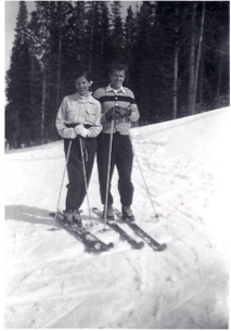
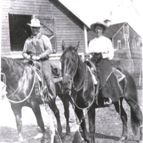
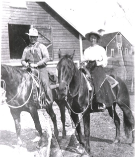
Joe on Melody

Skiing

Skiing Articles

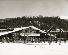
Arapahoe Ski Lodge
Arapahoe Ski Lodge

Article contributed by Chris Tracy, Courtesy of Alpenglow Magazine 2009

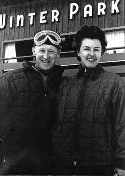
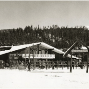
The Arapahoe Lodge's history has everything to do with a perfect ski vacation experience.  2009 celebrates the lodge's 35th anniversary. Rich and Mil Holzwarth and their children (now adults) Jan and husband, Greg Roman, Brad and Todd have lovingly operated the Arapahoe Ski Lodge since 1974. That was before there were sidewalks and street lights- when the town was still named Hideaway Park. It was before Mary Jane, and snowboards, when a day of skiing at Winter Park Ski Area was $7.50; when old Ski Idlewild boasted a $6 lift ticket; and lessons at both resorts cost a whopping $8. It was before snowmaking equipment allowed the resort to open early, and when phone calls still went through a friendly local switchboard operator, and calling Granby from Winter Park was long distance. "Our number at the lodge then was Winter Park 8222," Jan recalls.

In those days, no fewer than 15 mountain lodges hosted skiers and tourists from around the world. They operated on the Modified American Plan, with packages offering five days of lodging, meals, and lift tickets for two for $135.  Well, prices have gone up a bit. But Mil suggests that a stay at the Arapahoe Ski Lodge is comparable in price to a stay at a condo at the base of the ski area, "but here, you get your meals, too."

Mil and Rich Holzwarth left a busy city life and Rich's chemical lab career to buy the lodge they saw listed in the Wall Street Journal. A leap of faith, a willing family, and lots of determination culminated in their buying the lodge in June of 1974 from Ed and Beryl Parrington- who then purchased and operated the Tally Ho close to Fraser.

Rich remembers the huge snowstorm the day after they closed on the lodge that dumped more than three feet of snow. "It buried our Gremlin," Jan adds.  In the Holzwarths' premiere season, the lodge was booked for Christmas- and there was no snow. Guests began to arrive early Christmas week. Ready to ski, they asked Mil when it was going to snow. "Christmas Eve," Mil assured them-and, sure enough, as they served their first Christmas Eve dinner, the snow started falling and didn't stop.

Those early years at the lodge saw the Holzwarths hosting locals for Thanksgiving dinner, since there were few restaurants serving on Thanksgiving. The place was packed and thankful friends looked forward to the feast every year.  

 Growing up at the Arapahoe Ski Lodge was both fun and hard work for the Holzwarth kids. "We weren't allowed to go out for winter sports in school because we had to work," says Jan. But there were rewards. When the chores were done, there was skiing.

Other ski lodges in operation included Idlewild Lodge, Timberhouse, Beaver  Lodge, High Country Inn, Woodspur, High Forest Inn, Yodel Inn, Sitzmark, Miller's Idlewild Inn, Brookside, Winter Haven Lodge, Tally Ho, Outpost Inn, and Devil's Thumb. Like the Arapahoe, most had a bar, sauna and hot tub. Now, only a few of the grand old lodges remain. Condos and hotels have taken their place, and guests who frequent them unknowingly sacrifice a romantic, unique experience only a ski lodge can offer.

Most of the lodges in the 70s were members of The Winter Park Resort Association, which met regularly, offering cooperative marketing to the lodges and ski areas.  Meetings would always end in a friendly gathering at one of the lodges. Mil remembers how the lodge owners used to help one another with groceries, extra beds, and cooking when there were urgent needs. That's still the case when the Holzwarth sons, both firefighters with the East Grand Fire Department, are called out, leaving their lodge duties.

 Jan, the official baker, still makes many of long-time friend and former baker Twila Groswold's recipes, while Jan's dad, Rich, is famous among locals as "the doughnut man," getting up early every Wednesday to make his special cake doughnuts for guests and neighbors.   We fill up on fresh fruit, eggs, homemade bread, bacon and sausage, and enjoy the pretty surroundings. Red geraniums fill the dining room windows, and a crystal chandelier sparkles in the sunlight. Jan brings my apple spice tea in a teapot nestled in a crocheted tea cozy.

 I ask her how the Holzwarth family fared, working all these years together.   Jan laughs as she notes they all just do what has to be done. With the help of a couple of hired hands, they manage to care for the big lodge together, taking turns with laundry, room cleaning, baking, grilling, carving, waiting tables, cooking, bartending, hosting, plowing, greeting, booking and shuttling.  "Not all of us get mad at the same time," she jokes. "We all do each other's jobs."     Mil makes sure I understand this has been a family business. "Rich and I couldn't have done this without them," she says.


Barney & Margaret McLean

It was the spring of 1924 when an 8-year-old girl from Hot Springs, Ark., arrived in Hot Sulphur Springs by train to spend the summer with her aunt and uncle Hattie and Omar Qualls, homesteaders from Parshall who had recently purchased the Riverside Hotel. It wasn't the first time Margaret Wilson had been to Hot Sulphur. Her father had tuberculosis and was frequently prescribed treatment at the sanatorium on the Front Range. She was 6 years old the first time she made the train trip.

She remembered a boy and girl twin she had befriended on her first visit. When she saw the twins again on this second visit, they told her there was a boy in town who was calling her his girlfriend. His name was Lloyd “Barney” McLean. Margaret made sure to attend the opening of the new school in Hot Sulphur that spring (now the location of Pioneer Village Museum).

When Margaret first laid eyes on her future husband, she wasn't all that impressed. “I immediately knew who he was, and I thought, ‘Ugh.'” He was wearing wool knickers, leather boots, a V-neck sweater and a flat cap. “He had white hair and millions of freckles,” she recalls.

That white-haired boy from Hot Sulphur went on to become one of Grand County's earliest and most heralded Olympic skiers. He and Margaret would eventually travel the world together. They danced with Hollywood stars and shook hands with presidents. But their love story began right there, in a that little neighborhood schoolhouse. “We all had a crush on Barney until Margaret came to town, then it was all over,” one of Margaret's best friends used to say. At some point, she said, the banker's son asked her out, but she found him dull compared to Barney.

Barney was the oldest of 10 children — five boys and five girls. When the family outgrew the house his dad built a tiny shack for Barney in the backyard. Barney was barely big enough to see over the dashboard when he started driving a truck for his father's garage, which was located just up the street from the hotel. He was just 12 years old when he drove a load of dynamite over Trough Road.

There were stories of the brakes overheating on Rabbit Ears Pass and Barney riding down on the fenders in case he had to bail and hairy trips over Berthoud Pass. Margaret said she never realized how good Barney was at skiing. He worked all the time driving the truck (his dad pulled him out of school for good in 10th grade), and he would head straight to the jumping hill in Hot Sulphur after work and wouldn't come home until after dark.

“He didn't have the proper clothing,” Margaret said. “He wouldn't even be able to open the door when he got home and he would stand at the door crying until his mother let him in.” His mother would bring him in, take his boots off and put his feet in a bucket of hot water to thaw them. “For him, it was skiing for the joy of skiing,” Margaret said.

Barney raced on the weekends. Margaret rarely made it out of the restaurant to join him. It never struck her that skiing would someday become her husband's career. “He was never one to blow his own horn,” she said.

He qualified for Nationals in jumping in 1935 at age 17, and his dad gave him a quarter to make the trip. "Here was a kid from a town that nobody had ever heard of who shows up at Nationals and wins it," his only child Melissa McLean Jory said. He qualified for the 1936 Olympics but was badly hurt on a wind-blown landing that winter and missed going.

Margaret returned to Hot Sulphur almost every summer of her life after that, and by the time she was a teenager she was working for her aunt full time. “My friend Telly and I were the best waitresses in the county,” she said.


Hot Sulphur had four ski hills back then and Margaret recalls that in February 1936 the Rocky Mountain News sponsored an excursion train to the 25th Annual Winter Carnival in Hot Sulphur. More than 2,000 passengers arrived on three trains that weekend. (That same train later became the official ski train.
“There were no restrooms and no restaurants except for the hotel,” Margaret said. The Riverside was inundated. It was shoulder-to-shoulder people, she recalls.

There wasn't much to do for fun in Hot Sulphur back then, like now, so the young couple would drive up to Grand Lake — to the Pine Cone Inn — on summer nights to dance. It cost 10 cents per dance, and since they didn't have much money, they would have just three dances ... “Oh, Barney could dance,” ... drink a Coke and then drive home. Margaret would wait by the front window of the hotel to watch for Barney, who she knew would be going to meet the train at 11 a.m.

One time, she was out there waiting, the snow was still piled high, and Barney got so caught up looking for Margaret in the window that he nearly ran the truck off the bridge. The only thing that saved him from plummeting into the river was the dual wheel that got stuck in the steel girder.

Barney was 19 in 1937 when the couple married, not old enough for a marriage license and barely able to afford the suit he bought to get married (the first suit he ever owned) not to mention a big wedding. The couple eloped in Denver. Shortly after they married the couple started traveling the country for ski races and Barney switched from ski jumping to slalom. He was named as an alternate for the 1940 Olympic squad after skiing alpine for only two years.

But, then the war came and everybody was signing up. Barney, with his skiing experience, would have been a perfect candidate for the 10th Mountain Division, but another Hot Sulphur friend who had already joined wrote and said, “Don't join this outfit. It's a mess.” So he signed up for the Air Force instead. As luck would have it, somebody recognized his name as it came across his desk, and Barney was assigned to the Army Air Force Arctic Survival School in Edmonton, Alberta, Canada, where he was in charge of teaching pilots how to survive in snowy conditions should their planes go down.

Margaret came back to Hot Sulphur during the war and worked in the county courthouse. After the war, Barney earned a spot on the 1948 Olympic team. After that, he went on to work for the Groswold ski factory in Denver, losing his amateur status and disqualifying him from FIS ski racing. He was inducted into the US National Ski Hall of Fame in 1959 and the Colorado Ski Hall of Fame in 1978.

Barney had spent his whole life on the snow. He skied all over the world, from Europe to South America. "But Hot Sulphur Springs was always home to him," his daughter said. "He was an ambassador from Hot Sulphur wherever he went."

Barney was 3 years old the first time he skied and he skied the spring before he died — at Mary Jane in 2005 — in a foot of new snow. His grandsons skied down with him, wing men on either side. His health was bad that last time he skied, and he had a hard time walking from the car to the chairlift. But as soon as he hit the top of Mary Jane Trail, everything eased, Melissa said: "He could ski better than he could walk." It was the things that made Barney McLean a world class skier that Margaret loved most: He loved speed. Bumps didn't bother him. And, when faced with a challenge he just picked a line and was gone.

Railroads Build the Ski Industry

In the early to mid-1900s, the popularity of skiing spread across the western United States.  Ski areas popped up in many mountain communities, particularly in the Colorado Rockies. Much of this was due to access afforded by the existence of railroads to these areas.  Railroads broke the barriers of isolation during the winter months when most other forms of transportation were blocked (skiing being the exception).

Grand County has long depended on tourism.  From its earliest days of settlement, tourists were drawn to the springs of Hot Sulphur Springs and to the waters of Grand Lake and its surrounding streams.  Grand County was reached by stagecoach from Georgetown, via the Berthoud Pass Wagon Road. In the summer months tourists would fill up Hot Sulphur Springs’ five hotels.  Nonetheless, those same hotels would sit mostly vacant during the long winter months when the road was shutdown.


In 1911, Hot Sulphur Springs held the first winter sports carnival west of the Mississippi River. The purpose of the carnival was to boost the town’s economy by filling the empty hotels and restaurants with out of town guests for that one weekend at the end of December.  This was only possible due to the Moffat Road railroad, which had broken the town’s isolation just six years prior.


Not only did the railroad bring spectators for the winter carnival, it also brought the two most important participants of the event.  At least, it brought them part way. Carl Howelsen and Angell Schmidt boarded the train in Denver’s Moffat Station and rode it to the top of the divide at Corona, where they detrained and skied the rest of the 40-plus miles to Hot Sulphur Springs, where the carnival was under way.  Once re-united with their fellow train passengers, Howelsen and Schmidt performed the biggest event of the day, the ski jump competition, which made history. The ski jump competition at the 1911 Hot Sulphur Springs Winter Sports Carnival was the first west of the Mississippi and is considered the beginning of Colorado’s ski industry.


The 1911 winter carnival was such a successful and enjoyable event that it grabbed the attention of Denver newspapers on the front pages.  Consequently, John Peyer and the other carnival organizers of the carnival decided to make it an annual event and put together the 1st Annual Hot Sulphur Springs Winter Sports Carnival six weeks later in February 1912. The railroad was the sole reason that the success of the winter carnival at Hot Sulphur Springs was even a possibility in those early years.  Berthoud Pass, the former wagon road converted to an auto route was closed in the winter months. Even if the highway were open, automobiles of that day could not have made the winter drive anyway.  The railroad was the only way to bring people to the remote town in the winter and take advantage of the abundantly snowy hills.


The Moffat Road quickly realized the potential for profit that the Hot Sulphur Springs Winter  Carnival presented in the typically slow winter months of the railroad. In 1913, the Denver and Salt Lake Railway (D&SLR) advertised a special round trip fare to Hot Sulphur for the winter carnival.  The following year, further up the Moffat Road, Steamboat Springs held its first winter carnival.. Once again, the D&SLR provided the means to reach the new ski destination. People road the rails from Denver and Hot Sulphur Springs.


As the popularity of Hot Sulphur Springs as a winter destination grew, so did ridership of the D&SLR to the winter carnival.  In 1936, the Rocky Mountain News sponsored the “Snow Train” to Hot Sulphur Springs for the 25th anniversary of the winter carnival.  Despite the fact that Berthoud Pass was open year round starting in 1933, over 2,200 passengers rode the ironhorse from Denver and another 500 came over the Moffat Road from Steamboat Springs for the event.  Over 7,000 people attended the carnival that weekend.


1912 Winter Carnival Brochure001
 

In the early years of the ski industry, Nordic was the dominant form of skiing.  By the late 1920s, Alpine skiing began to grow by leaps and bounds in the United States.  This coincided with the opening of the Moffat Tunnel, which made the railroad far more reliable in the winter time.  It would be at the west portal (West Portal) that the railroad would make its biggest impact on skiing in Colorado. Following the opening of the Moffat Tunnel, skiers would ride up to West Portal from Denver to slide the deep and steep slopes immediately adjacent of the tunnel.  Not long after the opening of the tunnel, the Arlberg Club was formed and they built their clubhouse not for from the tunnel to take advantage of the rails from Denver to the slopes on the west side of the divide.


Arlberg Club members and other ski enthusiasts flocked to West Portal by rail throughout the 1930s, even though there was no formal ski area.  Skiing and riding the train to West Portal was so popular that in 1938 the D&SLR started the “Snow Train,” offering regular weekend service to West Portal.  The D&SLR even provided a place for skiers to wax their skis in the West Portal Depot.


The start of the Snow Train coincided with decision of Denver Parks Director, George Cranmer’s decision to locate Denver’s Winter Park at West Portal. Cranmer announced his intention of creating for Denver a winter sports playground that would be “unequalled in the world.  When he determined that West Portal would be the location for Denver’s Winter Park he referenced the great ski conditions of the area and additionally remarked that “West Portal may be reached by auto or train.”  Cranmer clearly recognized the importance of access by train from Denver.


As ski trails were cut and T-bars were installed on the mountainside the base area facilities for Winter Park were literally constructed on the tailings of the Moffat Tunnel.  This provided easy access to the facilities and slopes of the ambitious new ski area for those riding the train from Denver. The D&SLR continued to provide the Snow Train weekend service when Winter Park opened in 1940 for $1.75 per round trip.  Unfortunately, due to the demands of World War II and a coal workers strike in 1943, the Snow Train service came to an end. This would prove to be temporary though. In 1946, one year after the end of World War II, the Denver and Rio Grande Western (D&RGW) brought the special weekend service back to Winter Park and    christened it as the “Ski Train.” This was the foundation of the Ski Train that ran between Denver and Winter Park until 2009.


Grand County was not the only ski destination that benefitted from the railroads in the early growth years of the ski industry in the west.  A couple of major examples are Marshall Pass in Colorado and Sun Valley, Idaho. Beginning in 1938, the D&RGW literally acted as a chairlift for skiers from Salida and Gunnison.  A special excursion train on the weekends selling seats as lift tickets to the top of Marshall Pass.  The first train sold out with 500 tickets and 200 skiers were turned away that day. The railroad even provided a  warming hut at the bottom of the slopes.


In possibly the greatest example of the railroad on the ski industry of the west is Sun Valley, Idaho and the Union Pacific Railroad (UP).  Sun Valley was literally the conceived, constructed, and operated by the UP. Under the leadership of Averill Harriman, who was a ski enthusiast himself, conjured up the plan to build a world class ski destination that would rival any in Europe.  This resort was to be reached by rail as a means to boost ridership on the UP, which it did. Sun Valley became the glamorous playground for the rich and famous. At Sun Valley, skiing was elevated in class and viewed as elite. Nonetheless, it was at Sun Valley that the railroad made its most significant contribution to the ski industry.  The first chairlifts in the world were installed at Sun Valley in 1936, replacing the rope tow. Engineers for the UP developed the chairlift at the railroad’s headquarters in Omaha. The invention of the chairlift transformed the method of how skiers were to be transported to the top of ski trails the world over.


The impact of the railroads on the development of the ski industry in the western United States cannot be understated.  Without the assistance of the network of steel that penetrated into remote mountain locations, the ski industry could not have developed with the rapidity that it did in the early part of the 20th century.   Furthermore, as we look to the future of the ski industry and try and figure out ways to conveniently transport skiers to the slopes of Colorado trains emerge more and more as the answer.  This is apparent in the rejoice that devotees to Winter Park sang when Amtrak’s Winter Park Express returned weekend service in 2017 that had been left in a void ever since the Ski Train made its last run in 2009.  Once again skiers are riding the rails of the old Moffat Road.


5277 Ski Train001

 5425 ski train 1950s001Passengers unloading the Snow Train at the West Portal Depot in 1938

 Ski Train Brochure 1980s

 
Skiing
Skiing

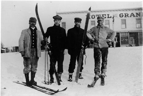
Grand County was one of the first areas in Colorado to enjoy sport skiing.  While mail carriers, loggers and other workers used the "Norwegian Snowshoes" as necessary winter transportation, it was a natural progression to begin racing down the slopes for fun.

An 1883 newspaper noted that in Grand Lake "Coasting on snowshoes has taken the place of dancing parties.   Quite a number of ladies are becoming adept at the art.  First class snowshoers, B.W. Tower and Max James are the best; or at least they can fall more gracefully then the rest".

According to famous Hot Sulphur Springs champion Barney McLean, that town had three jumping hills in the 1920s and held the first Winter Carnival in the West there in 1911.  By 1925, Denver sent special "snow trains" there for the recreating tourists.  Skiers such as Bob McQueary and Jim Harsh competed in statewide events along with skiing "veterans" Horace Button and McLean.  Grand Lake's Jim Harsh became the first Coloradoan to qualify for the U.S. Olympic Team.

In 1932, the Grand Lake Ski Club held its first winter sports week on Denver 25-January 1st.  Featured was a motor sled with an airplane engine which pulled skiers over the frozen lake are speeds of 90 miles per hour.

Colorado's first ski tow was opened at the summit of Berthoud Pass in 1936.  Berthoud Pass operated on and off throughout the next 60+ years but was finally closed and the lifts dismantled in 2002.  

What became the resort of Winter Park featured skiing at the West Portal of the Moffatt Tunnel and the Winter Park Ski Area opened as a result of efforts by Denver Parks & Recreation Director George Cranmer. Early lodging resorts in the area, then known as Hideaway Park (now Winter Park), included Sportland Valley, Timberhaus Lodge, and Millers Idlewild Inn.  Eventually trains made daily runs to Winter Park, loaded with intrepid skiers.  Steve Bradley invented the first effective snow packer on the slopes of Winter Park.

With a strong record of winning high school ski teams, Grand County accounted for a remarkable number of skiers who later took park in FIS (International Federation of Skiers) meets and U.S. Olympic teams.

A later ski area, now know as Sol Vista Ski Basin (formerly Silver Creek Resort) opened in Granby in the 1980's.  World class cross country ski areas in Grand County include Snow Mountain Ranch and Devil's Thumb Ranch.

The Millers Build Idlewild

Article contributed by Jean Miller


In June 1946, the C.D. Miller family broke ground for Idlewild Inn in the small village of Hideaway Park, Colorado. Although WWII was over, materials were still very scarce.  What could be obtained locally was bought.  Much was brought from Wichita, Kansas, where the family lived. By 1948, the rustic Inn was up and running.  It had the charm that comes with

the scent of pine wood, cozy fires, hearty food, friendly hosts, and total relaxation.  Sons Elwood and Dwight managed the business, with the vital assistance of parents and friends during the Christmas season and summers.


Elwood married after graduating from college and bit by bit, he gravitated to the teaching world, leaving Dwight to deal with eager guests. Idlewild Inn became a popular spot, especially families for seeking simple vacations.  However, after a few years, the Millers realized that there was developing a desire for more sophisticated lodgings.


About 1952, Dwight and his bride Jean had the opportunity to buy 160 acres of land across the valley, to which was later added 40 acres from a mining claim.  The price was $10,000 and the couple wondered how they ever would pay for it.  Nevertheless, this chance was too good to miss. The property extended far into what is the main portion of town today, across

the railroad, and along both the Fraser and Vasquez Creek.  A pleasant lane wound through the forest from the highway to the creeks and broad meadow.


One step led to another.  Dwight chose one-of-a-kind heavy, 4 foot thick cedar planks for the walls of his new lodge.  He nestled the building into the "vee" of the valley flowing down behind. By Christmas 1957, Dwight and Jean opened by far the finest lodge in the area.  Each bedroom had two double beds and a private bath with ceramic tile, a first in the area.  The first full bar in the lodge was much appreciated by guests on cold nights. A few years later, Dwight built a year-round outdoor swimming pool, the first in the county. (It took as much coal to heat the pool as to heat the lodge itself.)  Guests loved it, for in winter, they came from a day of skiing, jumped into the pool for a swim, ran to the steam room (also a

first), and finally took a snooze before evening festivities began.


Dwight was the first in the area to use a school bus for transportation to and from the ski area and in summer, to take people on trips within and out of the county. The realization grew that a beginners' area close at hand would be a great attraction, especially for mothers who found the trails at Winter Park daunting.  They could bring their children to Ski Idlewild to learn to ski, brush up on their own skiing, and when tired, go into the lodge to

relax or swim.  It took all of two weeks to decide on a Pomagowski double chairlift.  That summer slopes were cleared and groomed, the lift and warming house built, and the area opened in 1960, two years before Winter Park had its first chair lift.  Dwight and Jean even had a fine neon sign at the entry off the highway, one more first.


Saturday races, sponsored by Ski Idlewild and George/Hazel Ferris's Mountain Shop drew droves of youngsters.  About 1961, Dwight introduced ski bicycles, which were hugely popular.  He also started using the first snowmobile for grooming and first aid purposes in the area.


In the meanwhile, Jean was identifying snowshoe and cross-country ski trails through the nearby back country. By 1964, their thoughts were turning to snowmaking, to enhance early skiing.  To this day, people will walk up to the Millers and say, "Oh, Ski Idlewild!  I learned to ski there! Loved it."


As for summer activities, trips to areas of interest, swimming, and horseback rides were standbys.  In addition, the Millers built a small golf course in the meadow and a trout pond at the bridge, which they stocked.


As the Miller children grew, Dwight and Jean found that they wished for more family time together, and when an opportunity to sell the property came along in 1965, they gave up what was a flourishing, solid, and very profitable business, moving to Tabernash to try other challenges. Unfortunately, the new owner was not a good steward and Ski Idlewild

gradually d clined.  An era of exciting innovation came to an end.


Winter Carnivals
Winter Carnivals

Carl Howelsen, a ski jumping champion in his native Norway, came to Denver to pursue a career as a stonemason in the early years of the 20th Century.  He amused himself and others by demonstrating ski-jumping in the foothills of Denver. 

In 1911, Howelson went to Hot Sulphur Springs, where he taught locals such as Horace Button the art of jumping.  Under Howelson's leadership, the first winter carnival west of the Mississippi Rover was held there on February 10-12.  According to the Middle Park Times, "Never before in the history of the Territory and State of Colorado has such an event even been contemplated, much less held!".

Norwegian immigrants Howelson, Angell Schmidt of Denver and Gunnar Dahles of Williams Fork (Grand County) all staged jumping competitions during the carnival.  There were also skating and tobogganing events and a Grand Ball.  Hot Sulphur Springs continued holding Winter Carnivals annually until World War II, when they were discontinued until the 100th anniversary celebration, called the Grand Winter Sports Carnival scheduled for December 30, 2011-February 11, 2012.

Articles to Browse

Topic: Grand County

Grand County Time Line

Prehistoric
7000 BCE to 900 BCE: Paleo Indians  (Yarmony, Rollins Pass, Windy Gap) use Middle Park as summer hunting area

1819 – 1860
1819:Adams-Onis Treaty – Middle Park partitioned – Sites of Granby, Fraser, Grand Lake and Hot Sulphur are in the U.S, Kremmling still part of Spain

Middle Park well known to “Mountain Men” by 1820

1828: Kremmling becomes part of Texas

1837: T.J. Farnham’s expedition crosses the Blue at Grand River

1839: Grand River named on a semi-official map

1842: Rufus B. Sage visit

1844: Captain John C. Fremont’s second expedition, accompanied by Kit Carson, enters Middle Park over Muddy Pass and exits up the Blue River

1854: Sir St. George Gore, an Englishmen, accompanied by Jim Bridger enters Middle Park for hunting expedition

1859: First appearance of prospectors; interest in Hot Sulphur Springs

1861 – 1874
1861: Berthoud crosses Berthoud Pass and traverses Middle Park

1861: Middle Park becomes part of Summit County

1863: Trouble begins between the Utes and white men

1864-1868: Wm. N. Byers acquires Hot Sulphur Springs

1866: Gov. Cummings signs Treaty of Middle Park

1868: John Wesley Powell visits Grand Lake, makes first recorded ascent of Longs Peak

1867: Joseph Westcott settles at Grand Lake

1871-1872: Clarence King surveys area

1873-1874:  F.V. Hayden surveys area

1874: Creation of Grand County (two years before Colorado became a state)

1874: Toll roads opens over Rollins and Berthoud Passes

1874: William H. Jackson, renowned photographer, takes first photographs of Middle Park

1875 – 1888
1875: First mail routes to Hot Sulphur Springs

1875: Silver ore indications in Never Summer Range

1875: First school opens in Hot Sulphur Springs with 12 students, (school “year” was 20 days)

1877: Routt County detached from Grand County

1877: Stokes-Dean political crisis

1878: Tabernash and Abraham Elliott killed

1879: Ute Indian War produces excitement, anxiety

1879: Lulu City & Teller City formed

1880: Gaskill City formed

1881: Four railroad projects frustrated

1881: County Seat moves to Grand Lake, height of mining boom,   Grand Lake Prospector is launched

1883: Commissioner shootings at Grand Lake

1884: Shooting of Texas Charlie in Hot Sulphur Springs

1884: Kremmling formed

1885: Kremmling Post Office opens

1885-1886: Collapse of mining, North Park separates from Grand County

1888: County Seat moves back to Hot Sulphur Springs

1889 – 1904
Expansion of ranching

Development of public education

1890: Grand Ditch construction begins... carries water from Grand Lake mountains to the front range

1891: First platting of Kremmling

1891: Berthoud Pass route becomes state road

1893: Construction begins on Byers Canyon road

1896 et seq.: Organized religious congregations develop

1892: First diversion of water to eastern slope

1898: First high school opens in Kremmling

1902-1904:  Moffat – Harriman struggle

1903: Hot Sulphur Springs incorporates

1904: Kremmling incorporates

1904: Moffat Road crosses Rollins Pass

1904: First motor car arrives Grand County

1904: First telephones installed

1905 – 1914
1905: First Forest Reserves

1905: Fraser develops, Granby is founded

1905: Moffat Road reaches Hot Sulphur Springs

1905: Parshall is founded

1906: Moffat Road reaches Kremmling

Proliferation of competitive newspapers

1905-1908: Heyday of Monarch

1908: Arapaho National Forest established

1911: First Hot Sulphur Springs Winter Carnival

1912: First Middle Park Fair

1913: Eleven motor vehicles are registered in Grand County

1913: Tabernash established as railroad division point

1915 – 1930
1915: Rocky Mountain National Park founded

1917-1918: Participation in World War I by 151 Grand County residents

1918-1919: Influenza epidemic

1919: Grand County Pioneer Society founded

1919: Fall River Road completed

1921: Grand River name changed to Colorado River by U.S. Congress

1922: First radio receiver

1923: Gore Pass opens to motor vehicles

1923: Improved Berthoud Pass road opens

1923-1928: Moffat Tunnel built

1926: Fred Selak murder

1929-1941: The Great Depression

1930-1932: Berthoud kept open all winter

1932: Trail Ridge Road completed

Since 1930
1938: Colorado-Big Thompson irrigation and power project begins

1940: Winter Park Ski Area opens

1941-1945: Participation in WWII

Late 1940s – early 1950s: Construction of Colorado– Big Thompson Project

1947: Adams Tunnel in operation

Growth, then boom, of winter sports


Topic: Biographies

Joseph Wescott

Joseph Wescott was born in 1838 in Nova Scotia and reared in Iowa.  By 1865, he was in Middle Park, squatting, half-blind and semi-alcoholic, in Hot Sulphur Springs with his friend Charlie Utter.  

Having come to Colorado to get relief from rheumatism, he passed his time in creative writing, fishing, drinking, and shooting his revolver.  In 1868, after being induced to sell all of his claims of 160 acres around the hot springs, he left Hot Sulphur Springs to go to Grand Lake.

In 1870, a group of Arapahoe Indians arrived in the area and there is an unverified report that Wescott, Jack Sumner, and three fishermen killed “not less than five” of the Indians.  Soon after this incident, Wescott settled into developing a rustic resort with cabins, rafts, canoes, and skiffs on Grand Lake.

By 1879, he had three buildings on the West Shore. In July 1880, disaster struck when Edward Phillips Weber, an attorney, took over Wescott’s original filing as his own.  Weber claimed that there were “flaws in the filing” and forced Wescott out.

Nevertheless, on June 26, 1888, Wescott filed a plat for “Grand Lake City,” on the lake shore south from the inlet.  He designed the area for summer visitors rather than as a residential community. 

Wescott later wrote a famous poem about the legend of Grand Lake, and how the spirits of the lost Ute women and children can still be heard wailing on foggy mornings at the lake shore.
 

Topic:

Abbott Fay

History and Philosophy Professor Abbott Eastman Fay was born in Scottsbluff, Nebraska on July 19, 1926. He married Joan D. Richardson November 26, 1953 near the beginning of his teaching career. They had three children: Rand, Diana, and Collin. He obtained his BA at Colorado State College (now the University of Northern Colorado) in Greeley, Colorado.

He taught and was a principal in the  Leadville, Colorado Public Schools  from 1952-54, then moved to Mesa College in Grand Junction, where he taught until 1964.

From 1964-1982 he taught at Western State College in Gunnison, Colorado, retiring as Associate Professor Emeritus and has since taught extensively for Western State and other regional colleges as adjunct professor.

His published works are extensive and include Ski Tracks in the Rockies, Famous Coloradans, I Never Knew That About Colorado, More That I Never Knew About Colorado , Beyond the Great Divide, To Think that This Happened In Grand County!, A History of Skiing in Colorado, The Story of Colorado Wines, and many other books and articles.

Abbott Fay died March 12, 2009 after a brief illness. His biographical website is abbottfay.com.

Topic: Ranching

Murphy Family Ranch

Article contributed by Tonya Bina of Sky Hi Daily News, October 2009


As late as this summer, John Murphy, 94, mowed ditches on his ranch land and built a new fence. "You got to keep busy doing something," he said.
His longevity, he said smiling at wife Carolyn across the table, is owed to "having a good wife to keep you healthy."

And then he added, "and being stubborn and contrary, I guess." But, Carolyn believes John's secret to healthy aging is due to "hard physical labor from an early age," plus the privilege of being raised where there is good air, little junk food, fresh vegetables, fresh milk daily and ranch-harvested meat. Dancing and regular rodeo jaunts also don't hurt.

This week, the Murphys are pausing to acknowledge a 100-year milestone, when John's parents first bought the ranch in greater Granby. John Murphy was born in the family's white two-story ranch house, which still stands on the property, six years after his parents Anna (Rohracher) and James Murphy bought 160 acres from Leopold Mueller in 1909. He had purchased the land from the widow of Edward Weber, who was one of the Grand County commissioners shot in the Grand Lake shoot-out of 1883. Weber's grave is still surrounded by a white-picket fence, located just northwest from the Murphys' newer home.

Mother Anna had crossed the ocean from Austria in 1882 with her family, then in the spring of 1884, they walked over Rollins Pass from Ward to homestead at Eight-Mile Creek south of Granby. The town of Granby didn't sprout until the railroad came through in the early 1900s, so twice a year, the family would travel over Berthoud to Georgetown to buy groceries - a testament to the fortitude people had back then. "How often do you go for groceries now?" John asked. "Twice a day?"

Anna and James married in March of 1907 and had three children: Margaret, James and John. When John was just two years old, his father died and his mother was left to care for the ranch and the three young children. She later married Joseph Reinhardt who had the ranch above theirs.

Upon her death in 1952 at the age of 75, "The Middle Park Times" saluted Anna for having been "a hardy pioneer woman" who prided herself for her ability to horseback ride and milk cows, and called the latter a "fine art rather than a chore."

"It was a pleasure for her to sit down and milk cows," John said. "That's when she could rest. She would milk half of the cows while me and my step-dad milked the other half."

The ranch had about 35 cows, and the cream and milk they produced was shipped to Denver where it was sold. When the lettuce colonies came to the Granby area around the early 1920s, the Murphy ranch prospered selling milk and butter to local settlers.  "Where the airport is now, there was a shack or tent on every 10 acres over there," he said, "and five packing warehouses along the railroad." Even a section of Murphy land was leased to grow lettuce and spinach.

When young boys, John and his brother would sometimes find entertainment riding on the backs of calves in the barn - always out of sight from their mother who would have disapproved, he said. And the younger John would horseback to the Granby schoolhouse located across from the present day Granby Community Center.

Back then, Granby was barely a settlement, and the Murphys' closest neighbor was farther than a mile away. Granby, especially, has grown in the past 20 years, threatening the lifestyle he has known all his life. In the past, ranching families made up the community, and neighbors looked out for one another, he said. "There was kind of a togetherness," he said. "Now we don't have that."

Nodding to the golf courses and newer homes surrounding Granby proper, "We're losing it, losing all the ranchers," he said. "Like any piece of property, I hate to see it change hands, but progress happens and there's nothing you can do about it."

John Murphy began running the ranch in 1934 and his older brother James ran another ranch near Fraser, land the brothers originally had purchased together.
John's first wife Edith died during childbirth, and John became a single dad to a daughter and son who were 2 and 4 years old at the time, running the ranch and raising his children like his own mother did when he was a toddler.

At its height, John Murphy's commercial cattle operation had about 2,000 acres and about 120 pair of cows and calves, with the calves selling at the top of the market in Omaha. John said from working his land for hay through the years, he has found buffalo horns. "There must have been quite a few buffalo here in the 1800s," he said. The land has since been leased, split, and some shared with John's family, including daughter Jennifer Baker and son Steve Murphy.

Although the winters are no longer as harsh as he remembers them - "It would get 30 to 40 below for the whole month," he said - he and wife Carolyn now winter in Arizona. John met Carolyn in the 1970s, and the couple would dance at haunts such as the Circle H and Hazel Mosle's (now Johnson's Landing). "I just held the girls, and they did the dancing," John said. "She complained I held her too tight," he said, of Carolyn. "And she's been suffering every since."


Origins of the Ute People

Before there were any people anywhere, the Creator, "Sinawaf", cut sticks and placed them in a large sack.  After many days, this aroused the curiosity of the coyote.  When Sinewaf was away, the coyote could no longer control himself and opened the sack.

Out came many people who scattered in all directions.  Each spoke a difference language from the others.  When Sinewaf returned, there were only a few people remaining in the sack.  He was furious with the coyote, as he had planned to distribute the people equally in various parts of the land.  As there could now be no such equity, there would be wars among the different people, who would fight for the best locations.

Of the small group left in the sack, Sinawaf called them Ute or Nuche, which meant "the people".  They would be a very brave and strong tribe.

Topic: Mountains

Mountain Names

While the origin of the names of many mountains in Grand County has been lost to history, we do know the source of many of the more notable mountains.  The name originations of some mountains of Grand County are as follows:   Adams Peak – Named for either Jay E. Adams who owned a cottage in Grand Lake or Alexander and Louise Adams, original owners of the Grand Lake Lodge.  

Mount Alice – 13,110 ft. – Named in 1911 by request of geologist Dr. William S. Cooper.  Who “Alice” was, was not explained.   Arapaho Peak – Named for the Arapaho Indian tribe who frequented Grand County during hunting season.   Arikaree Peak – Named for the Arikaree Indian tribe by James Grafton Rogers in 1955.   Baker Mountain – Named for John Baker from Indiana, a well known prospector and hunter of the 1850’s and 1860’s.  

Bills Peak – Named after an early settler in the area whose last name was not known.   Bottle Mountain – Named for the bottle shape of the mountain, three miles north of Byers Peak.   Byers Peak – 12,790 ft. – Named for William N. Byers, publisher and editor of the Rocky Mountain News and early promoter of Hot Sulphur Springs.   Mountain Cairns – 10,800 ft. – Named for James Cairns, first storekeeper at Grand Lake.   West Carter Peak and North Carter Peak– Believed to have been named for a member of the original U.S. Geological Survey team.   Cascade Mountain – Also known as Loder Mountain, popularly named for cascading stream.  

The Cleaver – Believed named by early settlers for location between two other peaks.   Coal Mountain – Named for visible coal seam.   Mount Cumulus – 12,725 ft. – Named for cloud formation resemblance.  One of three “cloud” peaks.   Diamond Mountain – Named for rumors of diamonds found there or its shape.  Located four miles East of Muddy Pass.   Mount Epworth – Believed named for a Methodist youth group founded in 1889.  Located east of Rollins Pass.  

Fairview Mountain – Named for scenic view.  Located ½ mile south of Parika Peak.   Mount Flora – Named for fields of flowers on mountain.   Mount George – 12,876 – Named for Dr. R.D. George, a geologist.  Its north spur is Lone Eagle Peak.   Green Mountain – Named for the green trees covering the mountain.   Grouse Mountain – Named for the grouse that inhabit the area.   Hallett Park – 12,713 – Named for William H. Hallett who lived from 1851 to 1947.  The mountain was named in 1887.  

Howard Mountain – Named for John Howard, a prospector.  The mountain was named in 1880.   Mount Irving Hale – Named for Brigadier General Hale who lead Colorado troops in the Philippines during the Spanish American War.  Hale was a member of the first graduating class at Denver High School and won an appointment to West Point.  Camp Hale, near Leadville, was a training site for World War II ski troops and was also named for him.

Barger Gulch - Archaelogical site

The prospect of discovering a remnant from a 10,000-year-old stone age society that inhabited Colorado's Middle Park so long ago seemed remote at best - while the suggestion that a prized Folsom point could somehow materialize before our very eyes appeared all but impossible.  For one thing, it was the last day of excavating for the summer at the Barger Gulch archaeological site and the ten member scientific team would soon be packing up and heading back to their ivory towers at the University of Wyoming and the University of Arizona.

Barger Gulch is a desolate spot that the federal Bureau of Land Management (BLM) oversees. It is hard, parched dirt dabbled with sagebrush as far as your eyes can see across the flat valley - a haven for all manner of bugs and other forms of native wildlife. In winter, the place turns to the opposite extreme as temperatures plunge to minus 40-degrees and howling winds whip up ghostly images of snow that swirl eerily across the land. This is Middle Park, a high mountain basin with roughly the same geo-political boundaries as Grand County. It encompasses some 1,100 square miles of unforgiving territory flanked on three sides by the formidable wall of the Continental Divide and its terrain soars high over the Great Plains into the thin, alpine air up to altitudes of 13,000 feet above sea level. What would induce these primitive Americans to trek all the way up here without so much as horses for transportation? How would they have survived the brutal winters with only primitive tools and clothing?  And why in the world would they ever want to settle in such a barren, god-forsaken place as Barger Gulch? 

This site could well prove to be one of the most significant archaeological discoveries of its kind in North America, according to BLM officials who oversee the project here. In just three years of work in a relatively small excavation area, investigators unearthed more than 18,000 artifacts - a staggering number ten times that discovered at typical Folsom sites. And this is only one of four sites in the same vicinity.  In addition to Barger Gulch and Upper Twin Mountain, discoveries include the Jerry Craig and Yarmony Pit House sites. Most of these were occupied by peoples described by archaeologists as Paleo-Indians, a catchall term for ancient humans that inhabited North America; Yarmony Pit House post dated Paleo-Indians by about 3,000 years.

But long before Paleo-Indians ever set foot on the Continent, Middle Park was a prehistoric menagerie; 20-million years ago, it was the stomping grounds for prehistoric rhinoceros, three-toed horses, camels, giant beavers, and even small horses. Creatures known as oreodonts also romped across the mountainous terrain. These vegetarians, ranging in size from small dogs to large pigs, fed on grasses and green, leafy plants. In fact, the skull of one of these animals was discovered recently in the vicinity of Barger Gulch. These long extinct, hoofed animals resembled sheep, but were actually closer to camels, and were common in the western U.S. This latest discovery is remarkably well preserved; while the bones have turned to stone, the smooth, hard enamel that encased the animal's teeth is still intact. 

Humans arrived in North America much later - about 12,000 years ago - as the last Ice Age of the Pleistocene Epoch made its exit. These first Americans crossed a land bridge from Siberia to Alaska and began populating the entire Continent; experts believe it is possible they also arrived on boats following the Continental Shelf into North America. Folsom people are best known as nomadic, big game hunters who chiseled out their spear points and finished them off with a distinctive, artistic flourish - a unique groove, or flute, that runs lengthwise along the face that has become the symbol of this Paleo-Indian culture. They honed the tips of these primitive weapons surprisingly sharp for killing frenzies that were necessarily up close and personal: they herded their prey into traps before launching their spears - and archaeologists suspect there was just such a bison ambush site near Barger Gulch. The quarry just over the rise is a gold mine of raw materials, including fine-grained Kremmling chert and abundant Windy Ridge quartzite, which provided a never-ending supply of top grade stone. "It makes sense," explains Todd Surovell. "You would want to camp where you could get as many raw materials as possible within a short distance. That's where you're going to park yourself for awhile."

The bulk of these tools originated with local material, but investigators have found some 200  "exotic" items noticeably out of place at Barger Gulch. One is a distinctive piece of yellow, petrified wood that came from 93 miles away as the crow flies, near the town of Castle Rock on the Colorado plains. Another is a large biface that was brought up from the Arkansas Valley, some 60 miles south. "They worked on it up here in one place and turned it into two, maybe three projectile points," notes Surovell. "One of them broke during manufacture and we have two pieces that fit exactly together."

Fitting these and thousands of other pieces together is what archaeologists do when they get back to the lab. The process begins on site where investigators photograph each find and record its exact location within the excavation block. This gives the team a visual reference to help recognize activity patterns - a way to connect the dots of Folsom society.  But the specks come to an abrupt stop, as if they suddenly run into a solid wall. "If we could figure out that this represented the wall of a structure, that would be really special," he explains. "Nobody's even been able to do that before in a site of this age in North America." Just then, a graduate student pops his head inside the door. "You want to be a camera man?" he asks Surrovell. "What do you got?" "A Folsom point," he replies with a broad grin. We rush over to the site where Waguespack has dug a narrow shaft down the north wall of the excavation pit and hit pay dirt - a Folsom point that remains half buried in the stratum of rich soil.

Topic: Granby

The Naming of Granby

Granby Hillyer was born in Cartersville, Georgia on July 7, 1874. The third of six children, born of Shaler Granby Jr. and Lelia (Holloway) Hillyer, and the grandson of the Rev. Shaler Granby Hillyer, Sr. who was born in Granby, Hartford County, Connecticut. When Granby was 13 years old the Hillyer family moved to Washington, D.C. where Granby graduated from public high school. He then entered government service and at the same time studied at George Washington University, receiving a Bachelors of Law Degree. A postgraduate law degree was awarded in 1896 from Columbia University School of Law. He moved to Colorado in 1898 settling at Lamar (Prowers  County) launching a 40+ year legal career. On June 16, 1900 he married Miss Annie Creaghe, from a prominent southern Colorado pioneer family, and a daughter of an Apache County, Arizona sheriff. To this union were born 3 children St. George Creaghe, Granby Francis Ridgeway Jr., and Helen Edna Dolorine (Jane) later Mrs. Albert Hunt of Boston, Massachusetts.

Granby Hillyer was a member of the Republican Party. He served as Lamar City Attorney, Prowers County Attorney, and Deputy District Attorney. He was also affiliated with the Elks, Masons, Sons of the American Revolution, and Woodmen of the World fraternal organizations.

At 28 years of age, the citizens of Prowers, Baca and Las Animas Counties, elected Granby Hillyer to serve in the 14th Colorado General Assembly, House of Representatives, making him one of the youngest elected officials in state legislature history. He served one term from 1903-1905. During this tenure he plotted the streets at no cost for the Frontier Land and Investment Companies newest town on the Denver, Northwestern & Pacific Railroad (The Moffat Road). In doing so, Mr. Hillyer was honored by having the Town of Granby, Grand County, Colorado named for him.

Governor Carlson appointed Mr. Hillyer as the Third Judicial District Court Judge, at Trinidad, Colorado from 1914-1916. Her served as the United States Attorney for Colorado from 1922-1925. Afterwards he enjoyed a large private law practice in Lamar and Denver.

In 1928 at Lamar, Granby Hillyer was a speical prosecutor in the "Fleagle Gang Case".  On May 23rd, the First National Bank was robbed, resulting in the loss of four lives.  The case has been credited by the F.B.I. as the first robbery solved from a single fingerprint.

The Denver Post on July 21, 1931 page 9, reported "Granby Hillyer Is Disbarred By Federal Courts." In a decision reached by the United States Circuit Court of Appeals, predicated by a Colorado Supreme Court tribunal, of neglecting the interests of his clients in a number of cases.

Tragedy then struck the Hillyer family twice with the loss of St. George Creaghe in June 1932 and October 1933, Granby Jr. was killed in an automobile accident near Lamar. They both were attorneys. St. George and Granby Jr. were born 16 months apart and passed away 17 months apart. Both funeral services were held at the Immaculate Conception Cathedral in Denver, with the same set of pallbearers for both young men. They were laid to rest at Denver's Fairmount Cemetery. Their father Granby Hillyer, joined his sons on January 2, 1942, passing away at Denver Mercy Hospital, after suffering a heart attack at age 68.

The name Granby also comes from Great Britain, one of the original references was for the "Marquis of Granby," John Manners. A Member of Parliament from 1754 until his death in 1770, he also was a popular army officer and hero of the Seven-Year War 1756-1763, obtaining the rank of Lieutenant General. In 1766, he was named British Commander-in-Chief of the Army. John Manners once had his hat and wig shot off during a cavalry charge, thus leading to the British expression, "to go baldheaded at something." He had his office attacked by the pseudonymous political writer "Junius." The Marquis of Granby resigned most of his offices and died in debt.

Curiously, Granby Hillyer had an uncle and a brother named Junius.

Topic: Mountains

Rollins or Corona - What shall it be called?

Travel across various passes of the Continental Divide occurred long before white men showed up. Indeed, as anthropologist James Benedict wrote c. 1975, some 10,000 years ago, prehistoric Indians camped, hunted, and built hunting walls on the upper reaches of Rollins Pass, as well as moving in and out of Middle Park for the warm summer months.

Historic Indians followed the same paths. In the earliest days of non-Indian access, a particular pass at the head of Boulder Creek was dubbed Boulder Pass. Capt. Jacob Bonesteel, including wagons, made the first recorded crossing by a white man at this point in April 1862. Three years later, a group of Mormons brought wagons over this route and a year later, promoters of new roads into Middle Park brought in many wagons and livestock.

In fact, tourists were starting to enter the park by a number of routes, and one of them, Samuel Bowles, who wrote a fascinating account of his trip, including his return to Denver via Boulder Pass. Interest was growing rapidly for a road over the Divide, into Hot Sulphur Springs, and on into Utah. One promoter, John Quincy Adams Rollins, from New Hampshire, teamed up with William N. Byers and Porter M. Smart to carry this project through. Rollins was interested in crossing the Divide; Byers was promoting the Springs; Porter wanted to develop the valley of the Middle Yampa. All three were pushing to have Middle Park officially named as Grand County, a challenge finally accomplished in 1874. So Rollins and associates started his road, reaching the top in 1873.

That next winter, they publicized this access and in June, Jimmy Crawford brought his family and wagons to Rollinsville and thence to Yankee Doodle Lake, ready to cross the pass now named Rollins Pass by the developer. But the road ended, and they found Rollins' men still hacking the road out of the granite! Jimmy and his crew found it necessary to leave their wagons and help. Finally, on June 10th, the family was able to head for the top. Jimmy borrowed two yokes of oxen, hitching them to mules, and then to his horse. The road was so rough that the procession could proceed but a few feet before having to rest. The family itself climbed on foot. At the summit, they discovered only a rough swath cut down through the trees on the western side. The "road" dropped down between the lakes and followed Ranch Creek to its junction with the Fraser River.

Rollins quickly realized that Berthoud Pass, which also opened in 1874, was superior to his own pass for wheeled vehicles, so he determined to hedge his bets. He initiated the first mail service into the county in 1873. He also built a commodious hotel where his road joined the Berthoud Pass road at the confluence of Crooked Creek and the Fraser. He called it the Junction House. Next, he proposed to the builders of Berthoud Pass that they form a joint ownership of the two roads between Junction Ranch and the Springs. Tickets would be issued for both routes and revenues would be shared. The two companies would build a bridge over the Grand at Hot Sulphur Springs. He even buttered up his rivals by complementing their work. All this was accomplished, although the mail route soon moved to Berthoud Pass, because of the severe winters on Rollins Pass.

The bridge was started in November 1874. From the beginning, Rollins' road was preferred for trailing livestock, because there were fewer problems with heavy timber and bogs. For years, the Church brothers, George and John, who introduced the Hereford breed into the county, trailed their cattle for summering in what became known as Church Park. However, tourists such as Irving Hale still drove wagons over Rollins Pass in 1878. About 1880, interest burgeoned for bringing a railroad up South Boulder Canyon and through a tunnel near Rollins Pass. Numerous surveys were completed all along the area. David Moffat settled on Rollins Pass for the tunnel site but decided first to put a temporary line over the top.

Thus, in the summer of 1903, a formal contract was let for work up and over the Pass itself. By 1904, the workers reached Arrowhead and they also built a work station on top, called Corona Station, or "crown of the mountain." This railroad construction town of Corona, located at over 11,600 feet at the top of Rollins Pass (first called Boulder Pass) along the Continental Divide was the highest railroad station in the world. It became obvious by 1905 that the Corona area would require snowsheds if trains were to travel, even irregularly, during the winter. Still, word got out of the spectacular splendor of Rollins Pass and tourists flocked in on summer train excursions, sometimes stopping on top, sometimes going as far as Arrow.

In 1913, a fine hotel was built next to the rail facilities. Because Rollins Pass was right in the middle of severe weather patterns, a weather station was built on top, as well as one down at Sunnyside. In 1915, Rollins Pass was actually proposed to be the south boundary of a proposed "Estes National Park." Later, on the National Historic Register, the district was listed in 1997 as the Denver, Northwestern and Pacific Railway Historic District--Rollinsville & Middle Park Wagon Road. It was also identified as the Rollinsville and Middle Park Wagon Road; Boulder Wagon Road, Rollins Pass, and Rollinsville area. In 1956, Governor Steve McNichols had presided at the official re-opening of the four percent grade to vehicle traffic over Corona Pass, expressing the hope that the route would someday be paved. The Colorado Game and Fish Department and the U.S. Forest Service made additional improvements, and the Arapaho and Roosevelt National Forests put out a 24-page booklet titled "The Moffat Road: A Self-Guiding Auto Tour."

The road crossed two of the original railroad trestles near Corona but those trestles, even if reached by 4-wheel vehicles, were crumbling and could no longer even be crossed safely on foot. The current self-guided auto tour refers to Rollins Pass, as well as the Moffat Road and the Boulder Wagon Road. Corona Station and Hotel are discussed. In 1979, a portion of the auto road over Corona Pass was permanently closed because of a cave-in of the "Needle's Eye," a tunnel located before the trestles heading west from the Moffat Tunnel's East Portal. The tunnel reopened on July 3, 1988, thanks to efforts of the Rollins Pass Restoration Association on both sides of the Divide, with the cooperation of the U.S. Forest Service, Colorado History Society, and Boulder, Grand, and Gilpin Counties. It then closed once more when another rockfall hit the tunnel on July 15, 1990. The RPRA is continuing its efforts for re-opening. The noted photographer, Charles McClure, took many outstanding photos of the Rollins Pass road.

One, titled "Group on Rollins Pass, shows well-dressed men and women stand on a snowfield making snowballs on Rollins Pass, Moffat Road, Boulder or Grand County, Colorado; probably on Denver, Northwestern and Pacific excursion train. Date: between 1904 and 1913 near Corona Station." Another photo shows a "30 ft. snowcut on Rollins Pass, Moffat Road photo. Denver and Salt Lake Arrow passenger car is parked east of Corona snowshed by the thirty foot snowbank cut, Rollins Pass, Colorado; it shows men, women and railroad employees posed behind train, on the roof and on the snowbank and a standard gauge track. Date: between 1904 and 1915." A sign at the highway turn onto the Moffat roadbed says: The Moffat Road "Hill Route" Also called "Corona Pass Road", this road over the Continental Divide was the original "Hill Route" of the Denver, Northwestern & Pacific Railway built by David H. Moffat in 1903. It crosses Rollins Pass at 11,666 feet elevation. On top of Rollins Pass, a sign says: Elevation 11, 660 feet, John Quincy Adams Rollins established a toll wagon road through this pass in the mid 1870's. David H. Moffat's Denver, Northwestern & Pacific Railway crossed the Continental Divide at this point in 1903.

First known as Boulder Pass, then Rollins Pass, the railroad workers dubbed it "Corona", the crown of the "Top of the world." A railroad station, hotel, restaurant and workers' quarters existed here until 1928 when the railroad was abandoned due to the building of the Moffat Tunnel. Identifications in various trail and geographical guides say: Rollins Pass (el. 11,680 ft) is a high mountain pass in the Rocky Mountains of north-central Colorado in the United States. The pass is located on the continental divide at the crest of the Front Range southwest of Boulder, at the boundary of Grand County, Colorado and Boulder County, Colorado. Rollins Pass (a.k.a. Corona Pass) sits approximately 5 miles east and above the popular ski areas around Winter Park, between Winter Park and Rollinsville. The pass is traversed by an unpaved road, mostly the former roadbed of the Denver and Salt Lake Railway which abandoned the route in 1928 when the Moffat Tunnel opened to replace it. Railroad advertising called this the "Top O' the World" and it referred to the Moffat Route over the continental divide and the Rocky Mountains. Rollins Pass was the primary travel route west from Denver until an easier road over Berthoud Pass was constructed. The Denver, Northwestern and Pacific railroad laid its tracks across the pass in 1903-1904 and established a Depot at Corona on the crest. It can be noted that in R.C. Black's Island in the Rockies, the term "Corona Pass" was mentioned one time, on p. 351; the terms "Corona Station" or "Corona Snowsheds were used. In Dismantling the Rails That Climbed, Rollins Pass was used, the Corona hotel, and just once, Corona Pass; 1936.

In Maggie By My Side, it was Boulder Pass and Rollins Pass. In Rails that Climbed, Rollins Pass, the Corona shed, weather at Corona, Rollins Pass Snow Shed, other references to Corona as a site. In Guide to the Colorado Mountains (Orme) , they speak of the Corona Trail to Rollins Pass. High Country Names (Ward) used Rollins Pass entirely. Only Hiking Grand County, Colorado, published 2002 by Carr speaks of Corona Pass, with reference to Rollins Pass (near the town of Corona), Moffat Road. The term "town" might be questionable; there was only a small restaurant, workers quarters, railroad offices, and in 1913, the hotel. Current maps, USFS and the Grand County Trail Map, show Rollins Pass, with Corona at the side as being a site. The use of "Corona Pass' seems to be a rather recent innovation that has come into being with tourism efforts in the upper Fraser Valley. Rollins Pass From Island in the Rockies p. 45 Rollins Pass was originally known as Boulder Pass, first recorded being crossed by whites, by Capt. Jacob Bonesteel in April 1862. Their supplies were carried in wagons. A second organized party went over the same pass in 1865. In 1866, promoters of access into Grand County brought many wagons and livestock over Boulder Pass.In 1867, Samuel Bowles and a group returned home to Denver via Boulder Pass. In 1873-74, two roads were proposed into the county, one of Berthouds pass and one over Boulder Pass. This was the same time that the county was named "Grand". J..A Rollins and his associates started the road and reached the top of the pass in 1873, at which time they envisaged a road from HSS into Utah. The first wagons went over in June 1874. The western descent was so bad that it never was much patronized by wheeled vehicles, instead becoming primarily used for trailing of cattle. At this time the name Boulder Pass disappeared from maps and Rollins Pass became the official name. p. 85. p. 80 Lots of schemes to build roads into GC, but of all the schemes for transport, only one, the Rollinsville and Middle Park Wagon Road showed any promise. T

hat was designed by John Quincy Adams Rollins, from NH, a gifted promoter, a son of a clergyman, second of 19 children. He was a farmer, miner, freighter, road bulder, and platter of towns. He was perhaps the most accomplished billiard player west of the Mississippi. He was a Colorado resident at least by 1866. His finances were up and down, but he was tremendously strong. In December 1884, when he was 68, he thought nothing of a 3-day snow-clogged crossing of the Continental Divide. p. 85 Rollins was interested in MP as an investor and he was interested in extending his road into Utah.. At the same time, a Porter M. Smart was likewise excited about speculating in frontier projects and was working at developing the valley of the Middle Yampa. William N. Byers was busy planning for HSS. These three men launched at least two petitions, with more than 80 "residents" for creating GC. Grand County was created that year, 1874. p. 89 With the creation of GC, people began to consider the area more seriously. p. 92 There was no official mail into the county until 1873 when Rollins brought in the first US pouch over his pass. In May 1874, he built a commodious hotel at the confluence of Crooked Creek and the Fraser, known as the Junction House. p. 94 Rollins knew that the road over Berthoud Pass was superior to Rollins Pass; his main advantage was the railhead at Blackhawk.

So Rollins proposed a joint ownership and operation of the two roads for the line between Junction Ranch and HSS. Tickets would be issued for both routes and revenues would be shared. The two companies would build a bridge across the Grand at HSS. Rollins even complimented the Berthoud work. This merger was completed soon. p. 104 This bridge was started in November 1874. p. 108 A mail contract was made in July 1875 for once a week delivery over Rollins Pass, but conditions were so severe that the route was changed to Berthoud Pass. p. 110 From the beginning, Rollins Pass was used in preference to Berthoud Pass for trailing livestock, because there were fewer problems with timber and bogs. However, late spring snowdrifts were a problem, so 20-30 horses were often brought along to break trail. The Church brothers, ?George and John, summered their cattle in what became known as Church Park and dug the Church Ditch. They also introduced the celebrated Hereford breed into GC. p. 170-171 As interest in bringing a railroad into and through GC developed, about 1880, various stockholders proposed to build up South Boulder Canyon to Yankee Doodle Lake and start a tunnel near Rollins Pass. Nothing came of the first attempts but by the end of July 1881, numerous surveys had been made for that tunnel. p. 238 Cattle was still being trailed out via Rollins Pass up to the turn of the century. p. 258 David Moffat and Horace Sumner, his chief engineer, in the fall of 1903, were planning the tunnel for future excavation; but in the meantime a temporary line was planned for crissing Rollins Pass, at 11,640 feet. p. 264 A formal contract was let for the work over Rollins Pass in August 1903. The loftiest sections were started first, and the first cuts at the top were nearly finished by the 26th of October and tunneling started at Riflesight Notch. As snow came, work slowed to a standstill. p. 265 Work in 1904 was extremely slow until the end of August.

An encampment was built at Arrowhead and a station at the crest of the Divide was named Corona Station, where long snow sheds were built almost immediately. p. 267 Arrowhead was soon shortened to Arrow, when a post office was opened there in 1905. Travel on the grades, at 4-5% grades up over Rollins Pass was exceedingly difficult. p. 270 In 1908, word of the scenic splendor of Rollins Pass was becoming known world wide. Also, Rollins Pass and its "Corona station" were attracting the attention fo the US Weather Bureau, for the pass lay squarely in the center of the region of heaviest snowfall on the entire Colorado Continental Divide. p. 344 A terrible winter in 1909 made people think that Rollins Pass was never going to be practical for the long term. Time and again freight and passengers were stuck on top at the Corona facility. In 1913, a $10,000 hotel was built at Corona next to the rail facilities. From Dismantling the Rails That Climbed p. 6 The railroad went from Denver to the top of Rollins Pass. p. 8 Snowsheds were built over the tracks at Corona and other strategic places in 1905. p. 12 The top was referred to as "Corona Pass" 1936. p. 16 Crews who were to removed tails and ties reached Corona at the top of Rollins Pass 1936. p. 20 Reference to the Corona hotel From Maggie By My Side p. 1 Jimmy Crawford heard that a man named John Quincy Adams Rollins was building a road over the range at a place called Boulder Pass. 1873 p. 9-14 June 1874 The Crawford family traveled to Rollinsville and then to Yankee Doodle Lake, where the road ended. Rollins' men were still hacking the road out of the granite. Jimmy and his crew helped. On the morning of June 10, the family started out to go over the rocks and up the mountain. Then he borrowed two yokes of oxen to his wagon, then mules, then his horse. The animals had to rest every few feet; the family climbed on foot. There was no shelter at the top. Rollins' men had done no work yet on the west side of the pass except to cut a rough swath down through the trees. The road dropped down along Ranch Creek. From Rails That Climb published 1950 p. 43 Leyden Junction to Tolland to Rollins Pass. P. 63-64 Many references to Tunnels as identifiers of location. p. 76-77, 78 reference to the old Rollins Pass toll road; first mention of the place called Corona- crown of the mountain. Most references are to Rollins Pass. The Corona shed is mentioned, p. 82. p. 83 Sunnyside water stop, Loop Trestle and Tunnel, Ranch Creek Trestle and water stop, Arrow. p. 95, 100- 101 It is eleven miles from Arrowhead to Rollins Pass. Rollins Pass-Boulder wagon road; other references p. 107 - 112 reference to Corona shed. Reference to pipe line to Corona; a number of comments to Rollins Pass p. 119 weather at Corona p. 120-121 Rollins Pass p. 151 Rollins Pass p. 182 photo of "Rollins Pass Snow Shed" "This Corona station burned one night." p. 188 photo of June at Rollins Pass p. 192-194 photos of Corona shed and other buildings; Rollins Pass p. 252 walking on top of snow shed at Corona p. 271- 272. 1910 Snowshed at Corona p. 312-314 Rollins Pass; Rollins Pass snowshed; Corona; Corona siding p. 324 Corona; Sunnyside weather report station p. 326 Corona sheds p. 333-335 Corona shed; references to "Corona" as a place From Guide to the Colorado Mountains published 1974 p. 54-55 Corona Trail, going from East Portal to Rollins Pass From High Country Names published 1972 p. 105 Irving Hale in 1878 drove his wagon over Rollins Pass, now nearly abandoned as a wagon road. p. 131 David Moffat decides to build a temporary line over Rollins Pass. p. 165 In 1915, Rollins Pass was proposed to be the south boundary of a proposed "Estes National Park". From Hiking Grand County, Colorado published 2002 p. 52 Trailhead on the "Moffat Road to Corona Pass". In same paragraph, it becomes Rollins Pass (near the town of Corona). On p. 54, reference to the Corona Road. On p. 57, map shows Rollins Pass with Corona marked as a "site." p. 56, reference to the old railroad bed used crossing the Divide at Rollins Pass, near the town of Corona.

Sometimes called Corona Pass. p. 60-61 Rollins Pass Wagon Road historical notes on JQA Rollins and how to find his wagon road over Rollins Pass, following Ranch Creek to Tabernash. p. 66 Rollins Pass (Corona) to Devil's Thumb From GCHA Journal The Journey p. 6 Rollins Pass used by Indians; comment in 1981 From GCHA Journal Middle Park Indians to 1881 p. 8 Archaic hunters camped in the Rollins Pass area; written mid-1970's The current maps, USFS and Grand County Trail Map, show Rollins Pass with Corona at the side as being a site. The Rollins Pass Restoration Association for many years, and currently, has been trying to open the road and Needles Eye Tunnel. The self-guided auto tour refers to Rollins Pass, as well as the Moffat Road and the Boulder Wagon Road. Corona Station and Hotel are discussed. On the National Historic Register Denver, Northwestern and Pacific Railway Historic District--Rollinsville & Middle Park Wagon Road (Boundary Increase) ** (added 1997 - District - #97001114) Also known as Rollinsville and Middle Park Wagon Road;Boulder Wagon Road;R Rollins Pass, Rollinsville Corona Station and Hotel The railroad construction town of Corona, Colorado, located at over 11,600 feet at the top Corona Pass (first called Boulder Pass) along the Continental Divide was the highest railroad station in the world. It was situated on an old Native American trail, the same trail it is believed the Mormons traveled on their way to Utah. The road was improved by the U.S. Army, then further improved in 1866 by General John Q. Rollins, for whom the pass and the town of Rollinsville were officially named. Because of the high drifts of snow, the pass was only open from around July to the first big snowstorm two or three months later. In 1956, Governor Steve McNichols presided at the official re-opening of the four percent grade to vehicle traffic over Corona Pass, expressing the hope that the route would someday be paved. The Colorado Game and Fish Department and the U.S. Forest Service made additional improvements, and the Arapaho and Roosevelt National Forests put out a 24-page booklet titled "The Moffat Road: A Self-Guiding Auto Tour."

The road crossed two of the original railroad trestles near Corona but those trestles, even if reached by 4-wheel vehicles, are crumbling and can no longer even be crossed safely on foot. In 1979, a portion of the auto road over Corona Pass was permanently closed because of a cave-in of the "Needle's Eye," a tunnel that came before the trestles on a westward drive from the Moffat Tunnel's East Portal area. The tunnel reopened on July 3, 1988, thanks to the efforts of the Rollins Pass Restoration Association with the cooperation of the U.S. Forest Service, Colorado History Society, and Boulder, Grand, and Gilpin Counties. It was then closed once more when another rockfall hit the tunnel on July 15, 1990. John K. Aldrich is a geologist, lecturer, and author whose "Ghosts of . . . " books and accompanying topo maps are a boon to hobbyists, explorers, and those interested in Colorado mining history. Date: 02/04/08 05:13 Rollins Pass Milepost 16 Corona Station. Picture 6 below, is DPL photo X-7388. "Title: Corona, Colorado, interior of snowshed. Summary: Passengers stand next to the covered train depot at Rollins Pass, in Corona (Grand County), Colorado. The tracks of the Denver, Northwestern & Pacific Railway are in the foreground. The depot is constructed of logs, and the roof of the snowshed is upheld by timbers. Sunlight streams through the opening at the end of the snowshed. Date: (between 1904 and 1913). Source: E. T. Bollinger from W. I. Hoklas." Picture 7 below, is DPL photo MCC-454A. "Title: Group on Rollins Pass. Summary: Well dressed men and women stand on a snowfield making snowballs, Rollins Pass, Moffat Road, Boulder or Grand County, Colorado; probably on Denver, Northwestern and Pacific excursion train. Date: (between 1904 and 1913). Creator: Louis Charles McClure 1867-1957. Picture 8 below, is DPL photo MCC-624. "Title: 30 ft. snowcut, Rollins Pass, Moffat Road photo. Summary: Denver and Salt Lake Arrow Turn (passenger car) parked east of Corona snowshed by thirty foot snowbank cut, Rollins Pass, Colorado; shows men, women and railroad employees posed behind train, on roof and on snowbank and standard gauge track. Date: (between 1904 and 1915 The highway sign says The Moffat Road "Hill Route" Also called "Corona Pass Road", this road over the Continental Divide was the original "Hill Route" of the Denver, Northwestern & Pacific Railway built by David H. Moffat in 1903. It crosses Rollins Pass at 11,666 feet elevation. On top of Rollins Pass, a sign says: Rollins Pass Elevation 11, 660 feet John Quincy Adams Rollins established a toll wagon road through this pass in the mid 1860-s. David H. Moffat's Denver, Northwestern & Pacific Railway crossed the Continental Divide at this point in 1903. First known as Boulder Pass, then Rollins Pass, the railroad workers dubbed it "Corona", the crown of the "Top of the world." A railroad station, hotel, restaurant and workers' quarters existed here until 1928 when the railroad was abandoned due to the building of the Moffat Tunnel. Rollins Pass Elevation 11,680 ft (3,560.1 m) Traversed by Unpaved road Location Boulder_County,_Colorado / Grand,Colorado Rollins Pass (el. 11,680 ft) is a high mountain pass in the Rocky Mountains of north-central Colorado in the United States. The pass is located on the continental divide at the crest of the Front Range southwest of Boulder at the boundary of Grand_County,_Colorado and Boulder County. Sign that sits on top of Rollins Pass Rollins Pass (a.k.a. Corona Pass) sits approximately 5 miles east and above the popular ski areas around Winter Park, between Winter Park and Rollinsville. The pass is traversed by an unpaved road, mostly the former roadbed of the Denver and Salt Lake RailwayDenver_and_Salt_Lake_Railway which abandoned the route in 1928 when the Moffat Tunnel opened to replace it. Rollins Pass Railroad advertising called this the "Top 'O the World" and it referred to the Moffat Route over the continental divide and the Rocky Mountains. Rollins Pass was the primary travel route west from Denver until an easier road over Berthoud Pass was constructed. The Denver, Northwestern and Pacific railroad laid its tracks across the pass in 1903-1904 and established a Depot at Corona on the crest. David Moffat planned to replace the "Hill Line" with a tunnel through James Peak within a few years of the railroad construction. However, he never could obtain financing for the tunnel due to the inability of the railroad to make a profit and opposition from competing railroads such as the Denver and Rio Grande. The D&RG saw the line as a threat. But, in the far future the construction of Moffat Tunnel would turn out to be the D&RG's saving grace.

The trip up Rollins Pass was a favorite of summer tourists looking to enjoy the mountain scenery. It was heavily promoted by the railroad with picnic and wildflower picking excursions. Sights along the line were made famous by postcards containing the photos of L. C. McClure. At last the route surmounts the crest of the Continental Divide and takes quick refuge on the top at Corona. At elevation 11, 660 this is truly the famous Top O' the World and one of the highest railroad passes in the world. Due to the great height and nature of the Rocky Mountains, the entire railroad complex was completely enclosed in giant covered snow sheds.

The Ute Legend of Grand Lake

A group of Utes were camping on the shores of Grand Lake when they were suddenly attacked by an enemy tribe of the Arapaho (and in some versions the Cheyenne as well).  As the brave Ute warriors began fighting, the women and children were hurried onto a large raft for safety and pushed to the middle of the lake.  As the battle continued, a treacherous wind overturned the raft and all the women and children were drowned. Many Ute warriors were also killed during the fighting. 

The legend holds that you can still see ghostly forms in the morning mist rising from the lake and hear the wailing of the lost women and children beneath the winter ice.  The Utes avoided the lake for many years because of these tragic events and evil spirits.

Skiing