Winter Park Ski Shop
Ute Bill Thompson

Granby

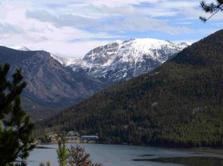
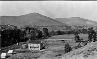
Granby was settled in 1904 and incorporated the next year.

Granby Articles

100 Years of Location, Location, Location

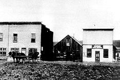
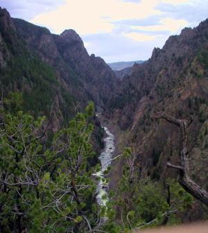
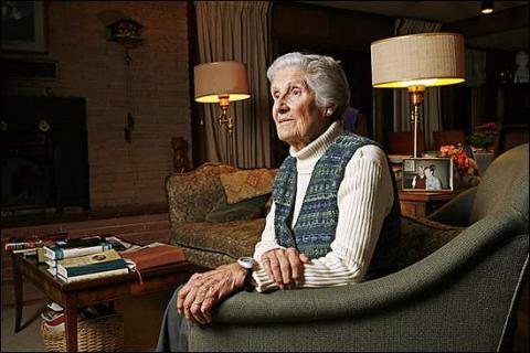
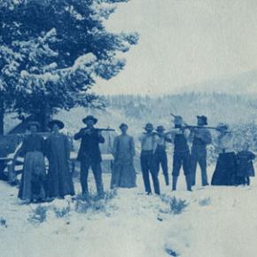
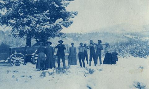
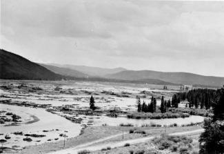
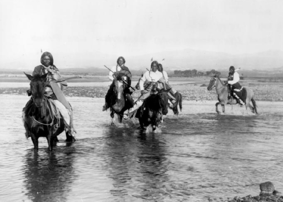
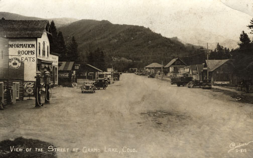
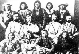
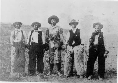
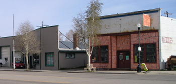
Real Estate and land ownership have always been important to the Granby area. With the passage of the 1862 Homestead Act by Congress, the West, including the area around the current town of Granby, began to be settled with hardy, ranching pioneers. The opportunity to own land was often made possible by homesteading.   This lured many settlers to the area.

As Congress adjusted the homesteading rules over the years to allow for larger acreages which would support ranching in the Middle Park, towns began to grow. Ranching, mining and especially the railroad fueled the growth. In 1902, railroad visionary, David Moffat, set events into motion in Denver to build a steam railroad from Denver to Salt Lake City which would be built over Rollins Pass.   This was a monumental task which led to the founding of the town of Granby.

Mary Lyons Cairns observed in her book, “Grand Lake in the Olden Days,” “Granby came into being with the Moffat Railroad, which reached that point in September, 1905. The town site was laid out on a piece of land which was part of a homestead and part of a pre-emption taken up by James Snyder from the government. Mr. Snyder sold this land to David Moffat who had the town site surveyed and platted in 1904, and a man named Hunter auctioned off the lots.”  

The lots on the town plat were 12 blocks and a Block “A.” Each block, except Block 12 and “A,” would have 32 lots. Each lot would be 25 feet by 125 feet. Block 12 only had 20 lots. Block “A” only had four smaller lots. David Moffat and the railroad in the form of the Frontier Land and Investment Company designed the town streets so that the southern boundary of the town was Agate Avenue, the western was First Street, and the northern boundary was Garnet Avenue. A variation in terrain in between Block 12 and Block “A” created Opal Avenue that would lead down Fifth Street which would be the eastern boundary of the new town of Granby.    

The new town streets were named Agate, Jasper, Topaz, Garnet and Opal, all precious gems which might reflect the mining heritage. But, in the King James version of the Bible in the Book of Revelation, Chapter 21, Verse 19, heaven is described as, “And the foundations of the wall of the city were garnished with all manner of precious stones. The first foundation was jasper…” Other streets and foundations are described as being made of precious gems such as topaz and chalcedony. Agate is described in the dictionary as a variegated variety of quartz or chalcedony.   Maybe the founders thought Granby was “heaven on earth.” Or, at least the real estate marketers wanted buyers to think that.

The real estate advertising in the December 16, 1905, Grand County Advocate showed V.S. Wilson as the local real estate agent for Granby. He also was the newspaper editor and became Granby’s first mayor on December 11, 1905. With that background, hyperbole and adjectives must have been in his blood.   “Now is the time to buy property at Granby-The newest and best town on the ‘Moffat Road.’…It would be a Happy Christmas investment. Do it now,” was part of the ad copy.  Mr. Wilson became one of the first land owners in Granby buying lots 18 and 19, Block 7 on Topaz from Frontier Land & Investment in November, 1905.  

When the railroad’s real estate company founded Granby in 1905, local historian, Betty Jo Woods, said the new town location was chosen because it had great connections with the stage route to Grand Lake, was mostly dry ground, and had pleasant views. As they say in real estate, the three keys to successful land investing are “Location, location, location!”   The locations of many of the historic buildings were on the north side of Agate Avenue. According to photographs and written explanations by the late Vera Snider, in 1920, on “main” street, one of the only buildings on the south side of the street was the firehouse which protected the fire pumper and hoses. The post office was also on the south side.   Vera Snider later arranged for the preservation of this historic structure built in 1910 by moving the first post office building in the 1960s from 458 East Agate where it had stood for over 50 years to its present location at 170 2nd Street.

According to the current owner of this historic structure, Deb Brynoff, “When Ron, my husband, was remodeling he found old letters in the wall from when it was the post office building.” It was not unusual during the early years of construction for letters and newspapers to be “stuffed” into the walls to help increase what little “R-factor insulation” existed.    Other early buildings which still exist in Granby are a home at 127 4th Street which was built in 1909. The current Re/Max Granby office at 247 Agate was a home originally built in 1909. Other early Agate Avenue buildings still thriving are Crafter’s Corner at 295 East Agate built in 1913 for the Granby Mercantile. Local lore says the basement was used as a temporary morgue during the 1918 flu pandemic. However, no historic research has yet been found to document this information.  

Research on High Country Motors at 277 East Agate reveal it was originally Middle Park Auto which grew up with the town of Granby. The tax rolls indicate 1913 for the birth of this building. The business was “born” in 1915 when Jack Schliz founded Middle Park Auto. During Granby’s early years this was a hub for locals. It even included a small medical-first aid station inside it before Granby had any local medical services. In 1938, the business was sold to Glenn Pharo and Morris Long. Later, Jack Shield was associated with the business. The authorized Ford dealership was later purchased by Fred Garrett, who later sold it to Mike and Kimberly Garrett.   The only constant on Agate Avenue is change. Many of the buildings have a colorful past. For example, the current location of Brown & Company at 315 East Agate was a Texaco Service Station built in the 1930s.

The Long Branch at 185 East Agate is in a building that was Granby’s first strip mall. That accounts for the many doors fronting on to Agate. Built around 1938 for the Craig’s Café, it has housed Olson’s Café, a Laundromat, a barber shop, The Carpet Wagon rug store and Maureen’s Clothing Store to name a few.   The Silver Spur Saloon & Steakhouse at 15 East Agate used to be the Grand Bar and Café run by Dick and Beulah Samuelson from 1944 to 1964. The original business at this location was the lettuce shed where the famous Granby Iceberg Lettuce was delivered by local growers for shipping to the Broadmoor Hotel in Colorado Springs. Some of the original lettuce shed has been incorporated into this building.  

The Dick Samuelson family also has a history with the Granby Mart at 62 East Agate. This building at one time was the home of Bud and Ken Chalmers’ Auto Repair Shop. In the early 1940s, it had a dirt floor when Sonny Samuelson and his Dad bought it. Clyde Redburn had a bowling alley on one side. The Samuelsons later put in more bowling lanes. Upstairs they had a club called “3.2.” At the time, those 18 and older could sip the 3.2 beer served there and dance. At one time Wayne Snyder’s Saddlery shared half of the store.   Sharing a location was the thinking behind the former Minnie Mall located at 480 East Age. Named by local businessman, Jack Applebee, for his mother, Minnie, in the 1980s, many businesses enjoyed the convenient location, The Furniture Store, Hobby Shop, Montgomery Wards, Honey Bear Children’s Clothing, Fabric Nook, Greg Henry’s Get-N-Pack, Radio Shack, Julie Sneddon’s Cards and Gifts, Patti Applebee’s Nimble Needle, Ben’s Aspen Leaf Café and the Shaft Shop which specialized in darts and dart supplies. Today, Granby Medical Center-Centura Health is at this historic downtown location.  

Granby’s historic story from 1905 to 2005 is one of building dreams, homes and businesses to create a community. Chinese Proverb says, “One generation plants the trees; another gets the shade.” How true.
2005


Historic Granby Real Estate

William Shakespeare, the historic play writer, said, “There is a history in all men’s lives.” The same could be said for many Grand County buildings. According to author, Lela McQueary in her 1962 book, “Widening Trails,” real estate sales and land giveaways helped to build our towns. “In 1905, a town site was obtained from Jim Snider, who had homesteaded the land upon the sagebrush mesa,” wrote McQueary. “The village was called Granby for Granby Hillyer, a civil engineer. Two general stores, two livery stables, a post office and a tiny café (all built with false fronts to make them appear much larger) were scattered on the north side of Main Street, three blocks long.”  That Main Street today is Agate Avenue. A quick search of the Grand County tax rolls reveals an interesting historic mix of buildings.

For example, the current Brynoff home at 170 2nd Street was the Post Office building constructed in 1910 and originally located at 458 East Agate. That building was moved to its current home to make way for the construction for the new Post Office building in 1945 at 458 East Agate. Deb Brynoff, the Executive Director of the Grand County Board of Realtors, said, “When we updated and built onto the original building, we found old letters stuffed in the walls. Obviously, they used them in the early years to add insulating value. I guess they had junk mail even then!”

On July 1, 1966, a new Post Office building was dedicated at 225 East Jasper Avenue (now the current home of the Grand County Library District Administrative Office). According to Granby-area Realtor, Susie Peterson of Glenn Realty, who used to own the building at 458 East Agate when they converted it to the Granby Veterinary Clinic, “Downstairs was full of those neat glass front post office boxes with the gold dials. You can just imagine the history in that building.”  Other buildings constructed in those early years were 127 4th Street in 1909. In addition to a private home, over the years, businesses such as Re/max Real Estate and Katie’s Flower Shop were located at 247 East Agate, which was also built in 1909. In 1910, the property at 110 Garnet was built.
The Roaring 20s saw a spurt of construction such as 172 Topaz (1922), 307 Jasper and 59 4th Street (1924), 166 Jasper and 291 Topaz (1929). The current Columbine Café property at 395 East Agate was built during the heydays of 1927 when it was called the Town Crier Restaurant.

After the Great Crash of 1929 and the Depression of the 1930s, New Deal jobs and loan programs helped fuel new construction. In fact, in 1933, the famous Payne’s Café was built at 365 East Agate. Today, the Greater Granby Chamber of Commerce and Downtown Enhancement offices, along with Noriyuki & Parker law offices are housed in the almost 75 year-old building.

Today’s Shadow Mountain Chiropractic Clinic of Drs. Jeff and Deb Shaw at 60 2nd was built in 1935 as a private home. On April 18, 1935, the first addition to Granby helped the town grow. In 1938, 387 East Agate was the site of the new pool hall run by Alva West. Today Lorene Linke’s Fabric Nook welcomes customers and quilters at the historic location.

In 1938, the building at 185 East Agate, which was Granby’s first strip mall, also was constructed with Craig’s Café, later Olson’s Café. Over the years businesses such as Maureen’s Clothing Shop, a laundromat, a barbershop and the Carpet Wagon found homes where today the Longbranch and Schatzis Pasta & Pizza Restaurants are found.

Post World War II America and Granby boomed. Granby had an influx of new residents because of the continued construction of the Granby Dam and the Colorado Big Thompson Water Project. In 1946, the Granby Dairy Building at 106 Jasper sprung up. That same year, Carmichael Real Estate Company built a new office at 191 East Agate. Today real estate is still king at that corner building with the Grand County Board of Realtors and The Title Company of the Rockies offices located there.

The Granby landmark, Frontier Motel, at 232 West Agate was built in 1951 by Earl Saylor. In 1954 Jenkins & Fulk began construction of the Granby Trading Post at 231 East Agate. Ken and Debbie Eaker and Jay Young bought that property in May 1995 and renamed the store, The Grand Mountain Trading Company.  

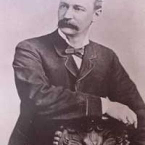
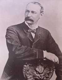
The Naming of Granby

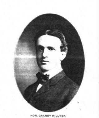
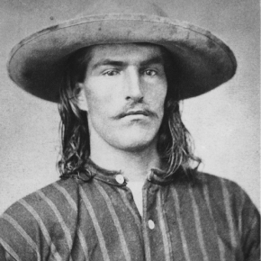
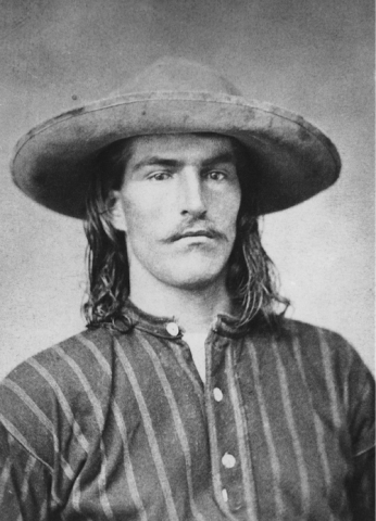
Granby Hillyer was born in Cartersville, Georgia on July 7, 1874. The third of six children, born of Shaler Granby Jr. and Lelia (Holloway) Hillyer, and the grandson of the Rev. Shaler Granby Hillyer, Sr. who was born in Granby, Hartford County, Connecticut. When Granby was 13 years old the Hillyer family moved to Washington, D.C. where Granby graduated from public high school. He then entered government service and at the same time studied at George Washington University, receiving a Bachelors of Law Degree. A postgraduate law degree was awarded in 1896 from Columbia University School of Law. He moved to Colorado in 1898 settling at Lamar (Prowers  County) launching a 40+ year legal career. On June 16, 1900 he married Miss Annie Creaghe, from a prominent southern Colorado pioneer family, and a daughter of an Apache County, Arizona sheriff. To this union were born 3 children St. George Creaghe, Granby Francis Ridgeway Jr., and Helen Edna Dolorine (Jane) later Mrs. Albert Hunt of Boston, Massachusetts.

Granby Hillyer was a member of the Republican Party. He served as Lamar City Attorney, Prowers County Attorney, and Deputy District Attorney. He was also affiliated with the Elks, Masons, Sons of the American Revolution, and Woodmen of the World fraternal organizations.

At 28 years of age, the citizens of Prowers, Baca and Las Animas Counties, elected Granby Hillyer to serve in the 14th Colorado General Assembly, House of Representatives, making him one of the youngest elected officials in state legislature history. He served one term from 1903-1905. During this tenure he plotted the streets at no cost for the Frontier Land and Investment Companies newest town on the Denver, Northwestern & Pacific Railroad (The Moffat Road). In doing so, Mr. Hillyer was honored by having the Town of Granby, Grand County, Colorado named for him.

Governor Carlson appointed Mr. Hillyer as the Third Judicial District Court Judge, at Trinidad, Colorado from 1914-1916. Her served as the United States Attorney for Colorado from 1922-1925. Afterwards he enjoyed a large private law practice in Lamar and Denver.

In 1928 at Lamar, Granby Hillyer was a speical prosecutor in the "Fleagle Gang Case".  On May 23rd, the First National Bank was robbed, resulting in the loss of four lives.  The case has been credited by the F.B.I. as the first robbery solved from a single fingerprint.

The Denver Post on July 21, 1931 page 9, reported "Granby Hillyer Is Disbarred By Federal Courts." In a decision reached by the United States Circuit Court of Appeals, predicated by a Colorado Supreme Court tribunal, of neglecting the interests of his clients in a number of cases.

Tragedy then struck the Hillyer family twice with the loss of St. George Creaghe in June 1932 and October 1933, Granby Jr. was killed in an automobile accident near Lamar. They both were attorneys. St. George and Granby Jr. were born 16 months apart and passed away 17 months apart. Both funeral services were held at the Immaculate Conception Cathedral in Denver, with the same set of pallbearers for both young men. They were laid to rest at Denver's Fairmount Cemetery. Their father Granby Hillyer, joined his sons on January 2, 1942, passing away at Denver Mercy Hospital, after suffering a heart attack at age 68.

The name Granby also comes from Great Britain, one of the original references was for the "Marquis of Granby," John Manners. A Member of Parliament from 1754 until his death in 1770, he also was a popular army officer and hero of the Seven-Year War 1756-1763, obtaining the rank of Lieutenant General. In 1766, he was named British Commander-in-Chief of the Army. John Manners once had his hat and wig shot off during a cavalry charge, thus leading to the British expression, "to go baldheaded at something." He had his office attacked by the pseudonymous political writer "Junius." The Marquis of Granby resigned most of his offices and died in debt.

Curiously, Granby Hillyer had an uncle and a brother named Junius.

Articles to Browse

Topic: Monarch

Monarch: Grand County's City of Atlantis

Monarch, now a picturesque lake for meandering around on a pleasant summer day, was once a bustling town, the home of the Monarch Consolidated Gold and Copper Mining and Smelting Company, and the rail head of the Rocky Mountain Railroad.  The life of this little company town and railroad was very short lived and now nearly forgotten. 

Boulder business men T.S. Waltemeyer, and Frank and Charles A. Wolcott heard about traces of gold, silver, and mostly copper at the junction of the Arapahoe Creek and the South Fork of the Colorado River.  In 1905 they established the Monarch Consolidated Gold and Copper Mining and Smelting Company and built their company on the assumption that a major belt of minerals extended east through the Continental Divide.  The Monarch Company consisted of several subsidiary companies including lumber companies, an "investment" company, an exploration company, and a development company.  The main objective of the company was to mine metal ores, but supplement it with timber and build a railway to benefit the whole corporation. 

The company had 1740 acres of placer and lode claims; the main mines were the Copper King, Copper Queen, Omaha, Ella C., and High Lonesome. The Monarch Company shipped heavy machinery by flatbed cars to Granby on the new Moffat Road.  They then put an ad in the paper asking for bids to haul heavy machinery 16 miles from Granby to Monarch.  The machinery included "5 boilers (eight and a quarter tons each), one engine (over eleven tons), one flywheel (6 tons), other machinery (from 1 to 5 tons), a carload of nails, and several hundred pounds of miscellaneous supplies."  The task of hauling the heavy equipment was made especially difficult by mud-holes and bridges not made for heavy loads.  Denver hauling companies refused to take on the job and one Swedish logging company from Wyoming abandoned the challenge after the first wagonload stuck in a mud-hole.

Finally Dick McQueary agreed to move the machinery.  To accomplish the job, McQueary purchased several hundred feet of hardwood planks in Denver, 3 inch thick, sixteen inches wide and twelve feet long.  Accompanying the heavy pieces up the mountain was a "4 horse team hauling hardwood plank, a 4 horse team pulling six inch pine poles, 10 feet long, and a four horse team pulling two ton large nails".   The crew built temporary bridges across mud-holes by laying pine poles 3 feet apart with hardwood planks laid across the poles.  2 light loads were driven across to test bridge followed by the heavy load pulled by 12 head horses.  Finally the planks and poles were pulled up to be used at the next mud-hole.  The heavy machinery was hauled in 2 weeks.

Construction on the Rocky Mountain Railway, a standard-gauge line from Granby to Monarch, began in 1907.  The 16 mile line was completed by Thanksgiving.  There were hopes of someday extending the line to Grand Lake for resort passengers and eventually a line to Walden in North Park.  The Denver and Northwest Railroad Company helped survey the line by lending J.J. Argo's services.  Dick McQueary was once again brought in to grade the road bed between the Monarch mill and Granby.  Most of the workers on the railroad were Japanese, Bulgarian, Hungarian, and Austrian day laborers from an employment agency in Denver.  The laborers were paid $2 a day, (plus a fifteen cent fee for their interpreter).

Once the railway was completed and in operation it issued passenger tickets.  However, the company never published a schedule.  Neither did the company hire a full train crew to run their single locomotive.  To meet regulations for switching service on Moffat tracks in Granby, the Rocky Mountain Railroad took on board a couple of interested bystanders.  At gates crossing ranch properties fireman Leo Algier would simply jump off the train to open the gate and close it after the train had crossed through before hopping back on the train.  Ranching families on the line were allowed to catch rides on the train when it passed through or to request package drop-offs. 

The Monarch Company created Monarch Lake by damming the valley, at the junction of Arapahoe Creek and South fork of the Colorado River, for use with the saw mill and the box factory. A 2800 foot long chute carried tree trunks down the hillside to the lake where they hit the water and could bounce up to 50 ft high.  Then a stern-wheel steamer pushed logs into a system of canals and flumes that led down to the saw mill and box factory. 

The town of Monarch included employee housing, business offices, a post office, and an assembly hall.  Dick McQueary helped haul sawlogs to mill and haul materials for building employee housing in Monarch.  Grand County's first hydro-electric generator was in Monarch.  The waterworks system was created by piping water from the falls at Mad Creek and had pressure up to 300 lbs per inch. 

Even thought the mining company never produced more than $150 a year, the owners continued to promote the business to stockholders and they were able to keep the business running by through their enthusiasm for the project.  During the summer, stockholders were invited to visit Monarch, tour the site, and hear lectures on the operation.  The tour often included a visit to a spruce tree named "Monarch" that was seven feet in diameter.  So, while business might not have been booming, enthusiasm and interest from stockholders was.  

The last piece of Monarch to be constructed was the box factory in 1907.  Unfortunately the factory only operated for 2 or 3 months before it suffered a fire and was totally destroyed.  Robert Black in Island in the Rockies stated that the questionable promotions of Monarch would have been forgiven if the box factory had developed into a solid operation. 

Soon after the fire, a disagreement between management and labor resulted in the entire work force being fired.  For several months the Rocky Mountain Railroad operated the train with one man who acted as engineer, fireman, brakeman and conductor. The company hired Dick McQueary as general manager until fall the fall of 1907 when stockholders discovered the true state of the company and declared bankruptcy.   Stockholders and the community were convinced that the whole company had been created as stock-selling scheme.

Although the Monarch Company and the Rocky Mountain Railroad were no longer in business, the railway continued to be used for a number of years.  For example, Ed McDonald, dude rancher, put a Cadillac touring car on flanged iron wheels to carry mail, supplies, and guests to his ranch.  The center of town was preserved and developed by the Dierks as a summer resort called Ka Rose, after Katherine Rose Dierks, after the owner's daughter.   In 1912 the rail line was used for transporting fisherman along the river by Ernest F. Behr, a former Colorado and Southern engineman.  Finally, in 1918 the rails were sold to a junk dealer in Denver to satisfy the World War I need for scrap metal. 

Currently, the town, mill site, and box factory lay under the waters of Lake Granby and are inaccessible, except in years of draught.  However, there are a couple of remaining pieces at Monarch Lake that are still visible.  On the south side of the lake, near the water's edge, is a boiler that was used to yard logs into a chute and shoots the logs into a holding pond.  Also, the flume still runs down the hillside into the lake.  The trail around Monarch Lake takes hikers directly under the flume.

Ute Legend of the Quaking Aspen

It is amazing to behold the continuous quivering of aspen leaves in groves around Grand County, even when there is no apparent breeze.

According to Ute legend, the reason for this unique aspect of the aspen tree happened during a visit to Erath from the Great Spirit during a special full moon.  All of nature anticipated the Spirit's arrival and trembled to pay homage.  All except the proud and beautiful aspen. The aspens stood still, refusing to pay proper respect. The Great Spirit was furious and decreed that, from that time on, the aspen leaves would tremble whenever anyone looked upon them.

Grand Lake's First Fireboat

During the summer of 1960, Jeff E. Fuller and Don Drake formed Mountain Services Inc. to offer Grand Lake shore owners protection by patrolling the properties.  In May of 1961, Don Drake promoted the idea of a fireboat and with donations, a 1960 18 foot Buehler Turbocraft Jet 56 was purchased and equipped to fight fires. Don tested the water jet and found that it would pump enough water to reach the fourth story of the five story-14 bedroom Oscar Malo home. 

Ironically, on September 10, 1961, that very home caught on fire.  The home was completely engulfed by the time Don got the fireboat to the location but, with the help of Elmer Badger and Jerry Gruber, they concentrated on the 4-slip boathouse.  The heat was so intense it melted the plastic trim on the fireboat but the boathouse was saved and still stands today.


Topic: Health Care

Health Care

In its earliest days of settlement, Middle Park area residents and travelers doctored themselves using whatever remedies they were able to concoct on the scene of accident, illness, or injury.  The cure might have been a poultice of herbs, bread, oil, mustard, or something called Raleigh’s Ointment.  It might have been a dip in the medicinal springs at Hot Sulphur, a dose of iodine, arnica or vinegar, castor oil, Epsom salts, or any number of other standbys.

The first “doctors” known in the area were Dr. Hilery Harris (1874 or 1876) and Dr. David Bock (1876); both were “self-certified”.  Dr. Harris had a predilection for the treatment of animals, while Dr. Bock treated the medical and dental needs of the people. By the mid-1880s, there were a number of doctors traveling through the area, working for various entities and setting up private practices.  During the mining boom, there were a number of physicians and surgeons in Teller City, which was then a part of Grand County.  

Around 1900, the Dunphy and Nelson Contracting Co, a construction firm building roadbeds through the Fraser Canyon for the Moffat Railroad employed Dr. John Wills as company physician.  By 1903, the Denver, Northwestern and Pacific Railroad employed Dr. Leonidas Wills, cousin to John Wills, for its employees and families.  These types of company jobs provided regular work as well as regular pay for doctors who otherwise would have had little in the way of compensation for their work.

Many of the doctors found themselves moving from community to community as the working community moved--from the Fraser Canyon to the Gore Canyon to lay roadbed, or from one logging area to another.  Later, work flow was based on government projects such as the construction of the Moffat Tunnel and the Alva B. Adams Tunnel, both of which went back to the old tradition of having a company doctor.  By the time of the coming of the Moffat Line to Grand County, most of the communities had drug stores, many of which were owned solely, or in part, by the local physicians. There, people could avail themselves of all types of patent medicines, drugs, toilet articles, soaps, perfumes, and sometimes even a drink at a soda fountain.

It was common for surgery to be done in the home of the patient, or the doctor.  Only occasionally, for the worst of illnesses or injuries, did the doctors attempt to transport patients over the Continental Divide to a Denver hospital.  Childbirth was almost always in the mother’s home, under the watchful eye of a female neighbor, or a midwife, and  rarely with a doctor in attendance.

Dr. Archie Sudan built a medical facility in Kremmling and Dr. Susan Anderson remodeled a barn in Fraser to accommodate her patients. Often it was the wife of the doctor, who might be a nurse, who attended the patients.  Many of those in attendance were trained by the doctor in charge; some went on to attain certifications as Registered Nurses or other professionals.

In June, 1947, the Middle Park Hospital Association held a fundraiser to undertake hospital improvement.  The first $20,000 raised went to buy the home/hospital of Dr. Archer Sudan.  In total, the group raised between $35,000 and $70,000 to purchase, remodel, and outfit the facility, which was intended to serve all of Grand County, most of Summit County, and parts of Eagle, Routt, and Jackson counties. The hospital had four private rooms, three wards for six patients each, living quarters for hospital personnel, an office, exam room, operating room and an x-ray room.  Dr. Ernest Ceriani was the first physician for the new facility.

The local rural physicians often called on their colleagues in the city for assistance with difficult cases.  They arranged for specialists to visit, consult and perform surgery, saving the patients and their families hospitalization in Denver.  Just as today, the need for specialized care presented special difficulties for the rural physician of the early days.

The list of physicians, surgeons, dentists, osteopaths, and veterinarians who served Grand County is lengthy, but the most famous are Dr. Susan Anderson (Fraser), Dr. Archie Sudan (Kremmling), Dr. Mac Ogden (Granby and Kremmling), Dr. Ernest Ceriani (Kremmling), and Dr. James Fraser (Grand Lake).  “Medical Practices in Early Middle Park-Grand County” includes extensive information on each.

Topic: Places

Place Names

Article contributed by Kathy Zeigler

The County of Grand was established in 1874, taking its name from the Grand River which has its headwaters in the county, and from Grand Lake, the largest natural body of water in the state of Colorado.  The county seat is Hot Sulphur Springs.  The area of the county is 1854 sq. mi., making it larger than the state of Rhode Island.

Fraser was established in 1871 as the town of Eastom.  Its name changed to Fraser, after the river that flows through the town, though it was originally spelled Frazier, for Reuben Frazier. The Post Office adopted the simpler spelling at the establishment of the Post Office.  The town bore the distinction of being the "icebox of the nation" for many years, losing that title in a legal battle with a town in Minnesota.

Granby was established in 1904, taking its name from Granby Hillyer, a Denver attorney who may have been associated with the founding of the town.

Grand Lake was established in 1881 as a mining settlement by the Grand Lake Town and Improvement Company, taking its name from Grand Lake.

Hideaway Park was established approximately 1905, and named for its hidden location with the trees screening it from the road. It may have been earlier known as Woodstock, Vasquez and Little Chicago. Max Kortz, owner of a dance hall in the village is said to have provided the moniker. 

Hot Sulphur Springs was established in 1860 and named for the hot springs.  It may have been refered to as Sulphur Springs in its earliest days, and as Sulphur by the workers and management of the Denver and Salt Lake Railroad when it came through in 1904.

Kremmling was established in 1881 as a general merchandise store, owned by Kare Kremmling on the ranch of Dr. Harris, located on the north bank of the Muddy River. In 1888 John and Aaron Kinsey had part of their ranch platted, calling the site Kinsey City. Kremmling moved his store across the river to the new site; eventually the town came to be known as Kremmling.  (Note the two different first names-Reuben Kremmling and Kare Kremmling.  I'll keep working on that discrepancy.)

Radium's name was suggested by Harry S. Porter, prospector and miner, in reference to the radium content in one of his mines.

Winter Park was first known as West Portal, a settlement that grew up during the construction of the Moffat Tunnel in the 1920s.  Postal authorities agreed to the name change to Winter Park, after a request was made by Denver mayor Benjamin F. Stapleton and many sport enthusiasts to publicize the establishment of a top winter sports area.

Berthoud Pass, el. 11314, was named for Capt. Edward L. Berthoud. Berthoud discovered the pass in 1861. He was also chief engineer on the Colorado Central Railroad.

Gore Pass, el. 9524, was named for Sir Charles Gore, who mounted a monumental "hunt" to the American West during the 1850s. Gore spent considerable time in the area, and gave his name to the Pass, a mountain range, and a canyon.

Milner Pass, el. 10759, was named for T.J. Milner, and accomplished civil engineer for railroads and street car lines.

Muddy Pass, el. 8772, bears the name of Big Muddy Creek, a tributary of the Colorado River, with reference to the muddy appearance of the waters during the spring runoff and storms.

Rabbit Ears Pass, el. 9426, refers to Rabbit Ears Peak, whose outcroppings somewhat resemble a rabbit's ears.

Willow Creek Pass, el 10850, is named for the stream, and almost certainly for the willow bushes that line the banks of the stream. The pass was a well known Indian trail, and became a road in the early 1900s.

Source: Eichler, George R. Colorado Place Names. Boulder: Johnson Publishing, 1977.

My Granby, Little Old Log Church

Contributed by Vera "Stathos" Shay, Kremmling...Granby resident 1930-1945

From what I hear

It is very near

To be torn away

The little church of my childhood day

The most beautiful to see

That can ever be

Inside and out

Without a doubt

Built of log so fine

In the style of old time

In my own little chair

Every Sunday I was there

The chime of its bell

For miles around

Heard its wonderful sound

For a while our school

We didn't fit

So in our church were classes

For a bit

Beside our church on the hill

We sledded for a thrill

That poor little church

They moved it around

All over town

Proudly it's hung together

In all kinds of weather

Every time I go to Granby town

I look around to find

And have a look

At my log church for my eyes'

Memory book

Now they say it's got to go

Pray it won't be so

All of you Granby folk

Louder you should have spoke

To save that church with its

Memories and history

For there could never be

Anything that would compare

Built or put there

With my magnificent, beautiful

Childhood Granby log church

Find it in your hearts

To never let it be torn apart.


April 2005


A Man Called Blue

“Blue” should have been a grouch, with a name like that.  Nobody who knew him seems to know why he was called this; his real name was Rudolph O. Cogdell.  If one went into his little grocery store in Fraser, although his voice was gruff, he gave a peasant greeting.  He did possess a temper that could be ignited, and if his blood pressure rose, his face turned a brilliant red. 

However, he was kind to his wife, Gladys (Hunnicutt), a local girl, and loving to their daughter, Mary Ellen, who was a “late-comer” (Gladys was over 40 when the baby was born).   On the store front, the sign read Codgell’s Market, which was located facing the highway near what is now Doc Susie Avenue.  Before Blue bought the store in the mid-1940’s, he worked on the Fraser railroad section, and he also owned the Sinclair gas station at the corner of the highway and the main street, about 1940.  

Codgell’s Market was quite small, and the customer base was likewise, for there weren¹t many people in the valley in those days. Three grocery stores competed: R.L. Cogdell¹s Market, The Fraser Mercantile, owned by Frank Carlson, and the Red & White Store, run by Charles Bridge, Sr. There was also a tiny store by the sawmill near “Old Town” Winter Park; that one was operated by Mr. and Mrs. Green.  The economy struggled for many years after the war, and everyone lived on a shoestring.  Thus, prosperous times for any of the grocery stores had marginal potential.  That should have made Blue grumpy, one might think.   Blue, a short, rather stocky man with dark hair and brown eyes framed in glasses and habitually clad in his grocer’s apron, took care of everything in his mercantile except for the meat counter at the rear of the store.  He would be found arranging the goods on shelves, dry goods on one side, dried food on the other, and fresh food in between.  He stored some of the dried foods in barrels along the aisle. Fresh food was picked up once a week.  It was, of course, very seasonal, with only root vegetables, apples, oranges, and bananas being available year-round.

Granby Dairy delivered dairy products; Rube Strachman in Granby sold him meat.  Nobel Mercantile from Denver serviced the dried foods and produce.   Gladys, even shorter and stockier than Blue, had a fiery temper and she was known on occasion to retaliate if some customer gave her any lip.  She was an expert butcher, and if a person wanted some special roast or other cut of meat, he went to see Gladys.  She was good.  Mary Ellen helped when she could, as she grew older.   When the theater, located on the corner of Highway 40 and St. Louis Ave., or Main Street (now Eisenhower Drive) in Fraser closed its doors, Blue bought the building, doubling his available space.  The layout was the same and Gladys still manned the butcher department at the rear of the store. Walking into the long skinny building always brought to mind the movies of previous days. 

The economy improved as the ski area grew.   It was a fact that Blue, although a hard worker, also loved to gamble, and one report speaks of certain crap games.  It seems that there was a stretch of track inside one of the tunnels in the Fraser Canyon that would rise with the frost every winter.  When this happened, section hands from Fraser and Tabernash, including Blue in those days, had to go into the tunnel, removed the rails, dig out the hump, and replace the rails.  While the men were at it, they would take time for those crap games.  A good deal of gambling occurred at the Red & White Store too. Carlson, Cogdell, and Bridge often had poker games, where the losses were considerable on occasion.  If he lost, did that make Blue blue?  We don’t know.  

In any case, Blue and Gladys took separate vacations.  Perhaps he went to gambling towns like Las Vegas; on the other hand, perhaps one of them just had to stay home and mind the store.   Every Christmas season, Blue wandered over to the Fraser School to find out how many children were enrolled this year.  It was Blue who furnished al the fruits, nuts, and candies for paper sacks to be given out to each child by Santa Claus at the end of the Christmas program.  This was a town affair and nearly every person in town attended, sitting if there was room, standing against the walls of the gym if there wasn’t.  Nobody cared to miss the play and singing performed by every single child in the school.  PTA mothers filled the goody bags.  Few people were aware of Blue’s generosity.

Topic: Towns

Parshall

The town-site of Parshall was part of the ranch homesteaded by Fred Dean in the 1880s. Before 1900 the ranch belonged to William Byers, founder of the Rocky Mountain News and town of Hot Sulphur Springs. In 1902 Frank Byers, son of William Byers, sold the ranch of 480 acres to Cordelia and Simon Parshall.   

Cordelia Parshall died on March 30, 1904, leaving the ranch to her son Clyde. In 1907 Clyde sold 60.6 acres of the northeast corner of the ranch to Alonzo F. Polhamus, a civil engineer. Polhamus dedicated the town plat to Grand County on July 26, 1907 and named it for his friend and the Parshall homestead. The original primitive store operated by Walter Dow was the drawing card for visitors. Parshall was the headquarters of the “Williams Fork Telephone Company,” a highly informal operation that is said to have transmitted its subscribers’ voices along barbed wire fences.

The town was never incorporated and today still has a bar and restaurant, a post office and a chapel, plus the Grand County Road and Bridge Dept. District 3 maintenance shops. Population varies seasonally between 75 and 90 people.

Edits and corrections to original posting by Don Dailey, 10-2021.


Topic: Mountains

Rollins or Corona - What shall it be called?

Travel across various passes of the Continental Divide occurred long before white men showed up. Indeed, as anthropologist James Benedict wrote c. 1975, some 10,000 years ago, prehistoric Indians camped, hunted, and built hunting walls on the upper reaches of Rollins Pass, as well as moving in and out of Middle Park for the warm summer months.

Historic Indians followed the same paths. In the earliest days of non-Indian access, a particular pass at the head of Boulder Creek was dubbed Boulder Pass. Capt. Jacob Bonesteel, including wagons, made the first recorded crossing by a white man at this point in April 1862. Three years later, a group of Mormons brought wagons over this route and a year later, promoters of new roads into Middle Park brought in many wagons and livestock.

In fact, tourists were starting to enter the park by a number of routes, and one of them, Samuel Bowles, who wrote a fascinating account of his trip, including his return to Denver via Boulder Pass. Interest was growing rapidly for a road over the Divide, into Hot Sulphur Springs, and on into Utah. One promoter, John Quincy Adams Rollins, from New Hampshire, teamed up with William N. Byers and Porter M. Smart to carry this project through. Rollins was interested in crossing the Divide; Byers was promoting the Springs; Porter wanted to develop the valley of the Middle Yampa. All three were pushing to have Middle Park officially named as Grand County, a challenge finally accomplished in 1874. So Rollins and associates started his road, reaching the top in 1873.

That next winter, they publicized this access and in June, Jimmy Crawford brought his family and wagons to Rollinsville and thence to Yankee Doodle Lake, ready to cross the pass now named Rollins Pass by the developer. But the road ended, and they found Rollins' men still hacking the road out of the granite! Jimmy and his crew found it necessary to leave their wagons and help. Finally, on June 10th, the family was able to head for the top. Jimmy borrowed two yokes of oxen, hitching them to mules, and then to his horse. The road was so rough that the procession could proceed but a few feet before having to rest. The family itself climbed on foot. At the summit, they discovered only a rough swath cut down through the trees on the western side. The "road" dropped down between the lakes and followed Ranch Creek to its junction with the Fraser River.

Rollins quickly realized that Berthoud Pass, which also opened in 1874, was superior to his own pass for wheeled vehicles, so he determined to hedge his bets. He initiated the first mail service into the county in 1873. He also built a commodious hotel where his road joined the Berthoud Pass road at the confluence of Crooked Creek and the Fraser. He called it the Junction House. Next, he proposed to the builders of Berthoud Pass that they form a joint ownership of the two roads between Junction Ranch and the Springs. Tickets would be issued for both routes and revenues would be shared. The two companies would build a bridge over the Grand at Hot Sulphur Springs. He even buttered up his rivals by complementing their work. All this was accomplished, although the mail route soon moved to Berthoud Pass, because of the severe winters on Rollins Pass.

The bridge was started in November 1874. From the beginning, Rollins' road was preferred for trailing livestock, because there were fewer problems with heavy timber and bogs. For years, the Church brothers, George and John, who introduced the Hereford breed into the county, trailed their cattle for summering in what became known as Church Park. However, tourists such as Irving Hale still drove wagons over Rollins Pass in 1878. About 1880, interest burgeoned for bringing a railroad up South Boulder Canyon and through a tunnel near Rollins Pass. Numerous surveys were completed all along the area. David Moffat settled on Rollins Pass for the tunnel site but decided first to put a temporary line over the top.

Thus, in the summer of 1903, a formal contract was let for work up and over the Pass itself. By 1904, the workers reached Arrowhead and they also built a work station on top, called Corona Station, or "crown of the mountain." This railroad construction town of Corona, located at over 11,600 feet at the top of Rollins Pass (first called Boulder Pass) along the Continental Divide was the highest railroad station in the world. It became obvious by 1905 that the Corona area would require snowsheds if trains were to travel, even irregularly, during the winter. Still, word got out of the spectacular splendor of Rollins Pass and tourists flocked in on summer train excursions, sometimes stopping on top, sometimes going as far as Arrow.

In 1913, a fine hotel was built next to the rail facilities. Because Rollins Pass was right in the middle of severe weather patterns, a weather station was built on top, as well as one down at Sunnyside. In 1915, Rollins Pass was actually proposed to be the south boundary of a proposed "Estes National Park." Later, on the National Historic Register, the district was listed in 1997 as the Denver, Northwestern and Pacific Railway Historic District--Rollinsville & Middle Park Wagon Road. It was also identified as the Rollinsville and Middle Park Wagon Road; Boulder Wagon Road, Rollins Pass, and Rollinsville area. In 1956, Governor Steve McNichols had presided at the official re-opening of the four percent grade to vehicle traffic over Corona Pass, expressing the hope that the route would someday be paved. The Colorado Game and Fish Department and the U.S. Forest Service made additional improvements, and the Arapaho and Roosevelt National Forests put out a 24-page booklet titled "The Moffat Road: A Self-Guiding Auto Tour."

The road crossed two of the original railroad trestles near Corona but those trestles, even if reached by 4-wheel vehicles, were crumbling and could no longer even be crossed safely on foot. The current self-guided auto tour refers to Rollins Pass, as well as the Moffat Road and the Boulder Wagon Road. Corona Station and Hotel are discussed. In 1979, a portion of the auto road over Corona Pass was permanently closed because of a cave-in of the "Needle's Eye," a tunnel located before the trestles heading west from the Moffat Tunnel's East Portal. The tunnel reopened on July 3, 1988, thanks to efforts of the Rollins Pass Restoration Association on both sides of the Divide, with the cooperation of the U.S. Forest Service, Colorado History Society, and Boulder, Grand, and Gilpin Counties. It then closed once more when another rockfall hit the tunnel on July 15, 1990. The RPRA is continuing its efforts for re-opening. The noted photographer, Charles McClure, took many outstanding photos of the Rollins Pass road.

One, titled "Group on Rollins Pass, shows well-dressed men and women stand on a snowfield making snowballs on Rollins Pass, Moffat Road, Boulder or Grand County, Colorado; probably on Denver, Northwestern and Pacific excursion train. Date: between 1904 and 1913 near Corona Station." Another photo shows a "30 ft. snowcut on Rollins Pass, Moffat Road photo. Denver and Salt Lake Arrow passenger car is parked east of Corona snowshed by the thirty foot snowbank cut, Rollins Pass, Colorado; it shows men, women and railroad employees posed behind train, on the roof and on the snowbank and a standard gauge track. Date: between 1904 and 1915." A sign at the highway turn onto the Moffat roadbed says: The Moffat Road "Hill Route" Also called "Corona Pass Road", this road over the Continental Divide was the original "Hill Route" of the Denver, Northwestern & Pacific Railway built by David H. Moffat in 1903. It crosses Rollins Pass at 11,666 feet elevation. On top of Rollins Pass, a sign says: Elevation 11, 660 feet, John Quincy Adams Rollins established a toll wagon road through this pass in the mid 1870's. David H. Moffat's Denver, Northwestern & Pacific Railway crossed the Continental Divide at this point in 1903.

First known as Boulder Pass, then Rollins Pass, the railroad workers dubbed it "Corona", the crown of the "Top of the world." A railroad station, hotel, restaurant and workers' quarters existed here until 1928 when the railroad was abandoned due to the building of the Moffat Tunnel. Identifications in various trail and geographical guides say: Rollins Pass (el. 11,680 ft) is a high mountain pass in the Rocky Mountains of north-central Colorado in the United States. The pass is located on the continental divide at the crest of the Front Range southwest of Boulder, at the boundary of Grand County, Colorado and Boulder County, Colorado. Rollins Pass (a.k.a. Corona Pass) sits approximately 5 miles east and above the popular ski areas around Winter Park, between Winter Park and Rollinsville. The pass is traversed by an unpaved road, mostly the former roadbed of the Denver and Salt Lake Railway which abandoned the route in 1928 when the Moffat Tunnel opened to replace it. Railroad advertising called this the "Top O' the World" and it referred to the Moffat Route over the continental divide and the Rocky Mountains. Rollins Pass was the primary travel route west from Denver until an easier road over Berthoud Pass was constructed. The Denver, Northwestern and Pacific railroad laid its tracks across the pass in 1903-1904 and established a Depot at Corona on the crest. It can be noted that in R.C. Black's Island in the Rockies, the term "Corona Pass" was mentioned one time, on p. 351; the terms "Corona Station" or "Corona Snowsheds were used. In Dismantling the Rails That Climbed, Rollins Pass was used, the Corona hotel, and just once, Corona Pass; 1936.

In Maggie By My Side, it was Boulder Pass and Rollins Pass. In Rails that Climbed, Rollins Pass, the Corona shed, weather at Corona, Rollins Pass Snow Shed, other references to Corona as a site. In Guide to the Colorado Mountains (Orme) , they speak of the Corona Trail to Rollins Pass. High Country Names (Ward) used Rollins Pass entirely. Only Hiking Grand County, Colorado, published 2002 by Carr speaks of Corona Pass, with reference to Rollins Pass (near the town of Corona), Moffat Road. The term "town" might be questionable; there was only a small restaurant, workers quarters, railroad offices, and in 1913, the hotel. Current maps, USFS and the Grand County Trail Map, show Rollins Pass, with Corona at the side as being a site. The use of "Corona Pass' seems to be a rather recent innovation that has come into being with tourism efforts in the upper Fraser Valley. Rollins Pass From Island in the Rockies p. 45 Rollins Pass was originally known as Boulder Pass, first recorded being crossed by whites, by Capt. Jacob Bonesteel in April 1862. Their supplies were carried in wagons. A second organized party went over the same pass in 1865. In 1866, promoters of access into Grand County brought many wagons and livestock over Boulder Pass.In 1867, Samuel Bowles and a group returned home to Denver via Boulder Pass. In 1873-74, two roads were proposed into the county, one of Berthouds pass and one over Boulder Pass. This was the same time that the county was named "Grand". J..A Rollins and his associates started the road and reached the top of the pass in 1873, at which time they envisaged a road from HSS into Utah. The first wagons went over in June 1874. The western descent was so bad that it never was much patronized by wheeled vehicles, instead becoming primarily used for trailing of cattle. At this time the name Boulder Pass disappeared from maps and Rollins Pass became the official name. p. 85. p. 80 Lots of schemes to build roads into GC, but of all the schemes for transport, only one, the Rollinsville and Middle Park Wagon Road showed any promise. T

hat was designed by John Quincy Adams Rollins, from NH, a gifted promoter, a son of a clergyman, second of 19 children. He was a farmer, miner, freighter, road bulder, and platter of towns. He was perhaps the most accomplished billiard player west of the Mississippi. He was a Colorado resident at least by 1866. His finances were up and down, but he was tremendously strong. In December 1884, when he was 68, he thought nothing of a 3-day snow-clogged crossing of the Continental Divide. p. 85 Rollins was interested in MP as an investor and he was interested in extending his road into Utah.. At the same time, a Porter M. Smart was likewise excited about speculating in frontier projects and was working at developing the valley of the Middle Yampa. William N. Byers was busy planning for HSS. These three men launched at least two petitions, with more than 80 "residents" for creating GC. Grand County was created that year, 1874. p. 89 With the creation of GC, people began to consider the area more seriously. p. 92 There was no official mail into the county until 1873 when Rollins brought in the first US pouch over his pass. In May 1874, he built a commodious hotel at the confluence of Crooked Creek and the Fraser, known as the Junction House. p. 94 Rollins knew that the road over Berthoud Pass was superior to Rollins Pass; his main advantage was the railhead at Blackhawk.

So Rollins proposed a joint ownership and operation of the two roads for the line between Junction Ranch and HSS. Tickets would be issued for both routes and revenues would be shared. The two companies would build a bridge across the Grand at HSS. Rollins even complimented the Berthoud work. This merger was completed soon. p. 104 This bridge was started in November 1874. p. 108 A mail contract was made in July 1875 for once a week delivery over Rollins Pass, but conditions were so severe that the route was changed to Berthoud Pass. p. 110 From the beginning, Rollins Pass was used in preference to Berthoud Pass for trailing livestock, because there were fewer problems with timber and bogs. However, late spring snowdrifts were a problem, so 20-30 horses were often brought along to break trail. The Church brothers, ?George and John, summered their cattle in what became known as Church Park and dug the Church Ditch. They also introduced the celebrated Hereford breed into GC. p. 170-171 As interest in bringing a railroad into and through GC developed, about 1880, various stockholders proposed to build up South Boulder Canyon to Yankee Doodle Lake and start a tunnel near Rollins Pass. Nothing came of the first attempts but by the end of July 1881, numerous surveys had been made for that tunnel. p. 238 Cattle was still being trailed out via Rollins Pass up to the turn of the century. p. 258 David Moffat and Horace Sumner, his chief engineer, in the fall of 1903, were planning the tunnel for future excavation; but in the meantime a temporary line was planned for crissing Rollins Pass, at 11,640 feet. p. 264 A formal contract was let for the work over Rollins Pass in August 1903. The loftiest sections were started first, and the first cuts at the top were nearly finished by the 26th of October and tunneling started at Riflesight Notch. As snow came, work slowed to a standstill. p. 265 Work in 1904 was extremely slow until the end of August.

An encampment was built at Arrowhead and a station at the crest of the Divide was named Corona Station, where long snow sheds were built almost immediately. p. 267 Arrowhead was soon shortened to Arrow, when a post office was opened there in 1905. Travel on the grades, at 4-5% grades up over Rollins Pass was exceedingly difficult. p. 270 In 1908, word of the scenic splendor of Rollins Pass was becoming known world wide. Also, Rollins Pass and its "Corona station" were attracting the attention fo the US Weather Bureau, for the pass lay squarely in the center of the region of heaviest snowfall on the entire Colorado Continental Divide. p. 344 A terrible winter in 1909 made people think that Rollins Pass was never going to be practical for the long term. Time and again freight and passengers were stuck on top at the Corona facility. In 1913, a $10,000 hotel was built at Corona next to the rail facilities. From Dismantling the Rails That Climbed p. 6 The railroad went from Denver to the top of Rollins Pass. p. 8 Snowsheds were built over the tracks at Corona and other strategic places in 1905. p. 12 The top was referred to as "Corona Pass" 1936. p. 16 Crews who were to removed tails and ties reached Corona at the top of Rollins Pass 1936. p. 20 Reference to the Corona hotel From Maggie By My Side p. 1 Jimmy Crawford heard that a man named John Quincy Adams Rollins was building a road over the range at a place called Boulder Pass. 1873 p. 9-14 June 1874 The Crawford family traveled to Rollinsville and then to Yankee Doodle Lake, where the road ended. Rollins' men were still hacking the road out of the granite. Jimmy and his crew helped. On the morning of June 10, the family started out to go over the rocks and up the mountain. Then he borrowed two yokes of oxen to his wagon, then mules, then his horse. The animals had to rest every few feet; the family climbed on foot. There was no shelter at the top. Rollins' men had done no work yet on the west side of the pass except to cut a rough swath down through the trees. The road dropped down along Ranch Creek. From Rails That Climb published 1950 p. 43 Leyden Junction to Tolland to Rollins Pass. P. 63-64 Many references to Tunnels as identifiers of location. p. 76-77, 78 reference to the old Rollins Pass toll road; first mention of the place called Corona- crown of the mountain. Most references are to Rollins Pass. The Corona shed is mentioned, p. 82. p. 83 Sunnyside water stop, Loop Trestle and Tunnel, Ranch Creek Trestle and water stop, Arrow. p. 95, 100- 101 It is eleven miles from Arrowhead to Rollins Pass. Rollins Pass-Boulder wagon road; other references p. 107 - 112 reference to Corona shed. Reference to pipe line to Corona; a number of comments to Rollins Pass p. 119 weather at Corona p. 120-121 Rollins Pass p. 151 Rollins Pass p. 182 photo of "Rollins Pass Snow Shed" "This Corona station burned one night." p. 188 photo of June at Rollins Pass p. 192-194 photos of Corona shed and other buildings; Rollins Pass p. 252 walking on top of snow shed at Corona p. 271- 272. 1910 Snowshed at Corona p. 312-314 Rollins Pass; Rollins Pass snowshed; Corona; Corona siding p. 324 Corona; Sunnyside weather report station p. 326 Corona sheds p. 333-335 Corona shed; references to "Corona" as a place From Guide to the Colorado Mountains published 1974 p. 54-55 Corona Trail, going from East Portal to Rollins Pass From High Country Names published 1972 p. 105 Irving Hale in 1878 drove his wagon over Rollins Pass, now nearly abandoned as a wagon road. p. 131 David Moffat decides to build a temporary line over Rollins Pass. p. 165 In 1915, Rollins Pass was proposed to be the south boundary of a proposed "Estes National Park". From Hiking Grand County, Colorado published 2002 p. 52 Trailhead on the "Moffat Road to Corona Pass". In same paragraph, it becomes Rollins Pass (near the town of Corona). On p. 54, reference to the Corona Road. On p. 57, map shows Rollins Pass with Corona marked as a "site." p. 56, reference to the old railroad bed used crossing the Divide at Rollins Pass, near the town of Corona.

Sometimes called Corona Pass. p. 60-61 Rollins Pass Wagon Road historical notes on JQA Rollins and how to find his wagon road over Rollins Pass, following Ranch Creek to Tabernash. p. 66 Rollins Pass (Corona) to Devil's Thumb From GCHA Journal The Journey p. 6 Rollins Pass used by Indians; comment in 1981 From GCHA Journal Middle Park Indians to 1881 p. 8 Archaic hunters camped in the Rollins Pass area; written mid-1970's The current maps, USFS and Grand County Trail Map, show Rollins Pass with Corona at the side as being a site. The Rollins Pass Restoration Association for many years, and currently, has been trying to open the road and Needles Eye Tunnel. The self-guided auto tour refers to Rollins Pass, as well as the Moffat Road and the Boulder Wagon Road. Corona Station and Hotel are discussed. On the National Historic Register Denver, Northwestern and Pacific Railway Historic District--Rollinsville & Middle Park Wagon Road (Boundary Increase) ** (added 1997 - District - #97001114) Also known as Rollinsville and Middle Park Wagon Road;Boulder Wagon Road;R Rollins Pass, Rollinsville Corona Station and Hotel The railroad construction town of Corona, Colorado, located at over 11,600 feet at the top Corona Pass (first called Boulder Pass) along the Continental Divide was the highest railroad station in the world. It was situated on an old Native American trail, the same trail it is believed the Mormons traveled on their way to Utah. The road was improved by the U.S. Army, then further improved in 1866 by General John Q. Rollins, for whom the pass and the town of Rollinsville were officially named. Because of the high drifts of snow, the pass was only open from around July to the first big snowstorm two or three months later. In 1956, Governor Steve McNichols presided at the official re-opening of the four percent grade to vehicle traffic over Corona Pass, expressing the hope that the route would someday be paved. The Colorado Game and Fish Department and the U.S. Forest Service made additional improvements, and the Arapaho and Roosevelt National Forests put out a 24-page booklet titled "The Moffat Road: A Self-Guiding Auto Tour."

The road crossed two of the original railroad trestles near Corona but those trestles, even if reached by 4-wheel vehicles, are crumbling and can no longer even be crossed safely on foot. In 1979, a portion of the auto road over Corona Pass was permanently closed because of a cave-in of the "Needle's Eye," a tunnel that came before the trestles on a westward drive from the Moffat Tunnel's East Portal area. The tunnel reopened on July 3, 1988, thanks to the efforts of the Rollins Pass Restoration Association with the cooperation of the U.S. Forest Service, Colorado History Society, and Boulder, Grand, and Gilpin Counties. It was then closed once more when another rockfall hit the tunnel on July 15, 1990. John K. Aldrich is a geologist, lecturer, and author whose "Ghosts of . . . " books and accompanying topo maps are a boon to hobbyists, explorers, and those interested in Colorado mining history. Date: 02/04/08 05:13 Rollins Pass Milepost 16 Corona Station. Picture 6 below, is DPL photo X-7388. "Title: Corona, Colorado, interior of snowshed. Summary: Passengers stand next to the covered train depot at Rollins Pass, in Corona (Grand County), Colorado. The tracks of the Denver, Northwestern & Pacific Railway are in the foreground. The depot is constructed of logs, and the roof of the snowshed is upheld by timbers. Sunlight streams through the opening at the end of the snowshed. Date: (between 1904 and 1913). Source: E. T. Bollinger from W. I. Hoklas." Picture 7 below, is DPL photo MCC-454A. "Title: Group on Rollins Pass. Summary: Well dressed men and women stand on a snowfield making snowballs, Rollins Pass, Moffat Road, Boulder or Grand County, Colorado; probably on Denver, Northwestern and Pacific excursion train. Date: (between 1904 and 1913). Creator: Louis Charles McClure 1867-1957. Picture 8 below, is DPL photo MCC-624. "Title: 30 ft. snowcut, Rollins Pass, Moffat Road photo. Summary: Denver and Salt Lake Arrow Turn (passenger car) parked east of Corona snowshed by thirty foot snowbank cut, Rollins Pass, Colorado; shows men, women and railroad employees posed behind train, on roof and on snowbank and standard gauge track. Date: (between 1904 and 1915 The highway sign says The Moffat Road "Hill Route" Also called "Corona Pass Road", this road over the Continental Divide was the original "Hill Route" of the Denver, Northwestern & Pacific Railway built by David H. Moffat in 1903. It crosses Rollins Pass at 11,666 feet elevation. On top of Rollins Pass, a sign says: Rollins Pass Elevation 11, 660 feet John Quincy Adams Rollins established a toll wagon road through this pass in the mid 1860-s. David H. Moffat's Denver, Northwestern & Pacific Railway crossed the Continental Divide at this point in 1903. First known as Boulder Pass, then Rollins Pass, the railroad workers dubbed it "Corona", the crown of the "Top of the world." A railroad station, hotel, restaurant and workers' quarters existed here until 1928 when the railroad was abandoned due to the building of the Moffat Tunnel. Rollins Pass Elevation 11,680 ft (3,560.1 m) Traversed by Unpaved road Location Boulder_County,_Colorado / Grand,Colorado Rollins Pass (el. 11,680 ft) is a high mountain pass in the Rocky Mountains of north-central Colorado in the United States. The pass is located on the continental divide at the crest of the Front Range southwest of Boulder at the boundary of Grand_County,_Colorado and Boulder County. Sign that sits on top of Rollins Pass Rollins Pass (a.k.a. Corona Pass) sits approximately 5 miles east and above the popular ski areas around Winter Park, between Winter Park and Rollinsville. The pass is traversed by an unpaved road, mostly the former roadbed of the Denver and Salt Lake RailwayDenver_and_Salt_Lake_Railway which abandoned the route in 1928 when the Moffat Tunnel opened to replace it. Rollins Pass Railroad advertising called this the "Top 'O the World" and it referred to the Moffat Route over the continental divide and the Rocky Mountains. Rollins Pass was the primary travel route west from Denver until an easier road over Berthoud Pass was constructed. The Denver, Northwestern and Pacific railroad laid its tracks across the pass in 1903-1904 and established a Depot at Corona on the crest. David Moffat planned to replace the "Hill Line" with a tunnel through James Peak within a few years of the railroad construction. However, he never could obtain financing for the tunnel due to the inability of the railroad to make a profit and opposition from competing railroads such as the Denver and Rio Grande. The D&RG saw the line as a threat. But, in the far future the construction of Moffat Tunnel would turn out to be the D&RG's saving grace.

The trip up Rollins Pass was a favorite of summer tourists looking to enjoy the mountain scenery. It was heavily promoted by the railroad with picnic and wildflower picking excursions. Sights along the line were made famous by postcards containing the photos of L. C. McClure. At last the route surmounts the crest of the Continental Divide and takes quick refuge on the top at Corona. At elevation 11, 660 this is truly the famous Top O' the World and one of the highest railroad passes in the world. Due to the great height and nature of the Rocky Mountains, the entire railroad complex was completely enclosed in giant covered snow sheds.

Topic: Biographies
Barney McLean

Skiing Legends Horace Button and Barney McLean

Barney McLean

Horace Button was 10 years old when he saw the ski jump competition at the 1911 First Annual Hot Sulphur Springs Winter Sports Carnival.  A railway man noticed that Horace was spellbound.  The man asked Horace what he wanted to be when he grew up, to which Horace replied, “I want to be a ski jumper like Carl Howelsen.” The seed had been sown, and Howelsen taught Horace the skills of skiing.

Horace Button became an All-American Skier.  Winning awards over nationally recognized competitive ski racers.  The basic knowledge he learned from Howelsen was passed on which in turn sent Jim Harsh of Grand Lake, to be on the 1932 United States Olympic Nordic Combined team.  The Olympics were held at Lake Placid, New York. 

Barney McLean of Hot Sulphur Springs, became a champion following in the "ski boots" of Mr. Button. Horace would be waiting at the ski hill every afternoon, when school hours were over and he and Barney would schuss the mountain together.  Barney was a 9-time national champion, and a 3-time Olympian.  In 1948 he was Captain of the men’s alpine ski team that competed at St. Moritz, Switzerland. 

Horace Button continued to advise ski techniques to students of East and West Grand School Districts, helping them compete at the university or Olympic level.  They were; Dale Thompson, Wes Palmer, Zane Palmer, Landis Arnold, Todd Wilson, Kerry Lynch, Tim Flanagan, and many more.  Horace coached 12 national champions. 

Horace also was an accomplished artist. His specialty was carton ski scenes.  Tim Flanagan honored Mr. Button for his work with local youths and created the Horace Button Ski Foundation.

Horace Button, Jim Harsh, Barney McLean, and Carl Howelsen have been inducted into the Colorado Ski Hall of Fame. Barney McLean and Carl Howelsen are honored at The National Ski Hall of Fame.

The picture on the right is of Barney McLean at age 4, wearing a pair of skis his dad made for him. The photo was taken in Hot Sulphur Springs.

Granby