Towns

Many of the towns of Grand County have come and gone with the boom and bust of economic cycles.

Towns Articles

100 Years of Location, Location, Location

Real Estate and land ownership have always been important to the Granby area. With the passage of the 1862 Homestead Act by Congress, the West, including the area around the current town of Granby, began to be settled with hardy, ranching pioneers. The opportunity to own land was often made possible by homesteading.   This lured many settlers to the area.

As Congress adjusted the homesteading rules over the years to allow for larger acreages which would support ranching in the Middle Park, towns began to grow. Ranching, mining and especially the railroad fueled the growth. In 1902, railroad visionary, David Moffat, set events into motion in Denver to build a steam railroad from Denver to Salt Lake City which would be built over Rollins Pass.   This was a monumental task which led to the founding of the town of Granby.

Mary Lyons Cairns observed in her book, “Grand Lake in the Olden Days,” “Granby came into being with the Moffat Railroad, which reached that point in September, 1905. The town site was laid out on a piece of land which was part of a homestead and part of a pre-emption taken up by James Snyder from the government. Mr. Snyder sold this land to David Moffat who had the town site surveyed and platted in 1904, and a man named Hunter auctioned off the lots.”  

The lots on the town plat were 12 blocks and a Block “A.” Each block, except Block 12 and “A,” would have 32 lots. Each lot would be 25 feet by 125 feet. Block 12 only had 20 lots. Block “A” only had four smaller lots. David Moffat and the railroad in the form of the Frontier Land and Investment Company designed the town streets so that the southern boundary of the town was Agate Avenue, the western was First Street, and the northern boundary was Garnet Avenue. A variation in terrain in between Block 12 and Block “A” created Opal Avenue that would lead down Fifth Street which would be the eastern boundary of the new town of Granby.    

The new town streets were named Agate, Jasper, Topaz, Garnet and Opal, all precious gems which might reflect the mining heritage. But, in the King James version of the Bible in the Book of Revelation, Chapter 21, Verse 19, heaven is described as, “And the foundations of the wall of the city were garnished with all manner of precious stones. The first foundation was jasper…” Other streets and foundations are described as being made of precious gems such as topaz and chalcedony. Agate is described in the dictionary as a variegated variety of quartz or chalcedony.   Maybe the founders thought Granby was “heaven on earth.” Or, at least the real estate marketers wanted buyers to think that.

The real estate advertising in the December 16, 1905, Grand County Advocate showed V.S. Wilson as the local real estate agent for Granby. He also was the newspaper editor and became Granby’s first mayor on December 11, 1905. With that background, hyperbole and adjectives must have been in his blood.   “Now is the time to buy property at Granby-The newest and best town on the ‘Moffat Road.’…It would be a Happy Christmas investment. Do it now,” was part of the ad copy.  Mr. Wilson became one of the first land owners in Granby buying lots 18 and 19, Block 7 on Topaz from Frontier Land & Investment in November, 1905.  

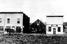
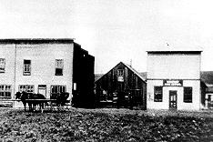
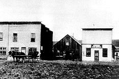
When the railroad’s real estate company founded Granby in 1905, local historian, Betty Jo Woods, said the new town location was chosen because it had great connections with the stage route to Grand Lake, was mostly dry ground, and had pleasant views. As they say in real estate, the three keys to successful land investing are “Location, location, location!”   The locations of many of the historic buildings were on the north side of Agate Avenue. According to photographs and written explanations by the late Vera Snider, in 1920, on “main” street, one of the only buildings on the south side of the street was the firehouse which protected the fire pumper and hoses. The post office was also on the south side.   Vera Snider later arranged for the preservation of this historic structure built in 1910 by moving the first post office building in the 1960s from 458 East Agate where it had stood for over 50 years to its present location at 170 2nd Street.

According to the current owner of this historic structure, Deb Brynoff, “When Ron, my husband, was remodeling he found old letters in the wall from when it was the post office building.” It was not unusual during the early years of construction for letters and newspapers to be “stuffed” into the walls to help increase what little “R-factor insulation” existed.    Other early buildings which still exist in Granby are a home at 127 4th Street which was built in 1909. The current Re/Max Granby office at 247 Agate was a home originally built in 1909. Other early Agate Avenue buildings still thriving are Crafter’s Corner at 295 East Agate built in 1913 for the Granby Mercantile. Local lore says the basement was used as a temporary morgue during the 1918 flu pandemic. However, no historic research has yet been found to document this information.  

Research on High Country Motors at 277 East Agate reveal it was originally Middle Park Auto which grew up with the town of Granby. The tax rolls indicate 1913 for the birth of this building. The business was “born” in 1915 when Jack Schliz founded Middle Park Auto. During Granby’s early years this was a hub for locals. It even included a small medical-first aid station inside it before Granby had any local medical services. In 1938, the business was sold to Glenn Pharo and Morris Long. Later, Jack Shield was associated with the business. The authorized Ford dealership was later purchased by Fred Garrett, who later sold it to Mike and Kimberly Garrett.   The only constant on Agate Avenue is change. Many of the buildings have a colorful past. For example, the current location of Brown & Company at 315 East Agate was a Texaco Service Station built in the 1930s.

The Long Branch at 185 East Agate is in a building that was Granby’s first strip mall. That accounts for the many doors fronting on to Agate. Built around 1938 for the Craig’s Café, it has housed Olson’s Café, a Laundromat, a barber shop, The Carpet Wagon rug store and Maureen’s Clothing Store to name a few.   The Silver Spur Saloon & Steakhouse at 15 East Agate used to be the Grand Bar and Café run by Dick and Beulah Samuelson from 1944 to 1964. The original business at this location was the lettuce shed where the famous Granby Iceberg Lettuce was delivered by local growers for shipping to the Broadmoor Hotel in Colorado Springs. Some of the original lettuce shed has been incorporated into this building.  

The Dick Samuelson family also has a history with the Granby Mart at 62 East Agate. This building at one time was the home of Bud and Ken Chalmers’ Auto Repair Shop. In the early 1940s, it had a dirt floor when Sonny Samuelson and his Dad bought it. Clyde Redburn had a bowling alley on one side. The Samuelsons later put in more bowling lanes. Upstairs they had a club called “3.2.” At the time, those 18 and older could sip the 3.2 beer served there and dance. At one time Wayne Snyder’s Saddlery shared half of the store.   Sharing a location was the thinking behind the former Minnie Mall located at 480 East Age. Named by local businessman, Jack Applebee, for his mother, Minnie, in the 1980s, many businesses enjoyed the convenient location, The Furniture Store, Hobby Shop, Montgomery Wards, Honey Bear Children’s Clothing, Fabric Nook, Greg Henry’s Get-N-Pack, Radio Shack, Julie Sneddon’s Cards and Gifts, Patti Applebee’s Nimble Needle, Ben’s Aspen Leaf Café and the Shaft Shop which specialized in darts and dart supplies. Today, Granby Medical Center-Centura Health is at this historic downtown location.  

Granby’s historic story from 1905 to 2005 is one of building dreams, homes and businesses to create a community. Chinese Proverb says, “One generation plants the trees; another gets the shade.” How true.
2005


Fraser
Fraser

The origin of Fraser was in 1905 and it was incorporated in 1953. It was formerly known as Eastom, for George Eastom, who laid out the town site in 1871. The spelling of Fraser was originally Frazier, after Reuben Frazier. The town came into being because it was the site of a large sawmill and was a railroad terminus for the lumbering operation.

While Fraser was generally considered to be an isolated mountain outpost, at one point there was enough cultural interest to support a local opera house.  Fraser was the location of a weather station for several years and during that time it was not uncommon for the winter temperatures to be 45 to 50 degrees below zero; one Fraserite remembers a morning when it was 60 degrees BELOW zero. Thus the town earned the nickname “Icebox of the Nation.” After a legal battle, that offical title went to a town in Minnesota.

A transcontinental motor route dubbed the Midland Trail came through Grand County and by 1913 a Ford sales agency was located outside of Fraser on the 4 Bar 4 Ranch. Avid fly fisherman President Eisenhower was a frequent visitor between 1948 and 1955.

Granby
Granby

Granby was settled in 1904 and incorporated the next year. The town was created along the railroad line being built by Denver, Northwestern & Pacific, and was a connection with the stage route to Grand Lake. The Granby site was also chosen because of the dry ground and and good view of the surrounding mountains.

The town was named in appreciation of the services of Denver attorney Granby Hillyer, who worked to lay out the town site. Its central location makes it a natural trade center for east Grand County. Specialty truck farming, principally lettuce, became a major crop for Granby. At the peak of the market, the Waldorf Astoria hotel in New York City proudly advertised Granby Head Lettuce on its menus. Later, after WW II, Granby was called the “Dude Ranch Capital of the World.” Today the town offers a mix of recreational amenities and residential charm.
Grand Lake
Grand Lake

Grand Lake was established in 1879 and incorporated in 1944. It is named for the largest natural body of water in Colorado. In 1867, when only a few people resided near the lake, Major John Wesley Powell (the man whose group first rafted the Grand Canyon) came to explore the possibility of floating down the Grand (now Colorado) River. That summer, Powell, local resident Jack Sumner, and William Byers, founder of the Rocky Mountain News, made the first recorded ascent of Longs Peak from Grand Lake. In the early 1900’s a Yacht Club was formed by enthusiasts who were attracted by the demands of attentive seamanship the lake demanded.

In 1912, Sir Thomas Lipton contributed an impressive cup to be presented annually to the winner of the annual August Regatta. This event still draws skilled sailors to the challenging competition. The town was founded during a very brief mining boom, but because of it's natural beauty, tourism has long been the sustaining feature of it's economy.

Grand Lake
Grand Lake

Grand Lake was established in 1879 and incorporated in 1944. It is named for the largest natural body of water in Colorado.

In 1867, when only a few people resided near the lake, Major John Wesley Powell (the man whose group first rafted the Grand Canyon) came to explore the possibility of floating down the Grand (now Colorado) River. That summer, Powell, local resident Jack Sumner, and William Byers, founder of the Rocky Mountain News, made the first recorded ascent of Longs Peak from Grand Lake.

In the early 1900’s a Yacht Club was formed by enthusiasts who were attracted by the demands of attentive seamanship the lake demanded. In 1912, Sir Thomas Lipton contributed an impressive cup to be presented annually to the winner of the annual August Regatta. This event still draws skilled sailors to the challenging competition. 

The town was founded during a very brief mining boom, but because of it's natural beauty, tourism has long been the sustaining feature of it's economy.

Historic Granby Real Estate

William Shakespeare, the historic play writer, said, “There is a history in all men’s lives.” The same could be said for many Grand County buildings. According to author, Lela McQueary in her 1962 book, “Widening Trails,” real estate sales and land giveaways helped to build our towns. “In 1905, a town site was obtained from Jim Snider, who had homesteaded the land upon the sagebrush mesa,” wrote McQueary. “The village was called Granby for Granby Hillyer, a civil engineer. Two general stores, two livery stables, a post office and a tiny café (all built with false fronts to make them appear much larger) were scattered on the north side of Main Street, three blocks long.”  That Main Street today is Agate Avenue. A quick search of the Grand County tax rolls reveals an interesting historic mix of buildings.

For example, the current Brynoff home at 170 2nd Street was the Post Office building constructed in 1910 and originally located at 458 East Agate. That building was moved to its current home to make way for the construction for the new Post Office building in 1945 at 458 East Agate. Deb Brynoff, the Executive Director of the Grand County Board of Realtors, said, “When we updated and built onto the original building, we found old letters stuffed in the walls. Obviously, they used them in the early years to add insulating value. I guess they had junk mail even then!”

On July 1, 1966, a new Post Office building was dedicated at 225 East Jasper Avenue (now the current home of the Grand County Library District Administrative Office). According to Granby-area Realtor, Susie Peterson of Glenn Realty, who used to own the building at 458 East Agate when they converted it to the Granby Veterinary Clinic, “Downstairs was full of those neat glass front post office boxes with the gold dials. You can just imagine the history in that building.”  Other buildings constructed in those early years were 127 4th Street in 1909. In addition to a private home, over the years, businesses such as Re/max Real Estate and Katie’s Flower Shop were located at 247 East Agate, which was also built in 1909. In 1910, the property at 110 Garnet was built.
The Roaring 20s saw a spurt of construction such as 172 Topaz (1922), 307 Jasper and 59 4th Street (1924), 166 Jasper and 291 Topaz (1929). The current Columbine Café property at 395 East Agate was built during the heydays of 1927 when it was called the Town Crier Restaurant.

After the Great Crash of 1929 and the Depression of the 1930s, New Deal jobs and loan programs helped fuel new construction. In fact, in 1933, the famous Payne’s Café was built at 365 East Agate. Today, the Greater Granby Chamber of Commerce and Downtown Enhancement offices, along with Noriyuki & Parker law offices are housed in the almost 75 year-old building.

Today’s Shadow Mountain Chiropractic Clinic of Drs. Jeff and Deb Shaw at 60 2nd was built in 1935 as a private home. On April 18, 1935, the first addition to Granby helped the town grow. In 1938, 387 East Agate was the site of the new pool hall run by Alva West. Today Lorene Linke’s Fabric Nook welcomes customers and quilters at the historic location.

In 1938, the building at 185 East Agate, which was Granby’s first strip mall, also was constructed with Craig’s Café, later Olson’s Café. Over the years businesses such as Maureen’s Clothing Shop, a laundromat, a barbershop and the Carpet Wagon found homes where today the Longbranch and Schatzis Pasta & Pizza Restaurants are found.

Post World War II America and Granby boomed. Granby had an influx of new residents because of the continued construction of the Granby Dam and the Colorado Big Thompson Water Project. In 1946, the Granby Dairy Building at 106 Jasper sprung up. That same year, Carmichael Real Estate Company built a new office at 191 East Agate. Today real estate is still king at that corner building with the Grand County Board of Realtors and The Title Company of the Rockies offices located there.

The Granby landmark, Frontier Motel, at 232 West Agate was built in 1951 by Earl Saylor. In 1954 Jenkins & Fulk began construction of the Granby Trading Post at 231 East Agate. Ken and Debbie Eaker and Jay Young bought that property in May 1995 and renamed the store, The Grand Mountain Trading Company.  

Hot Sulphur Springs
Hot Sulphur Springs

Hot Sulphur Springs was founded as the first town in Grand County around 1870.  By 1903 it gained incorporation. The hot springs in the area were considered a healing and sacred place by the Ute Indians long before the white man discovered them.

The town site was once owned by William N. Byers, founder of the Denver newspaper, the Rocky Mountain News. Planning to build a town to take advantage of the springs, he first had to construct an enclosure around the main pool to keep the Indian ponies out and the steam in. The white settlers and travellers were drawn to the  springs for their therapeutic value.

During the Christmas season of 1911, Hot Sulphur Springs hosted the first Winter Carnival west of the Mississippi.

Except for a brief period in the early 1880’s, the town has been the county seat.  The Grand County Historical Museum there draws many visitors to its unique displays.


How Parshall got its name

A question frequently asked of native-born son, George Mitchell. It has long been believed that Parshall was named after Ralph Parshall of the Parshall Flume invention fame. But recent research in the Grand County Historical Archives at the Pioneer Village Museum, and with the help of Tim Nicklas, former museum manager, has proved this to be wrong. Daisy Jenne began gathering historical artifacts and memorabilia from the early 1900s. She reports in her records that Alonzo Polhamus named the town for his good friend, Clyde Parshall, son and heir of Cordelia Parshall, owner of the ranch. Polhamus surveyed sixty acres of the flat above the confluence of the Williams Fork and Grand Rivers into lots and blocks and registered the town plat in the Grand County records on July 26, 1907. The following is an excerpt of the upcoming Parshall History Journal. Please note the dates and timeline to verify the events that have led to this correction.

The Other Parshall “legend" says that the town of Parshall was named in honor of Ralph Parshall. However, numerical evidence does not support this legend. Ralph may have been a relative but was not a member of the family that purchased the property that later became the townsite of Parshall. A grave marker in the Golden, Colorado cemetery shows that Cordelia M. Parshall was born in 1862 and died in 1904. She purchased the property from Frank Byers in 1902. According to the 1900 census, Cordelia was married to Simon E. Parshall. The pair had one son, Clyde. Ralph Parshall was born in 1881. He enrolled at Colorado State University in Fort Collins, Colorado as a freshman in 1899 and graduated in 1904 with a degree in Civil Engineering and Hydrology. After post-graduate work, Ralph joined the faculty in 1907 at age twenty-six. Six years later he joined the USDA Irrigation Office, while still part of the CSU Hydrology Department. In 1915, he invented the Parshall Flume, a water measuring device for the purpose of accurately gauging the stream flow of irrigation water, and registered it in the U.S. Patent Office in 1921. He is credited with establishing the Hydrology Lab at the University. Ralph Parshall died in Fort Collins in 1959 at age 78.”


by Barbara Mitchell - GCHA Board Member and 2018 Pioneer of the Year 

Kremmling
Kremmling

Kremmling started as a general mechandise store, owned by Rudolph (or Kare) Kremmling, on the ranch of Dr. Harris, located on the north bank of the Muddy River. In 1888, John and Aaron Kinsey had part of their ranch platted, calling the site Kinsey City. Kremmling moved his store across the river from the new site and the town that subsequently developed became known as Kremmling. There was a post office established at Kremmling as early as 1885 and the town was incorporated in 1904. 

The Middle Park Fair was established here in 1912. Famous Western Novelist Zane Grey spent time in Kremmling and, as a result, wrote "Mysterious Rider" in which the area is shown as a classic Western setting.

During World War II the town was the location of a prisoner of war camp where German prisoners cut ice that was shipped by rail to other locations.

The local ranching industry, the presence of the railroad and its strategic location at the confluence of the Colorado River, the Blue River, and Muddy Creek made Kremmling a natural location for a town, which still retains the “Old West“ atmosphere.

Monarch & KaRose
Monarch & KaRose

Once upon a time on the land that lies beneath Lake Granby and Shadow Mountain Lake there were ranches, pastures and an almost forgotten town, Monarch.  It is a story that goes back 100 years to the Summer of 1905, and the arrival of train service in Middle Park and promoters who were "honest men, but too visionary and lacking in experience", according to Frank H. Wolcott, a brother of one of the founders.

The Monarch Consolidated Gold and Copper Mining and Smelting Company owned the King and Queen copper mines on Arapahoe Range above the South Fork of the Colorado River.  They felt their assays indicated ore worthy of a mill and arranged to haul in the heavy machinery and proceeded to build a town with cottages, a small hotel, stores, a bowling alley, theater and dance hall.  By 1907 Monarch had a school and post office.  However, records indicate only about $150 worth of copper per year was ever produced.    

Soon the promoters realized a sawmill was needed to provide both timber and cash to support the mine operation. A dam was built creating Monarch Lake at the junction of Arapahoe Creek and the South Fork of the Colorado, and a canal was built to float logs cut near Strawberry Lake to Monarch Lake.  A stern wheel steamer bunted rafts of logs into flumes and canals towards the sawmill downstream in Monarch.

In the spring of 1906, Monarch management obtained a charter to build the Rocky Mountain Railway, a standard gauge, for lumber and passengers, from the Moffat tracks in Granby to Grand Lake, with a spur over an unspecified pass to Walden, in North Park.  The track was laid following the river from Granby to the sawmill, by Japanese and eastern European laborers.  Ranchers along the route, excepting Fred and Frank Selak, quietly granted rights-of way. The only rolling stock owned by the railroad was a small, ancient locomotive and a caboose.  The night before Thanksgiving 1906 the first train rolled into Monarch, and the rails never extended any farther.  There was daily service, and local ranchers could flag a ride or have their packages dropped off.  There were no cattle guards, so the fireman would step off the locomotive, open a ranch gate, and close the gate and hop back on after the train passed through. 

During the winter of 1905-06 a box factory was started. It operated briefly before it was destroyed by fire in the fall of 1908.  The fire forced the mill and railroad into receivership.  Visitors, particularly former stockholders, helped themselves to equipment and entire buildings, but Monarch's core was preserved and developed by Harry L. Dierks of Kansas City into KaRose.  This summer resort was named in honor of Dierks' daughter Katharine Rose.  Other Monarch buildings went to neighboring dude ranches and the bowling alley went to Granby.  

To hold the railroad right-of-way, Ernest Behr restored the locomotive in 1912 to carry parties of fishermen along the river from one pool to another.  Ed McDonald, a dude rancher, ran a Cadillac touring car on flanged wheels on the rails to carry mail, supplies, and passengers to the valley ranches.  Just before World War I the engine and rails were sold for scrap. 

Frank H. Wolcott wrote, "In September 1954 my wife and I drove over the site to discover any signs of Monarch or the railroad...It gave us a queer feeling to realize that substantial things like railroads and buildings that we helped build have vanished.  Was it all a dream?"

Articles to Browse

Topic:

Water/Lakes/Reservoirs

Grand County is home to the headwaters of the famed Colorado River - the river that brings water to five other arid Western states.  Water is the lifeblood of semi-arid Colorado and Grand County is one of the most water-rich areas of Colorado, and yet faces a shortage due to historical water agreements, written long before population pressures and the environmental awareness of the current age.  On average, the water diversion projects in the county move a whopping 305,000 acre-feet per year from the Fraser, Colorado and Williams Fork rivers - all headwaters of the Colorado's main stem.

60 percent of the water in Grand County is diverted elsewhere and there are plans underway, mostly from Front Range communities, to divert as much as 80 percent of the county's headwaters by the year 2010.  Two of the main water utilities, Denver Water and the Northern Colorado Water Conservancy District face a quandary: how to take the water from Grand County without further damaging the delicate environment and the region's economy, which is fueled by tourists who expect to play in the very water the Front Range wants to take.


More on water issues in Grand County

Topic: Railroads

Moffat Road


"I shall never forget it as long as I live. Nor do I ever expect to experience anything comparable to it again. Civilization had found its way across the mountains into Middle Park," reflected Mrs. Josephine Button in 1955 on her 91st birthday, as she recalled seeing smoke from the first Denver Northwestern and Pacific work-train on Rollins Pass, high above the Fraser Valley and Middle Park. Once those rails made it over the Continental Divide all the way to Hot Sulphur Springs, "changes came thick and fast." Many men, many dollars, many routes and many dreams tried to bring a railroad over the Continental Divide into Northwest Colorado, and the "Hill Route" over Rollins Pass that finally accomplished it a century ago has retained its allure ever since.

The Moffat Railroad built a cafeteria, telegraph station, living quarters for Moffat's "Hill Men" (as the railroad crews up there were known) and a fine hotel - all collectively called Corona Station. Soot-filled snow sheds protected over a mile of this windblown section of track. And where today silence is the most powerful sense, colorful locomotives pulled passenger and freight cars, filling the rare atmosphere with black smoke and mechanical clatter.

Decades of men's dreams lay behind the once massive snow shed that cut the bitter winds from the north and west, behind that fine hotel that offered some of the most spectacular scenery in America, behind the hopeful Town of Arrow nestled below tree-line ten or twelve miles west of Rollins Pass, and behind that first work-train that Josephine Button watched from her hay ranch along the Cottonwood Pass Wagon Road to Hot Sulphur Springs. Competent, often powerful, men in the 1860's through the 1890's filed surveys, graded road beds, and even began drilling before being stopped by severe storms that foiled the best laid plans or their inability to fund the ambitious projects.

Dreams to penetrate the high mountains along the Divide in central Colorado began when the Front Range was flooded with miners during the Gold Rush of 1859. Even before Colorado became a territory in 1861, Golden City, just west of Denver along Clear Creek, recognized its potential as a gateway to the rich mineral resources of mountain towns like Central City, Black Hawk, and Georgetown. Golden City's ambitions went beyond becoming a mountain transportation hub, believing that with the right incentives, enthusiasms, and leadership, its location supported a future as a national commerce center. 

Golden City certainly had men of vision, ambition, and wealth among its ranks. William Loveland and George Vest, both young and feverishly ambitious to see Golden City reach its potential, vigorously pursued their dreams for a powerful commercial center in Golden City. From Missouri River towns like Leavenworth in Eastern Kansas, leading town founders also recognized the benefits of linking their water and rail routes to the east with the resources of the west. Finally, as if destiny had demanded it, Edward L. Berthoud, a young civil engineer and surveyor with energy and ability, arrived in Golden City from Leavenworth in April of 1860 to unite the similar passions of leading citizens from both locations.

From 1861 until 1866, Berthoud, Loveland and Vest focused on bringing a direct transcontinental railroad route through Golden City. First, Edward Berthoud, along with Jim Bridger and a capable young cartographer named Redwood Fisher, blazed a trail across Berthoud Pass through Middle Park all the way to Salt Lake City. Returning to Golden City on May 28, 1861, Berthoud reported "a good wagon road could be ?quickly' built" from Denver to Salt Lake City over Berthoud Pass for about $100,000.00. According to the local hyperbole, a railroad would surely follow.

In spite of considerable enthusiasm, disappointment plagued early efforts to put a rail line over the mountains in Colorado Territory. In 1862, Territorial Governor John Evans sent the Surveyor General for Colorado and Territories along Berthoud's route and others to confirm or deny the potential of a railroad line. About the same time, the Union Pacific Railroad Company sent an independent reconnaissance to examine potential routes over the divide that included Berthoud and Boulder Passes (Boulder Pass became Rollins Pass in the early 1870's, when John Quincy Adams Rollins built a toll road over it, and then Corona Pass when the Railroad crossed it). Surveyor General Case and the UP agreed that neither route offered much hope for a standard gauge railroad. The dream of a transcontinental line over the Continental Divide through central Colorado seemed to die with the UP surveyor's words, "I learned enough to satisfy myself that no railroad would - at least in our day - cross the mountains south of the Cache la Poudre..." 

Multiple failed attempts to bring a rail line over the Divide through Middle Park during the following decades strengthened the UP's "death sentence." Against the odds, Berthoud and Loveland continued to solicit support for a railroad west over or through the Continental Divide, using improved surveys and maps to support their requests. In the 1880's, survey crews from a variety of railway incorporations were scattered over the high country on or near Rollins Pass. Over Berthoud, Rollins and other passes, they marked potential railroad lines with their wooden stakes. It was during this stretch of strenuous surveying activity that David Moffat, a highly successful Denver capitalist, got involved with an unsuccessful effort to bring through the mountains instead of over the top. 

 In the early 1880's, Mr. Moffat invested in the Denver, Utah and Pacific Railroad, which intended to tunnel through the mountains near Rollins Pass. Like the other efforts, though, the Denver, Utah and Pacific vanished in a few short years. Unlike many other lines that accomplished little more than surveys and maps, the DU&PRR completed significant grading and began tunneling before reaching the "end of its resources."

Money, power and success supported Moffat's dream to put Denver on a direct transcontinental railroad line. Doctor Robert C. Black, III, wrote that David Moffat's failed efforts in the early 1880's converted him to the idea that Denver needed to be on a direct transcontinental rail line. Moffat considered the route over Rollins Pass valuable enough to have surveying and grading crews working on it throughout the winter in 1902. The Denver Rocky Mountain News claimed that Moffat's route through Northwestern Colorado included "the largest strip of fertile land as yet undeveloped in the United States..." With his Denver, Northwestern and Pacific Railroad, David Moffat planned to make good his intentions to put Denver on direct transcontinental railroad line.

Moffat's original plan called for the "Hill Route" over Corona Pass ? the name changed from Rollins Pass in honor of Corona Station at the top ? to last for only a few short years. While the "temporary" route over the top generated resources by extracting the resources of Northwestern Colorado, a tunnel was to be bored through the Continental Divide. Even the wealth and power of Moffat, though, failed to adequately finance the tunnel before he died in 1911. The temporary line, therefore, lasted for nearly of a quarter century, from 1904 until 1928.

Its obstacles proved as enormous as the mountains it crossed. Work crews had to cease operations because of snow for most of April in 1920. The road was closed from late January until May in 1921. In December of 1924, engine number 210 busted "a main reservoir pipe," causing the train to fly down the hill out of control until it jumped the tracks and crashed into the valley below. Clearly, the Denver and Salt Lake Railroad, which took over Moffat's DNW&P after his death, needed a tunnel to replace the expensive effort over the "Devil's Backbone."

 As Denver and Salt Lake Locomotive Number 120 came through the tunnel in early 1928, it represented the culmination of a massive undertaking through wet, unstable rocks which required considerable engineering ingenuity and caused six deaths in a 1926 cave-in. It also took an enormous amount of coordination and effort to secure the necessary funding. Through local bond issues, private investors and other means, the project was completed. And through a connection at Dotsero, a railroad station less than 30 minutes west of Vail on I-70, freight and passengers could make a direct Pacific connection from Denver. Posthumously, David Moffat's dream became a reality.

For significant periods of time since the trains stopped operations over Rollins Pass in the late 1920's with the opening of the Moffat Tunnel, on-road vehicles crept along its relatively easy grades and wide curves from Rollinsville on the east slope to Winter Park on the west side of the Divide. Like now, the road ran through an area attractive to backcountry campers and sport enthusiasts. On September 1, 1956, local officials and private citizens met on Rollins Pass to celebrate a "joint state-federal-county project to convert the old D. & S. L. railroad right of way over Corona Pass into an access road for sportsmen." According to the Denver Post, the game and fish department's construction division reconstructed the road during the summer of 1955 for about $20,000. The following year, the road became a scenic route over the Continental Divide for family cars and jeep caravans alike. And after it was built, or at least reconstructed, they did come. Intrepid tourists into Middle Park.

Christmas at Fraser

The lights dimmed; mothers had already found their seats after coming from the classrooms where they had put makeup on little children’s faces and checked their costumes to make sure angel wings and halos were secure and costumes were on right side round.  I was at the piano, music and script lined out. The gym was full to the brim, every seat taken, with folks lining the sides and back walls, for the whole town had turned out.  Early birds got the seats!  Christmas wasn’t Christmas in the Fraser Valley unless it included the program at Fraser School (now the Town Hall).   I began the overture and chatter stopped.   I had played for this event for ages, starting in 1958.  High school students were gone by then, moved to the new Union High School in Granby, but 7th and 8th graders were still there.  And in 1958, the first kindergartens in the district were established.   It was a time of excitement and anticipation, of fun, and of panic? Well, no, not panic, for the teachers were beautifully organized. 

The program was chosen during October. Each teacher had a specific job. For instance, Martha Vernon, the art teacher, did sets.  Helen Hurtgen was responsible for dialog.  Edith Hill did costumes.  Nancy Bowlby was in charge of the music.  Others coordinated the whole.  And I played the piano, with Nancy sometimes accompanying me on her violin.  

Mothers were asked to contribute sheets and any fabric they could spare.  Patterns and material for costumes went home to be sewn into various sizes and shapes -- angels, gingerbread men, knights or royalty.  In the gym, we stitched on finishing touches, bright patches to decorate jester outfits, townspeople, and such, while watching various groups practice. Bits of tinsel became crowns, tinfoil turned into wands, cheesecloth into wings.  Lace scraps and sequins added color and “class.”   The budget was extremely minimal at first, but over the years, more money was directed to Christmas programs.  Instead of old sheets, we could buy cotton fabrics, velveteens, sometimes satin.  One year I even stopped by a furrier’s in Denver and begged some fur scraps.  Were we uptown then!  We had fur trim around the necks, cuffs, and hems of the costumes for the prince, queen, and king.  

The day before the play, PTA mothers gathered in the gym to fill brown paper sacks with an apple, orange, nuts, and candies, provided by R. L. Cogdell from his grocery store.  

Every single child in school took part in the play, as a class, except for those with speaking parts, of course.  Fraser grew and grew, then as now. Soon the 7th and 8th grades moved to Granby.  Then the 6th graders went, but the 4th and 5th graders handled the leads neatly.  Our stories were usually simple Christmas tales, but sometimes we tackled ambitious efforts such as the Nutcracker Suite or a version of Gilbert and Sullivan.   The only children not included were the Jehovah Witness youngsters.  They couldn’t be in the play and they couldn’t come watch it either.  We all felt very sorry for them, because everyone had such a wonderful time.  Their teachers tried to give them special projects to entertain and interest them while they sat off in a corner or in their classrooms.   The plays always went well.  Tiny kindergartners came out onto the stage, to stand behind the colored lights.  They knew their song perfectly in practices, but I have to admit that a number of them usually stood silent, stunned by that mass of faces looking up at them.  No matter.  They were darling. “Hi, Mom,” some were sure to call. “Mom” beamed.  

There might be a glitch or two every year. For instance, little Diane was chosen to do the Arabian dance in Nutcracker Suite.  Her parents were dark, as she was, and she was slender as a dancer. Trouble was, she didn’t have an ounce of grace in her body at that stage of her life.  I thought Nancy Bowlby was going to have grey hair before she got that child moving properly.  But the night of the program, Diane looked like Anitra herself, doing her exotic dance.   One year the king jumped his cue and entered on stage.  His first words were, “Did I miss anything?”  The prince muttered, in an aside, “Yes, three pages!”  But the cast went on as if nothing had happened, while down at the piano I sat, flipping pages rapidly, trying to figure out where the dialog was now.  

Another year, our son James was to take part in a minuet.  “Uck!  I have to touch a girl?”  By the greatest good fortune, he broke his leg and got to be a guard at the palace door, standing at attention on crutches, while another boy took his place.  (I think he did that on purpose.)   Songs and parts were adapted to the talents of the students.  We had five boys once, who couldn’t talk, dance, sing -- anything.  So they wore monks’ costumes and filed on stage, supposedly singing a Christmas carol, but supported strongly by the cast present.   Another time, Twyla’s parents couldn’t come, so Miss Vernon took her home to get ready. Now, Twyla usually looked like a dirty ragamuffin, but after a bath and hair wash, she truly looked like the angel she portrayed.   For the finale, the entire school came on stage to sing a last carol, with the audience joining in.  Then Santa showed up to distribute the goodie sacks, and the great night was over.  Coming out into the quiet night was a wonderful feeling.  Sometimes we moved through drifts of new falling snow; sometimes the sky was filled with icy stars.  Gay lights showed in windows throughout town. 

We never talked much on the way home, as we thought of the play, the success of everyone¹s efforts, and how happy the children had made their parents and families.   My last program was the first year after the new school was built.  It was fun still, but the school population had grown enough that it was impossible for whole classes to participate as one. Things weren’t the same as they were in the little old school.

Topic: Mining

Teller City, Crescent City and Tyner

The original Grand County contained North Park as well as Middle Park, and during the mining boom of the early 1880's there were several mining camps east of the modern town of Rand. It was several years after the mining boom northern area of Jackson County was created.

Teller City was founded in 1879 and named for Colorado's famous Senator Henry M. Teller, who later became U.S. Secretary of the Interior.  By 1882, the population of Teller City was about 1200.  It had a fine hotel with 40 rooms, a newspaper and two steam saw mills.  It was a lively Old West town with twenty seven saloons and a number of "houses of ill repute".

Some high quality ore assayed at Teller City was as much as $3000 a ton, but most of that soon ran out and by 1884, the high shipping costs to far away smelters dropped the price per ton dropped to $20. The best mine, Endomile, was three miles from town.

Crescent City, southwest of Teller City had an even more brief existence, but there was population enough for a U.S. Post Office in 1880. 

Rumors of valuable silver three miles sough of Teller City drew a number of prospectors to found the camp known as Tyner.  John Noble Tyner was the First Assistant Postmaster General of the United States and visited the mining camp so named in 1879.  He promised the miners a weekly mail delivery if at least 2 miners mined through the winter.  Tyner had been a special agent for the Post Office from 1861 thru 1868, at which time he was appointed to serve in an open seat in the U.S. House of Representatives for Indiana.  He ran for election win the appointed term ended and was elected and continued to be reelected and serve as a Representative until 1875 when President Grant appointed him Second Assistant Postmaster General.  Grant would later appoint him to the "big job" of Postmaster General in 1876. 

Tyner worked to elect Rutherford B. Hayes in 1876 and after Hayes was elected and took office in March of 1877, Hayes appointed a new Postmaster General, but gave the second spot, First Assistant to the Postmaster General to Tyner.  Historians suggest that Tyner's demotion angered him to the point that he allowed wide spread corruption in the day to day operation of the Postal Service which was his responsibility to over see. He resigned in 1881 under great public pressure from what became known as the "Star Route Fraud scandal".  He would remain a political figure  being appointed  various positions  with the U. S. Postal Service until shortly before his death in 1904.  Although indited three times for corruption in his Post Office management, he was never convicted.  The "Star Route Fraud scandal", may have local implications.  It had to do with over charging and providing needless postal routes, roads and post offices and kick backs to politicians from contractors .

Topic: Biographies
, Gram Wood on horseback

Lillian Russell Smith Wood - "Gram" Wood

, Gram Wood on horseback

Lillian Russell Smith Wood was born in Dunlap, Kansas, in 1884, she was not a particularly healthy child.  Born just before her and just after her were sets of twins, 2 of the 4 sets born to her parents and the only 2 sets that survived into adulthood.  Lillian spent her adult years on the Williams Fork and then in Parshall. Known as “Gram” Wood to most everyone who knew her, she was grandmother to 39 who bear the names Wood, Noell, Stack, and Black.  And her history in Grand County beginning in 1905 made her one of our pioneers. 

In the fall of 1905, the local newspapers report that Herb Wood had lost a large portion of his right hand in an ore crusher accident.  Herb had come into Summit County originally with a mule team for “Uncle Joe” Coberly, another Williams Fork resident and apparently worked in or around mines and mining equipment while also hauling the timbers for mine use.  Herb needed some round the clock nursing, and in those days, for Gram to take proper care of him and still be in an acceptable position, they needed to be married. One source says the situation was so different that a Denver newspaper picked up the story with a headline of “Loses Three Fingers, Wins a Bride”, indicating that they married 3 days after they met.  Research has never turned up a trace of that story, and it’s unlikely in the mining camps in the area that they hadn’t met until he was injured.  Still, they were married by Judge Swisher, well known area businessman, in short order in the hotel room where Herb was recovering .  A short time later they made a brief wedding trip to Denver and then returned to Argentine.

Before fall set in that year, the newly married couple moved to the Little Muddy.  Herb had been sending money to a partner who was helping him to secure a homestead there not far from where Joe Coberly lived.  It was probably with anticipation of a great future on their own land that sent them into Middle Park to face their first winter as a couple without having had a chance to raise a garden or preserve any winter supplies.  They moved into one end of a two room cabin with a man named Ranger Charlie in the other.  And about that same time, they discovered that Herb’s partner had been drinking the money he’d sent over the years.  What devastation that must have caused!

On the other side of the valley just across the creek was the large  ranching operation known as the Hermosa Ranch, owned by Dr. T. F. DeWitt, a well-to-do doctor from back East.  With the dream of his homestead gone, Herb went to work for DeWitt, eventually becoming one of his foremen.  Gram probably helped out with cooking and cleaning, but within a few months, she went back to Kansas to await the birth of their first child. Over the next 21 years, she raised kids and gardens and developed her love of fishing, which helped feed a family that eventually totaled 13 kids, including a set of twins born 2 weeks before Christmas and delivered by Herb when a doctor couldn’t reach them in time. Pictures of the time show a large family of 9 boys and 4 girls with Gram, all 5’2” and maybe 100 pounds of her on one end, and Herb with a child or two on his lap at the other.  The kids recall Christmases being supplied mostly by Mrs. DeWitt and sometimes being late if the trains got snowed out of the area. All attended one room schools, Hermosa and Columbine, and stories of their lives together can make one wonder why any of them survived.

Life continued  pretty much routinely until 1928.  That summer, the youngest daughter, Marilyn, a premature baby and ailing child caught whooping cough.  She lingered and languished until early October, and then she passed away.  The close-knit family had suffered it’s first loss. Two weeks later, Herb came in from the hayfield complaining of not feeling well.  Gram followed him into the living room and sat down with him on the couch. Minutes later, he collapsed in her arms and died of a cerebral hemorrhage.  They buried him alongside Marilyn in the Hot Sulphur Springs Cemetery.

The boys continued the work for Dr. DeWitt for several years, and in 1932, they built a 2 bedroom house for Gram several miles from where DeWitt had relocated his ranch.  Her sons made sure she had what she needed as she finished raising the youngest ones who had been little more than toddlers when Herb died.

By the time I was old enough to remember much about Gram, she was already a “little old lady” who lived in a small, pink mobile home next to Uncle Kenneth in Parshall. Everyone knew that she was one of the best fishermen in the country, having caught as many as 1200 in a season when she was feeding her family by herself.  She enjoyed creek fishing the most, and even as she got older her ability to maneuver around the biggest holes and catch fish in any small body of water never faltered.   I never saw her get wet.

In the winter, she was totally unafraid getting a couple of her grandkids on a sled and making a run down the hill in Parshall that ended at the store and U.S. 40, which then went through the center of town.  Had her feet not worked so well as brakes, we could have ended up on the pavement.  But we never did.

She must have driven many teams of horses in her day, and I believe she was a good rider. She never drove a car, but unless she needed to go to the doctor in Kremmling, she didn’t need to leave town. Her friends included Doc Ceriani’s mother and fellow fishermen from Hot Sulphur, a couple from Poland with heavy accents.  Somehow, somewhere she had met Ralph Moody, author of the “Little Britches” series. And she, too, had a “fish” experience with warden Henry “Rooster” Wilson.

Only once did I get into trouble because of Gram.  She was fishing one day near where I was getting ready to ride, when she laid down her pole and walked over to me.  After watching me for a minute she said, “Can I ride?”  What do you say to your 80 year old grandmother but, “Of course!”  I saddled up the gentlest mare we had and helped her aboard.  She only made a couple of trips around the small pasture, but as she rode, walking only, I’m sure I saw a young woman next to her husband on horseback in front of one of the Hermosa’s big barns.  It’s one of the pictures you’ll find at the County Museum in Hot Sulphur.  When dad found out what I’d done, he turned deathly white.  “Don’t you know if she’d fallen or been thrown she could have been seriously injured or killed?”  No, I had to admit.  This was one rider’s request to another, with age no consideration .  And to her at that particular moment, had either occurred I believe she would have considered those few moments worth the risk.  When she was finished, she walked back to her fishing pole, satisfied that nowshe was done riding.

Gram introduced me to horehound candy, something I will also think about each time I taste it.  And because she didn’t like my first name, I didn’t even know what it was until I started school.  She taught me that barn cats do fish and that survival in a small living space was possible The one thing she didn’t teach me was anything about her growing up years or about my grandfather.  It seemed like we knew as very young kids that we didn’t ask about him.  I believe that hers was a love so strong that even to the point where her mind grew dim, the pain of losing him was too much to bear.  One regret we all have, however, is that we never asked to her to go with us up to Summit County to show us where she lived and to tell us stories of that life and time.  And unfortunately that’s been lost forever. Gram passed away in 1980, at the age of 97.  She is buried with Marilyn and Herb and their son, Melvin who died during World War II in a family plot in Hot Sulphur with other family and pioneers characters nearby.

She left a true legacy through her kids and grandkids who continue the nostalgic traditions of their beloved Gram.

Topic: Regions

The Troublesome

Tradition holds that an army party led by one Lt. Col Johns gave the name of Troublesome to what had sometimes been called Oties Creek.  The Army was plotting a road in 1865 and had to go north to the forks of the East and West Troublesome in order to cross it, because of the soft soil, thereby being a “troublesome” creek.  Some historians claim that mountain man “Colorado Charley” Utter had built a cabin on the creek in 1861, which became a popular stopping place for early hunters and trappers in the region.  Another report credits John S. Jones of Empire with a cabin near the mouth of the Blue River, a few miles away, that same year.

Among the earliest settlers on the Troublesome were Barney Day, Henry King and Martin “Dock” McQueary, who had a cabin there in 1871.  In 1878, a post office was established at the King home. 

By the end of the century, many ranches had been established at on Troublesome Creek.  Farthest upstream was the remote George Hendricks ranch, difficult to reach year round and totally cut off from the rest of the world during winter snow.  Mrs. Hendricks had a large library and gave her children a sound education prior to their high school years in Kremmling. 

Among the most prominent ranches were those of George and Forrest Wheatly.  Probably the largest ranch (3000 acres) was that of the family of Con Ritschard, lying just north of current day U.S. Highway 40 east of Troublesome Creek.

Life was hard for the settlers in the area.  Like much of Grand County, the soil was frozen as deep as eight feet in the winter.  One memoir noted that when there was a death in the winter, the corpse was placed in the roof of a cabin, well swathed, until the spring thaw allowed for permanent burial.

There was a six year school (second to seventh grade) and a post office established at Pearmont about half way up the Troublesome, in the 1920s.  This area was named for local settler Gus Pearson.

Ranching was not the only pursuit along the Troublesome Creek.  Settler Roy Polhamos grew lettuce and shipped it through the Granby Cooperative to Denver.  He also had a potato contract with one of the Denver grocers.  Other growers contributed to the 125 refrigerated train carloads of lettuce that were shipped from Granby in 1924.  By 1929, 34 farmed from Granby to Troublesome netted $46,000, a highly respectable profit in those days.

Topic: Water

Moving Water from Point A to Point B

Most serious ranchers had more than one ditch and most built one or more reservoirs. Hilry Harris, Munroe C. Wythe, Samuel H. Burghard, and John A. Coulter entered the first water claim in the county on September 20, 1874. This came out of Sheep Creek above the head of Gore Canyon.

There usually was some natural irrigation; but the challenge of getting the water from the creek required laborious construction of diversion dams, headgates, and ditches, the earliest ditches being dug by hand and often taking up to four years to complete. Later, ditches were dug using teams and scrapers. The grade was figured out initially by simple gravity flow, letting a trickle of water move down the ditch. Soon ranchers refined the process, using a 16’ long board placed with a 1/8" slope, determined by a carpenter’s level. A.F. and Roy Polhamus surveyed a great many of the water ditches, especially those impressive ones in West Grand County, some of which even had tunnels involved. Most small ditches supplied just one ranch, but if a ditch had to cross another ranch, that rancher usually got a share. And some of these ditches were long!

For instance, Dr. Henry Hoagland, on the Blue River, anticipated getting water close at hand from Spruce Creek. Instead, he discovered an old timer had previous rights that forced him to go back into the mountains and build a 13-mile long ditch. Hoagland had figured on spending about $7000; in the end, the actual cost was $26,000! His crew dug the ditch around side hills and across valleys using flumes and siphons. Then his real troubles began. Terrible leaks and washouts occurred everywhere. Finally he hauled in adobe and put this in the bottom of the ditch, rented sheep, and drove them day after day up and down the ditch to pack it. After a couple of years of using this tamping process, the ditch held. Other ditches were even longer. The Church Ditch at Willow Creek and the Wheatley Ditch on the back Troublesome were both 16 miles long.

The Company Ditch (aka the Williams Fork Ditch), eight feet wide on the bottom, was another long one. Built between 1903 and 1907, it cost $44,000 and had a decree for 150 cubic feet / second. The ditch went uphill and down, requiring many flumes and bridges. One flume was actually 1200 feet long! Subsequent breakdowns, leaks, and slides were so frequent and repairs so extremely costly that old-timers have said the reason the Company Ranch went broke about 1920 was the expense of The Ditch. The Lyman Ditch (or the Curtis), started about 1891, was just as complicated as the Company Ditch. Crossing high above the Williams Fork River, the ditch eventually needed cement piers to carry the pipe (1928). This ditch had so many slides, leaks, and washouts, that it had to be inspected once or twice daily! Siphons were required over draws. Flumes, sometimes ¼ mile long, might be 25-30 feet high, and one flume was actually 177 feet high; but these heights were necessary to maintain the elevation.

Flumes, being of wood, rotted and were guaranteed to leak. Sometimes wind blew a portion of the flume down. Finally the county put in big pipes to help the ditches across the Williams Fork. It might be noted that, when water leaked out of ditches, a side benefit was that ranchers along the way could use the "lost" water. Along with the ditches came reservoirs.

Fred DeBerard had four reservoirs on the Muddy: the Albert, the Binco, Milk Creek, and a low one that flooded the Jones place near Kremmling. All were dirt, of course. The Hermosa Ranch on the Little Muddy had water rights through the Sylvan Ditch and Reservoir Company and they built the Sylvan Reservoir dam and the Hermosa Ditch starting in 1911 and completing it by the spring of 1916. The Stein Ditch, started in 1897, was another large ditch, this one later purchased by the Taussig family. These ditches were all built originally to provide water to meadows and fields for ranching purposes. For years, people hauled in water for baths and household use, but that gradually changed. Leon Almirall, near the Horseshoe Ranger Station on the Williams Fork, decided that he wanted water for his home, so he built a 1700’ pipeline to his house, added an inside bathroom, and was shocked when the line froze the first winter – it was only three feet deep. He called in workers who dug down and insulated the line with manure and straw. It froze again. Finally, Almirall gave up and buried the line six feet deep. Now he had his water!

On Ranch Creek in the east end of the county, E.D. Shew cut a ditch upstream from his house, placing it along the edge of the creek, but directing the water back into the main channel near his house. At that point, he put a little water wheel that pushed the water up the hill to his cabins -- and furnished electricity besides. Eventually he replaced the water wheel with a gas engine. There was a similar water wheel, used for the same purpose, up in Hideaway Park.

Water was used to transport lumber as well. A flume ran down the mountain into Monarch Lake, in the days when the Monarch Company was timbering there. There was a flume along St. Louis Creek, carrying lumber from the camps upstream. Perhaps the most ambitious flume ran from Western Box Sawmill. This area is now under Meadow Creek Reservoir. In 1906, the Deisher Lumber Company paid Nathan Hurd for a right of way through his land and built a flume with a 2% grade down Hurd Creek. Logs were placed in the flume and a horse harnessed to the last log. The horse then pushed the logs down the flume with the help of the water. Three years later, the mill was moved to "Sawmill Meadow" on Meadow Creek.

In 1911 construction on the seven-mile-long Vaver Flume began, with 117 cubic inches of water allotment. This flume ran down Meadow Creek and over to Tabernash, carrying partially processed logs for further manufacture. A flume rider checked along the way, making sure there were no jams, and phone line allowed the rider to report troubles. Hikers can see remnants of both the St. Louis Creek flume and that one coming down Meadow Creek today.

Topic: Biographies

David Moffat and the Railroad Dream

David Moffat was a wealthy Denver businessman who saw the need for a rail link between Denver and Salt Lake City. His vision, a 6.2 mile long tunnel beneath the Continental Divide, made this link possible.

He was born in 1839, the youngest of 8 children. He ran away from home at age of 12, went to New York City and found work as a bank messenger.  He was an assistant teller by the age of 16 and  became a millionaire through real estate by the age of 21. 

Moffat was admired for his qualities of courage, adaptation to the “barbaric” West and his goodness of heart. He married his childhood sweetheart, Francis Buckhout, moved to Denver, and in 1860 opened a bookstore/stationary/drug store with C.C. & S.W. Woolworth on the corner of 11th and Larimer.  

Moffat and others formed the Denver Pacific Railroad to reach Cheyenne. The rail line to the Moffat Tunnel was the highest standard railroad ever built in the U.S. (11,660 ft). It went over the Continental Divide at Rollins Pass and came into the Fraser Valley in 1904. At the time, it was the most difficult railroad engineering and construction project ever undertaken. It involved boring numerous tunnels through solid granite, as well as constructing precarious timbered trestles that bridged deep mountain gorges. 

David Moffat was a multi-millionaire when he started the Moffat Line and was nearly broke when he died in 1911 trying to raise money for the tunnel that would eventually be built and bear his name. It was finally completed in 1928. The west portal of the Moffat Tunnel can be seen from the Winter Park Resort.


Ninety Four Winters So Far

January, 1911.  Five years ago they were teenagers in Torsby, Sweden, oblivious to the sweeping changes that history and hope would bring to their lives.   Now they’re in a mountain valley halfway around the world from their Scandinavian homeland, marveling at the tiny bundle of flesh and spirit who has just joined their family. It’s the coldest week of the year in one of the coldest spots in America, but there’s a fire crackling in the woodstove, and their hearts are warm with love for each other and their firstborn child.   For the next few days, a parade of fellow Swedes stop by to pay their respects to the newest resident of the town of Fraser: Elsie Josephine Goranson.  

February, 1918.  It’s barely dawn, and a blizzard is howling across the valley, piling snow against the sturdy wooden house.  George Goranson puts on his boots and woolen overcoat and trudges towards the barn.  There are cows to milk and horses to feed.  There are no days off.  Meanwhile, in the house, 7-year old Elsie stokes the perpetual fire in the cook stove, while her mother grinds the beans for a second pot of strong coffee.  Later they will make sour cream cookies.   Her younger brother Hill is sick in bed with influenza.  He will survive.  Many others will not.   

March, 1925.  The logging camps are humming, the Moffat Tunnel is under construction, and the valley is brimming with workers and their hard earned pay.  Fraser merchants and boarding houses are doing a brisk business, as are the local bootleggers.  Elsie is waiting tables at the “Victory Café”, named for its proximity to the new coast-to-coast “Victory Highway” that passes through town, and each morning she serves breakfast to the nice looking (if scantily clad) girls from the corner house of ill repute.  Soon the local vigilante committee will force these ladies of the night to leave town, but for now it’s business as usual, and Fraser is hopping.   In fact, “Russell’s Riot Squad” is playing at a dance tonight at the Thomas Hotel.  

April, 1927.  Sleigh bells jangle as a team of horses pulls four young couples down valley to a dance in Tabernash, the most happening town in the county.  The roundhouse is there, as are the wages of engineers and brakemen who guide the trains over Rollins Pass.  There is even a movie house, where Elsie saw her first moving picture, “Jackie Coogan”. As the sleigh glides across the moonlit snow, Elsie feels a mix of excitement and nervousness.  This is her first date with Chuck Clayton, a hardworking man from Oklahoma. Chuck is handsome as he steals glances through the cold night air, but her Dad doesn’t approve of his drinking and gambling.  Other dates will follow: motor trips in a Model A Roadster to Garden of the Gods, picnics in Rocky Mountain National Park, and plenty of dancing.  “I’ll never marry you,” she tells him everyday.  “Yes you will,” he insists.  

May, 1933.  One child underfoot and another in the belly, and Elsie Clayton is tired.  Chuck bought a house for 20 dollars and used the lumber to build a hamburger stand (soon café and bar) right along the newly paved Highway 40, the main route from Denver to San Francisco.  For the next 38 years, their lives will be a blur of ham and eggs, New Year’s Eve parties, and a long medley of songs on the jukebox.  The school bus will stop there, as will the “Steamboat Stagecoach” bus line, and three generations of folks looking for a home cooked meal or glass of beer.  There will be marathon cribbage games, war stories, and “Friday Night Fights” watched live on the first television in town.  Despite the booze and boxing, Clayton’s Café and Bar will be known as a family establishment, especially compared to the “Fraser Bar”, a.k.a. the “Bloody Bucket”, where a love triangle will one day lead to murder.  

June, 1945.  It’s 4:30 a.m.  Elsie tiptoes downstairs and into the café.  She brews coffee, warms up the grill, then sits and enjoys a rare moment of relaxation before her workday begins.  In the distance, a steam locomotive blows its whistle as it chugs towards town.  Before her life is over, nearly a half million trains will pass through Fraser, an endless stream of rumbling horsepower that conjures up different images as the years pass by: trains bringing home soldiers from the Great War; trains loading up ranchers’ fattened cattle in the fall; trains delivering newspapers and mail; trains colliding head on in the Fraser flats; a train’s whistle frantically blowing to alert sleeping townspeople to a midnight fire; streamlined diesel trains ushering in a new era, and countless coal trains, hauling the carbon wealth of Western Colorado to the factories and power plants of far off cities.  

July, 1950.  Summer’s here, and all are invited to the town picnic down by the Fraser River.  Aging Swedish bachelors will be there, sipping steel cans of Coors and swapping stories of crosscut saws and the rowdy “Lapland” logging camps up St. Louis Creek.  Young men will dance with young women.  Young men will start fistfights with other young men.  Navajo railroad workers will perform a rain dance. Children will play Audie Murphy in the riverside willows and drink Coca Cola from thick glass bottles.  Meanwhile, the deluxe brick barbecue will sizzle as Elsie spreads mayonnaise on buns and Chuck flips burgers and jokes with friends.      

August, 1953.  President Dwight D. Eisenhower is coming to town to fish and relax.  “We come Ike” banners wave in the breeze as the motorcade turns off Highway 40 and onto the dusty gravel of Main Street.  Cheers erupt and flashbulbs pop as a smiling Ike emerges from his limo and waves to the crowd of 300.  It is the biggest day in Fraser history, but Elsie sees none of it, for even as her husband, the Mayor of Fraser, is welcoming the leader of the free world to town, she’s in the cafe tending to the crush of reporters and tourists who’ve come to see an American hero.   Tomorrow, after the excitement dies down, she’ll personally deliver two of her homemade pies to the President, who will rave about the perfect crust.   

September, 1971.  Retired.  Chuck and Elsie sit on the porch of their new home on the edge of town, watching cows graze just beyond the fence, and taking in the unobstructed view of Byers Peak.  Labor Day has come and gone, and now town is peaceful, the highway quiet.  Freed from the busy schedule she’s kept for decades, Elsie will soon embark on a reading frenzy and will begin to keep a modest journal of the days’ events:  A Grandchild born, an illness in the family, an exceptionally cold morning.  Chuck busies himself planting trees, tending a garden, and mowing his spacious lawn.  Tomorrow they will pack a picnic lunch and drive the Denver Water Board roads in search of raspberry bushes.   

October, 1978.  Today is Chuck and Elsie’s 50th wedding anniversary.  It’s a perfect day, sunny and warm, Indian summer if there ever was such a thing.  The mountains shimmer beneath a blanket of fresh snow.  Hay meadows glow golden beneath the cloudless sky.  Family and friends gather in the yard for photos before heading to the Crooked Creek Saloon, formerly Clayton’s Cafe and Bar, for a long afternoon of celebration and reminiscing.   

November, 1999.  After 71 years of marriage, Chuck has passed on, and Elsie is suddenly alone.  She sits at her dining room table, peering out the frost fringed window at the town she was born in, the town she has lived in her whole life.  The ridge she once sledded down is covered with condominiums.  The willowed wetland where her brother trapped muskrats has become a large parking lot.  Her father’s horse pasture is now a shopping center.  Everything has changed, yet memories remain, taking on a life of their own.  Horses still pull wagonloads of hay up the highway.  Loggers come in from the woods every Saturday night for revelry and roulette.  A young couple poses for a photo in front of their new cafe.  A sharp axe splits a chunk of pine.  Life goes on.   

December, 2004.  Christmas Eve.  There is plenty of food, including the homemade potato sausage that’s been served at every family Christmas for centuries, and plenty of gifts stacked beneath the brightly lit tree.  Elsie sits at the head of the table, quietly marveling at this clan she has wrought.  Her surviving children are here, as are her grandchildren, some of who have grandchildren of their own.  Five generations of family pour gravy on potatoes and crack jokes.  As she looks at their faces, she remembers her own parents, her grandparents, and her husband.  Everyone is here.   In a few minutes, in a ritual as old as Elsie can remember, her great-great grandkids will hand out presents, and the house will resound with laughter.  

Winner of  the “One Grand Essay” contest 2005

Topic: Mountains

Berthoud Pass

Berthoud Pass was named for Captain Edward L. Berthoud, who completed the first survey of  this saddle in the main Divide in the spring of 1861.

Berthoud’s expedition of eight people, including Jim Bridger, crossed the Continental Divide at the 11,315 foot summit and established a relatively easy way to get into Middle Park from the east. Berthoud also served as chief engineer on the Colorado Central Railroad.

It is surprising that this famous pass had played no previous role in the history of the region. Even Jim Bridger, who knew the country well, did not learn of its existence until the survey. For reasons of their own, Indians had chosen to go over the divide at higher levels further to the north. One explanation may be that the pass is not evident from most locations on either side of the Continental Divide.

Error message

  • Notice: Undefined index: quantity in omega_views_mini_pager() (line 234 of /var/www/html/docroot/sites/all/themes/omega/omega/inc/theme.inc).
  • Notice: Undefined index: quantity in omega_views_mini_pager() (line 234 of /var/www/html/docroot/sites/all/themes/omega/omega/inc/theme.inc).

Towns