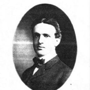
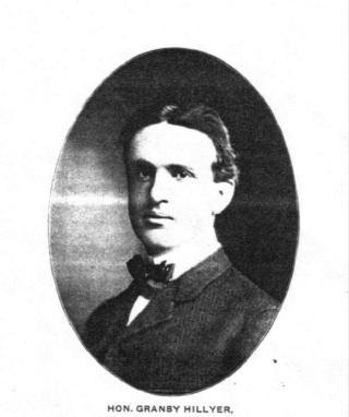
Granby Hillyer was born in Cartersville, Georgia on July 7, 1874. The third of six children, born of Shaler Granby Jr. and Lelia (Holloway) Hillyer, and the grandson of the Rev. Shaler Granby Hillyer, Sr. who was born in Granby, Hartford County, Connecticut. When Granby was 13 years old the Hillyer family moved to Washington, D.C. where Granby graduated from public high school. He then entered government service and at the same time studied at George Washington University, receiving a Bachelors of Law Degree. A postgraduate law degree was awarded in 1896 from Columbia University School of Law. He moved to Colorado in 1898 settling at Lamar (Prowers County) launching a 40+ year legal career. On June 16, 1900 he married Miss Annie Creaghe, from a prominent southern Colorado pioneer family, and a daughter of an Apache County, Arizona sheriff. To this union were born 3 children St. George Creaghe, Granby Francis Ridgeway Jr., and Helen Edna Dolorine (Jane) later Mrs. Albert Hunt of Boston, Massachusetts.
Granby Hillyer was a member of the Republican Party. He served as Lamar City Attorney, Prowers County Attorney, and Deputy District Attorney. He was also affiliated with the Elks, Masons, Sons of the American Revolution, and Woodmen of the World fraternal organizations.
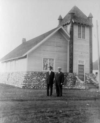
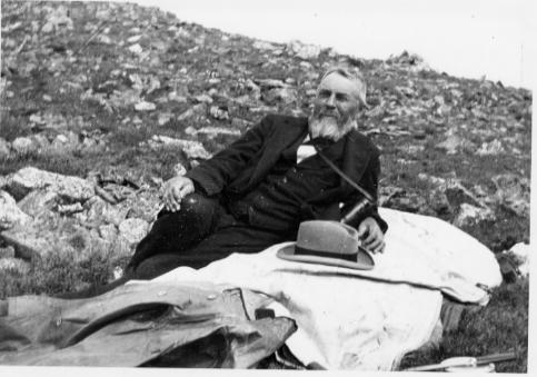
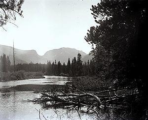
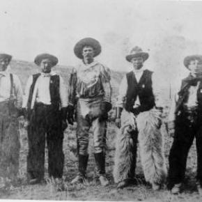
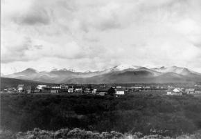
At 28 years of age, the citizens of Prowers, Baca and Las Animas Counties, elected Granby Hillyer to serve in the 14th Colorado General Assembly, House of Representatives, making him one of the youngest elected officials in state legislature history. He served one term from 1903-1905. During this tenure he plotted the streets at no cost for the Frontier Land and Investment Companies newest town on the Denver, Northwestern & Pacific Railroad (The Moffat Road). In doing so, Mr. Hillyer was honored by having the Town of Granby, Grand County, Colorado named for him.
Governor Carlson appointed Mr. Hillyer as the Third Judicial District Court Judge, at Trinidad, Colorado from 1914-1916. Her served as the United States Attorney for Colorado from 1922-1925. Afterwards he enjoyed a large private law practice in Lamar and Denver.
In 1928 at Lamar, Granby Hillyer was a speical prosecutor in the "Fleagle Gang Case". On May 23rd, the First National Bank was robbed, resulting in the loss of four lives. The case has been credited by the F.B.I. as the first robbery solved from a single fingerprint.
The Denver Post on July 21, 1931 page 9, reported "Granby Hillyer Is Disbarred By Federal Courts." In a decision reached by the United States Circuit Court of Appeals, predicated by a Colorado Supreme Court tribunal, of neglecting the interests of his clients in a number of cases.
Tragedy then struck the Hillyer family twice with the loss of St. George Creaghe in June 1932 and October 1933, Granby Jr. was killed in an automobile accident near Lamar. They both were attorneys. St. George and Granby Jr. were born 16 months apart and passed away 17 months apart. Both funeral services were held at the Immaculate Conception Cathedral in Denver, with the same set of pallbearers for both young men. They were laid to rest at Denver's Fairmount Cemetery. Their father Granby Hillyer, joined his sons on January 2, 1942, passing away at Denver Mercy Hospital, after suffering a heart attack at age 68.
The name Granby also comes from Great Britain, one of the original references was for the "Marquis of Granby," John Manners. A Member of Parliament from 1754 until his death in 1770, he also was a popular army officer and hero of the Seven-Year War 1756-1763, obtaining the rank of Lieutenant General. In 1766, he was named British Commander-in-Chief of the Army. John Manners once had his hat and wig shot off during a cavalry charge, thus leading to the British expression, "to go baldheaded at something." He had his office attacked by the pseudonymous political writer "Junius." The Marquis of Granby resigned most of his offices and died in debt.
Curiously, Granby Hillyer had an uncle and a brother named Junius.