Mountains

Mountains Articles

Berthoud Pass
Berthoud Pass

Berthoud Pass was named for Captain Edward L. Berthoud, who completed the first survey of  this saddle in the main Divide in the spring of 1861.

Berthoud’s expedition of eight people, including Jim Bridger, crossed the Continental Divide at the 11,315 foot summit and established a relatively easy way to get into Middle Park from the east. Berthoud also served as chief engineer on the Colorado Central Railroad.

It is surprising that this famous pass had played no previous role in the history of the region. Even Jim Bridger, who knew the country well, did not learn of its existence until the survey. For reasons of their own, Indians had chosen to go over the divide at higher levels further to the north. One explanation may be that the pass is not evident from most locations on either side of the Continental Divide.

Five Middle Park Veterans - Members of the Powell Expedition

On May 24, 1869, Major John W. Powell embarked on an expedition to fill in the final unknowns on the map of the American West. Among his nine-man crew were five veterans of the Civil War from Middle Park, unaware that by joining Powell’s discovery expedition they would find their own immortality.  

Corporal John "Jack" C. Sumner served in Company E, 32nd Iowa Volunteer Infantry in the Civil War. His sister Elizabeth Byers brought him to Colorado in 1866.  W.N. Byers, editor of the Rocky Mountain News, employed Jack as caretaker of the Middle Park Hot Springs. Sumner set up a trading post for hunters and trappers. Bill Dunn, Billy Hawkins, Oramel Howland, and Seneca Howland were all customers. 

Major and Mrs. John Wesley Powell visited the springs in 1867. Nearby, the headwaters of the Grand River flowed. Powell and Sumner planned to navigate the Grand, Green, and Colorado Rivers to the Gulf of California. Sumner convinced his colleagues to join the Colorado River Exploring Expedition. Only Sumner made it to the Gulf. He died July 5, 1907, leaving a widow and three sons.

page6image62730048

Private William H. “Bill” Dunn served with Co. K, 15th Ohio Vol. Inf. After service, he came to Colorado. Powell said of Dunn, “He dresses in buckskin with dark luster, and has a contempt for razors and shears.” Dunn left the expedition at Separation Rapid, Arizona, and was subsequently killed.  No photos of Dunn exist today. Artist’s interpretation courtesy of Hannah George.

Oramel G. Howland was a printer at the Rocky Mountain News, and VP of the Typographical Union. He was associated with the Methodist publication The Sunday School Casket. Powell said Oramel had a “King Lear” look. At age 36, he was the expedition’s mapmaker. His fate was the same as Dunn’s.

page6image62718736 

Pvt. William R.W. “Billy” Hawkins enlisted with Company D, 15th Missouri Vol. Cavalry. Hawkins came to Colorado as a bullwhacker. He was the expedition’s cook and last survivor, passing away in Arizona at age 70, on June 7, 1919.

page6image62718624

 A half-brother of Oramel, Seneca B. Howland was a member of Co. G, Vermont Vol. Inf. Brigade. At age 26, he shared the same demise as Oramel and Bill Dunn.

page6image62727472

2019 marked the 150th Anniversary of the Powell Expedition.  

Mount Craig
Mount Craig

The rounded mountain at the head of the East Inlet to Grand Lake has born many names-from Middle Mountain, to Mount Baldy, to Mount Westcott. It's official title, however, is Mount Craig. It's namesake is The Reverend William Bayard Craig, who came to the area in 1882, to be pastor of the Central Christian Church in Denver. He visited Grand Lake occasionally, and completed some real estate dealings there. The town of Craig also bears his name, due to the influence of his friend, David Moffat, of the Denver and Salt Lake Railroad.

Mountain Names
Mountain Names

While the origin of the names of many mountains in Grand County has been lost to history, we do know the source of many of the more notable mountains.  The name originations of some mountains of Grand County are as follows:   Adams Peak – Named for either Jay E. Adams who owned a cottage in Grand Lake or Alexander and Louise Adams, original owners of the Grand Lake Lodge.  

Mount Alice – 13,110 ft. – Named in 1911 by request of geologist Dr. William S. Cooper.  Who “Alice” was, was not explained.   Arapaho Peak – Named for the Arapaho Indian tribe who frequented Grand County during hunting season.   Arikaree Peak – Named for the Arikaree Indian tribe by James Grafton Rogers in 1955.   Baker Mountain – Named for John Baker from Indiana, a well known prospector and hunter of the 1850’s and 1860’s.  

Bills Peak – Named after an early settler in the area whose last name was not known.   Bottle Mountain – Named for the bottle shape of the mountain, three miles north of Byers Peak.   Byers Peak – 12,790 ft. – Named for William N. Byers, publisher and editor of the Rocky Mountain News and early promoter of Hot Sulphur Springs.   Mountain Cairns – 10,800 ft. – Named for James Cairns, first storekeeper at Grand Lake.   West Carter Peak and North Carter Peak– Believed to have been named for a member of the original U.S. Geological Survey team.   Cascade Mountain – Also known as Loder Mountain, popularly named for cascading stream.  

The Cleaver – Believed named by early settlers for location between two other peaks.   Coal Mountain – Named for visible coal seam.   Mount Cumulus – 12,725 ft. – Named for cloud formation resemblance.  One of three “cloud” peaks.   Diamond Mountain – Named for rumors of diamonds found there or its shape.  Located four miles East of Muddy Pass.   Mount Epworth – Believed named for a Methodist youth group founded in 1889.  Located east of Rollins Pass.  

Fairview Mountain – Named for scenic view.  Located ½ mile south of Parika Peak.   Mount Flora – Named for fields of flowers on mountain.   Mount George – 12,876 – Named for Dr. R.D. George, a geologist.  Its north spur is Lone Eagle Peak.   Green Mountain – Named for the green trees covering the mountain.   Grouse Mountain – Named for the grouse that inhabit the area.   Hallett Park – 12,713 – Named for William H. Hallett who lived from 1851 to 1947.  The mountain was named in 1887.  

Howard Mountain – Named for John Howard, a prospector.  The mountain was named in 1880.   Mount Irving Hale – Named for Brigadier General Hale who lead Colorado troops in the Philippines during the Spanish American War.  Hale was a member of the first graduating class at Denver High School and won an appointment to West Point.  Camp Hale, near Leadville, was a training site for World War II ski troops and was also named for him.

Mountains
Mountains

The mountains of Grand County may not boast any of the famous “fourteeners“ (14,000 feet and above), but Middle Park is defined by some of the most majestic ranges in the state. These include parts of the Front Range, Gore Range, Rabbit Ears Range, and the Williams Fork Mountains.  

The only range Grand County can call entirely it's own is The Never Summer Range.  It's highest point is Mount Richthofen (12,940 feet).  Other major peaks include: Mount Howard (12,810 feet), Mount Cirrus (12,797 feet), Mount Nimbus (12,706 feet), and Nokhu Crags (12,485 feet). The name Never Summer is translated from the Arapahoe name, Ni-chebe-chii, which means “the place of No Never Summer“.  The cloud names of Cirrus and Nimbus, and Stratus and Cumulus were the idea of James Grafton Rogers, a founder of the Colorado Mountain Club.  

The Never Summer Range stretches for ten miles from Cameron Pass to Bowen Mountain.  This range is darker and harder due the tremendous heat produced when the peaks were a localized center of volcanic activity.

Mountains of Grand County

The mountains of Grand County may not boast any of the famous “fourteeners“ (14,000 feet and above), but Middle Park is defined by some of the most majestic ranges in the state. These include parts of the Front Range, Gore Range, Rabbit Ears Range, and the Williams Fork Mountains.

The only range Grand County can call entirely it's own is the Never Summer Range. It's highest point is Mount Richthofen (12,940 feet). Other major peaks include: Mount Howard (12,810 feet), Mount Cirrus (12,797 feet), Mount Nimbus (12,706 feet), and Nokhu Crags (12,485 feet). The name Never Summer is translated from the Arapahoe name, Ni-chebe-chii, which means “the place of No Never Summer“. The cloud names of Cirrus and Nimbus, and Stratus and Cumulus were the idea of James Grafton Rogers, a founder of the Colorado Mountain Club.

The Never Summer Range stretches for ten miles from Cameron Pass to Bowen Mountain. This range is darker and harder due the tremendous heat produced when the peaks were a localized center of volcanic activity.

Rollins or Corona - What shall it be called?

Travel across various passes of the Continental Divide occurred long before white men showed up. Indeed, as anthropologist James Benedict wrote c. 1975, some 10,000 years ago, prehistoric Indians camped, hunted, and built hunting walls on the upper reaches of Rollins Pass, as well as moving in and out of Middle Park for the warm summer months. Historic Indians followed the same paths. In the earliest days of non-Indian access, a particular pass at the head of Boulder Creek was dubbed Boulder Pass.

Capt. Jacob Bonesteel, including wagons, made the first recorded crossing by a white man at this point in April 1862. Three years later, a group of Mormons brought wagons over this route and a year later, promoters of new roads into Middle Park brought in many wagons and livestock. In fact, tourists were starting to enter the park by a number of routes, and one of them, Samuel Bowles, who wrote a fascinating account of his trip, including his return to Denver via Boulder Pass.

Interest was growing rapidly for a road over the Divide, into Hot Sulphur Springs, and on into Utah. One promoter, John Quincy Adams Rollins, from New Hampshire, teamed up with William N. Byers and Porter M. Smart to carry this project through. Rollins was interested in crossing the Divide; Byers was promoting the Springs; Porter wanted to develop the valley of the Middle Yampa. All three were pushing to have Middle Park officially named as Grand County, a challenge finally accomplished in 1874.

So Rollins and associates started his road, reaching the top in 1873. That next winter, they publicized this access and in June, Jimmy Crawford brought his family and wagons to Rollinsville and thence to Yankee Doodle Lake, ready to cross the pass now named Rollins Pass by the developer. But the road ended, and they found Rollins' men still hacking the road out of the granite! Jimmy and his crew found it necessary to leave their wagons and help.

Finally, on June 10th, the family was able to head for the top. Jimmy borrowed two yokes of oxen, hitching them to mules, and then to his horse. The road was so rough that the procession could proceed but a few feet before having to rest. The family itself climbed on foot. At the summit, they discovered only a rough swath cut down through the trees on the western side. The "road" dropped down between the lakes and followed Ranch Creek to its junction with the Fraser River. Rollins quickly realized that Berthoud Pass, which also opened in 1874, was superior to his own pass for wheeled vehicles, so he determined to hedge his bets. He initiated the first mail service into the county in 1873. He also built a commodious hotel where his road joined the Berthoud Pass road at the confluence of Crooked Creek and the Fraser. He called it the Junction House. Next, he proposed to the builders of Berthoud Pass that they form a joint ownership of the two roads between Junction Ranch and the Springs. Tickets would be issued for both routes and revenues would be shared. The two companies would build a bridge over the Grand at Hot Sulphur Springs. He even buttered up his rivals by complementing their work.

All this was accomplished, although the mail route soon moved to Berthoud Pass, because of the severe winters on Rollins Pass. The bridge was started in November 1874. From the beginning, Rollins' road was preferred for trailing livestock, because there were fewer problems with heavy timber and bogs. For years, the Church brothers, George and John, who introduced the Hereford breed into the county, trailed their cattle for summering in what became known as Church Park. However, tourists such as Irving Hale still drove wagons over Rollins Pass in 1878.

About 1880, interest burgeoned for bringing a railroad up South Boulder Canyon and through a tunnel near Rollins Pass. Numerous surveys were completed all along the area. David Moffat settled on Rollins Pass for the tunnel site but decided first to put a temporary line over the top. Thus, in the summer of 1903, a formal contract was let for work up and over the Pass itself. By 1904, the workers reached Arrowhead and they also built a work station on top, called Corona Station, or "crown of the mountain." This railroad construction town of Corona, located at over 11,600 feet at the top of Rollins Pass (first called Boulder Pass) along the Continental Divide was the highest railroad station in the world.

It became obvious by 1905 that the Corona area would require snowsheds if trains were to travel, even irregularly, during the winter. Still, word got out of the spectacular splendor of Rollins Pass and tourists flocked in on summer train excursions, sometimes stopping on top, sometimes going as far as Arrow. In 1913, a fine hotel was built next to the rail facilities. Because Rollins Pass was right in the middle of severe weather patterns, a weather station was built on top, as well as one down at Sunnyside. In 1915, Rollins Pass was actually proposed to be the south boundary of a proposed "Estes National Park."

Later, on the National Historic Register, the district was listed in 1997 as the Denver, Northwestern and Pacific Railway Historic District--Rollinsville & Middle Park Wagon Road. It was also identified as the Rollinsville and Middle Park Wagon Road; Boulder Wagon Road, Rollins Pass, and Rollinsville area. In 1956, Governor Steve McNichols had presided at the official re-opening of the four percent grade to vehicle traffic over Corona Pass, expressing the hope that the route would someday be paved. The Colorado Game and Fish Department and the U.S. Forest Service made additional improvements, and the Arapaho and Roosevelt National Forests put out a 24-page booklet titled "The Moffat Road: A Self-Guiding Auto Tour." The road crossed two of the original railroad trestles near Corona but those trestles, even if reached by 4-wheel vehicles, were crumbling and could no longer even be crossed safely on foot. The current self-guided auto tour refers to Rollins Pass, as well as the Moffat Road and the Boulder Wagon Road. Corona Station and Hotel are discussed. In 1979, a portion of the auto road over Corona Pass was permanently closed because of a cave-in of the "Needle's Eye," a tunnel located before the trestles heading west from the Moffat Tunnel's East Portal.

The tunnel reopened on July 3, 1988, thanks to efforts of the Rollins Pass Restoration Association on both sides of the Divide, with the cooperation of the U.S. Forest Service, Colorado History Society, and Boulder, Grand, and Gilpin Counties. It then closed once more when another rockfall hit the tunnel on July 15, 1990. The RPRA is continuing its efforts for re-opening. The noted photographer, Charles McClure, took many outstanding photos of the Rollins Pass road. One, titled"Group on Rollins Pass, shows well-dressed men and women stand on a snowfield making snowballs on Rollins Pass, Moffat Road, Boulder or Grand County, Colorado; probably on Denver, Northwestern and Pacific excursion train. Date: between 1904 and 1913 near Corona Station." Another photo shows a "30 ft. snowcut on Rollins Pass, Moffat Road photo. Denver and Salt Lake Arrow passenger car is parked east of Corona snowshed by the thirty foot snowbank cut, Rollins Pass, Colorado; it shows men, women and railroad employees posed behind train, on the roof and on the snowbank and a standard gauge track. Date: between 1904 and 1915."

A sign at the highway turn onto the Moffat roadbed says: The Moffat Road "Hill Route" Also called "Corona Pass Road", this road over the Continental Divide was the original "Hill Route" of the Denver, Northwestern & Pacific Railway built by David H. Moffat in 1903. It crosses Rollins Pass at 11,666 feet elevation. On top of Rollins Pass, a sign says: Elevation 11, 660 feet, John Quincy Adams Rollins established a toll wagon road through this pass in the mid 1870's. David H. Moffat's Denver, Northwestern & Pacific Railway crossed the Continental Divide at this point in 1903. First known as Boulder Pass, then Rollins Pass, the railroad workers dubbed it "Corona", the crown of the "Top of the world." A railroad station, hotel, restaurant and workers' quarters existed here until 1928 when the railroad was abandoned due to the building of the Moffat Tunnel. Identifications in various trail and geographical guides say: Rollins Pass (el. 11,680 ft) is a high mountain pass in the Rocky Mountains of north-central Colorado in the United States. The pass is located on the continental divide at the crest of the Front Range southwest of Boulder, at the boundary of Grand County,Colorado and Boulder County, Colorado. Rollins Pass (a.k.a. Corona Pass) sits approximately 5 miles east and above the popular ski areas around Winter Park, between Winter Park and Rollinsville. The pass is traversed by an unpaved road, mostly the former roadbed of the Denver and Salt Lake Railway which abandoned the route in 1928 when the Moffat Tunnel opened to replace it. Railroad advertising called this the "Top O' the World" and it referred to the Moffat Route over the continental divide and the Rocky Mountains.

Rollins Pass was the primary travel route west from Denver until an easier road over Berthoud Pass was constructed. The Denver, Northwestern and Pacific railroad laid its tracks across the pass in 1903-1904 and established a Depot at Corona on the crest. It can be noted that in R.C. Black's Island in the Rockies, the term "Corona Pass" was mentioned one time, on p. 351; the terms "Corona Station" or "Corona Snowsheds were used. In Dismantling the Rails That Climbed, Rollins Pass was used, the Corona hotel, and just once, Corona Pass; 1936. In Maggie By My Side, it was Boulder Pass and Rollins Pass. In Rails that Climbed, Rollins Pass, the Corona shed, weather at Corona, Rollins Pass Snow Shed, other references to Corona as a site. In Guide to the Colorado Mountains (Orme) , they speak of the Corona Trail to Rollins Pass. High Country Names (Ward) used Rollins Pass entirely. Only Hiking Grand County, Colorado, published 2002 by Carr speaks of Corona Pass, with reference to Rollins Pass (near the town of Corona), Moffat Road. The term "town" might be questionable; there was only a small restaurant, workers quarters, railroad offices, and in 1913, the hotel. Current maps, USFS and the Grand County Trail Map, show Rollins Pass, with Corona at the side as being a site.

The use of "Corona Pass' seems to be a rather recent innovation that has come into being with tourism efforts in the upper Fraser Valley. Rollins Pass From Island in the Rockies p. 45 Rollins Pass was originally known as Boulder Pass, first recorded being crossed by whites, by Capt. Jacob Bonesteel in April 1862. Their supplies were carried in wagons. A second organized party went over the same pass in 1865. In 1866, promoters of access into Grand County brought many wagons and livestock over Boulder Pass.In 1867, Samuel Bowles and a group returned home to Denver via Boulder Pass. In 1873-74, two roads were proposed into the county, one of Berthouds pass and one over Boulder Pass. This was the same time that the county was named "Grand". J..A Rollins and his associates started the road and reached the top of the pass in 1873, at which time they envisaged a road from HSS into Utah. The first wagons went over in June 1874. The western descent was so bad that it never was much patronized by wheeled vehicles, instead becoming primarily used for trailing of cattle. At this time the name Boulder Pass disappeared from maps and Rollins Pass became the official name. p. 85. p. 80 Lots of schemes to build roads into GC, but of all the schemes for transport, only one, the Rollinsville and Middle Park Wagon Road showed any promise. That was designed by John Quincy Adams Rollins, from NH, a gifted promoter, a son of a clergyman, second of 19 children. He was a farmer, miner, freighter, road bulder, and platter of towns. He was perhaps the most accomplished billiard player west of the Mississippi. He was a Colorado resident at least by 1866. His finances were up and down, but he was tremendously strong. In December 1884, when he was 68, he thought nothing of a 3-day snow-clogged crossing of the Continental Divide. p. 85 Rollins was interested in MP as an investor and he was interested in extending his road into Utah.

At the same time, a Porter M. Smart was likewise excited about speculating in frontier projects and was working at developing the valley of the Middle Yampa. William N. Byers was busy planning for HSS. These three men launched at least two petitions, with more than 80 "residents" for creating GC. Grand County was created that year, 1874. p. 89 With the creation of GC, people began to consider the area more seriously. p. 92 There was no official mail into the county until 1873 when Rollins brought in the first US pouch over his pass. In May 1874, he built a commodious hotel at the confluence of Crooked Creek and the Fraser, known as the Junction House. p. 94 Rollins knew that the road over Berthoud Pass was superior to Rollins Pass; his main advantage was the railhead at Blackhawk. So Rollins proposed a joint ownership and operation of the two roads for the line between Junction Ranch and HSS. Tickets would be issued for both routes and revenues would be shared. The two companies would build a bridge across the Grand at HSS. Rollins even complimented the Berthoud work. This merger was completed soon. p. 104 This bridge was started in November 1874. p. 108

A mail contract was made in July 1875 for once a week delivery over Rollins Pass, but conditions were so severe that the route was changed to Berthoud Pass. p. 110 From the beginning, Rollins Pass was used in preference to Berthoud Pass for trailing livestock, because there were fewer problems with timber and bogs. However, late spring snowdrifts were a problem, so 20-30 horses were often brought along to break trail. The Church brothers, George and John, summered their cattle in what became known as Church Park and dug the Church Ditch. They also introduced the celebrated Hereford breed into GC. p. 170-171 As interest in bringing a railroad into and through GC developed, about 1880, various stockholders proposed to build up South Boulder Canyon to Yankee Doodle Lake and start a tunnel near Rollins Pass. Nothing came of the first attempts but by the end of July 1881, numerous surveys had been made for that tunnel. p. 238 Cattle was still being trailed out via Rollins Pass up to the turn of the century. p. 258

David Moffat and Horace Sumner, his chief engineer, in the fall of 1903, were planning the tunnel for future excavation; but in the meantime a temporary line was planned for crissing Rollins Pass, at 11,640 feet. p. 264 A formal contract was let for the work over Rollins Pass in August 1903. The loftiest sections were started first, and the first cuts at the top were nearly finished by the 26th of October and tunneling started at Riflesight Notch. As snow came, work slowed to a standstill. p. 265 Work in 1904 was extremely slow until the end of August. An encampment was built at Arrowhead and a station at the crest of the Divide was named Corona Station, where long snow sheds were built almost immediately. p. 267 Arrowhead was soon shortened to Arrow, when a post office was opened there in 1905. Travel on the grades, at 4-5% grades up over Rollins Pass was exceedingly difficult. p. 270 In 1908, word of the scenic splendor of Rollins Pass was becoming known world wide.

Also, Rollins Pass and its "Corona station" were attracting the attention fo the US Weather Bureau, for the pass lay squarely in the center of the region of heaviest snowfall on the entire Colorado Continental Divide p. 344 A terrible winter in 1909 made people think that Rollins Pass was never going to be practical for the long term. Time and again freight and passengers were stuck on top at the Corona facility. In 1913, a $10,000 hotel was built at Corona next to the rail facilities. From Dismantling the Rails That Climbed p. 6 The railroad went from Denver to the top of Rollins Pass. p. 8 Snowsheds were built over the tracks at Corona and other strategic places in 1905. p. 12 The top was referred to as "Corona Pass" 1936. p. 16 Crews who were to removed tails and ties reached Corona at the top of Rollins Pass 1936. p. 20 Reference to the Corona hotel From Maggie By My Side p. 1 Jimmy Crawford heard that a man named John Quincy Adams Rollins was building a road over the range at a place called Boulder Pass. 1873 p. 9-14 June 1874

The Crawford family traveled to Rollinsville and then to Yankee Doodle Lake, where the road ended. Rollins' men were still hacking the road out of the granite. Jimmy and his crew helped. On the morning of June 10, the family started out to go over the rocks and up the mountain. Then he borrowed two yokes of oxen to his wagon, then mules, then his horse. The animals had to rest every few feet; the family climbed on foot. There was no shelter at the top. Rollins' men had done no work yet on the west side of the pass except to cut a rough swath down through the trees. The road dropped down along Ranch Creek. From Rails That Climb published 1950 p. 43 Leyden Junction to Tolland to Rollins Pass. P. 63-64 Many references to Tunnels as identifiers of location. p. 76-77, 78 reference to the old Rollins Pass toll road; first mention of the place called Corona- crown of the mountain. Most references are to Rollins Pass. The Corona shed is mentioned, p. 82. p. 83 Sunnyside water stop, Loop Trestle and Tunnel, Ranch Creek Trestle and water stop, Arrow. p. 95, 100- 101 It is eleven miles from Arrowhead to Rollins Pass. Rollins Pass-Boulder wagon road; other references p. 107 - 112 reference to Corona shed. Reference to pipe line to Corona; a number of comments to Rollins Pass p. 119 weather at Corona p. 120-121 Rollins Pass p. 151 Rollins Pass p. 182 photo of "Rollins Pass Snow Shed" "This Corona station burned one night." p. 188 photo of June at Rollins Pass p. 192-194 photos of Corona shed and other buildings; Rollins Pass p. 252 walking on top of snow shed at Corona p. 271- 272. 1910 Snowshed at Corona p. 312-314 Rollins Pass; Rollins Pass snowshed; Corona; Corona siding p. 324 Corona; Sunnyside weather report station p. 326 Corona sheds p. 333-335 Corona shed; references to "Corona" as a place From Guide to the Colorado Mountains published 1974 p. 54-55 Corona Trail, going from East Portal to Rollins Pass From High Country Names published 1972 p. 105 Irving Hale in 1878 drove his wagon over Rollins Pass, now nearly abandoned as a wagon road. p. 131

David Moffat decides to build a temporary line over Rollins Pass. p. 165 In 1915, Rollins Pass was proposed to be the south boundary of a proposed "Estes National Park". From Hiking Grand County, Colorado published 2002 p. 52 Trailhead on the "Moffat Road to Corona Pass". In same paragraph, it becomes Rollins Pass (near the town of Corona). On p. 54, reference to the Corona Road. On p. 57, map shows Rollins Pass with Corona marked as a "site." p. 56, reference to the old railroad bed used crossing the Divide at Rollins Pass, near the town of Corona. Sometimes called Corona Pass. p. 60-61 Rollins Pass Wagon Road historical notes on JQA Rollins and how to find his wagon road over Rollins Pass, following Ranch Creek to Tabernash. p. 66 Rollins Pass (Corona) to Devil's Thumb From GCHA Journal The Journey p. 6 Rollins Pass used by Indians; comment in 1981 From GCHA Journal Middle Park Indians to 1881 p. 8 Archaic hunters camped in the Rollins Pass area; written mid-1970's The current maps, USFS and Grand County Trail Map, show Rollins Pass with Corona at the side as being a site. The Rollins Pass Restoration Association for many years, and currently, has been trying to open the road and Needles Eye Tunnel. The self-guided auto tour refers to Rollins Pass, as well as the Moffat Road and the Boulder Wagon Road. Corona Station and Hotel are discussed. On the National Historic Register Denver, Northwestern and Pacific Railway Historic District--Rollinsville & Middle Park Wagon Road (Boundary Increase) ** (added 1997 - District - #97001114)

Also known as Rollinsville and Middle Park Wagon Road;Boulder Wagon Road;R Rollins Pass, Rollinsville Corona Station and Hotel The railroad construction town of Corona, Colorado, located at over 11,600 feet at the top Corona Pass (first called Boulder Pass) along the Continental Divide was the highest railroad station in the world. It was situated on an old Native American trail, the same trail it is believed the Mormons traveled on their way to Utah. The road was improved by the U.S. Army, then further improved in 1866 by General John Q. Rollins, for whom the pass and the town of Rollinsville were officially named. Because of the high drifts of snow, the pass was only open from around July to the first big snowstorm two or three months later. In 1956, Governor Steve McNichols presided at the official re-opening of the four percent grade to vehicle traffic over Corona Pass, expressing the hope that the route would someday be paved. The Colorado Game and Fish Department and the U.S. Forest Service made additional improvements, and the Arapaho and Roosevelt National Forests put out a 24-page booklet titled "The Moffat Road: A Self-Guiding Auto Tour."

The road crossed two of the original railroad trestles near Corona but those trestles, even if reached by 4-wheel vehicles, are crumbling and can no longer even be crossed safely on foot. In 1979, a portion of the auto road over Corona Pass was permanently closed because of a cave-in of the "Needle's Eye," a tunnel that came before the trestles on a westward drive from the Moffat Tunnel's East Portal area. The tunnel reopened on July 3, 1988, thanks to the efforts of the Rollins Pass Restoration Association with the cooperation of the U.S. Forest Service, Colorado History Society, and Boulder, Grand, and Gilpin Counties. It was then closed once more when another rockfall hit the tunnel on July 15, 1990. John K. Aldrich is a geologist, lecturer, and author whose "Ghosts of . . . " books and accompanying topo maps are a boon to hobbyists, explorers, and those interested in Colorado mining history. Date: 02/04/08 05:13 Rollins Pass Milepost 16 Corona Station. Picture 6 below, is DPL photo X-7388. "Title: Corona, Colorado, interior of snowshed. Summary: Passengers stand next to the covered train depot at Rollins Pass, in Corona (Grand County), Colorado. The tracks of the Denver, Northwestern & Pacific Railway are in the foreground. The depot is constructed of logs, and the roof of the snowshed is upheld by timbers. Sunlight streams through the opening at the end of the snowshed. Date: (between 1904 and 1913). Source: E. T. Bollinger from W. I. Hoklas." Picture 7 below, is DPL photo MCC-454A. "Title: Group on Rollins Pass. Summary: Well dressed men and women stand on a snowfield making snowballs, Rollins Pass, Moffat Road, Boulder or Grand County, Colorado; probably on Denver, Northwestern and Pacific excursion train. Date: (between 1904 and 1913). Creator: Louis Charles McClure 1867-1957. Picture 8 below, is DPL photo MCC-624. "Title: 30 ft. snowcut, Rollins Pass, Moffat Road photo. Summary: Denver and Salt Lake Arrow Turn (passenger car) parked east of Corona snowshed by thirty foot snowbank cut, Rollins Pass, Colorado; shows men, women and railroad employees posed behind train, on roof and on snowbank and standard gauge track. Date: (between 1904 and 1915 The highway sign says The Moffat Road "Hill Route" Also called "Corona Pass Road", this road over the Continental Divide was the original "Hill Route" of the Denver, Northwestern & Pacific Railway built by David H. Moffat in 1903. It crosses Rollins Pass at 11,666 feet elevation. On top of Rollins Pass, a sign says: Rollins Pass Elevation 11, 660 feet John Quincy Adams Rollins established a toll wagon road through this pass in the mid 1860-s. David H. Moffat's Denver, Northwestern & Pacific Railway crossed the Continental Divide at this point in 1903. First known as Boulder Pass, then Rollins Pass, the railroad workers dubbed it "Corona", the crown of the "Top of the world." A railroad station, hotel, restaurant and workers' quarters existed here until 1928 when the railroad was abandoned due to the building of the Moffat Tunnel. Rollins Pass Elevation 11,680 ft (3,560.1 m) Traversed by Unpaved road Location Boulder_County,_Colorado / Grand,Colorado Rollins Pass (el. 11,680 ft) is a high mountain pass in the Rocky Mountains of north-central Colorado in the United States. The pass is located on the continental divide at the crest of the Front Range southwest of Boulder at the boundary of Grand_County,_Colorado and Boulder County. Sign that sits on top of Rollins Pass Rollins Pass (a.k.a. Corona Pass) sits approximately 5 miles east and above the popular ski areas around Winter Park, between Winter Park and Rollinsville. The pass is traversed by an unpaved road, mostly the former roadbed of the Denver and Salt Lake RailwayDenver_and_Salt_Lake_Railway which abandoned the route in 1928 when the Moffat Tunnel opened to replace it. Rollins Pass Railroad advertising called this the "Top 'O the World" and it referred to the Moffat Route over the continental divide and the Rocky Mountains.

Rollins Pass was the primary travel route west from Denver until an easier road over Berthoud Pass was constructed. The Denver, Northwestern and Pacific railroad laid its tracks across the pass in 1903-1904 and established a Depot at Corona on the crest. David Moffat planned to replace the "Hill Line" with a tunnel through James Peak within a few years of the railroad construction. However, he never could obtain financing for the tunnel due to the inability of the railroad to make a profit and opposition from competing railroads such as the Denver and Rio Grande. The D&RG saw the line as a threat. But, in the far future the construction of Moffat Tunnel would turn out to be the D&RG's saving grace. The trip up Rollins Pass was a favorite of summer tourists looking to enjoy the mountain scenery. It was heavily promoted by the railroad with picnic and wildflower picking excursions. Sights along the line were made famous by postcards containing the photos of L. C. McClure. At last the route surmounts the crest of the Continental Divide and takes quick refuge on the top at Corona. At elevation 11, 660 this is truly the famous Top O' the World and one of the highest railroad passes in the world. Due to the great height and nature of the Rocky Mountains, the entire railroad complex was completely enclosed in giant covered snow sheds.

Rollins or Corona - What shall it be called?

Travel across various passes of the Continental Divide occurred long before white men showed up. Indeed, as anthropologist James Benedict wrote c. 1975, some 10,000 years ago, prehistoric Indians camped, hunted, and built hunting walls on the upper reaches of Rollins Pass, as well as moving in and out of Middle Park for the warm summer months.

Historic Indians followed the same paths. In the earliest days of non-Indian access, a particular pass at the head of Boulder Creek was dubbed Boulder Pass. Capt. Jacob Bonesteel, including wagons, made the first recorded crossing by a white man at this point in April 1862. Three years later, a group of Mormons brought wagons over this route and a year later, promoters of new roads into Middle Park brought in many wagons and livestock.

In fact, tourists were starting to enter the park by a number of routes, and one of them, Samuel Bowles, who wrote a fascinating account of his trip, including his return to Denver via Boulder Pass. Interest was growing rapidly for a road over the Divide, into Hot Sulphur Springs, and on into Utah. One promoter, John Quincy Adams Rollins, from New Hampshire, teamed up with William N. Byers and Porter M. Smart to carry this project through. Rollins was interested in crossing the Divide; Byers was promoting the Springs; Porter wanted to develop the valley of the Middle Yampa. All three were pushing to have Middle Park officially named as Grand County, a challenge finally accomplished in 1874. So Rollins and associates started his road, reaching the top in 1873.

That next winter, they publicized this access and in June, Jimmy Crawford brought his family and wagons to Rollinsville and thence to Yankee Doodle Lake, ready to cross the pass now named Rollins Pass by the developer. But the road ended, and they found Rollins' men still hacking the road out of the granite! Jimmy and his crew found it necessary to leave their wagons and help. Finally, on June 10th, the family was able to head for the top. Jimmy borrowed two yokes of oxen, hitching them to mules, and then to his horse. The road was so rough that the procession could proceed but a few feet before having to rest. The family itself climbed on foot. At the summit, they discovered only a rough swath cut down through the trees on the western side. The "road" dropped down between the lakes and followed Ranch Creek to its junction with the Fraser River.

Rollins quickly realized that Berthoud Pass, which also opened in 1874, was superior to his own pass for wheeled vehicles, so he determined to hedge his bets. He initiated the first mail service into the county in 1873. He also built a commodious hotel where his road joined the Berthoud Pass road at the confluence of Crooked Creek and the Fraser. He called it the Junction House. Next, he proposed to the builders of Berthoud Pass that they form a joint ownership of the two roads between Junction Ranch and the Springs. Tickets would be issued for both routes and revenues would be shared. The two companies would build a bridge over the Grand at Hot Sulphur Springs. He even buttered up his rivals by complementing their work. All this was accomplished, although the mail route soon moved to Berthoud Pass, because of the severe winters on Rollins Pass.

The bridge was started in November 1874. From the beginning, Rollins' road was preferred for trailing livestock, because there were fewer problems with heavy timber and bogs. For years, the Church brothers, George and John, who introduced the Hereford breed into the county, trailed their cattle for summering in what became known as Church Park. However, tourists such as Irving Hale still drove wagons over Rollins Pass in 1878. About 1880, interest burgeoned for bringing a railroad up South Boulder Canyon and through a tunnel near Rollins Pass. Numerous surveys were completed all along the area. David Moffat settled on Rollins Pass for the tunnel site but decided first to put a temporary line over the top.

Thus, in the summer of 1903, a formal contract was let for work up and over the Pass itself. By 1904, the workers reached Arrowhead and they also built a work station on top, called Corona Station, or "crown of the mountain." This railroad construction town of Corona, located at over 11,600 feet at the top of Rollins Pass (first called Boulder Pass) along the Continental Divide was the highest railroad station in the world. It became obvious by 1905 that the Corona area would require snowsheds if trains were to travel, even irregularly, during the winter. Still, word got out of the spectacular splendor of Rollins Pass and tourists flocked in on summer train excursions, sometimes stopping on top, sometimes going as far as Arrow.

In 1913, a fine hotel was built next to the rail facilities. Because Rollins Pass was right in the middle of severe weather patterns, a weather station was built on top, as well as one down at Sunnyside. In 1915, Rollins Pass was actually proposed to be the south boundary of a proposed "Estes National Park." Later, on the National Historic Register, the district was listed in 1997 as the Denver, Northwestern and Pacific Railway Historic District--Rollinsville & Middle Park Wagon Road. It was also identified as the Rollinsville and Middle Park Wagon Road; Boulder Wagon Road, Rollins Pass, and Rollinsville area. In 1956, Governor Steve McNichols had presided at the official re-opening of the four percent grade to vehicle traffic over Corona Pass, expressing the hope that the route would someday be paved. The Colorado Game and Fish Department and the U.S. Forest Service made additional improvements, and the Arapaho and Roosevelt National Forests put out a 24-page booklet titled "The Moffat Road: A Self-Guiding Auto Tour."

The road crossed two of the original railroad trestles near Corona but those trestles, even if reached by 4-wheel vehicles, were crumbling and could no longer even be crossed safely on foot. The current self-guided auto tour refers to Rollins Pass, as well as the Moffat Road and the Boulder Wagon Road. Corona Station and Hotel are discussed. In 1979, a portion of the auto road over Corona Pass was permanently closed because of a cave-in of the "Needle's Eye," a tunnel located before the trestles heading west from the Moffat Tunnel's East Portal. The tunnel reopened on July 3, 1988, thanks to efforts of the Rollins Pass Restoration Association on both sides of the Divide, with the cooperation of the U.S. Forest Service, Colorado History Society, and Boulder, Grand, and Gilpin Counties. It then closed once more when another rockfall hit the tunnel on July 15, 1990. The RPRA is continuing its efforts for re-opening. The noted photographer, Charles McClure, took many outstanding photos of the Rollins Pass road.

One, titled "Group on Rollins Pass, shows well-dressed men and women stand on a snowfield making snowballs on Rollins Pass, Moffat Road, Boulder or Grand County, Colorado; probably on Denver, Northwestern and Pacific excursion train. Date: between 1904 and 1913 near Corona Station." Another photo shows a "30 ft. snowcut on Rollins Pass, Moffat Road photo. Denver and Salt Lake Arrow passenger car is parked east of Corona snowshed by the thirty foot snowbank cut, Rollins Pass, Colorado; it shows men, women and railroad employees posed behind train, on the roof and on the snowbank and a standard gauge track. Date: between 1904 and 1915." A sign at the highway turn onto the Moffat roadbed says: The Moffat Road "Hill Route" Also called "Corona Pass Road", this road over the Continental Divide was the original "Hill Route" of the Denver, Northwestern & Pacific Railway built by David H. Moffat in 1903. It crosses Rollins Pass at 11,666 feet elevation. On top of Rollins Pass, a sign says: Elevation 11, 660 feet, John Quincy Adams Rollins established a toll wagon road through this pass in the mid 1870's. David H. Moffat's Denver, Northwestern & Pacific Railway crossed the Continental Divide at this point in 1903.

First known as Boulder Pass, then Rollins Pass, the railroad workers dubbed it "Corona", the crown of the "Top of the world." A railroad station, hotel, restaurant and workers' quarters existed here until 1928 when the railroad was abandoned due to the building of the Moffat Tunnel. Identifications in various trail and geographical guides say: Rollins Pass (el. 11,680 ft) is a high mountain pass in the Rocky Mountains of north-central Colorado in the United States. The pass is located on the continental divide at the crest of the Front Range southwest of Boulder, at the boundary of Grand County, Colorado and Boulder County, Colorado. Rollins Pass (a.k.a. Corona Pass) sits approximately 5 miles east and above the popular ski areas around Winter Park, between Winter Park and Rollinsville. The pass is traversed by an unpaved road, mostly the former roadbed of the Denver and Salt Lake Railway which abandoned the route in 1928 when the Moffat Tunnel opened to replace it. Railroad advertising called this the "Top O' the World" and it referred to the Moffat Route over the continental divide and the Rocky Mountains. Rollins Pass was the primary travel route west from Denver until an easier road over Berthoud Pass was constructed. The Denver, Northwestern and Pacific railroad laid its tracks across the pass in 1903-1904 and established a Depot at Corona on the crest. It can be noted that in R.C. Black's Island in the Rockies, the term "Corona Pass" was mentioned one time, on p. 351; the terms "Corona Station" or "Corona Snowsheds were used. In Dismantling the Rails That Climbed, Rollins Pass was used, the Corona hotel, and just once, Corona Pass; 1936.

In Maggie By My Side, it was Boulder Pass and Rollins Pass. In Rails that Climbed, Rollins Pass, the Corona shed, weather at Corona, Rollins Pass Snow Shed, other references to Corona as a site. In Guide to the Colorado Mountains (Orme) , they speak of the Corona Trail to Rollins Pass. High Country Names (Ward) used Rollins Pass entirely. Only Hiking Grand County, Colorado, published 2002 by Carr speaks of Corona Pass, with reference to Rollins Pass (near the town of Corona), Moffat Road. The term "town" might be questionable; there was only a small restaurant, workers quarters, railroad offices, and in 1913, the hotel. Current maps, USFS and the Grand County Trail Map, show Rollins Pass, with Corona at the side as being a site. The use of "Corona Pass' seems to be a rather recent innovation that has come into being with tourism efforts in the upper Fraser Valley. Rollins Pass From Island in the Rockies p. 45 Rollins Pass was originally known as Boulder Pass, first recorded being crossed by whites, by Capt. Jacob Bonesteel in April 1862. Their supplies were carried in wagons. A second organized party went over the same pass in 1865. In 1866, promoters of access into Grand County brought many wagons and livestock over Boulder Pass.In 1867, Samuel Bowles and a group returned home to Denver via Boulder Pass. In 1873-74, two roads were proposed into the county, one of Berthouds pass and one over Boulder Pass. This was the same time that the county was named "Grand". J..A Rollins and his associates started the road and reached the top of the pass in 1873, at which time they envisaged a road from HSS into Utah. The first wagons went over in June 1874. The western descent was so bad that it never was much patronized by wheeled vehicles, instead becoming primarily used for trailing of cattle. At this time the name Boulder Pass disappeared from maps and Rollins Pass became the official name. p. 85. p. 80 Lots of schemes to build roads into GC, but of all the schemes for transport, only one, the Rollinsville and Middle Park Wagon Road showed any promise. T

hat was designed by John Quincy Adams Rollins, from NH, a gifted promoter, a son of a clergyman, second of 19 children. He was a farmer, miner, freighter, road bulder, and platter of towns. He was perhaps the most accomplished billiard player west of the Mississippi. He was a Colorado resident at least by 1866. His finances were up and down, but he was tremendously strong. In December 1884, when he was 68, he thought nothing of a 3-day snow-clogged crossing of the Continental Divide. p. 85 Rollins was interested in MP as an investor and he was interested in extending his road into Utah.. At the same time, a Porter M. Smart was likewise excited about speculating in frontier projects and was working at developing the valley of the Middle Yampa. William N. Byers was busy planning for HSS. These three men launched at least two petitions, with more than 80 "residents" for creating GC. Grand County was created that year, 1874. p. 89 With the creation of GC, people began to consider the area more seriously. p. 92 There was no official mail into the county until 1873 when Rollins brought in the first US pouch over his pass. In May 1874, he built a commodious hotel at the confluence of Crooked Creek and the Fraser, known as the Junction House. p. 94 Rollins knew that the road over Berthoud Pass was superior to Rollins Pass; his main advantage was the railhead at Blackhawk.

So Rollins proposed a joint ownership and operation of the two roads for the line between Junction Ranch and HSS. Tickets would be issued for both routes and revenues would be shared. The two companies would build a bridge across the Grand at HSS. Rollins even complimented the Berthoud work. This merger was completed soon. p. 104 This bridge was started in November 1874. p. 108 A mail contract was made in July 1875 for once a week delivery over Rollins Pass, but conditions were so severe that the route was changed to Berthoud Pass. p. 110 From the beginning, Rollins Pass was used in preference to Berthoud Pass for trailing livestock, because there were fewer problems with timber and bogs. However, late spring snowdrifts were a problem, so 20-30 horses were often brought along to break trail. The Church brothers, ?George and John, summered their cattle in what became known as Church Park and dug the Church Ditch. They also introduced the celebrated Hereford breed into GC. p. 170-171 As interest in bringing a railroad into and through GC developed, about 1880, various stockholders proposed to build up South Boulder Canyon to Yankee Doodle Lake and start a tunnel near Rollins Pass. Nothing came of the first attempts but by the end of July 1881, numerous surveys had been made for that tunnel. p. 238 Cattle was still being trailed out via Rollins Pass up to the turn of the century. p. 258 David Moffat and Horace Sumner, his chief engineer, in the fall of 1903, were planning the tunnel for future excavation; but in the meantime a temporary line was planned for crissing Rollins Pass, at 11,640 feet. p. 264 A formal contract was let for the work over Rollins Pass in August 1903. The loftiest sections were started first, and the first cuts at the top were nearly finished by the 26th of October and tunneling started at Riflesight Notch. As snow came, work slowed to a standstill. p. 265 Work in 1904 was extremely slow until the end of August.

An encampment was built at Arrowhead and a station at the crest of the Divide was named Corona Station, where long snow sheds were built almost immediately. p. 267 Arrowhead was soon shortened to Arrow, when a post office was opened there in 1905. Travel on the grades, at 4-5% grades up over Rollins Pass was exceedingly difficult. p. 270 In 1908, word of the scenic splendor of Rollins Pass was becoming known world wide. Also, Rollins Pass and its "Corona station" were attracting the attention fo the US Weather Bureau, for the pass lay squarely in the center of the region of heaviest snowfall on the entire Colorado Continental Divide. p. 344 A terrible winter in 1909 made people think that Rollins Pass was never going to be practical for the long term. Time and again freight and passengers were stuck on top at the Corona facility. In 1913, a $10,000 hotel was built at Corona next to the rail facilities. From Dismantling the Rails That Climbed p. 6 The railroad went from Denver to the top of Rollins Pass. p. 8 Snowsheds were built over the tracks at Corona and other strategic places in 1905. p. 12 The top was referred to as "Corona Pass" 1936. p. 16 Crews who were to removed tails and ties reached Corona at the top of Rollins Pass 1936. p. 20 Reference to the Corona hotel From Maggie By My Side p. 1 Jimmy Crawford heard that a man named John Quincy Adams Rollins was building a road over the range at a place called Boulder Pass. 1873 p. 9-14 June 1874 The Crawford family traveled to Rollinsville and then to Yankee Doodle Lake, where the road ended. Rollins' men were still hacking the road out of the granite. Jimmy and his crew helped. On the morning of June 10, the family started out to go over the rocks and up the mountain. Then he borrowed two yokes of oxen to his wagon, then mules, then his horse. The animals had to rest every few feet; the family climbed on foot. There was no shelter at the top. Rollins' men had done no work yet on the west side of the pass except to cut a rough swath down through the trees. The road dropped down along Ranch Creek. From Rails That Climb published 1950 p. 43 Leyden Junction to Tolland to Rollins Pass. P. 63-64 Many references to Tunnels as identifiers of location. p. 76-77, 78 reference to the old Rollins Pass toll road; first mention of the place called Corona- crown of the mountain. Most references are to Rollins Pass. The Corona shed is mentioned, p. 82. p. 83 Sunnyside water stop, Loop Trestle and Tunnel, Ranch Creek Trestle and water stop, Arrow. p. 95, 100- 101 It is eleven miles from Arrowhead to Rollins Pass. Rollins Pass-Boulder wagon road; other references p. 107 - 112 reference to Corona shed. Reference to pipe line to Corona; a number of comments to Rollins Pass p. 119 weather at Corona p. 120-121 Rollins Pass p. 151 Rollins Pass p. 182 photo of "Rollins Pass Snow Shed" "This Corona station burned one night." p. 188 photo of June at Rollins Pass p. 192-194 photos of Corona shed and other buildings; Rollins Pass p. 252 walking on top of snow shed at Corona p. 271- 272. 1910 Snowshed at Corona p. 312-314 Rollins Pass; Rollins Pass snowshed; Corona; Corona siding p. 324 Corona; Sunnyside weather report station p. 326 Corona sheds p. 333-335 Corona shed; references to "Corona" as a place From Guide to the Colorado Mountains published 1974 p. 54-55 Corona Trail, going from East Portal to Rollins Pass From High Country Names published 1972 p. 105 Irving Hale in 1878 drove his wagon over Rollins Pass, now nearly abandoned as a wagon road. p. 131 David Moffat decides to build a temporary line over Rollins Pass. p. 165 In 1915, Rollins Pass was proposed to be the south boundary of a proposed "Estes National Park". From Hiking Grand County, Colorado published 2002 p. 52 Trailhead on the "Moffat Road to Corona Pass". In same paragraph, it becomes Rollins Pass (near the town of Corona). On p. 54, reference to the Corona Road. On p. 57, map shows Rollins Pass with Corona marked as a "site." p. 56, reference to the old railroad bed used crossing the Divide at Rollins Pass, near the town of Corona.

Sometimes called Corona Pass. p. 60-61 Rollins Pass Wagon Road historical notes on JQA Rollins and how to find his wagon road over Rollins Pass, following Ranch Creek to Tabernash. p. 66 Rollins Pass (Corona) to Devil's Thumb From GCHA Journal The Journey p. 6 Rollins Pass used by Indians; comment in 1981 From GCHA Journal Middle Park Indians to 1881 p. 8 Archaic hunters camped in the Rollins Pass area; written mid-1970's The current maps, USFS and Grand County Trail Map, show Rollins Pass with Corona at the side as being a site. The Rollins Pass Restoration Association for many years, and currently, has been trying to open the road and Needles Eye Tunnel. The self-guided auto tour refers to Rollins Pass, as well as the Moffat Road and the Boulder Wagon Road. Corona Station and Hotel are discussed. On the National Historic Register Denver, Northwestern and Pacific Railway Historic District--Rollinsville & Middle Park Wagon Road (Boundary Increase) ** (added 1997 - District - #97001114) Also known as Rollinsville and Middle Park Wagon Road;Boulder Wagon Road;R Rollins Pass, Rollinsville Corona Station and Hotel The railroad construction town of Corona, Colorado, located at over 11,600 feet at the top Corona Pass (first called Boulder Pass) along the Continental Divide was the highest railroad station in the world. It was situated on an old Native American trail, the same trail it is believed the Mormons traveled on their way to Utah. The road was improved by the U.S. Army, then further improved in 1866 by General John Q. Rollins, for whom the pass and the town of Rollinsville were officially named. Because of the high drifts of snow, the pass was only open from around July to the first big snowstorm two or three months later. In 1956, Governor Steve McNichols presided at the official re-opening of the four percent grade to vehicle traffic over Corona Pass, expressing the hope that the route would someday be paved. The Colorado Game and Fish Department and the U.S. Forest Service made additional improvements, and the Arapaho and Roosevelt National Forests put out a 24-page booklet titled "The Moffat Road: A Self-Guiding Auto Tour."

The road crossed two of the original railroad trestles near Corona but those trestles, even if reached by 4-wheel vehicles, are crumbling and can no longer even be crossed safely on foot. In 1979, a portion of the auto road over Corona Pass was permanently closed because of a cave-in of the "Needle's Eye," a tunnel that came before the trestles on a westward drive from the Moffat Tunnel's East Portal area. The tunnel reopened on July 3, 1988, thanks to the efforts of the Rollins Pass Restoration Association with the cooperation of the U.S. Forest Service, Colorado History Society, and Boulder, Grand, and Gilpin Counties. It was then closed once more when another rockfall hit the tunnel on July 15, 1990. John K. Aldrich is a geologist, lecturer, and author whose "Ghosts of . . . " books and accompanying topo maps are a boon to hobbyists, explorers, and those interested in Colorado mining history. Date: 02/04/08 05:13 Rollins Pass Milepost 16 Corona Station. Picture 6 below, is DPL photo X-7388. "Title: Corona, Colorado, interior of snowshed. Summary: Passengers stand next to the covered train depot at Rollins Pass, in Corona (Grand County), Colorado. The tracks of the Denver, Northwestern & Pacific Railway are in the foreground. The depot is constructed of logs, and the roof of the snowshed is upheld by timbers. Sunlight streams through the opening at the end of the snowshed. Date: (between 1904 and 1913). Source: E. T. Bollinger from W. I. Hoklas." Picture 7 below, is DPL photo MCC-454A. "Title: Group on Rollins Pass. Summary: Well dressed men and women stand on a snowfield making snowballs, Rollins Pass, Moffat Road, Boulder or Grand County, Colorado; probably on Denver, Northwestern and Pacific excursion train. Date: (between 1904 and 1913). Creator: Louis Charles McClure 1867-1957. Picture 8 below, is DPL photo MCC-624. "Title: 30 ft. snowcut, Rollins Pass, Moffat Road photo. Summary: Denver and Salt Lake Arrow Turn (passenger car) parked east of Corona snowshed by thirty foot snowbank cut, Rollins Pass, Colorado; shows men, women and railroad employees posed behind train, on roof and on snowbank and standard gauge track. Date: (between 1904 and 1915 The highway sign says The Moffat Road "Hill Route" Also called "Corona Pass Road", this road over the Continental Divide was the original "Hill Route" of the Denver, Northwestern & Pacific Railway built by David H. Moffat in 1903. It crosses Rollins Pass at 11,666 feet elevation. On top of Rollins Pass, a sign says: Rollins Pass Elevation 11, 660 feet John Quincy Adams Rollins established a toll wagon road through this pass in the mid 1860-s. David H. Moffat's Denver, Northwestern & Pacific Railway crossed the Continental Divide at this point in 1903. First known as Boulder Pass, then Rollins Pass, the railroad workers dubbed it "Corona", the crown of the "Top of the world." A railroad station, hotel, restaurant and workers' quarters existed here until 1928 when the railroad was abandoned due to the building of the Moffat Tunnel. Rollins Pass Elevation 11,680 ft (3,560.1 m) Traversed by Unpaved road Location Boulder_County,_Colorado / Grand,Colorado Rollins Pass (el. 11,680 ft) is a high mountain pass in the Rocky Mountains of north-central Colorado in the United States. The pass is located on the continental divide at the crest of the Front Range southwest of Boulder at the boundary of Grand_County,_Colorado and Boulder County. Sign that sits on top of Rollins Pass Rollins Pass (a.k.a. Corona Pass) sits approximately 5 miles east and above the popular ski areas around Winter Park, between Winter Park and Rollinsville. The pass is traversed by an unpaved road, mostly the former roadbed of the Denver and Salt Lake RailwayDenver_and_Salt_Lake_Railway which abandoned the route in 1928 when the Moffat Tunnel opened to replace it. Rollins Pass Railroad advertising called this the "Top 'O the World" and it referred to the Moffat Route over the continental divide and the Rocky Mountains. Rollins Pass was the primary travel route west from Denver until an easier road over Berthoud Pass was constructed. The Denver, Northwestern and Pacific railroad laid its tracks across the pass in 1903-1904 and established a Depot at Corona on the crest. David Moffat planned to replace the "Hill Line" with a tunnel through James Peak within a few years of the railroad construction. However, he never could obtain financing for the tunnel due to the inability of the railroad to make a profit and opposition from competing railroads such as the Denver and Rio Grande. The D&RG saw the line as a threat. But, in the far future the construction of Moffat Tunnel would turn out to be the D&RG's saving grace.

The trip up Rollins Pass was a favorite of summer tourists looking to enjoy the mountain scenery. It was heavily promoted by the railroad with picnic and wildflower picking excursions. Sights along the line were made famous by postcards containing the photos of L. C. McClure. At last the route surmounts the crest of the Continental Divide and takes quick refuge on the top at Corona. At elevation 11, 660 this is truly the famous Top O' the World and one of the highest railroad passes in the world. Due to the great height and nature of the Rocky Mountains, the entire railroad complex was completely enclosed in giant covered snow sheds.

The First Recorded Ascent of Long’s Peak
John Wesley Powell about the time of his Longs Peak ascent

After his discharge from the Union Army in 1865, a veteran who lost his right arm at the Battle of Shiloh, Tennessee as a commander of a field artillery battery, John Wesley Powell was appointed curator of the Illinois Natural History Society’s Museum located at Illinois State University-Normal. Later, he was a Professor of Natural Science at Illinois Wesleyan University-Bloomington. 

In the summer of 1867, Professor Powell and his wife Emma, brought five students of the two university’s and six educators at other Illinois schools to Colorado Territory. Two peaks over 14,000 feet were climbed. Pike’s Peak (Emma was the 4thwoman to do so), and Mt. Lincoln. The expedition combined exploration and higher education of large scale student field trips was the first of its kind in American college history. 

In the autumn, the Powell’s visited the natural Middle Park hot springs (the heart of Hot Sulphur Springs) owned by William N. Byers editor of the Rocky Mountain News. The caretaker of the springs introduced himself as Jack Sumner, also a Union Army veteran, and Byers’ brother-in-law. Near the springs was the Grand River as the headwaters of the Colorado River were called. Around a campfire Powell and Sumner made plans for a Colorado River Exploring Expedition. Looming over this decision on the eastern horizon was Long’s Peak.  In November, Wes and Emma Powell departed for Illinois filled with fortitude to return to Colorado. 

John Wesley Powell sought financing for an 1868 expedition from the museum and university’s boards of education, being happy to oblige. However, his request to draw supplies from U.S. Army western warehouses took an Act of Congress to approve. The Smithsonian Institute donated scientific materials. The expeditions purpose was to stock the natural history museum with large collections of specimens representing different sciences and illustrating the resources of the country. Before leaving Illinois for Colorado, it was understood that the ascent of Long’s Peak would be attempted. 

At Chicago on June 29th, a special Pullman car of the Chicago & Northwestern Railroad arrived with a banner lettered “Colorado Scientific Exploring Expedition”. At 3 p.m. Professor and Mrs. Powell, with 19 others were taken to Omaha, Nebraska traveling all night. In the morning they rode a Union Pacific train to Cheyenne, Wyoming. They were organized into messes of four and drew supplies from the army warehouse. Each man had to break his own bronco for the pack train ride to Denver. One man was bucked into a cactus. A Reverend was thrown with his foot hung in a stirrup. While being dragged he said, “take hold of her boy’s. Whoa!  Sweet little angel you.” They arrived and camped at Denver on July 14th. Then proceeded to Empire where they were greeted by mountain man and guide Jack Sumner,  William Byers, and Ned Farrell.  

So much was untouched to be plucked in the names of anthropology to zoology. A week was spent on Berthoud Pass. One young scientist shot a jack rabbit thinking it an antelope. Jack Sumner was used to dudes. Finally, the expedition arrived at Mr. Byers’ resort where headquarters and the Reverend’s “Preaching Tent” was set up. Rest and relaxation were enjoyed by soaking in the hot springs. 

Professor Powell used his military rank Major. He never let the loss of his right arm hinder him. The Major took a trip to the Rabbit Ears and Gore Range where the highest peak is named Mt. Powell. When he returned the Major selected his student squad for the ascent of Long’s Peak. Chosen were L.W. Keplinger, and Sam Garman. One old mountaineer told the two that nothing could get them there that didn’t have wings. The idea of tenderfeet trying the ascent was ridiculous!

August 20th-22nd -The Major, his brother Walter Powell, Jack Sumner, William Byers, Ned Farrell, and the squad, departed headquarters mounted on horses, and one pack mule with 10 days rations. Each carried a pistol or rifle. The squad had weather equipment. They camped at Grand Lake. In the morning the party of seven rode up a steep rock ridge almost impassable by fallen timber. They corralled the equines at Mt. McHenry elevation 13,327 feet and camped for the night. At 7 a.m. the Major made bacon and biscuits. The men stuffed their pockets with a two day’s allotment. Leaving their firearms behind Sumner and Keplinger led the way to Wild Basin over tortuous terrain. All arrived exhausted at 2 p.m. except for Keplinger who volunteered to find a route to Long’s Peak. Keplinger went through the notch and was within 200 feet of the crown. Turning to enjoy the view he almost became an eternal resident of Estes Park. Nightfall was setting in and he had to return to Wild Basin. To his amazement Sumner was hollering and had lit beacon fires. At 10 p.m. Keplinger and Sumner were in camp. 

At 6 a.m. on August 23rd, Keplinger led the way. Required of each was caution, coolness, and intense labor; life depending on the grasp of fingers in a crevice that would hardly admit them. Moving up in order were Keplinger, the Major, Sumner, Byers, and the others. Before 10 a.m. the entire party stood on Long’s Peak summit, elevation 14,255 feet. “Glory to God!” shouted the Major. For three hours they remained enjoying the spectacular views. North, south, east, and west. They counted 32 alpine lakes. An American flag was flown and left. A monument was built, and a baking soda can was used as a time capsule. Placed in the capsule were each member’s names, and the temperature. A biscuit was going into the capsule but the Major objected as he wanted fame as a mountain climber and not a biscuit maker. The capsule was sealed for the next climbers to find. Wine was sprinkled on the monument and disposed of in the usual manner. Two members abstained. 

The descent route went towards the branches of the St. Vrain River. Noticed on the snowbanks were two bears feasting on grasshoppers numbed by the cold. On the western branch of the St. Vrain the party was out of grub and they rested for the night. The men hiked to Mt. McHenry where a hearty breakfast was made. The two Powell’s, Sumner, Byers, and Farrell, returned to the springs on August 25th. Keplinger and Garman remained to record high altitude weather. Submitting the first mountain climate observations to the Smithsonian Institute. 

The First Recorded Ascent of Long’s Peak (with a lengthy caption) was published in the Rocky Mountain News by William N. Byers on September 1, 1868. Proud of the fact, “that all were eminently successful and satisfied; the more so because the mountain had always before been pronounced inaccessible, and ours was the first party that had set foot on its summit.” 


Articles to Browse

Topic: Time Line

Statehood

Colorado was the 38th state admitted to the Union, and is known as the “Centennial State” because of its entrance into the union in 1876, one hundred years after the signing of the Declaration of Independence. The Colorado River was named earlier, and is Spanish for “red“, the color of the water that the Spanish explorers observed.

People have been living in Colorado at least 9,000 years. Spanish explorers were here in 1540, but the discovery of gold caused a major population explosion in 1859.

The state consists of 3 topographic zones: plains, mountains, and plateaus. The Continental Divide bisects the state, north to south and there are 54 peaks above 14,000 feet.

Denver is the State Capitol at 5,280 feet, one mile above sea level. Colorado is noted for its waterways and is the only state in the U.S. from which all water courses flow out of the state. Rivers that have their origins in Colorado include the North Platte, South Platte, Arkansas, Rio Grande, and the Colorado with its headwaters in Grand County.

Topic: Skiing

Barney & Margaret McLean

It was the spring of 1924 when an 8-year-old girl from Hot Springs, Ark., arrived in Hot Sulphur Springs by train to spend the summer with her aunt and uncle Hattie and Omar Qualls, homesteaders from Parshall who had recently purchased the Riverside Hotel. It wasn't the first time Margaret Wilson had been to Hot Sulphur. Her father had tuberculosis and was frequently prescribed treatment at the sanatorium on the Front Range. She was 6 years old the first time she made the train trip.

She remembered a boy and girl twin she had befriended on her first visit. When she saw the twins again on this second visit, they told her there was a boy in town who was calling her his girlfriend. His name was Lloyd “Barney” McLean. Margaret made sure to attend the opening of the new school in Hot Sulphur that spring (now the location of Pioneer Village Museum).

When Margaret first laid eyes on her future husband, she wasn't all that impressed. “I immediately knew who he was, and I thought, ‘Ugh.'” He was wearing wool knickers, leather boots, a V-neck sweater and a flat cap. “He had white hair and millions of freckles,” she recalls.

That white-haired boy from Hot Sulphur went on to become one of Grand County's earliest and most heralded Olympic skiers. He and Margaret would eventually travel the world together. They danced with Hollywood stars and shook hands with presidents. But their love story began right there, in a that little neighborhood schoolhouse. “We all had a crush on Barney until Margaret came to town, then it was all over,” one of Margaret's best friends used to say. At some point, she said, the banker's son asked her out, but she found him dull compared to Barney.

Barney was the oldest of 10 children — five boys and five girls. When the family outgrew the house his dad built a tiny shack for Barney in the backyard. Barney was barely big enough to see over the dashboard when he started driving a truck for his father's garage, which was located just up the street from the hotel. He was just 12 years old when he drove a load of dynamite over Trough Road.

There were stories of the brakes overheating on Rabbit Ears Pass and Barney riding down on the fenders in case he had to bail and hairy trips over Berthoud Pass. Margaret said she never realized how good Barney was at skiing. He worked all the time driving the truck (his dad pulled him out of school for good in 10th grade), and he would head straight to the jumping hill in Hot Sulphur after work and wouldn't come home until after dark.

“He didn't have the proper clothing,” Margaret said. “He wouldn't even be able to open the door when he got home and he would stand at the door crying until his mother let him in.” His mother would bring him in, take his boots off and put his feet in a bucket of hot water to thaw them. “For him, it was skiing for the joy of skiing,” Margaret said.

Barney raced on the weekends. Margaret rarely made it out of the restaurant to join him. It never struck her that skiing would someday become her husband's career. “He was never one to blow his own horn,” she said.

He qualified for Nationals in jumping in 1935 at age 17, and his dad gave him a quarter to make the trip. "Here was a kid from a town that nobody had ever heard of who shows up at Nationals and wins it," his only child Melissa McLean Jory said. He qualified for the 1936 Olympics but was badly hurt on a wind-blown landing that winter and missed going.

Margaret returned to Hot Sulphur almost every summer of her life after that, and by the time she was a teenager she was working for her aunt full time. “My friend Telly and I were the best waitresses in the county,” she said.


Hot Sulphur had four ski hills back then and Margaret recalls that in February 1936 the Rocky Mountain News sponsored an excursion train to the 25th Annual Winter Carnival in Hot Sulphur. More than 2,000 passengers arrived on three trains that weekend. (That same train later became the official ski train.
“There were no restrooms and no restaurants except for the hotel,” Margaret said. The Riverside was inundated. It was shoulder-to-shoulder people, she recalls.

There wasn't much to do for fun in Hot Sulphur back then, like now, so the young couple would drive up to Grand Lake — to the Pine Cone Inn — on summer nights to dance. It cost 10 cents per dance, and since they didn't have much money, they would have just three dances ... “Oh, Barney could dance,” ... drink a Coke and then drive home. Margaret would wait by the front window of the hotel to watch for Barney, who she knew would be going to meet the train at 11 a.m.

One time, she was out there waiting, the snow was still piled high, and Barney got so caught up looking for Margaret in the window that he nearly ran the truck off the bridge. The only thing that saved him from plummeting into the river was the dual wheel that got stuck in the steel girder.

Barney was 19 in 1937 when the couple married, not old enough for a marriage license and barely able to afford the suit he bought to get married (the first suit he ever owned) not to mention a big wedding. The couple eloped in Denver. Shortly after they married the couple started traveling the country for ski races and Barney switched from ski jumping to slalom. He was named as an alternate for the 1940 Olympic squad after skiing alpine for only two years.

But, then the war came and everybody was signing up. Barney, with his skiing experience, would have been a perfect candidate for the 10th Mountain Division, but another Hot Sulphur friend who had already joined wrote and said, “Don't join this outfit. It's a mess.” So he signed up for the Air Force instead. As luck would have it, somebody recognized his name as it came across his desk, and Barney was assigned to the Army Air Force Arctic Survival School in Edmonton, Alberta, Canada, where he was in charge of teaching pilots how to survive in snowy conditions should their planes go down.

Margaret came back to Hot Sulphur during the war and worked in the county courthouse. After the war, Barney earned a spot on the 1948 Olympic team. After that, he went on to work for the Groswold ski factory in Denver, losing his amateur status and disqualifying him from FIS ski racing. He was inducted into the US National Ski Hall of Fame in 1959 and the Colorado Ski Hall of Fame in 1978.

Barney had spent his whole life on the snow. He skied all over the world, from Europe to South America. "But Hot Sulphur Springs was always home to him," his daughter said. "He was an ambassador from Hot Sulphur wherever he went."

Barney was 3 years old the first time he skied and he skied the spring before he died — at Mary Jane in 2005 — in a foot of new snow. His grandsons skied down with him, wing men on either side. His health was bad that last time he skied, and he had a hard time walking from the car to the chairlift. But as soon as he hit the top of Mary Jane Trail, everything eased, Melissa said: "He could ski better than he could walk." It was the things that made Barney McLean a world class skier that Margaret loved most: He loved speed. Bumps didn't bother him. And, when faced with a challenge he just picked a line and was gone.

Topic: Mining

Teller City, Crescent City and Tyner

The original Grand County contained North Park as well as Middle Park, and during the mining boom of the early 1880's there were several mining camps east of the modern town of Rand. It was several years after the mining boom northern area of Jackson County was created.

Teller City was founded in 1879 and named for Colorado's famous Senator Henry M. Teller, who later became U.S. Secretary of the Interior.  By 1882, the population of Teller City was about 1200.  It had a fine hotel with 40 rooms, a newspaper and two steam saw mills.  It was a lively Old West town with twenty seven saloons and a number of "houses of ill repute".

Some high quality ore assayed at Teller City was as much as $3000 a ton, but most of that soon ran out and by 1884, the high shipping costs to far away smelters dropped the price per ton dropped to $20. The best mine, Endomile, was three miles from town.

Crescent City, southwest of Teller City had an even more brief existence, but there was population enough for a U.S. Post Office in 1880. 

Rumors of valuable silver three miles sough of Teller City drew a number of prospectors to found the camp known as Tyner.  John Noble Tyner was the First Assistant Postmaster General of the United States and visited the mining camp so named in 1879.  He promised the miners a weekly mail delivery if at least 2 miners mined through the winter.  Tyner had been a special agent for the Post Office from 1861 thru 1868, at which time he was appointed to serve in an open seat in the U.S. House of Representatives for Indiana.  He ran for election win the appointed term ended and was elected and continued to be reelected and serve as a Representative until 1875 when President Grant appointed him Second Assistant Postmaster General.  Grant would later appoint him to the "big job" of Postmaster General in 1876. 

Tyner worked to elect Rutherford B. Hayes in 1876 and after Hayes was elected and took office in March of 1877, Hayes appointed a new Postmaster General, but gave the second spot, First Assistant to the Postmaster General to Tyner.  Historians suggest that Tyner's demotion angered him to the point that he allowed wide spread corruption in the day to day operation of the Postal Service which was his responsibility to over see. He resigned in 1881 under great public pressure from what became known as the "Star Route Fraud scandal".  He would remain a political figure  being appointed  various positions  with the U. S. Postal Service until shortly before his death in 1904.  Although indited three times for corruption in his Post Office management, he was never convicted.  The "Star Route Fraud scandal", may have local implications.  It had to do with over charging and providing needless postal routes, roads and post offices and kick backs to politicians from contractors .

Smiths of the Blue River

Frank John Smith was born October 5, 1852 in Granby, New York.  He married Elizabeth Olive Sanders, who was born in 1860 in Hannibal, New York.  They were married in 1878 in Hannibal and had two children Albert and Lelah.  Albert died as an infant in 1881.  In 1880 Frank homesteaded his ranch close to the Blue River and sent for his wife and baby daughter who came West by train to Dillon in the spring of 1883.

They had 10 more children, all born at the Smith Ranch, between 1884 and 1907.  As the boys grew into young men, they homesteaded additional acreage around the ranch.  The youngest son, Earl, operated the Smith Ranch until 1958, when it was sold to Ted Orr Sr. His son, Ted Orr Jr. and his wife, Virginia Smith (granddaughter of Frank and Elizabeth) operated the ranch until 1967, when it was sold to the Berger brothers.    

Topic: Agriculture

Agriculture of Grand County

The first settlers in Granby realized the sunny days and cool nights were perfect for growing one crop in particular, lettuce. Lettuce farming boomed in the 1920's and a new industry was born. Granby had become an important railway center as tracks were laid over the Divide at Rollins Pass,giving the Moffat Railroad access to Salt Lake City.

Granby produced some of the best-known lettuce in America. There are even tales that New York's Waldorf-Astoria Hotel bragged of their “Granby Lettuce” on the menu. Then a blight settled into the soil, probably brought in by the wooden crates used for shipping, and the lettuce business was ruined. Since then, ranching has replaced agriculture as Granby's major industry.

Topic: Biographies
Winter Park Ski Shop, Joyce and George Engel

George & Joyce Engle

Winter Park Ski Shop, Joyce and George Engel

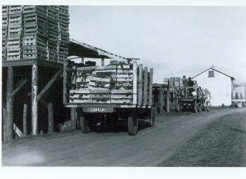
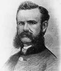
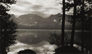
Here is the story of how Joyce and George Engel became legends in Winter Park and Fraser. In 1945, Winter Park Resort hired George Engel as their very first paid ski patroller.  Little could George have known that this job would lead him to his wife, Joyce Hanna, disembarking from a ski train, and together they would call Winter Park and the Fraser Valley their home for life. Along with Joyce and their daughters, the Engel Family would have a lasting influence not only on Winter Park Resort but on the Fraser Valley community as well.

In the year following his hiring as Winter Park’s ski patroller, George Engel took on different responsibilities at the ski area, such as plowing the parking lot and collecting rental fees in the bunkhouse.  Gordy Wren and Frank Bulkley formed Colorado Outings in 1946 and started the ski school at Winter Park.  As director of the ski school, Gordy Wren hired George Engel as a ski instructor. That same year George passed one of the first ski instructor certification exams ever held.  By 1949, the Professional Ski Instructors of America was formed and Engel held pin # 12.

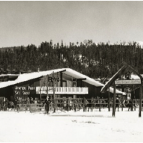
Gordy Wren was busy practicing for the 1948 Olympics and consequently sold his share in Colorado Outings.  This gave George Engel the opportunity to buy into the company and he became director and eventually sole owner of the ski school. George added the Winter Park Ski Shop onto the ski school.  

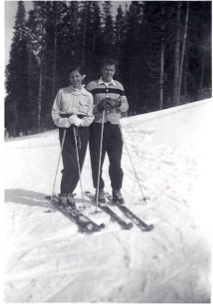
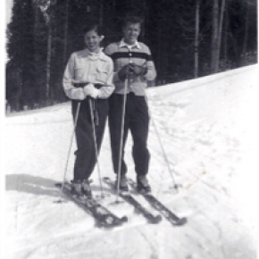
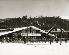
George met the love of his life, Joyce Hanna in 1951 as she disembarked from the Winter Park Ski Train.  Joyce, with two BA degrees from the University of Colorado, was ready to ski and work.  After dating for three weeks, George proposed to his future bride and business partner. The Winter Park Ski School under George’s leadership, and the Winter Park Ski Shop with Joyce at the helm, became fixtures of the ski area. George and Joyce’s two daughters grew up on the slopes.

Daughters Wendy and Janet tell wonderful stories from when the family lived in an apartment above the Winter Park Ski Shop.  After Winter Park Resort bought the ski school in 1982, they demolished the shop and apartment to make way for the West Portal Station.

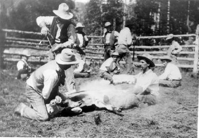
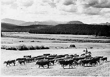
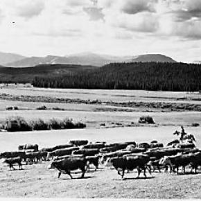
Along with skiing, another Engel passion was horses which led to their acquiring 40 acres along County Road 5 where they built Casa de Engel.  From their ranch, the Engels helped to establish the Winter Park Horseman’s Association and the High Country Stampede Rodeo at John Work Arena in Fraser.    Naturally, Janet Engel became a rodeo star. The Engels were also involved with the Middle Park Fair and Rodeo for decades.

As community leaders, the Engels transformed Winter Park Resort and the Fraser Valley. They helped start the Fraser Valley Metropolitan Recreation District, the Winter Park Chamber of Commerce and the Winter Park Sanitation District.  Joyce Engel was a founder of the Grand County Concert Series bringing live classical music to this rural community.  In 1968, George Engel was instrumental in bringing the National Sports Center for the Disabled to Winter Park. The family’s wide-ranging passions enrich all our lives then, now and into the future.   


Topic: Grand County

Grand County

Grand County was established in 1874 by the Territory of Colorado, thus becoming a county two years before Colorado became a state. It was named for the Grand River, the name by which the Colorado River was known at that time. The headwaters of the today’s Colorado River are in Grand County. The county was formed from a portion of Summit County but acquired its current boundaries in 1877, when part of the Grand County was used to create Routt County. The county seat is Hot Sulphur Springs. The area of 1,854 square miles consists of meadows, river valleys and mountains.

Topic: Biographies

Milton "Green" McQueary

"One Grand Essay" contest 2005 

It is a strange feeling one gets as you realize you are breathing your last breaths. You start to remember some of the wonderful and not so wonderful things that have happened in your life.  As I am lying on this cold ground in Phoenix, Arizona instead of my beloved land in Dexter Colorado, I start to think of my family. I miss my sweet and beautiful wife Anna whom I have had to live without for so long and realize suddenly that is has been 20 lonely years. We had an interesting life together: she and I and our 10 children.

I remember many years ago before I met Anna, when I was only 11 on the day of April 27, 1873. My family had decided to head out of Missouri with our covered wagon. It was pulled by mules and oxen and filled with all of our precious possessions, along with boxes of shot and black powder for muzzle-loading guns. Potatoes, flour, beans, coffee, salt pork, fish hooks, and of course my dog Ranger accompanied us. My father and mother, Walker Barron and Mary, my younger brothers John H., Walker Emery and my little sister Maud who was only 3 at the time were all ready as we started out early in the morning with my Uncle James Allen "Polk" and his family. We traveled until we met up with a train of about 100 other wagons heading west in search of a new home, and possibly some gold.

We had traversed across the country over the plains, streams and mountain ranges from Johnson Country Missouri to Denver, Colorado arriving on June 5th where we made camp the first night near Sloan's Lake. Then we continued moving west until my father and uncle found work at a sawmill between Golden and Idaho Springs in the town of Beaverbrook.

With the completion of the Berthoud Pass stagecoach road in 1874, my father and some friends went over the Gore Range to explore Middle Park. Then two years later on July 9, 1876, our family moved to Middle Park just two weeks after General Custer's defeat on the Little Bighorn River in Montana.

My father decided to claim squatter's rights by building a one room cabin on the bank of the Grand River near Kremmling a mere two years before we had the Ute Indian scare. After the scare my mother wanted to move to Hot Sulphur Springs where there was and established school and more people. It was there that my father purchased the Springs Hotel renaming it the McQueary House. Shortly after some success with the hotel, my father purchased a home along the Willow Creek near Windy Gap.

I remember the day I had met my love, Anna Rebecca Kemmerer. She was so sweet that we married quickly on May 6 1884. In February of 1885 my first son Frederick was born followed by Clayton Henry two year later, and Harry Senator two years after that. However, Harry was not to be with us long and we lost him in August of 1892. Nevertheless, life goes on we were blessed with another son Ralph Grant who was born in August of 1892, followed by Myrtle Grace in 1894 and Chester William in 1896.

With our ever-increasing family, Anna and I purchased the 160-acre Frank Adam's homestead adjoining my father's home on Willow Creek where we would have room to grow and my children could enjoy the company of my parents. Just before Chester was born, I applied for a coveted appointment as postmaster and wanted to locate a post office on Gold Run, naming it the "Willows Post Office." On September 25, 1896, the US postal department did let us open a post but decided but renamed it Dexter instead. We had expected a mining boom along the Willow Creek and thought a town would be built around our post office and homes.

I remember when Ike Alden had found gold along the creek and sent it down to Georgetown to have it assayed. He found out that it was estimated to be worth about $1,700.00 to the ton, which is where the name Gold Run came from. But our peaceful valley did not prosper as we had hoped and the town was never built so we turned to ranching instead. We had four more children Gertrude Mildred, Robert Melvin, Mary Frances and lastly Ada Rebecca who was born in 1904.

During those years in my blacksmiths shop, I made wagons, repaired some of my neighbor's equipment and farm machinery. We had thought that a stagecoach line would bring the mail on a regular basis but it was really just a freight line. Anyone who wanted to could ride it and some of the passengers who used it were welcome to stay for a meal at the Dexter Ranch. There were two cabins across the road, which used for guest or tourists, mostly fisherman, but a place for anyone to sleep.

In 1905, the first train reached Granby and many of the ranchers of North Park would travel to the depot via Dexter and stay, purchase hay and join us for some meals. I was somewhat handy with carpentry and had built a large round table, which was a little unusual but very practical. I had fashioned it with pegs around a lazy Susan. I remember now at supper one time a guest of ours was helping himself to some food from a dish when someone asked him what the matter was. He was holding the dish in his hand and looked befuddled. He answered, "I forgot where I got this," We all laughed at his little dilemma. It makes me smile now thinking how wonderful the food was and how lovely my Anna looked when she laughed.

We built a schoolhouse made out of log in Dexter. Using our horses we created a log skid trail, dragging log after log until we had enough for a 16, or was it 18 by 20 foot building. Years later the children would still climb the skid trail with their skis and ski down during their recess.

Sometimes we would have dances at the schoolhouse and we would push all of the desks back against the wall and play old-time pieces. I liked to play my fiddle with a few of my other friends. Roy Curtis, and Andy Eairheart and sometimes my cousin Dick would call out square dances.

I also remember what a great time everyone would have as they danced when we played at the Grand County Winter Sports Carnival Grand Ball. Although the Carnival was held in Hot Sulphur Springs the last two days of December, we all headed over to participate and watch the skating, tobogganing and skiing. One year my son Robert who was a member of the Commercial Club went to Denver to represent us in the National Ski Association meet there and the following year he went to Steamboat.

As time went, on my daughter, Myrtle Grace met and married Charles Everhart and I had my first granddaughter Violet. I remember that as Violet became older she loved to play in my Blacksmith shop. I told her "If you play with my tools put them back where you got them". She was an obedient child and did as I asked so I never minded her coming in and playing with the bellows. She would get some scrap iron and place it in the fire until it was red-hot and then put it into the tempering barrel. She just loved to hear that sizzling sound. It makes me smile to think about that now as I start to shiver in this darkness and evening begins to approach.

I am struggling to stay awake hoping someone will help me get out of this place as memories of my other granddaughter Gertrude Jane come to my mind. She did not like the name Gertrude Jane because her mothers name was Gertrude Mildred, and everyone called her mother Gertie. She did not want to be called Gertie too; she preferred to be called by her middle name Jane instead. She would tell me what an interesting man I was and that she loved my blue eyes.

My little Jane is 17 years old already. But I guess I won't be celebrating her eighteenth birthday or the birthdays of any of other grandchildren now. I feel myself falling deeper and deeper into darkness and know that my Anna is waiting for me. I see a light now and my blue eyes are starting to tear.  As I walk towards the light I see my Anna is holding out her had for me to grasp. How wonderful my life has been and how I have enjoyed my journey. Now it is time for us to go home.

Topic: Regions

The Blue

Because gold had been found at the headwaters of the Blue River at Breckenridge, hopes were high among prospectors who worked the downstream tributaries in Grand County.  However, this lower section of the Blue contained no mineral wealth. 

The Denver and Rio Grand Railroad planned to run a route through the valley and began constructing grades, but the tracks were never laid because Moffatt's railroad crossed the county first.

An enterprising Canadian, 25 year old Willis Charles Call, had been employed as a cook for the grading company in 1881.  When the railroad abandoned the project, Call became a registrar of voters, and in 1886, the county assessor.  By 1890, he had a choice ranch near Kremmling.  His Austrian wife, Mary Rohrocher, was a very popular hostess.  It is believed that they owned the first automobile in the county.

The conflicts between the white settles and Ute Indians came to a climax in 1878 when the Ute leader Tabernash was killed by a posse and the very next day, Abraham Elliott a homesteader on the Blue, was killed in retaliation.  The remains of his ranch can be seen on Highway 9 at mile marker 135. 

Across the river was the ranch of Henry Yust, who settled there in 1885.  Another early ranching family was that of Thomas Pharo, An Englishman from Franham in Surry, near London.  Settling there in 1880, he developed a major cattle and horse ranch. 

The Blue River area was connected with a route west in 1913, when the co-called Trough Road was constructed, beside the Gore Canyon to State Bridge.

Topic: Towns

Parshall

The town-site of Parshall was part of the ranch homesteaded by Fred Dean in the 1880s. Before 1900 the ranch belonged to William Byers, founder of the Rocky Mountain News and town of Hot Sulphur Springs. In 1902 Frank Byers, son of William Byers, sold the ranch of 480 acres to Cordelia and Simon Parshall.   

Cordelia Parshall died on March 30, 1904, leaving the ranch to her son Clyde. In 1907 Clyde sold 60.6 acres of the northeast corner of the ranch to Alonzo F. Polhamus, a civil engineer. Polhamus dedicated the town plat to Grand County on July 26, 1907 and named it for his friend and the Parshall homestead. The original primitive store operated by Walter Dow was the drawing card for visitors. Parshall was the headquarters of the “Williams Fork Telephone Company,” a highly informal operation that is said to have transmitted its subscribers’ voices along barbed wire fences.

The town was never incorporated and today still has a bar and restaurant, a post office and a chapel, plus the Grand County Road and Bridge Dept. District 3 maintenance shops. Population varies seasonally between 75 and 90 people.

Edits and corrections to original posting by Don Dailey, 10-2021.


Mountains