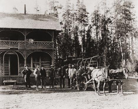
Spruce Lodge

Dude Ranches

Starting in the late 1870s, ranchers took in guests to supplement their income during hard times.

Dude Ranches Articles

Devil's Thumb Ranch
Devil's Thumb Ranch

According to local lore, Native Americans named Devil's Thumb, a rocky outcropping that towers high above the Ranch. As legend goes, after the warring Ute and Arapahoe tribes settled their differences in the Ranch Creek Valley, they buried the devil, but left his thumb exposed to remind them of the evils of war.

Before the Trans-Continental Railroad opened up the area in 1904, a stagecoach route from Idlewild (now
Winter Park) joined the Rollins Pass route. A state station was situated east of what is now our Ranch. The road extended transversely over the Ranch where it followed the course of the existing County Road 83. The land was rich agriculturally, and was used for cattle grazing in the early 1900s.

After the railroad was introduced, settlers began moving west in search of wealth and opportunity. Many ended their journeys in the
Rocky Mountains. During this time, there were more people living in the Fraser Valley than there are today. One favorite hangout of the railroad workers was a dance hall on Black Ranch, located immediately north of Devil's Thumb Ranch.

In the 1930s, Margaret Radcliff built the original Ranch homestead and operated it as a dairy. However, it was brothers Dan, Louis, and George Yager who started Devil's Thumb Ranch as a vacation property in 1946. The Yagers incorporated the Radcliff homestead in to the Ranch facilities and the original building exists today as the Ranch House Saloon.

The Yagers operated Devil's Thumb Ranch as both a working ranch and dude ranch until 1972. They introduced cross-country skiing in the winter of 1975-1976. Dick Taylor, a 1964 Olympic cross-country team member, designed 35 kilometers of the area's Nordic trails.

The Ranch was well known as a Nordic destination, but one without many amenities or niceties. The current owners purchased it in 2001, saving it from a group of developers who planned to fill the valley with residences and a golf course. They immediately began making improvements to the facilities, all the while impacting the land as little as possible.

Dude Ranches
Dude Ranches

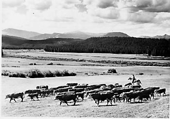
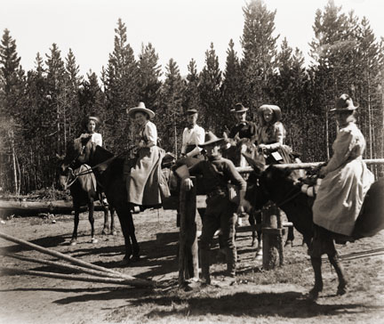
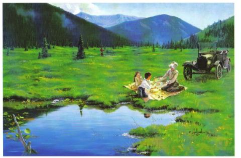
Starting in the late 1870s, ranchers took in guests to supplement their income during hard times. Early adventure-seekers from the East made the long rail journey to the wilds of Middle Park in search of big game and unspoiled mountain scenery. With few accommodations available, travelers looked to frontier families for room and board. Ranchers soon discovered guests, or “dudes” as they came to be known, would pay to fix fences, ride horses, work cattle and sleep in tents....sometimes for an entire summer! Entertainment was eventually incorporated into the guest experience.

Located on the stage stop between Georgetown and Hot Sulphur Springs, William Z. Cozens was the first rancher in Grand County to provide room and board to travelers starting as early as 1874. The Lehman and Sheriff families also ran well-known turn of the century dude ranches. The years following World War I were the height of the dude ranch era. By the late 1950s, Granby had as many as ten guest ranches between Granby and Grand Lake with others scattered throughout the county. Today Grand County is still home to six dude ranches, which attract visitors from all over the world for their western charm, high-quality accommodations, horseback riding programs and superb fly fishing.

Dwight D. Eisenhower and the Western White House

Dwight D. Eisenhower met and married Mamie Geneva Doud of Denver on July 1, 1916. Carl Norgren, a Doud family friend, had started spending time in the Fraser area and was enchanted by the beauty of the area and especially the Byers Peak Ranch for Boys.

By the late 1930s, Norgren partnered with Aksel Nielsen to purchase the Byers Peak Ranch.  During Eisenhower's presidency, the Brown Palace Hotel in Denver, the Byers Peak Ranch, and Lowry AFB were all known as "Western White Houses" or "Summer White Houses." There is a well known photo published in Life Magazine of Eisenhower fishing in the Fraser River with his grandson, David.

Eisenhower used his time at the Byers Peak Ranch to rest and recompose himself in the face of difficult political times. As President, Eisenhower dealt with the threats of the Cold War, a truce in Korea, the desegregation of public schools (Little Rock, Arkansas), and the development of the "Eisenhower Doctrine" to bolster the Middle East against the threat of communism. On the domestic front, he was faced with the difficulties of dealing with the Republican Old Guard, including Senator Joseph McCarthy, who headed a subcommittee charged with the finding of communists within the government.  

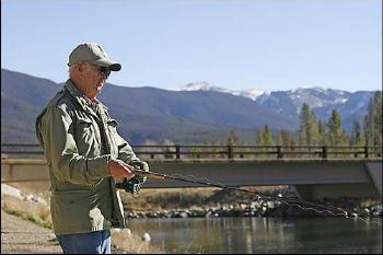
Eisenhower enjoyed cooking for guests at the Ranch, fishing St. Louis Creek and having "brookies" (brook trout) for breakfast, painting, and playing golf.  On September 24, 1955 while at the Ranch, Eisenhower suffered a coronary thrombosis (heart attack) and was hospitalized at Fitzsimmons Army Hospital in Denver until November 11, 1955.  His hospital suite has now been restored and is open for limited tours.

The bulk of information about Eisenhower and the Byers Peak Ranch comes from the personal papers of Carl Norgren, which are housed at the Eisenhower Museum and Library in Abilene, KS.  The collection of correspondence from 1948-1964 covered a broad variety of topics: fishing, recreation, taxes, health matters, food, communism, reorganization of the Department of Defense, federal spending, etc. The Norgren collection valued for the details it provides concerning the hobbies and recreational pursuits of the President during his visits to Grand County between 1952 and 1957.

Squeaky Bob's Hotel de Hardscrabble

Robert L. "Squeaky Bob" Wheeler homesteaded the northern end of the Kawuneeche Valley in 1907, setting up his tent camp at the base of Shipler Mountain.  He called his accommodations Squeaky Bob's Hotel de Hardscrabble.  He was one of many guest lodge operators who catered to the leisure traveler seeking relaxation through recreation.  These vacations were quite rustic, especially by today's standards. At least two guests at a time were asked to share lumpy beds. The sheets were said to be "refreshed" with talcum powder rather than changed and laundered.  The outhouses were stocked with mail order catalogs rather than toilet paper.

Despite these conditions, Squeaky Bob was very successful and his hotel hosted famous travelers from all over, including President Theodore Roosevelt. Squeaky Bob was known for entertaining his visitors with amazing tales and witty yarns.

Articles to Browse

Topic: True Crime

The Selak Hanging

Fred Selak was a descendant of early settlers in Grand County.  He built a cabin three miles south of Grand Lake where he lived alone.  He helped his brothers in various enterprises including mining, a general store and a sawmill.  Selak was known to be a prosperous citizen who lent money to others and there were rumors of hidden cash and gold in his cabin.  He was also known to be an avid coin collector. 

When Selak failed to pick up his mail for several weeks, the postmaster visited his cabin July 26, 1926. After not getting a response to his knocks, the postmaster summoned an employee of Selak's with a key.  When they opened the door, they discovered the cabin in shambles and Selak missing.  Sheriff Mark Fletcher was notified and a nephew of Selak's called in the Denver Police Department. 

As the investigation progressed, a .22 caliber slug was extracted from the wall and blood was found on an easy chair, but further investigation ruled these clues inconsequential as they were dated to many years prior. Sheriff Fletcher conducted a massive manhunt on August 16th and the body of Fred Selak was found on the second day by a deputy's dog.  The body was hanging from a tree and evidence showed that, because of a sloppy knot, Selak did not die quickly of a broken neck but rather suffered a slow strangulation.  The murder had taken place a month earlier and the body had stretched until the feet were touching the ground. 

Arthur Osborn, 22, and his cousin Roy Noakes, 21, became prime suspects after showing off old coins and trying to spend them for minor purchases around Grand Lake.  After interrogation by the Denver Police, both confessed to robbing and killing Selak.  Later, Noakes claimed that the confessions were coerced by the police. 

The suspects were kept in the Denver jail until their trial on March 7, 1927 and Sheriff Fletcher had to take great precautions against a possible lynching.  The only motive for the murder seems to be based on a land dispute years earlier in which Osborn was arrested for a violating fence line.  Both suspects were found guilty and sentenced to death.  After many appeals, the convicted murderers were hung in Canon City on March 30, 1928.  

Rocky Mountain National Park

In 1915, thanks to the efforts of visionary Enos Mills, Rocky Mountain National Park became the 10th national park. The concept was then, and still is, conservation of natural lands and wildlife. No commercial enterprises which consume resources operate within its boundaries--no logging, grazing, farming, mining, hunting or trapping.

Almost all private property in-holdings have been bought by the National Park Service and the buildings destroyed. Located within park boundaries, Longs Peak, at an altitude of 14,256 feet, named for explorer Stephen Long, is visible from both sides of the Continental Divide. Indeed, one can look northwest along 17th Street in Denver, to see one of the area’s best known peaks.

Trail Ridge Road, which runs through the park, was completed in 1932 and is the highest continuous highway in the United States. It is open only in the summer. Dignitaries from the towns of Estes Park and Grand Lake celebrate the opening each year, often but not always by Memorial Day, with a ceremony at the top called “Hands Across the Nation.”

Topic:

Ray Osborn

Article contributed by Tonya Bina 11-07


Ray Osborn's father, Elonzo Osborn was also an avid fisherman and hunter, and he and a neighbor stocked cutthroat trout the in the 1920s in the lakes in what is now Rocky Mountain National Park. This fact seems to bring pride to Osborn, who spent his entire adolescence exploring the terrain surrounding the upper Colorado River. "Everything in the outdoors was so ingrained in the way we lived," he said. "We lived in the outdoors, and we fished when we could and hunted when we could."

Osborn's maternal great grandfather is Warren Gregg, a settler and talented carpenter whose wife took the life of her young children, sparing two boys, in a story that has become legend in
Grand Lake. His maternal grandfather, Ray Gregg, was a blacksmith and a carpenter. He was also the justice of the peace in Grand Lake.

And Ray Osborn's father was a rancher, a man who was forced off of his land when a large water delivery system came to define the West Slope. Being fourth-generation
Grand County can be frustrating, he said. "There's too many changes. None of them for the better. Rich developers are coming in here and tearing the country up and developing the county. They don't care because they're not going to live here. They're going to get their money and go someplace else," he said. "I don't like all the changes now, they're destroying the natural beauty of Grand County."

Osborn, who had six brothers and sisters, has seen two of his childhood homes be torn down "for progress." The first was the ranch house his family lived in before the Bureau of Reclamation claimed his father's 54 acres for the Colorado-Big Thompson project. The ranch land is now a lake bed, 11 feet below the water's surface.
When Shadow Mountain Reservoir was drained last year to kill weed growth, Osborn said he could still see the old foundation. The government offered his father $5,400 for the 54 acres, take it or leave it.  "My father was broken-hearted over it because he loved to ranch."

With the money, Elonzo Osborn bought 11 acres on the north side of the North Fork of the Colorado, where he kept a milking cow and raised chickens, then went to work for the Bureau as a janitor at the government camps that sprung up for the construction of the project. Ray's mother went to work as a mail carrier, with a route from
Granby to Grand Lake up to Phantom Valley in the Park to supplement the family's income.

During WWII, the family raised rabbits during a meat shortage. "Rabbits were easy to raise, and we sold a lot of them," Osborn said. Ray Osborn attended first through ninth grade at the
Grand Lake primary school before attending Middle Park High School, which had just been built in 1947. There were 22 people in Osborn's class, and he was the first student to graduate mid-term from the new school. The very next day, he joined the Navy, the start of a 24-year career that involved two wars.
"On my first tour of duty, I came home on leave and went to a high school football game," Osborn said. It was there that Osborn met Mary Ann, who was visiting from
Iowa for a few months during her senior year in high school.

After a long-distance engagement, the couple married at St. Anne's Catholic Church in
Grand Lake in the fall. This September, they celebrated their 55th anniversary.
Most of his career was spent overseas, Osborn said, with more than 16 years in
Asia. He credits his wife for raising their four children mostly on her own. In 1973, he retired from the military; his youngest was 13 years old.

Upon retirement, after a stint in
Denver, the family relocated to Grand County, where Osborn worked at Winter Park Resort for 12 years. Nearly every day, Osborn heads to his favorite fishing spots, such as the canal that feeds into Shadow Mountain reservoir, a replacement of the river that once was.  He now brings his grandchildren fishing too, and grandma Mary Ann knows just how to cook up those brookies, "cornmeal and flower, olive oil in the pan, a sprinkle of lemon pepper" to make them taste real good. "Get them real brown," she says.

Osborn likes how much fun they are to catch, and his youngest grandson does too.
"They're like wild trout - you got to know how to fish for them in order to catch them," he said. It's when the 75 year-old outdoorsman is talking about the rivers, inlets and hills he knows so well, he seems most at home. "Not too many people left here that have been here longer," he said.


Topic: Indians

Tabernash

The unrest and hard feelings between the Indians and settlers in Middle Park gave rise to an inevitable conflict the last week of August, 1878. About forty Utes, led by Piah and Washington, started to set up camp in William Cozens’ meadow, near Fraser, taking fence poles to make fires. Cozens drove them off, telling them to replace the poles and leave. The Utes moved down valley about five miles to a spring not far from Junction Ranch (named for the junction of the Rollins Pass and Berthoud Pass wagon roads).

There, Johnson Turner, who leased that land, became increasingly uneasy as the Indians were drinking heavily and expressing anger that Ouray given away their land in treaties with the white man. They wanted Turner to pay them for the hay he was cutting. They tore down his fences for firewood, turned their 100 horses into his meadow, and set up camp. They also laid out a race track on drier ground about a mile way.

Turner complained to the sheriff, Eugene Marker, who rounded up a posse of men, intending to remove the Indians or at least convince them to move on. Accompanying him, on September 1, were Frank Addison, a transient prospector, John Stokes, T.D. Livingston, and Frank Byers.  The posse found only women and children at the camp, since the Ute men were at the race course. Marker, the sheriff, ordered the encampment searched for firearms and when the Ute men returned, an angry confrontation ensued. 

Tabernash and Frank Addison exchanged threats, and Tabernash jumped from his horse and snatched one of the guns piled on the ground. Frank Addison immediately shot him. Tabernash tried to pull his rifle from its scabbard, but that it became entangled, and Addison then fired twice more. Tabernash slumped over the neck of his pony, which ran away through the willows. Apparently Addison recognized Tabernash as the Indian responsible for the killing several of his companions while trapping furs on Grizzly Fork in North Park six years earlier. 

After this bloodshed, the posse persuaded the rest of the Utes to leave, after they buried Tabernash’s body in a shallow grave. No one was ever sure where Tabernash was buried. There was a rumor that the slain Tabernash was buried in a draw not far from Junction Ranch, but when the Grand County Historical Association excavated the site, nothing was found.

A day later, September 3, on a Ranch near Kremmling, Abraham Elliott was shot while cutting wood, and his horses stolen.  In response, the posse moved north in the direction of the White River Reservation. 60 Utes met the posse, and explained that the culprits were Piah and Washington, neither of whom was a part of the White River band.  Ultimately, the Utes signed a council report, returned horses stolen from the Elliott ranch, while the  ranchers returned guns confiscated from the Utes at Junction Ranch.  The matter was considered legally settled, but outrage and fear continued among the settlers and the Utes of the area.

In 1902, E.A. Meredith, chief engineer for the Denver & Salt Lake Railroad, named the town that had grown up with the building of the railroad, after the slain Ute, Tabernash.

Topic: Mountains

Rollins or Corona - What shall it be called?

Travel across various passes of the Continental Divide occurred long before white men showed up. Indeed, as anthropologist James Benedict wrote c. 1975, some 10,000 years ago, prehistoric Indians camped, hunted, and built hunting walls on the upper reaches of Rollins Pass, as well as moving in and out of Middle Park for the warm summer months.

Historic Indians followed the same paths. In the earliest days of non-Indian access, a particular pass at the head of Boulder Creek was dubbed Boulder Pass. Capt. Jacob Bonesteel, including wagons, made the first recorded crossing by a white man at this point in April 1862. Three years later, a group of Mormons brought wagons over this route and a year later, promoters of new roads into Middle Park brought in many wagons and livestock.

In fact, tourists were starting to enter the park by a number of routes, and one of them, Samuel Bowles, who wrote a fascinating account of his trip, including his return to Denver via Boulder Pass. Interest was growing rapidly for a road over the Divide, into Hot Sulphur Springs, and on into Utah. One promoter, John Quincy Adams Rollins, from New Hampshire, teamed up with William N. Byers and Porter M. Smart to carry this project through. Rollins was interested in crossing the Divide; Byers was promoting the Springs; Porter wanted to develop the valley of the Middle Yampa. All three were pushing to have Middle Park officially named as Grand County, a challenge finally accomplished in 1874. So Rollins and associates started his road, reaching the top in 1873.

That next winter, they publicized this access and in June, Jimmy Crawford brought his family and wagons to Rollinsville and thence to Yankee Doodle Lake, ready to cross the pass now named Rollins Pass by the developer. But the road ended, and they found Rollins' men still hacking the road out of the granite! Jimmy and his crew found it necessary to leave their wagons and help. Finally, on June 10th, the family was able to head for the top. Jimmy borrowed two yokes of oxen, hitching them to mules, and then to his horse. The road was so rough that the procession could proceed but a few feet before having to rest. The family itself climbed on foot. At the summit, they discovered only a rough swath cut down through the trees on the western side. The "road" dropped down between the lakes and followed Ranch Creek to its junction with the Fraser River.

Rollins quickly realized that Berthoud Pass, which also opened in 1874, was superior to his own pass for wheeled vehicles, so he determined to hedge his bets. He initiated the first mail service into the county in 1873. He also built a commodious hotel where his road joined the Berthoud Pass road at the confluence of Crooked Creek and the Fraser. He called it the Junction House. Next, he proposed to the builders of Berthoud Pass that they form a joint ownership of the two roads between Junction Ranch and the Springs. Tickets would be issued for both routes and revenues would be shared. The two companies would build a bridge over the Grand at Hot Sulphur Springs. He even buttered up his rivals by complementing their work. All this was accomplished, although the mail route soon moved to Berthoud Pass, because of the severe winters on Rollins Pass.

The bridge was started in November 1874. From the beginning, Rollins' road was preferred for trailing livestock, because there were fewer problems with heavy timber and bogs. For years, the Church brothers, George and John, who introduced the Hereford breed into the county, trailed their cattle for summering in what became known as Church Park. However, tourists such as Irving Hale still drove wagons over Rollins Pass in 1878. About 1880, interest burgeoned for bringing a railroad up South Boulder Canyon and through a tunnel near Rollins Pass. Numerous surveys were completed all along the area. David Moffat settled on Rollins Pass for the tunnel site but decided first to put a temporary line over the top.

Thus, in the summer of 1903, a formal contract was let for work up and over the Pass itself. By 1904, the workers reached Arrowhead and they also built a work station on top, called Corona Station, or "crown of the mountain." This railroad construction town of Corona, located at over 11,600 feet at the top of Rollins Pass (first called Boulder Pass) along the Continental Divide was the highest railroad station in the world. It became obvious by 1905 that the Corona area would require snowsheds if trains were to travel, even irregularly, during the winter. Still, word got out of the spectacular splendor of Rollins Pass and tourists flocked in on summer train excursions, sometimes stopping on top, sometimes going as far as Arrow.

In 1913, a fine hotel was built next to the rail facilities. Because Rollins Pass was right in the middle of severe weather patterns, a weather station was built on top, as well as one down at Sunnyside. In 1915, Rollins Pass was actually proposed to be the south boundary of a proposed "Estes National Park." Later, on the National Historic Register, the district was listed in 1997 as the Denver, Northwestern and Pacific Railway Historic District--Rollinsville & Middle Park Wagon Road. It was also identified as the Rollinsville and Middle Park Wagon Road; Boulder Wagon Road, Rollins Pass, and Rollinsville area. In 1956, Governor Steve McNichols had presided at the official re-opening of the four percent grade to vehicle traffic over Corona Pass, expressing the hope that the route would someday be paved. The Colorado Game and Fish Department and the U.S. Forest Service made additional improvements, and the Arapaho and Roosevelt National Forests put out a 24-page booklet titled "The Moffat Road: A Self-Guiding Auto Tour."

The road crossed two of the original railroad trestles near Corona but those trestles, even if reached by 4-wheel vehicles, were crumbling and could no longer even be crossed safely on foot. The current self-guided auto tour refers to Rollins Pass, as well as the Moffat Road and the Boulder Wagon Road. Corona Station and Hotel are discussed. In 1979, a portion of the auto road over Corona Pass was permanently closed because of a cave-in of the "Needle's Eye," a tunnel located before the trestles heading west from the Moffat Tunnel's East Portal. The tunnel reopened on July 3, 1988, thanks to efforts of the Rollins Pass Restoration Association on both sides of the Divide, with the cooperation of the U.S. Forest Service, Colorado History Society, and Boulder, Grand, and Gilpin Counties. It then closed once more when another rockfall hit the tunnel on July 15, 1990. The RPRA is continuing its efforts for re-opening. The noted photographer, Charles McClure, took many outstanding photos of the Rollins Pass road.

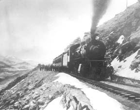
One, titled "Group on Rollins Pass, shows well-dressed men and women stand on a snowfield making snowballs on Rollins Pass, Moffat Road, Boulder or Grand County, Colorado; probably on Denver, Northwestern and Pacific excursion train. Date: between 1904 and 1913 near Corona Station." Another photo shows a "30 ft. snowcut on Rollins Pass, Moffat Road photo. Denver and Salt Lake Arrow passenger car is parked east of Corona snowshed by the thirty foot snowbank cut, Rollins Pass, Colorado; it shows men, women and railroad employees posed behind train, on the roof and on the snowbank and a standard gauge track. Date: between 1904 and 1915." A sign at the highway turn onto the Moffat roadbed says: The Moffat Road "Hill Route" Also called "Corona Pass Road", this road over the Continental Divide was the original "Hill Route" of the Denver, Northwestern & Pacific Railway built by David H. Moffat in 1903. It crosses Rollins Pass at 11,666 feet elevation. On top of Rollins Pass, a sign says: Elevation 11, 660 feet, John Quincy Adams Rollins established a toll wagon road through this pass in the mid 1870's. David H. Moffat's Denver, Northwestern & Pacific Railway crossed the Continental Divide at this point in 1903.

First known as Boulder Pass, then Rollins Pass, the railroad workers dubbed it "Corona", the crown of the "Top of the world." A railroad station, hotel, restaurant and workers' quarters existed here until 1928 when the railroad was abandoned due to the building of the Moffat Tunnel. Identifications in various trail and geographical guides say: Rollins Pass (el. 11,680 ft) is a high mountain pass in the Rocky Mountains of north-central Colorado in the United States. The pass is located on the continental divide at the crest of the Front Range southwest of Boulder, at the boundary of Grand County, Colorado and Boulder County, Colorado. Rollins Pass (a.k.a. Corona Pass) sits approximately 5 miles east and above the popular ski areas around Winter Park, between Winter Park and Rollinsville. The pass is traversed by an unpaved road, mostly the former roadbed of the Denver and Salt Lake Railway which abandoned the route in 1928 when the Moffat Tunnel opened to replace it. Railroad advertising called this the "Top O' the World" and it referred to the Moffat Route over the continental divide and the Rocky Mountains. Rollins Pass was the primary travel route west from Denver until an easier road over Berthoud Pass was constructed. The Denver, Northwestern and Pacific railroad laid its tracks across the pass in 1903-1904 and established a Depot at Corona on the crest. It can be noted that in R.C. Black's Island in the Rockies, the term "Corona Pass" was mentioned one time, on p. 351; the terms "Corona Station" or "Corona Snowsheds were used. In Dismantling the Rails That Climbed, Rollins Pass was used, the Corona hotel, and just once, Corona Pass; 1936.

In Maggie By My Side, it was Boulder Pass and Rollins Pass. In Rails that Climbed, Rollins Pass, the Corona shed, weather at Corona, Rollins Pass Snow Shed, other references to Corona as a site. In Guide to the Colorado Mountains (Orme) , they speak of the Corona Trail to Rollins Pass. High Country Names (Ward) used Rollins Pass entirely. Only Hiking Grand County, Colorado, published 2002 by Carr speaks of Corona Pass, with reference to Rollins Pass (near the town of Corona), Moffat Road. The term "town" might be questionable; there was only a small restaurant, workers quarters, railroad offices, and in 1913, the hotel. Current maps, USFS and the Grand County Trail Map, show Rollins Pass, with Corona at the side as being a site. The use of "Corona Pass' seems to be a rather recent innovation that has come into being with tourism efforts in the upper Fraser Valley. Rollins Pass From Island in the Rockies p. 45 Rollins Pass was originally known as Boulder Pass, first recorded being crossed by whites, by Capt. Jacob Bonesteel in April 1862. Their supplies were carried in wagons. A second organized party went over the same pass in 1865. In 1866, promoters of access into Grand County brought many wagons and livestock over Boulder Pass.In 1867, Samuel Bowles and a group returned home to Denver via Boulder Pass. In 1873-74, two roads were proposed into the county, one of Berthouds pass and one over Boulder Pass. This was the same time that the county was named "Grand". J..A Rollins and his associates started the road and reached the top of the pass in 1873, at which time they envisaged a road from HSS into Utah. The first wagons went over in June 1874. The western descent was so bad that it never was much patronized by wheeled vehicles, instead becoming primarily used for trailing of cattle. At this time the name Boulder Pass disappeared from maps and Rollins Pass became the official name. p. 85. p. 80 Lots of schemes to build roads into GC, but of all the schemes for transport, only one, the Rollinsville and Middle Park Wagon Road showed any promise. T

hat was designed by John Quincy Adams Rollins, from NH, a gifted promoter, a son of a clergyman, second of 19 children. He was a farmer, miner, freighter, road bulder, and platter of towns. He was perhaps the most accomplished billiard player west of the Mississippi. He was a Colorado resident at least by 1866. His finances were up and down, but he was tremendously strong. In December 1884, when he was 68, he thought nothing of a 3-day snow-clogged crossing of the Continental Divide. p. 85 Rollins was interested in MP as an investor and he was interested in extending his road into Utah.. At the same time, a Porter M. Smart was likewise excited about speculating in frontier projects and was working at developing the valley of the Middle Yampa. William N. Byers was busy planning for HSS. These three men launched at least two petitions, with more than 80 "residents" for creating GC. Grand County was created that year, 1874. p. 89 With the creation of GC, people began to consider the area more seriously. p. 92 There was no official mail into the county until 1873 when Rollins brought in the first US pouch over his pass. In May 1874, he built a commodious hotel at the confluence of Crooked Creek and the Fraser, known as the Junction House. p. 94 Rollins knew that the road over Berthoud Pass was superior to Rollins Pass; his main advantage was the railhead at Blackhawk.

So Rollins proposed a joint ownership and operation of the two roads for the line between Junction Ranch and HSS. Tickets would be issued for both routes and revenues would be shared. The two companies would build a bridge across the Grand at HSS. Rollins even complimented the Berthoud work. This merger was completed soon. p. 104 This bridge was started in November 1874. p. 108 A mail contract was made in July 1875 for once a week delivery over Rollins Pass, but conditions were so severe that the route was changed to Berthoud Pass. p. 110 From the beginning, Rollins Pass was used in preference to Berthoud Pass for trailing livestock, because there were fewer problems with timber and bogs. However, late spring snowdrifts were a problem, so 20-30 horses were often brought along to break trail. The Church brothers, ?George and John, summered their cattle in what became known as Church Park and dug the Church Ditch. They also introduced the celebrated Hereford breed into GC. p. 170-171 As interest in bringing a railroad into and through GC developed, about 1880, various stockholders proposed to build up South Boulder Canyon to Yankee Doodle Lake and start a tunnel near Rollins Pass. Nothing came of the first attempts but by the end of July 1881, numerous surveys had been made for that tunnel. p. 238 Cattle was still being trailed out via Rollins Pass up to the turn of the century. p. 258 David Moffat and Horace Sumner, his chief engineer, in the fall of 1903, were planning the tunnel for future excavation; but in the meantime a temporary line was planned for crissing Rollins Pass, at 11,640 feet. p. 264 A formal contract was let for the work over Rollins Pass in August 1903. The loftiest sections were started first, and the first cuts at the top were nearly finished by the 26th of October and tunneling started at Riflesight Notch. As snow came, work slowed to a standstill. p. 265 Work in 1904 was extremely slow until the end of August.

An encampment was built at Arrowhead and a station at the crest of the Divide was named Corona Station, where long snow sheds were built almost immediately. p. 267 Arrowhead was soon shortened to Arrow, when a post office was opened there in 1905. Travel on the grades, at 4-5% grades up over Rollins Pass was exceedingly difficult. p. 270 In 1908, word of the scenic splendor of Rollins Pass was becoming known world wide. Also, Rollins Pass and its "Corona station" were attracting the attention fo the US Weather Bureau, for the pass lay squarely in the center of the region of heaviest snowfall on the entire Colorado Continental Divide. p. 344 A terrible winter in 1909 made people think that Rollins Pass was never going to be practical for the long term. Time and again freight and passengers were stuck on top at the Corona facility. In 1913, a $10,000 hotel was built at Corona next to the rail facilities. From Dismantling the Rails That Climbed p. 6 The railroad went from Denver to the top of Rollins Pass. p. 8 Snowsheds were built over the tracks at Corona and other strategic places in 1905. p. 12 The top was referred to as "Corona Pass" 1936. p. 16 Crews who were to removed tails and ties reached Corona at the top of Rollins Pass 1936. p. 20 Reference to the Corona hotel From Maggie By My Side p. 1 Jimmy Crawford heard that a man named John Quincy Adams Rollins was building a road over the range at a place called Boulder Pass. 1873 p. 9-14 June 1874 The Crawford family traveled to Rollinsville and then to Yankee Doodle Lake, where the road ended. Rollins' men were still hacking the road out of the granite. Jimmy and his crew helped. On the morning of June 10, the family started out to go over the rocks and up the mountain. Then he borrowed two yokes of oxen to his wagon, then mules, then his horse. The animals had to rest every few feet; the family climbed on foot. There was no shelter at the top. Rollins' men had done no work yet on the west side of the pass except to cut a rough swath down through the trees. The road dropped down along Ranch Creek. From Rails That Climb published 1950 p. 43 Leyden Junction to Tolland to Rollins Pass. P. 63-64 Many references to Tunnels as identifiers of location. p. 76-77, 78 reference to the old Rollins Pass toll road; first mention of the place called Corona- crown of the mountain. Most references are to Rollins Pass. The Corona shed is mentioned, p. 82. p. 83 Sunnyside water stop, Loop Trestle and Tunnel, Ranch Creek Trestle and water stop, Arrow. p. 95, 100- 101 It is eleven miles from Arrowhead to Rollins Pass. Rollins Pass-Boulder wagon road; other references p. 107 - 112 reference to Corona shed. Reference to pipe line to Corona; a number of comments to Rollins Pass p. 119 weather at Corona p. 120-121 Rollins Pass p. 151 Rollins Pass p. 182 photo of "Rollins Pass Snow Shed" "This Corona station burned one night." p. 188 photo of June at Rollins Pass p. 192-194 photos of Corona shed and other buildings; Rollins Pass p. 252 walking on top of snow shed at Corona p. 271- 272. 1910 Snowshed at Corona p. 312-314 Rollins Pass; Rollins Pass snowshed; Corona; Corona siding p. 324 Corona; Sunnyside weather report station p. 326 Corona sheds p. 333-335 Corona shed; references to "Corona" as a place From Guide to the Colorado Mountains published 1974 p. 54-55 Corona Trail, going from East Portal to Rollins Pass From High Country Names published 1972 p. 105 Irving Hale in 1878 drove his wagon over Rollins Pass, now nearly abandoned as a wagon road. p. 131 David Moffat decides to build a temporary line over Rollins Pass. p. 165 In 1915, Rollins Pass was proposed to be the south boundary of a proposed "Estes National Park". From Hiking Grand County, Colorado published 2002 p. 52 Trailhead on the "Moffat Road to Corona Pass". In same paragraph, it becomes Rollins Pass (near the town of Corona). On p. 54, reference to the Corona Road. On p. 57, map shows Rollins Pass with Corona marked as a "site." p. 56, reference to the old railroad bed used crossing the Divide at Rollins Pass, near the town of Corona.

Sometimes called Corona Pass. p. 60-61 Rollins Pass Wagon Road historical notes on JQA Rollins and how to find his wagon road over Rollins Pass, following Ranch Creek to Tabernash. p. 66 Rollins Pass (Corona) to Devil's Thumb From GCHA Journal The Journey p. 6 Rollins Pass used by Indians; comment in 1981 From GCHA Journal Middle Park Indians to 1881 p. 8 Archaic hunters camped in the Rollins Pass area; written mid-1970's The current maps, USFS and Grand County Trail Map, show Rollins Pass with Corona at the side as being a site. The Rollins Pass Restoration Association for many years, and currently, has been trying to open the road and Needles Eye Tunnel. The self-guided auto tour refers to Rollins Pass, as well as the Moffat Road and the Boulder Wagon Road. Corona Station and Hotel are discussed. On the National Historic Register Denver, Northwestern and Pacific Railway Historic District--Rollinsville & Middle Park Wagon Road (Boundary Increase) ** (added 1997 - District - #97001114) Also known as Rollinsville and Middle Park Wagon Road;Boulder Wagon Road;R Rollins Pass, Rollinsville Corona Station and Hotel The railroad construction town of Corona, Colorado, located at over 11,600 feet at the top Corona Pass (first called Boulder Pass) along the Continental Divide was the highest railroad station in the world. It was situated on an old Native American trail, the same trail it is believed the Mormons traveled on their way to Utah. The road was improved by the U.S. Army, then further improved in 1866 by General John Q. Rollins, for whom the pass and the town of Rollinsville were officially named. Because of the high drifts of snow, the pass was only open from around July to the first big snowstorm two or three months later. In 1956, Governor Steve McNichols presided at the official re-opening of the four percent grade to vehicle traffic over Corona Pass, expressing the hope that the route would someday be paved. The Colorado Game and Fish Department and the U.S. Forest Service made additional improvements, and the Arapaho and Roosevelt National Forests put out a 24-page booklet titled "The Moffat Road: A Self-Guiding Auto Tour."

The road crossed two of the original railroad trestles near Corona but those trestles, even if reached by 4-wheel vehicles, are crumbling and can no longer even be crossed safely on foot. In 1979, a portion of the auto road over Corona Pass was permanently closed because of a cave-in of the "Needle's Eye," a tunnel that came before the trestles on a westward drive from the Moffat Tunnel's East Portal area. The tunnel reopened on July 3, 1988, thanks to the efforts of the Rollins Pass Restoration Association with the cooperation of the U.S. Forest Service, Colorado History Society, and Boulder, Grand, and Gilpin Counties. It was then closed once more when another rockfall hit the tunnel on July 15, 1990. John K. Aldrich is a geologist, lecturer, and author whose "Ghosts of . . . " books and accompanying topo maps are a boon to hobbyists, explorers, and those interested in Colorado mining history. Date: 02/04/08 05:13 Rollins Pass Milepost 16 Corona Station. Picture 6 below, is DPL photo X-7388. "Title: Corona, Colorado, interior of snowshed. Summary: Passengers stand next to the covered train depot at Rollins Pass, in Corona (Grand County), Colorado. The tracks of the Denver, Northwestern & Pacific Railway are in the foreground. The depot is constructed of logs, and the roof of the snowshed is upheld by timbers. Sunlight streams through the opening at the end of the snowshed. Date: (between 1904 and 1913). Source: E. T. Bollinger from W. I. Hoklas." Picture 7 below, is DPL photo MCC-454A. "Title: Group on Rollins Pass. Summary: Well dressed men and women stand on a snowfield making snowballs, Rollins Pass, Moffat Road, Boulder or Grand County, Colorado; probably on Denver, Northwestern and Pacific excursion train. Date: (between 1904 and 1913). Creator: Louis Charles McClure 1867-1957. Picture 8 below, is DPL photo MCC-624. "Title: 30 ft. snowcut, Rollins Pass, Moffat Road photo. Summary: Denver and Salt Lake Arrow Turn (passenger car) parked east of Corona snowshed by thirty foot snowbank cut, Rollins Pass, Colorado; shows men, women and railroad employees posed behind train, on roof and on snowbank and standard gauge track. Date: (between 1904 and 1915 The highway sign says The Moffat Road "Hill Route" Also called "Corona Pass Road", this road over the Continental Divide was the original "Hill Route" of the Denver, Northwestern & Pacific Railway built by David H. Moffat in 1903. It crosses Rollins Pass at 11,666 feet elevation. On top of Rollins Pass, a sign says: Rollins Pass Elevation 11, 660 feet John Quincy Adams Rollins established a toll wagon road through this pass in the mid 1860-s. David H. Moffat's Denver, Northwestern & Pacific Railway crossed the Continental Divide at this point in 1903. First known as Boulder Pass, then Rollins Pass, the railroad workers dubbed it "Corona", the crown of the "Top of the world." A railroad station, hotel, restaurant and workers' quarters existed here until 1928 when the railroad was abandoned due to the building of the Moffat Tunnel. Rollins Pass Elevation 11,680 ft (3,560.1 m) Traversed by Unpaved road Location Boulder_County,_Colorado / Grand,Colorado Rollins Pass (el. 11,680 ft) is a high mountain pass in the Rocky Mountains of north-central Colorado in the United States. The pass is located on the continental divide at the crest of the Front Range southwest of Boulder at the boundary of Grand_County,_Colorado and Boulder County. Sign that sits on top of Rollins Pass Rollins Pass (a.k.a. Corona Pass) sits approximately 5 miles east and above the popular ski areas around Winter Park, between Winter Park and Rollinsville. The pass is traversed by an unpaved road, mostly the former roadbed of the Denver and Salt Lake RailwayDenver_and_Salt_Lake_Railway which abandoned the route in 1928 when the Moffat Tunnel opened to replace it. Rollins Pass Railroad advertising called this the "Top 'O the World" and it referred to the Moffat Route over the continental divide and the Rocky Mountains. Rollins Pass was the primary travel route west from Denver until an easier road over Berthoud Pass was constructed. The Denver, Northwestern and Pacific railroad laid its tracks across the pass in 1903-1904 and established a Depot at Corona on the crest. David Moffat planned to replace the "Hill Line" with a tunnel through James Peak within a few years of the railroad construction. However, he never could obtain financing for the tunnel due to the inability of the railroad to make a profit and opposition from competing railroads such as the Denver and Rio Grande. The D&RG saw the line as a threat. But, in the far future the construction of Moffat Tunnel would turn out to be the D&RG's saving grace.

The trip up Rollins Pass was a favorite of summer tourists looking to enjoy the mountain scenery. It was heavily promoted by the railroad with picnic and wildflower picking excursions. Sights along the line were made famous by postcards containing the photos of L. C. McClure. At last the route surmounts the crest of the Continental Divide and takes quick refuge on the top at Corona. At elevation 11, 660 this is truly the famous Top O' the World and one of the highest railroad passes in the world. Due to the great height and nature of the Rocky Mountains, the entire railroad complex was completely enclosed in giant covered snow sheds.

Topic: Towns

Kremmling

Kremmling started as a general mechandise store, owned by Rudolph (or Kare) Kremmling, on the ranch of Dr. Harris, located on the north bank of the Muddy River. In 1888, John and Aaron Kinsey had part of their ranch platted, calling the site Kinsey City. Kremmling moved his store across the river from the new site and the town that subsequently developed became known as Kremmling. There was a post office established at Kremmling as early as 1885 and the town was incorporated in 1904. 

The Middle Park Fair was established here in 1912. Famous Western Novelist Zane Grey spent time in Kremmling and, as a result, wrote "Mysterious Rider" in which the area is shown as a classic Western setting.

During World War II the town was the location of a prisoner of war camp where German prisoners cut ice that was shipped by rail to other locations.

The local ranching industry, the presence of the railroad and its strategic location at the confluence of the Colorado River, the Blue River, and Muddy Creek made Kremmling a natural location for a town, which still retains the “Old West“ atmosphere.

Topic: Biographies

Sir St. George Gore

Sir St. George Gore was born in 1811 in County Donegal, Ireland, heir to an Irish baronetcy and was often referred to as Lord Gore.  He was educated as an aristocrat, never married, and never held public office.

He staged an expensive and expansive “American hunt,” leaving Westport, Missouri on June 6, 1854, with plans to hunt in the southern Rockies.  After spending some time at Fort Laramie, he arrived inMiddle Park. His guides were Joseph Chattillon and Jim Bridger. Gore had a entourage of 40 workers, 25 wagons, 24 mules, 112 horses , 3 milk cows and 14 dogs!

Loving his luxury, he slept in a brass bed, had nightly hot baths, and dines on superb food served on a lace tablecloth set with fine silver and crystal.  He often invited Bridger, who was illiterate, to dinner and awakened in the guide an interest in Shakespeare, which lead to the frontiersman hiring a boy to read the bard's plays to him.  

Described as "a good shot at rest but rather poor offhand" he nevertheless claimed to have killed 2,500 buffalos, 40 grizzly bears and countless deer, elk and antelope.   

Bridger led Gore to West Grand County, to the pass, range, and canyon that now bear his name.  The Indians were shocked at the expedition's wanton slaughter of every game animal in sight.

The expedition did not end until sometime in 1857, when Gore returned to Ireland and relative obscurity.  Not even a portrait remains of the infamous poacher.

Christmas at the Crawfords

Jimmy and Maggie Crawford settled in Hot Sulphur Springs in June of 1874.  They left their farm in Missouri with their three children, John not yet two, Logan 4 and Lulie 7 years old to begin a new life in Colorado. The one room cabin was built of round logs and had a sod roof.  In several places outside light could be seen between the logs. The floor was packed earth covered with elk skins which had a tendency to smell while drying out after a rain or melting snow.  The sod roof was far from water proof.  When the children came down with scarlet fever Jimmy promised to cover the roof with wood shingles and had gone to Billy Cozens' sawmill to make them.  Mr. Cozens was very helpful and even gave Jimmy a rusty iron stove to take back home.  Rusty or not, to Maggie it was like new.  She was most appreciative.  The shingles were carefully stacked by the cabin but never made it to the roof.

Jimmy carefully explored the area for suitable pasture land for his small cattle herd.  His explorations took him further and further to the west of Hot Sulphur Springs and as fall approached he became desperate to locate suitable grazing pasture before the snows.  Although Jimmy would return home every few weeks, the time in between his visits became longer and longer as he moved his cows to the west.  Maggie was faced with many hardships in his absence.  Ute Indians would quietly appear, seemingly from nowhere, and ask for food or as in one instance, ask to trade a pony for the little boy John which she of course adamantly refused.  Maggie was able to keep friendly relations with the Utes but never comfortable when they appeared.  The conversations were limited to jesters, hand language and a variety of facial expressions.

But this is a Christmas Story. To begin with, mountain men, prospectors and just plain loafers from Georgetown would stop by the Crawford's for a meal when they were in the area.  Maggie would never refuse them.  A few weeks before Christmas four prospectors enjoyed a well prepared venison stew with Maggie and the three children.  Lulie, the seven year old told the visitors how she was going to hang a stocking at the foot of the bed for Santa Claus to fill with toys and candy.  Her two brothers shook their heads in agreement.  Maggie said, "Lulie, I really don't think Santa Claus could find us way out here in Colorado!"  She knew there was nothing she had to fill the stockings except maybe some sugar candy which would likely be a disappointment for each of them.  Their Christmases in Missouri were memorable with presents, candies and fruit.   One of the four prospectors listened intently to Lulie as she described the Crawford's last Christmas in Missouri.  He had introduced himself as Charley Royer.  Charley was a 22 year old, recently from Kentucky now working in the silver mines near Georgetown. After a very satisfying lunch the men left and a heavy snow began to fall.

By Christmas Eve the snow was deep and drifts were high. The temperature dropped  below zero.  Although Jimmy had promised to be back for Christmas, Maggie thought the snow too deep for him to travel.  He had located what he called the perfect pasture far to the west and had made a land claim close to a bubbling sulphur spring.  He told Maggie it reminded him of the sounds steamboats made on the Missouri River and named his land claim, "Steamboat Springs."   Alone with the children, Maggie read the bible story of Christmas.  Before dropping off to sleep, Lulie said, "I know Santa Claus will find us, I just know he will!"  Maggie sadly shook her head.  Hours later, close to midnight, there was a gentle knock on the door.  Maggie cautiously opened the door hoping it would not invite trouble.  To her surprise it was the young Charley Royer.  He held out a gunny sack and said, "Mam, I've brought some oranges, hope they haven't froze, some candy and a few toys for the children.  Please tell them Santa Claus did know where they lived.  I remember how important Christmas was for me and I wish you and your family a Happy Christmas."  He turned and walked back into the darkness.  Charley Royer had come 60 miles from Georgetown in the bitter cold and heavy snow to make three little children happy on Christmas morning with oranges no less, in the middle of winter, toys and candy, a Christmas they would never forget. Jimmy made it home on Christmas day to add to the joy.  The following year and many years after the Crawfords had Christmas in a comfortable ranch house in a place called "Steamboat Springs."  As for what the future held for Charley Royer, well that's a story for another time.

Topic:

Regions

Grand County has a stunning variety of terrain, landscapes and distinctive regions.  The county encompasses 1869 square miles with almost 68% of the land is managed by the U.S. Forest Service, the Bureau of Land Management or the National Park Service. The Continental Divide marks the northern and western boundary of the county and the county is also the headwaters of the Colorado River.  Regions have been established by proximity to water sources (The Troublesome, The Muddy, The Blue, and Three Lakes) or by their geographic features (Middle Park, Church Park, and the Fraser Valley).

Topic: True Crime

Spider House Tragedy

Nestled on a quiet lane in Old Grand Lake City sits the intricately crafted home of Warren C. and Mary O’Brien Gregg, known today as the Spider House – a testament to a remarkable woodcraftsman and his tormented wife.

Warren (Watt to his friends) was a dreamer and in the 1870s he left his first wife and a young son in Wisconsin and headed for the Colorado Territory seeking his fortune in the mines of Gilpin County.  Upon returning to Wisconsin his first wife died of fever, leaving Warren a widower with a small son.  Holding tight to his dreams of the west, Warren eventually ended up in his native Indiana where he met and married 20 year-old Mary O’Brien, in 1884.   By 1888 Warren packed his new family into a prairie schooner and headed west.  Like so many other pioneer women before her, Mary bore a child along the trail, a second son whose short life would send Mary down a dark and tortured path. 

The family arrived in Middle Park late in the summer of 1888, built a small homestead on the eastern slope of the Stillwater drainage and the newborn died shortly thereafter.  Though the years would bring more children, Mary would never quite recover from the loss of her second son. They continued to scratch out a living in this harsh and isolated land, where winters were long and supplies were meager. 

Warren spent much of his time searching for game and exploring this new country. The Gregg’s moved numerous times, finally purchasing a plot of land from Old Judge Wescott on the west side of the lake.  Warren built his family an admirable house, with intricate detail and spider-like webs of wooden elements.  Despite the warmth and comfort of this new home, and the close proximity of neighbors, Mary’s depression deepened. 

Then on a sunny Sunday in 1904, while Warren was working in his woodshop and oldest son Lloyd was having Sunday dinner at Judge Westcott’s, Mary took a gun to her four remaining children and then turned the weapon on herself.  The children died instantly while Mary lingered on for four days.  The five victims of this tragedy, one girl, three boys and Mary herself are buried together in one grave in the Grand Lake Cemetery.

Warren lived in the Spider House for another 29 years. With his son Lloyd, he continued building homes and stone fireplaces.  He succumbed to heart failure in 1933.  Mary O’Brien Gregg finally found peace in the quiet grace of the little town cemetery surrounded by her children.  Almost a century later, as the tall pines whisper their mournful winter song, the Spider House still sits nestled on that quiet little lane.

Dude Ranches