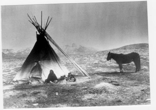
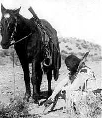
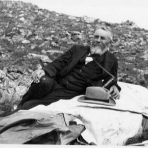
Ute Bill Thompson
Joe on Melody

Indians

Browse Subtopics

Indians Articles

Colorow - Ute Chieftain

Colorow was a Ute Chieftain who was known for profound stubbornness and bitter resentment of the white man's intrusion into the Ute hunting grounds.  

Indian Agent Meeker had ruled that that the Utes must depend on the United States government for food supplies, rather than their traditional hunting. These supplies were sometimes held up for delivery and upon their eventual arrival,contaminated. Colorow thought the white settlers of Middle Park (near Granby) were killing too many of the game animals that had been critical in feeding the Ute people.  

So in the fall of 1878, Colorow started a brush fire high in the Medicine Bow range, planning to drive the deer, elk, and buffalo west to the Ute reservation.  But the winds took an unexpected shift, driving the wild game northward and away from Ute territory.  

The fire drove out the last of the buffalo ever to be seen in the Middle Park region again and it took many years for the forests and ranges to recover from the devastation.

Indians
Indians

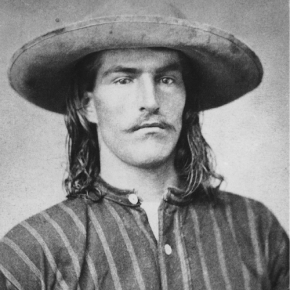
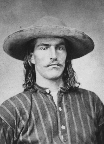
There is a great deal of evidence of primitive cultures in what is now Grand County, but all seems to have been transient until the modern tribes arrived, probably around 1450. The Arapaho Tribe claimed the northern part of this region and were in frequent territorial dispute with the Ute Tribe, who were dominate in the Colorado Rockies. The Utes did not have “chiefs” in the sense of the organized Plains Indians.

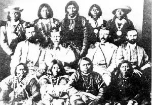
There were five different tribal groupings in Colorado, and those in the Grand County area were known as the “White River Utes”. The Uncompahgre Utes lived in the southern area of the state, near the San Juan Mountains. Their spokesman to the white man was Ouray, and because of his knowledge of Spanish and some English, the federal negotiators designated him “Chief of All Utes”. Thus it was he, who in 1868 agreed that most of the land west of the 107th degree longitude (about one third of Colorado) would be a Ute Reservation “for all time”.

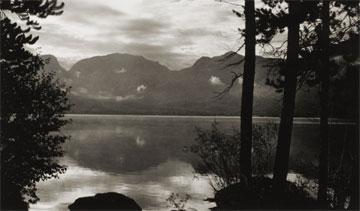
Ouray probably never knew the Utes of the northern region and they were never notified officially of this treaty. Suddenly, their favored hunting grounds of Middle Park, the healing waters of Hot Sulphur Springs, and much of the Front Range and Gore Range were opened to white settlement. Naturally there were tensions between the Utes and the white settlers and there are several well documented accounts of disputes in the area, including the killing of Tabernash, retaliatory strikes by the Utes, and the supposedly intentional burning of Middle Park by Colorow. Finally, there was an uprising in 1879, known as the Thornburg and White River Massacres, and the result was that the Utes were evacuated from almost all of their former reservation and driven to the Utah area in 1882.

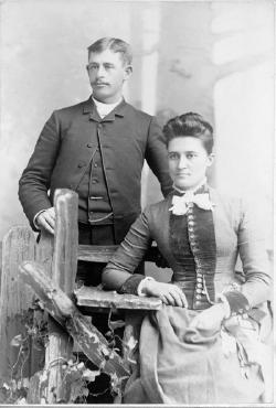
Though much of the culture, knowledge and influence of the original Indian people has been lost to time, Ute and Arapaho names still grace many landmarks in Grand County.
 

Origins of the Ute People

Before there were any people anywhere, the Creator, "Sinawaf", cut sticks and placed them in a large sack.  After many days, this aroused the curiosity of the coyote.  When Sinewaf was away, the coyote could no longer control himself and opened the sack.

Out came many people who scattered in all directions.  Each spoke a difference language from the others.  When Sinewaf returned, there were only a few people remaining in the sack.  He was furious with the coyote, as he had planned to distribute the people equally in various parts of the land.  As there could now be no such equity, there would be wars among the different people, who would fight for the best locations.

Of the small group left in the sack, Sinawaf called them Ute or Nuche, which meant "the people".  They would be a very brave and strong tribe.

Tabernash
Tabernash

The unrest and hard feelings between the Indians and settlers in Middle Park gave rise to an inevitable conflict the last week of August, 1878. About forty Utes, led by Piah and Washington, started to set up camp in William Cozens’ meadow, near Fraser, taking fence poles to make fires. Cozens drove them off, telling them to replace the poles and leave. The Utes moved down valley about five miles to a spring not far from Junction Ranch (named for the junction of the Rollins Pass and Berthoud Pass wagon roads).

There, Johnson Turner, who leased that land, became increasingly uneasy as the Indians were drinking heavily and expressing anger that Ouray given away their land in treaties with the white man. They wanted Turner to pay them for the hay he was cutting. They tore down his fences for firewood, turned their 100 horses into his meadow, and set up camp. They also laid out a race track on drier ground about a mile way.

Turner complained to the sheriff, Eugene Marker, who rounded up a posse of men, intending to remove the Indians or at least convince them to move on. Accompanying him, on September 1, were Frank Addison, a transient prospector, John Stokes, T.D. Livingston, and Frank Byers.  The posse found only women and children at the camp, since the Ute men were at the race course. Marker, the sheriff, ordered the encampment searched for firearms and when the Ute men returned, an angry confrontation ensued. 

Tabernash and Frank Addison exchanged threats, and Tabernash jumped from his horse and snatched one of the guns piled on the ground. Frank Addison immediately shot him. Tabernash tried to pull his rifle from its scabbard, but that it became entangled, and Addison then fired twice more. Tabernash slumped over the neck of his pony, which ran away through the willows. Apparently Addison recognized Tabernash as the Indian responsible for the killing several of his companions while trapping furs on Grizzly Fork in North Park six years earlier. 

After this bloodshed, the posse persuaded the rest of the Utes to leave, after they buried Tabernash’s body in a shallow grave. No one was ever sure where Tabernash was buried. There was a rumor that the slain Tabernash was buried in a draw not far from Junction Ranch, but when the Grand County Historical Association excavated the site, nothing was found.

A day later, September 3, on a Ranch near Kremmling, Abraham Elliott was shot while cutting wood, and his horses stolen.  In response, the posse moved north in the direction of the White River Reservation. 60 Utes met the posse, and explained that the culprits were Piah and Washington, neither of whom was a part of the White River band.  Ultimately, the Utes signed a council report, returned horses stolen from the Elliott ranch, while the  ranchers returned guns confiscated from the Utes at Junction Ranch.  The matter was considered legally settled, but outrage and fear continued among the settlers and the Utes of the area.

In 1902, E.A. Meredith, chief engineer for the Denver & Salt Lake Railroad, named the town that had grown up with the building of the railroad, after the slain Ute, Tabernash.

The Ute Legend of Grand Lake

A group of Utes were camping on the shores of Grand Lake when they were suddenly attacked by an enemy tribe of the Arapaho (and in some versions the Cheyenne as well).  As the brave Ute warriors began fighting, the women and children were hurried onto a large raft for safety and pushed to the middle of the lake.  As the battle continued, a treacherous wind overturned the raft and all the women and children were drowned. Many Ute warriors were also killed during the fighting. 

The legend holds that you can still see ghostly forms in the morning mist rising from the lake and hear the wailing of the lost women and children beneath the winter ice.  The Utes avoided the lake for many years because of these tragic events and evil spirits.

Ute Legend of Canyons

Major John Wesley Powell was in the first party to make a recorded climb of Pikes Peak in 1868.  Later, he would lead the first expedition of the Green and Colorado (Grand) Rivers. He was very interested in the Indian tribes that he encountered and later became head of the new U.S. Bureau of Ethnology.  He recorded this legend as told by the Utes on his first visit to the Colorado mountains, during his Pikes Peak climb.

A chief of the Utes mourned the death of his beloved wife, and his grief was so deep, that no one could console him.  Then the Great Spirit, Ta-Vwoats, appeared to him and promised to take him southwest to where he could see where his wife had gone, if he would promise to grieve no more.

Ta-Vwoats rolled a magical ball before him and it crushed mountains, earth and rocks, making a trail to the land of the afterlife.  Following the ball was a rolling globe of fire which the Great Spirit and the chief followed.  At last they were in the happy land where all was blessed with plenty and joy.  This was where the chief's wife had gone and he was glad to see it.

When they returned, Ta-Vwoats told the chief that he must never travel that trail again during life and warned all the people against it.  Knowing that those who had lost their loved ones would be tempted to make the journey, Ta-Vwoats rolled a river into the canyons so that no one could enter.

Ute Legend of the Quaking Aspen

It is amazing to behold the continuous quivering of aspen leaves in groves around Grand County, even when there is no apparent breeze.

According to Ute legend, the reason for this unique aspect of the aspen tree happened during a visit to Erath from the Great Spirit during a special full moon.  All of nature anticipated the Spirit's arrival and trembled to pay homage.  All except the proud and beautiful aspen. The aspens stood still, refusing to pay proper respect. The Great Spirit was furious and decreed that, from that time on, the aspen leaves would tremble whenever anyone looked upon them.

Ute Legends of Hot Sulphur Springs

Ages ago, there were many Ute Indians who enjoyed life in Middle Park with its plentiful game and lush meadows.  They lived in peace and harmony for "as many years as there are hairs on the head."

In spite of this idyllic life, there was one young brave who yearned for more adventure and material goods.  He proposed that the Utes attack the Sioux, who lived beyond the mountains on the plains of the rising sun.  As victors, they would return in glory with much wealth and many captives.

Spiquet Pah (Smoking Water) was an elderly medicine man who foresaw only grief in the prospect of such a war.  He spoke before a council meeting, warning of the devastation that such an action would bring upon the tribe.  He foretold " As the North Wind soon brings the snows and death of winter, so will he bring sorrow and death to our own people.....if you do this, strength and peace and plenty will be but for a few; joy will be seen no more."

Disregarding his warning, most of the young men were tantalized with the temptation of the grand adventure of such a conquest.  In the autumn of the year, when they usually did their hunting, the young men rallied behind the young brave and followed him over the Great Divide into combat with the plains people.  As the fighters departed, a saddened Spiquet Pah went into the heart of the mountain "and pulled the hole in after him."

The young Ute men found the enemy better armed and organized than they expected. Many Ute braves were killed and others were taken as slaves. The prophecy had come true as starvation and disease plagued the tribe as there were too few men to hunt for food. The old man sat on his haunches beside his subterranean fire which he heated water from an underground stream.  From the mountain at Hot Sulphur Springs, water flows even today as a reminder of the rash behavior of so long ago.

Another legend holds simply that the Hot Sulphur Springs water acquired medicinal qualities in answer to the prayers of an old chief who has be left by his tribe to die.  The old man built fires within the mountain, and after drinking the water and bathing in them, we was restored to health and rejoined his people.

Articles to Browse

The Daily Life of Mountain Men

Washington Irving wrote "There is, perhaps, no class of men on the face of the Earth who lead a life of more continued exertion, peril and excitement, and who are more enamored of their occupations, than the free trappers of the West".

The diet of the mountain men at times consisted of nothing more than meat. When possible. wild plants and berries supplemented needed vitamins.  Pemmican, a meat pounded with fruits and dried in flakes, was convenient to carry and lasted a long time. Mountain men made boudins, sausage made from the intestines of newly killed animals.  These sausages were packed full of undigested grasses which probably protected the mountain men from the illness of scurvy.  The mountain men also chewed on leaves and wild grasses to supplement their vitamin needs.  Potatoes soaked in vinegar supplied further balance to the diet.  Jams and orange marmalade were highly valued whenever they could be obtained. Bread consisted almost entirely of hardtack, a touch cracker usually unsalted, which would not spoil and sturdy enough not to crumble.

Beaver tail soup was considered a delicacy by most mountain men.  Another treat was called "French dumplings", made by mincing buffalo hump with marrow, rolling it into balls, and covering with flour dough and boiled.  Coffee was popular, but limited for transport.  Tea from China came in solid blocks which could be shaved off as needed. 

Normally, mountain men could not carry whiskey on the move but at rendezvous or during visits to forts, they were known as fabulous drinkers.  The most common intoxicant in those days was "Taos Lightening", a strong whiskey manufactured by Simeon Truly of Taos New Mexico.  Various writers have portrayed these men as brutes who lived from one drunken episode to the next, but the facts, and common sense contradict that image.  They could not achieve much in either trapping or trading if they did not stay focused on their outdoor skills and survival. 

Smoking pipes was a luxury, mostly at nights as only a limited amount of tobacco could be obtained.  The mountain men would stretch their tobacco supplies by mixing it with kinnick-kinnick and other plants.

While many traders and trappers dressed in buckskin shirts and trousers, wool garments were even more common and needed to be shrunk to fit.  Probably every mountain man carried what was called a "possibilities bag" that contained personal items such as a pipe, tobacco, soap, needles, and small keepsakes such as mouth-harps.

Before the Sharps "Big 50" rifle was invented, it was necessary to carry a waterproof powder horn and a bag of rifle balls weighing fifty to a pound.  A good knife was essential.  The most sought after of these was the Bowie Knife, invented by Rezin Bowie, but made famous by his brother Jim, who was adept at its use.  Jim was one of the heros killed at the Battle of the Alamo in Texas.

Some mountain men simply loved the lifestyle and had no reason to return to their original homes.  Some had wives back in St. Louis and made an annual trek there every year.  Others had Indian wives or female companions.  Some men claimed to have a wife in every tribe they visited.  Divorce within many tribes was often simple, a matter of putting one's belongings outside the lodge.

As journeys by foot or horse were lonely, mountain men were known to play their mouth harps or sing songs along the trail.  The use of profanity was common, except in the presence of white ladies.  One writer claimed the Indians called white men "Godams" because that swear word was used so frequently by the mountain men, ranch hands and mule skinners.     

Stage and Freight Lines

Berthoud Pass Stage Road was built by the extreme efforts of Captain Lewis Gaskill.  It came from the top of the Pass through Spruce Lodge, Idlewild (now Winter Park), the Cozens Ranch (near Fraser) Junction Ranch (Tabernash) and Coulter.  From there once branch lead over Cottonwood Divide to Hot Sulphur Springs (and points west) while the other went to Selak’s and over Coffey Divide to the Lehman Post Office and on to Grand Lake.  

At the summit of Berthoud Pass there was a large house of hewn logs, occupied by Lewis Gaskill and his family.  They collected the tolls for the road and gave welcome shelter to those weathering the variable passage.  The house was located on the West side of current Hwy. 40 but no trace of the building remains.  

At the steepest portion of the west side of Berthoud Pass was the Spruce House rest stop, which by 1900 was a sold structure of two and a half stories.  There the traveler could find a warm meal and corral for livestock.  No trace of it remains today.  

The Idlewild Stage Stop was located in present day Winter Park and was a popular place to change horses before the steep assent up the pass.  Mrs. Ed Evans served a hearty noonday meal there for only 35 cents.

Cozens Ranch was also one of the more popular stops and Fraser Post Office until 1904. Built around 1874 by William Zane Cozens, it remains today, outfitted in period décor and is the home of the Cozens Ranch History Museum.  

The Gaskill House, in Fraser was built by Lewis De Witt Clinton Gaskill, one of the original investors in the road and a prominent Grand County citizen. The house now houses the Hungry Bear Restaurant.

Junction House at Junction Ranch (Tabernash) could accommodate up to fifty travelers and was built by Quincy Adams Rollins, and subsequently leased to Johnson Turner.   

The Coulter Stage Stop was built by John Coulter, an attorney from George town and shareholder in the stage road.  It also served as a Post Office from 1884 to 1905. 

Frank and Fred Selak, sons of a pioneer Georgetown brewer ran the Selak stop which was north of Granby and east of current Hwy. 34.           

Cottonwood Divide (Pass), at 8904 feet above sea level, was laid out by Edward Berthoud and Redwood Fisher in 1861.  The route was used by stagecoaches from 1874 until the railroad arrived at Hot Sulphur Springs in 1905.  The last driver on the route was Charlie Purcell.  Summer travel time between Hot Sulphur Springs and Georgetown was typically twelve hours. Travelers between Hot Sulphur Springs and Kremmling could stop at the Barney Day or King Ranches, both near current Hwy. 40.   The Pinney Ranch House, used by the firm of Whipple and Metcalf for the connecting service to Steamboat Springs, is still standing on Hwy. 134 on the east slope of Gore Pass. There a traveler could pay 50 cents for a meal, 50 cents for a bed and expect a change of horses every ten miles.  It ceased operation in 1908 when the railroad reached Toponas.  

Topic: Biographies
, Gram Wood on horseback

Lillian Russell Smith Wood - "Gram" Wood

, Gram Wood on horseback

Lillian Russell Smith Wood was born in Dunlap, Kansas, in 1884, she was not a particularly healthy child.  Born just before her and just after her were sets of twins, 2 of the 4 sets born to her parents and the only 2 sets that survived into adulthood.  Lillian spent her adult years on the Williams Fork and then in Parshall. Known as “Gram” Wood to most everyone who knew her, she was grandmother to 39 who bear the names Wood, Noell, Stack, and Black.  And her history in Grand County beginning in 1905 made her one of our pioneers. 

In the fall of 1905, the local newspapers report that Herb Wood had lost a large portion of his right hand in an ore crusher accident.  Herb had come into Summit County originally with a mule team for “Uncle Joe” Coberly, another Williams Fork resident and apparently worked in or around mines and mining equipment while also hauling the timbers for mine use.  Herb needed some round the clock nursing, and in those days, for Gram to take proper care of him and still be in an acceptable position, they needed to be married. One source says the situation was so different that a Denver newspaper picked up the story with a headline of “Loses Three Fingers, Wins a Bride”, indicating that they married 3 days after they met.  Research has never turned up a trace of that story, and it’s unlikely in the mining camps in the area that they hadn’t met until he was injured.  Still, they were married by Judge Swisher, well known area businessman, in short order in the hotel room where Herb was recovering .  A short time later they made a brief wedding trip to Denver and then returned to Argentine.

Before fall set in that year, the newly married couple moved to the Little Muddy.  Herb had been sending money to a partner who was helping him to secure a homestead there not far from where Joe Coberly lived.  It was probably with anticipation of a great future on their own land that sent them into Middle Park to face their first winter as a couple without having had a chance to raise a garden or preserve any winter supplies.  They moved into one end of a two room cabin with a man named Ranger Charlie in the other.  And about that same time, they discovered that Herb’s partner had been drinking the money he’d sent over the years.  What devastation that must have caused!

On the other side of the valley just across the creek was the large  ranching operation known as the Hermosa Ranch, owned by Dr. T. F. DeWitt, a well-to-do doctor from back East.  With the dream of his homestead gone, Herb went to work for DeWitt, eventually becoming one of his foremen.  Gram probably helped out with cooking and cleaning, but within a few months, she went back to Kansas to await the birth of their first child. Over the next 21 years, she raised kids and gardens and developed her love of fishing, which helped feed a family that eventually totaled 13 kids, including a set of twins born 2 weeks before Christmas and delivered by Herb when a doctor couldn’t reach them in time. Pictures of the time show a large family of 9 boys and 4 girls with Gram, all 5’2” and maybe 100 pounds of her on one end, and Herb with a child or two on his lap at the other.  The kids recall Christmases being supplied mostly by Mrs. DeWitt and sometimes being late if the trains got snowed out of the area. All attended one room schools, Hermosa and Columbine, and stories of their lives together can make one wonder why any of them survived.

Life continued  pretty much routinely until 1928.  That summer, the youngest daughter, Marilyn, a premature baby and ailing child caught whooping cough.  She lingered and languished until early October, and then she passed away.  The close-knit family had suffered it’s first loss. Two weeks later, Herb came in from the hayfield complaining of not feeling well.  Gram followed him into the living room and sat down with him on the couch. Minutes later, he collapsed in her arms and died of a cerebral hemorrhage.  They buried him alongside Marilyn in the Hot Sulphur Springs Cemetery.

The boys continued the work for Dr. DeWitt for several years, and in 1932, they built a 2 bedroom house for Gram several miles from where DeWitt had relocated his ranch.  Her sons made sure she had what she needed as she finished raising the youngest ones who had been little more than toddlers when Herb died.

By the time I was old enough to remember much about Gram, she was already a “little old lady” who lived in a small, pink mobile home next to Uncle Kenneth in Parshall. Everyone knew that she was one of the best fishermen in the country, having caught as many as 1200 in a season when she was feeding her family by herself.  She enjoyed creek fishing the most, and even as she got older her ability to maneuver around the biggest holes and catch fish in any small body of water never faltered.   I never saw her get wet.

In the winter, she was totally unafraid getting a couple of her grandkids on a sled and making a run down the hill in Parshall that ended at the store and U.S. 40, which then went through the center of town.  Had her feet not worked so well as brakes, we could have ended up on the pavement.  But we never did.

She must have driven many teams of horses in her day, and I believe she was a good rider. She never drove a car, but unless she needed to go to the doctor in Kremmling, she didn’t need to leave town. Her friends included Doc Ceriani’s mother and fellow fishermen from Hot Sulphur, a couple from Poland with heavy accents.  Somehow, somewhere she had met Ralph Moody, author of the “Little Britches” series. And she, too, had a “fish” experience with warden Henry “Rooster” Wilson.

Only once did I get into trouble because of Gram.  She was fishing one day near where I was getting ready to ride, when she laid down her pole and walked over to me.  After watching me for a minute she said, “Can I ride?”  What do you say to your 80 year old grandmother but, “Of course!”  I saddled up the gentlest mare we had and helped her aboard.  She only made a couple of trips around the small pasture, but as she rode, walking only, I’m sure I saw a young woman next to her husband on horseback in front of one of the Hermosa’s big barns.  It’s one of the pictures you’ll find at the County Museum in Hot Sulphur.  When dad found out what I’d done, he turned deathly white.  “Don’t you know if she’d fallen or been thrown she could have been seriously injured or killed?”  No, I had to admit.  This was one rider’s request to another, with age no consideration .  And to her at that particular moment, had either occurred I believe she would have considered those few moments worth the risk.  When she was finished, she walked back to her fishing pole, satisfied that nowshe was done riding.

Gram introduced me to horehound candy, something I will also think about each time I taste it.  And because she didn’t like my first name, I didn’t even know what it was until I started school.  She taught me that barn cats do fish and that survival in a small living space was possible The one thing she didn’t teach me was anything about her growing up years or about my grandfather.  It seemed like we knew as very young kids that we didn’t ask about him.  I believe that hers was a love so strong that even to the point where her mind grew dim, the pain of losing him was too much to bear.  One regret we all have, however, is that we never asked to her to go with us up to Summit County to show us where she lived and to tell us stories of that life and time.  And unfortunately that’s been lost forever. Gram passed away in 1980, at the age of 97.  She is buried with Marilyn and Herb and their son, Melvin who died during World War II in a family plot in Hot Sulphur with other family and pioneers characters nearby.

She left a true legacy through her kids and grandkids who continue the nostalgic traditions of their beloved Gram.

Topic: People

The Knight Ranch and Charles Lindbergh

In Grand County during the 1920's, you might have been lucky enough to have taken a plane ride over Grand Lake with Charles Lindbergh.  It may sound preposterous, but Gordon Spitzmiller and his father, Gus, were two of the many fortunate people who got private sightseeing tours over the Grand Lake area with Charles A. Lindbergh as tour guide.

In the early 1920's, the aviation industry was a brand new field open to the adventurers, the thrill seekers and the adventurous.  Charles Lindbergh was one of those men.  In the spring of 1926, Lindbergh had the dream of flying solo over the Atlantic Ocean, from New York to Paris nonstop.  He was a determined man and was resolved to be the first man to cross the Atlantic and win the Orteig Prize.

On May 22, 1919, Raymond Orteig of New York City offered a prize of $25,000 "to be awarded to the first aviator who shall cross the Atlantic in a land or water aircraft (heavier-than-air) from Paris or the shores of France to New York, or from New York to Paris or the shores of France, without stop."

Besides Lindbergh, there were four serious contenders for the Orteig prize, one of which was Commander Richard Byrd, the first man to reach the South Pole.  Lindbergh's courage and enthusiasm for such a flight were not enough; he needed financial backing.  Lindbergh found his financial answer in Harry H. Knight, a young aviator who could usually be found bumming around the Lambert Field in St. Louis.  This was the beginning of the Knight-Lindbergh partnership that would soon change the course of aviation history. 

After being denied any financial assistance by several of St. Louis's businessmen, Lindbergh made an appointment with knight at his brokerage office.  Knight, the president of the St. Louis Air Club, was fascinated with Lindbergh's plan and called his friend, Harold M. Bixby, president of the St. Louis Chamber of Commerce.  Bixby also displayed a strong interest in the obscure stunt flyer and mail pilot.  Together Knight and Bixby formed an organization called "the Spirit of St. Louis", which was dedicated to gathering funds for the flight.  More than $10,000 was needed in order to build a single engine plane and acquire the proper equipment.

Knight went to his father, Harry F. Knight, who was a major power in the realm of finance and an equal partner in the firm Dysart, Gamble & Knight Brokerage Company.  Like his son, the senior Knight was interested in the aviation field and backed every effort to make America conscious of airplane transportation.

Without the financial aid and moral support offered by the Knight family, Charles Lindbergh may not have been able to cross the Atlantic in 1927.  Lindbergh's gratitude to these two men never ebbed.  Lindbergh and, his famous wife Ann Morrow, came often to Grand County as guests of Harry F. Knight whose ranch encompassed 1,500 acres on the South Fork of the Colorado River.  The ranch today is covered by the waters of the Granby Reservoir.

Knight, a nature lover, spent much of his time at this ranch.  It was a haven for sportsmen and adventure seekers, and Lindbergh was a natural for these two categories.  One of the largest and best airstrips in the west was added to the Knight Ranch in order to accommodate the owner and his guests.  Besides the airstrip, the ranch boasted a miniature golf course, a 28 room estate, a private guest "cabin", a good selection of livestock and an array of entertainment that would suit all.  It was a sanctuary for the affluent.

Local people were so enthused about the handsome aviator that they named a 12,000 ft. peak in the Indian Peaks Wilderness Area (east of Granby) "Lindbergh Peak". However, during the 1930's the hero was honored by Adolph Hitler and Lindbergh made a speech favoring Nazism.  This lead to a fall from grace in the eyes of the public.  Even though Lindbergh changed his mind as World War II began, it was too late to regain his former popularity. The peak was renamed "Lone Eagle Peak" which was a nickname for the famous aviator.

After Harry F. Knight died of coronary thrombosis in 1933, his son, along with ranch manager Harry Morris, turned the ranch into a major breeding and beef cattle operation.  It continued as such until 1948, when the Knights were asked to sell it to the federal government or have it condemned to make way for the reservoir.  Moss bought out the cattle operation and most of the buildings were sold, but the colorful memories of the Knight ranch were buried in the depths of Granby Reservoir.

Stafford Family

James "Jimmy" M. Stafford was born in 1849 in Wexford Ireland. Jimmy immigrated to Leadville in the 1870's to work in the booming silver mines. In Leadville, he met and married  Deborah Helen Acey (born 1846 in Trenton New Jersey) in 1880.  In the 1880's the couple moved to Dillon and then homesteaded the Stafford Ranch on the Blue River at Spring Creek Road. Jimmy built their home by hand carrying logs from Green Mountain.  They had one son, Frank Elmer Stafford, born in 1886. Jimmy and Deborah also operated the stage stop, boarding house and saloon called the "Halfway House" between Kremmling and Dillon on Highway 9.  It remained in operation until the stage lines ceased in the early 1900's and the buildings were dismantled in the 1940's.  

Frank went on to marry Alice Smith in 1909 and they had six children, including their first, a son, James Elmer, who died at age 8 in the worldwide flu epidemic of 1918. Frank and Alice built the Stafford General Store, directly across from the "Halfway House".  Frank was instrumental in installing the first telephone lines in the area and served as Grand County Commissioner from 1928 to 1936 and as County Commissioner from 1948 until his death from injuries in a car wreck in 1950.  Alice was called the "Blue River Belle" and kept the general store until 1960.  Alice lived in Kremmling until her death in 1969.  


Topic: Mountains

Rollins or Corona - What shall it be called?

Travel across various passes of the Continental Divide occurred long before white men showed up. Indeed, as anthropologist James Benedict wrote c. 1975, some 10,000 years ago, prehistoric Indians camped, hunted, and built hunting walls on the upper reaches of Rollins Pass, as well as moving in and out of Middle Park for the warm summer months. Historic Indians followed the same paths. In the earliest days of non-Indian access, a particular pass at the head of Boulder Creek was dubbed Boulder Pass.

Capt. Jacob Bonesteel, including wagons, made the first recorded crossing by a white man at this point in April 1862. Three years later, a group of Mormons brought wagons over this route and a year later, promoters of new roads into Middle Park brought in many wagons and livestock. In fact, tourists were starting to enter the park by a number of routes, and one of them, Samuel Bowles, who wrote a fascinating account of his trip, including his return to Denver via Boulder Pass.

Interest was growing rapidly for a road over the Divide, into Hot Sulphur Springs, and on into Utah. One promoter, John Quincy Adams Rollins, from New Hampshire, teamed up with William N. Byers and Porter M. Smart to carry this project through. Rollins was interested in crossing the Divide; Byers was promoting the Springs; Porter wanted to develop the valley of the Middle Yampa. All three were pushing to have Middle Park officially named as Grand County, a challenge finally accomplished in 1874.

So Rollins and associates started his road, reaching the top in 1873. That next winter, they publicized this access and in June, Jimmy Crawford brought his family and wagons to Rollinsville and thence to Yankee Doodle Lake, ready to cross the pass now named Rollins Pass by the developer. But the road ended, and they found Rollins' men still hacking the road out of the granite! Jimmy and his crew found it necessary to leave their wagons and help.

Finally, on June 10th, the family was able to head for the top. Jimmy borrowed two yokes of oxen, hitching them to mules, and then to his horse. The road was so rough that the procession could proceed but a few feet before having to rest. The family itself climbed on foot. At the summit, they discovered only a rough swath cut down through the trees on the western side. The "road" dropped down between the lakes and followed Ranch Creek to its junction with the Fraser River. Rollins quickly realized that Berthoud Pass, which also opened in 1874, was superior to his own pass for wheeled vehicles, so he determined to hedge his bets. He initiated the first mail service into the county in 1873. He also built a commodious hotel where his road joined the Berthoud Pass road at the confluence of Crooked Creek and the Fraser. He called it the Junction House. Next, he proposed to the builders of Berthoud Pass that they form a joint ownership of the two roads between Junction Ranch and the Springs. Tickets would be issued for both routes and revenues would be shared. The two companies would build a bridge over the Grand at Hot Sulphur Springs. He even buttered up his rivals by complementing their work.

All this was accomplished, although the mail route soon moved to Berthoud Pass, because of the severe winters on Rollins Pass. The bridge was started in November 1874. From the beginning, Rollins' road was preferred for trailing livestock, because there were fewer problems with heavy timber and bogs. For years, the Church brothers, George and John, who introduced the Hereford breed into the county, trailed their cattle for summering in what became known as Church Park. However, tourists such as Irving Hale still drove wagons over Rollins Pass in 1878.

About 1880, interest burgeoned for bringing a railroad up South Boulder Canyon and through a tunnel near Rollins Pass. Numerous surveys were completed all along the area. David Moffat settled on Rollins Pass for the tunnel site but decided first to put a temporary line over the top. Thus, in the summer of 1903, a formal contract was let for work up and over the Pass itself. By 1904, the workers reached Arrowhead and they also built a work station on top, called Corona Station, or "crown of the mountain." This railroad construction town of Corona, located at over 11,600 feet at the top of Rollins Pass (first called Boulder Pass) along the Continental Divide was the highest railroad station in the world.

It became obvious by 1905 that the Corona area would require snowsheds if trains were to travel, even irregularly, during the winter. Still, word got out of the spectacular splendor of Rollins Pass and tourists flocked in on summer train excursions, sometimes stopping on top, sometimes going as far as Arrow. In 1913, a fine hotel was built next to the rail facilities. Because Rollins Pass was right in the middle of severe weather patterns, a weather station was built on top, as well as one down at Sunnyside. In 1915, Rollins Pass was actually proposed to be the south boundary of a proposed "Estes National Park."

Later, on the National Historic Register, the district was listed in 1997 as the Denver, Northwestern and Pacific Railway Historic District--Rollinsville & Middle Park Wagon Road. It was also identified as the Rollinsville and Middle Park Wagon Road; Boulder Wagon Road, Rollins Pass, and Rollinsville area. In 1956, Governor Steve McNichols had presided at the official re-opening of the four percent grade to vehicle traffic over Corona Pass, expressing the hope that the route would someday be paved. The Colorado Game and Fish Department and the U.S. Forest Service made additional improvements, and the Arapaho and Roosevelt National Forests put out a 24-page booklet titled "The Moffat Road: A Self-Guiding Auto Tour." The road crossed two of the original railroad trestles near Corona but those trestles, even if reached by 4-wheel vehicles, were crumbling and could no longer even be crossed safely on foot. The current self-guided auto tour refers to Rollins Pass, as well as the Moffat Road and the Boulder Wagon Road. Corona Station and Hotel are discussed. In 1979, a portion of the auto road over Corona Pass was permanently closed because of a cave-in of the "Needle's Eye," a tunnel located before the trestles heading west from the Moffat Tunnel's East Portal.

The tunnel reopened on July 3, 1988, thanks to efforts of the Rollins Pass Restoration Association on both sides of the Divide, with the cooperation of the U.S. Forest Service, Colorado History Society, and Boulder, Grand, and Gilpin Counties. It then closed once more when another rockfall hit the tunnel on July 15, 1990. The RPRA is continuing its efforts for re-opening. The noted photographer, Charles McClure, took many outstanding photos of the Rollins Pass road. One, titled"Group on Rollins Pass, shows well-dressed men and women stand on a snowfield making snowballs on Rollins Pass, Moffat Road, Boulder or Grand County, Colorado; probably on Denver, Northwestern and Pacific excursion train. Date: between 1904 and 1913 near Corona Station." Another photo shows a "30 ft. snowcut on Rollins Pass, Moffat Road photo. Denver and Salt Lake Arrow passenger car is parked east of Corona snowshed by the thirty foot snowbank cut, Rollins Pass, Colorado; it shows men, women and railroad employees posed behind train, on the roof and on the snowbank and a standard gauge track. Date: between 1904 and 1915."

A sign at the highway turn onto the Moffat roadbed says: The Moffat Road "Hill Route" Also called "Corona Pass Road", this road over the Continental Divide was the original "Hill Route" of the Denver, Northwestern & Pacific Railway built by David H. Moffat in 1903. It crosses Rollins Pass at 11,666 feet elevation. On top of Rollins Pass, a sign says: Elevation 11, 660 feet, John Quincy Adams Rollins established a toll wagon road through this pass in the mid 1870's. David H. Moffat's Denver, Northwestern & Pacific Railway crossed the Continental Divide at this point in 1903. First known as Boulder Pass, then Rollins Pass, the railroad workers dubbed it "Corona", the crown of the "Top of the world." A railroad station, hotel, restaurant and workers' quarters existed here until 1928 when the railroad was abandoned due to the building of the Moffat Tunnel. Identifications in various trail and geographical guides say: Rollins Pass (el. 11,680 ft) is a high mountain pass in the Rocky Mountains of north-central Colorado in the United States. The pass is located on the continental divide at the crest of the Front Range southwest of Boulder, at the boundary of Grand County,Colorado and Boulder County, Colorado. Rollins Pass (a.k.a. Corona Pass) sits approximately 5 miles east and above the popular ski areas around Winter Park, between Winter Park and Rollinsville. The pass is traversed by an unpaved road, mostly the former roadbed of the Denver and Salt Lake Railway which abandoned the route in 1928 when the Moffat Tunnel opened to replace it. Railroad advertising called this the "Top O' the World" and it referred to the Moffat Route over the continental divide and the Rocky Mountains.

Rollins Pass was the primary travel route west from Denver until an easier road over Berthoud Pass was constructed. The Denver, Northwestern and Pacific railroad laid its tracks across the pass in 1903-1904 and established a Depot at Corona on the crest. It can be noted that in R.C. Black's Island in the Rockies, the term "Corona Pass" was mentioned one time, on p. 351; the terms "Corona Station" or "Corona Snowsheds were used. In Dismantling the Rails That Climbed, Rollins Pass was used, the Corona hotel, and just once, Corona Pass; 1936. In Maggie By My Side, it was Boulder Pass and Rollins Pass. In Rails that Climbed, Rollins Pass, the Corona shed, weather at Corona, Rollins Pass Snow Shed, other references to Corona as a site. In Guide to the Colorado Mountains (Orme) , they speak of the Corona Trail to Rollins Pass. High Country Names (Ward) used Rollins Pass entirely. Only Hiking Grand County, Colorado, published 2002 by Carr speaks of Corona Pass, with reference to Rollins Pass (near the town of Corona), Moffat Road. The term "town" might be questionable; there was only a small restaurant, workers quarters, railroad offices, and in 1913, the hotel. Current maps, USFS and the Grand County Trail Map, show Rollins Pass, with Corona at the side as being a site.

The use of "Corona Pass' seems to be a rather recent innovation that has come into being with tourism efforts in the upper Fraser Valley. Rollins Pass From Island in the Rockies p. 45 Rollins Pass was originally known as Boulder Pass, first recorded being crossed by whites, by Capt. Jacob Bonesteel in April 1862. Their supplies were carried in wagons. A second organized party went over the same pass in 1865. In 1866, promoters of access into Grand County brought many wagons and livestock over Boulder Pass.In 1867, Samuel Bowles and a group returned home to Denver via Boulder Pass. In 1873-74, two roads were proposed into the county, one of Berthouds pass and one over Boulder Pass. This was the same time that the county was named "Grand". J..A Rollins and his associates started the road and reached the top of the pass in 1873, at which time they envisaged a road from HSS into Utah. The first wagons went over in June 1874. The western descent was so bad that it never was much patronized by wheeled vehicles, instead becoming primarily used for trailing of cattle. At this time the name Boulder Pass disappeared from maps and Rollins Pass became the official name. p. 85. p. 80 Lots of schemes to build roads into GC, but of all the schemes for transport, only one, the Rollinsville and Middle Park Wagon Road showed any promise. That was designed by John Quincy Adams Rollins, from NH, a gifted promoter, a son of a clergyman, second of 19 children. He was a farmer, miner, freighter, road bulder, and platter of towns. He was perhaps the most accomplished billiard player west of the Mississippi. He was a Colorado resident at least by 1866. His finances were up and down, but he was tremendously strong. In December 1884, when he was 68, he thought nothing of a 3-day snow-clogged crossing of the Continental Divide. p. 85 Rollins was interested in MP as an investor and he was interested in extending his road into Utah.

At the same time, a Porter M. Smart was likewise excited about speculating in frontier projects and was working at developing the valley of the Middle Yampa. William N. Byers was busy planning for HSS. These three men launched at least two petitions, with more than 80 "residents" for creating GC. Grand County was created that year, 1874. p. 89 With the creation of GC, people began to consider the area more seriously. p. 92 There was no official mail into the county until 1873 when Rollins brought in the first US pouch over his pass. In May 1874, he built a commodious hotel at the confluence of Crooked Creek and the Fraser, known as the Junction House. p. 94 Rollins knew that the road over Berthoud Pass was superior to Rollins Pass; his main advantage was the railhead at Blackhawk. So Rollins proposed a joint ownership and operation of the two roads for the line between Junction Ranch and HSS. Tickets would be issued for both routes and revenues would be shared. The two companies would build a bridge across the Grand at HSS. Rollins even complimented the Berthoud work. This merger was completed soon. p. 104 This bridge was started in November 1874. p. 108

A mail contract was made in July 1875 for once a week delivery over Rollins Pass, but conditions were so severe that the route was changed to Berthoud Pass. p. 110 From the beginning, Rollins Pass was used in preference to Berthoud Pass for trailing livestock, because there were fewer problems with timber and bogs. However, late spring snowdrifts were a problem, so 20-30 horses were often brought along to break trail. The Church brothers, George and John, summered their cattle in what became known as Church Park and dug the Church Ditch. They also introduced the celebrated Hereford breed into GC. p. 170-171 As interest in bringing a railroad into and through GC developed, about 1880, various stockholders proposed to build up South Boulder Canyon to Yankee Doodle Lake and start a tunnel near Rollins Pass. Nothing came of the first attempts but by the end of July 1881, numerous surveys had been made for that tunnel. p. 238 Cattle was still being trailed out via Rollins Pass up to the turn of the century. p. 258

David Moffat and Horace Sumner, his chief engineer, in the fall of 1903, were planning the tunnel for future excavation; but in the meantime a temporary line was planned for crissing Rollins Pass, at 11,640 feet. p. 264 A formal contract was let for the work over Rollins Pass in August 1903. The loftiest sections were started first, and the first cuts at the top were nearly finished by the 26th of October and tunneling started at Riflesight Notch. As snow came, work slowed to a standstill. p. 265 Work in 1904 was extremely slow until the end of August. An encampment was built at Arrowhead and a station at the crest of the Divide was named Corona Station, where long snow sheds were built almost immediately. p. 267 Arrowhead was soon shortened to Arrow, when a post office was opened there in 1905. Travel on the grades, at 4-5% grades up over Rollins Pass was exceedingly difficult. p. 270 In 1908, word of the scenic splendor of Rollins Pass was becoming known world wide.

Also, Rollins Pass and its "Corona station" were attracting the attention fo the US Weather Bureau, for the pass lay squarely in the center of the region of heaviest snowfall on the entire Colorado Continental Divide p. 344 A terrible winter in 1909 made people think that Rollins Pass was never going to be practical for the long term. Time and again freight and passengers were stuck on top at the Corona facility. In 1913, a $10,000 hotel was built at Corona next to the rail facilities. From Dismantling the Rails That Climbed p. 6 The railroad went from Denver to the top of Rollins Pass. p. 8 Snowsheds were built over the tracks at Corona and other strategic places in 1905. p. 12 The top was referred to as "Corona Pass" 1936. p. 16 Crews who were to removed tails and ties reached Corona at the top of Rollins Pass 1936. p. 20 Reference to the Corona hotel From Maggie By My Side p. 1 Jimmy Crawford heard that a man named John Quincy Adams Rollins was building a road over the range at a place called Boulder Pass. 1873 p. 9-14 June 1874

The Crawford family traveled to Rollinsville and then to Yankee Doodle Lake, where the road ended. Rollins' men were still hacking the road out of the granite. Jimmy and his crew helped. On the morning of June 10, the family started out to go over the rocks and up the mountain. Then he borrowed two yokes of oxen to his wagon, then mules, then his horse. The animals had to rest every few feet; the family climbed on foot. There was no shelter at the top. Rollins' men had done no work yet on the west side of the pass except to cut a rough swath down through the trees. The road dropped down along Ranch Creek. From Rails That Climb published 1950 p. 43 Leyden Junction to Tolland to Rollins Pass. P. 63-64 Many references to Tunnels as identifiers of location. p. 76-77, 78 reference to the old Rollins Pass toll road; first mention of the place called Corona- crown of the mountain. Most references are to Rollins Pass. The Corona shed is mentioned, p. 82. p. 83 Sunnyside water stop, Loop Trestle and Tunnel, Ranch Creek Trestle and water stop, Arrow. p. 95, 100- 101 It is eleven miles from Arrowhead to Rollins Pass. Rollins Pass-Boulder wagon road; other references p. 107 - 112 reference to Corona shed. Reference to pipe line to Corona; a number of comments to Rollins Pass p. 119 weather at Corona p. 120-121 Rollins Pass p. 151 Rollins Pass p. 182 photo of "Rollins Pass Snow Shed" "This Corona station burned one night." p. 188 photo of June at Rollins Pass p. 192-194 photos of Corona shed and other buildings; Rollins Pass p. 252 walking on top of snow shed at Corona p. 271- 272. 1910 Snowshed at Corona p. 312-314 Rollins Pass; Rollins Pass snowshed; Corona; Corona siding p. 324 Corona; Sunnyside weather report station p. 326 Corona sheds p. 333-335 Corona shed; references to "Corona" as a place From Guide to the Colorado Mountains published 1974 p. 54-55 Corona Trail, going from East Portal to Rollins Pass From High Country Names published 1972 p. 105 Irving Hale in 1878 drove his wagon over Rollins Pass, now nearly abandoned as a wagon road. p. 131

David Moffat decides to build a temporary line over Rollins Pass. p. 165 In 1915, Rollins Pass was proposed to be the south boundary of a proposed "Estes National Park". From Hiking Grand County, Colorado published 2002 p. 52 Trailhead on the "Moffat Road to Corona Pass". In same paragraph, it becomes Rollins Pass (near the town of Corona). On p. 54, reference to the Corona Road. On p. 57, map shows Rollins Pass with Corona marked as a "site." p. 56, reference to the old railroad bed used crossing the Divide at Rollins Pass, near the town of Corona. Sometimes called Corona Pass. p. 60-61 Rollins Pass Wagon Road historical notes on JQA Rollins and how to find his wagon road over Rollins Pass, following Ranch Creek to Tabernash. p. 66 Rollins Pass (Corona) to Devil's Thumb From GCHA Journal The Journey p. 6 Rollins Pass used by Indians; comment in 1981 From GCHA Journal Middle Park Indians to 1881 p. 8 Archaic hunters camped in the Rollins Pass area; written mid-1970's The current maps, USFS and Grand County Trail Map, show Rollins Pass with Corona at the side as being a site. The Rollins Pass Restoration Association for many years, and currently, has been trying to open the road and Needles Eye Tunnel. The self-guided auto tour refers to Rollins Pass, as well as the Moffat Road and the Boulder Wagon Road. Corona Station and Hotel are discussed. On the National Historic Register Denver, Northwestern and Pacific Railway Historic District--Rollinsville & Middle Park Wagon Road (Boundary Increase) ** (added 1997 - District - #97001114)

Also known as Rollinsville and Middle Park Wagon Road;Boulder Wagon Road;R Rollins Pass, Rollinsville Corona Station and Hotel The railroad construction town of Corona, Colorado, located at over 11,600 feet at the top Corona Pass (first called Boulder Pass) along the Continental Divide was the highest railroad station in the world. It was situated on an old Native American trail, the same trail it is believed the Mormons traveled on their way to Utah. The road was improved by the U.S. Army, then further improved in 1866 by General John Q. Rollins, for whom the pass and the town of Rollinsville were officially named. Because of the high drifts of snow, the pass was only open from around July to the first big snowstorm two or three months later. In 1956, Governor Steve McNichols presided at the official re-opening of the four percent grade to vehicle traffic over Corona Pass, expressing the hope that the route would someday be paved. The Colorado Game and Fish Department and the U.S. Forest Service made additional improvements, and the Arapaho and Roosevelt National Forests put out a 24-page booklet titled "The Moffat Road: A Self-Guiding Auto Tour."

The road crossed two of the original railroad trestles near Corona but those trestles, even if reached by 4-wheel vehicles, are crumbling and can no longer even be crossed safely on foot. In 1979, a portion of the auto road over Corona Pass was permanently closed because of a cave-in of the "Needle's Eye," a tunnel that came before the trestles on a westward drive from the Moffat Tunnel's East Portal area. The tunnel reopened on July 3, 1988, thanks to the efforts of the Rollins Pass Restoration Association with the cooperation of the U.S. Forest Service, Colorado History Society, and Boulder, Grand, and Gilpin Counties. It was then closed once more when another rockfall hit the tunnel on July 15, 1990. John K. Aldrich is a geologist, lecturer, and author whose "Ghosts of . . . " books and accompanying topo maps are a boon to hobbyists, explorers, and those interested in Colorado mining history. Date: 02/04/08 05:13 Rollins Pass Milepost 16 Corona Station. Picture 6 below, is DPL photo X-7388. "Title: Corona, Colorado, interior of snowshed. Summary: Passengers stand next to the covered train depot at Rollins Pass, in Corona (Grand County), Colorado. The tracks of the Denver, Northwestern & Pacific Railway are in the foreground. The depot is constructed of logs, and the roof of the snowshed is upheld by timbers. Sunlight streams through the opening at the end of the snowshed. Date: (between 1904 and 1913). Source: E. T. Bollinger from W. I. Hoklas." Picture 7 below, is DPL photo MCC-454A. "Title: Group on Rollins Pass. Summary: Well dressed men and women stand on a snowfield making snowballs, Rollins Pass, Moffat Road, Boulder or Grand County, Colorado; probably on Denver, Northwestern and Pacific excursion train. Date: (between 1904 and 1913). Creator: Louis Charles McClure 1867-1957. Picture 8 below, is DPL photo MCC-624. "Title: 30 ft. snowcut, Rollins Pass, Moffat Road photo. Summary: Denver and Salt Lake Arrow Turn (passenger car) parked east of Corona snowshed by thirty foot snowbank cut, Rollins Pass, Colorado; shows men, women and railroad employees posed behind train, on roof and on snowbank and standard gauge track. Date: (between 1904 and 1915 The highway sign says The Moffat Road "Hill Route" Also called "Corona Pass Road", this road over the Continental Divide was the original "Hill Route" of the Denver, Northwestern & Pacific Railway built by David H. Moffat in 1903. It crosses Rollins Pass at 11,666 feet elevation. On top of Rollins Pass, a sign says: Rollins Pass Elevation 11, 660 feet John Quincy Adams Rollins established a toll wagon road through this pass in the mid 1860-s. David H. Moffat's Denver, Northwestern & Pacific Railway crossed the Continental Divide at this point in 1903. First known as Boulder Pass, then Rollins Pass, the railroad workers dubbed it "Corona", the crown of the "Top of the world." A railroad station, hotel, restaurant and workers' quarters existed here until 1928 when the railroad was abandoned due to the building of the Moffat Tunnel. Rollins Pass Elevation 11,680 ft (3,560.1 m) Traversed by Unpaved road Location Boulder_County,_Colorado / Grand,Colorado Rollins Pass (el. 11,680 ft) is a high mountain pass in the Rocky Mountains of north-central Colorado in the United States. The pass is located on the continental divide at the crest of the Front Range southwest of Boulder at the boundary of Grand_County,_Colorado and Boulder County. Sign that sits on top of Rollins Pass Rollins Pass (a.k.a. Corona Pass) sits approximately 5 miles east and above the popular ski areas around Winter Park, between Winter Park and Rollinsville. The pass is traversed by an unpaved road, mostly the former roadbed of the Denver and Salt Lake RailwayDenver_and_Salt_Lake_Railway which abandoned the route in 1928 when the Moffat Tunnel opened to replace it. Rollins Pass Railroad advertising called this the "Top 'O the World" and it referred to the Moffat Route over the continental divide and the Rocky Mountains.

Rollins Pass was the primary travel route west from Denver until an easier road over Berthoud Pass was constructed. The Denver, Northwestern and Pacific railroad laid its tracks across the pass in 1903-1904 and established a Depot at Corona on the crest. David Moffat planned to replace the "Hill Line" with a tunnel through James Peak within a few years of the railroad construction. However, he never could obtain financing for the tunnel due to the inability of the railroad to make a profit and opposition from competing railroads such as the Denver and Rio Grande. The D&RG saw the line as a threat. But, in the far future the construction of Moffat Tunnel would turn out to be the D&RG's saving grace. The trip up Rollins Pass was a favorite of summer tourists looking to enjoy the mountain scenery. It was heavily promoted by the railroad with picnic and wildflower picking excursions. Sights along the line were made famous by postcards containing the photos of L. C. McClure. At last the route surmounts the crest of the Continental Divide and takes quick refuge on the top at Corona. At elevation 11, 660 this is truly the famous Top O' the World and one of the highest railroad passes in the world. Due to the great height and nature of the Rocky Mountains, the entire railroad complex was completely enclosed in giant covered snow sheds.

My Granby, Little Old Log Church

Contributed by Vera "Stathos" Shay, Kremmling...Granby resident 1930-1945

From what I hear

It is very near

To be torn away

The little church of my childhood day

The most beautiful to see

That can ever be

Inside and out

Without a doubt

Built of log so fine

In the style of old time

In my own little chair

Every Sunday I was there

The chime of its bell

For miles around

Heard its wonderful sound

For a while our school

We didn't fit

So in our church were classes

For a bit

Beside our church on the hill

We sledded for a thrill

That poor little church

They moved it around

All over town

Proudly it's hung together

In all kinds of weather

Every time I go to Granby town

I look around to find

And have a look

At my log church for my eyes'

Memory book

Now they say it's got to go

Pray it won't be so

All of you Granby folk

Louder you should have spoke

To save that church with its

Memories and history

For there could never be

Anything that would compare

Built or put there

With my magnificent, beautiful

Childhood Granby log church

Find it in your hearts

To never let it be torn apart.


April 2005


Topic: Biographies

Redwood Fisher

Article contributed by Corinne Lively

There were two Redwood Fishers, grandfather and grandson, who made significant contributions to the development of the Grand Lake area. 

One of the earliest pioneers was the senior Redwood “Woody” Fisher, born in Urbana, IL in 1839.  He learned surveying skills in New Jersey, and received a degree in Civil Engineering in New York City, where he met his future wife, Louise Perrenoud.  He arrived in Denver in June 1860 and borrowed money to purchase his first surveying instruments.  His bride to be, her two sisters and widowed father arrived in Denver in July 1862 in a mule drawn ambulance. They had traveled for six weeks from Omaha to deliver the vehicle which was used as an ambulance and hearse.  The first marriage license in Denver was issued to Woody and Louise, and their wedding took place May 6, 1865. 

The day after his marriage to Louise, Woody joined General Hughes and E.L. Berthoud as Chief Surveyor in building the wagon road from Denver to Provo, Utah over Berthoud Pass.  The expedition followed a route laid out by Jim Bridger. 

Woody held the offices of Denver city and county surveyor and county commissioner.  He was foreman of Hook and Ladder Co. #1, and helped fight many Denver fires. 

In May 1870, Woody was killed attempting to stop a runaway team of horses at the corner of California and 14th Streets.  While trying to save the lives of several children, he fell and the wagon wheels ran over him.  Woody left his wife with three children, Louise, Charles and Ella.  He is buried in Riverside Cemetery.

Redwood must have spoken in glowing terms about his time in Grand County since his son Charles, only two when his father was killed, spent most of his life near Grand Lake, built a summer home on the North Inlet below the Rapids Lodge, purchased 160 acres on the east side of the Colorado River from the Fred Selak estate.  He died here in August 1945.  Charles and his wife Sara had a son in May 1907, whom they named Redwood.

The junior Redwood “Red” Fisher also spent most of his life in the Grand Lake area.  He was an early Park ranger and helped stock many of the high lakes on horseback.  After his marriage to Helen Schultz in 1928 he started ranching below the present Shadow Mountain dam on land purchased from Mrs. Cairns.  He later acquired the 7V/ on Stillwater Creek.  He was President of the Colorado Dude Ranch Association in 1947 and traveled to conventions in Chicago and elsewhere promoting Colorado’s guest ranches with displays of fancy roping and riding.  His own dude ranch, Fisherancho, was on the land below Shadow Mountain Dam and served guests until the 1950s.  The barn still stands, and is now part of the Arapahoe Recreation Area. 

Sources:
Lela McQueary, Widening Trails, World Press, 1962
Middle Park Times, August 12, 1945 and May 6, 1993
Colorado Families: A Territorial Heritage, CO Geneological Society, 1981
Brand Book, Middle Park Stock Growers Assn.
BLM General Land Office Records
Conversations with local decendant Toots Cherrington


Topic:

Ray Osborn

Article contributed by Tonya Bina 11-07


Ray Osborn's father, Elonzo Osborn was also an avid fisherman and hunter, and he and a neighbor stocked cutthroat trout the in the 1920s in the lakes in what is now Rocky Mountain National Park. This fact seems to bring pride to Osborn, who spent his entire adolescence exploring the terrain surrounding the upper Colorado River. "Everything in the outdoors was so ingrained in the way we lived," he said. "We lived in the outdoors, and we fished when we could and hunted when we could."

Osborn's maternal great grandfather is Warren Gregg, a settler and talented carpenter whose wife took the life of her young children, sparing two boys, in a story that has become legend in
Grand Lake. His maternal grandfather, Ray Gregg, was a blacksmith and a carpenter. He was also the justice of the peace in Grand Lake.

And Ray Osborn's father was a rancher, a man who was forced off of his land when a large water delivery system came to define the West Slope. Being fourth-generation
Grand County can be frustrating, he said. "There's too many changes. None of them for the better. Rich developers are coming in here and tearing the country up and developing the county. They don't care because they're not going to live here. They're going to get their money and go someplace else," he said. "I don't like all the changes now, they're destroying the natural beauty of Grand County."

Osborn, who had six brothers and sisters, has seen two of his childhood homes be torn down "for progress." The first was the ranch house his family lived in before the Bureau of Reclamation claimed his father's 54 acres for the Colorado-Big Thompson project. The ranch land is now a lake bed, 11 feet below the water's surface.
When Shadow Mountain Reservoir was drained last year to kill weed growth, Osborn said he could still see the old foundation. The government offered his father $5,400 for the 54 acres, take it or leave it.  "My father was broken-hearted over it because he loved to ranch."

With the money, Elonzo Osborn bought 11 acres on the north side of the North Fork of the Colorado, where he kept a milking cow and raised chickens, then went to work for the Bureau as a janitor at the government camps that sprung up for the construction of the project. Ray's mother went to work as a mail carrier, with a route from
Granby to Grand Lake up to Phantom Valley in the Park to supplement the family's income.

During WWII, the family raised rabbits during a meat shortage. "Rabbits were easy to raise, and we sold a lot of them," Osborn said. Ray Osborn attended first through ninth grade at the
Grand Lake primary school before attending Middle Park High School, which had just been built in 1947. There were 22 people in Osborn's class, and he was the first student to graduate mid-term from the new school. The very next day, he joined the Navy, the start of a 24-year career that involved two wars.
"On my first tour of duty, I came home on leave and went to a high school football game," Osborn said. It was there that Osborn met Mary Ann, who was visiting from
Iowa for a few months during her senior year in high school.

After a long-distance engagement, the couple married at St. Anne's Catholic Church in
Grand Lake in the fall. This September, they celebrated their 55th anniversary.
Most of his career was spent overseas, Osborn said, with more than 16 years in
Asia. He credits his wife for raising their four children mostly on her own. In 1973, he retired from the military; his youngest was 13 years old.

Upon retirement, after a stint in
Denver, the family relocated to Grand County, where Osborn worked at Winter Park Resort for 12 years. Nearly every day, Osborn heads to his favorite fishing spots, such as the canal that feeds into Shadow Mountain reservoir, a replacement of the river that once was.  He now brings his grandchildren fishing too, and grandma Mary Ann knows just how to cook up those brookies, "cornmeal and flower, olive oil in the pan, a sprinkle of lemon pepper" to make them taste real good. "Get them real brown," she says.

Osborn likes how much fun they are to catch, and his youngest grandson does too.
"They're like wild trout - you got to know how to fish for them in order to catch them," he said. It's when the 75 year-old outdoorsman is talking about the rivers, inlets and hills he knows so well, he seems most at home. "Not too many people left here that have been here longer," he said.


Schools

Article contributed by Betty Jo Woods

The first official school in Grand County was founded in 1875 in Hot Sulphur Springs in a crude dugout. The school met for twenty days and a painting of the classroom shows nine students in attendance. Typically the woman teachers of that era would have earned about $25 per month. 

One report to the Colorado State Department of Education said, “The school secretary left during the Indian uprising and no school records are available.” This school was presumed to be at Hot Sulphur Springs.

In the 1890s school was not held every year in Grand Lake because not enough taxes were raised to pay for a teacher. The school year was generally April through October and classes were held in various vacant buildings for many years. The first schoolhouse in Grand Lake was built in 1910 and remained a one-teacher school until 1935. 

A notice published in the Middle Park Times on january 31, 1889 annouce that a masquerade ball and supper of "beef steer and chickens" would be held on February 14th to raise money to build a school.    

In 1898, the offerings were expanded to include the first experimental high school curriculum to be offered in the county. As towns were developed, several rural one-room schools also came into existence. Many schools were taught only during the summer because winter travel was too difficult.

At one time there were nineteen school districts. In 1958 the County was reorganized into two school districts, with the result that today there are two high schools, two middle schools, four elementary schools, one charter school, one alternative school, and one private Christian school in Grand County.

Sources:
R.C. Black, Island in The Rockies. Pruett Publishing Company, 1969
Colorado State Department of Education, First Formal Biennial Report of Superintendent of Public Instruction for State of Colorado. Denver, Colorado: Daily Times Printing House, 1879

Indians