Grand County

Grand County Articles

Grand County
Grand County

Grand County was established in 1874 by the Territory of Colorado, thus becoming a county two years before Colorado became a state. It was named for the Grand River, the name by which the Colorado River was known at that time. The headwaters of the today’s Colorado River are in Grand County. The county was formed from a portion of Summit County but acquired its current boundaries in 1877, when part of the Grand County was used to create Routt County. The county seat is Hot Sulphur Springs. The area of 1,854 square miles consists of meadows, river valleys and mountains.

Grand County Time Line

Prehistoric
7000 BCE to 900 BCE: Paleo Indians  (Yarmony, Rollins Pass, Windy Gap) use Middle Park as summer hunting area

1819 – 1860
1819:Adams-Onis Treaty – Middle Park partitioned – Sites of Granby, Fraser, Grand Lake and Hot Sulphur are in the U.S, Kremmling still part of Spain

Middle Park well known to “Mountain Men” by 1820

1828: Kremmling becomes part of Texas

1837: T.J. Farnham’s expedition crosses the Blue at Grand River

1839: Grand River named on a semi-official map

1842: Rufus B. Sage visit

1844: Captain John C. Fremont’s second expedition, accompanied by Kit Carson, enters Middle Park over Muddy Pass and exits up the Blue River

1854: Sir St. George Gore, an Englishmen, accompanied by Jim Bridger enters Middle Park for hunting expedition

1859: First appearance of prospectors; interest in Hot Sulphur Springs

1861 – 1874
1861: Berthoud crosses Berthoud Pass and traverses Middle Park

1861: Middle Park becomes part of Summit County

1863: Trouble begins between the Utes and white men

1864-1868: Wm. N. Byers acquires Hot Sulphur Springs

1866: Gov. Cummings signs Treaty of Middle Park

1868: John Wesley Powell visits Grand Lake, makes first recorded ascent of Longs Peak

1867: Joseph Westcott settles at Grand Lake

1871-1872: Clarence King surveys area

1873-1874:  F.V. Hayden surveys area

1874: Creation of Grand County (two years before Colorado became a state)

1874: Toll roads opens over Rollins and Berthoud Passes

1874: William H. Jackson, renowned photographer, takes first photographs of Middle Park

1875 – 1888
1875: First mail routes to Hot Sulphur Springs

1875: Silver ore indications in Never Summer Range

1875: First school opens in Hot Sulphur Springs with 12 students, (school “year” was 20 days)

1877: Routt County detached from Grand County

1877: Stokes-Dean political crisis

1878: Tabernash and Abraham Elliott killed

1879: Ute Indian War produces excitement, anxiety

1879: Lulu City & Teller City formed

1880: Gaskill City formed

1881: Four railroad projects frustrated

1881: County Seat moves to Grand Lake, height of mining boom,   Grand Lake Prospector is launched

1883: Commissioner shootings at Grand Lake

1884: Shooting of Texas Charlie in Hot Sulphur Springs

1884: Kremmling formed

1885: Kremmling Post Office opens

1885-1886: Collapse of mining, North Park separates from Grand County

1888: County Seat moves back to Hot Sulphur Springs

1889 – 1904
Expansion of ranching

Development of public education

1890: Grand Ditch construction begins... carries water from Grand Lake mountains to the front range

1891: First platting of Kremmling

1891: Berthoud Pass route becomes state road

1893: Construction begins on Byers Canyon road

1896 et seq.: Organized religious congregations develop

1892: First diversion of water to eastern slope

1898: First high school opens in Kremmling

1902-1904:  Moffat – Harriman struggle

1903: Hot Sulphur Springs incorporates

1904: Kremmling incorporates

1904: Moffat Road crosses Rollins Pass

1904: First motor car arrives Grand County

1904: First telephones installed

1905 – 1914
1905: First Forest Reserves

1905: Fraser develops, Granby is founded

1905: Moffat Road reaches Hot Sulphur Springs

1905: Parshall is founded

1906: Moffat Road reaches Kremmling

Proliferation of competitive newspapers

1905-1908: Heyday of Monarch

1908: Arapaho National Forest established

1911: First Hot Sulphur Springs Winter Carnival

1912: First Middle Park Fair

1913: Eleven motor vehicles are registered in Grand County

1913: Tabernash established as railroad division point

1915 – 1930
1915: Rocky Mountain National Park founded

1917-1918: Participation in World War I by 151 Grand County residents

1918-1919: Influenza epidemic

1919: Grand County Pioneer Society founded

1919: Fall River Road completed

1921: Grand River name changed to Colorado River by U.S. Congress

1922: First radio receiver

1923: Gore Pass opens to motor vehicles

1923: Improved Berthoud Pass road opens

1923-1928: Moffat Tunnel built

1926: Fred Selak murder

1929-1941: The Great Depression

1930-1932: Berthoud kept open all winter

1932: Trail Ridge Road completed

Since 1930
1938: Colorado-Big Thompson irrigation and power project begins

1940: Winter Park Ski Area opens

1941-1945: Participation in WWII

Late 1940s – early 1950s: Construction of Colorado– Big Thompson Project

1947: Adams Tunnel in operation

Growth, then boom, of winter sports


Grand County Trivia
Grand County Trivia

After 1879 there were no Native Americans in Grand County.

In the 1800, the leading cause of death in Grand County was accidents followed by pneumonia.

Between 1887 and 1902, Grand County had no divorces.

The total resident population of Grand County in 1900 was 741.  The average life expectancy was 47 years.

Winters in Grand County often were severe, but nothing as terrible as the winter of 1898-1899.  Warm weather preceded the storm which began on February 2nd.  Four feet of snow fell by that first evening and the residents did not see the sun for the rest of the month as the snow continued to fall.  The snow continued into March and April and while few residents died, but the loss of livestock was tremendous.

Articles to Browse

Topic: Indians

Indians

There is a great deal of evidence of primitive cultures in what is now Grand County, but all seems to have been transient until the modern tribes arrived, probably around 1450. The Arapaho Tribe claimed the northern part of this region and were in frequent territorial dispute with the Ute Tribe, who were dominate in the Colorado Rockies. The Utes did not have “chiefs” in the sense of the organized Plains Indians.

There were five different tribal groupings in Colorado, and those in the Grand County area were known as the “White River Utes”. The Uncompahgre Utes lived in the southern area of the state, near the San Juan Mountains. Their spokesman to the white man was Ouray, and because of his knowledge of Spanish and some English, the federal negotiators designated him “Chief of All Utes”. Thus it was he, who in 1868 agreed that most of the land west of the 107th degree longitude (about one third of Colorado) would be a Ute Reservation “for all time”.

Ouray probably never knew the Utes of the northern region and they were never notified officially of this treaty. Suddenly, their favored hunting grounds of Middle Park, the healing waters of Hot Sulphur Springs, and much of the Front Range and Gore Range were opened to white settlement. Naturally there were tensions between the Utes and the white settlers and there are several well documented accounts of disputes in the area, including the killing of Tabernash, retaliatory strikes by the Utes, and the supposedly intentional burning of Middle Park by Colorow. Finally, there was an uprising in 1879, known as the Thornburg and White River Massacres, and the result was that the Utes were evacuated from almost all of their former reservation and driven to the Utah area in 1882.

Though much of the culture, knowledge and influence of the original Indian people has been lost to time, Ute and Arapaho names still grace many landmarks in Grand County.
 

Topic: Biographies

Ellen E. Crabb, Parshall Postmaster

Ellen Elaine Engelhaupt was the first of nine children and was born in Chambers, Neb., on July 13, 1912, to Michael and Ollie Engelhaupt. She attended schools in Sterling and Crook, Colo., driving a pony trap to school when the distance was too far to walk. She graduated from Sterling High School at age 20, as one high school year was spent recovering at home from rheumatic fever. In 1919, she also missed her first grade year recovering from the Spanish Flu.

She met James Samuel Crabb, a resident of Crook and they eloped on Jan. 29, 1934. They farmed outside of Crook until 1941 when they joined partnership with Joe Spacek, growing winter wheat at the Company Ranch on the Williams Fork.

After building a house in Parshall, Ellen was commissioned in 1948 as Post Master. The Post Office was operated out of the Crabb's house. Being the Post Master, Ellen was in the position to be the contact person for needs and emergencies in the community. As she approached retirement, Ellen worked diligently to obtain another Post Office site in Parshall, which would guarantee continuous service to the town and surrounding community residents' emergencies in the community.

Ellen was known for her green thumb and her sewing arts.  Throughout the summer months, her yard was in constant bloom and a source of pride for her and her family. She sewed clothes for her daughters, knitted or crocheted gifts for family and friends, and in her retirement years, designed and made quilts as a hobby. She won numerous ribbons for her craft at the Middle Park Fair.

She was member of the Williams Fork Demonstration Club, a past Worthy Matron of Eastern Star Starlight Chapter 129, and in retirement worked with Grand County Social Services on behalf of the senior citizens. She worked diligently for low-income senior housing including development of the Silver Spruce Senior Apartments in Kremmling.

Ellen and Jim had in common their love of music and dancing. Often at local dances others would step aside to watch Ellen and Jim. They would dance at the Trocadero Ballroom in the old Denver Elitch Gardens where other dancers would also create a circle around them to watch their foxtrot. Ellen and her husband of 58 years, Jim had three daughters: Frances, Leota and Margaret.

Topic: Regions

Three Lakes

The Three Lakes area encompasses the north-east corner of Grand County and is so named because of the three connected lakes of Grand Lake, Shadow Mountain Reservoir and Granby Reservoir. 

The two reservoirs were formed as a part of the Colorado-Big Thompson Project, which takes water from Grand Lake on the western side of the Continental Divide to the Big Thompson River on the east.  Shadow Mountain Reservoir and Granby Reservoir. connected by a   unique pumping plant, assure that the Grand Lake water level remains consistent. Further reservoirs were added in the Three Lakes area, including the Willow Creek and Windy Gap Reservoirs.

Topic: Mining

Mining in Grand County

Ghost towns and broken dreams are legacies left by the early miners and prospectors of Grand County.  

Ever since 1879 when the first mines were staked out and claimed on Bowen Mountain near Grand Lake, “gold and silver fever” grew like an epidemic.  Men blinded by greed and prospects of a better tomorrow scrambled to the Kawuneeche Valley with picks and shovels to unearth their fortunes.  

Women worked just as feverishly along side their men and encampments gave way to mining towns almost overnight.  Land offices, eateries, and boarding houses sprouted like wild flowers. Claim jumping became a common practice, resulting in fights and even murders.  Most of these injustices would go unpunished, for no one wanted to risk losing their chance of riches.  

In Grand County the mother load was a false prophecy, as only small quantities of low grade gold, silver, and lead ore were found.  In a few short years, Gaskill, Teller City, and Lulu City, three of the more noted settlements, suffered the same fate as the other boom towns.  By 1885 the mining boom had ended in Grand County and ranching had taken it’s place as a sustaining industry.

Topic: Mountains

Mountains of Grand County

The mountains of Grand County may not boast any of the famous “fourteeners“ (14,000 feet and above), but Middle Park is defined by some of the most majestic ranges in the state. These include parts of the Front Range, Gore Range, Rabbit Ears Range, and the Williams Fork Mountains.

The only range Grand County can call entirely it's own is the Never Summer Range. It's highest point is Mount Richthofen (12,940 feet). Other major peaks include: Mount Howard (12,810 feet), Mount Cirrus (12,797 feet), Mount Nimbus (12,706 feet), and Nokhu Crags (12,485 feet). The name Never Summer is translated from the Arapahoe name, Ni-chebe-chii, which means “the place of No Never Summer“. The cloud names of Cirrus and Nimbus, and Stratus and Cumulus were the idea of James Grafton Rogers, a founder of the Colorado Mountain Club.

The Never Summer Range stretches for ten miles from Cameron Pass to Bowen Mountain. This range is darker and harder due the tremendous heat produced when the peaks were a localized center of volcanic activity.

Topic: Biographies

R.W. "Dick" McQueary

R.W. (Dick) McQueary was born May 9, 1868, in the San Luis Valley near what is now Del Norte. Dick moved to Grand County in 1876. In 1892, Dick, newly married, began freighting between Hot Sulphur Springs and George Town's railroad terminal.

He moved boxes of merchandise for the general store, barrels of whiskey for saloons and machinery for sawmills. On one of these trips he decided to build cabins closer to Berthoud Pass. His crew built several log buildings 6 miles from the top of the pass and named it "Spruce Lodge".

In the spring of 1893, Dick contracted to open snowbound Berthoud Pass by middle June. He moved his wife Jessie and three-months old son to Spruce Lodge. Snow was shoveled from the roofs and trails to the buildings. Heat from stoves thawed the frozen dirt roofs and water entered the cabins. Pans were placed under the leaks to catch snow water. Work was completed 2 weeks later. On June 14, snow began to fall and canvas was placed over stove pipes to keep water from putting out the fires. Four feet of snow fell and the only dry place in the cabins was the pallet with the baby on it under the table.

1895 saw Dick Mcqueary homestead 320 acres between Pole and Crooked Creeks The ranch was named "Four-Bar-Four" after Dick's cattle brand. It became a well-known travel stop and is a point of interest to this day. By 1909 R.W. was freighting the Grand Lake area and became involved with building a road between the foot of Milner Pass to Pouder Lake at the summit. Dick bid $49,000 to build the road. Three years later, completion of a rough outline of the entire road through Rocky Mtn.National Park. M cqueary completed the west side and Jacobson the east side. Dick prepared festival grounds west of Grand Lake and a large crowd enjoyed the road opening celebration.

Topic:

Agriculture

Article contributed by Scott Rethi

The first settlers in Granby realized the sunny days and cool nights were perfect for growing one crop in particular, lettuce.  Lettuce farming boomed in the 1920's and a new industry was born.

Granby had become an important railway center as tracks were laid over the Divide at Rollins Pass,giving the Moffat Railroad access to Salt Lake City. Granby produced some of the best-known lettuce
in America.  There are even tales that New York's Waldorf-Astoria Hotel bragged of their “Granby Lettuce” on the menu.  

Then a blight settled into the soil, probably brought in by the wooden crates used for shipping, and the lettuce business was ruined. Since then, ranching has replaced agriculture as Granby's major industry.

Sources:
www.byways.org, national scenic byways online, 2003
www.grandcountynews.com, Johnson Media, Inc., 2000-2002
www.djhome.net, 2002

Mountain Men / Trappers

Many noted fur trappers and traders are reported to have been familiar with the headwaters of the Grand (Colorado) River as early as the 1820s. Among them were Thomas Fitzpatrick, Jim Beckwurth, Christopher “Kit “Carson, Henry Fraeb and Peter Sarpy. Louis Vasquez built a trading fort on the South Platte River and ventured into what is now Grand County, where a pass east of Berthoud Pass is named for him.

His partner, Andrew Sublette, also came across the Divide to trade in Grand County, as well as Ceran St. Vrain, whose fort was near modern Platteville. 26 year old Tom Smith was with a group of trappers who entered the northern part of Grand County in 1827, where they were attacked by either Ute or Arapahoe Indians. Tom was hit in the leg by an arrow, splitting the bone and creating a life threatening infection. Amputation was needed but none of the party had the nerve to perform the operation. So Tom took a butcher knife and amputated his own leg. As “Pegleg Smith” Tom later became noted as one of the greatest horse thieves in the West, but was never prosecuted.

The beaver trade was essentially over by the 1840s as silk replaced beaver pelt as the stylish material for top hats. In 1842, famed traveler Rufus Sage came over Muddy Pass into Middle Park, but recorded almost no hunting activity there. On the other hand …fishing was great! His party caught over 50 pounds of trout in one morning. Noted mountain man Jim Bridger and another guide, Joseph Chatillon, let the infamous Sir George Gore on an extravagant hunting expedition in Middle Park. Despite the senseless slaughter of thousands of game animals, Gore has been immortalized with a mountain range, canyon and pass named for him.

One of the earliest of the mountain men to discover what was to become Grand County arrived in the Fraser Valley as early as 1860, soon after gold was discovered in Colorado. Charley Utter, known as “Colorado Charley”, was considered the prototype of rough trappers and traders. He was unique, though, in that he insisted on taking a bath every day, whether in the hot springs or beneath frigid waterfalls. In 1864, Charley was one of the first to make use of Berthoud Pass driving cattle that he raised at Troublesome Creek. His home was host to various adventurers who came to explore the prospects of Middle Park. He would eventually work with the famous Buffalo Bill Cody, appearing in “Wild West” shows.

When Kentuckian Beverly D. William spent some time in Grand County, he realized the Grand River was originally named the Colorado. As a Washington delegate from the newly organized “Jefferson Territory” (as this area was known at the time), he was instrumental in getting the named changed to the “Colorado Territory”, although the river was called Grand River until 1921.

Topic: Water

Colorado-Big Thompson Project

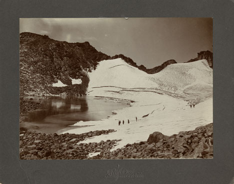
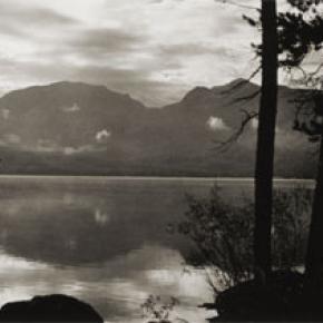
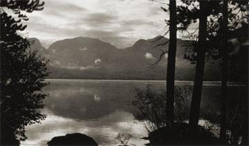
The idea of diverting water from the Colorado River on the Western Slope of the Continental Divide to the productive farmlands of the eastern plains had been a dream of planners as early as 1929.  Subsequently,  a long period of drought and the sagging economy of the “Great Depression” whetted demands for what became the largest trans-mountain diversion project ever built.

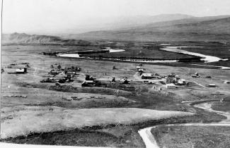
The Colorado-Big Thompson Project takes water from Grand Lake on the western side of the Continental Divide to the Big Thompson River on the east.  The water flows through a 13 mile tunnel beneath Rocky Mountain National Park.  In order to supply the residential and farming needs of Northeastern Colorado, the project was begun in 1938 and continued through the years of World War II.  The first water flowed though the tunnel, named for Senator Alva B. Adams, on June 23, 1947.

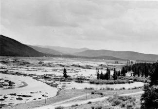
In order to assure an adequate supply from Grand Lake, a dam was built creating Shadow Mountain Reservoir.  A larger lake, Granby Reservoir was then built below, with a unique pumping plant that forces water into Shadow Mountain.  The Farr Pumping Plant cost over $9 million and provides an additional 700,000 of irrigated land to northeastern Colorado.  Further reservoirs were added, both to supplement the diversion and to compensate the water needs of Western Colorado.  These include Willow Creek and Windy Gap Reservoirs in Grand County.

While most legislators were enthusiastic about the project, U.S. Representative Edward Taylor was vehemently opposed to the reduction of water flowing down the Colorado River.  A compromise was reached in the creation of Green Mountain Reservoir (on the Blue River), which reserves water to replenish the Colorado River.   The city of Denver later claimed upstream water on the Blue River for the massive diversion project of Dillon Reservoir

Claims on the water of the Colorado River range from the fruit and wine regions of the Grand Valley in Colorado all the way to Los Angeles and Mexico.  It can be said that every snowflake which falls in Western Colorado had already been over-appropriated, especially during drought periods in the arid West.

Topic: Towns

Grand Lake

Grand Lake was established in 1879 and incorporated in 1944. It is named for the largest natural body of water in Colorado. In 1867, when only a few people resided near the lake, Major John Wesley Powell (the man whose group first rafted the Grand Canyon) came to explore the possibility of floating down the Grand (now Colorado) River. That summer, Powell, local resident Jack Sumner, and William Byers, founder of the Rocky Mountain News, made the first recorded ascent of Longs Peak from Grand Lake. In the early 1900’s a Yacht Club was formed by enthusiasts who were attracted by the demands of attentive seamanship the lake demanded.

In 1912, Sir Thomas Lipton contributed an impressive cup to be presented annually to the winner of the annual August Regatta. This event still draws skilled sailors to the challenging competition. The town was founded during a very brief mining boom, but because of it's natural beauty, tourism has long been the sustaining feature of it's economy.

Grand County