Transportation

How did people travel to Grand County? How did they get around? Click on the drop-down menus and take a little trip through history.

Browse Subtopics

Transportation Articles

Getting Around in North Park

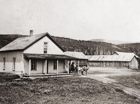
United States Geologist F.V. Hayden visited North Park briefly in August, 1868 in company of a small party of Army officers from Fort Saunders.  The campsite he described on the Big Laramie River is where the Boswell Ranch was later established.  They crossed the river at that point and entered North Park after following the Cherokee Trail twenty-five miles.  The trail from Boswell angled across Beaver Creek and Bear Creek to Chimney Park and then turned southwest to the neck of the Park.  It became North Park's main connection to the outside world.

In 1879, the year of the great fires, naturalist George Grinnell hired a teamster with a stout team and a Studebaker wagon to take him to North Park from Laramie.  By then wagon trails were numerous in the Park, probably created by market hunters who, in turn, likely followed travois-trails made by Indians.

Stagecoach service between Laramie and North Park started in May, 1881 with tri-weekly trips by Concord coach to mining community of Teller City.  The scheduled time for the trip was fifteen hours without any stoppage except for meals and to change horses.

After the mining activity at Teller slowed down the stages ran from Laramie to Walden.  Travel time was about twelve hours with three drivers on the route and five changes of horses, coming and going.

The Laramie-Walden stage had the best record for continuous service of any in the west in 1907.  At that time the mail had been carried six days each week for more than six years without missing a trip, although weather and roads had sometimes delayed the arrival of the stage until 2 or 3 in the morning.

That is a remarkable record considering the weather conditions the stage traveled in.  The editor of the Walden newspaper once described the Laramie Plains as a place "where the wind blows 400 days out of the year--sometimes with a speed and force that turns over wagons and miles of barbed wire fence."  During the winter months the stage would typically start from Laramie with a coach with wheels, transfer to a coach with sled runners at a point above Boswell when the snow got deep, and then transfer back to a coach with wheels when the snow ran out in North Park.

North Park had a public transportation system a century ago.  From Walden local stages carried the mail to the various post offices scattered around the Park.  Passengers could ride on the mail stages, so a traveler could get off the train in Laramie or Granby, take the stage to Walden and the next day catch a ride with the local mail stage to any place in the Park mail was delivered.

During the winter months local travel was by team and sled, skis or snowshoes. Willow Creek Pass became an important travel route for North Park after the Moffat Railroad reached Hot Sulphur Springs in the fall of 1905.  Dave Gresham established a road ranch for travelers near the top of the Pass.  J.W. Welch, the Rand merchant, soon had two freight outfits running between Rand and Granby and tri-weekly stagecoach service between Walden and Granby started in the spring of 1908.  Passengers left Walden at 6 a.m., spent the night at the Nixon cabins on Willow Creek Pass, and arrived in Granby at 11 a.m. the next morning.

Wagon loads of oats from the Yampa Valley were freighted into the Park over Buffalo Pass.  Construction of a road over Rabbit Ears Pass was still several years away.  Cameron Pass was a major transportation route in the days when Teller City was booming.  By 1879 it was obvious that the Park would soon be settled and Fort Collins businessmen were urging that a road to North Park be built to secure the travel and trade of the region before a trade route developed through Laramie.  A toll road was completed over Cameron Pass by 1881.  There was a charge of $2 for each vehicle drawn by one horse, ox or mule passing through the toll gate at Rustic.  A single span was $3 and any additional horses $1 each.  Business was brisk for only a few years and the road was opened to free public travel in 1902, but by then the public was using the road over Ute Pass and the road over Cameron Pass soon fell into a state of disrepair.

While a few automobiles ventured into North Park each summer, there is no mention in the early newspapers of anyone in North Park owning one of the contraptions by the spring of 1909.  There was one steam tractor in the Park and bicycles were popular.

Moffat Road
Moffat Road


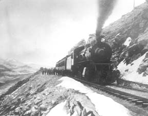
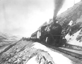
"I shall never forget it as long as I live. Nor do I ever expect to experience anything comparable to it again. Civilization had found its way across the mountains into Middle Park," reflected Mrs. Josephine Button in 1955 on her 91st birthday, as she recalled seeing smoke from the first Denver Northwestern and Pacific work-train on Rollins Pass, high above the Fraser Valley and Middle Park. Once those rails made it over the Continental Divide all the way to Hot Sulphur Springs, "changes came thick and fast." Many men, many dollars, many routes and many dreams tried to bring a railroad over the Continental Divide into Northwest Colorado, and the "Hill Route" over Rollins Pass that finally accomplished it a century ago has retained its allure ever since.

The Moffat Railroad built a cafeteria, telegraph station, living quarters for Moffat's "Hill Men" (as the railroad crews up there were known) and a fine hotel - all collectively called Corona Station. Soot-filled snow sheds protected over a mile of this windblown section of track. And where today silence is the most powerful sense, colorful locomotives pulled passenger and freight cars, filling the rare atmosphere with black smoke and mechanical clatter.

Decades of men's dreams lay behind the once massive snow shed that cut the bitter winds from the north and west, behind that fine hotel that offered some of the most spectacular scenery in America, behind the hopeful Town of Arrow nestled below tree-line ten or twelve miles west of Rollins Pass, and behind that first work-train that Josephine Button watched from her hay ranch along the Cottonwood Pass Wagon Road to Hot Sulphur Springs. Competent, often powerful, men in the 1860's through the 1890's filed surveys, graded road beds, and even began drilling before being stopped by severe storms that foiled the best laid plans or their inability to fund the ambitious projects.

Dreams to penetrate the high mountains along the Divide in central Colorado began when the Front Range was flooded with miners during the Gold Rush of 1859. Even before Colorado became a territory in 1861, Golden City, just west of Denver along Clear Creek, recognized its potential as a gateway to the rich mineral resources of mountain towns like Central City, Black Hawk, and Georgetown. Golden City's ambitions went beyond becoming a mountain transportation hub, believing that with the right incentives, enthusiasms, and leadership, its location supported a future as a national commerce center. 

Golden City certainly had men of vision, ambition, and wealth among its ranks. William Loveland and George Vest, both young and feverishly ambitious to see Golden City reach its potential, vigorously pursued their dreams for a powerful commercial center in Golden City. From Missouri River towns like Leavenworth in Eastern Kansas, leading town founders also recognized the benefits of linking their water and rail routes to the east with the resources of the west. Finally, as if destiny had demanded it, Edward L. Berthoud, a young civil engineer and surveyor with energy and ability, arrived in Golden City from Leavenworth in April of 1860 to unite the similar passions of leading citizens from both locations.

From 1861 until 1866, Berthoud, Loveland and Vest focused on bringing a direct transcontinental railroad route through Golden City. First, Edward Berthoud, along with Jim Bridger and a capable young cartographer named Redwood Fisher, blazed a trail across Berthoud Pass through Middle Park all the way to Salt Lake City. Returning to Golden City on May 28, 1861, Berthoud reported "a good wagon road could be ?quickly' built" from Denver to Salt Lake City over Berthoud Pass for about $100,000.00. According to the local hyperbole, a railroad would surely follow.

In spite of considerable enthusiasm, disappointment plagued early efforts to put a rail line over the mountains in Colorado Territory. In 1862, Territorial Governor John Evans sent the Surveyor General for Colorado and Territories along Berthoud's route and others to confirm or deny the potential of a railroad line. About the same time, the Union Pacific Railroad Company sent an independent reconnaissance to examine potential routes over the divide that included Berthoud and Boulder Passes (Boulder Pass became Rollins Pass in the early 1870's, when John Quincy Adams Rollins built a toll road over it, and then Corona Pass when the Railroad crossed it). Surveyor General Case and the UP agreed that neither route offered much hope for a standard gauge railroad. The dream of a transcontinental line over the Continental Divide through central Colorado seemed to die with the UP surveyor's words, "I learned enough to satisfy myself that no railroad would - at least in our day - cross the mountains south of the Cache la Poudre..." 

Multiple failed attempts to bring a rail line over the Divide through Middle Park during the following decades strengthened the UP's "death sentence." Against the odds, Berthoud and Loveland continued to solicit support for a railroad west over or through the Continental Divide, using improved surveys and maps to support their requests. In the 1880's, survey crews from a variety of railway incorporations were scattered over the high country on or near Rollins Pass. Over Berthoud, Rollins and other passes, they marked potential railroad lines with their wooden stakes. It was during this stretch of strenuous surveying activity that David Moffat, a highly successful Denver capitalist, got involved with an unsuccessful effort to bring through the mountains instead of over the top. 

 In the early 1880's, Mr. Moffat invested in the Denver, Utah and Pacific Railroad, which intended to tunnel through the mountains near Rollins Pass. Like the other efforts, though, the Denver, Utah and Pacific vanished in a few short years. Unlike many other lines that accomplished little more than surveys and maps, the DU&PRR completed significant grading and began tunneling before reaching the "end of its resources."

Money, power and success supported Moffat's dream to put Denver on a direct transcontinental railroad line. Doctor Robert C. Black, III, wrote that David Moffat's failed efforts in the early 1880's converted him to the idea that Denver needed to be on a direct transcontinental rail line. Moffat considered the route over Rollins Pass valuable enough to have surveying and grading crews working on it throughout the winter in 1902. The Denver Rocky Mountain News claimed that Moffat's route through Northwestern Colorado included "the largest strip of fertile land as yet undeveloped in the United States..." With his Denver, Northwestern and Pacific Railroad, David Moffat planned to make good his intentions to put Denver on direct transcontinental railroad line.

Moffat's original plan called for the "Hill Route" over Corona Pass ? the name changed from Rollins Pass in honor of Corona Station at the top ? to last for only a few short years. While the "temporary" route over the top generated resources by extracting the resources of Northwestern Colorado, a tunnel was to be bored through the Continental Divide. Even the wealth and power of Moffat, though, failed to adequately finance the tunnel before he died in 1911. The temporary line, therefore, lasted for nearly of a quarter century, from 1904 until 1928.

Its obstacles proved as enormous as the mountains it crossed. Work crews had to cease operations because of snow for most of April in 1920. The road was closed from late January until May in 1921. In December of 1924, engine number 210 busted "a main reservoir pipe," causing the train to fly down the hill out of control until it jumped the tracks and crashed into the valley below. Clearly, the Denver and Salt Lake Railroad, which took over Moffat's DNW&P after his death, needed a tunnel to replace the expensive effort over the "Devil's Backbone."

 As Denver and Salt Lake Locomotive Number 120 came through the tunnel in early 1928, it represented the culmination of a massive undertaking through wet, unstable rocks which required considerable engineering ingenuity and caused six deaths in a 1926 cave-in. It also took an enormous amount of coordination and effort to secure the necessary funding. Through local bond issues, private investors and other means, the project was completed. And through a connection at Dotsero, a railroad station less than 30 minutes west of Vail on I-70, freight and passengers could make a direct Pacific connection from Denver. Posthumously, David Moffat's dream became a reality.

For significant periods of time since the trains stopped operations over Rollins Pass in the late 1920's with the opening of the Moffat Tunnel, on-road vehicles crept along its relatively easy grades and wide curves from Rollinsville on the east slope to Winter Park on the west side of the Divide. Like now, the road ran through an area attractive to backcountry campers and sport enthusiasts. On September 1, 1956, local officials and private citizens met on Rollins Pass to celebrate a "joint state-federal-county project to convert the old D. & S. L. railroad right of way over Corona Pass into an access road for sportsmen." According to the Denver Post, the game and fish department's construction division reconstructed the road during the summer of 1955 for about $20,000. The following year, the road became a scenic route over the Continental Divide for family cars and jeep caravans alike. And after it was built, or at least reconstructed, they did come. Intrepid tourists into Middle Park.

Railroads
Railroads

Construction on the railroad line from Denver to Grand County began in July 1902.

The project, called the Moffat road (officially the Denver, Northwestern & Pacific), was the seemingly impossible dream of David H. Moffat, who spent much of his personal fortune building the tracks over the Continental Divide.

The rails pushed higher and higher up the mountains until they reached a station named Corona, meaning the crown of the continent.

Corona was the highest point in the world with a standard gauge railroad and the journey from Denver in the winter was perilous at best.

Huge snowplows were required on either side of the Divide to keep the tracks clear.

Eventually, in the late 1920s, a tunnel was dug through the range, eliminating 22.84 miles of track and the breathtaking journey over Rollins Pass.

The railroad reached Granby and Hot Sulphur Springs in 1905 and Kremmling in 1906, and played a significant role in building the population of Grand County.

In 1900 the total resident population of Grand County was only 741, but grew to 1,862 in 1910.

Stage and Freight Lines

Berthoud Pass Stage Road was built by the extreme efforts of Captain Lewis Gaskill.  It came from the top of the Pass through Spruce Lodge, Idlewild (now Winter Park), the Cozens Ranch (near Fraser) Junction Ranch (Tabernash) and Coulter.  From there once branch lead over Cottonwood Divide to Hot Sulphur Springs (and points west) while the other went to Selak’s and over Coffey Divide to the Lehman Post Office and on to Grand Lake.  

At the summit of Berthoud Pass there was a large house of hewn logs, occupied by Lewis Gaskill and his family.  They collected the tolls for the road and gave welcome shelter to those weathering the variable passage.  The house was located on the West side of current Hwy. 40 but no trace of the building remains.  

At the steepest portion of the west side of Berthoud Pass was the Spruce House rest stop, which by 1900 was a sold structure of two and a half stories.  There the traveler could find a warm meal and corral for livestock.  No trace of it remains today.  

The Idlewild Stage Stop was located in present day Winter Park and was a popular place to change horses before the steep assent up the pass.  Mrs. Ed Evans served a hearty noonday meal there for only 35 cents.

Cozens Ranch was also one of the more popular stops and Fraser Post Office until 1904. Built around 1874 by William Zane Cozens, it remains today, outfitted in period décor and is the home of the Cozens Ranch History Museum.  

The Gaskill House, in Fraser was built by Lewis De Witt Clinton Gaskill, one of the original investors in the road and a prominent Grand County citizen. The house now houses the Hungry Bear Restaurant.

Junction House at Junction Ranch (Tabernash) could accommodate up to fifty travelers and was built by Quincy Adams Rollins, and subsequently leased to Johnson Turner.   

The Coulter Stage Stop was built by John Coulter, an attorney from George town and shareholder in the stage road.  It also served as a Post Office from 1884 to 1905. 

Frank and Fred Selak, sons of a pioneer Georgetown brewer ran the Selak stop which was north of Granby and east of current Hwy. 34.           

Cottonwood Divide (Pass), at 8904 feet above sea level, was laid out by Edward Berthoud and Redwood Fisher in 1861.  The route was used by stagecoaches from 1874 until the railroad arrived at Hot Sulphur Springs in 1905.  The last driver on the route was Charlie Purcell.  Summer travel time between Hot Sulphur Springs and Georgetown was typically twelve hours. Travelers between Hot Sulphur Springs and Kremmling could stop at the Barney Day or King Ranches, both near current Hwy. 40.   The Pinney Ranch House, used by the firm of Whipple and Metcalf for the connecting service to Steamboat Springs, is still standing on Hwy. 134 on the east slope of Gore Pass. There a traveler could pay 50 cents for a meal, 50 cents for a bed and expect a change of horses every ten miles.  It ceased operation in 1908 when the railroad reached Toponas.  

The flood that built the Moffat Tunnel

Article contributed by Tim Nicklas


For many years Denver longed for its own direct line through the continental divide, linking the city to the west coast.  In the 1860s, Denver was slighted by the Union Pacific(UP), when the company chose Cheyenne as the major hub for the prized Transcontinental Railroad, before it snaked through the Rockies.  Fortunately, the city fathers of Denver did not give up on making their city the center of the Rocky Mountain Empire, as they risked financial disaster by bankrolling a spur line to the main route in Cheyenne.  Denver may not have had their direct route to the west and the fortunes that lay on the other side of the divide, but the city was not dead. 


For Grand County, the U.P.'s decision not to penetrate the formidable barrier of Colorado's mountains had a much greater impact.  As it stood Grand County had no for seeable future of gaining a rail line.  This meant that the only means of transportation into or out of the county was by pack animal or foot.  Furthermore, without a line to Denver, there was virtually no practical way for industry to develop in Grand County.


In 1904, Denver and Grand County's long awaited dream of a direct line through the mountains and on to Salt Lake City began to materialize.  The Moffat Railroad had risen over Corona Pass and descended into the Fraser Valley.  At the time Corona Pass was the highest rail pass in the world.  Along with this fact came the troubles of maintaining such a wonder.  The route was challenging to keep open in the summer with the violent storms that are prone at such a location.  In the winter the line would close all together.  Adding to the trouble of the unpredictable route was the fact that Colorado's economy of the 1870s was not the same in the early 20th century.


In the 1870s, much of Colorado's mineral wealth was centered directly west of Denver in Central City and Georgetown.  By 1880 many of those mines began to play out.  Furthermore, production shifted to the silver mines of Leadville and the Arkansas Valley.  As a result, rail traffic favored Pueblo over Denver.  Pueblo was situated on the plains as the Arkansas River exits from the mountains, eliminating the need for boring tunnels or climbing over arduous mountain passes.  In addition, Pueblo was close to the coalfields that were essential to power the locomotives.  Also, the city was the site of the largest steel mill west of the Mississippi, which supplied rails for the sprawling network.  Finally, Pueblo's smelters boomed when many others withered after the "Silver Panic" of 1893.  At the same time that depression gripped Colorado and silver was devalued, gold was discovered in Cripple Creek.  Within a few short years the new gold camp would become the world's largest producer.  As a result, nearby Pueblo would reap the benefits by converting from silver to gold, to become the smelting capitol of the nation.


By the early 20th century, Pueblo's status as an industrial powerhouse and rail center threatened Denver's status as Colorado's "first city."  This was even further evidenced by the "powers-that-be" in the northern part of the state being unable to convince the rest of Colorado to finance a tunnel under the continental divide west of Denver.  Time and again legislation that would fund the missing link between Denver and the western slope was defeated in the statehouse by those in southern Colorado who were content with their established web-link.  Barring a miracle, it looked as if Denver and Grand County would have to settle for the unreliable Moffat line over Corona Pass.  In 1921 that miracle would rush in, due to un-for-seen misfortune upon Colorado's "second city" in the south of the state. 


The spring of 1921 started as many do in Colorado, with a drought.  By June 1st the many farmers downstream in the Arkansas Valley feared disaster as crops withered with thirst.  On the 2nd day of June, the farmers got the relief of rain they eagerly wanted.  Unfortunately, the downpour continued until the formerly parched earth became like a sponge and the Arkansas River swelled.  The streets of Pueblo were ankle deep with water by nighttime.  Suddenly, with little warning, a torrent of water rushed from the upper Arkansas Valley toward the helpless "Steel City."  Pueblo's streets filled with water up to rooftops.  The unified rail-yard was ripped instantly.   Unfortunate train passengers were tossed unaware into the maddening grip of the Arkansas, unable to escape the iron coffins in which they were riding.  Families were stranded on roofs as row boats desperately searched for stranded victims.  As pungent water filled the business area with filth and debris, fires broke out.  Unable to do anything, citizens watched helplessly as fire and water consumed their city.  As the flood receded the Rocky Mountain News headline proclaimed "201 Bodies Found, Scores Lost, Pueblo Death Total, 500 To 1,500."  The Rocky Mountain News goes on to describe the scene from June 4th:

"All day long refugees, dazed, not knowing what to do, straggled

about the streets.  Mothers with babes in their arms, mothers

whose arms were empty, old men and women and people of every

description wandered about until gathered up and taken to Red

 Cross headquarters, where they were fed and allowed to rest."

The scene in Pueblo was like those witnessed in New Orleans after Hurricane Katrina or the notorious San Francisco Earthquake in 1906.


As Pueblo dried out in the days that followed, plans were immediately being drafted in the statehouse to assure that the devastated city would not befall a future wrath from the Arkansas River.  Seizing upon the opportunity presented by Pueblo's misery, interests in Denver, Grand County, and others in northern Colorado saw fit to take advantage.  As the discussion of flood control in the south dominated state legislation the notion of a tunnel under the continental divide west of Denver resurfaced.  According to Ubbelohde, Benson, and Smith's book, A Colorado History 8th Ed., a "special legislative session made history."  Attached to the act that created the Pueblo Conservancy District, northern lawmakers added the Moffat Tunnel Improvement District.  As a result of the passage of these two distinctly different special tax districts in a single signing by Governor Shoup, the long sought after western passage would be built.  With the tunnel Grand County would finally be open to the outside world by a year round and reliable link.


The building of the Moffat Tunnel was an enormous undertaking that cost several lives and injured even more workers.  Nonetheless, the tunnel from its inception has remained of vital importance to the Fraser Va

The Train Comes to Fraser

Article contributed by Tim Nicklas
 

A little over a hundred years ago the few residents of Fraser were awakened by a sound new to their town.  The railroad had finally arrived in 1904, just over 30 years after it had first debuted in Denver.  That same blaring horn, followed by the rumble of iron wheels on rails is waking up the good town-folk of the Fraser Valley today.  As the local Manifest has documented recently, many residents have long been annoyed by the noisy disruption the train makes as it announces its passing through town.  Additionally, parents of school children rushing to Fraser Elementary School in the morning can attest to the intrusive obstacle the slow moving behemoth becomes at in the morning.

A hundred years ago, residents of the Fraser Valley complained loudly of the intrusion of the iron horse on the tranquil lifestyle.  It has long been rumored that the course of the railroad was determined by an angry old timer by the name of Billy Cozens.  Cozens was a pioneer of the valley having homesteaded his ranch in the area in the early 1870s.  According to legend, when the engineers were surveying the route of the future Denver, Northwestern, and Pacific Railroad through the valley, Billy Cozens bullied the crewmen into the woods.  As the railmen would lay their flags for the roadbed, Cozens, an expert marksman, would shoot the markers out of the ground.  As the story goes, this was the reason the tracks were laid through the forest, rather than the meadow.

The reality of the chosen route for the D.N.&P. was due to grade and not fear of the rifle.  Whether Cozens despised the railroad is anyone's guess.  According to Robert Black's book, Island in the Rockies, the railroads designing engineers actually consulted Cozens concerning the lack of snow on the continental divide.  Regardless, the rumors have persisted over the years about the "Old Sheriff's" contempt for the railroad.  It has even divulged to me that the ghost of Billy Cozens will not allow anything concerning the railroad in his former home, the Cozens Ranch Museum.  Whenever railroad exhibits have been attempted they have mysteriously vanished and were never seen again.

As far as the townfolk of Fraser were concerned, many of them regarded the railroad as an opportunity that had eluded the region for years.  Unfortunately for Fraserites, their town was to be bypassed as the major hub for the area.  Further down the valley Tabernash was chosen as the location for the workshops and roundhouse for the forthcoming trains.  As a result, the trains would move through Fraser without their engineers paying the town much notice outside of their blowing whistles.  Nonetheless, the people of the valley would embrace the iron horse.  Economic potential in Grand County would erupt due to the advent of relatively efficient transportation.  Specifically, the lumber industry would boom with the outlet that the railroad would provide.  Additionally, people could move between Denver and Grand County easily compared to the wagon roads that formerly provided the only passage to the outside world.  As timber and cattle traveled to the Front Range, mail and hard goods traveled back to the Fraser Valley.

In years past, just like today, it has been easy to forget the benefits that the railroad has brought to our lives.  Certainly, when the train moved into the valley, the people that day realized that their life could slow down a bit.  The reality was that the short inconvenience that the passing train brought with its blaring horn, bringing traffic to a momentary standstill enhanced the life and character of the Fraser Valley.  It provided power, people, and materials in a unique way that simplified life here.  This is as true today as it was in 1905.      


Train Legends of the Moffat Road

Article contributed by Abbott Fay

The railroaders graded and bridged the trails originally made by the Indians and expanded by the trappers, prospector and stage road builders that following in rapid succession. The

Moffat Road
train track has an almost endless series of wreck stories and legends.  In one, a "green clerk" was said to have piled all the mail order catalogs on the same side of a car, causing the train to leave the tracks and roll down the mountainside into Yankee Doodle Lake.


In another lost train story, the No. 3 westbound was seven hours late out of Denver because of a severe winter blizzard.  It crept out of the Fraser Canyon and whistled for the Granby Crossing.  The engineer parked the train intending to wait till daylight to continue on.  In the meantime, the No. 2 eastbound, 2 days late out of Craig reached Corona without passing the No. 3. In the morning, all were amazed to find the train parked "plumb center" of Granby's main street. Later investigation showed that the No. 3 train left the train tracks just east of Granby and traveled almost a mile over frozen highway.  The next day a Chinook wind came up and melted the frozen soil, sinking the train to it's axles in mud. It required the building of 1500 feet of special track to salvage the train. However, some longtime Granby residents say the locale of this incident was the Kremmling flats.


Sources: Roland L. Ives, Folklore of Middle Park Colorado,Journal of American Folklore, Vol. XXXIV, Nos. 211, 212, 1941; Levette J. Davidson & Forrester Blake, Rocky Mountain Tales, University of Oklahoma Press, 1947


Wagons of the West
Wagons of the West

Transportation into Grand County in the late 1800's was one of the more difficult tasks. Stage coaches were used to carry the many people to and from the county.

The first stagecoach into Grand County was a Concord. The Concord stagecoach was a luxury wagon weighing around 2,200 lbs. It cost around $1,050 and was beautifully painted. No two Concord luxury coach paint jobs were the same. The wheels were made of white oak and would not shrink in the cold or expand in hot weather, and made very reliable, durable wheels. The body was iron barred and was easier for the horses to pull than some of the other standard stagecoaches of its time. The mountain conditions caused different rules and a different coach then the stereotypical Concord.

The inside of a Concord was four feet wide, and four and one half feet tall. The coach had leather curtains, but they did little to keep the dust, wind, snow, and rain out. Three benches lined the inside, and held nine passengers. The coach was often known to hold up to six people on the roof as well. Luggage was held in the "boot", a metal box on the back of the coach. Mail was often put in the "boot" for transportation, or kept right behind the driver.

The average speed for the Concord was around fifteen miles an hour. The braking system was sand bags placed over the brake pads, so that sand could be released on rugged hills. The Concord was only used for one year because of its weight and bulkiness it did not make for a good coach in the mountains. The weight, price, and bulkiness caused this stagecoach to be produced for one year before another one came into play.

At one third of the cost, the Dearborn took over after the Concord. These were known as Mud Wagons because of their easy travel in the mud and tricky terrain. The Mud Wagon weighed around 1,600 lbs. and was much more efficient. It had the standard four wheels, but was only pulled by one to two horses, and could hold around one to three people. However it was not as luxurious as the Concord. They often  did not have side curtains, and the seats were not as nice. The cabin sat on wooden springs. The Mud Wagon was used by farmers, peddlers, emigrants, and pleasure travelers as it was affordable and decent in appearance.

The weary traveler who took the stagecoaches soon learned the rules of the road. The best seat was next to the driver where there were less bumps. Never ride in cold weather with tight boots or shoes, or tight gloves. If one is asked to walk, do so without grumbling as the driver would not ask unless truly necessary. Don't jump from the moving wagon, as nine out of ten times you will get badly hurt. Do not drink alcohol in cold weather as it can cause hypothermia. In warm weather it is okay to drink as long as you are willing to share. Eat what is available, no one wants to hear you whine. Do not smoke, or spit on the leeward side. Never swear, and don't fall asleep on your neighbor. Do not ask how much longer, you will get there when you get there. Never fire a gun as it will scare the horses. Never grease your hair because of dust and most important - remember mountain traveling is hard.The first stagecoach into Grand County was a Concord. The Concord stagecoach was a luxury wagon weighing around 2,200 lbs. It cost around $1,050 and was beautifully painted. No two Concord luxury coach paint jobs were the same. The wheels were made of white oak and would not shrink in the cold or expand in hot weather, and made very reliable, durable wheels. The body was iron barred and was easier for the horses to pull than some of the other standard stagecoaches of its time. The mountain conditions caused different rules and a different coach then the stereotypical Concord.

The inside of a Concord was four feet wide, and four and one half feet tall. The coach had leather curtains, but they did little to keep the dust, wind, snow, and rain out. Three benches lined the inside, and held nine passengers. The coach was often known to hold up to six people on the roof as well. Luggage was held in the "boot", a metal box on the back of the coach. Mail was often put in the "boot" for transportation, or kept right behind the driver.

The average speed for the Concord was around fifteen miles an hour. The braking system was sand bags placed over the brake pads, so that sand could be released on rugged hills. The Concord was only used for one year because of its weight and bulkiness it did not make for a good coach in the mountains. The weight, price, and bulkiness caused this stagecoach to be produced for one year before another one came into play.

At one third of the cost, the Dearborn took over after the Concord. These were known as Mud Wagons because of their easy travel in the mud and tricky terrain. The Mud Wagon weighed around 1,600 lbs. and was much more efficient. It had the standard four wheels, but was only pulled by one to two horses, and could hold around one to three people. However it was not as luxurious as the Concord. They often  did not have side curtains, and the seats were not as nice. The cabin sat on wooden springs. The Mud Wagon was used by farmers, peddlers, emigrants, and pleasure travelers as it was affordable and decent in appearance.

The weary traveler who took the stagecoaches soon learned the rules of the road. The best seat was next to the driver where there were less bumps. Never ride in cold weather with tight boots or shoes, or tight gloves. If one is asked to walk, do so without grumbling as the driver would not ask unless truly necessary. Don't jump from the moving wagon, as nine out of ten times you will get badly hurt. Do not drink alcohol in cold weather as it can cause hypothermia. In warm weather it is okay to drink as long as you are willing to share. Eat what is available, no one wants to hear you whine. Do not smoke, or spit on the leeward side. Never swear, and don't fall asleep on your neighbor. Do not ask how much longer, you will get there when you get there. Never fire a gun as it will scare the horses. Never grease your hair because of dust and most important - remember mountain traveling is hard.

Articles to Browse

Topic: Dude Ranches

Dwight D. Eisenhower and the Western White House

Dwight D. Eisenhower met and married Mamie Geneva Doud of Denver on July 1, 1916. Carl Norgren, a Doud family friend, had started spending time in the Fraser area and was enchanted by the beauty of the area and especially the Byers Peak Ranch for Boys.

By the late 1930s, Norgren partnered with Aksel Nielsen to purchase the Byers Peak Ranch.  During Eisenhower's presidency, the Brown Palace Hotel in Denver, the Byers Peak Ranch, and Lowry AFB were all known as "Western White Houses" or "Summer White Houses." There is a well known photo published in Life Magazine of Eisenhower fishing in the Fraser River with his grandson, David.

Eisenhower used his time at the Byers Peak Ranch to rest and recompose himself in the face of difficult political times. As President, Eisenhower dealt with the threats of the Cold War, a truce in Korea, the desegregation of public schools (Little Rock, Arkansas), and the development of the "Eisenhower Doctrine" to bolster the Middle East against the threat of communism. On the domestic front, he was faced with the difficulties of dealing with the Republican Old Guard, including Senator Joseph McCarthy, who headed a subcommittee charged with the finding of communists within the government.  

Eisenhower enjoyed cooking for guests at the Ranch, fishing St. Louis Creek and having "brookies" (brook trout) for breakfast, painting, and playing golf.  On September 24, 1955 while at the Ranch, Eisenhower suffered a coronary thrombosis (heart attack) and was hospitalized at Fitzsimmons Army Hospital in Denver until November 11, 1955.  His hospital suite has now been restored and is open for limited tours.

The bulk of information about Eisenhower and the Byers Peak Ranch comes from the personal papers of Carl Norgren, which are housed at the Eisenhower Museum and Library in Abilene, KS.  The collection of correspondence from 1948-1964 covered a broad variety of topics: fishing, recreation, taxes, health matters, food, communism, reorganization of the Department of Defense, federal spending, etc. The Norgren collection valued for the details it provides concerning the hobbies and recreational pursuits of the President during his visits to Grand County between 1952 and 1957.

Topic: Mountains

Mount Craig

The rounded mountain at the head of the East Inlet to Grand Lake has born many names-from Middle Mountain, to Mount Baldy, to Mount Westcott. It's official title, however, is Mount Craig. It's namesake is The Reverend William Bayard Craig, who came to the area in 1882, to be pastor of the Central Christian Church in Denver. He visited Grand Lake occasionally, and completed some real estate dealings there. The town of Craig also bears his name, due to the influence of his friend, David Moffat, of the Denver and Salt Lake Railroad.

Ute Legends of Hot Sulphur Springs

Ages ago, there were many Ute Indians who enjoyed life in Middle Park with its plentiful game and lush meadows.  They lived in peace and harmony for "as many years as there are hairs on the head."

In spite of this idyllic life, there was one young brave who yearned for more adventure and material goods.  He proposed that the Utes attack the Sioux, who lived beyond the mountains on the plains of the rising sun.  As victors, they would return in glory with much wealth and many captives.

Spiquet Pah (Smoking Water) was an elderly medicine man who foresaw only grief in the prospect of such a war.  He spoke before a council meeting, warning of the devastation that such an action would bring upon the tribe.  He foretold " As the North Wind soon brings the snows and death of winter, so will he bring sorrow and death to our own people.....if you do this, strength and peace and plenty will be but for a few; joy will be seen no more."

Disregarding his warning, most of the young men were tantalized with the temptation of the grand adventure of such a conquest.  In the autumn of the year, when they usually did their hunting, the young men rallied behind the young brave and followed him over the Great Divide into combat with the plains people.  As the fighters departed, a saddened Spiquet Pah went into the heart of the mountain "and pulled the hole in after him."

The young Ute men found the enemy better armed and organized than they expected. Many Ute braves were killed and others were taken as slaves. The prophecy had come true as starvation and disease plagued the tribe as there were too few men to hunt for food. The old man sat on his haunches beside his subterranean fire which he heated water from an underground stream.  From the mountain at Hot Sulphur Springs, water flows even today as a reminder of the rash behavior of so long ago.

Another legend holds simply that the Hot Sulphur Springs water acquired medicinal qualities in answer to the prayers of an old chief who has be left by his tribe to die.  The old man built fires within the mountain, and after drinking the water and bathing in them, we was restored to health and rejoined his people.

Topic: Leisure Time

Grand Lake Yacht Club

Grand County often attracts adventurous spirits who prefer its splendid isolation to Wal-Mart and fast food. Others, who never make the leap of faith to live here, enjoy it as a familiar playground, returning regularly to enjoy its vast mountain ranges and unlimited outdoor opportunities.

It has to come many as a surprise to learn that Grand Lake, Colorado - nestled next the Continental Divide at over 8,300 feet elevation - has had a yacht club for over one hundred years! When this adventure began, back in 1902, there was only a stage road into the southeast corner of Grand County over Berthoud Pass. Grand Lake is situated next to the entrance of Rocky Mountain National Park, at the far northeast corner of the county, with the rugged backbone of the continent directly to the north and east. At the turn of the twentieth century, it was a summer vacation spot with few full-time residents. Summer visitors and full-time residents alike recognized the grandeur of the their surroundings, and Grand Lake very early became a summer home to many of Denver's elite, and the summer business they brought helped support the local economy.

It was a few enthusiastic Denverites with a keen interest in Grand Lake and sailing who organized the Grand Lake Yacht Club over 100 years ago. The founders included Richard Crawford Campbell, who married Senator Thomas Patterson's daughter and became the business manager of his father's newspaper, the Rocky Mountain News; William Henry Bryant, a Denver lawyer who was active in both sailing and Colorado politics; J. Fermor Spencer, a close friend of Mr. Bryant and long-time treasurer of the club; and William Bayard Craig, who enjoyed a broad education and had been the Chancellor of Duke University before he became interested in "acquiring land in Colorado."  By the end of 1902, according to Denver papers, "the first bona fide yacht club between the Mississippi river and the Pacific ocean" was in operation.

An atmosphere of excitement and pageantry swept over Grand Lake during the early Regatta weeks, when the Yacht Club held its annual races. In Denver, The Friday Evening Times proclaimed during August of 1904, "Yachting season is here", and went on to describe the "enthusiastic cottagers gathered on shore" around Grand Lake to cheer for the yachts. In 1907, Regatta week included yacht racing as well as foot races, donkey races and bronco busting. When the yacht races ended, the boat captain who won the most races had earned the Colorado Cup.

The Grand Lake Yacht Club's small sailing fleet during Regatta week - three days of racing during mid-August - sometimes included only a handful of boats during its first decade or so. Still, according to one observer, "the organization has more spirit to the square foot than I ever saw exhibited before." Races on the first day of Regatta week, 1905, illustrate the enthusiasm well. In the hotly contested first race of Regatta week, Robert Campbell's Highball, built in Racine, Wisconsin, tossed her two-man crew into the icy waters of Grand Lake when she capsized while running in second place. Shortly after, the third place yacht, Duchess, went over too, leaving the Chicago-built Dorothy II captained by Commodore Bryant the first and only boat to cross the home buoy.

Today, Dorothy O'Donnell O'Ryan, Commodore Bryant's granddaughter, maintains her family's summer home in Grand Lake. In 2002, she published Sailing Above the Clouds: An Early History of the Grand Lake Yacht Club, which chronicles the club's first 50 years. Her Colorado roots go back to Colorado territory's last, and the state of Colorado's first Governor, John Long Routt, who was appointed by President Grant in 1875, the year before Colorado became a state. Knowing the early history as she does, and the difficulties inherit with mountain transportation, O'Ryan marvels at "the logistics" of bringing sailboats built in Racine, Wisconsin or Chicago, Illinois over the Continental Divide into Grand County, Colorado by rail and stage road.

Home-built crafts, both crude and highly crafted, competed as well. Many of the first home-built boats were modified rowboats, "with homemade sails and masts." Observing the annual Regatta week in August of 1904, though, Arthur Johnson called attention to "the Jessica, a 16-foot boat belonging to the vice-commodore and built at Grand Lake" that sported "a sail that would have done credit to a venturesome Lipton on the high seas."

If a sailboat in Grand Lake during 1904 "done credit to a venturesome Lipton," Sir Thomas Lipton himself returned the favor tenfold in 1912. It so happened in 1912 that Lipton was traveling by train across the United States and would pass through Denver on his journey. Probably, Sir Thomas had met the well-traveled and enthusiastic yachtsman, William H. Bryant (Grand Lake Yacht Club Commodore) at the New York Yacht Club. Continued correspondence between the two resulted in the Grand Lake Yacht Club inviting Sir Thomas to the Denver Club for dinner in December of 1912, sponsored, of course, by the Grand Lake Yacht Club. Before he left that evening, flattered by the warm welcome he received, Lipton had proffered a silver cup to the Grand Lake Yacht Club.

Lipton became a yachting icon during the early 20th century. His sportsmanship was nearly unparalleled in the sport and he spent most of 30 years and millions of dollars trying to win the America's Cup. Thoroughly devoted to yachting as a sport and highly capable in the art of advertising, Lipton spread his Lipton Cups "around the globe" to promote the sport and himself.  His gift to the Grand Lake Yacht Club energized the young organization.

Today, the boathouse of the Grand Lake Yacht Club still reminds visitors and members of the organization's heritage. Built in 1912 by Grand County pioneer Preston Smith on land donated by fellow pioneer Jake Pettingell, the lakefront log structure sits in the midst of magnificent mountain scenery, with the dramatic peaks of the Continental Divide to the west and north and the Never Summer mountain range to the west.

As the club matured, it began to offer more races to more members and guests throughout the summer season. The original Regatta week still exists as the most important, and festive, event. Races were added, though, in 1912 with the Adams Cup; in 1914, the Lipton Cup was incorporated; in 1923, the inventor of the Sunshine Lamp (which Coleman Lanterns later bought out) presented the Hoffstot Cup; and in 1925, Dorothy Bryant O'Donnell offered the Bryant Cup in honor of the late first Commodore, W. H. Bryant. Well over 20 cups or trophies now highlight the Grand Lake Yacht Club's season. Throughout its evolution the Club has remained as unique as the dramatic physical environment that surrounds it and the people who envisioned and created it.

Topic: Granby

Historic Granby Real Estate

William Shakespeare, the historic play writer, said, “There is a history in all men’s lives.” The same could be said for many Grand County buildings. According to author, Lela McQueary in her 1962 book, “Widening Trails,” real estate sales and land giveaways helped to build our towns. “In 1905, a town site was obtained from Jim Snider, who had homesteaded the land upon the sagebrush mesa,” wrote McQueary. “The village was called Granby for Granby Hillyer, a civil engineer. Two general stores, two livery stables, a post office and a tiny café (all built with false fronts to make them appear much larger) were scattered on the north side of Main Street, three blocks long.”  That Main Street today is Agate Avenue. A quick search of the Grand County tax rolls reveals an interesting historic mix of buildings.

For example, the current Brynoff home at 170 2nd Street was the Post Office building constructed in 1910 and originally located at 458 East Agate. That building was moved to its current home to make way for the construction for the new Post Office building in 1945 at 458 East Agate. Deb Brynoff, the Executive Director of the Grand County Board of Realtors, said, “When we updated and built onto the original building, we found old letters stuffed in the walls. Obviously, they used them in the early years to add insulating value. I guess they had junk mail even then!”

On July 1, 1966, a new Post Office building was dedicated at 225 East Jasper Avenue (now the current home of the Grand County Library District Administrative Office). According to Granby-area Realtor, Susie Peterson of Glenn Realty, who used to own the building at 458 East Agate when they converted it to the Granby Veterinary Clinic, “Downstairs was full of those neat glass front post office boxes with the gold dials. You can just imagine the history in that building.”  Other buildings constructed in those early years were 127 4th Street in 1909. In addition to a private home, over the years, businesses such as Re/max Real Estate and Katie’s Flower Shop were located at 247 East Agate, which was also built in 1909. In 1910, the property at 110 Garnet was built.
The Roaring 20s saw a spurt of construction such as 172 Topaz (1922), 307 Jasper and 59 4th Street (1924), 166 Jasper and 291 Topaz (1929). The current Columbine Café property at 395 East Agate was built during the heydays of 1927 when it was called the Town Crier Restaurant.

After the Great Crash of 1929 and the Depression of the 1930s, New Deal jobs and loan programs helped fuel new construction. In fact, in 1933, the famous Payne’s Café was built at 365 East Agate. Today, the Greater Granby Chamber of Commerce and Downtown Enhancement offices, along with Noriyuki & Parker law offices are housed in the almost 75 year-old building.

Today’s Shadow Mountain Chiropractic Clinic of Drs. Jeff and Deb Shaw at 60 2nd was built in 1935 as a private home. On April 18, 1935, the first addition to Granby helped the town grow. In 1938, 387 East Agate was the site of the new pool hall run by Alva West. Today Lorene Linke’s Fabric Nook welcomes customers and quilters at the historic location.

In 1938, the building at 185 East Agate, which was Granby’s first strip mall, also was constructed with Craig’s Café, later Olson’s Café. Over the years businesses such as Maureen’s Clothing Shop, a laundromat, a barbershop and the Carpet Wagon found homes where today the Longbranch and Schatzis Pasta & Pizza Restaurants are found.

Post World War II America and Granby boomed. Granby had an influx of new residents because of the continued construction of the Granby Dam and the Colorado Big Thompson Water Project. In 1946, the Granby Dairy Building at 106 Jasper sprung up. That same year, Carmichael Real Estate Company built a new office at 191 East Agate. Today real estate is still king at that corner building with the Grand County Board of Realtors and The Title Company of the Rockies offices located there.

The Granby landmark, Frontier Motel, at 232 West Agate was built in 1951 by Earl Saylor. In 1954 Jenkins & Fulk began construction of the Granby Trading Post at 231 East Agate. Ken and Debbie Eaker and Jay Young bought that property in May 1995 and renamed the store, The Grand Mountain Trading Company.  

Topic: Biographies

David Moffat and the Railroad Dream

David Moffat was a wealthy Denver businessman who saw the need for a rail link between Denver and Salt Lake City. His vision, a 6.2 mile long tunnel beneath the Continental Divide, made this link possible.

He was born in 1839, the youngest of 8 children. He ran away from home at age of 12, went to New York City and found work as a bank messenger.  He was an assistant teller by the age of 16 and  became a millionaire through real estate by the age of 21. 

Moffat was admired for his qualities of courage, adaptation to the “barbaric” West and his goodness of heart. He married his childhood sweetheart, Francis Buckhout, moved to Denver, and in 1860 opened a bookstore/stationary/drug store with C.C. & S.W. Woolworth on the corner of 11th and Larimer.  

Moffat and others formed the Denver Pacific Railroad to reach Cheyenne. The rail line to the Moffat Tunnel was the highest standard railroad ever built in the U.S. (11,660 ft). It went over the Continental Divide at Rollins Pass and came into the Fraser Valley in 1904. At the time, it was the most difficult railroad engineering and construction project ever undertaken. It involved boring numerous tunnels through solid granite, as well as constructing precarious timbered trestles that bridged deep mountain gorges. 

David Moffat was a multi-millionaire when he started the Moffat Line and was nearly broke when he died in 1911 trying to raise money for the tunnel that would eventually be built and bear his name. It was finally completed in 1928. The west portal of the Moffat Tunnel can be seen from the Winter Park Resort.


Topic: Biographies

Stephen Bradley


Article contributed by Karen Wischnack


Born to a Wisconsin doctor in Chicago November 12, 1916 was one of seven skiing sons by the name of Stephen J. Bradley.  His talents in skiing showed up at a very early age.  By the time he was attending Dartmouth College his talents were apparent and was a top competitive skier.  He skied in the slalom, downhill, jumping and langlauf while on the college's team.  Steve then was called to serve his country during the World War II Army service.  After his discharge he then attended and coached skiing at Colorado University. 


In 1950 Steve became Winter Park's executive director.  During his employment at Winter Park he guided it from a four rope tow/three T-bar local ski area to a major resort of 770 acres with 13 chair lifts.  His brilliance in design led to the Balcony House, the Base Lodge which was one of the first ski area structures to utilize solar heating, the restaurant in the midway proved to be a model for the "scramble" system of food service and then there's the Mary Jane section of Winter Park which was another one of his talents.


Stephen was given the name "Father of Slope Grooming" in 1952 when he then invented the famous Bradley Packer-Grader when experimenting with slope grooming.  The invention was a one man gravity-powered slope grooming device which revolutionized the ski maintenance industry.  Nick-named "the Purple People Eater".  This machine was a mogul-cutting snow groomer that was 5-foot-wide corrugated culvert that a skier would drag down hill or as they said " A hardy mountain crewman" who risked his life by being devoured by the spinning rotor.  As skiing became more popular, skiers started demanding that the slopes be groomed.  Nature was no problem but not everyone wanted to ski moguls.  This Bradley Packer was a way to reduce the mogul's and keep snow on the trails by flattening the snow.  "It was a pretty scary thing" supervisors claimed.  Grooming was soon transferred to a line of tracked vehicles now known a "Snowcats". 


Stephen served as President of the NSAA (National Ski Areas Association) and helped organize Colorado Ski Country USA and the Colorado Passenger Tramway Safety Board before his death in Longmont November 13, 2002.  You can find him as an honored member of the Colorado Ski Hall of Fame and in the National Ski Hall of Fame.


Topic: Biographies

Isabella Bird

In Yorkshire, England on October 15th 1831, a clergyman and the daughter of a clergyman gave birth to small, sickly girl who would grow up to be one of the most well known travel writers of her time, an exceptional accomplishment in an era when women rarely ventured far from home unescorted. In 1850, after a childhood full of ailments, Isabella had an only partially successful operation to remove a tumor from her spine. Following the surgery, Isabella suffered greatly from depression and insomnia; it was then that her doctor recommended that she travel.  Isabella's father, becoming increasingly worried about his daughter, gave her a hundred pounds and sent her off to see the world.

Ms. Bird traveled throughout the world including Canada, Hawaii, Australia, China, Tibet and Morocco.  She came to Colorado right after the territory had officially been become a state. Isabella loved it in the mountains, so much so that she wrote many letters home to her sister which eventually came to become her third and most famous book, A Lady's Life in the Rocky Mountains. In this document, Isabella wrote of her adoration of the area saying, "I have found a dream of beauty at which one might look all one's life and sigh."

Upon her arrival to Colorado, she traveled into the mountains west of Estes Park. She wrote about adventures and challenges and of her romance with Jim Nugent, or "Rocky Mountain Jim" a one eyed outlaw with an attraction to violence and poetry. He was shot and killed a year after Isabella left Colorado.

Throughout the letters, Isabella mentions the wonderful sights of the lands she explored near current day Grand County.  In one of her letters, Isabella wrote of the time she rode a horse through a blizzard with her eyes frozen shut.  She found herself in another adventure when she was snowed in a cabin with two young men for several months.

Isabella grew eventually grew homesick and headed back to Edinburgh Scotland where she married a doctor. After five years of marriage, her husband died and Isabella returned to travelling. When Isabella returned to Edinburgh in 1904, she grew very ill and died while planning another trip to China.

Topic: Regions

Three Lakes

The Three Lakes area encompasses the north-east corner of Grand County and is so named because of the three connected lakes of Grand Lake, Shadow Mountain Reservoir and Granby Reservoir. 

The two reservoirs were formed as a part of the Colorado-Big Thompson Project, which takes water from Grand Lake on the western side of the Continental Divide to the Big Thompson River on the east.  Shadow Mountain Reservoir and Granby Reservoir. connected by a   unique pumping plant, assure that the Grand Lake water level remains consistent. Further reservoirs were added in the Three Lakes area, including the Willow Creek and Windy Gap Reservoirs.

Topic: Biographies

Nathaniel "Nathan" Shore

Nathaniel "Nathan" Shore was born in Cottonwood Harbor Canada in 1856. When he was about 16 years old he had visited and then worked as a freighter hauling groceries to different towns in western Colorado. He saved enough money to purchase his own wagons and 2 yoke of oxen for each wagon to continue freighting.

Nathan became famous as a man who carried his Bible in one hand and a gun in the other. Nathan returned to visit his family and met Sarah Jones in Springfield Missouri. They were married in 1885. Their trip to Colorado and the Williams Fork was undertaken with Sarah driving a team of horses pulling a covered wagon and Nathan herding their few cows.

The cows helped start a homestead ranch east of the Williams Fork river. In 1907 they sold the homestead ranch to the Curtis Family. They had purchased the Anders Anderson ranch close to Williams Peak and the Joseph Jackson ranch on Bull Run Creek.

They lived on the Anderson place until the forest fire that burned along the Williams Fork Mountains. Nathan told Sarah to hitch the horses to the hay rack, load the furniture that it would carry, take all the children and move to the Jackson place while he helped fight the fire. Nathan's team of horses were stolen so he broke 3 heifers and a steer to work in the yoke.

He still did a lot of freighting to make a living for his family. He freighted to Hot Sulphur Springs and also from Georgetown. He returned home to the ranch about once a week. He sold butter, that Sarah had made and hung down in the well to keep cold, in the mining town of Breckenridge.

Nathan Shore died June, 1928 when his pickup stalled on a railroad crossing in Utah. He was trying to find the trouble under the hood and didn't hear the train as it whistled and whistled. He was headed for a trip to Hawaii.

Transportation