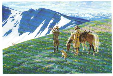
Joe on Melody

Biographies Articles

Stephen Bradley
Stephen Bradley


Article contributed by Karen Wischnack


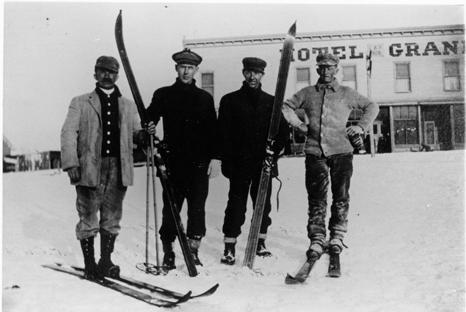
Born to a Wisconsin doctor in Chicago November 12, 1916 was one of seven skiing sons by the name of Stephen J. Bradley.  His talents in skiing showed up at a very early age.  By the time he was attending Dartmouth College his talents were apparent and was a top competitive skier.  He skied in the slalom, downhill, jumping and langlauf while on the college's team.  Steve then was called to serve his country during the World War II Army service.  After his discharge he then attended and coached skiing at Colorado University. 


In 1950 Steve became Winter Park's executive director.  During his employment at Winter Park he guided it from a four rope tow/three T-bar local ski area to a major resort of 770 acres with 13 chair lifts.  His brilliance in design led to the Balcony House, the Base Lodge which was one of the first ski area structures to utilize solar heating, the restaurant in the midway proved to be a model for the "scramble" system of food service and then there's the Mary Jane section of Winter Park which was another one of his talents.


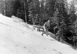
Stephen was given the name "Father of Slope Grooming" in 1952 when he then invented the famous Bradley Packer-Grader when experimenting with slope grooming.  The invention was a one man gravity-powered slope grooming device which revolutionized the ski maintenance industry.  Nick-named "the Purple People Eater".  This machine was a mogul-cutting snow groomer that was 5-foot-wide corrugated culvert that a skier would drag down hill or as they said " A hardy mountain crewman" who risked his life by being devoured by the spinning rotor.  As skiing became more popular, skiers started demanding that the slopes be groomed.  Nature was no problem but not everyone wanted to ski moguls.  This Bradley Packer was a way to reduce the mogul's and keep snow on the trails by flattening the snow.  "It was a pretty scary thing" supervisors claimed.  Grooming was soon transferred to a line of tracked vehicles now known a "Snowcats". 


Stephen served as President of the NSAA (National Ski Areas Association) and helped organize Colorado Ski Country USA and the Colorado Passenger Tramway Safety Board before his death in Longmont November 13, 2002.  You can find him as an honored member of the Colorado Ski Hall of Fame and in the National Ski Hall of Fame.


Ute Bill Thompson
Ute Bill Thompson
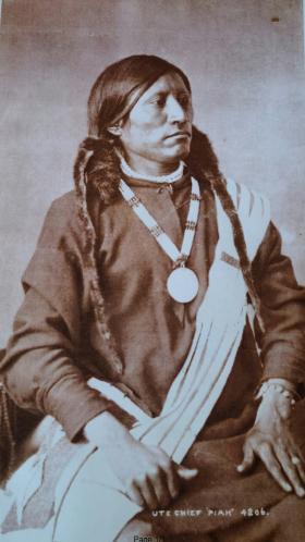
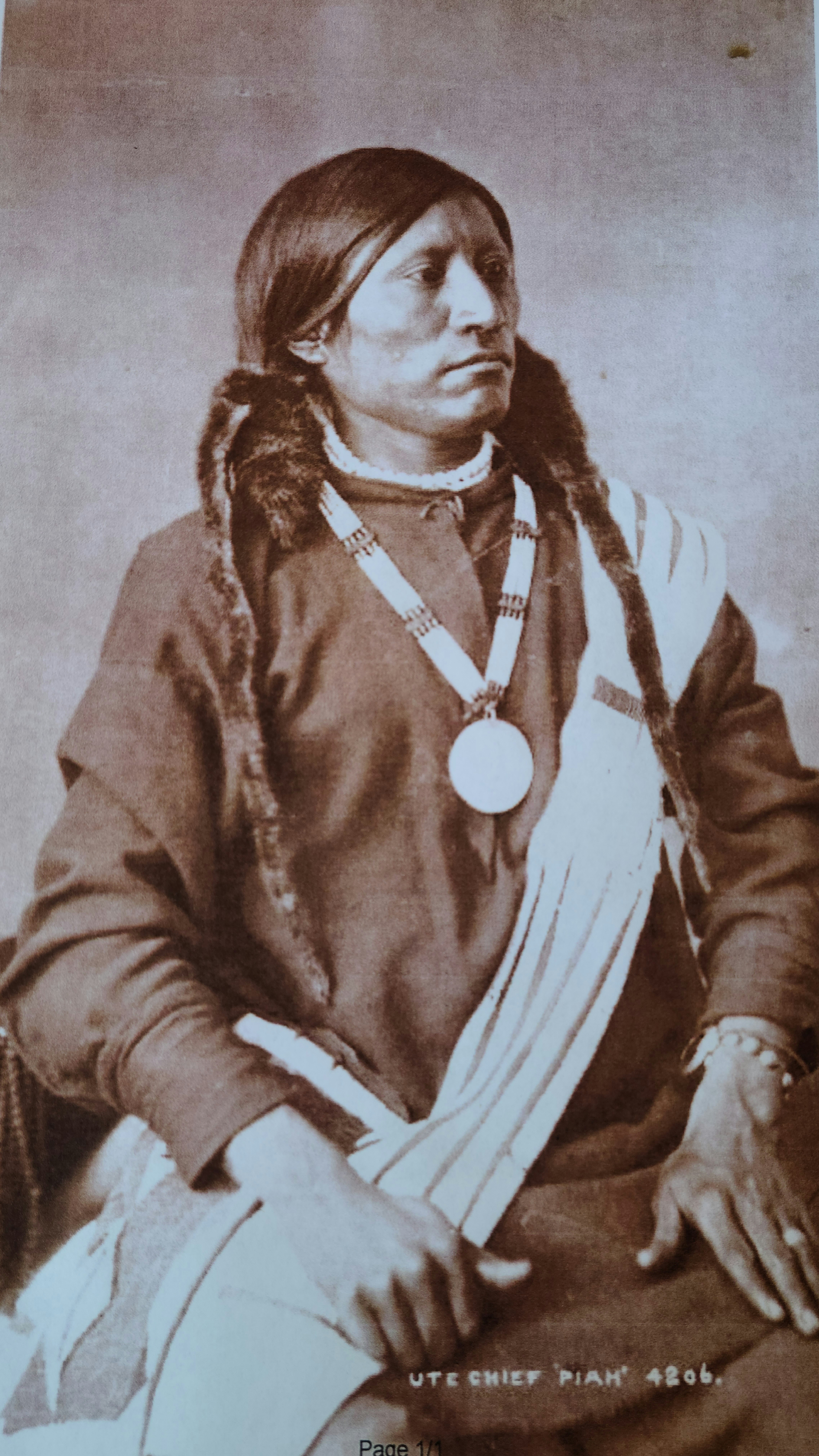
Ute Bill Thompson, Ute Chief Piah

William Jefferson (Wm./W.J./Bill) Thompson was born on March 26, 1849 in Aurora Township, Preston County, Virginia (1863-West Virginia). The 8th child of 9 children of Wm. & Mary Anne (Wotring) Thompson. His father was a shoemaker at the Wotring Tannery and died in 1853. Mrs. Thompson left Preston County in September 1859 with her children on a covered wagon for Oregon. They arrived at St. Charles, Iowa around Christmas, settling at New Virginia, joining other relatives.

Wm. may have been taken captive by Native Americans prior to entering Colorado Territory. Via ox cart he came to Central City to start mining in 1865. He ventured into adjacent Middle Park, seeking gold in the Troublesome Valley, supplied with 1 ton of flour. He spent four years as a postal carrier from Hot Sulphur Springs to Steamboat Springs, using the Gore Pass route.

Once, the Ute Indians saw him baking biscuits and they enjoyed the “beescuts” until the flour ran out. An altercation left Wm. severely beaten. He made his way to Georgetown and the miners denied him entry, thinking he was a crazy man. One kind miner gave Wm. canvas for clothing, and took him to Idaho Springs. He recovered and was employed as a shoemaker.

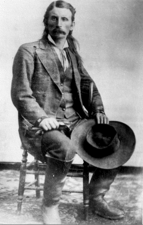
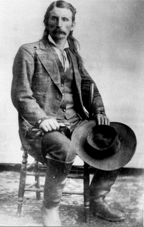
Wm. re-entered Middle Park, built a hunting cabin on Muddy Creek ready for the 1867 winter. Chief Yarmonite led 40 Ute men, women and children to Wm’s cabin explaining to him that the Gore Range was covered with snow, and they were in need of food. This time Wm. refused. A rifle match was agreed upon with the loser put to death. Wm. threw his sombrero to the ground as his hair fell to his shoulders. A cry of the Ute went up as they recognized Wm. from the Troublesome. Sub-chief Piah told Wm. they could not fight a Ute brother, and braided Wm’s hair and applied face paint as they were at war with the Arapahoes. A hunt for bison began. Shooting was heard with the thought the Arapahoes arrived. Len Pollard & Sandy Mellon were chasing buffalo, which Wm. shot and killed. Len & Sandy confronted the supposed Ute with Len asking, “Where did you get Bill Thompson’s Winchester rifle?” Wm. played along until Sandy aimed his rifle on Wm. who wisely said, “Don’t over reach yourself, Sandy.” Sandy demanded, “Who in the hell are you!” Bill laughed and told them he was Bill Thompson. The sobriquet of “Ute Bill” was given. Wm. preferred his nick name over his legal name.

Ute Bill carried on as a mountaineer. Hunting and trapping, taking wild game to the Georgetown & Denver markets selling the meat, until laws prohibited the practice. A new career began of driving stagecoaches and freight wagons for the Colorado Stage Company on the Georgetown, Empire & Middle Park Wagon Road, over Berthoud Pass to Grand Lake, Hot Sulphur Springs, Gore Pass, and occasionally Steamboat Springs. One day on Cottonwood Pass, Ute Bill stopped and hiked over a ridge to find 400 Ute tipis on a meadow, imaging this could be a ranch. He homesteaded acreage, bought the home ranch from Al Honscome, and through marriage owned 4000 acres.

The T Lazy S brand was patented. The Thompson Ranch was the 1st in Middle Park allowed to receive water from the Grand (Colorado) River for irrigation. Ute Bill Creek and Ute Bill Ditch 1 & 2 were also patented. Middle Park became Grand County of February 2, 1874. Ute Bill was on the first jury, appointed Road Supervisor, and a delegate to the state Democrat Party Convention. In 1879 he owned Thompson’s Billiard Hall, bought a store from John Kinsey and expanded it into Ute Bill’s Saloon in Hot Sulphur Springs. He also had a game park of tame antelope, deer, and elk.

The “Texas Charley” incident of December 5, 1884 began at the saloon when Texas Charley forced Ute Bill to hand over his prized Winchester rifle. His future father in law played a role in the coroner’s inquest. January 30, 1889 The Middle Park Times listed the sale of the saloon to Billy Pharo with the quote of, “We don’t reach Denver yet but were getting there you see.” An ad in Hot Sulphur Springs complemented the sale.

On December 25, 1893 Ute Bill Tompson was united in marriage to Mabel Smith. The first recorded marriage in the Hot Sulphur Springs Congregational Community Church. Mabel was the eldest daughter of Preston Henry & the late Mary Smith. Ute Bill & Mabel had 6 children Fred Charles, William Preston, John Henry, Otto Woodring, Marion Loman, and Mary Ellen. W.J. Thompson advertised in the Grand County News, January 8, 1904 Sulphur Springs and Kremmling Stage Carries Mail & Express Stage Fare, One Way $1.50 Round Trip, $2.75 In 1903-1904 The Denver, Northwestern & Pacific Railroad (D.N.P.R.R.) was buying ranchers land. Ute Bill refused to sell his for $500 and lost on appeal in District Court receiving $300. However, it was “matter of principal” that he won on, as E.A. Meredith the railroad surveyor diverted the rail bed to be placed on the other side of the Colorado River below the cliffs.

As the excursion trains were passing by the Thompson Ranch on their way to the Railroad Days celebration in Hot Sulphur Springs on September 15, 1905 Ute Bill danced with joy knowing that the “Iron Horse” was NOT allowed to disturb the sacred tipi grounds of the Utes! Ute Bill forgot his grievances and presided over a vast fish fry and barbeque of elk on July 4, 1906. The last cattle trail drive out of Grand County was conducted by 2 aged pioneers, Sam Martin of Muddy Creek, and Ute Bill in 1923. Another matter of principal to avoid paying railroad costs, but of great sentimental value of all the past cattle trail drives. Ute Bill & Mabel both entered St. Luke’s Hospital in Denver for surgery in late February 1926. Ute Bill’s first surgery went well, the second did not. Mabel was not able to be with him as she was recovering from her own.

Many Middle Park pioneers visited them to wish them well. Old friend Charles Nines Sr. who retired in Denver from Pine Ridge Agency, South Dakota a Sioux language interpreter and Trading Post owner was with Ute Bill when he passed away on March 19, 1926, one week shy of his 77th birthday. William Jefferson “Ute Bill” Thompson is buried in the Hot Sulphur Springs Cemetery off of Cottonwood Pass, Looking at Elk Mountain and the original homestead.

This article is dedicated to Lorna Marie Gowen; September 6, 1954-April 14, 2006

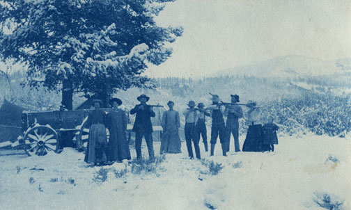
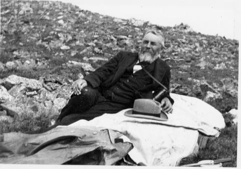
Ute Bill Thompson and His Memorial Marker

Dark clouds covered the Continental Divide as we looked east from the ridge leading toward Elk Mountain's remarkable view. Cool winds and spitting snow followed us. We weren't seeking the height of Elk Mountain, but instead, were tracking the historic path of Grand County Pioneer William Jefferson "Ute Bill" Thompson. Specifically, we wanted to locate the memorial marker for Ute Bill that Henry Grafke and Otto Schott placed along this ridge after Ute Bill died in 1926. 

Tracking Thompson requires divergent paths. On one hand, Ute Bill's early presence in Middle Park places him in an era when mountain men and Ute Indians shared the vast herds of elk and deer. Only a handful of hardy souls called Middle Park home when Bill Thompson arrived in the late 1860s or early 70s. On another hand, Thompson settled just east of Hot Sulphur Springs as a young man, where he carved out a cattle ranch that remains in his family today.  

Records prove he owned and operated a billiard hall, drove stagecoaches and established a homestead along the Colorado (then, the Grand) River. But tall tales and oral legends abound too, capturing hair-breath escapes, harrowing western adventures and the mischievous nature of a 19th century westerner. Looking through the numerous historic photos of Ute Bill at the Pioneer Village Museum in Hot Sulphur Springs leaves an impression of a capable trapper, businessman and rancher who textured his image with stories of western adventure. 

With Don Dailey - fellow historic trekker and great grandson of Ute Bill - along, I hoped to pursue the fact and folklore of Ute Bill. As Don pointed out an isolated cabin in the valley below, a Ute Bill tale from the Georgetown Arbitrator of September 1886, "as narrated at the time by one of the participants," captured my imagination.  

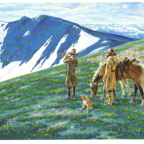
Bill Thompson breathed a sigh of relief. The rugged, hungry band of Ute in front of him smiled approvingly as his long black hair fell from his broad-brimmed black hat. A tense moment before, he'd worried about his future as the small band of Ute Indians led by Yarmony came upon his isolated cabin in Middle Park. Fact is, Bill Thompson's hair had just saved his life. Not bein' cut since the Sioux captured him as a child, it hung nearly to his waist.  

Bill was all set up for a Middle Park Winter, with supplies to last through the toughest stretch, when Yarmony and his band came along. Thompson cursed softly at himself for not payin' closer heed to their approach. "Figured they'd be out west by now," Bill muttered as he squared up to his guests. 

Speakin' through a mix of hand signs, broken Ute and English that most fellers in the mountain parks west of the divide understood well enough for basic communication, Bill impressed the band with his manly firmness and calm self-confidence. Then Yarmony spoke, "Beescits," was all he said. Bill hesitated to open his cabin supplies. "Why, them folks are so hungry," he thought to himself, "they're near certain to go mad if they laid eyes on my bacon and flour." At best he'd be without supplies at a risky time of year. "No biscuits, fellers," Bill said with as much certainty as he could muster, "barely enough food fer myself. There's still a shaggy buffalo er two fer the takin' and every feller's got the same chance." When Bill finished talkin' he looked Yarmony square in the eyes. He watched the headman's leathered face swing toward his rough-sawn cabin door thoughtfully. "Beescits," he repeated. 

Yarmony's band, snuggled in their elk skins and trade blankets, looked stoically at Bill. "Well," Bill said, throwing down his last ace, "seems you're intent on havin' my grub and I'm intent you ain't." Then, regrettin' it before he finished sayin' it, Bill raised the stakes, "Why don't we have us a shootin' contest fer it?" No immediate reaction caused Bill to wonder if he'd communicated clearly. Slowly, though, excitement spread through the crowd of Ute, as the entire band - from the pretty young girls to the big-bellies - looked to one feller. In front of Bill stepped a mountain-sized-Ute feller, creating a shadow as he approached. "Piah," the Ute whispered, breaking into a quiet chaos of conversations. Movin' quick and hopin' for some break, Bill scooped up his improved Winchester rifle as he threw off his broad-brimmed black hat so nothin' could obstruct his shootin' eye. Just as soon as his long black hair fell near his waist, the tense moment ended with a gasp from the Ute, followed by a welcome reception that meant more to Bill than any he recollected! Bill determined then and thar on never cuttin' his hair again! 

As he eased down the gun smilin', all them pretty Ute girls began paintin' his face and braidin' his locks. Bill was feelin' positively giddy about his good fortune. Decidin' he just might owe these hungry Utes a favor fer endin' a potentially tragic shootin', he led 'em to a nearby ravine where he'd been watchin' a small herd of shaggy buffalo. Now Bill Thompson figured he'd repay 'em with meat, and still keep his own supplies. Leavin' the Ute on a rise above the ravine, he sauntered down to the fresh buffalo trail just as he heard the thunder of hooves around the ravine's bend to the south. Settlin' into a remote stand of lodge pole pines, he sat right along the path of the rumblin' bison. Pickin' out his choices as they rounded the bend, Bill's Winchester boomed repeatedly, each shot bringin' down a fat cow or a young bull.          

Swaggering toward his kills, Bill was suddenly confronted by Sandy Mellon and Len Pollard, sneakin' along that ravine behind the buffalo. Not recognizin' Bill through all the paint and braids, Sandy thundered to Len that this Ute feller must "a stole Bill Thompon's gun," because there weren't many repeaters like his. Both their guns were trained on Bill.   Calmly, Bill broke the silence. "Don't over-reach yourself, Sandy." Yes sir, Sandy knew from the voice that this-here Ute feller in front of him was really Bill Thompson. That day, he became Ute Bill.  

Breathing hard to make the final incline, Don and I reached the point along the ridge of Elk Mountain where we expected to find the memorial. There it was, as we had hoped. After a hurrah for our success, we slowly read the plaque: "Hunting Grounds of "Ute Bill.'" As we snapped photos and drank water from our packs, I decided that where historic fact and local folklore meet, an authentic western tale begins.

William Byers
William Byers

Article contributed by Abbott Fay

Born in Ohio in 1831, William Byers became a surveyor in Iowa, Nebraska, Oregon and Washington during the 1850's.  He described himself later as "a mountain tramp". In 1859, he hauled a printing press to the new town of Denver, where he founded the Rocky Mountain News. He also served as postmaster of the settlement.

He was enthusiastic about the mining prospects of Colorado, and wrote endless editorials about the wealth to be found in the mountains to the West.  However, many disappointed prospectors took to referring to Byers newspaper as the "Rocky Mountain Liar".  Among his promotions was the idea that the South Platte River could be made navigable. That vision never became reality due to the size of the river. He wrote inflammatory articles against Indians which contributed to the infamous Sand Creek Massacre, a slaughter of peaceful natives by Colorado militia in 1864.

Fascinated by the co-called "boiling springs" in Middle Park, Byers managed to obtain rudimentary land titles from Indian claimants and promoters to establish the town of Hot Sulphur Springs in 1863.

Byers developed Hot Sulphur Springs into what was probably Colorado's first resort town.  He also tried to grow grapes and other commercial garden crops in Grand County, with little or no success.  He invested in sawmills and was part owner with William Cozens of the Hilry Harry & Company "Brand H" ranch.

In 1901, at the age of 70, Byers undertook the ascent of the peak which had been named for him by the official Hayden survey.  The next year he donated land for the Grand County Courthouse in Hot Sulphur Springs

William Byers died in 1903.  His fame is preserved in the names of Byers Canyon, Byers Peak and the town of Byers. He was one of the founders of the Colorado Historical Society, which owns the Byers-Evans House, a historical museum in Denver.  There is a stained glass window of his portrait in the Colorado State Capitol building.

Sources: Don and Jean Griswold, Colorado's Century of Cities, Denver CO 1958.

Thomas J. Noel, The Colorado Almanac, Portland, OR 2001

Samuel Bowles, The Switzerland of America, Springfield, MA, 1869

Robert C. Black, Island in Rockies, Boulder CO, 1968

Lulita Pritchett, Maggie By My Side, Steamboat Springs CO, 1976

Dougall MacDonald, Long's Peak: Colorado's Favorite Fourteener, Englewood CO, 2004

Carl Ubbelokdre, Maxine Benson and Duane Smith, A Colorado History, Boulder CO 1972

Alice Reich and Thomas Steel, Fraser Haps and Mishaps, Denver CO  1990 


William H. Kimball
William H. Kimball

The span crossing the Colorado River on State Highway 9 southeast of Kremmling is known as the Kimball Bridge.  It honors the memory of William H. Kimball who carried the mail over Berthoud Pass from Empire to Hot Sulphur Springs by foot, winter and summer.  Kimball was born in Maine and accepted the Middle Park mail contract in 1875.  Although reportedly nearly blind, Kimball traveled on snowshoes all winter carrying a backpack of mail weighing 70-105 pounds, day and night, at least once a week.

In  1884, Kimball established a flat bottom ferry over the Colorado River near the spot where the bridge now stands.  Before that time, no wagons could cross at that area.  With the addition of the ferry, load of game meat and fish could be taken up the Blue River to be traded for much needed staples. 

Kimball never married and lived at a nearby ranch until his death in 1909.

Articles to Browse

Topic: Biographies
Winter Park Ski Shop, Joyce and George Engel

George & Joyce Engle

Winter Park Ski Shop, Joyce and George Engel

Here is the story of how Joyce and George Engel became legends in Winter Park and Fraser. In 1945, Winter Park Resort hired George Engel as their very first paid ski patroller.  Little could George have known that this job would lead him to his wife, Joyce Hanna, disembarking from a ski train, and together they would call Winter Park and the Fraser Valley their home for life. Along with Joyce and their daughters, the Engel Family would have a lasting influence not only on Winter Park Resort but on the Fraser Valley community as well.

In the year following his hiring as Winter Park’s ski patroller, George Engel took on different responsibilities at the ski area, such as plowing the parking lot and collecting rental fees in the bunkhouse.  Gordy Wren and Frank Bulkley formed Colorado Outings in 1946 and started the ski school at Winter Park.  As director of the ski school, Gordy Wren hired George Engel as a ski instructor. That same year George passed one of the first ski instructor certification exams ever held.  By 1949, the Professional Ski Instructors of America was formed and Engel held pin # 12.

Gordy Wren was busy practicing for the 1948 Olympics and consequently sold his share in Colorado Outings.  This gave George Engel the opportunity to buy into the company and he became director and eventually sole owner of the ski school. George added the Winter Park Ski Shop onto the ski school.  

George met the love of his life, Joyce Hanna in 1951 as she disembarked from the Winter Park Ski Train.  Joyce, with two BA degrees from the University of Colorado, was ready to ski and work.  After dating for three weeks, George proposed to his future bride and business partner. The Winter Park Ski School under George’s leadership, and the Winter Park Ski Shop with Joyce at the helm, became fixtures of the ski area. George and Joyce’s two daughters grew up on the slopes.

Daughters Wendy and Janet tell wonderful stories from when the family lived in an apartment above the Winter Park Ski Shop.  After Winter Park Resort bought the ski school in 1982, they demolished the shop and apartment to make way for the West Portal Station.

Along with skiing, another Engel passion was horses which led to their acquiring 40 acres along County Road 5 where they built Casa de Engel.  From their ranch, the Engels helped to establish the Winter Park Horseman’s Association and the High Country Stampede Rodeo at John Work Arena in Fraser.    Naturally, Janet Engel became a rodeo star. The Engels were also involved with the Middle Park Fair and Rodeo for decades.

As community leaders, the Engels transformed Winter Park Resort and the Fraser Valley. They helped start the Fraser Valley Metropolitan Recreation District, the Winter Park Chamber of Commerce and the Winter Park Sanitation District.  Joyce Engel was a founder of the Grand County Concert Series bringing live classical music to this rural community.  In 1968, George Engel was instrumental in bringing the National Sports Center for the Disabled to Winter Park. The family’s wide-ranging passions enrich all our lives then, now and into the future.   


Topic: Towns

Parshall

The town-site of Parshall was part of the ranch homesteaded by Fred Dean in the 1880s. Before 1900 the ranch belonged to William Byers, founder of the Rocky Mountain News and town of Hot Sulphur Springs. In 1902 Frank Byers, son of William Byers, sold the ranch of 480 acres to Cordelia and Simon Parshall.   

Cordelia Parshall died on March 30, 1904, leaving the ranch to her son Clyde. In 1907 Clyde sold 60.6 acres of the northeast corner of the ranch to Alonzo F. Polhamus, a civil engineer. Polhamus dedicated the town plat to Grand County on July 26, 1907 and named it for his friend and the Parshall homestead. The original primitive store operated by Walter Dow was the drawing card for visitors. Parshall was the headquarters of the “Williams Fork Telephone Company,” a highly informal operation that is said to have transmitted its subscribers’ voices along barbed wire fences.

The town was never incorporated and today still has a bar and restaurant, a post office and a chapel, plus the Grand County Road and Bridge Dept. District 3 maintenance shops. Population varies seasonally between 75 and 90 people.

Edits and corrections to original posting by Don Dailey, 10-2021.


Topic: Water

Onahu Creek

Onahu Creek was called Fish Creek and is a tributary of the North Fork of the Colorado River. The name refers to one of the Indian race horses who came up to a campfire to warm himself, and the name means “warms himself“.  The horse ultimately died on Fish Creek and gave his name to the waterway.

Topic:

Community Life

What was it like to live in Grand County in the 1800's or the early 1900's?  Click on the drop down menus and find out about community life in the “olden days.“

Topic: Mining

Mining in Grand County

Ghost towns and broken dreams are legacies left by the early miners and prospectors of Grand County.  

Ever since 1879 when the first mines were staked out and claimed on Bowen Mountain near Grand Lake, “gold and silver fever” grew like an epidemic.  Men blinded by greed and prospects of a better tomorrow scrambled to the Kawuneeche Valley with picks and shovels to unearth their fortunes.  

Women worked just as feverishly along side their men and encampments gave way to mining towns almost overnight.  Land offices, eateries, and boarding houses sprouted like wild flowers. Claim jumping became a common practice, resulting in fights and even murders.  Most of these injustices would go unpunished, for no one wanted to risk losing their chance of riches.  

In Grand County the mother load was a false prophecy, as only small quantities of low grade gold, silver, and lead ore were found.  In a few short years, Gaskill, Teller City, and Lulu City, three of the more noted settlements, suffered the same fate as the other boom towns.  By 1885 the mining boom had ended in Grand County and ranching had taken it’s place as a sustaining industry.

Topic: Railroads

Moffat Road


"I shall never forget it as long as I live. Nor do I ever expect to experience anything comparable to it again. Civilization had found its way across the mountains into Middle Park," reflected Mrs. Josephine Button in 1955 on her 91st birthday, as she recalled seeing smoke from the first Denver Northwestern and Pacific work-train on Rollins Pass, high above the Fraser Valley and Middle Park. Once those rails made it over the Continental Divide all the way to Hot Sulphur Springs, "changes came thick and fast." Many men, many dollars, many routes and many dreams tried to bring a railroad over the Continental Divide into Northwest Colorado, and the "Hill Route" over Rollins Pass that finally accomplished it a century ago has retained its allure ever since.

The Moffat Railroad built a cafeteria, telegraph station, living quarters for Moffat's "Hill Men" (as the railroad crews up there were known) and a fine hotel - all collectively called Corona Station. Soot-filled snow sheds protected over a mile of this windblown section of track. And where today silence is the most powerful sense, colorful locomotives pulled passenger and freight cars, filling the rare atmosphere with black smoke and mechanical clatter.

Decades of men's dreams lay behind the once massive snow shed that cut the bitter winds from the north and west, behind that fine hotel that offered some of the most spectacular scenery in America, behind the hopeful Town of Arrow nestled below tree-line ten or twelve miles west of Rollins Pass, and behind that first work-train that Josephine Button watched from her hay ranch along the Cottonwood Pass Wagon Road to Hot Sulphur Springs. Competent, often powerful, men in the 1860's through the 1890's filed surveys, graded road beds, and even began drilling before being stopped by severe storms that foiled the best laid plans or their inability to fund the ambitious projects.

Dreams to penetrate the high mountains along the Divide in central Colorado began when the Front Range was flooded with miners during the Gold Rush of 1859. Even before Colorado became a territory in 1861, Golden City, just west of Denver along Clear Creek, recognized its potential as a gateway to the rich mineral resources of mountain towns like Central City, Black Hawk, and Georgetown. Golden City's ambitions went beyond becoming a mountain transportation hub, believing that with the right incentives, enthusiasms, and leadership, its location supported a future as a national commerce center. 

Golden City certainly had men of vision, ambition, and wealth among its ranks. William Loveland and George Vest, both young and feverishly ambitious to see Golden City reach its potential, vigorously pursued their dreams for a powerful commercial center in Golden City. From Missouri River towns like Leavenworth in Eastern Kansas, leading town founders also recognized the benefits of linking their water and rail routes to the east with the resources of the west. Finally, as if destiny had demanded it, Edward L. Berthoud, a young civil engineer and surveyor with energy and ability, arrived in Golden City from Leavenworth in April of 1860 to unite the similar passions of leading citizens from both locations.

From 1861 until 1866, Berthoud, Loveland and Vest focused on bringing a direct transcontinental railroad route through Golden City. First, Edward Berthoud, along with Jim Bridger and a capable young cartographer named Redwood Fisher, blazed a trail across Berthoud Pass through Middle Park all the way to Salt Lake City. Returning to Golden City on May 28, 1861, Berthoud reported "a good wagon road could be ?quickly' built" from Denver to Salt Lake City over Berthoud Pass for about $100,000.00. According to the local hyperbole, a railroad would surely follow.

In spite of considerable enthusiasm, disappointment plagued early efforts to put a rail line over the mountains in Colorado Territory. In 1862, Territorial Governor John Evans sent the Surveyor General for Colorado and Territories along Berthoud's route and others to confirm or deny the potential of a railroad line. About the same time, the Union Pacific Railroad Company sent an independent reconnaissance to examine potential routes over the divide that included Berthoud and Boulder Passes (Boulder Pass became Rollins Pass in the early 1870's, when John Quincy Adams Rollins built a toll road over it, and then Corona Pass when the Railroad crossed it). Surveyor General Case and the UP agreed that neither route offered much hope for a standard gauge railroad. The dream of a transcontinental line over the Continental Divide through central Colorado seemed to die with the UP surveyor's words, "I learned enough to satisfy myself that no railroad would - at least in our day - cross the mountains south of the Cache la Poudre..." 

Multiple failed attempts to bring a rail line over the Divide through Middle Park during the following decades strengthened the UP's "death sentence." Against the odds, Berthoud and Loveland continued to solicit support for a railroad west over or through the Continental Divide, using improved surveys and maps to support their requests. In the 1880's, survey crews from a variety of railway incorporations were scattered over the high country on or near Rollins Pass. Over Berthoud, Rollins and other passes, they marked potential railroad lines with their wooden stakes. It was during this stretch of strenuous surveying activity that David Moffat, a highly successful Denver capitalist, got involved with an unsuccessful effort to bring through the mountains instead of over the top. 

 In the early 1880's, Mr. Moffat invested in the Denver, Utah and Pacific Railroad, which intended to tunnel through the mountains near Rollins Pass. Like the other efforts, though, the Denver, Utah and Pacific vanished in a few short years. Unlike many other lines that accomplished little more than surveys and maps, the DU&PRR completed significant grading and began tunneling before reaching the "end of its resources."

Money, power and success supported Moffat's dream to put Denver on a direct transcontinental railroad line. Doctor Robert C. Black, III, wrote that David Moffat's failed efforts in the early 1880's converted him to the idea that Denver needed to be on a direct transcontinental rail line. Moffat considered the route over Rollins Pass valuable enough to have surveying and grading crews working on it throughout the winter in 1902. The Denver Rocky Mountain News claimed that Moffat's route through Northwestern Colorado included "the largest strip of fertile land as yet undeveloped in the United States..." With his Denver, Northwestern and Pacific Railroad, David Moffat planned to make good his intentions to put Denver on direct transcontinental railroad line.

Moffat's original plan called for the "Hill Route" over Corona Pass ? the name changed from Rollins Pass in honor of Corona Station at the top ? to last for only a few short years. While the "temporary" route over the top generated resources by extracting the resources of Northwestern Colorado, a tunnel was to be bored through the Continental Divide. Even the wealth and power of Moffat, though, failed to adequately finance the tunnel before he died in 1911. The temporary line, therefore, lasted for nearly of a quarter century, from 1904 until 1928.

Its obstacles proved as enormous as the mountains it crossed. Work crews had to cease operations because of snow for most of April in 1920. The road was closed from late January until May in 1921. In December of 1924, engine number 210 busted "a main reservoir pipe," causing the train to fly down the hill out of control until it jumped the tracks and crashed into the valley below. Clearly, the Denver and Salt Lake Railroad, which took over Moffat's DNW&P after his death, needed a tunnel to replace the expensive effort over the "Devil's Backbone."

 As Denver and Salt Lake Locomotive Number 120 came through the tunnel in early 1928, it represented the culmination of a massive undertaking through wet, unstable rocks which required considerable engineering ingenuity and caused six deaths in a 1926 cave-in. It also took an enormous amount of coordination and effort to secure the necessary funding. Through local bond issues, private investors and other means, the project was completed. And through a connection at Dotsero, a railroad station less than 30 minutes west of Vail on I-70, freight and passengers could make a direct Pacific connection from Denver. Posthumously, David Moffat's dream became a reality.

For significant periods of time since the trains stopped operations over Rollins Pass in the late 1920's with the opening of the Moffat Tunnel, on-road vehicles crept along its relatively easy grades and wide curves from Rollinsville on the east slope to Winter Park on the west side of the Divide. Like now, the road ran through an area attractive to backcountry campers and sport enthusiasts. On September 1, 1956, local officials and private citizens met on Rollins Pass to celebrate a "joint state-federal-county project to convert the old D. & S. L. railroad right of way over Corona Pass into an access road for sportsmen." According to the Denver Post, the game and fish department's construction division reconstructed the road during the summer of 1955 for about $20,000. The following year, the road became a scenic route over the Continental Divide for family cars and jeep caravans alike. And after it was built, or at least reconstructed, they did come. Intrepid tourists into Middle Park.

Topic: Water

A Dream Smashed in Gore Canyon

The idea of a water passage from the Atlantic to the Pacific Ocean had long captivated the imagination of early explorers.  Soon after the Territory of Colorado was established, the United States government made a standing offer of $3,750 to anyone who could demonstrate such a route.

In 1869 a dreamer named Sam Adams convinced some people in the town of Breckenridge that goods could be sent upriver via the Mississippi, Missouri, Platte and South Platte Rivers to South Park.  Then, with a short portage over Boreas pass, they could continue down the Blue River to the Grand (Colorado) River and then through Gore Canyon the Sea of Cortez.

Volunteers were told they would share in the prize, and they built four boats of green lumber for the voyage.  The flotilla was launched with great celebration, the lead boat bearing a banner proclaiming "Western Colorado to California ? Greetings!"  A little dog was given to the crew to keep up morale.

As the boats went down the Blue River, the waters were a bit rougher than expected. When the men arrived at the Grand (Colorado) River, the crew set up camp. However several of the "sailors" declared they had had enough and began a trek, via dry land back home to Breckenridge.

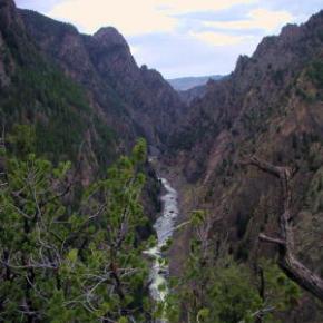
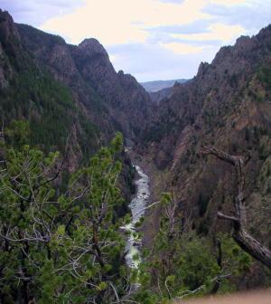
When the boats reached Gore Canyon, they encountered violent upsurges and dramatic drops.  The wild waters smashed all four of the vessels on dangerous rocks.  Fortunately, all members made it to dry land, even the little dog.  No reward was ever given for the attempt.

Topic:

Early Families

While natural events occasionally determine history, it is most often the existence of natural resources that lure humans to a region.  Those who first arrived in Grand County came to mine ore, cut timber and graze cattle and therefore they determined the subsequent history of the region.

The pioneering families of Grand County had exceptional stamina, pride and endurance to survive the grueling winters and isolation.  We have collected the stories of just a few of these families, but will continue expanding this section as information becomes available.  If you know the story of one of the early Grand County families, please contact us so that we may include it in this section

Topic: Water

Moving Water from Point A to Point B

Most serious ranchers had more than one ditch and most built one or more reservoirs. Hilry Harris, Munroe C. Wythe, Samuel H. Burghard, and John A. Coulter entered the first water claim in the county on September 20, 1874. This came out of Sheep Creek above the head of Gore Canyon.

There usually was some natural irrigation; but the challenge of getting the water from the creek required laborious construction of diversion dams, headgates, and ditches, the earliest ditches being dug by hand and often taking up to four years to complete. Later, ditches were dug using teams and scrapers. The grade was figured out initially by simple gravity flow, letting a trickle of water move down the ditch. Soon ranchers refined the process, using a 16’ long board placed with a 1/8" slope, determined by a carpenter’s level. A.F. and Roy Polhamus surveyed a great many of the water ditches, especially those impressive ones in West Grand County, some of which even had tunnels involved. Most small ditches supplied just one ranch, but if a ditch had to cross another ranch, that rancher usually got a share. And some of these ditches were long!

For instance, Dr. Henry Hoagland, on the Blue River, anticipated getting water close at hand from Spruce Creek. Instead, he discovered an old timer had previous rights that forced him to go back into the mountains and build a 13-mile long ditch. Hoagland had figured on spending about $7000; in the end, the actual cost was $26,000! His crew dug the ditch around side hills and across valleys using flumes and siphons. Then his real troubles began. Terrible leaks and washouts occurred everywhere. Finally he hauled in adobe and put this in the bottom of the ditch, rented sheep, and drove them day after day up and down the ditch to pack it. After a couple of years of using this tamping process, the ditch held. Other ditches were even longer. The Church Ditch at Willow Creek and the Wheatley Ditch on the back Troublesome were both 16 miles long.

The Company Ditch (aka the Williams Fork Ditch), eight feet wide on the bottom, was another long one. Built between 1903 and 1907, it cost $44,000 and had a decree for 150 cubic feet / second. The ditch went uphill and down, requiring many flumes and bridges. One flume was actually 1200 feet long! Subsequent breakdowns, leaks, and slides were so frequent and repairs so extremely costly that old-timers have said the reason the Company Ranch went broke about 1920 was the expense of The Ditch. The Lyman Ditch (or the Curtis), started about 1891, was just as complicated as the Company Ditch. Crossing high above the Williams Fork River, the ditch eventually needed cement piers to carry the pipe (1928). This ditch had so many slides, leaks, and washouts, that it had to be inspected once or twice daily! Siphons were required over draws. Flumes, sometimes ¼ mile long, might be 25-30 feet high, and one flume was actually 177 feet high; but these heights were necessary to maintain the elevation.

Flumes, being of wood, rotted and were guaranteed to leak. Sometimes wind blew a portion of the flume down. Finally the county put in big pipes to help the ditches across the Williams Fork. It might be noted that, when water leaked out of ditches, a side benefit was that ranchers along the way could use the "lost" water. Along with the ditches came reservoirs.

Fred DeBerard had four reservoirs on the Muddy: the Albert, the Binco, Milk Creek, and a low one that flooded the Jones place near Kremmling. All were dirt, of course. The Hermosa Ranch on the Little Muddy had water rights through the Sylvan Ditch and Reservoir Company and they built the Sylvan Reservoir dam and the Hermosa Ditch starting in 1911 and completing it by the spring of 1916. The Stein Ditch, started in 1897, was another large ditch, this one later purchased by the Taussig family. These ditches were all built originally to provide water to meadows and fields for ranching purposes. For years, people hauled in water for baths and household use, but that gradually changed. Leon Almirall, near the Horseshoe Ranger Station on the Williams Fork, decided that he wanted water for his home, so he built a 1700’ pipeline to his house, added an inside bathroom, and was shocked when the line froze the first winter – it was only three feet deep. He called in workers who dug down and insulated the line with manure and straw. It froze again. Finally, Almirall gave up and buried the line six feet deep. Now he had his water!

On Ranch Creek in the east end of the county, E.D. Shew cut a ditch upstream from his house, placing it along the edge of the creek, but directing the water back into the main channel near his house. At that point, he put a little water wheel that pushed the water up the hill to his cabins -- and furnished electricity besides. Eventually he replaced the water wheel with a gas engine. There was a similar water wheel, used for the same purpose, up in Hideaway Park.

Water was used to transport lumber as well. A flume ran down the mountain into Monarch Lake, in the days when the Monarch Company was timbering there. There was a flume along St. Louis Creek, carrying lumber from the camps upstream. Perhaps the most ambitious flume ran from Western Box Sawmill. This area is now under Meadow Creek Reservoir. In 1906, the Deisher Lumber Company paid Nathan Hurd for a right of way through his land and built a flume with a 2% grade down Hurd Creek. Logs were placed in the flume and a horse harnessed to the last log. The horse then pushed the logs down the flume with the help of the water. Three years later, the mill was moved to "Sawmill Meadow" on Meadow Creek.

In 1911 construction on the seven-mile-long Vaver Flume began, with 117 cubic inches of water allotment. This flume ran down Meadow Creek and over to Tabernash, carrying partially processed logs for further manufacture. A flume rider checked along the way, making sure there were no jams, and phone line allowed the rider to report troubles. Hikers can see remnants of both the St. Louis Creek flume and that one coming down Meadow Creek today.

Topic: Water

Grand Lake

Grand Lake is Colorado's largest natural lake.  The clear blue waters are surrounded by magnificent mountain scenery and a haunting Indian legend.  

Judge Joseph L. Wescott, an early white settler, wrote a poem about a Ute story he heard from an Indian camping at the lake in 1867.  One summer Utes were camping on the shores of Grand Lake when they were suddenly attacked by an enemy tribe of the Arapahoe.  As the brave Ute warriors began fighting, the squaws and papooses hurried onto a raft for safety, pushing the raft to the middle of the lake. As the battle continued, a treacherous wind overturned the raft and all the women and children drowned.  

It is said that you can see ghostly forms in the morning mist rising from the lake and hear the wailing of the women and children beneath the winter ice.

Biographies