Winter Park Ski Shop
Ute Bill Thompson

Voices of Middle Park

Oral histories of Grand County.

Featured Video

Voices of Middle Park Articles

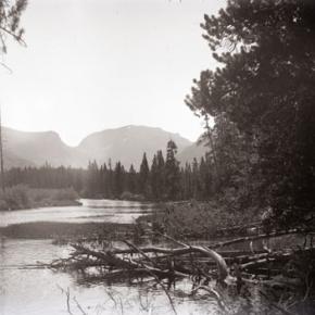
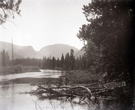
Jacob Pettingell - An interview from 1931

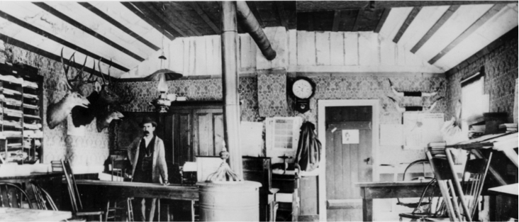
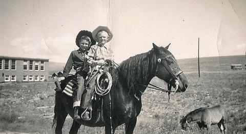
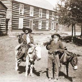
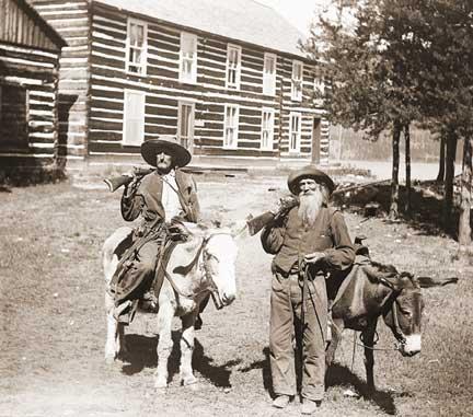
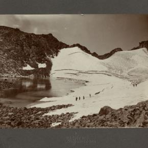
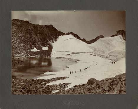
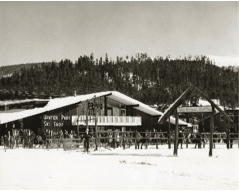
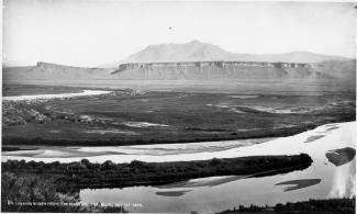
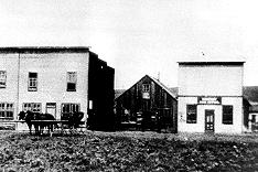
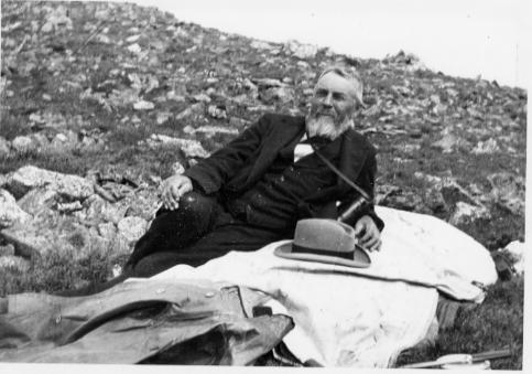
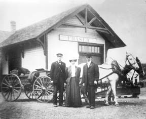
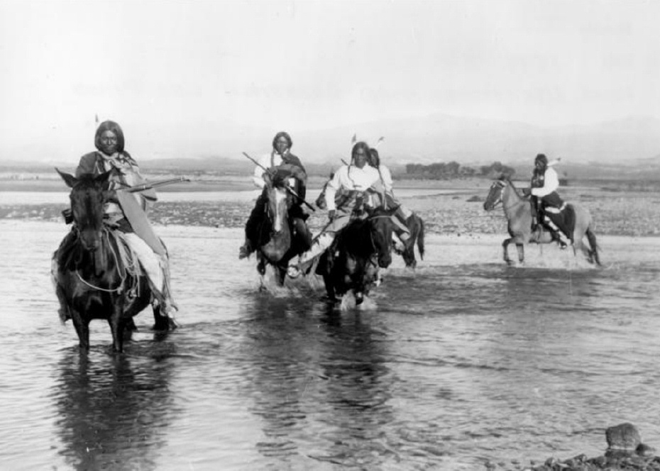
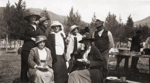
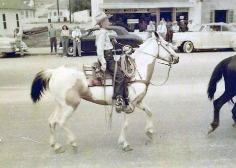
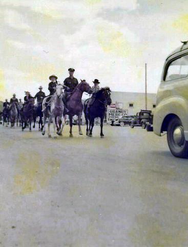
Transcribed by Dan Nolan

In 1880, Jacob Pettingell moved to Grand County at the age of 20. He spent the rest of his life here serving as postmaster, notary public, insurance agent, abstracter, legal counsel, justice of the peace and county clerk. The following is part of an interview conducted by his son-in-law Victor Frey in 1931.

Company of soldiers 
"When I came here, there was a company of U.S. soldiers camped at the old Barney Day ranch; this ranch is a few miles below Parshall, Colo. I think they left that fall. The Meeker Indian Massacre was in ‘79 and these soldiers were sent here in anticipation of further trouble. In addition, the govern­ment sent Springfield rifles to all settlers with ammunition.  We were curious about these new guns and went up on the hill to try them out; before we realized it, we had used up about all the ammunition. At this time some of the Utes came to Sulphur and vicinity to hunt and fish, and to trade. 

Fish & game 
Both fish and game were very plenti­ful in the early ‘80s. On account of severe weather, the settlers usually laid in their winter’s supply of grub early in the fall. At this time they would take several loads of game out to Empire and Georgetown, trading same for grub and provisions.  C. H. Hook, who ran the stage, would pay 25 cents per pound for fish, taking it out to market and selling it for 50 cents per pound. Some persons made as high as $15 per day by fishing. There were no state game laws then. 

Town of Kremmling 
Around 1880 or 1881, there was one little store and a building or two, located across the River (Muddy Cr.). This store belonged to a man named Kremmling.  About 1891, John Kinsey laid out the town of Kinsey City. Later, Kremmling moved his store and post office across the river to this townsite and the name was changed to Kremmling, Colo. There were some ranches in this locality and some of the ranchers names were Bill Kindell, Tracey Tyler, Jim Hetherley, and Dr. Hillery Harris.

Williams Fork
There was only about one ranch here owned by Joe Coberley. There was, of course, no town of Parshall. 

Town of Grand Lake
Old man Wescott lived here; a family by name of John Shafer and Ike Burton. Hot Sulphur Springs had been the county seat and headquarters for supplies for all the mines up Bowen Gulch. Grand County included all of Jackson County at that time.  About 1881, when the mining boom commenced up Bowen Gulch where the towns of Lulu, Gaskill and Teller City sprang up, they decided to move the county seat to Grand Lake since this was much closer. The county seat remained there until 1888 when it was moved back to Hot Sulphur Springs. The old town of Gaskill was located at the mouth of Bowen Gulch; Lulu was about three miles above Squeaky Bob’s ranch, now the Phantom Valley Ranch; while Teller City was on the other side of the ridge in North Park. 

Sandy Campbell and Jim Bowen were the first prospectors. The price of silver was high, and most of these mines were for silver. These mining towns sprang up around 1880-81. I originally came west to spend about three months in Middle Park, hunting and fishing, but when the mining boom struck this locality, I became interested. I grubstaked two men; later I took up a claim above the old Wolverine mine for silver and mined for 7 or 8 years. It was a paying proposition while silver was up in price but on account of the long freight haul and drop in price, the mine was later abandoned. Estimated population dur­ing boom days: Gaskill 150; Lulu 200; Teller City from 1,200 to 1,500. It was claimed that Teller City had 27 saloons. My personal recollections are that they might have had as many as 20 at one time.

The Famous Foot Race 
About once a month, the miners would all come down to Grand Lake for celebra­tions. There is no use to say that considerable liquor was disposed of. During the winter of 1882 a man named Sharp had been working at the Wolverine mine; he had beat them all at foot racing early that spring when the snow went off; these miners thought they had a world beater at foot racing.  While down at Grand Lake on a monthly celebration, they were all bragging about this man Sharp. At this time Harley McCoy was living at Grand Lake and he spoke up and said he had a man named Montgomery who could beat Sharp in a foot race. Sharp went into training at Gaskill; Montgomery at Grand Lake. Bets were originally around $100 and increased to nearly $8,000 on this proposed foot race. The race was pulled off July 4 on the main street of Teller City. Montgomery won the race by about 7 feet and Sharp kept right on running to the end of Main Street, then out into the timber. There was a horse tied there for him and a man waiting to divide up the swag—Sharp was never seen again. The gang at the Wolverine mine took their defeat like good sports, the other bunch paying for all they could eat and drink for a number of days.

The Mock Trial
Usually there was quite a bit of fun and excitement during the mining boom, but once in a while the boys would get a little lonesome on Sundays. This was one of those particu­lar Sundays when they craved a little excitement. There was a tourist and his party who had come in from around Boulder to fish and hunt. The boys confided in the judge and they arrested this man by an old location certificate and he was charged with horse steal­ing (a pretty serious offense in those days).

They held open court and the house was packed, not only with local people, but about 20 tourists were present. The defense attorney spent much of his time describing the wonderful scenery around Grand Lake and Colorado in general. The prosecut­ing attorney prosecuted hard and produced a witness who claimed he actually recognized the accused man and stated there was no doubt but what he was the guilty party. About the time the jury was to have the case, it was framed that I should commence a heated argument across the room with Gil Martin. When I jumped up and called Martin a liar, he opened fire with blank cartridges across the room: I commenced returning the fire. There was a great commo­tion, people actually jumping out thru the windows and a wild scramble thru the doors. The frightened defendant escaped into the timber. It rained all that afternoon. We later succeeded in convincing his partner that it was a joke, so he finally brought the de­fendant in that night, dripping wet and still badly frightened. They all pulled out of Grand Lake before morning.

First Courthouse
This was a small frame building about 12’ x 14’, one room. It has been moved and is now one of the cab­ins belonging to the Corner Cupboard. The Commission­ers then let a contract to Tom Johnston to build a new court house with jail behind, as quickly as possible. There was a sawmill at Grand Lake and plenty of lumber. Johnston put on a large crew; they start­ed in one morning; the next day they moved into the new court house building. John­ston put up this building in a little over one day, sufficiently for them to move in and use it. This building is now John Zick’s restaurant building. 

The Duel 
The commissioners were Barney Day, Webber and Mills, an attorney from Teller City. The sheriff was Chas. Royer and under-sheriff Bill Red­man. Cap Dean was the clerk pro-tem. Mills and Webber had been close friends but had a falling out over the Repub­lican State Convention the year before and since then had become bitter enemies. It is reported that there had been differences between Bar­ney Day and the sheriff and under-sheriff. 

The commissioners met at Grand Lake on July 3, 1883; they all agreed to adjourn un­til July 4 because Mills had an important case in court that day. Mills went to court but Day and Webber went to the Nickerson House and held a commissioners meeting there. At this meeting they raised the amount of bonds for county officers, making same so high they knew none could comply. As I recall, the sheriff’s bond was around $50,000. This caused the sheriff and under-sheriff to throw in with Mills. The next day was Fourth of July and many people were shooting out into the lake, there being considerable noise. Cap Dean, Barney Day and Webber left the Young Hotel (where I was also stopping) and started down town. No one knew just what did happen or who fired the first shot. There were some extra shots in that direction: someone thought they saw a man fall to the ground; we all ran down to the spot which was about 500 yards from the Young Hotel. 

Mills was lying in the road; Barney Day part way in the water; both Dean and Web­ber had been carried into the hotel. Day and Mills died instantly, while Webber lived until around 2 A.M. the next morning. I sat by his bedside. Cap Dean lived 4 or 5 days although he was shot to pieces. I sat beside Dean’s bed and asked him who did the shoot­ing and he replied that he did not care to say. Later, he described one tall man with a handkerchief over his face who attacked him and it fit the description of Bill Redman. It was thought that Mills opened up the attack by firing his rifle. The sheriff and undersheriff both es­caped. They first came to Sulphur and tried to organize a posse but the people seemed to mistrust them and they left the country. Later, Chas. Royer, the sheriff, committed suicide. Bill Redman had been a great pal of Royer’s and when he picked up a paper reading about Royer, he also com­mitted suicide. Therefore, this cost the lives of 6 men.

Firsts in Grand County:

The First Newspaper
The Middle Park Times was founded in 1881 at Grand Lake by John Smart and George Bailey. They called it the Grand Lake Prospector. It was moved to Sulphur in 1889 and called the Grand County Prospector. One day, in 1890, I walked into the newspaper office and was talking to Willard Minor, then running the paper. I told him that I thought Grand County Prospector was a h-l of a name for a county newspaper and sug­gested they change this name to “Middle Park Times.” They took this action and the paper has been known by this name from then on. About 1897, I bought out this paper and edited it for three years.

The First Auto
It was a Thomas Flyer driven from Denver to the Grand Hotel at Sulphur by Harold Brinker, who later on became a famous race driver. This was in 1905. It caused no end of excitement in our small town. Brinker kindly took several of the young people for a ride out to the old horse race track. My daughter, now Mrs. V. H. Frey, was one of the persons and she often mentions the thrill that first auto ride gave her. The car was driven in over the old Berthoud Pass road. 

The First Train
In the fall of 1905 the tracks were laid as far as Hot Sulphur Springs and at this time the first train came in two sections; there were about 1,000 people with a band. The community gave a barbecue and fish fry.

The Grand Hotel 
This was contracted for by my friend Mr. Chapin and myself, and finished in the year 1905. I ran same for a number of years. The first Forest Service office was located in this building and J. C. Stahl was the Supervisor. Later the forest office was moved to Fraser; it was there a short time, then moved back to Hot Sulphur Springs. 

Conclusion
From May 10, 1880 to the present time, February 7, 1931 I have watched the following towns spring up in Grand County: West Portal, Fraser, Tabernash, Granby, Grand Lake, Parshall, and Krem­mling. The Williams Fork locality has also settled up. The old mining towns of Gaskill, Lulu and Teller City came, and then died away. Ranches have developed over most of the county. Stock raising, both sheep and cattle, has become a fixed indus­try. The county, during this time, has shipped out an enormous amount of timber. Like else­where, the auto has developed rapidly and we have many miles of splendid mountain pass roads. There is an abundance of fish and game, although not so plenti­ful as the early days. Every town in Grand County is growing slowly but surely, with the possible exception of one railroad town. Grand County is well off financially and it has the very brightest prospects for future prosperity.


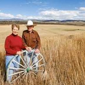
Video: Betty Birdsill & Maryan Pharo Part 1

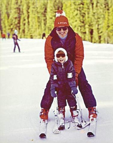
The Voices of Middle Park Project is up and running! If you are interested in helping to capture the living history of Grand County through videos or audio interviews….or if you have a potential interviewee in mind, Contact Dede Fay at 970-531-7020 for more information. Watch an interview with Betty Birdsill and Maryan Pharo

Video: Betty Birdsill & Maryan Pharo Part 2

Interview with Betty and Maryan - October 2010

Articles to Browse

Topic: Monarch

Monarch: Grand County's City of Atlantis

Monarch, now a picturesque lake for meandering around on a pleasant summer day, was once a bustling town, the home of the Monarch Consolidated Gold and Copper Mining and Smelting Company, and the rail head of the Rocky Mountain Railroad.  The life of this little company town and railroad was very short lived and now nearly forgotten. 

Boulder business men T.S. Waltemeyer, and Frank and Charles A. Wolcott heard about traces of gold, silver, and mostly copper at the junction of the Arapahoe Creek and the South Fork of the Colorado River.  In 1905 they established the Monarch Consolidated Gold and Copper Mining and Smelting Company and built their company on the assumption that a major belt of minerals extended east through the Continental Divide.  The Monarch Company consisted of several subsidiary companies including lumber companies, an "investment" company, an exploration company, and a development company.  The main objective of the company was to mine metal ores, but supplement it with timber and build a railway to benefit the whole corporation. 

The company had 1740 acres of placer and lode claims; the main mines were the Copper King, Copper Queen, Omaha, Ella C., and High Lonesome. The Monarch Company shipped heavy machinery by flatbed cars to Granby on the new Moffat Road.  They then put an ad in the paper asking for bids to haul heavy machinery 16 miles from Granby to Monarch.  The machinery included "5 boilers (eight and a quarter tons each), one engine (over eleven tons), one flywheel (6 tons), other machinery (from 1 to 5 tons), a carload of nails, and several hundred pounds of miscellaneous supplies."  The task of hauling the heavy equipment was made especially difficult by mud-holes and bridges not made for heavy loads.  Denver hauling companies refused to take on the job and one Swedish logging company from Wyoming abandoned the challenge after the first wagonload stuck in a mud-hole.

Finally Dick McQueary agreed to move the machinery.  To accomplish the job, McQueary purchased several hundred feet of hardwood planks in Denver, 3 inch thick, sixteen inches wide and twelve feet long.  Accompanying the heavy pieces up the mountain was a "4 horse team hauling hardwood plank, a 4 horse team pulling six inch pine poles, 10 feet long, and a four horse team pulling two ton large nails".   The crew built temporary bridges across mud-holes by laying pine poles 3 feet apart with hardwood planks laid across the poles.  2 light loads were driven across to test bridge followed by the heavy load pulled by 12 head horses.  Finally the planks and poles were pulled up to be used at the next mud-hole.  The heavy machinery was hauled in 2 weeks.

Construction on the Rocky Mountain Railway, a standard-gauge line from Granby to Monarch, began in 1907.  The 16 mile line was completed by Thanksgiving.  There were hopes of someday extending the line to Grand Lake for resort passengers and eventually a line to Walden in North Park.  The Denver and Northwest Railroad Company helped survey the line by lending J.J. Argo's services.  Dick McQueary was once again brought in to grade the road bed between the Monarch mill and Granby.  Most of the workers on the railroad were Japanese, Bulgarian, Hungarian, and Austrian day laborers from an employment agency in Denver.  The laborers were paid $2 a day, (plus a fifteen cent fee for their interpreter).

Once the railway was completed and in operation it issued passenger tickets.  However, the company never published a schedule.  Neither did the company hire a full train crew to run their single locomotive.  To meet regulations for switching service on Moffat tracks in Granby, the Rocky Mountain Railroad took on board a couple of interested bystanders.  At gates crossing ranch properties fireman Leo Algier would simply jump off the train to open the gate and close it after the train had crossed through before hopping back on the train.  Ranching families on the line were allowed to catch rides on the train when it passed through or to request package drop-offs. 

The Monarch Company created Monarch Lake by damming the valley, at the junction of Arapahoe Creek and South fork of the Colorado River, for use with the saw mill and the box factory. A 2800 foot long chute carried tree trunks down the hillside to the lake where they hit the water and could bounce up to 50 ft high.  Then a stern-wheel steamer pushed logs into a system of canals and flumes that led down to the saw mill and box factory. 

The town of Monarch included employee housing, business offices, a post office, and an assembly hall.  Dick McQueary helped haul sawlogs to mill and haul materials for building employee housing in Monarch.  Grand County's first hydro-electric generator was in Monarch.  The waterworks system was created by piping water from the falls at Mad Creek and had pressure up to 300 lbs per inch. 

Even thought the mining company never produced more than $150 a year, the owners continued to promote the business to stockholders and they were able to keep the business running by through their enthusiasm for the project.  During the summer, stockholders were invited to visit Monarch, tour the site, and hear lectures on the operation.  The tour often included a visit to a spruce tree named "Monarch" that was seven feet in diameter.  So, while business might not have been booming, enthusiasm and interest from stockholders was.  

The last piece of Monarch to be constructed was the box factory in 1907.  Unfortunately the factory only operated for 2 or 3 months before it suffered a fire and was totally destroyed.  Robert Black in Island in the Rockies stated that the questionable promotions of Monarch would have been forgiven if the box factory had developed into a solid operation. 

Soon after the fire, a disagreement between management and labor resulted in the entire work force being fired.  For several months the Rocky Mountain Railroad operated the train with one man who acted as engineer, fireman, brakeman and conductor. The company hired Dick McQueary as general manager until fall the fall of 1907 when stockholders discovered the true state of the company and declared bankruptcy.   Stockholders and the community were convinced that the whole company had been created as stock-selling scheme.

Although the Monarch Company and the Rocky Mountain Railroad were no longer in business, the railway continued to be used for a number of years.  For example, Ed McDonald, dude rancher, put a Cadillac touring car on flanged iron wheels to carry mail, supplies, and guests to his ranch.  The center of town was preserved and developed by the Dierks as a summer resort called Ka Rose, after Katherine Rose Dierks, after the owner's daughter.   In 1912 the rail line was used for transporting fisherman along the river by Ernest F. Behr, a former Colorado and Southern engineman.  Finally, in 1918 the rails were sold to a junk dealer in Denver to satisfy the World War I need for scrap metal. 

Currently, the town, mill site, and box factory lay under the waters of Lake Granby and are inaccessible, except in years of draught.  However, there are a couple of remaining pieces at Monarch Lake that are still visible.  On the south side of the lake, near the water's edge, is a boiler that was used to yard logs into a chute and shoots the logs into a holding pond.  Also, the flume still runs down the hillside into the lake.  The trail around Monarch Lake takes hikers directly under the flume.

Topic: Biographies

David Moffat and the Railroad Dream

David Moffat was a wealthy Denver businessman who saw the need for a rail link between Denver and Salt Lake City. His vision, a 6.2 mile long tunnel beneath the Continental Divide, made this link possible.

He was born in 1839, the youngest of 8 children. He ran away from home at age of 12, went to New York City and found work as a bank messenger.  He was an assistant teller by the age of 16 and  became a millionaire through real estate by the age of 21. 

Moffat was admired for his qualities of courage, adaptation to the “barbaric” West and his goodness of heart. He married his childhood sweetheart, Francis Buckhout, moved to Denver, and in 1860 opened a bookstore/stationary/drug store with C.C. & S.W. Woolworth on the corner of 11th and Larimer.  

Moffat and others formed the Denver Pacific Railroad to reach Cheyenne. The rail line to the Moffat Tunnel was the highest standard railroad ever built in the U.S. (11,660 ft). It went over the Continental Divide at Rollins Pass and came into the Fraser Valley in 1904. At the time, it was the most difficult railroad engineering and construction project ever undertaken. It involved boring numerous tunnels through solid granite, as well as constructing precarious timbered trestles that bridged deep mountain gorges. 

David Moffat was a multi-millionaire when he started the Moffat Line and was nearly broke when he died in 1911 trying to raise money for the tunnel that would eventually be built and bear his name. It was finally completed in 1928. The west portal of the Moffat Tunnel can be seen from the Winter Park Resort.


Topic: Regions

The Blue

Because gold had been found at the headwaters of the Blue River at Breckenridge, hopes were high among prospectors who worked the downstream tributaries in Grand County.  However, this lower section of the Blue contained no mineral wealth. 

The Denver and Rio Grand Railroad planned to run a route through the valley and began constructing grades, but the tracks were never laid because Moffatt's railroad crossed the county first.

An enterprising Canadian, 25 year old Willis Charles Call, had been employed as a cook for the grading company in 1881.  When the railroad abandoned the project, Call became a registrar of voters, and in 1886, the county assessor.  By 1890, he had a choice ranch near Kremmling.  His Austrian wife, Mary Rohrocher, was a very popular hostess.  It is believed that they owned the first automobile in the county.

The conflicts between the white settles and Ute Indians came to a climax in 1878 when the Ute leader Tabernash was killed by a posse and the very next day, Abraham Elliott a homesteader on the Blue, was killed in retaliation.  The remains of his ranch can be seen on Highway 9 at mile marker 135. 

Across the river was the ranch of Henry Yust, who settled there in 1885.  Another early ranching family was that of Thomas Pharo, An Englishman from Franham in Surry, near London.  Settling there in 1880, he developed a major cattle and horse ranch. 

The Blue River area was connected with a route west in 1913, when the co-called Trough Road was constructed, beside the Gore Canyon to State Bridge.

Topic: Biographies

Isabella Bird

In Yorkshire, England on October 15th 1831, a clergyman and the daughter of a clergyman gave birth to small, sickly girl who would grow up to be one of the most well known travel writers of her time, an exceptional accomplishment in an era when women rarely ventured far from home unescorted. In 1850, after a childhood full of ailments, Isabella had an only partially successful operation to remove a tumor from her spine. Following the surgery, Isabella suffered greatly from depression and insomnia; it was then that her doctor recommended that she travel.  Isabella's father, becoming increasingly worried about his daughter, gave her a hundred pounds and sent her off to see the world.

Ms. Bird traveled throughout the world including Canada, Hawaii, Australia, China, Tibet and Morocco.  She came to Colorado right after the territory had officially been become a state. Isabella loved it in the mountains, so much so that she wrote many letters home to her sister which eventually came to become her third and most famous book, A Lady's Life in the Rocky Mountains. In this document, Isabella wrote of her adoration of the area saying, "I have found a dream of beauty at which one might look all one's life and sigh."

Upon her arrival to Colorado, she traveled into the mountains west of Estes Park. She wrote about adventures and challenges and of her romance with Jim Nugent, or "Rocky Mountain Jim" a one eyed outlaw with an attraction to violence and poetry. He was shot and killed a year after Isabella left Colorado.

Throughout the letters, Isabella mentions the wonderful sights of the lands she explored near current day Grand County.  In one of her letters, Isabella wrote of the time she rode a horse through a blizzard with her eyes frozen shut.  She found herself in another adventure when she was snowed in a cabin with two young men for several months.

Isabella grew eventually grew homesick and headed back to Edinburgh Scotland where she married a doctor. After five years of marriage, her husband died and Isabella returned to travelling. When Isabella returned to Edinburgh in 1904, she grew very ill and died while planning another trip to China.

Topic: Mountains

Rollins or Corona - What shall it be called?

Travel across various passes of the Continental Divide occurred long before white men showed up. Indeed, as anthropologist James Benedict wrote c. 1975, some 10,000 years ago, prehistoric Indians camped, hunted, and built hunting walls on the upper reaches of Rollins Pass, as well as moving in and out of Middle Park for the warm summer months. Historic Indians followed the same paths. In the earliest days of non-Indian access, a particular pass at the head of Boulder Creek was dubbed Boulder Pass.

Capt. Jacob Bonesteel, including wagons, made the first recorded crossing by a white man at this point in April 1862. Three years later, a group of Mormons brought wagons over this route and a year later, promoters of new roads into Middle Park brought in many wagons and livestock. In fact, tourists were starting to enter the park by a number of routes, and one of them, Samuel Bowles, who wrote a fascinating account of his trip, including his return to Denver via Boulder Pass.

Interest was growing rapidly for a road over the Divide, into Hot Sulphur Springs, and on into Utah. One promoter, John Quincy Adams Rollins, from New Hampshire, teamed up with William N. Byers and Porter M. Smart to carry this project through. Rollins was interested in crossing the Divide; Byers was promoting the Springs; Porter wanted to develop the valley of the Middle Yampa. All three were pushing to have Middle Park officially named as Grand County, a challenge finally accomplished in 1874.

So Rollins and associates started his road, reaching the top in 1873. That next winter, they publicized this access and in June, Jimmy Crawford brought his family and wagons to Rollinsville and thence to Yankee Doodle Lake, ready to cross the pass now named Rollins Pass by the developer. But the road ended, and they found Rollins' men still hacking the road out of the granite! Jimmy and his crew found it necessary to leave their wagons and help.

Finally, on June 10th, the family was able to head for the top. Jimmy borrowed two yokes of oxen, hitching them to mules, and then to his horse. The road was so rough that the procession could proceed but a few feet before having to rest. The family itself climbed on foot. At the summit, they discovered only a rough swath cut down through the trees on the western side. The "road" dropped down between the lakes and followed Ranch Creek to its junction with the Fraser River. Rollins quickly realized that Berthoud Pass, which also opened in 1874, was superior to his own pass for wheeled vehicles, so he determined to hedge his bets. He initiated the first mail service into the county in 1873. He also built a commodious hotel where his road joined the Berthoud Pass road at the confluence of Crooked Creek and the Fraser. He called it the Junction House. Next, he proposed to the builders of Berthoud Pass that they form a joint ownership of the two roads between Junction Ranch and the Springs. Tickets would be issued for both routes and revenues would be shared. The two companies would build a bridge over the Grand at Hot Sulphur Springs. He even buttered up his rivals by complementing their work.

All this was accomplished, although the mail route soon moved to Berthoud Pass, because of the severe winters on Rollins Pass. The bridge was started in November 1874. From the beginning, Rollins' road was preferred for trailing livestock, because there were fewer problems with heavy timber and bogs. For years, the Church brothers, George and John, who introduced the Hereford breed into the county, trailed their cattle for summering in what became known as Church Park. However, tourists such as Irving Hale still drove wagons over Rollins Pass in 1878.

About 1880, interest burgeoned for bringing a railroad up South Boulder Canyon and through a tunnel near Rollins Pass. Numerous surveys were completed all along the area. David Moffat settled on Rollins Pass for the tunnel site but decided first to put a temporary line over the top. Thus, in the summer of 1903, a formal contract was let for work up and over the Pass itself. By 1904, the workers reached Arrowhead and they also built a work station on top, called Corona Station, or "crown of the mountain." This railroad construction town of Corona, located at over 11,600 feet at the top of Rollins Pass (first called Boulder Pass) along the Continental Divide was the highest railroad station in the world.

It became obvious by 1905 that the Corona area would require snowsheds if trains were to travel, even irregularly, during the winter. Still, word got out of the spectacular splendor of Rollins Pass and tourists flocked in on summer train excursions, sometimes stopping on top, sometimes going as far as Arrow. In 1913, a fine hotel was built next to the rail facilities. Because Rollins Pass was right in the middle of severe weather patterns, a weather station was built on top, as well as one down at Sunnyside. In 1915, Rollins Pass was actually proposed to be the south boundary of a proposed "Estes National Park."

Later, on the National Historic Register, the district was listed in 1997 as the Denver, Northwestern and Pacific Railway Historic District--Rollinsville & Middle Park Wagon Road. It was also identified as the Rollinsville and Middle Park Wagon Road; Boulder Wagon Road, Rollins Pass, and Rollinsville area. In 1956, Governor Steve McNichols had presided at the official re-opening of the four percent grade to vehicle traffic over Corona Pass, expressing the hope that the route would someday be paved. The Colorado Game and Fish Department and the U.S. Forest Service made additional improvements, and the Arapaho and Roosevelt National Forests put out a 24-page booklet titled "The Moffat Road: A Self-Guiding Auto Tour." The road crossed two of the original railroad trestles near Corona but those trestles, even if reached by 4-wheel vehicles, were crumbling and could no longer even be crossed safely on foot. The current self-guided auto tour refers to Rollins Pass, as well as the Moffat Road and the Boulder Wagon Road. Corona Station and Hotel are discussed. In 1979, a portion of the auto road over Corona Pass was permanently closed because of a cave-in of the "Needle's Eye," a tunnel located before the trestles heading west from the Moffat Tunnel's East Portal.

The tunnel reopened on July 3, 1988, thanks to efforts of the Rollins Pass Restoration Association on both sides of the Divide, with the cooperation of the U.S. Forest Service, Colorado History Society, and Boulder, Grand, and Gilpin Counties. It then closed once more when another rockfall hit the tunnel on July 15, 1990. The RPRA is continuing its efforts for re-opening. The noted photographer, Charles McClure, took many outstanding photos of the Rollins Pass road. One, titled"Group on Rollins Pass, shows well-dressed men and women stand on a snowfield making snowballs on Rollins Pass, Moffat Road, Boulder or Grand County, Colorado; probably on Denver, Northwestern and Pacific excursion train. Date: between 1904 and 1913 near Corona Station." Another photo shows a "30 ft. snowcut on Rollins Pass, Moffat Road photo. Denver and Salt Lake Arrow passenger car is parked east of Corona snowshed by the thirty foot snowbank cut, Rollins Pass, Colorado; it shows men, women and railroad employees posed behind train, on the roof and on the snowbank and a standard gauge track. Date: between 1904 and 1915."

A sign at the highway turn onto the Moffat roadbed says: The Moffat Road "Hill Route" Also called "Corona Pass Road", this road over the Continental Divide was the original "Hill Route" of the Denver, Northwestern & Pacific Railway built by David H. Moffat in 1903. It crosses Rollins Pass at 11,666 feet elevation. On top of Rollins Pass, a sign says: Elevation 11, 660 feet, John Quincy Adams Rollins established a toll wagon road through this pass in the mid 1870's. David H. Moffat's Denver, Northwestern & Pacific Railway crossed the Continental Divide at this point in 1903. First known as Boulder Pass, then Rollins Pass, the railroad workers dubbed it "Corona", the crown of the "Top of the world." A railroad station, hotel, restaurant and workers' quarters existed here until 1928 when the railroad was abandoned due to the building of the Moffat Tunnel. Identifications in various trail and geographical guides say: Rollins Pass (el. 11,680 ft) is a high mountain pass in the Rocky Mountains of north-central Colorado in the United States. The pass is located on the continental divide at the crest of the Front Range southwest of Boulder, at the boundary of Grand County,Colorado and Boulder County, Colorado. Rollins Pass (a.k.a. Corona Pass) sits approximately 5 miles east and above the popular ski areas around Winter Park, between Winter Park and Rollinsville. The pass is traversed by an unpaved road, mostly the former roadbed of the Denver and Salt Lake Railway which abandoned the route in 1928 when the Moffat Tunnel opened to replace it. Railroad advertising called this the "Top O' the World" and it referred to the Moffat Route over the continental divide and the Rocky Mountains.

Rollins Pass was the primary travel route west from Denver until an easier road over Berthoud Pass was constructed. The Denver, Northwestern and Pacific railroad laid its tracks across the pass in 1903-1904 and established a Depot at Corona on the crest. It can be noted that in R.C. Black's Island in the Rockies, the term "Corona Pass" was mentioned one time, on p. 351; the terms "Corona Station" or "Corona Snowsheds were used. In Dismantling the Rails That Climbed, Rollins Pass was used, the Corona hotel, and just once, Corona Pass; 1936. In Maggie By My Side, it was Boulder Pass and Rollins Pass. In Rails that Climbed, Rollins Pass, the Corona shed, weather at Corona, Rollins Pass Snow Shed, other references to Corona as a site. In Guide to the Colorado Mountains (Orme) , they speak of the Corona Trail to Rollins Pass. High Country Names (Ward) used Rollins Pass entirely. Only Hiking Grand County, Colorado, published 2002 by Carr speaks of Corona Pass, with reference to Rollins Pass (near the town of Corona), Moffat Road. The term "town" might be questionable; there was only a small restaurant, workers quarters, railroad offices, and in 1913, the hotel. Current maps, USFS and the Grand County Trail Map, show Rollins Pass, with Corona at the side as being a site.

The use of "Corona Pass' seems to be a rather recent innovation that has come into being with tourism efforts in the upper Fraser Valley. Rollins Pass From Island in the Rockies p. 45 Rollins Pass was originally known as Boulder Pass, first recorded being crossed by whites, by Capt. Jacob Bonesteel in April 1862. Their supplies were carried in wagons. A second organized party went over the same pass in 1865. In 1866, promoters of access into Grand County brought many wagons and livestock over Boulder Pass.In 1867, Samuel Bowles and a group returned home to Denver via Boulder Pass. In 1873-74, two roads were proposed into the county, one of Berthouds pass and one over Boulder Pass. This was the same time that the county was named "Grand". J..A Rollins and his associates started the road and reached the top of the pass in 1873, at which time they envisaged a road from HSS into Utah. The first wagons went over in June 1874. The western descent was so bad that it never was much patronized by wheeled vehicles, instead becoming primarily used for trailing of cattle. At this time the name Boulder Pass disappeared from maps and Rollins Pass became the official name. p. 85. p. 80 Lots of schemes to build roads into GC, but of all the schemes for transport, only one, the Rollinsville and Middle Park Wagon Road showed any promise. That was designed by John Quincy Adams Rollins, from NH, a gifted promoter, a son of a clergyman, second of 19 children. He was a farmer, miner, freighter, road bulder, and platter of towns. He was perhaps the most accomplished billiard player west of the Mississippi. He was a Colorado resident at least by 1866. His finances were up and down, but he was tremendously strong. In December 1884, when he was 68, he thought nothing of a 3-day snow-clogged crossing of the Continental Divide. p. 85 Rollins was interested in MP as an investor and he was interested in extending his road into Utah.

At the same time, a Porter M. Smart was likewise excited about speculating in frontier projects and was working at developing the valley of the Middle Yampa. William N. Byers was busy planning for HSS. These three men launched at least two petitions, with more than 80 "residents" for creating GC. Grand County was created that year, 1874. p. 89 With the creation of GC, people began to consider the area more seriously. p. 92 There was no official mail into the county until 1873 when Rollins brought in the first US pouch over his pass. In May 1874, he built a commodious hotel at the confluence of Crooked Creek and the Fraser, known as the Junction House. p. 94 Rollins knew that the road over Berthoud Pass was superior to Rollins Pass; his main advantage was the railhead at Blackhawk. So Rollins proposed a joint ownership and operation of the two roads for the line between Junction Ranch and HSS. Tickets would be issued for both routes and revenues would be shared. The two companies would build a bridge across the Grand at HSS. Rollins even complimented the Berthoud work. This merger was completed soon. p. 104 This bridge was started in November 1874. p. 108

A mail contract was made in July 1875 for once a week delivery over Rollins Pass, but conditions were so severe that the route was changed to Berthoud Pass. p. 110 From the beginning, Rollins Pass was used in preference to Berthoud Pass for trailing livestock, because there were fewer problems with timber and bogs. However, late spring snowdrifts were a problem, so 20-30 horses were often brought along to break trail. The Church brothers, George and John, summered their cattle in what became known as Church Park and dug the Church Ditch. They also introduced the celebrated Hereford breed into GC. p. 170-171 As interest in bringing a railroad into and through GC developed, about 1880, various stockholders proposed to build up South Boulder Canyon to Yankee Doodle Lake and start a tunnel near Rollins Pass. Nothing came of the first attempts but by the end of July 1881, numerous surveys had been made for that tunnel. p. 238 Cattle was still being trailed out via Rollins Pass up to the turn of the century. p. 258

David Moffat and Horace Sumner, his chief engineer, in the fall of 1903, were planning the tunnel for future excavation; but in the meantime a temporary line was planned for crissing Rollins Pass, at 11,640 feet. p. 264 A formal contract was let for the work over Rollins Pass in August 1903. The loftiest sections were started first, and the first cuts at the top were nearly finished by the 26th of October and tunneling started at Riflesight Notch. As snow came, work slowed to a standstill. p. 265 Work in 1904 was extremely slow until the end of August. An encampment was built at Arrowhead and a station at the crest of the Divide was named Corona Station, where long snow sheds were built almost immediately. p. 267 Arrowhead was soon shortened to Arrow, when a post office was opened there in 1905. Travel on the grades, at 4-5% grades up over Rollins Pass was exceedingly difficult. p. 270 In 1908, word of the scenic splendor of Rollins Pass was becoming known world wide.

Also, Rollins Pass and its "Corona station" were attracting the attention fo the US Weather Bureau, for the pass lay squarely in the center of the region of heaviest snowfall on the entire Colorado Continental Divide p. 344 A terrible winter in 1909 made people think that Rollins Pass was never going to be practical for the long term. Time and again freight and passengers were stuck on top at the Corona facility. In 1913, a $10,000 hotel was built at Corona next to the rail facilities. From Dismantling the Rails That Climbed p. 6 The railroad went from Denver to the top of Rollins Pass. p. 8 Snowsheds were built over the tracks at Corona and other strategic places in 1905. p. 12 The top was referred to as "Corona Pass" 1936. p. 16 Crews who were to removed tails and ties reached Corona at the top of Rollins Pass 1936. p. 20 Reference to the Corona hotel From Maggie By My Side p. 1 Jimmy Crawford heard that a man named John Quincy Adams Rollins was building a road over the range at a place called Boulder Pass. 1873 p. 9-14 June 1874

The Crawford family traveled to Rollinsville and then to Yankee Doodle Lake, where the road ended. Rollins' men were still hacking the road out of the granite. Jimmy and his crew helped. On the morning of June 10, the family started out to go over the rocks and up the mountain. Then he borrowed two yokes of oxen to his wagon, then mules, then his horse. The animals had to rest every few feet; the family climbed on foot. There was no shelter at the top. Rollins' men had done no work yet on the west side of the pass except to cut a rough swath down through the trees. The road dropped down along Ranch Creek. From Rails That Climb published 1950 p. 43 Leyden Junction to Tolland to Rollins Pass. P. 63-64 Many references to Tunnels as identifiers of location. p. 76-77, 78 reference to the old Rollins Pass toll road; first mention of the place called Corona- crown of the mountain. Most references are to Rollins Pass. The Corona shed is mentioned, p. 82. p. 83 Sunnyside water stop, Loop Trestle and Tunnel, Ranch Creek Trestle and water stop, Arrow. p. 95, 100- 101 It is eleven miles from Arrowhead to Rollins Pass. Rollins Pass-Boulder wagon road; other references p. 107 - 112 reference to Corona shed. Reference to pipe line to Corona; a number of comments to Rollins Pass p. 119 weather at Corona p. 120-121 Rollins Pass p. 151 Rollins Pass p. 182 photo of "Rollins Pass Snow Shed" "This Corona station burned one night." p. 188 photo of June at Rollins Pass p. 192-194 photos of Corona shed and other buildings; Rollins Pass p. 252 walking on top of snow shed at Corona p. 271- 272. 1910 Snowshed at Corona p. 312-314 Rollins Pass; Rollins Pass snowshed; Corona; Corona siding p. 324 Corona; Sunnyside weather report station p. 326 Corona sheds p. 333-335 Corona shed; references to "Corona" as a place From Guide to the Colorado Mountains published 1974 p. 54-55 Corona Trail, going from East Portal to Rollins Pass From High Country Names published 1972 p. 105 Irving Hale in 1878 drove his wagon over Rollins Pass, now nearly abandoned as a wagon road. p. 131

David Moffat decides to build a temporary line over Rollins Pass. p. 165 In 1915, Rollins Pass was proposed to be the south boundary of a proposed "Estes National Park". From Hiking Grand County, Colorado published 2002 p. 52 Trailhead on the "Moffat Road to Corona Pass". In same paragraph, it becomes Rollins Pass (near the town of Corona). On p. 54, reference to the Corona Road. On p. 57, map shows Rollins Pass with Corona marked as a "site." p. 56, reference to the old railroad bed used crossing the Divide at Rollins Pass, near the town of Corona. Sometimes called Corona Pass. p. 60-61 Rollins Pass Wagon Road historical notes on JQA Rollins and how to find his wagon road over Rollins Pass, following Ranch Creek to Tabernash. p. 66 Rollins Pass (Corona) to Devil's Thumb From GCHA Journal The Journey p. 6 Rollins Pass used by Indians; comment in 1981 From GCHA Journal Middle Park Indians to 1881 p. 8 Archaic hunters camped in the Rollins Pass area; written mid-1970's The current maps, USFS and Grand County Trail Map, show Rollins Pass with Corona at the side as being a site. The Rollins Pass Restoration Association for many years, and currently, has been trying to open the road and Needles Eye Tunnel. The self-guided auto tour refers to Rollins Pass, as well as the Moffat Road and the Boulder Wagon Road. Corona Station and Hotel are discussed. On the National Historic Register Denver, Northwestern and Pacific Railway Historic District--Rollinsville & Middle Park Wagon Road (Boundary Increase) ** (added 1997 - District - #97001114)

Also known as Rollinsville and Middle Park Wagon Road;Boulder Wagon Road;R Rollins Pass, Rollinsville Corona Station and Hotel The railroad construction town of Corona, Colorado, located at over 11,600 feet at the top Corona Pass (first called Boulder Pass) along the Continental Divide was the highest railroad station in the world. It was situated on an old Native American trail, the same trail it is believed the Mormons traveled on their way to Utah. The road was improved by the U.S. Army, then further improved in 1866 by General John Q. Rollins, for whom the pass and the town of Rollinsville were officially named. Because of the high drifts of snow, the pass was only open from around July to the first big snowstorm two or three months later. In 1956, Governor Steve McNichols presided at the official re-opening of the four percent grade to vehicle traffic over Corona Pass, expressing the hope that the route would someday be paved. The Colorado Game and Fish Department and the U.S. Forest Service made additional improvements, and the Arapaho and Roosevelt National Forests put out a 24-page booklet titled "The Moffat Road: A Self-Guiding Auto Tour."

The road crossed two of the original railroad trestles near Corona but those trestles, even if reached by 4-wheel vehicles, are crumbling and can no longer even be crossed safely on foot. In 1979, a portion of the auto road over Corona Pass was permanently closed because of a cave-in of the "Needle's Eye," a tunnel that came before the trestles on a westward drive from the Moffat Tunnel's East Portal area. The tunnel reopened on July 3, 1988, thanks to the efforts of the Rollins Pass Restoration Association with the cooperation of the U.S. Forest Service, Colorado History Society, and Boulder, Grand, and Gilpin Counties. It was then closed once more when another rockfall hit the tunnel on July 15, 1990. John K. Aldrich is a geologist, lecturer, and author whose "Ghosts of . . . " books and accompanying topo maps are a boon to hobbyists, explorers, and those interested in Colorado mining history. Date: 02/04/08 05:13 Rollins Pass Milepost 16 Corona Station. Picture 6 below, is DPL photo X-7388. "Title: Corona, Colorado, interior of snowshed. Summary: Passengers stand next to the covered train depot at Rollins Pass, in Corona (Grand County), Colorado. The tracks of the Denver, Northwestern & Pacific Railway are in the foreground. The depot is constructed of logs, and the roof of the snowshed is upheld by timbers. Sunlight streams through the opening at the end of the snowshed. Date: (between 1904 and 1913). Source: E. T. Bollinger from W. I. Hoklas." Picture 7 below, is DPL photo MCC-454A. "Title: Group on Rollins Pass. Summary: Well dressed men and women stand on a snowfield making snowballs, Rollins Pass, Moffat Road, Boulder or Grand County, Colorado; probably on Denver, Northwestern and Pacific excursion train. Date: (between 1904 and 1913). Creator: Louis Charles McClure 1867-1957. Picture 8 below, is DPL photo MCC-624. "Title: 30 ft. snowcut, Rollins Pass, Moffat Road photo. Summary: Denver and Salt Lake Arrow Turn (passenger car) parked east of Corona snowshed by thirty foot snowbank cut, Rollins Pass, Colorado; shows men, women and railroad employees posed behind train, on roof and on snowbank and standard gauge track. Date: (between 1904 and 1915 The highway sign says The Moffat Road "Hill Route" Also called "Corona Pass Road", this road over the Continental Divide was the original "Hill Route" of the Denver, Northwestern & Pacific Railway built by David H. Moffat in 1903. It crosses Rollins Pass at 11,666 feet elevation. On top of Rollins Pass, a sign says: Rollins Pass Elevation 11, 660 feet John Quincy Adams Rollins established a toll wagon road through this pass in the mid 1860-s. David H. Moffat's Denver, Northwestern & Pacific Railway crossed the Continental Divide at this point in 1903. First known as Boulder Pass, then Rollins Pass, the railroad workers dubbed it "Corona", the crown of the "Top of the world." A railroad station, hotel, restaurant and workers' quarters existed here until 1928 when the railroad was abandoned due to the building of the Moffat Tunnel. Rollins Pass Elevation 11,680 ft (3,560.1 m) Traversed by Unpaved road Location Boulder_County,_Colorado / Grand,Colorado Rollins Pass (el. 11,680 ft) is a high mountain pass in the Rocky Mountains of north-central Colorado in the United States. The pass is located on the continental divide at the crest of the Front Range southwest of Boulder at the boundary of Grand_County,_Colorado and Boulder County. Sign that sits on top of Rollins Pass Rollins Pass (a.k.a. Corona Pass) sits approximately 5 miles east and above the popular ski areas around Winter Park, between Winter Park and Rollinsville. The pass is traversed by an unpaved road, mostly the former roadbed of the Denver and Salt Lake RailwayDenver_and_Salt_Lake_Railway which abandoned the route in 1928 when the Moffat Tunnel opened to replace it. Rollins Pass Railroad advertising called this the "Top 'O the World" and it referred to the Moffat Route over the continental divide and the Rocky Mountains.

Rollins Pass was the primary travel route west from Denver until an easier road over Berthoud Pass was constructed. The Denver, Northwestern and Pacific railroad laid its tracks across the pass in 1903-1904 and established a Depot at Corona on the crest. David Moffat planned to replace the "Hill Line" with a tunnel through James Peak within a few years of the railroad construction. However, he never could obtain financing for the tunnel due to the inability of the railroad to make a profit and opposition from competing railroads such as the Denver and Rio Grande. The D&RG saw the line as a threat. But, in the far future the construction of Moffat Tunnel would turn out to be the D&RG's saving grace. The trip up Rollins Pass was a favorite of summer tourists looking to enjoy the mountain scenery. It was heavily promoted by the railroad with picnic and wildflower picking excursions. Sights along the line were made famous by postcards containing the photos of L. C. McClure. At last the route surmounts the crest of the Continental Divide and takes quick refuge on the top at Corona. At elevation 11, 660 this is truly the famous Top O' the World and one of the highest railroad passes in the world. Due to the great height and nature of the Rocky Mountains, the entire railroad complex was completely enclosed in giant covered snow sheds.

Topic: People

The Knight Ranch and Charles Lindbergh

In Grand County during the 1920's, you might have been lucky enough to have taken a plane ride over Grand Lake with Charles Lindbergh.  It may sound preposterous, but Gordon Spitzmiller and his father, Gus, were two of the many fortunate people who got private sightseeing tours over the Grand Lake area with Charles A. Lindbergh as tour guide.

In the early 1920's, the aviation industry was a brand new field open to the adventurers, the thrill seekers and the adventurous.  Charles Lindbergh was one of those men.  In the spring of 1926, Lindbergh had the dream of flying solo over the Atlantic Ocean, from New York to Paris nonstop.  He was a determined man and was resolved to be the first man to cross the Atlantic and win the Orteig Prize.

On May 22, 1919, Raymond Orteig of New York City offered a prize of $25,000 "to be awarded to the first aviator who shall cross the Atlantic in a land or water aircraft (heavier-than-air) from Paris or the shores of France to New York, or from New York to Paris or the shores of France, without stop."

Besides Lindbergh, there were four serious contenders for the Orteig prize, one of which was Commander Richard Byrd, the first man to reach the South Pole.  Lindbergh's courage and enthusiasm for such a flight were not enough; he needed financial backing.  Lindbergh found his financial answer in Harry H. Knight, a young aviator who could usually be found bumming around the Lambert Field in St. Louis.  This was the beginning of the Knight-Lindbergh partnership that would soon change the course of aviation history. 

After being denied any financial assistance by several of St. Louis's businessmen, Lindbergh made an appointment with knight at his brokerage office.  Knight, the president of the St. Louis Air Club, was fascinated with Lindbergh's plan and called his friend, Harold M. Bixby, president of the St. Louis Chamber of Commerce.  Bixby also displayed a strong interest in the obscure stunt flyer and mail pilot.  Together Knight and Bixby formed an organization called "the Spirit of St. Louis", which was dedicated to gathering funds for the flight.  More than $10,000 was needed in order to build a single engine plane and acquire the proper equipment.

Knight went to his father, Harry F. Knight, who was a major power in the realm of finance and an equal partner in the firm Dysart, Gamble & Knight Brokerage Company.  Like his son, the senior Knight was interested in the aviation field and backed every effort to make America conscious of airplane transportation.

Without the financial aid and moral support offered by the Knight family, Charles Lindbergh may not have been able to cross the Atlantic in 1927.  Lindbergh's gratitude to these two men never ebbed.  Lindbergh and, his famous wife Ann Morrow, came often to Grand County as guests of Harry F. Knight whose ranch encompassed 1,500 acres on the South Fork of the Colorado River.  The ranch today is covered by the waters of the Granby Reservoir.

Knight, a nature lover, spent much of his time at this ranch.  It was a haven for sportsmen and adventure seekers, and Lindbergh was a natural for these two categories.  One of the largest and best airstrips in the west was added to the Knight Ranch in order to accommodate the owner and his guests.  Besides the airstrip, the ranch boasted a miniature golf course, a 28 room estate, a private guest "cabin", a good selection of livestock and an array of entertainment that would suit all.  It was a sanctuary for the affluent.

Local people were so enthused about the handsome aviator that they named a 12,000 ft. peak in the Indian Peaks Wilderness Area (east of Granby) "Lindbergh Peak". However, during the 1930's the hero was honored by Adolph Hitler and Lindbergh made a speech favoring Nazism.  This lead to a fall from grace in the eyes of the public.  Even though Lindbergh changed his mind as World War II began, it was too late to regain his former popularity. The peak was renamed "Lone Eagle Peak" which was a nickname for the famous aviator.

After Harry F. Knight died of coronary thrombosis in 1933, his son, along with ranch manager Harry Morris, turned the ranch into a major breeding and beef cattle operation.  It continued as such until 1948, when the Knights were asked to sell it to the federal government or have it condemned to make way for the reservoir.  Moss bought out the cattle operation and most of the buildings were sold, but the colorful memories of the Knight ranch were buried in the depths of Granby Reservoir.

Topic: Biographies

William Byers

Article contributed by Abbott Fay

Born in Ohio in 1831, William Byers became a surveyor in Iowa, Nebraska, Oregon and Washington during the 1850's.  He described himself later as "a mountain tramp". In 1859, he hauled a printing press to the new town of Denver, where he founded the Rocky Mountain News. He also served as postmaster of the settlement.

He was enthusiastic about the mining prospects of Colorado, and wrote endless editorials about the wealth to be found in the mountains to the West.  However, many disappointed prospectors took to referring to Byers newspaper as the "Rocky Mountain Liar".  Among his promotions was the idea that the South Platte River could be made navigable. That vision never became reality due to the size of the river. He wrote inflammatory articles against Indians which contributed to the infamous Sand Creek Massacre, a slaughter of peaceful natives by Colorado militia in 1864.

Fascinated by the co-called "boiling springs" in Middle Park, Byers managed to obtain rudimentary land titles from Indian claimants and promoters to establish the town of Hot Sulphur Springs in 1863.

Byers developed Hot Sulphur Springs into what was probably Colorado's first resort town.  He also tried to grow grapes and other commercial garden crops in Grand County, with little or no success.  He invested in sawmills and was part owner with William Cozens of the Hilry Harry & Company "Brand H" ranch.

In 1901, at the age of 70, Byers undertook the ascent of the peak which had been named for him by the official Hayden survey.  The next year he donated land for the Grand County Courthouse in Hot Sulphur Springs

William Byers died in 1903.  His fame is preserved in the names of Byers Canyon, Byers Peak and the town of Byers. He was one of the founders of the Colorado Historical Society, which owns the Byers-Evans House, a historical museum in Denver.  There is a stained glass window of his portrait in the Colorado State Capitol building.

Sources: Don and Jean Griswold, Colorado's Century of Cities, Denver CO 1958.

Thomas J. Noel, The Colorado Almanac, Portland, OR 2001

Samuel Bowles, The Switzerland of America, Springfield, MA, 1869

Robert C. Black, Island in Rockies, Boulder CO, 1968

Lulita Pritchett, Maggie By My Side, Steamboat Springs CO, 1976

Dougall MacDonald, Long's Peak: Colorado's Favorite Fourteener, Englewood CO, 2004

Carl Ubbelokdre, Maxine Benson and Duane Smith, A Colorado History, Boulder CO 1972

Alice Reich and Thomas Steel, Fraser Haps and Mishaps, Denver CO  1990 


Rocky Mountain National Park

In 1915, thanks to the efforts of visionary Enos Mills, Rocky Mountain National Park became the 10th national park. The concept was then, and still is, conservation of natural lands and wildlife. No commercial enterprises which consume resources operate within its boundaries--no logging, grazing, farming, mining, hunting or trapping.

Almost all private property in-holdings have been bought by the National Park Service and the buildings destroyed. Located within park boundaries, Longs Peak, at an altitude of 14,256 feet, named for explorer Stephen Long, is visible from both sides of the Continental Divide. Indeed, one can look northwest along 17th Street in Denver, to see one of the area’s best known peaks.

Trail Ridge Road, which runs through the park, was completed in 1932 and is the highest continuous highway in the United States. It is open only in the summer. Dignitaries from the towns of Estes Park and Grand Lake celebrate the opening each year, often but not always by Memorial Day, with a ceremony at the top called “Hands Across the Nation.”

The Norton Family

From his earliest memories, Mike Norton recalls playing with model ships and submarines with his older brother. His older brother had a ship, and he had the sub. The small pond on the Circle H ranch where he spent his early life before Lake Granby filled up gave little boys' imaginations an ocean. Marbles gave them depth charges. "But I could never find a way to shoot marbles from the sub," Norton laughingly remembers. As the water literally rose above his home, it shaped his life.

The history of Lake Granby and the Norton Marina goes as deep as the water, literally. Grand County's pioneer ranching history lurks at the lake's bottom, sharing its place with rainbow trout amid the vast water supply for eastern Colorado and beyond. Before the lake filled up as part of the Colorado Big Thompson project, ranches like the Lehmans, Knights and Harveys had been stage stops, cattle and dude ranches and even an airstrip used by Charles Lindbergh.

Mike's dad Frank came to Grand County to ranch. "All I ever really wanted to do  first was to be a rancher here," Frank Norton told the Sky-Hi News back in 1997. At fifteen or sixteen years old, Frank Norton in a Model T Roadster traveled from Okmulgee, Oklahoma to Grand County, where he "fell in love" with the ranch that his mother and step-father started around 1930. The Circle H, started by his step-father Jim Harvey in the valley that is now Lake Granby, became his summer home.

By all accounts, Frank Norton loved ranching. The Circle H "was a working ranch and a dude ranch." Harvey's ranch provided a spectacular backdrop highlighted by the Indian Peaks, reaching 13,000 ft high along the Continental Divide. The Circle H offered a caricature map for tourists looking for a real western experience. It led them over Berthoud Pass along hwy 40 to hwy 34 and then right at the Circle H sign to the Ranch. Leaving on horses from the Circle H, Frank Norton and Jim Harvey took them into a vast and remarkable country that, for the most part, can only be reached on foot today.

In those days, the area now protected as the Indian Peaks Wilderness Area faced less threats from overuse. Ranchers hunted the region to supplement the sometimes skinny winter rations. "Jim Harvey shot two elk from his saddle," Mike Norton proudly recalls of his grandfather as we look at a romantic image of Harvey on horseback. Nowadays, quotas limit use through the peak season. The National Park and Forest Service restrict horse traffic and campfires as well. Early Harvey and Norton history highlight a different time and place, when the remote reaches of Indian Peaks could still be reached by trusting a cowboy with a Winchester rifle to get you there and back safely.

For Mike Norton, the water that drowned out his family's ranching history also floated Norton Marina. Going from ranching to the marina business may seem an odd transition, but Mike's family history shows how flexible they were! Frank Norton spent his early youth traveling with his father's tent show, Norton's comedians. "Dad had such funny stories about that," Mike says. When the traveling troupe era ended (talkies and the Great Depression meant "they didn't eat too well sometimes"), Frank Norton moved to Oklahoma with his father before finally joining his mother and Jim Harvey in Grand County.  

Regardless of his occupation, Frank Norton was a showman. Remarkable old photos save the rich history of pack trips into the Indian Peaks area, camp sites on the shores Lake Monarch and rich harvests of rainbow trout. But Frank Norton and his horse Oak rearing high like the lone ranger really show Frank Norton's flare and charisma.

In many ways, Norton Marina continued the Circle H's heritage. Frank's marina included the Gangplank, a restaurant and dancehall that looked like a boat, with porthole windows and originally a rainbow trout aquarium for the bar. His admiral's hat, which Mike still has today, replaced his cowboy hat and a 25 foot Chris Craft named the Bonnie B replaced old Oak as his ride. More or less, this is the world in which Mike Norton grew up.

Growing up Frank's son meant work too. "I was 8 or 10 years old" when we started "Norton's Ark," Mike smiles, referring to the Gangplank restaurant. It was the early fifties in Grand County. "What backhoe?"

No bailouts either! "Those first few years, I nearly starved to death," Frank Norton once told a reporter. "But," he added, "every year the business kept growing and before I knew it we had a good marina going." Before it was over, Norton Marina fulfilled Frank's dream of a family business, only in "boating recreation" instead of ranching!

"It wasn't all roses," Mike agrees. As a boy, Frank Norton went to military school. "They disciplined him and he used the same technique on his kids." Frank expected his kids to help and to obey his commands, without question. Using Tide and a G.I. scrub brush, Mike Norton recalls scrubbing lower units. They painted wooden boats in the wintertime in the shop. The kids came in from school, changed clothes and started working. "Dad and mom had a lot of kids cause they needed a crew!"

Maybe his most memorable job was cleaning out the septic tanks for the cabins that his dad built to help offset the lack of income at a Rocky Mountain marina during winter. After digging up the lids, "dad would put a ladder into the septic tanks." Then, Mike crawled in and shoveled out the waste while his dad hoisted the buckets out. "I was so glad when Ernie Seipps started his septic clean out business," Mike says as we motor along beside Grand Elk Marina's covered docks on a pontoon boat.

The hard work and experience at the marina paid off when Mike joined the military. Like so many of his generation, Mike received his notice to join ground forces in Vietnam. Luckily, about that time, Navy recruiters were in Granby. They showed a strong interest in a National Honors Society student who lived a life on water! The pieces of the puzzle fit, and "that got me in the Navy," says Mike with real appreciation.

In 1973, the family tradition passed on to Mike and his brother Frank when they bought the marina business from their dad. A lifetime of experience came with them. But it took more than dock maintenance, boat service and customer service to run Norton Marina. And, as the brothers took over, the old Admiral Frank Norton stayed in the house he had built next door to the gangplank, insuring that his strong personality was never far away.

Lots of obstacles exist for a marina on public lands. As Mike took over sole ownership from his brother, he also fought to bring the marina under the National Forest Service instead of the National Park Service, which effectively removed the "power of condemnation." "We had to fight for our livelihood," Mike explained when he sold the Marina in January of 1997.

Mother Nature challenged the marina too. Ice might remain on the water for half of May. June snowstorms blow in monster clouds, as awe-inspiring as the calm sunsets. Freezing rain rips into all but the best prepared boaters nearly any time of year, and hailstorms can hit in a heartbeat. "We're like farmers in that way," Mike recalled. "Drought, winters, high water, low water, you can't really help, we understand that."

On the other hand, the glassy waters of Lake Granby reflect the awe-inspiring Indian Peaks along the Continental Divide on calm, sunny days. Tourists and locals try their luck catching the Mackinaw that makes it attractive to sportsmen and women. Intrepid wake boarders mix with sweet sailboats against a beautiful background of rugged peaks that reach high above tree line. On those days, it's hard to think of a more spectacular place.

Through it all, Mike Norton clearly enjoyed his life at Norton Marina. "I liked being out in the elements with the boating public."  He also counts the independence of self-employment and the uniqueness of the marina as blessings in his "good life."

Grand Elk runs the marina today (2009). Its operation rents out slips and moorings, daily pontoon boats and other related services. It's as beautiful as ever to peer across the lake at sunrise in August, and it's as cold and forbidding as ever when the winter winds whip across the thick ice an snow of the lake in January. Few wooden hulls appear during summer season as in the old days, but beautiful boats, both motor and sail, still surround the Marina.

Yes, its original character remains, not far from the surface. The Gangplank changed its name to Mackinaws, where customers in the main room still look out portholes across the lake to the rugged outline of Indian Peaks Wilderness Area, although there is no longer as much space on the dance floor. Those familiar with Indian Peaks recognize old Abe Lincoln lying in his grave along the Continental divide, where Mike's early ranching family led pack trips and today can still be reached, albeit under more controlled circumstances. Today's anchored concrete docks and gas dock continue the process that started with Frank Norton using finger docks that Mike staked in the ground and an old chicken coup from the Circle H to fuel boats.

And in all of Grand Elk Marina's features and history, Frank Norton and his family exist. In the house that they built on site where all of his children were photographed as they grew up and as they graduated from Middle Park High School. In the restaurant where Mike remembers finding the nerve to ask pretty young gals to dance. And, in the numerous family photos that show a smiling, handsome Frank Norton and his attractive family surrounded by high mountains, wooden Chris Craft and a sense of high expectations.

Mike remembers his dad as the "greatest storyteller I've ever known," which he used to his advantage in all occupations. In 2001, I met Frank Norton, only once before he died the next year. He told us about the time Jim Harvey knocked the federal agent who came to tell take their land away to the floor, placed a foot on his chest and said, "If you get up, I'll knock you down again." We could see it happening as he told the story more than 50 years later.

But the story continues beyond Frank Norton. From traveling tents shows to dude ranches to a forty-plus year family run marina, the Nortons made one of Grand County's most enduring "institutions." Entertaining, industrious, and life-loving, Mike simply says, "It's been a really good life." And that's a family tradition.

Topic: Railroads

Moffat Road


"I shall never forget it as long as I live. Nor do I ever expect to experience anything comparable to it again. Civilization had found its way across the mountains into Middle Park," reflected Mrs. Josephine Button in 1955 on her 91st birthday, as she recalled seeing smoke from the first Denver Northwestern and Pacific work-train on Rollins Pass, high above the Fraser Valley and Middle Park. Once those rails made it over the Continental Divide all the way to Hot Sulphur Springs, "changes came thick and fast." Many men, many dollars, many routes and many dreams tried to bring a railroad over the Continental Divide into Northwest Colorado, and the "Hill Route" over Rollins Pass that finally accomplished it a century ago has retained its allure ever since.

The Moffat Railroad built a cafeteria, telegraph station, living quarters for Moffat's "Hill Men" (as the railroad crews up there were known) and a fine hotel - all collectively called Corona Station. Soot-filled snow sheds protected over a mile of this windblown section of track. And where today silence is the most powerful sense, colorful locomotives pulled passenger and freight cars, filling the rare atmosphere with black smoke and mechanical clatter.

Decades of men's dreams lay behind the once massive snow shed that cut the bitter winds from the north and west, behind that fine hotel that offered some of the most spectacular scenery in America, behind the hopeful Town of Arrow nestled below tree-line ten or twelve miles west of Rollins Pass, and behind that first work-train that Josephine Button watched from her hay ranch along the Cottonwood Pass Wagon Road to Hot Sulphur Springs. Competent, often powerful, men in the 1860's through the 1890's filed surveys, graded road beds, and even began drilling before being stopped by severe storms that foiled the best laid plans or their inability to fund the ambitious projects.

Dreams to penetrate the high mountains along the Divide in central Colorado began when the Front Range was flooded with miners during the Gold Rush of 1859. Even before Colorado became a territory in 1861, Golden City, just west of Denver along Clear Creek, recognized its potential as a gateway to the rich mineral resources of mountain towns like Central City, Black Hawk, and Georgetown. Golden City's ambitions went beyond becoming a mountain transportation hub, believing that with the right incentives, enthusiasms, and leadership, its location supported a future as a national commerce center. 

Golden City certainly had men of vision, ambition, and wealth among its ranks. William Loveland and George Vest, both young and feverishly ambitious to see Golden City reach its potential, vigorously pursued their dreams for a powerful commercial center in Golden City. From Missouri River towns like Leavenworth in Eastern Kansas, leading town founders also recognized the benefits of linking their water and rail routes to the east with the resources of the west. Finally, as if destiny had demanded it, Edward L. Berthoud, a young civil engineer and surveyor with energy and ability, arrived in Golden City from Leavenworth in April of 1860 to unite the similar passions of leading citizens from both locations.

From 1861 until 1866, Berthoud, Loveland and Vest focused on bringing a direct transcontinental railroad route through Golden City. First, Edward Berthoud, along with Jim Bridger and a capable young cartographer named Redwood Fisher, blazed a trail across Berthoud Pass through Middle Park all the way to Salt Lake City. Returning to Golden City on May 28, 1861, Berthoud reported "a good wagon road could be ?quickly' built" from Denver to Salt Lake City over Berthoud Pass for about $100,000.00. According to the local hyperbole, a railroad would surely follow.

In spite of considerable enthusiasm, disappointment plagued early efforts to put a rail line over the mountains in Colorado Territory. In 1862, Territorial Governor John Evans sent the Surveyor General for Colorado and Territories along Berthoud's route and others to confirm or deny the potential of a railroad line. About the same time, the Union Pacific Railroad Company sent an independent reconnaissance to examine potential routes over the divide that included Berthoud and Boulder Passes (Boulder Pass became Rollins Pass in the early 1870's, when John Quincy Adams Rollins built a toll road over it, and then Corona Pass when the Railroad crossed it). Surveyor General Case and the UP agreed that neither route offered much hope for a standard gauge railroad. The dream of a transcontinental line over the Continental Divide through central Colorado seemed to die with the UP surveyor's words, "I learned enough to satisfy myself that no railroad would - at least in our day - cross the mountains south of the Cache la Poudre..." 

Multiple failed attempts to bring a rail line over the Divide through Middle Park during the following decades strengthened the UP's "death sentence." Against the odds, Berthoud and Loveland continued to solicit support for a railroad west over or through the Continental Divide, using improved surveys and maps to support their requests. In the 1880's, survey crews from a variety of railway incorporations were scattered over the high country on or near Rollins Pass. Over Berthoud, Rollins and other passes, they marked potential railroad lines with their wooden stakes. It was during this stretch of strenuous surveying activity that David Moffat, a highly successful Denver capitalist, got involved with an unsuccessful effort to bring through the mountains instead of over the top. 

 In the early 1880's, Mr. Moffat invested in the Denver, Utah and Pacific Railroad, which intended to tunnel through the mountains near Rollins Pass. Like the other efforts, though, the Denver, Utah and Pacific vanished in a few short years. Unlike many other lines that accomplished little more than surveys and maps, the DU&PRR completed significant grading and began tunneling before reaching the "end of its resources."

Money, power and success supported Moffat's dream to put Denver on a direct transcontinental railroad line. Doctor Robert C. Black, III, wrote that David Moffat's failed efforts in the early 1880's converted him to the idea that Denver needed to be on a direct transcontinental rail line. Moffat considered the route over Rollins Pass valuable enough to have surveying and grading crews working on it throughout the winter in 1902. The Denver Rocky Mountain News claimed that Moffat's route through Northwestern Colorado included "the largest strip of fertile land as yet undeveloped in the United States..." With his Denver, Northwestern and Pacific Railroad, David Moffat planned to make good his intentions to put Denver on direct transcontinental railroad line.

Moffat's original plan called for the "Hill Route" over Corona Pass ? the name changed from Rollins Pass in honor of Corona Station at the top ? to last for only a few short years. While the "temporary" route over the top generated resources by extracting the resources of Northwestern Colorado, a tunnel was to be bored through the Continental Divide. Even the wealth and power of Moffat, though, failed to adequately finance the tunnel before he died in 1911. The temporary line, therefore, lasted for nearly of a quarter century, from 1904 until 1928.

Its obstacles proved as enormous as the mountains it crossed. Work crews had to cease operations because of snow for most of April in 1920. The road was closed from late January until May in 1921. In December of 1924, engine number 210 busted "a main reservoir pipe," causing the train to fly down the hill out of control until it jumped the tracks and crashed into the valley below. Clearly, the Denver and Salt Lake Railroad, which took over Moffat's DNW&P after his death, needed a tunnel to replace the expensive effort over the "Devil's Backbone."

 As Denver and Salt Lake Locomotive Number 120 came through the tunnel in early 1928, it represented the culmination of a massive undertaking through wet, unstable rocks which required considerable engineering ingenuity and caused six deaths in a 1926 cave-in. It also took an enormous amount of coordination and effort to secure the necessary funding. Through local bond issues, private investors and other means, the project was completed. And through a connection at Dotsero, a railroad station less than 30 minutes west of Vail on I-70, freight and passengers could make a direct Pacific connection from Denver. Posthumously, David Moffat's dream became a reality.

For significant periods of time since the trains stopped operations over Rollins Pass in the late 1920's with the opening of the Moffat Tunnel, on-road vehicles crept along its relatively easy grades and wide curves from Rollinsville on the east slope to Winter Park on the west side of the Divide. Like now, the road ran through an area attractive to backcountry campers and sport enthusiasts. On September 1, 1956, local officials and private citizens met on Rollins Pass to celebrate a "joint state-federal-county project to convert the old D. & S. L. railroad right of way over Corona Pass into an access road for sportsmen." According to the Denver Post, the game and fish department's construction division reconstructed the road during the summer of 1955 for about $20,000. The following year, the road became a scenic route over the Continental Divide for family cars and jeep caravans alike. And after it was built, or at least reconstructed, they did come. Intrepid tourists into Middle Park.

Voices of Middle Park