Browse Subtopics

Early Families Articles

Stafford Family
Stafford Family

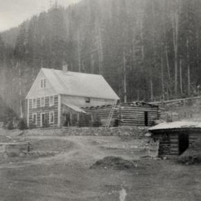
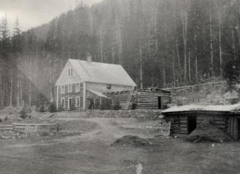
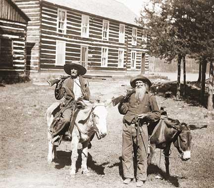
James "Jimmy" M. Stafford was born in 1849 in Wexford Ireland. Jimmy immigrated to Leadville in the 1870's to work in the booming silver mines. In Leadville, he met and married  Deborah Helen Acey (born 1846 in Trenton New Jersey) in 1880.  In the 1880's the couple moved to Dillon and then homesteaded the Stafford Ranch on the Blue River at Spring Creek Road. Jimmy built their home by hand carrying logs from Green Mountain.  They had one son, Frank Elmer Stafford, born in 1886. Jimmy and Deborah also operated the stage stop, boarding house and saloon called the "Halfway House" between Kremmling and Dillon on Highway 9.  It remained in operation until the stage lines ceased in the early 1900's and the buildings were dismantled in the 1940's.  

Frank went on to marry Alice Smith in 1909 and they had six children, including their first, a son, James Elmer, who died at age 8 in the worldwide flu epidemic of 1918. Frank and Alice built the Stafford General Store, directly across from the "Halfway House".  Frank was instrumental in installing the first telephone lines in the area and served as Grand County Commissioner from 1928 to 1936 and as County Commissioner from 1948 until his death from injuries in a car wreck in 1950.  Alice was called the "Blue River Belle" and kept the general store until 1960.  Alice lived in Kremmling until her death in 1969.  


The Ish Family
The Ish Family

The prosperous John Lapsley (Laps) Ish family are an example of very successful settlers and entrepreneurs in early Grand County. The Ish family, with eleven children, came by covered wagon to Colorado from Missouri 1863 and settled on a farm outside of Denver.

18-year-old Laps Ish came to Grand County in 1881 to attempt his luck at the short lived mining boom outside of Teller, north of Grand Lake.  He tried his luck at mining for 4 years and also carried the mail between Teller and Grand Lake, on skis or snowshoes in the winter and by foot in the summer. 

Laps Ish married Alice Shearer and homesteaded near Rand (in present day Jackson County). They had two sons, Lesley John Ish and Guy Lapsley Ish. Laps and Alice built the Rand Hotel and operated it until 1910.  The family then moved to Granby and built the Middle Park Auto Company garage and ran a stage line to Grand Lake. They built the Rapids Lodge by operating a sawmill on the Tonahutu River in Grand Lake and opened for business in 1915  They also built the Pine Cone Inn in Grand Lake and Leslie managed it for many years. Laps Ish died in 1943.

The Norton Family
The Norton Family

From his earliest memories, Mike Norton recalls playing with model ships and submarines with his older brother. His older brother had a ship, and he had the sub. The small pond on the Circle H ranch where he spent his early life before Lake Granby filled up gave little boys' imaginations an ocean. Marbles gave them depth charges. "But I could never find a way to shoot marbles from the sub," Norton laughingly remembers. As the water literally rose above his home, it shaped his life.

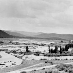
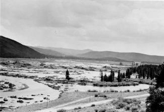
The history of Lake Granby and the Norton Marina goes as deep as the water, literally. Grand County's pioneer ranching history lurks at the lake's bottom, sharing its place with rainbow trout amid the vast water supply for eastern Colorado and beyond. Before the lake filled up as part of the Colorado Big Thompson project, ranches like the Lehmans, Knights and Harveys had been stage stops, cattle and dude ranches and even an airstrip used by Charles Lindbergh.

Mike's dad Frank came to Grand County to ranch. "All I ever really wanted to do  first was to be a rancher here," Frank Norton told the Sky-Hi News back in 1997. At fifteen or sixteen years old, Frank Norton in a Model T Roadster traveled from Okmulgee, Oklahoma to Grand County, where he "fell in love" with the ranch that his mother and step-father started around 1930. The Circle H, started by his step-father Jim Harvey in the valley that is now Lake Granby, became his summer home.

By all accounts, Frank Norton loved ranching. The Circle H "was a working ranch and a dude ranch." Harvey's ranch provided a spectacular backdrop highlighted by the Indian Peaks, reaching 13,000 ft high along the Continental Divide. The Circle H offered a caricature map for tourists looking for a real western experience. It led them over Berthoud Pass along hwy 40 to hwy 34 and then right at the Circle H sign to the Ranch. Leaving on horses from the Circle H, Frank Norton and Jim Harvey took them into a vast and remarkable country that, for the most part, can only be reached on foot today.

In those days, the area now protected as the Indian Peaks Wilderness Area faced less threats from overuse. Ranchers hunted the region to supplement the sometimes skinny winter rations. "Jim Harvey shot two elk from his saddle," Mike Norton proudly recalls of his grandfather as we look at a romantic image of Harvey on horseback. Nowadays, quotas limit use through the peak season. The National Park and Forest Service restrict horse traffic and campfires as well. Early Harvey and Norton history highlight a different time and place, when the remote reaches of Indian Peaks could still be reached by trusting a cowboy with a Winchester rifle to get you there and back safely.

For Mike Norton, the water that drowned out his family's ranching history also floated Norton Marina. Going from ranching to the marina business may seem an odd transition, but Mike's family history shows how flexible they were! Frank Norton spent his early youth traveling with his father's tent show, Norton's comedians. "Dad had such funny stories about that," Mike says. When the traveling troupe era ended (talkies and the Great Depression meant "they didn't eat too well sometimes"), Frank Norton moved to Oklahoma with his father before finally joining his mother and Jim Harvey in Grand County.  

Regardless of his occupation, Frank Norton was a showman. Remarkable old photos save the rich history of pack trips into the Indian Peaks area, camp sites on the shores Lake Monarch and rich harvests of rainbow trout. But Frank Norton and his horse Oak rearing high like the lone ranger really show Frank Norton's flare and charisma.

In many ways, Norton Marina continued the Circle H's heritage. Frank's marina included the Gangplank, a restaurant and dancehall that looked like a boat, with porthole windows and originally a rainbow trout aquarium for the bar. His admiral's hat, which Mike still has today, replaced his cowboy hat and a 25 foot Chris Craft named the Bonnie B replaced old Oak as his ride. More or less, this is the world in which Mike Norton grew up.

Growing up Frank's son meant work too. "I was 8 or 10 years old" when we started "Norton's Ark," Mike smiles, referring to the Gangplank restaurant. It was the early fifties in Grand County. "What backhoe?"

No bailouts either! "Those first few years, I nearly starved to death," Frank Norton once told a reporter. "But," he added, "every year the business kept growing and before I knew it we had a good marina going." Before it was over, Norton Marina fulfilled Frank's dream of a family business, only in "boating recreation" instead of ranching!

"It wasn't all roses," Mike agrees. As a boy, Frank Norton went to military school. "They disciplined him and he used the same technique on his kids." Frank expected his kids to help and to obey his commands, without question. Using Tide and a G.I. scrub brush, Mike Norton recalls scrubbing lower units. They painted wooden boats in the wintertime in the shop. The kids came in from school, changed clothes and started working. "Dad and mom had a lot of kids cause they needed a crew!"

Maybe his most memorable job was cleaning out the septic tanks for the cabins that his dad built to help offset the lack of income at a Rocky Mountain marina during winter. After digging up the lids, "dad would put a ladder into the septic tanks." Then, Mike crawled in and shoveled out the waste while his dad hoisted the buckets out. "I was so glad when Ernie Seipps started his septic clean out business," Mike says as we motor along beside Grand Elk Marina's covered docks on a pontoon boat.

The hard work and experience at the marina paid off when Mike joined the military. Like so many of his generation, Mike received his notice to join ground forces in Vietnam. Luckily, about that time, Navy recruiters were in Granby. They showed a strong interest in a National Honors Society student who lived a life on water! The pieces of the puzzle fit, and "that got me in the Navy," says Mike with real appreciation.

In 1973, the family tradition passed on to Mike and his brother Frank when they bought the marina business from their dad. A lifetime of experience came with them. But it took more than dock maintenance, boat service and customer service to run Norton Marina. And, as the brothers took over, the old Admiral Frank Norton stayed in the house he had built next door to the gangplank, insuring that his strong personality was never far away.

Lots of obstacles exist for a marina on public lands. As Mike took over sole ownership from his brother, he also fought to bring the marina under the National Forest Service instead of the National Park Service, which effectively removed the "power of condemnation." "We had to fight for our livelihood," Mike explained when he sold the Marina in January of 1997.

Mother Nature challenged the marina too. Ice might remain on the water for half of May. June snowstorms blow in monster clouds, as awe-inspiring as the calm sunsets. Freezing rain rips into all but the best prepared boaters nearly any time of year, and hailstorms can hit in a heartbeat. "We're like farmers in that way," Mike recalled. "Drought, winters, high water, low water, you can't really help, we understand that."

On the other hand, the glassy waters of Lake Granby reflect the awe-inspiring Indian Peaks along the Continental Divide on calm, sunny days. Tourists and locals try their luck catching the Mackinaw that makes it attractive to sportsmen and women. Intrepid wake boarders mix with sweet sailboats against a beautiful background of rugged peaks that reach high above tree line. On those days, it's hard to think of a more spectacular place.

Through it all, Mike Norton clearly enjoyed his life at Norton Marina. "I liked being out in the elements with the boating public."  He also counts the independence of self-employment and the uniqueness of the marina as blessings in his "good life."

Grand Elk runs the marina today (2009). Its operation rents out slips and moorings, daily pontoon boats and other related services. It's as beautiful as ever to peer across the lake at sunrise in August, and it's as cold and forbidding as ever when the winter winds whip across the thick ice an snow of the lake in January. Few wooden hulls appear during summer season as in the old days, but beautiful boats, both motor and sail, still surround the Marina.

Yes, its original character remains, not far from the surface. The Gangplank changed its name to Mackinaws, where customers in the main room still look out portholes across the lake to the rugged outline of Indian Peaks Wilderness Area, although there is no longer as much space on the dance floor. Those familiar with Indian Peaks recognize old Abe Lincoln lying in his grave along the Continental divide, where Mike's early ranching family led pack trips and today can still be reached, albeit under more controlled circumstances. Today's anchored concrete docks and gas dock continue the process that started with Frank Norton using finger docks that Mike staked in the ground and an old chicken coup from the Circle H to fuel boats.

And in all of Grand Elk Marina's features and history, Frank Norton and his family exist. In the house that they built on site where all of his children were photographed as they grew up and as they graduated from Middle Park High School. In the restaurant where Mike remembers finding the nerve to ask pretty young gals to dance. And, in the numerous family photos that show a smiling, handsome Frank Norton and his attractive family surrounded by high mountains, wooden Chris Craft and a sense of high expectations.

Mike remembers his dad as the "greatest storyteller I've ever known," which he used to his advantage in all occupations. In 2001, I met Frank Norton, only once before he died the next year. He told us about the time Jim Harvey knocked the federal agent who came to tell take their land away to the floor, placed a foot on his chest and said, "If you get up, I'll knock you down again." We could see it happening as he told the story more than 50 years later.

But the story continues beyond Frank Norton. From traveling tents shows to dude ranches to a forty-plus year family run marina, the Nortons made one of Grand County's most enduring "institutions." Entertaining, industrious, and life-loving, Mike simply says, "It's been a really good life." And that's a family tradition.

Wheatley Family of the Troublesome

Forrest Wheatley was born in Chicago in 1875 and his brother George R. was born 6 years later.  Their parents were English immigrants, William and Mary.  The family moved to Denver in 1887 where William pursued his trade of upholstering carriages.

 After Forrest returned from service in the Spanish American War in 1900, he and George decided to establish homesteads of 160 acres each on the East Fork of Troublesome Creek. When the expansion of the National Forest land limited the growth of their holdings, they moved to Muddy Creek to the west and ran their operation there until 1929.  They continued to purchase additional homesteads on the Troublesome.

 The brothers had a disagreement so Forrest and his wife Ida remained on the Muddy while George moved back to the Troublesome.  He sold the original claims high on the East Fork.  Later he married his neighbor, Bessie Sampson, and they moved back to the Muddy Creek basin and had five children; George, Douglass, Kenneth, Maidie and Gene.  Gene drowned in an irrigation ditch while still a young child.

Through purchases and marriages, the Wheatley descendents eventually owned property throughout western Grand County and as far north as the Yampa River Valley.
 

Articles to Browse

Topic: Mining

Mining

Ghost towns and broken dreams are legacies left by the early miners and prospectors of Grand County. Ever since 1879 when the first mines were staked out and claimed on Bowen Mountain near Grand Lake, “gold and silver fever” grew like an epidemic. Men blinded by greed and prospects of a better tomorrow scrambled to the Kawuneeche Valley with picks and shovels to unearth their fortunes. Women worked just as feverishly along side their men and encampments gave way to mining towns almost overnight. Land offices, eateries, and boarding houses sprouted like wild flowers.

Claim jumping became a common practice, resulting in fights and even murders. Most of these injustices would go unpunished, for no one wanted to risk losing their chance of riches. In Grand County the mother load was a false prophecy, as only small quantities of low grade gold, silver, and lead ore were found. In a few short years, Gaskill, Teller City, and Lulu City, three of the more noted settlements, suffered the same fate as the other boom towns. By 1885 the mining boom had ended in Grand County and ranching had taken it’s place as a sustaining industry.

Topic: Mountains

Berthoud Pass

Berthoud Pass was named for Captain Edward L. Berthoud, who completed the first survey of  this saddle in the main Divide in the spring of 1861.

Berthoud’s expedition of eight people, including Jim Bridger, crossed the Continental Divide at the 11,315 foot summit and established a relatively easy way to get into Middle Park from the east. Berthoud also served as chief engineer on the Colorado Central Railroad.

It is surprising that this famous pass had played no previous role in the history of the region. Even Jim Bridger, who knew the country well, did not learn of its existence until the survey. For reasons of their own, Indians had chosen to go over the divide at higher levels further to the north. One explanation may be that the pass is not evident from most locations on either side of the Continental Divide.

Origins of the Ute People

Before there were any people anywhere, the Creator, "Sinawaf", cut sticks and placed them in a large sack.  After many days, this aroused the curiosity of the coyote.  When Sinewaf was away, the coyote could no longer control himself and opened the sack.

Out came many people who scattered in all directions.  Each spoke a difference language from the others.  When Sinewaf returned, there were only a few people remaining in the sack.  He was furious with the coyote, as he had planned to distribute the people equally in various parts of the land.  As there could now be no such equity, there would be wars among the different people, who would fight for the best locations.

Of the small group left in the sack, Sinawaf called them Ute or Nuche, which meant "the people".  They would be a very brave and strong tribe.

Topic: Regions

Church Park

George Henry Church and his brother John had a substantial ranch in Jefferson Country, prior to Colorado Statehood.  When the Timber and Stone Act of 1878 was passed, it permitted the purchase of land unfit for agriculture for $2.50 an acre.  Thus the Church brothers obtained land in Middle Park for summer grazing.  They would move their cattle into the Park by driving them over the Rollins Pass.   The area they used is just west of the town of Fraser and became known as Church Park.

In 1910, the Church Ditch was created to divert water across the Continental Divide for irrigation.  The remains of this early trans-mountain project can still be seen today at mile marker 241.5 on U.S. Highway 40.

Topic: Water

Early Water Disagreements

As fast as settlers arrived in the county, conflicts arose over water use.  George T. Bell, an early rancher on the Blue River in the 1890's, had water rights coming out of Deep Creek, Spring Creek, and Soda and Iron Springs.  Daughter Maud Bell had married James Mugrage and when her father died in 1925, she and James stayed on the ranch of about 800 acres, to operate it.  She reported years later that when Noonen, a large rancher also on the Blue, built his ditch, he took much of the Bell water and used it for his own benefit.  Many years later, Maud discovered that although her father was long dead, those early water rights still belonged to the Bells, not the Noonens. 

Another family, that of George Henricks, settled far up the Troublesome Valley, about 1900, in what was truly an inaccessible spot.  What possessed him to pick such a remote area for his ranch?  Because when he and his wife Aurille lived in Nebraska and tried to make a living on their farm, farmers upstream stole their water to the point that they couldn't keep their crops alive.  Aurille actually had to use the same batch of water for two or three purposes!  As water fights escalated, George vowed to find a place where nobody could be above him and his water source. Rancher Will Call took him far up the Troublesome valley to a large meadow, reachable only by foot or horseback.  Life wasn't easy, for George and Aurille had to do everything from scratch, and they lived in a cabin with a dirt floor for many years.  But nobody took his water! 

Even more recently there was a case on Crooked Creek, where a ranching family that owned quite a good spring and used it to water their hay, discovered that a new neighbor was diverting the water from the spring over onto his own land, to water his own hay!  The rancher protested and diverted the water back where it belonged.  The newcomer turned around and stole it again.  This situation went on for many years without good satisfaction.

The Kirtz Ditch development on the Troublesome began about 1890.  In 1911, an Elias T. Copelin homesteaded land, later adjacent to the Alexander and George Murray Baker ranches.  One day Copelin and Murray Baker, one of the brothers, got into an argument over water rights in the Kirtz Ditch, each accusing the other of stealing his water.  Murray, who was a little guy with a fierce temper, picked up a shovel and gave Copelin a mighty whack with it.  Copelin fell to the ground but after a bit picked himself up, climbed on his horse, and headed toward his home.  However, the blow must have damaged his brain because he was found the next day, dead on the ground at his own gate

High on Meadow Creek, in the early 1900's, lumber activity began in the area later known as Sawmill Meadow.  About 1910, the Western Land and Flume Co. put in a little dam near what is now the trailhead to Columbine Lake.  The resulting lake, today filled with water lilies, was used as a holding pond for logs that would be moved by flume to the main mill downstream in Tabernash.  This lumber company sold to Western Box & Lumber Company in 1912.  Business flourished.  There was even a short railroad going into the woods, with the tracks made of logs about 6" to 8" in diameter.  Prospects looked good.  However, from the beginning water rights were an issue. Some people say it was Nathan Hurd who broke the company.  Western Box had lost some of its water to the Strawberry Ditch (going to Granby) in 1914.  More trouble was looming.  Hurd wanted to keep the water from the little reservoir for the ranchers and lettuce farmers below.  The timber folks wanted to use the water during the summer months to keep the flume going.  Nobody was willing to give up anything, so in 1915, the big mill closed.   Still, efforts continued.

Then in 1919, the planing mill at Tabernash burned.  In the early twenties, further contention led to the withholding of more water from the lumber companies who wanted permission to ditch Trail Creek water across into Meadow Creek, replacing water taken higher up for the flume and Strawberry Ditch.  This would have been quite easy because, about seven miles out of Tabernash is a nearly flat saddle that exists between the two creeks.   Nevertheless the Hurds wouldn't hear of it.

Then one Henry Jarvis showed up on the scene.  He was known to all the timber men.  In 1923, Jarvis, using a box of TNT, "blew the dam" of the irrigation reservoir at Western Box.  People suspected that he did it for T.S. Huston, one of the big lumber powers of the area.  The feeling was that "if the lumbermen couldn't have the water, neither could the ranchers and the Granby farmers."  In any case, that basically was the end of Western Box Company. 

Topic: Skiing

Barney & Margaret McLean

It was the spring of 1924 when an 8-year-old girl from Hot Springs, Ark., arrived in Hot Sulphur Springs by train to spend the summer with her aunt and uncle Hattie and Omar Qualls, homesteaders from Parshall who had recently purchased the Riverside Hotel. It wasn't the first time Margaret Wilson had been to Hot Sulphur. Her father had tuberculosis and was frequently prescribed treatment at the sanatorium on the Front Range. She was 6 years old the first time she made the train trip.

She remembered a boy and girl twin she had befriended on her first visit. When she saw the twins again on this second visit, they told her there was a boy in town who was calling her his girlfriend. His name was Lloyd “Barney” McLean. Margaret made sure to attend the opening of the new school in Hot Sulphur that spring (now the location of Pioneer Village Museum).

When Margaret first laid eyes on her future husband, she wasn't all that impressed. “I immediately knew who he was, and I thought, ‘Ugh.'” He was wearing wool knickers, leather boots, a V-neck sweater and a flat cap. “He had white hair and millions of freckles,” she recalls.

That white-haired boy from Hot Sulphur went on to become one of Grand County's earliest and most heralded Olympic skiers. He and Margaret would eventually travel the world together. They danced with Hollywood stars and shook hands with presidents. But their love story began right there, in a that little neighborhood schoolhouse. “We all had a crush on Barney until Margaret came to town, then it was all over,” one of Margaret's best friends used to say. At some point, she said, the banker's son asked her out, but she found him dull compared to Barney.

Barney was the oldest of 10 children — five boys and five girls. When the family outgrew the house his dad built a tiny shack for Barney in the backyard. Barney was barely big enough to see over the dashboard when he started driving a truck for his father's garage, which was located just up the street from the hotel. He was just 12 years old when he drove a load of dynamite over Trough Road.

There were stories of the brakes overheating on Rabbit Ears Pass and Barney riding down on the fenders in case he had to bail and hairy trips over Berthoud Pass. Margaret said she never realized how good Barney was at skiing. He worked all the time driving the truck (his dad pulled him out of school for good in 10th grade), and he would head straight to the jumping hill in Hot Sulphur after work and wouldn't come home until after dark.

“He didn't have the proper clothing,” Margaret said. “He wouldn't even be able to open the door when he got home and he would stand at the door crying until his mother let him in.” His mother would bring him in, take his boots off and put his feet in a bucket of hot water to thaw them. “For him, it was skiing for the joy of skiing,” Margaret said.

Barney raced on the weekends. Margaret rarely made it out of the restaurant to join him. It never struck her that skiing would someday become her husband's career. “He was never one to blow his own horn,” she said.

He qualified for Nationals in jumping in 1935 at age 17, and his dad gave him a quarter to make the trip. "Here was a kid from a town that nobody had ever heard of who shows up at Nationals and wins it," his only child Melissa McLean Jory said. He qualified for the 1936 Olympics but was badly hurt on a wind-blown landing that winter and missed going.

Margaret returned to Hot Sulphur almost every summer of her life after that, and by the time she was a teenager she was working for her aunt full time. “My friend Telly and I were the best waitresses in the county,” she said.


Hot Sulphur had four ski hills back then and Margaret recalls that in February 1936 the Rocky Mountain News sponsored an excursion train to the 25th Annual Winter Carnival in Hot Sulphur. More than 2,000 passengers arrived on three trains that weekend. (That same train later became the official ski train.
“There were no restrooms and no restaurants except for the hotel,” Margaret said. The Riverside was inundated. It was shoulder-to-shoulder people, she recalls.

There wasn't much to do for fun in Hot Sulphur back then, like now, so the young couple would drive up to Grand Lake — to the Pine Cone Inn — on summer nights to dance. It cost 10 cents per dance, and since they didn't have much money, they would have just three dances ... “Oh, Barney could dance,” ... drink a Coke and then drive home. Margaret would wait by the front window of the hotel to watch for Barney, who she knew would be going to meet the train at 11 a.m.

One time, she was out there waiting, the snow was still piled high, and Barney got so caught up looking for Margaret in the window that he nearly ran the truck off the bridge. The only thing that saved him from plummeting into the river was the dual wheel that got stuck in the steel girder.

Barney was 19 in 1937 when the couple married, not old enough for a marriage license and barely able to afford the suit he bought to get married (the first suit he ever owned) not to mention a big wedding. The couple eloped in Denver. Shortly after they married the couple started traveling the country for ski races and Barney switched from ski jumping to slalom. He was named as an alternate for the 1940 Olympic squad after skiing alpine for only two years.

But, then the war came and everybody was signing up. Barney, with his skiing experience, would have been a perfect candidate for the 10th Mountain Division, but another Hot Sulphur friend who had already joined wrote and said, “Don't join this outfit. It's a mess.” So he signed up for the Air Force instead. As luck would have it, somebody recognized his name as it came across his desk, and Barney was assigned to the Army Air Force Arctic Survival School in Edmonton, Alberta, Canada, where he was in charge of teaching pilots how to survive in snowy conditions should their planes go down.

Margaret came back to Hot Sulphur during the war and worked in the county courthouse. After the war, Barney earned a spot on the 1948 Olympic team. After that, he went on to work for the Groswold ski factory in Denver, losing his amateur status and disqualifying him from FIS ski racing. He was inducted into the US National Ski Hall of Fame in 1959 and the Colorado Ski Hall of Fame in 1978.

Barney had spent his whole life on the snow. He skied all over the world, from Europe to South America. "But Hot Sulphur Springs was always home to him," his daughter said. "He was an ambassador from Hot Sulphur wherever he went."

Barney was 3 years old the first time he skied and he skied the spring before he died — at Mary Jane in 2005 — in a foot of new snow. His grandsons skied down with him, wing men on either side. His health was bad that last time he skied, and he had a hard time walking from the car to the chairlift. But as soon as he hit the top of Mary Jane Trail, everything eased, Melissa said: "He could ski better than he could walk." It was the things that made Barney McLean a world class skier that Margaret loved most: He loved speed. Bumps didn't bother him. And, when faced with a challenge he just picked a line and was gone.

Topic: Water

Onahu Creek

Onahu Creek was called Fish Creek and is a tributary of the North Fork of the Colorado River. The name refers to one of the Indian race horses who came up to a campfire to warm himself, and the name means “warms himself“.  The horse ultimately died on Fish Creek and gave his name to the waterway.

Smiths of the Blue River

Frank John Smith was born October 5, 1852 in Granby, New York.  He married Elizabeth Olive Sanders, who was born in 1860 in Hannibal, New York.  They were married in 1878 in Hannibal and had two children Albert and Lelah.  Albert died as an infant in 1881.  In 1880 Frank homesteaded his ranch close to the Blue River and sent for his wife and baby daughter who came West by train to Dillon in the spring of 1883.

They had 10 more children, all born at the Smith Ranch, between 1884 and 1907.  As the boys grew into young men, they homesteaded additional acreage around the ranch.  The youngest son, Earl, operated the Smith Ranch until 1958, when it was sold to Ted Orr Sr. His son, Ted Orr Jr. and his wife, Virginia Smith (granddaughter of Frank and Elizabeth) operated the ranch until 1967, when it was sold to the Berger brothers.    

Topic: Regions

The Blue

Because gold had been found at the headwaters of the Blue River at Breckenridge, hopes were high among prospectors who worked the downstream tributaries in Grand County.  However, this lower section of the Blue contained no mineral wealth. 

The Denver and Rio Grand Railroad planned to run a route through the valley and began constructing grades, but the tracks were never laid because Moffatt's railroad crossed the county first.

An enterprising Canadian, 25 year old Willis Charles Call, had been employed as a cook for the grading company in 1881.  When the railroad abandoned the project, Call became a registrar of voters, and in 1886, the county assessor.  By 1890, he had a choice ranch near Kremmling.  His Austrian wife, Mary Rohrocher, was a very popular hostess.  It is believed that they owned the first automobile in the county.

The conflicts between the white settles and Ute Indians came to a climax in 1878 when the Ute leader Tabernash was killed by a posse and the very next day, Abraham Elliott a homesteader on the Blue, was killed in retaliation.  The remains of his ranch can be seen on Highway 9 at mile marker 135. 

Across the river was the ranch of Henry Yust, who settled there in 1885.  Another early ranching family was that of Thomas Pharo, An Englishman from Franham in Surry, near London.  Settling there in 1880, he developed a major cattle and horse ranch. 

The Blue River area was connected with a route west in 1913, when the co-called Trough Road was constructed, beside the Gore Canyon to State Bridge.

Topic: Places
Spruce Lodge

The search for Spruce Lodge

Spruce Lodge

 You gotta love a mystery! My curiosity rose, my anticipation of being the one with the real story was more than my appetite could stand. I looked at pictures, figured angles, mused at what other people said, reviewed topographic maps and finally said to myself “it just can’t be.” The terrain doesn’t look like that. It isn’t two miles from the last switchback on Hwy 40. I don’t care what the writing on the back of the pictures say. 

I want to know once and for all, where is the real location of Spruce Lodge? How can it be located so everyone will agree. I’ve got it, find an expert wilderness person with my same curiosity. As fate would have it, entered Debora Carr, author of Hiking Grand County Colorado, complete with pictures, maps, GPS coordinates and trail narratives. Her coauthor Lou Ladrigan also caught the bug. “We can find it.” 

Exploration began early in the spring but the snow was just a little too deep to find any artifacts. Failed attempt, but the appetite was there. Wait till the snow melts in the trees. Again, as fate would have it, entered Carol Hunter. Carol has been instrumental in the efforts to resore the Berthoud Pass wagon road. Carol has lots of maps and pictures of the development of the wagon road and just happened to have an original U.S. Bureau of Public Roads 1920 survey map for the construction of Hwy 40 from Empire to Fraser. I loaded it into the computer, expanded the image and found lots of strange numbers. Almost like mile markers. Carol said they were numbers used by the work parties. They seemed evenly spaced and the map had a distance legend. It even had a marked location for Spruce Lodge. I couldn’t wait to add this map to Deborah and Lou’s reference material.

Armed with new references, Debora and Lou hiked both sides of Hwy 40 from the switchback to the entrance to Mary Jane. Looking for artifacts, existence of remnants of the old wagon road, foundations and terrain that matched the photos in the GCHA collection. A couple places looked promising, but not quite. Finally, a white station post number 390 was found lying on the ground on the west side of today’s Hwy 40. Then another white station post was found to the south, number 380. That was a match! Just what we needed. That confirmed the surveyor L.J. Young’s map. To the south of 390 a flat part of ground revealed what looked like part of a foundation and surrounding the location were remnants of discarded cans and possible buildings. A two holer! Now check the terrain with the pictures. Well maybe. Don’t forget that Hwy 40 didn’t exist. Step back and look from the east side of the existing Hwy. A great match with the slope and tree line. This was it! Just .9 miles North of the last switchback.


Early Families