Indian Legends

Indian Legends Articles

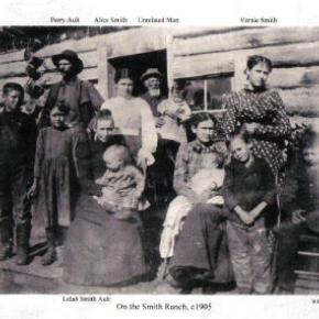
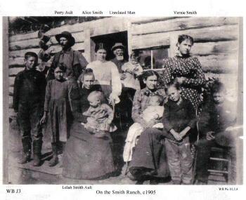
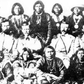
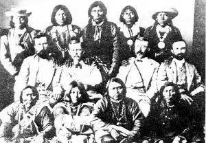
Origins of the Ute People

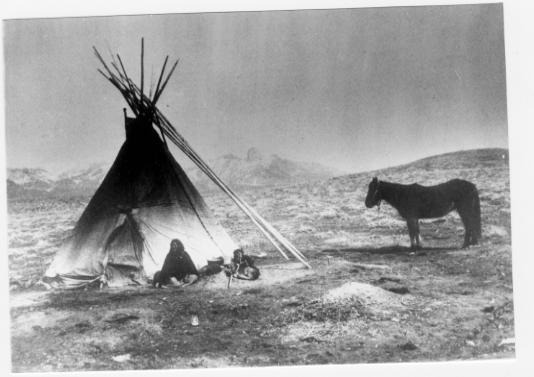
Before there were any people anywhere, the Creator, "Sinawaf", cut sticks and placed them in a large sack.  After many days, this aroused the curiosity of the coyote.  When Sinewaf was away, the coyote could no longer control himself and opened the sack.

Out came many people who scattered in all directions.  Each spoke a difference language from the others.  When Sinewaf returned, there were only a few people remaining in the sack.  He was furious with the coyote, as he had planned to distribute the people equally in various parts of the land.  As there could now be no such equity, there would be wars among the different people, who would fight for the best locations.

Of the small group left in the sack, Sinawaf called them Ute or Nuche, which meant "the people".  They would be a very brave and strong tribe.

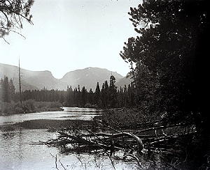
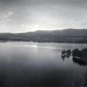
The Ute Legend of Grand Lake

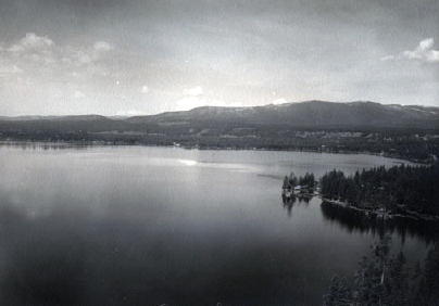
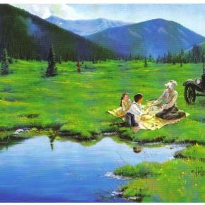
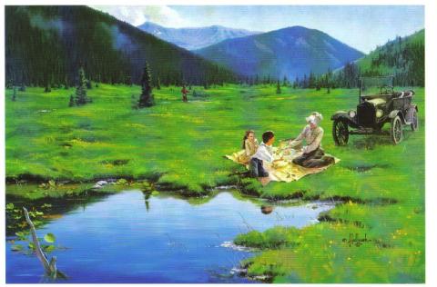
A group of Utes were camping on the shores of Grand Lake when they were suddenly attacked by an enemy tribe of the Arapaho (and in some versions the Cheyenne as well).  As the brave Ute warriors began fighting, the women and children were hurried onto a large raft for safety and pushed to the middle of the lake.  As the battle continued, a treacherous wind overturned the raft and all the women and children were drowned. Many Ute warriors were also killed during the fighting. 

The legend holds that you can still see ghostly forms in the morning mist rising from the lake and hear the wailing of the lost women and children beneath the winter ice.  The Utes avoided the lake for many years because of these tragic events and evil spirits.

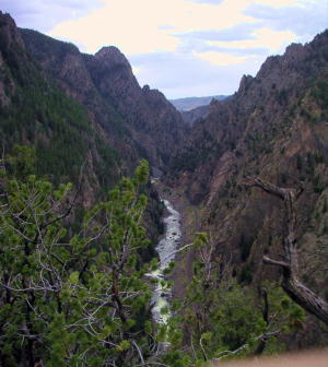
Ute Legend of Canyons

Major John Wesley Powell was in the first party to make a recorded climb of Pikes Peak in 1868.  Later, he would lead the first expedition of the Green and Colorado (Grand) Rivers. He was very interested in the Indian tribes that he encountered and later became head of the new U.S. Bureau of Ethnology.  He recorded this legend as told by the Utes on his first visit to the Colorado mountains, during his Pikes Peak climb.

A chief of the Utes mourned the death of his beloved wife, and his grief was so deep, that no one could console him.  Then the Great Spirit, Ta-Vwoats, appeared to him and promised to take him southwest to where he could see where his wife had gone, if he would promise to grieve no more.

Ta-Vwoats rolled a magical ball before him and it crushed mountains, earth and rocks, making a trail to the land of the afterlife.  Following the ball was a rolling globe of fire which the Great Spirit and the chief followed.  At last they were in the happy land where all was blessed with plenty and joy.  This was where the chief's wife had gone and he was glad to see it.

When they returned, Ta-Vwoats told the chief that he must never travel that trail again during life and warned all the people against it.  Knowing that those who had lost their loved ones would be tempted to make the journey, Ta-Vwoats rolled a river into the canyons so that no one could enter.

Ute Legend of the Quaking Aspen

It is amazing to behold the continuous quivering of aspen leaves in groves around Grand County, even when there is no apparent breeze.

According to Ute legend, the reason for this unique aspect of the aspen tree happened during a visit to Erath from the Great Spirit during a special full moon.  All of nature anticipated the Spirit's arrival and trembled to pay homage.  All except the proud and beautiful aspen. The aspens stood still, refusing to pay proper respect. The Great Spirit was furious and decreed that, from that time on, the aspen leaves would tremble whenever anyone looked upon them.

Ute Legends of Hot Sulphur Springs

Ages ago, there were many Ute Indians who enjoyed life in Middle Park with its plentiful game and lush meadows.  They lived in peace and harmony for "as many years as there are hairs on the head."

In spite of this idyllic life, there was one young brave who yearned for more adventure and material goods.  He proposed that the Utes attack the Sioux, who lived beyond the mountains on the plains of the rising sun.  As victors, they would return in glory with much wealth and many captives.

Spiquet Pah (Smoking Water) was an elderly medicine man who foresaw only grief in the prospect of such a war.  He spoke before a council meeting, warning of the devastation that such an action would bring upon the tribe.  He foretold " As the North Wind soon brings the snows and death of winter, so will he bring sorrow and death to our own people.....if you do this, strength and peace and plenty will be but for a few; joy will be seen no more."

Disregarding his warning, most of the young men were tantalized with the temptation of the grand adventure of such a conquest.  In the autumn of the year, when they usually did their hunting, the young men rallied behind the young brave and followed him over the Great Divide into combat with the plains people.  As the fighters departed, a saddened Spiquet Pah went into the heart of the mountain "and pulled the hole in after him."

The young Ute men found the enemy better armed and organized than they expected. Many Ute braves were killed and others were taken as slaves. The prophecy had come true as starvation and disease plagued the tribe as there were too few men to hunt for food. The old man sat on his haunches beside his subterranean fire which he heated water from an underground stream.  From the mountain at Hot Sulphur Springs, water flows even today as a reminder of the rash behavior of so long ago.

Another legend holds simply that the Hot Sulphur Springs water acquired medicinal qualities in answer to the prayers of an old chief who has be left by his tribe to die.  The old man built fires within the mountain, and after drinking the water and bathing in them, we was restored to health and rejoined his people.

Articles to Browse

Topic:

Places in Grand County

Click on the drop-down menus and discover the history behind some of the everyday places you visit in Grand County.

Grand County was established in 1874 by the Territory of Colorado, thus becoming a county two years before Colorado became a state. It was named for the Grand River, the name by which the Colorado River was known at that time. 

The headwaters of the today's
Colorado River are in Grand County. The county was formed from a portion of Summit County but acquired its current boundaries in 1877, when part of the Grand County was used to create Routt County.

The county seat is Hot Sulphur Springs. The area of 1,854 square miles (larger than Rhode Island) consists of meadows, river valleys and mountains.

Sources:
R.C. Black,
Island in the Rockies. Pruett Publishing Company, 1969
William Bright,

Colorado Place
Names. Johnson Publishing Company, 1993
Hafen and Hafen, Our State:
Colorado. Old West Publishing Company, 1971

Christmas in the Mountains 1951

It was my first Christmas in the mountains. Not only that, but it was my first time to be part of a vacation in a cozy ski inn.  This was at Millers Idlewild Inn in Hideaway Park (now the town of Winter Park). I had been married only eight months. Dwight and I had worked hard, getting everything in order: ­clean beds, fresh spreads and curtains, floors shining and bathrooms sparkling.  The woodpile was full and food supplies ready.  Our plans for evenings were laid out too. Dwight would do movies. His brother Woodie would call square dances, with former Moffat Road engineer George Shryer accompanying on the fiddle and his wife, Grace, chording on the piano.  Tom Smith would bring his sled and team of horses, to take happy folks along snow-packed roads for sleigh rides, to the tune of jingling bells. Games were at hand, along with a fine supply of books on the shelves. We expected a wonderfully busy two weeks, which was a good thing, because it had been a long time since our last income, before Labor Day.

Family and friends were coming tomorrow to give a hand over the holiday, and then the fun would begin. As the first guests arrived, I stepped outside, and lifting my nose, I thought, "I smell snow!"  Great!  The area already had a pretty good covering, so that when people called and asked, "Is there snow yet?  Should we come on ahead?" we could gladly say, "Come." That night it snowed,­ 12" of beautiful soft flakes.  Skiers were overjoyed. Dwight got out early to shovel, plow, pull people out of drifts, take others to Winter Park Ski Area, three miles away. That evening we heard that almost no stumps or rocks were evident on the slopes; all had been buried. The next night it snowed again ­ 12" of beautiful white stuff.  We were amazed.  But Dwight got out early to shovel, plow, pull people out if drifts, and take others to the area.  The following night it snowed again, and every night for a week, it snowed, dumping heaps of snow on the whole valley.

Winter Park Ski Area, in those days, wasn't open on Christmas Day; the management wanted to let its employees have the day at home with their families.  So we took our guests to the top of Berthoud Pass; from there they could ski down Seven Mile Trail and we met them at the bottom.  The day after Christmas began the busiest days of all. Back then, many families didn't leave home until the 26th. This was fine, until the passes closed from heavy snows and avalanches. Then visitors, who had to leave, couldn't drive out, but people who were coming by train could still get in!  We had a problem.  The parking lot was jammed with rental cars.  Although some folks went ahead and left by train, many families stayed on.  The rooms were completely full and after all, newcomers were entitled to their reserved space. We had guests stashed all over the lounge, extras in the dorms, and extras in the cabins.  What a crowd it was. I hardly had time to think. 

I cleaned all morning, helped set tables and serve, did dishes, sometimes hauled skiers to or from the area, kept up with the office work, and joined in entertaining folks in the evenings. Thank heaven for family and friends!  There never was such a hectic week. But the Miller hospitality at Idlewild kept our visitors relaxed and happy. Truly, it was a jolly time, with tired skiers loafing in front of the fire, doing puzzles or playing games.  There was always a group playing canasta after dinner, in the dining room, and peals of laughter would pour forth when somebody won a great hand. At last New Year's Eve came and went. The rental cars had gone back to Denver.  The rooms were empty.  We were alone except for a couple of guests.  Making our path through the deep drifts, Dwight and I went home and flopped down on our own sofa.  I heaved a sigh, saying, "Well!  So that's what Christmas in the mountains is like.  I had o idea there would be so much snow."  Little did I know that for Christmas, 1952, we would still have the crowd of guests, but there would be hardly any snow until January!

Topic: Regions

The Blue

Because gold had been found at the headwaters of the Blue River at Breckenridge, hopes were high among prospectors who worked the downstream tributaries in Grand County.  However, this lower section of the Blue contained no mineral wealth. 

The Denver and Rio Grand Railroad planned to run a route through the valley and began constructing grades, but the tracks were never laid because Moffatt's railroad crossed the county first.

An enterprising Canadian, 25 year old Willis Charles Call, had been employed as a cook for the grading company in 1881.  When the railroad abandoned the project, Call became a registrar of voters, and in 1886, the county assessor.  By 1890, he had a choice ranch near Kremmling.  His Austrian wife, Mary Rohrocher, was a very popular hostess.  It is believed that they owned the first automobile in the county.

The conflicts between the white settles and Ute Indians came to a climax in 1878 when the Ute leader Tabernash was killed by a posse and the very next day, Abraham Elliott a homesteader on the Blue, was killed in retaliation.  The remains of his ranch can be seen on Highway 9 at mile marker 135. 

Across the river was the ranch of Henry Yust, who settled there in 1885.  Another early ranching family was that of Thomas Pharo, An Englishman from Franham in Surry, near London.  Settling there in 1880, he developed a major cattle and horse ranch. 

The Blue River area was connected with a route west in 1913, when the co-called Trough Road was constructed, beside the Gore Canyon to State Bridge.

Topic: Mountains

Rollins or Corona - What shall it be called?

Travel across various passes of the Continental Divide occurred long before white men showed up. Indeed, as anthropologist James Benedict wrote c. 1975, some 10,000 years ago, prehistoric Indians camped, hunted, and built hunting walls on the upper reaches of Rollins Pass, as well as moving in and out of Middle Park for the warm summer months.

Historic Indians followed the same paths. In the earliest days of non-Indian access, a particular pass at the head of Boulder Creek was dubbed Boulder Pass. Capt. Jacob Bonesteel, including wagons, made the first recorded crossing by a white man at this point in April 1862. Three years later, a group of Mormons brought wagons over this route and a year later, promoters of new roads into Middle Park brought in many wagons and livestock.

In fact, tourists were starting to enter the park by a number of routes, and one of them, Samuel Bowles, who wrote a fascinating account of his trip, including his return to Denver via Boulder Pass. Interest was growing rapidly for a road over the Divide, into Hot Sulphur Springs, and on into Utah. One promoter, John Quincy Adams Rollins, from New Hampshire, teamed up with William N. Byers and Porter M. Smart to carry this project through. Rollins was interested in crossing the Divide; Byers was promoting the Springs; Porter wanted to develop the valley of the Middle Yampa. All three were pushing to have Middle Park officially named as Grand County, a challenge finally accomplished in 1874. So Rollins and associates started his road, reaching the top in 1873.

That next winter, they publicized this access and in June, Jimmy Crawford brought his family and wagons to Rollinsville and thence to Yankee Doodle Lake, ready to cross the pass now named Rollins Pass by the developer. But the road ended, and they found Rollins' men still hacking the road out of the granite! Jimmy and his crew found it necessary to leave their wagons and help. Finally, on June 10th, the family was able to head for the top. Jimmy borrowed two yokes of oxen, hitching them to mules, and then to his horse. The road was so rough that the procession could proceed but a few feet before having to rest. The family itself climbed on foot. At the summit, they discovered only a rough swath cut down through the trees on the western side. The "road" dropped down between the lakes and followed Ranch Creek to its junction with the Fraser River.

Rollins quickly realized that Berthoud Pass, which also opened in 1874, was superior to his own pass for wheeled vehicles, so he determined to hedge his bets. He initiated the first mail service into the county in 1873. He also built a commodious hotel where his road joined the Berthoud Pass road at the confluence of Crooked Creek and the Fraser. He called it the Junction House. Next, he proposed to the builders of Berthoud Pass that they form a joint ownership of the two roads between Junction Ranch and the Springs. Tickets would be issued for both routes and revenues would be shared. The two companies would build a bridge over the Grand at Hot Sulphur Springs. He even buttered up his rivals by complementing their work. All this was accomplished, although the mail route soon moved to Berthoud Pass, because of the severe winters on Rollins Pass.

The bridge was started in November 1874. From the beginning, Rollins' road was preferred for trailing livestock, because there were fewer problems with heavy timber and bogs. For years, the Church brothers, George and John, who introduced the Hereford breed into the county, trailed their cattle for summering in what became known as Church Park. However, tourists such as Irving Hale still drove wagons over Rollins Pass in 1878. About 1880, interest burgeoned for bringing a railroad up South Boulder Canyon and through a tunnel near Rollins Pass. Numerous surveys were completed all along the area. David Moffat settled on Rollins Pass for the tunnel site but decided first to put a temporary line over the top.

Thus, in the summer of 1903, a formal contract was let for work up and over the Pass itself. By 1904, the workers reached Arrowhead and they also built a work station on top, called Corona Station, or "crown of the mountain." This railroad construction town of Corona, located at over 11,600 feet at the top of Rollins Pass (first called Boulder Pass) along the Continental Divide was the highest railroad station in the world. It became obvious by 1905 that the Corona area would require snowsheds if trains were to travel, even irregularly, during the winter. Still, word got out of the spectacular splendor of Rollins Pass and tourists flocked in on summer train excursions, sometimes stopping on top, sometimes going as far as Arrow.

In 1913, a fine hotel was built next to the rail facilities. Because Rollins Pass was right in the middle of severe weather patterns, a weather station was built on top, as well as one down at Sunnyside. In 1915, Rollins Pass was actually proposed to be the south boundary of a proposed "Estes National Park." Later, on the National Historic Register, the district was listed in 1997 as the Denver, Northwestern and Pacific Railway Historic District--Rollinsville & Middle Park Wagon Road. It was also identified as the Rollinsville and Middle Park Wagon Road; Boulder Wagon Road, Rollins Pass, and Rollinsville area. In 1956, Governor Steve McNichols had presided at the official re-opening of the four percent grade to vehicle traffic over Corona Pass, expressing the hope that the route would someday be paved. The Colorado Game and Fish Department and the U.S. Forest Service made additional improvements, and the Arapaho and Roosevelt National Forests put out a 24-page booklet titled "The Moffat Road: A Self-Guiding Auto Tour."

The road crossed two of the original railroad trestles near Corona but those trestles, even if reached by 4-wheel vehicles, were crumbling and could no longer even be crossed safely on foot. The current self-guided auto tour refers to Rollins Pass, as well as the Moffat Road and the Boulder Wagon Road. Corona Station and Hotel are discussed. In 1979, a portion of the auto road over Corona Pass was permanently closed because of a cave-in of the "Needle's Eye," a tunnel located before the trestles heading west from the Moffat Tunnel's East Portal. The tunnel reopened on July 3, 1988, thanks to efforts of the Rollins Pass Restoration Association on both sides of the Divide, with the cooperation of the U.S. Forest Service, Colorado History Society, and Boulder, Grand, and Gilpin Counties. It then closed once more when another rockfall hit the tunnel on July 15, 1990. The RPRA is continuing its efforts for re-opening. The noted photographer, Charles McClure, took many outstanding photos of the Rollins Pass road.

One, titled "Group on Rollins Pass, shows well-dressed men and women stand on a snowfield making snowballs on Rollins Pass, Moffat Road, Boulder or Grand County, Colorado; probably on Denver, Northwestern and Pacific excursion train. Date: between 1904 and 1913 near Corona Station." Another photo shows a "30 ft. snowcut on Rollins Pass, Moffat Road photo. Denver and Salt Lake Arrow passenger car is parked east of Corona snowshed by the thirty foot snowbank cut, Rollins Pass, Colorado; it shows men, women and railroad employees posed behind train, on the roof and on the snowbank and a standard gauge track. Date: between 1904 and 1915." A sign at the highway turn onto the Moffat roadbed says: The Moffat Road "Hill Route" Also called "Corona Pass Road", this road over the Continental Divide was the original "Hill Route" of the Denver, Northwestern & Pacific Railway built by David H. Moffat in 1903. It crosses Rollins Pass at 11,666 feet elevation. On top of Rollins Pass, a sign says: Elevation 11, 660 feet, John Quincy Adams Rollins established a toll wagon road through this pass in the mid 1870's. David H. Moffat's Denver, Northwestern & Pacific Railway crossed the Continental Divide at this point in 1903.

First known as Boulder Pass, then Rollins Pass, the railroad workers dubbed it "Corona", the crown of the "Top of the world." A railroad station, hotel, restaurant and workers' quarters existed here until 1928 when the railroad was abandoned due to the building of the Moffat Tunnel. Identifications in various trail and geographical guides say: Rollins Pass (el. 11,680 ft) is a high mountain pass in the Rocky Mountains of north-central Colorado in the United States. The pass is located on the continental divide at the crest of the Front Range southwest of Boulder, at the boundary of Grand County, Colorado and Boulder County, Colorado. Rollins Pass (a.k.a. Corona Pass) sits approximately 5 miles east and above the popular ski areas around Winter Park, between Winter Park and Rollinsville. The pass is traversed by an unpaved road, mostly the former roadbed of the Denver and Salt Lake Railway which abandoned the route in 1928 when the Moffat Tunnel opened to replace it. Railroad advertising called this the "Top O' the World" and it referred to the Moffat Route over the continental divide and the Rocky Mountains. Rollins Pass was the primary travel route west from Denver until an easier road over Berthoud Pass was constructed. The Denver, Northwestern and Pacific railroad laid its tracks across the pass in 1903-1904 and established a Depot at Corona on the crest. It can be noted that in R.C. Black's Island in the Rockies, the term "Corona Pass" was mentioned one time, on p. 351; the terms "Corona Station" or "Corona Snowsheds were used. In Dismantling the Rails That Climbed, Rollins Pass was used, the Corona hotel, and just once, Corona Pass; 1936.

In Maggie By My Side, it was Boulder Pass and Rollins Pass. In Rails that Climbed, Rollins Pass, the Corona shed, weather at Corona, Rollins Pass Snow Shed, other references to Corona as a site. In Guide to the Colorado Mountains (Orme) , they speak of the Corona Trail to Rollins Pass. High Country Names (Ward) used Rollins Pass entirely. Only Hiking Grand County, Colorado, published 2002 by Carr speaks of Corona Pass, with reference to Rollins Pass (near the town of Corona), Moffat Road. The term "town" might be questionable; there was only a small restaurant, workers quarters, railroad offices, and in 1913, the hotel. Current maps, USFS and the Grand County Trail Map, show Rollins Pass, with Corona at the side as being a site. The use of "Corona Pass' seems to be a rather recent innovation that has come into being with tourism efforts in the upper Fraser Valley. Rollins Pass From Island in the Rockies p. 45 Rollins Pass was originally known as Boulder Pass, first recorded being crossed by whites, by Capt. Jacob Bonesteel in April 1862. Their supplies were carried in wagons. A second organized party went over the same pass in 1865. In 1866, promoters of access into Grand County brought many wagons and livestock over Boulder Pass.In 1867, Samuel Bowles and a group returned home to Denver via Boulder Pass. In 1873-74, two roads were proposed into the county, one of Berthouds pass and one over Boulder Pass. This was the same time that the county was named "Grand". J..A Rollins and his associates started the road and reached the top of the pass in 1873, at which time they envisaged a road from HSS into Utah. The first wagons went over in June 1874. The western descent was so bad that it never was much patronized by wheeled vehicles, instead becoming primarily used for trailing of cattle. At this time the name Boulder Pass disappeared from maps and Rollins Pass became the official name. p. 85. p. 80 Lots of schemes to build roads into GC, but of all the schemes for transport, only one, the Rollinsville and Middle Park Wagon Road showed any promise. T

hat was designed by John Quincy Adams Rollins, from NH, a gifted promoter, a son of a clergyman, second of 19 children. He was a farmer, miner, freighter, road bulder, and platter of towns. He was perhaps the most accomplished billiard player west of the Mississippi. He was a Colorado resident at least by 1866. His finances were up and down, but he was tremendously strong. In December 1884, when he was 68, he thought nothing of a 3-day snow-clogged crossing of the Continental Divide. p. 85 Rollins was interested in MP as an investor and he was interested in extending his road into Utah.. At the same time, a Porter M. Smart was likewise excited about speculating in frontier projects and was working at developing the valley of the Middle Yampa. William N. Byers was busy planning for HSS. These three men launched at least two petitions, with more than 80 "residents" for creating GC. Grand County was created that year, 1874. p. 89 With the creation of GC, people began to consider the area more seriously. p. 92 There was no official mail into the county until 1873 when Rollins brought in the first US pouch over his pass. In May 1874, he built a commodious hotel at the confluence of Crooked Creek and the Fraser, known as the Junction House. p. 94 Rollins knew that the road over Berthoud Pass was superior to Rollins Pass; his main advantage was the railhead at Blackhawk.

So Rollins proposed a joint ownership and operation of the two roads for the line between Junction Ranch and HSS. Tickets would be issued for both routes and revenues would be shared. The two companies would build a bridge across the Grand at HSS. Rollins even complimented the Berthoud work. This merger was completed soon. p. 104 This bridge was started in November 1874. p. 108 A mail contract was made in July 1875 for once a week delivery over Rollins Pass, but conditions were so severe that the route was changed to Berthoud Pass. p. 110 From the beginning, Rollins Pass was used in preference to Berthoud Pass for trailing livestock, because there were fewer problems with timber and bogs. However, late spring snowdrifts were a problem, so 20-30 horses were often brought along to break trail. The Church brothers, ?George and John, summered their cattle in what became known as Church Park and dug the Church Ditch. They also introduced the celebrated Hereford breed into GC. p. 170-171 As interest in bringing a railroad into and through GC developed, about 1880, various stockholders proposed to build up South Boulder Canyon to Yankee Doodle Lake and start a tunnel near Rollins Pass. Nothing came of the first attempts but by the end of July 1881, numerous surveys had been made for that tunnel. p. 238 Cattle was still being trailed out via Rollins Pass up to the turn of the century. p. 258 David Moffat and Horace Sumner, his chief engineer, in the fall of 1903, were planning the tunnel for future excavation; but in the meantime a temporary line was planned for crissing Rollins Pass, at 11,640 feet. p. 264 A formal contract was let for the work over Rollins Pass in August 1903. The loftiest sections were started first, and the first cuts at the top were nearly finished by the 26th of October and tunneling started at Riflesight Notch. As snow came, work slowed to a standstill. p. 265 Work in 1904 was extremely slow until the end of August.

An encampment was built at Arrowhead and a station at the crest of the Divide was named Corona Station, where long snow sheds were built almost immediately. p. 267 Arrowhead was soon shortened to Arrow, when a post office was opened there in 1905. Travel on the grades, at 4-5% grades up over Rollins Pass was exceedingly difficult. p. 270 In 1908, word of the scenic splendor of Rollins Pass was becoming known world wide. Also, Rollins Pass and its "Corona station" were attracting the attention fo the US Weather Bureau, for the pass lay squarely in the center of the region of heaviest snowfall on the entire Colorado Continental Divide. p. 344 A terrible winter in 1909 made people think that Rollins Pass was never going to be practical for the long term. Time and again freight and passengers were stuck on top at the Corona facility. In 1913, a $10,000 hotel was built at Corona next to the rail facilities. From Dismantling the Rails That Climbed p. 6 The railroad went from Denver to the top of Rollins Pass. p. 8 Snowsheds were built over the tracks at Corona and other strategic places in 1905. p. 12 The top was referred to as "Corona Pass" 1936. p. 16 Crews who were to removed tails and ties reached Corona at the top of Rollins Pass 1936. p. 20 Reference to the Corona hotel From Maggie By My Side p. 1 Jimmy Crawford heard that a man named John Quincy Adams Rollins was building a road over the range at a place called Boulder Pass. 1873 p. 9-14 June 1874 The Crawford family traveled to Rollinsville and then to Yankee Doodle Lake, where the road ended. Rollins' men were still hacking the road out of the granite. Jimmy and his crew helped. On the morning of June 10, the family started out to go over the rocks and up the mountain. Then he borrowed two yokes of oxen to his wagon, then mules, then his horse. The animals had to rest every few feet; the family climbed on foot. There was no shelter at the top. Rollins' men had done no work yet on the west side of the pass except to cut a rough swath down through the trees. The road dropped down along Ranch Creek. From Rails That Climb published 1950 p. 43 Leyden Junction to Tolland to Rollins Pass. P. 63-64 Many references to Tunnels as identifiers of location. p. 76-77, 78 reference to the old Rollins Pass toll road; first mention of the place called Corona- crown of the mountain. Most references are to Rollins Pass. The Corona shed is mentioned, p. 82. p. 83 Sunnyside water stop, Loop Trestle and Tunnel, Ranch Creek Trestle and water stop, Arrow. p. 95, 100- 101 It is eleven miles from Arrowhead to Rollins Pass. Rollins Pass-Boulder wagon road; other references p. 107 - 112 reference to Corona shed. Reference to pipe line to Corona; a number of comments to Rollins Pass p. 119 weather at Corona p. 120-121 Rollins Pass p. 151 Rollins Pass p. 182 photo of "Rollins Pass Snow Shed" "This Corona station burned one night." p. 188 photo of June at Rollins Pass p. 192-194 photos of Corona shed and other buildings; Rollins Pass p. 252 walking on top of snow shed at Corona p. 271- 272. 1910 Snowshed at Corona p. 312-314 Rollins Pass; Rollins Pass snowshed; Corona; Corona siding p. 324 Corona; Sunnyside weather report station p. 326 Corona sheds p. 333-335 Corona shed; references to "Corona" as a place From Guide to the Colorado Mountains published 1974 p. 54-55 Corona Trail, going from East Portal to Rollins Pass From High Country Names published 1972 p. 105 Irving Hale in 1878 drove his wagon over Rollins Pass, now nearly abandoned as a wagon road. p. 131 David Moffat decides to build a temporary line over Rollins Pass. p. 165 In 1915, Rollins Pass was proposed to be the south boundary of a proposed "Estes National Park". From Hiking Grand County, Colorado published 2002 p. 52 Trailhead on the "Moffat Road to Corona Pass". In same paragraph, it becomes Rollins Pass (near the town of Corona). On p. 54, reference to the Corona Road. On p. 57, map shows Rollins Pass with Corona marked as a "site." p. 56, reference to the old railroad bed used crossing the Divide at Rollins Pass, near the town of Corona.

Sometimes called Corona Pass. p. 60-61 Rollins Pass Wagon Road historical notes on JQA Rollins and how to find his wagon road over Rollins Pass, following Ranch Creek to Tabernash. p. 66 Rollins Pass (Corona) to Devil's Thumb From GCHA Journal The Journey p. 6 Rollins Pass used by Indians; comment in 1981 From GCHA Journal Middle Park Indians to 1881 p. 8 Archaic hunters camped in the Rollins Pass area; written mid-1970's The current maps, USFS and Grand County Trail Map, show Rollins Pass with Corona at the side as being a site. The Rollins Pass Restoration Association for many years, and currently, has been trying to open the road and Needles Eye Tunnel. The self-guided auto tour refers to Rollins Pass, as well as the Moffat Road and the Boulder Wagon Road. Corona Station and Hotel are discussed. On the National Historic Register Denver, Northwestern and Pacific Railway Historic District--Rollinsville & Middle Park Wagon Road (Boundary Increase) ** (added 1997 - District - #97001114) Also known as Rollinsville and Middle Park Wagon Road;Boulder Wagon Road;R Rollins Pass, Rollinsville Corona Station and Hotel The railroad construction town of Corona, Colorado, located at over 11,600 feet at the top Corona Pass (first called Boulder Pass) along the Continental Divide was the highest railroad station in the world. It was situated on an old Native American trail, the same trail it is believed the Mormons traveled on their way to Utah. The road was improved by the U.S. Army, then further improved in 1866 by General John Q. Rollins, for whom the pass and the town of Rollinsville were officially named. Because of the high drifts of snow, the pass was only open from around July to the first big snowstorm two or three months later. In 1956, Governor Steve McNichols presided at the official re-opening of the four percent grade to vehicle traffic over Corona Pass, expressing the hope that the route would someday be paved. The Colorado Game and Fish Department and the U.S. Forest Service made additional improvements, and the Arapaho and Roosevelt National Forests put out a 24-page booklet titled "The Moffat Road: A Self-Guiding Auto Tour."

The road crossed two of the original railroad trestles near Corona but those trestles, even if reached by 4-wheel vehicles, are crumbling and can no longer even be crossed safely on foot. In 1979, a portion of the auto road over Corona Pass was permanently closed because of a cave-in of the "Needle's Eye," a tunnel that came before the trestles on a westward drive from the Moffat Tunnel's East Portal area. The tunnel reopened on July 3, 1988, thanks to the efforts of the Rollins Pass Restoration Association with the cooperation of the U.S. Forest Service, Colorado History Society, and Boulder, Grand, and Gilpin Counties. It was then closed once more when another rockfall hit the tunnel on July 15, 1990. John K. Aldrich is a geologist, lecturer, and author whose "Ghosts of . . . " books and accompanying topo maps are a boon to hobbyists, explorers, and those interested in Colorado mining history. Date: 02/04/08 05:13 Rollins Pass Milepost 16 Corona Station. Picture 6 below, is DPL photo X-7388. "Title: Corona, Colorado, interior of snowshed. Summary: Passengers stand next to the covered train depot at Rollins Pass, in Corona (Grand County), Colorado. The tracks of the Denver, Northwestern & Pacific Railway are in the foreground. The depot is constructed of logs, and the roof of the snowshed is upheld by timbers. Sunlight streams through the opening at the end of the snowshed. Date: (between 1904 and 1913). Source: E. T. Bollinger from W. I. Hoklas." Picture 7 below, is DPL photo MCC-454A. "Title: Group on Rollins Pass. Summary: Well dressed men and women stand on a snowfield making snowballs, Rollins Pass, Moffat Road, Boulder or Grand County, Colorado; probably on Denver, Northwestern and Pacific excursion train. Date: (between 1904 and 1913). Creator: Louis Charles McClure 1867-1957. Picture 8 below, is DPL photo MCC-624. "Title: 30 ft. snowcut, Rollins Pass, Moffat Road photo. Summary: Denver and Salt Lake Arrow Turn (passenger car) parked east of Corona snowshed by thirty foot snowbank cut, Rollins Pass, Colorado; shows men, women and railroad employees posed behind train, on roof and on snowbank and standard gauge track. Date: (between 1904 and 1915 The highway sign says The Moffat Road "Hill Route" Also called "Corona Pass Road", this road over the Continental Divide was the original "Hill Route" of the Denver, Northwestern & Pacific Railway built by David H. Moffat in 1903. It crosses Rollins Pass at 11,666 feet elevation. On top of Rollins Pass, a sign says: Rollins Pass Elevation 11, 660 feet John Quincy Adams Rollins established a toll wagon road through this pass in the mid 1860-s. David H. Moffat's Denver, Northwestern & Pacific Railway crossed the Continental Divide at this point in 1903. First known as Boulder Pass, then Rollins Pass, the railroad workers dubbed it "Corona", the crown of the "Top of the world." A railroad station, hotel, restaurant and workers' quarters existed here until 1928 when the railroad was abandoned due to the building of the Moffat Tunnel. Rollins Pass Elevation 11,680 ft (3,560.1 m) Traversed by Unpaved road Location Boulder_County,_Colorado / Grand,Colorado Rollins Pass (el. 11,680 ft) is a high mountain pass in the Rocky Mountains of north-central Colorado in the United States. The pass is located on the continental divide at the crest of the Front Range southwest of Boulder at the boundary of Grand_County,_Colorado and Boulder County. Sign that sits on top of Rollins Pass Rollins Pass (a.k.a. Corona Pass) sits approximately 5 miles east and above the popular ski areas around Winter Park, between Winter Park and Rollinsville. The pass is traversed by an unpaved road, mostly the former roadbed of the Denver and Salt Lake RailwayDenver_and_Salt_Lake_Railway which abandoned the route in 1928 when the Moffat Tunnel opened to replace it. Rollins Pass Railroad advertising called this the "Top 'O the World" and it referred to the Moffat Route over the continental divide and the Rocky Mountains. Rollins Pass was the primary travel route west from Denver until an easier road over Berthoud Pass was constructed. The Denver, Northwestern and Pacific railroad laid its tracks across the pass in 1903-1904 and established a Depot at Corona on the crest. David Moffat planned to replace the "Hill Line" with a tunnel through James Peak within a few years of the railroad construction. However, he never could obtain financing for the tunnel due to the inability of the railroad to make a profit and opposition from competing railroads such as the Denver and Rio Grande. The D&RG saw the line as a threat. But, in the far future the construction of Moffat Tunnel would turn out to be the D&RG's saving grace.

The trip up Rollins Pass was a favorite of summer tourists looking to enjoy the mountain scenery. It was heavily promoted by the railroad with picnic and wildflower picking excursions. Sights along the line were made famous by postcards containing the photos of L. C. McClure. At last the route surmounts the crest of the Continental Divide and takes quick refuge on the top at Corona. At elevation 11, 660 this is truly the famous Top O' the World and one of the highest railroad passes in the world. Due to the great height and nature of the Rocky Mountains, the entire railroad complex was completely enclosed in giant covered snow sheds.

Topic: Granby

The Naming of Granby

Granby Hillyer was born in Cartersville, Georgia on July 7, 1874. The third of six children, born of Shaler Granby Jr. and Lelia (Holloway) Hillyer, and the grandson of the Rev. Shaler Granby Hillyer, Sr. who was born in Granby, Hartford County, Connecticut. When Granby was 13 years old the Hillyer family moved to Washington, D.C. where Granby graduated from public high school. He then entered government service and at the same time studied at George Washington University, receiving a Bachelors of Law Degree. A postgraduate law degree was awarded in 1896 from Columbia University School of Law. He moved to Colorado in 1898 settling at Lamar (Prowers  County) launching a 40+ year legal career. On June 16, 1900 he married Miss Annie Creaghe, from a prominent southern Colorado pioneer family, and a daughter of an Apache County, Arizona sheriff. To this union were born 3 children St. George Creaghe, Granby Francis Ridgeway Jr., and Helen Edna Dolorine (Jane) later Mrs. Albert Hunt of Boston, Massachusetts.

Granby Hillyer was a member of the Republican Party. He served as Lamar City Attorney, Prowers County Attorney, and Deputy District Attorney. He was also affiliated with the Elks, Masons, Sons of the American Revolution, and Woodmen of the World fraternal organizations.

At 28 years of age, the citizens of Prowers, Baca and Las Animas Counties, elected Granby Hillyer to serve in the 14th Colorado General Assembly, House of Representatives, making him one of the youngest elected officials in state legislature history. He served one term from 1903-1905. During this tenure he plotted the streets at no cost for the Frontier Land and Investment Companies newest town on the Denver, Northwestern & Pacific Railroad (The Moffat Road). In doing so, Mr. Hillyer was honored by having the Town of Granby, Grand County, Colorado named for him.

Governor Carlson appointed Mr. Hillyer as the Third Judicial District Court Judge, at Trinidad, Colorado from 1914-1916. Her served as the United States Attorney for Colorado from 1922-1925. Afterwards he enjoyed a large private law practice in Lamar and Denver.

In 1928 at Lamar, Granby Hillyer was a speical prosecutor in the "Fleagle Gang Case".  On May 23rd, the First National Bank was robbed, resulting in the loss of four lives.  The case has been credited by the F.B.I. as the first robbery solved from a single fingerprint.

The Denver Post on July 21, 1931 page 9, reported "Granby Hillyer Is Disbarred By Federal Courts." In a decision reached by the United States Circuit Court of Appeals, predicated by a Colorado Supreme Court tribunal, of neglecting the interests of his clients in a number of cases.

Tragedy then struck the Hillyer family twice with the loss of St. George Creaghe in June 1932 and October 1933, Granby Jr. was killed in an automobile accident near Lamar. They both were attorneys. St. George and Granby Jr. were born 16 months apart and passed away 17 months apart. Both funeral services were held at the Immaculate Conception Cathedral in Denver, with the same set of pallbearers for both young men. They were laid to rest at Denver's Fairmount Cemetery. Their father Granby Hillyer, joined his sons on January 2, 1942, passing away at Denver Mercy Hospital, after suffering a heart attack at age 68.

The name Granby also comes from Great Britain, one of the original references was for the "Marquis of Granby," John Manners. A Member of Parliament from 1754 until his death in 1770, he also was a popular army officer and hero of the Seven-Year War 1756-1763, obtaining the rank of Lieutenant General. In 1766, he was named British Commander-in-Chief of the Army. John Manners once had his hat and wig shot off during a cavalry charge, thus leading to the British expression, "to go baldheaded at something." He had his office attacked by the pseudonymous political writer "Junius." The Marquis of Granby resigned most of his offices and died in debt.

Curiously, Granby Hillyer had an uncle and a brother named Junius.

Topic: Railroads

The Train Comes to Fraser

Article contributed by Tim Nicklas
 

A little over a hundred years ago the few residents of Fraser were awakened by a sound new to their town.  The railroad had finally arrived in 1904, just over 30 years after it had first debuted in Denver.  That same blaring horn, followed by the rumble of iron wheels on rails is waking up the good town-folk of the Fraser Valley today.  As the local Manifest has documented recently, many residents have long been annoyed by the noisy disruption the train makes as it announces its passing through town.  Additionally, parents of school children rushing to Fraser Elementary School in the morning can attest to the intrusive obstacle the slow moving behemoth becomes at in the morning.

A hundred years ago, residents of the Fraser Valley complained loudly of the intrusion of the iron horse on the tranquil lifestyle.  It has long been rumored that the course of the railroad was determined by an angry old timer by the name of Billy Cozens.  Cozens was a pioneer of the valley having homesteaded his ranch in the area in the early 1870s.  According to legend, when the engineers were surveying the route of the future Denver, Northwestern, and Pacific Railroad through the valley, Billy Cozens bullied the crewmen into the woods.  As the railmen would lay their flags for the roadbed, Cozens, an expert marksman, would shoot the markers out of the ground.  As the story goes, this was the reason the tracks were laid through the forest, rather than the meadow.

The reality of the chosen route for the D.N.&P. was due to grade and not fear of the rifle.  Whether Cozens despised the railroad is anyone's guess.  According to Robert Black's book, Island in the Rockies, the railroads designing engineers actually consulted Cozens concerning the lack of snow on the continental divide.  Regardless, the rumors have persisted over the years about the "Old Sheriff's" contempt for the railroad.  It has even divulged to me that the ghost of Billy Cozens will not allow anything concerning the railroad in his former home, the Cozens Ranch Museum.  Whenever railroad exhibits have been attempted they have mysteriously vanished and were never seen again.

As far as the townfolk of Fraser were concerned, many of them regarded the railroad as an opportunity that had eluded the region for years.  Unfortunately for Fraserites, their town was to be bypassed as the major hub for the area.  Further down the valley Tabernash was chosen as the location for the workshops and roundhouse for the forthcoming trains.  As a result, the trains would move through Fraser without their engineers paying the town much notice outside of their blowing whistles.  Nonetheless, the people of the valley would embrace the iron horse.  Economic potential in Grand County would erupt due to the advent of relatively efficient transportation.  Specifically, the lumber industry would boom with the outlet that the railroad would provide.  Additionally, people could move between Denver and Grand County easily compared to the wagon roads that formerly provided the only passage to the outside world.  As timber and cattle traveled to the Front Range, mail and hard goods traveled back to the Fraser Valley.

In years past, just like today, it has been easy to forget the benefits that the railroad has brought to our lives.  Certainly, when the train moved into the valley, the people that day realized that their life could slow down a bit.  The reality was that the short inconvenience that the passing train brought with its blaring horn, bringing traffic to a momentary standstill enhanced the life and character of the Fraser Valley.  It provided power, people, and materials in a unique way that simplified life here.  This is as true today as it was in 1905.      


Topic: Biographies

Ute Bill Thompson and His Memorial Marker

Dark clouds covered the Continental Divide as we looked east from the ridge leading toward Elk Mountain's remarkable view. Cool winds and spitting snow followed us. We weren't seeking the height of Elk Mountain, but instead, were tracking the historic path of Grand County Pioneer William Jefferson "Ute Bill" Thompson. Specifically, we wanted to locate the memorial marker for Ute Bill that Henry Grafke and Otto Schott placed along this ridge after Ute Bill died in 1926. 

Tracking Thompson requires divergent paths. On one hand, Ute Bill's early presence in Middle Park places him in an era when mountain men and Ute Indians shared the vast herds of elk and deer. Only a handful of hardy souls called Middle Park home when Bill Thompson arrived in the late 1860s or early 70s. On another hand, Thompson settled just east of Hot Sulphur Springs as a young man, where he carved out a cattle ranch that remains in his family today.  

Records prove he owned and operated a billiard hall, drove stagecoaches and established a homestead along the Colorado (then, the Grand) River. But tall tales and oral legends abound too, capturing hair-breath escapes, harrowing western adventures and the mischievous nature of a 19th century westerner. Looking through the numerous historic photos of Ute Bill at the Pioneer Village Museum in Hot Sulphur Springs leaves an impression of a capable trapper, businessman and rancher who textured his image with stories of western adventure. 

With Don Dailey - fellow historic trekker and great grandson of Ute Bill - along, I hoped to pursue the fact and folklore of Ute Bill. As Don pointed out an isolated cabin in the valley below, a Ute Bill tale from the Georgetown Arbitrator of September 1886, "as narrated at the time by one of the participants," captured my imagination.  

Bill Thompson breathed a sigh of relief. The rugged, hungry band of Ute in front of him smiled approvingly as his long black hair fell from his broad-brimmed black hat. A tense moment before, he'd worried about his future as the small band of Ute Indians led by Yarmony came upon his isolated cabin in Middle Park. Fact is, Bill Thompson's hair had just saved his life. Not bein' cut since the Sioux captured him as a child, it hung nearly to his waist.  

Bill was all set up for a Middle Park Winter, with supplies to last through the toughest stretch, when Yarmony and his band came along. Thompson cursed softly at himself for not payin' closer heed to their approach. "Figured they'd be out west by now," Bill muttered as he squared up to his guests. 

Speakin' through a mix of hand signs, broken Ute and English that most fellers in the mountain parks west of the divide understood well enough for basic communication, Bill impressed the band with his manly firmness and calm self-confidence. Then Yarmony spoke, "Beescits," was all he said. Bill hesitated to open his cabin supplies. "Why, them folks are so hungry," he thought to himself, "they're near certain to go mad if they laid eyes on my bacon and flour." At best he'd be without supplies at a risky time of year. "No biscuits, fellers," Bill said with as much certainty as he could muster, "barely enough food fer myself. There's still a shaggy buffalo er two fer the takin' and every feller's got the same chance." When Bill finished talkin' he looked Yarmony square in the eyes. He watched the headman's leathered face swing toward his rough-sawn cabin door thoughtfully. "Beescits," he repeated. 

Yarmony's band, snuggled in their elk skins and trade blankets, looked stoically at Bill. "Well," Bill said, throwing down his last ace, "seems you're intent on havin' my grub and I'm intent you ain't." Then, regrettin' it before he finished sayin' it, Bill raised the stakes, "Why don't we have us a shootin' contest fer it?" No immediate reaction caused Bill to wonder if he'd communicated clearly. Slowly, though, excitement spread through the crowd of Ute, as the entire band - from the pretty young girls to the big-bellies - looked to one feller. In front of Bill stepped a mountain-sized-Ute feller, creating a shadow as he approached. "Piah," the Ute whispered, breaking into a quiet chaos of conversations. Movin' quick and hopin' for some break, Bill scooped up his improved Winchester rifle as he threw off his broad-brimmed black hat so nothin' could obstruct his shootin' eye. Just as soon as his long black hair fell near his waist, the tense moment ended with a gasp from the Ute, followed by a welcome reception that meant more to Bill than any he recollected! Bill determined then and thar on never cuttin' his hair again! 

As he eased down the gun smilin', all them pretty Ute girls began paintin' his face and braidin' his locks. Bill was feelin' positively giddy about his good fortune. Decidin' he just might owe these hungry Utes a favor fer endin' a potentially tragic shootin', he led 'em to a nearby ravine where he'd been watchin' a small herd of shaggy buffalo. Now Bill Thompson figured he'd repay 'em with meat, and still keep his own supplies. Leavin' the Ute on a rise above the ravine, he sauntered down to the fresh buffalo trail just as he heard the thunder of hooves around the ravine's bend to the south. Settlin' into a remote stand of lodge pole pines, he sat right along the path of the rumblin' bison. Pickin' out his choices as they rounded the bend, Bill's Winchester boomed repeatedly, each shot bringin' down a fat cow or a young bull.          

Swaggering toward his kills, Bill was suddenly confronted by Sandy Mellon and Len Pollard, sneakin' along that ravine behind the buffalo. Not recognizin' Bill through all the paint and braids, Sandy thundered to Len that this Ute feller must "a stole Bill Thompon's gun," because there weren't many repeaters like his. Both their guns were trained on Bill.   Calmly, Bill broke the silence. "Don't over-reach yourself, Sandy." Yes sir, Sandy knew from the voice that this-here Ute feller in front of him was really Bill Thompson. That day, he became Ute Bill.  

Breathing hard to make the final incline, Don and I reached the point along the ridge of Elk Mountain where we expected to find the memorial. There it was, as we had hoped. After a hurrah for our success, we slowly read the plaque: "Hunting Grounds of "Ute Bill.'" As we snapped photos and drank water from our packs, I decided that where historic fact and local folklore meet, an authentic western tale begins.

Topic: Biographies

Billy Cozens - First Settler in the Fraser Valley

William Zane Cozens was born in Canada on July 2, 1830. After spending some time in New York, he moved to Central City Colorado in 1859, lured by the rumor of gold in the mountains. There, he became well known as a steady and trusted lawman.

In December 1860 he married Mary York, who had been born in England in 1830.  Mary was a devout Roman Catholic and was not happy with the uproarious mining camp of Central City and the constant threat to her husband in his role as Sheriff. So by the mid-1870's, they decided to relocate over the Continental Divide and established a hay ranch and stage stop in Middle Park (north of the present town of Winter Park). They had seven children, although only three ? Mary Elizabeth, Sarah Agnes and Willie ? survived infancy.

Mr. Cozens became the Fraser postmaster in 1876, holding the position until his death in 1904. On July 29, 1878, there was a total eclipse of the sun over Colorado.  The Ute leader Tabernash took that as a divine omen to take action against the increasing encroachment of white settlers, miners and hunters into Ute hunting grounds. Tabernash gathered 40 armed warriors and set out to attack the Cozens Ranch. Billy Cozens negotiated with the group, offered food and finally persuaded them to move on.  The group ended up confronting another rancher and the face off resulted in the death of Tabernash (more details under Tabernash page). 

Mary worked very hard to make their isolated home a pleasant place.  She even ordered dandelion seeds from a seed catalog in order to add color and zest to her garden.  One can speculate that the source the abundant dandelions in the Valley are the result of Mary's original plants.

The Cozens Families' stage stop became a well-known stopping place for summer tourists, who often enjoyed Mary's fine meals and "Uncle Billy's" (Mr. Cozens' nickname) tales from his days as a Gilpin County lawman. When Billy dies in 1904, none of his children had any offspring so Mary left the ranch to the Catholic Church and Regis University, which built a retreat on the property.  In 1987 the ranch house was given to the Grand County Historical Association and now houses a museum.   

Source:


Logging

In the early decades of Grand County, lumbering was a key contributor to the local economy.  Logging was necessary as the principal source of building construction and also as the only available fuel.  When the railroad first made its way over Rollins Pass, the production of railroad ties became an important industry.  In the Grand Lake area, the brief mining boom of the 1880s created a steady demand for timber.

Some remains of log structures from abandoned logging camps were still evident late in to the 20th century. These include the Middle Park Lumber Company on St. Louis Creek (southwest of Fraser), an operation that had it's own railroad line into town.  In the same area, the independent logging settlements of Lapland and Stockholm date back to 1915. 

Above Tabernash was located the Deiler Mill, ten miles up Hurd Creek.  In 1910, the Western Box Company bought the mill and moved it to the head of Meadow Creek.  A box factory was located in Tabernash and the logs were floated down in a flume, thirteen miles long.  Mrs. Braddock was the "flume lady" at one time and would balance on a log while breaking up log jams on the trip downstream.....a task that required "great skill and derring-do". 

Other operations included Koppers Camp up Pole Creek (above Tabernash), Mr. Daves Mill at Hideaway Park and Bob Morrow's camp on Byers Peak.  Broderick Wood Products Company of Denver was a major purchaser of Grand County timber starting in 1930.  In 1939, Smokey Harrison founded the Timberline Sawmill at Kremmling.

A huge box making plant was built on a site now covered by Granby reservoir.  Its main supply point was a logging camp at southwest corner of Monarch Lake.  You can still see remnants of the logging machinery along the shore of the lake.  For a short time there was a branch railroad from Granby to the box factory, which later burned to the ground, In 1949, American Timber built a sawmill and log pond at Granby, west of the Highway 40 overpass.  The west end of the county was logged by the Kremmling Division of the Edward Hines Lumber Company.  Later, Louisiana Pacific built a wafer board plant in Kremmling but it closed in the 1980's.

The short growing and harvesting season created many challenges for the loggers.  According to Ed. "Jr." O'Neil, it takes over 100 years in Grand County to grow a tree big enough got a 35 foot telephone pole.  In contrast, it would only take 30 years to grow a similar tree in warmer climes.  There is still private logging activity in Grand County, most of it for the construction of luxury log homes.

Topic: Leisure Time

Picnics, Games and Socials

Article contributed by Abbott Fay


There were many games and leisure time activities enjoyed by the early settlers in Middle Park.  Among the most common adult games were gambling games such as crap-shooting.  Poker in almost all its forms was also very popular. Some saloon poker sessions would go on for entire weekends.  Parlor games often included Blind Mans Bluff, which has a history dating from ancient times.  Charades, dating from the 1770's was recorded in at least one pioneer diary.  Marbles and Jacks were common children's games. 


Some of the more athletic pursuits included swimming, which was very popular in the summer and during winter at the Hot Sulphur Springs.  Contests of croquet and horseshoes were played at almost all the resorts and dude ranches.  Several times, the Middle Park Fair Horseshoe Champion went on to compete at the Colorado State Fair, and in 1920, a local winner went on to the World Championships held in Minnesota.


All sorts of tag games were invented, including a version called "Fox and Geese" played in the snow fields of winter.  A variation which is rarely seen today was called "Statues".  In this game, "it" would whirl each player around and then release him or her.  However the released one landed, that position had to be held totally motionless (as a statue).  After all the players had been cast off into statues, "it" would pass among them looking for even the slightest motion, even to the blink of an eye.  As "it" caught a victim in movement, the victim then had to join "it" to pass among the statues, often taunting and teasing to elicit a movement, until only one statue remained.  The final statue became "it" for the next round.  


Rope jumping, hop scotch, sleigh riding, skiing and ski-jouring have all been mentioned in letters, diaries and newspaper accounts. Potluck picnics were frequent in the summers.  Ranch families would meet on Saturday nights in the school house for dancing.   At church celebrations there was almost always a cake-walk and donated box lunches were auctioned off.


In additional to fishing and hunting, rodeos gradually replaced informal races and other private ranch contests.  One of the first rodeos in the nation was held at Deer Trail in Colorado in 1869.  By the end of the century, almost every ranching area in the state had at least one rodeo a year. 


As for musical entertainment in those days before phonographs or radios, many people would perform at public and private gatherings.  Violinist, often self-taught, would play with other instrumentalists in what were called "hoe downs".  Mountain men often carried mouth harps for self-entertainment or impromptu performances for other trappers and Indians.  Accordianists were very popular at polka dances and the Jew harp was another common musical instrument.


On long lonely treks, some travelers would sing, not only for pleasure, but to scare away predatory animals.  Some ladies cultivated excellent singing voices and were often accompanied by piano music.  Pianos were more common in homes a century ago than they are today.  For households without a capable musician, there were player pianos, which made music from rolls of perforated paper to reproduce popular and classic tunes.


Story-telling was an art for some talented individuals, who were the highlight feature at many gatherings.  Some stories ended on a humorous note; other were mysterious or even scary.  Conversation was also considered a form of entertainment.  Women's sewing bees were welcomed for the gossip opportunities as well as the craftsmanship. 


Essentially, there was much more individual participation and carefully planned intermingling in those days than the more passive entertainment (TV, video games, movies, etc.) of today.   


Sources: Merlyn Simmonds Mohr, The New Games Treasury, Boston, 1997

Gertrude Hollingsworth, I Rember Fraser, Fraser, CO

Luela Pritchett, Maggie By My Side, Steamboat Springs, CO 1976

Candy Moulton, A Writers Guide to Everyday Life in the Wild West, Cincinnati, Ohio, 1999

Robert C. Black, Island In the Rockies, Boulder, CO 1969

Indian Legends