Ute Bill Thompson
Mount Baker

Maps

Articles to Browse

Topic: Places

Place Names of Grand County

Because Grand County has such a rich history, many names reflect that important heritage. Traveling East to West from town-to-town, here are a few historical tidbits to think about.  

Winter Park came into being around 1923. Several names to identify the place were used over the years, including West Portal, Hideaway Park, Vasquez, Woodstock, and even "Little Chicago" because of gambling and other activities. The City of Denver bought land in 1939. Winter Park officially opened in 1940. According to "Colorado Place Names" by George R. Eichler, with the assistance of Denver Mayor, Benjamin F. Stapleton, the town changed its name to "Winter Park" to publicize the establishment of the city's winter sports centers.

Iron Horse Resort and Zephyr Mountain Lodge reflect the importance of the railroad in the development of Grand County. Newer condominiums also reflect the heritage of the area. Sawmill Station, Teller City and more recently, Telemark, are a few examples. "Telemark is named after the traditional method of skiing," said a Telemark Townhomes representative. Red Quill townhomes, according to broker and owner Mike Ray of Century 21 Real Estate in Winter Park, are named after President Eisenhower's favorite fishing fly lure. "He found the Red Quill pattern particularly effective on St. Louis Creek while visiting and fishing with Axel Neilsen at the Byers Peak Ranch." Van Anderson Drive, according to Jan Smith, a Realtor at Century 21 of Winter Park and longtime local, is named after the first mayor of Winter Park. He developed the Hideaway Village, including the condos, Filings 1 and 2 and Hideaway Village South.  


Vasquez Road, according to well-known historian, Abbott Fay, is named after Louis Vasquez, an early fur trader. Woodspur and even Woodstock, one of the early names attributed to the town of Winter Park, referred to Billy Wood's lumber mill which furnished Rollins Pass railroad ties.

Fraser was originally spelled "Frazier" for Reuben Frazier, an early Grand County Settler. Postal authorities adopted the simpler spelling when the post office was established. Doc Susie Avenue is named for Susan Anderson, M.D. "Doc Susie," a pioneer physician who came to the area in 1907. She served the citizens of Grand County faithfully until she died in Fraser at the age of 90. Fraser's Eastom Avenue is named after George Eastom, who founded the town. The Eastom family from Ohio built an important lumber mill. Mill Avenue also reflects those early lumber days. Eisenhower Drive is named after President Dwight D. Eisenhower, who enjoyed visiting the area especially for fishing. Ptarmigan is a grouse with feathered feet particularly found in the cold, mountainous regions. And, for Wapiti Drive/Lane, Wapiti is an elk. Zerex Street, according to Susan Stone of the Fraser Visitor Center, is named after the antifreeze product which was tested at "the Icebox of the Nation."

Tabernash is on the homestead of 1882 pioneer Edward J. Vulgamott. By 1905, the enclave came into existence because of its location during the building of the Denver & Salt Lake Railroad. E.A. Meredith, chief engineer, named the town after the Ute Native American called Tabernash who was killed earlier by a white man named "Big Frank." Junction Ranch, built by Quincy Adams Rollins, according to noted historian Abbott Fay, was an important stop on the Idlewild Stage line which could accommodate up to 50 travelers.

Granby was founded in 1905, named after attorney Granby Hillyer, who assisted David Moffat and Frontier Land and Investment Company with the incorporation. Granby landmark, Kaibab Park was donated by the Kaibab Company. According to former local postmistress Carole Clark, during the 1940s, Broderick Wood Products Company had a large sawmill with housing for their workers where the current ball fields are now located. Selak Drive is named after the Selak family, who ran a large Granby Merchantile. Before Granby, the Selak post office and general store provided service from June 1883 to September 1893 on the nearby Selak Ranch.
Ouray Ranch, a residential community located off US. Highway 34, was the original home of the YMCA Camp Chief Ouray until the early 1980s when the YMCA sold the land and relocated to Snow Mountain Ranch outside of Granby on US Highway 40. Chief of the Ute Indians, Ouray was born in Colorado in 1820. He was noted for his friendship with the white settlers.

Grand Lake was established by hardy pioneers in 1879. Joseph L. Wescott, was the first white settler-prospector. Grand Lake was founded as a mining settlement by the Grand Lake Town & Improvement Company. As the mines played out, tourism and focus on Grand Lake, Colorado's largest natural body of water, took center stage. Cairns Avenue, according to Jane Kemp, granddaughter of James Cairns, is named for him. In 1881, he ran a general store. He extended credit for supplies to many of the miners who left town without paying him. With unpaid bills and depleted stock, Cairns then homesteaded a ranch to sell hay to freighters for their horses. He trapped bears for their shaggy skins to sell. All the while he kept his store open. A mountain peak bears his name, also.  

Columbine Lake is named after the Colorado State Flower. Kinnikinnick is a Native American term used to describe mixtures of Indian tobacco.  West Portal Road leads to the west portal of the Alva B. Adams Tunnel, which since 1947 delivers Grand County-Western Slope water to farmers on the Front Range as part of the Colorado-Big Thompson Project.

Hot Sulphur Springs, established in 1860 is named for the famous hot springs in the area. (Colorado Place Names) Ute and Arapaho tribes used the hot springs for their "healing waters." Byers Avenue is named after William N. Byers, founder of the Denver Rocky Mountain News. He wanted to create a spa resort modeled after Saratoga in New York.

Moffat Avenue-Several streets in Grand County are named after David Moffat, the pioneer railroading legend, who started the Moffat tunnel and brought predictable rail service to Grand County with his "true-grit" determination.

Parshall, according to Colorado Place Names, was established in 1907 when a Mr. Dow set up a small store and circulated a petition for a post office. The name "Parshall" honored a local pioneer. Postal authorities accepted it as no other post office had that name in the entire county.

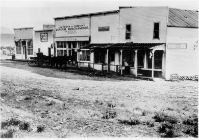
Kremmling established in 1881 according to Colorado Place Names, the town's beginning was a general merchandise store run by Kare Kremmling, (The Chamber of Commerce web site says Mr. Kremmling was named Rudolph and the town was established in 1884) located on a ranch on the north bank of the Muddy River. When Aaron and John Kinsey platted their ranch and called the site Kinsey City, Kremmling moved his store across the river to a new site which soon became known as "Kremmling."

Radium had a post office as early as 1906. Harry S. Porter, a prospector and miner, suggested the name because of the radium content in a mine he owned near the town. The community was settled by Tim Mugrage and his family.
Topic: Biographies

Billy Cozens - First Settler in the Fraser Valley

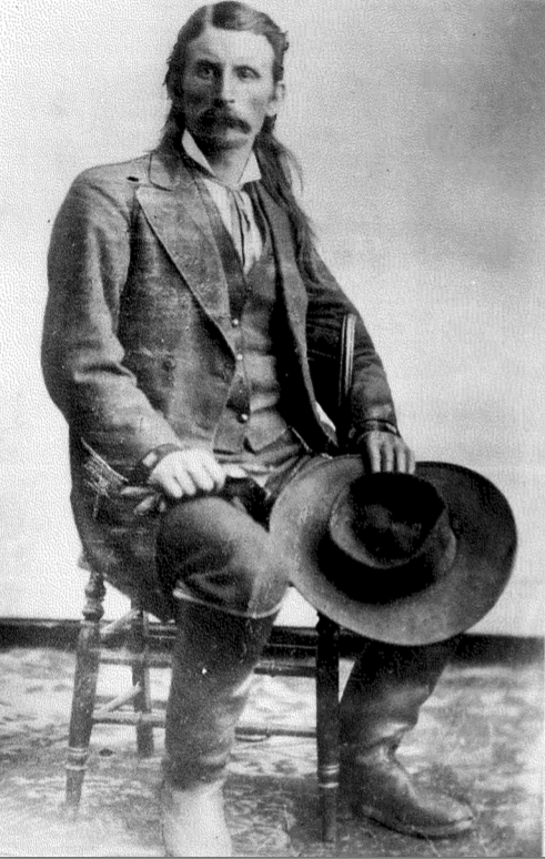
William Zane Cozens was born in Canada on July 2, 1830. After spending some time in New York, he moved to Central City Colorado in 1859, lured by the rumor of gold in the mountains. There, he became well known as a steady and trusted lawman.

In December 1860 he married Mary York, who had been born in England in 1830.  Mary was a devout Roman Catholic and was not happy with the uproarious mining camp of Central City and the constant threat to her husband in his role as Sheriff. So by the mid-1870's, they decided to relocate over the Continental Divide and established a hay ranch and stage stop in Middle Park (north of the present town of Winter Park). They had seven children, although only three ? Mary Elizabeth, Sarah Agnes and Willie ? survived infancy.

Mr. Cozens became the Fraser postmaster in 1876, holding the position until his death in 1904. On July 29, 1878, there was a total eclipse of the sun over Colorado.  The Ute leader Tabernash took that as a divine omen to take action against the increasing encroachment of white settlers, miners and hunters into Ute hunting grounds. Tabernash gathered 40 armed warriors and set out to attack the Cozens Ranch. Billy Cozens negotiated with the group, offered food and finally persuaded them to move on.  The group ended up confronting another rancher and the face off resulted in the death of Tabernash (more details under Tabernash page). 

Mary worked very hard to make their isolated home a pleasant place.  She even ordered dandelion seeds from a seed catalog in order to add color and zest to her garden.  One can speculate that the source the abundant dandelions in the Valley are the result of Mary's original plants.

The Cozens Families' stage stop became a well-known stopping place for summer tourists, who often enjoyed Mary's fine meals and "Uncle Billy's" (Mr. Cozens' nickname) tales from his days as a Gilpin County lawman. When Billy dies in 1904, none of his children had any offspring so Mary left the ranch to the Catholic Church and Regis University, which built a retreat on the property.  In 1987 the ranch house was given to the Grand County Historical Association and now houses a museum.   

Source:


Topic: Mining
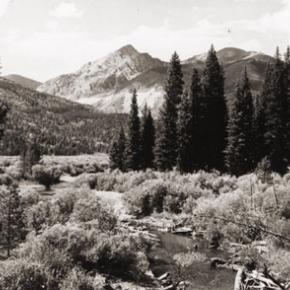
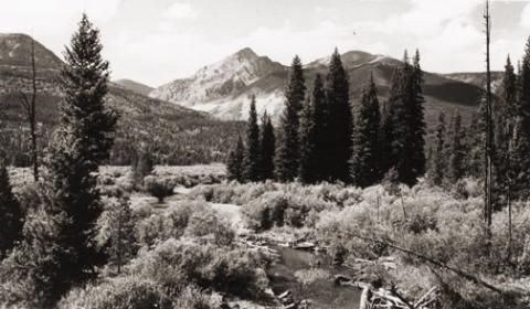
Mount Baker

Gaskill and the Wolverine and Ruby Mines

Mount Baker

The Wolverine Mine was discovered in 1875 by James Bourn and Alexander Campbell. Bourn was the brother-in-law of James Crawford, the founder of Steamboat Springs. James Bourn was the twin brother of Crawford's wife, Maggie.  A Grand County recording error forever changed the name of Bourn in the area to "Bowen".  The mine was located in the Rabbit Ears Range on Bowen Mountain, up Bowen Gulch, approximately 10 miles northwest of Grand Lake.  This discovery sparked additional exploration in the area that lead to a number of new mines. Within a week of the original discovery,  interested parties formed the Campbell Mining District which included Bowen Mountain, Bowen and Baker gulches.  Some of the Middle Park residents who participated in the mining exploration  were John Baker, Charles Royer, Charles Hook, John Stokes and the Redman brothers, William and Mann. The Redman's  eventually  discovered the Sedalia mine. Bourn and Campbell  in less than a year lost the Wolverine mine by not fulfilling a grubstake agreement with the Georgetown grocers, Spruance and Hutchinson.

John Stokes leased the Wolverine Mine from the grocers until Edward Phillip Weber, an agent representing a group of Illinois investors, purchased the Wolverine Mine in the Summer of 1879.  Weber continued purchasing other Campbell Mining District claims which created a great deal of local excitement.  Weber hired Stokes  to assist him and also hired Lewis Dewitt Clinton Gaskill to act as the first foreman for the Wolverine mine.  Gaskill had mine operation experience, having successfully operated the Saco Mine, on Leavenworth Mountain, above Georgetown for several years.  A mining camp was built  below the Wolverine Mine that contained a large bunk house building and a more substantial mine office building.

Gaskill, a Civil War veteran of the 28th  Regiment of the New York Volunteer Infantry,  had come to Colorado in 1868 as a representative of a group of Auburn, New York bankers to invest in mining properties.  He eventually successfully operated the Saco mine in 1873 and 1874.  He invested in the Georgetown, Empire and Middle Park Wagon Road in 1874, which was a toll road that finally made the Berthoud Pass road passable for wagon traffic.  Gaskill also acted as the foreman during the construction of the road. The principal investor in the road was William Cushman of the First National Bank of Georgetown. The bank had a financial collapse in 1877.  At that time, Gaskill was the secretary of the road company and lived with his family in the company house just below the summit of Berthoud Pass on the west side.  William Hamill, a wealthy Georgetown businessman, bought the wagon road in a foreclosure auction in 1881 for $7,000.  Gaskill continued to live with his family in the Berthoud Pass summit house until 1885, when he moved his family into the Fraser Valley and homesteaded 160 acres along Elk Creek.

The settlement of Gaskill began when  in August of 1880,  Al J. Warner built a log cabin store in a meadow below Bowen Gulch on the trail/road that lead to both Bowen Gulch and Baker Gulch.  The settlement was also strategically well placed midway on the trail/road between Grand Lake and Lulu City and the Lead Mountain Mining District.  Another store was built in September by  John K. Mowery.  By that October, Mowery was appointed as the first postmaster of Gaskill.  The following spring E. Snell, opened a large general merchandise store that prompted the original store keeper, Al Warner, to relocate to Grand Lake as Al's Place. The town was named to honor L.D.C. Gaskill, the greatly respected foreman of the Wolverine Mine, the road builder/operator and the Civil War veteran.  By 1882, the town covered 60 acres.  E.P. Weber of the Grand Lake Mining and Smelting Company got involved in the town real estate development by laying out a city grid and offering lots for sale.  Weber's plat renamed the town Auburn after L. D. C. Gaskill's home town of Auburn, New York, but the Gaskill name stuck.  By the close of 1882, there were over 100 residents living in Gaskill.  The most substantial building was the Rogerson House, a well appointed two  story, squared log hostelry, Horatio Bailey Rogerson, proprietor.  Rogerson, would be elected County Commissioner in November of 1882, but would not serve because of a sudden discovery of ineligibility.  Instead, lame duck Colorado Governor Pitkin, appointed E. P. Weber to the post.  Weber was killed in the infamous July 4, 1883 shoot-out at Grand Lake.   

The Bowen Gulch trail lead to many of the  most productive and worked mines in the Campbell Mining District which included the Wolverine, now owned by the Grand Lake Mining and Smelting Company, E. P. Weber superintendent and the Ruby and Cross mines owned by Kentucky and Colorado Mining and Smelting  Company, John Barbee superintendent. Barbee, who lived in Grand Lake,  would go on to serve as superintendent of schools, Justice of the Peace and briefly the editor of the Grand Lake Prospector.  Barbee's partner in many endeavors was Antelope Jack Warren. Warren was as rough as Barbee was refined.  He acted as a foreman and, by one account, a bodyguard for Barbee.  The Bowen Gulch trail continued up the mountain to Bowen Pass and then descended into North Park and the Jack and Park mining districts which were organized by the end of 1880, to the settlement of Teller City.  Passable roads that could handle wagon traffic were needed and often planned but rarely built.  The high cost of building and maintaining  wagon capable roads in Middle Park was a difficult proposition for local governments and private entrepreneurs.  

The Grand County Commissioners in July of 1877 had declared the trail from Grand Lake to the mining gulches of the Rabbit Ears  Range to be a county road.  However there was little county money to pay for improvements to make the trail a road.  Private investors were reluctant to invest in wagon roads when there was the persistent  rumor that railroads were coming spawned by the numerous railroad surveys that were performed in the area.   Albert Selak, a Georgetown brewer, in August of 1878, organized a toll road that would branch off of the Georgetown, Empire, and Middle Park Wagon Road at the Ostrander Ranch on Red Dirt Hill, and proceed to Grand Lake and continue on to the Rabbit Ears Range mines and continue on into North Park and on to the Wyoming territory line.  John Barbee invested in the Middle Park Toll Bridge Company, a toll bridge company that intended  to build a bridge across the Grand River  above the confluence of Willow Creek and the Grand River.  However, this project languished, and was taken over by the county with an expenditure of $150.  

If ore wagons would need to haul ore to the nearest reduction mill which was over 60 miles in Georgetown, the toll road might have been a financial success. However, the lower grade ore from these Rabbit Ears Range mines would not yield a sufficient profit to cover the transportation and processing costs in a market where the market value of silver annually declined.  So the ore piles grew.  What was needed was a nearby reduction mill or cheaper transportation, like a railroad or a higher price for silver.  Weber had  repeatedly promised that a reduction mill was coming, but nothing was ever built.  By April of 1883 with tons of ore piled up and waiting for transport to be processed,  Weber temporarily closed the Wolverine Mine and laid off his miners.  He admitted  in June of 1883 that the ore from the Wolverine was “rather refractory” and that it would not justify shipment without local reduction.  Some hoped the closing was a strategic move by Weber to trigger a sell off of area mining properties  so that he could acquire additional mines before he built the reduction mill, but it was not to be. Weber would soon be shot dead by his political rival, John Gillis Mills.

The favorable newspaper stories of Rabbit Ears Range mining would continue, but for the informed, it had become  clear that without a major investment in improved transportation including a railroad or a major investment in a reduction mill in the area, the mining concerns were doomed to fail.  Mining claims had to be worked in order to be kept.   A minimum of $100 of labor or $500 in improvements had to be expended each year to maintain the claim or else the claim would be deemed abandoned.  Many claim holders leased their claims to miners to work for a percentage of the return.  Without the ability to sell and process the ore for a profit, there was no return.  The speculative mining investment money began to dry up and the miners and their supporting merchants began to leave.  By the end of 1886, the Middle Park mining boom had  ended. To further add to the decline,  a border dispute that arose between Larimer County and Grand County over the taxation and mineral wealth of North Park was finally decided in 1886 by the Colorado Supreme Court in favor of Larimer County.  North Park was part of Larimer County, not part of Grand County.  A lawsuit would follow so that Larimer County could recover the wrongly collected taxes of $20,000 from Grand County.  Grand County's total tax income at the time was less than $3,500 a year.

Topic: Places
Spruce Lodge

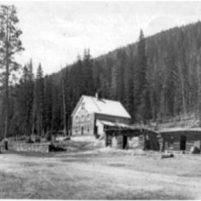
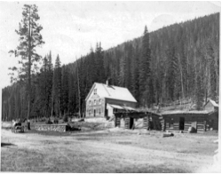
The search for Spruce Lodge

Spruce Lodge

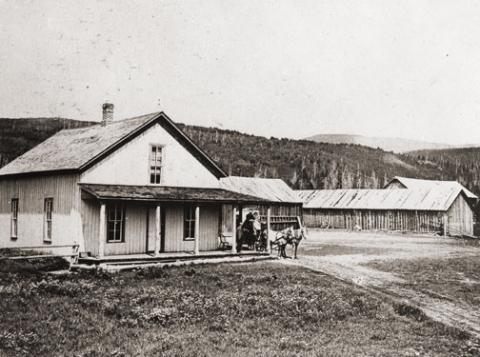
 You gotta love a mystery! My curiosity rose, my anticipation of being the one with the real story was more than my appetite could stand. I looked at pictures, figured angles, mused at what other people said, reviewed topographic maps and finally said to myself “it just can’t be.” The terrain doesn’t look like that. It isn’t two miles from the last switchback on Hwy 40. I don’t care what the writing on the back of the pictures say. 

I want to know once and for all, where is the real location of Spruce Lodge? How can it be located so everyone will agree. I’ve got it, find an expert wilderness person with my same curiosity. As fate would have it, entered Debora Carr, author of Hiking Grand County Colorado, complete with pictures, maps, GPS coordinates and trail narratives. Her coauthor Lou Ladrigan also caught the bug. “We can find it.” 

Exploration began early in the spring but the snow was just a little too deep to find any artifacts. Failed attempt, but the appetite was there. Wait till the snow melts in the trees. Again, as fate would have it, entered Carol Hunter. Carol has been instrumental in the efforts to resore the Berthoud Pass wagon road. Carol has lots of maps and pictures of the development of the wagon road and just happened to have an original U.S. Bureau of Public Roads 1920 survey map for the construction of Hwy 40 from Empire to Fraser. I loaded it into the computer, expanded the image and found lots of strange numbers. Almost like mile markers. Carol said they were numbers used by the work parties. They seemed evenly spaced and the map had a distance legend. It even had a marked location for Spruce Lodge. I couldn’t wait to add this map to Deborah and Lou’s reference material.

Armed with new references, Debora and Lou hiked both sides of Hwy 40 from the switchback to the entrance to Mary Jane. Looking for artifacts, existence of remnants of the old wagon road, foundations and terrain that matched the photos in the GCHA collection. A couple places looked promising, but not quite. Finally, a white station post number 390 was found lying on the ground on the west side of today’s Hwy 40. Then another white station post was found to the south, number 380. That was a match! Just what we needed. That confirmed the surveyor L.J. Young’s map. To the south of 390 a flat part of ground revealed what looked like part of a foundation and surrounding the location were remnants of discarded cans and possible buildings. A two holer! Now check the terrain with the pictures. Well maybe. Don’t forget that Hwy 40 didn’t exist. Step back and look from the east side of the existing Hwy. A great match with the slope and tree line. This was it! Just .9 miles North of the last switchback.


Topic: Biographies

Nathaniel "Nathan" Shore

Nathaniel "Nathan" Shore was born in Cottonwood Harbor Canada in 1856. When he was about 16 years old he had visited and then worked as a freighter hauling groceries to different towns in western Colorado. He saved enough money to purchase his own wagons and 2 yoke of oxen for each wagon to continue freighting.

Nathan became famous as a man who carried his Bible in one hand and a gun in the other. Nathan returned to visit his family and met Sarah Jones in Springfield Missouri. They were married in 1885. Their trip to Colorado and the Williams Fork was undertaken with Sarah driving a team of horses pulling a covered wagon and Nathan herding their few cows.

The cows helped start a homestead ranch east of the Williams Fork river. In 1907 they sold the homestead ranch to the Curtis Family. They had purchased the Anders Anderson ranch close to Williams Peak and the Joseph Jackson ranch on Bull Run Creek.

They lived on the Anderson place until the forest fire that burned along the Williams Fork Mountains. Nathan told Sarah to hitch the horses to the hay rack, load the furniture that it would carry, take all the children and move to the Jackson place while he helped fight the fire. Nathan's team of horses were stolen so he broke 3 heifers and a steer to work in the yoke.

He still did a lot of freighting to make a living for his family. He freighted to Hot Sulphur Springs and also from Georgetown. He returned home to the ranch about once a week. He sold butter, that Sarah had made and hung down in the well to keep cold, in the mining town of Breckenridge.
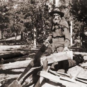
Nathan Shore died June, 1928 when his pickup stalled on a railroad crossing in Utah. He was trying to find the trouble under the hood and didn't hear the train as it whistled and whistled. He was headed for a trip to Hawaii.

The Ish Family

The prosperous John Lapsley (Laps) Ish family are an example of very successful settlers and entrepreneurs in early Grand County. The Ish family, with eleven children, came by covered wagon to Colorado from Missouri 1863 and settled on a farm outside of Denver.

18-year-old Laps Ish came to Grand County in 1881 to attempt his luck at the short lived mining boom outside of Teller, north of Grand Lake.  He tried his luck at mining for 4 years and also carried the mail between Teller and Grand Lake, on skis or snowshoes in the winter and by foot in the summer. 

Laps Ish married Alice Shearer and homesteaded near Rand (in present day Jackson County). They had two sons, Lesley John Ish and Guy Lapsley Ish. Laps and Alice built the Rand Hotel and operated it until 1910.  The family then moved to Granby and built the Middle Park Auto Company garage and ran a stage line to Grand Lake. They built the Rapids Lodge by operating a sawmill on the Tonahutu River in Grand Lake and opened for business in 1915  They also built the Pine Cone Inn in Grand Lake and Leslie managed it for many years. Laps Ish died in 1943.

Topic: Regions

The Blue

Because gold had been found at the headwaters of the Blue River at Breckenridge, hopes were high among prospectors who worked the downstream tributaries in Grand County.  However, this lower section of the Blue contained no mineral wealth. 

The Denver and Rio Grand Railroad planned to run a route through the valley and began constructing grades, but the tracks were never laid because Moffatt's railroad crossed the county first.

An enterprising Canadian, 25 year old Willis Charles Call, had been employed as a cook for the grading company in 1881.  When the railroad abandoned the project, Call became a registrar of voters, and in 1886, the county assessor.  By 1890, he had a choice ranch near Kremmling.  His Austrian wife, Mary Rohrocher, was a very popular hostess.  It is believed that they owned the first automobile in the county.

The conflicts between the white settles and Ute Indians came to a climax in 1878 when the Ute leader Tabernash was killed by a posse and the very next day, Abraham Elliott a homesteader on the Blue, was killed in retaliation.  The remains of his ranch can be seen on Highway 9 at mile marker 135. 

Across the river was the ranch of Henry Yust, who settled there in 1885.  Another early ranching family was that of Thomas Pharo, An Englishman from Franham in Surry, near London.  Settling there in 1880, he developed a major cattle and horse ranch. 

The Blue River area was connected with a route west in 1913, when the co-called Trough Road was constructed, beside the Gore Canyon to State Bridge.

Topic: Agriculture

Timothy & Clover at Hurd Creek Ranch

Before the invention of seeding machines, a farmer or rancher would walk across his field in a straight line carrying a bucket or sack of seed with one hand. With his other hand he would fling fistfuls of fertile grain in a wide arc in front of his path. On reaching the end of the field, he would refill his bag, move over a few yards and repeat the process on the way back. After hours of walking and the casting of numerous sacks of seed, one handful at a time, the field would be planted.

I guess I was about 13 or maybe 14 when my father decided to plant timothy and clover on the east half of the meadow on the mesa. The area to be planted was probably forty acres or more that the ranch had leased to a Hindu man to grow lettuce and other truck crops. For several years we had gotten free lettuce for our table and our milk cows had loved the turnips from his harvest that were either too big or too small to be sold. I guess the profits from his work weren’t very good and the risk of growing lettuce in the rainy valley was too high. The Hindu had abandoned his lease and we would now put the water and the land to our own good use. Since we had no seeding equipment, we would broadcast the seed by hand. It would take hundreds of pounds of it to do the forty acres.

I was eager to help. Dad looked skeptical but finally agreed to let me try. After a bit of instruction he sent me off across the field. “Remember,” he had said. “You have to spread it even and don’t miss any spots.” I soon developed some regrets about volunteering. Not only did we have to plant the field once, but we had to plant it a second time as well. It seems that a planting of timothy and clover grows only a few inches high the first year and doesn’t produce a harvest. In order to avoid losing an entire season, it was customary to plant a second crop on top of it. In our case, Dad had chosen oats for the second planting. This choice would produce lots of feed right away even though the growing season in the Fraser Valley was too short to yield any grain. We planted the hay crop on one day and the oats the next.

I was exhausted by the time we had finished. In fact, if memory serves me right, Dad did the last five or ten acres by himself. When fall came, we had oats four feet high. They were cut, stacked like hay and fed out the following winter. The year after, there was beautiful timothy and clover that has continued to produce a fine crop for more than 60 years. When I visit friends on Ranch Creek every August, I drive by our field both coming and going.

Each time I see it, I remember my work and experience a sense of joy and accomplishment. All the things I produced over a professional career of nearly 40 years are now obsolete but the timothy and clover seeds planted so long ago are still growing. They will continue to do so until the Hurd Creek Ranch sells its water right and the field dries up. In our modern world, a 40-acre field of timothy and clover isn’t much. But how often, today, does a teen-ager have the opportunity to do work that will serve for a lifetime?

The above material is copyrighted by the author, Robert K. Peterson. Reproduction is any form is limited to the personal use of the view and/or to educational purposes. Neither the sale of nor any other commercial use of the text or illustrations is authorized.

Ute Legend of the Quaking Aspen

It is amazing to behold the continuous quivering of aspen leaves in groves around Grand County, even when there is no apparent breeze.

According to Ute legend, the reason for this unique aspect of the aspen tree happened during a visit to Erath from the Great Spirit during a special full moon.  All of nature anticipated the Spirit's arrival and trembled to pay homage.  All except the proud and beautiful aspen. The aspens stood still, refusing to pay proper respect. The Great Spirit was furious and decreed that, from that time on, the aspen leaves would tremble whenever anyone looked upon them.

Logging

In the early decades of Grand County, lumbering was a key contributor to the local economy.  Logging was necessary as the principal source of building construction and also as the only available fuel.  When the railroad first made its way over Rollins Pass, the production of railroad ties became an important industry.  In the Grand Lake area, the brief mining boom of the 1880s created a steady demand for timber.

Some remains of log structures from abandoned logging camps were still evident late in to the 20th century. These include the Middle Park Lumber Company on St. Louis Creek (southwest of Fraser), an operation that had it's own railroad line into town.  In the same area, the independent logging settlements of Lapland and Stockholm date back to 1915. 

Above Tabernash was located the Deiler Mill, ten miles up Hurd Creek.  In 1910, the Western Box Company bought the mill and moved it to the head of Meadow Creek.  A box factory was located in Tabernash and the logs were floated down in a flume, thirteen miles long.  Mrs. Braddock was the "flume lady" at one time and would balance on a log while breaking up log jams on the trip downstream.....a task that required "great skill and derring-do". 

Other operations included Koppers Camp up Pole Creek (above Tabernash), Mr. Daves Mill at Hideaway Park and Bob Morrow's camp on Byers Peak.  Broderick Wood Products Company of Denver was a major purchaser of Grand County timber starting in 1930.  In 1939, Smokey Harrison founded the Timberline Sawmill at Kremmling.

A huge box making plant was built on a site now covered by Granby reservoir.  Its main supply point was a logging camp at southwest corner of Monarch Lake.  You can still see remnants of the logging machinery along the shore of the lake.  For a short time there was a branch railroad from Granby to the box factory, which later burned to the ground, In 1949, American Timber built a sawmill and log pond at Granby, west of the Highway 40 overpass.  The west end of the county was logged by the Kremmling Division of the Edward Hines Lumber Company.  Later, Louisiana Pacific built a wafer board plant in Kremmling but it closed in the 1980's.

The short growing and harvesting season created many challenges for the loggers.  According to Ed. "Jr." O'Neil, it takes over 100 years in Grand County to grow a tree big enough got a 35 foot telephone pole.  In contrast, it would only take 30 years to grow a similar tree in warmer climes.  There is still private logging activity in Grand County, most of it for the construction of luxury log homes.

Maps