Ute Bill Thompson

Museums

.

Museums Articles

Who Started the Museum?

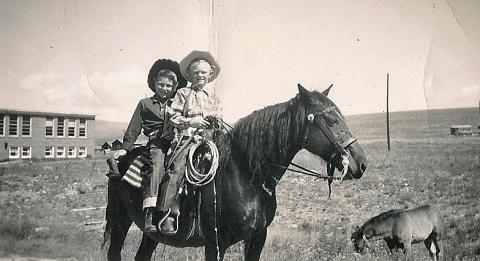
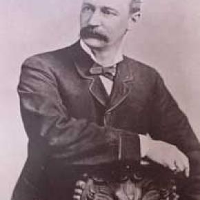
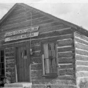
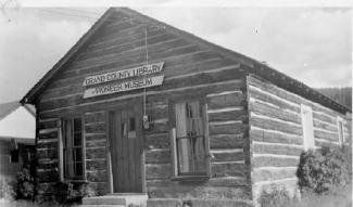
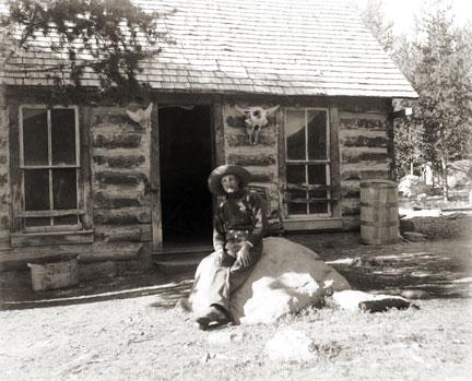
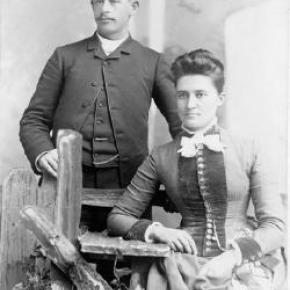
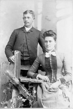
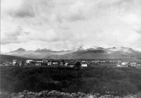
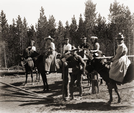
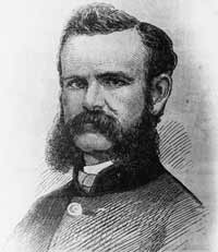
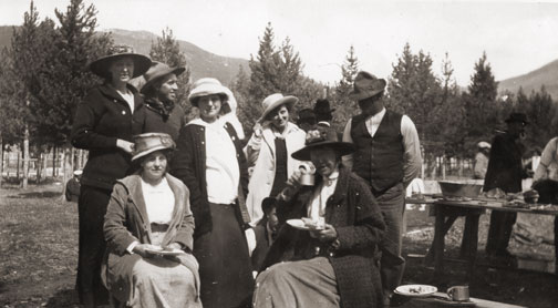
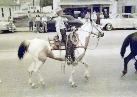
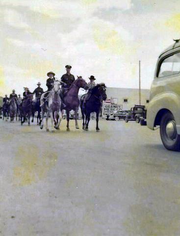
Article contributed by Jean Miller


Many years ago, as in the beginning of the 20th century, the early Grand County pioneers worked, socialized, raised families, and developed sturdy towns such as Hot Sulphur Springs.  Many of them gathered information about county citizens, but of all these, probably Daisy Button created the most comprehensive resource over the decades.  Daisy and her brother Horace lived with their parents, Schuyler and Josephine, on a small ranch at the foot of Cottonwood Pass on the east side. Among other things, the family operated the toll gate, collecting fees from travelers going to Hot Sulphur. Eventually the Buttons moved into town and, Later, Daisy, married Charles Jenne.


Daisy was one of those people who had a real feel for what information was the most useful to save for the future.  She collected obituaries (one of the most valuable of all tools for historical reference). She cut out articles on politics, new businesses, town events. She kept

programs, fliers, political announcements, menus, and dance cards.


Then in 1919, the first and second waves of Grand County pioneers created the Pioneer Society.  At first it was mostly a social group, but as the old-timers started to die off more quickly, their children realized they should start keeping records of the settlers and their doings.  Who had a large and extensive set of scrapbooks, telling all about the early days, but Daisy Jenne!


The original Courthouse in Hot Sulphur stood about where the County Jail is now.  When the "new" Courthouse was built, the old building's space became available for the Pioneer Society to use as a museum.  Daisy moved her collection of artifacts over there. Others donated household or personal articles.  So the little museum came to life, with Daisy as its primary caretaker.


There was a core of folks from the area who, over the years, helped her and who took over after she died.  There was John Sheriff, whose mother had homesteaded on the Grand River just east of "Potato Hill", coming from Leadville after her husband died.  John's wife Ida (Marte) was a key person; her family had come from Austria to homestead east of Cottonwood Pass on Eight Mile Creek.  Manny Wood, part of a huge homesteading family on the Williams Fork, pitched in, along with his wife Henrietta (Bode), whose family settled on Corral Creek.  And there was Paul Gilbert, long time head of the Fish and Game Dept. in the county.  Paul was a fine photographer. For many years, he took photos of historical sites and people, and he also reprinted old pictures, all of this for the Pioneer Museum.  If it weren't for Paul, the Grand County Museum would not be able to boast of its very

excellent and extensive collection of photos today.


As Colorado's Centennial Year (1976) approached, Regina Black and her husband Bob thought that there were so many newcomers who were not of pioneer stock, but who were very interested in the history of the area, perhaps a new organization could be formed to accommodate these folks.  Bob had already written Island in the Rockies in 1969, published by the Pioneer Society.  This book basically became the "bible" for county pioneer history.


 So Reggie put notices in the paper, announcing a meeting at their home, to discuss possibilities.  She expected 10 or 15 people maybe.  Some 60-70 showed up!  The need was great.  By this time, a small addition had been built at the rear of the old courthouse, to hold the Hot Sulphur Library.  I was on the library board at that time.  I remember well how the museum collection was growing and the library collection was growing; and we library folks kept encroaching on museum space.  We never came to blows, but we thought about it!


The upshot of Reggie's effort was the creation of the Grand County Historical Association, an umbrella organization intended to support all historical efforts within the county.  The group sought and received a Centennial Grant that allowed them to go to the East Grand School Board and negotiate the transfer of the old school from the school district to the GCHA.  I was on the school board at that time, when we closed that school for lack of students, amidst a huge amount of community flack.  This seemed a good way to accomplish our purpose and also to continue helping out the community. The grant allowed GCHA to moved the old courthouse and the original jail to the new museum grounds.  The Hot Sulphur library was given a tiny space in the "new" courthouse.


I got involved with GCHA about this time, in 1976.  The first day I went over to offer to work, I came in to find Ida and Henrietta coming up from the basement, totally covered in soot.  They were scrubbing out where the old coal furnace had been, to make space suitable for storage.&n sp; I was put to making signs with press-on letters, a job I hated but did for years,

until we got a computer.  I never could get those pesky letters straight and evenly spaced!


Reggie, Ida, Henrietta, and I formed the core exhibits committee in those early years, with John and Mannie furnishing building expertise and Paul furnishing photos.  Over time, many others came to help in many ways ­ Jean Chenoweth, Jan Catlow, Keith Nunn, and later, the George Mitchells, Larry and Jan Gross, and others.


To raise money, one of our best efforts was the Buffalo Barbecue and Flea Market, a hugely successful event until others like the idea and held their own, resulting in major loss to our profits.  We tried other ideas, such as house tours and silent auctions and lectures, with basically the same kind of result.  What the answer is for fund raising is a mystery, for today there are so many activities going on that it is very difficult to come up with something new.  The Endowment Fund is the most effective fund source as nobody else can encroach on that territory.


Articles to Browse

Topic: Mining

Dutch Town

When two Germans, having imbibed too liberally shot up the mining town of Lulu City, they were run out of town.  They went higher and established camp, on the side of Red Mountain near timberline.  There they found a lode of low grade gold, silver and lead.

While it lasted only two years, this encampment came to be called "Dutch Town".  Gradually the fierce winters and lower quality of ore drove the settlers out, leaving only a few empty cabins about a mile west of Lulu City. 


Topic: Biographies

John Charles Fremont

Captain John Charles Fremont was born in 1813 and at the age of 31, in June 1844, was exploring the northern reaches of the Republic of Texas when he passed through Grand County.  This marked the first appearance of official government enterprise in Grand County.

His expedition included some 40 explorers, including people of Creole, French, and Black descent. The guides were Thomas Fitzpatrick and Kit Carson. This expedition entered Grand County via Muddy Pass and exited via the Blue River, never traveling into the eastern part of the County. 

They met with some 200 Arapahoe Indians, who were traditionally suspicious of the intruders, but through the giving of trade gifts, overt conflicts were avoided. The cartographer for that expedition was Charles Preuss, who provided the first map on which all of the central Rocky Mountain Parks were named and mapped accurately.

Ute Legends of Hot Sulphur Springs

Ages ago, there were many Ute Indians who enjoyed life in Middle Park with its plentiful game and lush meadows.  They lived in peace and harmony for "as many years as there are hairs on the head."

In spite of this idyllic life, there was one young brave who yearned for more adventure and material goods.  He proposed that the Utes attack the Sioux, who lived beyond the mountains on the plains of the rising sun.  As victors, they would return in glory with much wealth and many captives.

Spiquet Pah (Smoking Water) was an elderly medicine man who foresaw only grief in the prospect of such a war.  He spoke before a council meeting, warning of the devastation that such an action would bring upon the tribe.  He foretold " As the North Wind soon brings the snows and death of winter, so will he bring sorrow and death to our own people.....if you do this, strength and peace and plenty will be but for a few; joy will be seen no more."

Disregarding his warning, most of the young men were tantalized with the temptation of the grand adventure of such a conquest.  In the autumn of the year, when they usually did their hunting, the young men rallied behind the young brave and followed him over the Great Divide into combat with the plains people.  As the fighters departed, a saddened Spiquet Pah went into the heart of the mountain "and pulled the hole in after him."

The young Ute men found the enemy better armed and organized than they expected. Many Ute braves were killed and others were taken as slaves. The prophecy had come true as starvation and disease plagued the tribe as there were too few men to hunt for food. The old man sat on his haunches beside his subterranean fire which he heated water from an underground stream.  From the mountain at Hot Sulphur Springs, water flows even today as a reminder of the rash behavior of so long ago.

Another legend holds simply that the Hot Sulphur Springs water acquired medicinal qualities in answer to the prayers of an old chief who has be left by his tribe to die.  The old man built fires within the mountain, and after drinking the water and bathing in them, we was restored to health and rejoined his people.

Topic: Biographies

Betty Cranmer

November 2007


Betty Cranmer, a longtime Granby resident, says she doesn't like to be in the spotlight. Her modest home with brown siding and roof, tucked into a hill behind a stately spruce tree, reflects nothing of her and her family's past.  Betty's story - full of heartache and triumph - deserves recognition.

She is a World War II veteran, a cancer-survivor, and the mother of five children (her sixth son, Forrest, died when he was 33.) She is the wife of the late Chappell Cranmer, whose father, George Cranmer, is the Cranmer the ski run at Winter Park Resort is named after.  At 86 years old, Betty has lived a fuller life than many - and she shows no signs of slowing down.

She was born in England on Aug. 29, 1921. When she was 18, she joined the Women's Royal Air Force and was stationed at a burn and plastic surgery hospital, later named Queen Victoria Cottage Hospital. Deep down, she had wanted to be stationed at a fighter station instead - closer to "where the action was" - because she had just lost her first love, an Australian man, who was shot down by enemy fire.  "My job was to clean up burns, which were very bad," Betty said. "A lot of them didn't have eyelids, or their noses were burned off."

Betty was fascinated by the way the doctors would build up the soldier's faces by skin grafting, she said.  "It was very interesting, once you get over the smell of burns, and get into the feeling you're doing a service for those people," she said. Betty served at the hospital for four-and-a-half years. Her home was in a small town in Sussex, 30 miles from the south coast of England. The town was sometimes known as "bomb alley" during the war. Because of the town's proximity to London, German planes would often drop their bombs on her town on their way to London, she said.

She recalled pilotless planes - "big bombs with wings, nothing else" - and running for cover, although there wasn't any. She recalled the Battle of Britain, and how the sky was "almost black" with hundreds of German planes. One night, as she was working at the hospital, a young pilot from Denver was brought in. He was a member of the Canadian Air Force who had crashed in the North Sea, and spent 14 days on a dingey with no food or water. When he was finally found, semi-conscious, he was brought to a nearby hospital. "When they took his boots off, his toes came off, because they'd been immersed in water and cold for so long," Betty said. "So they sent him down to our hospital to see if we could do some grafting on his feet."

After a year of treatment, however, there was nothing the hospital could do for the young pilot; to save his life, they amputated his legs, and he was forced to use a wheelchair.  He and Betty struck up a friendship, and she would often take him to town where they'd visit the cinema or local pub. Eventually, they fell in love.

One day after leaving the cinema early because Betty had to return to work, they were heading down a hill toward the hospital when a German plane flew over them. Both of them were in uniform.  "I said, "My goodnesss!? There were no sirens, nothing ."  The plane circled and opened fire.    "I was so frightened, I let go of his (wheel)chair. Thankfully he grabbed the front wheels and was able to stop himself."

Betty and the young man returned to the hospital safely, but the attack had brought in many casualties. Eighty people were killed and 250 were wounded. The cinema they attended was destroyed by a single bomb. Betty's eyes glaze over as she remembers how lucky they had been to survive that day.  "I wasn't a believer ... I didn't know there was a God in those days, because when you're in a war, well ... But I think then, by the grace of God, we got out of that."   Betty and the pilot were married in the mid-1940s, and had a daughter named Susan after the war ended. Although the war was over, life wasn't any easier, Betty said.  "It's hard for people who were in the war in
England to describe rationing to people in this country. ... We had two ounces of meat per week, per person. You could not buy anything in the shops at all without giving up coupons. Two ounces of butter, four ounces of sugar."

Betty was pregnant with her second child when her husband died suddenly due to complications. Before his death, he told her to move to Denver where his father lived. It was 1946, and America offered a better life. Betty took Susan and all that they had and moved to Denver; she first set foot on American soil in May 1946, where she eventually had her second child, Holbrook.
Two years later, she met Chappell Cranmer, who was an investor at the time. They were married and had four children: Allen, Bruce, Genie and Forrest, and lived in Denver for 25 years. In 1969, her husband decided to move to Granby.  "He attended seminary school and was ordained as a priest," Betty explained. "The Bishop said, I want you to move to Granby.' "Betty joined her husband one year later, and they bought a home she would continue to live in the next 37 years.


Chappell, or "Chap," started a church in 1981 called St. Columba Chapel - later named Cranmer Chapel - that is located behind the Silver Screen Cinema in downtown Winter Park. It is there to this day and is a vital part of the local community. Betty and her husband continued to visit England every two years to see her parents, but in 1994 she was diagnosed with cancer in her abdomen. Betty beat the cancer - despite a doctor's prognosis that she had three weeks to live - and would go on to fight and survive two more major bouts of cancer.

Chap died in 2000, two years after Betty fought off colon cancer. She continues to travel, and has just returned from a trip to England and Spain with her son.  As she sits in her couch chair, her white and gray hair framed by the sun peeking through her window, one can't help but be in awe of Betty Cramner. Her home is immaculate but cozy and inviting, and the rooms are filled with photographs of children and grandchildren. She loves living in Granby, she said, where everything is close by.
"I'm very independent. I don't like driving in big blizzards and stuff like that, so I can walk to the library, the post office, the church every Sunday. ... So I like living here. I couldn't live in a big city anymore."

Betty knows she has led an amazing life, but her humbleness is what makes her unique. As she rattles off her daily routine - snowshoeing, walking, swimming, attending four different Bible studies - she mentions she is a volunteer at Cold Springs, a local greenhouse just up the road. "I love flowers," she said, as she turns and faces her bay window full of geraniums and different types of plants. "Would you like one? I have plenty."

Topic:

Early Families

While natural events occasionally determine history, it is most often the existence of natural resources that lure humans to a region.  Those who first arrived in Grand County came to mine ore, cut timber and graze cattle and therefore they determined the subsequent history of the region.

The pioneering families of Grand County had exceptional stamina, pride and endurance to survive the grueling winters and isolation.  We have collected the stories of just a few of these families, but will continue expanding this section as information becomes available.  If you know the story of one of the early Grand County families, please contact us so that we may include it in this section

Schools

Article contributed by Betty Jo Woods

The first official school in Grand County was founded in 1875 in Hot Sulphur Springs in a crude dugout. The school met for twenty days and a painting of the classroom shows nine students in attendance. Typically the woman teachers of that era would have earned about $25 per month. 

One report to the Colorado State Department of Education said, “The school secretary left during the Indian uprising and no school records are available.” This school was presumed to be at Hot Sulphur Springs.

In the 1890s school was not held every year in Grand Lake because not enough taxes were raised to pay for a teacher. The school year was generally April through October and classes were held in various vacant buildings for many years. The first schoolhouse in Grand Lake was built in 1910 and remained a one-teacher school until 1935. 

A notice published in the Middle Park Times on january 31, 1889 annouce that a masquerade ball and supper of "beef steer and chickens" would be held on February 14th to raise money to build a school.    

In 1898, the offerings were expanded to include the first experimental high school curriculum to be offered in the county. As towns were developed, several rural one-room schools also came into existence. Many schools were taught only during the summer because winter travel was too difficult.

At one time there were nineteen school districts. In 1958 the County was reorganized into two school districts, with the result that today there are two high schools, two middle schools, four elementary schools, one charter school, one alternative school, and one private Christian school in Grand County.

Sources:
R.C. Black, Island in The Rockies. Pruett Publishing Company, 1969
Colorado State Department of Education, First Formal Biennial Report of Superintendent of Public Instruction for State of Colorado. Denver, Colorado: Daily Times Printing House, 1879

John & Ida and the Sheriff Ranch

Sheriff Ranch lies in a valley just below Highway 40, 2 miles east of the Town of Hot Sulphur Springs. It's the serene world of John & Ida Sheriff. Old cabins with outhouses align themselves against the riverbank of the Colorado River. They tell a story of the fishermen who once rented the cabins for just a dollar a day-a long time ago.

It's a quiet Sunday morning and only the sound of geese flying overhead can be heard. The cattle are quiet in the meadow as the sun begins to rise and feeding time comes close. They sense the presence of this stranger. The air is cool and damp as Ida comes to greet me. John is not far behind. Looking across the meadow, a calf seems to have caught herself in a fence and to my surprise, the entire herd rushed off to help her. Suddenly she's free and the cattle slow to a stop. The cows quiet down as John throws hay from the pickup. The calves are more curious and come right up to us. One mother cow took off with her young one and Ida called her by name, "Oh, Spook, why are you running off?-she's always taking off! She's afraid you're here to brand her!"

John & Ida begin this morning just as they have for the past 57 years, checking on momma cows ready to give birth and carefully watching the newborn calves. They all have a name, just like children. Two calves, not quite awake, lie together on the hay while chewing on the tender hay. The sound of the cows chewing is soothing to the ear.

A story of the ranch heritage unfolds while we sit at the kitchen table enjoying a cup of tea and fresh baked date-nut bread.

Marietta Sumner Sheriff and her sons came to Leadville, Colorado from a farm in Keithsburg, Illinois, in search of mining claims recorded by her deceased husband, Matthew. (Many farmers and ranchers moved to Colorado ? the promise land of gold). Some years later, Marietta and her sons moved to Hot Sulphur Springs where her sister, Mrs. William Byers lived (1859 Rocky Mountain News founder, William F. Byers).

The ranch has been passed down from generation to generation since then. John Sheriff was the eldest son of Glenn and Adaline Sheriff (Glenn Sheriff was County Commissioner for 21 years, County Assessor, Director of the State Welfare Board for 13 years, and President of the Board of the Middle Park Union High School). He attended the Hot Sulphur Springs Public School through the 12 th grade. Everyone had to share in working the ranch and John was no stranger to peddling milk door to door for 10 cents a quart before he went to school.

Harsh winters closed off travel over Corona Pass (Top of the World) and the only way into the County was on snowshoes. Middle Park was a tough place to live with 50 degrees below freezing for weeks on end. Many people stocked up on flour and sugar and other supplies for the winter because they couldn't get into town for supplies. The Sheriffs were more fortunate and would use a horse and sled and follow the river into the town of Hot Sulphur for supplies.

Ranch life was not a wealthy profession as many may have thought. The Sheriffs know how hard it was to keep the family ranch. In the 1930's, Roosevelt's New Deal (Agriculture Adjustment Administration-AAA) forced ranchers and farmers to kill off half of their herd to level out the economy. Cow hides were sold for 5 cents a hide. Ida recalls, "Everyone in agriculture had to start over. Everyone was in the same boat. Some people couldn't take the stress and just moved off their ranches-- just leaving them!" The Sheriff ranch was in debt following the depression era. Ranches were up for foreclosure everywhere; banks didn't want them. The family just hung in there until they could get a herd of cattle going again.

Joining the Navy, John served in the South Pacific during World War II, and returned home to attend Colorado State University where he studied general agriculture. He met and married Ida Marte in 1949, daughter to early Grand County pioneers, Liberat and Bertha Marte. Ida is known over the years for her involvement with historical societies, documenting the history of the County, and maintaining original cemetery plots for the Hot Sulphur Springs Cemetery.

The years after the war were a struggle. With not enough hay to put up and only a handful of cattle, ranchers turned to raising sheep and harvesting crops of lettuce. Japanese prisoners of war were sent here from California to work on ranches.

"We always had to have an outside income ?cabin rentals, John's dad, Glenn was commissioner, and Mom worked at the library to help pay expenses. Once in a while we would have enough cows or lambs to go to market. The Federal Land Bank saved a lot of ranches allowing us to borrow money to get going. We were all afraid of another recession after the war," Ida said.

In the first 30 years of their marriage, John & Ida did not see much of each other. John traveled back and forth taking cattle to auction. When they got married, the ranch was so much in debt that they were "darn lucky that we didn't loose it".

The Sheriff homestead was registered in 1881 with 1350 acres and had as many as 250 head of high grade Herefords by 1975. Pure-bred bulls were purchased from neighboring ranches (Taussig Brothers, Hermosa Ranch, and Lawson Ranch) improving the quality of the herd. Sheriff ranch's registered brand-Bar Double S---is still known to be the oldest registered brand in the County.

In 1984 a large portion of ranch acreage was sold to Chimney Rock Ranch Company and the remaining acreage is where Ida and John live today, raising a small herd of cattle. They no longer make trips to auction. Today, a buyer comes to the ranch.

With no electricity in the early years, trudging through deep snow to the barn's generator was a morning ritual to power the lights in the house. In later years, electricity allowed the Sheriffs to start the generator with a flick of the switch from within the main residence.

The years of struggle and hardship, hard work and the desire to keep the family ranch has been a great sense of pride for the Sheriff family today. John and Ida, their ancestors and their family are a living example of family ranches surviving today. Not many remain, but this ranch, with a great family history, has a river of life flowing through it.

Topic: Leisure Time

Grand Lake Yacht Club

Grand County often attracts adventurous spirits who prefer its splendid isolation to Wal-Mart and fast food. Others, who never make the leap of faith to live here, enjoy it as a familiar playground, returning regularly to enjoy its vast mountain ranges and unlimited outdoor opportunities.

It has to come many as a surprise to learn that Grand Lake, Colorado - nestled next the Continental Divide at over 8,300 feet elevation - has had a yacht club for over one hundred years! When this adventure began, back in 1902, there was only a stage road into the southeast corner of Grand County over Berthoud Pass. Grand Lake is situated next to the entrance of Rocky Mountain National Park, at the far northeast corner of the county, with the rugged backbone of the continent directly to the north and east. At the turn of the twentieth century, it was a summer vacation spot with few full-time residents. Summer visitors and full-time residents alike recognized the grandeur of the their surroundings, and Grand Lake very early became a summer home to many of Denver's elite, and the summer business they brought helped support the local economy.

It was a few enthusiastic Denverites with a keen interest in Grand Lake and sailing who organized the Grand Lake Yacht Club over 100 years ago. The founders included Richard Crawford Campbell, who married Senator Thomas Patterson's daughter and became the business manager of his father's newspaper, the Rocky Mountain News; William Henry Bryant, a Denver lawyer who was active in both sailing and Colorado politics; J. Fermor Spencer, a close friend of Mr. Bryant and long-time treasurer of the club; and William Bayard Craig, who enjoyed a broad education and had been the Chancellor of Duke University before he became interested in "acquiring land in Colorado."  By the end of 1902, according to Denver papers, "the first bona fide yacht club between the Mississippi river and the Pacific ocean" was in operation.

An atmosphere of excitement and pageantry swept over Grand Lake during the early Regatta weeks, when the Yacht Club held its annual races. In Denver, The Friday Evening Times proclaimed during August of 1904, "Yachting season is here", and went on to describe the "enthusiastic cottagers gathered on shore" around Grand Lake to cheer for the yachts. In 1907, Regatta week included yacht racing as well as foot races, donkey races and bronco busting. When the yacht races ended, the boat captain who won the most races had earned the Colorado Cup.

The Grand Lake Yacht Club's small sailing fleet during Regatta week - three days of racing during mid-August - sometimes included only a handful of boats during its first decade or so. Still, according to one observer, "the organization has more spirit to the square foot than I ever saw exhibited before." Races on the first day of Regatta week, 1905, illustrate the enthusiasm well. In the hotly contested first race of Regatta week, Robert Campbell's Highball, built in Racine, Wisconsin, tossed her two-man crew into the icy waters of Grand Lake when she capsized while running in second place. Shortly after, the third place yacht, Duchess, went over too, leaving the Chicago-built Dorothy II captained by Commodore Bryant the first and only boat to cross the home buoy.

Today, Dorothy O'Donnell O'Ryan, Commodore Bryant's granddaughter, maintains her family's summer home in Grand Lake. In 2002, she published Sailing Above the Clouds: An Early History of the Grand Lake Yacht Club, which chronicles the club's first 50 years. Her Colorado roots go back to Colorado territory's last, and the state of Colorado's first Governor, John Long Routt, who was appointed by President Grant in 1875, the year before Colorado became a state. Knowing the early history as she does, and the difficulties inherit with mountain transportation, O'Ryan marvels at "the logistics" of bringing sailboats built in Racine, Wisconsin or Chicago, Illinois over the Continental Divide into Grand County, Colorado by rail and stage road.

Home-built crafts, both crude and highly crafted, competed as well. Many of the first home-built boats were modified rowboats, "with homemade sails and masts." Observing the annual Regatta week in August of 1904, though, Arthur Johnson called attention to "the Jessica, a 16-foot boat belonging to the vice-commodore and built at Grand Lake" that sported "a sail that would have done credit to a venturesome Lipton on the high seas."

If a sailboat in Grand Lake during 1904 "done credit to a venturesome Lipton," Sir Thomas Lipton himself returned the favor tenfold in 1912. It so happened in 1912 that Lipton was traveling by train across the United States and would pass through Denver on his journey. Probably, Sir Thomas had met the well-traveled and enthusiastic yachtsman, William H. Bryant (Grand Lake Yacht Club Commodore) at the New York Yacht Club. Continued correspondence between the two resulted in the Grand Lake Yacht Club inviting Sir Thomas to the Denver Club for dinner in December of 1912, sponsored, of course, by the Grand Lake Yacht Club. Before he left that evening, flattered by the warm welcome he received, Lipton had proffered a silver cup to the Grand Lake Yacht Club.

Lipton became a yachting icon during the early 20th century. His sportsmanship was nearly unparalleled in the sport and he spent most of 30 years and millions of dollars trying to win the America's Cup. Thoroughly devoted to yachting as a sport and highly capable in the art of advertising, Lipton spread his Lipton Cups "around the globe" to promote the sport and himself.  His gift to the Grand Lake Yacht Club energized the young organization.

Today, the boathouse of the Grand Lake Yacht Club still reminds visitors and members of the organization's heritage. Built in 1912 by Grand County pioneer Preston Smith on land donated by fellow pioneer Jake Pettingell, the lakefront log structure sits in the midst of magnificent mountain scenery, with the dramatic peaks of the Continental Divide to the west and north and the Never Summer mountain range to the west.

As the club matured, it began to offer more races to more members and guests throughout the summer season. The original Regatta week still exists as the most important, and festive, event. Races were added, though, in 1912 with the Adams Cup; in 1914, the Lipton Cup was incorporated; in 1923, the inventor of the Sunshine Lamp (which Coleman Lanterns later bought out) presented the Hoffstot Cup; and in 1925, Dorothy Bryant O'Donnell offered the Bryant Cup in honor of the late first Commodore, W. H. Bryant. Well over 20 cups or trophies now highlight the Grand Lake Yacht Club's season. Throughout its evolution the Club has remained as unique as the dramatic physical environment that surrounds it and the people who envisioned and created it.

Topic: Granby

Historic Granby Real Estate

William Shakespeare, the historic play writer, said, “There is a history in all men’s lives.” The same could be said for many Grand County buildings. According to author, Lela McQueary in her 1962 book, “Widening Trails,” real estate sales and land giveaways helped to build our towns. “In 1905, a town site was obtained from Jim Snider, who had homesteaded the land upon the sagebrush mesa,” wrote McQueary. “The village was called Granby for Granby Hillyer, a civil engineer. Two general stores, two livery stables, a post office and a tiny café (all built with false fronts to make them appear much larger) were scattered on the north side of Main Street, three blocks long.”  That Main Street today is Agate Avenue. A quick search of the Grand County tax rolls reveals an interesting historic mix of buildings.

For example, the current Brynoff home at 170 2nd Street was the Post Office building constructed in 1910 and originally located at 458 East Agate. That building was moved to its current home to make way for the construction for the new Post Office building in 1945 at 458 East Agate. Deb Brynoff, the Executive Director of the Grand County Board of Realtors, said, “When we updated and built onto the original building, we found old letters stuffed in the walls. Obviously, they used them in the early years to add insulating value. I guess they had junk mail even then!”

On July 1, 1966, a new Post Office building was dedicated at 225 East Jasper Avenue (now the current home of the Grand County Library District Administrative Office). According to Granby-area Realtor, Susie Peterson of Glenn Realty, who used to own the building at 458 East Agate when they converted it to the Granby Veterinary Clinic, “Downstairs was full of those neat glass front post office boxes with the gold dials. You can just imagine the history in that building.”  Other buildings constructed in those early years were 127 4th Street in 1909. In addition to a private home, over the years, businesses such as Re/max Real Estate and Katie’s Flower Shop were located at 247 East Agate, which was also built in 1909. In 1910, the property at 110 Garnet was built.
The Roaring 20s saw a spurt of construction such as 172 Topaz (1922), 307 Jasper and 59 4th Street (1924), 166 Jasper and 291 Topaz (1929). The current Columbine Café property at 395 East Agate was built during the heydays of 1927 when it was called the Town Crier Restaurant.

After the Great Crash of 1929 and the Depression of the 1930s, New Deal jobs and loan programs helped fuel new construction. In fact, in 1933, the famous Payne’s Café was built at 365 East Agate. Today, the Greater Granby Chamber of Commerce and Downtown Enhancement offices, along with Noriyuki & Parker law offices are housed in the almost 75 year-old building.

Today’s Shadow Mountain Chiropractic Clinic of Drs. Jeff and Deb Shaw at 60 2nd was built in 1935 as a private home. On April 18, 1935, the first addition to Granby helped the town grow. In 1938, 387 East Agate was the site of the new pool hall run by Alva West. Today Lorene Linke’s Fabric Nook welcomes customers and quilters at the historic location.

In 1938, the building at 185 East Agate, which was Granby’s first strip mall, also was constructed with Craig’s Café, later Olson’s Café. Over the years businesses such as Maureen’s Clothing Shop, a laundromat, a barbershop and the Carpet Wagon found homes where today the Longbranch and Schatzis Pasta & Pizza Restaurants are found.

Post World War II America and Granby boomed. Granby had an influx of new residents because of the continued construction of the Granby Dam and the Colorado Big Thompson Water Project. In 1946, the Granby Dairy Building at 106 Jasper sprung up. That same year, Carmichael Real Estate Company built a new office at 191 East Agate. Today real estate is still king at that corner building with the Grand County Board of Realtors and The Title Company of the Rockies offices located there.

The Granby landmark, Frontier Motel, at 232 West Agate was built in 1951 by Earl Saylor. In 1954 Jenkins & Fulk began construction of the Granby Trading Post at 231 East Agate. Ken and Debbie Eaker and Jay Young bought that property in May 1995 and renamed the store, The Grand Mountain Trading Company.  

Topic: Mountains

Rollins or Corona - What shall it be called?

Travel across various passes of the Continental Divide occurred long before white men showed up. Indeed, as anthropologist James Benedict wrote c. 1975, some 10,000 years ago, prehistoric Indians camped, hunted, and built hunting walls on the upper reaches of Rollins Pass, as well as moving in and out of Middle Park for the warm summer months. Historic Indians followed the same paths. In the earliest days of non-Indian access, a particular pass at the head of Boulder Creek was dubbed Boulder Pass.

Capt. Jacob Bonesteel, including wagons, made the first recorded crossing by a white man at this point in April 1862. Three years later, a group of Mormons brought wagons over this route and a year later, promoters of new roads into Middle Park brought in many wagons and livestock. In fact, tourists were starting to enter the park by a number of routes, and one of them, Samuel Bowles, who wrote a fascinating account of his trip, including his return to Denver via Boulder Pass.

Interest was growing rapidly for a road over the Divide, into Hot Sulphur Springs, and on into Utah. One promoter, John Quincy Adams Rollins, from New Hampshire, teamed up with William N. Byers and Porter M. Smart to carry this project through. Rollins was interested in crossing the Divide; Byers was promoting the Springs; Porter wanted to develop the valley of the Middle Yampa. All three were pushing to have Middle Park officially named as Grand County, a challenge finally accomplished in 1874.

So Rollins and associates started his road, reaching the top in 1873. That next winter, they publicized this access and in June, Jimmy Crawford brought his family and wagons to Rollinsville and thence to Yankee Doodle Lake, ready to cross the pass now named Rollins Pass by the developer. But the road ended, and they found Rollins' men still hacking the road out of the granite! Jimmy and his crew found it necessary to leave their wagons and help.

Finally, on June 10th, the family was able to head for the top. Jimmy borrowed two yokes of oxen, hitching them to mules, and then to his horse. The road was so rough that the procession could proceed but a few feet before having to rest. The family itself climbed on foot. At the summit, they discovered only a rough swath cut down through the trees on the western side. The "road" dropped down between the lakes and followed Ranch Creek to its junction with the Fraser River. Rollins quickly realized that Berthoud Pass, which also opened in 1874, was superior to his own pass for wheeled vehicles, so he determined to hedge his bets. He initiated the first mail service into the county in 1873. He also built a commodious hotel where his road joined the Berthoud Pass road at the confluence of Crooked Creek and the Fraser. He called it the Junction House. Next, he proposed to the builders of Berthoud Pass that they form a joint ownership of the two roads between Junction Ranch and the Springs. Tickets would be issued for both routes and revenues would be shared. The two companies would build a bridge over the Grand at Hot Sulphur Springs. He even buttered up his rivals by complementing their work.

All this was accomplished, although the mail route soon moved to Berthoud Pass, because of the severe winters on Rollins Pass. The bridge was started in November 1874. From the beginning, Rollins' road was preferred for trailing livestock, because there were fewer problems with heavy timber and bogs. For years, the Church brothers, George and John, who introduced the Hereford breed into the county, trailed their cattle for summering in what became known as Church Park. However, tourists such as Irving Hale still drove wagons over Rollins Pass in 1878.

About 1880, interest burgeoned for bringing a railroad up South Boulder Canyon and through a tunnel near Rollins Pass. Numerous surveys were completed all along the area. David Moffat settled on Rollins Pass for the tunnel site but decided first to put a temporary line over the top. Thus, in the summer of 1903, a formal contract was let for work up and over the Pass itself. By 1904, the workers reached Arrowhead and they also built a work station on top, called Corona Station, or "crown of the mountain." This railroad construction town of Corona, located at over 11,600 feet at the top of Rollins Pass (first called Boulder Pass) along the Continental Divide was the highest railroad station in the world.

It became obvious by 1905 that the Corona area would require snowsheds if trains were to travel, even irregularly, during the winter. Still, word got out of the spectacular splendor of Rollins Pass and tourists flocked in on summer train excursions, sometimes stopping on top, sometimes going as far as Arrow. In 1913, a fine hotel was built next to the rail facilities. Because Rollins Pass was right in the middle of severe weather patterns, a weather station was built on top, as well as one down at Sunnyside. In 1915, Rollins Pass was actually proposed to be the south boundary of a proposed "Estes National Park."

Later, on the National Historic Register, the district was listed in 1997 as the Denver, Northwestern and Pacific Railway Historic District--Rollinsville & Middle Park Wagon Road. It was also identified as the Rollinsville and Middle Park Wagon Road; Boulder Wagon Road, Rollins Pass, and Rollinsville area. In 1956, Governor Steve McNichols had presided at the official re-opening of the four percent grade to vehicle traffic over Corona Pass, expressing the hope that the route would someday be paved. The Colorado Game and Fish Department and the U.S. Forest Service made additional improvements, and the Arapaho and Roosevelt National Forests put out a 24-page booklet titled "The Moffat Road: A Self-Guiding Auto Tour." The road crossed two of the original railroad trestles near Corona but those trestles, even if reached by 4-wheel vehicles, were crumbling and could no longer even be crossed safely on foot. The current self-guided auto tour refers to Rollins Pass, as well as the Moffat Road and the Boulder Wagon Road. Corona Station and Hotel are discussed. In 1979, a portion of the auto road over Corona Pass was permanently closed because of a cave-in of the "Needle's Eye," a tunnel located before the trestles heading west from the Moffat Tunnel's East Portal.

The tunnel reopened on July 3, 1988, thanks to efforts of the Rollins Pass Restoration Association on both sides of the Divide, with the cooperation of the U.S. Forest Service, Colorado History Society, and Boulder, Grand, and Gilpin Counties. It then closed once more when another rockfall hit the tunnel on July 15, 1990. The RPRA is continuing its efforts for re-opening. The noted photographer, Charles McClure, took many outstanding photos of the Rollins Pass road. One, titled"Group on Rollins Pass, shows well-dressed men and women stand on a snowfield making snowballs on Rollins Pass, Moffat Road, Boulder or Grand County, Colorado; probably on Denver, Northwestern and Pacific excursion train. Date: between 1904 and 1913 near Corona Station." Another photo shows a "30 ft. snowcut on Rollins Pass, Moffat Road photo. Denver and Salt Lake Arrow passenger car is parked east of Corona snowshed by the thirty foot snowbank cut, Rollins Pass, Colorado; it shows men, women and railroad employees posed behind train, on the roof and on the snowbank and a standard gauge track. Date: between 1904 and 1915."

A sign at the highway turn onto the Moffat roadbed says: The Moffat Road "Hill Route" Also called "Corona Pass Road", this road over the Continental Divide was the original "Hill Route" of the Denver, Northwestern & Pacific Railway built by David H. Moffat in 1903. It crosses Rollins Pass at 11,666 feet elevation. On top of Rollins Pass, a sign says: Elevation 11, 660 feet, John Quincy Adams Rollins established a toll wagon road through this pass in the mid 1870's. David H. Moffat's Denver, Northwestern & Pacific Railway crossed the Continental Divide at this point in 1903. First known as Boulder Pass, then Rollins Pass, the railroad workers dubbed it "Corona", the crown of the "Top of the world." A railroad station, hotel, restaurant and workers' quarters existed here until 1928 when the railroad was abandoned due to the building of the Moffat Tunnel. Identifications in various trail and geographical guides say: Rollins Pass (el. 11,680 ft) is a high mountain pass in the Rocky Mountains of north-central Colorado in the United States. The pass is located on the continental divide at the crest of the Front Range southwest of Boulder, at the boundary of Grand County,Colorado and Boulder County, Colorado. Rollins Pass (a.k.a. Corona Pass) sits approximately 5 miles east and above the popular ski areas around Winter Park, between Winter Park and Rollinsville. The pass is traversed by an unpaved road, mostly the former roadbed of the Denver and Salt Lake Railway which abandoned the route in 1928 when the Moffat Tunnel opened to replace it. Railroad advertising called this the "Top O' the World" and it referred to the Moffat Route over the continental divide and the Rocky Mountains.

Rollins Pass was the primary travel route west from Denver until an easier road over Berthoud Pass was constructed. The Denver, Northwestern and Pacific railroad laid its tracks across the pass in 1903-1904 and established a Depot at Corona on the crest. It can be noted that in R.C. Black's Island in the Rockies, the term "Corona Pass" was mentioned one time, on p. 351; the terms "Corona Station" or "Corona Snowsheds were used. In Dismantling the Rails That Climbed, Rollins Pass was used, the Corona hotel, and just once, Corona Pass; 1936. In Maggie By My Side, it was Boulder Pass and Rollins Pass. In Rails that Climbed, Rollins Pass, the Corona shed, weather at Corona, Rollins Pass Snow Shed, other references to Corona as a site. In Guide to the Colorado Mountains (Orme) , they speak of the Corona Trail to Rollins Pass. High Country Names (Ward) used Rollins Pass entirely. Only Hiking Grand County, Colorado, published 2002 by Carr speaks of Corona Pass, with reference to Rollins Pass (near the town of Corona), Moffat Road. The term "town" might be questionable; there was only a small restaurant, workers quarters, railroad offices, and in 1913, the hotel. Current maps, USFS and the Grand County Trail Map, show Rollins Pass, with Corona at the side as being a site.

The use of "Corona Pass' seems to be a rather recent innovation that has come into being with tourism efforts in the upper Fraser Valley. Rollins Pass From Island in the Rockies p. 45 Rollins Pass was originally known as Boulder Pass, first recorded being crossed by whites, by Capt. Jacob Bonesteel in April 1862. Their supplies were carried in wagons. A second organized party went over the same pass in 1865. In 1866, promoters of access into Grand County brought many wagons and livestock over Boulder Pass.In 1867, Samuel Bowles and a group returned home to Denver via Boulder Pass. In 1873-74, two roads were proposed into the county, one of Berthouds pass and one over Boulder Pass. This was the same time that the county was named "Grand". J..A Rollins and his associates started the road and reached the top of the pass in 1873, at which time they envisaged a road from HSS into Utah. The first wagons went over in June 1874. The western descent was so bad that it never was much patronized by wheeled vehicles, instead becoming primarily used for trailing of cattle. At this time the name Boulder Pass disappeared from maps and Rollins Pass became the official name. p. 85. p. 80 Lots of schemes to build roads into GC, but of all the schemes for transport, only one, the Rollinsville and Middle Park Wagon Road showed any promise. That was designed by John Quincy Adams Rollins, from NH, a gifted promoter, a son of a clergyman, second of 19 children. He was a farmer, miner, freighter, road bulder, and platter of towns. He was perhaps the most accomplished billiard player west of the Mississippi. He was a Colorado resident at least by 1866. His finances were up and down, but he was tremendously strong. In December 1884, when he was 68, he thought nothing of a 3-day snow-clogged crossing of the Continental Divide. p. 85 Rollins was interested in MP as an investor and he was interested in extending his road into Utah.

At the same time, a Porter M. Smart was likewise excited about speculating in frontier projects and was working at developing the valley of the Middle Yampa. William N. Byers was busy planning for HSS. These three men launched at least two petitions, with more than 80 "residents" for creating GC. Grand County was created that year, 1874. p. 89 With the creation of GC, people began to consider the area more seriously. p. 92 There was no official mail into the county until 1873 when Rollins brought in the first US pouch over his pass. In May 1874, he built a commodious hotel at the confluence of Crooked Creek and the Fraser, known as the Junction House. p. 94 Rollins knew that the road over Berthoud Pass was superior to Rollins Pass; his main advantage was the railhead at Blackhawk. So Rollins proposed a joint ownership and operation of the two roads for the line between Junction Ranch and HSS. Tickets would be issued for both routes and revenues would be shared. The two companies would build a bridge across the Grand at HSS. Rollins even complimented the Berthoud work. This merger was completed soon. p. 104 This bridge was started in November 1874. p. 108

A mail contract was made in July 1875 for once a week delivery over Rollins Pass, but conditions were so severe that the route was changed to Berthoud Pass. p. 110 From the beginning, Rollins Pass was used in preference to Berthoud Pass for trailing livestock, because there were fewer problems with timber and bogs. However, late spring snowdrifts were a problem, so 20-30 horses were often brought along to break trail. The Church brothers, George and John, summered their cattle in what became known as Church Park and dug the Church Ditch. They also introduced the celebrated Hereford breed into GC. p. 170-171 As interest in bringing a railroad into and through GC developed, about 1880, various stockholders proposed to build up South Boulder Canyon to Yankee Doodle Lake and start a tunnel near Rollins Pass. Nothing came of the first attempts but by the end of July 1881, numerous surveys had been made for that tunnel. p. 238 Cattle was still being trailed out via Rollins Pass up to the turn of the century. p. 258

David Moffat and Horace Sumner, his chief engineer, in the fall of 1903, were planning the tunnel for future excavation; but in the meantime a temporary line was planned for crissing Rollins Pass, at 11,640 feet. p. 264 A formal contract was let for the work over Rollins Pass in August 1903. The loftiest sections were started first, and the first cuts at the top were nearly finished by the 26th of October and tunneling started at Riflesight Notch. As snow came, work slowed to a standstill. p. 265 Work in 1904 was extremely slow until the end of August. An encampment was built at Arrowhead and a station at the crest of the Divide was named Corona Station, where long snow sheds were built almost immediately. p. 267 Arrowhead was soon shortened to Arrow, when a post office was opened there in 1905. Travel on the grades, at 4-5% grades up over Rollins Pass was exceedingly difficult. p. 270 In 1908, word of the scenic splendor of Rollins Pass was becoming known world wide.

Also, Rollins Pass and its "Corona station" were attracting the attention fo the US Weather Bureau, for the pass lay squarely in the center of the region of heaviest snowfall on the entire Colorado Continental Divide p. 344 A terrible winter in 1909 made people think that Rollins Pass was never going to be practical for the long term. Time and again freight and passengers were stuck on top at the Corona facility. In 1913, a $10,000 hotel was built at Corona next to the rail facilities. From Dismantling the Rails That Climbed p. 6 The railroad went from Denver to the top of Rollins Pass. p. 8 Snowsheds were built over the tracks at Corona and other strategic places in 1905. p. 12 The top was referred to as "Corona Pass" 1936. p. 16 Crews who were to removed tails and ties reached Corona at the top of Rollins Pass 1936. p. 20 Reference to the Corona hotel From Maggie By My Side p. 1 Jimmy Crawford heard that a man named John Quincy Adams Rollins was building a road over the range at a place called Boulder Pass. 1873 p. 9-14 June 1874

The Crawford family traveled to Rollinsville and then to Yankee Doodle Lake, where the road ended. Rollins' men were still hacking the road out of the granite. Jimmy and his crew helped. On the morning of June 10, the family started out to go over the rocks and up the mountain. Then he borrowed two yokes of oxen to his wagon, then mules, then his horse. The animals had to rest every few feet; the family climbed on foot. There was no shelter at the top. Rollins' men had done no work yet on the west side of the pass except to cut a rough swath down through the trees. The road dropped down along Ranch Creek. From Rails That Climb published 1950 p. 43 Leyden Junction to Tolland to Rollins Pass. P. 63-64 Many references to Tunnels as identifiers of location. p. 76-77, 78 reference to the old Rollins Pass toll road; first mention of the place called Corona- crown of the mountain. Most references are to Rollins Pass. The Corona shed is mentioned, p. 82. p. 83 Sunnyside water stop, Loop Trestle and Tunnel, Ranch Creek Trestle and water stop, Arrow. p. 95, 100- 101 It is eleven miles from Arrowhead to Rollins Pass. Rollins Pass-Boulder wagon road; other references p. 107 - 112 reference to Corona shed. Reference to pipe line to Corona; a number of comments to Rollins Pass p. 119 weather at Corona p. 120-121 Rollins Pass p. 151 Rollins Pass p. 182 photo of "Rollins Pass Snow Shed" "This Corona station burned one night." p. 188 photo of June at Rollins Pass p. 192-194 photos of Corona shed and other buildings; Rollins Pass p. 252 walking on top of snow shed at Corona p. 271- 272. 1910 Snowshed at Corona p. 312-314 Rollins Pass; Rollins Pass snowshed; Corona; Corona siding p. 324 Corona; Sunnyside weather report station p. 326 Corona sheds p. 333-335 Corona shed; references to "Corona" as a place From Guide to the Colorado Mountains published 1974 p. 54-55 Corona Trail, going from East Portal to Rollins Pass From High Country Names published 1972 p. 105 Irving Hale in 1878 drove his wagon over Rollins Pass, now nearly abandoned as a wagon road. p. 131

David Moffat decides to build a temporary line over Rollins Pass. p. 165 In 1915, Rollins Pass was proposed to be the south boundary of a proposed "Estes National Park". From Hiking Grand County, Colorado published 2002 p. 52 Trailhead on the "Moffat Road to Corona Pass". In same paragraph, it becomes Rollins Pass (near the town of Corona). On p. 54, reference to the Corona Road. On p. 57, map shows Rollins Pass with Corona marked as a "site." p. 56, reference to the old railroad bed used crossing the Divide at Rollins Pass, near the town of Corona. Sometimes called Corona Pass. p. 60-61 Rollins Pass Wagon Road historical notes on JQA Rollins and how to find his wagon road over Rollins Pass, following Ranch Creek to Tabernash. p. 66 Rollins Pass (Corona) to Devil's Thumb From GCHA Journal The Journey p. 6 Rollins Pass used by Indians; comment in 1981 From GCHA Journal Middle Park Indians to 1881 p. 8 Archaic hunters camped in the Rollins Pass area; written mid-1970's The current maps, USFS and Grand County Trail Map, show Rollins Pass with Corona at the side as being a site. The Rollins Pass Restoration Association for many years, and currently, has been trying to open the road and Needles Eye Tunnel. The self-guided auto tour refers to Rollins Pass, as well as the Moffat Road and the Boulder Wagon Road. Corona Station and Hotel are discussed. On the National Historic Register Denver, Northwestern and Pacific Railway Historic District--Rollinsville & Middle Park Wagon Road (Boundary Increase) ** (added 1997 - District - #97001114)

Also known as Rollinsville and Middle Park Wagon Road;Boulder Wagon Road;R Rollins Pass, Rollinsville Corona Station and Hotel The railroad construction town of Corona, Colorado, located at over 11,600 feet at the top Corona Pass (first called Boulder Pass) along the Continental Divide was the highest railroad station in the world. It was situated on an old Native American trail, the same trail it is believed the Mormons traveled on their way to Utah. The road was improved by the U.S. Army, then further improved in 1866 by General John Q. Rollins, for whom the pass and the town of Rollinsville were officially named. Because of the high drifts of snow, the pass was only open from around July to the first big snowstorm two or three months later. In 1956, Governor Steve McNichols presided at the official re-opening of the four percent grade to vehicle traffic over Corona Pass, expressing the hope that the route would someday be paved. The Colorado Game and Fish Department and the U.S. Forest Service made additional improvements, and the Arapaho and Roosevelt National Forests put out a 24-page booklet titled "The Moffat Road: A Self-Guiding Auto Tour."

The road crossed two of the original railroad trestles near Corona but those trestles, even if reached by 4-wheel vehicles, are crumbling and can no longer even be crossed safely on foot. In 1979, a portion of the auto road over Corona Pass was permanently closed because of a cave-in of the "Needle's Eye," a tunnel that came before the trestles on a westward drive from the Moffat Tunnel's East Portal area. The tunnel reopened on July 3, 1988, thanks to the efforts of the Rollins Pass Restoration Association with the cooperation of the U.S. Forest Service, Colorado History Society, and Boulder, Grand, and Gilpin Counties. It was then closed once more when another rockfall hit the tunnel on July 15, 1990. John K. Aldrich is a geologist, lecturer, and author whose "Ghosts of . . . " books and accompanying topo maps are a boon to hobbyists, explorers, and those interested in Colorado mining history. Date: 02/04/08 05:13 Rollins Pass Milepost 16 Corona Station. Picture 6 below, is DPL photo X-7388. "Title: Corona, Colorado, interior of snowshed. Summary: Passengers stand next to the covered train depot at Rollins Pass, in Corona (Grand County), Colorado. The tracks of the Denver, Northwestern & Pacific Railway are in the foreground. The depot is constructed of logs, and the roof of the snowshed is upheld by timbers. Sunlight streams through the opening at the end of the snowshed. Date: (between 1904 and 1913). Source: E. T. Bollinger from W. I. Hoklas." Picture 7 below, is DPL photo MCC-454A. "Title: Group on Rollins Pass. Summary: Well dressed men and women stand on a snowfield making snowballs, Rollins Pass, Moffat Road, Boulder or Grand County, Colorado; probably on Denver, Northwestern and Pacific excursion train. Date: (between 1904 and 1913). Creator: Louis Charles McClure 1867-1957. Picture 8 below, is DPL photo MCC-624. "Title: 30 ft. snowcut, Rollins Pass, Moffat Road photo. Summary: Denver and Salt Lake Arrow Turn (passenger car) parked east of Corona snowshed by thirty foot snowbank cut, Rollins Pass, Colorado; shows men, women and railroad employees posed behind train, on roof and on snowbank and standard gauge track. Date: (between 1904 and 1915 The highway sign says The Moffat Road "Hill Route" Also called "Corona Pass Road", this road over the Continental Divide was the original "Hill Route" of the Denver, Northwestern & Pacific Railway built by David H. Moffat in 1903. It crosses Rollins Pass at 11,666 feet elevation. On top of Rollins Pass, a sign says: Rollins Pass Elevation 11, 660 feet John Quincy Adams Rollins established a toll wagon road through this pass in the mid 1860-s. David H. Moffat's Denver, Northwestern & Pacific Railway crossed the Continental Divide at this point in 1903. First known as Boulder Pass, then Rollins Pass, the railroad workers dubbed it "Corona", the crown of the "Top of the world." A railroad station, hotel, restaurant and workers' quarters existed here until 1928 when the railroad was abandoned due to the building of the Moffat Tunnel. Rollins Pass Elevation 11,680 ft (3,560.1 m) Traversed by Unpaved road Location Boulder_County,_Colorado / Grand,Colorado Rollins Pass (el. 11,680 ft) is a high mountain pass in the Rocky Mountains of north-central Colorado in the United States. The pass is located on the continental divide at the crest of the Front Range southwest of Boulder at the boundary of Grand_County,_Colorado and Boulder County. Sign that sits on top of Rollins Pass Rollins Pass (a.k.a. Corona Pass) sits approximately 5 miles east and above the popular ski areas around Winter Park, between Winter Park and Rollinsville. The pass is traversed by an unpaved road, mostly the former roadbed of the Denver and Salt Lake RailwayDenver_and_Salt_Lake_Railway which abandoned the route in 1928 when the Moffat Tunnel opened to replace it. Rollins Pass Railroad advertising called this the "Top 'O the World" and it referred to the Moffat Route over the continental divide and the Rocky Mountains.

Rollins Pass was the primary travel route west from Denver until an easier road over Berthoud Pass was constructed. The Denver, Northwestern and Pacific railroad laid its tracks across the pass in 1903-1904 and established a Depot at Corona on the crest. David Moffat planned to replace the "Hill Line" with a tunnel through James Peak within a few years of the railroad construction. However, he never could obtain financing for the tunnel due to the inability of the railroad to make a profit and opposition from competing railroads such as the Denver and Rio Grande. The D&RG saw the line as a threat. But, in the far future the construction of Moffat Tunnel would turn out to be the D&RG's saving grace. The trip up Rollins Pass was a favorite of summer tourists looking to enjoy the mountain scenery. It was heavily promoted by the railroad with picnic and wildflower picking excursions. Sights along the line were made famous by postcards containing the photos of L. C. McClure. At last the route surmounts the crest of the Continental Divide and takes quick refuge on the top at Corona. At elevation 11, 660 this is truly the famous Top O' the World and one of the highest railroad passes in the world. Due to the great height and nature of the Rocky Mountains, the entire railroad complex was completely enclosed in giant covered snow sheds.

Museums