Ute Bill Thompson

Museums

.

Museums Articles

Who Started the Museum?

Article contributed by Jean Miller


Many years ago, as in the beginning of the 20th century, the early Grand County pioneers worked, socialized, raised families, and developed sturdy towns such as Hot Sulphur Springs.  Many of them gathered information about county citizens, but of all these, probably Daisy Button created the most comprehensive resource over the decades.  Daisy and her brother Horace lived with their parents, Schuyler and Josephine, on a small ranch at the foot of Cottonwood Pass on the east side. Among other things, the family operated the toll gate, collecting fees from travelers going to Hot Sulphur. Eventually the Buttons moved into town and, Later, Daisy, married Charles Jenne.


Daisy was one of those people who had a real feel for what information was the most useful to save for the future.  She collected obituaries (one of the most valuable of all tools for historical reference). She cut out articles on politics, new businesses, town events. She kept

programs, fliers, political announcements, menus, and dance cards.


Then in 1919, the first and second waves of Grand County pioneers created the Pioneer Society.  At first it was mostly a social group, but as the old-timers started to die off more quickly, their children realized they should start keeping records of the settlers and their doings.  Who had a large and extensive set of scrapbooks, telling all about the early days, but Daisy Jenne!


The original Courthouse in Hot Sulphur stood about where the County Jail is now.  When the "new" Courthouse was built, the old building's space became available for the Pioneer Society to use as a museum.  Daisy moved her collection of artifacts over there. Others donated household or personal articles.  So the little museum came to life, with Daisy as its primary caretaker.


There was a core of folks from the area who, over the years, helped her and who took over after she died.  There was John Sheriff, whose mother had homesteaded on the Grand River just east of "Potato Hill", coming from Leadville after her husband died.  John's wife Ida (Marte) was a key person; her family had come from Austria to homestead east of Cottonwood Pass on Eight Mile Creek.  Manny Wood, part of a huge homesteading family on the Williams Fork, pitched in, along with his wife Henrietta (Bode), whose family settled on Corral Creek.  And there was Paul Gilbert, long time head of the Fish and Game Dept. in the county.  Paul was a fine photographer. For many years, he took photos of historical sites and people, and he also reprinted old pictures, all of this for the Pioneer Museum.  If it weren't for Paul, the Grand County Museum would not be able to boast of its very

excellent and extensive collection of photos today.


As Colorado's Centennial Year (1976) approached, Regina Black and her husband Bob thought that there were so many newcomers who were not of pioneer stock, but who were very interested in the history of the area, perhaps a new organization could be formed to accommodate these folks.  Bob had already written Island in the Rockies in 1969, published by the Pioneer Society.  This book basically became the "bible" for county pioneer history.


 So Reggie put notices in the paper, announcing a meeting at their home, to discuss possibilities.  She expected 10 or 15 people maybe.  Some 60-70 showed up!  The need was great.  By this time, a small addition had been built at the rear of the old courthouse, to hold the Hot Sulphur Library.  I was on the library board at that time.  I remember well how the museum collection was growing and the library collection was growing; and we library folks kept encroaching on museum space.  We never came to blows, but we thought about it!


The upshot of Reggie's effort was the creation of the Grand County Historical Association, an umbrella organization intended to support all historical efforts within the county.  The group sought and received a Centennial Grant that allowed them to go to the East Grand School Board and negotiate the transfer of the old school from the school district to the GCHA.  I was on the school board at that time, when we closed that school for lack of students, amidst a huge amount of community flack.  This seemed a good way to accomplish our purpose and also to continue helping out the community. The grant allowed GCHA to moved the old courthouse and the original jail to the new museum grounds.  The Hot Sulphur library was given a tiny space in the "new" courthouse.


I got involved with GCHA about this time, in 1976.  The first day I went over to offer to work, I came in to find Ida and Henrietta coming up from the basement, totally covered in soot.  They were scrubbing out where the old coal furnace had been, to make space suitable for storage.&n sp; I was put to making signs with press-on letters, a job I hated but did for years,

until we got a computer.  I never could get those pesky letters straight and evenly spaced!


Reggie, Ida, Henrietta, and I formed the core exhibits committee in those early years, with John and Mannie furnishing building expertise and Paul furnishing photos.  Over time, many others came to help in many ways ­ Jean Chenoweth, Jan Catlow, Keith Nunn, and later, the George Mitchells, Larry and Jan Gross, and others.


To raise money, one of our best efforts was the Buffalo Barbecue and Flea Market, a hugely successful event until others like the idea and held their own, resulting in major loss to our profits.  We tried other ideas, such as house tours and silent auctions and lectures, with basically the same kind of result.  What the answer is for fund raising is a mystery, for today there are so many activities going on that it is very difficult to come up with something new.  The Endowment Fund is the most effective fund source as nobody else can encroach on that territory.


Articles to Browse

Topic: Granby

Historic Granby Real Estate

William Shakespeare, the historic play writer, said, “There is a history in all men’s lives.” The same could be said for many Grand County buildings. According to author, Lela McQueary in her 1962 book, “Widening Trails,” real estate sales and land giveaways helped to build our towns. “In 1905, a town site was obtained from Jim Snider, who had homesteaded the land upon the sagebrush mesa,” wrote McQueary. “The village was called Granby for Granby Hillyer, a civil engineer. Two general stores, two livery stables, a post office and a tiny café (all built with false fronts to make them appear much larger) were scattered on the north side of Main Street, three blocks long.”  That Main Street today is Agate Avenue. A quick search of the Grand County tax rolls reveals an interesting historic mix of buildings.

For example, the current Brynoff home at 170 2nd Street was the Post Office building constructed in 1910 and originally located at 458 East Agate. That building was moved to its current home to make way for the construction for the new Post Office building in 1945 at 458 East Agate. Deb Brynoff, the Executive Director of the Grand County Board of Realtors, said, “When we updated and built onto the original building, we found old letters stuffed in the walls. Obviously, they used them in the early years to add insulating value. I guess they had junk mail even then!”

On July 1, 1966, a new Post Office building was dedicated at 225 East Jasper Avenue (now the current home of the Grand County Library District Administrative Office). According to Granby-area Realtor, Susie Peterson of Glenn Realty, who used to own the building at 458 East Agate when they converted it to the Granby Veterinary Clinic, “Downstairs was full of those neat glass front post office boxes with the gold dials. You can just imagine the history in that building.”  Other buildings constructed in those early years were 127 4th Street in 1909. In addition to a private home, over the years, businesses such as Re/max Real Estate and Katie’s Flower Shop were located at 247 East Agate, which was also built in 1909. In 1910, the property at 110 Garnet was built.
The Roaring 20s saw a spurt of construction such as 172 Topaz (1922), 307 Jasper and 59 4th Street (1924), 166 Jasper and 291 Topaz (1929). The current Columbine Café property at 395 East Agate was built during the heydays of 1927 when it was called the Town Crier Restaurant.

After the Great Crash of 1929 and the Depression of the 1930s, New Deal jobs and loan programs helped fuel new construction. In fact, in 1933, the famous Payne’s Café was built at 365 East Agate. Today, the Greater Granby Chamber of Commerce and Downtown Enhancement offices, along with Noriyuki & Parker law offices are housed in the almost 75 year-old building.

Today’s Shadow Mountain Chiropractic Clinic of Drs. Jeff and Deb Shaw at 60 2nd was built in 1935 as a private home. On April 18, 1935, the first addition to Granby helped the town grow. In 1938, 387 East Agate was the site of the new pool hall run by Alva West. Today Lorene Linke’s Fabric Nook welcomes customers and quilters at the historic location.

In 1938, the building at 185 East Agate, which was Granby’s first strip mall, also was constructed with Craig’s Café, later Olson’s Café. Over the years businesses such as Maureen’s Clothing Shop, a laundromat, a barbershop and the Carpet Wagon found homes where today the Longbranch and Schatzis Pasta & Pizza Restaurants are found.

Post World War II America and Granby boomed. Granby had an influx of new residents because of the continued construction of the Granby Dam and the Colorado Big Thompson Water Project. In 1946, the Granby Dairy Building at 106 Jasper sprung up. That same year, Carmichael Real Estate Company built a new office at 191 East Agate. Today real estate is still king at that corner building with the Grand County Board of Realtors and The Title Company of the Rockies offices located there.

The Granby landmark, Frontier Motel, at 232 West Agate was built in 1951 by Earl Saylor. In 1954 Jenkins & Fulk began construction of the Granby Trading Post at 231 East Agate. Ken and Debbie Eaker and Jay Young bought that property in May 1995 and renamed the store, The Grand Mountain Trading Company.  

Topic: People

The Knight Ranch and Charles Lindbergh

In Grand County during the 1920's, you might have been lucky enough to have taken a plane ride over Grand Lake with Charles Lindbergh.  It may sound preposterous, but Gordon Spitzmiller and his father, Gus, were two of the many fortunate people who got private sightseeing tours over the Grand Lake area with Charles A. Lindbergh as tour guide.

In the early 1920's, the aviation industry was a brand new field open to the adventurers, the thrill seekers and the adventurous.  Charles Lindbergh was one of those men.  In the spring of 1926, Lindbergh had the dream of flying solo over the Atlantic Ocean, from New York to Paris nonstop.  He was a determined man and was resolved to be the first man to cross the Atlantic and win the Orteig Prize.

On May 22, 1919, Raymond Orteig of New York City offered a prize of $25,000 "to be awarded to the first aviator who shall cross the Atlantic in a land or water aircraft (heavier-than-air) from Paris or the shores of France to New York, or from New York to Paris or the shores of France, without stop."

Besides Lindbergh, there were four serious contenders for the Orteig prize, one of which was Commander Richard Byrd, the first man to reach the South Pole.  Lindbergh's courage and enthusiasm for such a flight were not enough; he needed financial backing.  Lindbergh found his financial answer in Harry H. Knight, a young aviator who could usually be found bumming around the Lambert Field in St. Louis.  This was the beginning of the Knight-Lindbergh partnership that would soon change the course of aviation history. 

After being denied any financial assistance by several of St. Louis's businessmen, Lindbergh made an appointment with knight at his brokerage office.  Knight, the president of the St. Louis Air Club, was fascinated with Lindbergh's plan and called his friend, Harold M. Bixby, president of the St. Louis Chamber of Commerce.  Bixby also displayed a strong interest in the obscure stunt flyer and mail pilot.  Together Knight and Bixby formed an organization called "the Spirit of St. Louis", which was dedicated to gathering funds for the flight.  More than $10,000 was needed in order to build a single engine plane and acquire the proper equipment.

Knight went to his father, Harry F. Knight, who was a major power in the realm of finance and an equal partner in the firm Dysart, Gamble & Knight Brokerage Company.  Like his son, the senior Knight was interested in the aviation field and backed every effort to make America conscious of airplane transportation.

Without the financial aid and moral support offered by the Knight family, Charles Lindbergh may not have been able to cross the Atlantic in 1927.  Lindbergh's gratitude to these two men never ebbed.  Lindbergh and, his famous wife Ann Morrow, came often to Grand County as guests of Harry F. Knight whose ranch encompassed 1,500 acres on the South Fork of the Colorado River.  The ranch today is covered by the waters of the Granby Reservoir.

Knight, a nature lover, spent much of his time at this ranch.  It was a haven for sportsmen and adventure seekers, and Lindbergh was a natural for these two categories.  One of the largest and best airstrips in the west was added to the Knight Ranch in order to accommodate the owner and his guests.  Besides the airstrip, the ranch boasted a miniature golf course, a 28 room estate, a private guest "cabin", a good selection of livestock and an array of entertainment that would suit all.  It was a sanctuary for the affluent.

Local people were so enthused about the handsome aviator that they named a 12,000 ft. peak in the Indian Peaks Wilderness Area (east of Granby) "Lindbergh Peak". However, during the 1930's the hero was honored by Adolph Hitler and Lindbergh made a speech favoring Nazism.  This lead to a fall from grace in the eyes of the public.  Even though Lindbergh changed his mind as World War II began, it was too late to regain his former popularity. The peak was renamed "Lone Eagle Peak" which was a nickname for the famous aviator.

After Harry F. Knight died of coronary thrombosis in 1933, his son, along with ranch manager Harry Morris, turned the ranch into a major breeding and beef cattle operation.  It continued as such until 1948, when the Knights were asked to sell it to the federal government or have it condemned to make way for the reservoir.  Moss bought out the cattle operation and most of the buildings were sold, but the colorful memories of the Knight ranch were buried in the depths of Granby Reservoir.

Topic: Dude Ranches

Devil's Thumb Ranch

According to local lore, Native Americans named Devil's Thumb, a rocky outcropping that towers high above the Ranch. As legend goes, after the warring Ute and Arapahoe tribes settled their differences in the Ranch Creek Valley, they buried the devil, but left his thumb exposed to remind them of the evils of war.

Before the Trans-Continental Railroad opened up the area in 1904, a stagecoach route from Idlewild (now
Winter Park) joined the Rollins Pass route. A state station was situated east of what is now our Ranch. The road extended transversely over the Ranch where it followed the course of the existing County Road 83. The land was rich agriculturally, and was used for cattle grazing in the early 1900s.

After the railroad was introduced, settlers began moving west in search of wealth and opportunity. Many ended their journeys in the
Rocky Mountains. During this time, there were more people living in the Fraser Valley than there are today. One favorite hangout of the railroad workers was a dance hall on Black Ranch, located immediately north of Devil's Thumb Ranch.

In the 1930s, Margaret Radcliff built the original Ranch homestead and operated it as a dairy. However, it was brothers Dan, Louis, and George Yager who started Devil's Thumb Ranch as a vacation property in 1946. The Yagers incorporated the Radcliff homestead in to the Ranch facilities and the original building exists today as the Ranch House Saloon.

The Yagers operated Devil's Thumb Ranch as both a working ranch and dude ranch until 1972. They introduced cross-country skiing in the winter of 1975-1976. Dick Taylor, a 1964 Olympic cross-country team member, designed 35 kilometers of the area's Nordic trails.

The Ranch was well known as a Nordic destination, but one without many amenities or niceties. The current owners purchased it in 2001, saving it from a group of developers who planned to fill the valley with residences and a golf course. They immediately began making improvements to the facilities, all the while impacting the land as little as possible.

Topic: Biographies

Stephen Bradley


Article contributed by Karen Wischnack


Born to a Wisconsin doctor in Chicago November 12, 1916 was one of seven skiing sons by the name of Stephen J. Bradley.  His talents in skiing showed up at a very early age.  By the time he was attending Dartmouth College his talents were apparent and was a top competitive skier.  He skied in the slalom, downhill, jumping and langlauf while on the college's team.  Steve then was called to serve his country during the World War II Army service.  After his discharge he then attended and coached skiing at Colorado University. 


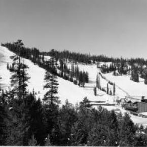
In 1950 Steve became Winter Park's executive director.  During his employment at Winter Park he guided it from a four rope tow/three T-bar local ski area to a major resort of 770 acres with 13 chair lifts.  His brilliance in design led to the Balcony House, the Base Lodge which was one of the first ski area structures to utilize solar heating, the restaurant in the midway proved to be a model for the "scramble" system of food service and then there's the Mary Jane section of Winter Park which was another one of his talents.


Stephen was given the name "Father of Slope Grooming" in 1952 when he then invented the famous Bradley Packer-Grader when experimenting with slope grooming.  The invention was a one man gravity-powered slope grooming device which revolutionized the ski maintenance industry.  Nick-named "the Purple People Eater".  This machine was a mogul-cutting snow groomer that was 5-foot-wide corrugated culvert that a skier would drag down hill or as they said " A hardy mountain crewman" who risked his life by being devoured by the spinning rotor.  As skiing became more popular, skiers started demanding that the slopes be groomed.  Nature was no problem but not everyone wanted to ski moguls.  This Bradley Packer was a way to reduce the mogul's and keep snow on the trails by flattening the snow.  "It was a pretty scary thing" supervisors claimed.  Grooming was soon transferred to a line of tracked vehicles now known a "Snowcats". 


Stephen served as President of the NSAA (National Ski Areas Association) and helped organize Colorado Ski Country USA and the Colorado Passenger Tramway Safety Board before his death in Longmont November 13, 2002.  You can find him as an honored member of the Colorado Ski Hall of Fame and in the National Ski Hall of Fame.


Topic: Mountains

Rollins or Corona - What shall it be called?

Travel across various passes of the Continental Divide occurred long before white men showed up. Indeed, as anthropologist James Benedict wrote c. 1975, some 10,000 years ago, prehistoric Indians camped, hunted, and built hunting walls on the upper reaches of Rollins Pass, as well as moving in and out of Middle Park for the warm summer months. Historic Indians followed the same paths. In the earliest days of non-Indian access, a particular pass at the head of Boulder Creek was dubbed Boulder Pass.

Capt. Jacob Bonesteel, including wagons, made the first recorded crossing by a white man at this point in April 1862. Three years later, a group of Mormons brought wagons over this route and a year later, promoters of new roads into Middle Park brought in many wagons and livestock. In fact, tourists were starting to enter the park by a number of routes, and one of them, Samuel Bowles, who wrote a fascinating account of his trip, including his return to Denver via Boulder Pass.

Interest was growing rapidly for a road over the Divide, into Hot Sulphur Springs, and on into Utah. One promoter, John Quincy Adams Rollins, from New Hampshire, teamed up with William N. Byers and Porter M. Smart to carry this project through. Rollins was interested in crossing the Divide; Byers was promoting the Springs; Porter wanted to develop the valley of the Middle Yampa. All three were pushing to have Middle Park officially named as Grand County, a challenge finally accomplished in 1874.

So Rollins and associates started his road, reaching the top in 1873. That next winter, they publicized this access and in June, Jimmy Crawford brought his family and wagons to Rollinsville and thence to Yankee Doodle Lake, ready to cross the pass now named Rollins Pass by the developer. But the road ended, and they found Rollins' men still hacking the road out of the granite! Jimmy and his crew found it necessary to leave their wagons and help.

Finally, on June 10th, the family was able to head for the top. Jimmy borrowed two yokes of oxen, hitching them to mules, and then to his horse. The road was so rough that the procession could proceed but a few feet before having to rest. The family itself climbed on foot. At the summit, they discovered only a rough swath cut down through the trees on the western side. The "road" dropped down between the lakes and followed Ranch Creek to its junction with the Fraser River. Rollins quickly realized that Berthoud Pass, which also opened in 1874, was superior to his own pass for wheeled vehicles, so he determined to hedge his bets. He initiated the first mail service into the county in 1873. He also built a commodious hotel where his road joined the Berthoud Pass road at the confluence of Crooked Creek and the Fraser. He called it the Junction House. Next, he proposed to the builders of Berthoud Pass that they form a joint ownership of the two roads between Junction Ranch and the Springs. Tickets would be issued for both routes and revenues would be shared. The two companies would build a bridge over the Grand at Hot Sulphur Springs. He even buttered up his rivals by complementing their work.

All this was accomplished, although the mail route soon moved to Berthoud Pass, because of the severe winters on Rollins Pass. The bridge was started in November 1874. From the beginning, Rollins' road was preferred for trailing livestock, because there were fewer problems with heavy timber and bogs. For years, the Church brothers, George and John, who introduced the Hereford breed into the county, trailed their cattle for summering in what became known as Church Park. However, tourists such as Irving Hale still drove wagons over Rollins Pass in 1878.

About 1880, interest burgeoned for bringing a railroad up South Boulder Canyon and through a tunnel near Rollins Pass. Numerous surveys were completed all along the area. David Moffat settled on Rollins Pass for the tunnel site but decided first to put a temporary line over the top. Thus, in the summer of 1903, a formal contract was let for work up and over the Pass itself. By 1904, the workers reached Arrowhead and they also built a work station on top, called Corona Station, or "crown of the mountain." This railroad construction town of Corona, located at over 11,600 feet at the top of Rollins Pass (first called Boulder Pass) along the Continental Divide was the highest railroad station in the world.

It became obvious by 1905 that the Corona area would require snowsheds if trains were to travel, even irregularly, during the winter. Still, word got out of the spectacular splendor of Rollins Pass and tourists flocked in on summer train excursions, sometimes stopping on top, sometimes going as far as Arrow. In 1913, a fine hotel was built next to the rail facilities. Because Rollins Pass was right in the middle of severe weather patterns, a weather station was built on top, as well as one down at Sunnyside. In 1915, Rollins Pass was actually proposed to be the south boundary of a proposed "Estes National Park."

Later, on the National Historic Register, the district was listed in 1997 as the Denver, Northwestern and Pacific Railway Historic District--Rollinsville & Middle Park Wagon Road. It was also identified as the Rollinsville and Middle Park Wagon Road; Boulder Wagon Road, Rollins Pass, and Rollinsville area. In 1956, Governor Steve McNichols had presided at the official re-opening of the four percent grade to vehicle traffic over Corona Pass, expressing the hope that the route would someday be paved. The Colorado Game and Fish Department and the U.S. Forest Service made additional improvements, and the Arapaho and Roosevelt National Forests put out a 24-page booklet titled "The Moffat Road: A Self-Guiding Auto Tour." The road crossed two of the original railroad trestles near Corona but those trestles, even if reached by 4-wheel vehicles, were crumbling and could no longer even be crossed safely on foot. The current self-guided auto tour refers to Rollins Pass, as well as the Moffat Road and the Boulder Wagon Road. Corona Station and Hotel are discussed. In 1979, a portion of the auto road over Corona Pass was permanently closed because of a cave-in of the "Needle's Eye," a tunnel located before the trestles heading west from the Moffat Tunnel's East Portal.

The tunnel reopened on July 3, 1988, thanks to efforts of the Rollins Pass Restoration Association on both sides of the Divide, with the cooperation of the U.S. Forest Service, Colorado History Society, and Boulder, Grand, and Gilpin Counties. It then closed once more when another rockfall hit the tunnel on July 15, 1990. The RPRA is continuing its efforts for re-opening. The noted photographer, Charles McClure, took many outstanding photos of the Rollins Pass road. One, titled"Group on Rollins Pass, shows well-dressed men and women stand on a snowfield making snowballs on Rollins Pass, Moffat Road, Boulder or Grand County, Colorado; probably on Denver, Northwestern and Pacific excursion train. Date: between 1904 and 1913 near Corona Station." Another photo shows a "30 ft. snowcut on Rollins Pass, Moffat Road photo. Denver and Salt Lake Arrow passenger car is parked east of Corona snowshed by the thirty foot snowbank cut, Rollins Pass, Colorado; it shows men, women and railroad employees posed behind train, on the roof and on the snowbank and a standard gauge track. Date: between 1904 and 1915."

A sign at the highway turn onto the Moffat roadbed says: The Moffat Road "Hill Route" Also called "Corona Pass Road", this road over the Continental Divide was the original "Hill Route" of the Denver, Northwestern & Pacific Railway built by David H. Moffat in 1903. It crosses Rollins Pass at 11,666 feet elevation. On top of Rollins Pass, a sign says: Elevation 11, 660 feet, John Quincy Adams Rollins established a toll wagon road through this pass in the mid 1870's. David H. Moffat's Denver, Northwestern & Pacific Railway crossed the Continental Divide at this point in 1903. First known as Boulder Pass, then Rollins Pass, the railroad workers dubbed it "Corona", the crown of the "Top of the world." A railroad station, hotel, restaurant and workers' quarters existed here until 1928 when the railroad was abandoned due to the building of the Moffat Tunnel. Identifications in various trail and geographical guides say: Rollins Pass (el. 11,680 ft) is a high mountain pass in the Rocky Mountains of north-central Colorado in the United States. The pass is located on the continental divide at the crest of the Front Range southwest of Boulder, at the boundary of Grand County,Colorado and Boulder County, Colorado. Rollins Pass (a.k.a. Corona Pass) sits approximately 5 miles east and above the popular ski areas around Winter Park, between Winter Park and Rollinsville. The pass is traversed by an unpaved road, mostly the former roadbed of the Denver and Salt Lake Railway which abandoned the route in 1928 when the Moffat Tunnel opened to replace it. Railroad advertising called this the "Top O' the World" and it referred to the Moffat Route over the continental divide and the Rocky Mountains.

Rollins Pass was the primary travel route west from Denver until an easier road over Berthoud Pass was constructed. The Denver, Northwestern and Pacific railroad laid its tracks across the pass in 1903-1904 and established a Depot at Corona on the crest. It can be noted that in R.C. Black's Island in the Rockies, the term "Corona Pass" was mentioned one time, on p. 351; the terms "Corona Station" or "Corona Snowsheds were used. In Dismantling the Rails That Climbed, Rollins Pass was used, the Corona hotel, and just once, Corona Pass; 1936. In Maggie By My Side, it was Boulder Pass and Rollins Pass. In Rails that Climbed, Rollins Pass, the Corona shed, weather at Corona, Rollins Pass Snow Shed, other references to Corona as a site. In Guide to the Colorado Mountains (Orme) , they speak of the Corona Trail to Rollins Pass. High Country Names (Ward) used Rollins Pass entirely. Only Hiking Grand County, Colorado, published 2002 by Carr speaks of Corona Pass, with reference to Rollins Pass (near the town of Corona), Moffat Road. The term "town" might be questionable; there was only a small restaurant, workers quarters, railroad offices, and in 1913, the hotel. Current maps, USFS and the Grand County Trail Map, show Rollins Pass, with Corona at the side as being a site.

The use of "Corona Pass' seems to be a rather recent innovation that has come into being with tourism efforts in the upper Fraser Valley. Rollins Pass From Island in the Rockies p. 45 Rollins Pass was originally known as Boulder Pass, first recorded being crossed by whites, by Capt. Jacob Bonesteel in April 1862. Their supplies were carried in wagons. A second organized party went over the same pass in 1865. In 1866, promoters of access into Grand County brought many wagons and livestock over Boulder Pass.In 1867, Samuel Bowles and a group returned home to Denver via Boulder Pass. In 1873-74, two roads were proposed into the county, one of Berthouds pass and one over Boulder Pass. This was the same time that the county was named "Grand". J..A Rollins and his associates started the road and reached the top of the pass in 1873, at which time they envisaged a road from HSS into Utah. The first wagons went over in June 1874. The western descent was so bad that it never was much patronized by wheeled vehicles, instead becoming primarily used for trailing of cattle. At this time the name Boulder Pass disappeared from maps and Rollins Pass became the official name. p. 85. p. 80 Lots of schemes to build roads into GC, but of all the schemes for transport, only one, the Rollinsville and Middle Park Wagon Road showed any promise. That was designed by John Quincy Adams Rollins, from NH, a gifted promoter, a son of a clergyman, second of 19 children. He was a farmer, miner, freighter, road bulder, and platter of towns. He was perhaps the most accomplished billiard player west of the Mississippi. He was a Colorado resident at least by 1866. His finances were up and down, but he was tremendously strong. In December 1884, when he was 68, he thought nothing of a 3-day snow-clogged crossing of the Continental Divide. p. 85 Rollins was interested in MP as an investor and he was interested in extending his road into Utah.

At the same time, a Porter M. Smart was likewise excited about speculating in frontier projects and was working at developing the valley of the Middle Yampa. William N. Byers was busy planning for HSS. These three men launched at least two petitions, with more than 80 "residents" for creating GC. Grand County was created that year, 1874. p. 89 With the creation of GC, people began to consider the area more seriously. p. 92 There was no official mail into the county until 1873 when Rollins brought in the first US pouch over his pass. In May 1874, he built a commodious hotel at the confluence of Crooked Creek and the Fraser, known as the Junction House. p. 94 Rollins knew that the road over Berthoud Pass was superior to Rollins Pass; his main advantage was the railhead at Blackhawk. So Rollins proposed a joint ownership and operation of the two roads for the line between Junction Ranch and HSS. Tickets would be issued for both routes and revenues would be shared. The two companies would build a bridge across the Grand at HSS. Rollins even complimented the Berthoud work. This merger was completed soon. p. 104 This bridge was started in November 1874. p. 108

A mail contract was made in July 1875 for once a week delivery over Rollins Pass, but conditions were so severe that the route was changed to Berthoud Pass. p. 110 From the beginning, Rollins Pass was used in preference to Berthoud Pass for trailing livestock, because there were fewer problems with timber and bogs. However, late spring snowdrifts were a problem, so 20-30 horses were often brought along to break trail. The Church brothers, George and John, summered their cattle in what became known as Church Park and dug the Church Ditch. They also introduced the celebrated Hereford breed into GC. p. 170-171 As interest in bringing a railroad into and through GC developed, about 1880, various stockholders proposed to build up South Boulder Canyon to Yankee Doodle Lake and start a tunnel near Rollins Pass. Nothing came of the first attempts but by the end of July 1881, numerous surveys had been made for that tunnel. p. 238 Cattle was still being trailed out via Rollins Pass up to the turn of the century. p. 258

David Moffat and Horace Sumner, his chief engineer, in the fall of 1903, were planning the tunnel for future excavation; but in the meantime a temporary line was planned for crissing Rollins Pass, at 11,640 feet. p. 264 A formal contract was let for the work over Rollins Pass in August 1903. The loftiest sections were started first, and the first cuts at the top were nearly finished by the 26th of October and tunneling started at Riflesight Notch. As snow came, work slowed to a standstill. p. 265 Work in 1904 was extremely slow until the end of August. An encampment was built at Arrowhead and a station at the crest of the Divide was named Corona Station, where long snow sheds were built almost immediately. p. 267 Arrowhead was soon shortened to Arrow, when a post office was opened there in 1905. Travel on the grades, at 4-5% grades up over Rollins Pass was exceedingly difficult. p. 270 In 1908, word of the scenic splendor of Rollins Pass was becoming known world wide.

Also, Rollins Pass and its "Corona station" were attracting the attention fo the US Weather Bureau, for the pass lay squarely in the center of the region of heaviest snowfall on the entire Colorado Continental Divide p. 344 A terrible winter in 1909 made people think that Rollins Pass was never going to be practical for the long term. Time and again freight and passengers were stuck on top at the Corona facility. In 1913, a $10,000 hotel was built at Corona next to the rail facilities. From Dismantling the Rails That Climbed p. 6 The railroad went from Denver to the top of Rollins Pass. p. 8 Snowsheds were built over the tracks at Corona and other strategic places in 1905. p. 12 The top was referred to as "Corona Pass" 1936. p. 16 Crews who were to removed tails and ties reached Corona at the top of Rollins Pass 1936. p. 20 Reference to the Corona hotel From Maggie By My Side p. 1 Jimmy Crawford heard that a man named John Quincy Adams Rollins was building a road over the range at a place called Boulder Pass. 1873 p. 9-14 June 1874

The Crawford family traveled to Rollinsville and then to Yankee Doodle Lake, where the road ended. Rollins' men were still hacking the road out of the granite. Jimmy and his crew helped. On the morning of June 10, the family started out to go over the rocks and up the mountain. Then he borrowed two yokes of oxen to his wagon, then mules, then his horse. The animals had to rest every few feet; the family climbed on foot. There was no shelter at the top. Rollins' men had done no work yet on the west side of the pass except to cut a rough swath down through the trees. The road dropped down along Ranch Creek. From Rails That Climb published 1950 p. 43 Leyden Junction to Tolland to Rollins Pass. P. 63-64 Many references to Tunnels as identifiers of location. p. 76-77, 78 reference to the old Rollins Pass toll road; first mention of the place called Corona- crown of the mountain. Most references are to Rollins Pass. The Corona shed is mentioned, p. 82. p. 83 Sunnyside water stop, Loop Trestle and Tunnel, Ranch Creek Trestle and water stop, Arrow. p. 95, 100- 101 It is eleven miles from Arrowhead to Rollins Pass. Rollins Pass-Boulder wagon road; other references p. 107 - 112 reference to Corona shed. Reference to pipe line to Corona; a number of comments to Rollins Pass p. 119 weather at Corona p. 120-121 Rollins Pass p. 151 Rollins Pass p. 182 photo of "Rollins Pass Snow Shed" "This Corona station burned one night." p. 188 photo of June at Rollins Pass p. 192-194 photos of Corona shed and other buildings; Rollins Pass p. 252 walking on top of snow shed at Corona p. 271- 272. 1910 Snowshed at Corona p. 312-314 Rollins Pass; Rollins Pass snowshed; Corona; Corona siding p. 324 Corona; Sunnyside weather report station p. 326 Corona sheds p. 333-335 Corona shed; references to "Corona" as a place From Guide to the Colorado Mountains published 1974 p. 54-55 Corona Trail, going from East Portal to Rollins Pass From High Country Names published 1972 p. 105 Irving Hale in 1878 drove his wagon over Rollins Pass, now nearly abandoned as a wagon road. p. 131

David Moffat decides to build a temporary line over Rollins Pass. p. 165 In 1915, Rollins Pass was proposed to be the south boundary of a proposed "Estes National Park". From Hiking Grand County, Colorado published 2002 p. 52 Trailhead on the "Moffat Road to Corona Pass". In same paragraph, it becomes Rollins Pass (near the town of Corona). On p. 54, reference to the Corona Road. On p. 57, map shows Rollins Pass with Corona marked as a "site." p. 56, reference to the old railroad bed used crossing the Divide at Rollins Pass, near the town of Corona. Sometimes called Corona Pass. p. 60-61 Rollins Pass Wagon Road historical notes on JQA Rollins and how to find his wagon road over Rollins Pass, following Ranch Creek to Tabernash. p. 66 Rollins Pass (Corona) to Devil's Thumb From GCHA Journal The Journey p. 6 Rollins Pass used by Indians; comment in 1981 From GCHA Journal Middle Park Indians to 1881 p. 8 Archaic hunters camped in the Rollins Pass area; written mid-1970's The current maps, USFS and Grand County Trail Map, show Rollins Pass with Corona at the side as being a site. The Rollins Pass Restoration Association for many years, and currently, has been trying to open the road and Needles Eye Tunnel. The self-guided auto tour refers to Rollins Pass, as well as the Moffat Road and the Boulder Wagon Road. Corona Station and Hotel are discussed. On the National Historic Register Denver, Northwestern and Pacific Railway Historic District--Rollinsville & Middle Park Wagon Road (Boundary Increase) ** (added 1997 - District - #97001114)

Also known as Rollinsville and Middle Park Wagon Road;Boulder Wagon Road;R Rollins Pass, Rollinsville Corona Station and Hotel The railroad construction town of Corona, Colorado, located at over 11,600 feet at the top Corona Pass (first called Boulder Pass) along the Continental Divide was the highest railroad station in the world. It was situated on an old Native American trail, the same trail it is believed the Mormons traveled on their way to Utah. The road was improved by the U.S. Army, then further improved in 1866 by General John Q. Rollins, for whom the pass and the town of Rollinsville were officially named. Because of the high drifts of snow, the pass was only open from around July to the first big snowstorm two or three months later. In 1956, Governor Steve McNichols presided at the official re-opening of the four percent grade to vehicle traffic over Corona Pass, expressing the hope that the route would someday be paved. The Colorado Game and Fish Department and the U.S. Forest Service made additional improvements, and the Arapaho and Roosevelt National Forests put out a 24-page booklet titled "The Moffat Road: A Self-Guiding Auto Tour."

The road crossed two of the original railroad trestles near Corona but those trestles, even if reached by 4-wheel vehicles, are crumbling and can no longer even be crossed safely on foot. In 1979, a portion of the auto road over Corona Pass was permanently closed because of a cave-in of the "Needle's Eye," a tunnel that came before the trestles on a westward drive from the Moffat Tunnel's East Portal area. The tunnel reopened on July 3, 1988, thanks to the efforts of the Rollins Pass Restoration Association with the cooperation of the U.S. Forest Service, Colorado History Society, and Boulder, Grand, and Gilpin Counties. It was then closed once more when another rockfall hit the tunnel on July 15, 1990. John K. Aldrich is a geologist, lecturer, and author whose "Ghosts of . . . " books and accompanying topo maps are a boon to hobbyists, explorers, and those interested in Colorado mining history. Date: 02/04/08 05:13 Rollins Pass Milepost 16 Corona Station. Picture 6 below, is DPL photo X-7388. "Title: Corona, Colorado, interior of snowshed. Summary: Passengers stand next to the covered train depot at Rollins Pass, in Corona (Grand County), Colorado. The tracks of the Denver, Northwestern & Pacific Railway are in the foreground. The depot is constructed of logs, and the roof of the snowshed is upheld by timbers. Sunlight streams through the opening at the end of the snowshed. Date: (between 1904 and 1913). Source: E. T. Bollinger from W. I. Hoklas." Picture 7 below, is DPL photo MCC-454A. "Title: Group on Rollins Pass. Summary: Well dressed men and women stand on a snowfield making snowballs, Rollins Pass, Moffat Road, Boulder or Grand County, Colorado; probably on Denver, Northwestern and Pacific excursion train. Date: (between 1904 and 1913). Creator: Louis Charles McClure 1867-1957. Picture 8 below, is DPL photo MCC-624. "Title: 30 ft. snowcut, Rollins Pass, Moffat Road photo. Summary: Denver and Salt Lake Arrow Turn (passenger car) parked east of Corona snowshed by thirty foot snowbank cut, Rollins Pass, Colorado; shows men, women and railroad employees posed behind train, on roof and on snowbank and standard gauge track. Date: (between 1904 and 1915 The highway sign says The Moffat Road "Hill Route" Also called "Corona Pass Road", this road over the Continental Divide was the original "Hill Route" of the Denver, Northwestern & Pacific Railway built by David H. Moffat in 1903. It crosses Rollins Pass at 11,666 feet elevation. On top of Rollins Pass, a sign says: Rollins Pass Elevation 11, 660 feet John Quincy Adams Rollins established a toll wagon road through this pass in the mid 1860-s. David H. Moffat's Denver, Northwestern & Pacific Railway crossed the Continental Divide at this point in 1903. First known as Boulder Pass, then Rollins Pass, the railroad workers dubbed it "Corona", the crown of the "Top of the world." A railroad station, hotel, restaurant and workers' quarters existed here until 1928 when the railroad was abandoned due to the building of the Moffat Tunnel. Rollins Pass Elevation 11,680 ft (3,560.1 m) Traversed by Unpaved road Location Boulder_County,_Colorado / Grand,Colorado Rollins Pass (el. 11,680 ft) is a high mountain pass in the Rocky Mountains of north-central Colorado in the United States. The pass is located on the continental divide at the crest of the Front Range southwest of Boulder at the boundary of Grand_County,_Colorado and Boulder County. Sign that sits on top of Rollins Pass Rollins Pass (a.k.a. Corona Pass) sits approximately 5 miles east and above the popular ski areas around Winter Park, between Winter Park and Rollinsville. The pass is traversed by an unpaved road, mostly the former roadbed of the Denver and Salt Lake RailwayDenver_and_Salt_Lake_Railway which abandoned the route in 1928 when the Moffat Tunnel opened to replace it. Rollins Pass Railroad advertising called this the "Top 'O the World" and it referred to the Moffat Route over the continental divide and the Rocky Mountains.

Rollins Pass was the primary travel route west from Denver until an easier road over Berthoud Pass was constructed. The Denver, Northwestern and Pacific railroad laid its tracks across the pass in 1903-1904 and established a Depot at Corona on the crest. David Moffat planned to replace the "Hill Line" with a tunnel through James Peak within a few years of the railroad construction. However, he never could obtain financing for the tunnel due to the inability of the railroad to make a profit and opposition from competing railroads such as the Denver and Rio Grande. The D&RG saw the line as a threat. But, in the far future the construction of Moffat Tunnel would turn out to be the D&RG's saving grace. The trip up Rollins Pass was a favorite of summer tourists looking to enjoy the mountain scenery. It was heavily promoted by the railroad with picnic and wildflower picking excursions. Sights along the line were made famous by postcards containing the photos of L. C. McClure. At last the route surmounts the crest of the Continental Divide and takes quick refuge on the top at Corona. At elevation 11, 660 this is truly the famous Top O' the World and one of the highest railroad passes in the world. Due to the great height and nature of the Rocky Mountains, the entire railroad complex was completely enclosed in giant covered snow sheds.

Topic: Ranching

Ranching in Western Colorado

Article contributed by Nichole Fuqua


Ranching in western Colorado first began in 1866 when Texas cowboys began moving cattle into western Colorado. With this rising growth of cattle into Colorado, ranching was forever changed and became a natural part of Colorado's society.

Although the idea of establishing cattle operations in the mountains did not appeal to many, the cattle and ranching industry in western
Colorado began to flourish in 1882. Three causes greatly influenced this move. First, the flat grass lands from Texas to Montana were unavailable. Second, the Ute Indian tribe were being run out and soon removed from the mountains of Colorado. Third, the grasses in western Colorado were abundantly nutritious, especially in the autumn.


When cattle ranches first began, it was organized chaos. Up until the 1930's, all of the land used by cattle ranchers was open-range land. During the winter months the cows lived in the lower valleys where snow accumulation was small. Once spring began the cows were then rounded up and moved to the high mountain tops. This spring round up usually took place in the early part of June, between the first and second hay cutting. The main goal of the spring round up was to gather and sort all of the cattle into their respective herds; unfortunately many herds intermixed because of the open-range. Along with the sorting of the cows, the calves that had been born earlier that spring were branded.


During the open-range era, brands on cattle were very important. Brands were used as a marker to distinguish between herds. Today, branding is still used along with ear tags. The fall round up usually began in the early fall and was completed in stages. The first stage, involved the gathering up of cows that were going to be sold at the market. These were the first to descend from the mountains. The rest of the cattle were then taken down from the mountain and released into the lower valleys to live during the winter months. The 1930's ended the open-range era which also brought an end to fall and spring round ups.


Family life on a cattle ranch was very different from normal life in a town. The cowboy's job demanded a lot of devotion and self motivation. The men of the family were often away from the house for days sometimes weeks at a time moving and tending to the cows.


The women of a cattle ranch lead very isolated lives. During the winter months traveling was unheard of. Once the snow began to melt the water's run off caused creeks and rivers to overflow, which caused traveling in the spring to be tough.  During the summer and early fall, gardening, food processing, house keeping, raising children, and the general ranch duties kept a woman busy.


The children of a cattle ranch were treated very maturely. By the age of five to the age of twelve kids were considered miniature adults. By the age of thirteen or fourteen most kids were able to perform heavy labor tasks around the farm. Ranch families exhibited very strict discipline toward the children of the house and felt very strongly in a child's education.


Cattle ranches are still found all over western Colorado. The attitude has changed throughout the years since the first cattle ranch began but some of the same traditions still exist. 


Sources: Reyher, Ken. High Country Cowboys. Montrose: Western Reflections Publishing Company, 2002.

Peters, Aaron. Cattle Drives & Trail Drivers. 2003. 8 Mar. 2008 http://www.co.wilbarger.tx.us/cattle.htm.


Topic: Regions

The Troublesome

Tradition holds that an army party led by one Lt. Col Johns gave the name of Troublesome to what had sometimes been called Oties Creek.  The Army was plotting a road in 1865 and had to go north to the forks of the East and West Troublesome in order to cross it, because of the soft soil, thereby being a “troublesome” creek.  Some historians claim that mountain man “Colorado Charley” Utter had built a cabin on the creek in 1861, which became a popular stopping place for early hunters and trappers in the region.  Another report credits John S. Jones of Empire with a cabin near the mouth of the Blue River, a few miles away, that same year.

Among the earliest settlers on the Troublesome were Barney Day, Henry King and Martin “Dock” McQueary, who had a cabin there in 1871.  In 1878, a post office was established at the King home. 

By the end of the century, many ranches had been established at on Troublesome Creek.  Farthest upstream was the remote George Hendricks ranch, difficult to reach year round and totally cut off from the rest of the world during winter snow.  Mrs. Hendricks had a large library and gave her children a sound education prior to their high school years in Kremmling. 

Among the most prominent ranches were those of George and Forrest Wheatly.  Probably the largest ranch (3000 acres) was that of the family of Con Ritschard, lying just north of current day U.S. Highway 40 east of Troublesome Creek.

Life was hard for the settlers in the area.  Like much of Grand County, the soil was frozen as deep as eight feet in the winter.  One memoir noted that when there was a death in the winter, the corpse was placed in the roof of a cabin, well swathed, until the spring thaw allowed for permanent burial.

There was a six year school (second to seventh grade) and a post office established at Pearmont about half way up the Troublesome, in the 1920s.  This area was named for local settler Gus Pearson.

Ranching was not the only pursuit along the Troublesome Creek.  Settler Roy Polhamos grew lettuce and shipped it through the Granby Cooperative to Denver.  He also had a potato contract with one of the Denver grocers.  Other growers contributed to the 125 refrigerated train carloads of lettuce that were shipped from Granby in 1924.  By 1929, 34 farmed from Granby to Troublesome netted $46,000, a highly respectable profit in those days.

Topic: Libraries

Libraries

In 1938, Grand County decided to establish a library to act as a central reservoir of knowledge for its citizens. The community realized that few people can purchase all of the books and other materials which they may need, and so they agreed to pool their money in the library to build its central collection. At the same time they wanted to be sure that their interests would always be represented in the operations of the library, and so they formed a board of trustees from among themselves.

At about the same time, the federated women's clubs in Granby and Grand Lake, for the same reasons, set up lending libraries in those two communities. Run by the clubs for many years, both were eventually incorporated into the County Library. In 1994, the Committee to Protect the Library was established to petition the Board of Commissioners to increase funding for the library to set aside a completely separate library fund, which would be administered as a Library District. The voters approved the move on November 8, 1994, and Grand County Library District was formed on January 1, 1995. Today, the library still serves that same basic function for the community as well as new roles acquired in the intervening years.

The Ute Legend of Grand Lake

A group of Utes were camping on the shores of Grand Lake when they were suddenly attacked by an enemy tribe of the Arapaho (and in some versions the Cheyenne as well).  As the brave Ute warriors began fighting, the women and children were hurried onto a large raft for safety and pushed to the middle of the lake.  As the battle continued, a treacherous wind overturned the raft and all the women and children were drowned. Many Ute warriors were also killed during the fighting. 

The legend holds that you can still see ghostly forms in the morning mist rising from the lake and hear the wailing of the lost women and children beneath the winter ice.  The Utes avoided the lake for many years because of these tragic events and evil spirits.

Topic:

Early Families

While natural events occasionally determine history, it is most often the existence of natural resources that lure humans to a region.  Those who first arrived in Grand County came to mine ore, cut timber and graze cattle and therefore they determined the subsequent history of the region.

The pioneering families of Grand County had exceptional stamina, pride and endurance to survive the grueling winters and isolation.  We have collected the stories of just a few of these families, but will continue expanding this section as information becomes available.  If you know the story of one of the early Grand County families, please contact us so that we may include it in this section

Museums