Ute Bill Thompson

People Articles

Lillian Russell Smith Wood - "Gram" Wood
, Gram Wood on horseback

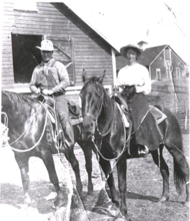
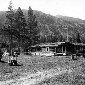
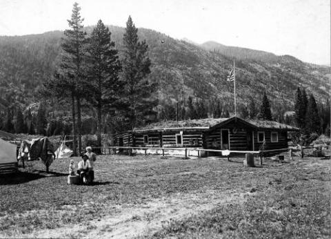
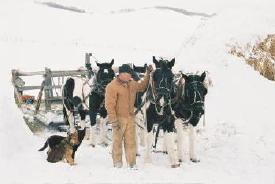
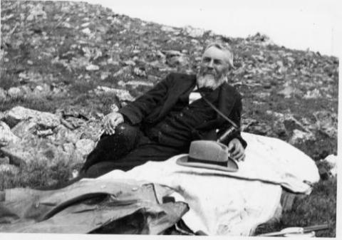
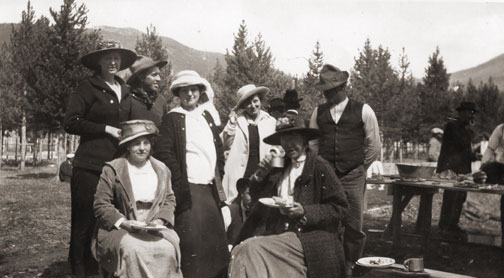
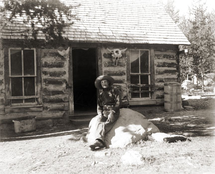
Lillian Russell Smith Wood was born in Dunlap, Kansas, in 1884, she was not a particularly healthy child.  Born just before her and just after her were sets of twins, 2 of the 4 sets born to her parents and the only 2 sets that survived into adulthood.  Lillian spent her adult years on the Williams Fork and then in Parshall. Known as “Gram” Wood to most everyone who knew her, she was grandmother to 39 who bear the names Wood, Noell, Stack, and Black.  And her history in Grand County beginning in 1905 made her one of our pioneers. 

In the fall of 1905, the local newspapers report that Herb Wood had lost a large portion of his right hand in an ore crusher accident.  Herb had come into Summit County originally with a mule team for “Uncle Joe” Coberly, another Williams Fork resident and apparently worked in or around mines and mining equipment while also hauling the timbers for mine use.  Herb needed some round the clock nursing, and in those days, for Gram to take proper care of him and still be in an acceptable position, they needed to be married. One source says the situation was so different that a Denver newspaper picked up the story with a headline of “Loses Three Fingers, Wins a Bride”, indicating that they married 3 days after they met.  Research has never turned up a trace of that story, and it’s unlikely in the mining camps in the area that they hadn’t met until he was injured.  Still, they were married by Judge Swisher, well known area businessman, in short order in the hotel room where Herb was recovering .  A short time later they made a brief wedding trip to Denver and then returned to Argentine.

Before fall set in that year, the newly married couple moved to the Little Muddy.  Herb had been sending money to a partner who was helping him to secure a homestead there not far from where Joe Coberly lived.  It was probably with anticipation of a great future on their own land that sent them into Middle Park to face their first winter as a couple without having had a chance to raise a garden or preserve any winter supplies.  They moved into one end of a two room cabin with a man named Ranger Charlie in the other.  And about that same time, they discovered that Herb’s partner had been drinking the money he’d sent over the years.  What devastation that must have caused!

On the other side of the valley just across the creek was the large  ranching operation known as the Hermosa Ranch, owned by Dr. T. F. DeWitt, a well-to-do doctor from back East.  With the dream of his homestead gone, Herb went to work for DeWitt, eventually becoming one of his foremen.  Gram probably helped out with cooking and cleaning, but within a few months, she went back to Kansas to await the birth of their first child. Over the next 21 years, she raised kids and gardens and developed her love of fishing, which helped feed a family that eventually totaled 13 kids, including a set of twins born 2 weeks before Christmas and delivered by Herb when a doctor couldn’t reach them in time. Pictures of the time show a large family of 9 boys and 4 girls with Gram, all 5’2” and maybe 100 pounds of her on one end, and Herb with a child or two on his lap at the other.  The kids recall Christmases being supplied mostly by Mrs. DeWitt and sometimes being late if the trains got snowed out of the area. All attended one room schools, Hermosa and Columbine, and stories of their lives together can make one wonder why any of them survived.

Life continued  pretty much routinely until 1928.  That summer, the youngest daughter, Marilyn, a premature baby and ailing child caught whooping cough.  She lingered and languished until early October, and then she passed away.  The close-knit family had suffered it’s first loss. Two weeks later, Herb came in from the hayfield complaining of not feeling well.  Gram followed him into the living room and sat down with him on the couch. Minutes later, he collapsed in her arms and died of a cerebral hemorrhage.  They buried him alongside Marilyn in the Hot Sulphur Springs Cemetery.

The boys continued the work for Dr. DeWitt for several years, and in 1932, they built a 2 bedroom house for Gram several miles from where DeWitt had relocated his ranch.  Her sons made sure she had what she needed as she finished raising the youngest ones who had been little more than toddlers when Herb died.

By the time I was old enough to remember much about Gram, she was already a “little old lady” who lived in a small, pink mobile home next to Uncle Kenneth in Parshall. Everyone knew that she was one of the best fishermen in the country, having caught as many as 1200 in a season when she was feeding her family by herself.  She enjoyed creek fishing the most, and even as she got older her ability to maneuver around the biggest holes and catch fish in any small body of water never faltered.   I never saw her get wet.

In the winter, she was totally unafraid getting a couple of her grandkids on a sled and making a run down the hill in Parshall that ended at the store and U.S. 40, which then went through the center of town.  Had her feet not worked so well as brakes, we could have ended up on the pavement.  But we never did.

She must have driven many teams of horses in her day, and I believe she was a good rider. She never drove a car, but unless she needed to go to the doctor in Kremmling, she didn’t need to leave town. Her friends included Doc Ceriani’s mother and fellow fishermen from Hot Sulphur, a couple from Poland with heavy accents.  Somehow, somewhere she had met Ralph Moody, author of the “Little Britches” series. And she, too, had a “fish” experience with warden Henry “Rooster” Wilson.

Only once did I get into trouble because of Gram.  She was fishing one day near where I was getting ready to ride, when she laid down her pole and walked over to me.  After watching me for a minute she said, “Can I ride?”  What do you say to your 80 year old grandmother but, “Of course!”  I saddled up the gentlest mare we had and helped her aboard.  She only made a couple of trips around the small pasture, but as she rode, walking only, I’m sure I saw a young woman next to her husband on horseback in front of one of the Hermosa’s big barns.  It’s one of the pictures you’ll find at the County Museum in Hot Sulphur.  When dad found out what I’d done, he turned deathly white.  “Don’t you know if she’d fallen or been thrown she could have been seriously injured or killed?”  No, I had to admit.  This was one rider’s request to another, with age no consideration .  And to her at that particular moment, had either occurred I believe she would have considered those few moments worth the risk.  When she was finished, she walked back to her fishing pole, satisfied that nowshe was done riding.

Gram introduced me to horehound candy, something I will also think about each time I taste it.  And because she didn’t like my first name, I didn’t even know what it was until I started school.  She taught me that barn cats do fish and that survival in a small living space was possible The one thing she didn’t teach me was anything about her growing up years or about my grandfather.  It seemed like we knew as very young kids that we didn’t ask about him.  I believe that hers was a love so strong that even to the point where her mind grew dim, the pain of losing him was too much to bear.  One regret we all have, however, is that we never asked to her to go with us up to Summit County to show us where she lived and to tell us stories of that life and time.  And unfortunately that’s been lost forever. Gram passed away in 1980, at the age of 97.  She is buried with Marilyn and Herb and their son, Melvin who died during World War II in a family plot in Hot Sulphur with other family and pioneers characters nearby.

She left a true legacy through her kids and grandkids who continue the nostalgic traditions of their beloved Gram.

Maggie and Jimmy Crawford

Maggie and Jimmy Crawford came to Middle Park in the summer of 1874 with their three children. They were given a piece of property and built a one room sod roofed cabin in Hot Sulphur Springs. They were probably the first family to stay the winter in Middle Park.

As they settled in for a long hard winter, Jimmy continued exploring lands to the west.  He found prime land near a spring that made a unique chugging noise.  That sound reminded him of the steamboats on the Missouri River back home.

After that winter, Maggie returned to Missouri with her family, while Jimmy built a cabin on the new filing, which would later become known as Steamboat Springs, Colorado.

By 1876, Maggie and the children were back in Colorado, and the family became founding members of that new community.
 

Mary Lyons Cairns
Mary Lyons Cairns

For being such a shy, quiet person, Mary Lyons Cairns always had an unexpected spirit of adventure. In 1905, the 5'11" twenty-year-old Mary Lyons left her family and home in Ellsworth, Kansas, and set out for her new teaching position in Grand Lake, Colorado.

It was a cold, dreary winter afternoon when she arrived at the hotel in Granby. She spent an uneasy night in her hotel "room", whose walls were merely curtains separating hers from the next "room". The next morning, the proprietress gave her one parting bit of advice before she boarded the stagecoach to Grand Lake. She said, "buy yourself some galoshes, dear."

In addition to a small salary, her teacher's compensation included room and board with the students' families. She boarded at Josephine Young Langley's Rustic Inn, which stood near present-day Point Park. Her five lively pupils were Charlie Eslick, Bessie Eslick, Jenny Young, Jake Young, and Chris Young. The school was a rented building on Grand Avenue, which today is the Mine Design jewelry store.

On New Year's Day 1907, 56 year-old James Cairns and 22 year-old Mary Lyons were married. James presented Mary with three wedding gifts-a piano, a gold, pearl and diamond brooch, and a dashing dark green cutter (sleigh) with gold pin-striping. They set up housekeeping in the large two-story home that James had built in 1903 on Grand Avenue across the street from his store. The Grand Lake Art Gallery sits on this location today.

A chimney fire in the summer of 1916 resulted in the complete destruction of their home. The "temporary" move to the little house behind present-day Humphrey's Cabin Fever lasted until 1937, when Mary Lyons Cairns and her daughter, Patience, had their new stone house built on the lakeshore site that James had bought in 1889.

McQueary Family of Middle Park

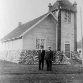
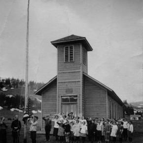
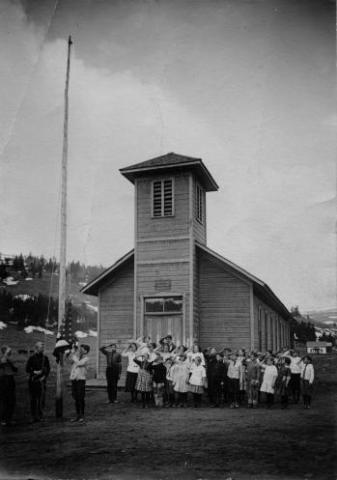
It has been said that if you walk down the streets of Hot Sulphur Springs and call out "Hello McQueary" at any given time, someone will respond.  Certainly one of the most prolific families to pioneer the Middle Park, the McQueary clan consisted of Scotch-Irish descendents of the immigrants who had settled in the mountainous regions of the Ozarks and the Blue Ridge Mountains.

Henry McQueary and his brother Humphrey, visited the Middle Park area in 1866 while prospecting for gold on Troublesome Creek.  Henry built a cabin on the creek in 1875 and other relatives came to settle including Walker, James, John and George, along with their families.  The families settled near Hot Sulphur Springs and as far west as Muddy Creek and the Gore Canyon.

In 1875, Henry found a Ute Indian with a broken leg near the Troublesome Creek.  He took the man to his cabin and splinted the leg.  After three weeks, the injury healed enough that the Ute could return to his family and that created a friendship that outlasted the Ute uprisings of 1878-1879.

In 1888, Fount McQuearly established a hotel in Hot Sulphur Springs which included a 45 foot ballroom in the Antlers Saloon.  In his later life, he served as County Commissioner (1924).  Many other McQuearys also went into politics, so much so that they were sometimes referred to as the "McQueary Gang".     

"Uncle Walk" McQueary once said that if Andy Eairheart "ever fell into the river and drowned, we'd have to look for his body upstream 'cause he's too stubborn to float downstream!".

Dick McQueary was quite enterprising, establishing a store in Hot Sulphur Springs (1904) and helping newcomers to the area locate homestead sites.  He once was paid with a barrel of china for his services.  Dick also was a contractor for building and maintenance for Grand County and he led the effort to build a road through Rocky Mountain National Park.  This road was eventually finished in 1920 and is known as the Fall River Road.

At least three McQuearys served their country in World War I and fifteen in World War II.  They were also noted athletes; at the 1924 Hot Sulphur Springs Winter Carnival, Margaret McQueary won first place in girls jumping and ski-joring while Milton won first in boys cross country.  

Eventually the McQuearys had over a dozen ranches in Middle Park.


Milton "Green" McQueary

"One Grand Essay" contest 2005 

It is a strange feeling one gets as you realize you are breathing your last breaths. You start to remember some of the wonderful and not so wonderful things that have happened in your life.  As I am lying on this cold ground in Phoenix, Arizona instead of my beloved land in Dexter Colorado, I start to think of my family. I miss my sweet and beautiful wife Anna whom I have had to live without for so long and realize suddenly that is has been 20 lonely years. We had an interesting life together: she and I and our 10 children.

I remember many years ago before I met Anna, when I was only 11 on the day of April 27, 1873. My family had decided to head out of Missouri with our covered wagon. It was pulled by mules and oxen and filled with all of our precious possessions, along with boxes of shot and black powder for muzzle-loading guns. Potatoes, flour, beans, coffee, salt pork, fish hooks, and of course my dog Ranger accompanied us. My father and mother, Walker Barron and Mary, my younger brothers John H., Walker Emery and my little sister Maud who was only 3 at the time were all ready as we started out early in the morning with my Uncle James Allen "Polk" and his family. We traveled until we met up with a train of about 100 other wagons heading west in search of a new home, and possibly some gold.

We had traversed across the country over the plains, streams and mountain ranges from Johnson Country Missouri to Denver, Colorado arriving on June 5th where we made camp the first night near Sloan's Lake. Then we continued moving west until my father and uncle found work at a sawmill between Golden and Idaho Springs in the town of Beaverbrook.

With the completion of the Berthoud Pass stagecoach road in 1874, my father and some friends went over the Gore Range to explore Middle Park. Then two years later on July 9, 1876, our family moved to Middle Park just two weeks after General Custer's defeat on the Little Bighorn River in Montana.

My father decided to claim squatter's rights by building a one room cabin on the bank of the Grand River near Kremmling a mere two years before we had the Ute Indian scare. After the scare my mother wanted to move to Hot Sulphur Springs where there was and established school and more people. It was there that my father purchased the Springs Hotel renaming it the McQueary House. Shortly after some success with the hotel, my father purchased a home along the Willow Creek near Windy Gap.

I remember the day I had met my love, Anna Rebecca Kemmerer. She was so sweet that we married quickly on May 6 1884. In February of 1885 my first son Frederick was born followed by Clayton Henry two year later, and Harry Senator two years after that. However, Harry was not to be with us long and we lost him in August of 1892. Nevertheless, life goes on we were blessed with another son Ralph Grant who was born in August of 1892, followed by Myrtle Grace in 1894 and Chester William in 1896.

With our ever-increasing family, Anna and I purchased the 160-acre Frank Adam's homestead adjoining my father's home on Willow Creek where we would have room to grow and my children could enjoy the company of my parents. Just before Chester was born, I applied for a coveted appointment as postmaster and wanted to locate a post office on Gold Run, naming it the "Willows Post Office." On September 25, 1896, the US postal department did let us open a post but decided but renamed it Dexter instead. We had expected a mining boom along the Willow Creek and thought a town would be built around our post office and homes.

I remember when Ike Alden had found gold along the creek and sent it down to Georgetown to have it assayed. He found out that it was estimated to be worth about $1,700.00 to the ton, which is where the name Gold Run came from. But our peaceful valley did not prosper as we had hoped and the town was never built so we turned to ranching instead. We had four more children Gertrude Mildred, Robert Melvin, Mary Frances and lastly Ada Rebecca who was born in 1904.

During those years in my blacksmiths shop, I made wagons, repaired some of my neighbor's equipment and farm machinery. We had thought that a stagecoach line would bring the mail on a regular basis but it was really just a freight line. Anyone who wanted to could ride it and some of the passengers who used it were welcome to stay for a meal at the Dexter Ranch. There were two cabins across the road, which used for guest or tourists, mostly fisherman, but a place for anyone to sleep.

In 1905, the first train reached Granby and many of the ranchers of North Park would travel to the depot via Dexter and stay, purchase hay and join us for some meals. I was somewhat handy with carpentry and had built a large round table, which was a little unusual but very practical. I had fashioned it with pegs around a lazy Susan. I remember now at supper one time a guest of ours was helping himself to some food from a dish when someone asked him what the matter was. He was holding the dish in his hand and looked befuddled. He answered, "I forgot where I got this," We all laughed at his little dilemma. It makes me smile now thinking how wonderful the food was and how lovely my Anna looked when she laughed.

We built a schoolhouse made out of log in Dexter. Using our horses we created a log skid trail, dragging log after log until we had enough for a 16, or was it 18 by 20 foot building. Years later the children would still climb the skid trail with their skis and ski down during their recess.

Sometimes we would have dances at the schoolhouse and we would push all of the desks back against the wall and play old-time pieces. I liked to play my fiddle with a few of my other friends. Roy Curtis, and Andy Eairheart and sometimes my cousin Dick would call out square dances.

I also remember what a great time everyone would have as they danced when we played at the Grand County Winter Sports Carnival Grand Ball. Although the Carnival was held in Hot Sulphur Springs the last two days of December, we all headed over to participate and watch the skating, tobogganing and skiing. One year my son Robert who was a member of the Commercial Club went to Denver to represent us in the National Ski Association meet there and the following year he went to Steamboat.

As time went, on my daughter, Myrtle Grace met and married Charles Everhart and I had my first granddaughter Violet. I remember that as Violet became older she loved to play in my Blacksmith shop. I told her "If you play with my tools put them back where you got them". She was an obedient child and did as I asked so I never minded her coming in and playing with the bellows. She would get some scrap iron and place it in the fire until it was red-hot and then put it into the tempering barrel. She just loved to hear that sizzling sound. It makes me smile to think about that now as I start to shiver in this darkness and evening begins to approach.

I am struggling to stay awake hoping someone will help me get out of this place as memories of my other granddaughter Gertrude Jane come to my mind. She did not like the name Gertrude Jane because her mothers name was Gertrude Mildred, and everyone called her mother Gertie. She did not want to be called Gertie too; she preferred to be called by her middle name Jane instead. She would tell me what an interesting man I was and that she loved my blue eyes.

My little Jane is 17 years old already. But I guess I won't be celebrating her eighteenth birthday or the birthdays of any of other grandchildren now. I feel myself falling deeper and deeper into darkness and know that my Anna is waiting for me. I see a light now and my blue eyes are starting to tear.  As I walk towards the light I see my Anna is holding out her had for me to grasp. How wonderful my life has been and how I have enjoyed my journey. Now it is time for us to go home.

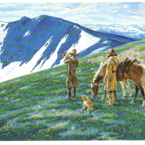
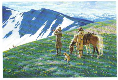
Mountain Men / Trappers

Many noted fur trappers and traders are reported to have been familiar with the headwaters of the Grand (Colorado) River as early as the 1820s. Among them were Thomas Fitzpatrick, Jim Beckwurth, Christopher “Kit “Carson, Henry Fraeb and Peter Sarpy. Louis Vasquez built a trading fort on the South Platte River and ventured into what is now Grand County, where a pass east of Berthoud Pass is named for him.

His partner, Andrew Sublette, also came across the Divide to trade in Grand County, as well as Ceran St. Vrain, whose fort was near modern Platteville. 26 year old Tom Smith was with a group of trappers who entered the northern part of Grand County in 1827, where they were attacked by either Ute or Arapahoe Indians. Tom was hit in the leg by an arrow, splitting the bone and creating a life threatening infection. Amputation was needed but none of the party had the nerve to perform the operation. So Tom took a butcher knife and amputated his own leg. As “Pegleg Smith” Tom later became noted as one of the greatest horse thieves in the West, but was never prosecuted.

The beaver trade was essentially over by the 1840s as silk replaced beaver pelt as the stylish material for top hats. In 1842, famed traveler Rufus Sage came over Muddy Pass into Middle Park, but recorded almost no hunting activity there. On the other hand …fishing was great! His party caught over 50 pounds of trout in one morning. Noted mountain man Jim Bridger and another guide, Joseph Chatillon, let the infamous Sir George Gore on an extravagant hunting expedition in Middle Park. Despite the senseless slaughter of thousands of game animals, Gore has been immortalized with a mountain range, canyon and pass named for him.

One of the earliest of the mountain men to discover what was to become Grand County arrived in the Fraser Valley as early as 1860, soon after gold was discovered in Colorado. Charley Utter, known as “Colorado Charley”, was considered the prototype of rough trappers and traders. He was unique, though, in that he insisted on taking a bath every day, whether in the hot springs or beneath frigid waterfalls. In 1864, Charley was one of the first to make use of Berthoud Pass driving cattle that he raised at Troublesome Creek. His home was host to various adventurers who came to explore the prospects of Middle Park. He would eventually work with the famous Buffalo Bill Cody, appearing in “Wild West” shows.

When Kentuckian Beverly D. William spent some time in Grand County, he realized the Grand River was originally named the Colorado. As a Washington delegate from the newly organized “Jefferson Territory” (as this area was known at the time), he was instrumental in getting the named changed to the “Colorado Territory”, although the river was called Grand River until 1921.

Murphy Family
Murphy Family

October 2009

As late as this summer, John Murphy, 94, mowed ditches on his ranch land and built a new fence. "You got to keep busy doing something," he said. His longevity, he said smiling at wife Carolyn across the table, is owed to "having a good wife to keep you healthy."

And then he added, "and being stubborn and contrary, I guess." But, Carolyn believes John's secret to healthy aging is due to "hard physical labor from an early age," plus the privilege of being raised where there is good air, little junk food, fresh vegetables, fresh milk daily and ranch-harvested meat. Dancing and regular rodeo jaunts also don't hurt.

This week, the Murphys are pausing to acknowledge a 100-year milestone, when John's parents first bought the ranch in greater Granby. John Murphy was born in the family's white two-story ranch house, which still stands on the property, six years after his parents Anna (Rohracher) and James Murphy bought 160 acres from Leopold Mueller in 1909. He had purchased the land from the widow of Edward Weber, who was one of the Grand County commissioners shot in the Grand Lake shoot-out of 1883. Weber's grave is still surrounded by a white-picket fence, located just northwest from the Murphys' newer home.

Mother Anna had crossed the ocean from Austria in 1882 with her family, then in the spring of 1884, they walked over Rollins Pass from Ward to homestead at Eight-Mile Creek south of Granby. The town of Granby didn't sprout until the railroad came through in the early 1900s, so twice a year, the family would travel over Berthoud to Georgetown to buy groceries - a testament to the fortitude people had back then. "How often do you go for groceries now?" John asked. "Twice a day?"

Anna and James married in March of 1907 and had three children: Margaret, James and John. When John was just two years old, his father died and his mother was left to care for the ranch and the three young children. She later married Joseph Reinhardt who had the ranch above theirs.

Upon her death in 1952 at the age of 75, "The Middle Park Times" saluted Anna for having been "a hardy pioneer woman" who prided herself for her ability to horseback ride and milk cows, and called the latter a "fine art rather than a chore."

"It was a pleasure for her to sit down and milk cows," John said. "That's when she could rest. She would milk half of the cows while me and my step-dad milked the other half."

The ranch had about 35 cows, and the cream and milk they produced was shipped to Denver where it was sold. When the lettuce colonies came to the Granby area around the early 1920s, the Murphy ranch prospered selling milk and butter to local settlers.  "Where the airport is now, there was a shack or tent on every 10 acres over there," he said, "and five packing warehouses along the railroad." Even a section of Murphy land was leased to grow lettuce and spinach.

When young boys, John and his brother would sometimes find entertainment riding on the backs of calves in the barn - always out of sight from their mother who would have disapproved, he said. And the younger John would horseback to the Granby schoolhouse located across from the present day Granby Community Center.

Back then, Granby was barely a settlement, and the Murphys' closest neighbor was farther than a mile away. Granby, especially, has grown in the past 20 years, threatening the lifestyle he has known all his life. In the past, ranching families made up the community, and neighbors looked out for one another, he said. "There was kind of a togetherness," he said. "Now we don't have that."

Nodding to the golf courses and newer homes surrounding Granby proper, "We're losing it, losing all the ranchers," he said. "Like any piece of property, I hate to see it change hands, but progress happens and there's nothing you can do about it."

John Murphy began running the ranch in 1934 and his older brother James ran another ranch near Fraser, land the brothers originally had purchased together.
John's first wife Edith died during childbirth, and John became a single dad to a daughter and son who were 2 and 4 years old at the time, running the ranch and raising his children like his own mother did when he was a toddler.

At its height, John Murphy's commercial cattle operation had about 2,000 acres and about 120 pair of cows and calves, with the calves selling at the top of the market in Omaha. John said from working his land for hay through the years, he has found buffalo horns. "There must have been quite a few buffalo here in the 1800s," he said. The land has since been leased, split, and some shared with John's family, including daughter Jennifer Baker and son Steve Murphy.

Although the winters are no longer as harsh as he remembers them - "It would get 30 to 40 below for the whole month," he said - he and wife Carolyn now winter in Arizona. John met Carolyn in the 1970s, and the couple would dance at haunts such as the Circle H and Hazel Mosle's (now Johnson's Landing). "I just held the girls, and they did the dancing," John said. "She complained I held her too tight," he said, of Carolyn. "And she's been suffering every since."

Nathaniel "Nathan" Shore

Nathaniel "Nathan" Shore was born in Cottonwood Harbor Canada in 1856. When he was about 16 years old he had visited and then worked as a freighter hauling groceries to different towns in western Colorado. He saved enough money to purchase his own wagons and 2 yoke of oxen for each wagon to continue freighting.

Nathan became famous as a man who carried his Bible in one hand and a gun in the other. Nathan returned to visit his family and met Sarah Jones in Springfield Missouri. They were married in 1885. Their trip to Colorado and the Williams Fork was undertaken with Sarah driving a team of horses pulling a covered wagon and Nathan herding their few cows.

The cows helped start a homestead ranch east of the Williams Fork river. In 1907 they sold the homestead ranch to the Curtis Family. They had purchased the Anders Anderson ranch close to Williams Peak and the Joseph Jackson ranch on Bull Run Creek.

They lived on the Anderson place until the forest fire that burned along the Williams Fork Mountains. Nathan told Sarah to hitch the horses to the hay rack, load the furniture that it would carry, take all the children and move to the Jackson place while he helped fight the fire. Nathan's team of horses were stolen so he broke 3 heifers and a steer to work in the yoke.

He still did a lot of freighting to make a living for his family. He freighted to Hot Sulphur Springs and also from Georgetown. He returned home to the ranch about once a week. He sold butter, that Sarah had made and hung down in the well to keep cold, in the mining town of Breckenridge.

Nathan Shore died June, 1928 when his pickup stalled on a railroad crossing in Utah. He was trying to find the trouble under the hood and didn't hear the train as it whistled and whistled. He was headed for a trip to Hawaii.

Origins of the Ute People

Before there were any people anywhere, the Creator, "Sinawaf", cut sticks and placed them in a large sack.  After many days, this aroused the curiosity of the coyote.  When Sinewaf was away, the coyote could no longer control himself and opened the sack.

Out came many people who scattered in all directions.  Each spoke a difference language from the others.  When Sinewaf returned, there were only a few people remaining in the sack.  He was furious with the coyote, as he had planned to distribute the people equally in various parts of the land.  As there could now be no such equity, there would be wars among the different people, who would fight for the best locations.

Of the small group left in the sack, Sinawaf called them Ute or Nuche, which meant "the people".  They would be a very brave and strong tribe.

R.W. "Dick" McQueary

R.W. (Dick) McQueary was born May 9, 1868, in the San Luis Valley near what is now Del Norte. Dick moved to Grand County in 1876. In 1892, Dick, newly married, began freighting between Hot Sulphur Springs and George Town's railroad terminal.

He moved boxes of merchandise for the general store, barrels of whiskey for saloons and machinery for sawmills. On one of these trips he decided to build cabins closer to Berthoud Pass. His crew built several log buildings 6 miles from the top of the pass and named it "Spruce Lodge".

In the spring of 1893, Dick contracted to open snowbound Berthoud Pass by middle June. He moved his wife Jessie and three-months old son to Spruce Lodge. Snow was shoveled from the roofs and trails to the buildings. Heat from stoves thawed the frozen dirt roofs and water entered the cabins. Pans were placed under the leaks to catch snow water. Work was completed 2 weeks later. On June 14, snow began to fall and canvas was placed over stove pipes to keep water from putting out the fires. Four feet of snow fell and the only dry place in the cabins was the pallet with the baby on it under the table.

1895 saw Dick Mcqueary homestead 320 acres between Pole and Crooked Creeks The ranch was named "Four-Bar-Four" after Dick's cattle brand. It became a well-known travel stop and is a point of interest to this day. By 1909 R.W. was freighting the Grand Lake area and became involved with building a road between the foot of Milner Pass to Pouder Lake at the summit. Dick bid $49,000 to build the road. Three years later, completion of a rough outline of the entire road through Rocky Mtn.National Park. M cqueary completed the west side and Jacobson the east side. Dick prepared festival grounds west of Grand Lake and a large crowd enjoyed the road opening celebration.

Articles to Browse

Topic: Towns

Radium

The settlement of Radium, on the north bank of the Colorado River in Gore Canyon, was established in 1906, when railroad construction of the Denver and Salt Lake Railroad brought in foreign workers, typically Swedes, Greeks, and Italians. After the rail lines were built, livestock was shipped out and vegetables such as potatoes, peas, and lettuce were grown and picked at the last minute so they could be shipped while still fresh.

Originally the land was homesteaded by the Murgrage and Hoyt ranch families. Railroad passenger service during the winter months was scheduled only three times a week each way but even then, couldn’t always get through. Nonetheless, the “Try Weakly Railroad” service was better transportation than anything residents had ever had before.

The name of Radium was suggested by Harry S. Porter because of the radioactivity found in his mine. The nearby Radium Copper Mine was a large copper producer at one time.

Maintainance workers for Union Pacific, current owners of the railroad, are still based at Radium.

Topic: Mountains

Rollins or Corona - What shall it be called?

Travel across various passes of the Continental Divide occurred long before white men showed up. Indeed, as anthropologist James Benedict wrote c. 1975, some 10,000 years ago, prehistoric Indians camped, hunted, and built hunting walls on the upper reaches of Rollins Pass, as well as moving in and out of Middle Park for the warm summer months. Historic Indians followed the same paths. In the earliest days of non-Indian access, a particular pass at the head of Boulder Creek was dubbed Boulder Pass.

Capt. Jacob Bonesteel, including wagons, made the first recorded crossing by a white man at this point in April 1862. Three years later, a group of Mormons brought wagons over this route and a year later, promoters of new roads into Middle Park brought in many wagons and livestock. In fact, tourists were starting to enter the park by a number of routes, and one of them, Samuel Bowles, who wrote a fascinating account of his trip, including his return to Denver via Boulder Pass.

Interest was growing rapidly for a road over the Divide, into Hot Sulphur Springs, and on into Utah. One promoter, John Quincy Adams Rollins, from New Hampshire, teamed up with William N. Byers and Porter M. Smart to carry this project through. Rollins was interested in crossing the Divide; Byers was promoting the Springs; Porter wanted to develop the valley of the Middle Yampa. All three were pushing to have Middle Park officially named as Grand County, a challenge finally accomplished in 1874.

So Rollins and associates started his road, reaching the top in 1873. That next winter, they publicized this access and in June, Jimmy Crawford brought his family and wagons to Rollinsville and thence to Yankee Doodle Lake, ready to cross the pass now named Rollins Pass by the developer. But the road ended, and they found Rollins' men still hacking the road out of the granite! Jimmy and his crew found it necessary to leave their wagons and help.

Finally, on June 10th, the family was able to head for the top. Jimmy borrowed two yokes of oxen, hitching them to mules, and then to his horse. The road was so rough that the procession could proceed but a few feet before having to rest. The family itself climbed on foot. At the summit, they discovered only a rough swath cut down through the trees on the western side. The "road" dropped down between the lakes and followed Ranch Creek to its junction with the Fraser River. Rollins quickly realized that Berthoud Pass, which also opened in 1874, was superior to his own pass for wheeled vehicles, so he determined to hedge his bets. He initiated the first mail service into the county in 1873. He also built a commodious hotel where his road joined the Berthoud Pass road at the confluence of Crooked Creek and the Fraser. He called it the Junction House. Next, he proposed to the builders of Berthoud Pass that they form a joint ownership of the two roads between Junction Ranch and the Springs. Tickets would be issued for both routes and revenues would be shared. The two companies would build a bridge over the Grand at Hot Sulphur Springs. He even buttered up his rivals by complementing their work.

All this was accomplished, although the mail route soon moved to Berthoud Pass, because of the severe winters on Rollins Pass. The bridge was started in November 1874. From the beginning, Rollins' road was preferred for trailing livestock, because there were fewer problems with heavy timber and bogs. For years, the Church brothers, George and John, who introduced the Hereford breed into the county, trailed their cattle for summering in what became known as Church Park. However, tourists such as Irving Hale still drove wagons over Rollins Pass in 1878.

About 1880, interest burgeoned for bringing a railroad up South Boulder Canyon and through a tunnel near Rollins Pass. Numerous surveys were completed all along the area. David Moffat settled on Rollins Pass for the tunnel site but decided first to put a temporary line over the top. Thus, in the summer of 1903, a formal contract was let for work up and over the Pass itself. By 1904, the workers reached Arrowhead and they also built a work station on top, called Corona Station, or "crown of the mountain." This railroad construction town of Corona, located at over 11,600 feet at the top of Rollins Pass (first called Boulder Pass) along the Continental Divide was the highest railroad station in the world.

It became obvious by 1905 that the Corona area would require snowsheds if trains were to travel, even irregularly, during the winter. Still, word got out of the spectacular splendor of Rollins Pass and tourists flocked in on summer train excursions, sometimes stopping on top, sometimes going as far as Arrow. In 1913, a fine hotel was built next to the rail facilities. Because Rollins Pass was right in the middle of severe weather patterns, a weather station was built on top, as well as one down at Sunnyside. In 1915, Rollins Pass was actually proposed to be the south boundary of a proposed "Estes National Park."

Later, on the National Historic Register, the district was listed in 1997 as the Denver, Northwestern and Pacific Railway Historic District--Rollinsville & Middle Park Wagon Road. It was also identified as the Rollinsville and Middle Park Wagon Road; Boulder Wagon Road, Rollins Pass, and Rollinsville area. In 1956, Governor Steve McNichols had presided at the official re-opening of the four percent grade to vehicle traffic over Corona Pass, expressing the hope that the route would someday be paved. The Colorado Game and Fish Department and the U.S. Forest Service made additional improvements, and the Arapaho and Roosevelt National Forests put out a 24-page booklet titled "The Moffat Road: A Self-Guiding Auto Tour." The road crossed two of the original railroad trestles near Corona but those trestles, even if reached by 4-wheel vehicles, were crumbling and could no longer even be crossed safely on foot. The current self-guided auto tour refers to Rollins Pass, as well as the Moffat Road and the Boulder Wagon Road. Corona Station and Hotel are discussed. In 1979, a portion of the auto road over Corona Pass was permanently closed because of a cave-in of the "Needle's Eye," a tunnel located before the trestles heading west from the Moffat Tunnel's East Portal.

The tunnel reopened on July 3, 1988, thanks to efforts of the Rollins Pass Restoration Association on both sides of the Divide, with the cooperation of the U.S. Forest Service, Colorado History Society, and Boulder, Grand, and Gilpin Counties. It then closed once more when another rockfall hit the tunnel on July 15, 1990. The RPRA is continuing its efforts for re-opening. The noted photographer, Charles McClure, took many outstanding photos of the Rollins Pass road. One, titled"Group on Rollins Pass, shows well-dressed men and women stand on a snowfield making snowballs on Rollins Pass, Moffat Road, Boulder or Grand County, Colorado; probably on Denver, Northwestern and Pacific excursion train. Date: between 1904 and 1913 near Corona Station." Another photo shows a "30 ft. snowcut on Rollins Pass, Moffat Road photo. Denver and Salt Lake Arrow passenger car is parked east of Corona snowshed by the thirty foot snowbank cut, Rollins Pass, Colorado; it shows men, women and railroad employees posed behind train, on the roof and on the snowbank and a standard gauge track. Date: between 1904 and 1915."

A sign at the highway turn onto the Moffat roadbed says: The Moffat Road "Hill Route" Also called "Corona Pass Road", this road over the Continental Divide was the original "Hill Route" of the Denver, Northwestern & Pacific Railway built by David H. Moffat in 1903. It crosses Rollins Pass at 11,666 feet elevation. On top of Rollins Pass, a sign says: Elevation 11, 660 feet, John Quincy Adams Rollins established a toll wagon road through this pass in the mid 1870's. David H. Moffat's Denver, Northwestern & Pacific Railway crossed the Continental Divide at this point in 1903. First known as Boulder Pass, then Rollins Pass, the railroad workers dubbed it "Corona", the crown of the "Top of the world." A railroad station, hotel, restaurant and workers' quarters existed here until 1928 when the railroad was abandoned due to the building of the Moffat Tunnel. Identifications in various trail and geographical guides say: Rollins Pass (el. 11,680 ft) is a high mountain pass in the Rocky Mountains of north-central Colorado in the United States. The pass is located on the continental divide at the crest of the Front Range southwest of Boulder, at the boundary of Grand County,Colorado and Boulder County, Colorado. Rollins Pass (a.k.a. Corona Pass) sits approximately 5 miles east and above the popular ski areas around Winter Park, between Winter Park and Rollinsville. The pass is traversed by an unpaved road, mostly the former roadbed of the Denver and Salt Lake Railway which abandoned the route in 1928 when the Moffat Tunnel opened to replace it. Railroad advertising called this the "Top O' the World" and it referred to the Moffat Route over the continental divide and the Rocky Mountains.

Rollins Pass was the primary travel route west from Denver until an easier road over Berthoud Pass was constructed. The Denver, Northwestern and Pacific railroad laid its tracks across the pass in 1903-1904 and established a Depot at Corona on the crest. It can be noted that in R.C. Black's Island in the Rockies, the term "Corona Pass" was mentioned one time, on p. 351; the terms "Corona Station" or "Corona Snowsheds were used. In Dismantling the Rails That Climbed, Rollins Pass was used, the Corona hotel, and just once, Corona Pass; 1936. In Maggie By My Side, it was Boulder Pass and Rollins Pass. In Rails that Climbed, Rollins Pass, the Corona shed, weather at Corona, Rollins Pass Snow Shed, other references to Corona as a site. In Guide to the Colorado Mountains (Orme) , they speak of the Corona Trail to Rollins Pass. High Country Names (Ward) used Rollins Pass entirely. Only Hiking Grand County, Colorado, published 2002 by Carr speaks of Corona Pass, with reference to Rollins Pass (near the town of Corona), Moffat Road. The term "town" might be questionable; there was only a small restaurant, workers quarters, railroad offices, and in 1913, the hotel. Current maps, USFS and the Grand County Trail Map, show Rollins Pass, with Corona at the side as being a site.

The use of "Corona Pass' seems to be a rather recent innovation that has come into being with tourism efforts in the upper Fraser Valley. Rollins Pass From Island in the Rockies p. 45 Rollins Pass was originally known as Boulder Pass, first recorded being crossed by whites, by Capt. Jacob Bonesteel in April 1862. Their supplies were carried in wagons. A second organized party went over the same pass in 1865. In 1866, promoters of access into Grand County brought many wagons and livestock over Boulder Pass.In 1867, Samuel Bowles and a group returned home to Denver via Boulder Pass. In 1873-74, two roads were proposed into the county, one of Berthouds pass and one over Boulder Pass. This was the same time that the county was named "Grand". J..A Rollins and his associates started the road and reached the top of the pass in 1873, at which time they envisaged a road from HSS into Utah. The first wagons went over in June 1874. The western descent was so bad that it never was much patronized by wheeled vehicles, instead becoming primarily used for trailing of cattle. At this time the name Boulder Pass disappeared from maps and Rollins Pass became the official name. p. 85. p. 80 Lots of schemes to build roads into GC, but of all the schemes for transport, only one, the Rollinsville and Middle Park Wagon Road showed any promise. That was designed by John Quincy Adams Rollins, from NH, a gifted promoter, a son of a clergyman, second of 19 children. He was a farmer, miner, freighter, road bulder, and platter of towns. He was perhaps the most accomplished billiard player west of the Mississippi. He was a Colorado resident at least by 1866. His finances were up and down, but he was tremendously strong. In December 1884, when he was 68, he thought nothing of a 3-day snow-clogged crossing of the Continental Divide. p. 85 Rollins was interested in MP as an investor and he was interested in extending his road into Utah.

At the same time, a Porter M. Smart was likewise excited about speculating in frontier projects and was working at developing the valley of the Middle Yampa. William N. Byers was busy planning for HSS. These three men launched at least two petitions, with more than 80 "residents" for creating GC. Grand County was created that year, 1874. p. 89 With the creation of GC, people began to consider the area more seriously. p. 92 There was no official mail into the county until 1873 when Rollins brought in the first US pouch over his pass. In May 1874, he built a commodious hotel at the confluence of Crooked Creek and the Fraser, known as the Junction House. p. 94 Rollins knew that the road over Berthoud Pass was superior to Rollins Pass; his main advantage was the railhead at Blackhawk. So Rollins proposed a joint ownership and operation of the two roads for the line between Junction Ranch and HSS. Tickets would be issued for both routes and revenues would be shared. The two companies would build a bridge across the Grand at HSS. Rollins even complimented the Berthoud work. This merger was completed soon. p. 104 This bridge was started in November 1874. p. 108

A mail contract was made in July 1875 for once a week delivery over Rollins Pass, but conditions were so severe that the route was changed to Berthoud Pass. p. 110 From the beginning, Rollins Pass was used in preference to Berthoud Pass for trailing livestock, because there were fewer problems with timber and bogs. However, late spring snowdrifts were a problem, so 20-30 horses were often brought along to break trail. The Church brothers, George and John, summered their cattle in what became known as Church Park and dug the Church Ditch. They also introduced the celebrated Hereford breed into GC. p. 170-171 As interest in bringing a railroad into and through GC developed, about 1880, various stockholders proposed to build up South Boulder Canyon to Yankee Doodle Lake and start a tunnel near Rollins Pass. Nothing came of the first attempts but by the end of July 1881, numerous surveys had been made for that tunnel. p. 238 Cattle was still being trailed out via Rollins Pass up to the turn of the century. p. 258

David Moffat and Horace Sumner, his chief engineer, in the fall of 1903, were planning the tunnel for future excavation; but in the meantime a temporary line was planned for crissing Rollins Pass, at 11,640 feet. p. 264 A formal contract was let for the work over Rollins Pass in August 1903. The loftiest sections were started first, and the first cuts at the top were nearly finished by the 26th of October and tunneling started at Riflesight Notch. As snow came, work slowed to a standstill. p. 265 Work in 1904 was extremely slow until the end of August. An encampment was built at Arrowhead and a station at the crest of the Divide was named Corona Station, where long snow sheds were built almost immediately. p. 267 Arrowhead was soon shortened to Arrow, when a post office was opened there in 1905. Travel on the grades, at 4-5% grades up over Rollins Pass was exceedingly difficult. p. 270 In 1908, word of the scenic splendor of Rollins Pass was becoming known world wide.

Also, Rollins Pass and its "Corona station" were attracting the attention fo the US Weather Bureau, for the pass lay squarely in the center of the region of heaviest snowfall on the entire Colorado Continental Divide p. 344 A terrible winter in 1909 made people think that Rollins Pass was never going to be practical for the long term. Time and again freight and passengers were stuck on top at the Corona facility. In 1913, a $10,000 hotel was built at Corona next to the rail facilities. From Dismantling the Rails That Climbed p. 6 The railroad went from Denver to the top of Rollins Pass. p. 8 Snowsheds were built over the tracks at Corona and other strategic places in 1905. p. 12 The top was referred to as "Corona Pass" 1936. p. 16 Crews who were to removed tails and ties reached Corona at the top of Rollins Pass 1936. p. 20 Reference to the Corona hotel From Maggie By My Side p. 1 Jimmy Crawford heard that a man named John Quincy Adams Rollins was building a road over the range at a place called Boulder Pass. 1873 p. 9-14 June 1874

The Crawford family traveled to Rollinsville and then to Yankee Doodle Lake, where the road ended. Rollins' men were still hacking the road out of the granite. Jimmy and his crew helped. On the morning of June 10, the family started out to go over the rocks and up the mountain. Then he borrowed two yokes of oxen to his wagon, then mules, then his horse. The animals had to rest every few feet; the family climbed on foot. There was no shelter at the top. Rollins' men had done no work yet on the west side of the pass except to cut a rough swath down through the trees. The road dropped down along Ranch Creek. From Rails That Climb published 1950 p. 43 Leyden Junction to Tolland to Rollins Pass. P. 63-64 Many references to Tunnels as identifiers of location. p. 76-77, 78 reference to the old Rollins Pass toll road; first mention of the place called Corona- crown of the mountain. Most references are to Rollins Pass. The Corona shed is mentioned, p. 82. p. 83 Sunnyside water stop, Loop Trestle and Tunnel, Ranch Creek Trestle and water stop, Arrow. p. 95, 100- 101 It is eleven miles from Arrowhead to Rollins Pass. Rollins Pass-Boulder wagon road; other references p. 107 - 112 reference to Corona shed. Reference to pipe line to Corona; a number of comments to Rollins Pass p. 119 weather at Corona p. 120-121 Rollins Pass p. 151 Rollins Pass p. 182 photo of "Rollins Pass Snow Shed" "This Corona station burned one night." p. 188 photo of June at Rollins Pass p. 192-194 photos of Corona shed and other buildings; Rollins Pass p. 252 walking on top of snow shed at Corona p. 271- 272. 1910 Snowshed at Corona p. 312-314 Rollins Pass; Rollins Pass snowshed; Corona; Corona siding p. 324 Corona; Sunnyside weather report station p. 326 Corona sheds p. 333-335 Corona shed; references to "Corona" as a place From Guide to the Colorado Mountains published 1974 p. 54-55 Corona Trail, going from East Portal to Rollins Pass From High Country Names published 1972 p. 105 Irving Hale in 1878 drove his wagon over Rollins Pass, now nearly abandoned as a wagon road. p. 131

David Moffat decides to build a temporary line over Rollins Pass. p. 165 In 1915, Rollins Pass was proposed to be the south boundary of a proposed "Estes National Park". From Hiking Grand County, Colorado published 2002 p. 52 Trailhead on the "Moffat Road to Corona Pass". In same paragraph, it becomes Rollins Pass (near the town of Corona). On p. 54, reference to the Corona Road. On p. 57, map shows Rollins Pass with Corona marked as a "site." p. 56, reference to the old railroad bed used crossing the Divide at Rollins Pass, near the town of Corona. Sometimes called Corona Pass. p. 60-61 Rollins Pass Wagon Road historical notes on JQA Rollins and how to find his wagon road over Rollins Pass, following Ranch Creek to Tabernash. p. 66 Rollins Pass (Corona) to Devil's Thumb From GCHA Journal The Journey p. 6 Rollins Pass used by Indians; comment in 1981 From GCHA Journal Middle Park Indians to 1881 p. 8 Archaic hunters camped in the Rollins Pass area; written mid-1970's The current maps, USFS and Grand County Trail Map, show Rollins Pass with Corona at the side as being a site. The Rollins Pass Restoration Association for many years, and currently, has been trying to open the road and Needles Eye Tunnel. The self-guided auto tour refers to Rollins Pass, as well as the Moffat Road and the Boulder Wagon Road. Corona Station and Hotel are discussed. On the National Historic Register Denver, Northwestern and Pacific Railway Historic District--Rollinsville & Middle Park Wagon Road (Boundary Increase) ** (added 1997 - District - #97001114)

Also known as Rollinsville and Middle Park Wagon Road;Boulder Wagon Road;R Rollins Pass, Rollinsville Corona Station and Hotel The railroad construction town of Corona, Colorado, located at over 11,600 feet at the top Corona Pass (first called Boulder Pass) along the Continental Divide was the highest railroad station in the world. It was situated on an old Native American trail, the same trail it is believed the Mormons traveled on their way to Utah. The road was improved by the U.S. Army, then further improved in 1866 by General John Q. Rollins, for whom the pass and the town of Rollinsville were officially named. Because of the high drifts of snow, the pass was only open from around July to the first big snowstorm two or three months later. In 1956, Governor Steve McNichols presided at the official re-opening of the four percent grade to vehicle traffic over Corona Pass, expressing the hope that the route would someday be paved. The Colorado Game and Fish Department and the U.S. Forest Service made additional improvements, and the Arapaho and Roosevelt National Forests put out a 24-page booklet titled "The Moffat Road: A Self-Guiding Auto Tour."

The road crossed two of the original railroad trestles near Corona but those trestles, even if reached by 4-wheel vehicles, are crumbling and can no longer even be crossed safely on foot. In 1979, a portion of the auto road over Corona Pass was permanently closed because of a cave-in of the "Needle's Eye," a tunnel that came before the trestles on a westward drive from the Moffat Tunnel's East Portal area. The tunnel reopened on July 3, 1988, thanks to the efforts of the Rollins Pass Restoration Association with the cooperation of the U.S. Forest Service, Colorado History Society, and Boulder, Grand, and Gilpin Counties. It was then closed once more when another rockfall hit the tunnel on July 15, 1990. John K. Aldrich is a geologist, lecturer, and author whose "Ghosts of . . . " books and accompanying topo maps are a boon to hobbyists, explorers, and those interested in Colorado mining history. Date: 02/04/08 05:13 Rollins Pass Milepost 16 Corona Station. Picture 6 below, is DPL photo X-7388. "Title: Corona, Colorado, interior of snowshed. Summary: Passengers stand next to the covered train depot at Rollins Pass, in Corona (Grand County), Colorado. The tracks of the Denver, Northwestern & Pacific Railway are in the foreground. The depot is constructed of logs, and the roof of the snowshed is upheld by timbers. Sunlight streams through the opening at the end of the snowshed. Date: (between 1904 and 1913). Source: E. T. Bollinger from W. I. Hoklas." Picture 7 below, is DPL photo MCC-454A. "Title: Group on Rollins Pass. Summary: Well dressed men and women stand on a snowfield making snowballs, Rollins Pass, Moffat Road, Boulder or Grand County, Colorado; probably on Denver, Northwestern and Pacific excursion train. Date: (between 1904 and 1913). Creator: Louis Charles McClure 1867-1957. Picture 8 below, is DPL photo MCC-624. "Title: 30 ft. snowcut, Rollins Pass, Moffat Road photo. Summary: Denver and Salt Lake Arrow Turn (passenger car) parked east of Corona snowshed by thirty foot snowbank cut, Rollins Pass, Colorado; shows men, women and railroad employees posed behind train, on roof and on snowbank and standard gauge track. Date: (between 1904 and 1915 The highway sign says The Moffat Road "Hill Route" Also called "Corona Pass Road", this road over the Continental Divide was the original "Hill Route" of the Denver, Northwestern & Pacific Railway built by David H. Moffat in 1903. It crosses Rollins Pass at 11,666 feet elevation. On top of Rollins Pass, a sign says: Rollins Pass Elevation 11, 660 feet John Quincy Adams Rollins established a toll wagon road through this pass in the mid 1860-s. David H. Moffat's Denver, Northwestern & Pacific Railway crossed the Continental Divide at this point in 1903. First known as Boulder Pass, then Rollins Pass, the railroad workers dubbed it "Corona", the crown of the "Top of the world." A railroad station, hotel, restaurant and workers' quarters existed here until 1928 when the railroad was abandoned due to the building of the Moffat Tunnel. Rollins Pass Elevation 11,680 ft (3,560.1 m) Traversed by Unpaved road Location Boulder_County,_Colorado / Grand,Colorado Rollins Pass (el. 11,680 ft) is a high mountain pass in the Rocky Mountains of north-central Colorado in the United States. The pass is located on the continental divide at the crest of the Front Range southwest of Boulder at the boundary of Grand_County,_Colorado and Boulder County. Sign that sits on top of Rollins Pass Rollins Pass (a.k.a. Corona Pass) sits approximately 5 miles east and above the popular ski areas around Winter Park, between Winter Park and Rollinsville. The pass is traversed by an unpaved road, mostly the former roadbed of the Denver and Salt Lake RailwayDenver_and_Salt_Lake_Railway which abandoned the route in 1928 when the Moffat Tunnel opened to replace it. Rollins Pass Railroad advertising called this the "Top 'O the World" and it referred to the Moffat Route over the continental divide and the Rocky Mountains.

Rollins Pass was the primary travel route west from Denver until an easier road over Berthoud Pass was constructed. The Denver, Northwestern and Pacific railroad laid its tracks across the pass in 1903-1904 and established a Depot at Corona on the crest. David Moffat planned to replace the "Hill Line" with a tunnel through James Peak within a few years of the railroad construction. However, he never could obtain financing for the tunnel due to the inability of the railroad to make a profit and opposition from competing railroads such as the Denver and Rio Grande. The D&RG saw the line as a threat. But, in the far future the construction of Moffat Tunnel would turn out to be the D&RG's saving grace. The trip up Rollins Pass was a favorite of summer tourists looking to enjoy the mountain scenery. It was heavily promoted by the railroad with picnic and wildflower picking excursions. Sights along the line were made famous by postcards containing the photos of L. C. McClure. At last the route surmounts the crest of the Continental Divide and takes quick refuge on the top at Corona. At elevation 11, 660 this is truly the famous Top O' the World and one of the highest railroad passes in the world. Due to the great height and nature of the Rocky Mountains, the entire railroad complex was completely enclosed in giant covered snow sheds.

Topic: Regions

The Blue

Because gold had been found at the headwaters of the Blue River at Breckenridge, hopes were high among prospectors who worked the downstream tributaries in Grand County.  However, this lower section of the Blue contained no mineral wealth. 

The Denver and Rio Grand Railroad planned to run a route through the valley and began constructing grades, but the tracks were never laid because Moffatt's railroad crossed the county first.

An enterprising Canadian, 25 year old Willis Charles Call, had been employed as a cook for the grading company in 1881.  When the railroad abandoned the project, Call became a registrar of voters, and in 1886, the county assessor.  By 1890, he had a choice ranch near Kremmling.  His Austrian wife, Mary Rohrocher, was a very popular hostess.  It is believed that they owned the first automobile in the county.

The conflicts between the white settles and Ute Indians came to a climax in 1878 when the Ute leader Tabernash was killed by a posse and the very next day, Abraham Elliott a homesteader on the Blue, was killed in retaliation.  The remains of his ranch can be seen on Highway 9 at mile marker 135. 

Across the river was the ranch of Henry Yust, who settled there in 1885.  Another early ranching family was that of Thomas Pharo, An Englishman from Franham in Surry, near London.  Settling there in 1880, he developed a major cattle and horse ranch. 

The Blue River area was connected with a route west in 1913, when the co-called Trough Road was constructed, beside the Gore Canyon to State Bridge.

Topic: True Crime

The Selak Hanging

Fred Selak was a descendant of early settlers in Grand County.  He built a cabin three miles south of Grand Lake where he lived alone.  He helped his brothers in various enterprises including mining, a general store and a sawmill.  Selak was known to be a prosperous citizen who lent money to others and there were rumors of hidden cash and gold in his cabin.  He was also known to be an avid coin collector. 

When Selak failed to pick up his mail for several weeks, the postmaster visited his cabin July 26, 1926. After not getting a response to his knocks, the postmaster summoned an employee of Selak's with a key.  When they opened the door, they discovered the cabin in shambles and Selak missing.  Sheriff Mark Fletcher was notified and a nephew of Selak's called in the Denver Police Department. 

As the investigation progressed, a .22 caliber slug was extracted from the wall and blood was found on an easy chair, but further investigation ruled these clues inconsequential as they were dated to many years prior. Sheriff Fletcher conducted a massive manhunt on August 16th and the body of Fred Selak was found on the second day by a deputy's dog.  The body was hanging from a tree and evidence showed that, because of a sloppy knot, Selak did not die quickly of a broken neck but rather suffered a slow strangulation.  The murder had taken place a month earlier and the body had stretched until the feet were touching the ground. 

Arthur Osborn, 22, and his cousin Roy Noakes, 21, became prime suspects after showing off old coins and trying to spend them for minor purchases around Grand Lake.  After interrogation by the Denver Police, both confessed to robbing and killing Selak.  Later, Noakes claimed that the confessions were coerced by the police. 

The suspects were kept in the Denver jail until their trial on March 7, 1927 and Sheriff Fletcher had to take great precautions against a possible lynching.  The only motive for the murder seems to be based on a land dispute years earlier in which Osborn was arrested for a violating fence line.  Both suspects were found guilty and sentenced to death.  After many appeals, the convicted murderers were hung in Canon City on March 30, 1928.  

Topic: Biographies

Billy Cozens - First Settler in the Fraser Valley

William Zane Cozens was born in Canada on July 2, 1830. After spending some time in New York, he moved to Central City Colorado in 1859, lured by the rumor of gold in the mountains. There, he became well known as a steady and trusted lawman.

In December 1860 he married Mary York, who had been born in England in 1830.  Mary was a devout Roman Catholic and was not happy with the uproarious mining camp of Central City and the constant threat to her husband in his role as Sheriff. So by the mid-1870's, they decided to relocate over the Continental Divide and established a hay ranch and stage stop in Middle Park (north of the present town of Winter Park). They had seven children, although only three ? Mary Elizabeth, Sarah Agnes and Willie ? survived infancy.

Mr. Cozens became the Fraser postmaster in 1876, holding the position until his death in 1904. On July 29, 1878, there was a total eclipse of the sun over Colorado.  The Ute leader Tabernash took that as a divine omen to take action against the increasing encroachment of white settlers, miners and hunters into Ute hunting grounds. Tabernash gathered 40 armed warriors and set out to attack the Cozens Ranch. Billy Cozens negotiated with the group, offered food and finally persuaded them to move on.  The group ended up confronting another rancher and the face off resulted in the death of Tabernash (more details under Tabernash page). 

Mary worked very hard to make their isolated home a pleasant place.  She even ordered dandelion seeds from a seed catalog in order to add color and zest to her garden.  One can speculate that the source the abundant dandelions in the Valley are the result of Mary's original plants.

The Cozens Families' stage stop became a well-known stopping place for summer tourists, who often enjoyed Mary's fine meals and "Uncle Billy's" (Mr. Cozens' nickname) tales from his days as a Gilpin County lawman. When Billy dies in 1904, none of his children had any offspring so Mary left the ranch to the Catholic Church and Regis University, which built a retreat on the property.  In 1987 the ranch house was given to the Grand County Historical Association and now houses a museum.   

Source:


Jacob Pettingell - An interview from 1931

Transcribed by Dan Nolan

In 1880, Jacob Pettingell moved to Grand County at the age of 20. He spent the rest of his life here serving as postmaster, notary public, insurance agent, abstracter, legal counsel, justice of the peace and county clerk. The following is part of an interview conducted by his son-in-law Victor Frey in 1931.

Company of soldiers 
"When I came here, there was a company of U.S. soldiers camped at the old Barney Day ranch; this ranch is a few miles below Parshall, Colo. I think they left that fall. The Meeker Indian Massacre was in ‘79 and these soldiers were sent here in anticipation of further trouble. In addition, the govern­ment sent Springfield rifles to all settlers with ammunition.  We were curious about these new guns and went up on the hill to try them out; before we realized it, we had used up about all the ammunition. At this time some of the Utes came to Sulphur and vicinity to hunt and fish, and to trade. 

Fish & game 
Both fish and game were very plenti­ful in the early ‘80s. On account of severe weather, the settlers usually laid in their winter’s supply of grub early in the fall. At this time they would take several loads of game out to Empire and Georgetown, trading same for grub and provisions.  C. H. Hook, who ran the stage, would pay 25 cents per pound for fish, taking it out to market and selling it for 50 cents per pound. Some persons made as high as $15 per day by fishing. There were no state game laws then. 

Town of Kremmling 
Around 1880 or 1881, there was one little store and a building or two, located across the River (Muddy Cr.). This store belonged to a man named Kremmling.  About 1891, John Kinsey laid out the town of Kinsey City. Later, Kremmling moved his store and post office across the river to this townsite and the name was changed to Kremmling, Colo. There were some ranches in this locality and some of the ranchers names were Bill Kindell, Tracey Tyler, Jim Hetherley, and Dr. Hillery Harris.

Williams Fork
There was only about one ranch here owned by Joe Coberley. There was, of course, no town of Parshall. 

Town of Grand Lake
Old man Wescott lived here; a family by name of John Shafer and Ike Burton. Hot Sulphur Springs had been the county seat and headquarters for supplies for all the mines up Bowen Gulch. Grand County included all of Jackson County at that time.  About 1881, when the mining boom commenced up Bowen Gulch where the towns of Lulu, Gaskill and Teller City sprang up, they decided to move the county seat to Grand Lake since this was much closer. The county seat remained there until 1888 when it was moved back to Hot Sulphur Springs. The old town of Gaskill was located at the mouth of Bowen Gulch; Lulu was about three miles above Squeaky Bob’s ranch, now the Phantom Valley Ranch; while Teller City was on the other side of the ridge in North Park. 

Sandy Campbell and Jim Bowen were the first prospectors. The price of silver was high, and most of these mines were for silver. These mining towns sprang up around 1880-81. I originally came west to spend about three months in Middle Park, hunting and fishing, but when the mining boom struck this locality, I became interested. I grubstaked two men; later I took up a claim above the old Wolverine mine for silver and mined for 7 or 8 years. It was a paying proposition while silver was up in price but on account of the long freight haul and drop in price, the mine was later abandoned. Estimated population dur­ing boom days: Gaskill 150; Lulu 200; Teller City from 1,200 to 1,500. It was claimed that Teller City had 27 saloons. My personal recollections are that they might have had as many as 20 at one time.

The Famous Foot Race 
About once a month, the miners would all come down to Grand Lake for celebra­tions. There is no use to say that considerable liquor was disposed of. During the winter of 1882 a man named Sharp had been working at the Wolverine mine; he had beat them all at foot racing early that spring when the snow went off; these miners thought they had a world beater at foot racing.  While down at Grand Lake on a monthly celebration, they were all bragging about this man Sharp. At this time Harley McCoy was living at Grand Lake and he spoke up and said he had a man named Montgomery who could beat Sharp in a foot race. Sharp went into training at Gaskill; Montgomery at Grand Lake. Bets were originally around $100 and increased to nearly $8,000 on this proposed foot race. The race was pulled off July 4 on the main street of Teller City. Montgomery won the race by about 7 feet and Sharp kept right on running to the end of Main Street, then out into the timber. There was a horse tied there for him and a man waiting to divide up the swag—Sharp was never seen again. The gang at the Wolverine mine took their defeat like good sports, the other bunch paying for all they could eat and drink for a number of days.

The Mock Trial
Usually there was quite a bit of fun and excitement during the mining boom, but once in a while the boys would get a little lonesome on Sundays. This was one of those particu­lar Sundays when they craved a little excitement. There was a tourist and his party who had come in from around Boulder to fish and hunt. The boys confided in the judge and they arrested this man by an old location certificate and he was charged with horse steal­ing (a pretty serious offense in those days).

They held open court and the house was packed, not only with local people, but about 20 tourists were present. The defense attorney spent much of his time describing the wonderful scenery around Grand Lake and Colorado in general. The prosecut­ing attorney prosecuted hard and produced a witness who claimed he actually recognized the accused man and stated there was no doubt but what he was the guilty party. About the time the jury was to have the case, it was framed that I should commence a heated argument across the room with Gil Martin. When I jumped up and called Martin a liar, he opened fire with blank cartridges across the room: I commenced returning the fire. There was a great commo­tion, people actually jumping out thru the windows and a wild scramble thru the doors. The frightened defendant escaped into the timber. It rained all that afternoon. We later succeeded in convincing his partner that it was a joke, so he finally brought the de­fendant in that night, dripping wet and still badly frightened. They all pulled out of Grand Lake before morning.

First Courthouse
This was a small frame building about 12’ x 14’, one room. It has been moved and is now one of the cab­ins belonging to the Corner Cupboard. The Commission­ers then let a contract to Tom Johnston to build a new court house with jail behind, as quickly as possible. There was a sawmill at Grand Lake and plenty of lumber. Johnston put on a large crew; they start­ed in one morning; the next day they moved into the new court house building. John­ston put up this building in a little over one day, sufficiently for them to move in and use it. This building is now John Zick’s restaurant building. 

The Duel 
The commissioners were Barney Day, Webber and Mills, an attorney from Teller City. The sheriff was Chas. Royer and under-sheriff Bill Red­man. Cap Dean was the clerk pro-tem. Mills and Webber had been close friends but had a falling out over the Repub­lican State Convention the year before and since then had become bitter enemies. It is reported that there had been differences between Bar­ney Day and the sheriff and under-sheriff. 

The commissioners met at Grand Lake on July 3, 1883; they all agreed to adjourn un­til July 4 because Mills had an important case in court that day. Mills went to court but Day and Webber went to the Nickerson House and held a commissioners meeting there. At this meeting they raised the amount of bonds for county officers, making same so high they knew none could comply. As I recall, the sheriff’s bond was around $50,000. This caused the sheriff and under-sheriff to throw in with Mills. The next day was Fourth of July and many people were shooting out into the lake, there being considerable noise. Cap Dean, Barney Day and Webber left the Young Hotel (where I was also stopping) and started down town. No one knew just what did happen or who fired the first shot. There were some extra shots in that direction: someone thought they saw a man fall to the ground; we all ran down to the spot which was about 500 yards from the Young Hotel. 

Mills was lying in the road; Barney Day part way in the water; both Dean and Web­ber had been carried into the hotel. Day and Mills died instantly, while Webber lived until around 2 A.M. the next morning. I sat by his bedside. Cap Dean lived 4 or 5 days although he was shot to pieces. I sat beside Dean’s bed and asked him who did the shoot­ing and he replied that he did not care to say. Later, he described one tall man with a handkerchief over his face who attacked him and it fit the description of Bill Redman. It was thought that Mills opened up the attack by firing his rifle. The sheriff and undersheriff both es­caped. They first came to Sulphur and tried to organize a posse but the people seemed to mistrust them and they left the country. Later, Chas. Royer, the sheriff, committed suicide. Bill Redman had been a great pal of Royer’s and when he picked up a paper reading about Royer, he also com­mitted suicide. Therefore, this cost the lives of 6 men.

Firsts in Grand County:

The First Newspaper
The Middle Park Times was founded in 1881 at Grand Lake by John Smart and George Bailey. They called it the Grand Lake Prospector. It was moved to Sulphur in 1889 and called the Grand County Prospector. One day, in 1890, I walked into the newspaper office and was talking to Willard Minor, then running the paper. I told him that I thought Grand County Prospector was a h-l of a name for a county newspaper and sug­gested they change this name to “Middle Park Times.” They took this action and the paper has been known by this name from then on. About 1897, I bought out this paper and edited it for three years.

The First Auto
It was a Thomas Flyer driven from Denver to the Grand Hotel at Sulphur by Harold Brinker, who later on became a famous race driver. This was in 1905. It caused no end of excitement in our small town. Brinker kindly took several of the young people for a ride out to the old horse race track. My daughter, now Mrs. V. H. Frey, was one of the persons and she often mentions the thrill that first auto ride gave her. The car was driven in over the old Berthoud Pass road. 

The First Train
In the fall of 1905 the tracks were laid as far as Hot Sulphur Springs and at this time the first train came in two sections; there were about 1,000 people with a band. The community gave a barbecue and fish fry.

The Grand Hotel 
This was contracted for by my friend Mr. Chapin and myself, and finished in the year 1905. I ran same for a number of years. The first Forest Service office was located in this building and J. C. Stahl was the Supervisor. Later the forest office was moved to Fraser; it was there a short time, then moved back to Hot Sulphur Springs. 

Conclusion
From May 10, 1880 to the present time, February 7, 1931 I have watched the following towns spring up in Grand County: West Portal, Fraser, Tabernash, Granby, Grand Lake, Parshall, and Krem­mling. The Williams Fork locality has also settled up. The old mining towns of Gaskill, Lulu and Teller City came, and then died away. Ranches have developed over most of the county. Stock raising, both sheep and cattle, has become a fixed indus­try. The county, during this time, has shipped out an enormous amount of timber. Like else­where, the auto has developed rapidly and we have many miles of splendid mountain pass roads. There is an abundance of fish and game, although not so plenti­ful as the early days. Every town in Grand County is growing slowly but surely, with the possible exception of one railroad town. Grand County is well off financially and it has the very brightest prospects for future prosperity.


Topic: Water

Early Water Disagreements

As fast as settlers arrived in the county, conflicts arose over water use.  George T. Bell, an early rancher on the Blue River in the 1890's, had water rights coming out of Deep Creek, Spring Creek, and Soda and Iron Springs.  Daughter Maud Bell had married James Mugrage and when her father died in 1925, she and James stayed on the ranch of about 800 acres, to operate it.  She reported years later that when Noonen, a large rancher also on the Blue, built his ditch, he took much of the Bell water and used it for his own benefit.  Many years later, Maud discovered that although her father was long dead, those early water rights still belonged to the Bells, not the Noonens. 

Another family, that of George Henricks, settled far up the Troublesome Valley, about 1900, in what was truly an inaccessible spot.  What possessed him to pick such a remote area for his ranch?  Because when he and his wife Aurille lived in Nebraska and tried to make a living on their farm, farmers upstream stole their water to the point that they couldn't keep their crops alive.  Aurille actually had to use the same batch of water for two or three purposes!  As water fights escalated, George vowed to find a place where nobody could be above him and his water source. Rancher Will Call took him far up the Troublesome valley to a large meadow, reachable only by foot or horseback.  Life wasn't easy, for George and Aurille had to do everything from scratch, and they lived in a cabin with a dirt floor for many years.  But nobody took his water! 

Even more recently there was a case on Crooked Creek, where a ranching family that owned quite a good spring and used it to water their hay, discovered that a new neighbor was diverting the water from the spring over onto his own land, to water his own hay!  The rancher protested and diverted the water back where it belonged.  The newcomer turned around and stole it again.  This situation went on for many years without good satisfaction.

The Kirtz Ditch development on the Troublesome began about 1890.  In 1911, an Elias T. Copelin homesteaded land, later adjacent to the Alexander and George Murray Baker ranches.  One day Copelin and Murray Baker, one of the brothers, got into an argument over water rights in the Kirtz Ditch, each accusing the other of stealing his water.  Murray, who was a little guy with a fierce temper, picked up a shovel and gave Copelin a mighty whack with it.  Copelin fell to the ground but after a bit picked himself up, climbed on his horse, and headed toward his home.  However, the blow must have damaged his brain because he was found the next day, dead on the ground at his own gate

High on Meadow Creek, in the early 1900's, lumber activity began in the area later known as Sawmill Meadow.  About 1910, the Western Land and Flume Co. put in a little dam near what is now the trailhead to Columbine Lake.  The resulting lake, today filled with water lilies, was used as a holding pond for logs that would be moved by flume to the main mill downstream in Tabernash.  This lumber company sold to Western Box & Lumber Company in 1912.  Business flourished.  There was even a short railroad going into the woods, with the tracks made of logs about 6" to 8" in diameter.  Prospects looked good.  However, from the beginning water rights were an issue. Some people say it was Nathan Hurd who broke the company.  Western Box had lost some of its water to the Strawberry Ditch (going to Granby) in 1914.  More trouble was looming.  Hurd wanted to keep the water from the little reservoir for the ranchers and lettuce farmers below.  The timber folks wanted to use the water during the summer months to keep the flume going.  Nobody was willing to give up anything, so in 1915, the big mill closed.   Still, efforts continued.

Then in 1919, the planing mill at Tabernash burned.  In the early twenties, further contention led to the withholding of more water from the lumber companies who wanted permission to ditch Trail Creek water across into Meadow Creek, replacing water taken higher up for the flume and Strawberry Ditch.  This would have been quite easy because, about seven miles out of Tabernash is a nearly flat saddle that exists between the two creeks.   Nevertheless the Hurds wouldn't hear of it.

Then one Henry Jarvis showed up on the scene.  He was known to all the timber men.  In 1923, Jarvis, using a box of TNT, "blew the dam" of the irrigation reservoir at Western Box.  People suspected that he did it for T.S. Huston, one of the big lumber powers of the area.  The feeling was that "if the lumbermen couldn't have the water, neither could the ranchers and the Granby farmers."  In any case, that basically was the end of Western Box Company. 

Topic: Agriculture

Worm Farms and Other Gardens

Have you ever heard of a worm farm? Harry French Sr., who lived for many years at Azure, on the Colorado River, loved to fish, anywhere and anytime.  He had brought the first angleworms into the valley from Iowa.  At his Azure homestead, he made a worm bed and got his worms established. Pretty soon, everybody came by to get some worms for their own needs.  

Worms can’t be found just anywhere in these high mountain valleys. However, at the Arkell place (Diamond Bar T) on Ranch Creek in the east end of the county, luckily someone had planted worms in a corner of the garden plot and this was the only place the Arkells could find worms.  At one point, Gertrude Arkell’s cousin Rose started a small business, digging worms from the garden and selling them to fishermen who happened by.  She even charged the rest of the family if they wanted worms!  

Gertrude described planting their own garden in 1916 after they moved to the ranch.  Papa spread several loads of well-decayed fertilizer from an old corral onto the garden and plowed it, creating a fine base for his vegetables.  Of necessity, pioneers coming into Grand County started immediately to see what would grow here.  They had to eat, and gardens were one of the first items on anyone’s agenda.  Coming over Dice Hill from the Blue and into the Sheephorn area about 1880, Joseph McPhee, a Scot, homesteaded the grass-covered McPhee Flats in Garden Gulch, site of the first garden in the area.  There were only two other homesteads on the Sheephorn at that time.  

Possibly Nancy Veatch Schissler, (Mrs. Henry Roric) planted the first garden on the Williams Fork in 1883.  She asked the men to plow her a bed, but they were positive nothing would grow.  So, undaunted, she planted lettuce, onions, and radishes on her dirt roof and potato peelings along the ditch bank, all of which grew!  Her little daughters fetched pails of water to hand to her up on the roof for irrigation.  

George Henricks, on the farthest reaches of the Troublesome, rarely had access to stores.  His wife, Aurella, bravely started radishes on her sod roof before the ground thawed, later transplanting them to a sheltered spot along with other vegetables.   What were the usual high altitude crops?  Lettuce, green onions, peas, root vegetables, and beans generally grew well.  Willis Call near Kremmling brought the first white potatoes to Grand County. 

Now, the Arkells on Ranch Creek had been told that at 8900 feet altitude, beans would freeze, and they did.  So did the potatoes, except those planted high up the hill in a spot where the soil was deep and black.  An aspen grove had grown there once, maybe for hundreds of years.   The family anticipated a good crop, but in early September or even in late August, a heavy frost completely melted the patch down.  That crop yielded bushels of small potatoes, few larger than golf balls.  Still, the Arkells stored them in their so-called ice-house, because until Papa got a cellar dug, there was nothing else.  They hoped the ice-house would keep the cold out, as it did heat, but the potatoes froze as hard as rocks.  Mama would bring in enough for a meal and immediately put them into a kettle of boiling water.  When done, they tasted like fresh potatoes! 

Before July, the family had early green onions, lettuce, and radishes, since these didn¹t mind the frost.  They froze every night but still lived, grew, and were good.  The white radishes grew long, slender, and crisp.  Head lettuce could be eaten early as leaf lettuce, or later as a fine firm head.  Peas didn’t mind the cold either but grew fast and tall. The package advertised them as “Telephone Pole Peas.”  They bloomed, set on peas ready to pick, and kept right on blooming and growing more peas, producing right up till early frost.  By late July, the Arkells had small rutabagas to eat, a crop new to them.  Turnips in late July were already large, and by fall they were gigantic but still sweet and good to eat raw. Turnips were pulled in the fall and stored in a great pile. Rabbits chewed off the outer skin and ate it but left the rest.  The remaining skinless turnips soon froze and made good cow feed.

Actually, a number of ranchers grew turnips for cattle food, particularly for show cattle.   Over on the Sheephorn, Helen Anghern Curry related that families shipped plenty of potatoes and peas out of Radium to Denver.  Farmers had to get up very early to pick the vegetables in order to get them on the train. That was almost fresh!  

Grain was grown more commonly than one might expect, especially on the west end.  For instance, a young English chap on the Blue River, Tom Pharo, experimented with growing vegetables and grain as early as 1877.  The Company Ranch on the Williams Fork planted many acres in grain.  And Dr. Hoagland, on the Blue, regularly put in oats and barley for two years, before planting seed for hay crops, in order to break up the soil and gradually level the rough ground.  Others raised many grains such as wheat, rye, oats, and barley, as well as hay.   High altitude lettuce became a main crop to be shipped out of Grand County about 1920.  Before this decade, lettuce sent by train was grown, especially on the upper Sheephorn and on the Blacktail. 

Later, centered around Granby, farms spread to the Williams Fork and the Troublesome, as well as Ranch Creek.  Japanese laborers harvested much of the crop.  In 1919, there had not been a single truck farm in the county; in 1929, there were 34.   On the Troublesome, Roy Polhamus was famous for his lettuce.  His daughter, Catherine, lined the crates with heavy paper in the packing shed. After being cut in the fields, trimmed of bad outer leaves and packed, the crop was shipped to Denver by truck. It depended on how big the lettuce was as to how many dozen would fit into the crate.  Roy also grew enough potatoes that he could spare many for Granby stores in the winter.  

Encouraged by Nathan Hurd, a Mr. Henderson, on a little ranch straddling the shoulder between Hamilton Creek and Ranch Creek, tried growing lettuce long before the lettuce craze the west end of the county. Nobody had thought of growing it before and people were quite sure he was crazy.  His lettuce was as sweet as any ever tasted, but when the big craze hit, for some reason he gave it up.  Before he quit, he had some 2000 crates of Los Angeles Head Lettuce to sell and planned for 40 acres the following year.  Everyone laughed at him two years before when he started, but the laugh was on them now.  His 2 1/2 acres of jackpine paid him over $750/acre.   The lettuce was grown on new ground and no water; ­dry land farmed.  He called his place “The Happy Lettuce Farm”. 

In the same area, a group of Basques did all the work.  They irrigated at night, little lights at hand to show them the way.  This local lettuce was stored in Tabernash in a shed, before being put on the train.  This shed was later hauled to Granby and became the Grand Old Inn.   Other crops were raised, too. 

At Radium, sweet corn and strawberries were grown for sale.  Harry French’s wife, Mary, had a very green thumb, and at the 1914 County Fair, special mention was given to “Mrs. French of the Sheephorn area, then age 77, for her splendid display of Brown Australian onions, raised from seed.”  In addition, “she had a very handsome display of crabapples and tomatoes.”  Mike Leroux, also in the Sheephorn area, said that his family almost always won a prize at the county fair in Kremmling, because they had one of the few spots in the county where one could grow apples!   Women and children gathered wild berries for jams and pies.  Wild strawberries, raspberries, and gooseberries went into these treats.  The residents on the Troublesome picked chokecherries, and service berries, currants, in addition.  

Marie Craven George remembers growing rhubarb at their cabin.  Some of it still grows there.  Many years later, after Marie married, she and her husband dug up some of that rhubarb and took it to their own garden in Kremmling.  Marie remembers that, as a little girl, she stuck a gooseberry up her nose once and they had to hang her upside-down and spank her, until she sneezed the berry out.  She decided gooseberries were for pies and jams, not noses!  

Getting off the train, the Arkells often walked from Arrow, to check on the raspberry crop, for great quantities of bushes grew along the tracks.  The wild strawberries, though very small, were so full of unexcelled taste that one cup would be enough to flavor a shortcake for all of them, with whipped cream on top.  Using a kind of rake, they also gathered gooseberries, wild currants, and wild blueberries, which grew everywhere.  Bob Peterson maintains the best berry patch for blackberries or red and black currants was on Cabin Creek a mile of so above Devils Thumb Park.

Topic: Biographies

Ute Bill Thompson and His Memorial Marker

Dark clouds covered the Continental Divide as we looked east from the ridge leading toward Elk Mountain's remarkable view. Cool winds and spitting snow followed us. We weren't seeking the height of Elk Mountain, but instead, were tracking the historic path of Grand County Pioneer William Jefferson "Ute Bill" Thompson. Specifically, we wanted to locate the memorial marker for Ute Bill that Henry Grafke and Otto Schott placed along this ridge after Ute Bill died in 1926. 

Tracking Thompson requires divergent paths. On one hand, Ute Bill's early presence in Middle Park places him in an era when mountain men and Ute Indians shared the vast herds of elk and deer. Only a handful of hardy souls called Middle Park home when Bill Thompson arrived in the late 1860s or early 70s. On another hand, Thompson settled just east of Hot Sulphur Springs as a young man, where he carved out a cattle ranch that remains in his family today.  

Records prove he owned and operated a billiard hall, drove stagecoaches and established a homestead along the Colorado (then, the Grand) River. But tall tales and oral legends abound too, capturing hair-breath escapes, harrowing western adventures and the mischievous nature of a 19th century westerner. Looking through the numerous historic photos of Ute Bill at the Pioneer Village Museum in Hot Sulphur Springs leaves an impression of a capable trapper, businessman and rancher who textured his image with stories of western adventure. 

With Don Dailey - fellow historic trekker and great grandson of Ute Bill - along, I hoped to pursue the fact and folklore of Ute Bill. As Don pointed out an isolated cabin in the valley below, a Ute Bill tale from the Georgetown Arbitrator of September 1886, "as narrated at the time by one of the participants," captured my imagination.  

Bill Thompson breathed a sigh of relief. The rugged, hungry band of Ute in front of him smiled approvingly as his long black hair fell from his broad-brimmed black hat. A tense moment before, he'd worried about his future as the small band of Ute Indians led by Yarmony came upon his isolated cabin in Middle Park. Fact is, Bill Thompson's hair had just saved his life. Not bein' cut since the Sioux captured him as a child, it hung nearly to his waist.  

Bill was all set up for a Middle Park Winter, with supplies to last through the toughest stretch, when Yarmony and his band came along. Thompson cursed softly at himself for not payin' closer heed to their approach. "Figured they'd be out west by now," Bill muttered as he squared up to his guests. 

Speakin' through a mix of hand signs, broken Ute and English that most fellers in the mountain parks west of the divide understood well enough for basic communication, Bill impressed the band with his manly firmness and calm self-confidence. Then Yarmony spoke, "Beescits," was all he said. Bill hesitated to open his cabin supplies. "Why, them folks are so hungry," he thought to himself, "they're near certain to go mad if they laid eyes on my bacon and flour." At best he'd be without supplies at a risky time of year. "No biscuits, fellers," Bill said with as much certainty as he could muster, "barely enough food fer myself. There's still a shaggy buffalo er two fer the takin' and every feller's got the same chance." When Bill finished talkin' he looked Yarmony square in the eyes. He watched the headman's leathered face swing toward his rough-sawn cabin door thoughtfully. "Beescits," he repeated. 

Yarmony's band, snuggled in their elk skins and trade blankets, looked stoically at Bill. "Well," Bill said, throwing down his last ace, "seems you're intent on havin' my grub and I'm intent you ain't." Then, regrettin' it before he finished sayin' it, Bill raised the stakes, "Why don't we have us a shootin' contest fer it?" No immediate reaction caused Bill to wonder if he'd communicated clearly. Slowly, though, excitement spread through the crowd of Ute, as the entire band - from the pretty young girls to the big-bellies - looked to one feller. In front of Bill stepped a mountain-sized-Ute feller, creating a shadow as he approached. "Piah," the Ute whispered, breaking into a quiet chaos of conversations. Movin' quick and hopin' for some break, Bill scooped up his improved Winchester rifle as he threw off his broad-brimmed black hat so nothin' could obstruct his shootin' eye. Just as soon as his long black hair fell near his waist, the tense moment ended with a gasp from the Ute, followed by a welcome reception that meant more to Bill than any he recollected! Bill determined then and thar on never cuttin' his hair again! 

As he eased down the gun smilin', all them pretty Ute girls began paintin' his face and braidin' his locks. Bill was feelin' positively giddy about his good fortune. Decidin' he just might owe these hungry Utes a favor fer endin' a potentially tragic shootin', he led 'em to a nearby ravine where he'd been watchin' a small herd of shaggy buffalo. Now Bill Thompson figured he'd repay 'em with meat, and still keep his own supplies. Leavin' the Ute on a rise above the ravine, he sauntered down to the fresh buffalo trail just as he heard the thunder of hooves around the ravine's bend to the south. Settlin' into a remote stand of lodge pole pines, he sat right along the path of the rumblin' bison. Pickin' out his choices as they rounded the bend, Bill's Winchester boomed repeatedly, each shot bringin' down a fat cow or a young bull.          

Swaggering toward his kills, Bill was suddenly confronted by Sandy Mellon and Len Pollard, sneakin' along that ravine behind the buffalo. Not recognizin' Bill through all the paint and braids, Sandy thundered to Len that this Ute feller must "a stole Bill Thompon's gun," because there weren't many repeaters like his. Both their guns were trained on Bill.   Calmly, Bill broke the silence. "Don't over-reach yourself, Sandy." Yes sir, Sandy knew from the voice that this-here Ute feller in front of him was really Bill Thompson. That day, he became Ute Bill.  

Breathing hard to make the final incline, Don and I reached the point along the ridge of Elk Mountain where we expected to find the memorial. There it was, as we had hoped. After a hurrah for our success, we slowly read the plaque: "Hunting Grounds of "Ute Bill.'" As we snapped photos and drank water from our packs, I decided that where historic fact and local folklore meet, an authentic western tale begins.

Topic: Dude Ranches

Devil's Thumb Ranch

According to local lore, Native Americans named Devil's Thumb, a rocky outcropping that towers high above the Ranch. As legend goes, after the warring Ute and Arapahoe tribes settled their differences in the Ranch Creek Valley, they buried the devil, but left his thumb exposed to remind them of the evils of war.

Before the Trans-Continental Railroad opened up the area in 1904, a stagecoach route from Idlewild (now
Winter Park) joined the Rollins Pass route. A state station was situated east of what is now our Ranch. The road extended transversely over the Ranch where it followed the course of the existing County Road 83. The land was rich agriculturally, and was used for cattle grazing in the early 1900s.

After the railroad was introduced, settlers began moving west in search of wealth and opportunity. Many ended their journeys in the
Rocky Mountains. During this time, there were more people living in the Fraser Valley than there are today. One favorite hangout of the railroad workers was a dance hall on Black Ranch, located immediately north of Devil's Thumb Ranch.

In the 1930s, Margaret Radcliff built the original Ranch homestead and operated it as a dairy. However, it was brothers Dan, Louis, and George Yager who started Devil's Thumb Ranch as a vacation property in 1946. The Yagers incorporated the Radcliff homestead in to the Ranch facilities and the original building exists today as the Ranch House Saloon.

The Yagers operated Devil's Thumb Ranch as both a working ranch and dude ranch until 1972. They introduced cross-country skiing in the winter of 1975-1976. Dick Taylor, a 1964 Olympic cross-country team member, designed 35 kilometers of the area's Nordic trails.

The Ranch was well known as a Nordic destination, but one without many amenities or niceties. The current owners purchased it in 2001, saving it from a group of developers who planned to fill the valley with residences and a golf course. They immediately began making improvements to the facilities, all the while impacting the land as little as possible.

People