Winter Park Ski Shop
Joe on Melody

Water

Water Articles

A Dream Smashed in Gore Canyon

The idea of a water passage from the Atlantic to the Pacific Ocean had long captivated the imagination of early explorers.  Soon after the Territory of Colorado was established, the United States government made a standing offer of $3,750 to anyone who could demonstrate such a route.

In 1869 a dreamer named Sam Adams convinced some people in the town of Breckenridge that goods could be sent upriver via the Mississippi, Missouri, Platte and South Platte Rivers to South Park.  Then, with a short portage over Boreas pass, they could continue down the Blue River to the Grand (Colorado) River and then through Gore Canyon the Sea of Cortez.

Volunteers were told they would share in the prize, and they built four boats of green lumber for the voyage.  The flotilla was launched with great celebration, the lead boat bearing a banner proclaiming "Western Colorado to California ? Greetings!"  A little dog was given to the crew to keep up morale.

As the boats went down the Blue River, the waters were a bit rougher than expected. When the men arrived at the Grand (Colorado) River, the crew set up camp. However several of the "sailors" declared they had had enough and began a trek, via dry land back home to Breckenridge.

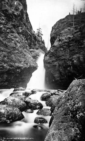
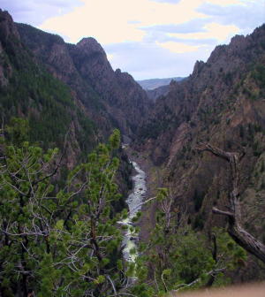
When the boats reached Gore Canyon, they encountered violent upsurges and dramatic drops.  The wild waters smashed all four of the vessels on dangerous rocks.  Fortunately, all members made it to dry land, even the little dog.  No reward was ever given for the attempt.

Colorado-Big Thompson Project

The idea of diverting water from the Colorado River on the Western Slope of the Continental Divide to the productive farmlands of the eastern plains had been a dream of planners as early as 1929.  Subsequently,  a long period of drought and the sagging economy of the “Great Depression” whetted demands for what became the largest trans-mountain diversion project ever built.

The Colorado-Big Thompson Project takes water from Grand Lake on the western side of the Continental Divide to the Big Thompson River on the east.  The water flows through a 13 mile tunnel beneath Rocky Mountain National Park.  In order to supply the residential and farming needs of Northeastern Colorado, the project was begun in 1938 and continued through the years of World War II.  The first water flowed though the tunnel, named for Senator Alva B. Adams, on June 23, 1947.

In order to assure an adequate supply from Grand Lake, a dam was built creating Shadow Mountain Reservoir.  A larger lake, Granby Reservoir was then built below, with a unique pumping plant that forces water into Shadow Mountain.  The Farr Pumping Plant cost over $9 million and provides an additional 700,000 of irrigated land to northeastern Colorado.  Further reservoirs were added, both to supplement the diversion and to compensate the water needs of Western Colorado.  These include Willow Creek and Windy Gap Reservoirs in Grand County.

While most legislators were enthusiastic about the project, U.S. Representative Edward Taylor was vehemently opposed to the reduction of water flowing down the Colorado River.  A compromise was reached in the creation of Green Mountain Reservoir (on the Blue River), which reserves water to replenish the Colorado River.   The city of Denver later claimed upstream water on the Blue River for the massive diversion project of Dillon Reservoir

Claims on the water of the Colorado River range from the fruit and wine regions of the Grand Valley in Colorado all the way to Los Angeles and Mexico.  It can be said that every snowflake which falls in Western Colorado had already been over-appropriated, especially during drought periods in the arid West.

Early Water Disagreements

As fast as settlers arrived in the county, conflicts arose over water use.  George T. Bell, an early rancher on the Blue River in the 1890's, had water rights coming out of Deep Creek, Spring Creek, and Soda and Iron Springs.  Daughter Maud Bell had married James Mugrage and when her father died in 1925, she and James stayed on the ranch of about 800 acres, to operate it.  She reported years later that when Noonen, a large rancher also on the Blue, built his ditch, he took much of the Bell water and used it for his own benefit.  Many years later, Maud discovered that although her father was long dead, those early water rights still belonged to the Bells, not the Noonens. 

Another family, that of George Henricks, settled far up the Troublesome Valley, about 1900, in what was truly an inaccessible spot.  What possessed him to pick such a remote area for his ranch?  Because when he and his wife Aurille lived in Nebraska and tried to make a living on their farm, farmers upstream stole their water to the point that they couldn't keep their crops alive.  Aurille actually had to use the same batch of water for two or three purposes!  As water fights escalated, George vowed to find a place where nobody could be above him and his water source. Rancher Will Call took him far up the Troublesome valley to a large meadow, reachable only by foot or horseback.  Life wasn't easy, for George and Aurille had to do everything from scratch, and they lived in a cabin with a dirt floor for many years.  But nobody took his water! 

Even more recently there was a case on Crooked Creek, where a ranching family that owned quite a good spring and used it to water their hay, discovered that a new neighbor was diverting the water from the spring over onto his own land, to water his own hay!  The rancher protested and diverted the water back where it belonged.  The newcomer turned around and stole it again.  This situation went on for many years without good satisfaction.

The Kirtz Ditch development on the Troublesome began about 1890.  In 1911, an Elias T. Copelin homesteaded land, later adjacent to the Alexander and George Murray Baker ranches.  One day Copelin and Murray Baker, one of the brothers, got into an argument over water rights in the Kirtz Ditch, each accusing the other of stealing his water.  Murray, who was a little guy with a fierce temper, picked up a shovel and gave Copelin a mighty whack with it.  Copelin fell to the ground but after a bit picked himself up, climbed on his horse, and headed toward his home.  However, the blow must have damaged his brain because he was found the next day, dead on the ground at his own gate

High on Meadow Creek, in the early 1900's, lumber activity began in the area later known as Sawmill Meadow.  About 1910, the Western Land and Flume Co. put in a little dam near what is now the trailhead to Columbine Lake.  The resulting lake, today filled with water lilies, was used as a holding pond for logs that would be moved by flume to the main mill downstream in Tabernash.  This lumber company sold to Western Box & Lumber Company in 1912.  Business flourished.  There was even a short railroad going into the woods, with the tracks made of logs about 6" to 8" in diameter.  Prospects looked good.  However, from the beginning water rights were an issue. Some people say it was Nathan Hurd who broke the company.  Western Box had lost some of its water to the Strawberry Ditch (going to Granby) in 1914.  More trouble was looming.  Hurd wanted to keep the water from the little reservoir for the ranchers and lettuce farmers below.  The timber folks wanted to use the water during the summer months to keep the flume going.  Nobody was willing to give up anything, so in 1915, the big mill closed.   Still, efforts continued.

Then in 1919, the planing mill at Tabernash burned.  In the early twenties, further contention led to the withholding of more water from the lumber companies who wanted permission to ditch Trail Creek water across into Meadow Creek, replacing water taken higher up for the flume and Strawberry Ditch.  This would have been quite easy because, about seven miles out of Tabernash is a nearly flat saddle that exists between the two creeks.   Nevertheless the Hurds wouldn't hear of it.

Then one Henry Jarvis showed up on the scene.  He was known to all the timber men.  In 1923, Jarvis, using a box of TNT, "blew the dam" of the irrigation reservoir at Western Box.  People suspected that he did it for T.S. Huston, one of the big lumber powers of the area.  The feeling was that "if the lumbermen couldn't have the water, neither could the ranchers and the Granby farmers."  In any case, that basically was the end of Western Box Company. 

Grand Lake
Grand Lake

Grand Lake is Colorado's largest natural lake.  The clear blue waters are surrounded by magnificent mountain scenery and a haunting Indian legend.  

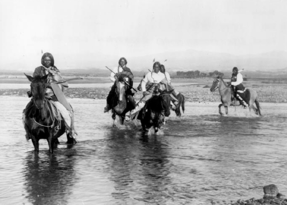
Judge Joseph L. Wescott, an early white settler, wrote a poem about a Ute story he heard from an Indian camping at the lake in 1867.  One summer Utes were camping on the shores of Grand Lake when they were suddenly attacked by an enemy tribe of the Arapahoe.  As the brave Ute warriors began fighting, the squaws and papooses hurried onto a raft for safety, pushing the raft to the middle of the lake. As the battle continued, a treacherous wind overturned the raft and all the women and children drowned.  

It is said that you can see ghostly forms in the morning mist rising from the lake and hear the wailing of the women and children beneath the winter ice.

Moving Water from Point A to Point B

Most serious ranchers had more than one ditch and most built one or more reservoirs. Hilry Harris, Munroe C. Wythe, Samuel H. Burghard, and John A. Coulter entered the first water claim in the county on September 20, 1874. This came out of Sheep Creek above the head of Gore Canyon.

There usually was some natural irrigation; but the challenge of getting the water from the creek required laborious construction of diversion dams, headgates, and ditches, the earliest ditches being dug by hand and often taking up to four years to complete. Later, ditches were dug using teams and scrapers. The grade was figured out initially by simple gravity flow, letting a trickle of water move down the ditch. Soon ranchers refined the process, using a 16’ long board placed with a 1/8" slope, determined by a carpenter’s level. A.F. and Roy Polhamus surveyed a great many of the water ditches, especially those impressive ones in West Grand County, some of which even had tunnels involved. Most small ditches supplied just one ranch, but if a ditch had to cross another ranch, that rancher usually got a share. And some of these ditches were long!

For instance, Dr. Henry Hoagland, on the Blue River, anticipated getting water close at hand from Spruce Creek. Instead, he discovered an old timer had previous rights that forced him to go back into the mountains and build a 13-mile long ditch. Hoagland had figured on spending about $7000; in the end, the actual cost was $26,000! His crew dug the ditch around side hills and across valleys using flumes and siphons. Then his real troubles began. Terrible leaks and washouts occurred everywhere. Finally he hauled in adobe and put this in the bottom of the ditch, rented sheep, and drove them day after day up and down the ditch to pack it. After a couple of years of using this tamping process, the ditch held. Other ditches were even longer. The Church Ditch at Willow Creek and the Wheatley Ditch on the back Troublesome were both 16 miles long.

The Company Ditch (aka the Williams Fork Ditch), eight feet wide on the bottom, was another long one. Built between 1903 and 1907, it cost $44,000 and had a decree for 150 cubic feet / second. The ditch went uphill and down, requiring many flumes and bridges. One flume was actually 1200 feet long! Subsequent breakdowns, leaks, and slides were so frequent and repairs so extremely costly that old-timers have said the reason the Company Ranch went broke about 1920 was the expense of The Ditch. The Lyman Ditch (or the Curtis), started about 1891, was just as complicated as the Company Ditch. Crossing high above the Williams Fork River, the ditch eventually needed cement piers to carry the pipe (1928). This ditch had so many slides, leaks, and washouts, that it had to be inspected once or twice daily! Siphons were required over draws. Flumes, sometimes ¼ mile long, might be 25-30 feet high, and one flume was actually 177 feet high; but these heights were necessary to maintain the elevation.

Flumes, being of wood, rotted and were guaranteed to leak. Sometimes wind blew a portion of the flume down. Finally the county put in big pipes to help the ditches across the Williams Fork. It might be noted that, when water leaked out of ditches, a side benefit was that ranchers along the way could use the "lost" water. Along with the ditches came reservoirs.

Fred DeBerard had four reservoirs on the Muddy: the Albert, the Binco, Milk Creek, and a low one that flooded the Jones place near Kremmling. All were dirt, of course. The Hermosa Ranch on the Little Muddy had water rights through the Sylvan Ditch and Reservoir Company and they built the Sylvan Reservoir dam and the Hermosa Ditch starting in 1911 and completing it by the spring of 1916. The Stein Ditch, started in 1897, was another large ditch, this one later purchased by the Taussig family. These ditches were all built originally to provide water to meadows and fields for ranching purposes. For years, people hauled in water for baths and household use, but that gradually changed. Leon Almirall, near the Horseshoe Ranger Station on the Williams Fork, decided that he wanted water for his home, so he built a 1700’ pipeline to his house, added an inside bathroom, and was shocked when the line froze the first winter – it was only three feet deep. He called in workers who dug down and insulated the line with manure and straw. It froze again. Finally, Almirall gave up and buried the line six feet deep. Now he had his water!

On Ranch Creek in the east end of the county, E.D. Shew cut a ditch upstream from his house, placing it along the edge of the creek, but directing the water back into the main channel near his house. At that point, he put a little water wheel that pushed the water up the hill to his cabins -- and furnished electricity besides. Eventually he replaced the water wheel with a gas engine. There was a similar water wheel, used for the same purpose, up in Hideaway Park.

Water was used to transport lumber as well. A flume ran down the mountain into Monarch Lake, in the days when the Monarch Company was timbering there. There was a flume along St. Louis Creek, carrying lumber from the camps upstream. Perhaps the most ambitious flume ran from Western Box Sawmill. This area is now under Meadow Creek Reservoir. In 1906, the Deisher Lumber Company paid Nathan Hurd for a right of way through his land and built a flume with a 2% grade down Hurd Creek. Logs were placed in the flume and a horse harnessed to the last log. The horse then pushed the logs down the flume with the help of the water. Three years later, the mill was moved to "Sawmill Meadow" on Meadow Creek.

In 1911 construction on the seven-mile-long Vaver Flume began, with 117 cubic inches of water allotment. This flume ran down Meadow Creek and over to Tabernash, carrying partially processed logs for further manufacture. A flume rider checked along the way, making sure there were no jams, and phone line allowed the rider to report troubles. Hikers can see remnants of both the St. Louis Creek flume and that one coming down Meadow Creek today.

Onahu Creek
Onahu Creek

Onahu Creek was called Fish Creek and is a tributary of the North Fork of the Colorado River. The name refers to one of the Indian race horses who came up to a campfire to warm himself, and the name means “warms himself“.  The horse ultimately died on Fish Creek and gave his name to the waterway.

Water
Water

Grand County is home to the headwaters of the famed Colorado River — the river that brings water to five other arid Western states. Water is the lifeblood of semi-arid Colorado and Grand County is one of the most water-rich areas of Colorado, and yet faces a shortage due to historical water agreements, written long before population pressures and the environmental awareness of the current age.

On average, the water diversion projects in the county move a whopping 305,000 acre-feet per year from the Fraser, Colorado and Williams Fork rivers — all headwaters of the Colorado's main stem. 60 percent of the water in Grand County is diverted elsewhere and there are plans underway, mostly from Front Range communities, to divert as much as 80 percent of the county's headwaters by the year 2010.

Two of the main water utilities, Denver Water and the Northern Colorado Water Conservancy District face a quandary: how to take the water from Grand County without further damaging the delicate environment and the region's economy, which is fueled by tourists who expect to play in the very water the Front Range wants to take.

Water from the Mountains - The Grand Ditch

 Though few, high altitude water ditches have had a major impact on Grand County's history and economy, there were many early valley ditches transporting this precious commodity from water-right sources to the owner's ranch. However, the threat of transporting great volumes of water from our county to Boulder County via high altitude ditches appeared back in 1889.  Certain interests east of the Divide talked the Legislature into appropriating $25,000, for surveying and developing a 20-mile-long canal over South Boulder Pass to South Boulder Creek.  Amazingly, neither Grand County residents nor very many others opposed this notion.  Luckily the state engineer found the terrain so difficult that not even $2000 was ever spent on the project.


The next effort occurred also in 1889.  This privately financed plan was to develop a two-branched canal system that would move 700 second feet of water to a half-mile tunnel just beneath Berthoud Pass at over 11,000 feet, thence down to Clear Creek and on to the Golden area.  Initial surveys were begun that fall and roads laid out the following year.  The effort bogged down but was resurrected in 1900 under the Agricultural Ditch Co., supplemented in 1902 with the Berthoud Canal Co.  The canal was partially completed by the Frank Church family ranching interests of Jefferson County by 1906.  The ditch, which can be walked today, runs from Second Creek to Berthoud Pass, though it no longer carries much water.  However, the Church Ditch water rights coming from Clear Creek still exist and today are owned by Northglenn.

Proposed in 1890 by the Water Supply and Storage Company of Fort Collins, a greater canal was to be built 1000 feet above the Kawuneeche Valley, that would tap the high tributaries of the North Fork of the Grand River, sending the water over Poudre Pass to a reservoir and then into the Cache La Poudre River and on to agricultural areas east of the Front Range.  The water company, later known as the Grand River Ditch Company, appropriated 525 second feet at the time of the initial diversion in 1892.  (When the Grand River was renamed the Colorado River in 1921, the company was changed to the Grand Valley Irrigation Company.)  The ditch was dug by hand, primarily by Japanese and Mexican laborers.  By 1900, water was flowing eastward.  

By 1906, this major canal, known as the Grand Ditch, and draining water from the Never Summer Range, had a capacity of nearly 358 second feet with 12 headgates within 8 miles, running from Baker Creek to the pass at 10,179 feet, plus a smaller canal carrying 183 second feet within 11 miles, coming from Specimen Mountain.  In 1936, using machinery, the ditch was lengthened to 14 miles.  The Grand Ditch is about 20 feet wide and 6 feet deep, though the water is rarely more than 3 feet deep, and this water irrigates some 40,000 acres in Weld and Larimer counties.

The National Park Service has argued against the allocation of all this water to the canal as it is needed to support plant life and animal habitat.  Becuase river water flow was cut in half, the immediate effect was a reduction in the fish population in the Colorado River.  More recently, a major washout in the ditch caused devastating damage to the slopes below the ditch and to the Colorado River itself.  Hikers climbing up from the valley use the Grand Ditch as a route to the high peaks and lake.  But as viewed from below, the Grand Ditch is often considered an ugly scar on the landscape.

Williams Fork Reservoir

Article contributed by Liz Church


Williams Fork Reservoir plays an important role in water conservation, while being an asset in revealing archaeological data of earlier existent peoples in the region. The reservoir is located about 12 miles southeast of Kremmling at an elevation of 7874 ft. in Grand County, Colorado, near the center of Middle Park. Williams Fork is a tributary of the Colorado River, extending from Clear Creek to Vasquez Creek, with the Vasquez Tunnel running through and its completion in 1959.


Williams Fork is a water source to the Denver Metro Area, with diverted water from high elevation tributaries of the Williams Fork River to the Gumlick Tunnel for departure to the Moffat Tunnel system. Standing 217 feet above the Williams Fork River streambed, the dam backs up a reservoir of 97,000 acre feet of water.


Williams Fork is also a Paleo-Indian site.  Archaeologists believe that 12,000 years ago, during the last Ice Age, people migrated from Asia into North America. Most Paleo-Indian sites are identified by an existence of projectile points. The Williams Fork Reservoir was dominated by James Allen projectile points, a categorized set of points, or better known as a categorized set of stone tools. The reservoir allows archaeologists to access the extent in which the James Allen points and perhaps earlier existent groups were bestowing the mountains during the Holocene period, the name given to the last 10,000 years of the Earth's history.


Source: http://en.wikipedia.org/wiki/Phillips-Williams_Fork_Reservoir _Site


Articles to Browse

Topic:

Agriculture

Article contributed by Scott Rethi

The first settlers in Granby realized the sunny days and cool nights were perfect for growing one crop in particular, lettuce.  Lettuce farming boomed in the 1920's and a new industry was born.

Granby had become an important railway center as tracks were laid over the Divide at Rollins Pass,giving the Moffat Railroad access to Salt Lake City. Granby produced some of the best-known lettuce
in America.  There are even tales that New York's Waldorf-Astoria Hotel bragged of their “Granby Lettuce” on the menu.  

Then a blight settled into the soil, probably brought in by the wooden crates used for shipping, and the lettuce business was ruined. Since then, ranching has replaced agriculture as Granby's major industry.

Sources:
www.byways.org, national scenic byways online, 2003
www.grandcountynews.com, Johnson Media, Inc., 2000-2002
www.djhome.net, 2002

Topic: Agriculture

Timothy & Clover at Hurd Creek Ranch

Before the invention of seeding machines, a farmer or rancher would walk across his field in a straight line carrying a bucket or sack of seed with one hand. With his other hand he would fling fistfuls of fertile grain in a wide arc in front of his path. On reaching the end of the field, he would refill his bag, move over a few yards and repeat the process on the way back. After hours of walking and the casting of numerous sacks of seed, one handful at a time, the field would be planted.

I guess I was about 13 or maybe 14 when my father decided to plant timothy and clover on the east half of the meadow on the mesa. The area to be planted was probably forty acres or more that the ranch had leased to a Hindu man to grow lettuce and other truck crops. For several years we had gotten free lettuce for our table and our milk cows had loved the turnips from his harvest that were either too big or too small to be sold. I guess the profits from his work weren’t very good and the risk of growing lettuce in the rainy valley was too high. The Hindu had abandoned his lease and we would now put the water and the land to our own good use. Since we had no seeding equipment, we would broadcast the seed by hand. It would take hundreds of pounds of it to do the forty acres.

I was eager to help. Dad looked skeptical but finally agreed to let me try. After a bit of instruction he sent me off across the field. “Remember,” he had said. “You have to spread it even and don’t miss any spots.” I soon developed some regrets about volunteering. Not only did we have to plant the field once, but we had to plant it a second time as well. It seems that a planting of timothy and clover grows only a few inches high the first year and doesn’t produce a harvest. In order to avoid losing an entire season, it was customary to plant a second crop on top of it. In our case, Dad had chosen oats for the second planting. This choice would produce lots of feed right away even though the growing season in the Fraser Valley was too short to yield any grain. We planted the hay crop on one day and the oats the next.

I was exhausted by the time we had finished. In fact, if memory serves me right, Dad did the last five or ten acres by himself. When fall came, we had oats four feet high. They were cut, stacked like hay and fed out the following winter. The year after, there was beautiful timothy and clover that has continued to produce a fine crop for more than 60 years. When I visit friends on Ranch Creek every August, I drive by our field both coming and going.

Each time I see it, I remember my work and experience a sense of joy and accomplishment. All the things I produced over a professional career of nearly 40 years are now obsolete but the timothy and clover seeds planted so long ago are still growing. They will continue to do so until the Hurd Creek Ranch sells its water right and the field dries up. In our modern world, a 40-acre field of timothy and clover isn’t much. But how often, today, does a teen-ager have the opportunity to do work that will serve for a lifetime?

The above material is copyrighted by the author, Robert K. Peterson. Reproduction is any form is limited to the personal use of the view and/or to educational purposes. Neither the sale of nor any other commercial use of the text or illustrations is authorized.

Topic: Health Care

Health Care

In its earliest days of settlement, Middle Park area residents and travelers doctored themselves using whatever remedies they were able to concoct on the scene of accident, illness, or injury.  The cure might have been a poultice of herbs, bread, oil, mustard, or something called Raleigh’s Ointment.  It might have been a dip in the medicinal springs at Hot Sulphur, a dose of iodine, arnica or vinegar, castor oil, Epsom salts, or any number of other standbys.

The first “doctors” known in the area were Dr. Hilery Harris (1874 or 1876) and Dr. David Bock (1876); both were “self-certified”.  Dr. Harris had a predilection for the treatment of animals, while Dr. Bock treated the medical and dental needs of the people. By the mid-1880s, there were a number of doctors traveling through the area, working for various entities and setting up private practices.  During the mining boom, there were a number of physicians and surgeons in Teller City, which was then a part of Grand County.  

Around 1900, the Dunphy and Nelson Contracting Co, a construction firm building roadbeds through the Fraser Canyon for the Moffat Railroad employed Dr. John Wills as company physician.  By 1903, the Denver, Northwestern and Pacific Railroad employed Dr. Leonidas Wills, cousin to John Wills, for its employees and families.  These types of company jobs provided regular work as well as regular pay for doctors who otherwise would have had little in the way of compensation for their work.

Many of the doctors found themselves moving from community to community as the working community moved--from the Fraser Canyon to the Gore Canyon to lay roadbed, or from one logging area to another.  Later, work flow was based on government projects such as the construction of the Moffat Tunnel and the Alva B. Adams Tunnel, both of which went back to the old tradition of having a company doctor.  By the time of the coming of the Moffat Line to Grand County, most of the communities had drug stores, many of which were owned solely, or in part, by the local physicians. There, people could avail themselves of all types of patent medicines, drugs, toilet articles, soaps, perfumes, and sometimes even a drink at a soda fountain.

It was common for surgery to be done in the home of the patient, or the doctor.  Only occasionally, for the worst of illnesses or injuries, did the doctors attempt to transport patients over the Continental Divide to a Denver hospital.  Childbirth was almost always in the mother’s home, under the watchful eye of a female neighbor, or a midwife, and  rarely with a doctor in attendance.

Dr. Archie Sudan built a medical facility in Kremmling and Dr. Susan Anderson remodeled a barn in Fraser to accommodate her patients. Often it was the wife of the doctor, who might be a nurse, who attended the patients.  Many of those in attendance were trained by the doctor in charge; some went on to attain certifications as Registered Nurses or other professionals.

In June, 1947, the Middle Park Hospital Association held a fundraiser to undertake hospital improvement.  The first $20,000 raised went to buy the home/hospital of Dr. Archer Sudan.  In total, the group raised between $35,000 and $70,000 to purchase, remodel, and outfit the facility, which was intended to serve all of Grand County, most of Summit County, and parts of Eagle, Routt, and Jackson counties. The hospital had four private rooms, three wards for six patients each, living quarters for hospital personnel, an office, exam room, operating room and an x-ray room.  Dr. Ernest Ceriani was the first physician for the new facility.

The local rural physicians often called on their colleagues in the city for assistance with difficult cases.  They arranged for specialists to visit, consult and perform surgery, saving the patients and their families hospitalization in Denver.  Just as today, the need for specialized care presented special difficulties for the rural physician of the early days.

The list of physicians, surgeons, dentists, osteopaths, and veterinarians who served Grand County is lengthy, but the most famous are Dr. Susan Anderson (Fraser), Dr. Archie Sudan (Kremmling), Dr. Mac Ogden (Granby and Kremmling), Dr. Ernest Ceriani (Kremmling), and Dr. James Fraser (Grand Lake).  “Medical Practices in Early Middle Park-Grand County” includes extensive information on each.

Topic: Biographies

John Wesley Powell

John Wesley Powell was a Civil War veteran who had lost part of one arm as a result of combat.  He was a professor of natural history at Illinois Wesleyan Collage, who took field trips with his students to the Rockies.

He came to the Grand County region looking for a vantage point to conduct an exploration of the Colorado (the Grand) River. With six local men he made the first recorded ascent of Long's Peak, the 14,255 foot landmark of the Front Range, on August 23, 1868.  From that summit he could view much of the headwaters area of the river.

Descending back into Middle Park, he ventured to Gore Canyon where he decided the turbulent rapids were too dangerous for his boats.  He decided to take an exploratory  party of students to the Green River in Wyoming, a tributary of the Colorado.  Losing one boat in that expedition, the party made the first known trip through the Grand Canyon in 1869.

He later became leader of the first U.S. Geological Survey, and because of his study of Indian tribes, the first head of the U.S. Bureau of Ethnology.

The Ish Family

The prosperous John Lapsley (Laps) Ish family are an example of very successful settlers and entrepreneurs in early Grand County. The Ish family, with eleven children, came by covered wagon to Colorado from Missouri 1863 and settled on a farm outside of Denver.

18-year-old Laps Ish came to Grand County in 1881 to attempt his luck at the short lived mining boom outside of Teller, north of Grand Lake.  He tried his luck at mining for 4 years and also carried the mail between Teller and Grand Lake, on skis or snowshoes in the winter and by foot in the summer. 

Laps Ish married Alice Shearer and homesteaded near Rand (in present day Jackson County). They had two sons, Lesley John Ish and Guy Lapsley Ish. Laps and Alice built the Rand Hotel and operated it until 1910.  The family then moved to Granby and built the Middle Park Auto Company garage and ran a stage line to Grand Lake. They built the Rapids Lodge by operating a sawmill on the Tonahutu River in Grand Lake and opened for business in 1915  They also built the Pine Cone Inn in Grand Lake and Leslie managed it for many years. Laps Ish died in 1943.

Topic: Dude Ranches

Dwight D. Eisenhower and the Western White House

Dwight D. Eisenhower met and married Mamie Geneva Doud of Denver on July 1, 1916. Carl Norgren, a Doud family friend, had started spending time in the Fraser area and was enchanted by the beauty of the area and especially the Byers Peak Ranch for Boys.

By the late 1930s, Norgren partnered with Aksel Nielsen to purchase the Byers Peak Ranch.  During Eisenhower's presidency, the Brown Palace Hotel in Denver, the Byers Peak Ranch, and Lowry AFB were all known as "Western White Houses" or "Summer White Houses." There is a well known photo published in Life Magazine of Eisenhower fishing in the Fraser River with his grandson, David.

Eisenhower used his time at the Byers Peak Ranch to rest and recompose himself in the face of difficult political times. As President, Eisenhower dealt with the threats of the Cold War, a truce in Korea, the desegregation of public schools (Little Rock, Arkansas), and the development of the "Eisenhower Doctrine" to bolster the Middle East against the threat of communism. On the domestic front, he was faced with the difficulties of dealing with the Republican Old Guard, including Senator Joseph McCarthy, who headed a subcommittee charged with the finding of communists within the government.  

Eisenhower enjoyed cooking for guests at the Ranch, fishing St. Louis Creek and having "brookies" (brook trout) for breakfast, painting, and playing golf.  On September 24, 1955 while at the Ranch, Eisenhower suffered a coronary thrombosis (heart attack) and was hospitalized at Fitzsimmons Army Hospital in Denver until November 11, 1955.  His hospital suite has now been restored and is open for limited tours.

The bulk of information about Eisenhower and the Byers Peak Ranch comes from the personal papers of Carl Norgren, which are housed at the Eisenhower Museum and Library in Abilene, KS.  The collection of correspondence from 1948-1964 covered a broad variety of topics: fishing, recreation, taxes, health matters, food, communism, reorganization of the Department of Defense, federal spending, etc. The Norgren collection valued for the details it provides concerning the hobbies and recreational pursuits of the President during his visits to Grand County between 1952 and 1957.

Topic: Biographies

Sir St. George Gore

Sir St. George Gore was born in 1811 in County Donegal, Ireland, heir to an Irish baronetcy and was often referred to as Lord Gore.  He was educated as an aristocrat, never married, and never held public office.

He staged an expensive and expansive “American hunt,” leaving Westport, Missouri on June 6, 1854, with plans to hunt in the southern Rockies.  After spending some time at Fort Laramie, he arrived inMiddle Park. His guides were Joseph Chattillon and Jim Bridger. Gore had a entourage of 40 workers, 25 wagons, 24 mules, 112 horses , 3 milk cows and 14 dogs!

Loving his luxury, he slept in a brass bed, had nightly hot baths, and dines on superb food served on a lace tablecloth set with fine silver and crystal.  He often invited Bridger, who was illiterate, to dinner and awakened in the guide an interest in Shakespeare, which lead to the frontiersman hiring a boy to read the bard's plays to him.  

Described as "a good shot at rest but rather poor offhand" he nevertheless claimed to have killed 2,500 buffalos, 40 grizzly bears and countless deer, elk and antelope.   

Bridger led Gore to West Grand County, to the pass, range, and canyon that now bear his name.  The Indians were shocked at the expedition's wanton slaughter of every game animal in sight.

The expedition did not end until sometime in 1857, when Gore returned to Ireland and relative obscurity.  Not even a portrait remains of the infamous poacher.
Topic: Water

Onahu Creek

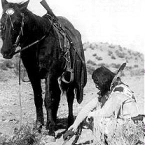
Onahu Creek was called Fish Creek and is a tributary of the North Fork of the Colorado River. The name refers to one of the Indian race horses who came up to a campfire to warm himself, and the name means “warms himself“.  The horse ultimately died on Fish Creek and gave his name to the waterway.
Origins of the Ute People

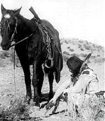
Before there were any people anywhere, the Creator, "Sinawaf", cut sticks and placed them in a large sack.  After many days, this aroused the curiosity of the coyote.  When Sinewaf was away, the coyote could no longer control himself and opened the sack.

Out came many people who scattered in all directions.  Each spoke a difference language from the others.  When Sinewaf returned, there were only a few people remaining in the sack.  He was furious with the coyote, as he had planned to distribute the people equally in various parts of the land.  As there could now be no such equity, there would be wars among the different people, who would fight for the best locations.

Of the small group left in the sack, Sinawaf called them Ute or Nuche, which meant "the people".  They would be a very brave and strong tribe.

Topic: Leisure Time

Grand Lake Yacht Club

Grand County often attracts adventurous spirits who prefer its splendid isolation to Wal-Mart and fast food. Others, who never make the leap of faith to live here, enjoy it as a familiar playground, returning regularly to enjoy its vast mountain ranges and unlimited outdoor opportunities.

It has to come many as a surprise to learn that Grand Lake, Colorado - nestled next the Continental Divide at over 8,300 feet elevation - has had a yacht club for over one hundred years! When this adventure began, back in 1902, there was only a stage road into the southeast corner of Grand County over Berthoud Pass. Grand Lake is situated next to the entrance of Rocky Mountain National Park, at the far northeast corner of the county, with the rugged backbone of the continent directly to the north and east. At the turn of the twentieth century, it was a summer vacation spot with few full-time residents. Summer visitors and full-time residents alike recognized the grandeur of the their surroundings, and Grand Lake very early became a summer home to many of Denver's elite, and the summer business they brought helped support the local economy.

It was a few enthusiastic Denverites with a keen interest in Grand Lake and sailing who organized the Grand Lake Yacht Club over 100 years ago. The founders included Richard Crawford Campbell, who married Senator Thomas Patterson's daughter and became the business manager of his father's newspaper, the Rocky Mountain News; William Henry Bryant, a Denver lawyer who was active in both sailing and Colorado politics; J. Fermor Spencer, a close friend of Mr. Bryant and long-time treasurer of the club; and William Bayard Craig, who enjoyed a broad education and had been the Chancellor of Duke University before he became interested in "acquiring land in Colorado."  By the end of 1902, according to Denver papers, "the first bona fide yacht club between the Mississippi river and the Pacific ocean" was in operation.

An atmosphere of excitement and pageantry swept over Grand Lake during the early Regatta weeks, when the Yacht Club held its annual races. In Denver, The Friday Evening Times proclaimed during August of 1904, "Yachting season is here", and went on to describe the "enthusiastic cottagers gathered on shore" around Grand Lake to cheer for the yachts. In 1907, Regatta week included yacht racing as well as foot races, donkey races and bronco busting. When the yacht races ended, the boat captain who won the most races had earned the Colorado Cup.

The Grand Lake Yacht Club's small sailing fleet during Regatta week - three days of racing during mid-August - sometimes included only a handful of boats during its first decade or so. Still, according to one observer, "the organization has more spirit to the square foot than I ever saw exhibited before." Races on the first day of Regatta week, 1905, illustrate the enthusiasm well. In the hotly contested first race of Regatta week, Robert Campbell's Highball, built in Racine, Wisconsin, tossed her two-man crew into the icy waters of Grand Lake when she capsized while running in second place. Shortly after, the third place yacht, Duchess, went over too, leaving the Chicago-built Dorothy II captained by Commodore Bryant the first and only boat to cross the home buoy.

Today, Dorothy O'Donnell O'Ryan, Commodore Bryant's granddaughter, maintains her family's summer home in Grand Lake. In 2002, she published Sailing Above the Clouds: An Early History of the Grand Lake Yacht Club, which chronicles the club's first 50 years. Her Colorado roots go back to Colorado territory's last, and the state of Colorado's first Governor, John Long Routt, who was appointed by President Grant in 1875, the year before Colorado became a state. Knowing the early history as she does, and the difficulties inherit with mountain transportation, O'Ryan marvels at "the logistics" of bringing sailboats built in Racine, Wisconsin or Chicago, Illinois over the Continental Divide into Grand County, Colorado by rail and stage road.

Home-built crafts, both crude and highly crafted, competed as well. Many of the first home-built boats were modified rowboats, "with homemade sails and masts." Observing the annual Regatta week in August of 1904, though, Arthur Johnson called attention to "the Jessica, a 16-foot boat belonging to the vice-commodore and built at Grand Lake" that sported "a sail that would have done credit to a venturesome Lipton on the high seas."

If a sailboat in Grand Lake during 1904 "done credit to a venturesome Lipton," Sir Thomas Lipton himself returned the favor tenfold in 1912. It so happened in 1912 that Lipton was traveling by train across the United States and would pass through Denver on his journey. Probably, Sir Thomas had met the well-traveled and enthusiastic yachtsman, William H. Bryant (Grand Lake Yacht Club Commodore) at the New York Yacht Club. Continued correspondence between the two resulted in the Grand Lake Yacht Club inviting Sir Thomas to the Denver Club for dinner in December of 1912, sponsored, of course, by the Grand Lake Yacht Club. Before he left that evening, flattered by the warm welcome he received, Lipton had proffered a silver cup to the Grand Lake Yacht Club.

Lipton became a yachting icon during the early 20th century. His sportsmanship was nearly unparalleled in the sport and he spent most of 30 years and millions of dollars trying to win the America's Cup. Thoroughly devoted to yachting as a sport and highly capable in the art of advertising, Lipton spread his Lipton Cups "around the globe" to promote the sport and himself.  His gift to the Grand Lake Yacht Club energized the young organization.

Today, the boathouse of the Grand Lake Yacht Club still reminds visitors and members of the organization's heritage. Built in 1912 by Grand County pioneer Preston Smith on land donated by fellow pioneer Jake Pettingell, the lakefront log structure sits in the midst of magnificent mountain scenery, with the dramatic peaks of the Continental Divide to the west and north and the Never Summer mountain range to the west.

As the club matured, it began to offer more races to more members and guests throughout the summer season. The original Regatta week still exists as the most important, and festive, event. Races were added, though, in 1912 with the Adams Cup; in 1914, the Lipton Cup was incorporated; in 1923, the inventor of the Sunshine Lamp (which Coleman Lanterns later bought out) presented the Hoffstot Cup; and in 1925, Dorothy Bryant O'Donnell offered the Bryant Cup in honor of the late first Commodore, W. H. Bryant. Well over 20 cups or trophies now highlight the Grand Lake Yacht Club's season. Throughout its evolution the Club has remained as unique as the dramatic physical environment that surrounds it and the people who envisioned and created it.

Water