Biographies Articles

George & Joyce Engle
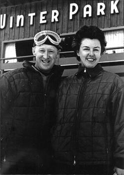
Winter Park Ski Shop, Joyce and George Engel

Here is the story of how Joyce and George Engel became legends in Winter Park and Fraser. In 1945, Winter Park Resort hired George Engel as their very first paid ski patroller.  Little could George have known that this job would lead him to his wife, Joyce Hanna, disembarking from a ski train, and together they would call Winter Park and the Fraser Valley their home for life. Along with Joyce and their daughters, the Engel Family would have a lasting influence not only on Winter Park Resort but on the Fraser Valley community as well.

In the year following his hiring as Winter Park’s ski patroller, George Engel took on different responsibilities at the ski area, such as plowing the parking lot and collecting rental fees in the bunkhouse.  Gordy Wren and Frank Bulkley formed Colorado Outings in 1946 and started the ski school at Winter Park.  As director of the ski school, Gordy Wren hired George Engel as a ski instructor. That same year George passed one of the first ski instructor certification exams ever held.  By 1949, the Professional Ski Instructors of America was formed and Engel held pin # 12.

Gordy Wren was busy practicing for the 1948 Olympics and consequently sold his share in Colorado Outings.  This gave George Engel the opportunity to buy into the company and he became director and eventually sole owner of the ski school. George added the Winter Park Ski Shop onto the ski school.  

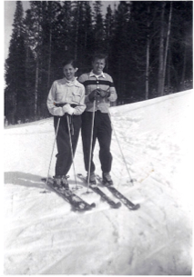
George met the love of his life, Joyce Hanna in 1951 as she disembarked from the Winter Park Ski Train.  Joyce, with two BA degrees from the University of Colorado, was ready to ski and work.  After dating for three weeks, George proposed to his future bride and business partner. The Winter Park Ski School under George’s leadership, and the Winter Park Ski Shop with Joyce at the helm, became fixtures of the ski area. George and Joyce’s two daughters grew up on the slopes.

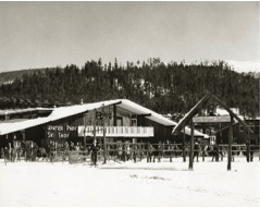
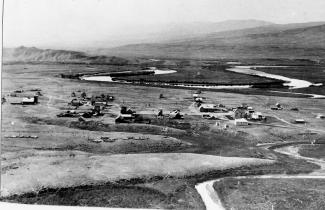
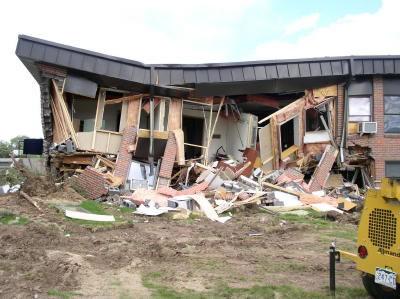
Daughters Wendy and Janet tell wonderful stories from when the family lived in an apartment above the Winter Park Ski Shop.  After Winter Park Resort bought the ski school in 1982, they demolished the shop and apartment to make way for the West Portal Station.

Along with skiing, another Engel passion was horses which led to their acquiring 40 acres along County Road 5 where they built Casa de Engel.  From their ranch, the Engels helped to establish the Winter Park Horseman’s Association and the High Country Stampede Rodeo at John Work Arena in Fraser.    Naturally, Janet Engel became a rodeo star. The Engels were also involved with the Middle Park Fair and Rodeo for decades.

As community leaders, the Engels transformed Winter Park Resort and the Fraser Valley. They helped start the Fraser Valley Metropolitan Recreation District, the Winter Park Chamber of Commerce and the Winter Park Sanitation District.  Joyce Engel was a founder of the Grand County Concert Series bringing live classical music to this rural community.  In 1968, George Engel was instrumental in bringing the National Sports Center for the Disabled to Winter Park. The family’s wide-ranging passions enrich all our lives then, now and into the future.   


Harry Knight
Harry Knight

The early emphasis north of Granby was tourism and mining. When the mines were exhausted in the early eighties, some of the locals turned to ranching. Henry Lehman was one of these ranchers on the upper Grand (Colorado). He homesteaded and built a ranch on the South Fork of the river where the family took in guests, travelers and fishermen. Henry died in 1919 and the ranch was purchased by the Knight family of St. Louis.

The first historical reference of Harry Knight was the gift to the Grand Lake Yacht Club of a cup for racing competition known as the Knight Cup. It was one of many coveted trophies sought after the winning of the famous Lipton Cup.

Knight's most important place in local history was his friendship with Charles Lindbergh. When Harry Knight was president of the St. Louis Flying Club he developed great respect for the "ace pilot". Lindbergh had pioneered the airmail route between St Louis and Chicago. Because of his skills Knight chose Lindbergh as his personal flight instructor. Harry convinced the head of the St Louis Chamber of Commerce to have them help Charles by sponsoring his famous flight with a check for $15,000.

Upon completion of the New York to Paris flight in 1927, Knight built an airport on the ranch. Writings of the period indicate that Harry built the airport just for Lindbergh. However, Harry also was a pilot in his own right. Lindbergh would fly over the divide and onto the ranch mostly for weekend visits.

Years passed and Lindbergh became involved with other activities that did not involve the Knights. Water storage became the most important problem facing them. The Granby dam was proposed for construction. After completion of the dam the Knight family auctioned off their house, bunkhouse and ranch equipment on July 27, 1946. The ranch house was dismantled and moved to a lot overlooking Lake Granby where it is still used as a private residence.

Helen Catharine Linke

Helen Catharine Linke, 90, of Granby, Colo., passed away quietly at the Cliffview Assisted Living Center in Kremmling, Colo., on Oct. 13, 2009. She was born March 13, 1919, in Hillrose, Colo., to Raymond and Malva (Wise) Odell. When she was a toddler, her family moved to Denver where Helen attended Skinner Elementary School and graduated from North High School in 1937.

During her youth, the family enjoyed coming to Grand County for visits to the Schmuck's Windy Gap Ranch, outside of Granby. During these visits she became acquainted with the Linke family.  On Nov. 1, 1941, Helen married Gilbert Walcher. She traveled to California and Mississippi while he was in the Army. While Helen was in California she worked for the USO, publishing a USO newsletter.  In 1943 Gilbert was killed in World War II at the Normandy invasion.

Helen returned to Denver and worked for her father. In 1947 Helen attended Pasadena State College in California for a year. After Gilbert's death, Helen once again joined her family for visits to the Windy Gap Ranch and was re-united with the Linkes.  On Feb. 11, 1950, she married William F. "Bud" Linke, her childhood friend, in Casper, Wyo. They moved into their house, a wedding present from her father. They celebrated 59 years of marriage together while keeping the ranch going and raising two children. For 24 years they spent winter months enjoying their second home in Lake Havasu City, Ariz.

For many years Helen was a Sunday school teacher for the Central Assembly Church in Granby and served as the secretary of the Granby Chamber of Commerce. She was well known for riding her motorcycles, beginning with her 1934 Harley and culminating with her Special Edition Honda Goldwing and the many others she owned in between. She was a member of the Motor Maids and would ride to rallies all over the United States. Helen was riding her motorcycle well into her 70s, even riding cross-country.

She was a member of Ports of Call and loved to travel. Helen enjoyed Israel, Rome, Turkey, Tahiti, England, and Austria. She also enjoyed gardening and sports. She spent many hours ice-skating, roller-skating, skiing, bowling and fishing. In her latter years one of her greatest joys was her "little dollies," her great-granddaughters. They enjoyed tea parties, playing school, driving the Kawasaki mule around the ranch and rides in Great Grandma's convertible.

Henry "Rooster" Wilson

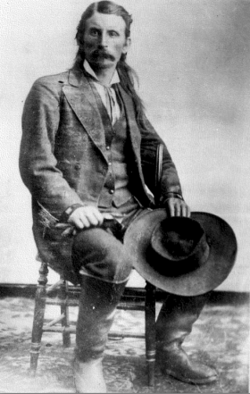
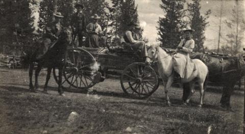
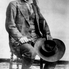
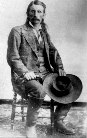
One of the most colorful characters of early Grand County history was Henry "Rooster" Wilson. He was born in Ft. Sill, Oklahoma in 1881 of part Cherokee ancestry. Shortly thereafter the family moved to Ft. Steele, Wyoming. During his younger years he worked as a cowpuncher in Wyoming and Colorado and claimed to be one of Teddy Roosevelt's packers when he hunted out of Glenwood Springs. After moving to Middle Park he became one of the early game wardens for the area. He always rode a white horse and most people thought he chose the color to be conspicuous so he didn't embarrass the local ranchers or his friends by catching them with illegal meat. All his horses and dogs were named "Major".

Rooster was one of the best ropers in the area and always helped folks when it was roundup time. He told a story about catching a bear with another fellow. They had two ropes on the bear to keep it away from the horses, but then they couldn't turn loose of the bear, so had to shoot it. He never mastered the operation of automobiles and misjudged one of the turns on the Hot Sulphur Springs/Parshall divide and put his Dodge touring car over the bank. The locals named the place "Dodge Turn" because of so many Dodge cars that seemed to find there way over the bank at that spot. One day Rooster was driving from the Post Office into the yard at the Parshall Hotel for lunch. As he drove into the yard there was a post in his way, so he reared back on the steering wheel and yelled "Whoa". As you might guess the car didn't "whoa" and it ran into the post without much damage.

One time he rode into the yard at the McMillan ranch (a.k.a. the Barney Day ranch about 4 miles west of Parshall on the Colorado River) just at supper time. The women had venison frying on the stove. My mother quickly stuck the meat into the oven and brought out some ham to cook.  Rooster had supper (in those days visitors were always fed), gossiped awhile and started to leave.  As he went out the door, he turned and said, “You can take that meat out of the oven now”, and rode away. His one big fault was alcohol. This was during prohibition, but there was always some available.  When my mother knew Rooster was going to be around she had to hide the vanilla and lemon extract because he would sneak into the cupboard and drink them for the alcohol content.

Rooster couldn’t talk without swearing, but he was a gentle man and, although he never married, he loved kids. At the local dances he was often put in charge of the babies and younger kids while the parents danced.Rooster liked kids and was often put in charge of the babies and younger children while their parents danced at local parties. How did "Rooster" get his nickname? There are two theories. When he was ready to retire to bed after a full day's work and conversation around the pot-bellied stove, he usually remarked, "Well, I guess I'll go to roost." The other theory was that while he worked as a wrangler, he was the first to get out of bed so he could round up the horses for the other cowpunchers. Then he would roust everybody out of bed at that early hour.

Rooster died in 1934 of natural causes and is buried in the Hot Sulphur Springs Cemetery.


Howard Henry Yust
Howard Henry Yust

Howard Henry Yust was the sixth child of Charley and Mary Yust, born April 18, 1891 on their homestead by the Blue River six miles south of Kremmling. At age eleven, Henry worked as a teamster. He and his brother Bill rode broncs at early Middle Park Fairs. He homesteaded part of the ranch then grew potatoes Wynn Howe sold at his Troublesome store. Henry and his brother Ed raised lettuce in 1924-5 where Mesa, Arizona is now.

Winters, Henry and Ed broke horses. Daily they rode five miles through deep snow. The first day one brother led the unbroken horse ridden by the other brother. The next day, the two rode their two horses together, but separately to feed the Yust family cow herd at the mouth of Gore Canyon. Loose hay pitched onto team pulled sleds was pitched off in meadows.

In the summer of 1931 Jack Shiltz approached Henry while he and Ed were building the first water carrying flume/suspension bridge over the Blue River and asked if he would work for Middle Park Auto in Granby as a mechanic. Henry asked Ed if he wanted the ranch. Ed said yes, so Henry left. Later, Henry operated Standard stations in Kremmling, first the current Kremmling town hall, second now O'Aces Liquor. After he leased the second station to Dolye Likely, Henry operated a rock shop where he sold jewelry he made.

July 7, 1943 Henry married Mary Anna Ostergaard. They raised Mary's nieces Willa Jo and Donna Dee Ostergaard. On his last visit to Kremmling August 30, 1980 Henry showed Jim Yust the location of Elliott's cabin on Elliott Creek three miles south of Kremmling. Elliott squatted on land now owned by Blue Valley Ranch when he was killed by Indians taking revenge for the killing of Chief Tabernash. This band went on west to participate in the Meeker Massacre (1879). Henry died Election Day November 4, 1980 in Northglenn, Colorado.

Inell Harvey
Inell Harvey

Born in 1916 in Springfield, Mo., and raised in Kansas, Inell came to Colorado to study at the Greeley State Teachers College, which later became the University of Northern Colorado. At the age of 22, she taught eight grades in Pratt, KS, in a one-room school to which she rode a horse every day and where stoked a potbelly stove for heat. Later, she taught on a Ute Indian reservation in Ignacio before going on to teach drama for several years.

Inell Harvey was locally famous for being a newspaper columnist, full-time volunteer, exercise fanatic, teacher, poet and former Heeney Tick Queen. She was a regular columnist for the Middle Park Times and the Sky-Hi Daily News for 22 years, writing close to 1,600 of her weekly "Heeney Hearsay" columns.

Harvey also worked at the Cliffview Assisted Living Center in Kremmling, where she organized holiday parties, called Bingo, and helped keep the limbs and minds of local seniors active by teaching chair aerobics.  Harvey also volunteered five times per week to help children with their reading. Harvey's work for the public good included being a member of both the Grand County Council on Aging and the regional Council on Aging. Both organizations have recognized her as Senior of the Year.

Always generous, Harvey crocheted hundreds of afghans for Kremmling-area babies over the years. Harvey's good deeds were recognized by the public as well. In 2006, she was honored by West Grand Educational Foundation as its Citizen of the Year. In 2000, she was named a "9News Who Care" Citizen of the Year and was featured on Channel 9 for her many contributions to the community.

Inell and her husband Bill had two children, Rick and Janifer.  After retiring, she and Bill moved to Heeney where they loved to fish in Green Mountain Reservoir. After Bill's death in 2000, she moved to Kremmling and lived in her own house.

An avid writer, Inell was a freelance writer for both the Denver Post and Rocky Mountain News. For more than 30 years, her poems, columns and essays appeared in the Middle Park Times and Sky-Hi Daily News.

Harvey died on June 4, 2008 at the age of 92, after a car accident on the Trough road west of Kremmling.

Isabella Bird
Isabella Bird

In Yorkshire, England on October 15th 1831, a clergyman and the daughter of a clergyman gave birth to small, sickly girl who would grow up to be one of the most well known travel writers of her time, an exceptional accomplishment in an era when women rarely ventured far from home unescorted. In 1850, after a childhood full of ailments, Isabella had an only partially successful operation to remove a tumor from her spine. Following the surgery, Isabella suffered greatly from depression and insomnia; it was then that her doctor recommended that she travel.  Isabella's father, becoming increasingly worried about his daughter, gave her a hundred pounds and sent her off to see the world.

Ms. Bird traveled throughout the world including Canada, Hawaii, Australia, China, Tibet and Morocco.  She came to Colorado right after the territory had officially been become a state. Isabella loved it in the mountains, so much so that she wrote many letters home to her sister which eventually came to become her third and most famous book, A Lady's Life in the Rocky Mountains. In this document, Isabella wrote of her adoration of the area saying, "I have found a dream of beauty at which one might look all one's life and sigh."

Upon her arrival to Colorado, she traveled into the mountains west of Estes Park. She wrote about adventures and challenges and of her romance with Jim Nugent, or "Rocky Mountain Jim" a one eyed outlaw with an attraction to violence and poetry. He was shot and killed a year after Isabella left Colorado.

Throughout the letters, Isabella mentions the wonderful sights of the lands she explored near current day Grand County.  In one of her letters, Isabella wrote of the time she rode a horse through a blizzard with her eyes frozen shut.  She found herself in another adventure when she was snowed in a cabin with two young men for several months.

Isabella grew eventually grew homesick and headed back to Edinburgh Scotland where she married a doctor. After five years of marriage, her husband died and Isabella returned to travelling. When Isabella returned to Edinburgh in 1904, she grew very ill and died while planning another trip to China.

John Charles Fremont

Captain John Charles Fremont was born in 1813 and at the age of 31, in June 1844, was exploring the northern reaches of the Republic of Texas when he passed through Grand County.  This marked the first appearance of official government enterprise in Grand County.

His expedition included some 40 explorers, including people of Creole, French, and Black descent. The guides were Thomas Fitzpatrick and Kit Carson. This expedition entered Grand County via Muddy Pass and exited via the Blue River, never traveling into the eastern part of the County. 

They met with some 200 Arapahoe Indians, who were traditionally suspicious of the intruders, but through the giving of trade gifts, overt conflicts were avoided. The cartographer for that expedition was Charles Preuss, who provided the first map on which all of the central Rocky Mountain Parks were named and mapped accurately.

John Peyer - Winter Carnival Founder

John Peyer was born in Zurich Switzerland on March 26, 1880 and emigrated to the United States in 1902, settling in Ionia (Jewell County) Kansas.  John eventually found his way to Hot Sulphur Springs on June 1, 1911 as the sales manager of the Hot Sulphur Springs Townsite Company.  John drove a luxury 7-passenger Martini automobile, which was used for transporting prospective land buyers  from the Moffat Railroad train depot. 

In October of 1911, the Moffat Railroad announced that freight operations would be moved from Hot Sulphur Springs to Fraser.  The Middle Park Times published an editorial concerned about the future of Hot Sulphur Springs.  John Peyer responded with a letter that suggested that the town could be a winter  sports tourist attraction. One week later John ran a notice in the paper for all interested parties to meet to plan a winter carnival.  John Peyer was elected Carnival Committee Chairman and the Carnival Day was set for December 30, 1911.

A Denver Post article the day before the carnival quoted “Hot Sulphur Springs Winter Sports Club hopes to make winter sports as popular in Colorado as they are in Switzerland and Norway”. 

The carnival had a great turnout and John Peyer showed he also had athletic skill, placing first in the Fancy Skating Contest and first in the Couples Fancy Skating Contest, along with Mrs. Fuller.  At 9pm at the highlight of the Grand Ball, two strangers appeared on skies, with 35 pound backpacks and rifles.  Carl Howelsen and Angell Schmidt, who had heard about the carnival, boarded the train in Denver at 8 am and detrained at the Corona Station atop of Rollins Pass to ski down the mountains.  They completed this feat of 44 miles on skis in 9 hours.  

The Norwegians set out the next day to build a crude ski jump and by shortly after noon, they gave a jumping exhibition that amazed the spectators.  John  Peyer and the Winter Carnival committee were inspired to plan yet another event in six weeks time to include the spectacular ski jumping.  The second carnival was planned for February 10-12, 1912.

Ski events of cross country, downhill and jumping were added to the skate and sled competitions.  This became the first winter ski carnival west of the Mississippi River.  Entrants came to compete from all over the United States and the Moffat Railroad ran special trains, bringing hundreds of spectators from the Denver area.  John Peyer’s dreams became a reality! The winter carnival was declared a great success and plans were made for the second annual event in 1913.

John Peyer headed up the planning for the Second Annual Winter Carnival and attracted skiers and athletes from all over including the National Ski Association’s professional circuit. The Middle Park Times had ads for the upcoming 2nd Annual Winter Sports Carnival on January 31, February 1 & 2, 1913.

Skis for sale $2.50 and up. See John Peyer.

Mr. John Peyer has received a consignment of skis from a ski factory in Ashland, Wisconsin and is selling them for Mr. C. Howelsen, our professional ski jumper.

If you don’t believe that Hot Sulphur Springs is the best place in the world for ski jumping, just ask John Peyer. He knows.

The  January 19th 1913 Denver Post, published a half page with photos and headlined “Skijoring, with Horses Hitched to Men on Skis to be seen at Sulphur Springs Winter Carnival.” “Novel Sport will be Witnessed in U.S. for First Time”.  The article explained skijoring.  The January 31st 1913 Rocky Mountain News headline was, “Ski Jumpers Are Ready For Great Midwinter Sport Carnival”. “Crack Flyers East and West will meet in Program of Daring Feats”.  Five photos appeared with two ski jumpers, persons on a sled, and a toboggan.  In the center photo was John Peyer and a lady demonstrating skijoring  with the caption, “Never before in America, so far as we can learn, has skijoring been attempted”.

The second carnival made history by being recorded in moving pictures which were shown across America. 

John Peyer pursued his real estate career with the Hot Sulphur Springs Company and in July 1913 became Automobile Park Superintendent for the Lincoln Highway Association.  The association was in charge of "The Main Street Across America Campaign".  John later made a living by repairing cars and went on to be a travelling salesman for the Hupp Motor Car Company. Around 1920, John Peyer settled in Brooklyn New York where he married and fathered two children. He continued to visit his bungalow in Hot Sulphur Springs. John became the proprietor of a hotel in DeSoto City Florida and then moved on to Sebring Florida where he opened a machine shop business.  At the outbreak of World War II, John Peyer helped organize and became an instructor at the Sebring Defense School at Hendricks Airfield. 

John Peyer passed away on November 5, 1941 at age 61 years.  He was survived by his wife Elsa, daughter Helen and son Herbert. His obituary said that he was considered to be one of the ablest machinists and manufacturers machinists in the nation.

John Wesley Powell
John Wesley Powell

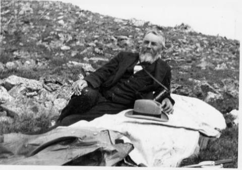
John Wesley Powell was a Civil War veteran who had lost part of one arm as a result of combat.  He was a professor of natural history at Illinois Wesleyan Collage, who took field trips with his students to the Rockies.

He came to the Grand County region looking for a vantage point to conduct an exploration of the Colorado (the Grand) River. With six local men he made the first recorded ascent of Long's Peak, the 14,255 foot landmark of the Front Range, on August 23, 1868.  From that summit he could view much of the headwaters area of the river.

Descending back into Middle Park, he ventured to Gore Canyon where he decided the turbulent rapids were too dangerous for his boats.  He decided to take an exploratory  party of students to the Green River in Wyoming, a tributary of the Colorado.  Losing one boat in that expedition, the party made the first known trip through the Grand Canyon in 1869.

He later became leader of the first U.S. Geological Survey, and because of his study of Indian tribes, the first head of the U.S. Bureau of Ethnology.

Articles to Browse

Origins of the Ute People

Before there were any people anywhere, the Creator, "Sinawaf", cut sticks and placed them in a large sack.  After many days, this aroused the curiosity of the coyote.  When Sinewaf was away, the coyote could no longer control himself and opened the sack.

Out came many people who scattered in all directions.  Each spoke a difference language from the others.  When Sinewaf returned, there were only a few people remaining in the sack.  He was furious with the coyote, as he had planned to distribute the people equally in various parts of the land.  As there could now be no such equity, there would be wars among the different people, who would fight for the best locations.

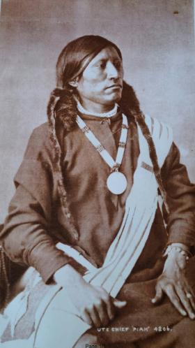
Of the small group left in the sack, Sinawaf called them Ute or Nuche, which meant "the people".  They would be a very brave and strong tribe.

Topic: Regions

North Park & Middle Park - Politics and Whiskey

The Territorial legislature defined the boundaries and county seats for the West Slope in 1861.  Geographic knowledge of the Colorado mountains was somewhat limited at that time.  North Park (a name now synonymous with Jackson County) was an Indian hunting ground and little was known about it.

A boom started with the discovery of gold and silver at Teller City in 1879.  North Park was considered to be part of Grand County, and now there was property to assess and tax.  The Grand County road tax in North Park for 1881 applied only to males between the ages of 21 and 45.  They had to either pay $3 in cash or do two day's work on the roads. John Mills, a Teller City resident who acted as an attorney for mine owners, served as a Grand County commissioner and was one of the commissioners killed in the July 4, 1883 gun battle at Grand Lake.

As ranches became established and more mineral deposits were discovered, the Larimer County commissioners began to speculate that the "Snowy Range" that defined the western boundary of Larimer County was the Park Range on the west side of North Park rather than the Medicine Bow Range.  This opinion soon degenerated into a dispute between Grand and Larimer counties, ultimately ending up in court. In 1886 the Colorado Supreme Court ruled that North Park was part of Larimer County.

A trip to the county seat in Fort Collins was a considerable undertaking.  If everything ran on schedule it was possible for travelers to leave Walden on the morning stage, catch a train from Laramie to Cheyenne, another train from Cheyenne to Greeley, still another from Greeley to Fort Collins, and arrive at the county seat before closing hours the following day.  The fares amounted to a significant expense.  It was probably more common for a North Parker to travel to Fort Collins in his wagon, take care of business, and come home with a wagonload of provisions.  The trip by wagon took three to four days each way.

As the population of North Park grew, so did the desire to split from Larimer County.  In 1908 the Loveland newspaper stated that Larimer County was too big and advocated a new county with Loveland as the county seat.  The Walden newspaper agreed that the county was too big but felt the wrong division line had been picked, pointing out that "A Loveland man can get to the county seat in three hours anytime, but it takes a North Park man three days most of the time."

Ranchers resisted early efforts to set off the area west of the Medicine Bow Range into a county of its own as they carried the largest part of the tax burden and felt their taxes would increase if a new county was established.  But by 1908 there was general agreement within the Park that it was time for court and administrative offices to be more conveniently located.

The total valuation assessed in 1908 of North Park property by Larimer County was $771,776, which generated $16,979 of revenue.  The salaries of some of the paid officers of the new county was estimated as follows:

     Assessor                                                    $800

     County School Superintendent                   $800

     Water Commissioner, 2 districts                $1000

     County Commissioners                             $1000

Even adding in salaries for the sheriff and county clerk it appeared quite likely that the new county could be operated efficiently without a tax increase and the proposal to create "North Park County" had nearly unanimous support from North Parkers.  The bill passed the legislature easily in April 1909, with a name change to Jackson, and was quickly signed into law on May 5 by Governor Shafroth.

While North Parkers were eager to sever their legal ties to Larimer County in 1909, they clearly weren't ready to give up the pleasures of offered by a nip of the bottle.  Like most frontier areas, North Park had a significant number of single men who liked to occasionally get together and enjoy a few drinks with their friends.  Walden was the center of socialization.  According to an 1899 newspaper article, Walden residents worried about the "toughs" who came to town to "drink barbed-wire bitters and then shoot up the place."

In addition, local married men sometimes frequented the bars when they could have been spending more time at home helping out with domestic chores.  As a result, a strong temperance movement soon divided the community.  One of the two local newspapers, the North Park Union, endorsed the temperance movement in early 1902 and soon found itself the target of a boycott by both advertisers and subscribers.  Although the editor declared it a "boycott of no great magnitude", the paper had a new owner/editor within a month.  The issue of whether Walden should be wet or dry was on the 1902 ballot.  By a very decisive majority, voters decided Walden would continue to be wet.

Just before the 1906 election, the Walden newspaper criticized the local Republican Party bosses for providing a lot of free whiskey in every North Park precinct on election day, and urged North Parkers not to sell their vote for a drink.  The temperance movement enjoyed its first victory when it combined forces with the local church and convinced the businessmen of Walden to close their stores on Sundays.  The closing did not stand in high favor with ranchers.  "When a man can't buy axle grease for his wagon when it runs dry and something else for himself when he runs dry, it is time to call a halt," they declared.  Quite a number of the ranchers started going through to Laramie for their provisions, and the Sunday closing rule was abandoned six weeks after it was implemented.

When news reached Walden in early 1909 that the bill creating Jackson County had cleared the legislature, the newspaper reported that the town was moved to the point of a merry celebration.  The brass band marched, guns were fired, and at daybreak "the women, as becomes their sex, were among the few who were sober."  A few weeks later news that the Governor had signed the bill was cause for another celebration.  The newspaper reported that, "the air about town clouded up and filled with burnt powder and raucous vocalizations.  The festivities continued in the evening with flying anvils propelled by stick powder . . ." The first hundred years of Jackson County had commenced.

Topic: Water

Moving Water from Point A to Point B

Most serious ranchers had more than one ditch and most built one or more reservoirs. Hilry Harris, Munroe C. Wythe, Samuel H. Burghard, and John A. Coulter entered the first water claim in the county on September 20, 1874. This came out of Sheep Creek above the head of Gore Canyon.

There usually was some natural irrigation; but the challenge of getting the water from the creek required laborious construction of diversion dams, headgates, and ditches, the earliest ditches being dug by hand and often taking up to four years to complete. Later, ditches were dug using teams and scrapers. The grade was figured out initially by simple gravity flow, letting a trickle of water move down the ditch. Soon ranchers refined the process, using a 16’ long board placed with a 1/8" slope, determined by a carpenter’s level. A.F. and Roy Polhamus surveyed a great many of the water ditches, especially those impressive ones in West Grand County, some of which even had tunnels involved. Most small ditches supplied just one ranch, but if a ditch had to cross another ranch, that rancher usually got a share. And some of these ditches were long!

For instance, Dr. Henry Hoagland, on the Blue River, anticipated getting water close at hand from Spruce Creek. Instead, he discovered an old timer had previous rights that forced him to go back into the mountains and build a 13-mile long ditch. Hoagland had figured on spending about $7000; in the end, the actual cost was $26,000! His crew dug the ditch around side hills and across valleys using flumes and siphons. Then his real troubles began. Terrible leaks and washouts occurred everywhere. Finally he hauled in adobe and put this in the bottom of the ditch, rented sheep, and drove them day after day up and down the ditch to pack it. After a couple of years of using this tamping process, the ditch held. Other ditches were even longer. The Church Ditch at Willow Creek and the Wheatley Ditch on the back Troublesome were both 16 miles long.

The Company Ditch (aka the Williams Fork Ditch), eight feet wide on the bottom, was another long one. Built between 1903 and 1907, it cost $44,000 and had a decree for 150 cubic feet / second. The ditch went uphill and down, requiring many flumes and bridges. One flume was actually 1200 feet long! Subsequent breakdowns, leaks, and slides were so frequent and repairs so extremely costly that old-timers have said the reason the Company Ranch went broke about 1920 was the expense of The Ditch. The Lyman Ditch (or the Curtis), started about 1891, was just as complicated as the Company Ditch. Crossing high above the Williams Fork River, the ditch eventually needed cement piers to carry the pipe (1928). This ditch had so many slides, leaks, and washouts, that it had to be inspected once or twice daily! Siphons were required over draws. Flumes, sometimes ¼ mile long, might be 25-30 feet high, and one flume was actually 177 feet high; but these heights were necessary to maintain the elevation.

Flumes, being of wood, rotted and were guaranteed to leak. Sometimes wind blew a portion of the flume down. Finally the county put in big pipes to help the ditches across the Williams Fork. It might be noted that, when water leaked out of ditches, a side benefit was that ranchers along the way could use the "lost" water. Along with the ditches came reservoirs.

Fred DeBerard had four reservoirs on the Muddy: the Albert, the Binco, Milk Creek, and a low one that flooded the Jones place near Kremmling. All were dirt, of course. The Hermosa Ranch on the Little Muddy had water rights through the Sylvan Ditch and Reservoir Company and they built the Sylvan Reservoir dam and the Hermosa Ditch starting in 1911 and completing it by the spring of 1916. The Stein Ditch, started in 1897, was another large ditch, this one later purchased by the Taussig family. These ditches were all built originally to provide water to meadows and fields for ranching purposes. For years, people hauled in water for baths and household use, but that gradually changed. Leon Almirall, near the Horseshoe Ranger Station on the Williams Fork, decided that he wanted water for his home, so he built a 1700’ pipeline to his house, added an inside bathroom, and was shocked when the line froze the first winter – it was only three feet deep. He called in workers who dug down and insulated the line with manure and straw. It froze again. Finally, Almirall gave up and buried the line six feet deep. Now he had his water!

On Ranch Creek in the east end of the county, E.D. Shew cut a ditch upstream from his house, placing it along the edge of the creek, but directing the water back into the main channel near his house. At that point, he put a little water wheel that pushed the water up the hill to his cabins -- and furnished electricity besides. Eventually he replaced the water wheel with a gas engine. There was a similar water wheel, used for the same purpose, up in Hideaway Park.

Water was used to transport lumber as well. A flume ran down the mountain into Monarch Lake, in the days when the Monarch Company was timbering there. There was a flume along St. Louis Creek, carrying lumber from the camps upstream. Perhaps the most ambitious flume ran from Western Box Sawmill. This area is now under Meadow Creek Reservoir. In 1906, the Deisher Lumber Company paid Nathan Hurd for a right of way through his land and built a flume with a 2% grade down Hurd Creek. Logs were placed in the flume and a horse harnessed to the last log. The horse then pushed the logs down the flume with the help of the water. Three years later, the mill was moved to "Sawmill Meadow" on Meadow Creek.

In 1911 construction on the seven-mile-long Vaver Flume began, with 117 cubic inches of water allotment. This flume ran down Meadow Creek and over to Tabernash, carrying partially processed logs for further manufacture. A flume rider checked along the way, making sure there were no jams, and phone line allowed the rider to report troubles. Hikers can see remnants of both the St. Louis Creek flume and that one coming down Meadow Creek today.

Topic: Biographies

Billy Cozens - First Settler in the Fraser Valley

William Zane Cozens was born in Canada on July 2, 1830. After spending some time in New York, he moved to Central City Colorado in 1859, lured by the rumor of gold in the mountains. There, he became well known as a steady and trusted lawman.

In December 1860 he married Mary York, who had been born in England in 1830.  Mary was a devout Roman Catholic and was not happy with the uproarious mining camp of Central City and the constant threat to her husband in his role as Sheriff. So by the mid-1870's, they decided to relocate over the Continental Divide and established a hay ranch and stage stop in Middle Park (north of the present town of Winter Park). They had seven children, although only three ? Mary Elizabeth, Sarah Agnes and Willie ? survived infancy.

Mr. Cozens became the Fraser postmaster in 1876, holding the position until his death in 1904. On July 29, 1878, there was a total eclipse of the sun over Colorado.  The Ute leader Tabernash took that as a divine omen to take action against the increasing encroachment of white settlers, miners and hunters into Ute hunting grounds. Tabernash gathered 40 armed warriors and set out to attack the Cozens Ranch. Billy Cozens negotiated with the group, offered food and finally persuaded them to move on.  The group ended up confronting another rancher and the face off resulted in the death of Tabernash (more details under Tabernash page). 

Mary worked very hard to make their isolated home a pleasant place.  She even ordered dandelion seeds from a seed catalog in order to add color and zest to her garden.  One can speculate that the source the abundant dandelions in the Valley are the result of Mary's original plants.

The Cozens Families' stage stop became a well-known stopping place for summer tourists, who often enjoyed Mary's fine meals and "Uncle Billy's" (Mr. Cozens' nickname) tales from his days as a Gilpin County lawman. When Billy dies in 1904, none of his children had any offspring so Mary left the ranch to the Catholic Church and Regis University, which built a retreat on the property.  In 1987 the ranch house was given to the Grand County Historical Association and now houses a museum.   

Source:


Topic: Mountains

Rollins or Corona - What shall it be called?

Travel across various passes of the Continental Divide occurred long before white men showed up. Indeed, as anthropologist James Benedict wrote c. 1975, some 10,000 years ago, prehistoric Indians camped, hunted, and built hunting walls on the upper reaches of Rollins Pass, as well as moving in and out of Middle Park for the warm summer months.

Historic Indians followed the same paths. In the earliest days of non-Indian access, a particular pass at the head of Boulder Creek was dubbed Boulder Pass. Capt. Jacob Bonesteel, including wagons, made the first recorded crossing by a white man at this point in April 1862. Three years later, a group of Mormons brought wagons over this route and a year later, promoters of new roads into Middle Park brought in many wagons and livestock.

In fact, tourists were starting to enter the park by a number of routes, and one of them, Samuel Bowles, who wrote a fascinating account of his trip, including his return to Denver via Boulder Pass. Interest was growing rapidly for a road over the Divide, into Hot Sulphur Springs, and on into Utah. One promoter, John Quincy Adams Rollins, from New Hampshire, teamed up with William N. Byers and Porter M. Smart to carry this project through. Rollins was interested in crossing the Divide; Byers was promoting the Springs; Porter wanted to develop the valley of the Middle Yampa. All three were pushing to have Middle Park officially named as Grand County, a challenge finally accomplished in 1874. So Rollins and associates started his road, reaching the top in 1873.

That next winter, they publicized this access and in June, Jimmy Crawford brought his family and wagons to Rollinsville and thence to Yankee Doodle Lake, ready to cross the pass now named Rollins Pass by the developer. But the road ended, and they found Rollins' men still hacking the road out of the granite! Jimmy and his crew found it necessary to leave their wagons and help. Finally, on June 10th, the family was able to head for the top. Jimmy borrowed two yokes of oxen, hitching them to mules, and then to his horse. The road was so rough that the procession could proceed but a few feet before having to rest. The family itself climbed on foot. At the summit, they discovered only a rough swath cut down through the trees on the western side. The "road" dropped down between the lakes and followed Ranch Creek to its junction with the Fraser River.

Rollins quickly realized that Berthoud Pass, which also opened in 1874, was superior to his own pass for wheeled vehicles, so he determined to hedge his bets. He initiated the first mail service into the county in 1873. He also built a commodious hotel where his road joined the Berthoud Pass road at the confluence of Crooked Creek and the Fraser. He called it the Junction House. Next, he proposed to the builders of Berthoud Pass that they form a joint ownership of the two roads between Junction Ranch and the Springs. Tickets would be issued for both routes and revenues would be shared. The two companies would build a bridge over the Grand at Hot Sulphur Springs. He even buttered up his rivals by complementing their work. All this was accomplished, although the mail route soon moved to Berthoud Pass, because of the severe winters on Rollins Pass.

The bridge was started in November 1874. From the beginning, Rollins' road was preferred for trailing livestock, because there were fewer problems with heavy timber and bogs. For years, the Church brothers, George and John, who introduced the Hereford breed into the county, trailed their cattle for summering in what became known as Church Park. However, tourists such as Irving Hale still drove wagons over Rollins Pass in 1878. About 1880, interest burgeoned for bringing a railroad up South Boulder Canyon and through a tunnel near Rollins Pass. Numerous surveys were completed all along the area. David Moffat settled on Rollins Pass for the tunnel site but decided first to put a temporary line over the top.

Thus, in the summer of 1903, a formal contract was let for work up and over the Pass itself. By 1904, the workers reached Arrowhead and they also built a work station on top, called Corona Station, or "crown of the mountain." This railroad construction town of Corona, located at over 11,600 feet at the top of Rollins Pass (first called Boulder Pass) along the Continental Divide was the highest railroad station in the world. It became obvious by 1905 that the Corona area would require snowsheds if trains were to travel, even irregularly, during the winter. Still, word got out of the spectacular splendor of Rollins Pass and tourists flocked in on summer train excursions, sometimes stopping on top, sometimes going as far as Arrow.

In 1913, a fine hotel was built next to the rail facilities. Because Rollins Pass was right in the middle of severe weather patterns, a weather station was built on top, as well as one down at Sunnyside. In 1915, Rollins Pass was actually proposed to be the south boundary of a proposed "Estes National Park." Later, on the National Historic Register, the district was listed in 1997 as the Denver, Northwestern and Pacific Railway Historic District--Rollinsville & Middle Park Wagon Road. It was also identified as the Rollinsville and Middle Park Wagon Road; Boulder Wagon Road, Rollins Pass, and Rollinsville area. In 1956, Governor Steve McNichols had presided at the official re-opening of the four percent grade to vehicle traffic over Corona Pass, expressing the hope that the route would someday be paved. The Colorado Game and Fish Department and the U.S. Forest Service made additional improvements, and the Arapaho and Roosevelt National Forests put out a 24-page booklet titled "The Moffat Road: A Self-Guiding Auto Tour."

The road crossed two of the original railroad trestles near Corona but those trestles, even if reached by 4-wheel vehicles, were crumbling and could no longer even be crossed safely on foot. The current self-guided auto tour refers to Rollins Pass, as well as the Moffat Road and the Boulder Wagon Road. Corona Station and Hotel are discussed. In 1979, a portion of the auto road over Corona Pass was permanently closed because of a cave-in of the "Needle's Eye," a tunnel located before the trestles heading west from the Moffat Tunnel's East Portal. The tunnel reopened on July 3, 1988, thanks to efforts of the Rollins Pass Restoration Association on both sides of the Divide, with the cooperation of the U.S. Forest Service, Colorado History Society, and Boulder, Grand, and Gilpin Counties. It then closed once more when another rockfall hit the tunnel on July 15, 1990. The RPRA is continuing its efforts for re-opening. The noted photographer, Charles McClure, took many outstanding photos of the Rollins Pass road.

One, titled "Group on Rollins Pass, shows well-dressed men and women stand on a snowfield making snowballs on Rollins Pass, Moffat Road, Boulder or Grand County, Colorado; probably on Denver, Northwestern and Pacific excursion train. Date: between 1904 and 1913 near Corona Station." Another photo shows a "30 ft. snowcut on Rollins Pass, Moffat Road photo. Denver and Salt Lake Arrow passenger car is parked east of Corona snowshed by the thirty foot snowbank cut, Rollins Pass, Colorado; it shows men, women and railroad employees posed behind train, on the roof and on the snowbank and a standard gauge track. Date: between 1904 and 1915." A sign at the highway turn onto the Moffat roadbed says: The Moffat Road "Hill Route" Also called "Corona Pass Road", this road over the Continental Divide was the original "Hill Route" of the Denver, Northwestern & Pacific Railway built by David H. Moffat in 1903. It crosses Rollins Pass at 11,666 feet elevation. On top of Rollins Pass, a sign says: Elevation 11, 660 feet, John Quincy Adams Rollins established a toll wagon road through this pass in the mid 1870's. David H. Moffat's Denver, Northwestern & Pacific Railway crossed the Continental Divide at this point in 1903.

First known as Boulder Pass, then Rollins Pass, the railroad workers dubbed it "Corona", the crown of the "Top of the world." A railroad station, hotel, restaurant and workers' quarters existed here until 1928 when the railroad was abandoned due to the building of the Moffat Tunnel. Identifications in various trail and geographical guides say: Rollins Pass (el. 11,680 ft) is a high mountain pass in the Rocky Mountains of north-central Colorado in the United States. The pass is located on the continental divide at the crest of the Front Range southwest of Boulder, at the boundary of Grand County, Colorado and Boulder County, Colorado. Rollins Pass (a.k.a. Corona Pass) sits approximately 5 miles east and above the popular ski areas around Winter Park, between Winter Park and Rollinsville. The pass is traversed by an unpaved road, mostly the former roadbed of the Denver and Salt Lake Railway which abandoned the route in 1928 when the Moffat Tunnel opened to replace it. Railroad advertising called this the "Top O' the World" and it referred to the Moffat Route over the continental divide and the Rocky Mountains. Rollins Pass was the primary travel route west from Denver until an easier road over Berthoud Pass was constructed. The Denver, Northwestern and Pacific railroad laid its tracks across the pass in 1903-1904 and established a Depot at Corona on the crest. It can be noted that in R.C. Black's Island in the Rockies, the term "Corona Pass" was mentioned one time, on p. 351; the terms "Corona Station" or "Corona Snowsheds were used. In Dismantling the Rails That Climbed, Rollins Pass was used, the Corona hotel, and just once, Corona Pass; 1936.

In Maggie By My Side, it was Boulder Pass and Rollins Pass. In Rails that Climbed, Rollins Pass, the Corona shed, weather at Corona, Rollins Pass Snow Shed, other references to Corona as a site. In Guide to the Colorado Mountains (Orme) , they speak of the Corona Trail to Rollins Pass. High Country Names (Ward) used Rollins Pass entirely. Only Hiking Grand County, Colorado, published 2002 by Carr speaks of Corona Pass, with reference to Rollins Pass (near the town of Corona), Moffat Road. The term "town" might be questionable; there was only a small restaurant, workers quarters, railroad offices, and in 1913, the hotel. Current maps, USFS and the Grand County Trail Map, show Rollins Pass, with Corona at the side as being a site. The use of "Corona Pass' seems to be a rather recent innovation that has come into being with tourism efforts in the upper Fraser Valley. Rollins Pass From Island in the Rockies p. 45 Rollins Pass was originally known as Boulder Pass, first recorded being crossed by whites, by Capt. Jacob Bonesteel in April 1862. Their supplies were carried in wagons. A second organized party went over the same pass in 1865. In 1866, promoters of access into Grand County brought many wagons and livestock over Boulder Pass.In 1867, Samuel Bowles and a group returned home to Denver via Boulder Pass. In 1873-74, two roads were proposed into the county, one of Berthouds pass and one over Boulder Pass. This was the same time that the county was named "Grand". J..A Rollins and his associates started the road and reached the top of the pass in 1873, at which time they envisaged a road from HSS into Utah. The first wagons went over in June 1874. The western descent was so bad that it never was much patronized by wheeled vehicles, instead becoming primarily used for trailing of cattle. At this time the name Boulder Pass disappeared from maps and Rollins Pass became the official name. p. 85. p. 80 Lots of schemes to build roads into GC, but of all the schemes for transport, only one, the Rollinsville and Middle Park Wagon Road showed any promise. T

hat was designed by John Quincy Adams Rollins, from NH, a gifted promoter, a son of a clergyman, second of 19 children. He was a farmer, miner, freighter, road bulder, and platter of towns. He was perhaps the most accomplished billiard player west of the Mississippi. He was a Colorado resident at least by 1866. His finances were up and down, but he was tremendously strong. In December 1884, when he was 68, he thought nothing of a 3-day snow-clogged crossing of the Continental Divide. p. 85 Rollins was interested in MP as an investor and he was interested in extending his road into Utah.. At the same time, a Porter M. Smart was likewise excited about speculating in frontier projects and was working at developing the valley of the Middle Yampa. William N. Byers was busy planning for HSS. These three men launched at least two petitions, with more than 80 "residents" for creating GC. Grand County was created that year, 1874. p. 89 With the creation of GC, people began to consider the area more seriously. p. 92 There was no official mail into the county until 1873 when Rollins brought in the first US pouch over his pass. In May 1874, he built a commodious hotel at the confluence of Crooked Creek and the Fraser, known as the Junction House. p. 94 Rollins knew that the road over Berthoud Pass was superior to Rollins Pass; his main advantage was the railhead at Blackhawk.

So Rollins proposed a joint ownership and operation of the two roads for the line between Junction Ranch and HSS. Tickets would be issued for both routes and revenues would be shared. The two companies would build a bridge across the Grand at HSS. Rollins even complimented the Berthoud work. This merger was completed soon. p. 104 This bridge was started in November 1874. p. 108 A mail contract was made in July 1875 for once a week delivery over Rollins Pass, but conditions were so severe that the route was changed to Berthoud Pass. p. 110 From the beginning, Rollins Pass was used in preference to Berthoud Pass for trailing livestock, because there were fewer problems with timber and bogs. However, late spring snowdrifts were a problem, so 20-30 horses were often brought along to break trail. The Church brothers, ?George and John, summered their cattle in what became known as Church Park and dug the Church Ditch. They also introduced the celebrated Hereford breed into GC. p. 170-171 As interest in bringing a railroad into and through GC developed, about 1880, various stockholders proposed to build up South Boulder Canyon to Yankee Doodle Lake and start a tunnel near Rollins Pass. Nothing came of the first attempts but by the end of July 1881, numerous surveys had been made for that tunnel. p. 238 Cattle was still being trailed out via Rollins Pass up to the turn of the century. p. 258 David Moffat and Horace Sumner, his chief engineer, in the fall of 1903, were planning the tunnel for future excavation; but in the meantime a temporary line was planned for crissing Rollins Pass, at 11,640 feet. p. 264 A formal contract was let for the work over Rollins Pass in August 1903. The loftiest sections were started first, and the first cuts at the top were nearly finished by the 26th of October and tunneling started at Riflesight Notch. As snow came, work slowed to a standstill. p. 265 Work in 1904 was extremely slow until the end of August.

An encampment was built at Arrowhead and a station at the crest of the Divide was named Corona Station, where long snow sheds were built almost immediately. p. 267 Arrowhead was soon shortened to Arrow, when a post office was opened there in 1905. Travel on the grades, at 4-5% grades up over Rollins Pass was exceedingly difficult. p. 270 In 1908, word of the scenic splendor of Rollins Pass was becoming known world wide. Also, Rollins Pass and its "Corona station" were attracting the attention fo the US Weather Bureau, for the pass lay squarely in the center of the region of heaviest snowfall on the entire Colorado Continental Divide. p. 344 A terrible winter in 1909 made people think that Rollins Pass was never going to be practical for the long term. Time and again freight and passengers were stuck on top at the Corona facility. In 1913, a $10,000 hotel was built at Corona next to the rail facilities. From Dismantling the Rails That Climbed p. 6 The railroad went from Denver to the top of Rollins Pass. p. 8 Snowsheds were built over the tracks at Corona and other strategic places in 1905. p. 12 The top was referred to as "Corona Pass" 1936. p. 16 Crews who were to removed tails and ties reached Corona at the top of Rollins Pass 1936. p. 20 Reference to the Corona hotel From Maggie By My Side p. 1 Jimmy Crawford heard that a man named John Quincy Adams Rollins was building a road over the range at a place called Boulder Pass. 1873 p. 9-14 June 1874 The Crawford family traveled to Rollinsville and then to Yankee Doodle Lake, where the road ended. Rollins' men were still hacking the road out of the granite. Jimmy and his crew helped. On the morning of June 10, the family started out to go over the rocks and up the mountain. Then he borrowed two yokes of oxen to his wagon, then mules, then his horse. The animals had to rest every few feet; the family climbed on foot. There was no shelter at the top. Rollins' men had done no work yet on the west side of the pass except to cut a rough swath down through the trees. The road dropped down along Ranch Creek. From Rails That Climb published 1950 p. 43 Leyden Junction to Tolland to Rollins Pass. P. 63-64 Many references to Tunnels as identifiers of location. p. 76-77, 78 reference to the old Rollins Pass toll road; first mention of the place called Corona- crown of the mountain. Most references are to Rollins Pass. The Corona shed is mentioned, p. 82. p. 83 Sunnyside water stop, Loop Trestle and Tunnel, Ranch Creek Trestle and water stop, Arrow. p. 95, 100- 101 It is eleven miles from Arrowhead to Rollins Pass. Rollins Pass-Boulder wagon road; other references p. 107 - 112 reference to Corona shed. Reference to pipe line to Corona; a number of comments to Rollins Pass p. 119 weather at Corona p. 120-121 Rollins Pass p. 151 Rollins Pass p. 182 photo of "Rollins Pass Snow Shed" "This Corona station burned one night." p. 188 photo of June at Rollins Pass p. 192-194 photos of Corona shed and other buildings; Rollins Pass p. 252 walking on top of snow shed at Corona p. 271- 272. 1910 Snowshed at Corona p. 312-314 Rollins Pass; Rollins Pass snowshed; Corona; Corona siding p. 324 Corona; Sunnyside weather report station p. 326 Corona sheds p. 333-335 Corona shed; references to "Corona" as a place From Guide to the Colorado Mountains published 1974 p. 54-55 Corona Trail, going from East Portal to Rollins Pass From High Country Names published 1972 p. 105 Irving Hale in 1878 drove his wagon over Rollins Pass, now nearly abandoned as a wagon road. p. 131 David Moffat decides to build a temporary line over Rollins Pass. p. 165 In 1915, Rollins Pass was proposed to be the south boundary of a proposed "Estes National Park". From Hiking Grand County, Colorado published 2002 p. 52 Trailhead on the "Moffat Road to Corona Pass". In same paragraph, it becomes Rollins Pass (near the town of Corona). On p. 54, reference to the Corona Road. On p. 57, map shows Rollins Pass with Corona marked as a "site." p. 56, reference to the old railroad bed used crossing the Divide at Rollins Pass, near the town of Corona.

Sometimes called Corona Pass. p. 60-61 Rollins Pass Wagon Road historical notes on JQA Rollins and how to find his wagon road over Rollins Pass, following Ranch Creek to Tabernash. p. 66 Rollins Pass (Corona) to Devil's Thumb From GCHA Journal The Journey p. 6 Rollins Pass used by Indians; comment in 1981 From GCHA Journal Middle Park Indians to 1881 p. 8 Archaic hunters camped in the Rollins Pass area; written mid-1970's The current maps, USFS and Grand County Trail Map, show Rollins Pass with Corona at the side as being a site. The Rollins Pass Restoration Association for many years, and currently, has been trying to open the road and Needles Eye Tunnel. The self-guided auto tour refers to Rollins Pass, as well as the Moffat Road and the Boulder Wagon Road. Corona Station and Hotel are discussed. On the National Historic Register Denver, Northwestern and Pacific Railway Historic District--Rollinsville & Middle Park Wagon Road (Boundary Increase) ** (added 1997 - District - #97001114) Also known as Rollinsville and Middle Park Wagon Road;Boulder Wagon Road;R Rollins Pass, Rollinsville Corona Station and Hotel The railroad construction town of Corona, Colorado, located at over 11,600 feet at the top Corona Pass (first called Boulder Pass) along the Continental Divide was the highest railroad station in the world. It was situated on an old Native American trail, the same trail it is believed the Mormons traveled on their way to Utah. The road was improved by the U.S. Army, then further improved in 1866 by General John Q. Rollins, for whom the pass and the town of Rollinsville were officially named. Because of the high drifts of snow, the pass was only open from around July to the first big snowstorm two or three months later. In 1956, Governor Steve McNichols presided at the official re-opening of the four percent grade to vehicle traffic over Corona Pass, expressing the hope that the route would someday be paved. The Colorado Game and Fish Department and the U.S. Forest Service made additional improvements, and the Arapaho and Roosevelt National Forests put out a 24-page booklet titled "The Moffat Road: A Self-Guiding Auto Tour."

The road crossed two of the original railroad trestles near Corona but those trestles, even if reached by 4-wheel vehicles, are crumbling and can no longer even be crossed safely on foot. In 1979, a portion of the auto road over Corona Pass was permanently closed because of a cave-in of the "Needle's Eye," a tunnel that came before the trestles on a westward drive from the Moffat Tunnel's East Portal area. The tunnel reopened on July 3, 1988, thanks to the efforts of the Rollins Pass Restoration Association with the cooperation of the U.S. Forest Service, Colorado History Society, and Boulder, Grand, and Gilpin Counties. It was then closed once more when another rockfall hit the tunnel on July 15, 1990. John K. Aldrich is a geologist, lecturer, and author whose "Ghosts of . . . " books and accompanying topo maps are a boon to hobbyists, explorers, and those interested in Colorado mining history. Date: 02/04/08 05:13 Rollins Pass Milepost 16 Corona Station. Picture 6 below, is DPL photo X-7388. "Title: Corona, Colorado, interior of snowshed. Summary: Passengers stand next to the covered train depot at Rollins Pass, in Corona (Grand County), Colorado. The tracks of the Denver, Northwestern & Pacific Railway are in the foreground. The depot is constructed of logs, and the roof of the snowshed is upheld by timbers. Sunlight streams through the opening at the end of the snowshed. Date: (between 1904 and 1913). Source: E. T. Bollinger from W. I. Hoklas." Picture 7 below, is DPL photo MCC-454A. "Title: Group on Rollins Pass. Summary: Well dressed men and women stand on a snowfield making snowballs, Rollins Pass, Moffat Road, Boulder or Grand County, Colorado; probably on Denver, Northwestern and Pacific excursion train. Date: (between 1904 and 1913). Creator: Louis Charles McClure 1867-1957. Picture 8 below, is DPL photo MCC-624. "Title: 30 ft. snowcut, Rollins Pass, Moffat Road photo. Summary: Denver and Salt Lake Arrow Turn (passenger car) parked east of Corona snowshed by thirty foot snowbank cut, Rollins Pass, Colorado; shows men, women and railroad employees posed behind train, on roof and on snowbank and standard gauge track. Date: (between 1904 and 1915 The highway sign says The Moffat Road "Hill Route" Also called "Corona Pass Road", this road over the Continental Divide was the original "Hill Route" of the Denver, Northwestern & Pacific Railway built by David H. Moffat in 1903. It crosses Rollins Pass at 11,666 feet elevation. On top of Rollins Pass, a sign says: Rollins Pass Elevation 11, 660 feet John Quincy Adams Rollins established a toll wagon road through this pass in the mid 1860-s. David H. Moffat's Denver, Northwestern & Pacific Railway crossed the Continental Divide at this point in 1903. First known as Boulder Pass, then Rollins Pass, the railroad workers dubbed it "Corona", the crown of the "Top of the world." A railroad station, hotel, restaurant and workers' quarters existed here until 1928 when the railroad was abandoned due to the building of the Moffat Tunnel. Rollins Pass Elevation 11,680 ft (3,560.1 m) Traversed by Unpaved road Location Boulder_County,_Colorado / Grand,Colorado Rollins Pass (el. 11,680 ft) is a high mountain pass in the Rocky Mountains of north-central Colorado in the United States. The pass is located on the continental divide at the crest of the Front Range southwest of Boulder at the boundary of Grand_County,_Colorado and Boulder County. Sign that sits on top of Rollins Pass Rollins Pass (a.k.a. Corona Pass) sits approximately 5 miles east and above the popular ski areas around Winter Park, between Winter Park and Rollinsville. The pass is traversed by an unpaved road, mostly the former roadbed of the Denver and Salt Lake RailwayDenver_and_Salt_Lake_Railway which abandoned the route in 1928 when the Moffat Tunnel opened to replace it. Rollins Pass Railroad advertising called this the "Top 'O the World" and it referred to the Moffat Route over the continental divide and the Rocky Mountains. Rollins Pass was the primary travel route west from Denver until an easier road over Berthoud Pass was constructed. The Denver, Northwestern and Pacific railroad laid its tracks across the pass in 1903-1904 and established a Depot at Corona on the crest. David Moffat planned to replace the "Hill Line" with a tunnel through James Peak within a few years of the railroad construction. However, he never could obtain financing for the tunnel due to the inability of the railroad to make a profit and opposition from competing railroads such as the Denver and Rio Grande. The D&RG saw the line as a threat. But, in the far future the construction of Moffat Tunnel would turn out to be the D&RG's saving grace.

The trip up Rollins Pass was a favorite of summer tourists looking to enjoy the mountain scenery. It was heavily promoted by the railroad with picnic and wildflower picking excursions. Sights along the line were made famous by postcards containing the photos of L. C. McClure. At last the route surmounts the crest of the Continental Divide and takes quick refuge on the top at Corona. At elevation 11, 660 this is truly the famous Top O' the World and one of the highest railroad passes in the world. Due to the great height and nature of the Rocky Mountains, the entire railroad complex was completely enclosed in giant covered snow sheds.

Topic: Water

Grand Lake

Grand Lake is Colorado's largest natural lake.  The clear blue waters are surrounded by magnificent mountain scenery and a haunting Indian legend.  

Judge Joseph L. Wescott, an early white settler, wrote a poem about a Ute story he heard from an Indian camping at the lake in 1867.  One summer Utes were camping on the shores of Grand Lake when they were suddenly attacked by an enemy tribe of the Arapahoe.  As the brave Ute warriors began fighting, the squaws and papooses hurried onto a raft for safety, pushing the raft to the middle of the lake. As the battle continued, a treacherous wind overturned the raft and all the women and children drowned.  

It is said that you can see ghostly forms in the morning mist rising from the lake and hear the wailing of the women and children beneath the winter ice.

Topic: Water

Colorado-Big Thompson Project

The idea of diverting water from the Colorado River on the Western Slope of the Continental Divide to the productive farmlands of the eastern plains had been a dream of planners as early as 1929.  Subsequently,  a long period of drought and the sagging economy of the “Great Depression” whetted demands for what became the largest trans-mountain diversion project ever built.

The Colorado-Big Thompson Project takes water from Grand Lake on the western side of the Continental Divide to the Big Thompson River on the east.  The water flows through a 13 mile tunnel beneath Rocky Mountain National Park.  In order to supply the residential and farming needs of Northeastern Colorado, the project was begun in 1938 and continued through the years of World War II.  The first water flowed though the tunnel, named for Senator Alva B. Adams, on June 23, 1947.

In order to assure an adequate supply from Grand Lake, a dam was built creating Shadow Mountain Reservoir.  A larger lake, Granby Reservoir was then built below, with a unique pumping plant that forces water into Shadow Mountain.  The Farr Pumping Plant cost over $9 million and provides an additional 700,000 of irrigated land to northeastern Colorado.  Further reservoirs were added, both to supplement the diversion and to compensate the water needs of Western Colorado.  These include Willow Creek and Windy Gap Reservoirs in Grand County.

While most legislators were enthusiastic about the project, U.S. Representative Edward Taylor was vehemently opposed to the reduction of water flowing down the Colorado River.  A compromise was reached in the creation of Green Mountain Reservoir (on the Blue River), which reserves water to replenish the Colorado River.   The city of Denver later claimed upstream water on the Blue River for the massive diversion project of Dillon Reservoir

Claims on the water of the Colorado River range from the fruit and wine regions of the Grand Valley in Colorado all the way to Los Angeles and Mexico.  It can be said that every snowflake which falls in Western Colorado had already been over-appropriated, especially during drought periods in the arid West.

Topic: Towns

Winter Park

The town of Winter Park was first settled in 1923 and incorporated in 1978. It came into existence as a construction camp during the building of the Moffat Tunnel. The west portal is located here, hence the original name of West Portal.

As early as 1929 hearty winter sports enthusiasts were getting off the regularly scheduled trains there to ski the trails that were being developed. Regular weekend service on a special ski train began in January 1938. That same year, the U.S. Forest Service gave permission to the City and County of Denver to develop land near West Portal for winter sports, constructing ski-tows and trails. Winter Park ski area was formally opened in 1940.

With the consent of postal authorities, West Portal’s name was changed to Winter Park to publicize the ski area.  Benjamin F. Stapleton, the mayor of Denver at the time, championed the cause of the name change to help publicize the winter sports of the area. The town has now grown into a classic resort town and the ski area management has been recently turned over to the Intrawest Corporation by the City and County of Denver.

Topic: Leisure Time

Picnics, Games and Socials

Article contributed by Abbott Fay


There were many games and leisure time activities enjoyed by the early settlers in Middle Park.  Among the most common adult games were gambling games such as crap-shooting.  Poker in almost all its forms was also very popular. Some saloon poker sessions would go on for entire weekends.  Parlor games often included Blind Mans Bluff, which has a history dating from ancient times.  Charades, dating from the 1770's was recorded in at least one pioneer diary.  Marbles and Jacks were common children's games. 


Some of the more athletic pursuits included swimming, which was very popular in the summer and during winter at the Hot Sulphur Springs.  Contests of croquet and horseshoes were played at almost all the resorts and dude ranches.  Several times, the Middle Park Fair Horseshoe Champion went on to compete at the Colorado State Fair, and in 1920, a local winner went on to the World Championships held in Minnesota.


All sorts of tag games were invented, including a version called "Fox and Geese" played in the snow fields of winter.  A variation which is rarely seen today was called "Statues".  In this game, "it" would whirl each player around and then release him or her.  However the released one landed, that position had to be held totally motionless (as a statue).  After all the players had been cast off into statues, "it" would pass among them looking for even the slightest motion, even to the blink of an eye.  As "it" caught a victim in movement, the victim then had to join "it" to pass among the statues, often taunting and teasing to elicit a movement, until only one statue remained.  The final statue became "it" for the next round.  


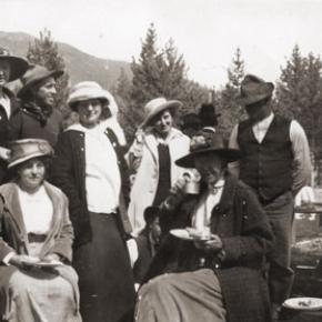
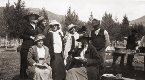
Rope jumping, hop scotch, sleigh riding, skiing and ski-jouring have all been mentioned in letters, diaries and newspaper accounts. Potluck picnics were frequent in the summers.  Ranch families would meet on Saturday nights in the school house for dancing.   At church celebrations there was almost always a cake-walk and donated box lunches were auctioned off.


In additional to fishing and hunting, rodeos gradually replaced informal races and other private ranch contests.  One of the first rodeos in the nation was held at Deer Trail in Colorado in 1869.  By the end of the century, almost every ranching area in the state had at least one rodeo a year. 


As for musical entertainment in those days before phonographs or radios, many people would perform at public and private gatherings.  Violinist, often self-taught, would play with other instrumentalists in what were called "hoe downs".  Mountain men often carried mouth harps for self-entertainment or impromptu performances for other trappers and Indians.  Accordianists were very popular at polka dances and the Jew harp was another common musical instrument.


On long lonely treks, some travelers would sing, not only for pleasure, but to scare away predatory animals.  Some ladies cultivated excellent singing voices and were often accompanied by piano music.  Pianos were more common in homes a century ago than they are today.  For households without a capable musician, there were player pianos, which made music from rolls of perforated paper to reproduce popular and classic tunes.


Story-telling was an art for some talented individuals, who were the highlight feature at many gatherings.  Some stories ended on a humorous note; other were mysterious or even scary.  Conversation was also considered a form of entertainment.  Women's sewing bees were welcomed for the gossip opportunities as well as the craftsmanship. 


Essentially, there was much more individual participation and carefully planned intermingling in those days than the more passive entertainment (TV, video games, movies, etc.) of today.   


Sources: Merlyn Simmonds Mohr, The New Games Treasury, Boston, 1997

Gertrude Hollingsworth, I Rember Fraser, Fraser, CO

Luela Pritchett, Maggie By My Side, Steamboat Springs, CO 1976

Candy Moulton, A Writers Guide to Everyday Life in the Wild West, Cincinnati, Ohio, 1999

Robert C. Black, Island In the Rockies, Boulder, CO 1969

Topic: Biographies

John Wesley Powell

John Wesley Powell was a Civil War veteran who had lost part of one arm as a result of combat.  He was a professor of natural history at Illinois Wesleyan Collage, who took field trips with his students to the Rockies.

He came to the Grand County region looking for a vantage point to conduct an exploration of the Colorado (the Grand) River. With six local men he made the first recorded ascent of Long's Peak, the 14,255 foot landmark of the Front Range, on August 23, 1868.  From that summit he could view much of the headwaters area of the river.

Descending back into Middle Park, he ventured to Gore Canyon where he decided the turbulent rapids were too dangerous for his boats.  He decided to take an exploratory  party of students to the Green River in Wyoming, a tributary of the Colorado.  Losing one boat in that expedition, the party made the first known trip through the Grand Canyon in 1869.

He later became leader of the first U.S. Geological Survey, and because of his study of Indian tribes, the first head of the U.S. Bureau of Ethnology.

Biographies