Ute Bill Thompson

Community Life Articles

Christmas at Fraser
Christmas at Fraser

The lights dimmed; mothers had already found their seats after coming from the classrooms where they had put makeup on little children’s faces and checked their costumes to make sure angel wings and halos were secure and costumes were on right side round.  I was at the piano, music and script lined out. The gym was full to the brim, every seat taken, with folks lining the sides and back walls, for the whole town had turned out.  Early birds got the seats!  Christmas wasn’t Christmas in the Fraser Valley unless it included the program at Fraser School (now the Town Hall).   I began the overture and chatter stopped.   I had played for this event for ages, starting in 1958.  High school students were gone by then, moved to the new Union High School in Granby, but 7th and 8th graders were still there.  And in 1958, the first kindergartens in the district were established.   It was a time of excitement and anticipation, of fun, and of panic? Well, no, not panic, for the teachers were beautifully organized. 

The program was chosen during October. Each teacher had a specific job. For instance, Martha Vernon, the art teacher, did sets.  Helen Hurtgen was responsible for dialog.  Edith Hill did costumes.  Nancy Bowlby was in charge of the music.  Others coordinated the whole.  And I played the piano, with Nancy sometimes accompanying me on her violin.  

Mothers were asked to contribute sheets and any fabric they could spare.  Patterns and material for costumes went home to be sewn into various sizes and shapes -- angels, gingerbread men, knights or royalty.  In the gym, we stitched on finishing touches, bright patches to decorate jester outfits, townspeople, and such, while watching various groups practice. Bits of tinsel became crowns, tinfoil turned into wands, cheesecloth into wings.  Lace scraps and sequins added color and “class.”   The budget was extremely minimal at first, but over the years, more money was directed to Christmas programs.  Instead of old sheets, we could buy cotton fabrics, velveteens, sometimes satin.  One year I even stopped by a furrier’s in Denver and begged some fur scraps.  Were we uptown then!  We had fur trim around the necks, cuffs, and hems of the costumes for the prince, queen, and king.  

The day before the play, PTA mothers gathered in the gym to fill brown paper sacks with an apple, orange, nuts, and candies, provided by R. L. Cogdell from his grocery store.  

Every single child in school took part in the play, as a class, except for those with speaking parts, of course.  Fraser grew and grew, then as now. Soon the 7th and 8th grades moved to Granby.  Then the 6th graders went, but the 4th and 5th graders handled the leads neatly.  Our stories were usually simple Christmas tales, but sometimes we tackled ambitious efforts such as the Nutcracker Suite or a version of Gilbert and Sullivan.   The only children not included were the Jehovah Witness youngsters.  They couldn’t be in the play and they couldn’t come watch it either.  We all felt very sorry for them, because everyone had such a wonderful time.  Their teachers tried to give them special projects to entertain and interest them while they sat off in a corner or in their classrooms.   The plays always went well.  Tiny kindergartners came out onto the stage, to stand behind the colored lights.  They knew their song perfectly in practices, but I have to admit that a number of them usually stood silent, stunned by that mass of faces looking up at them.  No matter.  They were darling. “Hi, Mom,” some were sure to call. “Mom” beamed.  

There might be a glitch or two every year. For instance, little Diane was chosen to do the Arabian dance in Nutcracker Suite.  Her parents were dark, as she was, and she was slender as a dancer. Trouble was, she didn’t have an ounce of grace in her body at that stage of her life.  I thought Nancy Bowlby was going to have grey hair before she got that child moving properly.  But the night of the program, Diane looked like Anitra herself, doing her exotic dance.   One year the king jumped his cue and entered on stage.  His first words were, “Did I miss anything?”  The prince muttered, in an aside, “Yes, three pages!”  But the cast went on as if nothing had happened, while down at the piano I sat, flipping pages rapidly, trying to figure out where the dialog was now.  

Another year, our son James was to take part in a minuet.  “Uck!  I have to touch a girl?”  By the greatest good fortune, he broke his leg and got to be a guard at the palace door, standing at attention on crutches, while another boy took his place.  (I think he did that on purpose.)   Songs and parts were adapted to the talents of the students.  We had five boys once, who couldn’t talk, dance, sing -- anything.  So they wore monks’ costumes and filed on stage, supposedly singing a Christmas carol, but supported strongly by the cast present.   Another time, Twyla’s parents couldn’t come, so Miss Vernon took her home to get ready. Now, Twyla usually looked like a dirty ragamuffin, but after a bath and hair wash, she truly looked like the angel she portrayed.   For the finale, the entire school came on stage to sing a last carol, with the audience joining in.  Then Santa showed up to distribute the goodie sacks, and the great night was over.  Coming out into the quiet night was a wonderful feeling.  Sometimes we moved through drifts of new falling snow; sometimes the sky was filled with icy stars.  Gay lights showed in windows throughout town. 

We never talked much on the way home, as we thought of the play, the success of everyone¹s efforts, and how happy the children had made their parents and families.   My last program was the first year after the new school was built.  It was fun still, but the school population had grown enough that it was impossible for whole classes to participate as one. Things weren’t the same as they were in the little old school.

Christmas at the Crawfords

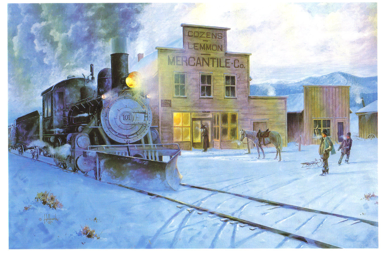
Jimmy and Maggie Crawford settled in Hot Sulphur Springs in June of 1874.  They left their farm in Missouri with their three children, John not yet two, Logan 4 and Lulie 7 years old to begin a new life in Colorado. The one room cabin was built of round logs and had a sod roof.  In several places outside light could be seen between the logs. The floor was packed earth covered with elk skins which had a tendency to smell while drying out after a rain or melting snow.  The sod roof was far from water proof.  When the children came down with scarlet fever Jimmy promised to cover the roof with wood shingles and had gone to Billy Cozens' sawmill to make them.  Mr. Cozens was very helpful and even gave Jimmy a rusty iron stove to take back home.  Rusty or not, to Maggie it was like new.  She was most appreciative.  The shingles were carefully stacked by the cabin but never made it to the roof.

Jimmy carefully explored the area for suitable pasture land for his small cattle herd.  His explorations took him further and further to the west of Hot Sulphur Springs and as fall approached he became desperate to locate suitable grazing pasture before the snows.  Although Jimmy would return home every few weeks, the time in between his visits became longer and longer as he moved his cows to the west.  Maggie was faced with many hardships in his absence.  Ute Indians would quietly appear, seemingly from nowhere, and ask for food or as in one instance, ask to trade a pony for the little boy John which she of course adamantly refused.  Maggie was able to keep friendly relations with the Utes but never comfortable when they appeared.  The conversations were limited to jesters, hand language and a variety of facial expressions.

But this is a Christmas Story. To begin with, mountain men, prospectors and just plain loafers from Georgetown would stop by the Crawford's for a meal when they were in the area.  Maggie would never refuse them.  A few weeks before Christmas four prospectors enjoyed a well prepared venison stew with Maggie and the three children.  Lulie, the seven year old told the visitors how she was going to hang a stocking at the foot of the bed for Santa Claus to fill with toys and candy.  Her two brothers shook their heads in agreement.  Maggie said, "Lulie, I really don't think Santa Claus could find us way out here in Colorado!"  She knew there was nothing she had to fill the stockings except maybe some sugar candy which would likely be a disappointment for each of them.  Their Christmases in Missouri were memorable with presents, candies and fruit.   One of the four prospectors listened intently to Lulie as she described the Crawford's last Christmas in Missouri.  He had introduced himself as Charley Royer.  Charley was a 22 year old, recently from Kentucky now working in the silver mines near Georgetown. After a very satisfying lunch the men left and a heavy snow began to fall.

By Christmas Eve the snow was deep and drifts were high. The temperature dropped  below zero.  Although Jimmy had promised to be back for Christmas, Maggie thought the snow too deep for him to travel.  He had located what he called the perfect pasture far to the west and had made a land claim close to a bubbling sulphur spring.  He told Maggie it reminded him of the sounds steamboats made on the Missouri River and named his land claim, "Steamboat Springs."   Alone with the children, Maggie read the bible story of Christmas.  Before dropping off to sleep, Lulie said, "I know Santa Claus will find us, I just know he will!"  Maggie sadly shook her head.  Hours later, close to midnight, there was a gentle knock on the door.  Maggie cautiously opened the door hoping it would not invite trouble.  To her surprise it was the young Charley Royer.  He held out a gunny sack and said, "Mam, I've brought some oranges, hope they haven't froze, some candy and a few toys for the children.  Please tell them Santa Claus did know where they lived.  I remember how important Christmas was for me and I wish you and your family a Happy Christmas."  He turned and walked back into the darkness.  Charley Royer had come 60 miles from Georgetown in the bitter cold and heavy snow to make three little children happy on Christmas morning with oranges no less, in the middle of winter, toys and candy, a Christmas they would never forget. Jimmy made it home on Christmas day to add to the joy.  The following year and many years after the Crawfords had Christmas in a comfortable ranch house in a place called "Steamboat Springs."  As for what the future held for Charley Royer, well that's a story for another time.

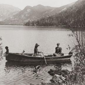
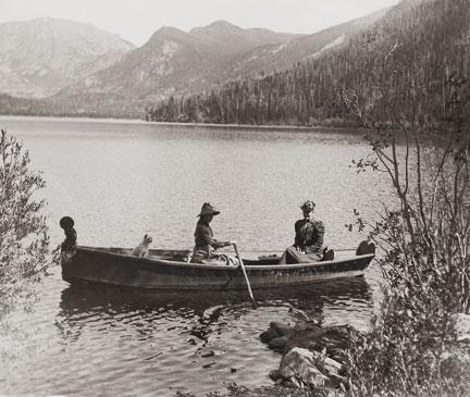
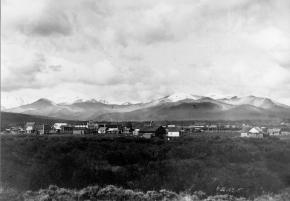
Christmas in the Mountains 1951

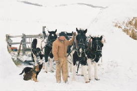
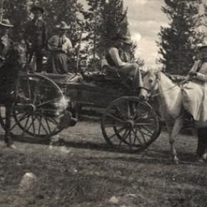
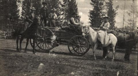
It was my first Christmas in the mountains. Not only that, but it was my first time to be part of a vacation in a cozy ski inn.  This was at Millers Idlewild Inn in Hideaway Park (now the town of Winter Park). I had been married only eight months. Dwight and I had worked hard, getting everything in order: ­clean beds, fresh spreads and curtains, floors shining and bathrooms sparkling.  The woodpile was full and food supplies ready.  Our plans for evenings were laid out too. Dwight would do movies. His brother Woodie would call square dances, with former Moffat Road engineer George Shryer accompanying on the fiddle and his wife, Grace, chording on the piano.  Tom Smith would bring his sled and team of horses, to take happy folks along snow-packed roads for sleigh rides, to the tune of jingling bells. Games were at hand, along with a fine supply of books on the shelves. We expected a wonderfully busy two weeks, which was a good thing, because it had been a long time since our last income, before Labor Day.

Family and friends were coming tomorrow to give a hand over the holiday, and then the fun would begin. As the first guests arrived, I stepped outside, and lifting my nose, I thought, "I smell snow!"  Great!  The area already had a pretty good covering, so that when people called and asked, "Is there snow yet?  Should we come on ahead?" we could gladly say, "Come." That night it snowed,­ 12" of beautiful soft flakes.  Skiers were overjoyed. Dwight got out early to shovel, plow, pull people out of drifts, take others to Winter Park Ski Area, three miles away. That evening we heard that almost no stumps or rocks were evident on the slopes; all had been buried. The next night it snowed again ­ 12" of beautiful white stuff.  We were amazed.  But Dwight got out early to shovel, plow, pull people out if drifts, and take others to the area.  The following night it snowed again, and every night for a week, it snowed, dumping heaps of snow on the whole valley.

Winter Park Ski Area, in those days, wasn't open on Christmas Day; the management wanted to let its employees have the day at home with their families.  So we took our guests to the top of Berthoud Pass; from there they could ski down Seven Mile Trail and we met them at the bottom.  The day after Christmas began the busiest days of all. Back then, many families didn't leave home until the 26th. This was fine, until the passes closed from heavy snows and avalanches. Then visitors, who had to leave, couldn't drive out, but people who were coming by train could still get in!  We had a problem.  The parking lot was jammed with rental cars.  Although some folks went ahead and left by train, many families stayed on.  The rooms were completely full and after all, newcomers were entitled to their reserved space. We had guests stashed all over the lounge, extras in the dorms, and extras in the cabins.  What a crowd it was. I hardly had time to think. 

I cleaned all morning, helped set tables and serve, did dishes, sometimes hauled skiers to or from the area, kept up with the office work, and joined in entertaining folks in the evenings. Thank heaven for family and friends!  There never was such a hectic week. But the Miller hospitality at Idlewild kept our visitors relaxed and happy. Truly, it was a jolly time, with tired skiers loafing in front of the fire, doing puzzles or playing games.  There was always a group playing canasta after dinner, in the dining room, and peals of laughter would pour forth when somebody won a great hand. At last New Year's Eve came and went. The rental cars had gone back to Denver.  The rooms were empty.  We were alone except for a couple of guests.  Making our path through the deep drifts, Dwight and I went home and flopped down on our own sofa.  I heaved a sigh, saying, "Well!  So that's what Christmas in the mountains is like.  I had o idea there would be so much snow."  Little did I know that for Christmas, 1952, we would still have the crowd of guests, but there would be hardly any snow until January!

Colorado Mountain Wild Flowers

A sight to behold
Not just a story to be told
A beauty of our own Grand County things
of the past of here and now

A sight that will forever last
Field, and fields everywhere down low
More growing the higher we go

Our beautiful Colorado mountain flowers
The prettiest of anywhere
All of those colors

Scattered among the trees
Swaying in the breeze
Yellow, purple, blue, pink and red

Tiny little heads
Names of them all I do not know
Just that here they grow
Making a wonderful show!

Oct 2006

Commissioner Shootings in Grand Lake

Article contributed by Abbott Fay & Steve Sumrall

July 4, 1883 was a tragic day of unprecedented magnitude in the history of Grand County. The booming mine town of Grand Lake had managed to move the county seat from Hot Sulphur Springs a year earlier and there was growing animosity between the “lake” and “springs” residents.

On that fateful day, County Commissioners Barney Day and Edward P. Weber, supporters of Hot Sulphur Springs as the County Seat, had breakfasted with County Clerk Thomas J. Dean.  As the three left the hotel beside the lake, they were ambushed by four masked men. After the smoke cleared, it was determined that the perpetrators were John Mills (the 3rd County Commissioner), Sheriff Charles Royer, Undersheriff William Redman and his brother, Mann. 

Day died instantly, Weber died the next morning, and Dean died from infection on July 17th.  But Day fired back back, killing one of the masked assailants, who later turned out to be Commissioner Mills.  The other three escaped.

The sheriff and undersheriff had quickly returned to Hot Sulphur Springs and shortly after, they were sent for to investigate the very crime they, themselves had committed!  Sheriff Royer shot himself on the night of the 15th and his body was discovered the next day.

Dean later testified that Mills shot Weber, Redman shot Dean, Day shot Mills and Readman and Royer shot Day.

Undersheriff Redman disappeared shortly thereafter, apparently shot.  A body was found later on the Utah border thought to be Redman but there was no positive ID.  The body was suspected to be Redman from the size of his feet. Whether he killed himself or was murdered was never determined, but nonetheless, if it was Redman, he was the sixth victim of the Grand Lake Commissioner shoot-out.  It is interesting to note that all three commissioners killed had been appointed to office rather than elected.

Ironically, the county seat was moved back to Hot Sulphur Springs several years later.    

Sources:
Abbott Fay. To Think That This Happened In Grand County!, Grand County Historical Association, 1999
Robert Black. Island in the Rockies, Pruett Publishing, Boulderm CO 1969.


Doc Ceriani
Doc Ceriani

Article contributed by Kathy Zeigler

Dr. Ernest Ceriani was a graduate of Loyola Medical School, and served his internship at St. Luke’s Hospital in Denver.  In 1942, he married a nurse, Bernetha Anderson, and joined the Navy, serving until 1946. He began a surgery residency in Denver, but was unhappy with city life,  city medical practice and its politics.  He came to practice in Kremmling in 1947, working for the Middle Park Hospital Association.

The Association had purchased the home of the previous doctor to remodel and serve as a hospital; it employed 2 nurses as well as the young doctor.  The doctor was general practitioner, seeing patients in office, hospital, and home, often as far away as Grand Lake.  He was as self-sufficient as he could be, developing his own X-ray films, for example, as a cost saving measure. Medical practice for an isolated doctor was challenging. Consultation with other physicians was difficult if not impossible and keeping up with medical journals was daunting. 

“Doc” Ceriani was dedicated to his community and to his practice, often returning to the hospital or going to an accident site to treat illness or injury when he had planned to take some leisure time.  The community depended upon him to listen to their recitation of symptoms and make sound judgments in the art of healing.  Their “Doc” was not just a medical corporation putting patients through procedures--he was a highly dedicated professional in the world of medicine.  He truly cared about his community and its members.

Life magazine honored him with a large article, which covered, in depth, the challenges of practicing medicine in such an isolated area. From childbirth, to ranch injuries, to treating the tourist who suffered from altitude sickness, the article showed the American public the human side of this very dedicated physician.

“Doc” practiced until 1986, in Kremmling, retiring at the age of 69.  He died two years later.

Source:
Of Things Medical in Middle Park,
Grand County Historical Association Journal, vol. XIV, no. 1. 1997

Doc Susie - Mountain Pioneer Woman Doctor
Doc Susie

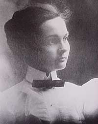
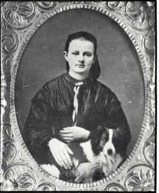
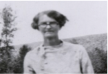
Susan Anderson was born on January 31, 1870, in Nevada Mills, Indiana. Her parents, William and Mary Anderson, were divorced in 1875. Four-year old Susan never forgot her parents arguing and her mother crying before her father literally grabbed Susan and her brother John, who was three years old, from their mother at a railroad depot. He jumped on the train as it was leaving the station and took them to Wichita, Kansas, where he homesteaded with Susan’s grandparents.

Susan’s father, Pa Anderson, had always wanted to be a doctor, and he vowed that one of his children would fulfill that role, which he had been unable to accomplish. John, however, was more interested in roping cattle and playing than becoming a doctor. Contrary to John, Susie watched her father, a self-taught veterinarian, as he worked on animals. She absorbed important knowledge for her future as a physician. Susie was less interested in the lessons that her grandmother taught her: manners, housework, crocheting and cooking. 

Shortly after Susan and John graduated from High School in 1891, Pa Anderson remarried and became very domineering, insisting that everything be exactly as he demanded. At about the same time, the gold strike in Cripple Creek, Colorado, caught William Anderson’s attention, causing him to sell his homestead in Wichita and move the entire family to Anaconda, CO, which was about one mile south of Cripple Creek. Very rare for the time, Susan pursued an education in medicine and graduated from the University of Michigan and started practicing in the mining towns of the area. 

In her 30's Susan contracted tubuculosis and came to the Fraser Valley in hopes of a cure in the clear mountain air.  Not only did she regain her health, but she he practiced medicine from 1909 to 1956 in Grand County, a total of forty-seven years.  

People in the area were very poor and seldom paid in cash. They usually gave her meals for payment. This suited her fine because she did not like to cook or keep house, which was always messy. Because the railroad ran beside her shack, she often would be called to various parts of the county, even at night. Doc. Susie would flag down a train and ride wher ever she needed to go, free of charge. She also treated the men working on the railroad and their families in Fraser and Tabernash, which was about three miles northwest of Fraser. Around 1926 Susan became the Coroner for Grand County. 

One time she hiked eight miles on snowshoes to a ranch because she was con cerned about a woman who was due to deliver her baby soon. That night the mother gave birth to a baby girl. While there, the four-year-old son had an appendicitis at- tack. Neither of the parents could take the boy to Denver for surgery. Doc Susie took him by train. A blizzard hit, blocking Corona Pass. The men passengers were called out to help clear the track It wasn't until the next morning the train arrived in Denver Doc Susie had no money for a taxi fare. The passengers gave her the taxi fare to get from the depot to Colorado General Hospital. Doc Susie stayed with the boy during the surgery from which he fully recovered. 

Another time Doc Susie rented a horse drawn sleigh to go as far as she could, then snow shoed into a ranch in a storm to treat a child with pneumonia. She had the rancher heat his home as warm as he could, heat water and then put the child in a tub of steaming hot water and open the door to make more steam. By morning the child had recovered.   SDoc Susie lived to be ninety years old. The last two years of her life she was cared for in a rest home by the doctors for the Colorado General Hospital out of respect and love. 

Susie wanted to be buried beside her brother in Cripple Creek, but because of bad record keeping, no one could find his grave until later. She was buried in a new section of the cemetery. When the residents of Grand County learned there was no head stone, they took up a collection and erected a headstone. 

Susan Anderson never married, but she said she had delivered more children than any one and claimed them as her children. Her family was everyone in Grand County. Her home still stands in Fraser and the Cozens Ranch Museum has a display of her life and medical tools. 


Dr. Sudan
Dr. Sudan

Article contributed by Barbara Mitchell


The people of Grand County have been lucky to have good doctors from early times to the present. Such a one was Dr. Sudan.

Archer Chester Sudan was born on a farm in Sioux Falls, S.D. in 1894. While still quite young, he discovered a talent for healing - mainly of sick or injured farm animals. The notion of medicine as a career led him to leave his family and move to Chicago to live with a married sister where he attended high school and college. To support himself, he worked as a barber and as a summer harvest hand in the Dakotas. He received his bachelor's degree and a master's degree from the University of Chicago and later graduated from Rush Medical School. Upon graduation in 1925, Sudan came west to intern at Denver General Hospital. There he met Tuleen Swift, a pretty little nurse from Kansas City, who later became his wife.

His first interest was teaching and research, but in 1926 his life took a major turn when he came to the mountains of Colorado to fish the area around Kremmling. As he was chatting one day with local druggist, C.C. Eastin, about potential fishing holes, a woman hurried in. She had four little ones at home, all ill with acute tonsillitis.

Gathering his medicines from his tent at the edge of the Colorado River, the young doctor hurried to their house to treat the youngsters. Before long, other neighbors made their way to his tent.

Dr. Sudan liked the country and the people so much that he took leave from his Chicago job and brought his wife to the high country where they set up practice in this sparsely settled rural area. He quickly came to know all about the bad roads, lack of sanitation facilities and electricity.

In the fall of 1926, he was introduced to the cow trails that represented roads to ranches back in the hills. A rancher had shot himself and was bleeding profusely. The rancher's wife was trying desperately to stem the flow of blood with towels. Guided by his new friend C.C. Eastin, the young physician headed out into the evening in his Model T Ford. Reaching the house some 30 miles away, he treated the man, rigged up a stretcher for the car, and started toward Kremmling. Part way there, the car bogged down in mud and Sudan had to hike five miles back to a ranch house where there was a telephone. Calling for a wrecker, he plodded back once again, arriving at his car about daylight. Sudan finally got the rancher to Denver, 130 miles away, where his leg was amputated. The Doctor left him there in the care of capable hands and returned to his home in Kremmling where he could finally take a breather.

He was dedicated to healing and sought to provide medical care as good as could be found in a city. He was also civic minded and actively boosted good roads and agitated for improved sanitation, home nursing and public health programs. He served on the school board and town council and was county coroner for a time. He was a sportsman and liked to ride the Gore Range on horseback, hunt, fish and cook out.

In April 1933, the Middle Park Times carried a note indicating that Dr. Sudan had built a small hospital having a basement with eight rooms including space for an x-ray machine and a furnace for heating. This building still stands as a part of the Kremmling Memorial Hospital District complex.

By the war's end, Sudan was getting tired. This was a young man's country, he felt, and he started planning to move to Denver, to do general practice and research there; he longed for a quieter life. He stayed on in Kremmling while serving as president of the Colorado State Medical Society until September 1947. Finally, 21 years after he came to Grand County, Archie Sudan turned his hospital over to young Dr. Ceriani and made the move to Denver. The following year, the American Medical Association gave him its first gold medal award for outstanding community service as a G.P.

Tuleen died in March 1950 and in 1955 Archie married longtime friend and neighbor, Martha Hawkins. The couple traveled, camped, fished and explored the West and Canada.

In the late 1960s, Dr. Sudan's health began to fail and the couple built a one level home on Martha's farm in Lafayette. In October 1971, the doctor was shoveling snow when he died of a massive heart attack at age 77.

(The above is taken from the Grand County Historical Association Journal No. XIV, "Of Things Medical in Middle Park" written by Dr. Jim Wier and Jean Miller. For a more complete account of Dr. Sudan's, and other pioneer doctors' medical contributions to Grand County, the Journal is worthy of a place in your home library. The GCHA Journals are available at the Grand County/Pioneer Village Museum in Hot Sulphur Springs.)


Ed Vucich
Ed Vucich
 Article contributed by Jean Miller    Ed stood, ramrod straight, in front of his tiny green house, checking out the day: sky­ clear blue; clouds ­ soft and fluffy; wind ­just a light breeze that gently lifted his thin white hair; Brown’s cow feeding in Millers’ yard, as usual; Old Lady “Ada” (aka, Mrs. Zeida) getting ready to water her Oriental poppies.  The day was on its way.  “Ha! Here comes Dwight to chase off that darned cow.  He goes through this every day.  I bet one of these days he’ll have fresh cow meat for supper!”   Ed returned inside his cabin, to feed the stove and make coffee.  The fact was he didn’t need any more heat.  He kept the place about 85 degrees, summer and winter.  But Ed was so thin, cold went through his worn body easily.  Soon he poured himself some coffee and went out to talk to Mrs. “Ada”.  “Hello there, old woman.  Those poppies are the prettiest you you’ve had for years.  You should win a prize.”   “Thanks, Ed. I agree that they’re especially nice this summer.  Brown’s cow has left them alone for a change.”  With a laugh, she went back in her house.   Dwight Miller wandered over to chat.  “Mornin’, Ed.  How’re things?”   “Well, just fine, except you’ve got to tell your cabin guests to quite using my outhouse! I saw three of them coming out of there early this morning. Tell them to use their own!  I’m going to build me a fence.”   Dwight looked apologetic.  “Boy, Ed, I’m so sorry.  You know, sometimes they just can’t wait, so they invade ours.  But I tell you what, I’m going to put in a regular bathroom at the back of my garage, facing the cabins.  I hope, at least, that will take care of the problem.  In fact, if you want, I’ll give you a hand on your fence.  I don’t blame you for being irritated!”   Ed was mollified with this offer.  He had lived in his cabin for some years now, after finishing up his days as a tunnel worker in 1927.  He used to tell Dwight, “Back then, there were prostitutes behind every tree up near the tunnel, and if you paid them a quarter, they’d give you 15 cents change!”  He was Austrian and had served many years in the Austrian army, but he got fed up with all that and came to Colorado to live.  The mountains reminded him of his home country, and his life style remained just as spare and regimented as it had been in the army.  Everything was neat as a pin.   The old man kept track of his neighbors’ comings and goings, including Dwight’s wife, Jean, and their toddler, Martha.  He used to really fuss at Jean, because she insisted on whistling.  “Jean, ladies don’t whistle!”  But Jean liked to whistle, so she continued not being a lady.  The baby was another subject.  Dwight had built a ladder coming down from their apartment on the upper floor, as a second exit in case of fire.  Martha learned to climb down that ladder before she was three years old. “Dwight,” Ed would protest, “that baby is going to kill herself!  She¹s going to fall; then where will you be?”  But Martha seemed to do just fine with her climbing and she never did kill herself!   One day Dwight bought a small Army surplus life raft.  Opening it, he discovered some dye, to be dumped into the ocean so that planes could spot men in the water.  “Hm-m,” he thought, “I wonder if this dye really works?” So he went up to the bridge over Vasquez Creek and poured some dye into the water.  Yes, indeed, it worked.  The bright red color spread into a great circle in the creek and promptly flowed downstream.  Dwight hightailed it down to his house, to see if the color still held. Here it came, and here came Ed Vucich, madder than a hornet.  He had spotted the dye and was quite positive that Dwight was trying to poison him and all the others who used the creek water for drinking.   In spite for fretting and stewing over illegal outhouse use, “poisoned” water, babies on ladders, and unladylike whistling, Ed cared for the young couple.  On day as Dwight and Jean were about to head into Denver, he came rushing out and stopped them.  “Here, I have something for you!”  And he presented two beautifully baked potatoes, straight out of his oven.  They were perfectly lovely.   Ed swore up and down that he didn’t drink, but in fact, he was known to visit Wally’s Bar on the highway into town.  One bitterly cold night, Dwight and Jean heard a rumpus going on outside. In those days, winter temperatures dropped regularly to minus 40 to minus 50 degrees.  Getting out of bed, the pair went to look out their front window.  Ed was attempting to get into his house, which he kept locked with three different padlocks (why was a mystery; he had very few belongings).  Perhaps he wasn’t drinking, but he certainly wasn’t sober.  He tried to open a lock; his feet slid out from under him and he swore, “Damn!”  He struggled back onto his feet again. Same result.  The young people didn’t dare just leave him, hoping he would finally get into his house he’d have frozen to death.  But if they had interfered, oh, he would have been furious.  So they watched until at last all three padlocks were open and the old man staggered inside. They never told him about the show he put on!   Ed lived in Hideaway Park for a number of years longer, but it’s uncertain as to where he is buried.  Dwight is convinced there probably aren’t as many characters in the valley as there were fifty some years ago.  
Fire Engine No 1 - Hideaway Park Fire Department

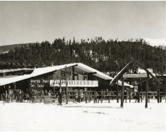
"What Hideaway Park needs is a fire engine!  No way can we fight fires without more water; all we can do is watch some building burn!"  The half dozen volunteer firefighters were seated around the table in Hildebrand's little grocery store on Highway 40. "I agree," said Ray.  "We've talked long enough!  Who's got the want ads?"

Claude pulled out the latest Denver Post want ads.   "I don't see any fire engines.  I looked up fire fighting equipment too.  Nothing there.  But here's a 1940 Chevy truck for $400.00.  That's just eight years old; maybe it would do."

"We could mount a tank and a pump on the back," said Dwight.  "Do we have enough money to pay for it?" Claude pulled out their account book.  " We've $550.00.  That would pay for the truck and we volunteers could use the rest to put up a shed.  We can always have more Bingo nights.

"Dwight, you're the Fire Chief.  Why don't you and Ray go down and look at it.  We'll give you a blank check so you can bring it home if it looks good." The men agreed.  At last they were getting started.

The following week Dwight and Ray drove to Denver to the car lot and took a look.  The truck wasn't much, but the engine worked and the tires weren't too bad.  Ray commented, "I know a fellow who has a galvanized tank.  We can buy some 2" hose and a pump from American LaFrance.

"Okay," said Dwight.  "Let's take it."   He brought out the check Claude had sent along and signed it.  The used truck salesman looked at it and looked at Dwight.    "How old are you, Mr. Miller?"

"I'm 20 years old," he answered.  "What's the problem?  I'm Fire Chief."

"Hmph, you look more like sixteen!  We're not supposed to take checks from anybody younger than 21.  Let me go talk to the bookkeeper."   It took a long time and Dwight and Ray were getting nervous.  At last the salesman returned.  They'd accept the check.

And so Hideaway Park got its very first fire truck.  The men in town finally got the tank and pump put together and started in on a wooden building, along the main road off Highway 40 where Cooper Creek is now.  Winter came early that year, and the fellows didn't have time to get the roof completed.  The rafters and sheeting were up, but the 90# roofing material had to wait; so snow drifted in with every storm, and ice built up, to melt and leak later onto the truck.  But the men knew they could finish up the following year.   Periodically they got together to try out the pump and drive up and down through town, with their new siren wailing.  Everything seemed to work.

A few years passed.  When fires occurred, however, the buildings still usually burned to the ground. One winter in 1952, Dwight was wakened before midnight.  "The Spot is burning.  Let's go!  Let's go!"  Ray's voice broke with excitement.  Dwight jumped from bed and threw on his clothes.  He could see the flames down on the highway leaping above the trees.

Men were gathering at the firehouse. Dwight ran through the door and clambered up on the fire truck.   He tried to start the engine.  R-r-r-r --.  Nothing happened.  R-r-r-r.   "The battery is dead," he cried. 

Ray and Wally were struggling to get the overhead door open and the miserable thing was frozen shut!  They took a hammer to the base, but the frost wasn't about to give way and let door move.  Finally Dwight cried, "Let's slip a cable under the door and hook it to the truck.  We can pull the truck out and on down to Vasquez, to fill the tank." 

The cable was soon in place and Claude jumped into his truck and started pulling.  With the fire truck in gear, it moved forward, hit the double garage door, and continued on.  With a groan and a jerk, the engine and siren  finally started.  Dwight guided the rig onto the road with the door riding on top of it, blinding him.  At last, the door fell to the ground.

At the creek, the fellows pulled the hose down to the water and chopped a hole in the ice.  Another started to hook the hose onto the pump.  "The hose has shrunk!  It won't fit!"

 "What?  It did the last time we practiced!"  The volunteers looked at each other and threw up their hands in disgust. The Spot to Stop was burning fiercely by this time, but Ray said, "Let me string my garden hose across the highway.  I think it's long enough, and maybe it will do some good."  This is what he did, but it was too late.  That building was a goner. 

The townspeople stood around until there was nothing left but ashes; then they went home to bed.  The firemen met the next morning to decide what to do about the truck.  They eventually chose just to leave it there all winter.  It sure wasn't going to do anybody any good.  The next winter, that fire truck had a new hose!

Some years later, Dwight and Jean Miller gave land for a volunteer fire building, which was made of metal and which had a heater.  And over the years, better trucks were purchased and the men received some proper training.  The early volunteers had a perfect record ? they never saved a building.

Some of the volunteers in 1947-48; there may be others.  
Dwight Miller
Ray Hildebrand
Claude Brock
Bill Polk
Jim Quinn
Wally Tunstead
Easy Butler
Leroy Hauptman
Dick Mulligan, Jr.

Articles to Browse

Topic: Water

A Dream Smashed in Gore Canyon

The idea of a water passage from the Atlantic to the Pacific Ocean had long captivated the imagination of early explorers.  Soon after the Territory of Colorado was established, the United States government made a standing offer of $3,750 to anyone who could demonstrate such a route.

In 1869 a dreamer named Sam Adams convinced some people in the town of Breckenridge that goods could be sent upriver via the Mississippi, Missouri, Platte and South Platte Rivers to South Park.  Then, with a short portage over Boreas pass, they could continue down the Blue River to the Grand (Colorado) River and then through Gore Canyon the Sea of Cortez.

Volunteers were told they would share in the prize, and they built four boats of green lumber for the voyage.  The flotilla was launched with great celebration, the lead boat bearing a banner proclaiming "Western Colorado to California ? Greetings!"  A little dog was given to the crew to keep up morale.

As the boats went down the Blue River, the waters were a bit rougher than expected. When the men arrived at the Grand (Colorado) River, the crew set up camp. However several of the "sailors" declared they had had enough and began a trek, via dry land back home to Breckenridge.

When the boats reached Gore Canyon, they encountered violent upsurges and dramatic drops.  The wild waters smashed all four of the vessels on dangerous rocks.  Fortunately, all members made it to dry land, even the little dog.  No reward was ever given for the attempt.

Topic:

Regions

Grand County has a stunning variety of terrain, landscapes and distinctive regions.  The county encompasses 1869 square miles with almost 68% of the land is managed by the U.S. Forest Service, the Bureau of Land Management or the National Park Service. The Continental Divide marks the northern and western boundary of the county and the county is also the headwaters of the Colorado River.  Regions have been established by proximity to water sources (The Troublesome, The Muddy, The Blue, and Three Lakes) or by their geographic features (Middle Park, Church Park, and the Fraser Valley).

Topic: Biographies
, Gram Wood on horseback

Lillian Russell Smith Wood - "Gram" Wood

, Gram Wood on horseback

Lillian Russell Smith Wood was born in Dunlap, Kansas, in 1884, she was not a particularly healthy child.  Born just before her and just after her were sets of twins, 2 of the 4 sets born to her parents and the only 2 sets that survived into adulthood.  Lillian spent her adult years on the Williams Fork and then in Parshall. Known as “Gram” Wood to most everyone who knew her, she was grandmother to 39 who bear the names Wood, Noell, Stack, and Black.  And her history in Grand County beginning in 1905 made her one of our pioneers. 

In the fall of 1905, the local newspapers report that Herb Wood had lost a large portion of his right hand in an ore crusher accident.  Herb had come into Summit County originally with a mule team for “Uncle Joe” Coberly, another Williams Fork resident and apparently worked in or around mines and mining equipment while also hauling the timbers for mine use.  Herb needed some round the clock nursing, and in those days, for Gram to take proper care of him and still be in an acceptable position, they needed to be married. One source says the situation was so different that a Denver newspaper picked up the story with a headline of “Loses Three Fingers, Wins a Bride”, indicating that they married 3 days after they met.  Research has never turned up a trace of that story, and it’s unlikely in the mining camps in the area that they hadn’t met until he was injured.  Still, they were married by Judge Swisher, well known area businessman, in short order in the hotel room where Herb was recovering .  A short time later they made a brief wedding trip to Denver and then returned to Argentine.

Before fall set in that year, the newly married couple moved to the Little Muddy.  Herb had been sending money to a partner who was helping him to secure a homestead there not far from where Joe Coberly lived.  It was probably with anticipation of a great future on their own land that sent them into Middle Park to face their first winter as a couple without having had a chance to raise a garden or preserve any winter supplies.  They moved into one end of a two room cabin with a man named Ranger Charlie in the other.  And about that same time, they discovered that Herb’s partner had been drinking the money he’d sent over the years.  What devastation that must have caused!

On the other side of the valley just across the creek was the large  ranching operation known as the Hermosa Ranch, owned by Dr. T. F. DeWitt, a well-to-do doctor from back East.  With the dream of his homestead gone, Herb went to work for DeWitt, eventually becoming one of his foremen.  Gram probably helped out with cooking and cleaning, but within a few months, she went back to Kansas to await the birth of their first child. Over the next 21 years, she raised kids and gardens and developed her love of fishing, which helped feed a family that eventually totaled 13 kids, including a set of twins born 2 weeks before Christmas and delivered by Herb when a doctor couldn’t reach them in time. Pictures of the time show a large family of 9 boys and 4 girls with Gram, all 5’2” and maybe 100 pounds of her on one end, and Herb with a child or two on his lap at the other.  The kids recall Christmases being supplied mostly by Mrs. DeWitt and sometimes being late if the trains got snowed out of the area. All attended one room schools, Hermosa and Columbine, and stories of their lives together can make one wonder why any of them survived.

Life continued  pretty much routinely until 1928.  That summer, the youngest daughter, Marilyn, a premature baby and ailing child caught whooping cough.  She lingered and languished until early October, and then she passed away.  The close-knit family had suffered it’s first loss. Two weeks later, Herb came in from the hayfield complaining of not feeling well.  Gram followed him into the living room and sat down with him on the couch. Minutes later, he collapsed in her arms and died of a cerebral hemorrhage.  They buried him alongside Marilyn in the Hot Sulphur Springs Cemetery.

The boys continued the work for Dr. DeWitt for several years, and in 1932, they built a 2 bedroom house for Gram several miles from where DeWitt had relocated his ranch.  Her sons made sure she had what she needed as she finished raising the youngest ones who had been little more than toddlers when Herb died.

By the time I was old enough to remember much about Gram, she was already a “little old lady” who lived in a small, pink mobile home next to Uncle Kenneth in Parshall. Everyone knew that she was one of the best fishermen in the country, having caught as many as 1200 in a season when she was feeding her family by herself.  She enjoyed creek fishing the most, and even as she got older her ability to maneuver around the biggest holes and catch fish in any small body of water never faltered.   I never saw her get wet.

In the winter, she was totally unafraid getting a couple of her grandkids on a sled and making a run down the hill in Parshall that ended at the store and U.S. 40, which then went through the center of town.  Had her feet not worked so well as brakes, we could have ended up on the pavement.  But we never did.

She must have driven many teams of horses in her day, and I believe she was a good rider. She never drove a car, but unless she needed to go to the doctor in Kremmling, she didn’t need to leave town. Her friends included Doc Ceriani’s mother and fellow fishermen from Hot Sulphur, a couple from Poland with heavy accents.  Somehow, somewhere she had met Ralph Moody, author of the “Little Britches” series. And she, too, had a “fish” experience with warden Henry “Rooster” Wilson.

Only once did I get into trouble because of Gram.  She was fishing one day near where I was getting ready to ride, when she laid down her pole and walked over to me.  After watching me for a minute she said, “Can I ride?”  What do you say to your 80 year old grandmother but, “Of course!”  I saddled up the gentlest mare we had and helped her aboard.  She only made a couple of trips around the small pasture, but as she rode, walking only, I’m sure I saw a young woman next to her husband on horseback in front of one of the Hermosa’s big barns.  It’s one of the pictures you’ll find at the County Museum in Hot Sulphur.  When dad found out what I’d done, he turned deathly white.  “Don’t you know if she’d fallen or been thrown she could have been seriously injured or killed?”  No, I had to admit.  This was one rider’s request to another, with age no consideration .  And to her at that particular moment, had either occurred I believe she would have considered those few moments worth the risk.  When she was finished, she walked back to her fishing pole, satisfied that nowshe was done riding.

Gram introduced me to horehound candy, something I will also think about each time I taste it.  And because she didn’t like my first name, I didn’t even know what it was until I started school.  She taught me that barn cats do fish and that survival in a small living space was possible The one thing she didn’t teach me was anything about her growing up years or about my grandfather.  It seemed like we knew as very young kids that we didn’t ask about him.  I believe that hers was a love so strong that even to the point where her mind grew dim, the pain of losing him was too much to bear.  One regret we all have, however, is that we never asked to her to go with us up to Summit County to show us where she lived and to tell us stories of that life and time.  And unfortunately that’s been lost forever. Gram passed away in 1980, at the age of 97.  She is buried with Marilyn and Herb and their son, Melvin who died during World War II in a family plot in Hot Sulphur with other family and pioneers characters nearby.

She left a true legacy through her kids and grandkids who continue the nostalgic traditions of their beloved Gram.

Topic: Towns

Radium

The settlement of Radium, on the north bank of the Colorado River in Gore Canyon, was established in 1906, when railroad construction of the Denver and Salt Lake Railroad brought in foreign workers, typically Swedes, Greeks, and Italians. After the rail lines were built, livestock was shipped out and vegetables such as potatoes, peas, and lettuce were grown and picked at the last minute so they could be shipped while still fresh.

Originally the land was homesteaded by the Murgrage and Hoyt ranch families. Railroad passenger service during the winter months was scheduled only three times a week each way but even then, couldn’t always get through. Nonetheless, the “Try Weakly Railroad” service was better transportation than anything residents had ever had before.

The name of Radium was suggested by Harry S. Porter because of the radioactivity found in his mine. The nearby Radium Copper Mine was a large copper producer at one time.

Maintainance workers for Union Pacific, current owners of the railroad, are still based at Radium.

Topic: Skiing

Winter Carnivals

Carl Howelsen, a ski jumping champion in his native Norway, came to Denver to pursue a career as a stonemason in the early years of the 20th Century.  He amused himself and others by demonstrating ski-jumping in the foothills of Denver. 

In 1911, Howelson went to Hot Sulphur Springs, where he taught locals such as Horace Button the art of jumping.  Under Howelson's leadership, the first winter carnival west of the Mississippi Rover was held there on February 10-12.  According to the Middle Park Times, "Never before in the history of the Territory and State of Colorado has such an event even been contemplated, much less held!".

Norwegian immigrants Howelson, Angell Schmidt of Denver and Gunnar Dahles of Williams Fork (Grand County) all staged jumping competitions during the carnival.  There were also skating and tobogganing events and a Grand Ball.  Hot Sulphur Springs continued holding Winter Carnivals annually until World War II, when they were discontinued until the 100th anniversary celebration, called the Grand Winter Sports Carnival scheduled for December 30, 2011-February 11, 2012.

Topic: Places
Spruce Lodge

The search for Spruce Lodge

Spruce Lodge

 You gotta love a mystery! My curiosity rose, my anticipation of being the one with the real story was more than my appetite could stand. I looked at pictures, figured angles, mused at what other people said, reviewed topographic maps and finally said to myself “it just can’t be.” The terrain doesn’t look like that. It isn’t two miles from the last switchback on Hwy 40. I don’t care what the writing on the back of the pictures say. 

I want to know once and for all, where is the real location of Spruce Lodge? How can it be located so everyone will agree. I’ve got it, find an expert wilderness person with my same curiosity. As fate would have it, entered Debora Carr, author of Hiking Grand County Colorado, complete with pictures, maps, GPS coordinates and trail narratives. Her coauthor Lou Ladrigan also caught the bug. “We can find it.” 

Exploration began early in the spring but the snow was just a little too deep to find any artifacts. Failed attempt, but the appetite was there. Wait till the snow melts in the trees. Again, as fate would have it, entered Carol Hunter. Carol has been instrumental in the efforts to resore the Berthoud Pass wagon road. Carol has lots of maps and pictures of the development of the wagon road and just happened to have an original U.S. Bureau of Public Roads 1920 survey map for the construction of Hwy 40 from Empire to Fraser. I loaded it into the computer, expanded the image and found lots of strange numbers. Almost like mile markers. Carol said they were numbers used by the work parties. They seemed evenly spaced and the map had a distance legend. It even had a marked location for Spruce Lodge. I couldn’t wait to add this map to Deborah and Lou’s reference material.

Armed with new references, Debora and Lou hiked both sides of Hwy 40 from the switchback to the entrance to Mary Jane. Looking for artifacts, existence of remnants of the old wagon road, foundations and terrain that matched the photos in the GCHA collection. A couple places looked promising, but not quite. Finally, a white station post number 390 was found lying on the ground on the west side of today’s Hwy 40. Then another white station post was found to the south, number 380. That was a match! Just what we needed. That confirmed the surveyor L.J. Young’s map. To the south of 390 a flat part of ground revealed what looked like part of a foundation and surrounding the location were remnants of discarded cans and possible buildings. A two holer! Now check the terrain with the pictures. Well maybe. Don’t forget that Hwy 40 didn’t exist. Step back and look from the east side of the existing Hwy. A great match with the slope and tree line. This was it! Just .9 miles North of the last switchback.


Christmas at Fraser

The lights dimmed; mothers had already found their seats after coming from the classrooms where they had put makeup on little children’s faces and checked their costumes to make sure angel wings and halos were secure and costumes were on right side round.  I was at the piano, music and script lined out. The gym was full to the brim, every seat taken, with folks lining the sides and back walls, for the whole town had turned out.  Early birds got the seats!  Christmas wasn’t Christmas in the Fraser Valley unless it included the program at Fraser School (now the Town Hall).   I began the overture and chatter stopped.   I had played for this event for ages, starting in 1958.  High school students were gone by then, moved to the new Union High School in Granby, but 7th and 8th graders were still there.  And in 1958, the first kindergartens in the district were established.   It was a time of excitement and anticipation, of fun, and of panic? Well, no, not panic, for the teachers were beautifully organized. 

The program was chosen during October. Each teacher had a specific job. For instance, Martha Vernon, the art teacher, did sets.  Helen Hurtgen was responsible for dialog.  Edith Hill did costumes.  Nancy Bowlby was in charge of the music.  Others coordinated the whole.  And I played the piano, with Nancy sometimes accompanying me on her violin.  

Mothers were asked to contribute sheets and any fabric they could spare.  Patterns and material for costumes went home to be sewn into various sizes and shapes -- angels, gingerbread men, knights or royalty.  In the gym, we stitched on finishing touches, bright patches to decorate jester outfits, townspeople, and such, while watching various groups practice. Bits of tinsel became crowns, tinfoil turned into wands, cheesecloth into wings.  Lace scraps and sequins added color and “class.”   The budget was extremely minimal at first, but over the years, more money was directed to Christmas programs.  Instead of old sheets, we could buy cotton fabrics, velveteens, sometimes satin.  One year I even stopped by a furrier’s in Denver and begged some fur scraps.  Were we uptown then!  We had fur trim around the necks, cuffs, and hems of the costumes for the prince, queen, and king.  

The day before the play, PTA mothers gathered in the gym to fill brown paper sacks with an apple, orange, nuts, and candies, provided by R. L. Cogdell from his grocery store.  

Every single child in school took part in the play, as a class, except for those with speaking parts, of course.  Fraser grew and grew, then as now. Soon the 7th and 8th grades moved to Granby.  Then the 6th graders went, but the 4th and 5th graders handled the leads neatly.  Our stories were usually simple Christmas tales, but sometimes we tackled ambitious efforts such as the Nutcracker Suite or a version of Gilbert and Sullivan.   The only children not included were the Jehovah Witness youngsters.  They couldn’t be in the play and they couldn’t come watch it either.  We all felt very sorry for them, because everyone had such a wonderful time.  Their teachers tried to give them special projects to entertain and interest them while they sat off in a corner or in their classrooms.   The plays always went well.  Tiny kindergartners came out onto the stage, to stand behind the colored lights.  They knew their song perfectly in practices, but I have to admit that a number of them usually stood silent, stunned by that mass of faces looking up at them.  No matter.  They were darling. “Hi, Mom,” some were sure to call. “Mom” beamed.  

There might be a glitch or two every year. For instance, little Diane was chosen to do the Arabian dance in Nutcracker Suite.  Her parents were dark, as she was, and she was slender as a dancer. Trouble was, she didn’t have an ounce of grace in her body at that stage of her life.  I thought Nancy Bowlby was going to have grey hair before she got that child moving properly.  But the night of the program, Diane looked like Anitra herself, doing her exotic dance.   One year the king jumped his cue and entered on stage.  His first words were, “Did I miss anything?”  The prince muttered, in an aside, “Yes, three pages!”  But the cast went on as if nothing had happened, while down at the piano I sat, flipping pages rapidly, trying to figure out where the dialog was now.  

Another year, our son James was to take part in a minuet.  “Uck!  I have to touch a girl?”  By the greatest good fortune, he broke his leg and got to be a guard at the palace door, standing at attention on crutches, while another boy took his place.  (I think he did that on purpose.)   Songs and parts were adapted to the talents of the students.  We had five boys once, who couldn’t talk, dance, sing -- anything.  So they wore monks’ costumes and filed on stage, supposedly singing a Christmas carol, but supported strongly by the cast present.   Another time, Twyla’s parents couldn’t come, so Miss Vernon took her home to get ready. Now, Twyla usually looked like a dirty ragamuffin, but after a bath and hair wash, she truly looked like the angel she portrayed.   For the finale, the entire school came on stage to sing a last carol, with the audience joining in.  Then Santa showed up to distribute the goodie sacks, and the great night was over.  Coming out into the quiet night was a wonderful feeling.  Sometimes we moved through drifts of new falling snow; sometimes the sky was filled with icy stars.  Gay lights showed in windows throughout town. 

We never talked much on the way home, as we thought of the play, the success of everyone¹s efforts, and how happy the children had made their parents and families.   My last program was the first year after the new school was built.  It was fun still, but the school population had grown enough that it was impossible for whole classes to participate as one. Things weren’t the same as they were in the little old school.

Topic: Mining

Dutch Town

When two Germans, having imbibed too liberally shot up the mining town of Lulu City, they were run out of town.  They went higher and established camp, on the side of Red Mountain near timberline.  There they found a lode of low grade gold, silver and lead.

While it lasted only two years, this encampment came to be called "Dutch Town".  Gradually the fierce winters and lower quality of ore drove the settlers out, leaving only a few empty cabins about a mile west of Lulu City. 


Topic: Mountains

Rollins or Corona - What shall it be called?

Travel across various passes of the Continental Divide occurred long before white men showed up. Indeed, as anthropologist James Benedict wrote c. 1975, some 10,000 years ago, prehistoric Indians camped, hunted, and built hunting walls on the upper reaches of Rollins Pass, as well as moving in and out of Middle Park for the warm summer months. Historic Indians followed the same paths. In the earliest days of non-Indian access, a particular pass at the head of Boulder Creek was dubbed Boulder Pass.

Capt. Jacob Bonesteel, including wagons, made the first recorded crossing by a white man at this point in April 1862. Three years later, a group of Mormons brought wagons over this route and a year later, promoters of new roads into Middle Park brought in many wagons and livestock. In fact, tourists were starting to enter the park by a number of routes, and one of them, Samuel Bowles, who wrote a fascinating account of his trip, including his return to Denver via Boulder Pass.

Interest was growing rapidly for a road over the Divide, into Hot Sulphur Springs, and on into Utah. One promoter, John Quincy Adams Rollins, from New Hampshire, teamed up with William N. Byers and Porter M. Smart to carry this project through. Rollins was interested in crossing the Divide; Byers was promoting the Springs; Porter wanted to develop the valley of the Middle Yampa. All three were pushing to have Middle Park officially named as Grand County, a challenge finally accomplished in 1874.

So Rollins and associates started his road, reaching the top in 1873. That next winter, they publicized this access and in June, Jimmy Crawford brought his family and wagons to Rollinsville and thence to Yankee Doodle Lake, ready to cross the pass now named Rollins Pass by the developer. But the road ended, and they found Rollins' men still hacking the road out of the granite! Jimmy and his crew found it necessary to leave their wagons and help.

Finally, on June 10th, the family was able to head for the top. Jimmy borrowed two yokes of oxen, hitching them to mules, and then to his horse. The road was so rough that the procession could proceed but a few feet before having to rest. The family itself climbed on foot. At the summit, they discovered only a rough swath cut down through the trees on the western side. The "road" dropped down between the lakes and followed Ranch Creek to its junction with the Fraser River. Rollins quickly realized that Berthoud Pass, which also opened in 1874, was superior to his own pass for wheeled vehicles, so he determined to hedge his bets. He initiated the first mail service into the county in 1873. He also built a commodious hotel where his road joined the Berthoud Pass road at the confluence of Crooked Creek and the Fraser. He called it the Junction House. Next, he proposed to the builders of Berthoud Pass that they form a joint ownership of the two roads between Junction Ranch and the Springs. Tickets would be issued for both routes and revenues would be shared. The two companies would build a bridge over the Grand at Hot Sulphur Springs. He even buttered up his rivals by complementing their work.

All this was accomplished, although the mail route soon moved to Berthoud Pass, because of the severe winters on Rollins Pass. The bridge was started in November 1874. From the beginning, Rollins' road was preferred for trailing livestock, because there were fewer problems with heavy timber and bogs. For years, the Church brothers, George and John, who introduced the Hereford breed into the county, trailed their cattle for summering in what became known as Church Park. However, tourists such as Irving Hale still drove wagons over Rollins Pass in 1878.

About 1880, interest burgeoned for bringing a railroad up South Boulder Canyon and through a tunnel near Rollins Pass. Numerous surveys were completed all along the area. David Moffat settled on Rollins Pass for the tunnel site but decided first to put a temporary line over the top. Thus, in the summer of 1903, a formal contract was let for work up and over the Pass itself. By 1904, the workers reached Arrowhead and they also built a work station on top, called Corona Station, or "crown of the mountain." This railroad construction town of Corona, located at over 11,600 feet at the top of Rollins Pass (first called Boulder Pass) along the Continental Divide was the highest railroad station in the world.

It became obvious by 1905 that the Corona area would require snowsheds if trains were to travel, even irregularly, during the winter. Still, word got out of the spectacular splendor of Rollins Pass and tourists flocked in on summer train excursions, sometimes stopping on top, sometimes going as far as Arrow. In 1913, a fine hotel was built next to the rail facilities. Because Rollins Pass was right in the middle of severe weather patterns, a weather station was built on top, as well as one down at Sunnyside. In 1915, Rollins Pass was actually proposed to be the south boundary of a proposed "Estes National Park."

Later, on the National Historic Register, the district was listed in 1997 as the Denver, Northwestern and Pacific Railway Historic District--Rollinsville & Middle Park Wagon Road. It was also identified as the Rollinsville and Middle Park Wagon Road; Boulder Wagon Road, Rollins Pass, and Rollinsville area. In 1956, Governor Steve McNichols had presided at the official re-opening of the four percent grade to vehicle traffic over Corona Pass, expressing the hope that the route would someday be paved. The Colorado Game and Fish Department and the U.S. Forest Service made additional improvements, and the Arapaho and Roosevelt National Forests put out a 24-page booklet titled "The Moffat Road: A Self-Guiding Auto Tour." The road crossed two of the original railroad trestles near Corona but those trestles, even if reached by 4-wheel vehicles, were crumbling and could no longer even be crossed safely on foot. The current self-guided auto tour refers to Rollins Pass, as well as the Moffat Road and the Boulder Wagon Road. Corona Station and Hotel are discussed. In 1979, a portion of the auto road over Corona Pass was permanently closed because of a cave-in of the "Needle's Eye," a tunnel located before the trestles heading west from the Moffat Tunnel's East Portal.

The tunnel reopened on July 3, 1988, thanks to efforts of the Rollins Pass Restoration Association on both sides of the Divide, with the cooperation of the U.S. Forest Service, Colorado History Society, and Boulder, Grand, and Gilpin Counties. It then closed once more when another rockfall hit the tunnel on July 15, 1990. The RPRA is continuing its efforts for re-opening. The noted photographer, Charles McClure, took many outstanding photos of the Rollins Pass road. One, titled"Group on Rollins Pass, shows well-dressed men and women stand on a snowfield making snowballs on Rollins Pass, Moffat Road, Boulder or Grand County, Colorado; probably on Denver, Northwestern and Pacific excursion train. Date: between 1904 and 1913 near Corona Station." Another photo shows a "30 ft. snowcut on Rollins Pass, Moffat Road photo. Denver and Salt Lake Arrow passenger car is parked east of Corona snowshed by the thirty foot snowbank cut, Rollins Pass, Colorado; it shows men, women and railroad employees posed behind train, on the roof and on the snowbank and a standard gauge track. Date: between 1904 and 1915."

A sign at the highway turn onto the Moffat roadbed says: The Moffat Road "Hill Route" Also called "Corona Pass Road", this road over the Continental Divide was the original "Hill Route" of the Denver, Northwestern & Pacific Railway built by David H. Moffat in 1903. It crosses Rollins Pass at 11,666 feet elevation. On top of Rollins Pass, a sign says: Elevation 11, 660 feet, John Quincy Adams Rollins established a toll wagon road through this pass in the mid 1870's. David H. Moffat's Denver, Northwestern & Pacific Railway crossed the Continental Divide at this point in 1903. First known as Boulder Pass, then Rollins Pass, the railroad workers dubbed it "Corona", the crown of the "Top of the world." A railroad station, hotel, restaurant and workers' quarters existed here until 1928 when the railroad was abandoned due to the building of the Moffat Tunnel. Identifications in various trail and geographical guides say: Rollins Pass (el. 11,680 ft) is a high mountain pass in the Rocky Mountains of north-central Colorado in the United States. The pass is located on the continental divide at the crest of the Front Range southwest of Boulder, at the boundary of Grand County,Colorado and Boulder County, Colorado. Rollins Pass (a.k.a. Corona Pass) sits approximately 5 miles east and above the popular ski areas around Winter Park, between Winter Park and Rollinsville. The pass is traversed by an unpaved road, mostly the former roadbed of the Denver and Salt Lake Railway which abandoned the route in 1928 when the Moffat Tunnel opened to replace it. Railroad advertising called this the "Top O' the World" and it referred to the Moffat Route over the continental divide and the Rocky Mountains.

Rollins Pass was the primary travel route west from Denver until an easier road over Berthoud Pass was constructed. The Denver, Northwestern and Pacific railroad laid its tracks across the pass in 1903-1904 and established a Depot at Corona on the crest. It can be noted that in R.C. Black's Island in the Rockies, the term "Corona Pass" was mentioned one time, on p. 351; the terms "Corona Station" or "Corona Snowsheds were used. In Dismantling the Rails That Climbed, Rollins Pass was used, the Corona hotel, and just once, Corona Pass; 1936. In Maggie By My Side, it was Boulder Pass and Rollins Pass. In Rails that Climbed, Rollins Pass, the Corona shed, weather at Corona, Rollins Pass Snow Shed, other references to Corona as a site. In Guide to the Colorado Mountains (Orme) , they speak of the Corona Trail to Rollins Pass. High Country Names (Ward) used Rollins Pass entirely. Only Hiking Grand County, Colorado, published 2002 by Carr speaks of Corona Pass, with reference to Rollins Pass (near the town of Corona), Moffat Road. The term "town" might be questionable; there was only a small restaurant, workers quarters, railroad offices, and in 1913, the hotel. Current maps, USFS and the Grand County Trail Map, show Rollins Pass, with Corona at the side as being a site.

The use of "Corona Pass' seems to be a rather recent innovation that has come into being with tourism efforts in the upper Fraser Valley. Rollins Pass From Island in the Rockies p. 45 Rollins Pass was originally known as Boulder Pass, first recorded being crossed by whites, by Capt. Jacob Bonesteel in April 1862. Their supplies were carried in wagons. A second organized party went over the same pass in 1865. In 1866, promoters of access into Grand County brought many wagons and livestock over Boulder Pass.In 1867, Samuel Bowles and a group returned home to Denver via Boulder Pass. In 1873-74, two roads were proposed into the county, one of Berthouds pass and one over Boulder Pass. This was the same time that the county was named "Grand". J..A Rollins and his associates started the road and reached the top of the pass in 1873, at which time they envisaged a road from HSS into Utah. The first wagons went over in June 1874. The western descent was so bad that it never was much patronized by wheeled vehicles, instead becoming primarily used for trailing of cattle. At this time the name Boulder Pass disappeared from maps and Rollins Pass became the official name. p. 85. p. 80 Lots of schemes to build roads into GC, but of all the schemes for transport, only one, the Rollinsville and Middle Park Wagon Road showed any promise. That was designed by John Quincy Adams Rollins, from NH, a gifted promoter, a son of a clergyman, second of 19 children. He was a farmer, miner, freighter, road bulder, and platter of towns. He was perhaps the most accomplished billiard player west of the Mississippi. He was a Colorado resident at least by 1866. His finances were up and down, but he was tremendously strong. In December 1884, when he was 68, he thought nothing of a 3-day snow-clogged crossing of the Continental Divide. p. 85 Rollins was interested in MP as an investor and he was interested in extending his road into Utah.

At the same time, a Porter M. Smart was likewise excited about speculating in frontier projects and was working at developing the valley of the Middle Yampa. William N. Byers was busy planning for HSS. These three men launched at least two petitions, with more than 80 "residents" for creating GC. Grand County was created that year, 1874. p. 89 With the creation of GC, people began to consider the area more seriously. p. 92 There was no official mail into the county until 1873 when Rollins brought in the first US pouch over his pass. In May 1874, he built a commodious hotel at the confluence of Crooked Creek and the Fraser, known as the Junction House. p. 94 Rollins knew that the road over Berthoud Pass was superior to Rollins Pass; his main advantage was the railhead at Blackhawk. So Rollins proposed a joint ownership and operation of the two roads for the line between Junction Ranch and HSS. Tickets would be issued for both routes and revenues would be shared. The two companies would build a bridge across the Grand at HSS. Rollins even complimented the Berthoud work. This merger was completed soon. p. 104 This bridge was started in November 1874. p. 108

A mail contract was made in July 1875 for once a week delivery over Rollins Pass, but conditions were so severe that the route was changed to Berthoud Pass. p. 110 From the beginning, Rollins Pass was used in preference to Berthoud Pass for trailing livestock, because there were fewer problems with timber and bogs. However, late spring snowdrifts were a problem, so 20-30 horses were often brought along to break trail. The Church brothers, George and John, summered their cattle in what became known as Church Park and dug the Church Ditch. They also introduced the celebrated Hereford breed into GC. p. 170-171 As interest in bringing a railroad into and through GC developed, about 1880, various stockholders proposed to build up South Boulder Canyon to Yankee Doodle Lake and start a tunnel near Rollins Pass. Nothing came of the first attempts but by the end of July 1881, numerous surveys had been made for that tunnel. p. 238 Cattle was still being trailed out via Rollins Pass up to the turn of the century. p. 258

David Moffat and Horace Sumner, his chief engineer, in the fall of 1903, were planning the tunnel for future excavation; but in the meantime a temporary line was planned for crissing Rollins Pass, at 11,640 feet. p. 264 A formal contract was let for the work over Rollins Pass in August 1903. The loftiest sections were started first, and the first cuts at the top were nearly finished by the 26th of October and tunneling started at Riflesight Notch. As snow came, work slowed to a standstill. p. 265 Work in 1904 was extremely slow until the end of August. An encampment was built at Arrowhead and a station at the crest of the Divide was named Corona Station, where long snow sheds were built almost immediately. p. 267 Arrowhead was soon shortened to Arrow, when a post office was opened there in 1905. Travel on the grades, at 4-5% grades up over Rollins Pass was exceedingly difficult. p. 270 In 1908, word of the scenic splendor of Rollins Pass was becoming known world wide.

Also, Rollins Pass and its "Corona station" were attracting the attention fo the US Weather Bureau, for the pass lay squarely in the center of the region of heaviest snowfall on the entire Colorado Continental Divide p. 344 A terrible winter in 1909 made people think that Rollins Pass was never going to be practical for the long term. Time and again freight and passengers were stuck on top at the Corona facility. In 1913, a $10,000 hotel was built at Corona next to the rail facilities. From Dismantling the Rails That Climbed p. 6 The railroad went from Denver to the top of Rollins Pass. p. 8 Snowsheds were built over the tracks at Corona and other strategic places in 1905. p. 12 The top was referred to as "Corona Pass" 1936. p. 16 Crews who were to removed tails and ties reached Corona at the top of Rollins Pass 1936. p. 20 Reference to the Corona hotel From Maggie By My Side p. 1 Jimmy Crawford heard that a man named John Quincy Adams Rollins was building a road over the range at a place called Boulder Pass. 1873 p. 9-14 June 1874

The Crawford family traveled to Rollinsville and then to Yankee Doodle Lake, where the road ended. Rollins' men were still hacking the road out of the granite. Jimmy and his crew helped. On the morning of June 10, the family started out to go over the rocks and up the mountain. Then he borrowed two yokes of oxen to his wagon, then mules, then his horse. The animals had to rest every few feet; the family climbed on foot. There was no shelter at the top. Rollins' men had done no work yet on the west side of the pass except to cut a rough swath down through the trees. The road dropped down along Ranch Creek. From Rails That Climb published 1950 p. 43 Leyden Junction to Tolland to Rollins Pass. P. 63-64 Many references to Tunnels as identifiers of location. p. 76-77, 78 reference to the old Rollins Pass toll road; first mention of the place called Corona- crown of the mountain. Most references are to Rollins Pass. The Corona shed is mentioned, p. 82. p. 83 Sunnyside water stop, Loop Trestle and Tunnel, Ranch Creek Trestle and water stop, Arrow. p. 95, 100- 101 It is eleven miles from Arrowhead to Rollins Pass. Rollins Pass-Boulder wagon road; other references p. 107 - 112 reference to Corona shed. Reference to pipe line to Corona; a number of comments to Rollins Pass p. 119 weather at Corona p. 120-121 Rollins Pass p. 151 Rollins Pass p. 182 photo of "Rollins Pass Snow Shed" "This Corona station burned one night." p. 188 photo of June at Rollins Pass p. 192-194 photos of Corona shed and other buildings; Rollins Pass p. 252 walking on top of snow shed at Corona p. 271- 272. 1910 Snowshed at Corona p. 312-314 Rollins Pass; Rollins Pass snowshed; Corona; Corona siding p. 324 Corona; Sunnyside weather report station p. 326 Corona sheds p. 333-335 Corona shed; references to "Corona" as a place From Guide to the Colorado Mountains published 1974 p. 54-55 Corona Trail, going from East Portal to Rollins Pass From High Country Names published 1972 p. 105 Irving Hale in 1878 drove his wagon over Rollins Pass, now nearly abandoned as a wagon road. p. 131

David Moffat decides to build a temporary line over Rollins Pass. p. 165 In 1915, Rollins Pass was proposed to be the south boundary of a proposed "Estes National Park". From Hiking Grand County, Colorado published 2002 p. 52 Trailhead on the "Moffat Road to Corona Pass". In same paragraph, it becomes Rollins Pass (near the town of Corona). On p. 54, reference to the Corona Road. On p. 57, map shows Rollins Pass with Corona marked as a "site." p. 56, reference to the old railroad bed used crossing the Divide at Rollins Pass, near the town of Corona. Sometimes called Corona Pass. p. 60-61 Rollins Pass Wagon Road historical notes on JQA Rollins and how to find his wagon road over Rollins Pass, following Ranch Creek to Tabernash. p. 66 Rollins Pass (Corona) to Devil's Thumb From GCHA Journal The Journey p. 6 Rollins Pass used by Indians; comment in 1981 From GCHA Journal Middle Park Indians to 1881 p. 8 Archaic hunters camped in the Rollins Pass area; written mid-1970's The current maps, USFS and Grand County Trail Map, show Rollins Pass with Corona at the side as being a site. The Rollins Pass Restoration Association for many years, and currently, has been trying to open the road and Needles Eye Tunnel. The self-guided auto tour refers to Rollins Pass, as well as the Moffat Road and the Boulder Wagon Road. Corona Station and Hotel are discussed. On the National Historic Register Denver, Northwestern and Pacific Railway Historic District--Rollinsville & Middle Park Wagon Road (Boundary Increase) ** (added 1997 - District - #97001114)

Also known as Rollinsville and Middle Park Wagon Road;Boulder Wagon Road;R Rollins Pass, Rollinsville Corona Station and Hotel The railroad construction town of Corona, Colorado, located at over 11,600 feet at the top Corona Pass (first called Boulder Pass) along the Continental Divide was the highest railroad station in the world. It was situated on an old Native American trail, the same trail it is believed the Mormons traveled on their way to Utah. The road was improved by the U.S. Army, then further improved in 1866 by General John Q. Rollins, for whom the pass and the town of Rollinsville were officially named. Because of the high drifts of snow, the pass was only open from around July to the first big snowstorm two or three months later. In 1956, Governor Steve McNichols presided at the official re-opening of the four percent grade to vehicle traffic over Corona Pass, expressing the hope that the route would someday be paved. The Colorado Game and Fish Department and the U.S. Forest Service made additional improvements, and the Arapaho and Roosevelt National Forests put out a 24-page booklet titled "The Moffat Road: A Self-Guiding Auto Tour."

The road crossed two of the original railroad trestles near Corona but those trestles, even if reached by 4-wheel vehicles, are crumbling and can no longer even be crossed safely on foot. In 1979, a portion of the auto road over Corona Pass was permanently closed because of a cave-in of the "Needle's Eye," a tunnel that came before the trestles on a westward drive from the Moffat Tunnel's East Portal area. The tunnel reopened on July 3, 1988, thanks to the efforts of the Rollins Pass Restoration Association with the cooperation of the U.S. Forest Service, Colorado History Society, and Boulder, Grand, and Gilpin Counties. It was then closed once more when another rockfall hit the tunnel on July 15, 1990. John K. Aldrich is a geologist, lecturer, and author whose "Ghosts of . . . " books and accompanying topo maps are a boon to hobbyists, explorers, and those interested in Colorado mining history. Date: 02/04/08 05:13 Rollins Pass Milepost 16 Corona Station. Picture 6 below, is DPL photo X-7388. "Title: Corona, Colorado, interior of snowshed. Summary: Passengers stand next to the covered train depot at Rollins Pass, in Corona (Grand County), Colorado. The tracks of the Denver, Northwestern & Pacific Railway are in the foreground. The depot is constructed of logs, and the roof of the snowshed is upheld by timbers. Sunlight streams through the opening at the end of the snowshed. Date: (between 1904 and 1913). Source: E. T. Bollinger from W. I. Hoklas." Picture 7 below, is DPL photo MCC-454A. "Title: Group on Rollins Pass. Summary: Well dressed men and women stand on a snowfield making snowballs, Rollins Pass, Moffat Road, Boulder or Grand County, Colorado; probably on Denver, Northwestern and Pacific excursion train. Date: (between 1904 and 1913). Creator: Louis Charles McClure 1867-1957. Picture 8 below, is DPL photo MCC-624. "Title: 30 ft. snowcut, Rollins Pass, Moffat Road photo. Summary: Denver and Salt Lake Arrow Turn (passenger car) parked east of Corona snowshed by thirty foot snowbank cut, Rollins Pass, Colorado; shows men, women and railroad employees posed behind train, on roof and on snowbank and standard gauge track. Date: (between 1904 and 1915 The highway sign says The Moffat Road "Hill Route" Also called "Corona Pass Road", this road over the Continental Divide was the original "Hill Route" of the Denver, Northwestern & Pacific Railway built by David H. Moffat in 1903. It crosses Rollins Pass at 11,666 feet elevation. On top of Rollins Pass, a sign says: Rollins Pass Elevation 11, 660 feet John Quincy Adams Rollins established a toll wagon road through this pass in the mid 1860-s. David H. Moffat's Denver, Northwestern & Pacific Railway crossed the Continental Divide at this point in 1903. First known as Boulder Pass, then Rollins Pass, the railroad workers dubbed it "Corona", the crown of the "Top of the world." A railroad station, hotel, restaurant and workers' quarters existed here until 1928 when the railroad was abandoned due to the building of the Moffat Tunnel. Rollins Pass Elevation 11,680 ft (3,560.1 m) Traversed by Unpaved road Location Boulder_County,_Colorado / Grand,Colorado Rollins Pass (el. 11,680 ft) is a high mountain pass in the Rocky Mountains of north-central Colorado in the United States. The pass is located on the continental divide at the crest of the Front Range southwest of Boulder at the boundary of Grand_County,_Colorado and Boulder County. Sign that sits on top of Rollins Pass Rollins Pass (a.k.a. Corona Pass) sits approximately 5 miles east and above the popular ski areas around Winter Park, between Winter Park and Rollinsville. The pass is traversed by an unpaved road, mostly the former roadbed of the Denver and Salt Lake RailwayDenver_and_Salt_Lake_Railway which abandoned the route in 1928 when the Moffat Tunnel opened to replace it. Rollins Pass Railroad advertising called this the "Top 'O the World" and it referred to the Moffat Route over the continental divide and the Rocky Mountains.

Rollins Pass was the primary travel route west from Denver until an easier road over Berthoud Pass was constructed. The Denver, Northwestern and Pacific railroad laid its tracks across the pass in 1903-1904 and established a Depot at Corona on the crest. David Moffat planned to replace the "Hill Line" with a tunnel through James Peak within a few years of the railroad construction. However, he never could obtain financing for the tunnel due to the inability of the railroad to make a profit and opposition from competing railroads such as the Denver and Rio Grande. The D&RG saw the line as a threat. But, in the far future the construction of Moffat Tunnel would turn out to be the D&RG's saving grace. The trip up Rollins Pass was a favorite of summer tourists looking to enjoy the mountain scenery. It was heavily promoted by the railroad with picnic and wildflower picking excursions. Sights along the line were made famous by postcards containing the photos of L. C. McClure. At last the route surmounts the crest of the Continental Divide and takes quick refuge on the top at Corona. At elevation 11, 660 this is truly the famous Top O' the World and one of the highest railroad passes in the world. Due to the great height and nature of the Rocky Mountains, the entire railroad complex was completely enclosed in giant covered snow sheds.

Topic: Mountains

Rollins or Corona - What shall it be called?

Travel across various passes of the Continental Divide occurred long before white men showed up. Indeed, as anthropologist James Benedict wrote c. 1975, some 10,000 years ago, prehistoric Indians camped, hunted, and built hunting walls on the upper reaches of Rollins Pass, as well as moving in and out of Middle Park for the warm summer months.

Historic Indians followed the same paths. In the earliest days of non-Indian access, a particular pass at the head of Boulder Creek was dubbed Boulder Pass. Capt. Jacob Bonesteel, including wagons, made the first recorded crossing by a white man at this point in April 1862. Three years later, a group of Mormons brought wagons over this route and a year later, promoters of new roads into Middle Park brought in many wagons and livestock.

In fact, tourists were starting to enter the park by a number of routes, and one of them, Samuel Bowles, who wrote a fascinating account of his trip, including his return to Denver via Boulder Pass. Interest was growing rapidly for a road over the Divide, into Hot Sulphur Springs, and on into Utah. One promoter, John Quincy Adams Rollins, from New Hampshire, teamed up with William N. Byers and Porter M. Smart to carry this project through. Rollins was interested in crossing the Divide; Byers was promoting the Springs; Porter wanted to develop the valley of the Middle Yampa. All three were pushing to have Middle Park officially named as Grand County, a challenge finally accomplished in 1874. So Rollins and associates started his road, reaching the top in 1873.

That next winter, they publicized this access and in June, Jimmy Crawford brought his family and wagons to Rollinsville and thence to Yankee Doodle Lake, ready to cross the pass now named Rollins Pass by the developer. But the road ended, and they found Rollins' men still hacking the road out of the granite! Jimmy and his crew found it necessary to leave their wagons and help. Finally, on June 10th, the family was able to head for the top. Jimmy borrowed two yokes of oxen, hitching them to mules, and then to his horse. The road was so rough that the procession could proceed but a few feet before having to rest. The family itself climbed on foot. At the summit, they discovered only a rough swath cut down through the trees on the western side. The "road" dropped down between the lakes and followed Ranch Creek to its junction with the Fraser River.

Rollins quickly realized that Berthoud Pass, which also opened in 1874, was superior to his own pass for wheeled vehicles, so he determined to hedge his bets. He initiated the first mail service into the county in 1873. He also built a commodious hotel where his road joined the Berthoud Pass road at the confluence of Crooked Creek and the Fraser. He called it the Junction House. Next, he proposed to the builders of Berthoud Pass that they form a joint ownership of the two roads between Junction Ranch and the Springs. Tickets would be issued for both routes and revenues would be shared. The two companies would build a bridge over the Grand at Hot Sulphur Springs. He even buttered up his rivals by complementing their work. All this was accomplished, although the mail route soon moved to Berthoud Pass, because of the severe winters on Rollins Pass.

The bridge was started in November 1874. From the beginning, Rollins' road was preferred for trailing livestock, because there were fewer problems with heavy timber and bogs. For years, the Church brothers, George and John, who introduced the Hereford breed into the county, trailed their cattle for summering in what became known as Church Park. However, tourists such as Irving Hale still drove wagons over Rollins Pass in 1878. About 1880, interest burgeoned for bringing a railroad up South Boulder Canyon and through a tunnel near Rollins Pass. Numerous surveys were completed all along the area. David Moffat settled on Rollins Pass for the tunnel site but decided first to put a temporary line over the top.

Thus, in the summer of 1903, a formal contract was let for work up and over the Pass itself. By 1904, the workers reached Arrowhead and they also built a work station on top, called Corona Station, or "crown of the mountain." This railroad construction town of Corona, located at over 11,600 feet at the top of Rollins Pass (first called Boulder Pass) along the Continental Divide was the highest railroad station in the world. It became obvious by 1905 that the Corona area would require snowsheds if trains were to travel, even irregularly, during the winter. Still, word got out of the spectacular splendor of Rollins Pass and tourists flocked in on summer train excursions, sometimes stopping on top, sometimes going as far as Arrow.

In 1913, a fine hotel was built next to the rail facilities. Because Rollins Pass was right in the middle of severe weather patterns, a weather station was built on top, as well as one down at Sunnyside. In 1915, Rollins Pass was actually proposed to be the south boundary of a proposed "Estes National Park." Later, on the National Historic Register, the district was listed in 1997 as the Denver, Northwestern and Pacific Railway Historic District--Rollinsville & Middle Park Wagon Road. It was also identified as the Rollinsville and Middle Park Wagon Road; Boulder Wagon Road, Rollins Pass, and Rollinsville area. In 1956, Governor Steve McNichols had presided at the official re-opening of the four percent grade to vehicle traffic over Corona Pass, expressing the hope that the route would someday be paved. The Colorado Game and Fish Department and the U.S. Forest Service made additional improvements, and the Arapaho and Roosevelt National Forests put out a 24-page booklet titled "The Moffat Road: A Self-Guiding Auto Tour."

The road crossed two of the original railroad trestles near Corona but those trestles, even if reached by 4-wheel vehicles, were crumbling and could no longer even be crossed safely on foot. The current self-guided auto tour refers to Rollins Pass, as well as the Moffat Road and the Boulder Wagon Road. Corona Station and Hotel are discussed. In 1979, a portion of the auto road over Corona Pass was permanently closed because of a cave-in of the "Needle's Eye," a tunnel located before the trestles heading west from the Moffat Tunnel's East Portal. The tunnel reopened on July 3, 1988, thanks to efforts of the Rollins Pass Restoration Association on both sides of the Divide, with the cooperation of the U.S. Forest Service, Colorado History Society, and Boulder, Grand, and Gilpin Counties. It then closed once more when another rockfall hit the tunnel on July 15, 1990. The RPRA is continuing its efforts for re-opening. The noted photographer, Charles McClure, took many outstanding photos of the Rollins Pass road.

One, titled "Group on Rollins Pass, shows well-dressed men and women stand on a snowfield making snowballs on Rollins Pass, Moffat Road, Boulder or Grand County, Colorado; probably on Denver, Northwestern and Pacific excursion train. Date: between 1904 and 1913 near Corona Station." Another photo shows a "30 ft. snowcut on Rollins Pass, Moffat Road photo. Denver and Salt Lake Arrow passenger car is parked east of Corona snowshed by the thirty foot snowbank cut, Rollins Pass, Colorado; it shows men, women and railroad employees posed behind train, on the roof and on the snowbank and a standard gauge track. Date: between 1904 and 1915." A sign at the highway turn onto the Moffat roadbed says: The Moffat Road "Hill Route" Also called "Corona Pass Road", this road over the Continental Divide was the original "Hill Route" of the Denver, Northwestern & Pacific Railway built by David H. Moffat in 1903. It crosses Rollins Pass at 11,666 feet elevation. On top of Rollins Pass, a sign says: Elevation 11, 660 feet, John Quincy Adams Rollins established a toll wagon road through this pass in the mid 1870's. David H. Moffat's Denver, Northwestern & Pacific Railway crossed the Continental Divide at this point in 1903.

First known as Boulder Pass, then Rollins Pass, the railroad workers dubbed it "Corona", the crown of the "Top of the world." A railroad station, hotel, restaurant and workers' quarters existed here until 1928 when the railroad was abandoned due to the building of the Moffat Tunnel. Identifications in various trail and geographical guides say: Rollins Pass (el. 11,680 ft) is a high mountain pass in the Rocky Mountains of north-central Colorado in the United States. The pass is located on the continental divide at the crest of the Front Range southwest of Boulder, at the boundary of Grand County, Colorado and Boulder County, Colorado. Rollins Pass (a.k.a. Corona Pass) sits approximately 5 miles east and above the popular ski areas around Winter Park, between Winter Park and Rollinsville. The pass is traversed by an unpaved road, mostly the former roadbed of the Denver and Salt Lake Railway which abandoned the route in 1928 when the Moffat Tunnel opened to replace it. Railroad advertising called this the "Top O' the World" and it referred to the Moffat Route over the continental divide and the Rocky Mountains. Rollins Pass was the primary travel route west from Denver until an easier road over Berthoud Pass was constructed. The Denver, Northwestern and Pacific railroad laid its tracks across the pass in 1903-1904 and established a Depot at Corona on the crest. It can be noted that in R.C. Black's Island in the Rockies, the term "Corona Pass" was mentioned one time, on p. 351; the terms "Corona Station" or "Corona Snowsheds were used. In Dismantling the Rails That Climbed, Rollins Pass was used, the Corona hotel, and just once, Corona Pass; 1936.

In Maggie By My Side, it was Boulder Pass and Rollins Pass. In Rails that Climbed, Rollins Pass, the Corona shed, weather at Corona, Rollins Pass Snow Shed, other references to Corona as a site. In Guide to the Colorado Mountains (Orme) , they speak of the Corona Trail to Rollins Pass. High Country Names (Ward) used Rollins Pass entirely. Only Hiking Grand County, Colorado, published 2002 by Carr speaks of Corona Pass, with reference to Rollins Pass (near the town of Corona), Moffat Road. The term "town" might be questionable; there was only a small restaurant, workers quarters, railroad offices, and in 1913, the hotel. Current maps, USFS and the Grand County Trail Map, show Rollins Pass, with Corona at the side as being a site. The use of "Corona Pass' seems to be a rather recent innovation that has come into being with tourism efforts in the upper Fraser Valley. Rollins Pass From Island in the Rockies p. 45 Rollins Pass was originally known as Boulder Pass, first recorded being crossed by whites, by Capt. Jacob Bonesteel in April 1862. Their supplies were carried in wagons. A second organized party went over the same pass in 1865. In 1866, promoters of access into Grand County brought many wagons and livestock over Boulder Pass.In 1867, Samuel Bowles and a group returned home to Denver via Boulder Pass. In 1873-74, two roads were proposed into the county, one of Berthouds pass and one over Boulder Pass. This was the same time that the county was named "Grand". J..A Rollins and his associates started the road and reached the top of the pass in 1873, at which time they envisaged a road from HSS into Utah. The first wagons went over in June 1874. The western descent was so bad that it never was much patronized by wheeled vehicles, instead becoming primarily used for trailing of cattle. At this time the name Boulder Pass disappeared from maps and Rollins Pass became the official name. p. 85. p. 80 Lots of schemes to build roads into GC, but of all the schemes for transport, only one, the Rollinsville and Middle Park Wagon Road showed any promise. T

hat was designed by John Quincy Adams Rollins, from NH, a gifted promoter, a son of a clergyman, second of 19 children. He was a farmer, miner, freighter, road bulder, and platter of towns. He was perhaps the most accomplished billiard player west of the Mississippi. He was a Colorado resident at least by 1866. His finances were up and down, but he was tremendously strong. In December 1884, when he was 68, he thought nothing of a 3-day snow-clogged crossing of the Continental Divide. p. 85 Rollins was interested in MP as an investor and he was interested in extending his road into Utah.. At the same time, a Porter M. Smart was likewise excited about speculating in frontier projects and was working at developing the valley of the Middle Yampa. William N. Byers was busy planning for HSS. These three men launched at least two petitions, with more than 80 "residents" for creating GC. Grand County was created that year, 1874. p. 89 With the creation of GC, people began to consider the area more seriously. p. 92 There was no official mail into the county until 1873 when Rollins brought in the first US pouch over his pass. In May 1874, he built a commodious hotel at the confluence of Crooked Creek and the Fraser, known as the Junction House. p. 94 Rollins knew that the road over Berthoud Pass was superior to Rollins Pass; his main advantage was the railhead at Blackhawk.

So Rollins proposed a joint ownership and operation of the two roads for the line between Junction Ranch and HSS. Tickets would be issued for both routes and revenues would be shared. The two companies would build a bridge across the Grand at HSS. Rollins even complimented the Berthoud work. This merger was completed soon. p. 104 This bridge was started in November 1874. p. 108 A mail contract was made in July 1875 for once a week delivery over Rollins Pass, but conditions were so severe that the route was changed to Berthoud Pass. p. 110 From the beginning, Rollins Pass was used in preference to Berthoud Pass for trailing livestock, because there were fewer problems with timber and bogs. However, late spring snowdrifts were a problem, so 20-30 horses were often brought along to break trail. The Church brothers, ?George and John, summered their cattle in what became known as Church Park and dug the Church Ditch. They also introduced the celebrated Hereford breed into GC. p. 170-171 As interest in bringing a railroad into and through GC developed, about 1880, various stockholders proposed to build up South Boulder Canyon to Yankee Doodle Lake and start a tunnel near Rollins Pass. Nothing came of the first attempts but by the end of July 1881, numerous surveys had been made for that tunnel. p. 238 Cattle was still being trailed out via Rollins Pass up to the turn of the century. p. 258 David Moffat and Horace Sumner, his chief engineer, in the fall of 1903, were planning the tunnel for future excavation; but in the meantime a temporary line was planned for crissing Rollins Pass, at 11,640 feet. p. 264 A formal contract was let for the work over Rollins Pass in August 1903. The loftiest sections were started first, and the first cuts at the top were nearly finished by the 26th of October and tunneling started at Riflesight Notch. As snow came, work slowed to a standstill. p. 265 Work in 1904 was extremely slow until the end of August.

An encampment was built at Arrowhead and a station at the crest of the Divide was named Corona Station, where long snow sheds were built almost immediately. p. 267 Arrowhead was soon shortened to Arrow, when a post office was opened there in 1905. Travel on the grades, at 4-5% grades up over Rollins Pass was exceedingly difficult. p. 270 In 1908, word of the scenic splendor of Rollins Pass was becoming known world wide. Also, Rollins Pass and its "Corona station" were attracting the attention fo the US Weather Bureau, for the pass lay squarely in the center of the region of heaviest snowfall on the entire Colorado Continental Divide. p. 344 A terrible winter in 1909 made people think that Rollins Pass was never going to be practical for the long term. Time and again freight and passengers were stuck on top at the Corona facility. In 1913, a $10,000 hotel was built at Corona next to the rail facilities. From Dismantling the Rails That Climbed p. 6 The railroad went from Denver to the top of Rollins Pass. p. 8 Snowsheds were built over the tracks at Corona and other strategic places in 1905. p. 12 The top was referred to as "Corona Pass" 1936. p. 16 Crews who were to removed tails and ties reached Corona at the top of Rollins Pass 1936. p. 20 Reference to the Corona hotel From Maggie By My Side p. 1 Jimmy Crawford heard that a man named John Quincy Adams Rollins was building a road over the range at a place called Boulder Pass. 1873 p. 9-14 June 1874 The Crawford family traveled to Rollinsville and then to Yankee Doodle Lake, where the road ended. Rollins' men were still hacking the road out of the granite. Jimmy and his crew helped. On the morning of June 10, the family started out to go over the rocks and up the mountain. Then he borrowed two yokes of oxen to his wagon, then mules, then his horse. The animals had to rest every few feet; the family climbed on foot. There was no shelter at the top. Rollins' men had done no work yet on the west side of the pass except to cut a rough swath down through the trees. The road dropped down along Ranch Creek. From Rails That Climb published 1950 p. 43 Leyden Junction to Tolland to Rollins Pass. P. 63-64 Many references to Tunnels as identifiers of location. p. 76-77, 78 reference to the old Rollins Pass toll road; first mention of the place called Corona- crown of the mountain. Most references are to Rollins Pass. The Corona shed is mentioned, p. 82. p. 83 Sunnyside water stop, Loop Trestle and Tunnel, Ranch Creek Trestle and water stop, Arrow. p. 95, 100- 101 It is eleven miles from Arrowhead to Rollins Pass. Rollins Pass-Boulder wagon road; other references p. 107 - 112 reference to Corona shed. Reference to pipe line to Corona; a number of comments to Rollins Pass p. 119 weather at Corona p. 120-121 Rollins Pass p. 151 Rollins Pass p. 182 photo of "Rollins Pass Snow Shed" "This Corona station burned one night." p. 188 photo of June at Rollins Pass p. 192-194 photos of Corona shed and other buildings; Rollins Pass p. 252 walking on top of snow shed at Corona p. 271- 272. 1910 Snowshed at Corona p. 312-314 Rollins Pass; Rollins Pass snowshed; Corona; Corona siding p. 324 Corona; Sunnyside weather report station p. 326 Corona sheds p. 333-335 Corona shed; references to "Corona" as a place From Guide to the Colorado Mountains published 1974 p. 54-55 Corona Trail, going from East Portal to Rollins Pass From High Country Names published 1972 p. 105 Irving Hale in 1878 drove his wagon over Rollins Pass, now nearly abandoned as a wagon road. p. 131 David Moffat decides to build a temporary line over Rollins Pass. p. 165 In 1915, Rollins Pass was proposed to be the south boundary of a proposed "Estes National Park". From Hiking Grand County, Colorado published 2002 p. 52 Trailhead on the "Moffat Road to Corona Pass". In same paragraph, it becomes Rollins Pass (near the town of Corona). On p. 54, reference to the Corona Road. On p. 57, map shows Rollins Pass with Corona marked as a "site." p. 56, reference to the old railroad bed used crossing the Divide at Rollins Pass, near the town of Corona.

Sometimes called Corona Pass. p. 60-61 Rollins Pass Wagon Road historical notes on JQA Rollins and how to find his wagon road over Rollins Pass, following Ranch Creek to Tabernash. p. 66 Rollins Pass (Corona) to Devil's Thumb From GCHA Journal The Journey p. 6 Rollins Pass used by Indians; comment in 1981 From GCHA Journal Middle Park Indians to 1881 p. 8 Archaic hunters camped in the Rollins Pass area; written mid-1970's The current maps, USFS and Grand County Trail Map, show Rollins Pass with Corona at the side as being a site. The Rollins Pass Restoration Association for many years, and currently, has been trying to open the road and Needles Eye Tunnel. The self-guided auto tour refers to Rollins Pass, as well as the Moffat Road and the Boulder Wagon Road. Corona Station and Hotel are discussed. On the National Historic Register Denver, Northwestern and Pacific Railway Historic District--Rollinsville & Middle Park Wagon Road (Boundary Increase) ** (added 1997 - District - #97001114) Also known as Rollinsville and Middle Park Wagon Road;Boulder Wagon Road;R Rollins Pass, Rollinsville Corona Station and Hotel The railroad construction town of Corona, Colorado, located at over 11,600 feet at the top Corona Pass (first called Boulder Pass) along the Continental Divide was the highest railroad station in the world. It was situated on an old Native American trail, the same trail it is believed the Mormons traveled on their way to Utah. The road was improved by the U.S. Army, then further improved in 1866 by General John Q. Rollins, for whom the pass and the town of Rollinsville were officially named. Because of the high drifts of snow, the pass was only open from around July to the first big snowstorm two or three months later. In 1956, Governor Steve McNichols presided at the official re-opening of the four percent grade to vehicle traffic over Corona Pass, expressing the hope that the route would someday be paved. The Colorado Game and Fish Department and the U.S. Forest Service made additional improvements, and the Arapaho and Roosevelt National Forests put out a 24-page booklet titled "The Moffat Road: A Self-Guiding Auto Tour."

The road crossed two of the original railroad trestles near Corona but those trestles, even if reached by 4-wheel vehicles, are crumbling and can no longer even be crossed safely on foot. In 1979, a portion of the auto road over Corona Pass was permanently closed because of a cave-in of the "Needle's Eye," a tunnel that came before the trestles on a westward drive from the Moffat Tunnel's East Portal area. The tunnel reopened on July 3, 1988, thanks to the efforts of the Rollins Pass Restoration Association with the cooperation of the U.S. Forest Service, Colorado History Society, and Boulder, Grand, and Gilpin Counties. It was then closed once more when another rockfall hit the tunnel on July 15, 1990. John K. Aldrich is a geologist, lecturer, and author whose "Ghosts of . . . " books and accompanying topo maps are a boon to hobbyists, explorers, and those interested in Colorado mining history. Date: 02/04/08 05:13 Rollins Pass Milepost 16 Corona Station. Picture 6 below, is DPL photo X-7388. "Title: Corona, Colorado, interior of snowshed. Summary: Passengers stand next to the covered train depot at Rollins Pass, in Corona (Grand County), Colorado. The tracks of the Denver, Northwestern & Pacific Railway are in the foreground. The depot is constructed of logs, and the roof of the snowshed is upheld by timbers. Sunlight streams through the opening at the end of the snowshed. Date: (between 1904 and 1913). Source: E. T. Bollinger from W. I. Hoklas." Picture 7 below, is DPL photo MCC-454A. "Title: Group on Rollins Pass. Summary: Well dressed men and women stand on a snowfield making snowballs, Rollins Pass, Moffat Road, Boulder or Grand County, Colorado; probably on Denver, Northwestern and Pacific excursion train. Date: (between 1904 and 1913). Creator: Louis Charles McClure 1867-1957. Picture 8 below, is DPL photo MCC-624. "Title: 30 ft. snowcut, Rollins Pass, Moffat Road photo. Summary: Denver and Salt Lake Arrow Turn (passenger car) parked east of Corona snowshed by thirty foot snowbank cut, Rollins Pass, Colorado; shows men, women and railroad employees posed behind train, on roof and on snowbank and standard gauge track. Date: (between 1904 and 1915 The highway sign says The Moffat Road "Hill Route" Also called "Corona Pass Road", this road over the Continental Divide was the original "Hill Route" of the Denver, Northwestern & Pacific Railway built by David H. Moffat in 1903. It crosses Rollins Pass at 11,666 feet elevation. On top of Rollins Pass, a sign says: Rollins Pass Elevation 11, 660 feet John Quincy Adams Rollins established a toll wagon road through this pass in the mid 1860-s. David H. Moffat's Denver, Northwestern & Pacific Railway crossed the Continental Divide at this point in 1903. First known as Boulder Pass, then Rollins Pass, the railroad workers dubbed it "Corona", the crown of the "Top of the world." A railroad station, hotel, restaurant and workers' quarters existed here until 1928 when the railroad was abandoned due to the building of the Moffat Tunnel. Rollins Pass Elevation 11,680 ft (3,560.1 m) Traversed by Unpaved road Location Boulder_County,_Colorado / Grand,Colorado Rollins Pass (el. 11,680 ft) is a high mountain pass in the Rocky Mountains of north-central Colorado in the United States. The pass is located on the continental divide at the crest of the Front Range southwest of Boulder at the boundary of Grand_County,_Colorado and Boulder County. Sign that sits on top of Rollins Pass Rollins Pass (a.k.a. Corona Pass) sits approximately 5 miles east and above the popular ski areas around Winter Park, between Winter Park and Rollinsville. The pass is traversed by an unpaved road, mostly the former roadbed of the Denver and Salt Lake RailwayDenver_and_Salt_Lake_Railway which abandoned the route in 1928 when the Moffat Tunnel opened to replace it. Rollins Pass Railroad advertising called this the "Top 'O the World" and it referred to the Moffat Route over the continental divide and the Rocky Mountains. Rollins Pass was the primary travel route west from Denver until an easier road over Berthoud Pass was constructed. The Denver, Northwestern and Pacific railroad laid its tracks across the pass in 1903-1904 and established a Depot at Corona on the crest. David Moffat planned to replace the "Hill Line" with a tunnel through James Peak within a few years of the railroad construction. However, he never could obtain financing for the tunnel due to the inability of the railroad to make a profit and opposition from competing railroads such as the Denver and Rio Grande. The D&RG saw the line as a threat. But, in the far future the construction of Moffat Tunnel would turn out to be the D&RG's saving grace.

The trip up Rollins Pass was a favorite of summer tourists looking to enjoy the mountain scenery. It was heavily promoted by the railroad with picnic and wildflower picking excursions. Sights along the line were made famous by postcards containing the photos of L. C. McClure. At last the route surmounts the crest of the Continental Divide and takes quick refuge on the top at Corona. At elevation 11, 660 this is truly the famous Top O' the World and one of the highest railroad passes in the world. Due to the great height and nature of the Rocky Mountains, the entire railroad complex was completely enclosed in giant covered snow sheds.

Error message

  • Notice: Undefined index: quantity in omega_views_mini_pager() (line 234 of /var/www/html/docroot/sites/all/themes/omega/omega/inc/theme.inc).
  • Notice: Undefined index: quantity in omega_views_mini_pager() (line 234 of /var/www/html/docroot/sites/all/themes/omega/omega/inc/theme.inc).

Community Life