Joe on Melody

Water

Water Articles

A Dream Smashed in Gore Canyon

The idea of a water passage from the Atlantic to the Pacific Ocean had long captivated the imagination of early explorers.  Soon after the Territory of Colorado was established, the United States government made a standing offer of $3,750 to anyone who could demonstrate such a route.

In 1869 a dreamer named Sam Adams convinced some people in the town of Breckenridge that goods could be sent upriver via the Mississippi, Missouri, Platte and South Platte Rivers to South Park.  Then, with a short portage over Boreas pass, they could continue down the Blue River to the Grand (Colorado) River and then through Gore Canyon the Sea of Cortez.

Volunteers were told they would share in the prize, and they built four boats of green lumber for the voyage.  The flotilla was launched with great celebration, the lead boat bearing a banner proclaiming "Western Colorado to California ? Greetings!"  A little dog was given to the crew to keep up morale.

As the boats went down the Blue River, the waters were a bit rougher than expected. When the men arrived at the Grand (Colorado) River, the crew set up camp. However several of the "sailors" declared they had had enough and began a trek, via dry land back home to Breckenridge.

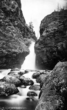
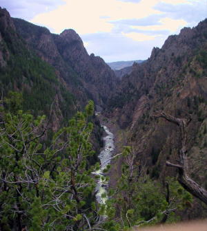
When the boats reached Gore Canyon, they encountered violent upsurges and dramatic drops.  The wild waters smashed all four of the vessels on dangerous rocks.  Fortunately, all members made it to dry land, even the little dog.  No reward was ever given for the attempt.

Colorado-Big Thompson Project

The idea of diverting water from the Colorado River on the Western Slope of the Continental Divide to the productive farmlands of the eastern plains had been a dream of planners as early as 1929.  Subsequently,  a long period of drought and the sagging economy of the “Great Depression” whetted demands for what became the largest trans-mountain diversion project ever built.

The Colorado-Big Thompson Project takes water from Grand Lake on the western side of the Continental Divide to the Big Thompson River on the east.  The water flows through a 13 mile tunnel beneath Rocky Mountain National Park.  In order to supply the residential and farming needs of Northeastern Colorado, the project was begun in 1938 and continued through the years of World War II.  The first water flowed though the tunnel, named for Senator Alva B. Adams, on June 23, 1947.

In order to assure an adequate supply from Grand Lake, a dam was built creating Shadow Mountain Reservoir.  A larger lake, Granby Reservoir was then built below, with a unique pumping plant that forces water into Shadow Mountain.  The Farr Pumping Plant cost over $9 million and provides an additional 700,000 of irrigated land to northeastern Colorado.  Further reservoirs were added, both to supplement the diversion and to compensate the water needs of Western Colorado.  These include Willow Creek and Windy Gap Reservoirs in Grand County.

While most legislators were enthusiastic about the project, U.S. Representative Edward Taylor was vehemently opposed to the reduction of water flowing down the Colorado River.  A compromise was reached in the creation of Green Mountain Reservoir (on the Blue River), which reserves water to replenish the Colorado River.   The city of Denver later claimed upstream water on the Blue River for the massive diversion project of Dillon Reservoir

Claims on the water of the Colorado River range from the fruit and wine regions of the Grand Valley in Colorado all the way to Los Angeles and Mexico.  It can be said that every snowflake which falls in Western Colorado had already been over-appropriated, especially during drought periods in the arid West.

Early Water Disagreements

As fast as settlers arrived in the county, conflicts arose over water use.  George T. Bell, an early rancher on the Blue River in the 1890's, had water rights coming out of Deep Creek, Spring Creek, and Soda and Iron Springs.  Daughter Maud Bell had married James Mugrage and when her father died in 1925, she and James stayed on the ranch of about 800 acres, to operate it.  She reported years later that when Noonen, a large rancher also on the Blue, built his ditch, he took much of the Bell water and used it for his own benefit.  Many years later, Maud discovered that although her father was long dead, those early water rights still belonged to the Bells, not the Noonens. 

Another family, that of George Henricks, settled far up the Troublesome Valley, about 1900, in what was truly an inaccessible spot.  What possessed him to pick such a remote area for his ranch?  Because when he and his wife Aurille lived in Nebraska and tried to make a living on their farm, farmers upstream stole their water to the point that they couldn't keep their crops alive.  Aurille actually had to use the same batch of water for two or three purposes!  As water fights escalated, George vowed to find a place where nobody could be above him and his water source. Rancher Will Call took him far up the Troublesome valley to a large meadow, reachable only by foot or horseback.  Life wasn't easy, for George and Aurille had to do everything from scratch, and they lived in a cabin with a dirt floor for many years.  But nobody took his water! 

Even more recently there was a case on Crooked Creek, where a ranching family that owned quite a good spring and used it to water their hay, discovered that a new neighbor was diverting the water from the spring over onto his own land, to water his own hay!  The rancher protested and diverted the water back where it belonged.  The newcomer turned around and stole it again.  This situation went on for many years without good satisfaction.

The Kirtz Ditch development on the Troublesome began about 1890.  In 1911, an Elias T. Copelin homesteaded land, later adjacent to the Alexander and George Murray Baker ranches.  One day Copelin and Murray Baker, one of the brothers, got into an argument over water rights in the Kirtz Ditch, each accusing the other of stealing his water.  Murray, who was a little guy with a fierce temper, picked up a shovel and gave Copelin a mighty whack with it.  Copelin fell to the ground but after a bit picked himself up, climbed on his horse, and headed toward his home.  However, the blow must have damaged his brain because he was found the next day, dead on the ground at his own gate

High on Meadow Creek, in the early 1900's, lumber activity began in the area later known as Sawmill Meadow.  About 1910, the Western Land and Flume Co. put in a little dam near what is now the trailhead to Columbine Lake.  The resulting lake, today filled with water lilies, was used as a holding pond for logs that would be moved by flume to the main mill downstream in Tabernash.  This lumber company sold to Western Box & Lumber Company in 1912.  Business flourished.  There was even a short railroad going into the woods, with the tracks made of logs about 6" to 8" in diameter.  Prospects looked good.  However, from the beginning water rights were an issue. Some people say it was Nathan Hurd who broke the company.  Western Box had lost some of its water to the Strawberry Ditch (going to Granby) in 1914.  More trouble was looming.  Hurd wanted to keep the water from the little reservoir for the ranchers and lettuce farmers below.  The timber folks wanted to use the water during the summer months to keep the flume going.  Nobody was willing to give up anything, so in 1915, the big mill closed.   Still, efforts continued.

Then in 1919, the planing mill at Tabernash burned.  In the early twenties, further contention led to the withholding of more water from the lumber companies who wanted permission to ditch Trail Creek water across into Meadow Creek, replacing water taken higher up for the flume and Strawberry Ditch.  This would have been quite easy because, about seven miles out of Tabernash is a nearly flat saddle that exists between the two creeks.   Nevertheless the Hurds wouldn't hear of it.

Then one Henry Jarvis showed up on the scene.  He was known to all the timber men.  In 1923, Jarvis, using a box of TNT, "blew the dam" of the irrigation reservoir at Western Box.  People suspected that he did it for T.S. Huston, one of the big lumber powers of the area.  The feeling was that "if the lumbermen couldn't have the water, neither could the ranchers and the Granby farmers."  In any case, that basically was the end of Western Box Company. 

Grand Lake
Grand Lake

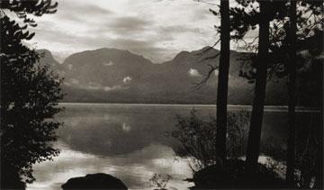
Grand Lake is Colorado's largest natural lake.  The clear blue waters are surrounded by magnificent mountain scenery and a haunting Indian legend.  

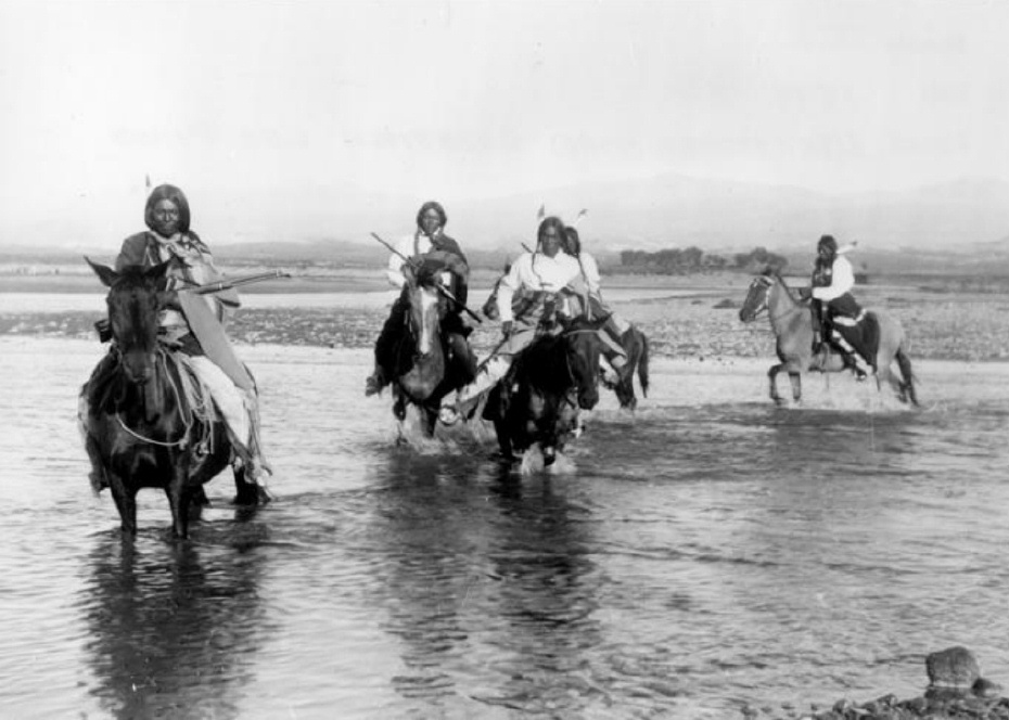
Judge Joseph L. Wescott, an early white settler, wrote a poem about a Ute story he heard from an Indian camping at the lake in 1867.  One summer Utes were camping on the shores of Grand Lake when they were suddenly attacked by an enemy tribe of the Arapahoe.  As the brave Ute warriors began fighting, the squaws and papooses hurried onto a raft for safety, pushing the raft to the middle of the lake. As the battle continued, a treacherous wind overturned the raft and all the women and children drowned.  

It is said that you can see ghostly forms in the morning mist rising from the lake and hear the wailing of the women and children beneath the winter ice.

Moving Water from Point A to Point B

Most serious ranchers had more than one ditch and most built one or more reservoirs. Hilry Harris, Munroe C. Wythe, Samuel H. Burghard, and John A. Coulter entered the first water claim in the county on September 20, 1874. This came out of Sheep Creek above the head of Gore Canyon.

There usually was some natural irrigation; but the challenge of getting the water from the creek required laborious construction of diversion dams, headgates, and ditches, the earliest ditches being dug by hand and often taking up to four years to complete. Later, ditches were dug using teams and scrapers. The grade was figured out initially by simple gravity flow, letting a trickle of water move down the ditch. Soon ranchers refined the process, using a 16’ long board placed with a 1/8" slope, determined by a carpenter’s level. A.F. and Roy Polhamus surveyed a great many of the water ditches, especially those impressive ones in West Grand County, some of which even had tunnels involved. Most small ditches supplied just one ranch, but if a ditch had to cross another ranch, that rancher usually got a share. And some of these ditches were long!
For instance, Dr. Henry Hoagland, on the Blue River, anticipated getting water close at hand from Spruce Creek. Instead, he discovered an old timer had previous rights that forced him to go back into the mountains and build a 13-mile long ditch. Hoagland had figured on spending about $7000; in the end, the actual cost was $26,000! His crew dug the ditch around side hills and across valleys using flumes and siphons. Then his real troubles began. Terrible leaks and washouts occurred everywhere. Finally he hauled in adobe and put this in the bottom of the ditch, rented sheep, and drove them day after day up and down the ditch to pack it. After a couple of years of using this tamping process, the ditch held. Other ditches were even longer. The Church Ditch at Willow Creek and the Wheatley Ditch on the back Troublesome were both 16 miles long.

The Company Ditch (aka the Williams Fork Ditch), eight feet wide on the bottom, was another long one. Built between 1903 and 1907, it cost $44,000 and had a decree for 150 cubic feet / second. The ditch went uphill and down, requiring many flumes and bridges. One flume was actually 1200 feet long! Subsequent breakdowns, leaks, and slides were so frequent and repairs so extremely costly that old-timers have said the reason the Company Ranch went broke about 1920 was the expense of The Ditch. The Lyman Ditch (or the Curtis), started about 1891, was just as complicated as the Company Ditch. Crossing high above the Williams Fork River, the ditch eventually needed cement piers to carry the pipe (1928). This ditch had so many slides, leaks, and washouts, that it had to be inspected once or twice daily! Siphons were required over draws. Flumes, sometimes ¼ mile long, might be 25-30 feet high, and one flume was actually 177 feet high; but these heights were necessary to maintain the elevation.

Flumes, being of wood, rotted and were guaranteed to leak. Sometimes wind blew a portion of the flume down. Finally the county put in big pipes to help the ditches across the Williams Fork. It might be noted that, when water leaked out of ditches, a side benefit was that ranchers along the way could use the "lost" water. Along with the ditches came reservoirs.

Fred DeBerard had four reservoirs on the Muddy: the Albert, the Binco, Milk Creek, and a low one that flooded the Jones place near Kremmling. All were dirt, of course. The Hermosa Ranch on the Little Muddy had water rights through the Sylvan Ditch and Reservoir Company and they built the Sylvan Reservoir dam and the Hermosa Ditch starting in 1911 and completing it by the spring of 1916. The Stein Ditch, started in 1897, was another large ditch, this one later purchased by the Taussig family. These ditches were all built originally to provide water to meadows and fields for ranching purposes. For years, people hauled in water for baths and household use, but that gradually changed. Leon Almirall, near the Horseshoe Ranger Station on the Williams Fork, decided that he wanted water for his home, so he built a 1700’ pipeline to his house, added an inside bathroom, and was shocked when the line froze the first winter – it was only three feet deep. He called in workers who dug down and insulated the line with manure and straw. It froze again. Finally, Almirall gave up and buried the line six feet deep. Now he had his water!

On Ranch Creek in the east end of the county, E.D. Shew cut a ditch upstream from his house, placing it along the edge of the creek, but directing the water back into the main channel near his house. At that point, he put a little water wheel that pushed the water up the hill to his cabins -- and furnished electricity besides. Eventually he replaced the water wheel with a gas engine. There was a similar water wheel, used for the same purpose, up in Hideaway Park.

Water was used to transport lumber as well. A flume ran down the mountain into Monarch Lake, in the days when the Monarch Company was timbering there. There was a flume along St. Louis Creek, carrying lumber from the camps upstream. Perhaps the most ambitious flume ran from Western Box Sawmill. This area is now under Meadow Creek Reservoir. In 1906, the Deisher Lumber Company paid Nathan Hurd for a right of way through his land and built a flume with a 2% grade down Hurd Creek. Logs were placed in the flume and a horse harnessed to the last log. The horse then pushed the logs down the flume with the help of the water. Three years later, the mill was moved to "Sawmill Meadow" on Meadow Creek.

In 1911 construction on the seven-mile-long Vaver Flume began, with 117 cubic inches of water allotment. This flume ran down Meadow Creek and over to Tabernash, carrying partially processed logs for further manufacture. A flume rider checked along the way, making sure there were no jams, and phone line allowed the rider to report troubles. Hikers can see remnants of both the St. Louis Creek flume and that one coming down Meadow Creek today.

Onahu Creek
Onahu Creek

Onahu Creek was called Fish Creek and is a tributary of the North Fork of the Colorado River. The name refers to one of the Indian race horses who came up to a campfire to warm himself, and the name means “warms himself“.  The horse ultimately died on Fish Creek and gave his name to the waterway.

Water
Water

Grand County is home to the headwaters of the famed Colorado River — the river that brings water to five other arid Western states. Water is the lifeblood of semi-arid Colorado and Grand County is one of the most water-rich areas of Colorado, and yet faces a shortage due to historical water agreements, written long before population pressures and the environmental awareness of the current age.

On average, the water diversion projects in the county move a whopping 305,000 acre-feet per year from the Fraser, Colorado and Williams Fork rivers — all headwaters of the Colorado's main stem. 60 percent of the water in Grand County is diverted elsewhere and there are plans underway, mostly from Front Range communities, to divert as much as 80 percent of the county's headwaters by the year 2010.

Two of the main water utilities, Denver Water and the Northern Colorado Water Conservancy District face a quandary: how to take the water from Grand County without further damaging the delicate environment and the region's economy, which is fueled by tourists who expect to play in the very water the Front Range wants to take.

Water from the Mountains - The Grand Ditch

 Though few, high altitude water ditches have had a major impact on Grand County's history and economy, there were many early valley ditches transporting this precious commodity from water-right sources to the owner's ranch. However, the threat of transporting great volumes of water from our county to Boulder County via high altitude ditches appeared back in 1889.  Certain interests east of the Divide talked the Legislature into appropriating $25,000, for surveying and developing a 20-mile-long canal over South Boulder Pass to South Boulder Creek.  Amazingly, neither Grand County residents nor very many others opposed this notion.  Luckily the state engineer found the terrain so difficult that not even $2000 was ever spent on the project.


The next effort occurred also in 1889.  This privately financed plan was to develop a two-branched canal system that would move 700 second feet of water to a half-mile tunnel just beneath Berthoud Pass at over 11,000 feet, thence down to Clear Creek and on to the Golden area.  Initial surveys were begun that fall and roads laid out the following year.  The effort bogged down but was resurrected in 1900 under the Agricultural Ditch Co., supplemented in 1902 with the Berthoud Canal Co.  The canal was partially completed by the Frank Church family ranching interests of Jefferson County by 1906.  The ditch, which can be walked today, runs from Second Creek to Berthoud Pass, though it no longer carries much water.  However, the Church Ditch water rights coming from Clear Creek still exist and today are owned by Northglenn.

Proposed in 1890 by the Water Supply and Storage Company of Fort Collins, a greater canal was to be built 1000 feet above the Kawuneeche Valley, that would tap the high tributaries of the North Fork of the Grand River, sending the water over Poudre Pass to a reservoir and then into the Cache La Poudre River and on to agricultural areas east of the Front Range.  The water company, later known as the Grand River Ditch Company, appropriated 525 second feet at the time of the initial diversion in 1892.  (When the Grand River was renamed the Colorado River in 1921, the company was changed to the Grand Valley Irrigation Company.)  The ditch was dug by hand, primarily by Japanese and Mexican laborers.  By 1900, water was flowing eastward.  

By 1906, this major canal, known as the Grand Ditch, and draining water from the Never Summer Range, had a capacity of nearly 358 second feet with 12 headgates within 8 miles, running from Baker Creek to the pass at 10,179 feet, plus a smaller canal carrying 183 second feet within 11 miles, coming from Specimen Mountain.  In 1936, using machinery, the ditch was lengthened to 14 miles.  The Grand Ditch is about 20 feet wide and 6 feet deep, though the water is rarely more than 3 feet deep, and this water irrigates some 40,000 acres in Weld and Larimer counties.

The National Park Service has argued against the allocation of all this water to the canal as it is needed to support plant life and animal habitat.  Becuase river water flow was cut in half, the immediate effect was a reduction in the fish population in the Colorado River.  More recently, a major washout in the ditch caused devastating damage to the slopes below the ditch and to the Colorado River itself.  Hikers climbing up from the valley use the Grand Ditch as a route to the high peaks and lake.  But as viewed from below, the Grand Ditch is often considered an ugly scar on the landscape.

Williams Fork Reservoir

Article contributed by Liz Church


Williams Fork Reservoir plays an important role in water conservation, while being an asset in revealing archaeological data of earlier existent peoples in the region. The reservoir is located about 12 miles southeast of Kremmling at an elevation of 7874 ft. in Grand County, Colorado, near the center of Middle Park. Williams Fork is a tributary of the Colorado River, extending from Clear Creek to Vasquez Creek, with the Vasquez Tunnel running through and its completion in 1959.


Williams Fork is a water source to the Denver Metro Area, with diverted water from high elevation tributaries of the Williams Fork River to the Gumlick Tunnel for departure to the Moffat Tunnel system. Standing 217 feet above the Williams Fork River streambed, the dam backs up a reservoir of 97,000 acre feet of water.


Williams Fork is also a Paleo-Indian site.  Archaeologists believe that 12,000 years ago, during the last Ice Age, people migrated from Asia into North America. Most Paleo-Indian sites are identified by an existence of projectile points. The Williams Fork Reservoir was dominated by James Allen projectile points, a categorized set of points, or better known as a categorized set of stone tools. The reservoir allows archaeologists to access the extent in which the James Allen points and perhaps earlier existent groups were bestowing the mountains during the Holocene period, the name given to the last 10,000 years of the Earth's history.


Source: http://en.wikipedia.org/wiki/Phillips-Williams_Fork_Reservoir _Site


Articles to Browse

Topic: Grand County

Grand County

Grand County was established in 1874 by the Territory of Colorado, thus becoming a county two years before Colorado became a state. It was named for the Grand River, the name by which the Colorado River was known at that time. The headwaters of the today’s Colorado River are in Grand County. The county was formed from a portion of Summit County but acquired its current boundaries in 1877, when part of the Grand County was used to create Routt County. The county seat is Hot Sulphur Springs. The area of 1,854 square miles consists of meadows, river valleys and mountains.

Topic: Places

Place Names of Grand County

Because Grand County has such a rich history, many names reflect that important heritage. Traveling East to West from town-to-town, here are a few historical tidbits to think about.  

Winter Park came into being around 1923. Several names to identify the place were used over the years, including West Portal, Hideaway Park, Vasquez, Woodstock, and even "Little Chicago" because of gambling and other activities. The City of Denver bought land in 1939. Winter Park officially opened in 1940. According to "Colorado Place Names" by George R. Eichler, with the assistance of Denver Mayor, Benjamin F. Stapleton, the town changed its name to "Winter Park" to publicize the establishment of the city's winter sports centers.

Iron Horse Resort and Zephyr Mountain Lodge reflect the importance of the railroad in the development of Grand County. Newer condominiums also reflect the heritage of the area. Sawmill Station, Teller City and more recently, Telemark, are a few examples. "Telemark is named after the traditional method of skiing," said a Telemark Townhomes representative. Red Quill townhomes, according to broker and owner Mike Ray of Century 21 Real Estate in Winter Park, are named after President Eisenhower's favorite fishing fly lure. "He found the Red Quill pattern particularly effective on St. Louis Creek while visiting and fishing with Axel Neilsen at the Byers Peak Ranch." Van Anderson Drive, according to Jan Smith, a Realtor at Century 21 of Winter Park and longtime local, is named after the first mayor of Winter Park. He developed the Hideaway Village, including the condos, Filings 1 and 2 and Hideaway Village South.  


Vasquez Road, according to well-known historian, Abbott Fay, is named after Louis Vasquez, an early fur trader. Woodspur and even Woodstock, one of the early names attributed to the town of Winter Park, referred to Billy Wood's lumber mill which furnished Rollins Pass railroad ties.

Fraser was originally spelled "Frazier" for Reuben Frazier, an early Grand County Settler. Postal authorities adopted the simpler spelling when the post office was established. Doc Susie Avenue is named for Susan Anderson, M.D. "Doc Susie," a pioneer physician who came to the area in 1907. She served the citizens of Grand County faithfully until she died in Fraser at the age of 90. Fraser's Eastom Avenue is named after George Eastom, who founded the town. The Eastom family from Ohio built an important lumber mill. Mill Avenue also reflects those early lumber days. Eisenhower Drive is named after President Dwight D. Eisenhower, who enjoyed visiting the area especially for fishing. Ptarmigan is a grouse with feathered feet particularly found in the cold, mountainous regions. And, for Wapiti Drive/Lane, Wapiti is an elk. Zerex Street, according to Susan Stone of the Fraser Visitor Center, is named after the antifreeze product which was tested at "the Icebox of the Nation."

Tabernash is on the homestead of 1882 pioneer Edward J. Vulgamott. By 1905, the enclave came into existence because of its location during the building of the Denver & Salt Lake Railroad. E.A. Meredith, chief engineer, named the town after the Ute Native American called Tabernash who was killed earlier by a white man named "Big Frank." Junction Ranch, built by Quincy Adams Rollins, according to noted historian Abbott Fay, was an important stop on the Idlewild Stage line which could accommodate up to 50 travelers.

Granby was founded in 1905, named after attorney Granby Hillyer, who assisted David Moffat and Frontier Land and Investment Company with the incorporation. Granby landmark, Kaibab Park was donated by the Kaibab Company. According to former local postmistress Carole Clark, during the 1940s, Broderick Wood Products Company had a large sawmill with housing for their workers where the current ball fields are now located. Selak Drive is named after the Selak family, who ran a large Granby Merchantile. Before Granby, the Selak post office and general store provided service from June 1883 to September 1893 on the nearby Selak Ranch.
Ouray Ranch, a residential community located off US. Highway 34, was the original home of the YMCA Camp Chief Ouray until the early 1980s when the YMCA sold the land and relocated to Snow Mountain Ranch outside of Granby on US Highway 40. Chief of the Ute Indians, Ouray was born in Colorado in 1820. He was noted for his friendship with the white settlers.

Grand Lake was established by hardy pioneers in 1879. Joseph L. Wescott, was the first white settler-prospector. Grand Lake was founded as a mining settlement by the Grand Lake Town & Improvement Company. As the mines played out, tourism and focus on Grand Lake, Colorado's largest natural body of water, took center stage. Cairns Avenue, according to Jane Kemp, granddaughter of James Cairns, is named for him. In 1881, he ran a general store. He extended credit for supplies to many of the miners who left town without paying him. With unpaid bills and depleted stock, Cairns then homesteaded a ranch to sell hay to freighters for their horses. He trapped bears for their shaggy skins to sell. All the while he kept his store open. A mountain peak bears his name, also.  

Columbine Lake is named after the Colorado State Flower. Kinnikinnick is a Native American term used to describe mixtures of Indian tobacco.  West Portal Road leads to the west portal of the Alva B. Adams Tunnel, which since 1947 delivers Grand County-Western Slope water to farmers on the Front Range as part of the Colorado-Big Thompson Project.

Hot Sulphur Springs, established in 1860 is named for the famous hot springs in the area. (Colorado Place Names) Ute and Arapaho tribes used the hot springs for their "healing waters." Byers Avenue is named after William N. Byers, founder of the Denver Rocky Mountain News. He wanted to create a spa resort modeled after Saratoga in New York.

Moffat Avenue-Several streets in Grand County are named after David Moffat, the pioneer railroading legend, who started the Moffat tunnel and brought predictable rail service to Grand County with his "true-grit" determination.

Parshall, according to Colorado Place Names, was established in 1907 when a Mr. Dow set up a small store and circulated a petition for a post office. The name "Parshall" honored a local pioneer. Postal authorities accepted it as no other post office had that name in the entire county.

Kremmling established in 1881 according to Colorado Place Names, the town's beginning was a general merchandise store run by Kare Kremmling, (The Chamber of Commerce web site says Mr. Kremmling was named Rudolph and the town was established in 1884) located on a ranch on the north bank of the Muddy River. When Aaron and John Kinsey platted their ranch and called the site Kinsey City, Kremmling moved his store across the river to a new site which soon became known as "Kremmling."

Radium had a post office as early as 1906. Harry S. Porter, a prospector and miner, suggested the name because of the radium content in a mine he owned near the town. The community was settled by Tim Mugrage and his family.

Christmas at Fraser

The lights dimmed; mothers had already found their seats after coming from the classrooms where they had put makeup on little children’s faces and checked their costumes to make sure angel wings and halos were secure and costumes were on right side round.  I was at the piano, music and script lined out. The gym was full to the brim, every seat taken, with folks lining the sides and back walls, for the whole town had turned out.  Early birds got the seats!  Christmas wasn’t Christmas in the Fraser Valley unless it included the program at Fraser School (now the Town Hall).   I began the overture and chatter stopped.   I had played for this event for ages, starting in 1958.  High school students were gone by then, moved to the new Union High School in Granby, but 7th and 8th graders were still there.  And in 1958, the first kindergartens in the district were established.   It was a time of excitement and anticipation, of fun, and of panic? Well, no, not panic, for the teachers were beautifully organized. 

The program was chosen during October. Each teacher had a specific job. For instance, Martha Vernon, the art teacher, did sets.  Helen Hurtgen was responsible for dialog.  Edith Hill did costumes.  Nancy Bowlby was in charge of the music.  Others coordinated the whole.  And I played the piano, with Nancy sometimes accompanying me on her violin.  

Mothers were asked to contribute sheets and any fabric they could spare.  Patterns and material for costumes went home to be sewn into various sizes and shapes -- angels, gingerbread men, knights or royalty.  In the gym, we stitched on finishing touches, bright patches to decorate jester outfits, townspeople, and such, while watching various groups practice. Bits of tinsel became crowns, tinfoil turned into wands, cheesecloth into wings.  Lace scraps and sequins added color and “class.”   The budget was extremely minimal at first, but over the years, more money was directed to Christmas programs.  Instead of old sheets, we could buy cotton fabrics, velveteens, sometimes satin.  One year I even stopped by a furrier’s in Denver and begged some fur scraps.  Were we uptown then!  We had fur trim around the necks, cuffs, and hems of the costumes for the prince, queen, and king.  

The day before the play, PTA mothers gathered in the gym to fill brown paper sacks with an apple, orange, nuts, and candies, provided by R. L. Cogdell from his grocery store.  

Every single child in school took part in the play, as a class, except for those with speaking parts, of course.  Fraser grew and grew, then as now. Soon the 7th and 8th grades moved to Granby.  Then the 6th graders went, but the 4th and 5th graders handled the leads neatly.  Our stories were usually simple Christmas tales, but sometimes we tackled ambitious efforts such as the Nutcracker Suite or a version of Gilbert and Sullivan.   The only children not included were the Jehovah Witness youngsters.  They couldn’t be in the play and they couldn’t come watch it either.  We all felt very sorry for them, because everyone had such a wonderful time.  Their teachers tried to give them special projects to entertain and interest them while they sat off in a corner or in their classrooms.   The plays always went well.  Tiny kindergartners came out onto the stage, to stand behind the colored lights.  They knew their song perfectly in practices, but I have to admit that a number of them usually stood silent, stunned by that mass of faces looking up at them.  No matter.  They were darling. “Hi, Mom,” some were sure to call. “Mom” beamed.  

There might be a glitch or two every year. For instance, little Diane was chosen to do the Arabian dance in Nutcracker Suite.  Her parents were dark, as she was, and she was slender as a dancer. Trouble was, she didn’t have an ounce of grace in her body at that stage of her life.  I thought Nancy Bowlby was going to have grey hair before she got that child moving properly.  But the night of the program, Diane looked like Anitra herself, doing her exotic dance.   One year the king jumped his cue and entered on stage.  His first words were, “Did I miss anything?”  The prince muttered, in an aside, “Yes, three pages!”  But the cast went on as if nothing had happened, while down at the piano I sat, flipping pages rapidly, trying to figure out where the dialog was now.  

Another year, our son James was to take part in a minuet.  “Uck!  I have to touch a girl?”  By the greatest good fortune, he broke his leg and got to be a guard at the palace door, standing at attention on crutches, while another boy took his place.  (I think he did that on purpose.)   Songs and parts were adapted to the talents of the students.  We had five boys once, who couldn’t talk, dance, sing -- anything.  So they wore monks’ costumes and filed on stage, supposedly singing a Christmas carol, but supported strongly by the cast present.   Another time, Twyla’s parents couldn’t come, so Miss Vernon took her home to get ready. Now, Twyla usually looked like a dirty ragamuffin, but after a bath and hair wash, she truly looked like the angel she portrayed.   For the finale, the entire school came on stage to sing a last carol, with the audience joining in.  Then Santa showed up to distribute the goodie sacks, and the great night was over.  Coming out into the quiet night was a wonderful feeling.  Sometimes we moved through drifts of new falling snow; sometimes the sky was filled with icy stars.  Gay lights showed in windows throughout town. 

We never talked much on the way home, as we thought of the play, the success of everyone¹s efforts, and how happy the children had made their parents and families.   My last program was the first year after the new school was built.  It was fun still, but the school population had grown enough that it was impossible for whole classes to participate as one. Things weren’t the same as they were in the little old school.

Topic: Biographies

Joseph Wescott

Joseph Wescott was born in 1838 in Nova Scotia and reared in Iowa.  By 1865, he was in Middle Park, squatting, half-blind and semi-alcoholic, in Hot Sulphur Springs with his friend Charlie Utter.  

Having come to Colorado to get relief from rheumatism, he passed his time in creative writing, fishing, drinking, and shooting his revolver.  In 1868, after being induced to sell all of his claims of 160 acres around the hot springs, he left Hot Sulphur Springs to go to Grand Lake.

In 1870, a group of Arapahoe Indians arrived in the area and there is an unverified report that Wescott, Jack Sumner, and three fishermen killed “not less than five” of the Indians.  Soon after this incident, Wescott settled into developing a rustic resort with cabins, rafts, canoes, and skiffs on Grand Lake.

By 1879, he had three buildings on the West Shore. In July 1880, disaster struck when Edward Phillips Weber, an attorney, took over Wescott’s original filing as his own.  Weber claimed that there were “flaws in the filing” and forced Wescott out.

Nevertheless, on June 26, 1888, Wescott filed a plat for “Grand Lake City,” on the lake shore south from the inlet.  He designed the area for summer visitors rather than as a residential community. 

Wescott later wrote a famous poem about the legend of Grand Lake, and how the spirits of the lost Ute women and children can still be heard wailing on foggy mornings at the lake shore.
 

Topic:

Business and Industry

How did people make a living? What were some of the businesses and industries that brought people to Grand County?  Jut click on the drop-down menus and find out more about it!

Rundell & French - Two families of the Sheephorn

October 2009

Here we have a story of two families, who became intertwined in a far away place where there weren't too many people. In fact, there was only a handful.  Three young fellows, the Rundell boys, came from Wisconsin about 1880, to settle on the Sheephorn, an area in the very southwest corner of Grand County.

Al, the oldest brother, chose land on the Upper Sheephorn.  While he was at it, he established a much-needed ferry across the Grand River at today's Rancho Del Rio.  His brother Clarence homesteaded land on the same stream some two miles above the Midland Trail, known to us as the Trough Road. The only home he could afford for a couple of years was a dugout under the creek bank.  That tended to be damp and dingy, but Clarence hung in.  Finally he was able to build a cabin uphill from the stream. Newspapers used as insulation on his cabin walls show the year to be 1882.  Clarence was pleased with his house.  "Now I feel I've really put down roots and am here to stay!" he exclaimed.

Their young brother, Ernest, was frail, for he had suffered all his life from lung trouble.   Still, he loved working with Clarence.  One summer, they were digging a water ditch near Azure, on the Grand, above Radium; Ernest caught pneumonia and died. The poor boy was only about sixteen. Clarence never got over his brother's death and he gave land for a cemetery, where he buried Ernest, the first person there.

The second family were the Rundell boys' neighbors, Charlie French and his older brother, Harry, Jr. who had "hit town" from Iowa just about the same time.  Harry homesteaded upstream from Clarence and anticipated ranching.  By and by, though, Harry remarked to Charlie, "I've discovered I'm not much of a hand at ranching and besides, my land isn't very fertile.  I think I'll sell it and become a U.S. Forest Ranger instead.  If they'll have me." He easily passed the test and soon transferred to the little community of Azure.

Now, Charlie French was a wonderful musician, a whiz at playing the fiddle.  He missed making music with their sister Phoebe.  "You know, Harry," he said one day.  "I'd really like Phoebe to come out and see this country. I'm sure she'd like it.  And besides, we could play together again."

He urged her several times to come visit.  At last she agreed, traveling by train to Leadville, then to Wolcott.  About then, Charlie started to worry.   "Phoebe's only 18," he thought, "and she's such a lady. Is it proper to expect her to ride sidesaddle all the way in from Wolcott?"  He stopped by to see Clarence Rundell.  "Clarence, do you suppose you could take your buggy to Wolcott and pick up our Phoebe?"  He explained the circumstances. "Why, I'd be delighted," answered his friend.

It was a happy development.  At the station Clarence saw a lovely young woman, tall and slender, obviously well-educated.  He soon found she had a beautiful soprano voice and was an accomplished musician who could play both piano and organ.  He took to Phoebe right away, and she, to him.  It wasn't long before the two decided to marry.

Now the French boys' parents, Harry, Sr. and Mary, sold their Iowa farm about now and homesteaded at Azure, to be near their boys, even though Charlie left the country soon after.  Here the old folks remained for many years.  They also had some land up the Little Sheephorn, which they gave Phoebe as a dowry, when Clarence and Phoebe decided to wed.  Shortly after, the happy young couple married and made the little cabin their home.

Their three children were born here, Ernest, named after the brother who died, Marie, and Helen.  Clarence worked very hard, ranching in the summer and cutting logs in the winter.  The young folks were thrifty.  In 1908, Clarence sold his homestead to a Swiss newcomer and bought land above his original site. By 1912, Clarence and Phoebe built a fine three-story house, complete with beautiful hardwood floors.  It was wonderful place to raise the children.  "This will surely be our home forever!"

Harry French, Sr., died in 1924.   "Mother," invited Phoebe, "move in with us, since you're alone now." Mary did this, but then she returned to Iowa to stay with her sister, until her death.  The French name continues on, however, for there are two French Creeks in the Sheephorn area.

Finally, the Rundells decided to buy a home in north Denver and to invest in an apartment house.  All went well until 1928, when everything fell apart at the beginning of the Depression.   Clarence lost nearly everything. "Let's go back to the ranch, Phoebe," he said.  "I still have my 300-400 head of cattle; I know ranching and love it.  Let's go."  Thus they left city life and returned to their ranching roots.

Ute Legend of the Quaking Aspen

It is amazing to behold the continuous quivering of aspen leaves in groves around Grand County, even when there is no apparent breeze.

According to Ute legend, the reason for this unique aspect of the aspen tree happened during a visit to Erath from the Great Spirit during a special full moon.  All of nature anticipated the Spirit's arrival and trembled to pay homage.  All except the proud and beautiful aspen. The aspens stood still, refusing to pay proper respect. The Great Spirit was furious and decreed that, from that time on, the aspen leaves would tremble whenever anyone looked upon them.

Topic:

Leisure Time

Article contributed by Scott Rethi

Of all the leisure time activities available to the pioneers, dancing
was the favorite.  Dances were held in grand hotels that remained from the mining boom, such as the Fairview House and The Garrison House in Grand Lake.  

Quadrilles, a type of square dance, were popular at the time.  A
fiddler would provide the music and serve as the caller.  These parties would start in the evening and last all night.  The formidable temperatures and great traveling distances were incentive for getting the most out of every gathering.  

Winter Sports have also always been a popular pastime.  Skiing was introduced to the region during the winter of 1883. Snowshoeing and sleigh rides were also enjoyed.  

1882 officially brought the arts to the Grand Lake area when the Dramatic Society was organized.  A production of the
well-known comedy "Our Boys" was the premiere performance.

Sources:
Mary Lyons Cairns, Grand Lake: The Pioneers & The Olden Days, Renaissance House Publishers, 1971

Topic: Places

Place Names

Article contributed by Kathy Zeigler

The County of Grand was established in 1874, taking its name from the Grand River which has its headwaters in the county, and from Grand Lake, the largest natural body of water in the state of Colorado.  The county seat is Hot Sulphur Springs.  The area of the county is 1854 sq. mi., making it larger than the state of Rhode Island.

Fraser was established in 1871 as the town of Eastom.  Its name changed to Fraser, after the river that flows through the town, though it was originally spelled Frazier, for Reuben Frazier. The Post Office adopted the simpler spelling at the establishment of the Post Office.  The town bore the distinction of being the "icebox of the nation" for many years, losing that title in a legal battle with a town in Minnesota.

Granby was established in 1904, taking its name from Granby Hillyer, a Denver attorney who may have been associated with the founding of the town.

Grand Lake was established in 1881 as a mining settlement by the Grand Lake Town and Improvement Company, taking its name from Grand Lake.

Hideaway Park was established approximately 1905, and named for its hidden location with the trees screening it from the road. It may have been earlier known as Woodstock, Vasquez and Little Chicago. Max Kortz, owner of a dance hall in the village is said to have provided the moniker. 

Hot Sulphur Springs was established in 1860 and named for the hot springs.  It may have been refered to as Sulphur Springs in its earliest days, and as Sulphur by the workers and management of the Denver and Salt Lake Railroad when it came through in 1904.

Kremmling was established in 1881 as a general merchandise store, owned by Kare Kremmling on the ranch of Dr. Harris, located on the north bank of the Muddy River. In 1888 John and Aaron Kinsey had part of their ranch platted, calling the site Kinsey City. Kremmling moved his store across the river to the new site; eventually the town came to be known as Kremmling.  (Note the two different first names-Reuben Kremmling and Kare Kremmling.  I'll keep working on that discrepancy.)

Radium's name was suggested by Harry S. Porter, prospector and miner, in reference to the radium content in one of his mines.

Winter Park was first known as West Portal, a settlement that grew up during the construction of the Moffat Tunnel in the 1920s.  Postal authorities agreed to the name change to Winter Park, after a request was made by Denver mayor Benjamin F. Stapleton and many sport enthusiasts to publicize the establishment of a top winter sports area.

Berthoud Pass, el. 11314, was named for Capt. Edward L. Berthoud. Berthoud discovered the pass in 1861. He was also chief engineer on the Colorado Central Railroad.

Gore Pass, el. 9524, was named for Sir Charles Gore, who mounted a monumental "hunt" to the American West during the 1850s. Gore spent considerable time in the area, and gave his name to the Pass, a mountain range, and a canyon.

Milner Pass, el. 10759, was named for T.J. Milner, and accomplished civil engineer for railroads and street car lines.

Muddy Pass, el. 8772, bears the name of Big Muddy Creek, a tributary of the Colorado River, with reference to the muddy appearance of the waters during the spring runoff and storms.

Rabbit Ears Pass, el. 9426, refers to Rabbit Ears Peak, whose outcroppings somewhat resemble a rabbit's ears.

Willow Creek Pass, el 10850, is named for the stream, and almost certainly for the willow bushes that line the banks of the stream. The pass was a well known Indian trail, and became a road in the early 1900s.

Source: Eichler, George R. Colorado Place Names. Boulder: Johnson Publishing, 1977.

Ute Legend of Canyons

Major John Wesley Powell was in the first party to make a recorded climb of Pikes Peak in 1868.  Later, he would lead the first expedition of the Green and Colorado (Grand) Rivers. He was very interested in the Indian tribes that he encountered and later became head of the new U.S. Bureau of Ethnology.  He recorded this legend as told by the Utes on his first visit to the Colorado mountains, during his Pikes Peak climb.

A chief of the Utes mourned the death of his beloved wife, and his grief was so deep, that no one could console him.  Then the Great Spirit, Ta-Vwoats, appeared to him and promised to take him southwest to where he could see where his wife had gone, if he would promise to grieve no more.

Ta-Vwoats rolled a magical ball before him and it crushed mountains, earth and rocks, making a trail to the land of the afterlife.  Following the ball was a rolling globe of fire which the Great Spirit and the chief followed.  At last they were in the happy land where all was blessed with plenty and joy.  This was where the chief's wife had gone and he was glad to see it.

When they returned, Ta-Vwoats told the chief that he must never travel that trail again during life and warned all the people against it.  Knowing that those who had lost their loved ones would be tempted to make the journey, Ta-Vwoats rolled a river into the canyons so that no one could enter.

Water