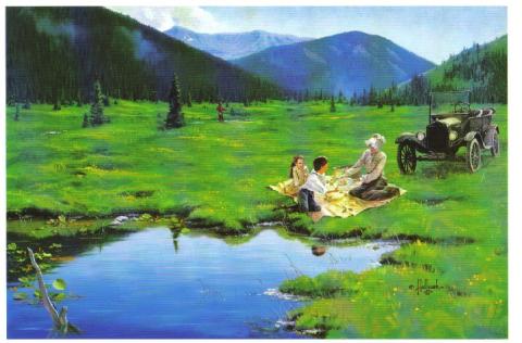
Ute Bill Thompson
Ute Bill Thompson
Ute Bill Thompson

Community Life Articles

Skiing
Skiing

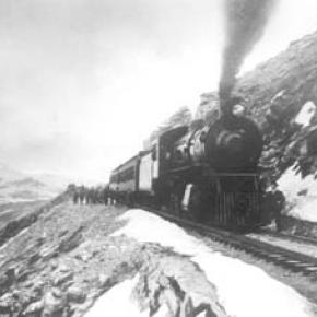
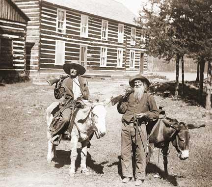
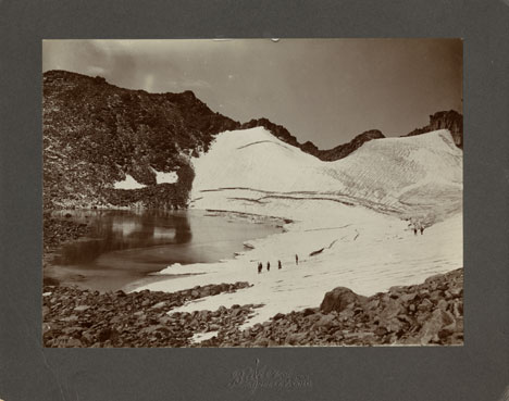
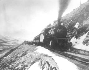
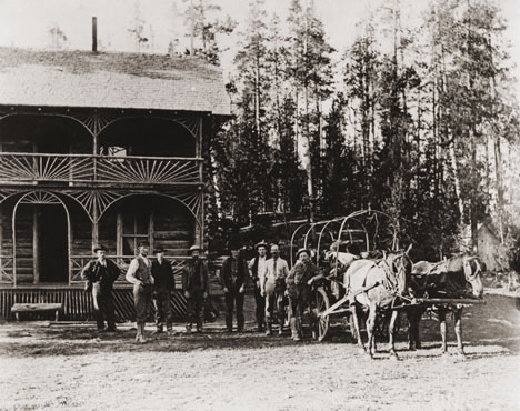
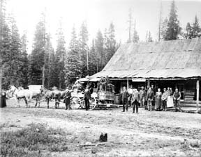
Grand County was one of the first areas in Colorado to enjoy sport skiing.  While mail carriers, loggers and other workers used the "Norwegian Snowshoes" as necessary winter transportation, it was a natural progression to begin racing down the slopes for fun.

An 1883 newspaper noted that in Grand Lake "Coasting on snowshoes has taken the place of dancing parties.   Quite a number of ladies are becoming adept at the art.  First class snowshoers, B.W. Tower and Max James are the best; or at least they can fall more gracefully then the rest".

According to famous Hot Sulphur Springs champion Barney McLean, that town had three jumping hills in the 1920s and held the first Winter Carnival in the West there in 1911.  By 1925, Denver sent special "snow trains" there for the recreating tourists.  Skiers such as Bob McQueary and Jim Harsh competed in statewide events along with skiing "veterans" Horace Button and McLean.  Grand Lake's Jim Harsh became the first Coloradoan to qualify for the U.S. Olympic Team.

In 1932, the Grand Lake Ski Club held its first winter sports week on Denver 25-January 1st.  Featured was a motor sled with an airplane engine which pulled skiers over the frozen lake are speeds of 90 miles per hour.

Colorado's first ski tow was opened at the summit of Berthoud Pass in 1936.  Berthoud Pass operated on and off throughout the next 60+ years but was finally closed and the lifts dismantled in 2002.  

What became the resort of Winter Park featured skiing at the West Portal of the Moffatt Tunnel and the Winter Park Ski Area opened as a result of efforts by Denver Parks & Recreation Director George Cranmer. Early lodging resorts in the area, then known as Hideaway Park (now Winter Park), included Sportland Valley, Timberhaus Lodge, and Millers Idlewild Inn.  Eventually trains made daily runs to Winter Park, loaded with intrepid skiers.  Steve Bradley invented the first effective snow packer on the slopes of Winter Park.

With a strong record of winning high school ski teams, Grand County accounted for a remarkable number of skiers who later took park in FIS (International Federation of Skiers) meets and U.S. Olympic teams.

A later ski area, now know as Sol Vista Ski Basin (formerly Silver Creek Resort) opened in Granby in the 1980's.  World class cross country ski areas in Grand County include Snow Mountain Ranch and Devil's Thumb Ranch.

Sounds of Christmas
Sounds of Christmas

Contributed by Vera "Stathos" Shay, Kremmling


A blast from the past

A frosty night in December

A wonderful time to remember

Fun on a hay ride

My husband at my side

Friends young and old

Dressed for the cold

A pickup truck

Praying it wouldn't get stuck

Snuggled together in the sled of hay

We were on our way

Our hearts and voices filled with song

From our Christmas caroling

Kremmling did ring

Everyone could hear

Us ringing Merry Christmas cheer.


Spider House Tragedy

Nestled on a quiet lane in Old Grand Lake City sits the intricately crafted home of Warren C. and Mary O’Brien Gregg, known today as the Spider House – a testament to a remarkable woodcraftsman and his tormented wife.

Warren (Watt to his friends) was a dreamer and in the 1870s he left his first wife and a young son in Wisconsin and headed for the Colorado Territory seeking his fortune in the mines of Gilpin County.  Upon returning to Wisconsin his first wife died of fever, leaving Warren a widower with a small son.  Holding tight to his dreams of the west, Warren eventually ended up in his native Indiana where he met and married 20 year-old Mary O’Brien, in 1884.   By 1888 Warren packed his new family into a prairie schooner and headed west.  Like so many other pioneer women before her, Mary bore a child along the trail, a second son whose short life would send Mary down a dark and tortured path. 

The family arrived in Middle Park late in the summer of 1888, built a small homestead on the eastern slope of the Stillwater drainage and the newborn died shortly thereafter.  Though the years would bring more children, Mary would never quite recover from the loss of her second son. They continued to scratch out a living in this harsh and isolated land, where winters were long and supplies were meager. 

Warren spent much of his time searching for game and exploring this new country. The Gregg’s moved numerous times, finally purchasing a plot of land from Old Judge Wescott on the west side of the lake.  Warren built his family an admirable house, with intricate detail and spider-like webs of wooden elements.  Despite the warmth and comfort of this new home, and the close proximity of neighbors, Mary’s depression deepened. 

Then on a sunny Sunday in 1904, while Warren was working in his woodshop and oldest son Lloyd was having Sunday dinner at Judge Westcott’s, Mary took a gun to her four remaining children and then turned the weapon on herself.  The children died instantly while Mary lingered on for four days.  The five victims of this tragedy, one girl, three boys and Mary herself are buried together in one grave in the Grand Lake Cemetery.

Warren lived in the Spider House for another 29 years. With his son Lloyd, he continued building homes and stone fireplaces.  He succumbed to heart failure in 1933.  Mary O’Brien Gregg finally found peace in the quiet grace of the little town cemetery surrounded by her children.  Almost a century later, as the tall pines whisper their mournful winter song, the Spider House still sits nestled on that quiet little lane.

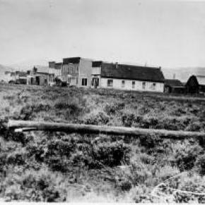
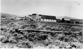
Sudden Death in Old Arrow

A shooting in the Old West I know was not much like the shootings on television today.  There was no glorification of the bad man. Killings were usually like the fatal shooting of Indian Tom on that 6th of September, 1906, in old Arrowhead (or Arrow).  Nobody called anybody out.  Nobody told anybody to draw or asked him if he was wearing a gun.  It wasn’t a fight. It was a killing.  

1906 Arrow had six saloons, a grocery store, one small hotel and a livery stable.  But two thousand people picked up their mail there.  The woods were full of tie-hacks: the three sawmills hired may lumberjacks and teamsters, most of them Swedes, who seemed to make the best lumbermen.   I had arrived in Arrow the 18th of April that year to work as a teamster for my brother Virgil, who had been operating a sawmill there for about a year.  I was just sixteen. 

My brother Dick, the tallest Lininger, had been Virgil’s foreman.  Virgil had also bought the only hotel in Arrow.  My mother, two sisters and my little brother Gilbert and I came from our farm in Osawatomie, Kansas, so that my mother could run the hotel. My brother Wesley came at that time too: he planned to buy a lot and build a café.  Whole families often followed the first member who had come to these early Colorado towns.   I soon discovered that driving logging horses needed a lot more technique than driving a small farm team, but Virgil was patient, and I soon received a raise to $2.75 a day as top teamster.  

 The town was a wide open as it could get.  My first introduction to the violence was the day my brother Dick fired three drunken lumberjacks.  They drew their pay and went to Graham’s saloon to get drunker. As dick passed the saloon later, one of the men grabbed a quart whiskey bottle, and ran out and struck Dick behind the ear, knocking him cold.  The three then proceeded to kick him around.  Dick’s roommate Charley came to my brother’s rescue.  When Dick came to, he started for the hotel.  Charley guessed what he was after and beat him to the six-shooter. “I’ll make sure you can taken them one at a time” Charley promised him.   I came along just as my brother knocked the pick from the pick handle.  Something was up! In less time than it takes to tell it, Dick had three drunks out cold. 

Mother patched Dick up.  I think this was her introduction, too.  A man couldn’t stay boss long if stayed whipped.   Every other Sunday was a holiday for me although I always saw to it that I put in enough overtime to bring my monthly paycheck to $75. That September Sunday I was dressed in my holiday garb – tan peg-top dress corduroys, light blue wool shirt, Western hat, and high-laces boots as befitting a teamster who drove four or six horses hauling logs from timber country to the saw mill.  When I drove six horses, I rode one of the wheel-team horses and held the lines over four.  If I drove four horses, I rode the wagon and sat on a sack of hay.  

About noon, I stopped in front of the MacDonald saloon to talk to Ed MacDonald, one of the few saloon men my mother didn’t disapprove of.  After all, Ed had come to Colorado as a TB and couldn’t do heavy work; filling glasses over a bar was about the only light work in those old mountain towns.  Later Ed owned the famous MacDonald Ranch on the South Fork of the Grand Rover – now Colorado River- and managed boats on Monarch Lake just above his ranch.  He always served great dinners and good food.   While Ed and I were talking, Indian Tom rode up.  He was a flashy cowboy of the old school, a very good looking man with predominantly Indian features although he was only half Cherokee. When riding, Tom always wore leather chaps, spurs, and a big Stetson.  As wagon foreman for Orman and Crook, contractors for building the Moffat Road, he was a very important figure, for he had charge of all their wagons and teamsters.   The greeting between Ed and Tom was cordial. 

Everyone liked Indian Tom.  When Tom learned I was a teamster for my brother Virgil, Tom showed a much keener interest and invited me in to MacDonald’s for a drink.  Ed rescued me.  “Oh the kids doesn’t drink; but he might like a cigar”.   As they ordered drinks, I puffed away in my best imitation of a Kentucky colonel; however I soon excused myself, saying that I had to target my 30-30 rifle for the upcoming deer season. I puffed until I was out of sight. The corn silk I had scorched behind the barn paid off. I didn’t disgrace myself, nor had I broken my pledge to my mother not to gamble, use profanity, drink, or perform any act inconsistent with the conduct of a gentleman.   I took my rifle northwest of Arrow to Fawn Creek. 

It was a beautiful fall day.  The aspen were just beginning to turn.  Fawn Creek Gulch had been burned over many years before by the Indians who hoped in this way to discourage settlers, and the aspen were all young, straight and shimmering in the way that has never ceased to delight me.  The fire thirty years before had made the gulch an excellent place for deer hunting because the new growth gave the deer some inviting protection, but the terrain was open enough for a hunter to locate his game.   I figured I’d have to shoot from at least 200 yards, so I planned to target for that distance.  I tacked a piece of cardboard I’d cut from my brother’s Stetson hat box (he never took off his Stetson off anyway) to a tree and stepped off the 200 yards.  That 6-inch target looked pretty small but after each three shots, I’d examine the target.  Finally satisfied, I took a long walk looking for deer sign, tracks, or droppings.  I found good sign but no droppings.   About feeding time for the horses, I went back to the barn in town to feed the four, Cap, the big bay, Bird, the glossy black (those were my two wheel horses- t e ones next to the wheel); Kate, the little lead horse; and Bud, her mate.  

Virgil had bought Kate, a grey mare weighing about 1400 pounds, at a very reasonable price from the Adams Express Company because she had run away at every opportunity and had destroyed several wagons.  He couldn’t run away now pulling Cap, Bird and a load of lumber with her, but her high spirits made her an excellent leader. The heavier team, always used as the wheel team, weighed about 1700 pounds each.   I was very proud of this unusually fine team.  Virgil had trained Cap and Bird so that after they were harnessed in the barn, they could be turned loose to go to the watering trough, drink long and thirstily, then walk out to the wagon, back into position by the tongue, and stand ready to have the breast straps snapped in place and the tongue attached.     When tourists trains stopped and hundreds of passengers stood around the eating places looking the town over, I’d drive slowly by, and then stop to rest the team a minute, to give the dudes a chance to see a good, four-horse team. Then with a single “Yup!” I’d pull all the lines tight, and they’d start as one horse while the tourists explained and pointed.  

That Sunday after I put a gallon of oats in their food box and shook some hay into their manger, I left the barn and started up the steps alongside the depot.  It was still light; the sky hadn’t even begun to color.   Time to head home for supper.  I’d have to be up, hitched and pulled by seven the next morning. We’d probably have roast beef or roast chicken with noodles, since it was Sunday.  Mother would be cooking on the big wood-burning stove at the hotel, and my sisters would be taking the heaping platters to the tables where everyone would pass them around.  Probably there would be hot biscuits.  

Suddenly a shot cracked just above me and across the street.  I knew instantly it had come from the Wolf Saloon ahead.  It wasn’t common to hear shots in those days.  You hear more in a 20-minute Western on TV than you heard in a couple of years unless a few boys rode into town on a Saturday night to shoot up the air.   I broke into a run and could see a man lying on the board walk in front of the saloon.  As I got to him, one of the ladies I wasn’t permitted to mention came out and fell to her knees beside him. Raising the man’s head, she tried to pour whiskey down his throat.  With a queer, paralyzed feeling, I realized it was Indian Tom.  I reached for his wrist.  His hand was warm as life, but there was no pulse. Several men ran our.  “Ragland got him!” one of them shouted.  

We carried Tom’s body into MacDonald’s and laid him on a roulette table that was in the back room for repair.  Somebody went to wire for the sheriff at Hot Sulphur Springs.  Word soon reached Orman and Crook’s, and the Indian’s many friends began to jam into Arrow.    Indian Tom and Ragland had evidently had words during the afternoon and had quarrels once more before at a rodeo.  The women from the saloon said that when Indian Tom left after the quarrel, Ragland had stationed himself, gun in hand, inside the saloon door.  Everyone agreed that Ragland knew he wouldn’t have had a chance in a fair fight with Tom.  The moment they heard Tom’s spurs outside , Ragland pushed the door slightly open and shot point blank through the aperture along the hinge.  The he ran out the back door.   We searched the town inside and out for Ragland. The sheriff joined is in the search late that night, but we found no trace of him.  Just after midnight a wire came for the sheriff. Ragland had turned himself in at Hot Sulphur.  We learned later he had run to a ranch down below, borrowed a horse and ridden for his life.   A coroner’s jury was called. 

My brother Virgil, named foreman, took a firm stand.  The only verdict he intended to take out of that room was murder, and, after only a few hours, that was their verdict.  After three days, Ragland was released on $3,000 bond posted by his father, but you may be sure he didn’t show himself around Arrow.  His attorney, John A. DeWeese, got a change of venue from Grand County to Jefferson County at Golden, claiming an article in the Middle Park Times of September 7, 1906, reporting the verdict of the coroner’s jury, made it impossible for Ragland to get a fair trial in Hot Sulphur.  The article said in part: Four witnesses for the prosecution, and seven for the Defendant were examined, making eleven in all.  The testimony of the witnesses on both sides failed to show that the shooting was justifiable.  According to the testimony, the fatal shot was fired when Reynolds (Tom) had his revolver in his scabbard and when he did not even see Ragland who was standing opposite the cut-off. (As told to Donna Geyer by A.W. Lininger)                     

The End of Texas Charlie

Article contributed by Abbott Fay

Charles Wilson, a punk nineteen year old, came to Grand County in 1883.  he called himself "Texas Charlie", and always wore a sombrero.  He was infatuated with the literature of tough outlaws and with his flamboyant style, he attracted two other cronies into a small gang of bullies.


One day in early December, 1883 the gang invaded a saloon in Hot Sulphur Springs and threatened the life of the barkeeper, then went to a general store and pistol-whipped a randomly chosen customer.


Threatened with arrest, Charlie challenged the local constable by tearing up the warrant.  The hoodlums left town but chose to return on December 9th.  They dismounted at the Justice of the Peace office and drew their pistols.


Suddenly, Charlie's revolver was shot out of his right hand and his buddies pulled back.  When the kid from Texas picked up his weapon with his left hand, he was gunned down by fire from many directions and finally lay dead in the dust.


A post-mortem investigation was held and everyone admitted hearing gunfire and seeing the body, but no one knew which of the "leading citizens" of the town had fired.  The jury returned the verdict: "We find that said C.W. Wilson came to his own death by gunshot wounds at the hands of some person or persons to us unknown".  His partners had left town and were never seen again in Hot Sulphur Springs.


The kid from Texas was buried on a hill in an unknown spot rather than in the town cemetery.


Source:  Robert C. Black, Island in the Rockies, Granby, CO, 1969   


The face of the 1883 Grand Lake Commissioner Shooting

By Amy Ackman Project Archaeologist - 2018

I work in Cultural Resource Management (CRM), which means I document any man-made occurrence that is 50 years or older. I’ve recorded anything from prehistoric stone tools to 1940’s cans and glass. As a CRM archaeologist, I’m a data collector. Our job is to protect the archaeological record by gathering data and determining the significance of it.  In 2011, I worked on a project near Jensen, Utah, just across the border from Colorado. During this project, I came across an unmarked grave. There was a headstone, but no name. I eventually found from historical documentation that the grave was that of a man named William Redman.

Redman was the undersheriff who took part in the Grand County Shooting of 1883 that involved three county commissioners, a county clerk, and the sheriff. Three men died during the shootout, two men died of their injuries after the fact, and the sheriff committed suicide out of guilt. Two weeks after the incident, Redman was the only living participant. He was on the run from the law and actively hunted by the Rocky Mountain Detective Association. A full month after the shootout, Redman was found dead in Utah at the side of a road with a bullet in his head.   

I knew Redman was part of the Grand County Shooting and poured over any sources I could get my hands on; books, websites, newspaper articles; any tidbits of information that might answer questions. Like a detective, I wanted to understand how Bill Redman was involved in the gunfight and how he ended up in Utah.  I found the story and a picture of William Redman and I was ecstatic that a site I had recorded was associated with such a tale.

William Redman was ruggedly handsome with high cheek bones and pronounced jaw; the clothes and countenance of a miner. The more I learned about him, the more questions I had. How old was he when the photo was taken? At a time when it was such a privilege to have a photo taken, why is there a photo of him and not other prominent men in the county? I wondered about his motivations. Was he the ruffian newspaper articles touted him to be?  Archaeology is about understanding the past. Most of the time we are forced to interpret the past with only a few pieces of material that are left behind. The more material and data we have, the more we can understand.

In the case of William Redman, there are questions surrounding his death that give rise to the possibility that the man in the grave is not Redman at all. If the opportunity arises to excavate the grave, his photograph will assist in his identification.  Archaeology not only studies the past but works to preserve the past for the future. Now, I hope that a family member of yours is never being researched by an archaeologist for being a ruffian and a murderer. But, like an archaeologist, I would encourage you to preserve as much as possible for those in the future who would care to learn about the past.

The Great Kaboom
The Great Kaboom
Article contributed by Jean Miller   Bill Cullen moved to Hideaway Park from Berthoud Falls in 1961, at which time he bought several pieces of property.  One was the filling station and the Village Inn, priced at $25,500, belonging to Wally and Dottie Tunstead, who had come to town right after the war. The Tunsteads moved back to Oklahoma, their former home.  Behind Tunsteads’ stood a very small, old house, on land possessed by Easy Butler; Bill bought this too, in 1963, as well as a house near Vasquez Creek, owned by an old-timer, Charlie Tigges.    Next he bought old Mrs. Zeida’s house; she had died in 1964, and when her son Joe came to clear it out, Bill hightailed it over to see him.  “I’d like to buy your place. Would you be interested?”  Joe was definitely interested, so the two came to an agreement on the price: $100 down and $50/month. Adjacent to this was land belonging to Marie Roth, which Bill had already bought, and the Roth/Zeida properties formed the nucleus of Bill’s “homestead.”    One of his first projects was to put in an access drive to the house, for there was none. Few of these people drove, you see.  Almost immediately Bill discovered that there was a huge rock in the way, one which wasn’t going to be moved with just a pick and shovel.  Wandering over to see his friend, Dwight Miller, he inquired, “Did you by chance have any dynamite left over after blasting those beaver dams the other day?”  “Why, as a matter of fact, I did,” answered Dwight.  “What do you need?”  Thus it was arranged for Dwight to come blast that rock out of there.   Now Bill’s driveway was to be built along the very edge of his property, which also happened to be very close to the home of Mrs. Hart, who lived with her son, Ken, and his children, Beverly and Danny. Bill and the Harts always had a running battle going.  He had gotten cross-wise with Ken, when he blacktopped the road in front of the Village Inn filling station, thinking to make it easier for customers. Because Bill and Dwight were friends, by extension, Dwight was also Mrs. Hart’s enemy.   Mrs. Hart was a crusty old gal and when she saw that something was a-foot, she hustled out to protest.  “You two’ll have holes knocked in the roof of my house with all that blasting! You can’t do it.”   Bill thought a moment.  “I see your point, Mrs. Hart.  I tell you what.  I know where there’s an old mattress.  We can put that over the rock and it will contain the sound as well as odd rocks that might go flying.”   So Bill and Dwight headed down to the little house behind the Village Inn. It seemed that some fellow was renting it from Bill and he hadn’t bothered to pay his rent, minimal as it was, for at least four months!  Without a qualm, the friends brought back a rather ratty mattress that would do the trick perfectly.   Dwight dug down next to the rock and carefully stuck his sticks of dynamite around it.  They laid the mattress over the top and placed the fuse leading away from the rock.  Mrs. Hart stood, glaring at them from inside her house.  The moment had come.  Dwight lit the fuse and the two men ran off to a safe distance. A few moments later --- KABOOM!   Dwight and Bill saw the mattress rise and rise, higher and higher, up to the very tops of the nearby pines.  They heard the rattle and clatter of small rocks tumbling and skittering off Mrs. Hart’s roof.  They watched that furious old woman rush from her house with fire in her eyes, almost before the mattress had a chance to make a safe landing.  She was ready to tear them limb from limb!   But they checked her roof, and amazingly there was no damage at all.  What a bit of good fortune.   They inspected the rock and found that it had shattered beautifully!  Bill would have no problem at all in building his road now.  Dwight did earn from this project, however, that there were some things he didn¹t know about blasting rocks!   As for the mattress, they searched for it. I can assure you that that mattress was never going to look the same again.  Off to the dump it went, at least those parts of it that could be found!  
The Middle Park Band and the Music Man

 The Middle Park High School band wasn’t much to brag about, and that’s a fact.  Several members were very capable young musicians, however. For instance, Stuart played a hot set of drums that set people’s feet to tapping and hands to clapping.  Debbie was an excellent trombonist, good enough so that one year, she was invited to march with Pierre Laval’s All American High School Band in the Rose Parade!  And Jack was right behind her in skill.  Martha led the flutes beautifully, and there were Alan, Bert, Roxanne, Carolyn, and others.  But the group never seemed to coalesce into a single playing unit.
 
Then a Music Man came to the school. Wes Robbins was a showman; he was enthusiastic; he had flare; he had color.  He took those young people in hand and soon had them marching in time down the same street.  People flocked to hear the music, whereas before, they just groaned.

By the end of the school year, Mr. Robbins decided that the band needed uniforms, sharp uniforms to match the cool music.  Now most of the extra-curricular funds went into sports, particularly football. But the band leader convinced the administration that with uniforms, the band would rouse the fans to a high pitch, encourage parents and family to attend games, incite the teams to greater, and winning, efforts.  So he got the uniforms. That fall the band players tingled with excitement as they waited to try on their new duds.  They looked wonderful.  All the effort was worthwhile. But Mr. Robbins didn¹t stop there.
 
Every spring, on the first weekend of May, Canon City held a Blossom Festival.  Bands from all over the region came to march and compete.  The Middle Park Band proposed to join this event! You must understand, there were only forty students in the band, for this was a small district still.
 
When the youngsters arrived in Canon City, they met bands from Texas, Oklahoma, Kansas, and Nebraska, as well as from New Mexico and numerous Colorado schools.  Many of these bands had 100 to 120 or so members!  All were much larger than our little group.  The Middle Park students felt rather overwhelmed.  But it wasn’t long before the big bands had adopted this nifty minuscule band as a mascot.
 
Saturday came and the bands lined up at the foot of the Canon City prison wall.  Just then, two inmates jumped from the top of the wall, presumably planning to escape into the mob of students and onlookers. Prison guards shot the men dead in the air.  This rather rocky start for the event didn’t phase the boys and girls; the parade commenced.
 
Grand County enthusiasts lined the edge of the avenue as the bands marched down, drums beating, horns tooting, and music filling the air.  “But where is our own band?” they wondered.  Suddenly, applause erupted and you could see why.  A Nebraska band of some 120 members filled the street.  Shortly after, striding bravely along, a compact band of forty students in spiffy navy blue uniforms, played beautifully and vigorously.  Following behind them was another band of over 100 members.  The contrast was astounding and people loved it! Clapping onlookers whistled and shouted.
 
That afternoon the many groups competed on the football field, doing intricate formations as they played their music. Middle Park picked up two first place ratings for their performance that day.  That was truly a triumph for our musicians, as they realized that even though they were small, they were mighty.
 
This must have been about 1971.


The Mighty Forty
The Mighty Forty
Article contributed by Jean Miller The Middle Park High School band wasn’t much to brag about, and that’s a fact.  Several members were very capable young musicians, however. For instance, Stuart played a hot set of drums that set people’s feet to tapping and hands to clapping.  Debbie was an excellent trombonist, good enough so that one year, she was invited to march with Pierre Laval’s All American High School Band in the Rose Parade!  And Jack was right behind her in skill.  Martha led the flutes beautifully, and there were Alan, Bert, Roxanne, Carolyn, and others.  But the group never seemed to coalesce into a single playing unit.
 
Then a Music Man came to the school. Wes Robbins was a showman; he was enthusiastic; he had flare; he had color.  He took those young people in hand and soon had them marching in time down the same street.  People flocked to hear the music, whereas before, they just groaned.

By the end of the school year, Mr. Robbins decided that the band needed uniforms, sharp uniforms to match the cool music.  Now most of the extra-curricular funds went into sports, particularly football. But the band leader convinced the administration that with uniforms, the band would rouse the fans to a high pitch, encourage parents and family to attend games, incite the teams to greater, and winning, efforts.  So he got the uniforms. That fall the band players tingled with excitement as they waited to try on their new duds.  They looked wonderful.  All the effort was worthwhile. But Mr. Robbins didn¹t stop there.
 
Every spring, on the first weekend of May, Canon City held a Blossom Festival.  Bands from all over the region came to march and compete.  The Middle Park Band proposed to join this event! You must understand, there were only forty students in the band, for this was a small district still.
 
When the youngsters arrived in Canon City, they met bands from Texas, Oklahoma, Kansas, and Nebraska, as well as from New Mexico and numerous Colorado schools.  Many of these bands had 100 to 120 or so members!  All were much larger than our little group.  The Middle Park students felt rather overwhelmed.  But it wasn’t long before the big bands had adopted this nifty minuscule band as a mascot.
 
Saturday came and the bands lined up at the foot of the Canon City prison wall.  Just then, two inmates jumped from the top of the wall, presumably planning to escape into the mob of students and onlookers. Prison guards shot the men dead in the air.  This rather rocky start for the event didn’t phase the boys and girls; the parade commenced.
 
Grand County enthusiasts lined the edge of the avenue as the bands marched down, drums beating, horns tooting, and music filling the air.  “But where is our own band?” they wondered.  Suddenly, applause erupted and you could see why.  A Nebraska band of some 120 members filled the street.  Shortly after, striding bravely along, a compact band of forty students in spiffy navy blue uniforms, played beautifully and vigorously.  Following behind them was another band of over 100 members.  The contrast was astounding and people loved it! Clapping onlookers whistled and shouted.
 
That afternoon the many groups competed on the football field, doing intricate formations as they played their music. Middle Park picked up two first place ratings for their performance that day.  That was truly a triumph for our musicians, as they realized that even though they were small, they were mighty.
 
This must have been about 1971.

 
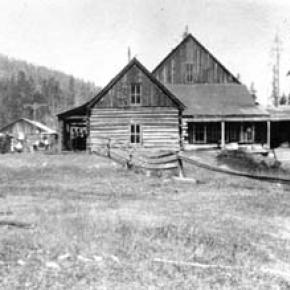
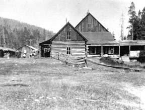
The Millers Build Idlewild

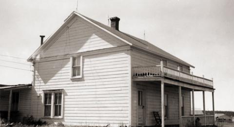
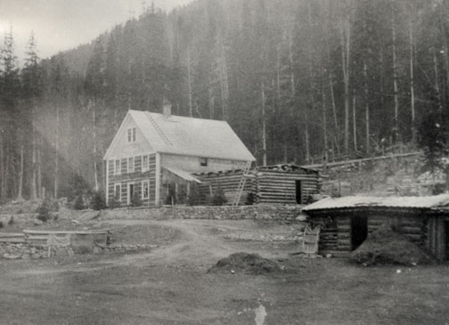
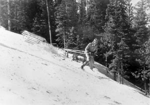
Article contributed by Jean Miller


In June 1946, the C.D. Miller family broke ground for Idlewild Inn in the small village of Hideaway Park, Colorado. Although WWII was over, materials were still very scarce.  What could be obtained locally was bought.  Much was brought from Wichita, Kansas, where the family lived. By 1948, the rustic Inn was up and running.  It had the charm that comes with

the scent of pine wood, cozy fires, hearty food, friendly hosts, and total relaxation.  Sons Elwood and Dwight managed the business, with the vital assistance of parents and friends during the Christmas season and summers.


Elwood married after graduating from college and bit by bit, he gravitated to the teaching world, leaving Dwight to deal with eager guests. Idlewild Inn became a popular spot, especially families for seeking simple vacations.  However, after a few years, the Millers realized that there was developing a desire for more sophisticated lodgings.


About 1952, Dwight and his bride Jean had the opportunity to buy 160 acres of land across the valley, to which was later added 40 acres from a mining claim.  The price was $10,000 and the couple wondered how they ever would pay for it.  Nevertheless, this chance was too good to miss. The property extended far into what is the main portion of town today, across

the railroad, and along both the Fraser and Vasquez Creek.  A pleasant lane wound through the forest from the highway to the creeks and broad meadow.


One step led to another.  Dwight chose one-of-a-kind heavy, 4 foot thick cedar planks for the walls of his new lodge.  He nestled the building into the "vee" of the valley flowing down behind. By Christmas 1957, Dwight and Jean opened by far the finest lodge in the area.  Each bedroom had two double beds and a private bath with ceramic tile, a first in the area.  The first full bar in the lodge was much appreciated by guests on cold nights. A few years later, Dwight built a year-round outdoor swimming pool, the first in the county. (It took as much coal to heat the pool as to heat the lodge itself.)  Guests loved it, for in winter, they came from a day of skiing, jumped into the pool for a swim, ran to the steam room (also a

first), and finally took a snooze before evening festivities began.


Dwight was the first in the area to use a school bus for transportation to and from the ski area and in summer, to take people on trips within and out of the county. The realization grew that a beginners' area close at hand would be a great attraction, especially for mothers who found the trails at Winter Park daunting.  They could bring their children to Ski Idlewild to learn to ski, brush up on their own skiing, and when tired, go into the lodge to

relax or swim.  It took all of two weeks to decide on a Pomagowski double chairlift.  That summer slopes were cleared and groomed, the lift and warming house built, and the area opened in 1960, two years before Winter Park had its first chair lift.  Dwight and Jean even had a fine neon sign at the entry off the highway, one more first.


Saturday races, sponsored by Ski Idlewild and George/Hazel Ferris's Mountain Shop drew droves of youngsters.  About 1961, Dwight introduced ski bicycles, which were hugely popular.  He also started using the first snowmobile for grooming and first aid purposes in the area.


In the meanwhile, Jean was identifying snowshoe and cross-country ski trails through the nearby back country. By 1964, their thoughts were turning to snowmaking, to enhance early skiing.  To this day, people will walk up to the Millers and say, "Oh, Ski Idlewild!  I learned to ski there! Loved it."


As for summer activities, trips to areas of interest, swimming, and horseback rides were standbys.  In addition, the Millers built a small golf course in the meadow and a trout pond at the bridge, which they stocked.


As the Miller children grew, Dwight and Jean found that they wished for more family time together, and when an opportunity to sell the property came along in 1965, they gave up what was a flourishing, solid, and very profitable business, moving to Tabernash to try other challenges. Unfortunately, the new owner was not a good steward and Ski Idlewild

gradually d clined.  An era of exciting innovation came to an end.


Articles to Browse

Topic: Railroads

Train Legends of the Moffat Road

Article contributed by Abbott Fay

The railroaders graded and bridged the trails originally made by the Indians and expanded by the trappers, prospector and stage road builders that following in rapid succession. The

Moffat Road
train track has an almost endless series of wreck stories and legends.  In one, a "green clerk" was said to have piled all the mail order catalogs on the same side of a car, causing the train to leave the tracks and roll down the mountainside into Yankee Doodle Lake.


In another lost train story, the No. 3 westbound was seven hours late out of Denver because of a severe winter blizzard.  It crept out of the Fraser Canyon and whistled for the Granby Crossing.  The engineer parked the train intending to wait till daylight to continue on.  In the meantime, the No. 2 eastbound, 2 days late out of Craig reached Corona without passing the No. 3. In the morning, all were amazed to find the train parked "plumb center" of Granby's main street. Later investigation showed that the No. 3 train left the train tracks just east of Granby and traveled almost a mile over frozen highway.  The next day a Chinook wind came up and melted the frozen soil, sinking the train to it's axles in mud. It required the building of 1500 feet of special track to salvage the train. However, some longtime Granby residents say the locale of this incident was the Kremmling flats.


Sources: Roland L. Ives, Folklore of Middle Park Colorado,Journal of American Folklore, Vol. XXXIV, Nos. 211, 212, 1941; Levette J. Davidson & Forrester Blake, Rocky Mountain Tales, University of Oklahoma Press, 1947


Topic: Mountains

Rollins or Corona - What shall it be called?

Travel across various passes of the Continental Divide occurred long before white men showed up. Indeed, as anthropologist James Benedict wrote c. 1975, some 10,000 years ago, prehistoric Indians camped, hunted, and built hunting walls on the upper reaches of Rollins Pass, as well as moving in and out of Middle Park for the warm summer months.

Historic Indians followed the same paths. In the earliest days of non-Indian access, a particular pass at the head of Boulder Creek was dubbed Boulder Pass. Capt. Jacob Bonesteel, including wagons, made the first recorded crossing by a white man at this point in April 1862. Three years later, a group of Mormons brought wagons over this route and a year later, promoters of new roads into Middle Park brought in many wagons and livestock.

In fact, tourists were starting to enter the park by a number of routes, and one of them, Samuel Bowles, who wrote a fascinating account of his trip, including his return to Denver via Boulder Pass. Interest was growing rapidly for a road over the Divide, into Hot Sulphur Springs, and on into Utah. One promoter, John Quincy Adams Rollins, from New Hampshire, teamed up with William N. Byers and Porter M. Smart to carry this project through. Rollins was interested in crossing the Divide; Byers was promoting the Springs; Porter wanted to develop the valley of the Middle Yampa. All three were pushing to have Middle Park officially named as Grand County, a challenge finally accomplished in 1874. So Rollins and associates started his road, reaching the top in 1873.

That next winter, they publicized this access and in June, Jimmy Crawford brought his family and wagons to Rollinsville and thence to Yankee Doodle Lake, ready to cross the pass now named Rollins Pass by the developer. But the road ended, and they found Rollins' men still hacking the road out of the granite! Jimmy and his crew found it necessary to leave their wagons and help. Finally, on June 10th, the family was able to head for the top. Jimmy borrowed two yokes of oxen, hitching them to mules, and then to his horse. The road was so rough that the procession could proceed but a few feet before having to rest. The family itself climbed on foot. At the summit, they discovered only a rough swath cut down through the trees on the western side. The "road" dropped down between the lakes and followed Ranch Creek to its junction with the Fraser River.

Rollins quickly realized that Berthoud Pass, which also opened in 1874, was superior to his own pass for wheeled vehicles, so he determined to hedge his bets. He initiated the first mail service into the county in 1873. He also built a commodious hotel where his road joined the Berthoud Pass road at the confluence of Crooked Creek and the Fraser. He called it the Junction House. Next, he proposed to the builders of Berthoud Pass that they form a joint ownership of the two roads between Junction Ranch and the Springs. Tickets would be issued for both routes and revenues would be shared. The two companies would build a bridge over the Grand at Hot Sulphur Springs. He even buttered up his rivals by complementing their work. All this was accomplished, although the mail route soon moved to Berthoud Pass, because of the severe winters on Rollins Pass.

The bridge was started in November 1874. From the beginning, Rollins' road was preferred for trailing livestock, because there were fewer problems with heavy timber and bogs. For years, the Church brothers, George and John, who introduced the Hereford breed into the county, trailed their cattle for summering in what became known as Church Park. However, tourists such as Irving Hale still drove wagons over Rollins Pass in 1878. About 1880, interest burgeoned for bringing a railroad up South Boulder Canyon and through a tunnel near Rollins Pass. Numerous surveys were completed all along the area. David Moffat settled on Rollins Pass for the tunnel site but decided first to put a temporary line over the top.

Thus, in the summer of 1903, a formal contract was let for work up and over the Pass itself. By 1904, the workers reached Arrowhead and they also built a work station on top, called Corona Station, or "crown of the mountain." This railroad construction town of Corona, located at over 11,600 feet at the top of Rollins Pass (first called Boulder Pass) along the Continental Divide was the highest railroad station in the world. It became obvious by 1905 that the Corona area would require snowsheds if trains were to travel, even irregularly, during the winter. Still, word got out of the spectacular splendor of Rollins Pass and tourists flocked in on summer train excursions, sometimes stopping on top, sometimes going as far as Arrow.

In 1913, a fine hotel was built next to the rail facilities. Because Rollins Pass was right in the middle of severe weather patterns, a weather station was built on top, as well as one down at Sunnyside. In 1915, Rollins Pass was actually proposed to be the south boundary of a proposed "Estes National Park." Later, on the National Historic Register, the district was listed in 1997 as the Denver, Northwestern and Pacific Railway Historic District--Rollinsville & Middle Park Wagon Road. It was also identified as the Rollinsville and Middle Park Wagon Road; Boulder Wagon Road, Rollins Pass, and Rollinsville area. In 1956, Governor Steve McNichols had presided at the official re-opening of the four percent grade to vehicle traffic over Corona Pass, expressing the hope that the route would someday be paved. The Colorado Game and Fish Department and the U.S. Forest Service made additional improvements, and the Arapaho and Roosevelt National Forests put out a 24-page booklet titled "The Moffat Road: A Self-Guiding Auto Tour."

The road crossed two of the original railroad trestles near Corona but those trestles, even if reached by 4-wheel vehicles, were crumbling and could no longer even be crossed safely on foot. The current self-guided auto tour refers to Rollins Pass, as well as the Moffat Road and the Boulder Wagon Road. Corona Station and Hotel are discussed. In 1979, a portion of the auto road over Corona Pass was permanently closed because of a cave-in of the "Needle's Eye," a tunnel located before the trestles heading west from the Moffat Tunnel's East Portal. The tunnel reopened on July 3, 1988, thanks to efforts of the Rollins Pass Restoration Association on both sides of the Divide, with the cooperation of the U.S. Forest Service, Colorado History Society, and Boulder, Grand, and Gilpin Counties. It then closed once more when another rockfall hit the tunnel on July 15, 1990. The RPRA is continuing its efforts for re-opening. The noted photographer, Charles McClure, took many outstanding photos of the Rollins Pass road.

One, titled "Group on Rollins Pass, shows well-dressed men and women stand on a snowfield making snowballs on Rollins Pass, Moffat Road, Boulder or Grand County, Colorado; probably on Denver, Northwestern and Pacific excursion train. Date: between 1904 and 1913 near Corona Station." Another photo shows a "30 ft. snowcut on Rollins Pass, Moffat Road photo. Denver and Salt Lake Arrow passenger car is parked east of Corona snowshed by the thirty foot snowbank cut, Rollins Pass, Colorado; it shows men, women and railroad employees posed behind train, on the roof and on the snowbank and a standard gauge track. Date: between 1904 and 1915." A sign at the highway turn onto the Moffat roadbed says: The Moffat Road "Hill Route" Also called "Corona Pass Road", this road over the Continental Divide was the original "Hill Route" of the Denver, Northwestern & Pacific Railway built by David H. Moffat in 1903. It crosses Rollins Pass at 11,666 feet elevation. On top of Rollins Pass, a sign says: Elevation 11, 660 feet, John Quincy Adams Rollins established a toll wagon road through this pass in the mid 1870's. David H. Moffat's Denver, Northwestern & Pacific Railway crossed the Continental Divide at this point in 1903.

First known as Boulder Pass, then Rollins Pass, the railroad workers dubbed it "Corona", the crown of the "Top of the world." A railroad station, hotel, restaurant and workers' quarters existed here until 1928 when the railroad was abandoned due to the building of the Moffat Tunnel. Identifications in various trail and geographical guides say: Rollins Pass (el. 11,680 ft) is a high mountain pass in the Rocky Mountains of north-central Colorado in the United States. The pass is located on the continental divide at the crest of the Front Range southwest of Boulder, at the boundary of Grand County, Colorado and Boulder County, Colorado. Rollins Pass (a.k.a. Corona Pass) sits approximately 5 miles east and above the popular ski areas around Winter Park, between Winter Park and Rollinsville. The pass is traversed by an unpaved road, mostly the former roadbed of the Denver and Salt Lake Railway which abandoned the route in 1928 when the Moffat Tunnel opened to replace it. Railroad advertising called this the "Top O' the World" and it referred to the Moffat Route over the continental divide and the Rocky Mountains. Rollins Pass was the primary travel route west from Denver until an easier road over Berthoud Pass was constructed. The Denver, Northwestern and Pacific railroad laid its tracks across the pass in 1903-1904 and established a Depot at Corona on the crest. It can be noted that in R.C. Black's Island in the Rockies, the term "Corona Pass" was mentioned one time, on p. 351; the terms "Corona Station" or "Corona Snowsheds were used. In Dismantling the Rails That Climbed, Rollins Pass was used, the Corona hotel, and just once, Corona Pass; 1936.

In Maggie By My Side, it was Boulder Pass and Rollins Pass. In Rails that Climbed, Rollins Pass, the Corona shed, weather at Corona, Rollins Pass Snow Shed, other references to Corona as a site. In Guide to the Colorado Mountains (Orme) , they speak of the Corona Trail to Rollins Pass. High Country Names (Ward) used Rollins Pass entirely. Only Hiking Grand County, Colorado, published 2002 by Carr speaks of Corona Pass, with reference to Rollins Pass (near the town of Corona), Moffat Road. The term "town" might be questionable; there was only a small restaurant, workers quarters, railroad offices, and in 1913, the hotel. Current maps, USFS and the Grand County Trail Map, show Rollins Pass, with Corona at the side as being a site. The use of "Corona Pass' seems to be a rather recent innovation that has come into being with tourism efforts in the upper Fraser Valley. Rollins Pass From Island in the Rockies p. 45 Rollins Pass was originally known as Boulder Pass, first recorded being crossed by whites, by Capt. Jacob Bonesteel in April 1862. Their supplies were carried in wagons. A second organized party went over the same pass in 1865. In 1866, promoters of access into Grand County brought many wagons and livestock over Boulder Pass.In 1867, Samuel Bowles and a group returned home to Denver via Boulder Pass. In 1873-74, two roads were proposed into the county, one of Berthouds pass and one over Boulder Pass. This was the same time that the county was named "Grand". J..A Rollins and his associates started the road and reached the top of the pass in 1873, at which time they envisaged a road from HSS into Utah. The first wagons went over in June 1874. The western descent was so bad that it never was much patronized by wheeled vehicles, instead becoming primarily used for trailing of cattle. At this time the name Boulder Pass disappeared from maps and Rollins Pass became the official name. p. 85. p. 80 Lots of schemes to build roads into GC, but of all the schemes for transport, only one, the Rollinsville and Middle Park Wagon Road showed any promise. T

hat was designed by John Quincy Adams Rollins, from NH, a gifted promoter, a son of a clergyman, second of 19 children. He was a farmer, miner, freighter, road bulder, and platter of towns. He was perhaps the most accomplished billiard player west of the Mississippi. He was a Colorado resident at least by 1866. His finances were up and down, but he was tremendously strong. In December 1884, when he was 68, he thought nothing of a 3-day snow-clogged crossing of the Continental Divide. p. 85 Rollins was interested in MP as an investor and he was interested in extending his road into Utah.. At the same time, a Porter M. Smart was likewise excited about speculating in frontier projects and was working at developing the valley of the Middle Yampa. William N. Byers was busy planning for HSS. These three men launched at least two petitions, with more than 80 "residents" for creating GC. Grand County was created that year, 1874. p. 89 With the creation of GC, people began to consider the area more seriously. p. 92 There was no official mail into the county until 1873 when Rollins brought in the first US pouch over his pass. In May 1874, he built a commodious hotel at the confluence of Crooked Creek and the Fraser, known as the Junction House. p. 94 Rollins knew that the road over Berthoud Pass was superior to Rollins Pass; his main advantage was the railhead at Blackhawk.

So Rollins proposed a joint ownership and operation of the two roads for the line between Junction Ranch and HSS. Tickets would be issued for both routes and revenues would be shared. The two companies would build a bridge across the Grand at HSS. Rollins even complimented the Berthoud work. This merger was completed soon. p. 104 This bridge was started in November 1874. p. 108 A mail contract was made in July 1875 for once a week delivery over Rollins Pass, but conditions were so severe that the route was changed to Berthoud Pass. p. 110 From the beginning, Rollins Pass was used in preference to Berthoud Pass for trailing livestock, because there were fewer problems with timber and bogs. However, late spring snowdrifts were a problem, so 20-30 horses were often brought along to break trail. The Church brothers, ?George and John, summered their cattle in what became known as Church Park and dug the Church Ditch. They also introduced the celebrated Hereford breed into GC. p. 170-171 As interest in bringing a railroad into and through GC developed, about 1880, various stockholders proposed to build up South Boulder Canyon to Yankee Doodle Lake and start a tunnel near Rollins Pass. Nothing came of the first attempts but by the end of July 1881, numerous surveys had been made for that tunnel. p. 238 Cattle was still being trailed out via Rollins Pass up to the turn of the century. p. 258 David Moffat and Horace Sumner, his chief engineer, in the fall of 1903, were planning the tunnel for future excavation; but in the meantime a temporary line was planned for crissing Rollins Pass, at 11,640 feet. p. 264 A formal contract was let for the work over Rollins Pass in August 1903. The loftiest sections were started first, and the first cuts at the top were nearly finished by the 26th of October and tunneling started at Riflesight Notch. As snow came, work slowed to a standstill. p. 265 Work in 1904 was extremely slow until the end of August.

An encampment was built at Arrowhead and a station at the crest of the Divide was named Corona Station, where long snow sheds were built almost immediately. p. 267 Arrowhead was soon shortened to Arrow, when a post office was opened there in 1905. Travel on the grades, at 4-5% grades up over Rollins Pass was exceedingly difficult. p. 270 In 1908, word of the scenic splendor of Rollins Pass was becoming known world wide. Also, Rollins Pass and its "Corona station" were attracting the attention fo the US Weather Bureau, for the pass lay squarely in the center of the region of heaviest snowfall on the entire Colorado Continental Divide. p. 344 A terrible winter in 1909 made people think that Rollins Pass was never going to be practical for the long term. Time and again freight and passengers were stuck on top at the Corona facility. In 1913, a $10,000 hotel was built at Corona next to the rail facilities. From Dismantling the Rails That Climbed p. 6 The railroad went from Denver to the top of Rollins Pass. p. 8 Snowsheds were built over the tracks at Corona and other strategic places in 1905. p. 12 The top was referred to as "Corona Pass" 1936. p. 16 Crews who were to removed tails and ties reached Corona at the top of Rollins Pass 1936. p. 20 Reference to the Corona hotel From Maggie By My Side p. 1 Jimmy Crawford heard that a man named John Quincy Adams Rollins was building a road over the range at a place called Boulder Pass. 1873 p. 9-14 June 1874 The Crawford family traveled to Rollinsville and then to Yankee Doodle Lake, where the road ended. Rollins' men were still hacking the road out of the granite. Jimmy and his crew helped. On the morning of June 10, the family started out to go over the rocks and up the mountain. Then he borrowed two yokes of oxen to his wagon, then mules, then his horse. The animals had to rest every few feet; the family climbed on foot. There was no shelter at the top. Rollins' men had done no work yet on the west side of the pass except to cut a rough swath down through the trees. The road dropped down along Ranch Creek. From Rails That Climb published 1950 p. 43 Leyden Junction to Tolland to Rollins Pass. P. 63-64 Many references to Tunnels as identifiers of location. p. 76-77, 78 reference to the old Rollins Pass toll road; first mention of the place called Corona- crown of the mountain. Most references are to Rollins Pass. The Corona shed is mentioned, p. 82. p. 83 Sunnyside water stop, Loop Trestle and Tunnel, Ranch Creek Trestle and water stop, Arrow. p. 95, 100- 101 It is eleven miles from Arrowhead to Rollins Pass. Rollins Pass-Boulder wagon road; other references p. 107 - 112 reference to Corona shed. Reference to pipe line to Corona; a number of comments to Rollins Pass p. 119 weather at Corona p. 120-121 Rollins Pass p. 151 Rollins Pass p. 182 photo of "Rollins Pass Snow Shed" "This Corona station burned one night." p. 188 photo of June at Rollins Pass p. 192-194 photos of Corona shed and other buildings; Rollins Pass p. 252 walking on top of snow shed at Corona p. 271- 272. 1910 Snowshed at Corona p. 312-314 Rollins Pass; Rollins Pass snowshed; Corona; Corona siding p. 324 Corona; Sunnyside weather report station p. 326 Corona sheds p. 333-335 Corona shed; references to "Corona" as a place From Guide to the Colorado Mountains published 1974 p. 54-55 Corona Trail, going from East Portal to Rollins Pass From High Country Names published 1972 p. 105 Irving Hale in 1878 drove his wagon over Rollins Pass, now nearly abandoned as a wagon road. p. 131 David Moffat decides to build a temporary line over Rollins Pass. p. 165 In 1915, Rollins Pass was proposed to be the south boundary of a proposed "Estes National Park". From Hiking Grand County, Colorado published 2002 p. 52 Trailhead on the "Moffat Road to Corona Pass". In same paragraph, it becomes Rollins Pass (near the town of Corona). On p. 54, reference to the Corona Road. On p. 57, map shows Rollins Pass with Corona marked as a "site." p. 56, reference to the old railroad bed used crossing the Divide at Rollins Pass, near the town of Corona.

Sometimes called Corona Pass. p. 60-61 Rollins Pass Wagon Road historical notes on JQA Rollins and how to find his wagon road over Rollins Pass, following Ranch Creek to Tabernash. p. 66 Rollins Pass (Corona) to Devil's Thumb From GCHA Journal The Journey p. 6 Rollins Pass used by Indians; comment in 1981 From GCHA Journal Middle Park Indians to 1881 p. 8 Archaic hunters camped in the Rollins Pass area; written mid-1970's The current maps, USFS and Grand County Trail Map, show Rollins Pass with Corona at the side as being a site. The Rollins Pass Restoration Association for many years, and currently, has been trying to open the road and Needles Eye Tunnel. The self-guided auto tour refers to Rollins Pass, as well as the Moffat Road and the Boulder Wagon Road. Corona Station and Hotel are discussed. On the National Historic Register Denver, Northwestern and Pacific Railway Historic District--Rollinsville & Middle Park Wagon Road (Boundary Increase) ** (added 1997 - District - #97001114) Also known as Rollinsville and Middle Park Wagon Road;Boulder Wagon Road;R Rollins Pass, Rollinsville Corona Station and Hotel The railroad construction town of Corona, Colorado, located at over 11,600 feet at the top Corona Pass (first called Boulder Pass) along the Continental Divide was the highest railroad station in the world. It was situated on an old Native American trail, the same trail it is believed the Mormons traveled on their way to Utah. The road was improved by the U.S. Army, then further improved in 1866 by General John Q. Rollins, for whom the pass and the town of Rollinsville were officially named. Because of the high drifts of snow, the pass was only open from around July to the first big snowstorm two or three months later. In 1956, Governor Steve McNichols presided at the official re-opening of the four percent grade to vehicle traffic over Corona Pass, expressing the hope that the route would someday be paved. The Colorado Game and Fish Department and the U.S. Forest Service made additional improvements, and the Arapaho and Roosevelt National Forests put out a 24-page booklet titled "The Moffat Road: A Self-Guiding Auto Tour."

The road crossed two of the original railroad trestles near Corona but those trestles, even if reached by 4-wheel vehicles, are crumbling and can no longer even be crossed safely on foot. In 1979, a portion of the auto road over Corona Pass was permanently closed because of a cave-in of the "Needle's Eye," a tunnel that came before the trestles on a westward drive from the Moffat Tunnel's East Portal area. The tunnel reopened on July 3, 1988, thanks to the efforts of the Rollins Pass Restoration Association with the cooperation of the U.S. Forest Service, Colorado History Society, and Boulder, Grand, and Gilpin Counties. It was then closed once more when another rockfall hit the tunnel on July 15, 1990. John K. Aldrich is a geologist, lecturer, and author whose "Ghosts of . . . " books and accompanying topo maps are a boon to hobbyists, explorers, and those interested in Colorado mining history. Date: 02/04/08 05:13 Rollins Pass Milepost 16 Corona Station. Picture 6 below, is DPL photo X-7388. "Title: Corona, Colorado, interior of snowshed. Summary: Passengers stand next to the covered train depot at Rollins Pass, in Corona (Grand County), Colorado. The tracks of the Denver, Northwestern & Pacific Railway are in the foreground. The depot is constructed of logs, and the roof of the snowshed is upheld by timbers. Sunlight streams through the opening at the end of the snowshed. Date: (between 1904 and 1913). Source: E. T. Bollinger from W. I. Hoklas." Picture 7 below, is DPL photo MCC-454A. "Title: Group on Rollins Pass. Summary: Well dressed men and women stand on a snowfield making snowballs, Rollins Pass, Moffat Road, Boulder or Grand County, Colorado; probably on Denver, Northwestern and Pacific excursion train. Date: (between 1904 and 1913). Creator: Louis Charles McClure 1867-1957. Picture 8 below, is DPL photo MCC-624. "Title: 30 ft. snowcut, Rollins Pass, Moffat Road photo. Summary: Denver and Salt Lake Arrow Turn (passenger car) parked east of Corona snowshed by thirty foot snowbank cut, Rollins Pass, Colorado; shows men, women and railroad employees posed behind train, on roof and on snowbank and standard gauge track. Date: (between 1904 and 1915 The highway sign says The Moffat Road "Hill Route" Also called "Corona Pass Road", this road over the Continental Divide was the original "Hill Route" of the Denver, Northwestern & Pacific Railway built by David H. Moffat in 1903. It crosses Rollins Pass at 11,666 feet elevation. On top of Rollins Pass, a sign says: Rollins Pass Elevation 11, 660 feet John Quincy Adams Rollins established a toll wagon road through this pass in the mid 1860-s. David H. Moffat's Denver, Northwestern & Pacific Railway crossed the Continental Divide at this point in 1903. First known as Boulder Pass, then Rollins Pass, the railroad workers dubbed it "Corona", the crown of the "Top of the world." A railroad station, hotel, restaurant and workers' quarters existed here until 1928 when the railroad was abandoned due to the building of the Moffat Tunnel. Rollins Pass Elevation 11,680 ft (3,560.1 m) Traversed by Unpaved road Location Boulder_County,_Colorado / Grand,Colorado Rollins Pass (el. 11,680 ft) is a high mountain pass in the Rocky Mountains of north-central Colorado in the United States. The pass is located on the continental divide at the crest of the Front Range southwest of Boulder at the boundary of Grand_County,_Colorado and Boulder County. Sign that sits on top of Rollins Pass Rollins Pass (a.k.a. Corona Pass) sits approximately 5 miles east and above the popular ski areas around Winter Park, between Winter Park and Rollinsville. The pass is traversed by an unpaved road, mostly the former roadbed of the Denver and Salt Lake RailwayDenver_and_Salt_Lake_Railway which abandoned the route in 1928 when the Moffat Tunnel opened to replace it. Rollins Pass Railroad advertising called this the "Top 'O the World" and it referred to the Moffat Route over the continental divide and the Rocky Mountains. Rollins Pass was the primary travel route west from Denver until an easier road over Berthoud Pass was constructed. The Denver, Northwestern and Pacific railroad laid its tracks across the pass in 1903-1904 and established a Depot at Corona on the crest. David Moffat planned to replace the "Hill Line" with a tunnel through James Peak within a few years of the railroad construction. However, he never could obtain financing for the tunnel due to the inability of the railroad to make a profit and opposition from competing railroads such as the Denver and Rio Grande. The D&RG saw the line as a threat. But, in the far future the construction of Moffat Tunnel would turn out to be the D&RG's saving grace.

The trip up Rollins Pass was a favorite of summer tourists looking to enjoy the mountain scenery. It was heavily promoted by the railroad with picnic and wildflower picking excursions. Sights along the line were made famous by postcards containing the photos of L. C. McClure. At last the route surmounts the crest of the Continental Divide and takes quick refuge on the top at Corona. At elevation 11, 660 this is truly the famous Top O' the World and one of the highest railroad passes in the world. Due to the great height and nature of the Rocky Mountains, the entire railroad complex was completely enclosed in giant covered snow sheds.

Rowley & Just Homesteads

Karl and Adella Just homesteaded on Pole Creek in the Fraser River Valley in 1896.  Della was the daughter of Henry Lehman, who had, himself, homesteaded on the upper Grand River about 1880.  Karl and Della worked hard, adding to their property until by the late twenties, they had the largest holding in the valley. 

This lovely ranch was where Snow Mountain Ranch is now, and their log home still stands there even today.  Their several children homesteaded in their own rights.  Della and her son Alfred had what is known as the Rowley homestead, (now part of the Y-Camp) as well as what currently is the Winter Park Highlands.  Son Rudy and his wife Clarabelle ranched part of the original Just property on Pole Creek where they watched over his mother.  Another daughter married one of the Daxton boys and their spread was on Crooked Creek.

Until the 1950's, just beyond Tabernash on the north side of the highway at the foot of Winter Park Highlands stood one of the original log homes of this family. In fact, this house appeared in a 1952 movie called "On Dangerous Ground", starring Ida Lupino, Robert Ryan, and Ward Bond.  It was torn down some years later and a modern house built there.

Life was hard for ranching pioneers, perhaps hardest of all for the women, for they worked in the fields and of course, did all the work of the house as well as much of the garden work.  Little Della raked hay during the season, hoed gardens, hauled water, fished, sewed, and cooked.  She was tough.  The bright spots were when rare visitors stopped by, or as the population increased, dances were held in one town or another.

It was a given that the Just home, like those of most pioneers, had no indoor plumbing.  Nobody expected it and nobody complained.  However, by 1957, Della Just was in her nineties.  Karl was long gone.  Her children decided that she should have indoor plumbing after all these years, and they heard that young Dwight Miller had a brand new backhoe.   When they called, Dwight was pleased at the thought of doing such a useful job.

He brought his machine out to the ranch and prepared to get to work.  He discovered, however, that there was disagreement on this bright idea.  Della thought the notion was silly.  "I've lived all these years with an outhouse and I don't see any reason at all to change!"  

Back in those days, temperatures were very much colder than those currently expected.  Forty and fifty degrees below zero were not unusual at all.  But that old lady didn't mind this.  (No doubt, there were chamber pots available for the worst weather.)

Della's children, themselves no longer young, won out, and Dwight dug the trenches and the septic tank hole and laid the pipes.  We never heard whether Della got used to such luxury or not, but we know that Rudy and Clarabelle agreed that moving into the modern world was a good idea!


Topic: Biographies

Lewis D.C. Gaskill

Lewis DeWitt Clinton Gaskill came to Colorado as a polished young mining promoter from upstate New York, where he was born in 1840. He married Miss Nellie C. Rogers in 1865, and raised three daughters born to the marriage.

By 1874 he partnered with William Cushman to build the Georgetown, Empire and Middle Park Wagon Road, which opened in November of that year, to the great surprise of locals and professionals alike.  He and his family lived at the summit of Berthoud Pass into the mid-1880s, when they built the Gaskill House in what became Fraser, CO.   For a short time he was employed as mine foreman at the Wolverine Mine in Bowen Gulch, outside of Grand Lake.  One of the mining camps, in fact, came to be known as Gaskill. Over the years there was significant competition between the different camps, and mercantiles associated with them.  Gaskill's was one of the biggest and best.  Gaskill, the camp, survived for about six years, before falling victim to the end of the mining boom.  In 1896, a county-wide passion for William Jennings Bryan and his Democratic-Populist party, helped to seat Gaskill as democratic chairman of the Board of County Commissioners for Grand County. By 1903, Gaskill came into conflict with D.H. Moffat and the Denver, Northwestern, and Pacific Railway, over property and right-of-way purchases. He, along with Nathan S. Hurd, ended up settling their dispute over property values in County Court. In 1904, upon the death of Fraser postmaster, William Z. Cozens, the Fraser post office was moved to the Gaskill House in Fraser, and L.D.C. Gaskill was appointed postmaster.  Soon after, the townsite was platted and development undertaken under the name of Eastom, but that name was soon forgotten and the area continued to be known as Fraser.

"[Gaskill] was one of those quiet, easy-tempered, efficient persons who can always be depended upon.'" Captain Gaskill (his rank came from service in the Civil War) became "a major Grand County personality."

Topic: Grand County

Grand County Time Line

Prehistoric
7000 BCE to 900 BCE: Paleo Indians  (Yarmony, Rollins Pass, Windy Gap) use Middle Park as summer hunting area

1819 – 1860
1819:Adams-Onis Treaty – Middle Park partitioned – Sites of Granby, Fraser, Grand Lake and Hot Sulphur are in the U.S, Kremmling still part of Spain

Middle Park well known to “Mountain Men” by 1820

1828: Kremmling becomes part of Texas

1837: T.J. Farnham’s expedition crosses the Blue at Grand River

1839: Grand River named on a semi-official map

1842: Rufus B. Sage visit

1844: Captain John C. Fremont’s second expedition, accompanied by Kit Carson, enters Middle Park over Muddy Pass and exits up the Blue River

1854: Sir St. George Gore, an Englishmen, accompanied by Jim Bridger enters Middle Park for hunting expedition

1859: First appearance of prospectors; interest in Hot Sulphur Springs

1861 – 1874
1861: Berthoud crosses Berthoud Pass and traverses Middle Park

1861: Middle Park becomes part of Summit County

1863: Trouble begins between the Utes and white men

1864-1868: Wm. N. Byers acquires Hot Sulphur Springs

1866: Gov. Cummings signs Treaty of Middle Park

1868: John Wesley Powell visits Grand Lake, makes first recorded ascent of Longs Peak

1867: Joseph Westcott settles at Grand Lake

1871-1872: Clarence King surveys area

1873-1874:  F.V. Hayden surveys area

1874: Creation of Grand County (two years before Colorado became a state)

1874: Toll roads opens over Rollins and Berthoud Passes

1874: William H. Jackson, renowned photographer, takes first photographs of Middle Park

1875 – 1888
1875: First mail routes to Hot Sulphur Springs

1875: Silver ore indications in Never Summer Range

1875: First school opens in Hot Sulphur Springs with 12 students, (school “year” was 20 days)

1877: Routt County detached from Grand County

1877: Stokes-Dean political crisis

1878: Tabernash and Abraham Elliott killed

1879: Ute Indian War produces excitement, anxiety

1879: Lulu City & Teller City formed

1880: Gaskill City formed

1881: Four railroad projects frustrated

1881: County Seat moves to Grand Lake, height of mining boom,   Grand Lake Prospector is launched

1883: Commissioner shootings at Grand Lake

1884: Shooting of Texas Charlie in Hot Sulphur Springs

1884: Kremmling formed

1885: Kremmling Post Office opens

1885-1886: Collapse of mining, North Park separates from Grand County

1888: County Seat moves back to Hot Sulphur Springs

1889 – 1904
Expansion of ranching

Development of public education

1890: Grand Ditch construction begins... carries water from Grand Lake mountains to the front range

1891: First platting of Kremmling

1891: Berthoud Pass route becomes state road

1893: Construction begins on Byers Canyon road

1896 et seq.: Organized religious congregations develop

1892: First diversion of water to eastern slope

1898: First high school opens in Kremmling

1902-1904:  Moffat – Harriman struggle

1903: Hot Sulphur Springs incorporates

1904: Kremmling incorporates

1904: Moffat Road crosses Rollins Pass

1904: First motor car arrives Grand County

1904: First telephones installed

1905 – 1914
1905: First Forest Reserves

1905: Fraser develops, Granby is founded

1905: Moffat Road reaches Hot Sulphur Springs

1905: Parshall is founded

1906: Moffat Road reaches Kremmling

Proliferation of competitive newspapers

1905-1908: Heyday of Monarch

1908: Arapaho National Forest established

1911: First Hot Sulphur Springs Winter Carnival

1912: First Middle Park Fair

1913: Eleven motor vehicles are registered in Grand County

1913: Tabernash established as railroad division point

1915 – 1930
1915: Rocky Mountain National Park founded

1917-1918: Participation in World War I by 151 Grand County residents

1918-1919: Influenza epidemic

1919: Grand County Pioneer Society founded

1919: Fall River Road completed

1921: Grand River name changed to Colorado River by U.S. Congress

1922: First radio receiver

1923: Gore Pass opens to motor vehicles

1923: Improved Berthoud Pass road opens

1923-1928: Moffat Tunnel built

1926: Fred Selak murder

1929-1941: The Great Depression

1930-1932: Berthoud kept open all winter

1932: Trail Ridge Road completed

Since 1930
1938: Colorado-Big Thompson irrigation and power project begins

1940: Winter Park Ski Area opens

1941-1945: Participation in WWII

Late 1940s – early 1950s: Construction of Colorado– Big Thompson Project

1947: Adams Tunnel in operation

Growth, then boom, of winter sports


Topic: Mining

Mining

Ghost towns and broken dreams are legacies left by the early miners and prospectors of Grand County. Ever since 1879 when the first mines were staked out and claimed on Bowen Mountain near Grand Lake, “gold and silver fever” grew like an epidemic. Men blinded by greed and prospects of a better tomorrow scrambled to the Kawuneeche Valley with picks and shovels to unearth their fortunes. Women worked just as feverishly along side their men and encampments gave way to mining towns almost overnight. Land offices, eateries, and boarding houses sprouted like wild flowers.

Claim jumping became a common practice, resulting in fights and even murders. Most of these injustices would go unpunished, for no one wanted to risk losing their chance of riches. In Grand County the mother load was a false prophecy, as only small quantities of low grade gold, silver, and lead ore were found. In a few short years, Gaskill, Teller City, and Lulu City, three of the more noted settlements, suffered the same fate as the other boom towns. By 1885 the mining boom had ended in Grand County and ranching had taken it’s place as a sustaining industry.

Topic: Biographies

William H. Kimball

The span crossing the Colorado River on State Highway 9 southeast of Kremmling is known as the Kimball Bridge.  It honors the memory of William H. Kimball who carried the mail over Berthoud Pass from Empire to Hot Sulphur Springs by foot, winter and summer.  Kimball was born in Maine and accepted the Middle Park mail contract in 1875.  Although reportedly nearly blind, Kimball traveled on snowshoes all winter carrying a backpack of mail weighing 70-105 pounds, day and night, at least once a week.

In  1884, Kimball established a flat bottom ferry over the Colorado River near the spot where the bridge now stands.  Before that time, no wagons could cross at that area.  With the addition of the ferry, load of game meat and fish could be taken up the Blue River to be traded for much needed staples. 

Kimball never married and lived at a nearby ranch until his death in 1909.

Rocky Mountain National Park

In 1915, thanks to the efforts of visionary Enos Mills, Rocky Mountain National Park became the 10th national park. The concept was then, and still is, conservation of natural lands and wildlife. No commercial enterprises which consume resources operate within its boundaries--no logging, grazing, farming, mining, hunting or trapping.

Almost all private property in-holdings have been bought by the National Park Service and the buildings destroyed. Located within park boundaries, Longs Peak, at an altitude of 14,256 feet, named for explorer Stephen Long, is visible from both sides of the Continental Divide. Indeed, one can look northwest along 17th Street in Denver, to see one of the area’s best known peaks.

Trail Ridge Road, which runs through the park, was completed in 1932 and is the highest continuous highway in the United States. It is open only in the summer. Dignitaries from the towns of Estes Park and Grand Lake celebrate the opening each year, often but not always by Memorial Day, with a ceremony at the top called “Hands Across the Nation.”

Topic: True Crime

The Selak Hanging

Fred Selak was a descendant of early settlers in Grand County.  He built a cabin three miles south of Grand Lake where he lived alone.  He helped his brothers in various enterprises including mining, a general store and a sawmill.  Selak was known to be a prosperous citizen who lent money to others and there were rumors of hidden cash and gold in his cabin.  He was also known to be an avid coin collector. 

When Selak failed to pick up his mail for several weeks, the postmaster visited his cabin July 26, 1926. After not getting a response to his knocks, the postmaster summoned an employee of Selak's with a key.  When they opened the door, they discovered the cabin in shambles and Selak missing.  Sheriff Mark Fletcher was notified and a nephew of Selak's called in the Denver Police Department. 

As the investigation progressed, a .22 caliber slug was extracted from the wall and blood was found on an easy chair, but further investigation ruled these clues inconsequential as they were dated to many years prior. Sheriff Fletcher conducted a massive manhunt on August 16th and the body of Fred Selak was found on the second day by a deputy's dog.  The body was hanging from a tree and evidence showed that, because of a sloppy knot, Selak did not die quickly of a broken neck but rather suffered a slow strangulation.  The murder had taken place a month earlier and the body had stretched until the feet were touching the ground. 

Arthur Osborn, 22, and his cousin Roy Noakes, 21, became prime suspects after showing off old coins and trying to spend them for minor purchases around Grand Lake.  After interrogation by the Denver Police, both confessed to robbing and killing Selak.  Later, Noakes claimed that the confessions were coerced by the police. 

The suspects were kept in the Denver jail until their trial on March 7, 1927 and Sheriff Fletcher had to take great precautions against a possible lynching.  The only motive for the murder seems to be based on a land dispute years earlier in which Osborn was arrested for a violating fence line.  Both suspects were found guilty and sentenced to death.  After many appeals, the convicted murderers were hung in Canon City on March 30, 1928.  

Topic: Libraries

Grand County Libraries

In 1938, Grand County decided to establish a library to act as a central reservoir of knowledge for its citizens. The community realized that few people can purchase all of the books and other materials which they may need, and so they agreed to pool their money in the library to build its central collection. At the same time they wanted to be sure that their interests would always be represented in the operations of the library, and so they formed a board of trustees from among themselves.

At about the same time, the federated women's clubs in Granby and Grand Lake, for the same reasons, set up lending libraries in those two communities. Run by the clubs for many years, both were eventually incorporated into the County Library.

In 1994, the Committee to Protect the Library was established to petition the Board of Commissioners to increase funding for the library to set aside a completely separate library fund, which would be administered as a Library District. The voters approved the move on November 8, 1994, and Grand County Library District was formed on January 1, 1995.

Today, the library still serves that same basic function for the community as well as new roles acquired in the intervening years.

Community Life