Barney McLean

Community Life Articles

The Rocky Mountain National Park

Poem contributed by Vera Shay, July 2006


Once you've been there

It'll be your most favorite anywhere

The beauty up through the trees

It's bound to please

From May through September

Sights and Sounds you will remember

Deer and moose grazing on meadows so green

All in their splendor to be seen

You will return again and again

In the fall just heat the bugle-call

Of the elegant, determined elk so strong

Choosing his mate to follow him along

Mountain lion and even brown bear are there

They you might hope to only from afar

Or the windows of your car

The Grand Lake Lodge in the park

Cabins looking so cozy and fun

A plan my husband and I to spend the night

We didn't get it done

In the Lodge Restaurant we had dinner

A many a time

With food so fine

My birthday dinner, year after year

With happiness and cheer

Yes this is a park to yourself and your friends you say

I love this park any summer day

The Rocky Mountain national park

For me many memories in this park


The Selak Hanging
The Selak Hanging

Fred Selak was a descendant of early settlers in Grand County.  He built a cabin three miles south of Grand Lake where he lived alone.  He helped his brothers in various enterprises including mining, a general store and a sawmill.  Selak was known to be a prosperous citizen who lent money to others and there were rumors of hidden cash and gold in his cabin.  He was also known to be an avid coin collector. 

When Selak failed to pick up his mail for several weeks, the postmaster visited his cabin July 26, 1926. After not getting a response to his knocks, the postmaster summoned an employee of Selak's with a key.  When they opened the door, they discovered the cabin in shambles and Selak missing.  Sheriff Mark Fletcher was notified and a nephew of Selak's called in the Denver Police Department. 

As the investigation progressed, a .22 caliber slug was extracted from the wall and blood was found on an easy chair, but further investigation ruled these clues inconsequential as they were dated to many years prior. Sheriff Fletcher conducted a massive manhunt on August 16th and the body of Fred Selak was found on the second day by a deputy's dog.  The body was hanging from a tree and evidence showed that, because of a sloppy knot, Selak did not die quickly of a broken neck but rather suffered a slow strangulation.  The murder had taken place a month earlier and the body had stretched until the feet were touching the ground. 

Arthur Osborn, 22, and his cousin Roy Noakes, 21, became prime suspects after showing off old coins and trying to spend them for minor purchases around Grand Lake.  After interrogation by the Denver Police, both confessed to robbing and killing Selak.  Later, Noakes claimed that the confessions were coerced by the police. 

The suspects were kept in the Denver jail until their trial on March 7, 1927 and Sheriff Fletcher had to take great precautions against a possible lynching.  The only motive for the murder seems to be based on a land dispute years earlier in which Osborn was arrested for a violating fence line.  Both suspects were found guilty and sentenced to death.  After many appeals, the convicted murderers were hung in Canon City on March 30, 1928.  

Welcome to Middle Park and Grand County!
Story Contributed by Jean Miller   Sam Conger worked long and hard in 1861, panning for gold along Coon Track Creek east of Colorado¹s Continental Divide; his findings encouraged him to follow the creek on up to 9800’.  Arapahoe Indians of that area told him about their “Treasure Mountain” and when the government moved the Indians out, Sam resolved to explore.  By the summer of 1869, he and five partners had found silver, enough to stake out the Caribou and Conger mines.   A year later, the little town of Caribou was established to house miners that flocked in.  Hopes were high and Caribou City soon had a church, three saloons, a brewery, and a newspaper to provide for the 400 people who lived there.  Eventually, this district produced an estimated $8 million before closing in 1884, enough to give rise to Colorado’s being dubbed the “Silver State.”    The area also became known as “The Place where Winds were Born,” for it was always windy, with plenty of snow to go with it.   In September 1879, nearly the entire town went up in flames.  Among those who lost their homes and belongings were Ben and Laura Simpson. The couple and their children found a place in the budding town of Nederland, where they stayed for six months while they decided what to do.  Although the town was soon rebuilt for a population of 549, the Simpsons weren’t sure they even wanted to remain.  Ben told his wife, “I’m thinking I’m not really cut out to be a miner. I reckon I’d like farming or ranching better.”   Word was that Middle Park, west of the Divide, had fine open meadows, ranch land, and plenty of water.  “That sounds hopeful,” commented Laura.  But how to get there was another question.   To the north no roads existed, all the way to Wyoming.  Indians sometimes entered the Park by way of the Milner Pass area or over Flattop Mountain, but that was a long way from Caribou.  To the south, the Crawford family, in 1874, had used a road of sorts, built by J.Q.A. Rollins; but that too was a long way from Caribou.  Berthoud Pass also had been opened in 1874, but that was even farther to travel, and walking was the only choice the Simpsons had.  As it was, several trips would be necessary to get their meager possessions all moved.   However, Ben had heard of a closer Indian trail that led over Buckhannon Pass (sic).  Simpson knew that there was fairly flat country between Caribou and a branch of St. Vrain Creek, which drained from Buchanan Pass and was closer at hand.  “We’ll go that way,” said Ben. “I figure we can make it one way in a week or so, at least, if we don’t get lost.”   Now, what we call “Buchanan” Pass and Creek today is supposedly named for James Buchanan, the pre-Civil War president, who was also president when Colorado Territory was created.  Be that as it may, early maps of Colorado, including Hayden’s 1877 Atlas, don’t name the pass at all and it’s uncertain if, in fact, this is so.   July was well along when the family packed the first load of their belongings, along with food that wouldn’t spoil. They headed out, the children driving or leading their stock.  Chickens were confined in coops, lashed to horses’ backs and the pigs in crates, to mules.  Progress was not difficult to start with, though it was slow, for Ben often had to scout on ahead.  He had only a very sketchy map and there were no roads to follow. Still, the family was glad to stop a bit and rest and to let the animals graze.  It took most of three days to reach the St. Vrain and locate the rumored Indian trail.   Tall aspens and pines crowded the forest here and the ground vegetation was thick, with large boulders scattered everywhere. “Keep those critters moving,” Simpson told the children.  “Don’t let them wander.  I want to get to the top of the pass today, if we can.”   Pines gradually gave way to moss-festooned spruce, but finally, the faint trail left the forest and opened onto bare, glacially-carved terrain with spectacular views of what today we call Indian Peaks, rugged, with sheer cliffs, surrounded by huge boulders.  Even though t was mid-summer, they met drifts of deep snow as they climbed higher and they had to pick their path through the wet and slop.  The horses and mules plunged and pawed their way through, chickens squawking frantically and pigs grunting uneasily.   The final stretch of the narrow path was steep enough that they had to make several switchbacks up the rock face to the tundra on top, almost 12,000’ high.  A chill wind quickly dried their sweaty faces, and everyone was happy to stop for a breather.    The view was stunning; Sawtooth Mountain towered to the southeast, with its flat summit and sharp drop-offs on three sides.  Alpine grasses and flowers of the most brilliant colors grew between flat lichen-covered boulders atop the crest.  The animals fell to grazing eagerly while the Simpsons looked west towards what would be their new home.  Soon, though, Laura said, “Let’s move on down, Ben.  I¹m getting chilled, and I see a thunderstorm building over that way. I don’t want that to catch us on top here.  They scare me.”   So the little group moved down the easy tundra slope leading northwest, until they spotted the descending trail.  This soon dropped steeply to a bench.  Here and there the spruce forest opened to meadows, soggy with melting snow and filled with little creeks, tarns, and abundant flowers.   Parallel to their route, Buchanan Creek gained momentum as it plunged downward, and whenever the canyon narrowed, the immense amount of water crashed and tumbled over the large boulders, creating a tremendous and frightening roar. “Don’t anybody get near that creek,” cried Ben.  “If you fall in, we’d never get you out!”   When the Simpsons saw that the trail, such as it was, seemed to split, they chose to go right, which seemed more moderate.  “That creek spooks me, with all its noise,” said Laura.   The forest was lodgepoles and aspens now and everyone was pleased when they came to a large, deep lake with boulders surrounding the water’s edge; they heard later this was Gourd Lake.  “Shall we camp here,” suggested Ben? “No,” said the children.  “It’s too wet!”   On they trudged then, down another very steep drop, switchbacking through the trees as well as they were able.  At last, scrambling over unstable, loose rock, they reached the valley where another large stream cascaded down on the left, to join Buchanan Creek. The way eased and the valley gradually opened until finally, to everyone¹s delight, a huge park appeared, with meadows filled with grass turning golden in the summer sun, sparkling streams, and kindly hills surrounding all.  The end of their trek was at hand.   Just then Laura spotted a rider on the far side of the meadow.  The man turned out to be Henry Lehman, a recent homesteader and rancher, one of only three in the area.  “Welcome to Middle Park and to Grand County,” he cried. When he heard who they were and where they had come from, he said, “Stay the night with us.  My wife will be delighted to have company; she sees so few people.”  The Simpsons were overjoyed at such a welcome.   Then Henry added, “You can rest with us a few days and leave your things here until you have fetched your other belongings. We can talk about where you might settle and even help you build a cabin before winter.”  Thus it was that Ben and Laura Simpson found a new home in this green oasis of Middle Park.   Sources: Louisa Ward Arps: High Country Names,GCHA Journals:1982 The Journey 1987 Indians of Middle Park, 1985 Ranching and Ranchers Henry Lehman, Deborah Carr, Hiking Grand CountyTrails and other hiking experts, Robert C. Black III,  Island in the Rockies  &l ;/P>  <
Welcome to the Modern World

Article contributed by Jean Miller

Karl and Adella Just homesteaded on Pole Creek in the Fraser River Valley in 1896.  Della was the daughter of Henry Lehman, who had, himself, homesteaded on the upper Grand River about 1880.  Karl and Della worked hard, adding to their property until by the late twenties, they had the largest holding in the valley. 

This lovely ranch was where Snow Mountain Ranch is now, and their log home still stands there even today.  Their several children homesteaded in their own rights.  Della and her son Alfred had what is known as the Rowley homestead, (now part of the Y-Camp) as well as what currently is the Winter Park Highlands.  Son Rudy and his wife Clarabelle ranched part of the original Just property on Pole Creek where they watched over his mother.  Another daughter married one of the Daxton boys and their spread was on Crooked Creek.

Until the 1950's, just beyond Tabernash on the north side of the highway at the foot of Winter Park Highlands stood one of the original log homes of this family. In fact, this house appeared in a 1952 movie called "On Dangerous Ground", starring Ida Lupino, Robert Ryan, and Ward Bond.  It was torn down some years later and a modern house built there.

Life was hard for ranching pioneers, perhaps hardest of all for the women, for they worked in the fields and of course, did all the work of the house as well as much of the garden work.  Little Della raked hay during the season, hoed gardens, hauled water, fished, sewed, and cooked.  She was tough.  The bright spots were when rare visitors stopped by, or as the population increased, dances were held in one town or another.

It was a given that the Just home, like those of most pioneers, had no indoor plumbing.  Nobody expected it and nobody complained.  However, by 1957, Della Just was in her nineties.  Karl was long gone.  Her children decided that she should have indoor plumbing after all these years, and they heard that young Dwight Miller had a brand new backhoe.   When they called, Dwight was pleased at the thought of doing such a useful job.

He brought his machine out to the ranch and prepared to get to work.  He discovered, however, that there was disagreement on this bright idea.  Della thought the notion was silly.  "I've lived all these years with an outhouse and I don't see any reason at all to change!"  

Back in those days, temperatures were very much colder than those currently expected.  Forty and fifty degrees below zero were not unusual at all.  But that old lady didn't mind this.  (No doubt, there were chamber pots available for the worst weather.)

Della's children, themselves no longer young, won out, and Dwight dug the trenches and the septic tank hole and laid the pipes.  We never heard whether Della got used to such luxury or not, but we know that Rudy and Clarabelle agreed that moving into the modern world was a good idea!
 

What I Got For Christmas by Nicolette Toussaint

It’s December, the tail end of 1959, and I’m hanging onto the back of an Airstream trailer. I have shimmied my ski pants down as far as possible. Now I‘m struggling to keep my balance, trying to keep my new toe-to-thigh cast dry and do my business — the only business that could have forced me out into this sleety, blustery night. The combination of the cast’s weight, the sloppy, slippery snow, the fabric bunched around my knees, and my wobbly attempts to avoid peeing on my underwear overthrow me. I tip over and slide partway beneath the trailer. Now it looks like a very big dog has dug a bathtub-sized hole while using the trailer’s rear corner as a fire hydrant. But dogs are much better at this leg-lifting maneuver than I am. So much for dry underwear.


The day before Christmas, I broke my leg skiing at Winter Park. My parents could have taken me back to Denver — an hour and a half over icy Berthoud Pass, but more since our car is pulling a rented trailer. The better option was to go to Kremmling, an isolated mountain town an hour west of Fraser, a town nicknamed “America’s ice box” because it usually reports the coldest temperature in the country. The clinic in Kremmling was tiny, just a few white rooms. I don’t remember how I fell, just that my ski bindings— the old-fashioned “bear trap” kind rather than the new-fangled, heel-release kind — didn’t let go. My heavy, wood skis torqued my leg, snapping the bone. I do remember the ski patrol bringing me down in a toboggan. I remember my Mom, Myra, sitting in the back seat so she could hold my hand and put my head in her lap during the long drive. My leg screamed every time we went around a corner, and it seemed like it took 50 years. I don’t remember who carried me from the car. But I do remember my pants’ leg being slit up the seam, and I remember being X-rayed by Dr. Ceriani.


I don’t think I will ever forget getting my leg straightened. My Mom and Dr. Ceriani’s nurse held my shoulders while the Doc pulled my shin straight. I screamed bloody murder. After the Doc and his nurse made my cast — layers of plaster-soaked gauze that were wound round and round my cotton-wrapped shin — Dr. Ceriani said it would take a day to harden. It would be best for him to keep an eye on me for awhile. So I stayed in Kremmling while my family went on with their ski vacation. That’s how, at age 9, I wound up spending my first Christmas apart from my family. I had coloring books and puzzles, but no TV. The radio was intermittent. I was feeling kind of sorry for myself, being alone on Christmas and all, until the nurse promised she would visit me. She was from Ireland; I think her name was Kathleen.Sure enough, she came on Christmas Day, bringing a record player and a brown paper bag tied with a red bow. Kathleen put on a ’45 and danced an Irish jig for me. Then she gave me the bag. Inside was a tree made from papier-mâché. It was layered up like my cast, but scalloped and decorated with shiny beads and buttons, and built over an empty mayonnaise jar. When I turned it over, I saw the lid. I unscrewed it, and out fell a small avalanche of Tootsie Rolls, peppermints, and Hershey’s Kisses! I felt loved.


My parents came back in a day or so, of course, and I spent the rest of the family vacation in the Airstream trailer (rented because we couldn’t afford hotels) and in day ski lodges, bored silly, with my right foot propped up on a chair. When I got back to school, I had to gimp to class by way of a somewhat sloping hall with a slippery, speckled stone floor. Try that on crutches! I wasn’t a popular kid, and because of the ski vacation, I’d missed the school Christmas party. But suddenly I was as popular as a Pez dispenser! Everyone in my third-grade class wanted to try out my crutches, carry my coat, and sign my cast. The next fall, I was back skiing, albeit with better skis and new Cubco safety bindings. I didn’t think about my broken leg until decades later.


Fast forward to around 2000. One unusually warm spring day, I walked from the San Francisco office where I worked to a food court in a high-rise on Market Street. As I was looking for a place to eat my Pad Thai, I noticed a photo display on the other side of the lobby. The Knight Foundation, whose programs I sometimes attended, was on the top floor, and they often mounted photo-journalistic shows, so I strolled over. The exhibition was called “The Country Doctor”. A historic collection of photos by W. Eugene Smith, the images had first appeared in Life Magazine in 1948. Stark, black-and-white, and unflinchingly intimate, those photos solidified Eugene Smith's stature as one of the most humane and preeminent photojournalists of the 20th century. Those photos instantly transported me back 50 years, out of sunny San Francisco and back into cold, snowy Kremmling, Colorado.


From the exhibit, I learned that following World War II, a fundraising committee had raised $35,000 to turn the home of the Kremmling’s retiring doctor into a 14-bed hospital, stocking it with as much equipment as they could afford. Some of it was war surplus machinery. The new clinic had an autoclave, an oxygen tent, and an X-ray machine — probably the same one that had revealed the spiral fracture in my right tibia. In 1947, that committee had hired Dr. Ernest Ceriani. Born on a Wyoming sheep ranch and educated in Denver, the young doctor was the only physician in Middle Park, a barren, windswept Rocky Mountain valley above 8,000 feet. His practice spanned 400 square miles. As the photos showed, he was a general practitioner, tending to the dying, delivering babies, cooling fevers, and patching people mangled by farm, ranch, auto, and sports injuries. Injuries like the one I had suffered nearly 50 years before!


With tears pricking my eyes, I realized that I had only been able to walk unaided through the exhibition thanks to the foresight of that 1947 committee in Kremmling, Colorado. I owed a debt of gratitude to a group of people I had never met, people who undoubtedly had passed away long ago. We stand on the shoulders of those who have gone before us. In my case, the “standing” part is literally true. Without the initiative of that committee, there would have been no clinic in Kremmling. Without them, I wouldn’t have been hospitalized for what seemed, at first, to be a sad and lonely Christmas. I wouldn’t have had the experience of nurse Kathleen turning that clinic stay into the most memorable Christmas of my life. And I wouldn’t have been able to stand in tribute to Dr. Ernest Ceriani. While the hula hoops, bikes and Barbies I received as a child have long-since been broken and forgotten, across the miles and years, the gift given to me by that country doctor has remained whole and straight, strong and true.

Who Started the Museum?

Article contributed by Jean Miller


Many years ago, as in the beginning of the 20th century, the early Grand County pioneers worked, socialized, raised families, and developed sturdy towns such as Hot Sulphur Springs.  Many of them gathered information about county citizens, but of all these, probably Daisy Button created the most comprehensive resource over the decades.  Daisy and her brother Horace lived with their parents, Schuyler and Josephine, on a small ranch at the foot of Cottonwood Pass on the east side. Among other things, the family operated the toll gate, collecting fees from travelers going to Hot Sulphur. Eventually the Buttons moved into town and, Later, Daisy, married Charles Jenne.


Daisy was one of those people who had a real feel for what information was the most useful to save for the future.  She collected obituaries (one of the most valuable of all tools for historical reference). She cut out articles on politics, new businesses, town events. She kept

programs, fliers, political announcements, menus, and dance cards.


Then in 1919, the first and second waves of Grand County pioneers created the Pioneer Society.  At first it was mostly a social group, but as the old-timers started to die off more quickly, their children realized they should start keeping records of the settlers and their doings.  Who had a large and extensive set of scrapbooks, telling all about the early days, but Daisy Jenne!


The original Courthouse in Hot Sulphur stood about where the County Jail is now.  When the "new" Courthouse was built, the old building's space became available for the Pioneer Society to use as a museum.  Daisy moved her collection of artifacts over there. Others donated household or personal articles.  So the little museum came to life, with Daisy as its primary caretaker.


There was a core of folks from the area who, over the years, helped her and who took over after she died.  There was John Sheriff, whose mother had homesteaded on the Grand River just east of "Potato Hill", coming from Leadville after her husband died.  John's wife Ida (Marte) was a key person; her family had come from Austria to homestead east of Cottonwood Pass on Eight Mile Creek.  Manny Wood, part of a huge homesteading family on the Williams Fork, pitched in, along with his wife Henrietta (Bode), whose family settled on Corral Creek.  And there was Paul Gilbert, long time head of the Fish and Game Dept. in the county.  Paul was a fine photographer. For many years, he took photos of historical sites and people, and he also reprinted old pictures, all of this for the Pioneer Museum.  If it weren't for Paul, the Grand County Museum would not be able to boast of its very

excellent and extensive collection of photos today.


As Colorado's Centennial Year (1976) approached, Regina Black and her husband Bob thought that there were so many newcomers who were not of pioneer stock, but who were very interested in the history of the area, perhaps a new organization could be formed to accommodate these folks.  Bob had already written Island in the Rockies in 1969, published by the Pioneer Society.  This book basically became the "bible" for county pioneer history.


 So Reggie put notices in the paper, announcing a meeting at their home, to discuss possibilities.  She expected 10 or 15 people maybe.  Some 60-70 showed up!  The need was great.  By this time, a small addition had been built at the rear of the old courthouse, to hold the Hot Sulphur Library.  I was on the library board at that time.  I remember well how the museum collection was growing and the library collection was growing; and we library folks kept encroaching on museum space.  We never came to blows, but we thought about it!


The upshot of Reggie's effort was the creation of the Grand County Historical Association, an umbrella organization intended to support all historical efforts within the county.  The group sought and received a Centennial Grant that allowed them to go to the East Grand School Board and negotiate the transfer of the old school from the school district to the GCHA.  I was on the school board at that time, when we closed that school for lack of students, amidst a huge amount of community flack.  This seemed a good way to accomplish our purpose and also to continue helping out the community. The grant allowed GCHA to moved the old courthouse and the original jail to the new museum grounds.  The Hot Sulphur library was given a tiny space in the "new" courthouse.


I got involved with GCHA about this time, in 1976.  The first day I went over to offer to work, I came in to find Ida and Henrietta coming up from the basement, totally covered in soot.  They were scrubbing out where the old coal furnace had been, to make space suitable for storage.&n sp; I was put to making signs with press-on letters, a job I hated but did for years,

until we got a computer.  I never could get those pesky letters straight and evenly spaced!


Reggie, Ida, Henrietta, and I formed the core exhibits committee in those early years, with John and Mannie furnishing building expertise and Paul furnishing photos.  Over time, many others came to help in many ways ­ Jean Chenoweth, Jan Catlow, Keith Nunn, and later, the George Mitchells, Larry and Jan Gross, and others.


To raise money, one of our best efforts was the Buffalo Barbecue and Flea Market, a hugely successful event until others like the idea and held their own, resulting in major loss to our profits.  We tried other ideas, such as house tours and silent auctions and lectures, with basically the same kind of result.  What the answer is for fund raising is a mystery, for today there are so many activities going on that it is very difficult to come up with something new.  The Endowment Fund is the most effective fund source as nobody else can encroach on that territory.


Winter Carnivals
Winter Carnivals

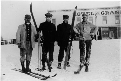
Carl Howelsen, a ski jumping champion in his native Norway, came to Denver to pursue a career as a stonemason in the early years of the 20th Century.  He amused himself and others by demonstrating ski-jumping in the foothills of Denver. 

In 1911, Howelson went to Hot Sulphur Springs, where he taught locals such as Horace Button the art of jumping.  Under Howelson's leadership, the first winter carnival west of the Mississippi Rover was held there on February 10-12.  According to the Middle Park Times, "Never before in the history of the Territory and State of Colorado has such an event even been contemplated, much less held!".

Norwegian immigrants Howelson, Angell Schmidt of Denver and Gunnar Dahles of Williams Fork (Grand County) all staged jumping competitions during the carnival.  There were also skating and tobogganing events and a Grand Ball.  Hot Sulphur Springs continued holding Winter Carnivals annually until World War II, when they were discontinued until the 100th anniversary celebration, called the Grand Winter Sports Carnival scheduled for December 30, 2011-February 11, 2012.

“Rooster” When I Knew Him

By George Mitchell

When I was a very young boy living in Parshall, I was privileged to know one of the most colorful characters of early Grand County history. His name was Henry “Rooster” Wilson. Most of what I remember about “Rooster” has been from his personal contact with my parents and from stories told over and over as the years have gone by.

He was born in Ft. Sill, OK in 1881 of part Cherokee ancestry. Shortly thereafter, the family moved to Ft. Steele, WY. He spent his younger years working as a cow-puncher in Wyoming and Colorado. Rooster claimed to be one of Teddy Roosevelt’s packers when he hunted out of Glenwood Springs.

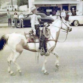
When he came into Middle Park, he rode for the Curtis Ranch on the Williams Fork. Later, he became one of the early game wardens for this area. He always rode a white horse (all his horses and dogs were named Major). Although he never said it, most people thought he used a white horse to be conspicuous so that he didn’t embarrass the local ranchers or his friends by catching them with illegal meat.

One time he rode into the yard at the McMillan ranch (aka the Barney Day ranch about 4 miles west of Parshall on the Colorado River) just at supper time. The women had venison frying on the stove. My mother quickly stuck the meat into the oven and brought out some ham to cook.  Rooster had supper (in those days visitors were always fed), gossiped awhile and started to leave.  As he went out the door, he turned and said, “You can take that meat out of the oven now”, and rode away.

Rooster was one of the best ropers in the area.  Whenever folks had a round-up or worked cattle they asked Rooster to help. I heard him tell about a time he and someone else caught a bear in the open sagebrush on the Company Ranch.  They roped it and with two ropes on it were able to keep it away from the horses. Most horses go crazy around a bear. Like the proverbial “bear by the tail” they couldn’t turn it loose. They finally had to shoot it to get their ropes back.

Rooster couldn’t talk without swearing, but he was a gentle man and, although he never married, he loved kids. At the local dances he was often put in charge of the babies and younger kids while the parents danced.

As automobiles became more popular Rooster got a Dodge touring car. He misjudged one of the turns on the Hot Sulphur Springs/Parshall divide and put the car over the bank.  The turn is nicknamed “Dodge Turn” because several other Dodge cars went off the same turn.

One day I was playing behind the Parshall Hotel, which my parents were running at the time.  There was a good sized post by the well that served as a hitching post. On this day Rooster had been up at the post office and he and his old Dodge came down to the Hotel for lunch. He wasn’t going fast but as he neared the post he reared back on the steering wheel and yelled “Whoa, Dammit.” However, he failed to use the brakes so the car banged into the post.  Neither the post nor the stout old Dodge bumper were hurt, but Rooster snorted and cussed his way to the back door.

His one big fault was alcohol. This was during prohibition, but there was always some available.  When my mother knew Rooster was going to be around she had to hide the vanilla and lemon extract because he would sneak into the cupboard and drink them for the alcohol content.

One of my favorite stories is again while he was an overnight guest at the Hotel. When he stayed overnight he always wanted the room over the kitchen which got a little heat from downstairs. He had gone to bed early and later my father and Ray Black came into the kitchen to get warm and to discuss how to hide the meat from a spike bull they had just poached. They argued awhile and got warm and went out to finish their butchering. When Dad came back in mother told him Rooster was upstairs. Dad always had a guilt complex so he was really sweating. Next morning Rooster came snorting and cussing downstairs for breakfast. All he ever said was, “Gawd, John, you guys sure make a lot of noise down here.”

Rooster had some ground and a nice cabin just west of the Lysander Williams place which is now the Dan Hilty ranch on the Williams Fork. The original road to the ranch crossed Battle Creek about 1/4 mi. above and came down on the west side. The road across the creek was treacherous and one day Rooster only made it as far as a deep Beaver pond in his old Dodge. It took a 4 horse hitch to pull him out of that one.

How did “Rooster” get his nickname? There are two theories. When he was ready to retire to bed after a full day’s work and conversation around the pot-bellied stove, he usually remarked, Well, I guess I’ll go to roost.” The other theory was that while he worked as a wrangler, he was the first to get out of bed so he could round up the horses for the other cow punchers. Then he would roust everybody out of bed at that early hour.

Rooster died in 1934 of natural causes and is buried in the Hot Sulphur Springs Cemetery.


Articles to Browse

Topic: Dude Ranches

Devil's Thumb Ranch

According to local lore, Native Americans named Devil's Thumb, a rocky outcropping that towers high above the Ranch. As legend goes, after the warring Ute and Arapahoe tribes settled their differences in the Ranch Creek Valley, they buried the devil, but left his thumb exposed to remind them of the evils of war.

Before the Trans-Continental Railroad opened up the area in 1904, a stagecoach route from Idlewild (now
Winter Park) joined the Rollins Pass route. A state station was situated east of what is now our Ranch. The road extended transversely over the Ranch where it followed the course of the existing County Road 83. The land was rich agriculturally, and was used for cattle grazing in the early 1900s.

After the railroad was introduced, settlers began moving west in search of wealth and opportunity. Many ended their journeys in the
Rocky Mountains. During this time, there were more people living in the Fraser Valley than there are today. One favorite hangout of the railroad workers was a dance hall on Black Ranch, located immediately north of Devil's Thumb Ranch.

In the 1930s, Margaret Radcliff built the original Ranch homestead and operated it as a dairy. However, it was brothers Dan, Louis, and George Yager who started Devil's Thumb Ranch as a vacation property in 1946. The Yagers incorporated the Radcliff homestead in to the Ranch facilities and the original building exists today as the Ranch House Saloon.

The Yagers operated Devil's Thumb Ranch as both a working ranch and dude ranch until 1972. They introduced cross-country skiing in the winter of 1975-1976. Dick Taylor, a 1964 Olympic cross-country team member, designed 35 kilometers of the area's Nordic trails.

The Ranch was well known as a Nordic destination, but one without many amenities or niceties. The current owners purchased it in 2001, saving it from a group of developers who planned to fill the valley with residences and a golf course. They immediately began making improvements to the facilities, all the while impacting the land as little as possible.

Topic: Biographies
Ute Bill Thompson, Ute Chief Piah

Ute Bill Thompson

Ute Bill Thompson, Ute Chief Piah

William Jefferson (Wm./W.J./Bill) Thompson was born on March 26, 1849 in Aurora Township, Preston County, Virginia (1863-West Virginia). The 8th child of 9 children of Wm. & Mary Anne (Wotring) Thompson. His father was a shoemaker at the Wotring Tannery and died in 1853. Mrs. Thompson left Preston County in September 1859 with her children on a covered wagon for Oregon. They arrived at St. Charles, Iowa around Christmas, settling at New Virginia, joining other relatives.

Wm. may have been taken captive by Native Americans prior to entering Colorado Territory. Via ox cart he came to Central City to start mining in 1865. He ventured into adjacent Middle Park, seeking gold in the Troublesome Valley, supplied with 1 ton of flour. He spent four years as a postal carrier from Hot Sulphur Springs to Steamboat Springs, using the Gore Pass route.

Once, the Ute Indians saw him baking biscuits and they enjoyed the “beescuts” until the flour ran out. An altercation left Wm. severely beaten. He made his way to Georgetown and the miners denied him entry, thinking he was a crazy man. One kind miner gave Wm. canvas for clothing, and took him to Idaho Springs. He recovered and was employed as a shoemaker.

Wm. re-entered Middle Park, built a hunting cabin on Muddy Creek ready for the 1867 winter. Chief Yarmonite led 40 Ute men, women and children to Wm’s cabin explaining to him that the Gore Range was covered with snow, and they were in need of food. This time Wm. refused. A rifle match was agreed upon with the loser put to death. Wm. threw his sombrero to the ground as his hair fell to his shoulders. A cry of the Ute went up as they recognized Wm. from the Troublesome. Sub-chief Piah told Wm. they could not fight a Ute brother, and braided Wm’s hair and applied face paint as they were at war with the Arapahoes. A hunt for bison began. Shooting was heard with the thought the Arapahoes arrived. Len Pollard & Sandy Mellon were chasing buffalo, which Wm. shot and killed. Len & Sandy confronted the supposed Ute with Len asking, “Where did you get Bill Thompson’s Winchester rifle?” Wm. played along until Sandy aimed his rifle on Wm. who wisely said, “Don’t over reach yourself, Sandy.” Sandy demanded, “Who in the hell are you!” Bill laughed and told them he was Bill Thompson. The sobriquet of “Ute Bill” was given. Wm. preferred his nick name over his legal name.

Ute Bill carried on as a mountaineer. Hunting and trapping, taking wild game to the Georgetown & Denver markets selling the meat, until laws prohibited the practice. A new career began of driving stagecoaches and freight wagons for the Colorado Stage Company on the Georgetown, Empire & Middle Park Wagon Road, over Berthoud Pass to Grand Lake, Hot Sulphur Springs, Gore Pass, and occasionally Steamboat Springs. One day on Cottonwood Pass, Ute Bill stopped and hiked over a ridge to find 400 Ute tipis on a meadow, imaging this could be a ranch. He homesteaded acreage, bought the home ranch from Al Honscome, and through marriage owned 4000 acres.

The T Lazy S brand was patented. The Thompson Ranch was the 1st in Middle Park allowed to receive water from the Grand (Colorado) River for irrigation. Ute Bill Creek and Ute Bill Ditch 1 & 2 were also patented. Middle Park became Grand County of February 2, 1874. Ute Bill was on the first jury, appointed Road Supervisor, and a delegate to the state Democrat Party Convention. In 1879 he owned Thompson’s Billiard Hall, bought a store from John Kinsey and expanded it into Ute Bill’s Saloon in Hot Sulphur Springs. He also had a game park of tame antelope, deer, and elk.

The “Texas Charley” incident of December 5, 1884 began at the saloon when Texas Charley forced Ute Bill to hand over his prized Winchester rifle. His future father in law played a role in the coroner’s inquest. January 30, 1889 The Middle Park Times listed the sale of the saloon to Billy Pharo with the quote of, “We don’t reach Denver yet but were getting there you see.” An ad in Hot Sulphur Springs complemented the sale.

On December 25, 1893 Ute Bill Tompson was united in marriage to Mabel Smith. The first recorded marriage in the Hot Sulphur Springs Congregational Community Church. Mabel was the eldest daughter of Preston Henry & the late Mary Smith. Ute Bill & Mabel had 6 children Fred Charles, William Preston, John Henry, Otto Woodring, Marion Loman, and Mary Ellen. W.J. Thompson advertised in the Grand County News, January 8, 1904 Sulphur Springs and Kremmling Stage Carries Mail & Express Stage Fare, One Way $1.50 Round Trip, $2.75 In 1903-1904 The Denver, Northwestern & Pacific Railroad (D.N.P.R.R.) was buying ranchers land. Ute Bill refused to sell his for $500 and lost on appeal in District Court receiving $300. However, it was “matter of principal” that he won on, as E.A. Meredith the railroad surveyor diverted the rail bed to be placed on the other side of the Colorado River below the cliffs.

As the excursion trains were passing by the Thompson Ranch on their way to the Railroad Days celebration in Hot Sulphur Springs on September 15, 1905 Ute Bill danced with joy knowing that the “Iron Horse” was NOT allowed to disturb the sacred tipi grounds of the Utes! Ute Bill forgot his grievances and presided over a vast fish fry and barbeque of elk on July 4, 1906. The last cattle trail drive out of Grand County was conducted by 2 aged pioneers, Sam Martin of Muddy Creek, and Ute Bill in 1923. Another matter of principal to avoid paying railroad costs, but of great sentimental value of all the past cattle trail drives. Ute Bill & Mabel both entered St. Luke’s Hospital in Denver for surgery in late February 1926. Ute Bill’s first surgery went well, the second did not. Mabel was not able to be with him as she was recovering from her own.

Many Middle Park pioneers visited them to wish them well. Old friend Charles Nines Sr. who retired in Denver from Pine Ridge Agency, South Dakota a Sioux language interpreter and Trading Post owner was with Ute Bill when he passed away on March 19, 1926, one week shy of his 77th birthday. William Jefferson “Ute Bill” Thompson is buried in the Hot Sulphur Springs Cemetery off of Cottonwood Pass, Looking at Elk Mountain and the original homestead.

This article is dedicated to Lorna Marie Gowen; September 6, 1954-April 14, 2006

Schools

Article contributed by Betty Jo Woods

The first official school in Grand County was founded in 1875 in Hot Sulphur Springs in a crude dugout. The school met for twenty days and a painting of the classroom shows nine students in attendance. Typically the woman teachers of that era would have earned about $25 per month. 

One report to the Colorado State Department of Education said, “The school secretary left during the Indian uprising and no school records are available.” This school was presumed to be at Hot Sulphur Springs.

In the 1890s school was not held every year in Grand Lake because not enough taxes were raised to pay for a teacher. The school year was generally April through October and classes were held in various vacant buildings for many years. The first schoolhouse in Grand Lake was built in 1910 and remained a one-teacher school until 1935. 

A notice published in the Middle Park Times on january 31, 1889 annouce that a masquerade ball and supper of "beef steer and chickens" would be held on February 14th to raise money to build a school.    

In 1898, the offerings were expanded to include the first experimental high school curriculum to be offered in the county. As towns were developed, several rural one-room schools also came into existence. Many schools were taught only during the summer because winter travel was too difficult.

At one time there were nineteen school districts. In 1958 the County was reorganized into two school districts, with the result that today there are two high schools, two middle schools, four elementary schools, one charter school, one alternative school, and one private Christian school in Grand County.

Sources:
R.C. Black, Island in The Rockies. Pruett Publishing Company, 1969
Colorado State Department of Education, First Formal Biennial Report of Superintendent of Public Instruction for State of Colorado. Denver, Colorado: Daily Times Printing House, 1879

McQueary Family of Middle Park

It has been said that if you walk down the streets of Hot Sulphur Springs and call out "Hello McQueary" at any given time, someone will respond.  Certainly one of the most prolific families to pioneer the Middle Park, the McQueary clan consisted of Scotch-Irish descendents of the immigrants who had settled in the mountainous regions of the Ozarks and the Blue Ridge Mountains.

Henry McQueary and his brother Humphrey, visited the Middle Park area in 1866 while prospecting for gold on Troublesome Creek.  Henry built a cabin on the creek in 1875 and other relatives came to settle including Walker, James, John and George, along with their families.  The families settled near Hot Sulphur Springs and as far west as Muddy Creek and the Gore Canyon.

In 1875, Henry found a Ute Indian with a broken leg near the Troublesome Creek.  He took the man to his cabin and splinted the leg.  After three weeks, the injury healed enough that the Ute could return to his family and that created a friendship that outlasted the Ute uprisings of 1878-1879.

In 1888, Fount McQuearly established a hotel in Hot Sulphur Springs which included a 45 foot ballroom in the Antlers Saloon.  In his later life, he served as County Commissioner (1924).  Many other McQuearys also went into politics, so much so that they were sometimes referred to as the "McQueary Gang".     

"Uncle Walk" McQueary once said that if Andy Eairheart "ever fell into the river and drowned, we'd have to look for his body upstream 'cause he's too stubborn to float downstream!".

Dick McQueary was quite enterprising, establishing a store in Hot Sulphur Springs (1904) and helping newcomers to the area locate homestead sites.  He once was paid with a barrel of china for his services.  Dick also was a contractor for building and maintenance for Grand County and he led the effort to build a road through Rocky Mountain National Park.  This road was eventually finished in 1920 and is known as the Fall River Road.

At least three McQuearys served their country in World War I and fifteen in World War II.  They were also noted athletes; at the 1924 Hot Sulphur Springs Winter Carnival, Margaret McQueary won first place in girls jumping and ski-joring while Milton won first in boys cross country.  

Eventually the McQuearys had over a dozen ranches in Middle Park.


Topic: Mountains

Rollins or Corona - What shall it be called?

Travel across various passes of the Continental Divide occurred long before white men showed up. Indeed, as anthropologist James Benedict wrote c. 1975, some 10,000 years ago, prehistoric Indians camped, hunted, and built hunting walls on the upper reaches of Rollins Pass, as well as moving in and out of Middle Park for the warm summer months. Historic Indians followed the same paths. In the earliest days of non-Indian access, a particular pass at the head of Boulder Creek was dubbed Boulder Pass.

Capt. Jacob Bonesteel, including wagons, made the first recorded crossing by a white man at this point in April 1862. Three years later, a group of Mormons brought wagons over this route and a year later, promoters of new roads into Middle Park brought in many wagons and livestock. In fact, tourists were starting to enter the park by a number of routes, and one of them, Samuel Bowles, who wrote a fascinating account of his trip, including his return to Denver via Boulder Pass.

Interest was growing rapidly for a road over the Divide, into Hot Sulphur Springs, and on into Utah. One promoter, John Quincy Adams Rollins, from New Hampshire, teamed up with William N. Byers and Porter M. Smart to carry this project through. Rollins was interested in crossing the Divide; Byers was promoting the Springs; Porter wanted to develop the valley of the Middle Yampa. All three were pushing to have Middle Park officially named as Grand County, a challenge finally accomplished in 1874.

So Rollins and associates started his road, reaching the top in 1873. That next winter, they publicized this access and in June, Jimmy Crawford brought his family and wagons to Rollinsville and thence to Yankee Doodle Lake, ready to cross the pass now named Rollins Pass by the developer. But the road ended, and they found Rollins' men still hacking the road out of the granite! Jimmy and his crew found it necessary to leave their wagons and help.

Finally, on June 10th, the family was able to head for the top. Jimmy borrowed two yokes of oxen, hitching them to mules, and then to his horse. The road was so rough that the procession could proceed but a few feet before having to rest. The family itself climbed on foot. At the summit, they discovered only a rough swath cut down through the trees on the western side. The "road" dropped down between the lakes and followed Ranch Creek to its junction with the Fraser River. Rollins quickly realized that Berthoud Pass, which also opened in 1874, was superior to his own pass for wheeled vehicles, so he determined to hedge his bets. He initiated the first mail service into the county in 1873. He also built a commodious hotel where his road joined the Berthoud Pass road at the confluence of Crooked Creek and the Fraser. He called it the Junction House. Next, he proposed to the builders of Berthoud Pass that they form a joint ownership of the two roads between Junction Ranch and the Springs. Tickets would be issued for both routes and revenues would be shared. The two companies would build a bridge over the Grand at Hot Sulphur Springs. He even buttered up his rivals by complementing their work.

All this was accomplished, although the mail route soon moved to Berthoud Pass, because of the severe winters on Rollins Pass. The bridge was started in November 1874. From the beginning, Rollins' road was preferred for trailing livestock, because there were fewer problems with heavy timber and bogs. For years, the Church brothers, George and John, who introduced the Hereford breed into the county, trailed their cattle for summering in what became known as Church Park. However, tourists such as Irving Hale still drove wagons over Rollins Pass in 1878.

About 1880, interest burgeoned for bringing a railroad up South Boulder Canyon and through a tunnel near Rollins Pass. Numerous surveys were completed all along the area. David Moffat settled on Rollins Pass for the tunnel site but decided first to put a temporary line over the top. Thus, in the summer of 1903, a formal contract was let for work up and over the Pass itself. By 1904, the workers reached Arrowhead and they also built a work station on top, called Corona Station, or "crown of the mountain." This railroad construction town of Corona, located at over 11,600 feet at the top of Rollins Pass (first called Boulder Pass) along the Continental Divide was the highest railroad station in the world.

It became obvious by 1905 that the Corona area would require snowsheds if trains were to travel, even irregularly, during the winter. Still, word got out of the spectacular splendor of Rollins Pass and tourists flocked in on summer train excursions, sometimes stopping on top, sometimes going as far as Arrow. In 1913, a fine hotel was built next to the rail facilities. Because Rollins Pass was right in the middle of severe weather patterns, a weather station was built on top, as well as one down at Sunnyside. In 1915, Rollins Pass was actually proposed to be the south boundary of a proposed "Estes National Park."

Later, on the National Historic Register, the district was listed in 1997 as the Denver, Northwestern and Pacific Railway Historic District--Rollinsville & Middle Park Wagon Road. It was also identified as the Rollinsville and Middle Park Wagon Road; Boulder Wagon Road, Rollins Pass, and Rollinsville area. In 1956, Governor Steve McNichols had presided at the official re-opening of the four percent grade to vehicle traffic over Corona Pass, expressing the hope that the route would someday be paved. The Colorado Game and Fish Department and the U.S. Forest Service made additional improvements, and the Arapaho and Roosevelt National Forests put out a 24-page booklet titled "The Moffat Road: A Self-Guiding Auto Tour." The road crossed two of the original railroad trestles near Corona but those trestles, even if reached by 4-wheel vehicles, were crumbling and could no longer even be crossed safely on foot. The current self-guided auto tour refers to Rollins Pass, as well as the Moffat Road and the Boulder Wagon Road. Corona Station and Hotel are discussed. In 1979, a portion of the auto road over Corona Pass was permanently closed because of a cave-in of the "Needle's Eye," a tunnel located before the trestles heading west from the Moffat Tunnel's East Portal.

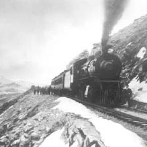
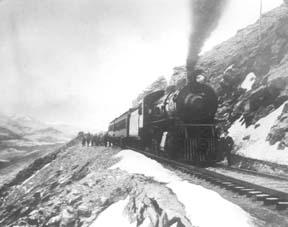
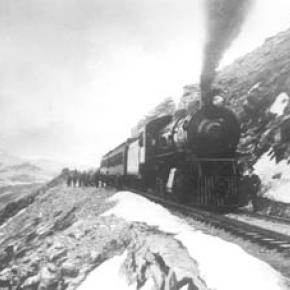
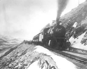
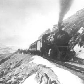
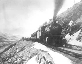
The tunnel reopened on July 3, 1988, thanks to efforts of the Rollins Pass Restoration Association on both sides of the Divide, with the cooperation of the U.S. Forest Service, Colorado History Society, and Boulder, Grand, and Gilpin Counties. It then closed once more when another rockfall hit the tunnel on July 15, 1990. The RPRA is continuing its efforts for re-opening. The noted photographer, Charles McClure, took many outstanding photos of the Rollins Pass road. One, titled"Group on Rollins Pass, shows well-dressed men and women stand on a snowfield making snowballs on Rollins Pass, Moffat Road, Boulder or Grand County, Colorado; probably on Denver, Northwestern and Pacific excursion train. Date: between 1904 and 1913 near Corona Station." Another photo shows a "30 ft. snowcut on Rollins Pass, Moffat Road photo. Denver and Salt Lake Arrow passenger car is parked east of Corona snowshed by the thirty foot snowbank cut, Rollins Pass, Colorado; it shows men, women and railroad employees posed behind train, on the roof and on the snowbank and a standard gauge track. Date: between 1904 and 1915."

A sign at the highway turn onto the Moffat roadbed says: The Moffat Road "Hill Route" Also called "Corona Pass Road", this road over the Continental Divide was the original "Hill Route" of the Denver, Northwestern & Pacific Railway built by David H. Moffat in 1903. It crosses Rollins Pass at 11,666 feet elevation. On top of Rollins Pass, a sign says: Elevation 11, 660 feet, John Quincy Adams Rollins established a toll wagon road through this pass in the mid 1870's. David H. Moffat's Denver, Northwestern & Pacific Railway crossed the Continental Divide at this point in 1903. First known as Boulder Pass, then Rollins Pass, the railroad workers dubbed it "Corona", the crown of the "Top of the world." A railroad station, hotel, restaurant and workers' quarters existed here until 1928 when the railroad was abandoned due to the building of the Moffat Tunnel. Identifications in various trail and geographical guides say: Rollins Pass (el. 11,680 ft) is a high mountain pass in the Rocky Mountains of north-central Colorado in the United States. The pass is located on the continental divide at the crest of the Front Range southwest of Boulder, at the boundary of Grand County,Colorado and Boulder County, Colorado. Rollins Pass (a.k.a. Corona Pass) sits approximately 5 miles east and above the popular ski areas around Winter Park, between Winter Park and Rollinsville. The pass is traversed by an unpaved road, mostly the former roadbed of the Denver and Salt Lake Railway which abandoned the route in 1928 when the Moffat Tunnel opened to replace it. Railroad advertising called this the "Top O' the World" and it referred to the Moffat Route over the continental divide and the Rocky Mountains.

Rollins Pass was the primary travel route west from Denver until an easier road over Berthoud Pass was constructed. The Denver, Northwestern and Pacific railroad laid its tracks across the pass in 1903-1904 and established a Depot at Corona on the crest. It can be noted that in R.C. Black's Island in the Rockies, the term "Corona Pass" was mentioned one time, on p. 351; the terms "Corona Station" or "Corona Snowsheds were used. In Dismantling the Rails That Climbed, Rollins Pass was used, the Corona hotel, and just once, Corona Pass; 1936. In Maggie By My Side, it was Boulder Pass and Rollins Pass. In Rails that Climbed, Rollins Pass, the Corona shed, weather at Corona, Rollins Pass Snow Shed, other references to Corona as a site. In Guide to the Colorado Mountains (Orme) , they speak of the Corona Trail to Rollins Pass. High Country Names (Ward) used Rollins Pass entirely. Only Hiking Grand County, Colorado, published 2002 by Carr speaks of Corona Pass, with reference to Rollins Pass (near the town of Corona), Moffat Road. The term "town" might be questionable; there was only a small restaurant, workers quarters, railroad offices, and in 1913, the hotel. Current maps, USFS and the Grand County Trail Map, show Rollins Pass, with Corona at the side as being a site.

The use of "Corona Pass' seems to be a rather recent innovation that has come into being with tourism efforts in the upper Fraser Valley. Rollins Pass From Island in the Rockies p. 45 Rollins Pass was originally known as Boulder Pass, first recorded being crossed by whites, by Capt. Jacob Bonesteel in April 1862. Their supplies were carried in wagons. A second organized party went over the same pass in 1865. In 1866, promoters of access into Grand County brought many wagons and livestock over Boulder Pass.In 1867, Samuel Bowles and a group returned home to Denver via Boulder Pass. In 1873-74, two roads were proposed into the county, one of Berthouds pass and one over Boulder Pass. This was the same time that the county was named "Grand". J..A Rollins and his associates started the road and reached the top of the pass in 1873, at which time they envisaged a road from HSS into Utah. The first wagons went over in June 1874. The western descent was so bad that it never was much patronized by wheeled vehicles, instead becoming primarily used for trailing of cattle. At this time the name Boulder Pass disappeared from maps and Rollins Pass became the official name. p. 85. p. 80 Lots of schemes to build roads into GC, but of all the schemes for transport, only one, the Rollinsville and Middle Park Wagon Road showed any promise. That was designed by John Quincy Adams Rollins, from NH, a gifted promoter, a son of a clergyman, second of 19 children. He was a farmer, miner, freighter, road bulder, and platter of towns. He was perhaps the most accomplished billiard player west of the Mississippi. He was a Colorado resident at least by 1866. His finances were up and down, but he was tremendously strong. In December 1884, when he was 68, he thought nothing of a 3-day snow-clogged crossing of the Continental Divide. p. 85 Rollins was interested in MP as an investor and he was interested in extending his road into Utah.

At the same time, a Porter M. Smart was likewise excited about speculating in frontier projects and was working at developing the valley of the Middle Yampa. William N. Byers was busy planning for HSS. These three men launched at least two petitions, with more than 80 "residents" for creating GC. Grand County was created that year, 1874. p. 89 With the creation of GC, people began to consider the area more seriously. p. 92 There was no official mail into the county until 1873 when Rollins brought in the first US pouch over his pass. In May 1874, he built a commodious hotel at the confluence of Crooked Creek and the Fraser, known as the Junction House. p. 94 Rollins knew that the road over Berthoud Pass was superior to Rollins Pass; his main advantage was the railhead at Blackhawk. So Rollins proposed a joint ownership and operation of the two roads for the line between Junction Ranch and HSS. Tickets would be issued for both routes and revenues would be shared. The two companies would build a bridge across the Grand at HSS. Rollins even complimented the Berthoud work. This merger was completed soon. p. 104 This bridge was started in November 1874. p. 108

A mail contract was made in July 1875 for once a week delivery over Rollins Pass, but conditions were so severe that the route was changed to Berthoud Pass. p. 110 From the beginning, Rollins Pass was used in preference to Berthoud Pass for trailing livestock, because there were fewer problems with timber and bogs. However, late spring snowdrifts were a problem, so 20-30 horses were often brought along to break trail. The Church brothers, George and John, summered their cattle in what became known as Church Park and dug the Church Ditch. They also introduced the celebrated Hereford breed into GC. p. 170-171 As interest in bringing a railroad into and through GC developed, about 1880, various stockholders proposed to build up South Boulder Canyon to Yankee Doodle Lake and start a tunnel near Rollins Pass. Nothing came of the first attempts but by the end of July 1881, numerous surveys had been made for that tunnel. p. 238 Cattle was still being trailed out via Rollins Pass up to the turn of the century. p. 258

David Moffat and Horace Sumner, his chief engineer, in the fall of 1903, were planning the tunnel for future excavation; but in the meantime a temporary line was planned for crissing Rollins Pass, at 11,640 feet. p. 264 A formal contract was let for the work over Rollins Pass in August 1903. The loftiest sections were started first, and the first cuts at the top were nearly finished by the 26th of October and tunneling started at Riflesight Notch. As snow came, work slowed to a standstill. p. 265 Work in 1904 was extremely slow until the end of August. An encampment was built at Arrowhead and a station at the crest of the Divide was named Corona Station, where long snow sheds were built almost immediately. p. 267 Arrowhead was soon shortened to Arrow, when a post office was opened there in 1905. Travel on the grades, at 4-5% grades up over Rollins Pass was exceedingly difficult. p. 270 In 1908, word of the scenic splendor of Rollins Pass was becoming known world wide.

Also, Rollins Pass and its "Corona station" were attracting the attention fo the US Weather Bureau, for the pass lay squarely in the center of the region of heaviest snowfall on the entire Colorado Continental Divide p. 344 A terrible winter in 1909 made people think that Rollins Pass was never going to be practical for the long term. Time and again freight and passengers were stuck on top at the Corona facility. In 1913, a $10,000 hotel was built at Corona next to the rail facilities. From Dismantling the Rails That Climbed p. 6 The railroad went from Denver to the top of Rollins Pass. p. 8 Snowsheds were built over the tracks at Corona and other strategic places in 1905. p. 12 The top was referred to as "Corona Pass" 1936. p. 16 Crews who were to removed tails and ties reached Corona at the top of Rollins Pass 1936. p. 20 Reference to the Corona hotel From Maggie By My Side p. 1 Jimmy Crawford heard that a man named John Quincy Adams Rollins was building a road over the range at a place called Boulder Pass. 1873 p. 9-14 June 1874

The Crawford family traveled to Rollinsville and then to Yankee Doodle Lake, where the road ended. Rollins' men were still hacking the road out of the granite. Jimmy and his crew helped. On the morning of June 10, the family started out to go over the rocks and up the mountain. Then he borrowed two yokes of oxen to his wagon, then mules, then his horse. The animals had to rest every few feet; the family climbed on foot. There was no shelter at the top. Rollins' men had done no work yet on the west side of the pass except to cut a rough swath down through the trees. The road dropped down along Ranch Creek. From Rails That Climb published 1950 p. 43 Leyden Junction to Tolland to Rollins Pass. P. 63-64 Many references to Tunnels as identifiers of location. p. 76-77, 78 reference to the old Rollins Pass toll road; first mention of the place called Corona- crown of the mountain. Most references are to Rollins Pass. The Corona shed is mentioned, p. 82. p. 83 Sunnyside water stop, Loop Trestle and Tunnel, Ranch Creek Trestle and water stop, Arrow. p. 95, 100- 101 It is eleven miles from Arrowhead to Rollins Pass. Rollins Pass-Boulder wagon road; other references p. 107 - 112 reference to Corona shed. Reference to pipe line to Corona; a number of comments to Rollins Pass p. 119 weather at Corona p. 120-121 Rollins Pass p. 151 Rollins Pass p. 182 photo of "Rollins Pass Snow Shed" "This Corona station burned one night." p. 188 photo of June at Rollins Pass p. 192-194 photos of Corona shed and other buildings; Rollins Pass p. 252 walking on top of snow shed at Corona p. 271- 272. 1910 Snowshed at Corona p. 312-314 Rollins Pass; Rollins Pass snowshed; Corona; Corona siding p. 324 Corona; Sunnyside weather report station p. 326 Corona sheds p. 333-335 Corona shed; references to "Corona" as a place From Guide to the Colorado Mountains published 1974 p. 54-55 Corona Trail, going from East Portal to Rollins Pass From High Country Names published 1972 p. 105 Irving Hale in 1878 drove his wagon over Rollins Pass, now nearly abandoned as a wagon road. p. 131

David Moffat decides to build a temporary line over Rollins Pass. p. 165 In 1915, Rollins Pass was proposed to be the south boundary of a proposed "Estes National Park". From Hiking Grand County, Colorado published 2002 p. 52 Trailhead on the "Moffat Road to Corona Pass". In same paragraph, it becomes Rollins Pass (near the town of Corona). On p. 54, reference to the Corona Road. On p. 57, map shows Rollins Pass with Corona marked as a "site." p. 56, reference to the old railroad bed used crossing the Divide at Rollins Pass, near the town of Corona. Sometimes called Corona Pass. p. 60-61 Rollins Pass Wagon Road historical notes on JQA Rollins and how to find his wagon road over Rollins Pass, following Ranch Creek to Tabernash. p. 66 Rollins Pass (Corona) to Devil's Thumb From GCHA Journal The Journey p. 6 Rollins Pass used by Indians; comment in 1981 From GCHA Journal Middle Park Indians to 1881 p. 8 Archaic hunters camped in the Rollins Pass area; written mid-1970's The current maps, USFS and Grand County Trail Map, show Rollins Pass with Corona at the side as being a site. The Rollins Pass Restoration Association for many years, and currently, has been trying to open the road and Needles Eye Tunnel. The self-guided auto tour refers to Rollins Pass, as well as the Moffat Road and the Boulder Wagon Road. Corona Station and Hotel are discussed. On the National Historic Register Denver, Northwestern and Pacific Railway Historic District--Rollinsville & Middle Park Wagon Road (Boundary Increase) ** (added 1997 - District - #97001114)

Also known as Rollinsville and Middle Park Wagon Road;Boulder Wagon Road;R Rollins Pass, Rollinsville Corona Station and Hotel The railroad construction town of Corona, Colorado, located at over 11,600 feet at the top Corona Pass (first called Boulder Pass) along the Continental Divide was the highest railroad station in the world. It was situated on an old Native American trail, the same trail it is believed the Mormons traveled on their way to Utah. The road was improved by the U.S. Army, then further improved in 1866 by General John Q. Rollins, for whom the pass and the town of Rollinsville were officially named. Because of the high drifts of snow, the pass was only open from around July to the first big snowstorm two or three months later. In 1956, Governor Steve McNichols presided at the official re-opening of the four percent grade to vehicle traffic over Corona Pass, expressing the hope that the route would someday be paved. The Colorado Game and Fish Department and the U.S. Forest Service made additional improvements, and the Arapaho and Roosevelt National Forests put out a 24-page booklet titled "The Moffat Road: A Self-Guiding Auto Tour."

The road crossed two of the original railroad trestles near Corona but those trestles, even if reached by 4-wheel vehicles, are crumbling and can no longer even be crossed safely on foot. In 1979, a portion of the auto road over Corona Pass was permanently closed because of a cave-in of the "Needle's Eye," a tunnel that came before the trestles on a westward drive from the Moffat Tunnel's East Portal area. The tunnel reopened on July 3, 1988, thanks to the efforts of the Rollins Pass Restoration Association with the cooperation of the U.S. Forest Service, Colorado History Society, and Boulder, Grand, and Gilpin Counties. It was then closed once more when another rockfall hit the tunnel on July 15, 1990. John K. Aldrich is a geologist, lecturer, and author whose "Ghosts of . . . " books and accompanying topo maps are a boon to hobbyists, explorers, and those interested in Colorado mining history. Date: 02/04/08 05:13 Rollins Pass Milepost 16 Corona Station. Picture 6 below, is DPL photo X-7388. "Title: Corona, Colorado, interior of snowshed. Summary: Passengers stand next to the covered train depot at Rollins Pass, in Corona (Grand County), Colorado. The tracks of the Denver, Northwestern & Pacific Railway are in the foreground. The depot is constructed of logs, and the roof of the snowshed is upheld by timbers. Sunlight streams through the opening at the end of the snowshed. Date: (between 1904 and 1913). Source: E. T. Bollinger from W. I. Hoklas." Picture 7 below, is DPL photo MCC-454A. "Title: Group on Rollins Pass. Summary: Well dressed men and women stand on a snowfield making snowballs, Rollins Pass, Moffat Road, Boulder or Grand County, Colorado; probably on Denver, Northwestern and Pacific excursion train. Date: (between 1904 and 1913). Creator: Louis Charles McClure 1867-1957. Picture 8 below, is DPL photo MCC-624. "Title: 30 ft. snowcut, Rollins Pass, Moffat Road photo. Summary: Denver and Salt Lake Arrow Turn (passenger car) parked east of Corona snowshed by thirty foot snowbank cut, Rollins Pass, Colorado; shows men, women and railroad employees posed behind train, on roof and on snowbank and standard gauge track. Date: (between 1904 and 1915 The highway sign says The Moffat Road "Hill Route" Also called "Corona Pass Road", this road over the Continental Divide was the original "Hill Route" of the Denver, Northwestern & Pacific Railway built by David H. Moffat in 1903. It crosses Rollins Pass at 11,666 feet elevation. On top of Rollins Pass, a sign says: Rollins Pass Elevation 11, 660 feet John Quincy Adams Rollins established a toll wagon road through this pass in the mid 1860-s. David H. Moffat's Denver, Northwestern & Pacific Railway crossed the Continental Divide at this point in 1903. First known as Boulder Pass, then Rollins Pass, the railroad workers dubbed it "Corona", the crown of the "Top of the world." A railroad station, hotel, restaurant and workers' quarters existed here until 1928 when the railroad was abandoned due to the building of the Moffat Tunnel. Rollins Pass Elevation 11,680 ft (3,560.1 m) Traversed by Unpaved road Location Boulder_County,_Colorado / Grand,Colorado Rollins Pass (el. 11,680 ft) is a high mountain pass in the Rocky Mountains of north-central Colorado in the United States. The pass is located on the continental divide at the crest of the Front Range southwest of Boulder at the boundary of Grand_County,_Colorado and Boulder County. Sign that sits on top of Rollins Pass Rollins Pass (a.k.a. Corona Pass) sits approximately 5 miles east and above the popular ski areas around Winter Park, between Winter Park and Rollinsville. The pass is traversed by an unpaved road, mostly the former roadbed of the Denver and Salt Lake RailwayDenver_and_Salt_Lake_Railway which abandoned the route in 1928 when the Moffat Tunnel opened to replace it. Rollins Pass Railroad advertising called this the "Top 'O the World" and it referred to the Moffat Route over the continental divide and the Rocky Mountains.

Rollins Pass was the primary travel route west from Denver until an easier road over Berthoud Pass was constructed. The Denver, Northwestern and Pacific railroad laid its tracks across the pass in 1903-1904 and established a Depot at Corona on the crest. David Moffat planned to replace the "Hill Line" with a tunnel through James Peak within a few years of the railroad construction. However, he never could obtain financing for the tunnel due to the inability of the railroad to make a profit and opposition from competing railroads such as the Denver and Rio Grande. The D&RG saw the line as a threat. But, in the far future the construction of Moffat Tunnel would turn out to be the D&RG's saving grace. The trip up Rollins Pass was a favorite of summer tourists looking to enjoy the mountain scenery. It was heavily promoted by the railroad with picnic and wildflower picking excursions. Sights along the line were made famous by postcards containing the photos of L. C. McClure. At last the route surmounts the crest of the Continental Divide and takes quick refuge on the top at Corona. At elevation 11, 660 this is truly the famous Top O' the World and one of the highest railroad passes in the world. Due to the great height and nature of the Rocky Mountains, the entire railroad complex was completely enclosed in giant covered snow sheds.

Barger Gulch - Archaelogical site

The prospect of discovering a remnant from a 10,000-year-old stone age society that inhabited Colorado's Middle Park so long ago seemed remote at best - while the suggestion that a prized Folsom point could somehow materialize before our very eyes appeared all but impossible.  For one thing, it was the last day of excavating for the summer at the Barger Gulch archaeological site and the ten member scientific team would soon be packing up and heading back to their ivory towers at the University of Wyoming and the University of Arizona.

Barger Gulch is a desolate spot that the federal Bureau of Land Management (BLM) oversees. It is hard, parched dirt dabbled with sagebrush as far as your eyes can see across the flat valley - a haven for all manner of bugs and other forms of native wildlife. In winter, the place turns to the opposite extreme as temperatures plunge to minus 40-degrees and howling winds whip up ghostly images of snow that swirl eerily across the land. This is Middle Park, a high mountain basin with roughly the same geo-political boundaries as Grand County. It encompasses some 1,100 square miles of unforgiving territory flanked on three sides by the formidable wall of the Continental Divide and its terrain soars high over the Great Plains into the thin, alpine air up to altitudes of 13,000 feet above sea level. What would induce these primitive Americans to trek all the way up here without so much as horses for transportation? How would they have survived the brutal winters with only primitive tools and clothing?  And why in the world would they ever want to settle in such a barren, god-forsaken place as Barger Gulch? 

This site could well prove to be one of the most significant archaeological discoveries of its kind in North America, according to BLM officials who oversee the project here. In just three years of work in a relatively small excavation area, investigators unearthed more than 18,000 artifacts - a staggering number ten times that discovered at typical Folsom sites. And this is only one of four sites in the same vicinity.  In addition to Barger Gulch and Upper Twin Mountain, discoveries include the Jerry Craig and Yarmony Pit House sites. Most of these were occupied by peoples described by archaeologists as Paleo-Indians, a catchall term for ancient humans that inhabited North America; Yarmony Pit House post dated Paleo-Indians by about 3,000 years.

But long before Paleo-Indians ever set foot on the Continent, Middle Park was a prehistoric menagerie; 20-million years ago, it was the stomping grounds for prehistoric rhinoceros, three-toed horses, camels, giant beavers, and even small horses. Creatures known as oreodonts also romped across the mountainous terrain. These vegetarians, ranging in size from small dogs to large pigs, fed on grasses and green, leafy plants. In fact, the skull of one of these animals was discovered recently in the vicinity of Barger Gulch. These long extinct, hoofed animals resembled sheep, but were actually closer to camels, and were common in the western U.S. This latest discovery is remarkably well preserved; while the bones have turned to stone, the smooth, hard enamel that encased the animal's teeth is still intact. 

Humans arrived in North America much later - about 12,000 years ago - as the last Ice Age of the Pleistocene Epoch made its exit. These first Americans crossed a land bridge from Siberia to Alaska and began populating the entire Continent; experts believe it is possible they also arrived on boats following the Continental Shelf into North America. Folsom people are best known as nomadic, big game hunters who chiseled out their spear points and finished them off with a distinctive, artistic flourish - a unique groove, or flute, that runs lengthwise along the face that has become the symbol of this Paleo-Indian culture. They honed the tips of these primitive weapons surprisingly sharp for killing frenzies that were necessarily up close and personal: they herded their prey into traps before launching their spears - and archaeologists suspect there was just such a bison ambush site near Barger Gulch. The quarry just over the rise is a gold mine of raw materials, including fine-grained Kremmling chert and abundant Windy Ridge quartzite, which provided a never-ending supply of top grade stone. "It makes sense," explains Todd Surovell. "You would want to camp where you could get as many raw materials as possible within a short distance. That's where you're going to park yourself for awhile."

The bulk of these tools originated with local material, but investigators have found some 200  "exotic" items noticeably out of place at Barger Gulch. One is a distinctive piece of yellow, petrified wood that came from 93 miles away as the crow flies, near the town of Castle Rock on the Colorado plains. Another is a large biface that was brought up from the Arkansas Valley, some 60 miles south. "They worked on it up here in one place and turned it into two, maybe three projectile points," notes Surovell. "One of them broke during manufacture and we have two pieces that fit exactly together."

Fitting these and thousands of other pieces together is what archaeologists do when they get back to the lab. The process begins on site where investigators photograph each find and record its exact location within the excavation block. This gives the team a visual reference to help recognize activity patterns - a way to connect the dots of Folsom society.  But the specks come to an abrupt stop, as if they suddenly run into a solid wall. "If we could figure out that this represented the wall of a structure, that would be really special," he explains. "Nobody's even been able to do that before in a site of this age in North America." Just then, a graduate student pops his head inside the door. "You want to be a camera man?" he asks Surrovell. "What do you got?" "A Folsom point," he replies with a broad grin. We rush over to the site where Waguespack has dug a narrow shaft down the north wall of the excavation pit and hit pay dirt - a Folsom point that remains half buried in the stratum of rich soil.

The Ish Family

The prosperous John Lapsley (Laps) Ish family are an example of very successful settlers and entrepreneurs in early Grand County. The Ish family, with eleven children, came by covered wagon to Colorado from Missouri 1863 and settled on a farm outside of Denver.

18-year-old Laps Ish came to Grand County in 1881 to attempt his luck at the short lived mining boom outside of Teller, north of Grand Lake.  He tried his luck at mining for 4 years and also carried the mail between Teller and Grand Lake, on skis or snowshoes in the winter and by foot in the summer. 

Laps Ish married Alice Shearer and homesteaded near Rand (in present day Jackson County). They had two sons, Lesley John Ish and Guy Lapsley Ish. Laps and Alice built the Rand Hotel and operated it until 1910.  The family then moved to Granby and built the Middle Park Auto Company garage and ran a stage line to Grand Lake. They built the Rapids Lodge by operating a sawmill on the Tonahutu River in Grand Lake and opened for business in 1915  They also built the Pine Cone Inn in Grand Lake and Leslie managed it for many years. Laps Ish died in 1943.

Topic: Indians

Indians

There is a great deal of evidence of primitive cultures in what is now Grand County, but all seems to have been transient until the modern tribes arrived, probably around 1450. The Arapaho Tribe claimed the northern part of this region and were in frequent territorial dispute with the Ute Tribe, who were dominate in the Colorado Rockies. The Utes did not have “chiefs” in the sense of the organized Plains Indians.

There were five different tribal groupings in Colorado, and those in the Grand County area were known as the “White River Utes”. The Uncompahgre Utes lived in the southern area of the state, near the San Juan Mountains. Their spokesman to the white man was Ouray, and because of his knowledge of Spanish and some English, the federal negotiators designated him “Chief of All Utes”. Thus it was he, who in 1868 agreed that most of the land west of the 107th degree longitude (about one third of Colorado) would be a Ute Reservation “for all time”.

Ouray probably never knew the Utes of the northern region and they were never notified officially of this treaty. Suddenly, their favored hunting grounds of Middle Park, the healing waters of Hot Sulphur Springs, and much of the Front Range and Gore Range were opened to white settlement. Naturally there were tensions between the Utes and the white settlers and there are several well documented accounts of disputes in the area, including the killing of Tabernash, retaliatory strikes by the Utes, and the supposedly intentional burning of Middle Park by Colorow. Finally, there was an uprising in 1879, known as the Thornburg and White River Massacres, and the result was that the Utes were evacuated from almost all of their former reservation and driven to the Utah area in 1882.

Though much of the culture, knowledge and influence of the original Indian people has been lost to time, Ute and Arapaho names still grace many landmarks in Grand County.
 

Logging

In the early decades of Grand County, lumbering was a key contributor to the local economy.  Logging was necessary as the principal source of building construction and also as the only available fuel.  When the railroad first made its way over Rollins Pass, the production of railroad ties became an important industry.  In the Grand Lake area, the brief mining boom of the 1880s created a steady demand for timber.

Some remains of log structures from abandoned logging camps were still evident late in to the 20th century. These include the Middle Park Lumber Company on St. Louis Creek (southwest of Fraser), an operation that had it's own railroad line into town.  In the same area, the independent logging settlements of Lapland and Stockholm date back to 1915. 

Above Tabernash was located the Deiler Mill, ten miles up Hurd Creek.  In 1910, the Western Box Company bought the mill and moved it to the head of Meadow Creek.  A box factory was located in Tabernash and the logs were floated down in a flume, thirteen miles long.  Mrs. Braddock was the "flume lady" at one time and would balance on a log while breaking up log jams on the trip downstream.....a task that required "great skill and derring-do". 

Other operations included Koppers Camp up Pole Creek (above Tabernash), Mr. Daves Mill at Hideaway Park and Bob Morrow's camp on Byers Peak.  Broderick Wood Products Company of Denver was a major purchaser of Grand County timber starting in 1930.  In 1939, Smokey Harrison founded the Timberline Sawmill at Kremmling.

A huge box making plant was built on a site now covered by Granby reservoir.  Its main supply point was a logging camp at southwest corner of Monarch Lake.  You can still see remnants of the logging machinery along the shore of the lake.  For a short time there was a branch railroad from Granby to the box factory, which later burned to the ground, In 1949, American Timber built a sawmill and log pond at Granby, west of the Highway 40 overpass.  The west end of the county was logged by the Kremmling Division of the Edward Hines Lumber Company.  Later, Louisiana Pacific built a wafer board plant in Kremmling but it closed in the 1980's.

The short growing and harvesting season created many challenges for the loggers.  According to Ed. "Jr." O'Neil, it takes over 100 years in Grand County to grow a tree big enough got a 35 foot telephone pole.  In contrast, it would only take 30 years to grow a similar tree in warmer climes.  There is still private logging activity in Grand County, most of it for the construction of luxury log homes.

Topic: Mining

Dutch Town

When two Germans, having imbibed too liberally shot up the mining town of Lulu City, they were run out of town.  They went higher and established camp, on the side of Red Mountain near timberline.  There they found a lode of low grade gold, silver and lead.

While it lasted only two years, this encampment came to be called "Dutch Town".  Gradually the fierce winters and lower quality of ore drove the settlers out, leaving only a few empty cabins about a mile west of Lulu City. 


Community Life