Winter Park Ski Shop
Ute Bill Thompson

Community Life Articles

Next stop - Kremmling

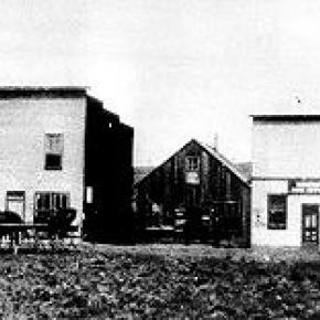
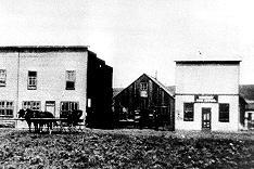
The rails reached Kremmling town
The train tracks were all lain down
That wonderful, exciting day from far and near
Were there to see and hear click-clack
Of the train coming down the track
Bringing hope, dreams and plans far and
Their way
From that 1906 June day
On July 4th a Kremmling Day that never again
Could be so exciting and fun as it was then
Celebrating the trains and the tracks
The eight or nine saloons were filled to the max
Guests came on the train from the City to join in
With all of them
A big fish fry, Bar-B-Que of elk and antelope
Greased pole to climb, games and prizes
A bucking horse contest
The day was the best
A way back in time
That train was by travel line
I could tell tales to you
Of exciting adventures or tow
And then-when
It was called the "Moffat Road"
Still is to me
Always will be


Ninety Four Winters So Far

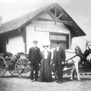
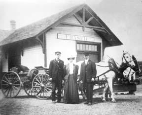
January, 1911.  Five years ago they were teenagers in Torsby, Sweden, oblivious to the sweeping changes that history and hope would bring to their lives.   Now they’re in a mountain valley halfway around the world from their Scandinavian homeland, marveling at the tiny bundle of flesh and spirit who has just joined their family. It’s the coldest week of the year in one of the coldest spots in America, but there’s a fire crackling in the woodstove, and their hearts are warm with love for each other and their firstborn child.   For the next few days, a parade of fellow Swedes stop by to pay their respects to the newest resident of the town of Fraser: Elsie Josephine Goranson.  

February, 1918.  It’s barely dawn, and a blizzard is howling across the valley, piling snow against the sturdy wooden house.  George Goranson puts on his boots and woolen overcoat and trudges towards the barn.  There are cows to milk and horses to feed.  There are no days off.  Meanwhile, in the house, 7-year old Elsie stokes the perpetual fire in the cook stove, while her mother grinds the beans for a second pot of strong coffee.  Later they will make sour cream cookies.   Her younger brother Hill is sick in bed with influenza.  He will survive.  Many others will not.   

March, 1925.  The logging camps are humming, the Moffat Tunnel is under construction, and the valley is brimming with workers and their hard earned pay.  Fraser merchants and boarding houses are doing a brisk business, as are the local bootleggers.  Elsie is waiting tables at the “Victory Café”, named for its proximity to the new coast-to-coast “Victory Highway” that passes through town, and each morning she serves breakfast to the nice looking (if scantily clad) girls from the corner house of ill repute.  Soon the local vigilante committee will force these ladies of the night to leave town, but for now it’s business as usual, and Fraser is hopping.   In fact, “Russell’s Riot Squad” is playing at a dance tonight at the Thomas Hotel.  

April, 1927.  Sleigh bells jangle as a team of horses pulls four young couples down valley to a dance in Tabernash, the most happening town in the county.  The roundhouse is there, as are the wages of engineers and brakemen who guide the trains over Rollins Pass.  There is even a movie house, where Elsie saw her first moving picture, “Jackie Coogan”. As the sleigh glides across the moonlit snow, Elsie feels a mix of excitement and nervousness.  This is her first date with Chuck Clayton, a hardworking man from Oklahoma. Chuck is handsome as he steals glances through the cold night air, but her Dad doesn’t approve of his drinking and gambling.  Other dates will follow: motor trips in a Model A Roadster to Garden of the Gods, picnics in Rocky Mountain National Park, and plenty of dancing.  “I’ll never marry you,” she tells him everyday.  “Yes you will,” he insists.  

May, 1933.  One child underfoot and another in the belly, and Elsie Clayton is tired.  Chuck bought a house for 20 dollars and used the lumber to build a hamburger stand (soon café and bar) right along the newly paved Highway 40, the main route from Denver to San Francisco.  For the next 38 years, their lives will be a blur of ham and eggs, New Year’s Eve parties, and a long medley of songs on the jukebox.  The school bus will stop there, as will the “Steamboat Stagecoach” bus line, and three generations of folks looking for a home cooked meal or glass of beer.  There will be marathon cribbage games, war stories, and “Friday Night Fights” watched live on the first television in town.  Despite the booze and boxing, Clayton’s Café and Bar will be known as a family establishment, especially compared to the “Fraser Bar”, a.k.a. the “Bloody Bucket”, where a love triangle will one day lead to murder.  

June, 1945.  It’s 4:30 a.m.  Elsie tiptoes downstairs and into the café.  She brews coffee, warms up the grill, then sits and enjoys a rare moment of relaxation before her workday begins.  In the distance, a steam locomotive blows its whistle as it chugs towards town.  Before her life is over, nearly a half million trains will pass through Fraser, an endless stream of rumbling horsepower that conjures up different images as the years pass by: trains bringing home soldiers from the Great War; trains loading up ranchers’ fattened cattle in the fall; trains delivering newspapers and mail; trains colliding head on in the Fraser flats; a train’s whistle frantically blowing to alert sleeping townspeople to a midnight fire; streamlined diesel trains ushering in a new era, and countless coal trains, hauling the carbon wealth of Western Colorado to the factories and power plants of far off cities.  

July, 1950.  Summer’s here, and all are invited to the town picnic down by the Fraser River.  Aging Swedish bachelors will be there, sipping steel cans of Coors and swapping stories of crosscut saws and the rowdy “Lapland” logging camps up St. Louis Creek.  Young men will dance with young women.  Young men will start fistfights with other young men.  Navajo railroad workers will perform a rain dance. Children will play Audie Murphy in the riverside willows and drink Coca Cola from thick glass bottles.  Meanwhile, the deluxe brick barbecue will sizzle as Elsie spreads mayonnaise on buns and Chuck flips burgers and jokes with friends.      

August, 1953.  President Dwight D. Eisenhower is coming to town to fish and relax.  “We come Ike” banners wave in the breeze as the motorcade turns off Highway 40 and onto the dusty gravel of Main Street.  Cheers erupt and flashbulbs pop as a smiling Ike emerges from his limo and waves to the crowd of 300.  It is the biggest day in Fraser history, but Elsie sees none of it, for even as her husband, the Mayor of Fraser, is welcoming the leader of the free world to town, she’s in the cafe tending to the crush of reporters and tourists who’ve come to see an American hero.   Tomorrow, after the excitement dies down, she’ll personally deliver two of her homemade pies to the President, who will rave about the perfect crust.   

September, 1971.  Retired.  Chuck and Elsie sit on the porch of their new home on the edge of town, watching cows graze just beyond the fence, and taking in the unobstructed view of Byers Peak.  Labor Day has come and gone, and now town is peaceful, the highway quiet.  Freed from the busy schedule she’s kept for decades, Elsie will soon embark on a reading frenzy and will begin to keep a modest journal of the days’ events:  A Grandchild born, an illness in the family, an exceptionally cold morning.  Chuck busies himself planting trees, tending a garden, and mowing his spacious lawn.  Tomorrow they will pack a picnic lunch and drive the Denver Water Board roads in search of raspberry bushes.   

October, 1978.  Today is Chuck and Elsie’s 50th wedding anniversary.  It’s a perfect day, sunny and warm, Indian summer if there ever was such a thing.  The mountains shimmer beneath a blanket of fresh snow.  Hay meadows glow golden beneath the cloudless sky.  Family and friends gather in the yard for photos before heading to the Crooked Creek Saloon, formerly Clayton’s Cafe and Bar, for a long afternoon of celebration and reminiscing.   

November, 1999.  After 71 years of marriage, Chuck has passed on, and Elsie is suddenly alone.  She sits at her dining room table, peering out the frost fringed window at the town she was born in, the town she has lived in her whole life.  The ridge she once sledded down is covered with condominiums.  The willowed wetland where her brother trapped muskrats has become a large parking lot.  Her father’s horse pasture is now a shopping center.  Everything has changed, yet memories remain, taking on a life of their own.  Horses still pull wagonloads of hay up the highway.  Loggers come in from the woods every Saturday night for revelry and roulette.  A young couple poses for a photo in front of their new cafe.  A sharp axe splits a chunk of pine.  Life goes on.   

December, 2004.  Christmas Eve.  There is plenty of food, including the homemade potato sausage that’s been served at every family Christmas for centuries, and plenty of gifts stacked beneath the brightly lit tree.  Elsie sits at the head of the table, quietly marveling at this clan she has wrought.  Her surviving children are here, as are her grandchildren, some of who have grandchildren of their own.  Five generations of family pour gravy on potatoes and crack jokes.  As she looks at their faces, she remembers her own parents, her grandparents, and her husband.  Everyone is here.   In a few minutes, in a ritual as old as Elsie can remember, her great-great grandkids will hand out presents, and the house will resound with laughter.  

Winner of  the “One Grand Essay” contest 2005

Oh, the Joy of Bicycling!

Bicycling has been a favorite pastime in recent years in Grand County.  People pedaling along the highway, crowds crawling through the forests ­ the mountains are full of folks getting their exercise.  Many of the bicycles are worth thousands of dollars, and have who knows how many gears.   People weren’t always so lucky, but the urge to use this form of transportation started early.  For instance, back in 1892, see Volume II, 1982, of the GCHA Journal, The Journey, Mr. and Mrs. Hatch had decided to tour this area.  That year, Agnes was dared by her husband to hike the total route from Georgetown to Grand Lake.  He never thought she could do it, but she did….in four days.  The following year, 1893, they determined to ride bikes over the same trail.  Mr. Hatch was positive that his wife would be more comfortable in bloomers, so he persuaded her to make some.  However, she also took along a full skirt that she could button in a hurry.   On the pass, Mrs. Hatch would crouch by her bicycle whenever they met a freighting team.  She was really embarrassed to be seen in bloomers. Even at that, horses shied a little.  Mr. Hatch urged her just to go on and walk by her bicycle.  She tried this, but the horses were so frightened, they nearly ran way. She went ahead and put her skirt on after that!  

At the turn of the century, Mrs. Orlando Ward (Edith Hannington) later related that her father often rode over the pass from Empire to Grand Lake on his bicycle. Now, this was one of the high bikes with a huge front wheel and no brakes; so he would cut a small tree and tie that on to the back to slow him down as he descended the west side of the pass.  He liked to keep track of his riding schedule when he arrived at certain spots and how long it took from one point to the next.  He stored that information over the front door inside their cabin.  He often told his daughter that the water he drank from Mrs. Coulter’s well was the sweetest, coldest, and most delicious in the whole United States!  The Coulter Stage Station on the west side of Red Dirt Hill was one of his regular stops.   Jumping forward a decade, the GCHA 2000 Journal on Old Time Religion tells that The Rev. Adelbert Anton Fonken, age 39, came to Fraser in 1911, to be the first minister called for the Presbyterian Church there. Normally Mr. Fonken rode a horse to make his calls to lumber camps, to Granby, and to Hot Sulphur Springs.  Then somebody stole his saddle.  Always conscientious, Mr. Fonken instead pedaled his bicycle down wagon roads or pushed it up hills. One time, on the way to Granby, the chain broke on the west side of Red Dirt Hill, leaving him without brakes. He picked up speed--faster and faster, until disaster seemed imminent.  Then he saw a ravine coming at him to the right and he quickly turned up that, managing to stop without damage!   One old man, Mr. McQuestion, probably between 1947-1951, rigged his bike with a small cart that he pulled behind him. He was a frequent sight, pedaling between Tabernash, where he lived, to Fraser, to buy groceries and such, summer and winter.  

Generally, people thought this was pretty high country in which to ride bikes.  With the fat tires, heavy frame, and no gears, it truly was a lot of work.  However, there was about to be a big improvement.  In the 1950¹s, a young chap by the name of Fred Naff had brought his prized bicycle with him when he came to a new job in the Fraser Valley.  This bike had three gears!  Nobody had three gears at that time.  Fred was so proud of it, and in his off time, he decided to try riding to the top of Berthoud Pass without stopping.  One day he announced to his employers that he had succeeded in doing this. Soon he went around, getting bets on whether he could indeed ride up without stopping.  (He already knew the answer to that one!)  The day was set and somebody followed Fred up the pass to make sure there were no stops.  Success!  Fred would have been entitled to collect his money, but he was an honest boy and knew that the bets weren’t in any question at all; he just told them that he knew beforehand that he would win.  

Today, of course, bicycling has many purposes. Stretching the legs after a day’s work, challenging precipitous hills, riding to work even in the winter. One sees bicycles built for two, bikes with little carriers following behind for one or more babies, mountain bikes and road bikes. People may use these to prepare for major cross-country rides. Others are developing their lungs for foot races.  In gyms, stationary bikes are used for rehab purposes -- people with broken knees, torn ACL’s, new knees.  In fact, one can say the bicycling has become a way of life in the high country.   

Picnics, Games and Socials

Article contributed by Abbott Fay


There were many games and leisure time activities enjoyed by the early settlers in Middle Park.  Among the most common adult games were gambling games such as crap-shooting.  Poker in almost all its forms was also very popular. Some saloon poker sessions would go on for entire weekends.  Parlor games often included Blind Mans Bluff, which has a history dating from ancient times.  Charades, dating from the 1770's was recorded in at least one pioneer diary.  Marbles and Jacks were common children's games. 


Some of the more athletic pursuits included swimming, which was very popular in the summer and during winter at the Hot Sulphur Springs.  Contests of croquet and horseshoes were played at almost all the resorts and dude ranches.  Several times, the Middle Park Fair Horseshoe Champion went on to compete at the Colorado State Fair, and in 1920, a local winner went on to the World Championships held in Minnesota.


All sorts of tag games were invented, including a version called "Fox and Geese" played in the snow fields of winter.  A variation which is rarely seen today was called "Statues".  In this game, "it" would whirl each player around and then release him or her.  However the released one landed, that position had to be held totally motionless (as a statue).  After all the players had been cast off into statues, "it" would pass among them looking for even the slightest motion, even to the blink of an eye.  As "it" caught a victim in movement, the victim then had to join "it" to pass among the statues, often taunting and teasing to elicit a movement, until only one statue remained.  The final statue became "it" for the next round.  


Rope jumping, hop scotch, sleigh riding, skiing and ski-jouring have all been mentioned in letters, diaries and newspaper accounts. Potluck picnics were frequent in the summers.  Ranch families would meet on Saturday nights in the school house for dancing.   At church celebrations there was almost always a cake-walk and donated box lunches were auctioned off.


In additional to fishing and hunting, rodeos gradually replaced informal races and other private ranch contests.  One of the first rodeos in the nation was held at Deer Trail in Colorado in 1869.  By the end of the century, almost every ranching area in the state had at least one rodeo a year. 


As for musical entertainment in those days before phonographs or radios, many people would perform at public and private gatherings.  Violinist, often self-taught, would play with other instrumentalists in what were called "hoe downs".  Mountain men often carried mouth harps for self-entertainment or impromptu performances for other trappers and Indians.  Accordianists were very popular at polka dances and the Jew harp was another common musical instrument.


On long lonely treks, some travelers would sing, not only for pleasure, but to scare away predatory animals.  Some ladies cultivated excellent singing voices and were often accompanied by piano music.  Pianos were more common in homes a century ago than they are today.  For households without a capable musician, there were player pianos, which made music from rolls of perforated paper to reproduce popular and classic tunes.


Story-telling was an art for some talented individuals, who were the highlight feature at many gatherings.  Some stories ended on a humorous note; other were mysterious or even scary.  Conversation was also considered a form of entertainment.  Women's sewing bees were welcomed for the gossip opportunities as well as the craftsmanship. 


Essentially, there was much more individual participation and carefully planned intermingling in those days than the more passive entertainment (TV, video games, movies, etc.) of today.   


Sources: Merlyn Simmonds Mohr, The New Games Treasury, Boston, 1997

Gertrude Hollingsworth, I Rember Fraser, Fraser, CO

Luela Pritchett, Maggie By My Side, Steamboat Springs, CO 1976

Candy Moulton, A Writers Guide to Everyday Life in the Wild West, Cincinnati, Ohio, 1999

Robert C. Black, Island In the Rockies, Boulder, CO 1969

Post Offices
Post Offices

Article contributed by Abbott Fay

Postal routes into Middle Park were first offered for contract to the lowest bidders in 1875.  A once a week route over Rollins Pass was bid at $693 per year but winter was so severe that the service stopped.  The route from Georgetown to Hot Sulphur Springs over Berthoud Pass from July through October was more enduring. 

Later, postmaster appointments were recommended by congressmen, thereby making the the system more variable as political party power shifted at election time.  The great advantage to having a post office was the opportunity to include a retail goods for sale, often in the living room of the postmaster's home.

Post offices were located within 10 miles of the addresses they served.  In those days, a 10 mile round trip would often take a full day of travel by horse or wagon.  Many post offices were simply ranch homes, and there were frequent changes in location due to disabilities or political party changes.

Post offices were closed when there were too few recipients to justify the cost, often caused by consolidation of ranches or mine closures.  As transportation became mechanized, there was no longer the need for a 10 mile radius maximum.     


PO                            Opening Date             First Postmaster

Hot Sulphur Springs     Sept. 10, 1874            Thomas N. Francie

Fraser                        July 20, 1876              William Z. Cozens

Troublesome               March 15, 1878            Henry King

(When Henry King died in 1879, his wife Albina replaced him. The Troublesome office was discontinued on April 19, 1935)                               

Red Mountain             April 8, 1878               William D. Coberly

(Discontinued in September 1878)

Hermitage                  May 17, 1878              George Rand

(Intermittent service.  Discontinued Jan. 10, 1884)

Grand Lake                 Jan. 10, 1879              John Baker

Twelve Mile                 June 1879         Daniel N. Ostrander

(Discontinued Aug. 5, 1880)

Lulu City                    July 20, 1880              D.W. Hassix

(Discontinued Nov. 26, 1883)

Gaskill                       Oct. 22, 1880             John K. Mowrey

(Discontinued Nov. 11, 1886) 

Colorow                     May 24, 1882              Thomas E. Pharo

(Discontinued May 16, 1903)

Selak                         June 11, 1883             Frank J. Selak

(Discontinued Sept. 29, 1893)

Fairfax                       Jan. 14, 1884              John Barber

(Discontinued July 9, 1885) 

Coulter                      Aug. 14, 1884             Fred Halkowiez

(Discontinued Sept. 20, 1905)

Kremmling                 Feb. 12, 1885             Rudolph Kremmling

Kinsey                       Oct. 24, 1891             Rudolph Kremmling

Crescent                    Feb. 14, 1887             Tracy C. Tyler

(Discontinued April 16, 1894) 

Clarkson                    July 28, 1892              William M. Clark

(Discontinued Dec. 8, 1898)

Dexter                       Sept. 21, 1896            Milton G. McQueary

(Discontinued May 20, 1911) 

Martin                        Aug. 24, 1898             Samuel Martin

Discontinued Nov. 3, 1934)

Scholl                        Nov. 27, 1901             Ole Langholm

(Discontinued Jan. 21, 1930)

Lohman                     March 31, 1903           Clyde N. King

(Name changed to Stillwater on Oct. 4, 1911.  Discontinued Oct. 29, 1930) 

Leal                          Sept. 17, 1904            Charles F. Barker

(Discontinued April 30, 1930) 

Arrow                        March 21, 1905           William L. York

(Discontinued March 15, 1915) 

Tabernash                  Sept. 30. 1905            Mary Knight

Granby                       Oct. 26, 1905             Agnes Whited

Radium                      Feb. 9, 1906               O.C. Mugrage

(Discontinued Dec. 6, 1963)

Parshall                     Nov. 17, 1906             G. Walter Dow

<

Prisoners of War
Prisoners of War

Article contributed by Abbott Fay

German Prisoner of War camps existed in Fraser and Kremmling during the wartime years of 1945-1946  The Fraser camp provided much needed labor for lumber production while the Kremmling camp shipped cut ice by rail, mostly to the Grand Junction area.

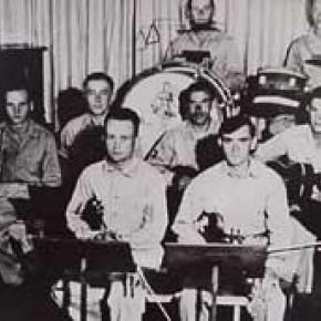
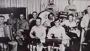
In Fraser, some 200 prisoners loaded an average of 25,000 feet of lumber on rail cars every day. They were quick learners; doing all phases of the work, from horseshoeing to bookkeeping. For their hard work, they were paid 75 cents a day, which they could spend at their Post Exchange.  The prisoners in the Fraser area were were sometimes rewarded with trips to the local movie theater.  They were also allowed to form a dance band utilizing homemade instruments and were permitted to bake special German pastries.

Examples of the beautiful inlay woodworking skills of the prisoners are on display at the Grand County Museum in Hot Sulphur Springs.

Source:
R.C. Black, Island in the Rockies, Pruett Publishing, 1969

Railroads Build the Ski Industry

In the early to mid-1900s, the popularity of skiing spread across the western United States.  Ski areas popped up in many mountain communities, particularly in the Colorado Rockies. Much of this was due to access afforded by the existence of railroads to these areas.  Railroads broke the barriers of isolation during the winter months when most other forms of transportation were blocked (skiing being the exception).

Grand County has long depended on tourism.  From its earliest days of settlement, tourists were drawn to the springs of Hot Sulphur Springs and to the waters of Grand Lake and its surrounding streams.  Grand County was reached by stagecoach from Georgetown, via the Berthoud Pass Wagon Road. In the summer months tourists would fill up Hot Sulphur Springs’ five hotels.  Nonetheless, those same hotels would sit mostly vacant during the long winter months when the road was shutdown.


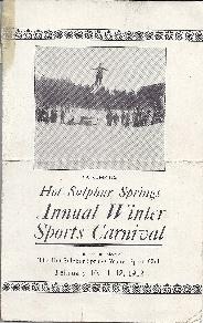
In 1911, Hot Sulphur Springs held the first winter sports carnival west of the Mississippi River. The purpose of the carnival was to boost the town’s economy by filling the empty hotels and restaurants with out of town guests for that one weekend at the end of December.  This was only possible due to the Moffat Road railroad, which had broken the town’s isolation just six years prior.


Not only did the railroad bring spectators for the winter carnival, it also brought the two most important participants of the event.  At least, it brought them part way. Carl Howelsen and Angell Schmidt boarded the train in Denver’s Moffat Station and rode it to the top of the divide at Corona, where they detrained and skied the rest of the 40-plus miles to Hot Sulphur Springs, where the carnival was under way.  Once re-united with their fellow train passengers, Howelsen and Schmidt performed the biggest event of the day, the ski jump competition, which made history. The ski jump competition at the 1911 Hot Sulphur Springs Winter Sports Carnival was the first west of the Mississippi and is considered the beginning of Colorado’s ski industry.


The 1911 winter carnival was such a successful and enjoyable event that it grabbed the attention of Denver newspapers on the front pages.  Consequently, John Peyer and the other carnival organizers of the carnival decided to make it an annual event and put together the 1st Annual Hot Sulphur Springs Winter Sports Carnival six weeks later in February 1912. The railroad was the sole reason that the success of the winter carnival at Hot Sulphur Springs was even a possibility in those early years.  Berthoud Pass, the former wagon road converted to an auto route was closed in the winter months. Even if the highway were open, automobiles of that day could not have made the winter drive anyway.  The railroad was the only way to bring people to the remote town in the winter and take advantage of the abundantly snowy hills.


The Moffat Road quickly realized the potential for profit that the Hot Sulphur Springs Winter  Carnival presented in the typically slow winter months of the railroad. In 1913, the Denver and Salt Lake Railway (D&SLR) advertised a special round trip fare to Hot Sulphur for the winter carnival.  The following year, further up the Moffat Road, Steamboat Springs held its first winter carnival.. Once again, the D&SLR provided the means to reach the new ski destination. People road the rails from Denver and Hot Sulphur Springs.


As the popularity of Hot Sulphur Springs as a winter destination grew, so did ridership of the D&SLR to the winter carnival.  In 1936, the Rocky Mountain News sponsored the “Snow Train” to Hot Sulphur Springs for the 25th anniversary of the winter carnival.  Despite the fact that Berthoud Pass was open year round starting in 1933, over 2,200 passengers rode the ironhorse from Denver and another 500 came over the Moffat Road from Steamboat Springs for the event.  Over 7,000 people attended the carnival that weekend.


1912 Winter Carnival Brochure001
 

In the early years of the ski industry, Nordic was the dominant form of skiing.  By the late 1920s, Alpine skiing began to grow by leaps and bounds in the United States.  This coincided with the opening of the Moffat Tunnel, which made the railroad far more reliable in the winter time.  It would be at the west portal (West Portal) that the railroad would make its biggest impact on skiing in Colorado. Following the opening of the Moffat Tunnel, skiers would ride up to West Portal from Denver to slide the deep and steep slopes immediately adjacent of the tunnel.  Not long after the opening of the tunnel, the Arlberg Club was formed and they built their clubhouse not for from the tunnel to take advantage of the rails from Denver to the slopes on the west side of the divide.


Arlberg Club members and other ski enthusiasts flocked to West Portal by rail throughout the 1930s, even though there was no formal ski area.  Skiing and riding the train to West Portal was so popular that in 1938 the D&SLR started the “Snow Train,” offering regular weekend service to West Portal.  The D&SLR even provided a place for skiers to wax their skis in the West Portal Depot.


The start of the Snow Train coincided with decision of Denver Parks Director, George Cranmer’s decision to locate Denver’s Winter Park at West Portal. Cranmer announced his intention of creating for Denver a winter sports playground that would be “unequalled in the world.  When he determined that West Portal would be the location for Denver’s Winter Park he referenced the great ski conditions of the area and additionally remarked that “West Portal may be reached by auto or train.”  Cranmer clearly recognized the importance of access by train from Denver.


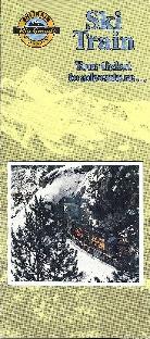
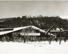
As ski trails were cut and T-bars were installed on the mountainside the base area facilities for Winter Park were literally constructed on the tailings of the Moffat Tunnel.  This provided easy access to the facilities and slopes of the ambitious new ski area for those riding the train from Denver. The D&SLR continued to provide the Snow Train weekend service when Winter Park opened in 1940 for $1.75 per round trip.  Unfortunately, due to the demands of World War II and a coal workers strike in 1943, the Snow Train service came to an end. This would prove to be temporary though. In 1946, one year after the end of World War II, the Denver and Rio Grande Western (D&RGW) brought the special weekend service back to Winter Park and    christened it as the “Ski Train.” This was the foundation of the Ski Train that ran between Denver and Winter Park until 2009.


Grand County was not the only ski destination that benefitted from the railroads in the early growth years of the ski industry in the west.  A couple of major examples are Marshall Pass in Colorado and Sun Valley, Idaho. Beginning in 1938, the D&RGW literally acted as a chairlift for skiers from Salida and Gunnison.  A special excursion train on the weekends selling seats as lift tickets to the top of Marshall Pass.  The first train sold out with 500 tickets and 200 skiers were turned away that day. The railroad even provided a  warming hut at the bottom of the slopes.


In possibly the greatest example of the railroad on the ski industry of the west is Sun Valley, Idaho and the Union Pacific Railroad (UP).  Sun Valley was literally the conceived, constructed, and operated by the UP. Under the leadership of Averill Harriman, who was a ski enthusiast himself, conjured up the plan to build a world class ski destination that would rival any in Europe.  This resort was to be reached by rail as a means to boost ridership on the UP, which it did. Sun Valley became the glamorous playground for the rich and famous. At Sun Valley, skiing was elevated in class and viewed as elite. Nonetheless, it was at Sun Valley that the railroad made its most significant contribution to the ski industry.  The first chairlifts in the world were installed at Sun Valley in 1936, replacing the rope tow. Engineers for the UP developed the chairlift at the railroad’s headquarters in Omaha. The invention of the chairlift transformed the method of how skiers were to be transported to the top of ski trails the world over.


The impact of the railroads on the development of the ski industry in the western United States cannot be understated.  Without the assistance of the network of steel that penetrated into remote mountain locations, the ski industry could not have developed with the rapidity that it did in the early part of the 20th century.   Furthermore, as we look to the future of the ski industry and try and figure out ways to conveniently transport skiers to the slopes of Colorado trains emerge more and more as the answer.  This is apparent in the rejoice that devotees to Winter Park sang when Amtrak’s Winter Park Express returned weekend service in 2017 that had been left in a void ever since the Ski Train made its last run in 2009.  Once again skiers are riding the rails of the old Moffat Road.


5277 Ski Train001

 5425 ski train 1950s001Passengers unloading the Snow Train at the West Portal Depot in 1938

 Ski Train Brochure 1980s

 
Religion
Religion

Article contributed by Betty Jo Woods

The first known white settlers came to Grand County about 1874 but there were no established churches for many years. The area even lacked circuit riders and camp meetings so typical of many other parts of the West.

The first building used exclusively for a church was probably an Episcopal church in Grand Lake, erected in 1896, but used sporadically during summers only. An Arapahoe Indian who was an Episcopal priest held occasional services in that town.

The First Congregational Church of Hot Sulphur Springs was dedicated in 1904 and other churches were also established about the same time in Kremmling and Fraser. 

Sunday School activities along with special holiday services and women’s activities seemed to be what provided continuity to worship efforts. Curiously, at one time a local newspaper carried weekly Sunday School lessons.

A Greek Orthodox church was built in Hot Sulphur Springs for the many of that faith who visit there. A major growth spurt developed during the last quarter of the 1900’s when older buildings became overcrowded and residents, long-term and recent, decided to commit time and money to new church buildings. In 2004, 28 churches were listed in the telephone directory.

Sources:
R.C. Black, Island in the Rockies. Pruett Publishing Company, 1969
Grand County Historical Association, Volume XV, Old Time Religion Early Churches, Grand County. Egan Printing Company, 2000

Schools
Schools

Article contributed by Betty Jo Woods

The first official school in Grand County was founded in 1875 in Hot Sulphur Springs in a crude dugout. The school met for twenty days and a painting of the classroom shows nine students in attendance. Typically the woman teachers of that era would have earned about $25 per month. 

One report to the Colorado State Department of Education said, “The school secretary left during the Indian uprising and no school records are available.” This school was presumed to be at Hot Sulphur Springs.

In the 1890s school was not held every year in Grand Lake because not enough taxes were raised to pay for a teacher. The school year was generally April through October and classes were held in various vacant buildings for many years. The first schoolhouse in Grand Lake was built in 1910 and remained a one-teacher school until 1935. 

A notice published in the Middle Park Times on january 31, 1889 annouce that a masquerade ball and supper of "beef steer and chickens" would be held on February 14th to raise money to build a school.    

In 1898, the offerings were expanded to include the first experimental high school curriculum to be offered in the county. As towns were developed, several rural one-room schools also came into existence. Many schools were taught only during the summer because winter travel was too difficult.

At one time there were nineteen school districts. In 1958 the County was reorganized into two school districts, with the result that today there are two high schools, two middle schools, four elementary schools, one charter school, one alternative school, and one private Christian school in Grand County.

Sources:
R.C. Black, Island in The Rockies. Pruett Publishing Company, 1969
Colorado State Department of Education, First Formal Biennial Report of Superintendent of Public Instruction for State of Colorado. Denver, Colorado: Daily Times Printing House, 1879

Sir Edmund Hillary visits Grand County

The Middle Park Times announced with excitement: Sir Edmund Hillary is going to visit Grand County!  The paper reviewed his famous climb up Everest in 1953 at age 33, his New Zealand background, his other well-known exploits; his picture was highlighted on the page with his story.  This was news of great interest to the area citizens, for there was little in the way of unusual happenings as a rule.

Dwight Miller had wandered down to the Hideaway Park Post Office one summer afternoon, when a man, asking for information, stopped him.  "Can you tell me where the Tabernash Campground is?"  Dwight took one look at him and recognized the long, somewhat horsey-looking face.  The chap's accent sounded British to Dwight, too.  "Are you Sir Edmund Hillary," he asked?

"Why yes, I am," answered Sir Edmund.  "We're traveling through this area and want to spend the night."

For a moment Dwight considered asking him and his party to stay at Miller's Idlewild Inn that night, but he thought probably the group really preferred being alone to enjoy the countryside, rather than having to deal with crowds.  He was aware that the climber was a very shy, modest man.  So he told Hillary to drive about six miles on down Highway 40, through Fraser and Tabernash; then follow the road to the top of Red Dirt Hill.  The campground he wanted was on the right side of the road, just before it descended toward Granby.  Close by, on the left side of the highway, Hillary would see a large meadow, in which were dairy cows, belonging to the Acord Dairy, I believe.  "The campground is set among the pines with just a few camp sites, so you shouldn't be disturbed," Dwight said.

Sir Edmund thanked Dwight and the two of them chatted a bit more.  "We just came over Berthoud Pass a bit ago; in fact we ate lunch there.  Something that really puzzles me is that I see you Americans just eating lunch while sitting in your cars or on your tailgates; and yet, if you were to take your lunch and walk about 100 feet, you would have all the valleys before you and never know that you that you were even near another person!"

"That's true," said Dwight.  "I think that Americans are always in a hurry.  They don't want to take time to walk a few feet.  It's just eat and run."

"Well, it amazes me.  You live in such beautiful country."

They said goodbye then and the Hillarys drove on down to the campground.  Dwight was so very pleased to have had this chance to meet him.

This campground was shut down some years later when the U.S. Forest Service traded that land to the Silver Creek group for some other property, so that Silver Creek could have a convenient road into their development.  The campground was located just beyond the turn in to Snow Mountain Ranch, as one heads west.  A few site remnants can still be seen there.

Articles to Browse

Topic:

Biographies

From Indians and explorers to doctors and developers, click on the drop-down menus to learn about some of the remarkable people who helped shape Grand County.

Topic: Biographies
Barney McLean

Skiing Legends Horace Button and Barney McLean

Barney McLean

Horace Button was 10 years old when he saw the ski jump competition at the 1911 First Annual Hot Sulphur Springs Winter Sports Carnival.  A railway man noticed that Horace was spellbound.  The man asked Horace what he wanted to be when he grew up, to which Horace replied, “I want to be a ski jumper like Carl Howelsen.” The seed had been sown, and Howelsen taught Horace the skills of skiing.

Horace Button became an All-American Skier.  Winning awards over nationally recognized competitive ski racers.  The basic knowledge he learned from Howelsen was passed on which in turn sent Jim Harsh of Grand Lake, to be on the 1932 United States Olympic Nordic Combined team.  The Olympics were held at Lake Placid, New York. 

Barney McLean of Hot Sulphur Springs, became a champion following in the "ski boots" of Mr. Button. Horace would be waiting at the ski hill every afternoon, when school hours were over and he and Barney would schuss the mountain together.  Barney was a 9-time national champion, and a 3-time Olympian.  In 1948 he was Captain of the men’s alpine ski team that competed at St. Moritz, Switzerland. 

Horace Button continued to advise ski techniques to students of East and West Grand School Districts, helping them compete at the university or Olympic level.  They were; Dale Thompson, Wes Palmer, Zane Palmer, Landis Arnold, Todd Wilson, Kerry Lynch, Tim Flanagan, and many more.  Horace coached 12 national champions. 

Horace also was an accomplished artist. His specialty was carton ski scenes.  Tim Flanagan honored Mr. Button for his work with local youths and created the Horace Button Ski Foundation.

Horace Button, Jim Harsh, Barney McLean, and Carl Howelsen have been inducted into the Colorado Ski Hall of Fame. Barney McLean and Carl Howelsen are honored at The National Ski Hall of Fame.

The picture on the right is of Barney McLean at age 4, wearing a pair of skis his dad made for him. The photo was taken in Hot Sulphur Springs.

Topic: Leisure Time

Grand Lake Yacht Club

Grand County often attracts adventurous spirits who prefer its splendid isolation to Wal-Mart and fast food. Others, who never make the leap of faith to live here, enjoy it as a familiar playground, returning regularly to enjoy its vast mountain ranges and unlimited outdoor opportunities.

It has to come many as a surprise to learn that Grand Lake, Colorado - nestled next the Continental Divide at over 8,300 feet elevation - has had a yacht club for over one hundred years! When this adventure began, back in 1902, there was only a stage road into the southeast corner of Grand County over Berthoud Pass. Grand Lake is situated next to the entrance of Rocky Mountain National Park, at the far northeast corner of the county, with the rugged backbone of the continent directly to the north and east. At the turn of the twentieth century, it was a summer vacation spot with few full-time residents. Summer visitors and full-time residents alike recognized the grandeur of the their surroundings, and Grand Lake very early became a summer home to many of Denver's elite, and the summer business they brought helped support the local economy.

It was a few enthusiastic Denverites with a keen interest in Grand Lake and sailing who organized the Grand Lake Yacht Club over 100 years ago. The founders included Richard Crawford Campbell, who married Senator Thomas Patterson's daughter and became the business manager of his father's newspaper, the Rocky Mountain News; William Henry Bryant, a Denver lawyer who was active in both sailing and Colorado politics; J. Fermor Spencer, a close friend of Mr. Bryant and long-time treasurer of the club; and William Bayard Craig, who enjoyed a broad education and had been the Chancellor of Duke University before he became interested in "acquiring land in Colorado."  By the end of 1902, according to Denver papers, "the first bona fide yacht club between the Mississippi river and the Pacific ocean" was in operation.

An atmosphere of excitement and pageantry swept over Grand Lake during the early Regatta weeks, when the Yacht Club held its annual races. In Denver, The Friday Evening Times proclaimed during August of 1904, "Yachting season is here", and went on to describe the "enthusiastic cottagers gathered on shore" around Grand Lake to cheer for the yachts. In 1907, Regatta week included yacht racing as well as foot races, donkey races and bronco busting. When the yacht races ended, the boat captain who won the most races had earned the Colorado Cup.

The Grand Lake Yacht Club's small sailing fleet during Regatta week - three days of racing during mid-August - sometimes included only a handful of boats during its first decade or so. Still, according to one observer, "the organization has more spirit to the square foot than I ever saw exhibited before." Races on the first day of Regatta week, 1905, illustrate the enthusiasm well. In the hotly contested first race of Regatta week, Robert Campbell's Highball, built in Racine, Wisconsin, tossed her two-man crew into the icy waters of Grand Lake when she capsized while running in second place. Shortly after, the third place yacht, Duchess, went over too, leaving the Chicago-built Dorothy II captained by Commodore Bryant the first and only boat to cross the home buoy.

Today, Dorothy O'Donnell O'Ryan, Commodore Bryant's granddaughter, maintains her family's summer home in Grand Lake. In 2002, she published Sailing Above the Clouds: An Early History of the Grand Lake Yacht Club, which chronicles the club's first 50 years. Her Colorado roots go back to Colorado territory's last, and the state of Colorado's first Governor, John Long Routt, who was appointed by President Grant in 1875, the year before Colorado became a state. Knowing the early history as she does, and the difficulties inherit with mountain transportation, O'Ryan marvels at "the logistics" of bringing sailboats built in Racine, Wisconsin or Chicago, Illinois over the Continental Divide into Grand County, Colorado by rail and stage road.

Home-built crafts, both crude and highly crafted, competed as well. Many of the first home-built boats were modified rowboats, "with homemade sails and masts." Observing the annual Regatta week in August of 1904, though, Arthur Johnson called attention to "the Jessica, a 16-foot boat belonging to the vice-commodore and built at Grand Lake" that sported "a sail that would have done credit to a venturesome Lipton on the high seas."

If a sailboat in Grand Lake during 1904 "done credit to a venturesome Lipton," Sir Thomas Lipton himself returned the favor tenfold in 1912. It so happened in 1912 that Lipton was traveling by train across the United States and would pass through Denver on his journey. Probably, Sir Thomas had met the well-traveled and enthusiastic yachtsman, William H. Bryant (Grand Lake Yacht Club Commodore) at the New York Yacht Club. Continued correspondence between the two resulted in the Grand Lake Yacht Club inviting Sir Thomas to the Denver Club for dinner in December of 1912, sponsored, of course, by the Grand Lake Yacht Club. Before he left that evening, flattered by the warm welcome he received, Lipton had proffered a silver cup to the Grand Lake Yacht Club.

Lipton became a yachting icon during the early 20th century. His sportsmanship was nearly unparalleled in the sport and he spent most of 30 years and millions of dollars trying to win the America's Cup. Thoroughly devoted to yachting as a sport and highly capable in the art of advertising, Lipton spread his Lipton Cups "around the globe" to promote the sport and himself.  His gift to the Grand Lake Yacht Club energized the young organization.

Today, the boathouse of the Grand Lake Yacht Club still reminds visitors and members of the organization's heritage. Built in 1912 by Grand County pioneer Preston Smith on land donated by fellow pioneer Jake Pettingell, the lakefront log structure sits in the midst of magnificent mountain scenery, with the dramatic peaks of the Continental Divide to the west and north and the Never Summer mountain range to the west.

As the club matured, it began to offer more races to more members and guests throughout the summer season. The original Regatta week still exists as the most important, and festive, event. Races were added, though, in 1912 with the Adams Cup; in 1914, the Lipton Cup was incorporated; in 1923, the inventor of the Sunshine Lamp (which Coleman Lanterns later bought out) presented the Hoffstot Cup; and in 1925, Dorothy Bryant O'Donnell offered the Bryant Cup in honor of the late first Commodore, W. H. Bryant. Well over 20 cups or trophies now highlight the Grand Lake Yacht Club's season. Throughout its evolution the Club has remained as unique as the dramatic physical environment that surrounds it and the people who envisioned and created it.

Topic: Biographies

Ute Bill Thompson and His Memorial Marker

Dark clouds covered the Continental Divide as we looked east from the ridge leading toward Elk Mountain's remarkable view. Cool winds and spitting snow followed us. We weren't seeking the height of Elk Mountain, but instead, were tracking the historic path of Grand County Pioneer William Jefferson "Ute Bill" Thompson. Specifically, we wanted to locate the memorial marker for Ute Bill that Henry Grafke and Otto Schott placed along this ridge after Ute Bill died in 1926. 

Tracking Thompson requires divergent paths. On one hand, Ute Bill's early presence in Middle Park places him in an era when mountain men and Ute Indians shared the vast herds of elk and deer. Only a handful of hardy souls called Middle Park home when Bill Thompson arrived in the late 1860s or early 70s. On another hand, Thompson settled just east of Hot Sulphur Springs as a young man, where he carved out a cattle ranch that remains in his family today.  

Records prove he owned and operated a billiard hall, drove stagecoaches and established a homestead along the Colorado (then, the Grand) River. But tall tales and oral legends abound too, capturing hair-breath escapes, harrowing western adventures and the mischievous nature of a 19th century westerner. Looking through the numerous historic photos of Ute Bill at the Pioneer Village Museum in Hot Sulphur Springs leaves an impression of a capable trapper, businessman and rancher who textured his image with stories of western adventure. 

With Don Dailey - fellow historic trekker and great grandson of Ute Bill - along, I hoped to pursue the fact and folklore of Ute Bill. As Don pointed out an isolated cabin in the valley below, a Ute Bill tale from the Georgetown Arbitrator of September 1886, "as narrated at the time by one of the participants," captured my imagination.  

Bill Thompson breathed a sigh of relief. The rugged, hungry band of Ute in front of him smiled approvingly as his long black hair fell from his broad-brimmed black hat. A tense moment before, he'd worried about his future as the small band of Ute Indians led by Yarmony came upon his isolated cabin in Middle Park. Fact is, Bill Thompson's hair had just saved his life. Not bein' cut since the Sioux captured him as a child, it hung nearly to his waist.  

Bill was all set up for a Middle Park Winter, with supplies to last through the toughest stretch, when Yarmony and his band came along. Thompson cursed softly at himself for not payin' closer heed to their approach. "Figured they'd be out west by now," Bill muttered as he squared up to his guests. 

Speakin' through a mix of hand signs, broken Ute and English that most fellers in the mountain parks west of the divide understood well enough for basic communication, Bill impressed the band with his manly firmness and calm self-confidence. Then Yarmony spoke, "Beescits," was all he said. Bill hesitated to open his cabin supplies. "Why, them folks are so hungry," he thought to himself, "they're near certain to go mad if they laid eyes on my bacon and flour." At best he'd be without supplies at a risky time of year. "No biscuits, fellers," Bill said with as much certainty as he could muster, "barely enough food fer myself. There's still a shaggy buffalo er two fer the takin' and every feller's got the same chance." When Bill finished talkin' he looked Yarmony square in the eyes. He watched the headman's leathered face swing toward his rough-sawn cabin door thoughtfully. "Beescits," he repeated. 

Yarmony's band, snuggled in their elk skins and trade blankets, looked stoically at Bill. "Well," Bill said, throwing down his last ace, "seems you're intent on havin' my grub and I'm intent you ain't." Then, regrettin' it before he finished sayin' it, Bill raised the stakes, "Why don't we have us a shootin' contest fer it?" No immediate reaction caused Bill to wonder if he'd communicated clearly. Slowly, though, excitement spread through the crowd of Ute, as the entire band - from the pretty young girls to the big-bellies - looked to one feller. In front of Bill stepped a mountain-sized-Ute feller, creating a shadow as he approached. "Piah," the Ute whispered, breaking into a quiet chaos of conversations. Movin' quick and hopin' for some break, Bill scooped up his improved Winchester rifle as he threw off his broad-brimmed black hat so nothin' could obstruct his shootin' eye. Just as soon as his long black hair fell near his waist, the tense moment ended with a gasp from the Ute, followed by a welcome reception that meant more to Bill than any he recollected! Bill determined then and thar on never cuttin' his hair again! 

As he eased down the gun smilin', all them pretty Ute girls began paintin' his face and braidin' his locks. Bill was feelin' positively giddy about his good fortune. Decidin' he just might owe these hungry Utes a favor fer endin' a potentially tragic shootin', he led 'em to a nearby ravine where he'd been watchin' a small herd of shaggy buffalo. Now Bill Thompson figured he'd repay 'em with meat, and still keep his own supplies. Leavin' the Ute on a rise above the ravine, he sauntered down to the fresh buffalo trail just as he heard the thunder of hooves around the ravine's bend to the south. Settlin' into a remote stand of lodge pole pines, he sat right along the path of the rumblin' bison. Pickin' out his choices as they rounded the bend, Bill's Winchester boomed repeatedly, each shot bringin' down a fat cow or a young bull.          

Swaggering toward his kills, Bill was suddenly confronted by Sandy Mellon and Len Pollard, sneakin' along that ravine behind the buffalo. Not recognizin' Bill through all the paint and braids, Sandy thundered to Len that this Ute feller must "a stole Bill Thompon's gun," because there weren't many repeaters like his. Both their guns were trained on Bill.   Calmly, Bill broke the silence. "Don't over-reach yourself, Sandy." Yes sir, Sandy knew from the voice that this-here Ute feller in front of him was really Bill Thompson. That day, he became Ute Bill.  

Breathing hard to make the final incline, Don and I reached the point along the ridge of Elk Mountain where we expected to find the memorial. There it was, as we had hoped. After a hurrah for our success, we slowly read the plaque: "Hunting Grounds of "Ute Bill.'" As we snapped photos and drank water from our packs, I decided that where historic fact and local folklore meet, an authentic western tale begins.

Topic: Mountains

Rollins or Corona - What shall it be called?

Travel across various passes of the Continental Divide occurred long before white men showed up. Indeed, as anthropologist James Benedict wrote c. 1975, some 10,000 years ago, prehistoric Indians camped, hunted, and built hunting walls on the upper reaches of Rollins Pass, as well as moving in and out of Middle Park for the warm summer months. Historic Indians followed the same paths. In the earliest days of non-Indian access, a particular pass at the head of Boulder Creek was dubbed Boulder Pass.

Capt. Jacob Bonesteel, including wagons, made the first recorded crossing by a white man at this point in April 1862. Three years later, a group of Mormons brought wagons over this route and a year later, promoters of new roads into Middle Park brought in many wagons and livestock. In fact, tourists were starting to enter the park by a number of routes, and one of them, Samuel Bowles, who wrote a fascinating account of his trip, including his return to Denver via Boulder Pass.

Interest was growing rapidly for a road over the Divide, into Hot Sulphur Springs, and on into Utah. One promoter, John Quincy Adams Rollins, from New Hampshire, teamed up with William N. Byers and Porter M. Smart to carry this project through. Rollins was interested in crossing the Divide; Byers was promoting the Springs; Porter wanted to develop the valley of the Middle Yampa. All three were pushing to have Middle Park officially named as Grand County, a challenge finally accomplished in 1874.

So Rollins and associates started his road, reaching the top in 1873. That next winter, they publicized this access and in June, Jimmy Crawford brought his family and wagons to Rollinsville and thence to Yankee Doodle Lake, ready to cross the pass now named Rollins Pass by the developer. But the road ended, and they found Rollins' men still hacking the road out of the granite! Jimmy and his crew found it necessary to leave their wagons and help.

Finally, on June 10th, the family was able to head for the top. Jimmy borrowed two yokes of oxen, hitching them to mules, and then to his horse. The road was so rough that the procession could proceed but a few feet before having to rest. The family itself climbed on foot. At the summit, they discovered only a rough swath cut down through the trees on the western side. The "road" dropped down between the lakes and followed Ranch Creek to its junction with the Fraser River. Rollins quickly realized that Berthoud Pass, which also opened in 1874, was superior to his own pass for wheeled vehicles, so he determined to hedge his bets. He initiated the first mail service into the county in 1873. He also built a commodious hotel where his road joined the Berthoud Pass road at the confluence of Crooked Creek and the Fraser. He called it the Junction House. Next, he proposed to the builders of Berthoud Pass that they form a joint ownership of the two roads between Junction Ranch and the Springs. Tickets would be issued for both routes and revenues would be shared. The two companies would build a bridge over the Grand at Hot Sulphur Springs. He even buttered up his rivals by complementing their work.

All this was accomplished, although the mail route soon moved to Berthoud Pass, because of the severe winters on Rollins Pass. The bridge was started in November 1874. From the beginning, Rollins' road was preferred for trailing livestock, because there were fewer problems with heavy timber and bogs. For years, the Church brothers, George and John, who introduced the Hereford breed into the county, trailed their cattle for summering in what became known as Church Park. However, tourists such as Irving Hale still drove wagons over Rollins Pass in 1878.

About 1880, interest burgeoned for bringing a railroad up South Boulder Canyon and through a tunnel near Rollins Pass. Numerous surveys were completed all along the area. David Moffat settled on Rollins Pass for the tunnel site but decided first to put a temporary line over the top. Thus, in the summer of 1903, a formal contract was let for work up and over the Pass itself. By 1904, the workers reached Arrowhead and they also built a work station on top, called Corona Station, or "crown of the mountain." This railroad construction town of Corona, located at over 11,600 feet at the top of Rollins Pass (first called Boulder Pass) along the Continental Divide was the highest railroad station in the world.

It became obvious by 1905 that the Corona area would require snowsheds if trains were to travel, even irregularly, during the winter. Still, word got out of the spectacular splendor of Rollins Pass and tourists flocked in on summer train excursions, sometimes stopping on top, sometimes going as far as Arrow. In 1913, a fine hotel was built next to the rail facilities. Because Rollins Pass was right in the middle of severe weather patterns, a weather station was built on top, as well as one down at Sunnyside. In 1915, Rollins Pass was actually proposed to be the south boundary of a proposed "Estes National Park."

Later, on the National Historic Register, the district was listed in 1997 as the Denver, Northwestern and Pacific Railway Historic District--Rollinsville & Middle Park Wagon Road. It was also identified as the Rollinsville and Middle Park Wagon Road; Boulder Wagon Road, Rollins Pass, and Rollinsville area. In 1956, Governor Steve McNichols had presided at the official re-opening of the four percent grade to vehicle traffic over Corona Pass, expressing the hope that the route would someday be paved. The Colorado Game and Fish Department and the U.S. Forest Service made additional improvements, and the Arapaho and Roosevelt National Forests put out a 24-page booklet titled "The Moffat Road: A Self-Guiding Auto Tour." The road crossed two of the original railroad trestles near Corona but those trestles, even if reached by 4-wheel vehicles, were crumbling and could no longer even be crossed safely on foot. The current self-guided auto tour refers to Rollins Pass, as well as the Moffat Road and the Boulder Wagon Road. Corona Station and Hotel are discussed. In 1979, a portion of the auto road over Corona Pass was permanently closed because of a cave-in of the "Needle's Eye," a tunnel located before the trestles heading west from the Moffat Tunnel's East Portal.

The tunnel reopened on July 3, 1988, thanks to efforts of the Rollins Pass Restoration Association on both sides of the Divide, with the cooperation of the U.S. Forest Service, Colorado History Society, and Boulder, Grand, and Gilpin Counties. It then closed once more when another rockfall hit the tunnel on July 15, 1990. The RPRA is continuing its efforts for re-opening. The noted photographer, Charles McClure, took many outstanding photos of the Rollins Pass road. One, titled"Group on Rollins Pass, shows well-dressed men and women stand on a snowfield making snowballs on Rollins Pass, Moffat Road, Boulder or Grand County, Colorado; probably on Denver, Northwestern and Pacific excursion train. Date: between 1904 and 1913 near Corona Station." Another photo shows a "30 ft. snowcut on Rollins Pass, Moffat Road photo. Denver and Salt Lake Arrow passenger car is parked east of Corona snowshed by the thirty foot snowbank cut, Rollins Pass, Colorado; it shows men, women and railroad employees posed behind train, on the roof and on the snowbank and a standard gauge track. Date: between 1904 and 1915."

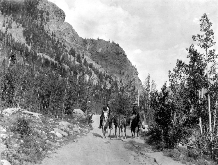
A sign at the highway turn onto the Moffat roadbed says: The Moffat Road "Hill Route" Also called "Corona Pass Road", this road over the Continental Divide was the original "Hill Route" of the Denver, Northwestern & Pacific Railway built by David H. Moffat in 1903. It crosses Rollins Pass at 11,666 feet elevation. On top of Rollins Pass, a sign says: Elevation 11, 660 feet, John Quincy Adams Rollins established a toll wagon road through this pass in the mid 1870's. David H. Moffat's Denver, Northwestern & Pacific Railway crossed the Continental Divide at this point in 1903. First known as Boulder Pass, then Rollins Pass, the railroad workers dubbed it "Corona", the crown of the "Top of the world." A railroad station, hotel, restaurant and workers' quarters existed here until 1928 when the railroad was abandoned due to the building of the Moffat Tunnel. Identifications in various trail and geographical guides say: Rollins Pass (el. 11,680 ft) is a high mountain pass in the Rocky Mountains of north-central Colorado in the United States. The pass is located on the continental divide at the crest of the Front Range southwest of Boulder, at the boundary of Grand County,Colorado and Boulder County, Colorado. Rollins Pass (a.k.a. Corona Pass) sits approximately 5 miles east and above the popular ski areas around Winter Park, between Winter Park and Rollinsville. The pass is traversed by an unpaved road, mostly the former roadbed of the Denver and Salt Lake Railway which abandoned the route in 1928 when the Moffat Tunnel opened to replace it. Railroad advertising called this the "Top O' the World" and it referred to the Moffat Route over the continental divide and the Rocky Mountains.

Rollins Pass was the primary travel route west from Denver until an easier road over Berthoud Pass was constructed. The Denver, Northwestern and Pacific railroad laid its tracks across the pass in 1903-1904 and established a Depot at Corona on the crest. It can be noted that in R.C. Black's Island in the Rockies, the term "Corona Pass" was mentioned one time, on p. 351; the terms "Corona Station" or "Corona Snowsheds were used. In Dismantling the Rails That Climbed, Rollins Pass was used, the Corona hotel, and just once, Corona Pass; 1936. In Maggie By My Side, it was Boulder Pass and Rollins Pass. In Rails that Climbed, Rollins Pass, the Corona shed, weather at Corona, Rollins Pass Snow Shed, other references to Corona as a site. In Guide to the Colorado Mountains (Orme) , they speak of the Corona Trail to Rollins Pass. High Country Names (Ward) used Rollins Pass entirely. Only Hiking Grand County, Colorado, published 2002 by Carr speaks of Corona Pass, with reference to Rollins Pass (near the town of Corona), Moffat Road. The term "town" might be questionable; there was only a small restaurant, workers quarters, railroad offices, and in 1913, the hotel. Current maps, USFS and the Grand County Trail Map, show Rollins Pass, with Corona at the side as being a site.

The use of "Corona Pass' seems to be a rather recent innovation that has come into being with tourism efforts in the upper Fraser Valley. Rollins Pass From Island in the Rockies p. 45 Rollins Pass was originally known as Boulder Pass, first recorded being crossed by whites, by Capt. Jacob Bonesteel in April 1862. Their supplies were carried in wagons. A second organized party went over the same pass in 1865. In 1866, promoters of access into Grand County brought many wagons and livestock over Boulder Pass.In 1867, Samuel Bowles and a group returned home to Denver via Boulder Pass. In 1873-74, two roads were proposed into the county, one of Berthouds pass and one over Boulder Pass. This was the same time that the county was named "Grand". J..A Rollins and his associates started the road and reached the top of the pass in 1873, at which time they envisaged a road from HSS into Utah. The first wagons went over in June 1874. The western descent was so bad that it never was much patronized by wheeled vehicles, instead becoming primarily used for trailing of cattle. At this time the name Boulder Pass disappeared from maps and Rollins Pass became the official name. p. 85. p. 80 Lots of schemes to build roads into GC, but of all the schemes for transport, only one, the Rollinsville and Middle Park Wagon Road showed any promise. That was designed by John Quincy Adams Rollins, from NH, a gifted promoter, a son of a clergyman, second of 19 children. He was a farmer, miner, freighter, road bulder, and platter of towns. He was perhaps the most accomplished billiard player west of the Mississippi. He was a Colorado resident at least by 1866. His finances were up and down, but he was tremendously strong. In December 1884, when he was 68, he thought nothing of a 3-day snow-clogged crossing of the Continental Divide. p. 85 Rollins was interested in MP as an investor and he was interested in extending his road into Utah.

At the same time, a Porter M. Smart was likewise excited about speculating in frontier projects and was working at developing the valley of the Middle Yampa. William N. Byers was busy planning for HSS. These three men launched at least two petitions, with more than 80 "residents" for creating GC. Grand County was created that year, 1874. p. 89 With the creation of GC, people began to consider the area more seriously. p. 92 There was no official mail into the county until 1873 when Rollins brought in the first US pouch over his pass. In May 1874, he built a commodious hotel at the confluence of Crooked Creek and the Fraser, known as the Junction House. p. 94 Rollins knew that the road over Berthoud Pass was superior to Rollins Pass; his main advantage was the railhead at Blackhawk. So Rollins proposed a joint ownership and operation of the two roads for the line between Junction Ranch and HSS. Tickets would be issued for both routes and revenues would be shared. The two companies would build a bridge across the Grand at HSS. Rollins even complimented the Berthoud work. This merger was completed soon. p. 104 This bridge was started in November 1874. p. 108

A mail contract was made in July 1875 for once a week delivery over Rollins Pass, but conditions were so severe that the route was changed to Berthoud Pass. p. 110 From the beginning, Rollins Pass was used in preference to Berthoud Pass for trailing livestock, because there were fewer problems with timber and bogs. However, late spring snowdrifts were a problem, so 20-30 horses were often brought along to break trail. The Church brothers, George and John, summered their cattle in what became known as Church Park and dug the Church Ditch. They also introduced the celebrated Hereford breed into GC. p. 170-171 As interest in bringing a railroad into and through GC developed, about 1880, various stockholders proposed to build up South Boulder Canyon to Yankee Doodle Lake and start a tunnel near Rollins Pass. Nothing came of the first attempts but by the end of July 1881, numerous surveys had been made for that tunnel. p. 238 Cattle was still being trailed out via Rollins Pass up to the turn of the century. p. 258

David Moffat and Horace Sumner, his chief engineer, in the fall of 1903, were planning the tunnel for future excavation; but in the meantime a temporary line was planned for crissing Rollins Pass, at 11,640 feet. p. 264 A formal contract was let for the work over Rollins Pass in August 1903. The loftiest sections were started first, and the first cuts at the top were nearly finished by the 26th of October and tunneling started at Riflesight Notch. As snow came, work slowed to a standstill. p. 265 Work in 1904 was extremely slow until the end of August. An encampment was built at Arrowhead and a station at the crest of the Divide was named Corona Station, where long snow sheds were built almost immediately. p. 267 Arrowhead was soon shortened to Arrow, when a post office was opened there in 1905. Travel on the grades, at 4-5% grades up over Rollins Pass was exceedingly difficult. p. 270 In 1908, word of the scenic splendor of Rollins Pass was becoming known world wide.

Also, Rollins Pass and its "Corona station" were attracting the attention fo the US Weather Bureau, for the pass lay squarely in the center of the region of heaviest snowfall on the entire Colorado Continental Divide p. 344 A terrible winter in 1909 made people think that Rollins Pass was never going to be practical for the long term. Time and again freight and passengers were stuck on top at the Corona facility. In 1913, a $10,000 hotel was built at Corona next to the rail facilities. From Dismantling the Rails That Climbed p. 6 The railroad went from Denver to the top of Rollins Pass. p. 8 Snowsheds were built over the tracks at Corona and other strategic places in 1905. p. 12 The top was referred to as "Corona Pass" 1936. p. 16 Crews who were to removed tails and ties reached Corona at the top of Rollins Pass 1936. p. 20 Reference to the Corona hotel From Maggie By My Side p. 1 Jimmy Crawford heard that a man named John Quincy Adams Rollins was building a road over the range at a place called Boulder Pass. 1873 p. 9-14 June 1874

The Crawford family traveled to Rollinsville and then to Yankee Doodle Lake, where the road ended. Rollins' men were still hacking the road out of the granite. Jimmy and his crew helped. On the morning of June 10, the family started out to go over the rocks and up the mountain. Then he borrowed two yokes of oxen to his wagon, then mules, then his horse. The animals had to rest every few feet; the family climbed on foot. There was no shelter at the top. Rollins' men had done no work yet on the west side of the pass except to cut a rough swath down through the trees. The road dropped down along Ranch Creek. From Rails That Climb published 1950 p. 43 Leyden Junction to Tolland to Rollins Pass. P. 63-64 Many references to Tunnels as identifiers of location. p. 76-77, 78 reference to the old Rollins Pass toll road; first mention of the place called Corona- crown of the mountain. Most references are to Rollins Pass. The Corona shed is mentioned, p. 82. p. 83 Sunnyside water stop, Loop Trestle and Tunnel, Ranch Creek Trestle and water stop, Arrow. p. 95, 100- 101 It is eleven miles from Arrowhead to Rollins Pass. Rollins Pass-Boulder wagon road; other references p. 107 - 112 reference to Corona shed. Reference to pipe line to Corona; a number of comments to Rollins Pass p. 119 weather at Corona p. 120-121 Rollins Pass p. 151 Rollins Pass p. 182 photo of "Rollins Pass Snow Shed" "This Corona station burned one night." p. 188 photo of June at Rollins Pass p. 192-194 photos of Corona shed and other buildings; Rollins Pass p. 252 walking on top of snow shed at Corona p. 271- 272. 1910 Snowshed at Corona p. 312-314 Rollins Pass; Rollins Pass snowshed; Corona; Corona siding p. 324 Corona; Sunnyside weather report station p. 326 Corona sheds p. 333-335 Corona shed; references to "Corona" as a place From Guide to the Colorado Mountains published 1974 p. 54-55 Corona Trail, going from East Portal to Rollins Pass From High Country Names published 1972 p. 105 Irving Hale in 1878 drove his wagon over Rollins Pass, now nearly abandoned as a wagon road. p. 131

David Moffat decides to build a temporary line over Rollins Pass. p. 165 In 1915, Rollins Pass was proposed to be the south boundary of a proposed "Estes National Park". From Hiking Grand County, Colorado published 2002 p. 52 Trailhead on the "Moffat Road to Corona Pass". In same paragraph, it becomes Rollins Pass (near the town of Corona). On p. 54, reference to the Corona Road. On p. 57, map shows Rollins Pass with Corona marked as a "site." p. 56, reference to the old railroad bed used crossing the Divide at Rollins Pass, near the town of Corona. Sometimes called Corona Pass. p. 60-61 Rollins Pass Wagon Road historical notes on JQA Rollins and how to find his wagon road over Rollins Pass, following Ranch Creek to Tabernash. p. 66 Rollins Pass (Corona) to Devil's Thumb From GCHA Journal The Journey p. 6 Rollins Pass used by Indians; comment in 1981 From GCHA Journal Middle Park Indians to 1881 p. 8 Archaic hunters camped in the Rollins Pass area; written mid-1970's The current maps, USFS and Grand County Trail Map, show Rollins Pass with Corona at the side as being a site. The Rollins Pass Restoration Association for many years, and currently, has been trying to open the road and Needles Eye Tunnel. The self-guided auto tour refers to Rollins Pass, as well as the Moffat Road and the Boulder Wagon Road. Corona Station and Hotel are discussed. On the National Historic Register Denver, Northwestern and Pacific Railway Historic District--Rollinsville & Middle Park Wagon Road (Boundary Increase) ** (added 1997 - District - #97001114)

Also known as Rollinsville and Middle Park Wagon Road;Boulder Wagon Road;R Rollins Pass, Rollinsville Corona Station and Hotel The railroad construction town of Corona, Colorado, located at over 11,600 feet at the top Corona Pass (first called Boulder Pass) along the Continental Divide was the highest railroad station in the world. It was situated on an old Native American trail, the same trail it is believed the Mormons traveled on their way to Utah. The road was improved by the U.S. Army, then further improved in 1866 by General John Q. Rollins, for whom the pass and the town of Rollinsville were officially named. Because of the high drifts of snow, the pass was only open from around July to the first big snowstorm two or three months later. In 1956, Governor Steve McNichols presided at the official re-opening of the four percent grade to vehicle traffic over Corona Pass, expressing the hope that the route would someday be paved. The Colorado Game and Fish Department and the U.S. Forest Service made additional improvements, and the Arapaho and Roosevelt National Forests put out a 24-page booklet titled "The Moffat Road: A Self-Guiding Auto Tour."

The road crossed two of the original railroad trestles near Corona but those trestles, even if reached by 4-wheel vehicles, are crumbling and can no longer even be crossed safely on foot. In 1979, a portion of the auto road over Corona Pass was permanently closed because of a cave-in of the "Needle's Eye," a tunnel that came before the trestles on a westward drive from the Moffat Tunnel's East Portal area. The tunnel reopened on July 3, 1988, thanks to the efforts of the Rollins Pass Restoration Association with the cooperation of the U.S. Forest Service, Colorado History Society, and Boulder, Grand, and Gilpin Counties. It was then closed once more when another rockfall hit the tunnel on July 15, 1990. John K. Aldrich is a geologist, lecturer, and author whose "Ghosts of . . . " books and accompanying topo maps are a boon to hobbyists, explorers, and those interested in Colorado mining history. Date: 02/04/08 05:13 Rollins Pass Milepost 16 Corona Station. Picture 6 below, is DPL photo X-7388. "Title: Corona, Colorado, interior of snowshed. Summary: Passengers stand next to the covered train depot at Rollins Pass, in Corona (Grand County), Colorado. The tracks of the Denver, Northwestern & Pacific Railway are in the foreground. The depot is constructed of logs, and the roof of the snowshed is upheld by timbers. Sunlight streams through the opening at the end of the snowshed. Date: (between 1904 and 1913). Source: E. T. Bollinger from W. I. Hoklas." Picture 7 below, is DPL photo MCC-454A. "Title: Group on Rollins Pass. Summary: Well dressed men and women stand on a snowfield making snowballs, Rollins Pass, Moffat Road, Boulder or Grand County, Colorado; probably on Denver, Northwestern and Pacific excursion train. Date: (between 1904 and 1913). Creator: Louis Charles McClure 1867-1957. Picture 8 below, is DPL photo MCC-624. "Title: 30 ft. snowcut, Rollins Pass, Moffat Road photo. Summary: Denver and Salt Lake Arrow Turn (passenger car) parked east of Corona snowshed by thirty foot snowbank cut, Rollins Pass, Colorado; shows men, women and railroad employees posed behind train, on roof and on snowbank and standard gauge track. Date: (between 1904 and 1915 The highway sign says The Moffat Road "Hill Route" Also called "Corona Pass Road", this road over the Continental Divide was the original "Hill Route" of the Denver, Northwestern & Pacific Railway built by David H. Moffat in 1903. It crosses Rollins Pass at 11,666 feet elevation. On top of Rollins Pass, a sign says: Rollins Pass Elevation 11, 660 feet John Quincy Adams Rollins established a toll wagon road through this pass in the mid 1860-s. David H. Moffat's Denver, Northwestern & Pacific Railway crossed the Continental Divide at this point in 1903. First known as Boulder Pass, then Rollins Pass, the railroad workers dubbed it "Corona", the crown of the "Top of the world." A railroad station, hotel, restaurant and workers' quarters existed here until 1928 when the railroad was abandoned due to the building of the Moffat Tunnel. Rollins Pass Elevation 11,680 ft (3,560.1 m) Traversed by Unpaved road Location Boulder_County,_Colorado / Grand,Colorado Rollins Pass (el. 11,680 ft) is a high mountain pass in the Rocky Mountains of north-central Colorado in the United States. The pass is located on the continental divide at the crest of the Front Range southwest of Boulder at the boundary of Grand_County,_Colorado and Boulder County. Sign that sits on top of Rollins Pass Rollins Pass (a.k.a. Corona Pass) sits approximately 5 miles east and above the popular ski areas around Winter Park, between Winter Park and Rollinsville. The pass is traversed by an unpaved road, mostly the former roadbed of the Denver and Salt Lake RailwayDenver_and_Salt_Lake_Railway which abandoned the route in 1928 when the Moffat Tunnel opened to replace it. Rollins Pass Railroad advertising called this the "Top 'O the World" and it referred to the Moffat Route over the continental divide and the Rocky Mountains.

Rollins Pass was the primary travel route west from Denver until an easier road over Berthoud Pass was constructed. The Denver, Northwestern and Pacific railroad laid its tracks across the pass in 1903-1904 and established a Depot at Corona on the crest. David Moffat planned to replace the "Hill Line" with a tunnel through James Peak within a few years of the railroad construction. However, he never could obtain financing for the tunnel due to the inability of the railroad to make a profit and opposition from competing railroads such as the Denver and Rio Grande. The D&RG saw the line as a threat. But, in the far future the construction of Moffat Tunnel would turn out to be the D&RG's saving grace. The trip up Rollins Pass was a favorite of summer tourists looking to enjoy the mountain scenery. It was heavily promoted by the railroad with picnic and wildflower picking excursions. Sights along the line were made famous by postcards containing the photos of L. C. McClure. At last the route surmounts the crest of the Continental Divide and takes quick refuge on the top at Corona. At elevation 11, 660 this is truly the famous Top O' the World and one of the highest railroad passes in the world. Due to the great height and nature of the Rocky Mountains, the entire railroad complex was completely enclosed in giant covered snow sheds.

Stage and Freight Lines

Berthoud Pass Stage Road was built by the extreme efforts of Captain Lewis Gaskill.  It came from the top of the Pass through Spruce Lodge, Idlewild (now Winter Park), the Cozens Ranch (near Fraser) Junction Ranch (Tabernash) and Coulter.  From there once branch lead over Cottonwood Divide to Hot Sulphur Springs (and points west) while the other went to Selak’s and over Coffey Divide to the Lehman Post Office and on to Grand Lake.  

At the summit of Berthoud Pass there was a large house of hewn logs, occupied by Lewis Gaskill and his family.  They collected the tolls for the road and gave welcome shelter to those weathering the variable passage.  The house was located on the West side of current Hwy. 40 but no trace of the building remains.  

At the steepest portion of the west side of Berthoud Pass was the Spruce House rest stop, which by 1900 was a sold structure of two and a half stories.  There the traveler could find a warm meal and corral for livestock.  No trace of it remains today.  

The Idlewild Stage Stop was located in present day Winter Park and was a popular place to change horses before the steep assent up the pass.  Mrs. Ed Evans served a hearty noonday meal there for only 35 cents.

Cozens Ranch was also one of the more popular stops and Fraser Post Office until 1904. Built around 1874 by William Zane Cozens, it remains today, outfitted in period décor and is the home of the Cozens Ranch History Museum.  

The Gaskill House, in Fraser was built by Lewis De Witt Clinton Gaskill, one of the original investors in the road and a prominent Grand County citizen. The house now houses the Hungry Bear Restaurant.

Junction House at Junction Ranch (Tabernash) could accommodate up to fifty travelers and was built by Quincy Adams Rollins, and subsequently leased to Johnson Turner.   

The Coulter Stage Stop was built by John Coulter, an attorney from George town and shareholder in the stage road.  It also served as a Post Office from 1884 to 1905. 

Frank and Fred Selak, sons of a pioneer Georgetown brewer ran the Selak stop which was north of Granby and east of current Hwy. 34.           

Cottonwood Divide (Pass), at 8904 feet above sea level, was laid out by Edward Berthoud and Redwood Fisher in 1861.  The route was used by stagecoaches from 1874 until the railroad arrived at Hot Sulphur Springs in 1905.  The last driver on the route was Charlie Purcell.  Summer travel time between Hot Sulphur Springs and Georgetown was typically twelve hours. Travelers between Hot Sulphur Springs and Kremmling could stop at the Barney Day or King Ranches, both near current Hwy. 40.   The Pinney Ranch House, used by the firm of Whipple and Metcalf for the connecting service to Steamboat Springs, is still standing on Hwy. 134 on the east slope of Gore Pass. There a traveler could pay 50 cents for a meal, 50 cents for a bed and expect a change of horses every ten miles.  It ceased operation in 1908 when the railroad reached Toponas.  

Topic: Regions

Church Park

George Henry Church and his brother John had a substantial ranch in Jefferson Country, prior to Colorado Statehood.  When the Timber and Stone Act of 1878 was passed, it permitted the purchase of land unfit for agriculture for $2.50 an acre.  Thus the Church brothers obtained land in Middle Park for summer grazing.  They would move their cattle into the Park by driving them over the Rollins Pass.   The area they used is just west of the town of Fraser and became known as Church Park.

In 1910, the Church Ditch was created to divert water across the Continental Divide for irrigation.  The remains of this early trans-mountain project can still be seen today at mile marker 241.5 on U.S. Highway 40.

Rocky Mountain National Park

In 1915, thanks to the efforts of visionary Enos Mills, Rocky Mountain National Park became the 10th national park. The concept was then, and still is, conservation of natural lands and wildlife. No commercial enterprises which consume resources operate within its boundaries--no logging, grazing, farming, mining, hunting or trapping.

Almost all private property in-holdings have been bought by the National Park Service and the buildings destroyed. Located within park boundaries, Longs Peak, at an altitude of 14,256 feet, named for explorer Stephen Long, is visible from both sides of the Continental Divide. Indeed, one can look northwest along 17th Street in Denver, to see one of the area’s best known peaks.

Trail Ridge Road, which runs through the park, was completed in 1932 and is the highest continuous highway in the United States. It is open only in the summer. Dignitaries from the towns of Estes Park and Grand Lake celebrate the opening each year, often but not always by Memorial Day, with a ceremony at the top called “Hands Across the Nation.”

Topic:

Community Life

What was it like to live in Grand County in the 1800's or the early 1900's?  Click on the drop down menus and find out about community life in the “olden days.“

Topic: Dude Ranches

Devil's Thumb Ranch

According to local lore, Native Americans named Devil's Thumb, a rocky outcropping that towers high above the Ranch. As legend goes, after the warring Ute and Arapahoe tribes settled their differences in the Ranch Creek Valley, they buried the devil, but left his thumb exposed to remind them of the evils of war.

Before the Trans-Continental Railroad opened up the area in 1904, a stagecoach route from Idlewild (now
Winter Park) joined the Rollins Pass route. A state station was situated east of what is now our Ranch. The road extended transversely over the Ranch where it followed the course of the existing County Road 83. The land was rich agriculturally, and was used for cattle grazing in the early 1900s.

After the railroad was introduced, settlers began moving west in search of wealth and opportunity. Many ended their journeys in the
Rocky Mountains. During this time, there were more people living in the Fraser Valley than there are today. One favorite hangout of the railroad workers was a dance hall on Black Ranch, located immediately north of Devil's Thumb Ranch.

In the 1930s, Margaret Radcliff built the original Ranch homestead and operated it as a dairy. However, it was brothers Dan, Louis, and George Yager who started Devil's Thumb Ranch as a vacation property in 1946. The Yagers incorporated the Radcliff homestead in to the Ranch facilities and the original building exists today as the Ranch House Saloon.

The Yagers operated Devil's Thumb Ranch as both a working ranch and dude ranch until 1972. They introduced cross-country skiing in the winter of 1975-1976. Dick Taylor, a 1964 Olympic cross-country team member, designed 35 kilometers of the area's Nordic trails.

The Ranch was well known as a Nordic destination, but one without many amenities or niceties. The current owners purchased it in 2001, saving it from a group of developers who planned to fill the valley with residences and a golf course. They immediately began making improvements to the facilities, all the while impacting the land as little as possible.

Community Life