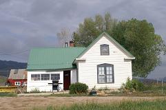
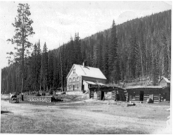
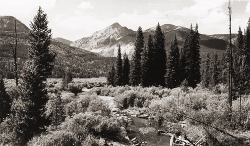
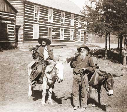
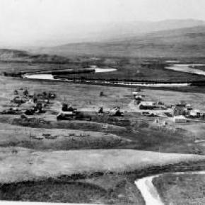
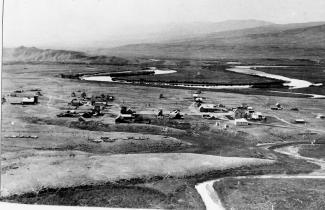
Sheriff Ranch lies in a valley just below Highway 40, 2 miles east of the Town of Hot Sulphur Springs. It's the serene world of John & Ida Sheriff. Old cabins with outhouses align themselves against the riverbank of the Colorado River. They tell a story of the fishermen who once rented the cabins for just a dollar a day-a long time ago.
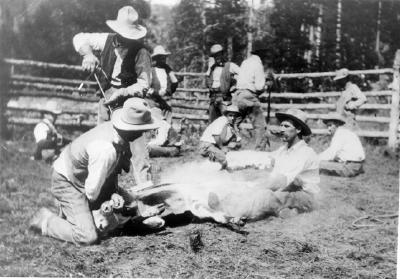
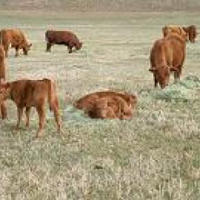
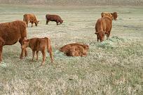
It's a quiet Sunday morning and only the sound of geese flying overhead can be heard. The cattle are quiet in the meadow as the sun begins to rise and feeding time comes close. They sense the presence of this stranger. The air is cool and damp as Ida comes to greet me. John is not far behind. Looking across the meadow, a calf seems to have caught herself in a fence and to my surprise, the entire herd rushed off to help her. Suddenly she's free and the cattle slow to a stop. The cows quiet down as John throws hay from the pickup. The calves are more curious and come right up to us. One mother cow took off with her young one and Ida called her by name, "Oh, Spook, why are you running off?-she's always taking off! She's afraid you're here to brand her!"
John & Ida begin this morning just as they have for the past 57 years, checking on momma cows ready to give birth and carefully watching the newborn calves. They all have a name, just like children. Two calves, not quite awake, lie together on the hay while chewing on the tender hay. The sound of the cows chewing is soothing to the ear.
A story of the ranch heritage unfolds while we sit at the kitchen table enjoying a cup of tea and fresh baked date-nut bread.
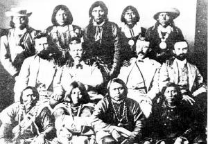
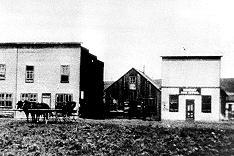
Marietta Sumner Sheriff and her sons came to Leadville, Colorado from a farm in Keithsburg, Illinois, in search of mining claims recorded by her deceased husband, Matthew. (Many farmers and ranchers moved to Colorado ? the promise land of gold). Some years later, Marietta and her sons moved to Hot Sulphur Springs where her sister, Mrs. William Byers lived (1859 Rocky Mountain News founder, William F. Byers).
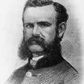
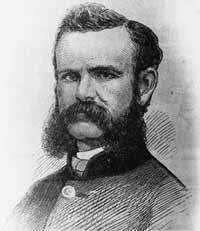
The ranch has been passed down from generation to generation since then. John Sheriff was the eldest son of Glenn and Adaline Sheriff (Glenn Sheriff was County Commissioner for 21 years, County Assessor, Director of the State Welfare Board for 13 years, and President of the Board of the Middle Park Union High School). He attended the Hot Sulphur Springs Public School through the 12 th grade. Everyone had to share in working the ranch and John was no stranger to peddling milk door to door for 10 cents a quart before he went to school.
Harsh winters closed off travel over Corona Pass (Top of the World) and the only way into the County was on snowshoes. Middle Park was a tough place to live with 50 degrees below freezing for weeks on end. Many people stocked up on flour and sugar and other supplies for the winter because they couldn't get into town for supplies. The Sheriffs were more fortunate and would use a horse and sled and follow the river into the town of Hot Sulphur for supplies.
Ranch life was not a wealthy profession as many may have thought. The Sheriffs know how hard it was to keep the family ranch. In the 1930's, Roosevelt's New Deal (Agriculture Adjustment Administration-AAA) forced ranchers and farmers to kill off half of their herd to level out the economy. Cow hides were sold for 5 cents a hide. Ida recalls, "Everyone in agriculture had to start over. Everyone was in the same boat. Some people couldn't take the stress and just moved off their ranches-- just leaving them!" The Sheriff ranch was in debt following the depression era. Ranches were up for foreclosure everywhere; banks didn't want them. The family just hung in there until they could get a herd of cattle going again.
Joining the Navy, John served in the South Pacific during World War II, and returned home to attend Colorado State University where he studied general agriculture. He met and married Ida Marte in 1949, daughter to early Grand County pioneers, Liberat and Bertha Marte. Ida is known over the years for her involvement with historical societies, documenting the history of the County, and maintaining original cemetery plots for the Hot Sulphur Springs Cemetery.
The years after the war were a struggle. With not enough hay to put up and only a handful of cattle, ranchers turned to raising sheep and harvesting crops of lettuce. Japanese prisoners of war were sent here from California to work on ranches.
"We always had to have an outside income ?cabin rentals, John's dad, Glenn was commissioner, and Mom worked at the library to help pay expenses. Once in a while we would have enough cows or lambs to go to market. The Federal Land Bank saved a lot of ranches allowing us to borrow money to get going. We were all afraid of another recession after the war," Ida said.
In the first 30 years of their marriage, John & Ida did not see much of each other. John traveled back and forth taking cattle to auction. When they got married, the ranch was so much in debt that they were "darn lucky that we didn't loose it".
The Sheriff homestead was registered in 1881 with 1350 acres and had as many as 250 head of high grade Herefords by 1975. Pure-bred bulls were purchased from neighboring ranches (Taussig Brothers, Hermosa Ranch, and Lawson Ranch) improving the quality of the herd. Sheriff ranch's registered brand-Bar Double S---is still known to be the oldest registered brand in the County.
In 1984 a large portion of ranch acreage was sold to Chimney Rock Ranch Company and the remaining acreage is where Ida and John live today, raising a small herd of cattle. They no longer make trips to auction. Today, a buyer comes to the ranch.
With no electricity in the early years, trudging through deep snow to the barn's generator was a morning ritual to power the lights in the house. In later years, electricity allowed the Sheriffs to start the generator with a flick of the switch from within the main residence.
The years of struggle and hardship, hard work and the desire to keep the family ranch has been a great sense of pride for the Sheriff family today. John and Ida, their ancestors and their family are a living example of family ranches surviving today. Not many remain, but this ranch, with a great family history, has a river of life flowing through it.