Winter Park Ski Shop
Ute Bill Thompson
Ute Bill Thompson

Places Articles

How Parshall got its name

A question frequently asked of native-born son, George Mitchell. It has long been believed that Parshall was named after Ralph Parshall of the Parshall Flume invention fame. But recent research in the Grand County Historical Archives at the Pioneer Village Museum, and with the help of Tim Nicklas, former museum manager, has proved this to be wrong. Daisy Jenne began gathering historical artifacts and memorabilia from the early 1900s. She reports in her records that Alonzo Polhamus named the town for his good friend, Clyde Parshall, son and heir of Cordelia Parshall, owner of the ranch. Polhamus surveyed sixty acres of the flat above the confluence of the Williams Fork and Grand Rivers into lots and blocks and registered the town plat in the Grand County records on July 26, 1907. The following is an excerpt of the upcoming Parshall History Journal. Please note the dates and timeline to verify the events that have led to this correction.

The Other Parshall “legend" says that the town of Parshall was named in honor of Ralph Parshall. However, numerical evidence does not support this legend. Ralph may have been a relative but was not a member of the family that purchased the property that later became the townsite of Parshall. A grave marker in the Golden, Colorado cemetery shows that Cordelia M. Parshall was born in 1862 and died in 1904. She purchased the property from Frank Byers in 1902. According to the 1900 census, Cordelia was married to Simon E. Parshall. The pair had one son, Clyde. Ralph Parshall was born in 1881. He enrolled at Colorado State University in Fort Collins, Colorado as a freshman in 1899 and graduated in 1904 with a degree in Civil Engineering and Hydrology. After post-graduate work, Ralph joined the faculty in 1907 at age twenty-six. Six years later he joined the USDA Irrigation Office, while still part of the CSU Hydrology Department. In 1915, he invented the Parshall Flume, a water measuring device for the purpose of accurately gauging the stream flow of irrigation water, and registered it in the U.S. Patent Office in 1921. He is credited with establishing the Hydrology Lab at the University. Ralph Parshall died in Fort Collins in 1959 at age 78.”


by Barbara Mitchell - GCHA Board Member and 2018 Pioneer of the Year 

Kremmling
Kremmling

Kremmling started as a general mechandise store, owned by Rudolph (or Kare) Kremmling, on the ranch of Dr. Harris, located on the north bank of the Muddy River. In 1888, John and Aaron Kinsey had part of their ranch platted, calling the site Kinsey City. Kremmling moved his store across the river from the new site and the town that subsequently developed became known as Kremmling. There was a post office established at Kremmling as early as 1885 and the town was incorporated in 1904. 

The Middle Park Fair was established here in 1912. Famous Western Novelist Zane Grey spent time in Kremmling and, as a result, wrote "Mysterious Rider" in which the area is shown as a classic Western setting.

During World War II the town was the location of a prisoner of war camp where German prisoners cut ice that was shipped by rail to other locations.

The local ranching industry, the presence of the railroad and its strategic location at the confluence of the Colorado River, the Blue River, and Muddy Creek made Kremmling a natural location for a town, which still retains the “Old West“ atmosphere.

Map of Grand County
Middle Park
Middle Park

Middle Park is one of three big parks in the Colorado Rockies and covers a large portion of Grand County. Like North Park and South Park on either side, Middle Park is a large open area of  meadows, river valleys, woodlands, surrounded by mountains. It is also the headwaters of the mighty Colorado River.

The first printed account of Middle Park was written in 1839 describing abundant antelope, deer, big horn sheep, bears, buffalo and elk. The word “parc” is of French origin and so it is logical to assume that French trappers named this location.

In 1819 the Adams-Onis Treaty partitioned Middle Park so that Fraser, Granby and Hot Sulphur Springs, had they existed, would become part of the United States; however, Kremmling would have belonged to Spain! Later, Kremmling would have been part of Texas.

While political boundaries have changed, the beauty of the park remains the same. As Middle Park is entirely surrounded by mountains, Robert C. Black, who wrote the area’s definitive history, chose to call his book, Island in the Rockies.

Monarch & KaRose
Monarch & KaRose

Once upon a time on the land that lies beneath Lake Granby and Shadow Mountain Lake there were ranches, pastures and an almost forgotten town, Monarch.  It is a story that goes back 100 years to the Summer of 1905, and the arrival of train service in Middle Park and promoters who were "honest men, but too visionary and lacking in experience", according to Frank H. Wolcott, a brother of one of the founders.

The Monarch Consolidated Gold and Copper Mining and Smelting Company owned the King and Queen copper mines on Arapahoe Range above the South Fork of the Colorado River.  They felt their assays indicated ore worthy of a mill and arranged to haul in the heavy machinery and proceeded to build a town with cottages, a small hotel, stores, a bowling alley, theater and dance hall.  By 1907 Monarch had a school and post office.  However, records indicate only about $150 worth of copper per year was ever produced.    

Soon the promoters realized a sawmill was needed to provide both timber and cash to support the mine operation. A dam was built creating Monarch Lake at the junction of Arapahoe Creek and the South Fork of the Colorado, and a canal was built to float logs cut near Strawberry Lake to Monarch Lake.  A stern wheel steamer bunted rafts of logs into flumes and canals towards the sawmill downstream in Monarch.

In the spring of 1906, Monarch management obtained a charter to build the Rocky Mountain Railway, a standard gauge, for lumber and passengers, from the Moffat tracks in Granby to Grand Lake, with a spur over an unspecified pass to Walden, in North Park.  The track was laid following the river from Granby to the sawmill, by Japanese and eastern European laborers.  Ranchers along the route, excepting Fred and Frank Selak, quietly granted rights-of way. The only rolling stock owned by the railroad was a small, ancient locomotive and a caboose.  The night before Thanksgiving 1906 the first train rolled into Monarch, and the rails never extended any farther.  There was daily service, and local ranchers could flag a ride or have their packages dropped off.  There were no cattle guards, so the fireman would step off the locomotive, open a ranch gate, and close the gate and hop back on after the train passed through. 

During the winter of 1905-06 a box factory was started. It operated briefly before it was destroyed by fire in the fall of 1908.  The fire forced the mill and railroad into receivership.  Visitors, particularly former stockholders, helped themselves to equipment and entire buildings, but Monarch's core was preserved and developed by Harry L. Dierks of Kansas City into KaRose.  This summer resort was named in honor of Dierks' daughter Katharine Rose.  Other Monarch buildings went to neighboring dude ranches and the bowling alley went to Granby.  

To hold the railroad right-of-way, Ernest Behr restored the locomotive in 1912 to carry parties of fishermen along the river from one pool to another.  Ed McDonald, a dude rancher, ran a Cadillac touring car on flanged wheels on the rails to carry mail, supplies, and passengers to the valley ranches.  Just before World War I the engine and rails were sold for scrap. 

Frank H. Wolcott wrote, "In September 1954 my wife and I drove over the site to discover any signs of Monarch or the railroad...It gave us a queer feeling to realize that substantial things like railroads and buildings that we helped build have vanished.  Was it all a dream?"

Monarch: Grand County's City of Atlantis

Monarch, now a picturesque lake for meandering around on a pleasant summer day, was once a bustling town, the home of the Monarch Consolidated Gold and Copper Mining and Smelting Company, and the rail head of the Rocky Mountain Railroad.  The life of this little company town and railroad was very short lived and now nearly forgotten. 

Boulder business men T.S. Waltemeyer, and Frank and Charles A. Wolcott heard about traces of gold, silver, and mostly copper at the junction of the Arapahoe Creek and the South Fork of the Colorado River.  In 1905 they established the Monarch Consolidated Gold and Copper Mining and Smelting Company and built their company on the assumption that a major belt of minerals extended east through the Continental Divide.  The Monarch Company consisted of several subsidiary companies including lumber companies, an "investment" company, an exploration company, and a development company.  The main objective of the company was to mine metal ores, but supplement it with timber and build a railway to benefit the whole corporation. 

The company had 1740 acres of placer and lode claims; the main mines were the Copper King, Copper Queen, Omaha, Ella C., and High Lonesome. The Monarch Company shipped heavy machinery by flatbed cars to Granby on the new Moffat Road.  They then put an ad in the paper asking for bids to haul heavy machinery 16 miles from Granby to Monarch.  The machinery included "5 boilers (eight and a quarter tons each), one engine (over eleven tons), one flywheel (6 tons), other machinery (from 1 to 5 tons), a carload of nails, and several hundred pounds of miscellaneous supplies."  The task of hauling the heavy equipment was made especially difficult by mud-holes and bridges not made for heavy loads.  Denver hauling companies refused to take on the job and one Swedish logging company from Wyoming abandoned the challenge after the first wagonload stuck in a mud-hole.

Finally Dick McQueary agreed to move the machinery.  To accomplish the job, McQueary purchased several hundred feet of hardwood planks in Denver, 3 inch thick, sixteen inches wide and twelve feet long.  Accompanying the heavy pieces up the mountain was a "4 horse team hauling hardwood plank, a 4 horse team pulling six inch pine poles, 10 feet long, and a four horse team pulling two ton large nails".   The crew built temporary bridges across mud-holes by laying pine poles 3 feet apart with hardwood planks laid across the poles.  2 light loads were driven across to test bridge followed by the heavy load pulled by 12 head horses.  Finally the planks and poles were pulled up to be used at the next mud-hole.  The heavy machinery was hauled in 2 weeks.

Construction on the Rocky Mountain Railway, a standard-gauge line from Granby to Monarch, began in 1907.  The 16 mile line was completed by Thanksgiving.  There were hopes of someday extending the line to Grand Lake for resort passengers and eventually a line to Walden in North Park.  The Denver and Northwest Railroad Company helped survey the line by lending J.J. Argo's services.  Dick McQueary was once again brought in to grade the road bed between the Monarch mill and Granby.  Most of the workers on the railroad were Japanese, Bulgarian, Hungarian, and Austrian day laborers from an employment agency in Denver.  The laborers were paid $2 a day, (plus a fifteen cent fee for their interpreter).

Once the railway was completed and in operation it issued passenger tickets.  However, the company never published a schedule.  Neither did the company hire a full train crew to run their single locomotive.  To meet regulations for switching service on Moffat tracks in Granby, the Rocky Mountain Railroad took on board a couple of interested bystanders.  At gates crossing ranch properties fireman Leo Algier would simply jump off the train to open the gate and close it after the train had crossed through before hopping back on the train.  Ranching families on the line were allowed to catch rides on the train when it passed through or to request package drop-offs. 

The Monarch Company created Monarch Lake by damming the valley, at the junction of Arapahoe Creek and South fork of the Colorado River, for use with the saw mill and the box factory. A 2800 foot long chute carried tree trunks down the hillside to the lake where they hit the water and could bounce up to 50 ft high.  Then a stern-wheel steamer pushed logs into a system of canals and flumes that led down to the saw mill and box factory. 

The town of Monarch included employee housing, business offices, a post office, and an assembly hall.  Dick McQueary helped haul sawlogs to mill and haul materials for building employee housing in Monarch.  Grand County's first hydro-electric generator was in Monarch.  The waterworks system was created by piping water from the falls at Mad Creek and had pressure up to 300 lbs per inch. 

Even thought the mining company never produced more than $150 a year, the owners continued to promote the business to stockholders and they were able to keep the business running by through their enthusiasm for the project.  During the summer, stockholders were invited to visit Monarch, tour the site, and hear lectures on the operation.  The tour often included a visit to a spruce tree named "Monarch" that was seven feet in diameter.  So, while business might not have been booming, enthusiasm and interest from stockholders was.  

The last piece of Monarch to be constructed was the box factory in 1907.  Unfortunately the factory only operated for 2 or 3 months before it suffered a fire and was totally destroyed.  Robert Black in Island in the Rockies stated that the questionable promotions of Monarch would have been forgiven if the box factory had developed into a solid operation. 

Soon after the fire, a disagreement between management and labor resulted in the entire work force being fired.  For several months the Rocky Mountain Railroad operated the train with one man who acted as engineer, fireman, brakeman and conductor. The company hired Dick McQueary as general manager until fall the fall of 1907 when stockholders discovered the true state of the company and declared bankruptcy.   Stockholders and the community were convinced that the whole company had been created as stock-selling scheme.

Although the Monarch Company and the Rocky Mountain Railroad were no longer in business, the railway continued to be used for a number of years.  For example, Ed McDonald, dude rancher, put a Cadillac touring car on flanged iron wheels to carry mail, supplies, and guests to his ranch.  The center of town was preserved and developed by the Dierks as a summer resort called Ka Rose, after Katherine Rose Dierks, after the owner's daughter.   In 1912 the rail line was used for transporting fisherman along the river by Ernest F. Behr, a former Colorado and Southern engineman.  Finally, in 1918 the rails were sold to a junk dealer in Denver to satisfy the World War I need for scrap metal. 

Currently, the town, mill site, and box factory lay under the waters of Lake Granby and are inaccessible, except in years of draught.  However, there are a couple of remaining pieces at Monarch Lake that are still visible.  On the south side of the lake, near the water's edge, is a boiler that was used to yard logs into a chute and shoots the logs into a holding pond.  Also, the flume still runs down the hillside into the lake.  The trail around Monarch Lake takes hikers directly under the flume.

Mount Craig
Mount Craig

The rounded mountain at the head of the East Inlet to Grand Lake has born many names-from Middle Mountain, to Mount Baldy, to Mount Westcott. It's official title, however, is Mount Craig. It's namesake is The Reverend William Bayard Craig, who came to the area in 1882, to be pastor of the Central Christian Church in Denver. He visited Grand Lake occasionally, and completed some real estate dealings there. The town of Craig also bears his name, due to the influence of his friend, David Moffat, of the Denver and Salt Lake Railroad.

Mountain Names
Mountain Names

While the origin of the names of many mountains in Grand County has been lost to history, we do know the source of many of the more notable mountains.  The name originations of some mountains of Grand County are as follows:   Adams Peak – Named for either Jay E. Adams who owned a cottage in Grand Lake or Alexander and Louise Adams, original owners of the Grand Lake Lodge.  

Mount Alice – 13,110 ft. – Named in 1911 by request of geologist Dr. William S. Cooper.  Who “Alice” was, was not explained.   Arapaho Peak – Named for the Arapaho Indian tribe who frequented Grand County during hunting season.   Arikaree Peak – Named for the Arikaree Indian tribe by James Grafton Rogers in 1955.   Baker Mountain – Named for John Baker from Indiana, a well known prospector and hunter of the 1850’s and 1860’s.  

Bills Peak – Named after an early settler in the area whose last name was not known.   Bottle Mountain – Named for the bottle shape of the mountain, three miles north of Byers Peak.   Byers Peak – 12,790 ft. – Named for William N. Byers, publisher and editor of the Rocky Mountain News and early promoter of Hot Sulphur Springs.   Mountain Cairns – 10,800 ft. – Named for James Cairns, first storekeeper at Grand Lake.   West Carter Peak and North Carter Peak– Believed to have been named for a member of the original U.S. Geological Survey team.   Cascade Mountain – Also known as Loder Mountain, popularly named for cascading stream.  

The Cleaver – Believed named by early settlers for location between two other peaks.   Coal Mountain – Named for visible coal seam.   Mount Cumulus – 12,725 ft. – Named for cloud formation resemblance.  One of three “cloud” peaks.   Diamond Mountain – Named for rumors of diamonds found there or its shape.  Located four miles East of Muddy Pass.   Mount Epworth – Believed named for a Methodist youth group founded in 1889.  Located east of Rollins Pass.  

Fairview Mountain – Named for scenic view.  Located ½ mile south of Parika Peak.   Mount Flora – Named for fields of flowers on mountain.   Mount George – 12,876 – Named for Dr. R.D. George, a geologist.  Its north spur is Lone Eagle Peak.   Green Mountain – Named for the green trees covering the mountain.   Grouse Mountain – Named for the grouse that inhabit the area.   Hallett Park – 12,713 – Named for William H. Hallett who lived from 1851 to 1947.  The mountain was named in 1887.  

Howard Mountain – Named for John Howard, a prospector.  The mountain was named in 1880.   Mount Irving Hale – Named for Brigadier General Hale who lead Colorado troops in the Philippines during the Spanish American War.  Hale was a member of the first graduating class at Denver High School and won an appointment to West Point.  Camp Hale, near Leadville, was a training site for World War II ski troops and was also named for him.

Mountains
Mountains

The mountains of Grand County may not boast any of the famous “fourteeners“ (14,000 feet and above), but Middle Park is defined by some of the most majestic ranges in the state. These include parts of the Front Range, Gore Range, Rabbit Ears Range, and the Williams Fork Mountains.  

The only range Grand County can call entirely it's own is The Never Summer Range.  It's highest point is Mount Richthofen (12,940 feet).  Other major peaks include: Mount Howard (12,810 feet), Mount Cirrus (12,797 feet), Mount Nimbus (12,706 feet), and Nokhu Crags (12,485 feet). The name Never Summer is translated from the Arapahoe name, Ni-chebe-chii, which means “the place of No Never Summer“.  The cloud names of Cirrus and Nimbus, and Stratus and Cumulus were the idea of James Grafton Rogers, a founder of the Colorado Mountain Club.  

The Never Summer Range stretches for ten miles from Cameron Pass to Bowen Mountain.  This range is darker and harder due the tremendous heat produced when the peaks were a localized center of volcanic activity.

Mountains of Grand County

The mountains of Grand County may not boast any of the famous “fourteeners“ (14,000 feet and above), but Middle Park is defined by some of the most majestic ranges in the state. These include parts of the Front Range, Gore Range, Rabbit Ears Range, and the Williams Fork Mountains.

The only range Grand County can call entirely it's own is the Never Summer Range. It's highest point is Mount Richthofen (12,940 feet). Other major peaks include: Mount Howard (12,810 feet), Mount Cirrus (12,797 feet), Mount Nimbus (12,706 feet), and Nokhu Crags (12,485 feet). The name Never Summer is translated from the Arapahoe name, Ni-chebe-chii, which means “the place of No Never Summer“. The cloud names of Cirrus and Nimbus, and Stratus and Cumulus were the idea of James Grafton Rogers, a founder of the Colorado Mountain Club.

The Never Summer Range stretches for ten miles from Cameron Pass to Bowen Mountain. This range is darker and harder due the tremendous heat produced when the peaks were a localized center of volcanic activity.

Articles to Browse

Topic: Mining

Mining in Grand County

Ghost towns and broken dreams are legacies left by the early miners and prospectors of Grand County.  

Ever since 1879 when the first mines were staked out and claimed on Bowen Mountain near Grand Lake, “gold and silver fever” grew like an epidemic.  Men blinded by greed and prospects of a better tomorrow scrambled to the Kawuneeche Valley with picks and shovels to unearth their fortunes.  

Women worked just as feverishly along side their men and encampments gave way to mining towns almost overnight.  Land offices, eateries, and boarding houses sprouted like wild flowers. Claim jumping became a common practice, resulting in fights and even murders.  Most of these injustices would go unpunished, for no one wanted to risk losing their chance of riches.  

In Grand County the mother load was a false prophecy, as only small quantities of low grade gold, silver, and lead ore were found.  In a few short years, Gaskill, Teller City, and Lulu City, three of the more noted settlements, suffered the same fate as the other boom towns.  By 1885 the mining boom had ended in Grand County and ranching had taken it’s place as a sustaining industry.

Topic: Grand County

Grand County Time Line

Prehistoric
7000 BCE to 900 BCE: Paleo Indians  (Yarmony, Rollins Pass, Windy Gap) use Middle Park as summer hunting area

1819 – 1860
1819:Adams-Onis Treaty – Middle Park partitioned – Sites of Granby, Fraser, Grand Lake and Hot Sulphur are in the U.S, Kremmling still part of Spain

Middle Park well known to “Mountain Men” by 1820

1828: Kremmling becomes part of Texas

1837: T.J. Farnham’s expedition crosses the Blue at Grand River

1839: Grand River named on a semi-official map

1842: Rufus B. Sage visit

1844: Captain John C. Fremont’s second expedition, accompanied by Kit Carson, enters Middle Park over Muddy Pass and exits up the Blue River

1854: Sir St. George Gore, an Englishmen, accompanied by Jim Bridger enters Middle Park for hunting expedition

1859: First appearance of prospectors; interest in Hot Sulphur Springs

1861 – 1874
1861: Berthoud crosses Berthoud Pass and traverses Middle Park

1861: Middle Park becomes part of Summit County

1863: Trouble begins between the Utes and white men

1864-1868: Wm. N. Byers acquires Hot Sulphur Springs

1866: Gov. Cummings signs Treaty of Middle Park

1868: John Wesley Powell visits Grand Lake, makes first recorded ascent of Longs Peak

1867: Joseph Westcott settles at Grand Lake

1871-1872: Clarence King surveys area

1873-1874:  F.V. Hayden surveys area

1874: Creation of Grand County (two years before Colorado became a state)

1874: Toll roads opens over Rollins and Berthoud Passes

1874: William H. Jackson, renowned photographer, takes first photographs of Middle Park

1875 – 1888
1875: First mail routes to Hot Sulphur Springs

1875: Silver ore indications in Never Summer Range

1875: First school opens in Hot Sulphur Springs with 12 students, (school “year” was 20 days)

1877: Routt County detached from Grand County

1877: Stokes-Dean political crisis

1878: Tabernash and Abraham Elliott killed

1879: Ute Indian War produces excitement, anxiety

1879: Lulu City & Teller City formed

1880: Gaskill City formed

1881: Four railroad projects frustrated

1881: County Seat moves to Grand Lake, height of mining boom,   Grand Lake Prospector is launched

1883: Commissioner shootings at Grand Lake

1884: Shooting of Texas Charlie in Hot Sulphur Springs

1884: Kremmling formed

1885: Kremmling Post Office opens

1885-1886: Collapse of mining, North Park separates from Grand County

1888: County Seat moves back to Hot Sulphur Springs

1889 – 1904
Expansion of ranching

Development of public education

1890: Grand Ditch construction begins... carries water from Grand Lake mountains to the front range

1891: First platting of Kremmling

1891: Berthoud Pass route becomes state road

1893: Construction begins on Byers Canyon road

1896 et seq.: Organized religious congregations develop

1892: First diversion of water to eastern slope

1898: First high school opens in Kremmling

1902-1904:  Moffat – Harriman struggle

1903: Hot Sulphur Springs incorporates

1904: Kremmling incorporates

1904: Moffat Road crosses Rollins Pass

1904: First motor car arrives Grand County

1904: First telephones installed

1905 – 1914
1905: First Forest Reserves

1905: Fraser develops, Granby is founded

1905: Moffat Road reaches Hot Sulphur Springs

1905: Parshall is founded

1906: Moffat Road reaches Kremmling

Proliferation of competitive newspapers

1905-1908: Heyday of Monarch

1908: Arapaho National Forest established

1911: First Hot Sulphur Springs Winter Carnival

1912: First Middle Park Fair

1913: Eleven motor vehicles are registered in Grand County

1913: Tabernash established as railroad division point

1915 – 1930
1915: Rocky Mountain National Park founded

1917-1918: Participation in World War I by 151 Grand County residents

1918-1919: Influenza epidemic

1919: Grand County Pioneer Society founded

1919: Fall River Road completed

1921: Grand River name changed to Colorado River by U.S. Congress

1922: First radio receiver

1923: Gore Pass opens to motor vehicles

1923: Improved Berthoud Pass road opens

1923-1928: Moffat Tunnel built

1926: Fred Selak murder

1929-1941: The Great Depression

1930-1932: Berthoud kept open all winter

1932: Trail Ridge Road completed

Since 1930
1938: Colorado-Big Thompson irrigation and power project begins

1940: Winter Park Ski Area opens

1941-1945: Participation in WWII

Late 1940s – early 1950s: Construction of Colorado– Big Thompson Project

1947: Adams Tunnel in operation

Growth, then boom, of winter sports


Topic: Biographies

John Charles Fremont

Captain John Charles Fremont was born in 1813 and at the age of 31, in June 1844, was exploring the northern reaches of the Republic of Texas when he passed through Grand County.  This marked the first appearance of official government enterprise in Grand County.

His expedition included some 40 explorers, including people of Creole, French, and Black descent. The guides were Thomas Fitzpatrick and Kit Carson. This expedition entered Grand County via Muddy Pass and exited via the Blue River, never traveling into the eastern part of the County. 

They met with some 200 Arapahoe Indians, who were traditionally suspicious of the intruders, but through the giving of trade gifts, overt conflicts were avoided. The cartographer for that expedition was Charles Preuss, who provided the first map on which all of the central Rocky Mountain Parks were named and mapped accurately.

Topic: True Crime

The Selak Hanging

Fred Selak was a descendant of early settlers in Grand County.  He built a cabin three miles south of Grand Lake where he lived alone.  He helped his brothers in various enterprises including mining, a general store and a sawmill.  Selak was known to be a prosperous citizen who lent money to others and there were rumors of hidden cash and gold in his cabin.  He was also known to be an avid coin collector. 

When Selak failed to pick up his mail for several weeks, the postmaster visited his cabin July 26, 1926. After not getting a response to his knocks, the postmaster summoned an employee of Selak's with a key.  When they opened the door, they discovered the cabin in shambles and Selak missing.  Sheriff Make Fletcher was notified and a nephew of Selak's called in the Denver Police Department. 

As the investigation progressed, a .22 caliber slug was extracted from the wall and blood was found on an easy chair, but further investigation ruled these clues inconsequential as they were dated to many years prior. Sheriff Fletcher conducted a massive manhunt on August 16th and the body of Fred Selak was found on the second day by a deputy's dog.  The body was hanging from a tree and evidence showed that, because of a sloppy knot, Selak did not die quickly of a broken neck but rather suffered a slow strangulation.  The murder had taken place a month earlier and the body had stretched until the feet were touching the ground. 

Arthur Osborn, 22, and his cousin Roy Noakes, 21, became prime suspects after showing off old coins and trying to spend them for minor purchases around Grand Lake.  After interrogation by the Denver Police, both confessed to robbing and killing Selak.  Later, Noakes claimed that the confessions were coerced by the police. 

The suspects were kept in the Denver jail until their trial on March 7, 1927 and Sheriff Fletcher had to take great precautions against a possible lynching.  The only motive for the murder seems to be based on a land dispute years earlier in which Osborn was arrested for a violating fence line.  Both suspects were found guilty and sentenced to death.  After many appeals, the convicted murderers were hung in Canon City on March 30, 1928.  

Topic: Dude Ranches

Dwight D. Eisenhower and the Western White House

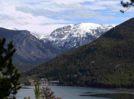
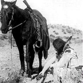
Dwight D. Eisenhower met and married Mamie Geneva Doud of Denver on July 1, 1916. Carl Norgren, a Doud family friend, had started spending time in the Fraser area and was enchanted by the beauty of the area and especially the Byers Peak Ranch for Boys.

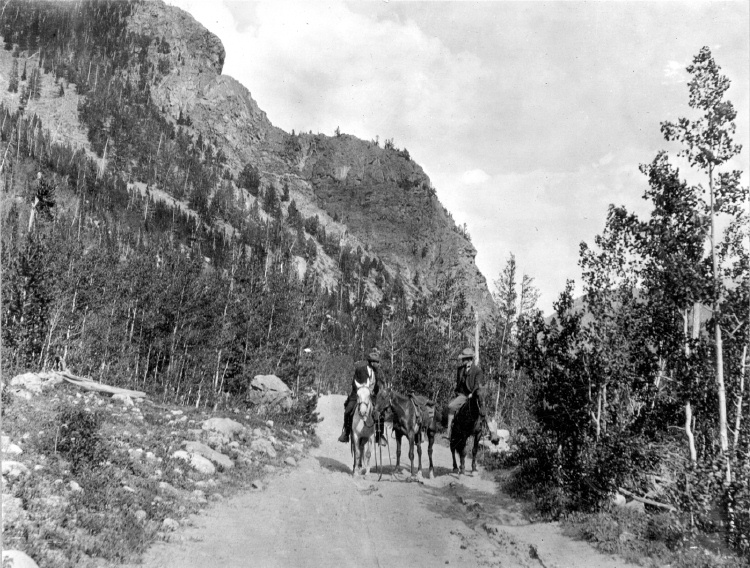
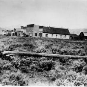
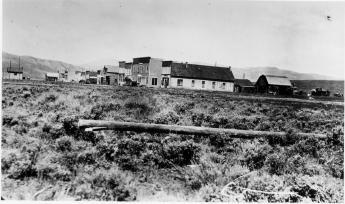
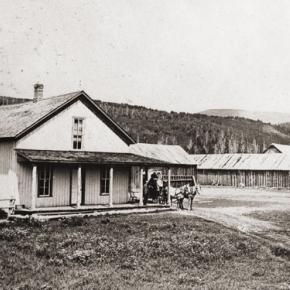
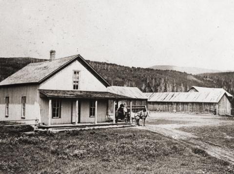
By the late 1930s, Norgren partnered with Aksel Nielsen to purchase the Byers Peak Ranch.  During Eisenhower's presidency, the Brown Palace Hotel in Denver, the Byers Peak Ranch, and Lowry AFB were all known as "Western White Houses" or "Summer White Houses." There is a well known photo published in Life Magazine of Eisenhower fishing in the Fraser River with his grandson, David.

Eisenhower used his time at the Byers Peak Ranch to rest and recompose himself in the face of difficult political times. As President, Eisenhower dealt with the threats of the Cold War, a truce in Korea, the desegregation of public schools (Little Rock, Arkansas), and the development of the "Eisenhower Doctrine" to bolster the Middle East against the threat of communism. On the domestic front, he was faced with the difficulties of dealing with the Republican Old Guard, including Senator Joseph McCarthy, who headed a subcommittee charged with the finding of communists within the government.  

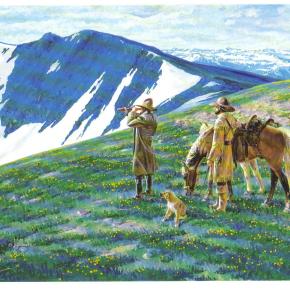
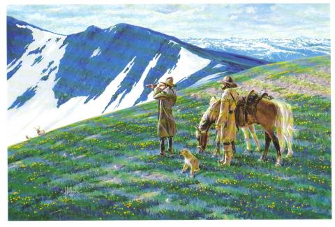
Eisenhower enjoyed cooking for guests at the Ranch, fishing St. Louis Creek and having "brookies" (brook trout) for breakfast, painting, and playing golf.  On September 24, 1955 while at the Ranch, Eisenhower suffered a coronary thrombosis (heart attack) and was hospitalized at Fitzsimmons Army Hospital in Denver until November 11, 1955.  His hospital suite has now been restored and is open for limited tours.

The bulk of information about Eisenhower and the Byers Peak Ranch comes from the personal papers of Carl Norgren, which are housed at the Eisenhower Museum and Library in Abilene, KS.  The collection of correspondence from 1948-1964 covered a broad variety of topics: fishing, recreation, taxes, health matters, food, communism, reorganization of the Department of Defense, federal spending, etc. The Norgren collection valued for the details it provides concerning the hobbies and recreational pursuits of the President during his visits to Grand County between 1952 and 1957.

Topic: Regions

Church Park

George Henry Church and his brother John had a substantial ranch in Jefferson Country, prior to Colorado Statehood.  When the Timber and Stone Act of 1878 was passed, it permitted the purchase of land unfit for agriculture for $2.50 an acre.  Thus the Church brothers obtained land in Middle Park for summer grazing.  They would move their cattle into the Park by driving them over the Rollins Pass.   The area they used is just west of the town of Fraser and became known as Church Park.

In 1910, the Church Ditch was created to divert water across the Continental Divide for irrigation.  The remains of this early trans-mountain project can still be seen today at mile marker 241.5 on U.S. Highway 40.

Topic: Biographies

R.W. "Dick" McQueary

R.W. (Dick) McQueary was born May 9, 1868, in the San Luis Valley near what is now Del Norte. Dick moved to Grand County in 1876. In 1892, Dick, newly married, began freighting between Hot Sulphur Springs and George Town's railroad terminal.

He moved boxes of merchandise for the general store, barrels of whiskey for saloons and machinery for sawmills. On one of these trips he decided to build cabins closer to Berthoud Pass. His crew built several log buildings 6 miles from the top of the pass and named it "Spruce Lodge".

In the spring of 1893, Dick contracted to open snowbound Berthoud Pass by middle June. He moved his wife Jessie and three-months old son to Spruce Lodge. Snow was shoveled from the roofs and trails to the buildings. Heat from stoves thawed the frozen dirt roofs and water entered the cabins. Pans were placed under the leaks to catch snow water. Work was completed 2 weeks later. On June 14, snow began to fall and canvas was placed over stove pipes to keep water from putting out the fires. Four feet of snow fell and the only dry place in the cabins was the pallet with the baby on it under the table.

1895 saw Dick Mcqueary homestead 320 acres between Pole and Crooked Creeks The ranch was named "Four-Bar-Four" after Dick's cattle brand. It became a well-known travel stop and is a point of interest to this day. By 1909 R.W. was freighting the Grand Lake area and became involved with building a road between the foot of Milner Pass to Pouder Lake at the summit. Dick bid $49,000 to build the road. Three years later, completion of a rough outline of the entire road through Rocky Mtn.National Park. M cqueary completed the west side and Jacobson the east side. Dick prepared festival grounds west of Grand Lake and a large crowd enjoyed the road opening celebration.

Topic: Towns

Grand Lake

Grand Lake was established in 1879 and incorporated in 1944. It is named for the largest natural body of water in Colorado.

In 1867, when only a few people resided near the lake, Major John Wesley Powell (the man whose group first rafted the Grand Canyon) came to explore the possibility of floating down the Grand (now Colorado) River. That summer, Powell, local resident Jack Sumner, and William Byers, founder of the Rocky Mountain News, made the first recorded ascent of Longs Peak from Grand Lake.

In the early 1900’s a Yacht Club was formed by enthusiasts who were attracted by the demands of attentive seamanship the lake demanded. In 1912, Sir Thomas Lipton contributed an impressive cup to be presented annually to the winner of the annual August Regatta. This event still draws skilled sailors to the challenging competition. 

The town was founded during a very brief mining boom, but because of it's natural beauty, tourism has long been the sustaining feature of it's economy.

Stafford Family

James "Jimmy" M. Stafford was born in 1849 in Wexford Ireland. Jimmy immigrated to Leadville in the 1870's to work in the booming silver mines. In Leadville, he met and married  Deborah Helen Acey (born 1846 in Trenton New Jersey) in 1880.  In the 1880's the couple moved to Dillon and then homesteaded the Stafford Ranch on the Blue River at Spring Creek Road. Jimmy built their home by hand carrying logs from Green Mountain.  They had one son, Frank Elmer Stafford, born in 1886. Jimmy and Deborah also operated the stage stop, boarding house and saloon called the "Halfway House" between Kremmling and Dillon on Highway 9.  It remained in operation until the stage lines ceased in the early 1900's and the buildings were dismantled in the 1940's.  

Frank went on to marry Alice Smith in 1909 and they had six children, including their first, a son, James Elmer, who died at age 8 in the worldwide flu epidemic of 1918. Frank and Alice built the Stafford General Store, directly across from the "Halfway House".  Frank was instrumental in installing the first telephone lines in the area and served as Grand County Commissioner from 1928 to 1936 and as County Commissioner from 1948 until his death from injuries in a car wreck in 1950.  Alice was called the "Blue River Belle" and kept the general store until 1960.  Alice lived in Kremmling until her death in 1969.  


Topic: Biographies

Billy Cozens - First Settler in the Fraser Valley

William Zane Cozens was born in Canada on July 2, 1830. After spending some time in New York, he moved to Central City Colorado in 1859, lured by the rumor of gold in the mountains. There, he became well known as a steady and trusted lawman.

In December 1860 he married Mary York, who had been born in England in 1830.  Mary was a devout Roman Catholic and was not happy with the uproarious mining camp of Central City and the constant threat to her husband in his role as Sheriff. So by the mid-1870's, they decided to relocate over the Continental Divide and established a hay ranch and stage stop in Middle Park (north of the present town of Winter Park). They had seven children, although only three ? Mary Elizabeth, Sarah Agnes and Willie ? survived infancy.

Mr. Cozens became the Fraser postmaster in 1876, holding the position until his death in 1904. On July 29, 1878, there was a total eclipse of the sun over Colorado.  The Ute leader Tabernash took that as a divine omen to take action against the increasing encroachment of white settlers, miners and hunters into Ute hunting grounds. Tabernash gathered 40 armed warriors and set out to attack the Cozens Ranch. Billy Cozens negotiated with the group, offered food and finally persuaded them to move on.  The group ended up confronting another rancher and the face off resulted in the death of Tabernash (more details under Tabernash page). 

Mary worked very hard to make their isolated home a pleasant place.  She even ordered dandelion seeds from a seed catalog in order to add color and zest to her garden.  One can speculate that the source the abundant dandelions in the Valley are the result of Mary's original plants.

The Cozens Families' stage stop became a well-known stopping place for summer tourists, who often enjoyed Mary's fine meals and "Uncle Billy's" (Mr. Cozens' nickname) tales from his days as a Gilpin County lawman. When Billy dies in 1904, none of his children had any offspring so Mary left the ranch to the Catholic Church and Regis University, which built a retreat on the property.  In 1987 the ranch house was given to the Grand County Historical Association and now houses a museum.   

Source:


Error message

  • Notice: Undefined index: quantity in omega_views_mini_pager() (line 234 of /var/www/html/docroot/sites/all/themes/omega/omega/inc/theme.inc).
  • Notice: Undefined index: quantity in omega_views_mini_pager() (line 234 of /var/www/html/docroot/sites/all/themes/omega/omega/inc/theme.inc).

Places