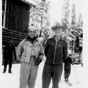
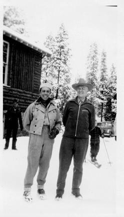
Ute Bill Thompson

Regions

Browse Subtopics

Regions Articles

Church Park
Church Park

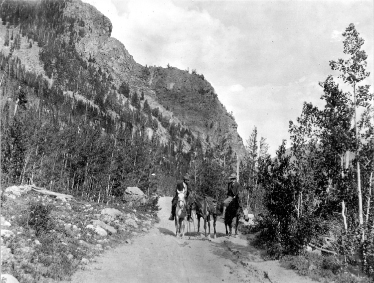
George Henry Church and his brother John had a substantial ranch in Jefferson Country, prior to Colorado Statehood.  When the Timber and Stone Act of 1878 was passed, it permitted the purchase of land unfit for agriculture for $2.50 an acre.  Thus the Church brothers obtained land in Middle Park for summer grazing.  They would move their cattle into the Park by driving them over the Rollins Pass.   The area they used is just west of the town of Fraser and became known as Church Park.

In 1910, the Church Ditch was created to divert water across the Continental Divide for irrigation.  The remains of this early trans-mountain project can still be seen today at mile marker 241.5 on U.S. Highway 40.

Fraser Valley
Fraser Valley

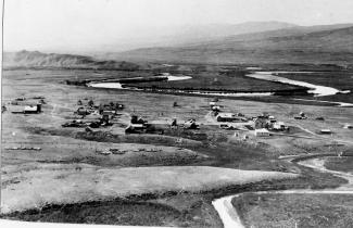
The principal population centers in the Fraser River Valley are Winter Park, Fraser and Tabernash.  When the early stage coaches came over Berthoud pass into the Fraser Valley, the most popular stop was at the Cozens Ranch, which now houses a historical museum in Winter Park. The valley is now bisected by U.S. Highway 40, which was designated the "Victory Highway" in 1931.  The new route of the highway leads through the main streets in both Fraser and Tabernash and the backdoors of some business became front doors because of the new highway alignment.   

Tabernash was the name given to a railroad siding, named for the Ute leader who was killed during a confrontation with local ranchers.  The town became a key station on the railroad line, and included a roundhouse, and a supply of helper engines for the steep climb over Rollins Pass.  When the Moffatt Tunnel was opened in 1928, the railroad no longer needed service there and the town lost its' main economic support.

George Easton founded the town site of Fraser in 1905.  The rest of the country became familiar with Fraser when the winter temperatures were often the lowest recorded in the U.S. and Fraser was know by the nickname "Icebox of the Nation".   Lumbering was one of the prime industries in the region until World War II.  During the war, the military built a Prisoner of War camp at Fraser to help lumber for the mills in the area.

The current area of Winter Park has had many names over the years.  First it was called simply "Old Town" or "Vasquez", named after the fur trader Louis Vasquez.  "Woodspur" or "Woodstock" referred to Billy Wood's lumber mill in the area, which furnished ties for the railroad while it was being built over Rollins Pass. During the construction of the Moffatt Tunnel, the name "West Portal" came into usage.  Rail workers also called the community "Little Chicago" as it was as it was a favorite gambling, saloon, and brothel site.  As tourists began to arrive it was known as "Idlewild" and also "Hideaway Park".  Finally, the name "Winter Park" was settled upon to correspond with the adjacent ski area of the same name.

The area population declined from 1232 people in the 1920's to only 373 people by 1930.  The Great Depression ended the construction boom and the price of beef became too low for ranches to turn a profit.  However, since that time, the area has thrived, mostly based on a tourism economy.  The valley's main source of income is now recreation and second home construction. 

Grand County
Grand County

Grand County was established in 1874 by the Territory of Colorado, thus becoming a county two years before Colorado became a state. It was named for the Grand River, the name by which the Colorado River was known at that time. The headwaters of the today’s Colorado River are in Grand County. The county was formed from a portion of Summit County but acquired its current boundaries in 1877, when part of the Grand County was used to create Routt County. The county seat is Hot Sulphur Springs. The area of 1,854 square miles consists of meadows, river valleys and mountains.

Grand County Time Line

Prehistoric
7000 BCE to 900 BCE: Paleo Indians  (Yarmony, Rollins Pass, Windy Gap) use Middle Park as summer hunting area

1819 – 1860
1819:Adams-Onis Treaty – Middle Park partitioned – Sites of Granby, Fraser, Grand Lake and Hot Sulphur are in the U.S, Kremmling still part of Spain

Middle Park well known to “Mountain Men” by 1820

1828: Kremmling becomes part of Texas

1837: T.J. Farnham’s expedition crosses the Blue at Grand River

1839: Grand River named on a semi-official map

1842: Rufus B. Sage visit

1844: Captain John C. Fremont’s second expedition, accompanied by Kit Carson, enters Middle Park over Muddy Pass and exits up the Blue River

1854: Sir St. George Gore, an Englishmen, accompanied by Jim Bridger enters Middle Park for hunting expedition

1859: First appearance of prospectors; interest in Hot Sulphur Springs

1861 – 1874
1861: Berthoud crosses Berthoud Pass and traverses Middle Park

1861: Middle Park becomes part of Summit County

1863: Trouble begins between the Utes and white men

1864-1868: Wm. N. Byers acquires Hot Sulphur Springs

1866: Gov. Cummings signs Treaty of Middle Park

1868: John Wesley Powell visits Grand Lake, makes first recorded ascent of Longs Peak

1867: Joseph Westcott settles at Grand Lake

1871-1872: Clarence King surveys area

1873-1874:  F.V. Hayden surveys area

1874: Creation of Grand County (two years before Colorado became a state)

1874: Toll roads opens over Rollins and Berthoud Passes

1874: William H. Jackson, renowned photographer, takes first photographs of Middle Park

1875 – 1888
1875: First mail routes to Hot Sulphur Springs

1875: Silver ore indications in Never Summer Range

1875: First school opens in Hot Sulphur Springs with 12 students, (school “year” was 20 days)

1877: Routt County detached from Grand County

1877: Stokes-Dean political crisis

1878: Tabernash and Abraham Elliott killed

1879: Ute Indian War produces excitement, anxiety

1879: Lulu City & Teller City formed

1880: Gaskill City formed

1881: Four railroad projects frustrated

1881: County Seat moves to Grand Lake, height of mining boom,   Grand Lake Prospector is launched

1883: Commissioner shootings at Grand Lake

1884: Shooting of Texas Charlie in Hot Sulphur Springs

1884: Kremmling formed

1885: Kremmling Post Office opens

1885-1886: Collapse of mining, North Park separates from Grand County

1888: County Seat moves back to Hot Sulphur Springs

1889 – 1904
Expansion of ranching

Development of public education

1890: Grand Ditch construction begins... carries water from Grand Lake mountains to the front range

1891: First platting of Kremmling

1891: Berthoud Pass route becomes state road

1893: Construction begins on Byers Canyon road

1896 et seq.: Organized religious congregations develop

1892: First diversion of water to eastern slope

1898: First high school opens in Kremmling

1902-1904:  Moffat – Harriman struggle

1903: Hot Sulphur Springs incorporates

1904: Kremmling incorporates

1904: Moffat Road crosses Rollins Pass

1904: First motor car arrives Grand County

1904: First telephones installed

1905 – 1914
1905: First Forest Reserves

1905: Fraser develops, Granby is founded

1905: Moffat Road reaches Hot Sulphur Springs

1905: Parshall is founded

1906: Moffat Road reaches Kremmling

Proliferation of competitive newspapers

1905-1908: Heyday of Monarch

1908: Arapaho National Forest established

1911: First Hot Sulphur Springs Winter Carnival

1912: First Middle Park Fair

1913: Eleven motor vehicles are registered in Grand County

1913: Tabernash established as railroad division point

1915 – 1930
1915: Rocky Mountain National Park founded

1917-1918: Participation in World War I by 151 Grand County residents

1918-1919: Influenza epidemic

1919: Grand County Pioneer Society founded

1919: Fall River Road completed

1921: Grand River name changed to Colorado River by U.S. Congress

1922: First radio receiver

1923: Gore Pass opens to motor vehicles

1923: Improved Berthoud Pass road opens

1923-1928: Moffat Tunnel built

1926: Fred Selak murder

1929-1941: The Great Depression

1930-1932: Berthoud kept open all winter

1932: Trail Ridge Road completed

Since 1930
1938: Colorado-Big Thompson irrigation and power project begins

1940: Winter Park Ski Area opens

1941-1945: Participation in WWII

Late 1940s – early 1950s: Construction of Colorado– Big Thompson Project

1947: Adams Tunnel in operation

Growth, then boom, of winter sports


Grand County Trivia
Grand County Trivia

After 1879 there were no Native Americans in Grand County.

In the 1800, the leading cause of death in Grand County was accidents followed by pneumonia.

Between 1887 and 1902, Grand County had no divorces.

The total resident population of Grand County in 1900 was 741.  The average life expectancy was 47 years.

Winters in Grand County often were severe, but nothing as terrible as the winter of 1898-1899.  Warm weather preceded the storm which began on February 2nd.  Four feet of snow fell by that first evening and the residents did not see the sun for the rest of the month as the snow continued to fall.  The snow continued into March and April and while few residents died, but the loss of livestock was tremendous.

Middle Park
Middle Park

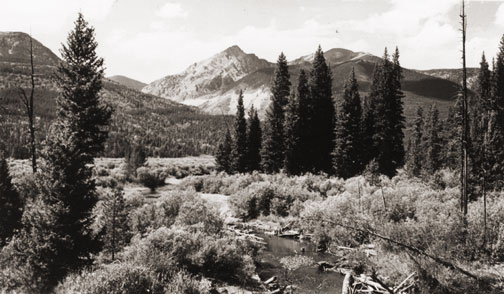
Middle Park is one of three big parks in the Colorado Rockies and covers a large portion of Grand County. Like North Park and South Park on either side, Middle Park is a large open area of  meadows, river valleys, woodlands, surrounded by mountains. It is also the headwaters of the mighty Colorado River.

The first printed account of Middle Park was written in 1839 describing abundant antelope, deer, big horn sheep, bears, buffalo and elk. The word “parc” is of French origin and so it is logical to assume that French trappers named this location.

In 1819 the Adams-Onis Treaty partitioned Middle Park so that Fraser, Granby and Hot Sulphur Springs, had they existed, would become part of the United States; however, Kremmling would have belonged to Spain! Later, Kremmling would have been part of Texas.

While political boundaries have changed, the beauty of the park remains the same. As Middle Park is entirely surrounded by mountains, Robert C. Black, who wrote the area’s definitive history, chose to call his book, Island in the Rockies.

North Park & Middle Park - Politics and Whiskey

The Territorial legislature defined the boundaries and county seats for the West Slope in 1861.  Geographic knowledge of the Colorado mountains was somewhat limited at that time.  North Park (a name now synonymous with Jackson County) was an Indian hunting ground and little was known about it.

A boom started with the discovery of gold and silver at Teller City in 1879.  North Park was considered to be part of Grand County, and now there was property to assess and tax.  The Grand County road tax in North Park for 1881 applied only to males between the ages of 21 and 45.  They had to either pay $3 in cash or do two day's work on the roads. John Mills, a Teller City resident who acted as an attorney for mine owners, served as a Grand County commissioner and was one of the commissioners killed in the July 4, 1883 gun battle at Grand Lake.

As ranches became established and more mineral deposits were discovered, the Larimer County commissioners began to speculate that the "Snowy Range" that defined the western boundary of Larimer County was the Park Range on the west side of North Park rather than the Medicine Bow Range.  This opinion soon degenerated into a dispute between Grand and Larimer counties, ultimately ending up in court. In 1886 the Colorado Supreme Court ruled that North Park was part of Larimer County.

A trip to the county seat in Fort Collins was a considerable undertaking.  If everything ran on schedule it was possible for travelers to leave Walden on the morning stage, catch a train from Laramie to Cheyenne, another train from Cheyenne to Greeley, still another from Greeley to Fort Collins, and arrive at the county seat before closing hours the following day.  The fares amounted to a significant expense.  It was probably more common for a North Parker to travel to Fort Collins in his wagon, take care of business, and come home with a wagonload of provisions.  The trip by wagon took three to four days each way.

As the population of North Park grew, so did the desire to split from Larimer County.  In 1908 the Loveland newspaper stated that Larimer County was too big and advocated a new county with Loveland as the county seat.  The Walden newspaper agreed that the county was too big but felt the wrong division line had been picked, pointing out that "A Loveland man can get to the county seat in three hours anytime, but it takes a North Park man three days most of the time."

Ranchers resisted early efforts to set off the area west of the Medicine Bow Range into a county of its own as they carried the largest part of the tax burden and felt their taxes would increase if a new county was established.  But by 1908 there was general agreement within the Park that it was time for court and administrative offices to be more conveniently located.

The total valuation assessed in 1908 of North Park property by Larimer County was $771,776, which generated $16,979 of revenue.  The salaries of some of the paid officers of the new county was estimated as follows:

     Assessor                                                    $800

     County School Superintendent                   $800

     Water Commissioner, 2 districts                $1000

     County Commissioners                             $1000

Even adding in salaries for the sheriff and county clerk it appeared quite likely that the new county could be operated efficiently without a tax increase and the proposal to create "North Park County" had nearly unanimous support from North Parkers.  The bill passed the legislature easily in April 1909, with a name change to Jackson, and was quickly signed into law on May 5 by Governor Shafroth.

While North Parkers were eager to sever their legal ties to Larimer County in 1909, they clearly weren't ready to give up the pleasures of offered by a nip of the bottle.  Like most frontier areas, North Park had a significant number of single men who liked to occasionally get together and enjoy a few drinks with their friends.  Walden was the center of socialization.  According to an 1899 newspaper article, Walden residents worried about the "toughs" who came to town to "drink barbed-wire bitters and then shoot up the place."

In addition, local married men sometimes frequented the bars when they could have been spending more time at home helping out with domestic chores.  As a result, a strong temperance movement soon divided the community.  One of the two local newspapers, the North Park Union, endorsed the temperance movement in early 1902 and soon found itself the target of a boycott by both advertisers and subscribers.  Although the editor declared it a "boycott of no great magnitude", the paper had a new owner/editor within a month.  The issue of whether Walden should be wet or dry was on the 1902 ballot.  By a very decisive majority, voters decided Walden would continue to be wet.

Just before the 1906 election, the Walden newspaper criticized the local Republican Party bosses for providing a lot of free whiskey in every North Park precinct on election day, and urged North Parkers not to sell their vote for a drink.  The temperance movement enjoyed its first victory when it combined forces with the local church and convinced the businessmen of Walden to close their stores on Sundays.  The closing did not stand in high favor with ranchers.  "When a man can't buy axle grease for his wagon when it runs dry and something else for himself when he runs dry, it is time to call a halt," they declared.  Quite a number of the ranchers started going through to Laramie for their provisions, and the Sunday closing rule was abandoned six weeks after it was implemented.

When news reached Walden in early 1909 that the bill creating Jackson County had cleared the legislature, the newspaper reported that the town was moved to the point of a merry celebration.  The brass band marched, guns were fired, and at daybreak "the women, as becomes their sex, were among the few who were sober."  A few weeks later news that the Governor had signed the bill was cause for another celebration.  The newspaper reported that, "the air about town clouded up and filled with burnt powder and raucous vocalizations.  The festivities continued in the evening with flying anvils propelled by stick powder . . ." The first hundred years of Jackson County had commenced.

The Blue
The Blue

Because gold had been found at the headwaters of the Blue River at Breckenridge, hopes were high among prospectors who worked the downstream tributaries in Grand County.  However, this lower section of the Blue contained no mineral wealth. 

The Denver and Rio Grand Railroad planned to run a route through the valley and began constructing grades, but the tracks were never laid because Moffatt's railroad crossed the county first.

An enterprising Canadian, 25 year old Willis Charles Call, had been employed as a cook for the grading company in 1881.  When the railroad abandoned the project, Call became a registrar of voters, and in 1886, the county assessor.  By 1890, he had a choice ranch near Kremmling.  His Austrian wife, Mary Rohrocher, was a very popular hostess.  It is believed that they owned the first automobile in the county.

The conflicts between the white settles and Ute Indians came to a climax in 1878 when the Ute leader Tabernash was killed by a posse and the very next day, Abraham Elliott a homesteader on the Blue, was killed in retaliation.  The remains of his ranch can be seen on Highway 9 at mile marker 135. 

Across the river was the ranch of Henry Yust, who settled there in 1885.  Another early ranching family was that of Thomas Pharo, An Englishman from Franham in Surry, near London.  Settling there in 1880, he developed a major cattle and horse ranch. 

The Blue River area was connected with a route west in 1913, when the co-called Trough Road was constructed, beside the Gore Canyon to State Bridge.

The Muddy
The Muddy

The Muddy Creek Valley, on the western edge of Grand County, has a rich history, mostly based on ranching. It became something of a multi-cultural region, attracting French, Greek, Belgian, British, Dutch, Austrian, Swiss, German and Jewish settlers.  There were also dozens of homesteading families that came from eastern Colorado and Mid-West America.

The known prehistory of the Muddy Creek area extends back 10,000 years at a kill site for bison on Twin Peaks, which separates the Muddy from the Troublesome Creek drainages. 

Among the early settlers in the region were the Ed Pinney family who has a ranch near the summit of Gore Pass.  As the boundary between Grand and Routt County was not well defined, Ed paid his taxes to whichever county had the lowest rate in any given year.  After the railroad arrived at Kremmling, a stage coach route to Topanos, west of Gore Pass, was started.  At first the Pinney Ranch was designated a lunch stop, and then an overnight stop.  In 1906, the Pinneys' built a big house that could accommodate up to 40 people, two to a room.

One of the many notable ranches was that of Fred and Myrtle DeBerard.  Their Park Ranch included 20,000 acres, and they ran over 1600 registered Herefords.  Fred was instrumental in the creation of four reservoirs in the region.

Another prominent early rancher was Frenchman Alfred Argualer, who first came to hunt the region but returned to establish the May-Be-So Ranch.  He continued developing properties from 1880 until 1911 when he sold his ranch on the Muddy to Nick "Turk" Constantine.

A significant rancher of the 20th century was Walter "Wad" Hinnan, who served form 1966-7 as President of the Colorado Cattlemen's Association and as Director of the National Western Stock Show in Denver.  He was instrumental in breaking the barrier between cattlemen and sheep growers by showing that both enterprises could be complimentary and profitable.  Wad also represented Grand County in the Colorado Legislature from 1968 to 1982.

At one time in the early 1920's there was a sanatorium for World War I veterans who had been disabled by mustard gas.  The lower Muddy was the site of an ice house which supplied refrigeration for fruit shipments out of Grand Junction and Palisade, Colorado.  German prisoners of war were used to cut the ice during World War II.

A unique innovation resulted from the widespread ranching families.  In 1935, the schoolhouse was put on sled runners so that it could be taken to which ever ranch had the most children for that season.  It was moved in the winter as the school terms were held during the summer.  It was moved three times between 1931 and 1939 and was probably the only mobile schoolhouse of that era.  

The Troublesome
The Troublesome

Tradition holds that an army party led by one Lt. Col Johns gave the name of Troublesome to what had sometimes been called Oties Creek.  The Army was plotting a road in 1865 and had to go north to the forks of the East and West Troublesome in order to cross it, because of the soft soil, thereby being a “troublesome” creek.  Some historians claim that mountain man “Colorado Charley” Utter had built a cabin on the creek in 1861, which became a popular stopping place for early hunters and trappers in the region.  Another report credits John S. Jones of Empire with a cabin near the mouth of the Blue River, a few miles away, that same year.

Among the earliest settlers on the Troublesome were Barney Day, Henry King and Martin “Dock” McQueary, who had a cabin there in 1871.  In 1878, a post office was established at the King home. 

By the end of the century, many ranches had been established at on Troublesome Creek.  Farthest upstream was the remote George Hendricks ranch, difficult to reach year round and totally cut off from the rest of the world during winter snow.  Mrs. Hendricks had a large library and gave her children a sound education prior to their high school years in Kremmling. 

Among the most prominent ranches were those of George and Forrest Wheatly.  Probably the largest ranch (3000 acres) was that of the family of Con Ritschard, lying just north of current day U.S. Highway 40 east of Troublesome Creek.

Life was hard for the settlers in the area.  Like much of Grand County, the soil was frozen as deep as eight feet in the winter.  One memoir noted that when there was a death in the winter, the corpse was placed in the roof of a cabin, well swathed, until the spring thaw allowed for permanent burial.

There was a six year school (second to seventh grade) and a post office established at Pearmont about half way up the Troublesome, in the 1920s.  This area was named for local settler Gus Pearson.

Ranching was not the only pursuit along the Troublesome Creek.  Settler Roy Polhamos grew lettuce and shipped it through the Granby Cooperative to Denver.  He also had a potato contract with one of the Denver grocers.  Other growers contributed to the 125 refrigerated train carloads of lettuce that were shipped from Granby in 1924.  By 1929, 34 farmed from Granby to Troublesome netted $46,000, a highly respectable profit in those days.

Articles to Browse

Topic: Indians

Indians

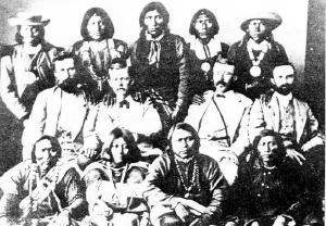
There is a great deal of evidence of primitive cultures in what is now Grand County, but all seems to have been transient until the modern tribes arrived, probably around 1450. The Arapaho Tribe claimed the northern part of this region and were in frequent territorial dispute with the Ute Tribe, who were dominate in the Colorado Rockies. The Utes did not have “chiefs” in the sense of the organized Plains Indians.

There were five different tribal groupings in Colorado, and those in the Grand County area were known as the “White River Utes”. The Uncompahgre Utes lived in the southern area of the state, near the San Juan Mountains. Their spokesman to the white man was Ouray, and because of his knowledge of Spanish and some English, the federal negotiators designated him “Chief of All Utes”. Thus it was he, who in 1868 agreed that most of the land west of the 107th degree longitude (about one third of Colorado) would be a Ute Reservation “for all time”.

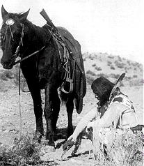
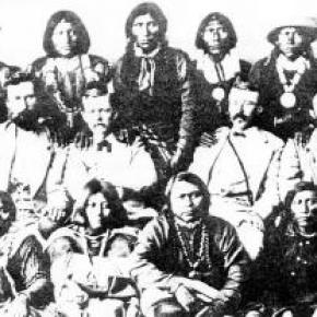
Ouray probably never knew the Utes of the northern region and they were never notified officially of this treaty. Suddenly, their favored hunting grounds of Middle Park, the healing waters of Hot Sulphur Springs, and much of the Front Range and Gore Range were opened to white settlement. Naturally there were tensions between the Utes and the white settlers and there are several well documented accounts of disputes in the area, including the killing of Tabernash, retaliatory strikes by the Utes, and the supposedly intentional burning of Middle Park by Colorow. Finally, there was an uprising in 1879, known as the Thornburg and White River Massacres, and the result was that the Utes were evacuated from almost all of their former reservation and driven to the Utah area in 1882.

Though much of the culture, knowledge and influence of the original Indian people has been lost to time, Ute and Arapaho names still grace many landmarks in Grand County.
 

Topic: Towns

Fraser

The origin of Fraser was in 1905 and it was incorporated in 1953. It was formerly known as Eastom, for George Eastom, who laid out the town site in 1871. The spelling of Fraser was originally Frazier, after Reuben Frazier. The town came into being because it was the site of a large sawmill and was a railroad terminus for the lumbering operation.

While Fraser was generally considered to be an isolated mountain outpost, at one point there was enough cultural interest to support a local opera house.  Fraser was the location of a weather station for several years and during that time it was not uncommon for the winter temperatures to be 45 to 50 degrees below zero; one Fraserite remembers a morning when it was 60 degrees BELOW zero. Thus the town earned the nickname “Icebox of the Nation.” After a legal battle, that offical title went to a town in Minnesota.

A transcontinental motor route dubbed the Midland Trail came through Grand County and by 1913 a Ford sales agency was located outside of Fraser on the 4 Bar 4 Ranch. Avid fly fisherman President Eisenhower was a frequent visitor between 1948 and 1955.

Topic: Regions

Church Park

George Henry Church and his brother John had a substantial ranch in Jefferson Country, prior to Colorado Statehood.  When the Timber and Stone Act of 1878 was passed, it permitted the purchase of land unfit for agriculture for $2.50 an acre.  Thus the Church brothers obtained land in Middle Park for summer grazing.  They would move their cattle into the Park by driving them over the Rollins Pass.   The area they used is just west of the town of Fraser and became known as Church Park.

In 1910, the Church Ditch was created to divert water across the Continental Divide for irrigation.  The remains of this early trans-mountain project can still be seen today at mile marker 241.5 on U.S. Highway 40.

Topic: Regions

Three Lakes

The Three Lakes area encompasses the north-east corner of Grand County and is so named because of the three connected lakes of Grand Lake, Shadow Mountain Reservoir and Granby Reservoir. 

The two reservoirs were formed as a part of the Colorado-Big Thompson Project, which takes water from Grand Lake on the western side of the Continental Divide to the Big Thompson River on the east.  Shadow Mountain Reservoir and Granby Reservoir. connected by a   unique pumping plant, assure that the Grand Lake water level remains consistent. Further reservoirs were added in the Three Lakes area, including the Willow Creek and Windy Gap Reservoirs.

Religion

Article contributed by Betty Jo Woods

The first known white settlers came to Grand County about 1874 but there were no established churches for many years. The area even lacked circuit riders and camp meetings so typical of many other parts of the West.

The first building used exclusively for a church was probably an Episcopal church in Grand Lake, erected in 1896, but used sporadically during summers only. An Arapahoe Indian who was an Episcopal priest held occasional services in that town.

The First Congregational Church of Hot Sulphur Springs was dedicated in 1904 and other churches were also established about the same time in Kremmling and Fraser. 

Sunday School activities along with special holiday services and women’s activities seemed to be what provided continuity to worship efforts. Curiously, at one time a local newspaper carried weekly Sunday School lessons.

A Greek Orthodox church was built in Hot Sulphur Springs for the many of that faith who visit there. A major growth spurt developed during the last quarter of the 1900’s when older buildings became overcrowded and residents, long-term and recent, decided to commit time and money to new church buildings. In 2004, 28 churches were listed in the telephone directory.

Sources:
R.C. Black, Island in the Rockies. Pruett Publishing Company, 1969
Grand County Historical Association, Volume XV, Old Time Religion Early Churches, Grand County. Egan Printing Company, 2000

Topic: Biographies

David Moffat and the Railroad Dream

David Moffat was a wealthy Denver businessman who saw the need for a rail link between Denver and Salt Lake City. His vision, a 6.2 mile long tunnel beneath the Continental Divide, made this link possible.

He was born in 1839, the youngest of 8 children. He ran away from home at age of 12, went to New York City and found work as a bank messenger.  He was an assistant teller by the age of 16 and  became a millionaire through real estate by the age of 21. 

Moffat was admired for his qualities of courage, adaptation to the “barbaric” West and his goodness of heart. He married his childhood sweetheart, Francis Buckhout, moved to Denver, and in 1860 opened a bookstore/stationary/drug store with C.C. & S.W. Woolworth on the corner of 11th and Larimer.  

Moffat and others formed the Denver Pacific Railroad to reach Cheyenne. The rail line to the Moffat Tunnel was the highest standard railroad ever built in the U.S. (11,660 ft). It went over the Continental Divide at Rollins Pass and came into the Fraser Valley in 1904. At the time, it was the most difficult railroad engineering and construction project ever undertaken. It involved boring numerous tunnels through solid granite, as well as constructing precarious timbered trestles that bridged deep mountain gorges. 

David Moffat was a multi-millionaire when he started the Moffat Line and was nearly broke when he died in 1911 trying to raise money for the tunnel that would eventually be built and bear his name. It was finally completed in 1928. The west portal of the Moffat Tunnel can be seen from the Winter Park Resort.


Ninety Four Winters So Far

January, 1911.  Five years ago they were teenagers in Torsby, Sweden, oblivious to the sweeping changes that history and hope would bring to their lives.   Now they’re in a mountain valley halfway around the world from their Scandinavian homeland, marveling at the tiny bundle of flesh and spirit who has just joined their family. It’s the coldest week of the year in one of the coldest spots in America, but there’s a fire crackling in the woodstove, and their hearts are warm with love for each other and their firstborn child.   For the next few days, a parade of fellow Swedes stop by to pay their respects to the newest resident of the town of Fraser: Elsie Josephine Goranson.  

February, 1918.  It’s barely dawn, and a blizzard is howling across the valley, piling snow against the sturdy wooden house.  George Goranson puts on his boots and woolen overcoat and trudges towards the barn.  There are cows to milk and horses to feed.  There are no days off.  Meanwhile, in the house, 7-year old Elsie stokes the perpetual fire in the cook stove, while her mother grinds the beans for a second pot of strong coffee.  Later they will make sour cream cookies.   Her younger brother Hill is sick in bed with influenza.  He will survive.  Many others will not.   

March, 1925.  The logging camps are humming, the Moffat Tunnel is under construction, and the valley is brimming with workers and their hard earned pay.  Fraser merchants and boarding houses are doing a brisk business, as are the local bootleggers.  Elsie is waiting tables at the “Victory Café”, named for its proximity to the new coast-to-coast “Victory Highway” that passes through town, and each morning she serves breakfast to the nice looking (if scantily clad) girls from the corner house of ill repute.  Soon the local vigilante committee will force these ladies of the night to leave town, but for now it’s business as usual, and Fraser is hopping.   In fact, “Russell’s Riot Squad” is playing at a dance tonight at the Thomas Hotel.  

April, 1927.  Sleigh bells jangle as a team of horses pulls four young couples down valley to a dance in Tabernash, the most happening town in the county.  The roundhouse is there, as are the wages of engineers and brakemen who guide the trains over Rollins Pass.  There is even a movie house, where Elsie saw her first moving picture, “Jackie Coogan”. As the sleigh glides across the moonlit snow, Elsie feels a mix of excitement and nervousness.  This is her first date with Chuck Clayton, a hardworking man from Oklahoma. Chuck is handsome as he steals glances through the cold night air, but her Dad doesn’t approve of his drinking and gambling.  Other dates will follow: motor trips in a Model A Roadster to Garden of the Gods, picnics in Rocky Mountain National Park, and plenty of dancing.  “I’ll never marry you,” she tells him everyday.  “Yes you will,” he insists.  

May, 1933.  One child underfoot and another in the belly, and Elsie Clayton is tired.  Chuck bought a house for 20 dollars and used the lumber to build a hamburger stand (soon café and bar) right along the newly paved Highway 40, the main route from Denver to San Francisco.  For the next 38 years, their lives will be a blur of ham and eggs, New Year’s Eve parties, and a long medley of songs on the jukebox.  The school bus will stop there, as will the “Steamboat Stagecoach” bus line, and three generations of folks looking for a home cooked meal or glass of beer.  There will be marathon cribbage games, war stories, and “Friday Night Fights” watched live on the first television in town.  Despite the booze and boxing, Clayton’s Café and Bar will be known as a family establishment, especially compared to the “Fraser Bar”, a.k.a. the “Bloody Bucket”, where a love triangle will one day lead to murder.  

June, 1945.  It’s 4:30 a.m.  Elsie tiptoes downstairs and into the café.  She brews coffee, warms up the grill, then sits and enjoys a rare moment of relaxation before her workday begins.  In the distance, a steam locomotive blows its whistle as it chugs towards town.  Before her life is over, nearly a half million trains will pass through Fraser, an endless stream of rumbling horsepower that conjures up different images as the years pass by: trains bringing home soldiers from the Great War; trains loading up ranchers’ fattened cattle in the fall; trains delivering newspapers and mail; trains colliding head on in the Fraser flats; a train’s whistle frantically blowing to alert sleeping townspeople to a midnight fire; streamlined diesel trains ushering in a new era, and countless coal trains, hauling the carbon wealth of Western Colorado to the factories and power plants of far off cities.  

July, 1950.  Summer’s here, and all are invited to the town picnic down by the Fraser River.  Aging Swedish bachelors will be there, sipping steel cans of Coors and swapping stories of crosscut saws and the rowdy “Lapland” logging camps up St. Louis Creek.  Young men will dance with young women.  Young men will start fistfights with other young men.  Navajo railroad workers will perform a rain dance. Children will play Audie Murphy in the riverside willows and drink Coca Cola from thick glass bottles.  Meanwhile, the deluxe brick barbecue will sizzle as Elsie spreads mayonnaise on buns and Chuck flips burgers and jokes with friends.      

August, 1953.  President Dwight D. Eisenhower is coming to town to fish and relax.  “We come Ike” banners wave in the breeze as the motorcade turns off Highway 40 and onto the dusty gravel of Main Street.  Cheers erupt and flashbulbs pop as a smiling Ike emerges from his limo and waves to the crowd of 300.  It is the biggest day in Fraser history, but Elsie sees none of it, for even as her husband, the Mayor of Fraser, is welcoming the leader of the free world to town, she’s in the cafe tending to the crush of reporters and tourists who’ve come to see an American hero.   Tomorrow, after the excitement dies down, she’ll personally deliver two of her homemade pies to the President, who will rave about the perfect crust.   

September, 1971.  Retired.  Chuck and Elsie sit on the porch of their new home on the edge of town, watching cows graze just beyond the fence, and taking in the unobstructed view of Byers Peak.  Labor Day has come and gone, and now town is peaceful, the highway quiet.  Freed from the busy schedule she’s kept for decades, Elsie will soon embark on a reading frenzy and will begin to keep a modest journal of the days’ events:  A Grandchild born, an illness in the family, an exceptionally cold morning.  Chuck busies himself planting trees, tending a garden, and mowing his spacious lawn.  Tomorrow they will pack a picnic lunch and drive the Denver Water Board roads in search of raspberry bushes.   

October, 1978.  Today is Chuck and Elsie’s 50th wedding anniversary.  It’s a perfect day, sunny and warm, Indian summer if there ever was such a thing.  The mountains shimmer beneath a blanket of fresh snow.  Hay meadows glow golden beneath the cloudless sky.  Family and friends gather in the yard for photos before heading to the Crooked Creek Saloon, formerly Clayton’s Cafe and Bar, for a long afternoon of celebration and reminiscing.   

November, 1999.  After 71 years of marriage, Chuck has passed on, and Elsie is suddenly alone.  She sits at her dining room table, peering out the frost fringed window at the town she was born in, the town she has lived in her whole life.  The ridge she once sledded down is covered with condominiums.  The willowed wetland where her brother trapped muskrats has become a large parking lot.  Her father’s horse pasture is now a shopping center.  Everything has changed, yet memories remain, taking on a life of their own.  Horses still pull wagonloads of hay up the highway.  Loggers come in from the woods every Saturday night for revelry and roulette.  A young couple poses for a photo in front of their new cafe.  A sharp axe splits a chunk of pine.  Life goes on.   

December, 2004.  Christmas Eve.  There is plenty of food, including the homemade potato sausage that’s been served at every family Christmas for centuries, and plenty of gifts stacked beneath the brightly lit tree.  Elsie sits at the head of the table, quietly marveling at this clan she has wrought.  Her surviving children are here, as are her grandchildren, some of who have grandchildren of their own.  Five generations of family pour gravy on potatoes and crack jokes.  As she looks at their faces, she remembers her own parents, her grandparents, and her husband.  Everyone is here.   In a few minutes, in a ritual as old as Elsie can remember, her great-great grandkids will hand out presents, and the house will resound with laughter.  

Winner of  the “One Grand Essay” contest 2005

Maggie and Jimmy Crawford

Maggie and Jimmy Crawford came to Middle Park in the summer of 1874 with their three children. They were given a piece of property and built a one room sod roofed cabin in Hot Sulphur Springs. They were probably the first family to stay the winter in Middle Park.

As they settled in for a long hard winter, Jimmy continued exploring lands to the west.  He found prime land near a spring that made a unique chugging noise.  That sound reminded him of the steamboats on the Missouri River back home.

After that winter, Maggie returned to Missouri with her family, while Jimmy built a cabin on the new filing, which would later become known as Steamboat Springs, Colorado.

By 1876, Maggie and the children were back in Colorado, and the family became founding members of that new community.
 

Topic: Biographies

Redwood Fisher

Article contributed by Corinne Lively

There were two Redwood Fishers, grandfather and grandson, who made significant contributions to the development of the Grand Lake area. 

One of the earliest pioneers was the senior Redwood “Woody” Fisher, born in Urbana, IL in 1839.  He learned surveying skills in New Jersey, and received a degree in Civil Engineering in New York City, where he met his future wife, Louise Perrenoud.  He arrived in Denver in June 1860 and borrowed money to purchase his first surveying instruments.  His bride to be, her two sisters and widowed father arrived in Denver in July 1862 in a mule drawn ambulance. They had traveled for six weeks from Omaha to deliver the vehicle which was used as an ambulance and hearse.  The first marriage license in Denver was issued to Woody and Louise, and their wedding took place May 6, 1865. 

The day after his marriage to Louise, Woody joined General Hughes and E.L. Berthoud as Chief Surveyor in building the wagon road from Denver to Provo, Utah over Berthoud Pass.  The expedition followed a route laid out by Jim Bridger. 

Woody held the offices of Denver city and county surveyor and county commissioner.  He was foreman of Hook and Ladder Co. #1, and helped fight many Denver fires. 

In May 1870, Woody was killed attempting to stop a runaway team of horses at the corner of California and 14th Streets.  While trying to save the lives of several children, he fell and the wagon wheels ran over him.  Woody left his wife with three children, Louise, Charles and Ella.  He is buried in Riverside Cemetery.

Redwood must have spoken in glowing terms about his time in Grand County since his son Charles, only two when his father was killed, spent most of his life near Grand Lake, built a summer home on the North Inlet below the Rapids Lodge, purchased 160 acres on the east side of the Colorado River from the Fred Selak estate.  He died here in August 1945.  Charles and his wife Sara had a son in May 1907, whom they named Redwood.

The junior Redwood “Red” Fisher also spent most of his life in the Grand Lake area.  He was an early Park ranger and helped stock many of the high lakes on horseback.  After his marriage to Helen Schultz in 1928 he started ranching below the present Shadow Mountain dam on land purchased from Mrs. Cairns.  He later acquired the 7V/ on Stillwater Creek.  He was President of the Colorado Dude Ranch Association in 1947 and traveled to conventions in Chicago and elsewhere promoting Colorado’s guest ranches with displays of fancy roping and riding.  His own dude ranch, Fisherancho, was on the land below Shadow Mountain Dam and served guests until the 1950s.  The barn still stands, and is now part of the Arapahoe Recreation Area. 

Sources:
Lela McQueary, Widening Trails, World Press, 1962
Middle Park Times, August 12, 1945 and May 6, 1993
Colorado Families: A Territorial Heritage, CO Geneological Society, 1981
Brand Book, Middle Park Stock Growers Assn.
BLM General Land Office Records
Conversations with local decendant Toots Cherrington


Topic: Time Line

Statehood

Colorado was the 38th state admitted to the Union, and is known as the “Centennial State” because of its entrance into the union in 1876, one hundred years after the signing of the Declaration of Independence. The Colorado River was named earlier, and is Spanish for “red“, the color of the water that the Spanish explorers observed.

People have been living in Colorado at least 9,000 years. Spanish explorers were here in 1540, but the discovery of gold caused a major population explosion in 1859.

The state consists of 3 topographic zones: plains, mountains, and plateaus. The Continental Divide bisects the state, north to south and there are 54 peaks above 14,000 feet.

Denver is the State Capitol at 5,280 feet, one mile above sea level. Colorado is noted for its waterways and is the only state in the U.S. from which all water courses flow out of the state. Rivers that have their origins in Colorado include the North Platte, South Platte, Arkansas, Rio Grande, and the Colorado with its headwaters in Grand County.

Regions