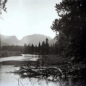
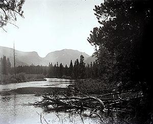
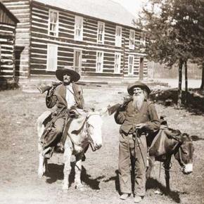
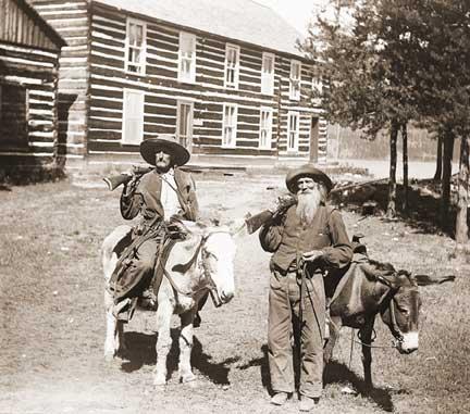
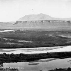
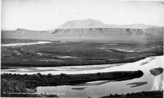
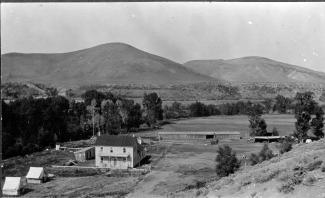
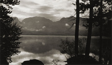
Joe on Melody

Places Articles

Tabernash
Tabernash

The town of Tabernash was established in 1905 on the location of the old Junction Ranch. The name came from the Ute Indian, Tabernash, who was killed here in 1878 during a confrontation with a posse sent to stop the Indians from tearing down fences and racing their horses on the white mans newly "private" property.

In 1913 the locomotive terminal was relocated from Fraser to Tabernash by the Denver and Salt Lake railroad. When the Moffat Tunnel was completed, the need for the terminal diminished, but the community persisted with a ranching economy.


The Blue
The Blue

Because gold had been found at the headwaters of the Blue River at Breckenridge, hopes were high among prospectors who worked the downstream tributaries in Grand County.  However, this lower section of the Blue contained no mineral wealth. 

The Denver and Rio Grand Railroad planned to run a route through the valley and began constructing grades, but the tracks were never laid because Moffatt's railroad crossed the county first.

An enterprising Canadian, 25 year old Willis Charles Call, had been employed as a cook for the grading company in 1881.  When the railroad abandoned the project, Call became a registrar of voters, and in 1886, the county assessor.  By 1890, he had a choice ranch near Kremmling.  His Austrian wife, Mary Rohrocher, was a very popular hostess.  It is believed that they owned the first automobile in the county.

The conflicts between the white settles and Ute Indians came to a climax in 1878 when the Ute leader Tabernash was killed by a posse and the very next day, Abraham Elliott a homesteader on the Blue, was killed in retaliation.  The remains of his ranch can be seen on Highway 9 at mile marker 135. 

Across the river was the ranch of Henry Yust, who settled there in 1885.  Another early ranching family was that of Thomas Pharo, An Englishman from Franham in Surry, near London.  Settling there in 1880, he developed a major cattle and horse ranch. 

The Blue River area was connected with a route west in 1913, when the co-called Trough Road was constructed, beside the Gore Canyon to State Bridge.

The First Recorded Ascent of Long’s Peak
John Wesley Powell about the time of his Longs Peak ascent

After his discharge from the Union Army in 1865, a veteran who lost his right arm at the Battle of Shiloh, Tennessee as a commander of a field artillery battery, John Wesley Powell was appointed curator of the Illinois Natural History Society’s Museum located at Illinois State University-Normal. Later, he was a Professor of Natural Science at Illinois Wesleyan University-Bloomington. 

In the summer of 1867, Professor Powell and his wife Emma, brought five students of the two university’s and six educators at other Illinois schools to Colorado Territory. Two peaks over 14,000 feet were climbed. Pike’s Peak (Emma was the 4thwoman to do so), and Mt. Lincoln. The expedition combined exploration and higher education of large scale student field trips was the first of its kind in American college history. 

In the autumn, the Powell’s visited the natural Middle Park hot springs (the heart of Hot Sulphur Springs) owned by William N. Byers editor of the Rocky Mountain News. The caretaker of the springs introduced himself as Jack Sumner, also a Union Army veteran, and Byers’ brother-in-law. Near the springs was the Grand River as the headwaters of the Colorado River were called. Around a campfire Powell and Sumner made plans for a Colorado River Exploring Expedition. Looming over this decision on the eastern horizon was Long’s Peak.  In November, Wes and Emma Powell departed for Illinois filled with fortitude to return to Colorado. 

John Wesley Powell sought financing for an 1868 expedition from the museum and university’s boards of education, being happy to oblige. However, his request to draw supplies from U.S. Army western warehouses took an Act of Congress to approve. The Smithsonian Institute donated scientific materials. The expeditions purpose was to stock the natural history museum with large collections of specimens representing different sciences and illustrating the resources of the country. Before leaving Illinois for Colorado, it was understood that the ascent of Long’s Peak would be attempted. 

At Chicago on June 29th, a special Pullman car of the Chicago & Northwestern Railroad arrived with a banner lettered “Colorado Scientific Exploring Expedition”. At 3 p.m. Professor and Mrs. Powell, with 19 others were taken to Omaha, Nebraska traveling all night. In the morning they rode a Union Pacific train to Cheyenne, Wyoming. They were organized into messes of four and drew supplies from the army warehouse. Each man had to break his own bronco for the pack train ride to Denver. One man was bucked into a cactus. A Reverend was thrown with his foot hung in a stirrup. While being dragged he said, “take hold of her boy’s. Whoa!  Sweet little angel you.” They arrived and camped at Denver on July 14th. Then proceeded to Empire where they were greeted by mountain man and guide Jack Sumner,  William Byers, and Ned Farrell.  

So much was untouched to be plucked in the names of anthropology to zoology. A week was spent on Berthoud Pass. One young scientist shot a jack rabbit thinking it an antelope. Jack Sumner was used to dudes. Finally, the expedition arrived at Mr. Byers’ resort where headquarters and the Reverend’s “Preaching Tent” was set up. Rest and relaxation were enjoyed by soaking in the hot springs. 

Professor Powell used his military rank Major. He never let the loss of his right arm hinder him. The Major took a trip to the Rabbit Ears and Gore Range where the highest peak is named Mt. Powell. When he returned the Major selected his student squad for the ascent of Long’s Peak. Chosen were L.W. Keplinger, and Sam Garman. One old mountaineer told the two that nothing could get them there that didn’t have wings. The idea of tenderfeet trying the ascent was ridiculous!

August 20th-22nd -The Major, his brother Walter Powell, Jack Sumner, William Byers, Ned Farrell, and the squad, departed headquarters mounted on horses, and one pack mule with 10 days rations. Each carried a pistol or rifle. The squad had weather equipment. They camped at Grand Lake. In the morning the party of seven rode up a steep rock ridge almost impassable by fallen timber. They corralled the equines at Mt. McHenry elevation 13,327 feet and camped for the night. At 7 a.m. the Major made bacon and biscuits. The men stuffed their pockets with a two day’s allotment. Leaving their firearms behind Sumner and Keplinger led the way to Wild Basin over tortuous terrain. All arrived exhausted at 2 p.m. except for Keplinger who volunteered to find a route to Long’s Peak. Keplinger went through the notch and was within 200 feet of the crown. Turning to enjoy the view he almost became an eternal resident of Estes Park. Nightfall was setting in and he had to return to Wild Basin. To his amazement Sumner was hollering and had lit beacon fires. At 10 p.m. Keplinger and Sumner were in camp. 

At 6 a.m. on August 23rd, Keplinger led the way. Required of each was caution, coolness, and intense labor; life depending on the grasp of fingers in a crevice that would hardly admit them. Moving up in order were Keplinger, the Major, Sumner, Byers, and the others. Before 10 a.m. the entire party stood on Long’s Peak summit, elevation 14,255 feet. “Glory to God!” shouted the Major. For three hours they remained enjoying the spectacular views. North, south, east, and west. They counted 32 alpine lakes. An American flag was flown and left. A monument was built, and a baking soda can was used as a time capsule. Placed in the capsule were each member’s names, and the temperature. A biscuit was going into the capsule but the Major objected as he wanted fame as a mountain climber and not a biscuit maker. The capsule was sealed for the next climbers to find. Wine was sprinkled on the monument and disposed of in the usual manner. Two members abstained. 

The descent route went towards the branches of the St. Vrain River. Noticed on the snowbanks were two bears feasting on grasshoppers numbed by the cold. On the western branch of the St. Vrain the party was out of grub and they rested for the night. The men hiked to Mt. McHenry where a hearty breakfast was made. The two Powell’s, Sumner, Byers, and Farrell, returned to the springs on August 25th. Keplinger and Garman remained to record high altitude weather. Submitting the first mountain climate observations to the Smithsonian Institute. 

The First Recorded Ascent of Long’s Peak (with a lengthy caption) was published in the Rocky Mountain News by William N. Byers on September 1, 1868. Proud of the fact, “that all were eminently successful and satisfied; the more so because the mountain had always before been pronounced inaccessible, and ours was the first party that had set foot on its summit.” 


The Muddy
The Muddy

The Muddy Creek Valley, on the western edge of Grand County, has a rich history, mostly based on ranching. It became something of a multi-cultural region, attracting French, Greek, Belgian, British, Dutch, Austrian, Swiss, German and Jewish settlers.  There were also dozens of homesteading families that came from eastern Colorado and Mid-West America.

The known prehistory of the Muddy Creek area extends back 10,000 years at a kill site for bison on Twin Peaks, which separates the Muddy from the Troublesome Creek drainages. 

Among the early settlers in the region were the Ed Pinney family who has a ranch near the summit of Gore Pass.  As the boundary between Grand and Routt County was not well defined, Ed paid his taxes to whichever county had the lowest rate in any given year.  After the railroad arrived at Kremmling, a stage coach route to Topanos, west of Gore Pass, was started.  At first the Pinney Ranch was designated a lunch stop, and then an overnight stop.  In 1906, the Pinneys' built a big house that could accommodate up to 40 people, two to a room.

One of the many notable ranches was that of Fred and Myrtle DeBerard.  Their Park Ranch included 20,000 acres, and they ran over 1600 registered Herefords.  Fred was instrumental in the creation of four reservoirs in the region.

Another prominent early rancher was Frenchman Alfred Argualer, who first came to hunt the region but returned to establish the May-Be-So Ranch.  He continued developing properties from 1880 until 1911 when he sold his ranch on the Muddy to Nick "Turk" Constantine.

A significant rancher of the 20th century was Walter "Wad" Hinnan, who served form 1966-7 as President of the Colorado Cattlemen's Association and as Director of the National Western Stock Show in Denver.  He was instrumental in breaking the barrier between cattlemen and sheep growers by showing that both enterprises could be complimentary and profitable.  Wad also represented Grand County in the Colorado Legislature from 1968 to 1982.

At one time in the early 1920's there was a sanatorium for World War I veterans who had been disabled by mustard gas.  The lower Muddy was the site of an ice house which supplied refrigeration for fruit shipments out of Grand Junction and Palisade, Colorado.  German prisoners of war were used to cut the ice during World War II.

A unique innovation resulted from the widespread ranching families.  In 1935, the schoolhouse was put on sled runners so that it could be taken to which ever ranch had the most children for that season.  It was moved in the winter as the school terms were held during the summer.  It was moved three times between 1931 and 1939 and was probably the only mobile schoolhouse of that era.  

The Naming of Granby

Granby Hillyer was born in Cartersville, Georgia on July 7, 1874. The third of six children, born of Shaler Granby Jr. and Lelia (Holloway) Hillyer, and the grandson of the Rev. Shaler Granby Hillyer, Sr. who was born in Granby, Hartford County, Connecticut. When Granby was 13 years old the Hillyer family moved to Washington, D.C. where Granby graduated from public high school. He then entered government service and at the same time studied at George Washington University, receiving a Bachelors of Law Degree. A postgraduate law degree was awarded in 1896 from Columbia University School of Law. He moved to Colorado in 1898 settling at Lamar (Prowers  County) launching a 40+ year legal career. On June 16, 1900 he married Miss Annie Creaghe, from a prominent southern Colorado pioneer family, and a daughter of an Apache County, Arizona sheriff. To this union were born 3 children St. George Creaghe, Granby Francis Ridgeway Jr., and Helen Edna Dolorine (Jane) later Mrs. Albert Hunt of Boston, Massachusetts.

Granby Hillyer was a member of the Republican Party. He served as Lamar City Attorney, Prowers County Attorney, and Deputy District Attorney. He was also affiliated with the Elks, Masons, Sons of the American Revolution, and Woodmen of the World fraternal organizations.

At 28 years of age, the citizens of Prowers, Baca and Las Animas Counties, elected Granby Hillyer to serve in the 14th Colorado General Assembly, House of Representatives, making him one of the youngest elected officials in state legislature history. He served one term from 1903-1905. During this tenure he plotted the streets at no cost for the Frontier Land and Investment Companies newest town on the Denver, Northwestern & Pacific Railroad (The Moffat Road). In doing so, Mr. Hillyer was honored by having the Town of Granby, Grand County, Colorado named for him.

Governor Carlson appointed Mr. Hillyer as the Third Judicial District Court Judge, at Trinidad, Colorado from 1914-1916. Her served as the United States Attorney for Colorado from 1922-1925. Afterwards he enjoyed a large private law practice in Lamar and Denver.

In 1928 at Lamar, Granby Hillyer was a speical prosecutor in the "Fleagle Gang Case".  On May 23rd, the First National Bank was robbed, resulting in the loss of four lives.  The case has been credited by the F.B.I. as the first robbery solved from a single fingerprint.

The Denver Post on July 21, 1931 page 9, reported "Granby Hillyer Is Disbarred By Federal Courts." In a decision reached by the United States Circuit Court of Appeals, predicated by a Colorado Supreme Court tribunal, of neglecting the interests of his clients in a number of cases.

Tragedy then struck the Hillyer family twice with the loss of St. George Creaghe in June 1932 and October 1933, Granby Jr. was killed in an automobile accident near Lamar. They both were attorneys. St. George and Granby Jr. were born 16 months apart and passed away 17 months apart. Both funeral services were held at the Immaculate Conception Cathedral in Denver, with the same set of pallbearers for both young men. They were laid to rest at Denver's Fairmount Cemetery. Their father Granby Hillyer, joined his sons on January 2, 1942, passing away at Denver Mercy Hospital, after suffering a heart attack at age 68.

The name Granby also comes from Great Britain, one of the original references was for the "Marquis of Granby," John Manners. A Member of Parliament from 1754 until his death in 1770, he also was a popular army officer and hero of the Seven-Year War 1756-1763, obtaining the rank of Lieutenant General. In 1766, he was named British Commander-in-Chief of the Army. John Manners once had his hat and wig shot off during a cavalry charge, thus leading to the British expression, "to go baldheaded at something." He had his office attacked by the pseudonymous political writer "Junius." The Marquis of Granby resigned most of his offices and died in debt.

Curiously, Granby Hillyer had an uncle and a brother named Junius.

The search for Spruce Lodge
Spruce Lodge

 You gotta love a mystery! My curiosity rose, my anticipation of being the one with the real story was more than my appetite could stand. I looked at pictures, figured angles, mused at what other people said, reviewed topographic maps and finally said to myself “it just can’t be.” The terrain doesn’t look like that. It isn’t two miles from the last switchback on Hwy 40. I don’t care what the writing on the back of the pictures say. 

I want to know once and for all, where is the real location of Spruce Lodge? How can it be located so everyone will agree. I’ve got it, find an expert wilderness person with my same curiosity. As fate would have it, entered Debora Carr, author of Hiking Grand County Colorado, complete with pictures, maps, GPS coordinates and trail narratives. Her coauthor Lou Ladrigan also caught the bug. “We can find it.” 

Exploration began early in the spring but the snow was just a little too deep to find any artifacts. Failed attempt, but the appetite was there. Wait till the snow melts in the trees. Again, as fate would have it, entered Carol Hunter. Carol has been instrumental in the efforts to resore the Berthoud Pass wagon road. Carol has lots of maps and pictures of the development of the wagon road and just happened to have an original U.S. Bureau of Public Roads 1920 survey map for the construction of Hwy 40 from Empire to Fraser. I loaded it into the computer, expanded the image and found lots of strange numbers. Almost like mile markers. Carol said they were numbers used by the work parties. They seemed evenly spaced and the map had a distance legend. It even had a marked location for Spruce Lodge. I couldn’t wait to add this map to Deborah and Lou’s reference material.

Armed with new references, Debora and Lou hiked both sides of Hwy 40 from the switchback to the entrance to Mary Jane. Looking for artifacts, existence of remnants of the old wagon road, foundations and terrain that matched the photos in the GCHA collection. A couple places looked promising, but not quite. Finally, a white station post number 390 was found lying on the ground on the west side of today’s Hwy 40. Then another white station post was found to the south, number 380. That was a match! Just what we needed. That confirmed the surveyor L.J. Young’s map. To the south of 390 a flat part of ground revealed what looked like part of a foundation and surrounding the location were remnants of discarded cans and possible buildings. A two holer! Now check the terrain with the pictures. Well maybe. Don’t forget that Hwy 40 didn’t exist. Step back and look from the east side of the existing Hwy. A great match with the slope and tree line. This was it! Just .9 miles North of the last switchback.


The Troublesome
The Troublesome

Tradition holds that an army party led by one Lt. Col Johns gave the name of Troublesome to what had sometimes been called Oties Creek.  The Army was plotting a road in 1865 and had to go north to the forks of the East and West Troublesome in order to cross it, because of the soft soil, thereby being a “troublesome” creek.  Some historians claim that mountain man “Colorado Charley” Utter had built a cabin on the creek in 1861, which became a popular stopping place for early hunters and trappers in the region.  Another report credits John S. Jones of Empire with a cabin near the mouth of the Blue River, a few miles away, that same year.

Among the earliest settlers on the Troublesome were Barney Day, Henry King and Martin “Dock” McQueary, who had a cabin there in 1871.  In 1878, a post office was established at the King home. 

By the end of the century, many ranches had been established at on Troublesome Creek.  Farthest upstream was the remote George Hendricks ranch, difficult to reach year round and totally cut off from the rest of the world during winter snow.  Mrs. Hendricks had a large library and gave her children a sound education prior to their high school years in Kremmling. 

Among the most prominent ranches were those of George and Forrest Wheatly.  Probably the largest ranch (3000 acres) was that of the family of Con Ritschard, lying just north of current day U.S. Highway 40 east of Troublesome Creek.

Life was hard for the settlers in the area.  Like much of Grand County, the soil was frozen as deep as eight feet in the winter.  One memoir noted that when there was a death in the winter, the corpse was placed in the roof of a cabin, well swathed, until the spring thaw allowed for permanent burial.

There was a six year school (second to seventh grade) and a post office established at Pearmont about half way up the Troublesome, in the 1920s.  This area was named for local settler Gus Pearson.

Ranching was not the only pursuit along the Troublesome Creek.  Settler Roy Polhamos grew lettuce and shipped it through the Granby Cooperative to Denver.  He also had a potato contract with one of the Denver grocers.  Other growers contributed to the 125 refrigerated train carloads of lettuce that were shipped from Granby in 1924.  By 1929, 34 farmed from Granby to Troublesome netted $46,000, a highly respectable profit in those days.

Three Lakes
Three Lakes

The Three Lakes area encompasses the north-east corner of Grand County and is so named because of the three connected lakes of Grand Lake, Shadow Mountain Reservoir and Granby Reservoir. 

The two reservoirs were formed as a part of the Colorado-Big Thompson Project, which takes water from Grand Lake on the western side of the Continental Divide to the Big Thompson River on the east.  Shadow Mountain Reservoir and Granby Reservoir. connected by a   unique pumping plant, assure that the Grand Lake water level remains consistent. Further reservoirs were added in the Three Lakes area, including the Willow Creek and Windy Gap Reservoirs.

Water
Water

Grand County is home to the headwaters of the famed Colorado River — the river that brings water to five other arid Western states. Water is the lifeblood of semi-arid Colorado and Grand County is one of the most water-rich areas of Colorado, and yet faces a shortage due to historical water agreements, written long before population pressures and the environmental awareness of the current age.

On average, the water diversion projects in the county move a whopping 305,000 acre-feet per year from the Fraser, Colorado and Williams Fork rivers — all headwaters of the Colorado's main stem. 60 percent of the water in Grand County is diverted elsewhere and there are plans underway, mostly from Front Range communities, to divert as much as 80 percent of the county's headwaters by the year 2010.

Two of the main water utilities, Denver Water and the Northern Colorado Water Conservancy District face a quandary: how to take the water from Grand County without further damaging the delicate environment and the region's economy, which is fueled by tourists who expect to play in the very water the Front Range wants to take.

Water from the Mountains - The Grand Ditch

 Though few, high altitude water ditches have had a major impact on Grand County's history and economy, there were many early valley ditches transporting this precious commodity from water-right sources to the owner's ranch. However, the threat of transporting great volumes of water from our county to Boulder County via high altitude ditches appeared back in 1889.  Certain interests east of the Divide talked the Legislature into appropriating $25,000, for surveying and developing a 20-mile-long canal over South Boulder Pass to South Boulder Creek.  Amazingly, neither Grand County residents nor very many others opposed this notion.  Luckily the state engineer found the terrain so difficult that not even $2000 was ever spent on the project.


The next effort occurred also in 1889.  This privately financed plan was to develop a two-branched canal system that would move 700 second feet of water to a half-mile tunnel just beneath Berthoud Pass at over 11,000 feet, thence down to Clear Creek and on to the Golden area.  Initial surveys were begun that fall and roads laid out the following year.  The effort bogged down but was resurrected in 1900 under the Agricultural Ditch Co., supplemented in 1902 with the Berthoud Canal Co.  The canal was partially completed by the Frank Church family ranching interests of Jefferson County by 1906.  The ditch, which can be walked today, runs from Second Creek to Berthoud Pass, though it no longer carries much water.  However, the Church Ditch water rights coming from Clear Creek still exist and today are owned by Northglenn.

Proposed in 1890 by the Water Supply and Storage Company of Fort Collins, a greater canal was to be built 1000 feet above the Kawuneeche Valley, that would tap the high tributaries of the North Fork of the Grand River, sending the water over Poudre Pass to a reservoir and then into the Cache La Poudre River and on to agricultural areas east of the Front Range.  The water company, later known as the Grand River Ditch Company, appropriated 525 second feet at the time of the initial diversion in 1892.  (When the Grand River was renamed the Colorado River in 1921, the company was changed to the Grand Valley Irrigation Company.)  The ditch was dug by hand, primarily by Japanese and Mexican laborers.  By 1900, water was flowing eastward.  

By 1906, this major canal, known as the Grand Ditch, and draining water from the Never Summer Range, had a capacity of nearly 358 second feet with 12 headgates within 8 miles, running from Baker Creek to the pass at 10,179 feet, plus a smaller canal carrying 183 second feet within 11 miles, coming from Specimen Mountain.  In 1936, using machinery, the ditch was lengthened to 14 miles.  The Grand Ditch is about 20 feet wide and 6 feet deep, though the water is rarely more than 3 feet deep, and this water irrigates some 40,000 acres in Weld and Larimer counties.

The National Park Service has argued against the allocation of all this water to the canal as it is needed to support plant life and animal habitat.  Becuase river water flow was cut in half, the immediate effect was a reduction in the fish population in the Colorado River.  More recently, a major washout in the ditch caused devastating damage to the slopes below the ditch and to the Colorado River itself.  Hikers climbing up from the valley use the Grand Ditch as a route to the high peaks and lake.  But as viewed from below, the Grand Ditch is often considered an ugly scar on the landscape.

Articles to Browse

Ute Legend of the Quaking Aspen

It is amazing to behold the continuous quivering of aspen leaves in groves around Grand County, even when there is no apparent breeze.

According to Ute legend, the reason for this unique aspect of the aspen tree happened during a visit to Erath from the Great Spirit during a special full moon.  All of nature anticipated the Spirit's arrival and trembled to pay homage.  All except the proud and beautiful aspen. The aspens stood still, refusing to pay proper respect. The Great Spirit was furious and decreed that, from that time on, the aspen leaves would tremble whenever anyone looked upon them.

Ute Legends of Hot Sulphur Springs

Ages ago, there were many Ute Indians who enjoyed life in Middle Park with its plentiful game and lush meadows.  They lived in peace and harmony for "as many years as there are hairs on the head."

In spite of this idyllic life, there was one young brave who yearned for more adventure and material goods.  He proposed that the Utes attack the Sioux, who lived beyond the mountains on the plains of the rising sun.  As victors, they would return in glory with much wealth and many captives.

Spiquet Pah (Smoking Water) was an elderly medicine man who foresaw only grief in the prospect of such a war.  He spoke before a council meeting, warning of the devastation that such an action would bring upon the tribe.  He foretold " As the North Wind soon brings the snows and death of winter, so will he bring sorrow and death to our own people.....if you do this, strength and peace and plenty will be but for a few; joy will be seen no more."

Disregarding his warning, most of the young men were tantalized with the temptation of the grand adventure of such a conquest.  In the autumn of the year, when they usually did their hunting, the young men rallied behind the young brave and followed him over the Great Divide into combat with the plains people.  As the fighters departed, a saddened Spiquet Pah went into the heart of the mountain "and pulled the hole in after him."

The young Ute men found the enemy better armed and organized than they expected. Many Ute braves were killed and others were taken as slaves. The prophecy had come true as starvation and disease plagued the tribe as there were too few men to hunt for food. The old man sat on his haunches beside his subterranean fire which he heated water from an underground stream.  From the mountain at Hot Sulphur Springs, water flows even today as a reminder of the rash behavior of so long ago.

Another legend holds simply that the Hot Sulphur Springs water acquired medicinal qualities in answer to the prayers of an old chief who has be left by his tribe to die.  The old man built fires within the mountain, and after drinking the water and bathing in them, we was restored to health and rejoined his people.

Topic: Biographies

Joseph Wescott

Joseph Wescott was born in 1838 in Nova Scotia and reared in Iowa.  By 1865, he was in Middle Park, squatting, half-blind and semi-alcoholic, in Hot Sulphur Springs with his friend Charlie Utter.  

Having come to Colorado to get relief from rheumatism, he passed his time in creative writing, fishing, drinking, and shooting his revolver.  In 1868, after being induced to sell all of his claims of 160 acres around the hot springs, he left Hot Sulphur Springs to go to Grand Lake.

In 1870, a group of Arapahoe Indians arrived in the area and there is an unverified report that Wescott, Jack Sumner, and three fishermen killed “not less than five” of the Indians.  Soon after this incident, Wescott settled into developing a rustic resort with cabins, rafts, canoes, and skiffs on Grand Lake.

By 1879, he had three buildings on the West Shore. In July 1880, disaster struck when Edward Phillips Weber, an attorney, took over Wescott’s original filing as his own.  Weber claimed that there were “flaws in the filing” and forced Wescott out.

Nevertheless, on June 26, 1888, Wescott filed a plat for “Grand Lake City,” on the lake shore south from the inlet.  He designed the area for summer visitors rather than as a residential community. 

Wescott later wrote a famous poem about the legend of Grand Lake, and how the spirits of the lost Ute women and children can still be heard wailing on foggy mornings at the lake shore.
 

Topic: Grand County

Grand County

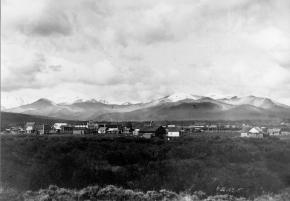
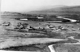
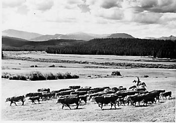
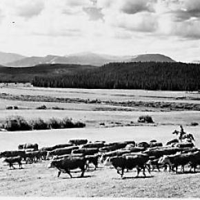
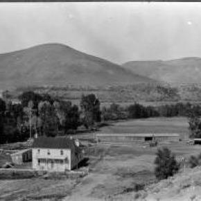
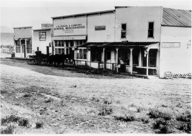
Grand County was established in 1874 by the Territory of Colorado, thus becoming a county two years before Colorado became a state. It was named for the Grand River, the name by which the Colorado River was known at that time. The headwaters of the today’s Colorado River are in Grand County. The county was formed from a portion of Summit County but acquired its current boundaries in 1877, when part of the Grand County was used to create Routt County. The county seat is Hot Sulphur Springs. The area of 1,854 square miles consists of meadows, river valleys and mountains.

Topic: Dude Ranches

Devil's Thumb Ranch

According to local lore, Native Americans named Devil's Thumb, a rocky outcropping that towers high above the Ranch. As legend goes, after the warring Ute and Arapahoe tribes settled their differences in the Ranch Creek Valley, they buried the devil, but left his thumb exposed to remind them of the evils of war.

Before the Trans-Continental Railroad opened up the area in 1904, a stagecoach route from Idlewild (now
Winter Park) joined the Rollins Pass route. A state station was situated east of what is now our Ranch. The road extended transversely over the Ranch where it followed the course of the existing County Road 83. The land was rich agriculturally, and was used for cattle grazing in the early 1900s.

After the railroad was introduced, settlers began moving west in search of wealth and opportunity. Many ended their journeys in the
Rocky Mountains. During this time, there were more people living in the Fraser Valley than there are today. One favorite hangout of the railroad workers was a dance hall on Black Ranch, located immediately north of Devil's Thumb Ranch.

In the 1930s, Margaret Radcliff built the original Ranch homestead and operated it as a dairy. However, it was brothers Dan, Louis, and George Yager who started Devil's Thumb Ranch as a vacation property in 1946. The Yagers incorporated the Radcliff homestead in to the Ranch facilities and the original building exists today as the Ranch House Saloon.

The Yagers operated Devil's Thumb Ranch as both a working ranch and dude ranch until 1972. They introduced cross-country skiing in the winter of 1975-1976. Dick Taylor, a 1964 Olympic cross-country team member, designed 35 kilometers of the area's Nordic trails.

The Ranch was well known as a Nordic destination, but one without many amenities or niceties. The current owners purchased it in 2001, saving it from a group of developers who planned to fill the valley with residences and a golf course. They immediately began making improvements to the facilities, all the while impacting the land as little as possible.

My Granby, Little Old Log Church

Contributed by Vera "Stathos" Shay, Kremmling...Granby resident 1930-1945

From what I hear

It is very near

To be torn away

The little church of my childhood day

The most beautiful to see

That can ever be

Inside and out

Without a doubt

Built of log so fine

In the style of old time

In my own little chair

Every Sunday I was there

The chime of its bell

For miles around

Heard its wonderful sound

For a while our school

We didn't fit

So in our church were classes

For a bit

Beside our church on the hill

We sledded for a thrill

That poor little church

They moved it around

All over town

Proudly it's hung together

In all kinds of weather

Every time I go to Granby town

I look around to find

And have a look

At my log church for my eyes'

Memory book

Now they say it's got to go

Pray it won't be so

All of you Granby folk

Louder you should have spoke

To save that church with its

Memories and history

For there could never be

Anything that would compare

Built or put there

With my magnificent, beautiful

Childhood Granby log church

Find it in your hearts

To never let it be torn apart.


April 2005


Topic: Regions

Fraser Valley

The principal population centers in the Fraser River Valley are Winter Park, Fraser and Tabernash.  When the early stage coaches came over Berthoud pass into the Fraser Valley, the most popular stop was at the Cozens Ranch, which now houses a historical museum in Winter Park. The valley is now bisected by U.S. Highway 40, which was designated the "Victory Highway" in 1931.  The new route of the highway leads through the main streets in both Fraser and Tabernash and the backdoors of some business became front doors because of the new highway alignment.   

Tabernash was the name given to a railroad siding, named for the Ute leader who was killed during a confrontation with local ranchers.  The town became a key station on the railroad line, and included a roundhouse, and a supply of helper engines for the steep climb over Rollins Pass.  When the Moffatt Tunnel was opened in 1928, the railroad no longer needed service there and the town lost its' main economic support.

George Easton founded the town site of Fraser in 1905.  The rest of the country became familiar with Fraser when the winter temperatures were often the lowest recorded in the U.S. and Fraser was know by the nickname "Icebox of the Nation".   Lumbering was one of the prime industries in the region until World War II.  During the war, the military built a Prisoner of War camp at Fraser to help lumber for the mills in the area.

The current area of Winter Park has had many names over the years.  First it was called simply "Old Town" or "Vasquez", named after the fur trader Louis Vasquez.  "Woodspur" or "Woodstock" referred to Billy Wood's lumber mill in the area, which furnished ties for the railroad while it was being built over Rollins Pass. During the construction of the Moffatt Tunnel, the name "West Portal" came into usage.  Rail workers also called the community "Little Chicago" as it was as it was a favorite gambling, saloon, and brothel site.  As tourists began to arrive it was known as "Idlewild" and also "Hideaway Park".  Finally, the name "Winter Park" was settled upon to correspond with the adjacent ski area of the same name.

The area population declined from 1232 people in the 1920's to only 373 people by 1930.  The Great Depression ended the construction boom and the price of beef became too low for ranches to turn a profit.  However, since that time, the area has thrived, mostly based on a tourism economy.  The valley's main source of income is now recreation and second home construction. 

Topic:

Agriculture

Article contributed by Scott Rethi

The first settlers in Granby realized the sunny days and cool nights were perfect for growing one crop in particular, lettuce.  Lettuce farming boomed in the 1920's and a new industry was born.

Granby had become an important railway center as tracks were laid over the Divide at Rollins Pass,giving the Moffat Railroad access to Salt Lake City. Granby produced some of the best-known lettuce
in America.  There are even tales that New York's Waldorf-Astoria Hotel bragged of their “Granby Lettuce” on the menu.  

Then a blight settled into the soil, probably brought in by the wooden crates used for shipping, and the lettuce business was ruined. Since then, ranching has replaced agriculture as Granby's major industry.

Sources:
www.byways.org, national scenic byways online, 2003
www.grandcountynews.com, Johnson Media, Inc., 2000-2002
www.djhome.net, 2002

Topic: Railroads

Train Legends of the Moffat Road

Article contributed by Abbott Fay

The railroaders graded and bridged the trails originally made by the Indians and expanded by the trappers, prospector and stage road builders that following in rapid succession. The

Moffat Road
train track has an almost endless series of wreck stories and legends.  In one, a "green clerk" was said to have piled all the mail order catalogs on the same side of a car, causing the train to leave the tracks and roll down the mountainside into Yankee Doodle Lake.


In another lost train story, the No. 3 westbound was seven hours late out of Denver because of a severe winter blizzard.  It crept out of the Fraser Canyon and whistled for the Granby Crossing.  The engineer parked the train intending to wait till daylight to continue on.  In the meantime, the No. 2 eastbound, 2 days late out of Craig reached Corona without passing the No. 3. In the morning, all were amazed to find the train parked "plumb center" of Granby's main street. Later investigation showed that the No. 3 train left the train tracks just east of Granby and traveled almost a mile over frozen highway.  The next day a Chinook wind came up and melted the frozen soil, sinking the train to it's axles in mud. It required the building of 1500 feet of special track to salvage the train. However, some longtime Granby residents say the locale of this incident was the Kremmling flats.


Sources: Roland L. Ives, Folklore of Middle Park Colorado,Journal of American Folklore, Vol. XXXIV, Nos. 211, 212, 1941; Levette J. Davidson & Forrester Blake, Rocky Mountain Tales, University of Oklahoma Press, 1947


Topic: Biographies

Nathaniel "Nathan" Shore

Nathaniel "Nathan" Shore was born in Cottonwood Harbor Canada in 1856. When he was about 16 years old he had visited and then worked as a freighter hauling groceries to different towns in western Colorado. He saved enough money to purchase his own wagons and 2 yoke of oxen for each wagon to continue freighting.

Nathan became famous as a man who carried his Bible in one hand and a gun in the other. Nathan returned to visit his family and met Sarah Jones in Springfield Missouri. They were married in 1885. Their trip to Colorado and the Williams Fork was undertaken with Sarah driving a team of horses pulling a covered wagon and Nathan herding their few cows.

The cows helped start a homestead ranch east of the Williams Fork river. In 1907 they sold the homestead ranch to the Curtis Family. They had purchased the Anders Anderson ranch close to Williams Peak and the Joseph Jackson ranch on Bull Run Creek.

They lived on the Anderson place until the forest fire that burned along the Williams Fork Mountains. Nathan told Sarah to hitch the horses to the hay rack, load the furniture that it would carry, take all the children and move to the Jackson place while he helped fight the fire. Nathan's team of horses were stolen so he broke 3 heifers and a steer to work in the yoke.

He still did a lot of freighting to make a living for his family. He freighted to Hot Sulphur Springs and also from Georgetown. He returned home to the ranch about once a week. He sold butter, that Sarah had made and hung down in the well to keep cold, in the mining town of Breckenridge.

Nathan Shore died June, 1928 when his pickup stalled on a railroad crossing in Utah. He was trying to find the trouble under the hood and didn't hear the train as it whistled and whistled. He was headed for a trip to Hawaii.

Places