Places

Places Articles

100 Years of Location, Location, Location

Real Estate and land ownership have always been important to the Granby area. With the passage of the 1862 Homestead Act by Congress, the West, including the area around the current town of Granby, began to be settled with hardy, ranching pioneers. The opportunity to own land was often made possible by homesteading.   This lured many settlers to the area.

As Congress adjusted the homesteading rules over the years to allow for larger acreages which would support ranching in the Middle Park, towns began to grow. Ranching, mining and especially the railroad fueled the growth. In 1902, railroad visionary, David Moffat, set events into motion in Denver to build a steam railroad from Denver to Salt Lake City which would be built over Rollins Pass.   This was a monumental task which led to the founding of the town of Granby.

Mary Lyons Cairns observed in her book, “Grand Lake in the Olden Days,” “Granby came into being with the Moffat Railroad, which reached that point in September, 1905. The town site was laid out on a piece of land which was part of a homestead and part of a pre-emption taken up by James Snyder from the government. Mr. Snyder sold this land to David Moffat who had the town site surveyed and platted in 1904, and a man named Hunter auctioned off the lots.”  

The lots on the town plat were 12 blocks and a Block “A.” Each block, except Block 12 and “A,” would have 32 lots. Each lot would be 25 feet by 125 feet. Block 12 only had 20 lots. Block “A” only had four smaller lots. David Moffat and the railroad in the form of the Frontier Land and Investment Company designed the town streets so that the southern boundary of the town was Agate Avenue, the western was First Street, and the northern boundary was Garnet Avenue. A variation in terrain in between Block 12 and Block “A” created Opal Avenue that would lead down Fifth Street which would be the eastern boundary of the new town of Granby.    

The new town streets were named Agate, Jasper, Topaz, Garnet and Opal, all precious gems which might reflect the mining heritage. But, in the King James version of the Bible in the Book of Revelation, Chapter 21, Verse 19, heaven is described as, “And the foundations of the wall of the city were garnished with all manner of precious stones. The first foundation was jasper…” Other streets and foundations are described as being made of precious gems such as topaz and chalcedony. Agate is described in the dictionary as a variegated variety of quartz or chalcedony.   Maybe the founders thought Granby was “heaven on earth.” Or, at least the real estate marketers wanted buyers to think that.

The real estate advertising in the December 16, 1905, Grand County Advocate showed V.S. Wilson as the local real estate agent for Granby. He also was the newspaper editor and became Granby’s first mayor on December 11, 1905. With that background, hyperbole and adjectives must have been in his blood.   “Now is the time to buy property at Granby-The newest and best town on the ‘Moffat Road.’…It would be a Happy Christmas investment. Do it now,” was part of the ad copy.  Mr. Wilson became one of the first land owners in Granby buying lots 18 and 19, Block 7 on Topaz from Frontier Land & Investment in November, 1905.  

When the railroad’s real estate company founded Granby in 1905, local historian, Betty Jo Woods, said the new town location was chosen because it had great connections with the stage route to Grand Lake, was mostly dry ground, and had pleasant views. As they say in real estate, the three keys to successful land investing are “Location, location, location!”   The locations of many of the historic buildings were on the north side of Agate Avenue. According to photographs and written explanations by the late Vera Snider, in 1920, on “main” street, one of the only buildings on the south side of the street was the firehouse which protected the fire pumper and hoses. The post office was also on the south side.   Vera Snider later arranged for the preservation of this historic structure built in 1910 by moving the first post office building in the 1960s from 458 East Agate where it had stood for over 50 years to its present location at 170 2nd Street.

According to the current owner of this historic structure, Deb Brynoff, “When Ron, my husband, was remodeling he found old letters in the wall from when it was the post office building.” It was not unusual during the early years of construction for letters and newspapers to be “stuffed” into the walls to help increase what little “R-factor insulation” existed.    Other early buildings which still exist in Granby are a home at 127 4th Street which was built in 1909. The current Re/Max Granby office at 247 Agate was a home originally built in 1909. Other early Agate Avenue buildings still thriving are Crafter’s Corner at 295 East Agate built in 1913 for the Granby Mercantile. Local lore says the basement was used as a temporary morgue during the 1918 flu pandemic. However, no historic research has yet been found to document this information.  

Research on High Country Motors at 277 East Agate reveal it was originally Middle Park Auto which grew up with the town of Granby. The tax rolls indicate 1913 for the birth of this building. The business was “born” in 1915 when Jack Schliz founded Middle Park Auto. During Granby’s early years this was a hub for locals. It even included a small medical-first aid station inside it before Granby had any local medical services. In 1938, the business was sold to Glenn Pharo and Morris Long. Later, Jack Shield was associated with the business. The authorized Ford dealership was later purchased by Fred Garrett, who later sold it to Mike and Kimberly Garrett.   The only constant on Agate Avenue is change. Many of the buildings have a colorful past. For example, the current location of Brown & Company at 315 East Agate was a Texaco Service Station built in the 1930s.

The Long Branch at 185 East Agate is in a building that was Granby’s first strip mall. That accounts for the many doors fronting on to Agate. Built around 1938 for the Craig’s Café, it has housed Olson’s Café, a Laundromat, a barber shop, The Carpet Wagon rug store and Maureen’s Clothing Store to name a few.   The Silver Spur Saloon & Steakhouse at 15 East Agate used to be the Grand Bar and Café run by Dick and Beulah Samuelson from 1944 to 1964. The original business at this location was the lettuce shed where the famous Granby Iceberg Lettuce was delivered by local growers for shipping to the Broadmoor Hotel in Colorado Springs. Some of the original lettuce shed has been incorporated into this building.  

The Dick Samuelson family also has a history with the Granby Mart at 62 East Agate. This building at one time was the home of Bud and Ken Chalmers’ Auto Repair Shop. In the early 1940s, it had a dirt floor when Sonny Samuelson and his Dad bought it. Clyde Redburn had a bowling alley on one side. The Samuelsons later put in more bowling lanes. Upstairs they had a club called “3.2.” At the time, those 18 and older could sip the 3.2 beer served there and dance. At one time Wayne Snyder’s Saddlery shared half of the store.   Sharing a location was the thinking behind the former Minnie Mall located at 480 East Age. Named by local businessman, Jack Applebee, for his mother, Minnie, in the 1980s, many businesses enjoyed the convenient location, The Furniture Store, Hobby Shop, Montgomery Wards, Honey Bear Children’s Clothing, Fabric Nook, Greg Henry’s Get-N-Pack, Radio Shack, Julie Sneddon’s Cards and Gifts, Patti Applebee’s Nimble Needle, Ben’s Aspen Leaf Café and the Shaft Shop which specialized in darts and dart supplies. Today, Granby Medical Center-Centura Health is at this historic downtown location.  

Granby’s historic story from 1905 to 2005 is one of building dreams, homes and businesses to create a community. Chinese Proverb says, “One generation plants the trees; another gets the shade.” How true.
2005


1873 directions to Hot Sulphur Springs

Hot Sulphur Springs (First published in 1873)

Location.—Middle Park, Summit County, Colorado  (now Grand County)

Access. – Go to Denver, via Kansas Pacific Railroad; thence, seventeen miles west, via Colorado Central Railroad, to Golden City; thence, thirty-two miles by stage, to Georgetown or Empire; thence, fifty miles horseback over Berthoud Pass. Or, from Denver, thirty-four miles west, via Colorado Central Railroad, to Central City; thence, fifty-five miles horseback over the James Peak route. Or, from Central City by wagon or carriage, fifty-five miles, over the South Boulder route.  Camp out on the way

Hotel.—One in contemplation.

Analysis.—None has been made. They are, however, said to be of the Sulphur class, and range in temperature from 111 to 116 degrees Fahr. Flow, two hundred gallons per minute.

Remarks.—These springs are no doubt destined to be a very popular resort. Situated as they are, on a mountain-bound plateau eight thousand feet above the level of the sea, under a cloudless sky, and surrounded by the attractions of mountain scenery and the chase, they cannot fail to receive visitors.

With all the inconvenience that attends a journey thither, and the necessity of camping out, over five hundred persons were there during the month of July, 1871.

The favorite route to the springs is by the way of Berthoud Pass. Having arrived at Georgetown, the tourist procures saddle and pack horses, and guides. The first day‘s journey will be over the summit of the range, eleven thousand feet above the sea, and through a dense forest of timber for fourteen miles beyond, to the “head of the park.” Here camp is usually made. The next day’s ride is down an open valley or arm of the park, following for some miles the course of Fraser’s River. The route by South Boulder Pass is tedious and difficult, the road passing over the extreme summit of the range, more than 12,000 feet above the sea, where snow-storms are not unusual in July and August. The James Peak route is one of the most interesting, the road winding around the mountain, one of the highest points in the range; and the ascent easily made. All the roads, however, after crossing the mountains, meet together in the valley of the Fraser River. Thence the road is a pleasant carriage-drive along meadow-like valleys, with timbered ridges or table-lands, to the right and left. The grass is of luxuriant growth, and great variety. Clover of several kinds, and the blue flowering flax, are seen everywhere. All through late spring and early summer the prairies are bright with flowers, and the air laden with their fragrance. Days or weeks can be whiled away in Arcadian simplicity and enjoyment. 

Arrived at the springs…...what a joy!


A Dream Smashed in Gore Canyon

The idea of a water passage from the Atlantic to the Pacific Ocean had long captivated the imagination of early explorers.  Soon after the Territory of Colorado was established, the United States government made a standing offer of $3,750 to anyone who could demonstrate such a route.

In 1869 a dreamer named Sam Adams convinced some people in the town of Breckenridge that goods could be sent upriver via the Mississippi, Missouri, Platte and South Platte Rivers to South Park.  Then, with a short portage over Boreas pass, they could continue down the Blue River to the Grand (Colorado) River and then through Gore Canyon the Sea of Cortez.

Volunteers were told they would share in the prize, and they built four boats of green lumber for the voyage.  The flotilla was launched with great celebration, the lead boat bearing a banner proclaiming "Western Colorado to California ? Greetings!"  A little dog was given to the crew to keep up morale.

As the boats went down the Blue River, the waters were a bit rougher than expected. When the men arrived at the Grand (Colorado) River, the crew set up camp. However several of the "sailors" declared they had had enough and began a trek, via dry land back home to Breckenridge.

When the boats reached Gore Canyon, they encountered violent upsurges and dramatic drops.  The wild waters smashed all four of the vessels on dangerous rocks.  Fortunately, all members made it to dry land, even the little dog.  No reward was ever given for the attempt.

Berthoud Pass
Berthoud Pass

Berthoud Pass was named for Captain Edward L. Berthoud, who completed the first survey of  this saddle in the main Divide in the spring of 1861.

Berthoud’s expedition of eight people, including Jim Bridger, crossed the Continental Divide at the 11,315 foot summit and established a relatively easy way to get into Middle Park from the east. Berthoud also served as chief engineer on the Colorado Central Railroad.

It is surprising that this famous pass had played no previous role in the history of the region. Even Jim Bridger, who knew the country well, did not learn of its existence until the survey. For reasons of their own, Indians had chosen to go over the divide at higher levels further to the north. One explanation may be that the pass is not evident from most locations on either side of the Continental Divide.

Church Park
Church Park

George Henry Church and his brother John had a substantial ranch in Jefferson Country, prior to Colorado Statehood.  When the Timber and Stone Act of 1878 was passed, it permitted the purchase of land unfit for agriculture for $2.50 an acre.  Thus the Church brothers obtained land in Middle Park for summer grazing.  They would move their cattle into the Park by driving them over the Rollins Pass.   The area they used is just west of the town of Fraser and became known as Church Park.

In 1910, the Church Ditch was created to divert water across the Continental Divide for irrigation.  The remains of this early trans-mountain project can still be seen today at mile marker 241.5 on U.S. Highway 40.

Colorado-Big Thompson Project

The idea of diverting water from the Colorado River on the Western Slope of the Continental Divide to the productive farmlands of the eastern plains had been a dream of planners as early as 1929.  Subsequently,  a long period of drought and the sagging economy of the “Great Depression” whetted demands for what became the largest trans-mountain diversion project ever built.

The Colorado-Big Thompson Project takes water from Grand Lake on the western side of the Continental Divide to the Big Thompson River on the east.  The water flows through a 13 mile tunnel beneath Rocky Mountain National Park.  In order to supply the residential and farming needs of Northeastern Colorado, the project was begun in 1938 and continued through the years of World War II.  The first water flowed though the tunnel, named for Senator Alva B. Adams, on June 23, 1947.

In order to assure an adequate supply from Grand Lake, a dam was built creating Shadow Mountain Reservoir.  A larger lake, Granby Reservoir was then built below, with a unique pumping plant that forces water into Shadow Mountain.  The Farr Pumping Plant cost over $9 million and provides an additional 700,000 of irrigated land to northeastern Colorado.  Further reservoirs were added, both to supplement the diversion and to compensate the water needs of Western Colorado.  These include Willow Creek and Windy Gap Reservoirs in Grand County.

While most legislators were enthusiastic about the project, U.S. Representative Edward Taylor was vehemently opposed to the reduction of water flowing down the Colorado River.  A compromise was reached in the creation of Green Mountain Reservoir (on the Blue River), which reserves water to replenish the Colorado River.   The city of Denver later claimed upstream water on the Blue River for the massive diversion project of Dillon Reservoir

Claims on the water of the Colorado River range from the fruit and wine regions of the Grand Valley in Colorado all the way to Los Angeles and Mexico.  It can be said that every snowflake which falls in Western Colorado had already been over-appropriated, especially during drought periods in the arid West.

Early Water Disagreements

As fast as settlers arrived in the county, conflicts arose over water use.  George T. Bell, an early rancher on the Blue River in the 1890's, had water rights coming out of Deep Creek, Spring Creek, and Soda and Iron Springs.  Daughter Maud Bell had married James Mugrage and when her father died in 1925, she and James stayed on the ranch of about 800 acres, to operate it.  She reported years later that when Noonen, a large rancher also on the Blue, built his ditch, he took much of the Bell water and used it for his own benefit.  Many years later, Maud discovered that although her father was long dead, those early water rights still belonged to the Bells, not the Noonens. 

Another family, that of George Henricks, settled far up the Troublesome Valley, about 1900, in what was truly an inaccessible spot.  What possessed him to pick such a remote area for his ranch?  Because when he and his wife Aurille lived in Nebraska and tried to make a living on their farm, farmers upstream stole their water to the point that they couldn't keep their crops alive.  Aurille actually had to use the same batch of water for two or three purposes!  As water fights escalated, George vowed to find a place where nobody could be above him and his water source. Rancher Will Call took him far up the Troublesome valley to a large meadow, reachable only by foot or horseback.  Life wasn't easy, for George and Aurille had to do everything from scratch, and they lived in a cabin with a dirt floor for many years.  But nobody took his water! 

Even more recently there was a case on Crooked Creek, where a ranching family that owned quite a good spring and used it to water their hay, discovered that a new neighbor was diverting the water from the spring over onto his own land, to water his own hay!  The rancher protested and diverted the water back where it belonged.  The newcomer turned around and stole it again.  This situation went on for many years without good satisfaction.

The Kirtz Ditch development on the Troublesome began about 1890.  In 1911, an Elias T. Copelin homesteaded land, later adjacent to the Alexander and George Murray Baker ranches.  One day Copelin and Murray Baker, one of the brothers, got into an argument over water rights in the Kirtz Ditch, each accusing the other of stealing his water.  Murray, who was a little guy with a fierce temper, picked up a shovel and gave Copelin a mighty whack with it.  Copelin fell to the ground but after a bit picked himself up, climbed on his horse, and headed toward his home.  However, the blow must have damaged his brain because he was found the next day, dead on the ground at his own gate

High on Meadow Creek, in the early 1900's, lumber activity began in the area later known as Sawmill Meadow.  About 1910, the Western Land and Flume Co. put in a little dam near what is now the trailhead to Columbine Lake.  The resulting lake, today filled with water lilies, was used as a holding pond for logs that would be moved by flume to the main mill downstream in Tabernash.  This lumber company sold to Western Box & Lumber Company in 1912.  Business flourished.  There was even a short railroad going into the woods, with the tracks made of logs about 6" to 8" in diameter.  Prospects looked good.  However, from the beginning water rights were an issue. Some people say it was Nathan Hurd who broke the company.  Western Box had lost some of its water to the Strawberry Ditch (going to Granby) in 1914.  More trouble was looming.  Hurd wanted to keep the water from the little reservoir for the ranchers and lettuce farmers below.  The timber folks wanted to use the water during the summer months to keep the flume going.  Nobody was willing to give up anything, so in 1915, the big mill closed.   Still, efforts continued.

Then in 1919, the planing mill at Tabernash burned.  In the early twenties, further contention led to the withholding of more water from the lumber companies who wanted permission to ditch Trail Creek water across into Meadow Creek, replacing water taken higher up for the flume and Strawberry Ditch.  This would have been quite easy because, about seven miles out of Tabernash is a nearly flat saddle that exists between the two creeks.   Nevertheless the Hurds wouldn't hear of it.

Then one Henry Jarvis showed up on the scene.  He was known to all the timber men.  In 1923, Jarvis, using a box of TNT, "blew the dam" of the irrigation reservoir at Western Box.  People suspected that he did it for T.S. Huston, one of the big lumber powers of the area.  The feeling was that "if the lumbermen couldn't have the water, neither could the ranchers and the Granby farmers."  In any case, that basically was the end of Western Box Company. 

Five Middle Park Veterans - Members of the Powell Expedition

On May 24, 1869, Major John W. Powell embarked on an expedition to fill in the final unknowns on the map of the American West. Among his nine-man crew were five veterans of the Civil War from Middle Park, unaware that by joining Powell’s discovery expedition they would find their own immortality.  

Corporal John "Jack" C. Sumner served in Company E, 32nd Iowa Volunteer Infantry in the Civil War. His sister Elizabeth Byers brought him to Colorado in 1866.  W.N. Byers, editor of the Rocky Mountain News, employed Jack as caretaker of the Middle Park Hot Springs. Sumner set up a trading post for hunters and trappers. Bill Dunn, Billy Hawkins, Oramel Howland, and Seneca Howland were all customers. 

Major and Mrs. John Wesley Powell visited the springs in 1867. Nearby, the headwaters of the Grand River flowed. Powell and Sumner planned to navigate the Grand, Green, and Colorado Rivers to the Gulf of California. Sumner convinced his colleagues to join the Colorado River Exploring Expedition. Only Sumner made it to the Gulf. He died July 5, 1907, leaving a widow and three sons.

page6image62730048

Private William H. “Bill” Dunn served with Co. K, 15th Ohio Vol. Inf. After service, he came to Colorado. Powell said of Dunn, “He dresses in buckskin with dark luster, and has a contempt for razors and shears.” Dunn left the expedition at Separation Rapid, Arizona, and was subsequently killed.  No photos of Dunn exist today. Artist’s interpretation courtesy of Hannah George.

Oramel G. Howland was a printer at the Rocky Mountain News, and VP of the Typographical Union. He was associated with the Methodist publication The Sunday School Casket. Powell said Oramel had a “King Lear” look. At age 36, he was the expedition’s mapmaker. His fate was the same as Dunn’s.

page6image62718736 

Pvt. William R.W. “Billy” Hawkins enlisted with Company D, 15th Missouri Vol. Cavalry. Hawkins came to Colorado as a bullwhacker. He was the expedition’s cook and last survivor, passing away in Arizona at age 70, on June 7, 1919.

page6image62718624

 A half-brother of Oramel, Seneca B. Howland was a member of Co. G, Vermont Vol. Inf. Brigade. At age 26, he shared the same demise as Oramel and Bill Dunn.

page6image62727472

2019 marked the 150th Anniversary of the Powell Expedition.  

Fraser
Fraser

The origin of Fraser was in 1905 and it was incorporated in 1953. It was formerly known as Eastom, for George Eastom, who laid out the town site in 1871. The spelling of Fraser was originally Frazier, after Reuben Frazier. The town came into being because it was the site of a large sawmill and was a railroad terminus for the lumbering operation.

While Fraser was generally considered to be an isolated mountain outpost, at one point there was enough cultural interest to support a local opera house.  Fraser was the location of a weather station for several years and during that time it was not uncommon for the winter temperatures to be 45 to 50 degrees below zero; one Fraserite remembers a morning when it was 60 degrees BELOW zero. Thus the town earned the nickname “Icebox of the Nation.” After a legal battle, that offical title went to a town in Minnesota.

A transcontinental motor route dubbed the Midland Trail came through Grand County and by 1913 a Ford sales agency was located outside of Fraser on the 4 Bar 4 Ranch. Avid fly fisherman President Eisenhower was a frequent visitor between 1948 and 1955.

Fraser Valley
Fraser Valley

The principal population centers in the Fraser River Valley are Winter Park, Fraser and Tabernash.  When the early stage coaches came over Berthoud pass into the Fraser Valley, the most popular stop was at the Cozens Ranch, which now houses a historical museum in Winter Park. The valley is now bisected by U.S. Highway 40, which was designated the "Victory Highway" in 1931.  The new route of the highway leads through the main streets in both Fraser and Tabernash and the backdoors of some business became front doors because of the new highway alignment.   

Tabernash was the name given to a railroad siding, named for the Ute leader who was killed during a confrontation with local ranchers.  The town became a key station on the railroad line, and included a roundhouse, and a supply of helper engines for the steep climb over Rollins Pass.  When the Moffatt Tunnel was opened in 1928, the railroad no longer needed service there and the town lost its' main economic support.

George Easton founded the town site of Fraser in 1905.  The rest of the country became familiar with Fraser when the winter temperatures were often the lowest recorded in the U.S. and Fraser was know by the nickname "Icebox of the Nation".   Lumbering was one of the prime industries in the region until World War II.  During the war, the military built a Prisoner of War camp at Fraser to help lumber for the mills in the area.

The current area of Winter Park has had many names over the years.  First it was called simply "Old Town" or "Vasquez", named after the fur trader Louis Vasquez.  "Woodspur" or "Woodstock" referred to Billy Wood's lumber mill in the area, which furnished ties for the railroad while it was being built over Rollins Pass. During the construction of the Moffatt Tunnel, the name "West Portal" came into usage.  Rail workers also called the community "Little Chicago" as it was as it was a favorite gambling, saloon, and brothel site.  As tourists began to arrive it was known as "Idlewild" and also "Hideaway Park".  Finally, the name "Winter Park" was settled upon to correspond with the adjacent ski area of the same name.

The area population declined from 1232 people in the 1920's to only 373 people by 1930.  The Great Depression ended the construction boom and the price of beef became too low for ranches to turn a profit.  However, since that time, the area has thrived, mostly based on a tourism economy.  The valley's main source of income is now recreation and second home construction. 

Articles to Browse

Topic: Towns

Monarch & KaRose

Once upon a time on the land that lies beneath Lake Granby and Shadow Mountain Lake there were ranches, pastures and an almost forgotten town, Monarch.  It is a story that goes back 100 years to the Summer of 1905, and the arrival of train service in Middle Park and promoters who were "honest men, but too visionary and lacking in experience", according to Frank H. Wolcott, a brother of one of the founders.

The Monarch Consolidated Gold and Copper Mining and Smelting Company owned the King and Queen copper mines on Arapahoe Range above the South Fork of the Colorado River.  They felt their assays indicated ore worthy of a mill and arranged to haul in the heavy machinery and proceeded to build a town with cottages, a small hotel, stores, a bowling alley, theater and dance hall.  By 1907 Monarch had a school and post office.  However, records indicate only about $150 worth of copper per year was ever produced.    

Soon the promoters realized a sawmill was needed to provide both timber and cash to support the mine operation. A dam was built creating Monarch Lake at the junction of Arapahoe Creek and the South Fork of the Colorado, and a canal was built to float logs cut near Strawberry Lake to Monarch Lake.  A stern wheel steamer bunted rafts of logs into flumes and canals towards the sawmill downstream in Monarch.

In the spring of 1906, Monarch management obtained a charter to build the Rocky Mountain Railway, a standard gauge, for lumber and passengers, from the Moffat tracks in Granby to Grand Lake, with a spur over an unspecified pass to Walden, in North Park.  The track was laid following the river from Granby to the sawmill, by Japanese and eastern European laborers.  Ranchers along the route, excepting Fred and Frank Selak, quietly granted rights-of way. The only rolling stock owned by the railroad was a small, ancient locomotive and a caboose.  The night before Thanksgiving 1906 the first train rolled into Monarch, and the rails never extended any farther.  There was daily service, and local ranchers could flag a ride or have their packages dropped off.  There were no cattle guards, so the fireman would step off the locomotive, open a ranch gate, and close the gate and hop back on after the train passed through. 

During the winter of 1905-06 a box factory was started. It operated briefly before it was destroyed by fire in the fall of 1908.  The fire forced the mill and railroad into receivership.  Visitors, particularly former stockholders, helped themselves to equipment and entire buildings, but Monarch's core was preserved and developed by Harry L. Dierks of Kansas City into KaRose.  This summer resort was named in honor of Dierks' daughter Katharine Rose.  Other Monarch buildings went to neighboring dude ranches and the bowling alley went to Granby.  

To hold the railroad right-of-way, Ernest Behr restored the locomotive in 1912 to carry parties of fishermen along the river from one pool to another.  Ed McDonald, a dude rancher, ran a Cadillac touring car on flanged wheels on the rails to carry mail, supplies, and passengers to the valley ranches.  Just before World War I the engine and rails were sold for scrap. 

Frank H. Wolcott wrote, "In September 1954 my wife and I drove over the site to discover any signs of Monarch or the railroad...It gave us a queer feeling to realize that substantial things like railroads and buildings that we helped build have vanished.  Was it all a dream?"

Topic: Skiing

Winter Carnivals

Carl Howelsen, a ski jumping champion in his native Norway, came to Denver to pursue a career as a stonemason in the early years of the 20th Century.  He amused himself and others by demonstrating ski-jumping in the foothills of Denver. 

In 1911, Howelson went to Hot Sulphur Springs, where he taught locals such as Horace Button the art of jumping.  Under Howelson's leadership, the first winter carnival west of the Mississippi Rover was held there on February 10-12.  According to the Middle Park Times, "Never before in the history of the Territory and State of Colorado has such an event even been contemplated, much less held!".

Norwegian immigrants Howelson, Angell Schmidt of Denver and Gunnar Dahles of Williams Fork (Grand County) all staged jumping competitions during the carnival.  There were also skating and tobogganing events and a Grand Ball.  Hot Sulphur Springs continued holding Winter Carnivals annually until World War II, when they were discontinued until the 100th anniversary celebration, called the Grand Winter Sports Carnival scheduled for December 30, 2011-February 11, 2012.

Topic: Biographies

Elenor and George Smith

"You have tuberculosis." Frightening words to be sure, especially in times when the life expectancy rate for such a disease was slim. Tuberculosis, or consumption as it was commonly called, is a disease that primarily affects the lungs. Something as simple as the common cold quickly develops until the patient is suffering from severe chest pain. Soon they are coughing up blood. For most diagnosed, the result was eventual death. As a last hope, many people fled westward, desperately seeking the arid climate that would dry up the fluid in their lungs. Little did they know that while the west would cure them, it would by no means make their lives easier.

Elenor Smith, a woman in her early thirties living in Wisconsin, was one of the many so diagnosed. The doctor who examined her did not have much hope for her survival. He ominously predicted she would live no more that a few years longer and she would be unable to bear any more children. With this devastating prognosis ringing in her ears, Elenor, along with her husband George and their five children, packed up and headed west. Their long journey brought them to Fraser, Colorado, where they ended up settling in 1910.

The Smiths soon became an important part of the community. They built a log cabin in what is now "Olde Town Fraser' and, like everyone else, allowed their cattle to roam freely. George, affectionately called "Whispering George" by those who knew him well, owned the only livery stable in town. He could regularly be found escorting "Doc Susie" to her patients, be they man or beast.


The climate seemed to have been the perfect cure for Elenor. She lived a hardy and wholesome life, and went on to have four more children. Being the hard worker she was, she would often cook for the men working in the nearby logging camps. When she wasn't cooking, she was washing laundry. She was known by many and loved by all.


However, things were rough all over and all too soon the Smith family learned how harsh life could be. In 1921, their second eldest son, Oliver, at the age of twenty, was killed while working at Virgil Linnegar's sawmill. Then in 1944, things again took a turn for the worst. Her youngest daughter's (Georgene) two children contracted polio, a contagious disease that causes muscle paralysis and stunted limb growth, while their father was away in World War II.


As the story goes, the eldest of the two children, Sherry, showed signs of polio first, so she was rushed to the hospital in Denver. Not thinking George, the youngest at the time, had also contracted it, his mother left him with his Grandma Elenor, so that she could be with her ailing daughter. However, one day Elenor found him hiding under the table crying. Knowing immediately the two-year-old wasn't just throwing a fit, she scooped him up in her arms and rushed to get help.


Polio had been going around for a few years now, leaving a swath of deaths in its wake. People were doing everything they could to prevent bringing the disease upon themselves and their families, which was why the woman working in the telephone office locked the door when she saw them coming. Not knowing what else to do, Elenor searched frantically for someone, anyone, to help her. She even began knocking on house doors. Finally one brave man offered to help. He took her and little George to Denver in his car. Luckily, both children survived, though they would carry the repercussions of the disease for the rest of their lives.


Having conquered tuberculosis, polio, and everyday hardships, Elenor Smith died in 1974 at the ripe age of 93.

Topic: Granby

The Naming of Granby

Granby Hillyer was born in Cartersville, Georgia on July 7, 1874. The third of six children, born of Shaler Granby Jr. and Lelia (Holloway) Hillyer, and the grandson of the Rev. Shaler Granby Hillyer, Sr. who was born in Granby, Hartford County, Connecticut. When Granby was 13 years old the Hillyer family moved to Washington, D.C. where Granby graduated from public high school. He then entered government service and at the same time studied at George Washington University, receiving a Bachelors of Law Degree. A postgraduate law degree was awarded in 1896 from Columbia University School of Law. He moved to Colorado in 1898 settling at Lamar (Prowers  County) launching a 40+ year legal career. On June 16, 1900 he married Miss Annie Creaghe, from a prominent southern Colorado pioneer family, and a daughter of an Apache County, Arizona sheriff. To this union were born 3 children St. George Creaghe, Granby Francis Ridgeway Jr., and Helen Edna Dolorine (Jane) later Mrs. Albert Hunt of Boston, Massachusetts.

Granby Hillyer was a member of the Republican Party. He served as Lamar City Attorney, Prowers County Attorney, and Deputy District Attorney. He was also affiliated with the Elks, Masons, Sons of the American Revolution, and Woodmen of the World fraternal organizations.

At 28 years of age, the citizens of Prowers, Baca and Las Animas Counties, elected Granby Hillyer to serve in the 14th Colorado General Assembly, House of Representatives, making him one of the youngest elected officials in state legislature history. He served one term from 1903-1905. During this tenure he plotted the streets at no cost for the Frontier Land and Investment Companies newest town on the Denver, Northwestern & Pacific Railroad (The Moffat Road). In doing so, Mr. Hillyer was honored by having the Town of Granby, Grand County, Colorado named for him.

Governor Carlson appointed Mr. Hillyer as the Third Judicial District Court Judge, at Trinidad, Colorado from 1914-1916. Her served as the United States Attorney for Colorado from 1922-1925. Afterwards he enjoyed a large private law practice in Lamar and Denver.

In 1928 at Lamar, Granby Hillyer was a speical prosecutor in the "Fleagle Gang Case".  On May 23rd, the First National Bank was robbed, resulting in the loss of four lives.  The case has been credited by the F.B.I. as the first robbery solved from a single fingerprint.

The Denver Post on July 21, 1931 page 9, reported "Granby Hillyer Is Disbarred By Federal Courts." In a decision reached by the United States Circuit Court of Appeals, predicated by a Colorado Supreme Court tribunal, of neglecting the interests of his clients in a number of cases.

Tragedy then struck the Hillyer family twice with the loss of St. George Creaghe in June 1932 and October 1933, Granby Jr. was killed in an automobile accident near Lamar. They both were attorneys. St. George and Granby Jr. were born 16 months apart and passed away 17 months apart. Both funeral services were held at the Immaculate Conception Cathedral in Denver, with the same set of pallbearers for both young men. They were laid to rest at Denver's Fairmount Cemetery. Their father Granby Hillyer, joined his sons on January 2, 1942, passing away at Denver Mercy Hospital, after suffering a heart attack at age 68.

The name Granby also comes from Great Britain, one of the original references was for the "Marquis of Granby," John Manners. A Member of Parliament from 1754 until his death in 1770, he also was a popular army officer and hero of the Seven-Year War 1756-1763, obtaining the rank of Lieutenant General. In 1766, he was named British Commander-in-Chief of the Army. John Manners once had his hat and wig shot off during a cavalry charge, thus leading to the British expression, "to go baldheaded at something." He had his office attacked by the pseudonymous political writer "Junius." The Marquis of Granby resigned most of his offices and died in debt.

Curiously, Granby Hillyer had an uncle and a brother named Junius.

National Sports Center for the Disabled

May 8, 2010 Sky-Hi News

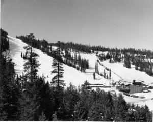
In January 1970, Gerald Groswold, then chairman of the board of Winter Park Ski Area, received a call from the Children's Hospital of Denver about program they'd been running at Arapahoe Basin for amputee children. A-Basin wasn't going to continue the program, and the hospital wanted to bring it to Winter Park.

In his morning meeting a few days later, George Engel, who ran Winter Park Ski School at the time, announced that this group was coming up in a week's time and asked for volunteers. Of the 40 or so ski instructors standing there that day, only one raised his hand to volunteer. Later, at lunch, Engel walked by the lone volunteer and threw a note in front of him. "Call this number. You're in charge," Engel said.

The 32-year-old Montreal-born ski instructor stared at the note while he finished eating his lunch. He had no way of knowing that by raising his hand he had just shifted the entire course his life as well as the lives of tens of thousands of others. That ski patroller was Hal O'Leary.

O'Leary went on to found the National Sports Center for the Disabled. Today, the NSCD is one of the largest outdoor therapeutic recreation agencies in the world. Each year, thousands of children and adults with disabilities take to the ski slopes, mountain trails and golf courses to learn more about sports, and themselves.

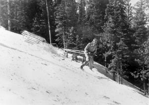
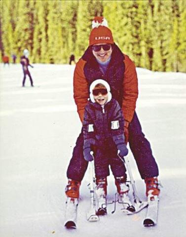
From the get-go, O'Leary had obstacles to overcome, starting with the fact that he'd never even known an amputee, not to mention seeing one ski. The day after he raised his hand, O'Leary got himself a set of outriggers and went about teaching himself to ski on one leg. Being schooled in the Professional Ski Instructions of America technique, he used all the same concepts as he would use for a conventional skier, sliding between turns.

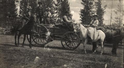
On Jan. 22, 1970, 23 amputee children arrived at Winter Park with equipment borrowed from Children's Hospital. It was a cold day, as O'Leary recalls, and he pushed the kids hard, making them climb up the bunny slope to turn around and practice making runs back down. Some of the kids who had participated in the program at A-Basin had been taught to jump turn the ski rather than sliding it. So they were hopping around like kangaroos, hopping three times to make each turn, O'Leary said. By 11 a.m., kids were collapsed on slope, crying. One screamed: "I hate your guts," O'Leary recalled.

Feeling that he had failed them, he took them over to the lift on Practice Slope after lunch and put them on the chairlift. A few bailed out, and O'Leary thought: ?Oh my God, I'm going to kill them,' he said: "I worried they'd end up in the tunnel." By the end of the day, however, the kids were flying down the hill, coats flapping in the wind and smiles on their faces. O'Leary was hooked.

For eight weeks the program continued. Before long, the television stations caught wind of what was going on at Winter Park. One day O'Leary got a call from the Today Show, which wanted to feature his program. No sooner had he hung up the phone then it rang again, and Good Morning America was on the line wanting an interview. "It really put Winter Park on the map in those days," he said.  As word got out, people with different disabilities started calling O'Leary to set up lessons, from the visually impaired to the paraplegic.

For each new challenge a skier presented, O'Leary needed a new adaptation to the traditional ski equipment. He spent nights at the ski shop working on modifications and pouring over medical books. Improving the design of the outrigger was O'Leary's first challenge. O'Leary made a lot of phone calls back and forth with George Engel (who also owned Winter Park Ski Shop) and other product manufactures, explaining the design he needed, then they would build it.

Another early invention was the "ski bra." Originally made of metal, the contraption slid over the tip of the skis, holding them in place and preventing them from crossing. "The ski still had freedom, but it helped people that lack lateral control of their bodies," O'Leary said. Sit skis hadn't been invented either. So when a paraplegic wanted to ski, O'Leary modified a cross-country ski item out of Norway. "It reminded me of a little bathtub," he said. "It didn't have any runners. It made me nervous. But, people could use it in a seated position, and it got people who couldn't stand out on the hill."

One of the more peculiar adaptive designs that O'Leary saw over the years was a space suit worn by a paraplegic man. The man filled the suit with enough air that he could stand upright, which worked well, O'Leary said, until he sprang a leak and had to be rushed back down the hill. "In 40 years, it's amazing what has happened to the gear," O'Leary said.

If equipment is the backbone of the program, volunteers are its heart. "We couldn't do this without our volunteers," O'Leary said. More than 800 people volunteer every year with the NSCD. It's a dedicated group of people - the average volunteer has been involved with the program for more than eight years, O'Leary said. Just about anyone who can ski can volunteer. NSCD provides the training and, soon, the volunteers are teaching the lessons. Thanks to the volunteer program, a NSCD participant in 2010 can get a full day lesson with a private instructor, plus a lift ticket and adaptive equipment for $100. Scholarships help people who can't afford the price tag. Raising money to help offset costs and provide these scholarships is key for the program's success. The NSCD holds more than a dozen fund raisers each year, although the Wells Fargo Cup and the Hal O'Leary Golf Classic are two of the biggest and most well-known.

O'Leary built the adaptive skiing program for 10 years before it began to develop into something permanent. In the early years, he was challenged a lot by the ski area, he said. Lift ops had concern about people riding the chairs with different apparatus. The ski patrol was concerned about people with various abilities getting on slope. "There was opposition from different parts of the mountain," O'Leary said. But the program's champion - Gerry Groswold, who served as the ski area's president for 22 years, from 1974 to 1996 - held strong to his conviction that the mountain should make room for skiers of all abilities, O'Leary said.

While the majority of those other ski instructors - the ones that didn't raise their hands that day - moved on to other pursuits, O'Leary had found his life's purpose. "It was seeing smiles on people's faces," he said. "I never realized what it would mean, giving these people movement they did not have in a wheelchair or walking. It changed their life. It helped them in many ways with their challenges. They did better in school. They started focusing more. After several years, wanting to give back what they took, many of them became instructors themselves."

For the first four years, O'Leary still had to wait tables in the summer to survive. Finally, in 1974, O'Leary parted ways from Winter Park Ski School, and Winter Park Ski Area brought the disabled skier program under its wings with O'Leary at its helm. That year, O'Leary introduced summer activities to the program, including whitewater rafting and horseback riding. "That first summer went extremely well," he said. "The turnout was huge."

Today, the summer program has expanded to include almost any recreational activity imaginable, including rock climbing, biking, hiking, canoeing, kayaking, camping and fishing. Programs are designed for individuals, families and groups and are available for all levels of ability, from beginner to advanced. "What we offer now parallels what any tourist would want to do on a vacation in Colorado," O'Leary said.

O'Leary has spent the past 14 years traveling to other countries, lecturing, writing books and working with ski areas to set up programs and introduce adaptive equipment. "It's not easy to create a program at a ski area," he said. "Space is limited. You have to raise money to finance it. But the point is to create choices for people who have disabilities, choices like everyone else has."

In the United States, the sporting opportunities for disabled people have exploded in the past few decades, thanks, in large part to the early efforts of folks like O'Leary. Disabled Sports USA now recognizes 13 disabled sports programs in Colorado, far more than any other state. Although O'Leary, now 72, handed over the day-to-day operations of NSCD more than eight years ago, he still works daily. He's traveled to 13 different countries helping to create NSCD-style program. He's written the book, literally, on adaptive skiing techniques (Bold Tracks: Skiing for the Disabled).

Looking back on that January day 40 years ago when he innocently raised his hand, O'Leary said he'd do it all again: "I've gotten more out of it than I put into it," he said. "I've worked with fabulous people. I've had great opportunities. It's been a good life. It really has."

Topic:

Business and Industry

How did people make a living? What were some of the businesses and industries that brought people to Grand County?  Jut click on the drop-down menus and find out more about it!

Christmas in the Mountains 1951

It was my first Christmas in the mountains. Not only that, but it was my first time to be part of a vacation in a cozy ski inn.  This was at Millers Idlewild Inn in Hideaway Park (now the town of Winter Park). I had been married only eight months. Dwight and I had worked hard, getting everything in order: ­clean beds, fresh spreads and curtains, floors shining and bathrooms sparkling.  The woodpile was full and food supplies ready.  Our plans for evenings were laid out too. Dwight would do movies. His brother Woodie would call square dances, with former Moffat Road engineer George Shryer accompanying on the fiddle and his wife, Grace, chording on the piano.  Tom Smith would bring his sled and team of horses, to take happy folks along snow-packed roads for sleigh rides, to the tune of jingling bells. Games were at hand, along with a fine supply of books on the shelves. We expected a wonderfully busy two weeks, which was a good thing, because it had been a long time since our last income, before Labor Day.

Family and friends were coming tomorrow to give a hand over the holiday, and then the fun would begin. As the first guests arrived, I stepped outside, and lifting my nose, I thought, "I smell snow!"  Great!  The area already had a pretty good covering, so that when people called and asked, "Is there snow yet?  Should we come on ahead?" we could gladly say, "Come." That night it snowed,­ 12" of beautiful soft flakes.  Skiers were overjoyed. Dwight got out early to shovel, plow, pull people out of drifts, take others to Winter Park Ski Area, three miles away. That evening we heard that almost no stumps or rocks were evident on the slopes; all had been buried. The next night it snowed again ­ 12" of beautiful white stuff.  We were amazed.  But Dwight got out early to shovel, plow, pull people out if drifts, and take others to the area.  The following night it snowed again, and every night for a week, it snowed, dumping heaps of snow on the whole valley.

Winter Park Ski Area, in those days, wasn't open on Christmas Day; the management wanted to let its employees have the day at home with their families.  So we took our guests to the top of Berthoud Pass; from there they could ski down Seven Mile Trail and we met them at the bottom.  The day after Christmas began the busiest days of all. Back then, many families didn't leave home until the 26th. This was fine, until the passes closed from heavy snows and avalanches. Then visitors, who had to leave, couldn't drive out, but people who were coming by train could still get in!  We had a problem.  The parking lot was jammed with rental cars.  Although some folks went ahead and left by train, many families stayed on.  The rooms were completely full and after all, newcomers were entitled to their reserved space. We had guests stashed all over the lounge, extras in the dorms, and extras in the cabins.  What a crowd it was. I hardly had time to think. 

I cleaned all morning, helped set tables and serve, did dishes, sometimes hauled skiers to or from the area, kept up with the office work, and joined in entertaining folks in the evenings. Thank heaven for family and friends!  There never was such a hectic week. But the Miller hospitality at Idlewild kept our visitors relaxed and happy. Truly, it was a jolly time, with tired skiers loafing in front of the fire, doing puzzles or playing games.  There was always a group playing canasta after dinner, in the dining room, and peals of laughter would pour forth when somebody won a great hand. At last New Year's Eve came and went. The rental cars had gone back to Denver.  The rooms were empty.  We were alone except for a couple of guests.  Making our path through the deep drifts, Dwight and I went home and flopped down on our own sofa.  I heaved a sigh, saying, "Well!  So that's what Christmas in the mountains is like.  I had o idea there would be so much snow."  Little did I know that for Christmas, 1952, we would still have the crowd of guests, but there would be hardly any snow until January!

Ute Legends of Hot Sulphur Springs

Ages ago, there were many Ute Indians who enjoyed life in Middle Park with its plentiful game and lush meadows.  They lived in peace and harmony for "as many years as there are hairs on the head."

In spite of this idyllic life, there was one young brave who yearned for more adventure and material goods.  He proposed that the Utes attack the Sioux, who lived beyond the mountains on the plains of the rising sun.  As victors, they would return in glory with much wealth and many captives.

Spiquet Pah (Smoking Water) was an elderly medicine man who foresaw only grief in the prospect of such a war.  He spoke before a council meeting, warning of the devastation that such an action would bring upon the tribe.  He foretold " As the North Wind soon brings the snows and death of winter, so will he bring sorrow and death to our own people.....if you do this, strength and peace and plenty will be but for a few; joy will be seen no more."

Disregarding his warning, most of the young men were tantalized with the temptation of the grand adventure of such a conquest.  In the autumn of the year, when they usually did their hunting, the young men rallied behind the young brave and followed him over the Great Divide into combat with the plains people.  As the fighters departed, a saddened Spiquet Pah went into the heart of the mountain "and pulled the hole in after him."

The young Ute men found the enemy better armed and organized than they expected. Many Ute braves were killed and others were taken as slaves. The prophecy had come true as starvation and disease plagued the tribe as there were too few men to hunt for food. The old man sat on his haunches beside his subterranean fire which he heated water from an underground stream.  From the mountain at Hot Sulphur Springs, water flows even today as a reminder of the rash behavior of so long ago.

Another legend holds simply that the Hot Sulphur Springs water acquired medicinal qualities in answer to the prayers of an old chief who has be left by his tribe to die.  The old man built fires within the mountain, and after drinking the water and bathing in them, we was restored to health and rejoined his people.

Topic: Dude Ranches

Dwight D. Eisenhower and the Western White House

Dwight D. Eisenhower met and married Mamie Geneva Doud of Denver on July 1, 1916. Carl Norgren, a Doud family friend, had started spending time in the Fraser area and was enchanted by the beauty of the area and especially the Byers Peak Ranch for Boys.

By the late 1930s, Norgren partnered with Aksel Nielsen to purchase the Byers Peak Ranch.  During Eisenhower's presidency, the Brown Palace Hotel in Denver, the Byers Peak Ranch, and Lowry AFB were all known as "Western White Houses" or "Summer White Houses." There is a well known photo published in Life Magazine of Eisenhower fishing in the Fraser River with his grandson, David.

Eisenhower used his time at the Byers Peak Ranch to rest and recompose himself in the face of difficult political times. As President, Eisenhower dealt with the threats of the Cold War, a truce in Korea, the desegregation of public schools (Little Rock, Arkansas), and the development of the "Eisenhower Doctrine" to bolster the Middle East against the threat of communism. On the domestic front, he was faced with the difficulties of dealing with the Republican Old Guard, including Senator Joseph McCarthy, who headed a subcommittee charged with the finding of communists within the government.  

Eisenhower enjoyed cooking for guests at the Ranch, fishing St. Louis Creek and having "brookies" (brook trout) for breakfast, painting, and playing golf.  On September 24, 1955 while at the Ranch, Eisenhower suffered a coronary thrombosis (heart attack) and was hospitalized at Fitzsimmons Army Hospital in Denver until November 11, 1955.  His hospital suite has now been restored and is open for limited tours.

The bulk of information about Eisenhower and the Byers Peak Ranch comes from the personal papers of Carl Norgren, which are housed at the Eisenhower Museum and Library in Abilene, KS.  The collection of correspondence from 1948-1964 covered a broad variety of topics: fishing, recreation, taxes, health matters, food, communism, reorganization of the Department of Defense, federal spending, etc. The Norgren collection valued for the details it provides concerning the hobbies and recreational pursuits of the President during his visits to Grand County between 1952 and 1957.

Barger Gulch - Archaelogical site

The prospect of discovering a remnant from a 10,000-year-old stone age society that inhabited Colorado's Middle Park so long ago seemed remote at best - while the suggestion that a prized Folsom point could somehow materialize before our very eyes appeared all but impossible.  For one thing, it was the last day of excavating for the summer at the Barger Gulch archaeological site and the ten member scientific team would soon be packing up and heading back to their ivory towers at the University of Wyoming and the University of Arizona.

Barger Gulch is a desolate spot that the federal Bureau of Land Management (BLM) oversees. It is hard, parched dirt dabbled with sagebrush as far as your eyes can see across the flat valley - a haven for all manner of bugs and other forms of native wildlife. In winter, the place turns to the opposite extreme as temperatures plunge to minus 40-degrees and howling winds whip up ghostly images of snow that swirl eerily across the land. This is Middle Park, a high mountain basin with roughly the same geo-political boundaries as Grand County. It encompasses some 1,100 square miles of unforgiving territory flanked on three sides by the formidable wall of the Continental Divide and its terrain soars high over the Great Plains into the thin, alpine air up to altitudes of 13,000 feet above sea level. What would induce these primitive Americans to trek all the way up here without so much as horses for transportation? How would they have survived the brutal winters with only primitive tools and clothing?  And why in the world would they ever want to settle in such a barren, god-forsaken place as Barger Gulch? 

This site could well prove to be one of the most significant archaeological discoveries of its kind in North America, according to BLM officials who oversee the project here. In just three years of work in a relatively small excavation area, investigators unearthed more than 18,000 artifacts - a staggering number ten times that discovered at typical Folsom sites. And this is only one of four sites in the same vicinity.  In addition to Barger Gulch and Upper Twin Mountain, discoveries include the Jerry Craig and Yarmony Pit House sites. Most of these were occupied by peoples described by archaeologists as Paleo-Indians, a catchall term for ancient humans that inhabited North America; Yarmony Pit House post dated Paleo-Indians by about 3,000 years.

But long before Paleo-Indians ever set foot on the Continent, Middle Park was a prehistoric menagerie; 20-million years ago, it was the stomping grounds for prehistoric rhinoceros, three-toed horses, camels, giant beavers, and even small horses. Creatures known as oreodonts also romped across the mountainous terrain. These vegetarians, ranging in size from small dogs to large pigs, fed on grasses and green, leafy plants. In fact, the skull of one of these animals was discovered recently in the vicinity of Barger Gulch. These long extinct, hoofed animals resembled sheep, but were actually closer to camels, and were common in the western U.S. This latest discovery is remarkably well preserved; while the bones have turned to stone, the smooth, hard enamel that encased the animal's teeth is still intact. 

Humans arrived in North America much later - about 12,000 years ago - as the last Ice Age of the Pleistocene Epoch made its exit. These first Americans crossed a land bridge from Siberia to Alaska and began populating the entire Continent; experts believe it is possible they also arrived on boats following the Continental Shelf into North America. Folsom people are best known as nomadic, big game hunters who chiseled out their spear points and finished them off with a distinctive, artistic flourish - a unique groove, or flute, that runs lengthwise along the face that has become the symbol of this Paleo-Indian culture. They honed the tips of these primitive weapons surprisingly sharp for killing frenzies that were necessarily up close and personal: they herded their prey into traps before launching their spears - and archaeologists suspect there was just such a bison ambush site near Barger Gulch. The quarry just over the rise is a gold mine of raw materials, including fine-grained Kremmling chert and abundant Windy Ridge quartzite, which provided a never-ending supply of top grade stone. "It makes sense," explains Todd Surovell. "You would want to camp where you could get as many raw materials as possible within a short distance. That's where you're going to park yourself for awhile."

The bulk of these tools originated with local material, but investigators have found some 200  "exotic" items noticeably out of place at Barger Gulch. One is a distinctive piece of yellow, petrified wood that came from 93 miles away as the crow flies, near the town of Castle Rock on the Colorado plains. Another is a large biface that was brought up from the Arkansas Valley, some 60 miles south. "They worked on it up here in one place and turned it into two, maybe three projectile points," notes Surovell. "One of them broke during manufacture and we have two pieces that fit exactly together."

Fitting these and thousands of other pieces together is what archaeologists do when they get back to the lab. The process begins on site where investigators photograph each find and record its exact location within the excavation block. This gives the team a visual reference to help recognize activity patterns - a way to connect the dots of Folsom society.  But the specks come to an abrupt stop, as if they suddenly run into a solid wall. "If we could figure out that this represented the wall of a structure, that would be really special," he explains. "Nobody's even been able to do that before in a site of this age in North America." Just then, a graduate student pops his head inside the door. "You want to be a camera man?" he asks Surrovell. "What do you got?" "A Folsom point," he replies with a broad grin. We rush over to the site where Waguespack has dug a narrow shaft down the north wall of the excavation pit and hit pay dirt - a Folsom point that remains half buried in the stratum of rich soil.

Error message

  • Notice: Undefined index: quantity in omega_views_mini_pager() (line 234 of /var/www/html/docroot/sites/all/themes/omega/omega/inc/theme.inc).
  • Notice: Undefined index: quantity in omega_views_mini_pager() (line 234 of /var/www/html/docroot/sites/all/themes/omega/omega/inc/theme.inc).

Places